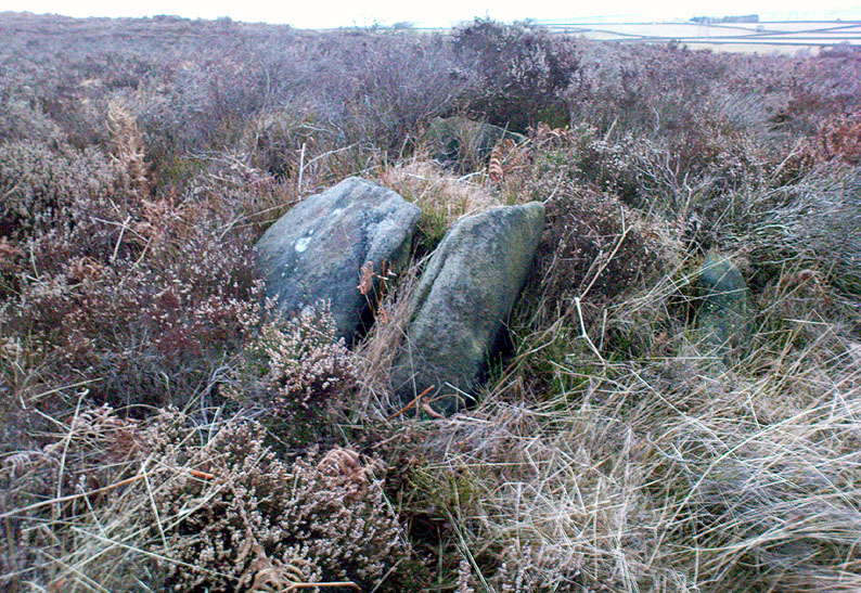
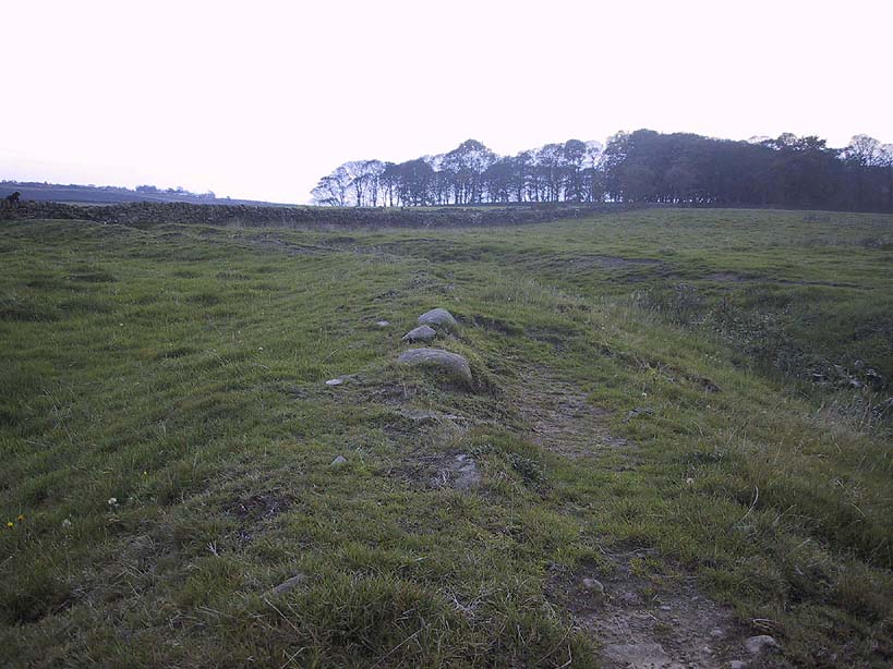
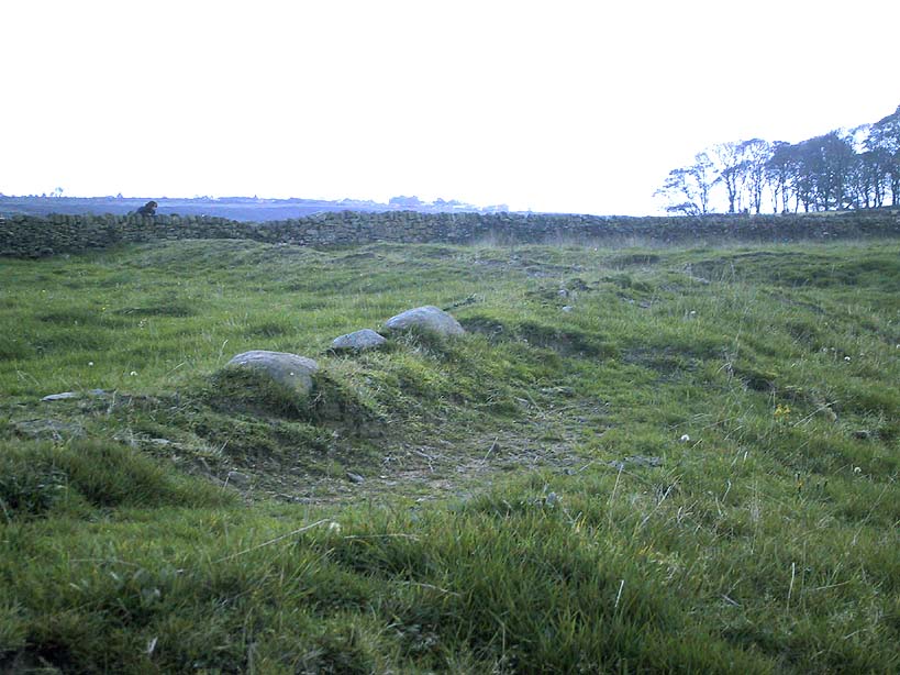
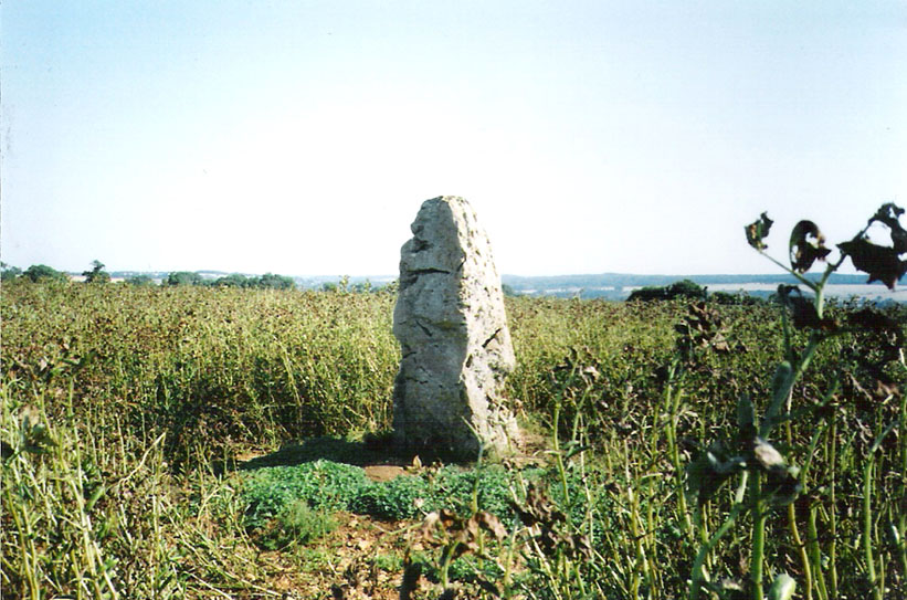
Follow the same directions to reach the Harden Moor circle. From here, walk down the footpath at its side down the slope for 100 yards and take the first little footpath on your left for 25 yards, then left again for 25 yards, watching for a small footpath on your right. Walk on here for another 100 yards or so, keeping your eyes peeled for the image in the photo just off-path on your left, almost overgrown with heather.
Archaeology & History
This is just one of several cairns in and around this area (I’ll probably add more and give ’em their own titles and profiles as time goes by), but it’s in a pretty good state of preservation. Nothing specific has previously been written about it, though it seems to have been recorded and given the National Monument number of 31489, with the comment “Cairn 330m north of Woodhead, Harden Moor.” (anyone able to confirm or correct this for me?)
It’s a good, seemingly undisturbed tomb, very overgrown on its north and eastern sides. Three pretty large upright stones, a couple of feet high, remain in position with an infill of smaller stones and overgrowth (apart from removing a little vegetation from the edges to see it clearer, we didn’t try disturbing it when we found it). It gives the impression of being a tomb for just one, perhaps two people and is more structured than the simple pile-of-stone cairns on the moors north of here above Ilkley and Bingley. Indeed, the upright stones initially gave the impression of it once being a small cromlech of sorts! Other cairns exist close by, but until we get heather-burning done up here, they’re difficult to find – or at least get any decent images of them!
Dead easy this one! On the Keighley-Halifax A629 road, about 500 yards south past Flappit Spring (public house), there’s a small road to your right. Walk on here for 200 yards and look in the field to your right. If the grass is long you might struggle to see it, but gerrin the field and it runs right up against the wall. Y’ can’t miss it really! You can park up a coupla hundred yards down the A629 main road, by the old quarry, and walk back to get here.
Archaeology & History
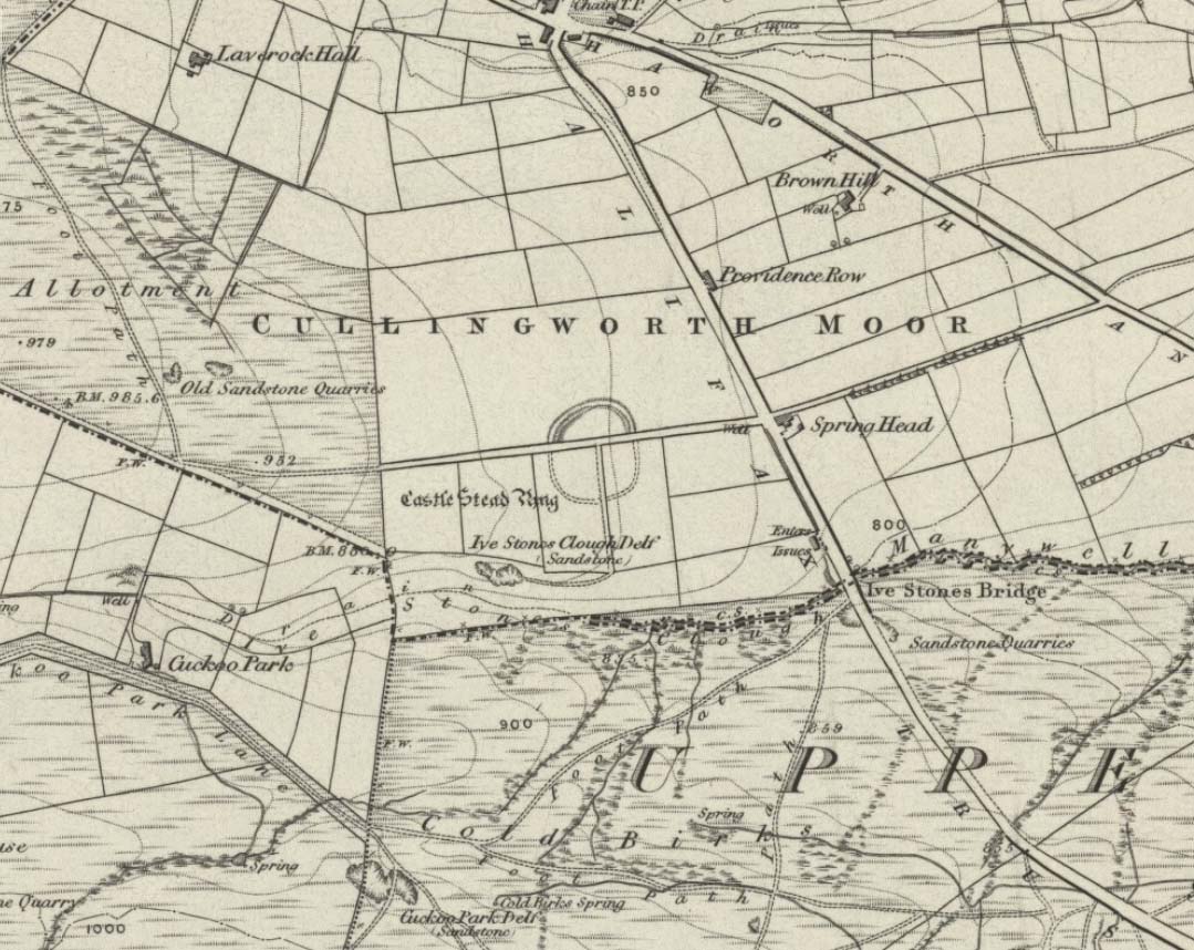
Although I’ve earlier described this as “nowt much to look at,” the more I come here, the more I like the place (sad aren’t !!?). The hard-core archaeology folks amidst you should like it aswell. Not to be confused with the site of the same name a mile to the south of here, this large earthwork was shown on the 1852 OS-map as a complete ring, which is also confirmed in old folklore; and a survey done by Bradford University in the late 1970s indicated a complete circle was once in evidence. To view this for yourself: if you type the OS grid-reference into Google maps, you’ll see from the aerial image that a complete ring was indeed here at sometime in the not-too-distant past.
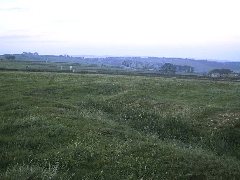
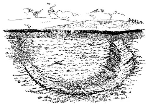
Bend in the ditch on northern side of the ringHarry Speight’s 1898 drawing
Today however – indeed, since William Keighley described it 1858 – there’s only a shallow, semi-circular ditch to be seen in the fields. But despite this, its remains have brought it to the literary attention of about a dozen writers – though we still don’t know exactly what it was! The best conjecture is by the archaeologist Bernard Barnes (1982), who thinks it best to describe as a enclosure or earthwork dating from the Bronze Age. Eighty feet across and covering more than 1.5 acres, an excavation of the site in 1911 found nothing to explain its status.
One of the first descriptions of this site comes from the pen of the industrial Bradford historian, John James in 1876 (though Hearne, Leland and Richardson describe it in brief much earlier). Talking of the sparsity of prehistoric remains in the region (ancient history wasn’t his forte!), he said, “I know of no British remains in the parish that are not equivocal, unless a small earth-work lying to the westward of Cullingworth may be considered of that class.”
Indeed it is! He continued:
“It is situated on a gentle slope, about two hundred yards from a place called Flappit Springs, on the right-hand side of the road leading thence to Halifax. The form has been circular. (my italics) The greater part of it to the south has been destroyed by the plough. I took several measurements of that part which remains, but have mislaid the memoranda I then made; I however estimate the diameter to have been about 50 yards. The ditch to the westward is very perfect. It is about two yards deep and three wide; with the earth thrown up in the form of a rampart on the inner side. The remain is less perfect to the eastward.”
James then speculates on the nature of the site, thinking it to be “one of a line of forts erected by the Brigantes…to prevent the inroads of the Sistuntii.” Intriguing idea!
A few years later when William Cudworth (1876) visited the site, he described:
“At present there only remains about one-fourth part of a circle representing the appearance of a considerable earthwork or rampart. The remainder has been cut away by the construction of the road leading to the allotments.”
Echoing Mr James’ sentiments, Cudworth also suggested “it may have been an enclosure to guard their cattle, while in summer they grazed on the vast slope on which it stands.” Y’ never know…
NW section showing bank and ditchExposed stonework of inner embankment
A visit to the place on October 21 2007, found not only a profusion of mushrooms scattering the field (varying species of Amanita, Lycoperdon, Panaeolina, Psilocybes, etc), and the remnants of two old stone buildings 20 yards of the NE side, but a distinctive ‘entrance’ on the northern side of the ring, which gave the slight impression of it being a possible henge monument. It’s certainly big enough! All traces of the southern-side of the ring however, have been ploughed out.
The views from here are quite excellent, nearly all the way round. You’re knocking-on a 1000 feet above sea level and the high hills of Baildon, Ilkley, Ogden Moor and the Oxenhope windmills are your mark-points. There’s one odd thing to think about aswell: if this is a prehistoric site, it’s pretty much an isolated one according to the archaeo-catalogue – and as we know only too well, that aint the rule of things. We’ve got adjacent moorlands south and west of here, very close by. Likelihood is, there’s undiscovered stuff to be foraged for hereabouts…
Folklore
An old folk-name given to this ring is the Blood Dykes, which is supposed to relate to the place being the site of a great battle.
References:
Barnes, Bernard, Man and the Changing Landscape, Eaton: Merseyside 1982.
Bennett, Paul, The Old Stones of Elmet, Capall Bann: Milverton 2001.
Cudworth, William, Round about Bradford, Thomas Brear: Bradford 1876.
Elgee, Frank & Harriett, The Archaeology of Yorkshire, Methuen: London 1933.
Forshaw, C.F., ‘Castlestead, near Cullingworth,’ in Yorkshire Notes and Queries – volume 4, H.C. Derwent: Bradford 1908.
James, John, The History and Topography of Bradford, Longmans: London 1876.
Keighley, J.J., ‘The Prehistoric Period,’ in Faull & Moorhouse’s, West Yorkshire: An Archaeological Survey to AD 1500 – volume 1, WYMCC: Wakefield 1981.
Keighley, William, Keighley, Past and Present, Arthur Hall: Keighley 1858.
Speight, Harry, Chronicles and Stories of Bingley and District, Elliott Stock: London 1898.
Dead easy to find! From Stirling head out on the A9 road towards Bridge of Allan and Stirling Uni. You’ll hit a small roundabout a mile out of Stirling – go straight across and up the little bendy road. Follow this round the bottom side of the Uni for a half-mile, watching out for the left-turn as the tree-line ends, taking you up to the factory behind the trees (if you hit the roundabout a bit further on, you’ve gone too far!). Go up the slope and onto the level sports playing fields – where this old beauty will catch your eye! If you somehow miss it, just get to the Uni and ask some of the students where it is!
Archaeology & History
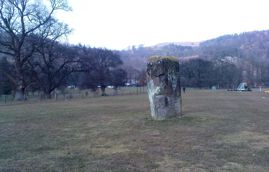
Airthrey Stone, looking NW
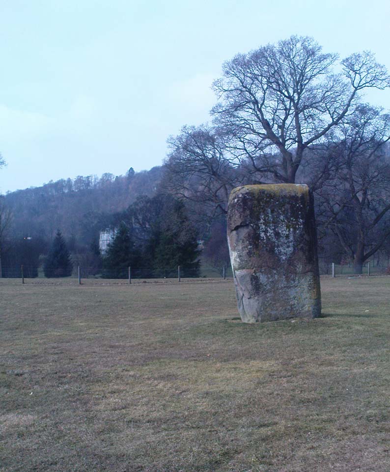
This single standing stone is a beauty! It’s big – it’s hard – and it’s bound to get you going! (assuming you’re into megaliths that is) Standing proud and upright on the eastern fields of the Stirling University campus, A.F. Hutchinson (1893) measured it as being “9ft 1in in height. Its greatest breadth is 4ft 10in, and its circumference 14ft.” A bittova big lad! More than fifty years later when the Royal Commission (1963) lads got round to measuring its vital statistics, only an inch of the upright had been eaten by the ground. The stone was highlighted on the earliest OS-maps of the area.
Folklore
Of the potential folklore here, most pens and voices seem quiet; although Mr Hutchinson (1897) told of William Nimmo’s early thoughts, linking the history of this stone with the others nearby, saying:
“Of what events these stones are monuments can not with certainty be determined. In the ninth century, Kenneth II, assembled the Scottish army in the neighbourhood of Stirling, in order to avenge the death of Alpin his father, taken prisoner and murdered by the Picts. Before they had time to march from the place of rendezvous, they were attacked by the Picts… As the castle and town of Stirling were at that date in the hands of the Picts, the rendezvous of Kenneth’s army and the battle must have been on the north side of the river; and as every circumstance of that action leads us to conclude that it happened near the spot where these stones stand, we are strongly inclined to consider them as monuments of it. The conjecture, too, is further confirmed from a tract of ground in the neighbourhood which, from time immemorial, hath gone by the name of Cambuskenneth: that is, the field or creek of Kenneth.”
And although this hypothesis is somewhat improbable, it was reiterated in the new Statistical Account of 1845, which also suggested that this and the other Pathfoot Stone were “intended probably to commemorate some battle or event long since forgotten.”
References:
Hutchinson, A.F., “The Standing Stones of Stirling District,” in The Stirling Antiquary, volume 1, 1893.
Royal Commission on the Ancient & Historical Monuments Scotland, Stirling – volume 1, HMSO: Edinburgh 1963.
Pretty easy to find. Head down the B8051 road south, out of Stirling, for a ¼-mile. Keep your eyes peeled for the central police station on your right as you come out of town. The stones are on the grassy forecourt in front of the police station!
Archaeology & History
It’s amazing that these stones are still standing! Jut out of the city centre, very close to the main road and right outside the central police station: if these standing stones would have stood anywhere in England, they’d have been destroyed. Thankfully, the Scots have more about them regarding their history, traditions and antiquities.
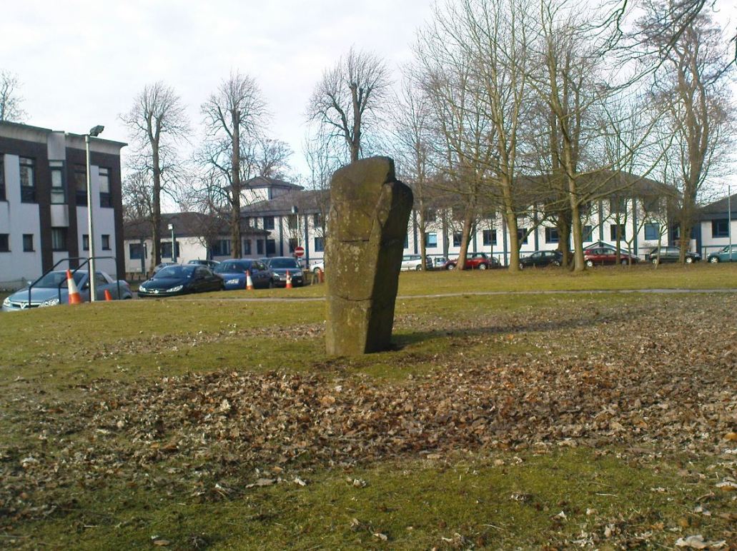
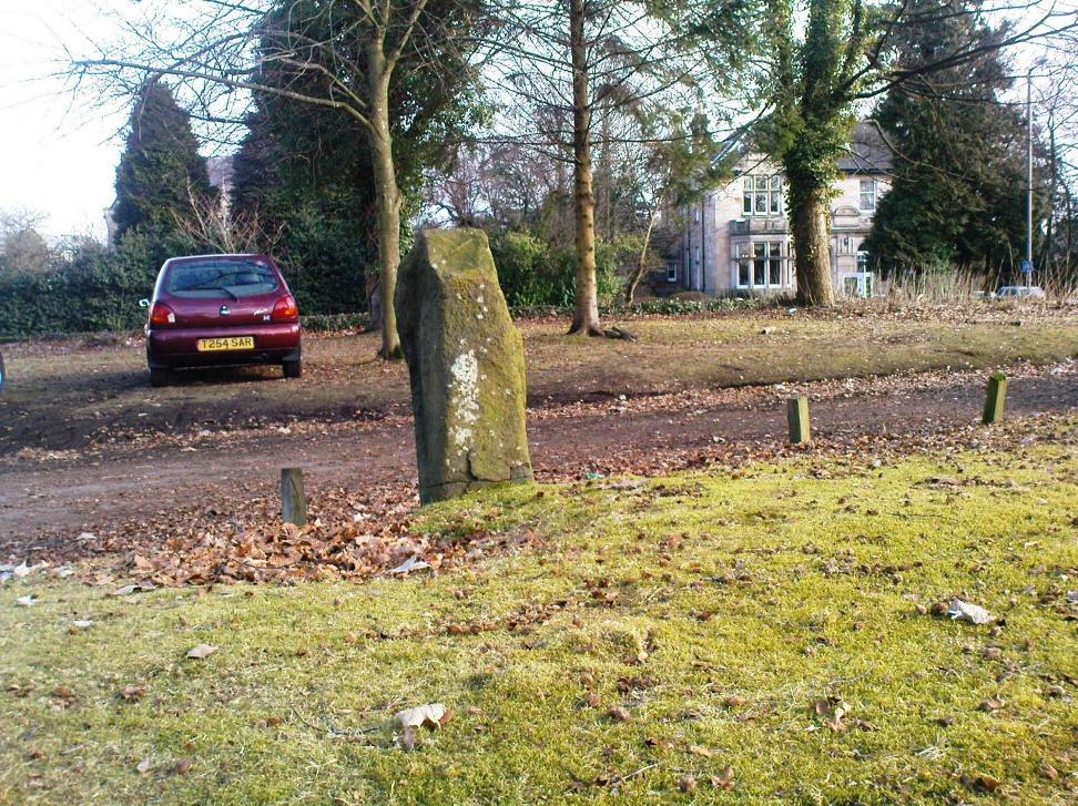
Randolphfield stone SWNE Randolphfield stone
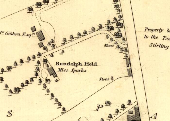
Of the two stones that remain here, they stand in (just about) the same position that they were shown as on an 1820 map of Stirling. The northernmost of the two is about 3½-feet tall and rests upright against the edge of the track and lawn; whilst its taller companion — knocking close on to six-feet tall — stands proudly near the middle of a well-kept lawn less than 50 yards away. Once you’ve found one, the other’s easy to spot!
It’s obvious that the larger of the two stones was cut down at some time in the recent past, as there are several blatant cuts where the standing stone had been snapped into at least three portions — but whoever did the damage was given a bittova bollocking, as the stone was cemented back into its near-original form and stood back upright again. To this day, as one of the female officers coming out of the station indignantly told me, “they’re protected!” Long may they stay that way!
In Mr A.F. Hutchinson’s (1893) early description of these stones he told that they stood “in a line from SW to NE — the line of direction making an angle of 235° with the magnetic north.
“The southwest stone stands 4ft above the ground. The portion underground measures 2ft 5in; so that in all it measures 6ft 5in. Its girth is 6ft 6in. It is four-sided in shape—nearly square—three of the faces measuring each 21 inches, and the fourth 15 inches. The northeast stone is smaller and less regular in form. Its height above ground is 3ft 6in, and its girth 4ft 6in. Both stones are pillars of dolerite, of the same material as the pillar stones of the Castle rock, from which place they have apparently been brought. The larger stones shows some marks on it, which have been supposed to be artificial. They are , however, merely the natural joints characteristic of these blocks…”
Folklore
Like many standing stones scattering our isles, this site possesses the old tradition of them marking a battle — in this case, the Battle of Bannockburn. Once again, Mr Hutchinson (1893) wrote:
“The local tradition as to the origin and meaning of these stones is well-known. It is thus stated by (William) Nimmo in his History of Stirlingshire, p.84…: ‘Two stones stand to this day in the field near Stirling, where Randolph, Earl of Murray, and Lord Clifford, the english general, had a sharp encounter, the evening before the great battle of Bannockburn.’ Again, p.193:- ‘To perpetuate the memory of this victory…two stones were reared up in that field and are still to be seen there.’ …The Old Statistical Account of St. Ninians (Rev. Mr Sheriff, 1796), makes the same statement, p.406-8:- ‘In a garden at Newhouse, two large stones still standing were erected in memory of the battle fought on the evening before the battle of Bannockburn, between Randolph and Clifford.'”
Yet the name ‘Randolphfield’ is apparently no older (in literary records) than the end of the 17th century and the thoughts of Hutchinson and other local historians is that the two stones here, whilst perhaps having some relevance to an encounter between the Scots and the invading english, were probably erected in more ancient times.
References:
Hutchinson, A.F., “The Standing Stones of Stirling District,” in The Stirling Antiquary, volume 1, 1893.
Royal Commission on the Ancient & Historical Monuments Scotland, Stirling – volume 1, HMSO: Edinburgh 1963.
In this lovely little hamlet we find an ancient well, registered as a scheduled monument in its well-house, but with a long history and lots of legends. It was said to have been a wishing well of considerable power, but many local people wouldn’t use it because it was also the place where mischievous pixies lived. It seems that one of its main magical properties was to divine the love of a person. The writer Ruth Tongue (1965) told a long tale she came across in her county folklore book about such a fortune:
“There was a maid servant, see, and she were coming on in years and she do serve a farmer’s wife as were high in station. Proper tackalackey she made of the dear soul, and she having no living kin. Twas pitiful, and her a-longing for a parcel of children underfoot, even if ’twas only to call her Auntie. But there, ‘twadn’t to be, and her with a heart so full a-drip with loving kindness as a honey comb. Oh, she were a proper mannerly maiden, no ways like her mistress who were just a old ewe dressed up lambs fashion and spending her days living two-three steps from nothing. But it didn’t seem like the maiden couldn’t never meet up with a proper man for her. She wadn’t no summer morning to look at, poor soul, and her mistress kept her so thin as a yard of pump water. But there Providence knows best! There were a old fellow over by Aisholt, and he were such a upstanding courageous man he’d a never got round to marrying, let alone finding the bravery to walk arm in crook with a maiden. Well o’ course he were lonely like she. And it come to a St. Agnes Eve when maids creepy over to her well at Cothelstone and whisper their heart’s desire when ’tis dark, and if St. Agnes do fancy the maiden she’ll send a husband that year. Now the poor maid she were coming to the end of her days of womanhood and beginning to blossom about the head, and she were desperate unhappy about it. Her heart was all a-set on children, and she find bravery to slip out after farm’s a-locked up. She didn’t feel ’twere mannerly to worrit St. Agnes over one who was so on in years when there was young maidens as plentiful as blackberries, so what do the dear soul do but go down all in the dimmit to the Wishing Well in Seven Wells Coombe. Proper unket well ’tis, and hard tew find. But St. Agnes must ha’ knowed, for she found’n though there wadn’ but little moon and old fellow he d’hear summat down in coombe and come to look-see. He were a wise old man and nothing hurted he, but he were shy of folks, seems like. Well, whether ’twere St. Agnes I can’t say, but in a year the farm was sold up and the maid was a-wed to the old fellow. So quiet as a sheep the man was, wouldn’ downarg no-one, but he made her a good husband. In a year or two she’d a babe in the cradle and one under her apron, and two clinging to her skirts, and they was all so happy as daisies in the sunshine, as they say.”
There are a number of sacred and healing wells on this small island, but this site in particular was deemed magickal by folk from far and wide. Found on the northwest slopes of Cnoc Largie (around which are other heathen spots) this legendary site had an attendant keeper of the well:
“an aged female direach, or guardian, whose uncanny powers could be commanded by a small offering of silver. Following this the cover of the sacred well would be removed in order that its waters might be ceremonially cleansed with a white clamshell prior to being stirred three times, sunwise, to the accompaniment of ritual incantations. Then three shell-fulls of the sacred water would be hurled aloft in the direction of the desired wind which, before the day was out, invariably appeared.”
This simple ritual obviously tells that it was a heathen site, seemingly one for divination and magick. Another piece of folklore (found at other wells) told that if the cover on the well were left unattended, its waters could overflow and flood the entire island.
References:
Anonymous, Exploring Historic Kintyre and the Isle of Gigha, Harlequin Press: Oban n.d.
On this “Isle of the Gods” — as some historians proclaim Gigha to mean — the ancient rites and ceremonies of local folk continued until pretty recent times. One writer narrated some intriguing pre-christian events connected to this curious and little-known place, speaking of indigenous heathen rites:
“These are in fact known to have persisted on the island until well into the early part of the (19th) century when Irish fishermen could still be seen climbing the little hill of Moinean Sitheil, in the sacred Moss of Peace below Ardminish, to pay homage to the “Old Ones” of Gigha: a pair of ancient legend-shrouded stones known as the Bodach and the Cailleach, that from time immemorial have stood upon a low green knoll below the farm of Achamore.
“Through the countless ages the strange jug-headed little Bodach and his smaller consort have kept steadfast vigil over Gigha: their mysterious aura said to guarantee its continuing fertility and prosperity as they link the thriving island of today with beliefs and traditions having roots in the earth-cults and sun-worship of primeval times. In the past folk would have honoured them with offerings of meal or milk and even now they still command considerable local affectation and respect, albeit expressed in less overtly pagan ways. And so they stand as ever upon their tiny hillock gazing out across tumbling terraces of old Cantereoch and beautiful Ardlamey Bay, inscrutable and silent, yet with a strangely ‘knowing’ air impossible to define.”
References:
Anonymous, Exploring Historic Kintyre and the Isle of Gigha, Harlequin Press: Oban n.d.
This site hasn’t been located. However, if it hasn’t been destroyed by the quarrying on the SW side of the moor, remains of it should still be found amidst the heather and would be a good discovery for any enthusiast.
Archaeology & History
The first notes I found about this place were those by archaeologist Sydney Jackson in 1956, who wrote:
“It would be interesting to know what Dr Richard Richardson, of Bierley Hall, Bradford meant when, writing about 1709, he said that Mr Benjamin Ferrand show him a ‘skirt of stones’ on Harden Moor, near to a row of stones placed in a line nigh two hundred paces in length some two feet above the heath, others hidden beneath it.” (my italics)
The undoubted man-made nature of this row of stones was emphasized by Dr Richardson when he wrote,
“That these stones were placed here by design, no person can doubt; but for what I end cannot conjecture, having never seen anything of this kind before.”
The great Yorkshire historian Harry Speight (1898) also came across the same antiquarian notes many years before and speculated how,
“it may be inferred from this that it had been a double row of stones, like the avenue of Maiden Castle in Swaledale.”
The ‘skirt of stones’ that were described here may be the well-preserved Harden Moor Circle. However in recently finding the short essay of Peter Craik (1907) of Keighley, this idea may need re-assessing, as Craik clearly shows in his survey of the the nearby Catstones Ring earthwork, what he described as the “remains of a cairn” on the northern edge of that ring, giving us a different location for this lost stone row.
However, another potential position for our lost stone row that needs exploring is the one described by Butler Wood following an exploratory visit here with the Bradford historian, William E. Preston, at the beginning of the 20th century. Mr Wood (1905) told of them both coming across some sort of earth-and-stone line “half-a-mile north of” the Catstones Ring, telling:
“Mr W.E. Preston and myself traced a short time ago on Harden Moor, remains of an entrenchment for a distance of 80 or 90 yards. It faces south, and lies near Spring Head Heights. The wall consisting of boulder and earth rising three feet above the soil, but there is no trace of a ditch.”
This is obviously half the length described by Richardson and Ferrand in 1709, but nearly two centuries separate the two accounts (the position of Mr Woods’ line is roughly SE 072 387; whilst that nearer to the Catstones Ring would be nearer SE 069 383).
I’ve searched the tops of this moorland a number of times hoping to locate this seemingly important megalithic stone row, obviously without success. Further searches on the moor are needed after the heather’s been burnt back.
Best visited out of season before the corn’s been planted. It makes it easier to find and doesn’t annoy the land-owner here, who tends to be a decent dood. From Chipping Norton go southeast along the B2046 road to Charlbury. After about 1½ miles take the second right turning down the small country lane. Go slowly down here for less than half a mile, watching the fields on your right. You’re damn close!
Archaeology & History
The Hawk Stone
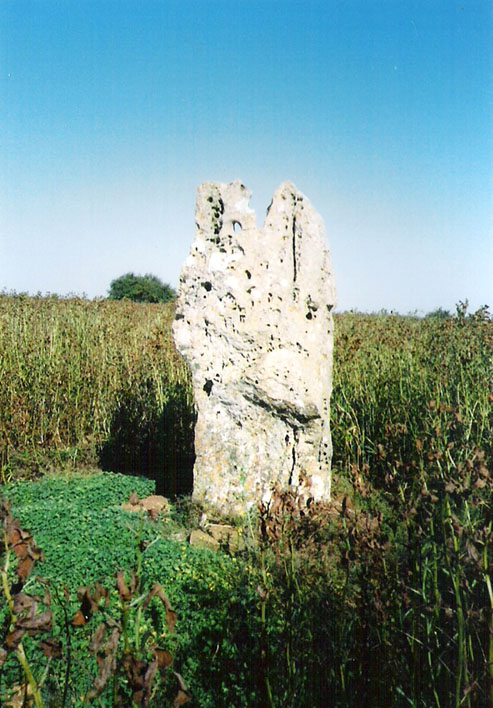
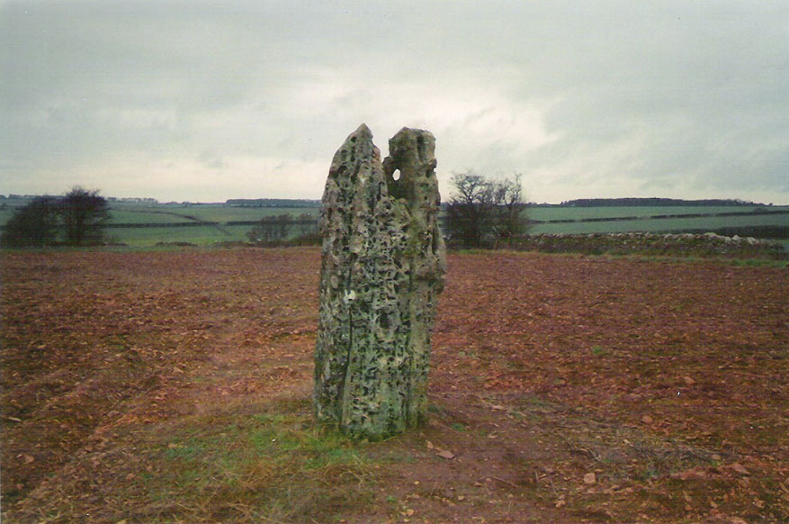
This impressive, weather-worn, eight-foot tall standing stone stands aloft in the middle of a field due west of the road between Chalford Green and Dean. It’s an excellent monolith and one which, I think, has a lot more occult history known of it than described here. Thought by O.G.S. Crawford (1925) and others in the past to have been “formerly part of a chambered structure,” or prehistoric chambered tomb like that of the Hoar Stone at nearby Enstone, no remains of such a structure unfortunately remain today. It is first illustrated and named on a local map of the region in 1743 CE, and the stone at least has fortunately managed to escape the intense agricultural ravages endemic to this part of the country.
The name “Hawk” stone has been fancied by some to relate to some obscure resemblence to a Hawk, or because there very often are hawks hovering over those upland fields – but these are unlikely. It’s thought by place-name authorities more likely to derive from a corruption of ‘Hoar’ meaning a grey or boundary stone; and as it stands just yards east of the present township boundary line, this derivation seems more probable.
To all lovers of megalithic sites, we highly recommend a visit here!
Folklore
In local folklore and in the opinion of some earlier historians, the Hawk Stone formed an integral part of a stone circle here, but there is little known evidence to substantiate this.
Hawk Stone in summerHawk Stone in winter
A creation legend attached to this site tells that the stone was thrown, or dragged across the land, by a old witch or hag — though we are not told from where. This is a motif found at megalithic sites all across the country (see Bord & Bord 1977; Grinsell 1976, etc). In Corbett’s History of Spelsbury (1962) the author told of the folklore spoken of by one Mr Caleb Lainchbury who
“said the cleft at the top of the Hawk Stone at Dean was supposed to of been made by the chains of the witches who were tied to it and burnt. As witches seem to have been extremely rare in Oxfordshire it cannot have been a very common practise to burn them at Dean; but there may indeed have been some kind of fire ceremonies near the stone.”
Grinsell (1976) also tells how the Hawk Stone has that animistic property, bestowed upon other old monoliths, of coming to life and going “down to the water to drink when it hears the clock strike 12.”
This evidently important and visually impressive monolith also plays an important part in an incredibly precise alignment (ley) running roughly east-west across the landscape. At first, Tom Wilson (1999) thought the alignment had previously gone unnoticed, but later we later found a reference to the same line in an early copy of The Ley Hunter (Cooper 1979). It links up with other important megalithic sites, such as the Hoar Stones at Enstone, Buswell’s thicket, and the ancient Sarsden Cross.
Similarly, when Tom Graves’ (1980) was doing some dowsing experiments at the Rollright stone circle a few miles west, he found what he described as an ‘overground’ (or ley) linking the ring of stones to the Hawk Stone, but no other connecting sites are known along this line.
References:
Bennett, Paul & Wilson, Tom, The Old Stones of Rollright and District, Cockley: London 1999.
Bord, Janet & Colin, The Secret Country, BCA: London 1977.
Cooper, Roy, “Some Oxfordshire Leys,” in The Ley Hunter, 86, 1979.
Corbett, Elsie, A History of Spelsbury, Cheney & Sons: Banbury 1962.
Crawford, O.G.S., The Long Barrows of the Cotswolds, John Bellows: Gloucester 1925.
Gelling, Margaret, The Place-Names of Oxfordshire – volume 2, Cambridge University Press 1954.
Graves, Tom, Needles of Stone, Granada: London 1980.
Grinsell, L.V., Folklore of Prehistoric Sites in Britain, David & Charles: Newton Abbot 1976.
From the old Glen House pub, walk up the road onto ‘Shipley Glen’ as all locals call the place. Go up the Glen Road for about half a mile, watching out for the small dirt-track turning going the slope on your left-hand side just near where the road starting swerving uphill to the right. At this point where the track heads down and into the trees, there’s a footpath going into the bracken along to the right, heading onto level ground. Walk up and along here. After 100 yards or so you’ll notice the disused quarry on your left. Keep walking along the footpath (two end up running parallel to each other) and you’ll see this carving right beneath your feet!
Archaeology & History
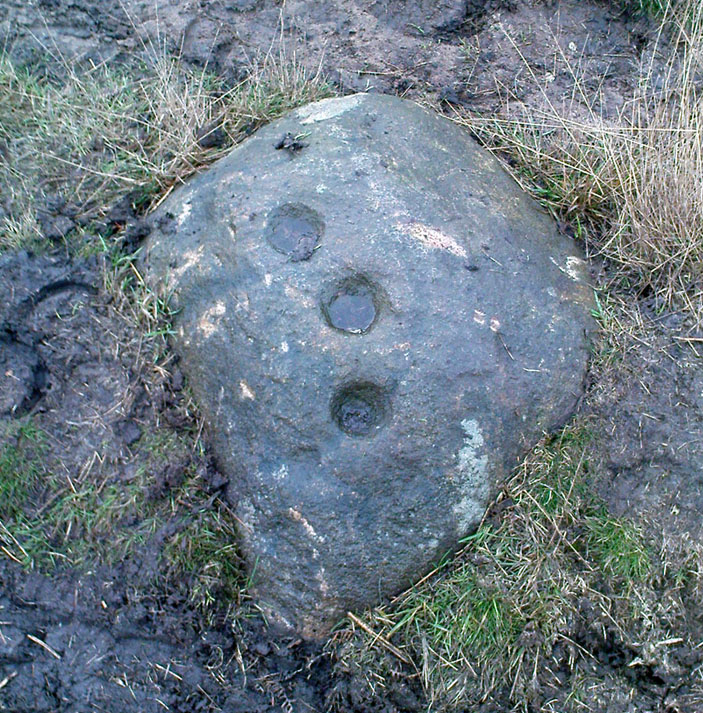
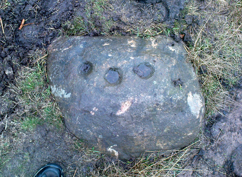
Baildon Moor carving 126
This was one of the very first examples of “cup and ring stones” that I ever saw, when I was a mere 10 or 11 years old! I’m not quite sure what I expected to find, but something about this stone with its deeply set cup-markings obviously had an effect on me – as I’m still foraging about looking at them more than 35 years later! About 20 yards away from the Glovershaw quarry carving (Baildon Moor 122), this central design stone — as I used to call it — was first recorded in W. Paley Baildon’s (1913) magnum opus and was then all-but-forgotten until the Bradford Archaeology Group mentioned it again more than forty years later. Although you can only see three distinct cups on this small rock, another 2 or 3 seem in evidence under better lighting conditions, and a small line runs below the cups in the photo here, which you can just make out above the central cup.
This carving and others close by give the distinct impression that they were once part of some seemingly lost cairn-field, awaiting rediscovery…
References:
Baildon, W. Paley, Baildon and the Baildons – parts 1-15, Adelphi: London 1913-1926.
Bennett, Paul, Of Cups and Rings and Things, unpublished: Shipley 1981.
Bennett, Paul, Megalithic Ramblings between Ilkley and Baildon, unpublished: Shipley 1982.
Boughey, Keith & Vickerman, E.A., Prehistoric Rock Art of the West Riding, WYAS: Leeds 2003.
Cowling, Eric T., Rombald’s Way, William Walker: Otley 1946.
Hedges, John, The Carved Rocks on Rombald’s Moor, WYMCC: Wakefield 1986.