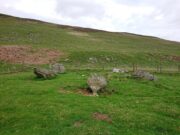
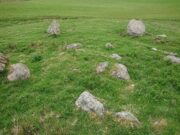
Kirktonhill, Channelkirk, Berwickshire

Stone Circle (destroyed):  OS Grid Reference – NT 474 548

Archaeology & History

Included in Aubrey Burl’s (1976) first gazetteer, without comment, the site was subsequently added to John Barnatt’s (1989) magnum opus.  He tells that in the 19th century, “early Ordnance Survey records…note a destroyed stone circle” here, but draws a somewhat sceptical opinion of its very existence as “the Ordnance Survey frequently made mistaken interpretations in the 19th century and hence this should be treated with caution.”

Despite this, early local historians refer to the site, albeit in the past tense.  The first would seem to have been Walter Elliot (1869) in his address to the respected Berwickshire Naturalists Club.  Some members of this group had visited a number of ancient sites the previous year:

“A camp above Channel Kirk was also indicated, near which a stone circle formerly existed, but it has been destroyed and the materials used for building dykes within the last five or six years.”

The “camp” was an old Roman one which has itself been almost completely destroyed, despite it still being shown on modern OS-maps.

The circle was mentioned in passing in Mr Thomson’s (1902) huge work on his descriptions of the many local hillforts.  Close to one at Kirktonhill known as the Roman or Agricola’s Camp, “forty years ago, there was said to have been a stone circle.”  This was reiterated in Craw’s (1920) survey of prehistoric monuments in Berwickshire.

Perhaps the most curious omission is in Mr Allan’s (1900) huge survey on Channelkirk parish.  His description of the Roman camp was considerable, but he made no mention of an adjoining circle.  The best we got from him was a vague allusion about some ancient pre-christian site not far from the church, when he wrote:

“Whether or not some rude form of a place of worship might then exist on the spot where now a church has stood for so long it were rash to assert, but there are certain indications that some particular place, specially marked as consecrated to religious rites, was then a local possession.”

(it should be noted that the Canmore entry for this site has its location at the prehistoric camp due west of Kirktonhill, which is incorrect)

References:

  1. Allan, Archibald, History of Channelkirk, J. Thin: Edinburgh 1900.
  2. Barnatt, John, Stone Circles of Britain – volume 2, BAR: Oxford 1989.
  3. Burl, Aubrey, The Stone Circles of British Isles, Yale University Press 1976.
  4. Burl, Aubrey, The Stone Circles of Britain, Ireland and Brittany, Yale University Press 2000.
  5. Craw, J H., “Early types of burial in Berwickshire“, in History Berwickshire Naturalists Club, volume 24, 1920.
  6. Elliot, Walter, “Anniversary Address Delivered at Berwick on the 30th of September, 1869,” in History Berwickshire Naturalists Club, volume 6, 1869-72.
  7. Thomson, A., Lauder and Lauderdale, Craighead Brothers: Galashiels 1902.

© Paul BennettThe Northern Antiquarian

Whitehillocks Farm, Glen Clova, Angus

Stone Circle:  OS Grid Reference – NO 37095 66958

Getting Here

Whitehillock stone circle

From Kirriemuir town centre up the B956 Kinnordy Road, turn left where it goes along the B955 road for several miles towards Cortachy.  Keep going on the B955 for a few more miles into the quiet beauty of Glen Clova.  A third-of-a-mile (0.5km) past Glenarm house, the road splits.  Take the right-hand road, which goes down and across the river below.  Keep on this road for just over a mile (1.8km) and as you approach the large farmhouse of Whitehillock—about 200 yards before it—keep your eyes very well focused in the field on your left and you’ll see a mass of large fallen stones right up against the other side of the fence.  You’ve arrived.

Archaeology & History

Internal “cairn”

A half-mile north of Clach na Brain, or the Stone of the Raven (a stone that was traditionally used to beat woven cloth after it had been washed), we come across this ruined stone circle, which has seen better days.  Not shown on any of the early OS-maps, nor found in the standard megalithic catalogues (Barnatt 1989; Burl 2000), its existence seems to have been logged for the first time by some of the Royal Commission doods in 1999, but of late its veracity as a prehistoric site has been questioned as the local farmer alleged it to have been built by his father sometime in the 20th century.  It might have been – but if he did, he made a bloody bad job of it!  The site doesn’t have that “new” look about it and, unless someone told you that this was a stone circle, you wouldn’t give it a second look!  That aside…

The stones have been placed around the edge of a small rise in the land, within which is a scatter of small and reasonably large stones that give the impression of a cairn at its centre.  All but one of the stones (the eastern one) is still standing and measures about 3 feet in height.  The rest are either laid down or near to collapse and measure between four and six feet in length.  Without an excavation of the site, we cannot be certain of its age, but the official records still have it listed as a stone circle.  We await further examination…

References:

  1. Dorward, David, The Glens of Angus, Pinkfoor Press: Forfar 2001.

© Paul BennettThe Northern Antiquarian

Cnoc Dubh, Moulin, Pitlochry, Perthshire

Stone Circle (destroyed):  OS Grid Reference – NN 9424 5871

Archaeology & History

Missing from the primary surveys of Burl (2000) and Barnatt (1989), a mention of this long lost site was made by local historian Hugh Mitchell (1923) in his survey of the area.  He told that,

“On the east side of the Moulin road beyond the Hydro Hotel a knoll and a clump of trees will be noticed on the right, inside the Hydropathic grounds; this knoll is known as the Cnoc Dubh, or “Black Knoll” and still bears an uncanny reputation as being an old site of Pagan worship.  There was at one time a stone circle on it, but the stones are said to have been broken up, fully 100 years ago, to build the old farmhouse of Balnadrum.”

Something ancient was there, obviously, as it was mentioned in another earlier account—albeit just a tourist guide of Atholl—which said that, on

“the knoll known as Knock-Dhu, within the (Pitlochry Hydro) grounds, are the remains of a pre-historic fort, now overgrown with pine trees.”

References:

  1. Anon., Atholl Illustrated, L. Mackay: Pitlochry c.1910.
  2. Dixon, John H., Pitlochry Past and Present, L. Mackay: Pitlochry 1925.
  3. Mitchell, H., Pitlochry and District: Its Topography, Archaeology and History, L. Mackay: Pitlochry 1923.

Links:

  1. Canmore

© Paul BennettThe Northern Antiquarian

Millden, Glen Esk, Edzell, Angus

Stone Circle:  OS Grid Reference – NO 54 79

Archaeology & History

I add this brief site profile in the hope that we can clarify, one way or the other, whether the report of a stone circle described in a letter by G.W. Zealand to the Ordnance Survey in November, 1978, has any basis in fact.  Zealand said that the structure comprised of “red stone, not very large” at Millden in Glen Esk.  Perhaps local people or megalithic explorers who may visit this area could try locating it so we can confirm it as real, or strike it from the listings.  It is included in the Canmore catalogues. I must point out that there were a large number of prehistoric sites in this area destroyed in recent centuries, meaning that this report may be authentic.

© Paul BennettThe Northern Antiquarian

Meikle Whitefield, Cargill, Perthshire

Stone Circle (destroyed):  OS Grid Reference – NO 173 342 (approximation)

Archaeology & History

In an archaeological report by Alexander Hutcheson for the Scottish Society of Antiquaries in 1884, he described and illustrated an impressive cup-and-ring stone that was formerly built into the walls of a demolished house ¾-mile from its original position near Meikle Whitefield farm.  Upon destruction of that house, the farmer of West Whitefield—a half-mile from its original position—then moved the stone it into his front garden.  According to tradition, said Hutcheson, this stone

“was originally removed from a circle of stones, which had stood about half-a-mile eastward, but which have now been buried or broken up.”

Despite the local tradition, Hutcheson was some what sceptical of it, thinking that it

“seems very unlikely that such a weighty stone should have been transported for half a mile merely to serve as a foundation stone for a cottage, when the ground around was capable of supplying as many stones as would be required.”

You can see his point; but there are known circumstances where individual stones from megalithic rings have been preserved.  Hence, like John Barnatt (1989) in his magnum opus who preserved the folk memory of such sites, we include it here.  The tradition may well be valid.  Added to this is the fact that in just a few square miles hereby we once had a large cluster of stone circles, a few of which still remain.

Refeences:

  1. Barnatt, John, Stone Circles of Britain (2 volumes), BAR: Oxford 1989.
  2. Hutcheson, Alexander, “Notice of a Cup and Ring-marked Stone, and of Incised Stones Recently Discovered at Cargill, and of an Incised Boulder at Fowlis Wester,” in Proceedings Society Antiquaries Scotland, vol. 18, 1884.

© Paul BennettThe Northern Antiquarian

Pipers Stones, Blessington, County Wicklow

Stone Circle (destroyed):  OS Grid Reference – N 96998 14582

Archaeology & History

This stone circle was found close to the roadside and is remembered today only by the street-name of ‘Pipers Stones’.  Shown on the first OS-map of the area, the site was destroyed sometime before 1838.

Folklore

In a folklore motif found at a number of megalithic rings, Grogan & Kilfeather (1997) tell us that the name of this circle,

“refers to a tradition that people caught dancing on a Sunday were turned to stone.”

References:

  1. Grogan, Eion & Kilfeather, Annaba, Archaeological Inventory of County Wicklow, Stationery Office: Dublin 1997.
  2. o’ Flanagan, Michael, Letters Containing Information Relative to the Antiquities of the County of Wicklow, Bray 1928.

© Paul BennettThe Northern Antiquarian 

East Whitefield, Cargill, Perthshire

Stone Circle (destroyed): OS Grid Reference – NO 1730 3515

Also Known as:

  1. Canmore ID 28503 

Getting Here

Site shown on 1867 OS map

Travelling north from Perth on the A94, take the left hand turn to Strelitz as you go into Burrelton, and follow that road for two miles, and park up about 300 yards past the turning to Gallowhill. The circle stood at the far end (south-east) of the field on your left. Keep the distant gap in the hills in sight and the probable site of the circle is in a dip in the land in front of the ditch.

History & Archaeology

The circle had been destroyed by the middle of the nineteenth century, but was remembered by locals who gave this description to the Ordnance Survey bods:

‘The authorities quoted says that this is the site of a number of standing stones, they formed a circle, and one stood in the centre and according to tradition they were the remains of a Druidical Temple.’

In 1969 an Ordnance Survey archaeologist wrote:

‘There is no trace of this circle, the site being in a level arable field. Immediately to the SE in a ditch running parallel to the fence are about a dozen large boulders cleared from the field, possibly from the site of the circle.’

The boulders have now gone but there are some broken stones on the banks of the drainage ditch which may or may not be the sorry remains of some of the stones. There is a depression in the field just in front of the ditch which is the likely site of the circle based on the position shown on the 1867 map.

Left – A faint cropmark which may show the position of the circle in this winter view. Centre – Shattered stones in the ditch bank. Right – View looking south-east from the probable site of the circle – the gap between Black Hill, left and Dunsinane, right

What is interesting is the gap in the horizon facing south east from the site of the circle. On the left of the gap is Black Hill, and on the right Dunsinane Hill of Macbeth fame. My reading of the angle from the probable site of the circle to the gap using a hand held compass was around 135° to 140°, and that may indicate a midwinter sunrise alignment from the lost circle. Something to be checked out when winter comes.

And there is a legend of a giant who leaped from Black Hill to Dunsinane who also tossed a boulder which stands between the two hills – whether this legend has anything to do with the possible solstitial sighting line from East Whitehill is an intriguing question.

Reference:

  1. Ordnance Survey Name Book – Perthshire Vol. XV, 1859-62

Acknowledgements:  Big thanks for use of the 1st edition OS-map in this site profile, Reproduced with the kind permission of the National Library of Scotland

To be continued…

© Paul T Hornby 2021

Bombie, Kirkcudbright, Kirkcudbrightshire

Stone Circle (destroyed):  OS Grid Reference – NX 7079 5018

Archaeology & History

This stone circle was destroyed sometime in the early 1780s by some moron who cared little for our ancient sites.  Its destruction was described by Robert Muter in 1794—the earliest known reference to the site—when he told:

“Near the Roman camp there is a Druidical temple, which was destroyed within these eight years, by the hands of an ignorant Goth, who carried off the stones, split them, and applied them to build a contemptible bridge over an insignificant rivulet, called Buckland Burn.  The stones were seven in number, of round granite, and of unequal sizes.  The smallest at least three feet in diameter.”

In the 1850s, when the Ordnance Survey lads came this way to map and seek out the place-names of the area, the ‘Clownstane’ was one such place they listed.  In seeking an explanation of the word, a local man told them the folk memory from seventy years prior:

“Mr. Bell of Balgreddan says the name Clownstane originated from the Stones of a Druid Circle which stood convenient to this place and which was broken up and removed to build a bridge near by.”

Fred Coles (1895) included the site in his survey of the Kirkcudbright circles, simply reiterating how,

“According to Dr Muter, the stones “were seized by some vandal for the building of Buckland Bridge.””

References:

  1. Coles, Fred R., “The Stone Circles of the Stewarty of Kirkcudbright,” in Proceedings of the Society of Antiquaries Scotland, volume 29, 1895.
  2. Muter, Robert, “The Parish of Kirkcudbright,” in Statistical Account of Scotland – volume 11, William Creech: Edinburgh 1794.

Links:

  1. Canmore notes on Bombie
  2. Ordnance Name Book on the Bombie Circle

© Paul BennettThe Northern Antiquarian

Little Balmae, Kirkcudbright, Kirkcudbrightshire

Stone Circle (destroyed):  OS Grid Reference – NX 691 447

Archaeology & History

In an area littered with neolithic and Bronze Age remains, the great Fred Coles (1895) reported a stone circle that was destroyed sometime roughly between 1890 and 1911.  When he visited the place with his colleague, Mr E.A. Hornel in 1887, the megalithic ring had already been tampered with.  It was, he said,

“found to consist of five granite boulders, all of them large, in situ, and the ridgy grassy hollows of five others—removed, no one can say when.  In the centre of this nearly true circle, 90 feet in diameter, is a slight mound, possibly artificial.”

In 1911, when the Royal Commission lads visited the area, they could find no stone circle and reported how “no information could be obtained concerning it” from the local farmer.  This might have been because he destroyed it.  Some land-owners do such things, as we know; but in this case we may never know.

The site was listed without comment in the Master’s magnum opus (Burl 2000), but he gave it the “uncertain status” category; whilst John Barnatt (1989) questioned whether this was a destroyed stone circle or merely a natural setting that Cole had misinterpreted.

References:

  1. Barnatt, John, Stone Circles of Britain – volume 2, BAR: Oxford 1989.
  2. Burl, Aubrey, The Stone Circles of Britain, Ireland and Brittany, Yale University Press 2000.
  3. Coles, Fred R., “The Stone Circles of the Stewarty of Kirkcudbright,” in Proceedings of the Society of Antiquaries Scotland, volume 29, 1895.
  4. Royal Commission Ancient & Historical Monuments, Scotland, Inventory of Monuments and Constructions in Galloway – volume 2: County of the Stewartry of Kirkcudbright, HMSO: Edinburgh 1914.

Links:

  1. Canmore notes on Little Balmae

© Paul BennettThe Northern Antiquarian

Torrnacloch, Dalbog, Edzell, Angus

Stone Circle (destroyed):  OS Grid Reference – NO 5871 7189

Also Known as:

  1. Canmore ID 35190

Archaeology & History

‘Site of’ stone circle, 1865

When the Ordnance Survey lads visited this area in 1860, they stood upon this small knoll that was known as Torrnacloch – or the Knoll of the Stone.  They were informed that a ring of stones had stood here, but had been destroyed about 1840, apparently by a local farmer.  The stones were described as being about 3 feet high.  They subsequently added it on the earliest OS-map of the area, but also made note that a cist was found within the site.  The circle was included and classed as a stone circle in Aubrey Burl’s (2000) magnum opus, but had previously been classed as a cairn with “a kerb of large boulders” by the Royal Commission doods. (1983)  They based their assessment on the appearance of some of the stones found on a gravel mound behind the farm which had apparently been removed from the circle when it was destroyed.  Andrew Jervise (1853) gave us the following account:

“The Chapelry of Dalbog was on the east side of the parish, due west of Neudos.  The time of its suppression is unknown; and though no vestige of any house remains, the site of the place of worship is still called the “chapel kirk shed” by old people, and, in the memory of an aged informant, a fine well and hamlet of houses graced the spot.  This field adjoins the hillock of Turnacloch, or “the knoll of stones,” which was probably so named, from being topped in old times by a so-called Druidical circle, the last of the boulders of which were only removed in 1840.  Some of them decorate a gravel mound behind the farm house; and, on levelling the knoll on which they stood, a small sepulchral chamber was discovered, about four feet below the surface. The sides, ends, and bottom, were built of round ordinary sized whinstones, cemented with clay, and the top composed of large rude flags.  It was situate on the sunny side of the knoll, within the range of the circle; but was so filled with gravel, that although carefully searched, no relics were found.”

The emphasis on this place being where a stone circle stood, as opposed a cairn, is highlighted in the place-name Torrnacloch, or the hillock of stones/boulders.  Both Dorwood (2001) and Will (1963), each telling it to be where a stone circle stood; with Will adding that parts of the circle “may yet be seen in rear of the steading of Dalbog.”  If this had been where a cairn existed, some variant on the word carn would have been here.

References:

  1. Burl, Aubrey, The Stone Circles of Britain, Ireland and Brittany, Yale University Press 2000.
  2. Dorwood, David, The Glens of Angus, Pinkfoot: Balgavies 2001.
  3. Jervise, Anrew, The History and Traditions of the Land of the Lindsays in Angus and Mearns, Sutherland & Knox: Edinburgh 1853.
  4. MacLaren, A. et al, The Archaeological Sites and Monuments of Central Angus, RCAHMS: Edinburgh 1983.
  5. Will, C.P., Place Names of Northeast Angus, Herald: Arbroath 1963.

Acknowledgements:  Big thanks for use of the 1st edition OS-map in this site profile, Reproduced with the kind permission of the National Library of Scotland

© Paul BennettThe Northern Antiquarian