St. George’s Well, Harrogate, North Yorkshire

Holy Well (destroyed):  OS Grid Reference – SE 2997 5561

Also Known as:

  1. St. George’s Spa

Archaeology & History

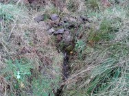
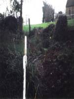
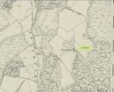
About 50 yards away from the Royal Promenade on the east-side of Parliament Street, there used to the flowing water of this old holy well, later becoming one more of Harrogate’s spa wells.  It was first recognized as a medicinal spring about 1792 when Thomas Garnett (1794) uncovered it beneath the overgrowth of vegetation surrounding the spring-head.  In doing so, it became evident that at some time in the past it had been used by local people as,

“a wall was discovered round the spring, but whether this had been built with an idea of its being a medicinal water, or with an intention of collecting water for cattle, I cannot determine.”

Chalybeate (iron-bearing) in nature, the waters were analyzed by Adam Hunter (1830) in the 1820s and, although possessed of soluble iron, had less than its medicinal compatriots nearby, meaning that its fortifying qualities weren’t quite as good. He told us how,

“it had been known (by locals) for many years, but at no time much used internally; it had acquired some celebrity however as a wash for sore eyes, for which purpose it was well adapted.  As chalybeate water has long been a favourite popular remedy for a wash in various weaknesses, and chronic affections of the eyes, it is proper to state that (the nearby) John’s Well, the Tewit Spa, or the succeeding one at Starbeck, are the only three chalybeates which can at present be recommended for that purpose.”

A few years after Hunter had been here, the well was destroyed “by the making of a highway drain.” Jennings 1981)

Folklore

St George (saint’s day – April 23) was one of the christian dragon-killers.  There is no known tradition of the saint or festivities that may once have occured here.

References:

  1. Garnett, Thomas, A Treatise on the Mineral Waters of Harrogate, Thomas Gill: Leeds 1794.
  2. Hunter, Adam, The Waters of Harrogate and its Vicinity, Langdale: Harrogate 1830.
  3. Jennings, Bernard, A History of the Wells and Springs of Harrogate, Interprint: Harrogate 1981.

© Paul BennettThe Northern Antiquarian

St. Ann’s Well, Harrogate, North Yorkshire

Holy Well (lost):  OS Grid Reference – SE 298 548

Archaeology & History

Very little is now known about this sacred site that was once found “a few hundred yards east from the New Church at Low Harrogate.” (Hunter 1830)  Even most of travellers and medical experts who wrote about the numerous Harrogate wells in the 18th and 19th century bypassed its quietude; and by the time Mr Hunter wrote about it in his great descriptive catalogue, its healing or medicinal qualities had been forgotten.

He told that “the spirit in the water…or that with which it is infused, has long been most actively engaged in adding real or fancied comforts to the (Harrogate) Fair, and is now in much more general use” than the two other holy wells in the town. It was, he said, “the best water for making tea and more extensively used for that purpose than any in the neighborhood of Harrogate.”  It would also appear to have been built over at some time in the not-too-distant past…

Folklore

St Ann (saint’s day – July 26) was a giant in early christian and Islamic myths.  An apocryphal figure, She was the Great Mother of the mother of Christ—the Virgin Mary—and was Herself a Virgin until, in Her old age, after seeing a bird feeding a chick, decided She wanted a child and so eventually gave birth to Mary.  An old woman giving birth when the Springtime appears (when birds and other animals become fertile) is the same motif found in the lore of the Cailleach in Ireland and Scotland (and parts of northern England).  Pre-christian lore at this old well would seem evident here.

References:

  1. Hunter, Adam, The Waters of Harrogate and its Vicinity, Langdale: Harrogate 1830.

© Paul BennettThe Northern Antiquarian

Bishop’s Well, Tottenham, Middlesex

Holy Well (destroyed):  OS Grid Reference – TQ 332 911

Also Known as:

  1. My Lady’s Hole

Archaeology & History

Long since gone after drainage operations on Tottenham Cemetery made the waters dry-up, this was one of several holy wells in the Tottenham area.  Its history has been described in various old tomes, but the most definitive is found in William Robinson’s (1840) classic on the parish of Tottenham, when the well was still visible.  He told us:

“There is a spring which issues from the side of a small hillock on the south side of the Moselle, nearly opposite the Vicarage, leading thence to the Church, called Bishop’s Well.  This spring was formerly considered famous for many strange and wonderful cures performed on the diseased by the use of this water.  It has been for some years neglected, but of late the owner of the field in which this well is, had it cleansed, and planted some trees round it, and put up posts and rails to prevent the cattle treading down the sides of it.  It is said that the water of this well never freezes.  In former times this well was in great repute from the purity of its water.  The ladies in the vicinity of it were accustomed to send their servants in the morning and evening for water for their tea, from which circumstance it was for many years known by the name of “My Lady’s Hole.”  The water of this well is not only esteemed for its medicinal qualities, but particularly for curing disorders of the eye.

“There were formerly many other springs about the village, especially one which issued out of the hill on which the Church stands; and another in Spottons Wood otherwise Spottons Grove, on the north side of Lordship Lane, which in the fifteenth century was of considerable notoriety; but none of which have in former times been so much frequented and held in such repute as Bishop’s Well.”

(Please note: the grid-reference for this site is an approximation)

References:

  1. Foord, Alfred Stanley, Springs, Streams and Spas of London: History and Association, T. Fisher Unwin: London 1910.
  2. Hope, Robert Charles, Legendary Lore of the Holy Wells of England, Elliott Stock: London 1893.
  3. Robinson, William, The History and Antiquities of the Parish of Tottenham, Nichols & Sons: London 1840.
  4. Sunderland, Septimus, Old London Spas, Baths and Wells, John Bale: London 1915.
  5. Thornbury, Walter & Walford, Edward, Old and New London – volume 5, Cassell: London 1878.

© Paul BennettThe Northern Antiquarian


Trumpeter’s Well, Strathaven, Lanarkshire

Healing Well:  OS Grid Reference – NS 66014 41685

Also Known as:

  1. Canmore ID 203472

Getting Here

Trumpeters Well on 1864 map

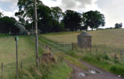
Take the A71 road southwest out of Strathaven as if you’re heading to Kilmarnock.  After 2½ miles (4.1km) you reach the tiny hamlet of Caldermill (be careful or you’ll truly miss it!).  As you go out of the hamlet, on your left there’s a track up to Hillhead Farm with the small but tell-tale signpost saying ‘Trumpeter’s Well’ and the small dome-shaped stone monument in the field is what yer looking for.  If you’re coming from the Kilmarnock side, when you reach the Caldermill sign, it’s in the field immediately to your right.  Y’ can’t really miss it.

Archaeology & History

When the site was surveyed by the Ordnance Survey lads in the 1850s, the water supply had completely run dry.  It was later revived and the nine-foot tall circular stone building built to commemorate its history.  The water apparently now runs within the building, being supplied from Hillhead Farm.

Trumpeters Well, Caldermill

Folklore

The well is said to have gained its name after the local Battle of Drumclog (1679), when one rich Tory known as John Graham of Claverhouse was retreating for fear of his life; and because his own horse had been killed, the coward stole the horse of his young fourteen-year-old trumpeter.  In doing so, the young lad was subsequently killed and his body was thrown down the well.  Tradition also tells that other soldiers were buried in the same field.

References:

  1. Campbell, J. Ramsey, My Ain, My Native Tour – Stra’ven, J.M. Bryson: Strathaven 1943.

© Paul BennettThe Northern Antiquarian

St. Bride’s Well, Avondale, Lanarkshire

Holy Well (destroyed):  OS Grid Reference – NS 6983 4138

Archaeology & History

St Brides Chapel & Well on the 1864 OS-map

Shown on the 1864 OS map of the area as a ‘Well’ just at the front of St Bride’s Chapel—now a very pleasant old cottage—peasants and pilgrims would stop for both refreshment and ritual here as they walked down High Kype Road.  Although the chapel was described in church records of January 1542 as being on the lands of Little Kype, close to the settlement of St Bride, there seems to be very little known about the history or traditions of the well.  If anyone has further information on this site, please let us know.

Folklore

Bride or Brigit has her origins in early British myth and legend, primarily from Scotland and Ireland.  Her saint’s day is February 1, or the heathen Imbolc (also known as Candlemas).  Although in christian lore St. Bride was born around 450 AD in Ireland and her father a Prince of Ulster, legend tells that her step-father (more probably a teacher) was a druid and her ‘saintly’ abilities as they were later described are simply attributes from this shamanic pantheon. Legends—christian and otherwise—describe Her as the friend of animals; possessor of a magickal cloak; a magickian and a healer; and whose ‘spirit’ or genius loci became attached to ‘sacred sites’ in the natural world, not the christian renunciation of it.  St Bride was one of the primal faces of the great prima Mater known as the Cailleach: the greater Gaelic deity of Earth’s natural cycles, whose changing seasons would also alter Her names, faces and clothes, as Her body moved annually through the rhythms of the year.  Bride was (and is) ostensibly an ecological deity, with humans intrinsically a part of such a model, not a part from it, in contrast to the flawed judaeo-christian theology.

References:

  1. Paul, J.B. & Thomson, J.M., Registrum Magni Sigilli Regum Scotorum: The Register of the Great Seal of Scotland AD 1513 – 1546, HMGRH: Edinburgh 1883.

© Paul BennettThe Northern Antiquarian


St. Botolph’s Well, Hadstock, Essex

Holy Well: OS Grid Reference — TL 559 448

Getting Here

Hadstock lies along the A1052 north of Saffron Walden. Once in the village, a fenced pond will be apparent on the left below the church.  Just above the pond is the well that feeds it – yet there seems some confusion regarding the exact location of the site.

Archaeology & History

John Wilson in his Imperial Gazetteer, III (1872) describes it as:

“A well set round with stones, and called St. Botolph’s Well, is in the churchyard.”

However, by the time of An Inventory of the Historical Monuments in Essex, I (1916) it was:

“In the churchyard—a well, known as St. Botolph’s well, now covered.”

St Botolph's Well

St Botolph’s Well

Indeed there would be some confusion regarding the exact location of this well.  The church guide describes a pump to the west end of the churchyard as the well (but the only pump apparent was that across the road), however I was informed that this well was the one picturesquely situated by the road beneath the church. This is a brick-lined square well whose spring percolates into a pool covered in duckweed.  No evidence of any material earlier than Victorian is apparent, suggesting it may date from when the pump was established.  A wooden fence has been erected around it to prevent people falling in, but apparently the well itself has been covered.

Folklore

The village has a St. Botolph’s Well although there is no direct link recorded between it and the saint of that name, but local tradition believes that he was interred in this church. This view was supported by the discovery of an empty Saxon grave in the east wall of the South Transept. Greater credence being lent by the fact that this had previously been exhumed, which is in accordance with the knowledge that the relics were removed in 970, and then distributed around East Anglia.

Its waters have had a mixed reputation. Tradition records their ability to cure scrofula. Until recently the well was the important source of drinking water for the village. One tradition suggests that if a ring was dropped into it by a lovelorn girl she would find her true love. This tradition was supported by the finding of two rings recently in the cleaning of the well.  Wilson (1970) notes a strange activity was practiced within living memory by the white witch: to keep the water pure, dead cats were placed down the well.  Obviously, this was not continued for on one occasion the water was the harbinger of a typhoid outbreak, and forty percent of the population—or 40 people—died (although there is no evidence for either). The contamination was the result of the Rev F. E. Smith using the spring as an outlet for his lavatory. If this was not bad enough, one of his staff was a typhoid carrier! This is also notwithstanding, that it was commonly believed that the spring water drains from the graveyard above it: and hence it has earned the name ‘bone gravy’. Despite all these traditions, this did not deter the locals, who vouched for its goodness. Even when piped water was brought to the village in the 1930s, many locals could not see the point as the well water was good enough.

References:

  1. Parish, R.B., Holy Wells and Healing Springs of Essex, Pixy Led Publications 2008.
  2. Royal Commission on Historic Monuments, An Inventory of the Historical Monuments in Essex – volume 1, HMSO: London 1916.
  3. Wilson, John M., The Imperial Gazetteer of England and Wales – volume 3, A. Fullarton: Edinburgh 1872.

Extracted from the R.B. Parish Holy Wells and healing springs of Essex (2008)

Links:

  1. Holy & Healing Wells

© R.B. Parish, The Northern Antiquarian


Devil’s Well, Abernethy, Perthshire

Sacred Well:  OS Grid Reference – NO 19430 14758

Also Known as:

  1. Canmore ID 28084

Getting Here

Devil’s Well on 1860 map

From Abernethy village, go west along the A913 road for half-a-mile, then turn left up the long and winding Glenfoot road up the Abernethy Glen.  About a mile up on your left-side is Craigden Farm and, just a bit past this, the forestry plantation.  Just before the trees, cut up the field and head uphill, passing the near forest of gorse, until you reach the huge detached house of Turflundie.  In the field immediately east, right up against the barbed-wire fence where it meets the depleted forestry, a very small trickle of water emerges beneath a small pile of rocks.  You’re here!

Archaeology & History

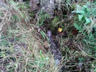
Long since thought to have been lost, the trickling remains of this old Well of the Devil are, in fact, still running beneath the pile of stones just over the barbed-wire fence on the edge of the forestry section.  A cluster of other worn rounded rocks scatter the ground just to the rear of where the water first comes out of the ground, suggesting, perhaps, that a small well-house covered the spring; but this is me being speculative, as there’s no mention of this in the early writings of the Ordnance Survey lads, nor is one shown on the first OS-map of the area in 1860.  And you’ll see on the OS-map how the well is slightly lower than where it presently trickles, but this is down to the fact that the source of it was piped-off at sometime in the not-too-distant past, as evidenced by remains of such piping laying just over the barbed-wire fence close to the source.  In truth, unless you’re hardcore, there’s very little to see.

Folklore

The trickling waters are on the other side of this fence

The dedication of this water-site to the christian ‘devil’ is obviously a corruption of its original traditional name, which may have simply been to the Bodach, or ‘Old Man’ in Gaelic and northern British lore.  The bodach‘s consort is the great prima Mater of the northern realms known as the Cailleach, but I can find no dedication to Her anywhere nearby.  The best we have are the ‘Witches Graves’ a half-mile to the northwest, below the edge of the geological ridge overlooking Abernethy, where folklore tells us 22 women were murdered and buried by the local christians several centuries ago.

In the Ordnance Name Book of 1859, they recorded that,

“A small Spring well on the farm of Turflundie, so called from the mark of a cloven hoof on a near, supposed to have been made by his Satanic majesty when he stopped to quench his thirst at this well during some of his midnight rambles.”

There’s no apt word that follows the word “near”, but assume it was meant to be a “stone,” although we could find no such stone close by and there are no known petroglyphs that could account for that ingredient.

References:

  1. Morris, Ruth & Frank, Scottish Healing Wells, Alethea: Sandy 1982.

© Paul BennettThe Northern Antiquarian


Our Lady’s Well, Stirling, Stirlingshire

Holy Well (destroyed):  OS Grid Reference – NS 7932 9454 

Also Known as:

  1. Whiskey Well
  2. Whusky Well

Archaeology & History

Fleming's 1898 drawing of Our Lady Well

Fleming’s 1898 drawing of Our Lady Well

Once found beneath the northern foot of Gowan Hill, below the old hillfort and close to Stirling’s famous castle, the Industrialists, as usual, built over and destroyed this piece of ancient heritage in the 20th century, leaving us only a few words and an old drawing to remember it by.  It was one of several holy wells in and around Stirling, most of which have fallen prey to the same scavengers in the march they call ‘progress.’

Thankfully the local writer J.S. Fleming’s (1898) talked about the well in his fine work, where he told:

“This Well is situated at the foot of the Gowan Hills, and adjacent to the skating pond, as shown in (the) sketch.  Though part of the waters of this Well have been abstracted, and led, by means of a pipe, to a neighbouring factory, it still gives off a considerable flow of water.  The local name, “Whusky Well” is supposed to be given this Well on account of the virtues of its waters for mixing with whisky, without any perceptible deterioration of the latter.  We can find no allusion to this Well in any of the Burgh Records, and Dr. Rogers gives no reason for its dedication to the Virgin Mary.  We do know, however, that “St. James’s Chapel of the Crag” was situated only 200 or 300 yards distant, and is referred to frequently as receiving alms from King James IV, especially on 26th July, 1496, of 14s.  We learn from a charter by Robert III to the Canon of Cambuskenneth Abbey, dated 10th March, 1402, that he grants “to God, and the blessed Virgin Mary, and to the said Canon,” this Chapel, or Hospital of St. James, at the end of the roadway of the Bridge of Stirling; and that King James II, on 24th June, 1456, grants the said Chapel, or Hospital, to the town of Stirling, ” to the praise and honour of God, the blessed Virgin Mary, his mother, and Saint James the Apostle.” May not this well have had connection with St. James’s chapel, an appanage of Cambuskenneth Abbey, dedicated to our Lady the Virgin, and thus give reason for its name, ” Our Lady Well? ” Saint James’s Chapel was held by Sir Robert Cristisoun, as part of his emoluments as master of the Grammar School, whose right was challenged in 1522; and in November, 1562, having become ruinous, the stones of the Chapel were directed by the Magistrates to be “brocht to the utility and profit of the common work,” — strengthening the town’s wall.  A northern boundary, in a charter of the Abbot of Aberbrothock, dated 1299, of lands in the burgh, is described as “the land of Saint Marie of Strivelin.” There is also “a Ladyrig,” but its situation is not indicated and, therefore, its connection with the Well is hypothetical.”

In early references of the site by Ordnance Survey in the 1860s and 1890s, it was only described and shown as the Whiskey Well.

References:

  1. Bennett, Paul, Holy Wells and Healing Springs of Stirling and District, forthcoming
  2. Fleming, J.S., Old Nooks of Stirling, Delineated and Described, Munro & Jamieson: Stirling 1898.
  3. Roger, Charles, A Week at Bridge of Allan, Adam & Charles Black: Edinburgh 1853.

© Paul BennettThe Northern Antiquarian


Fairy Well, Logie, Stirlingshire

Sacred Well:  OS Grid Reference – NS 8135 9804

Also Known as:

  1. Canmore ID 47123
  2. Hielantman’s Well
  3. Highlandman’s Well
  4. Holy Well

Getting Here

Fairy Well, emerging from wall

Fairy Well, emerging from wall

From Stirling, take the A9 to Bridge of Allan, turning right at the roundabout along the A907 for less than a mile, then turning left at the next roundabout up the A91.  A half-mile down, at the small roundabout, bear left and first right, up to Logie Church.  Keep going all the way up this steep winding road, turning right at the junction.  Go along here for a quarter of a mile and park up at the roadside.  Walk along a bit further where the road has a bittova sharp bend.  The sound of the stream coming out of the small glen is obvious.  Walk past this and, on the right-hand side of the road, past the stream, you’ll find a water source emerging from the boscage of an overgrown wall.  Keep looking.  It’s damn close!

Archaeology & History

In the 1792 Statistical Account of this northeastern edge of Stirling, moving into the ancient parish of Logie, we were given an early brief account of this all-but-forgotten sacred water source which, thankfully, still runs fine water to this day.  It was described in tandem with the ancient Hill of the Picts called Dunmyatt, more than a mile to the east; but,

“About half-a-mile from the foot of this hill…is a very fine well, which issues from more than sixty springs, that rise through the sand and channel.  It is called the Holy Well, and is said to have been much resorted to by the Roman Catholics.”
Close-up of the running waters

Close-up of the running waters

In R.M. Menzies (1905) magnum opus on the parish of Logie, he told that it “was popularly known as ‘the Heilantman’s Well’, a possible reminiscence of the ’15 where the battle of Sheriffmuir was fought nearby.”  This tradition is echoed by several local historians; though Angus Watson (1995) wonders whether it’s ‘Highlandman’s Well’ name (and its variants) is “perhaps more likely to the use of the well by Highland drovers.”  It’s in the perfect spot too!

When the Royal Commission (1963) lads visited the place in 1952, they described the well to have “been filled up.”  Thankfully today, the old well emerges out of the overgrown remains of an old wall, the waters of which still run fast and free and into the larger stream ahead of it.  The waters are fine and clear, and tasted cold and refreshing when I drank some a few days ago.  It’s an excellent spot to quench the thirst after a day out in the Ochils.

Folklore

Of the various titles given to this old water source, the more popular choice in recent years has been to call it the Highlandman’s Well.  However, local lore had always known it to be a place where the little people had acquaintance and it seems more vital to maintain its old folk-name.  In R.M. Menzies (1912) rare work on the folklore of the region, he told us the story behind the name:

“Once upon a time, when people took life more leisurely, and when the wee folk frequented the glens and hills of Scotland, there was one little fairy whose duty it was to look after certain wells renowned for their curative properties.  This fairy was called Blue Jacket, and his favourite haunt was the Fairy Well on the Sheriffmuir Road, where the water was so pure and cool that nobody could pass along without taking a drink of the magic spring.  A draught of this water would have such a refreshing effect that the drinker could go on his journey without feeling either thirsty or hungry.  Many travellers who had refreshed themselves at the Fairy Well would bless the good little man who kept guard over its purity, and proceed upon their way dreaming of pleasant things all the day long.

“One warm day in June, a Highland drover from the Braes of Rannoch came along with a drove of Highland cattle, which he was taking to Falkirk Tryst, and feeling tired and thirsty he stopped at the Fairy Well, took a good drink of its limpid water, and sat down beside it to rest, while his cattle browsed nearby.  The heat was very overpowering, and he fell into a dreamy sleep.

“As he lay enjoying his noonday siesta, Blue Jacket stepped out from among the brackens and approaching the wearied drover, asked him whence he came.  The drover said:

“‘I come from the Highland hills beside the Moor of Rannoch; but I have never seen such a wee man as you before.  Wha’ may you be?’

“‘Oh,’ said the fairy, ‘I am Blue Jacket, one of the wee folk!’

“‘Ay, ay man, ye have got a blue jacket, right enough; but I’ve never met ony o’ your kind before. Do ye bide here?’

“‘Sometimes; but I am the guardian of the spring from which you have just been drinking.’

“‘Weel, a’ I can say is that it is grand water; there is no’ the likes o’t frae this to Rannoch.’

“‘What’s your name?’ asked the fairy.

“‘They ca’ me Sandy Sinclair, the Piper o’ Rannoch,’ was the reply.

“‘Have you got your pipes?’ asked Blue Jacket.

“‘Aye, my mannie, here they are.  Wad ye like a tune?  Ye see there’s no’ a piper like me in a’ Perthshire.’

“‘Play away then,’ said Blue Jacket.

“Sandy Sinclair took up his pipes and, blowing up the bag, played a merry Highland reel.  When he finished, he was greatly surprised to see above the well a crowd of little folk, like Blue Jacket, dancing to the music he had been playing.  As he stopped they clapped their little hands and exclaimed, ‘Well done Sandy! You’re the piper we need.’

“Thereupon Blue Jacket blew a silver whistle, which he took from his belt, and all the wee folk formed themselves into a double row.  Blue Jacket then took the Highland piper by the hand, led him to the front of the procession, and told him to play a march.  Sandy felt himself unable to resist the command of the fairy, and, putting the chanter into his mouth, blew his hardest and played his best, marching at the head of the long line of little people, who tripped along, keeping time to the strains of the bagpipes.  Blue Jacket walked in front of the piper, leading the way in the direction of the Fairy Knowe.

“Sandy Sinclair never marched so proudly as he did that day, and the road, though fairly long, seemed to be no distance at all; the music of the pibroch fired his blood and made him feel as if he was leading his clansmen to battle.   When the Fairy Knowe was reached, the wee folk formed themselves into a circle round the little hill, and sang a song the sweetest that ever fell upon the ears of the Highlandman.  Blue Jacket once more took his whistle and, blowing three times upon it, held up his hand, and immediately the side of the knoll opened.  Bidding the piper to play on, Blue Jacket led the procession into the interior; and when all were inside, the fairies formed themselves into sets, and the piper playing a strathspey, they began dancing with might and main.

“One dance succeeded another, and still Sandy played on, the wee folk tripping it as merrily as ever.  All thoughts of Sandy’s drove had gone quite out of his head, and all he thought of now was how best to keep the fairies dancing: he had never seen such nimble dancers, and every motion was so graceful and becoming as made him play his very best to keep the fun going.  Sandy Sinclair was in Fairyland, and every other consideration was forgotten.

“Meanwhile his cattle and sheep were following their own sweet will, the only guardian left to take care of them being his collie dog.  This faithful animal kept watch as well as he could, and wondered what had become of his master.  Towards evening another drover came along with his cattle for the same tryst.  He knew the dog at once, and began to pet the animal, saying at the same time, ‘Where’s your master, Oscar? What’s become o’ Sandy?’

“All the dog would do was to wag his bushy tail, and look up with a pleading air, as if to say, ‘I don’t know; will you not find him?’

“‘My puir wee doggie, I wonder what’s come over Sandy?  It’s no like him to leave his cattle stravaiging by the roadside.  Ay ay man; and at the Fairy Well too!  Indeed, this looks unco bad.’

“The newcomer, who was also a Highlander, made up his mind to spend the night with his own drove and that of Sandy Sinclair, thinking that the missing man would turn up in the morning.  But when the morning came there was no sign of Sandy.

“Taking Sandy’s collie and leaving his own dog in charge of the combined droves, he said, ‘Find master, Oscar!’  The wise beast sniffed around for a little and then trotted off in the direction taken the day before by Sandy Sinclair and the fairies.  By and by they reached the Fairy Knowe; but there was nobody there as far as the drover could see.  The dog ran round and round the knoll, barking vigorously all the time, and looking up into the face of the drover as if to say, ‘This is where he is; this is where he is.’  The drover examined every bit of the Fairy Knowe, but there was no trace of Sandy Sinclair.  As the drover sat upon the top of the Fairy Knowe, wondering what he should do next, he seemed to hear the sound of distant music.  Telling the faithful dog to keep quiet, he listened attentively, and by-and-by made out the sound of the pibroch; but whether it was at a long distance or not, he could not be certain.  In the meantime, the dog began to scrape at the side of the mound and whimper in a plaintive manner.  Noticing this, the drover put his ear to the ground and listened.  There could be no mistake this time: the music of the pibroch came from the centre of the Fairy Knowe.

“‘Bless my soul!’ exclaimed Sandy’s friend. ‘He’s been enticed by the fairies to pipe at their dances.  We’ll ne’er see Sandy Sinclair again.’

“It was as true as he said.  The Piper of Rannoch never returned to the friends he knew, and the lads and lasses had to get another piper to play their dance music when they wished to spend a happy evening by the shore of the loch.  Long, long afterwards, the passers-by often heard the sound of pipe music, muffled and far away, coming from the Fairy Knowe; but the hidden piper was never seen.  When long absent friends returned to Rannoch and enquired about Sandy Sinclair, they were told that he had gone to be piper to the wee folk and had never come home again.”

The Fairy Knowe is the large prehistoric burial mound, neolithic in origin, found 1.08 miles (1.74km) west of the Fairy Well, above Bridge of Allan—and an absolute must to visit for any lovers of fairy lore!

References:

  1. Fergusson, R. Menzies, Logie: A Parish History – volume 1, Alexander Gardner: Paisley 1905.
  2. Fergusson, R. Menzies, The Ochil Fairy Tales, David Nutt: London 1912.
  3. Royal Commission on the Ancient & Historical Monuments Scotland, Stirling – volume 2, HMSO: Edinburgh 1963.
  4. Watson, Angus, The Ochils – Placenames, History, Tradition, Perth & Kinross District Libraries 1995.

© Paul BennettThe Northern Antiquarian


Chapel Well, Cambusbarron, Stirlingshire

Holy Well:  OS Grid Reference – NS 7781 9251

Also Known as:

  1. Bruce’s Well
  2. Canmore ID 46248
  3. Christ’s Well

Getting Here

Site of the Chapel Well

Site of the Chapel Well

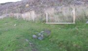
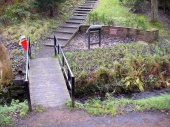
Along the Main Street in Cambusbarron, walk down Mill Hill for a hundred yards or so, to The Brae.  Just here, a paved footpath goes to the right.  Walk along here for about 120 yards until you reach a small footbridge crossing the stream.  On the other side of this bridge you’ll notice a notice board and a sign.  You’re here!

Archaeology & History

Today, all that remains of this spring of water that was sacred in the animistic pantheon of our ancestors, is a notice board and an epitaph, reading “Site of the Chapelwell (or Christ’s Well)”; but in times past this simple spring of water was a place of considerable activity.  Not only did the local people of Cambusbarron get their water supply from this (and others close to the Main Street), but it was also a place of ritual and reverence.  We know this from early church accounts—most of which were complaints about the traditions performed by local people, in contravention to the christian cult.

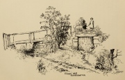
J.S. Fleming's old drawing

J.S. Fleming’s old drawing

The best account of the site is found in J.S. Fleming’s (1898) work, in which we find it also referred to as the ‘Christ’s Well’.  This attribution adds further mystery and controversy regarding another Christ’s Well a few miles away at Blair Drummond, whose position by the academic community is questioned by local historians.  Be that as it may, Mr Fleming’s words on this Chapel Well are worth reading.  He wrote:

“the most famous of all the Stirling Holy Wells, was, early in this century and is still, known by the name of ‘Chapel Well,’ and its water, up till a recent date, was used for domestic purposes by the villagers.  It originally consisted of a square, stone-built, open well, with parapets, but its walls are now built up and roofed, and it has a door, now shut up, however, and the well closed by the sanitary authorities of the district.  The well is situated on the brink of what we assume to be Glenmoray Burn, here crossed by a rustic wooden bridge in a part of the Chapel Croft garden, containing the alleged site of the chapel, from which it is distant a few feet.  The stump of an ancient thorn is shown on the right hand of the sketch.  The overflow of water empties itself into the adjoining burn.  The site of this famous well has been so variously described as to almost challenge its identity, but the authorities examined, all, with one single exception, afternoted, virtually agree in its situation:

“1) Sutherland, about a hundred years ago, writes:  “Not far from St. Thomas’ Well there is another, on the farm of Chapel Croft, called ‘Christ’s Well,’ of great repute, and visited by women, etc.”

“2) Dr. Rogers, later, after referring to the Chapel of Cambusbarron, says ”two of the three wells connected with the establishment still exist near its site by the margin of Glenmoray stream.”

“3) Another writer says: ‘”Christ’s Well,’ now called ‘ Chapel Well,’ is at bottom of a small dell called Glenmoray, immediately adjoining Cambusbarron, and there is a tradition that here the water was got for the religious services at the Battle of Bannockburn, one redeeming quality of the superstition which would consecrate its water.”

“4) A writer, over the initials “S.I.,” in the Stirling Observer of 27th September, 1866, says:  “Within its Chapel King Robert the Bruce partook of the sacrament on the eve of the Sabbath preceding the Battle of Bannockburn, and its sacred font was the resort at Beltane of the superstitious of a former age, as may be seen from extracts from kirk session records.”

“These all agree that ‘Christ’s Well’ was situated not far from St. Thomas’ Well, on Chapel Croft; that it and other two wells existed some few years ago near the site of the Chapel, on the margin of Glenmoray stream, by the name of “Chapel Well”; ” is situated in a small dell called Glenmoray, and is immediately adjoining Cambusbarron; and that it retains, and is presently known by, no other name than the “Chapel Well.”  Further, a small distillery, now removed, situated a few yards from the Chapel on this burn, taking its name from the glen and burn, was called Glenmoray Distillery…”

“However, a writer in the Stirling Observer of 7th September, 1871, in an article on “Touch Glen,” says that not far from the road leading to the three reservoirs on Touch Hills, two of the three Wells connected with the Chapel (which, he states, is 1000 yards distant from Gartur Lodge) still exist, and may be seen near the brink of a little burn which trickles from the miniature glen of Glenmoray, visible on the hillside just below the lowest reservoir. This burn is crossed by a small stone bridge on the main road, and is known as “Johnnie’s Burn.” These Holy Wells, including Chapel Well, would thus, according to this writer, be about a mile, if on “Johnnie’s Burn,” and if near the lower reservoir, on Touch Hill,’ fully a mile and a half from Chapel Croft and the Chapel…

“…The Church dealt severely with the devotees—principally women—who resorted to the virtues of “Christ’s Well,” as is shown by the session records, from which we make a few extracts: —

“July 12, 1610. — The quhilk day compeirit Grissal Glen and Marioun Gillaspie quha for ther superstitione in passing in pilgrimmage to ‘Christe’s Well’ as they confessit the last day ar ordeinit to mak publick repentance the next Sonday in lining claithis.”

” 1 June, 1630. — The quhilk day compeirit Elspet Aiken, spous to Anclro Cuyngham, tinckler; Jonet Harvie, William Huttoune, cutler; Margaret Mitchell, dochter to Alex Mitchell; Jonet Bennet, dochter to James Bennet, cuick; James Ewein, son of John Ewein, wobster, Margt. Wright, James Watsoune, who confessis passing in pilgrimmage to ‘Christe’s Well’ in Mai, and thairfoir they ar ordeaned to mak publik repentance the nixt Sabbat in thair awin habeit, under the paine of disobedience.”

” Lykway I, Mr. Patrik Bell, am ordeaned to desyre the breithren of the Presbyterie to appoint ane actuale minister for to preach upon Sonday nixt for to tak ordour with the said persounes above writen.” (Note — This offence seems a mere ploy of young people observing May morning, as is done at the present day on the first of May, and the responsibility “of asking” an “actual minister’s aid” to take “order” with the accused seems treating the offence too seriously.)

“6 October, 1631. — The quhilk day compeirit Jonet Norbell, in Cambusbarron, for going for water to help her sick son; and Jonet Main, in Cambusbarron, going to ‘Christe’s Well’ for water for help to her bairns; “and for another offence are ordained” to sair the pulpit on Sonday nixt in her ain habit to mak repentance.”

Mr Fleming seemed to think the traditions of Mayday a healthy thing and wrote well of local traditions, speaking of the healing virtues of the dew on May morning, used by people all over the country; also remembering a song that would be sung in honour of “the delightful custom of maying”:

I, been a rambling all this night,
And some time of this day ;
And now returning back again,
I brought you a garland gay.

Why don’t you do as we have done
The very first day of May ?
And from my parents I have come,
And would no longer stay.

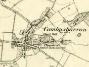
Chapel Well on 1865 map

Chapel Well on 1865 map

Modern plaque at the site

Modern plaque at the site

The fact that Mr Fleming cites the Chapel Well to be known locally as the ‘Christ’s Well’ needs to be remembered when you visit a site of the same name 5 miles northwest of here at Blair Drummond.  It was a place of considerable renown and much used by local people for a variety of indigenous rites and customs for many miles around.  The ancient Scottish practices were still very much alive…

References:

  1. Fleming, J.S., Old Nooks of Stirling, Delineated and Described, Munro & Jamieson: Stirling 1898.
  2. MacKinlay, James M., Folklore of Scottish Lochs and Springs, William Hodge: Glasgow 1893.
  3. Morris, Ruth & Frank, Scottish Healing Wells, Alethea: Sandy 1982.
  4. Roger, Charles, A Week at Bridge of Allan, Adam & Charles Black: Edinburgh 1853.

© Paul BennettThe Northern Antiquarian