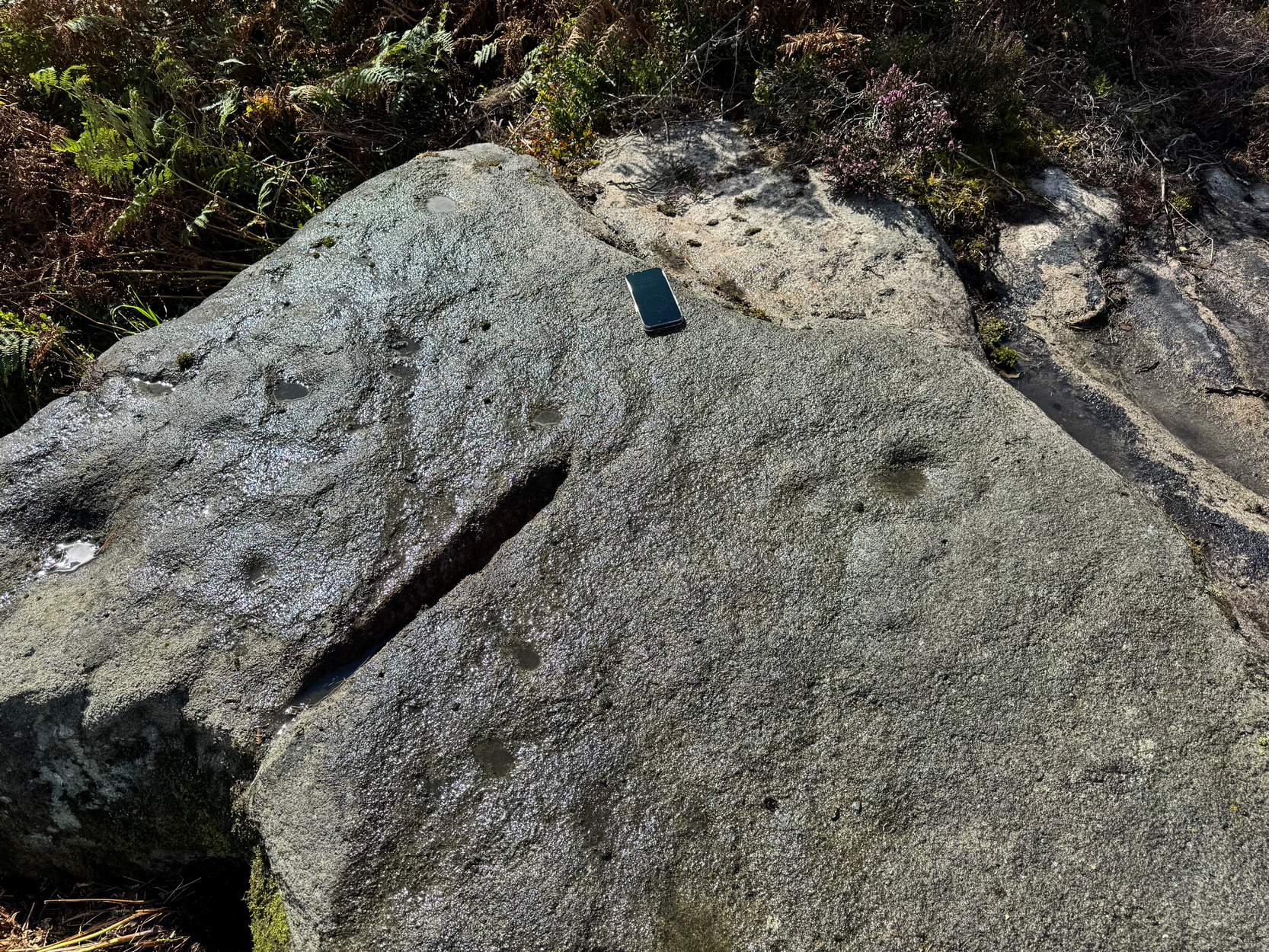
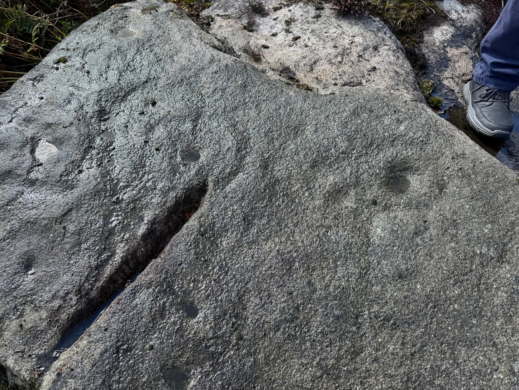
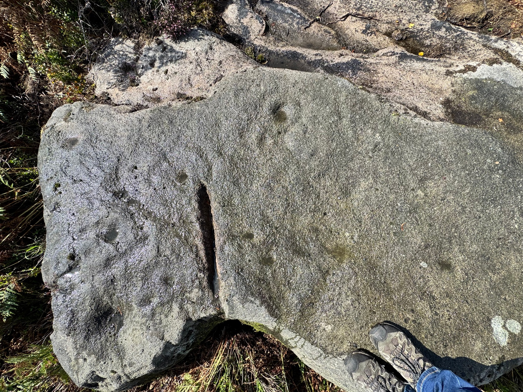
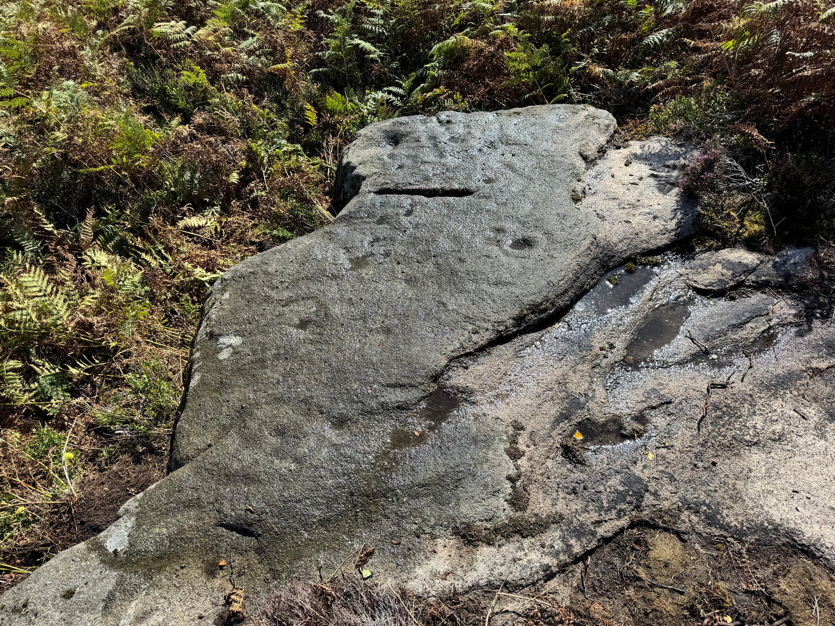
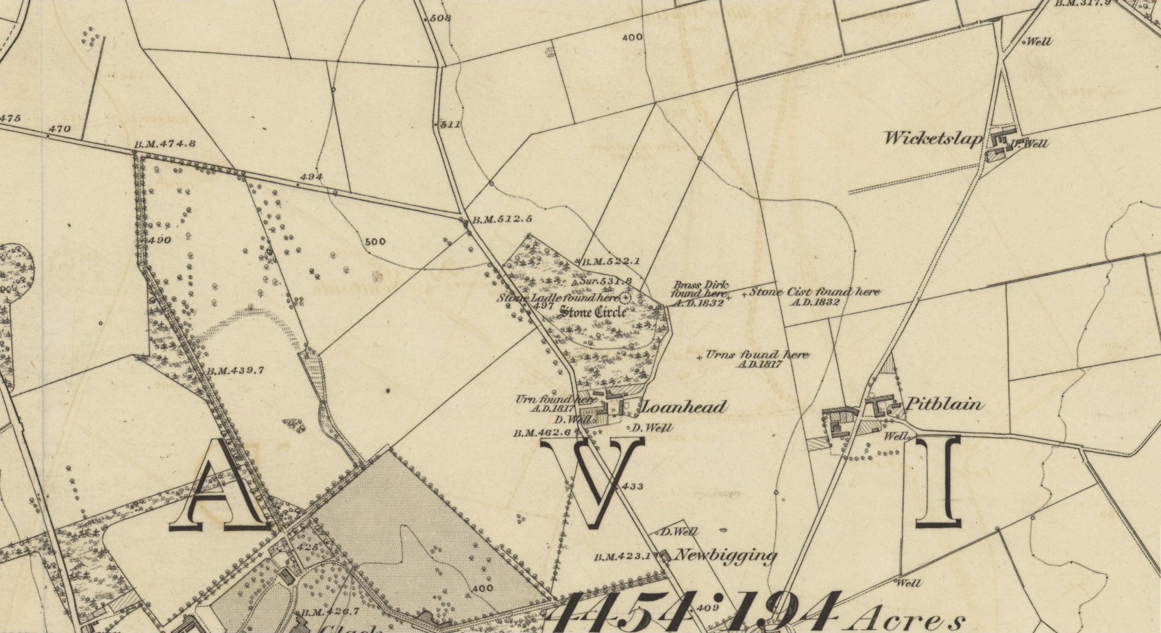
Solar Stone, Ballochraggan, Port of Menteith, Perthshire

Cup-and-Ring Stone:  OS Grid Reference – NN 56138 01827

Also Known as:

  1. Netherglenny 32

Getting Here

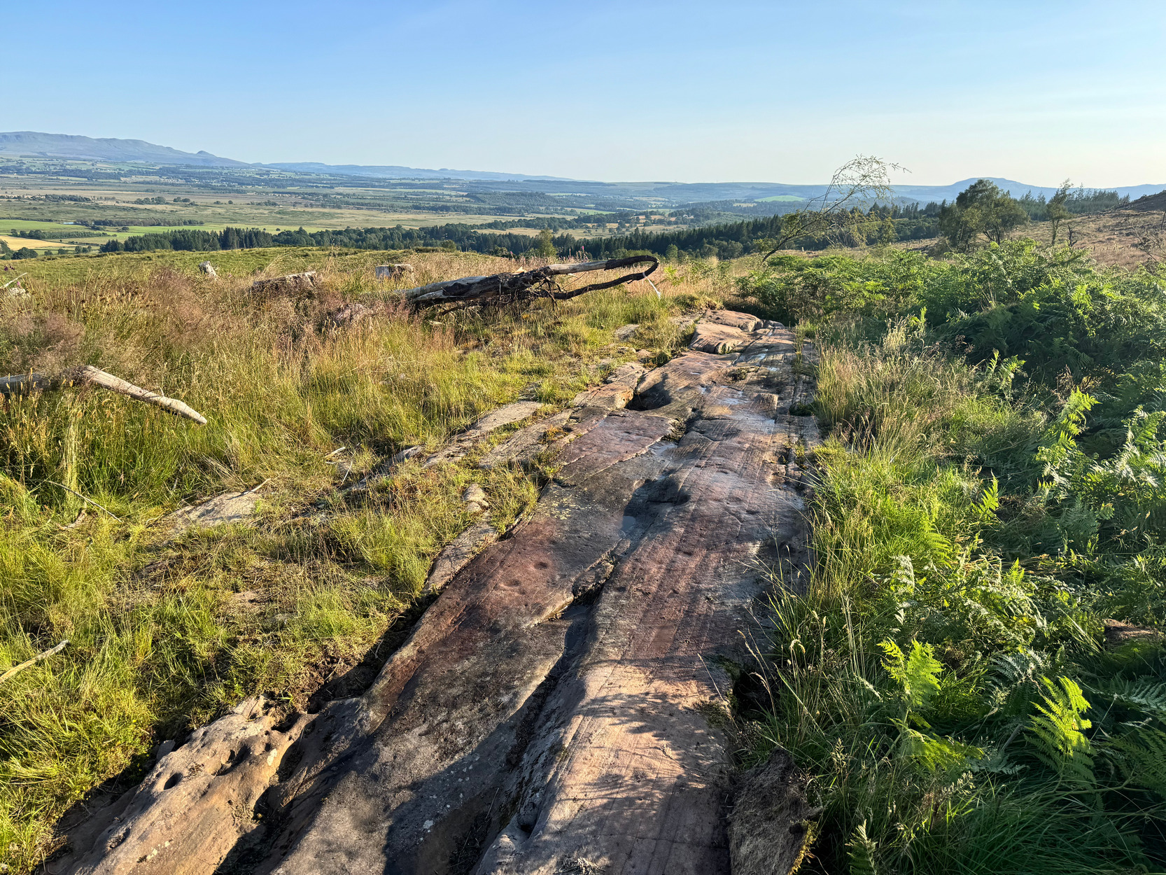
Solar Stone, looking SW

Along the A81 road between the Port of Menteith and Aberfoyle, ¾-mile (1.2km) west of the Port of Menteith you’ll see a small single-track road on the right—by a group of cottages—that takes you uphill.  Go uphill for just over a half-mile and park-up on the rough grass on your left, ensuring there’s enough room for a tractor to get past (if some halfwit Englishman comes out and says “you can’t park there!”, remind him that this is Scotland!*).  Just where you’ve parked-up there’s a dirt-track on your left; walk up it, go through the gate, and nearly 300 yards after this there’s a gate into the fields on your left. Go through here, and follow the straight line of fencing for 700 yards, passing one of the Netherglenny cairns, till you hit a wall.  Go through the gate and, 60-70 yards south-west on a raised ridge of land is a long line of bedrock stone. You’ve arrived!

Archaeology & History
Cups & rings & solar sign?

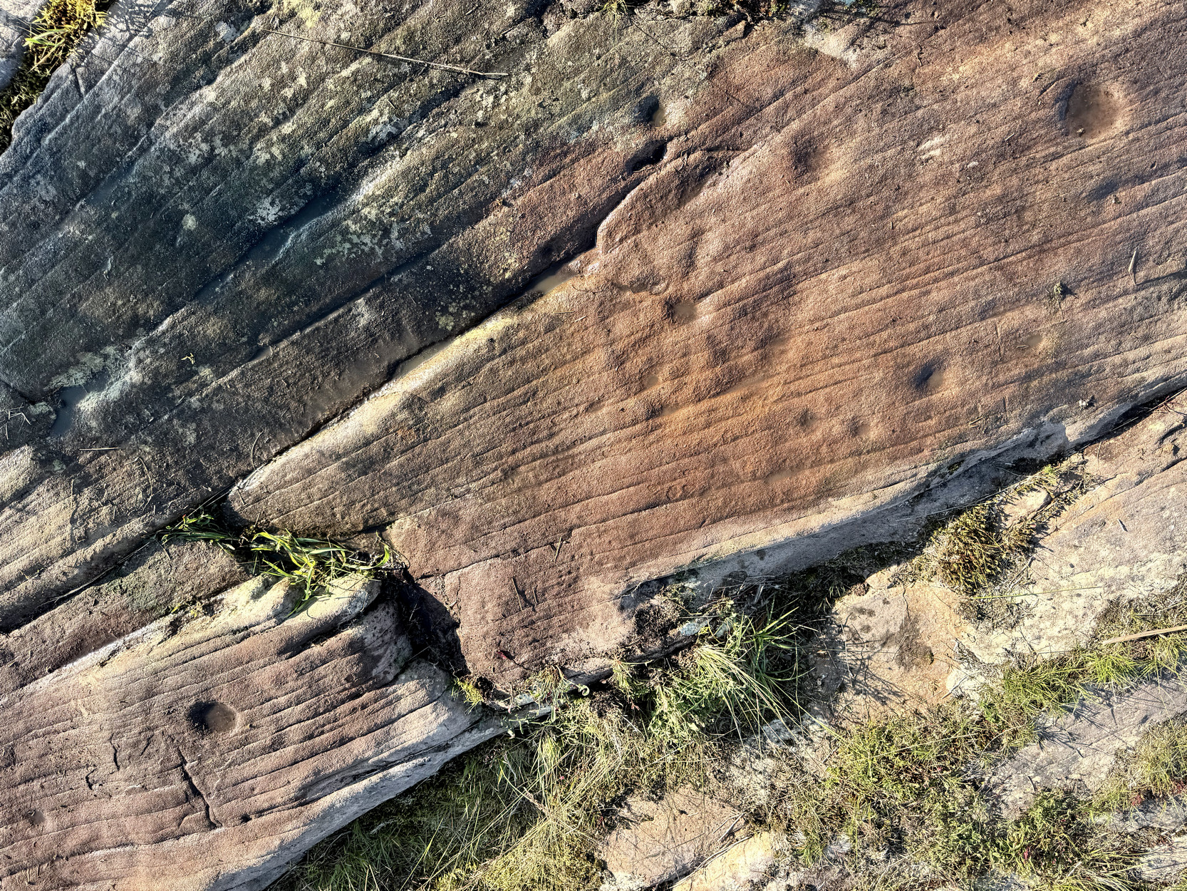
In the early 1990s, rock art explorer Kaledon Naddair gave a talk at Kilmartin on the prehistoric rock art of Scotland.  Amongst other carvings, he reported on a number of new finds that he and others had made at the Ballochraggan complex near Aberfoyle and, as I recall, it included this fascinating and almost unique design  (Naddair and his team did hundreds of detailed drawings of many carvings, most of which are very hard to find nowadays).  Some years later, in 2009, rock art student George Currie came across the same stone shortly before forestry plantation grew to obscure it entirely.  It was described for the first time in Brouwer & van Veen’s (2009) fine survey of the Ballochraggan petroglyphs.  My first visit here was in 2021 in the company of Prof Paul Hornby, when the forest was still standing and we had to cut our way through the trees to see a section of stone.  A few years on, now that the forest has been cut down, all of the carving has come to light again—and it’s a bittova beauty!
Down the stone NE-SW
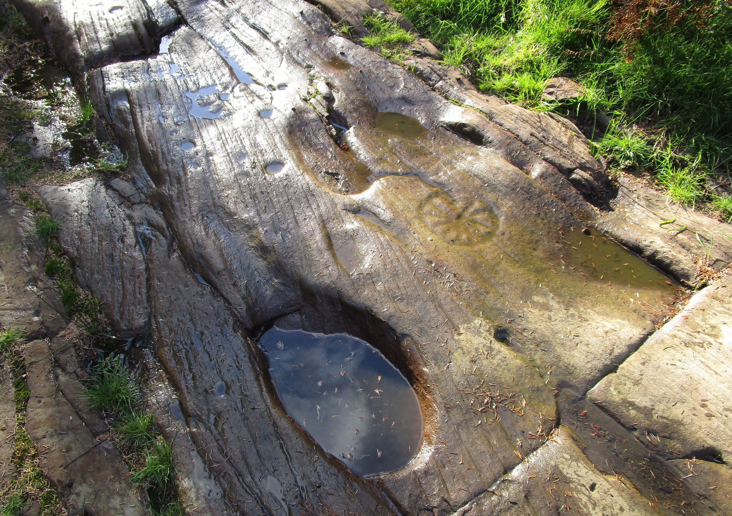
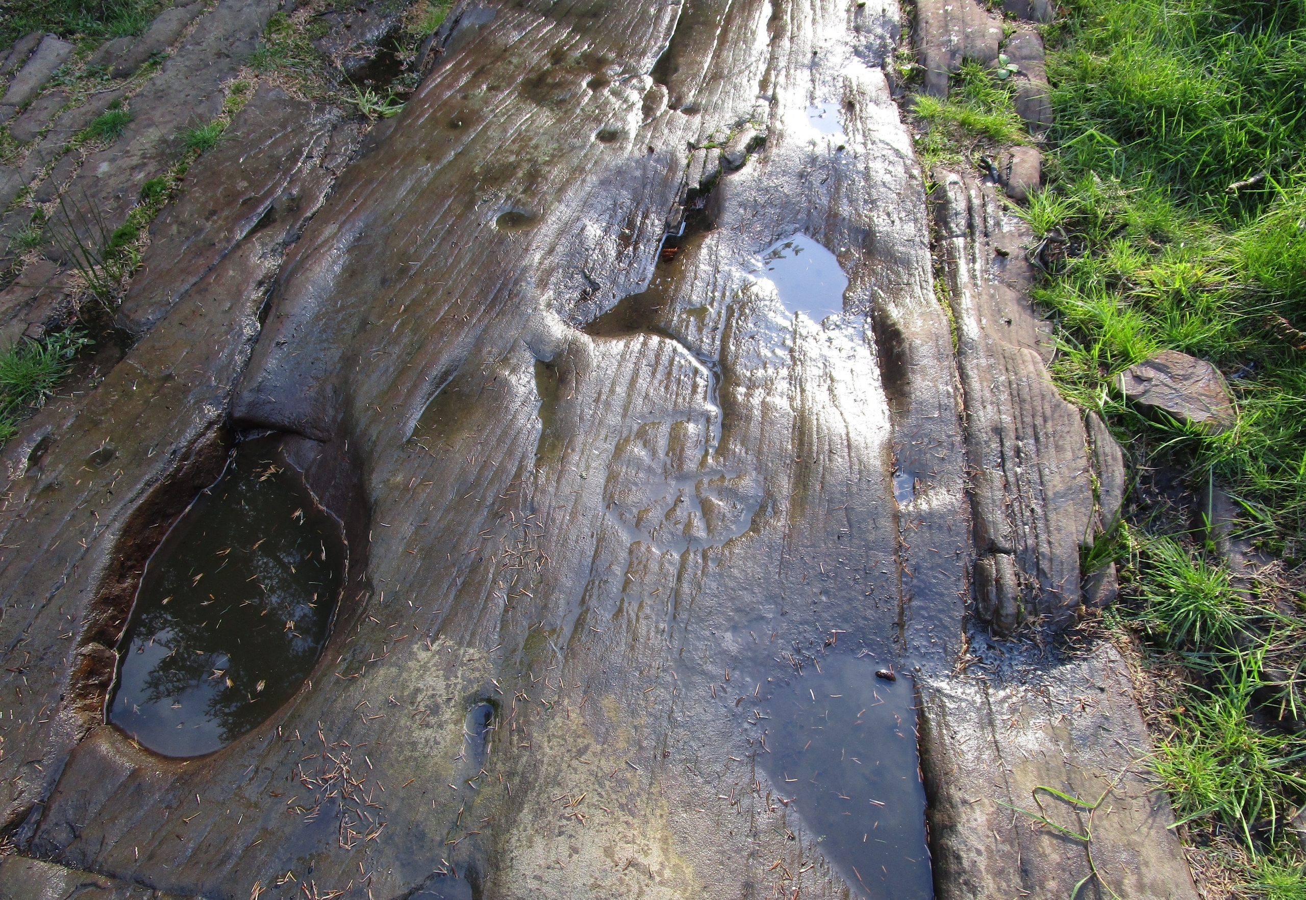
Bowls & troughs of water

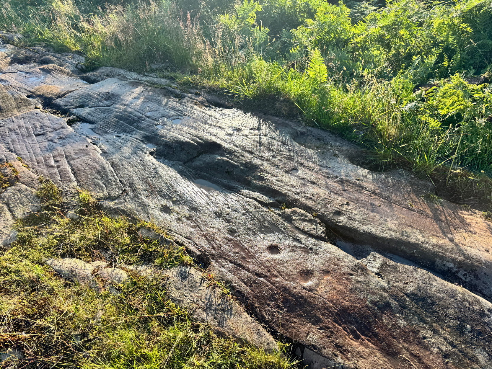
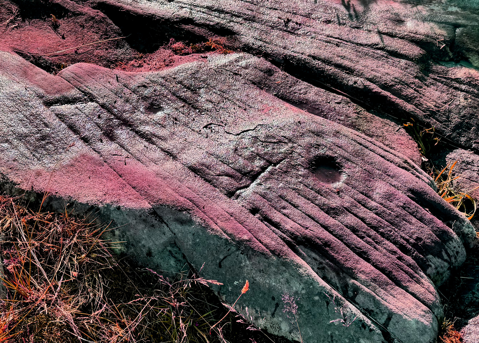
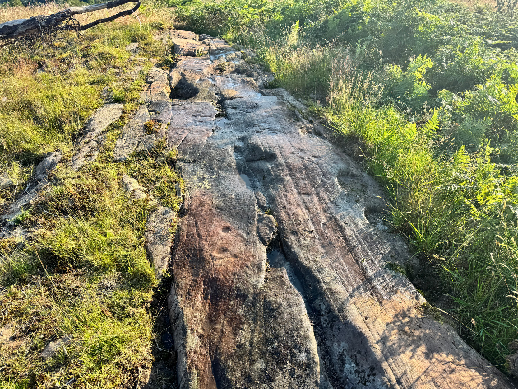
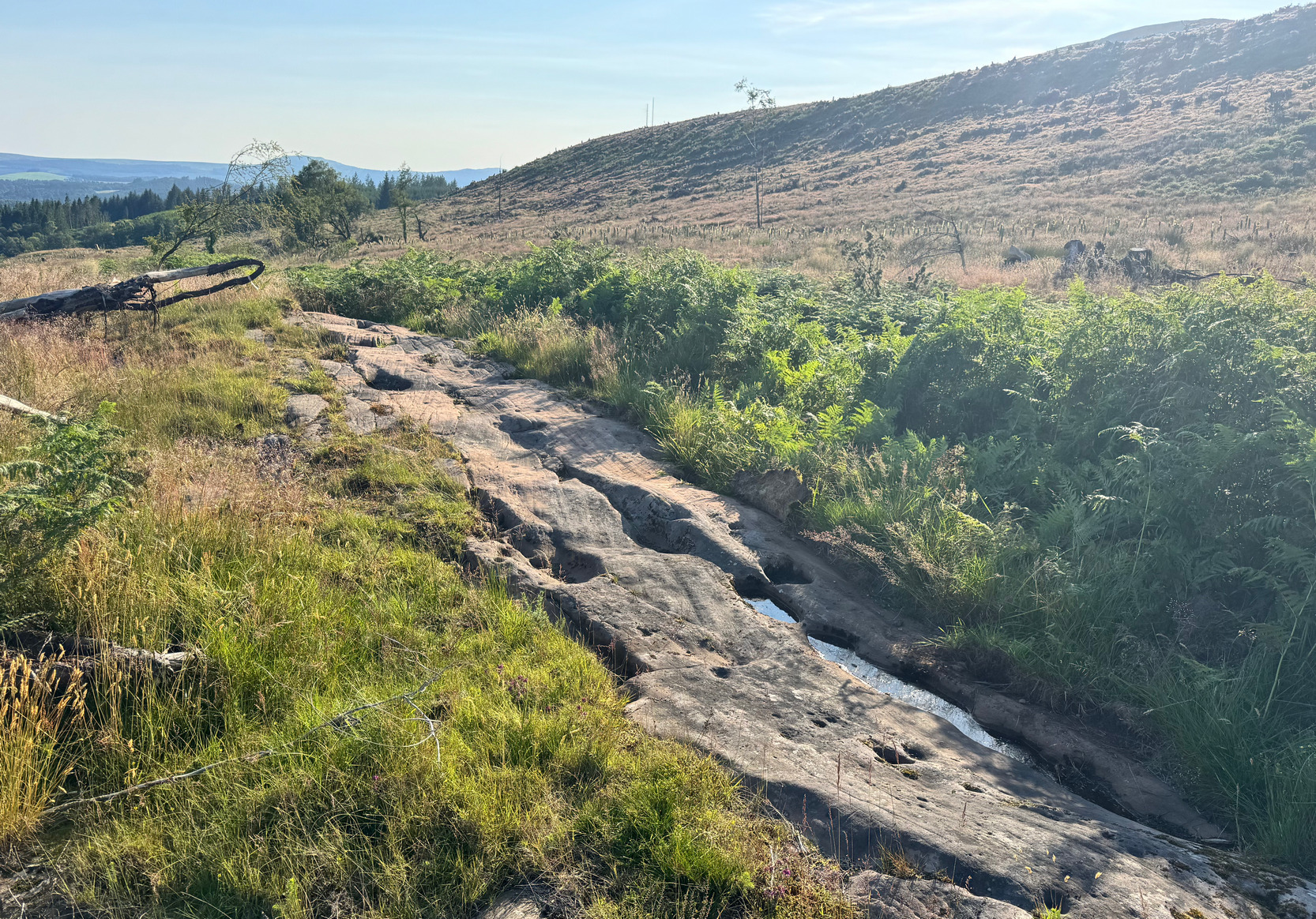
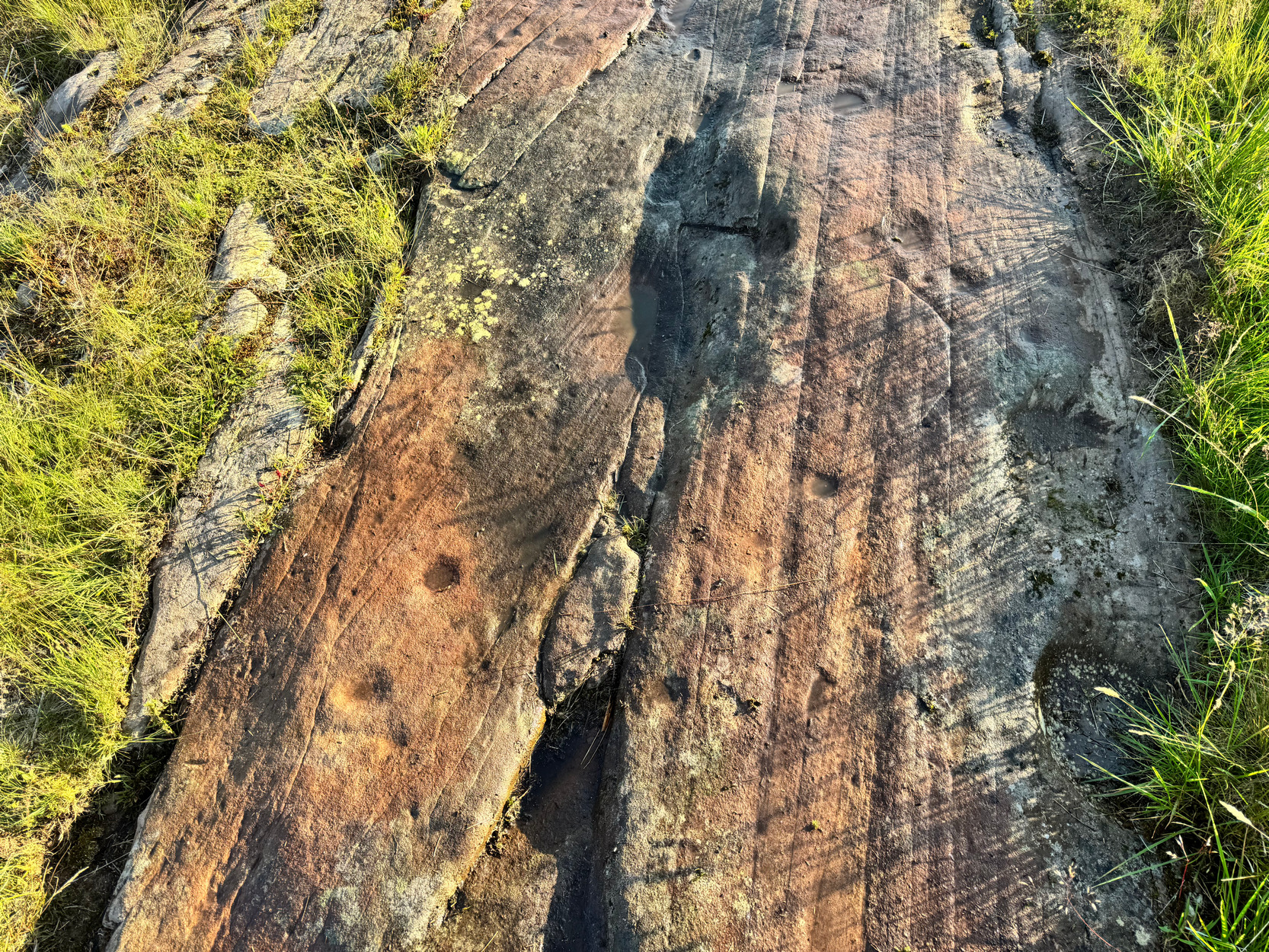
Described erroneously by the Scottish Rock Art Project as being at Netherglenny, this impressive design is just north of Ballochraggan house and is a faded but impressive carving, possessing a rare ‘motif’ or symbol not usually found on Scottish petroglyphs.  The line of rock on which the carving’s found runs in a northeast-to-southwest line, perhaps relating to the rising and setting of the solstice sun.  Perhaps…  Most of the carving is a scatter of cup-and-rings covering more than half the length of the rock surface, mainly on its more western section.  But also, notably, there’s a series of geological bowls and troughs along the rock, primarily from the middle of the stone to the easternmost end where, perhaps significantly, there are few carved elements apart from a couple of cup-marks close to two of the deep bowls. The bowls and troughs are mainly along the central and northern edge of the stone.  On my visit here recently, near the end of a lengthy heatwave, these natural ‘bowls’ were still filled with a lot of water!  I was grateful—and used the water to highlight some parts of the carving.
First group of cup&rings

…And so…

First group of cup&rings

We approach the stone from its north-eastern end.  Walking to the troughs and bowls of water, collecting some of it as we pass, it’s important to recognize that this water would have had some mythic relationship with the carving we are about to see.  The water in these bowls may have been used to mix organic paints, or possessed some healing virtues relative to the spirit of the rock; it would certainly have had some relevance to the design, so it’s important to mention them even though they’re Nature’s handiwork.  But as we get near the end of these watery cleavages, more of the cup-marks begin to appear.

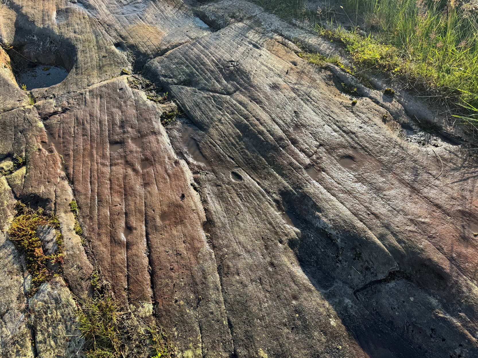
The first suggestion of a cup-and-ring appears where a single cup has the beginnings of a ring, or an arc, on its eastern side; and there’s a single cup attached to the end of this arc.  Just past this is another cup-mark which, when looked at from certain angles, seemed to have had a very faint ring round it—but I’m really not sure.  A couple of other single cups are just past these two, roughly in line with them.  They’re clearly visible in the photos.  Continuing southwestwards we come across a small cluster of cup-and-rings—two of them touching each other gently, all but kissing each other!  From these conjoined cup-and-rings, a step to the north brings us to another single cup-and-ring.
Cups & rings & things
More cups & rings & things

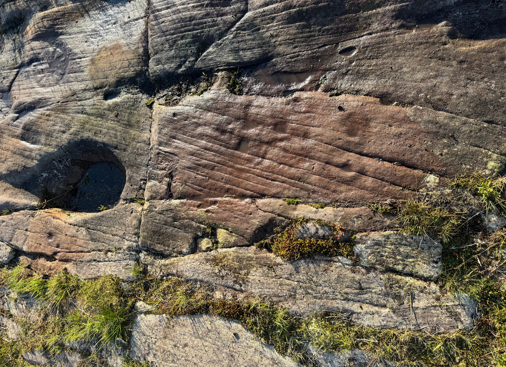
More intriguingly is what’s found a foot or so further west from the cup-and-rings that kiss!  We come across a very faint double cup-and-ring that never seem to have been completed—instead, intruded upon by two or three cup-marks on its northern edge and, more curiously still, what looks to be straight lines intruding the outer ring at various angles, almost in the form of the letter ‘W’—or ‘M’ depending where you’re stood.  It can be seen quite clearly in the photos here, both left and right.  I couldn’t make my mind up about this particular ‘W’ ingredient, inasmuch as: which parts of it are natural, and which parts are man-made.  As I walked round and round this element, crouching down, standing up and gazing at it from as many angles as I could, it never seemed to show itself fully one way or the other.  There’s undoubtedly some man-made element about it, but its ambiguity should perhaps be left to the computer-tech rock art kids and give them something to do when they next get some grant money to line their pockets. 😉 
Large isolated cup-mark
Photo from 2021

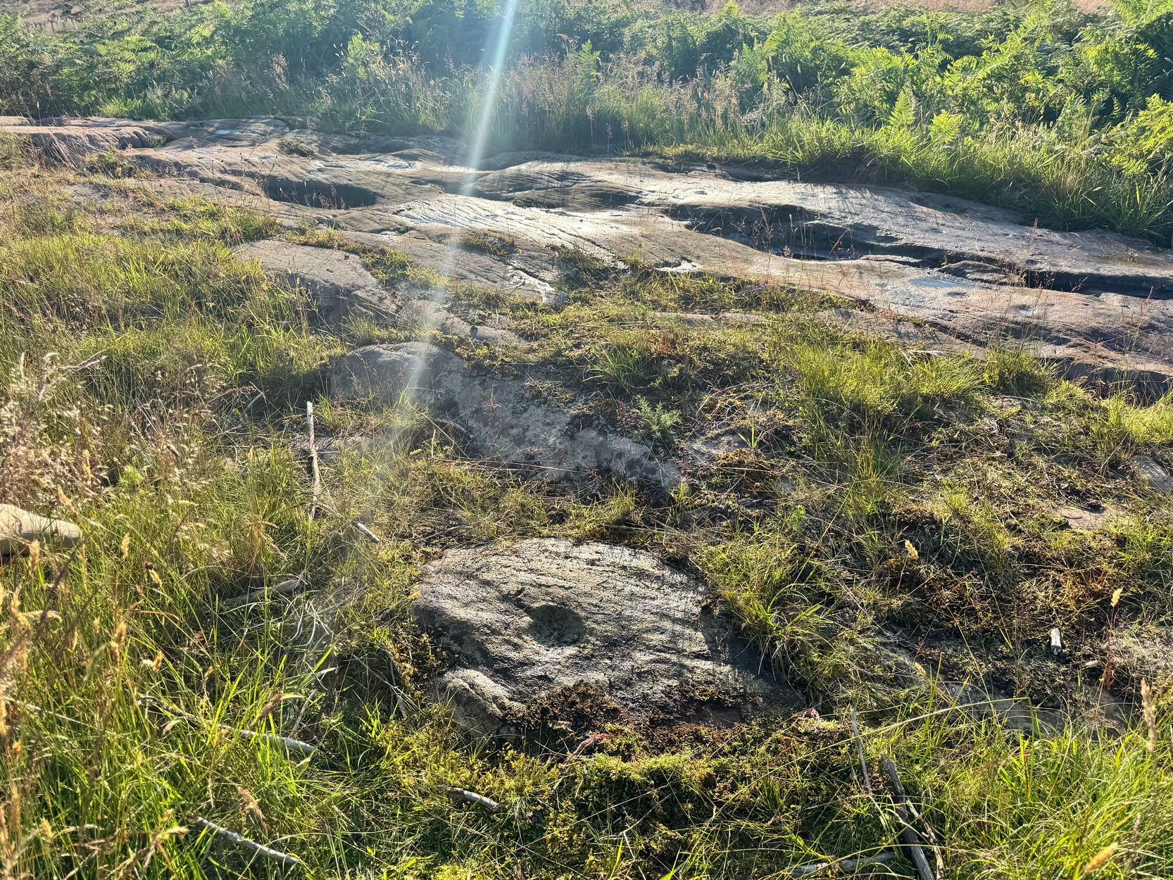
Detached from this portion of the petroglyph, a yard south of the main line of rock, is a small, earthfast oval-shaped stone.  On it is a large deep cup-marking, bigger than all the other cup-marks on the main stretch of carvings. But back onto the main length of the carving and continuing west, we next step over a notable (but not large) natural scar running roughly north-south across the stone.  Stepping onto the other side of this scar, the petroglyphic symbolism gets more expansive and complex.  
Spoked-wheels & more
The first spoked-wheel

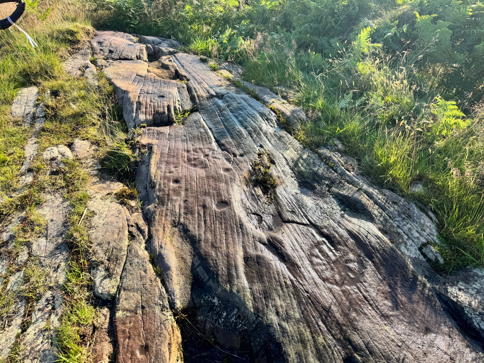
On the other side of the crack is another one of Nature’s carvings: a large, deep tear-shaped bowl.  About twelve inches above this (north), albeit very faint and almost impossible to see in some lights, is a wide carved circle, at the centre of which is a small cup-mark and, emerging from this central cup and reaching to the outer edges of the ring are a series of at least nine straight carved lines, somewhat like spokes on a wheel (but in no precise geometrical order), giving the impression of what some folk like to call a ‘solar’ symbol.  It may indeed have symbolized the sun—but we simply don’t know.  

Next down the rock is a small scatter of single cup-marks and then we reach another spoked-wheel or solar symbol, about the same size as the first one and again made up of at least nine ‘spokes’ radiating from a central cup-mark. A couple of single cup-marks are outside or above the ring.  Between the two solar wheels is another natural elongated hollow, albeit shallow compared to the others on this length of rock. 
Multiple cup-and-ring
Faint multiple rings

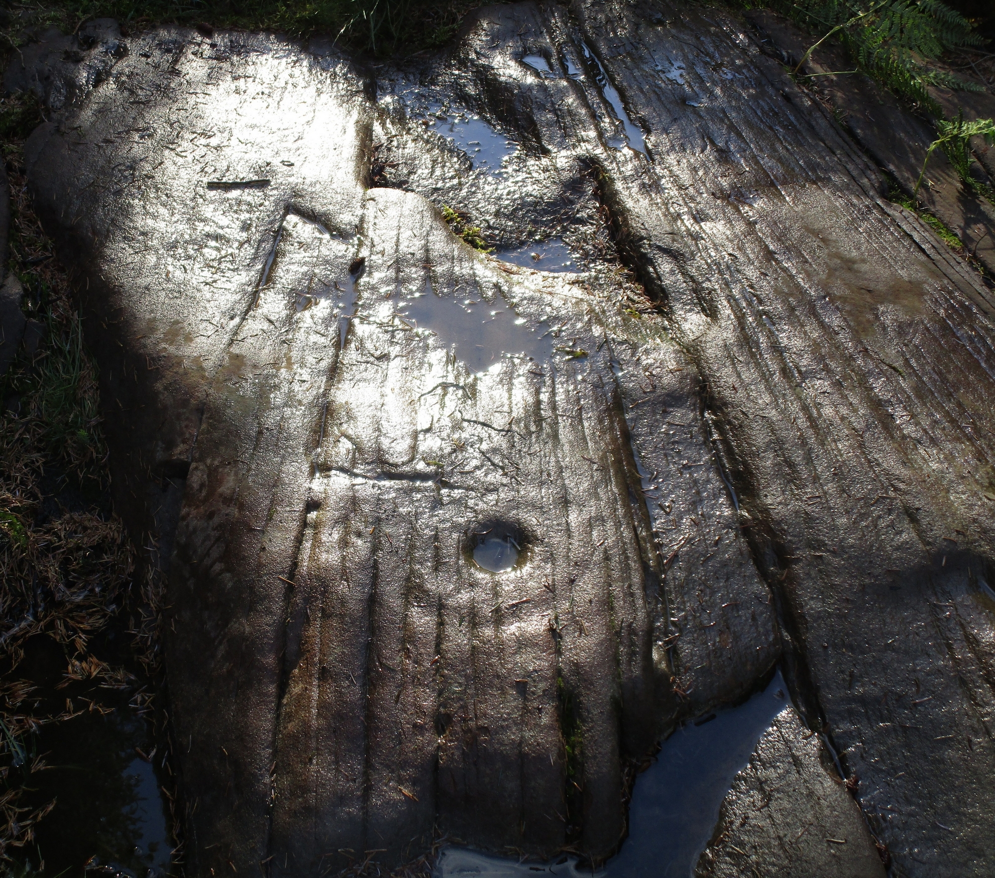
From here, a few steps further west brings us to two very faint multiple-rings.  These intrigue me just as much as the spoked-wheels!  Initial views of them seem to show them as double-rings around a central cup, but as I watered them and got views of them from different angles, it was obvious that there was more to them (as usual!), with one of the cups seemingly surrounded by four rings—although the outer ring is seemingly incomplete.  I’m not 100% sure about it though and it would be good to get more views around sunrise and sunset when the light paints the stone with richer textures, bringing the spirit of the rock into greater life.  The other multiple-ringed motif—three rings in all—is faint, but clearer in giving up its secrets: the outer ring of this looking somewhat deformed as it droops down in a more ovoid form.  

As we walk now to the very end of this long stretch of rock, no more carved imagery greets the eye.  If there was ever anymore to be seen, the elements and Time itself have faded them from view (the nearby Mask Stone exemplifying the difficulty we have in seeing eroded carvings).  If, however we walk off the western end of this rock, down into the uneven mass of roots, branches and decaying trees and keep going westwards, a short distance away is another outcrop, albeit much smaller.  It has a single cup-mark on its surface.  And, quite obviously, other carvings will still be found beneath the mass of dead trees and vegetation across this piece of land.  It was obviously a very important place indeed…

The entire carving is a pictorial narrative whose story has been lost.  Its complexity fits into the scheme of other carvings in this locale, possessing a rich tapestry of complex symbols along one stony face.  It reminded me somewhat of the equally impressive Blarnaboard (3) carving which, curiously enough, this Solar Stone points directly at four miles away to the southwest, and which also possesses a series of multiple complex symbols cut along a long thin stretch of bedrock stone.  

Anyhow, to those of you who just need the simplistic shorthand of the archaeologists: this carving comprises of at least fifteen single cup-marks, five cup-and-rings, a cup-and-double-ring, two cup-and-triple-rings (one of which may actually be cup-and-four rings), and two spoked-wheels or solar symbols.  It’s good—even by Ballochraggan standards!  

References:

  1. Brouwer, Jan & van Veen, Gus, Rock Art in the Menteith Hills, BRAC 2009.
  2. Parish, Nick, “Perthshire: Nether Glenny Field Visit,” in Discovery & Excavation Scotland, 2023.

* Numerous people have reported encountering this dickhead, and a number of local folk as far as Aberfoyle also report him as a miserable angry little man. Please don’t be intimidated by his antics (he’s obviously an unhappy old control freak) as he has no legal basis in  Scottish law for you to do what he commands.  Just walk on by and leave him to stamp his little feet and rant.

Acknowledgements:  Huge thanks for use of the Ordnance Survey map in this site profile, reproduced with the kind permission of the National Library of Scotland.

© Paul Bennett, The Northern Antiquarian 


Weary Hill (1), Ilkley Moor, West Yorkshire

Cup-Marked Stone:  OS Grid Reference – SE 10614 46251

Also Known as:

  1. Carving 243 (Boughey & Vickerman)

Getting Here

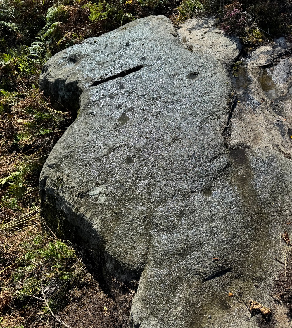
The stone in question

The best description to get here is, from Ilkley, to go up Wells Road, over the cattle grid, and about 500 yards past the cattle grid take the left turn up Keighley Road.  This becomes a truly dodgy dirt-track when you hit the road to the Silver Well cottage on your right, but keep going uphill for another  after a short while, but keeping walking uphill for another 500 yards till you reach a good-sized footpath on your right.  Walk along here for 50-60 yards and then walk into the vegetation on your right and, just a few yards along, you’ll see a good-sized elongated stone in front of you.

Archaeology & History

Looking down on the cups

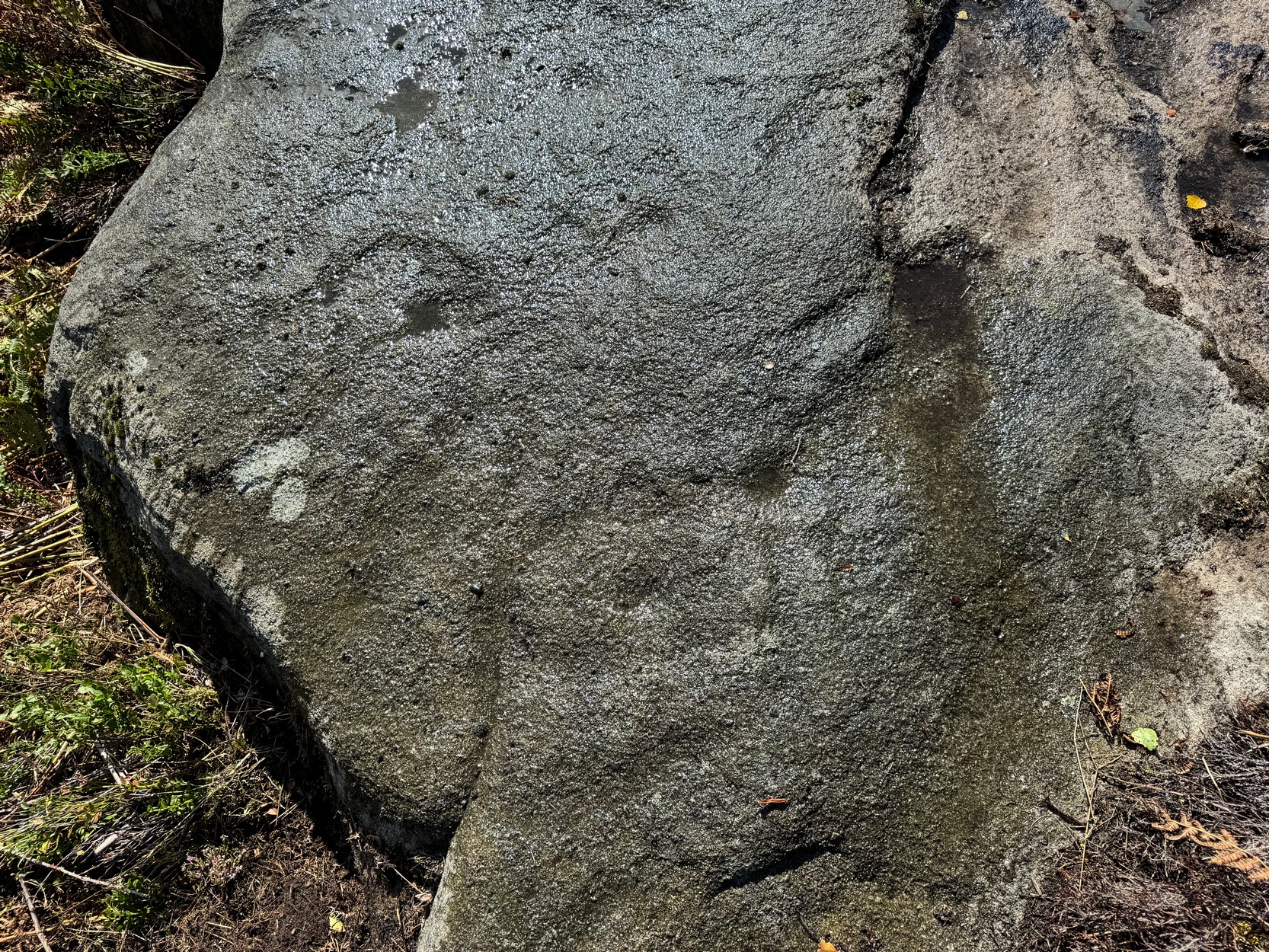
This large boulder has about nine cup-marked impressions, both on its eastern topmost part and others a few feet away on a lower south-facing section of the stone.  But they’re not all man-made.  The cups on the top-east surface are the ones we should be paying attention to.  Of the three or four that we can see, at least two of them are man-made: it’s possible that all of them have been man-affected, but without a detailed geomorphological analysis, we’ll never know for sure.  The cups and dips on the other, lower section of the rock are Nature’s handiwork.  That doesn’t mean they had no importance in the overall mythic nature of the carving but, as with most British petroglyphs, we may never know one way or the other.

References:

  1. Boughey, Keith & Vickerman, E.A., Prehistoric Rock Art of the West Riding, WYAS: Wakefield 2003.

© Paul Bennett, The Northern Antiquarian 

Hartlington Moor Lane (2), Hebden, North Yorkshire

Cup-and-Ring Stone:  OS Grid Reference – SE 0467 6373

Archaeology & History

Hartlington Moor (2) stone

After visiting the Hartlington Moor Lane carving, walk further up the track for bang-on 400 yards and you’ll reach a gate on your right.  In the field here, about 150 yards in, is an ornate cup-marked stone, which has had the dung of a hundred animals and other natural effects dumped upon it in recent years and, as a result, remains hidden at the mo.  A sketch of it was made some time back, showing it’s general design, but it would be good to get some good photos of it (let us know if you manage to locate it).

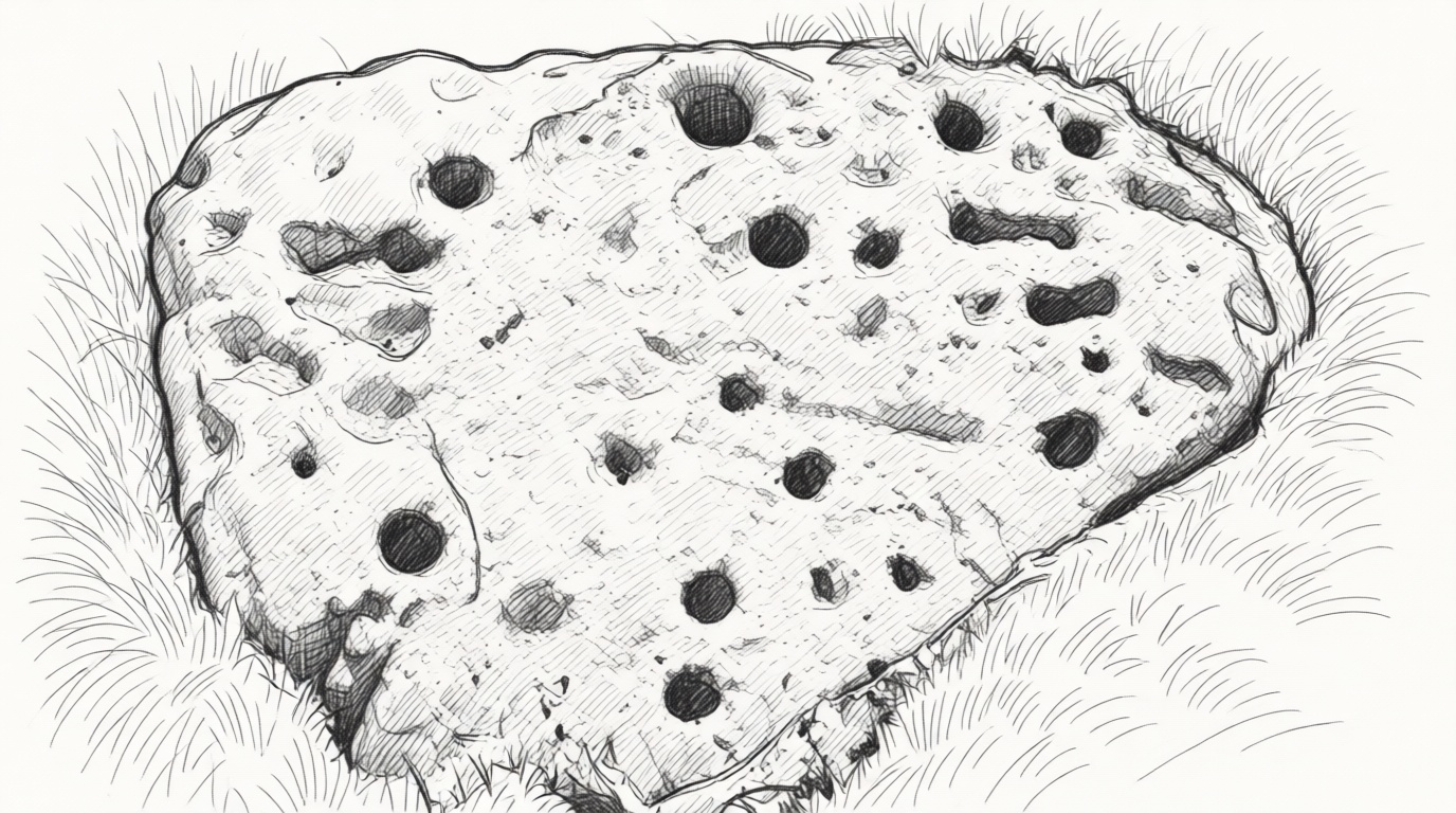
The carving covers most of the surface of this low rounded stone and a number of the cups are quite deep, which suggests that it had been hidden from view for a long time.  There are up to 54 cups, several of which are linked together by carved grooves, giving it what some folk call an ‘hour-glass’ feature.  Near the middle of the stone it looked as if there was a faint cup-and-ring with a carved line running out of it.

© Paul Bennett, The Northern Antiquarian 

Hartlington Moor Lane (1), Hebden, North Yorkshire

Cup-and-Ring Stone:  OS Grid Reference – SE 04382 63384

Getting Here

Hartlington Lane stone

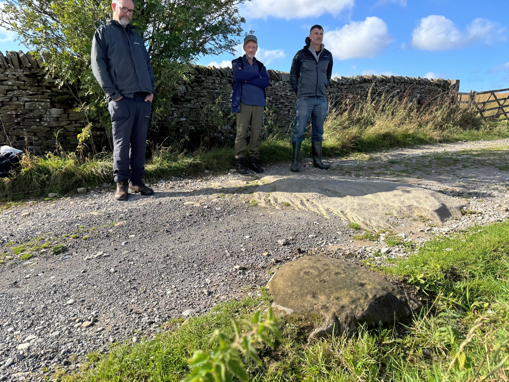
The worst part about getting to this stone is finding somewhere to park on the B6265 road if you’re visiting by car!  The best spot (as of writing) seems to be a small clearing that the farmer has made by the roadside near one of his gates.  From Hebden village travel literally one mile (1.62km) east up the B6265 road and (keep your eyes peeled!) you’ll reach the small left-turn down to Hartlington Raikes (and on your left is a dirt-track) – but keep going straight on past this turning for another 450 yards where the farmer’s cleared the edge of the road against his field.  Do not obstruct his field! (he’ll have every right to move it with his tractor if you’re an idiot)  Naathen – walk back on yourself to the dirt-track (known as Hartlington Moor Lane) 450 yards away and walk up it for 300 yards where there’s a small tree on to your left.  On the opposite side of the track, just below the wall right at the very edge of the track itself, you’ll see the small rounded carved stone.

Archaeology & History

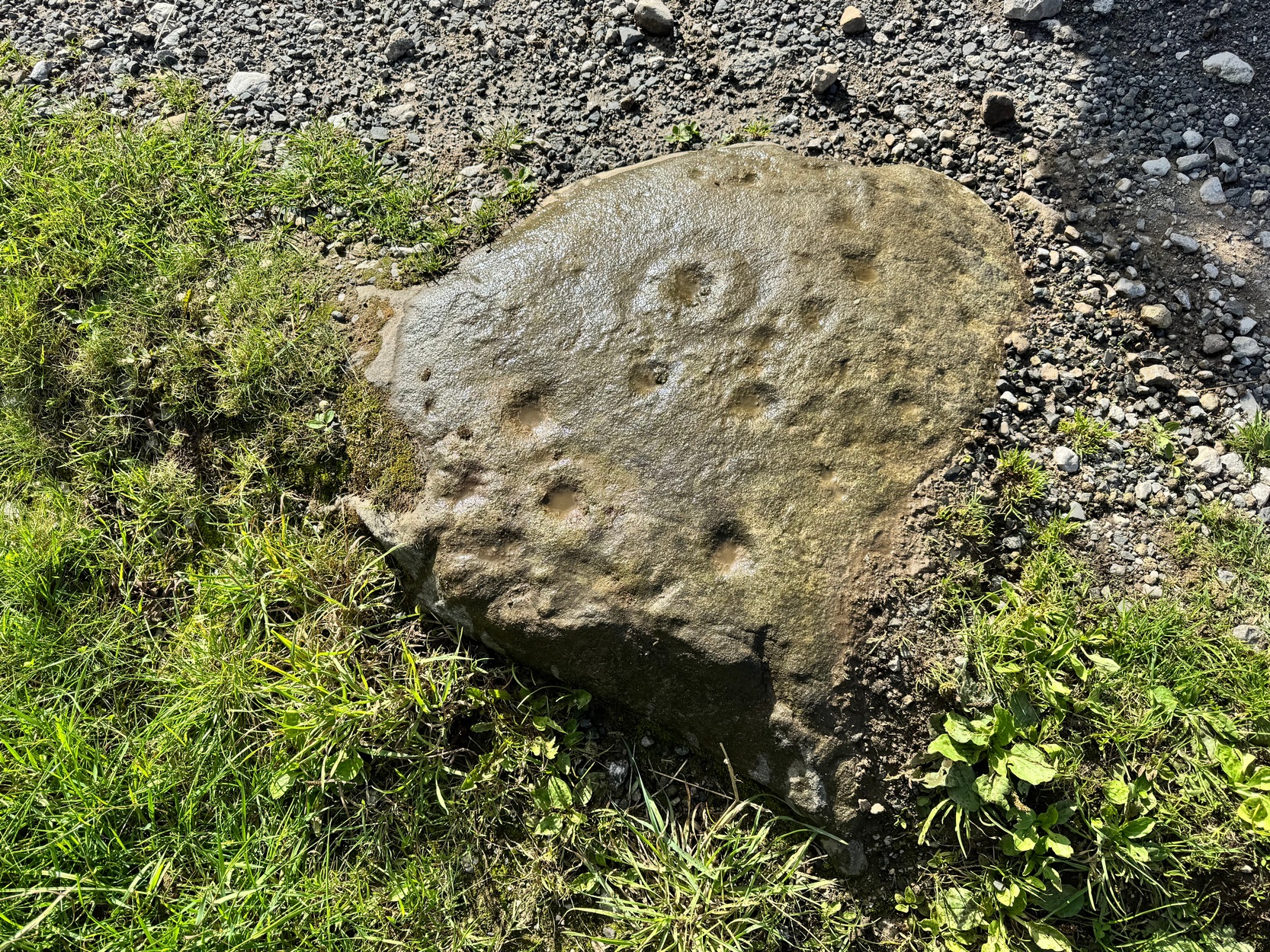
Adjacent to a large, flat, elongated ovoid stone that nearly covers the width of the dirt-track is this much smaller stone with a decent scatter of cup-marks on it that was rediscovered only a few years ago by Yvonne Luke of Ilkley.

A rock art menagerie of Morley, Chappell & Hotham

Hartlington Moor Lane (1)

The petroglyph comprises of two standard cup-and-rings, one of which has a carved groove running from the cup to the ring.  There may be up to nine other single cup-marks on the stone, many of them quite worn (as you’d expect with it living on a track!); but some of these may be the result of natural erosion.  Nonetheless, most of them seem to be the real deal.  There are also several oval ‘notches’ on the design, but these may have been made by agricultural/farm machinery scratching across the stone.

From this carving, if you venture another 400 yards up the Hartlington Moor Lane track and go through the gate on your right, about fifty yards into the field is another carving at grid-ref SE 0467 6373, covered in cup-marks, but now covered over in vegetation.  If you get a chance to make the stone visible again, let us know!  It’s likely that other unrecorded carvings are hiding away in the adjacent fields.

Acknowledgements:  With appreciations to Tony Morley, John Hotham and Graeme Chappell for getting us up to this olde stone. Cheers fellas!

© Paul Bennett, The Northern Antiquarian 

St. George’s Well, Taunton, Somerset

Holy Well (lost):  OS Grid Reference – ST 231 243

Also Known as:

  1. Fons George

Archaeology & History

This once important holy well seems to have been lost or covered over.  It was mentioned several times in Edward Jeboult’s (1873) huge survey of the county and he located it “to the south of the church” of St. George in Wilton where, in his day, a spring of water could be seen. He told that, in the parish of Taunton,

“was formerly a noted spring called Fons George, or St. George’s Well, to which the afflicted were accustomed to resort, and which tradition reports to have worked many marvellous cures. The site of this well seems now uncertain.”

In Ethelbert Horne’s (1923) survey, it seems he couldn’t locate the site as he gave no description of the well, but merely echoed the account given by Mr Jeboult.  Does anyone know what happened to it?

References:

  1. Horne, Ethelbert, Somerset Holy Wells and other Named Wells, Somerset Folk Series: London 1923.
  2. Jeboult, Edward, A General Account of West Somerset, Somerset & Bristol Steam Press: Taunton 1873.

© Paul Bennett, The Northern Antiquarian 

Harden Moor (1), Harden, Bingley, West Yorkshire

Cup-and-Ring Stone:  OS Grid Reference – SE 07342 38371

Getting Here

Harden Moor’s cup-&-ring

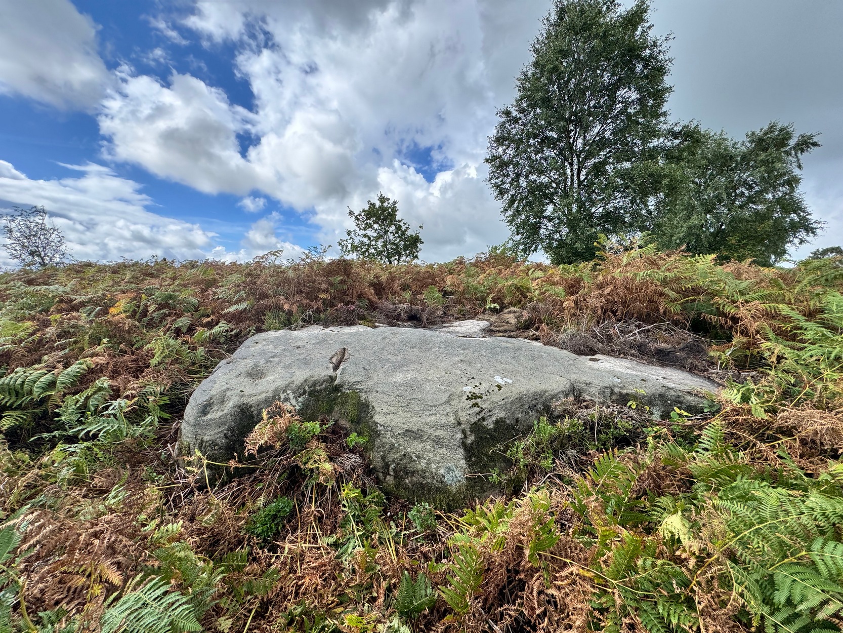
We took the long road round to get here, but perhaps the easiest route, from Harden village, is to go up Long Lane then turn right up the tiny Ryecroft Road.  Three-quarters of a mile up, past the entrance to the quarry, park up.  Walk back past the entrance to the quarry, and barely 50 yards past it, a wall on your left heads up the slope.  Walk up alongside the wall on the same side as the quarry (not in the field) for 250 yards where you reach the moorland and some fencing that runs to your left.  Walk alongside this for about 40 yards and then head to one of the birch trees on the moorland about 25 yards away.  Hereby is the large earthfast rock.  You’re damn close!

Archaeology & History

Main section of design

Rediscovered earlier this year by Lee Brotherton, this is—officially at least—the only prehistoric cup-and-ring stone on Harden Moor (a modern one has been carved not far from the Harden Moor circle more than 500 yards to the north-east).  A single cup-marked stone not far from the circle seems to be the only other petroglyph up here…..and for good reason: much of this small moorland area was heavily quarried in the 19th and 20th century and, obviously, traces of the prehistoric sites that were mentioned by earlier antiquarians have been destroyed.  This carving has been damn lucky to survive!

When you stand on top of this large curvaceous earthfast stone, you’ll notice a deep straight industrial cut into the edge of the rock, part of which runs into a section of the carving.  So it seems that the stone was selected for destruction but, for one reason or another, was spared the fate of its neighbours—thankfully!

Cups, rings & arcs

Cups, rings & arcs

Of the carving: the most notable thing you’ll see when you visit is the large, wide cup-and-ring design near the highest point of the rock, roughly 45° right of the deep cut.  It’s clearly visible even under bright sunlight, but as you can see in the photos, we’ve wet the stone and this element stands out much clearer.  A carved semi-circle with a smaller shallower cup-mark is attached at the side of this large cup-and-ring.  This may originally have been a complete cup-and-ring, but on our visit here, the high sun prevented us getting a clearer perspective.

At the top-end (south) of the deep quarry-mark is a single cup with a wide surrounding ring, which may have originally been complete.  What seems to be a carved line emerges from this central cup-mark and moves to the southern side of the stone; and it seems there’s a much wider, incomplete outer ring arching round the south- and eastern section of the inner ring.  These elements are visible in the photos but, once again, they need to be looked at in better light, when the sun is low.  Further down the side of the deep quarry mark, closer to the edge of the stone, is what seems to be another single cup-and-ring.  There are other marks on this part of the rock, but most of them seem to be natural.

Looking down the stone

Close-up of cup-&-oval

A curious design element on the stone is at the more northern end where a notable large singular cup-mark is found.  When we brushed water across this part of the stone, the isolated cup-mark seemed attached to an elongated, almost rectangular carved ‘enclosure’ design, near the middle of which was another shallow cup.  You can make it out in the photos, but it was difficult (again!) to see this clearly.

One final note to this site entry: despite a high degree of improbability, there might still be other carvings on some of the remaining rocks on this moorland. The general rule is a simple one: where there’s one carving, others tend to be close by.  So keep your eyes peeled if you explore the area…

Acknowledgements:  Huge thanks to Martin Ferner for getting us up here.

© Paul Bennett, The Northern Antiquarian 

Petrifying Well, Lymm, Cheshire

Sacred Well (lost):  OS Grid Reference – SJ 68 87?

Archaeology & History

We are unsure of the precise location of this site, described in some detail by the early Victorian naturalist Leo Grindon (1882) during one  his many botanical rambles in and around Manchester nearly 150 years ago.  He described it to be along a little valley known as Ridding’s Brook, located near “the water at Lymm” which he described as,

“a vast reservoir, brought into existence by the construction of the viaduct at the foot.  The site now occupied by the water was originally a little vale, down which flowed a streamlet called the Dane.  Becoming very narrow where the roadway now is, to throw a barricade across was easy.  The construction of this gave distinctiveness also to the “dell,” the pretty hollow, full of trees, into which, when the water is high, the overplus, creeping under the road by a concealed channel, springs so cheerily.”

This is undoubtedly the Lymm Dam as it’s known today.  From here, he told, “visitors should continue along the hillside, opposite the church, and as far as the grove of trees” and then “cross by the rustic bridge, and, turning to the left, ascend the little valley called Ridding’s Brook.”  It is here where a magickal well whose waters turned plants into stone could be found.  Grindon said of it:

“The special interest of the valley lies, after all, in its curious dropping and petrifying spring.  At the further extremity, upon the right, the steep clay bank, instead of receding, is hollowed underneath for the length of a hundred yards or so, the upper edge projecting to a considerable distance beyond the base, so as to overhang the stream, and form a sloping roof to it.  The surface is completely covered with luxuriant moss, and from the land overhead comes an incessant filter of water, which at once nourishing the moss and entangled in it, causes it to hang down in long vegetable ringlets.  At a distance they seem soft, but examination shows that every drop has brought along with it a particle of earth, which being deposited in the very substance of the moss, is gradually converting it into stone.  Every cluster, externally so green and living, is in its heart a petrifaction.”

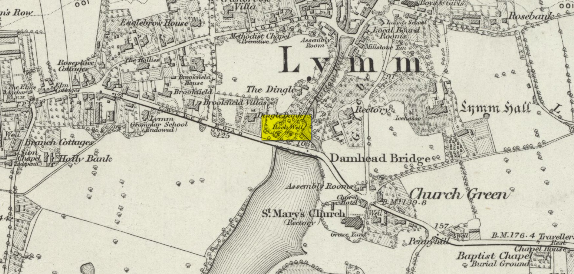
“Rock Well” on 1882 map

Waters that turn objects into stone were obviously seen as possessing a somewhat supernatural propensity in many cultures—and although I can find nothing in the local records of the myths or medicinal properties of this site (early animistic folklore records were sadly neglected by the many Industrial historians in Lancashire, meaning we lost masses of valuable village traditions), there’s little doubt it would have possessed a mythic history of its own in the local area.

It’s possible that a Well shown on the 19th century Ordnance Survey maps as a ‘Rock Well’ could be the petrifying waters in question, but until site gains the attention of a diligent local student of occult history, we’ll not know for sure… Does anyone know if it still exists…?

References:

  1. Grindon, L.H., Country Rambles and Manchester Walks and Wild Flowers, Palmer & Howe: Manchester 1882.

Acknowledgements:  Huge thanks for use of the Ordnance Survey map in this site profile, reproduced with the kind permission of the National Library of Scotland.

© Paul Bennett, The Northern Antiquarian 

Loanhead of Daviot (2), Daviot, Aberdeenshire

Cup-Marked Stone:  OS Grid Reference – NJ 74777 28854

Also Known as:

  1. ‘Stone 5’ carving

Archaeology & History

The cup-marked stone

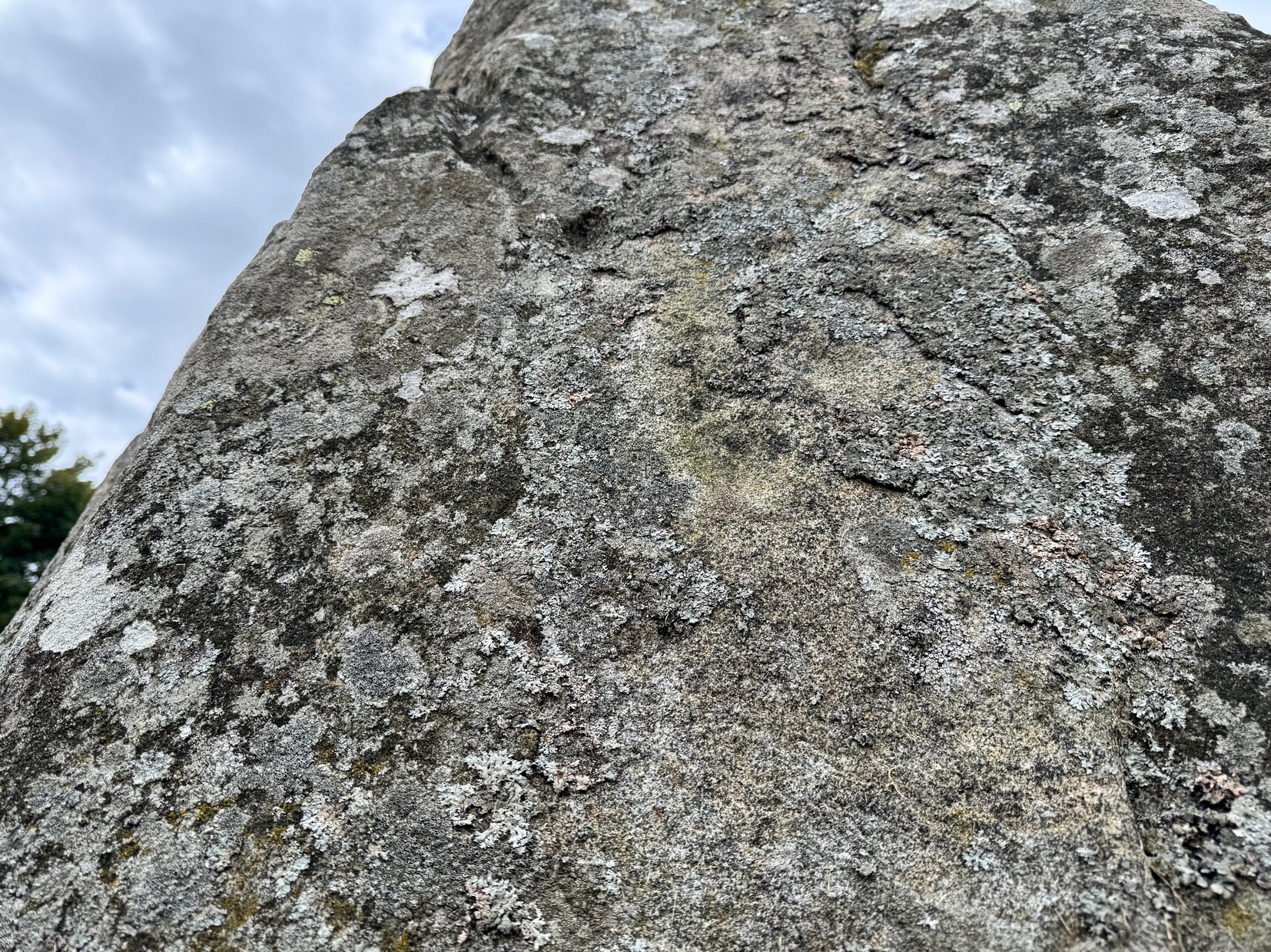
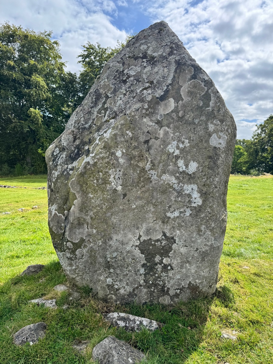
In Adam Welfare’s (2011) second volume to his grand megalithic inventory, he described there being, next to the cup-marked Loanhead of Daviot (1) stone, another, that “has two on its outer face”— i.e., the east-facing vertical surface of the standing stone.  It looked as if there were three cup-marks when we visited here recently, but I may be wrong.  The main one, visible in the attached photo, is about two-inches across and a half-inch deep; another is above this and the other one is below it (you can just about see them in the attached photo).  The design is in no way impressive.

Cup-mark to centre

Aubrey Burl (1979) suggested that the cup-marks on the neighbouring Loanhead of Daviot (1) stone were symbolic of the Moon, whose movement across the sky was recorded in the architecture of the circle itself.   When he wrote such words, this secondary cup-marked stone hadn’t been noticed and, as it faces the opposite directly looking eastwards, it makes you wonder what he might have thought this design represented. (Welfare [2011] also reported that on the standing stone flanking the east-side of the recumbent stone, there is “a single cupmark a little above the ground surface on its inner face”.)

References:

  1. Burl, Aubrey, Rings of Stone, Frances Lincoln: London 1979.
  2. Welfare, Adam, Great Crowns of Stone – 2 volumes, RCHAMS: Edinburgh 2011.

Acknowledgements:  Massive appreciation to Michelle and Steve Allan of Montrose for taking us to this site.  Huge thanks to you both.

© Paul Bennett, The Northern Antiquarian 
Loanhead of Daviot (1), Daviot, Aberdeenshire

Cup-Marked Stone:  OS Grid Reference – NJ 74773 28848

Also Known as:

  1. ‘Stone 4’ carving

Getting Here

The stone with the cups!

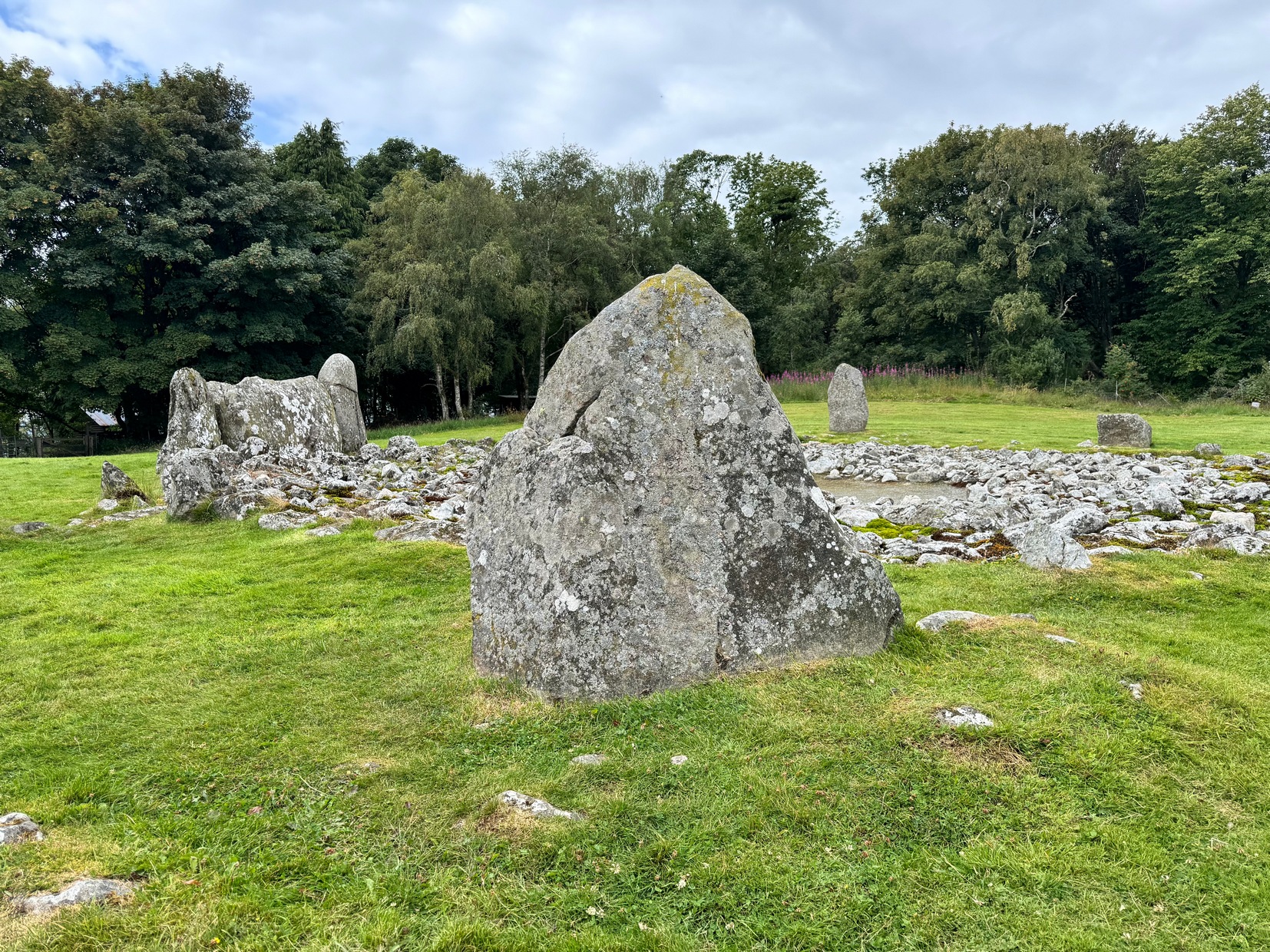
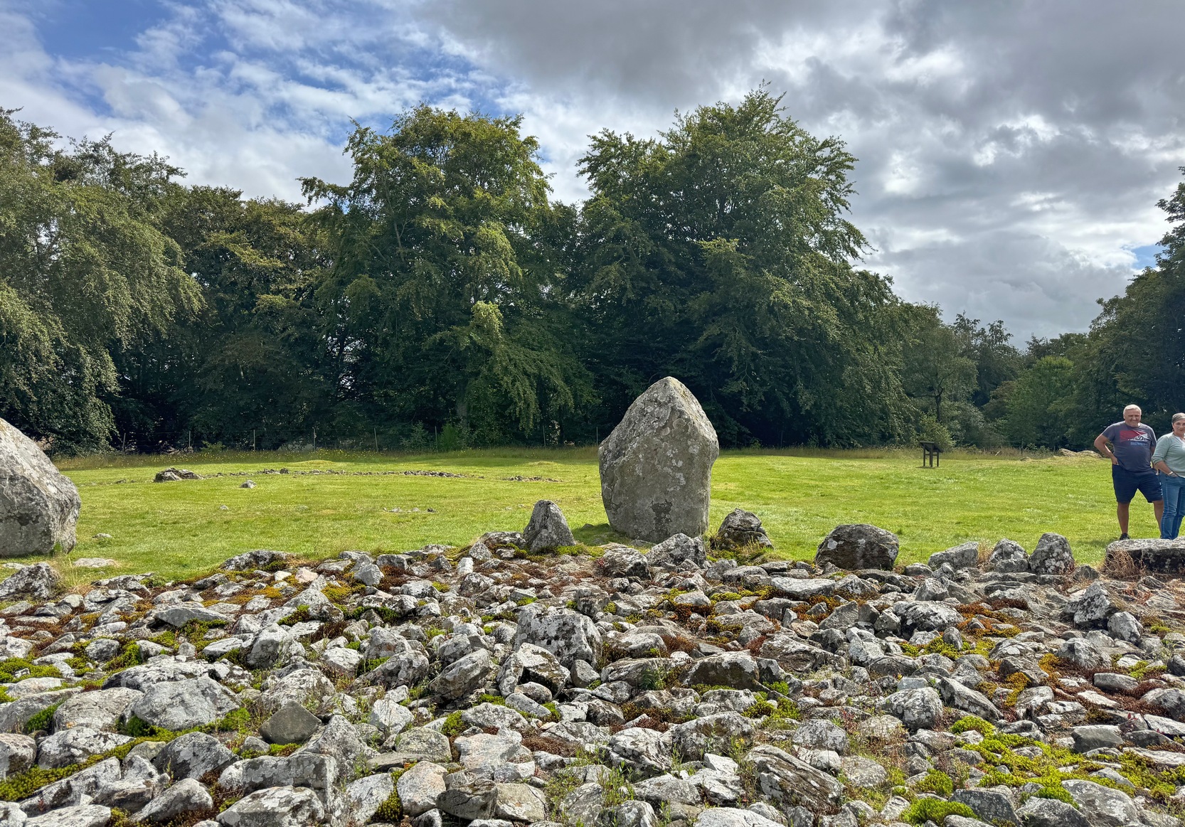
As you walk through the gate towards the stone circle, veer to the long fallen recumbent stone and, past the large upright that flanks the recumbent on the right-hand side, walk to the next standing stone along from here.  That’s the one you need to be looking at!

Archaeology & History

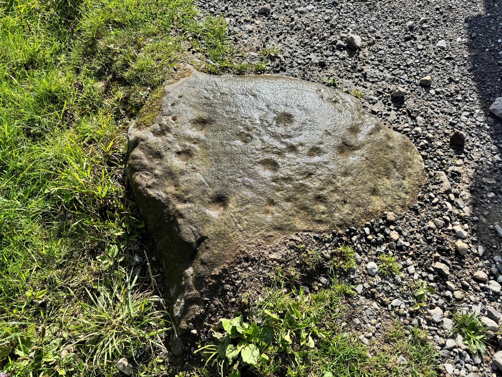
This is one of at least two petroglyphs within the Loanhead of Daviot circle.  Difficult to see unless the light is good (oh how often that’s the case!), on our visit here—under the fine guidance of Michelle and Steve Allan—the cups were hard to see clearly, and they proved troublesome getting good photos of them (we’d forgot our standard water-enhancing bottles this day too!).  But we could just about make them out, as our fingers fondled their depressions.

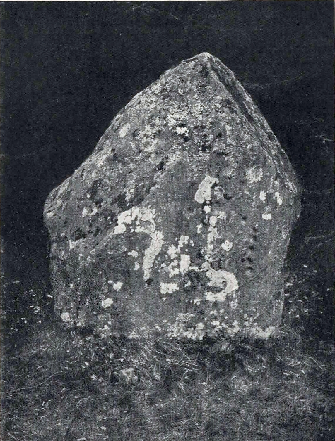
It seems that the carvings were first noticed (please correct me if I’m wrong) by the Aberdeenshire antiquarian James Ritchie (1918) who, in a lengthy essay on rock art and megalithic rings, described seeing “twelve plain cups” on the standing stone in question.  They are situated on the north-facing side of the stone, or, as Ritchie wrote,

The carved stone

Ritchie’s early photo

“on the inner face of the stone, which points towards the centre of the circle…. Near the western edge of the stone five cups are placed, one above another, in an almost perpendicular line.  Each of the three lower members of this group is 2 inches in diameter and ½ inch in depth, while the two upper members are ½ inch less in diameter and only ¼ inch deep.  A little to the left, near the upper end of the group, there is a single cup, 1 inch in diameter and ¼ inch in depth.  Near the centre of the stone there is another group of cups very similar in appearance to that already described.  It also consists of five cups in an almost perpendicular line, with a sixth, a little to the left, nearly in the middle of the stone.  All the cups in this second group are about 1 inch in diameter and very shallow.”

The second group of cup-marks that Ritchie described were the most difficult to see on our visit here, due to the bright daylight.  Under the Moon, or early sunrise when the stone is wet, they should stand out nice n’ easy.  Thankfully, most of them are visible in Mr Ritchie’s old photo of the stone (above), taken in 1917.

An interesting idea was posited by Mr Browne (1921) in his classic on the Aberdeenshire sites, where he thought that the cup-marks here are marks that denoted “the registers of the magician in charge” of rituals at the Loanhead circle.  More recently, the great megalithic archaeologist Aubrey Burl (1979) suggested that the cup-marks on this stone were representative of the cyclical movement of the Moon, as observed from this stone circle.

The second cup-marked stone at this stone circle is on the next stone along, going anticlockwise (east): on ‘Stone 5’ (as designated in the Royal Commission survey).

References:

  1. Beckensall, Stan, British Prehistoric Rock Art, Tempus: Stroud 1999.
  2. Beckensall, Stan, Circles in Stone: A British Prehistoric Mystery, Tempus: Stroud 2006.
  3. Browne, G.F., On Some Antiquities in the Neighbourhood of Dunecht House, Aberdeenshire, Cambridge University Press 1921.
  4. Burl, Aubrey, Rings of Stone, Frances Lincoln: London 1979.
  5. Ritchie, James, “Cup-Marks on the Stone Circles and Standing Stones of Aberdeenshire and Part of Banffshire,” in Proceedings of the Society of Antiquity, Scotland, volume 52, 1918.
  6. Welfare, Adam, Great Crowns of Stone – 2 volumes, RCHAMS: Edinburgh 2011.

Acknowledgements:  Massive appreciation to Michelle and Steve Allan of Montrose for taking us to this site.  Huge thanks to you both.

© Paul Bennett, The Northern Antiquarian 
Loanhead of Daviot (3), Daviot, Aberdeenshire

Cup-Marked Stone (missing):  OS Grid Reference – NJ 747 289

Archaeology & History

When James Ritchie’s (1918) wrote his lengthy essay on the cup-and-ring designs on the megaliths of Aberdeenshire, he mentioned one of the two known carvings that are in Loanhead of Daviot stone circle, but also mentioned one “in the wood, a short distance to the northwest of the circle.”  It’s not been seen since he wrote about it.  Ritchie described there being several rocks in the trees and, “on the upper surface of one of these, two plain cups are to be seen.”  He told them to be “similar in size and appearance to those on the standing-stone” in the Loanhead stone circle a short distance below, but he thought there was no connection between the two sites.  The carving is likely to be still there, beneath the undergrowth.  It would be worthwhile seeking it out during the Winter and Spring months, before the vegetation returns.

References:

  1. Ritchie, James, “Cup-Marks on the Stone Circles and Standing Stones of Aberdeenshire and Part of Banffshire,” in Proceedings of the Society of Antiquity, Scotland, volume 52, 1918.

Acknowledgements:  Huge thanks for use of the Ordnance Survey map in this site profile, reproduced with the kind permission of the National Library of Scotland.

© Paul Bennett, The Northern Antiquarian