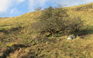
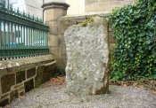
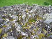
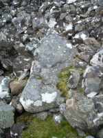
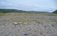
St. Ninian’s Well, Blairgowrie, Perthshire

Holy Well (destroyed):  OS Grid Reference – NO 180 452

Archaeology & History

The Well Meadow in the middle of Blairgowrie was once the place where the 5th century Apostle of the Southern Picts, or St Ninian, baptised local folk into the so-called “new faith”.  It’s long since gone.  The local historian John MacDonald (1899) told that it was located opposite the buildings on the north-side of the square, adding:

“St Ninian, one of the earliest Christian Celtic missionaries, on his tour through Scotland, pitched his camp where the Wellmeadow now is, and quenched his thirst at an old well or spring which ever afterwards bore the name of “St Ninian’s Well,” until it was covered in and the water led into the town drains.”

Old Ninian’s saint’s day is September 16.

References:

  1. MacDonald, John A.R., The History of Blairgowrie, Advertiser Office: Blairgowrie 1899.

© Paul BennettThe Northern Antiquarian

Pitchbury Ramparts, Great Horkesley, Essex

Hillfort:  OS Grid Reference – TL 9657 2906

Also Known as:

  1. Pitchbury Rings

Getting Here

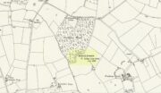
Pitchbury site on 1924 map

Along the A134 in Horkesley Heath, turn west along Coach Road and after a half-mile where it veers right, keep going for another half-mile where you’ll reach the woodland on your left.  A path goes into the trees just before Pitchbury Lodge.  Go along here and near the very far (southern) end of the trees, just before the open fields, you’ll see the large undulating ramparts of earth.  Keep your eyes peeled.  You’ll see them!

Archaeology & History

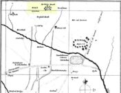
Stukeley’s 1759 map

This once large hillfort was described in the Colchester township perambulations of 1671 and cited in Philip Morant’s classic work. (1748) He told how the boundary line ran “under Chesterwell along the Rampiers by Horkesley Heath,” and which P.H. Reaney (1935) tells was our wooded hillfort.  In Morant’s day, the place was all but complete and so would have been well recognised by local people.   Certainly it came the attention of the great antiquarian William Stukeley who, in 1759, came to Colchester and met with Morant.  Stukeley mainly surveyed the area south of here, at Lexden Heath, but one of his sketch maps clearly highlighted a place he called “a circular work on Horkesley Heath”, i.e., Pitchbury Rings.  The site seems to have remained relatively intact until the middle of the 19th century when a local land-owner took it upon himself to plough over and vandalise much of the site, leaving only a small proportion of the earthworks that we can still see to this day.

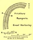
The ruins were described in I.C. Gould’s (1903) piece for the Victoria County History, where he told, at Great Horkesley,

Gould’s 1903 sketch of the remains
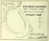
Royal Commission’s 1923 ground-plan

“are some remains of an earthwork known as ‘Pitchbury’ or ‘Pitsbury Ramparts.’  When the late Rev. Henry Jenkins described the camp in 1841, he stated that it was of oval shape, and contained about 6 acres.  Most of it was levelled for agricultural operations about fifty years ago, but there are still some remains, consisting of two banks with their accompanying ditches.  The lines moreover of that part which was destroyed, can be partially traced in the adjoining fields.”

When the Royal Commission (1922) doods wrote about the site nearly twenty years later, things hadn’t changed too much and they simply reported how the “ramparts have nearly disappeared, except for the north section.”  In this “imperfect” condition, as they called it, they gave the following brief description:

“Pitchbury Ramparts, in Pitchbury Wood, about 2 mile south of the church, are the north end of a large camp, roughly oval in shape, and defended by a double rampart and ditch.  The defences are well preserved in the wood, the inner rampart being 10 ft. above the ditch, which is 60ft wide from crest to crest, but the greater part of the work has been almost obliterated by the plough, and is now only faintly discernible in a large field S. of the wood.  The camp appears to have been 800 ft. long and 600 ft. wide.”

Thankfully there seems to have been no real increase in damage to the site since then.  It was excavated in some detail in 1933 and again in 1973 and the finds were published by the highly reputable Colchester Archaeological Trust, whose subsequent report by Hawkes & Crummy (1995) is required reading for anyone wanting to know the detailed archaeology of this and other sites in the area.

Folklore

An intriguing piece of folklore was described in John Round’s (1882) history of the early battles around Colchester Castle.  During the time when the Roman Empire was starting to crumble, the great Pictish tribes of Scotland ventured here and, we are told, took control of the Pitchbury Rings where they stayed before attacking Colchester Castle.

“Traces have been discovered of some violent catastrophe, possibly the first capture of the Colony by the marauding Picts from the North.  Allured, in one of their Southern raids, by the wealth of the goodly Colony, they swooped down like eagles on their quarry from the wooded heights of ‘Pictsbury’.”

References:

  1. Gould, I. Chalkley, “Ancient Earthworks“, in Victoria History of the County of Essex – volume 1, Archibald Constable: Westminster 1903.
  2. Hawkes, C.F.C. & Crummy, Philip, Colchester Archaeological Report 11 – Camulodunum 2, Colchester Archaeological Trust 1995.
  3. Hogg, A.H.A., British Hill-forts – An Index, BAR: Oxford 1979.
  4. Kemble, James, Prehistoric and Roman Essex, History Press: Stroud 2009.
  5. Morant, Philip, The History and Antiquities of the Most Ancient Town and Borough of Colchester, W. Bowyer: London 1748.
  6. Round, John H., The History and Antiquities of Colchester Castle, Benham 1882.
  7. Royal Commission Ancient Historical Monuments, England, An Inventory of Historical Monuments in Essex – volume 3, HMSO: London 1922.
  8. Reaney, P.H., The Place-Names of Essex, Cambridge University Press 1935.
  9. Watson, J.Y., Sketches of Ancient Colchester, Benham & Harrison: Colchester 1879.

Acknowledgements:  Big thanks for use of the 1st edition OS-map in this site profile, Reproduced with the kind permission of the National Library of Scotland

© Paul BennettThe Northern Antiquarian


Katie Thirsty’s Well, Logie, Stirlingshire

Sacred Well:  OS Grid Reference – NS 81787 97653

Getting Here

The scraggy hawthorn of Katie Thirsty’s Well

Not too tricky to locate, as long as you get onto the right footpath!  Take either road (both steep narrow and very bendy in places!) up from Logie on one side or Bridge of Allan on the other, towards Sheriffmuir and head to the Faerie or Highlandman’s Well.  About 150 yards before this, note the small car-park.  From here, go through the gate as if you’re walking to Dumyat, but 50 yards along the footpath it splits into two.  Take the lower right-hand path and keep walking for another 600 yards until you see a large worn hawthorn tree on your left, with boggy land just in front of it that runs to the path you’re walking on.  That’s it!

Archaeology & History

‘Katie Thirsty’ is a most intriguing character who pops up at a number of healing wells, primarily in Scotland.  Dedications to her are known near Abernethy, Falkirk, Innerleithen, Killearn, Kilsyth and elsewhere, with one example just over the Scottish border in Northumberland.  So who was she? And what’s the story behind this little known example, close to the ruinous Iron Age village east of Dumyat?  The truth is, we don’t know for sure as yet.  Tales are told of a local lady called ‘Katie’ at the wells near Abernethy and Kilsyth, each with their own domestic myth—but it seems that a wider mythic status underlies this dedication.

One very fine notion comes from the pen of Pictish researcher Ronald Henderson (2008; 2014), who tells that the name derives from a corruption of both St. Katherine of Alexandria [Katie] and the Pictish King, Drust or Drustan [Thirsty].  The latter etymological postulation finds faith in the fact that the great crags of Dumyat less than a mile to the east is universally credited with being the last Pictish stronghold at the old hillfort there.

The flowing clear waters

…This well on the hills north of Logie village—with its old hawthorn for companion above the old path to medieval Fossachie village—flows nicely, and its freezing waters are very good to drink.  Twenty yards east of the boggy overflow are the overgrown remains of an isolated Iron Age ‘homestead’ or hut circle, and the waters of Katie Thirsty’s Well would have been the primary drinking supply to the people living there in ancient times.

Very little is known about the specific history or folklore of the site and it is mentioned only in passing by David Morris (1935) who told us simply:

‘“Katie Thirty’s Well’ was the old name of a clear spring on the hillside by the track leading to Dumyat.”

It’s a beautiful spot to visit, with lovely views for many miles to the east, south and west.  If you’re going to visit the Fairy or Highlandman’s Well nearby, take time to visit Katie Thirsty’s refreshing flow too.

As for Katie herself: does anyone have their own ideas about her…?

References:

  1. Henderson, Ronald W., Rex Pictorum – The History of the Kings of the Picts, Perth 2008.
  2. Henderson, Ronald W., “Drust… of the Hundred Battles,” in Celtic Guide, 3:4, April 2014.
  3. Morris, David B., “Causewayhead a Hundred Years Ago,” in Stirling Natural History & Archaeological Society Transactions, 1935.

© Paul BennettThe Northern Antiquarian

Ribigill Souterrain, Tongue, Sutherland

Souterrain (missing):  OS Grid Reference – NC 5821 5471

Also Known as:

  1. Canmore ID 5354

Archaeology & History

The Royal Commission (1911) lads paid a visit to this site in June, 1909, after an earlier report—allegedly by James Horsburgh—told there to have been one close to the right-hand side of the road, but it has long since been forgotten.  The Commission lads told us simply,

“In a park about ¼-mile north of Ribigil farm-house is the site of an earth-house which was closed up many years ago.”

When I asked a number of local people about the place, they knew nothing of it; so I wandered around in the hope that I might find something.  All that I came across, close to where it was described, were two large flat stones covering a hole in the ground on the other side of the fence from the road.  A number of reeds were in the same field and I thought it must have been a well, but when I laid my ear to it, could hear no running water whatsoever.

References:

  1. Horsburgh, James, Notes of Cromlechs, Duns, Hut-circles, Chambered Cairns and other Remains, in the County of Sutherland“, in Proceedings Society of Antiquaries, Scotland, volume 7, 1870.

© Paul BennettThe Northern Antiquarian

Pitcur Souterrain (3), Kettins, Perthshire

Souterrain:  OS Grid Reference – NO 2529 3738

Also Known as:

  1. Canmore ID 30539
  2. The Cave
  3. Pitcur II (Wainwright)

Getting Here

Pitcur souterrain entrance

From Coupar Angus, take the A923 road southeast for nearly 2½ miles where you reach the crossroads.  Keeping walking along the A923 for just over 300 yards, then where you come to the second field on your left, follow the line of fencing the slope until you reach an overgrown fenced section.  It’s in there!

Archaeology & History

This is a mightily impressive site, which I’ve been looking forward to experience for many an age.  And—despite Nature covering it in deep grasses—it was even better than any of us anticipated.  Souterrains are ten-a-penny in this part of Scotland, but this one’s a beauty!  Here, dug 6-8 feet into the ground are at least two long curvaceous passageways, linked by another stone-roofed passageway—with the longest central passage leading at one end into a completely covered stone hallway, whose end is blocked by a massive fall of earth.  Outside this entrance, laid on the ground, is what looks like a possible old stone ‘door’ that may have once blocked the entrance, now fallen into disuse.  It is too small to have been a roofing stone.  In the walling just outside the entrance, on your left, you will see a faint cup-marked stone (Pitcur 3:5) and a larger cup-and-ring stone (Pitcur 3:6), both just above ground-level.
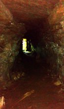
Inside looking out (photo by Frank Mercer)

Outside looking in (photo by Frank Mercer)

The site is evocative on so many levels: not least because we still don’t know what the hell it was used for.  The over-used idea that souterrains were cattle-pens makes no sense whatsoever here; the idea that they were food storage sites is, I suppose, a possibility; that they were possible shelters for people during inter-tribal raids is another; and equally as probable is that the deep dark enclosed construction was used by shamans, or neophytes enclosed for their rites of passage.  Iron Age archaeology specialist Ian Armit (1998) thought there may well be some as yet undiscovered “timber roundhouse” associated with this souterrain, awaiting excavation.  He may be right.  When we came here the other week we found previously unrecorded cup-and-ring carvings, at a site already renowned for decent petroglyphs.  A post-winter visit will hopefully bring us more finds.

The general history of this strange site is captured in Wainwright’s (1963) survey of souterrains, in which he wrote:

“Pitcur II was discovered in 1878 when a large stone, hit by a plough, was removed to reveal an underground passage.  Mr John Granger, tenant of Pitcur farm, excavated the souterrain himself, and twenty-two years later his son, Mr A. Granger Heiton, said that the only objects found by members of his family were ‘a small red clay bowl of Samian ware in pieces’ and ‘a Roman coin.’  The latter, according to David MacRitchie, ‘has been lost sight of’.  Mr Granger Heiton also told McRitchie that ‘one or two other coins were reported as having been found’, but were not seen by his father.

“As an excavation, Mr Granger’s effort seems to have been unsatisfactory by any standards, and it was followed by a ‘supplementary excavation’ conducted by Mr R. Stewart Menzies.  This was more successful as a relic-hunting operation, if not as an archaeological excavation, for between one hundred and two hundred finds are reported, including ‘a bronze pin’ and ‘a quantity of stones, beads, etc.’  But these too ‘seem to have been mislaid.’
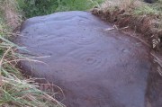
Newly-found Pitcur 3:2 carving

Curiously Mr Wainwright made little mention of the impressive petroglyphs within this complex, save to say that “they were too heavy to be removed and ‘mislaid’.”  There are at least seven of them at Pitcur-3: four complex cup-and-ring designs and three basic cup-marked stones (described individually in separate site-profiles).  They have all been incorporated into the walls and roofing stones. At least one of these is so eroded (Pitcur 3:2) that there is little doubt it was re-used from a now-lost neolithic structure; the rest may have been from Bronze Age sites (also lost) and their respective lack of erosion shows they have been inside this Iron Age structure, away from Nature’s wind and weathering effects. It is likely that the re-use of these carvings in Pitcur-3 was of significance to the builders; although we cannot be sure as to what their function may have been within the souterrain.  It’s quite possible that some form of ‘continuity of tradition’ as posited by David MacRitchie (1890) was in evidence, over that huge time scale from the neolithic into the Iron Age, relating specifically to the animistic plinth implicit in all early agrarian cultures.

But the first real overview of the site was written at the end of the 19th century by David MacRitchie (1900), over twenty years after its rediscovery in 1878.  His account was a good one too:

“The Pitcur house consists of one long subterranean gallery, slightly curved throughout most of its length, and bending abruptly in a hook shape at its western end. From this western end a short broad gallery or room goes off, curving round the outside of the ‘hook.’ The length of the main gallery, following the medial line, and measuring from the extreme of the entrance at either end, is almost 190 feet; while the subsidiary room is 60 feet long. For most of its length, this subsidiary room is 10 feet wide, measuring at the floor level. On account of this unusual width, it is reasonable to suppose that its roof was of timber; for although the walls slightly converge at the top, reducing the intervening space to 8 or 9 feet, the span is still so great that a flagged roof would scarcely have been practicable. To be sure, the walls might have been raised several courses higher, in the usual ‘ Cyclopean arch,’ and thus the interval to be bridged would become sufficiently narrowed at a height of say 12 feet. But there is no indication that the walls of any portion of this earth-house ever rose higher than the present level of their highest parts. Thus the inference is that this subsidiary room may have been roofed with timber.”

Modern groundplan (after RCAHMS, 1994)

MacRitchie’s 1900 groundplan

It may, but we have no remaining evidence to tell us for sure. MacRitchie cited possible evidences from elsewhere to add weight to this thought, but had the humility to leave the idea open, telling simply how “no vestige of a roof is visible at the present day, and the whole of this side room is open to the sky,” as with the majority of this entire souterrain.  In my opinion, more of it would have been roofed in stone slabs, but these would seem to have been robbed.  Certainly a well-preserved cup-marked stone (Pitcur 3:3) laying up against one of the walls appears to have slid from its topmost covering position into where it now rests in the passageway (near ‘b‘ in MacRitchie’s plan).

Continuing with Mr MacRitchie’s account, he (like most of us) found the underground section most impressive, telling:

“This covered section is unquestionably the most interesting and instructive of the whole building; for, as already stated, the other parts are more or less ruined and roofless. A few remaining flags lying in the unroofed part of the main gallery show, however, that it once possessed the usual stone roof throughout its entire length. This was rendered possible by the comparative narrowness of the main gallery, the width of which on the floor averages about 6 feet. The greater breadth of the subsidiary gallery will be realised by glancing at the cross section, a-b in the plan.

“The Pitcur earth-house had at least three separate entrances, namely, at the points hi, and j.  The subsidiary room appears also to have had an independent connection with the, outside world, at the point g, and perhaps also f, though the latter may only mark a fireplace or air-hole, for the condition of the ruin makes it difficult for one to speak with certainty. The entrance at i, which slopes rapidly downward, is roofed all the way to d; and consequently this short passage remains in its original state.

“Within the covered portion, and quite near its entrance, a well-built recess (e in the plan) seems clearly to have been used as a fireplace, although the orifice which presumably once connected it with the upper air is now covered over.  Another and a smaller recess in the covered portion (k in the plan) can hardly have been a fireplace, and it is difficult to know what it was used as.

“One other point of interest is the presence of two cup-marked stones (p and q on the plan). Of these, the former is lying isolated on the surface of the ground near the entrance i, while the latter forms one of the wall stones beside the doorway c.”
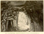
‘Fireplace’ near the entrance

The internal ‘cave’ section has that typical damp smell and feel to it, beloved of underground explorers.  As we can see in MacRitchie’s old photo of the site, the seeming ‘fireplace’ that he mentions is very obvious. Frank Mercer posited the same idea about this underground alcove when he first saw it, and it makes a lot of sense.  On the left-upright stone in the photo (right) you can just make out a single cup-marking (Pitcur 3:7) which we found when we visited; another one may be on the inside edge of the same fireplace.  If you climb up on top of the souterrain close to where the opening of the fireplace would have been, you’ll see the impressive Pitcur 3:5 petroglyph; whilst the Pitcur 3:1 carving is difficult to see (though Mr Mercer noticed it), just above ground-level, beneath the covering stone ‘m‘ in MacRitchie’s plan.  All in all, a bloody impressive place!

Folklore

In earlier centuries the site was known locally as The Cave, yet considering how impressive it is, folklore and oral tradition seem sparse.  Even David MacRitchie (1897) struggled to find anything here.  But in one short article he wrote for The Reliquary, he thought that stories of little-people may have related to Pitcur-3:

“A tradition which a family of that neighbourhood has preserved for the past two centuries, has, in the opinion of the present writer, a distinct bearing upon the “cave” and its builders.

“This is that, a long time ago, a community of “clever” little people, known as “the merry elfins,” inhabited a “tounie,” or village, close to the place. The present inheritors of the tradition assume that they lived above ground and do not connect them at all with this “cave,” of whose existence they were unaware until a comparatively recent date. But, in view of a mass of folk-lore ascribing to such “little people” an underground life, the presumption is that the “tounie” was nothing else than the “cave”. This theme cannot be enlarged upon here; but a study of the traditions relating to the inhabitants of those subterranean houses will make the identification clearer.

“It may be added that the term “Picts’ house” applied to the Pitcur souterrain, is in agreement with the inherited belief, so widespread in Scotland, that the Picts were a people of immense bodily strength, although of small stature.”

References:

  1. Armit, Ian, Scotland’s Hidden History, Tempus: Stroud 1998.
  2. Barclay, Gordon, “Newmill and the ‘Souterrains of Southern Pictland’”, in Proceedings Society of Antiquaries, Scotland, volume 110, 1980.
  3. Mackenna, F.S., “Recovery of an Earth House”, in The Kist, volume 4, 1972.
  4. Mackie, Euan, Scotland: An Archaeologial Guide, Faber: London 1975.
  5. MacRitchie, David, The Testimony of Tradition, Kegan Paul: London 1890.
  6. MacRitchie, David, “Pitcur and its Merry Elfins,” in The Reliquary, 1897.
  7. MacRitchie, David, “Description of an Earth-house at Pitcur, Forfarshire,” inProceedings Society of Antiquaries, Scotland, volume 34, 1900.
  8. Neighbour, T., “Pitcur Souterrain (Kettins parish)”, in Discovery & Excavation Scotland, 1995.
  9. Royal Commission on the Ancient & Historical Monuments of Scotland, South-East Perth: An Archaeological Landscape, HMSO: Edinburgh 1994.
  10. Wainwright, F T., The Souterrains of Southern Pictland, RKP: London 1963.
  11. Warden, Alex J., Angus or Forfarshire: The Land and People – Descriptive and Historical – 5 volumes, Charles Alexander: Dundee 1880-1885.
  12. Young, Alison, “Cup-and ring Markings on Craig Ruenshin, with some Comparative Notes“, in Proceedings Society of Antiquaries, Scotland, volume 72, 1938.

Acknowledgements:  This site profile would not have been made possible were it not for the huge help of Nina Harris, Frank Mercer & Paul Hornby.  Huge thanks to you all, both for the excursion and use of your photos in this site profile. 🙂

© Paul BennettThe Northern Antiquarian


Ardjachie Farm, Tain, Ross & Cromarty

Cup-Marked Stone:  OS Grid Reference – NH 746 845

Also Known as:

  1. Canmore ID 14736
  2. Tain Museum Stone

Getting Here

Ardjachie Stone, Tain

Ardjachie Stone, Tain

No longer in its original position; the stone can now be found if you visit the Tain & District Museum, just off Tower Street, in towards St Duthus’ Church.  The stone is upright around the side of the buildings adjacent, probably more accessible if you walk down Castle Brae, keeping your eyes peeled to your left. Otherwise, just ask the helpful people at the Museum.

Archaeology & History

Ardjachie CR Taylor 2004001

Ardjachie Carving (after Mark Taylor 2004)

An intriguing stone with what may be a long and fascinating history behind it…. It was only rediscovered in the 1960s, when the farmer at Ardjachie (2½ miles northwest of Tain town centre) came across it in one of his fields.  It’s not large or notable in any way, other than it possessing a couple of really peculiar symbols etched amongst a mass of otherwise standard neolithic and Bronze Age cup-marks.  These other symbols are (as seen in Mark Taylor’s drawing, right) a very distinct ‘spoked wheel’ and what looks like a right-angled ‘tool’ or set-square of some sort.  These symbols have brought with them notions from academics who are claim it has Pictish provenance.  However, we must be very cautious of this idea….

The first written account of the stone was by Ellis Macnamara (1971) who gave a detailed description of the carving:

“Boulder found on Ardjachie Farm, now in Tain Museum.  The boulder, of probably local old red sandstone, is uncut and very irregular in shape but has two principal faces; the maximum length is 1.7m; maximum width is 0.65m and on the maximum thickness is some 0.35m.  The carvings are all on one face, which is much weathered; the opposing face is conspicuously less smooth so that it is possible that this stone was never set upright.  The weathered face is covered with at least 30 ill-defined cup markings scattered over nearly the whole surface, though grouped towards one end; the average diameter of these cup markings is about 3 to 4cm, depth about 1.5cm.  There are several indistinct lines among the cup markings and there is among the thickest cluster of cup markings a symbol like a ‘wheel’, with the outer ‘rim’ drawn as a fairly perfect circle, with a diameter at the outer edge of some 17cm.  The ‘wheel’ has twelve ‘spokes’ and a single inner circle, or ‘hub’, with a diameter at the outer edges of about 4 or 5cm.”

Subsequent to Macnamara’s description, it’s been suggested that there are cup markings on both sides of the stone; but the ones on the other side are a little less certain.  The stone itself almost typifies the cup-marked cist covers we find scattered all over the country—yet no burial or other structure was noted upon its discovery in the fields.  It’s an oddity on various levels…

Close-up of spoked-wheel

Close-up of spoked-wheel

Close-up of spoked-wheel

Close-up of spoked-wheel

The spoked-wheel symbol and, moreso, the right-angled element, have led some to speculate that the symbol was carved in Pictish times; but there are problems with this on two levels at least.  The cup-marks we know are neolithic or Bronze Age in origin, and their design always inclines to abstract non-linear forms, screwing egocentric analysis. But the ‘spoked wheel’ is more linear in nature. But as acclaimed petroglyph researchers from George Coffey (1912) to Martin Brennan (1983) show, this spoked wheel occurs in neolithic Ireland; and the identical symbol occurs in prehistoric carvings at Petit Mont in France (Twohig 1981), at Cairnbaan in Argyll (Royal Commission 2008) and there’s even a partial spoked-ring on the Badger Stone on Ilkley Moor!  We have no need to jump into Pictish times to account for its origin and unless we have direct archaeological evidence to prove this, the academic Pictish association must be treated with a pinch of salt. It is nevertheless scarce amongst neolithic and Bronze Age carvings in Britain.   Maarten van Hoek (1990) suggested it to be a variant on the ‘rosette’ design, also neolithic in origin.  On the whole the symbol is interpreted as being the sun—which it may well be.

If you look carefully at the images above you can see, to the right of the ‘wheel’, a cup-marking surrounded by a ring of six-cups.  It is possible that this may be an older variant of the spiked-wheel solar symbol.  All speculation of course.  The other peculiar element here is the curious right-angled design, below the ‘sun’.  This symbol in particular is quite different from the early cup-marks and may have been carved at a much later date.  In which case, this raises the potential for a continuity of tradition here… which mightjust bring in the Picts!

A closer look at the carving

A closer look at the stone

But the general problem with a Pictish assignment is that of the Picts themselves.  If we ascribe the current anglocentric belief that the Picts only existed between the 3rd and 9th centuries (because we only have written records of them during that period), we are assuming the rather naive philosophy that anything before written history did not exist: a sort of blind-man’s Schrodinger’s Cat ideology, only really accepted by pseudo-historians.  But if the Picts didhave something to do with this carving, we may indeed be talking about a continuity of tradition from the ancient past into the written period.  Such an idea would be no problem in developed tribal cultures with an animistic cosmology—and that’s assuming that this stone was deemed as ‘special’ in some form or another to the local people. But all these are uncertainty principles in themselves and we may never know for sure…

There are no adjacent monuments to where Ardjachie’s stone came from, and apart from a scatter of flints found a hundred yards or so closer to the beach, other archaeological remains are down to a minimal.  Its isolation is peculiar.  There are however, a number of springs of water a few hundred yards away, just across the main A9 road, two of which have left their old names with us as the Cambuscurrie Well and the Fuaran nan Slainte, or fountain/spring of Healing (the modern Glenmorangie whisky gets it waters hereby!).  Although we must be careful not to assign every example of prehistoric rock art with the material, the mythic association between petroglyphs and water cannot be understated, and although such an association at Ardjachie is conjectural, it cannot go unnoticed.

References:

  1. Brennan, Martin, The Stars and the Stones: Ancient Art and Astronomy in Ireland, Thames & Hudson: London 1983.
  2. Coffey, George, New Grange and other Incised Tumuli in Ireland, Hodges Figgis: Dublin 1912.
  3. McHardy, Stuart, A New History of the Picts, Luath: Edinburgh 2012.
  4. Mack, Alastair, Symbols and Pictures: The Pictish Legacy in Stone, Pinkfoot Press: Brechin 2007.
  5. Macnamara, Ellen, “Tain, Ardjachie Farm: Cup Markings and Incised Symbol”, inDiscovery & Excavation Scotland, 1971.
  6. Macnamara, Ellen, The Pictish Stones of Easter Ross, Tain & District Museum 2010.
  7. Royal Commission on the Ancient & Historical Monuments of Scotland, Pictish Symbol Stones: A Gazetteer, Edinburgh 1999.
  8. Royal Commission on the Ancient & Historical Monuments of Scotland, Kilmartin – Prehistoric and Early Monuments, HMSO: Edinburgh 2008.
  9. Scott, Douglas, The Stones of the Pictish Peninsulas of Easter Ross and the Black Isle, Historic Hilton Trust 2004.
  10. Twohig, Elizabeth Shee, The Megalithic Art of Western Europe, Clarendon: Oxford 1981.
  11. van Hoek, M.A.M., “The Rosette in British and Irish Rock Art,” in Glasgow Archaeological Journal, volume 16, 1990.

Acknowledgements:  Huge thanks to Mark Taylor for use of his fine drawing in this site profile; copies of his work with Ellen Macnamara being available for sale from the Tain Museum.  Many thanks to the staff at Tain Museum for their help; and many thanks again to Prof Paul Hornby in the venture to this curious old petroglyph.

© Paul BennettThe Northern Antiquarian
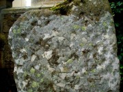

Fiscary (3), Farr, Sutherland

Cairn:  OS Grid Reference – NC 73222 62484

Also Known as:

  1. Canmore ID 6446
  2. Pict’s House

Getting Here

Fiscary 3 giant cairn, looking west

Fiscary 3 giant cairn, looking west

Along the A836 road from Bettyhill to Thurso, a mile east of the village keep your eyes peeled to your left (or to the right if you’re coming the other way!), looking north, and you’ll see some very large piles of stones a few hundred yards away. Go through the gate onto the rough grasslands and the first one you reach is the cairn in question. Y’ can’t miss it!

Archaeology & History

On 1878 OS-map as Picts House

On 1878 OS-map as Picts House

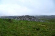
Close to the Fiscary 1 and Fiscary 2 tombs, this is the third and southernmost of the three giant cairns on this moorland hillside and is the second largest of the trio.  Curiously it was the only one highlighted by the Ordnance Survey lads in their cartographic analysis here in 1873—they somehow missed the others—when they told it to be a ‘Pictish House’, or broch.  A few years later when the Royal Commission (1911) fellas got their noses up here, they said that this,

“which is the most easterly, is circular in form, is about 68ft in diameter, and 15ft 6in to the apex, on which a small pile of stones has recently been erected.  The cairn does not appear to have been excavated, but the stones in several places have been pulled out, probably in attempts to discover the chambers or in pursuit of rabbits.”

Looking into its centre

Looking into its centre

Long stone at southern edge

Long stone at southern edge

Considering the size of this giant cairn and its close association with is neighbours 150 yards northwest, I’m surprised at the lack of attention it’s been given.  Within the collapse of stones on its southern-side we find an elongated stone which seems to have stood upright at some point in the past, either at the very edge of the cairn, or just inside it.  It may even have been a covering stone to a collapsed entrance, but without an excavation we’re not gonna know for certain.

The fact that this cairn is on the slopes south of the crowning cairns of Fiscary 1 and Fiscary 2 implies that this was built some centuries later than them.  Also notable here is that the view to the north is blocked and we are instead only looking across a panorama east, south and west.

Folklore

Looking across into the east

Looking across into the east

Local tradition told that this was a Pict’s house, or broch (it may well have been) and is shown as such on the first Ordnance Survey account of the region in 1878.  Otta Swire (1963) told that this landscape was once peopled by giants who made the land and played a part in the creation of some of the giant tombs around here.  One time local school-teacher at Bettyhill, Alan Temperley (1977) also told us how the fairy folk lived close to the giant tombs of Fiscary.

References:

  1. Gourley, Robert, Sutherland: An Archaeological Guide, Birlinn: Edinburgh 1996.
  2. Henshall, Audrey S., The Chambered Tombs of Scotland – volume 1, Edinburgh University Press 1963.
  3. Henshall, Audrey S., “The Distant Past,” in The Sutherland Book (edited by Donald Omand), Northern Times: Golspie 1991.
  4. Henshall, Audrey S., The Chambered Cairns of Sutherland, Edinburgh University Press 1995.
  5. Lelong, Olivia C., “Writing People into the Landscape: Approaches to the Archaeology of Badenoch and Strathnaver,” University of Glasgow 2002.
  6. o’ Reilly, Kevin & Crockford, Ashley, What to See Around Bettyhill, privately printed 2009.
  7. Royal Commission on Ancient & Historical Monuments, Scotland, Second report and inventory of monuments and constructions in the county of Sutherland. HMSO: Edinburgh 1911.
  8. Sutherland, George, Folk-lore Gleanings and Character Sketches from the Far North, John o’ Groats Journal: Wick 1937.
  9. Temperley, Alan, Tales of the North Coast, Research Publishing Company: London 1977.

Acknowledgments:  HUGE thanks to Aisha Domleo and for getting me up here.

© Paul BennettThe Northern Antiquarian
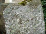
Dunvarich, Tongue, Sutherland

Souterrain (lost):  OS Grid Reference – NC 59 57

Also Known as:

  1. Canmore ID 5341

Archaeology & History

Site of the lost souterrain

There are a number of souterrains—or “earth houses” as they used to be known—in Sutherland that have been lost.  Many have simply fallen prey to being filled-in or covered over.  This is one such site, found in the fields between Tongue village heading out towards the sea-bridge crossing the Kyle.  In a brief excursion I made to the area a few days ago, I couldn’t locate the site and no one I spoke to seemed to know anything about it.  I’m assuming that the site has simply been blocked-up and overgrown, hiding beneath the green pastures above the sea-line.

Its exact whereabouts is difficult to ascertain, for when it was described in Mr Horsburgh’s (1870) excursion to the area, the location he gave for it was somewhat vague, telling:

“Between Tongue House and Kirkiboll, in a field on the right of the road, there is an Eirde house, which I opened for examination (it had often been opened before); it is now about 25 feet long, 2½ feet broad at the entrance, and widens to 4 feet at the far end, where it terminates in a circle; the sides are built with small stones without mortar, and the top covered with large flat slabs.”

This places the location of the souterrain anywhere in the fields between grid-references NC 5904 5815 to the north (near Tongue House) and NC 5901 5678 to the south.  If anyone knows anything about this site, please let us know.

References:

  1. Horsburgh, James, Notes of Cromlechs, Duns, Hut-circles, Chambered Cairns and other Remains, in the County of Sutherland“, in Proceedings Society of Antiquaries, Scotland, volume 7, 1870

© Paul BennettThe Northern Antiquarian
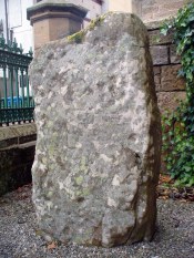
Deanside, Tongue, Sutherland

Souterrain (destroyed):  OS Grid Reference – NC 591 556

Also Known as:

  1. Canmore ID 5343
  2. Dionaite

Archaeology & History

Location of Deanside souterrain

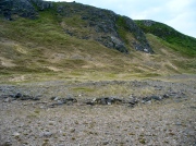
Nothing now remains of the prehistoric underground chamber, “eirde House” (as they were called) or souterrain, that was reported by the northern antiquarian James Horsburgh when he was exploring the sites here in the 1860s.  Found near Deanside a couple of miles south of Tongue, alongside the edge of the Allt an Dionaite (Deanside Burn), even in his day there wasn’t much of it left.  It was one of a number of souterrains in the region that he was shown, presumably by local people, telling us briefly that,

“Near Deanside, there were remains of the end of another (souterrain) on the bank of the burn, but it has since been washed away in a flood.”

In an exploration up the side of the burn today, I could find no remains whatsoever; although I didn’t walk too far up and have a feeling that its position would have been further up than where I got to.  In a brief chat with some of the old people living in the neighbourhood, they told me they had no memory of the site.

References:

  1. Horsburgh, James, Notes of Cromlechs, Duns, Hut-circles, Chambered Cairns and other Remains, in the County of Sutherland“, in Proceedings Society of Antiquaries, Scotland, volume 7, 1870

© Paul BennettThe Northern Antiquarian
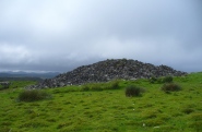
Baile Mhargaite Enclosure 1, Bettyhill, Sutherland

Enclosure:  OS Grid Reference – NC 69843 61228

Also Known as:

  1. Bail Margait
  2. Margaret’s Town

Getting Here

Baile Mhargaite 1 enclosure, looking NW

Baile Mhargaite 1 enclosure, looking NW

Take the A836 road west out of Bettyhill, down the road and cross the river on the tiny bridge.  From here, go over the gate on the right-hand side of the road and follow the edge of the river towards the sea. Crossing the large extensive sands, you’ll reach a large sand and gravel rise ahead of you. Once on top of this natural feature, walk NNE for 550 yards (0.5km) until you reach one of many extensive sandy expanses in the grasses (and pass tons of archaeological remains as you walk!).  You’ll get there!

Archaeology & History

Arc of south, west & north walling

Arc of south, west & north walling

On this naturally raised sand-and-gravel platform at the edge of this beautiful sandy coastline in the far north of Scotland, walking in search of this particular enclosure, you’ll meander past a whole host of prehistoric sites and remains – some of which are plain to see, others hiding almost just above ground level, barely visible.  But if you’re an antiquarian or historian, this plateau is a minefield of forgotten history!
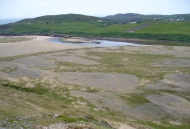
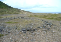
The site is shown on the 1878 Ordnance Survey map of the region as a “hut circle”, which it may well have been—but this is a large hut circle and was more probably a place where a large family would easily have lived.  When I visited the place the other week, there were no internal features visible.  It is a large ring of stones made up of thousands of small rocks whose walls are low and scattered, barely a foot above present ground-level in places, and barely two-feet at the very highest.  It has been greatly ruined or robbed of other architectural elements and an excavation is in order.  My initial evaluation is that this structure is at least Iron Age in origin.  In Angus Mackay’s (1906) venture here in the early 1900s, he suggested that this and the other “circular rings” were “cattle folds.”

Aerial view, looking straight down

Aerial view, looking straight down

Looking down from the broch above

Looking down from the broch above

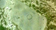
The enclosure measures, from outer-edge to outer-edge of the walling, 16.5 yards (15.1m) east-west by 18 yards (16.5m) north-south, and has a circumference of roughly 52.5 yards (4mm); although an accurate measure of its circumference is hampered by the scatter of spoilage from the collapsed walls stretching outwards.  Only the western walled section remains in reasonably good condition.

Looking south, thru the enclosure

Looking south, thru the enclosure

Close by are many cairns, some of which are prehistoric.  A chambered cairn  on the same ridge less than 200 yards away, with another enclosure of the same type yards away, clearly shows that people have lived and used this raised section of land for thousands of years.  We know that people were still living here at the end of the 18th century which—for me at least—begs the question: what ancient traditions, customs and lore did these people know about, which may have dated back into truly ancient history?  …And then the english Clearances destroyed them…

References:

  1. Mackay, Angus, “Notes on a Slab with Incised Crescentic Design, Stone Mould for Casting Bronze Spear-Heads, a Cup-Marked Stone, Holy Water Stoup, and other Antiquities in Strathnaver, Sutherlandshire,” in Proceedings of the Society Antiquaries, Scotland, volume 40, 1906.
  2. Royal Commission on Ancient & Historical Monuments, Scotland, Second report and inventory of monuments and constructions in the county of Sutherland. HMSO: Edinburgh 1911.

© Paul BennettThe Northern Antiquarian