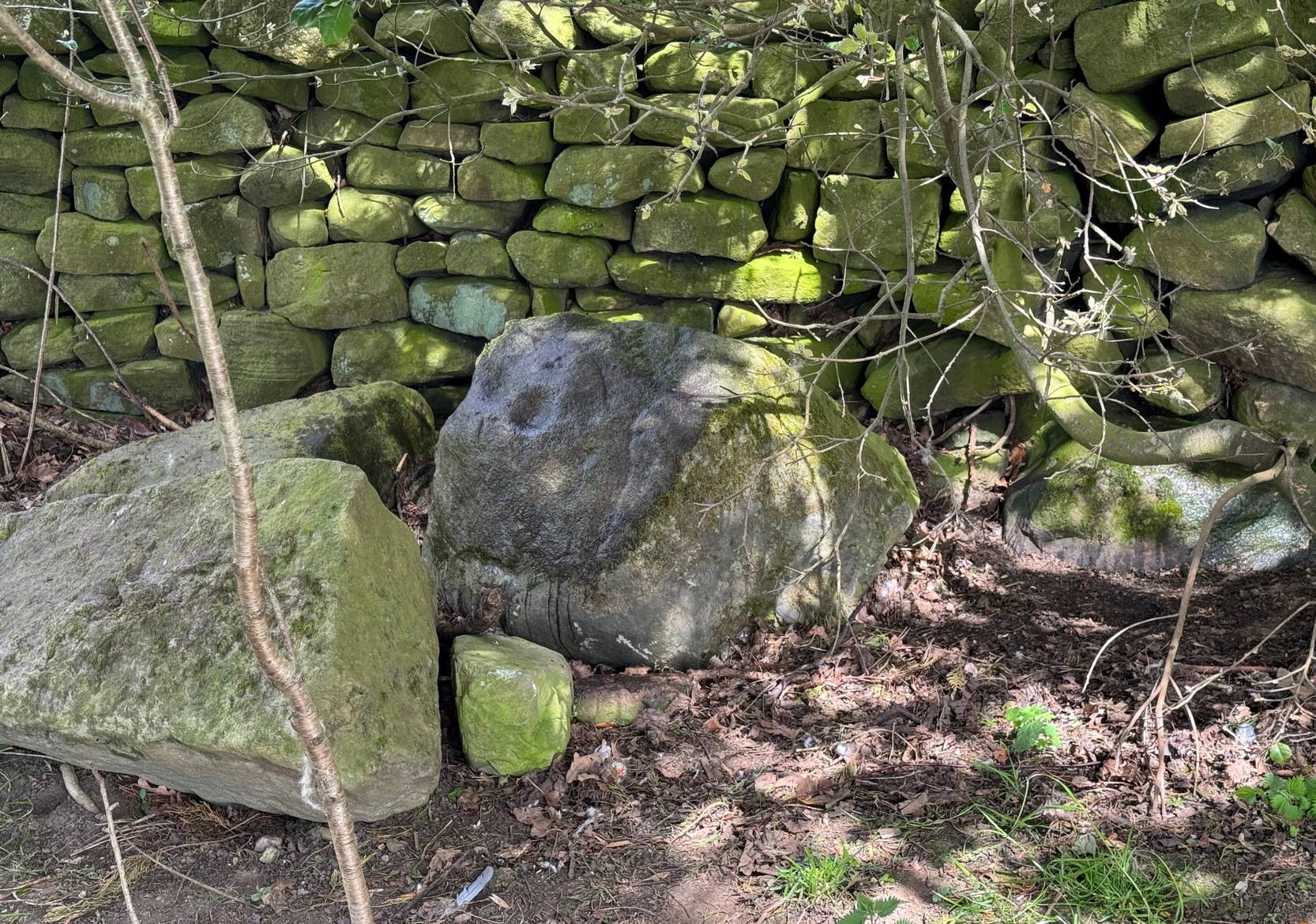
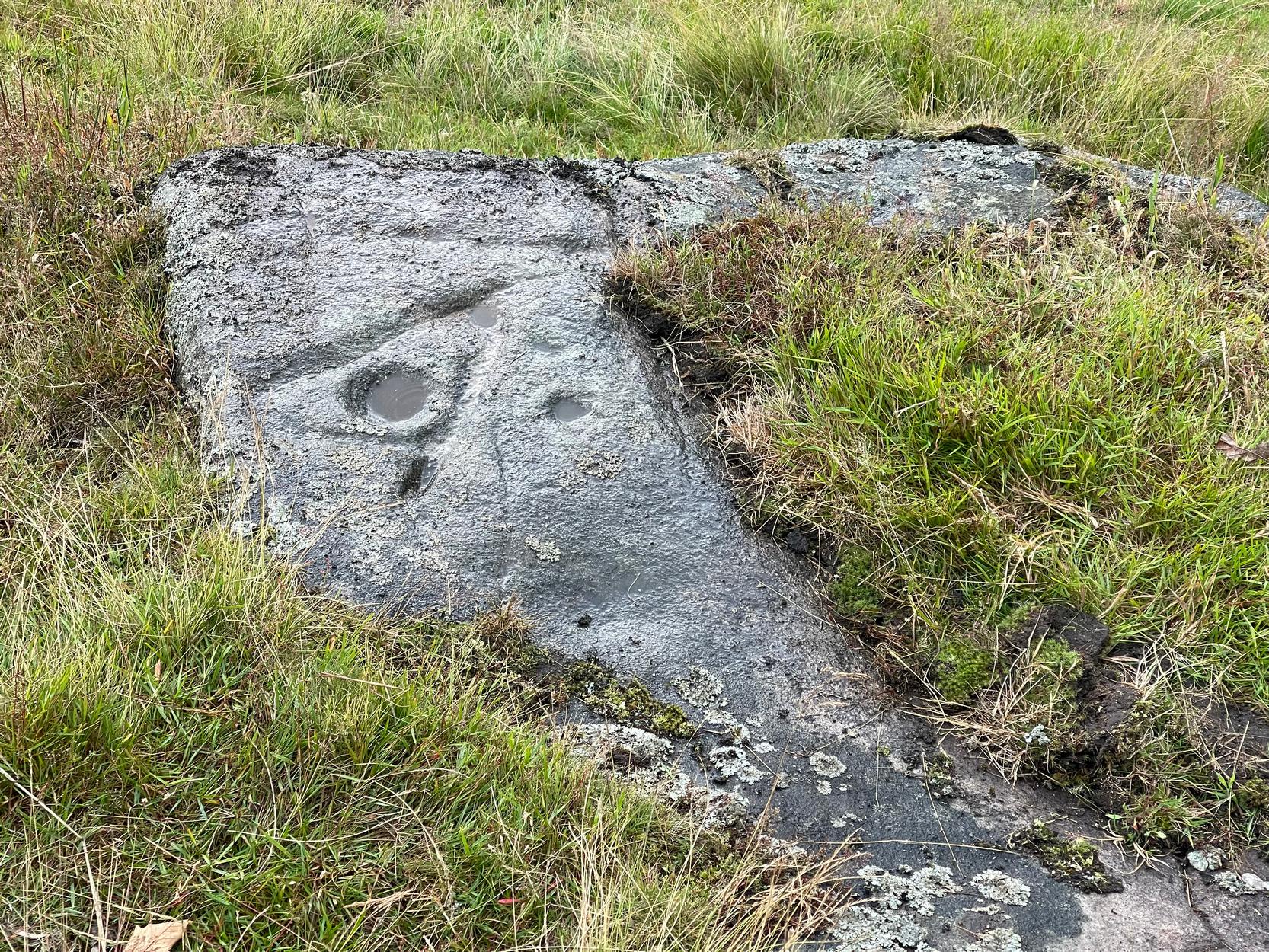
From Silsden, head up to Brunthwaite village and follow the same directions as if you’re going to see the Brunthwaite (1) cup-marked stone and, once there, look at the walling immediately behind it and you’ll see, at the base of the wall, peeking out is a small earthfast boulder. It’s about a yard away. You’ll find it.
Archaeology & History
Sticking out from the edge of the walling at ground level is this low small cup-marked stone, rediscovered by rock art explorer Tom Cleland just a few weeks ago. It sits behind the cluster of rocks that were dumped here not too many years back. The carving comprises of at least three well-defined and quite deep cups, only two of which were initially visible until we cleared out a third one that had become filled with soil. It’s possible that there’s more of them on the stone, but we’d have to take the wall down to find that out!
The stone seems to be earthfast and may have remained in the same spot, untouched, since when it was first carved four or five thousand years ago—and certainly the depths of the cups suggest that its it’s been pretty much covered over for most of its life. The walling that’s been built on top of it is pretty recent by comparison; but it’s notable that its petroglyphic neighbour, the High Brunthwaite (3) carving, 175 yards to the east, is also an earthfast rock with the field-wall built on top of it.
Its somewhat minimalist appearance reminds me of several of the cup-marked petroglyphs at the top of Shipley Glen, six miles southeast of here, including the Baildon Moor (126) and (130) carvings…
Acknowledgements: Massive appreciation to Thomas Cleland for finding this carving and showing us it’s whereabouts.
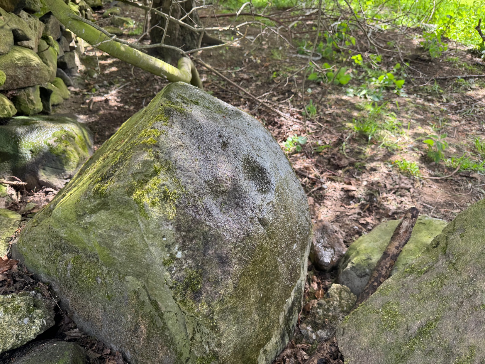
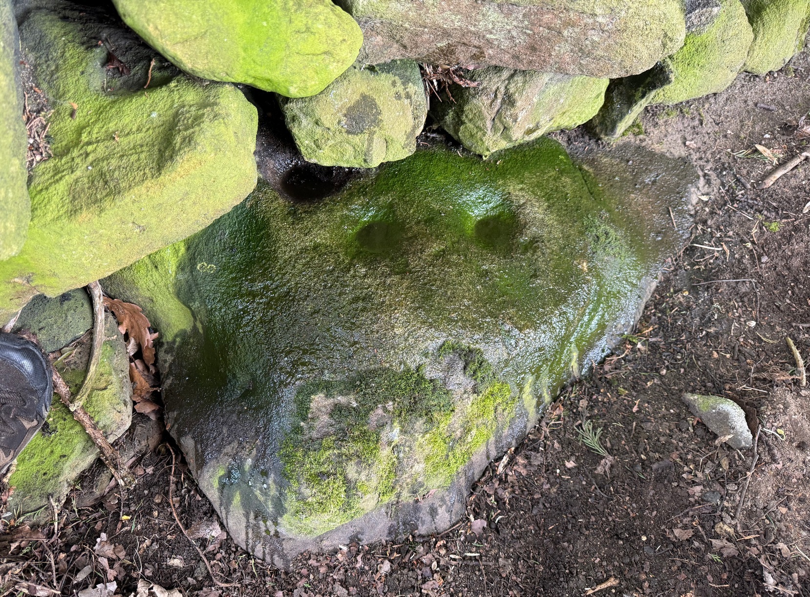
As you’re going into Silsden up the A6034 road, over the canal bridge, turn right (east) and go up Howden Road for half-a-mile, then go left up Hawber Lane and after 250 yards veer right along Brunthwaite Lane. After nearly another half-mile, through gorgeous High Brunthwaite hamlet and just as the road bends round past the last of the gardens and houses, go through the gate into the field on your right. You’re needing to look at the walling here, which runs alongside the road, but on the field-side, barely 10 yards up. A cluster of rocks has been piled-up against the wall. The largest rounded broken one is the one you’re looking for.
Archaeology & History
Looking across the cups
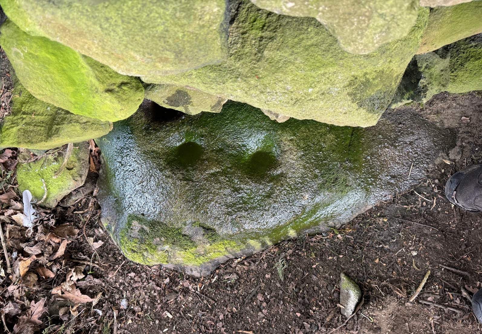
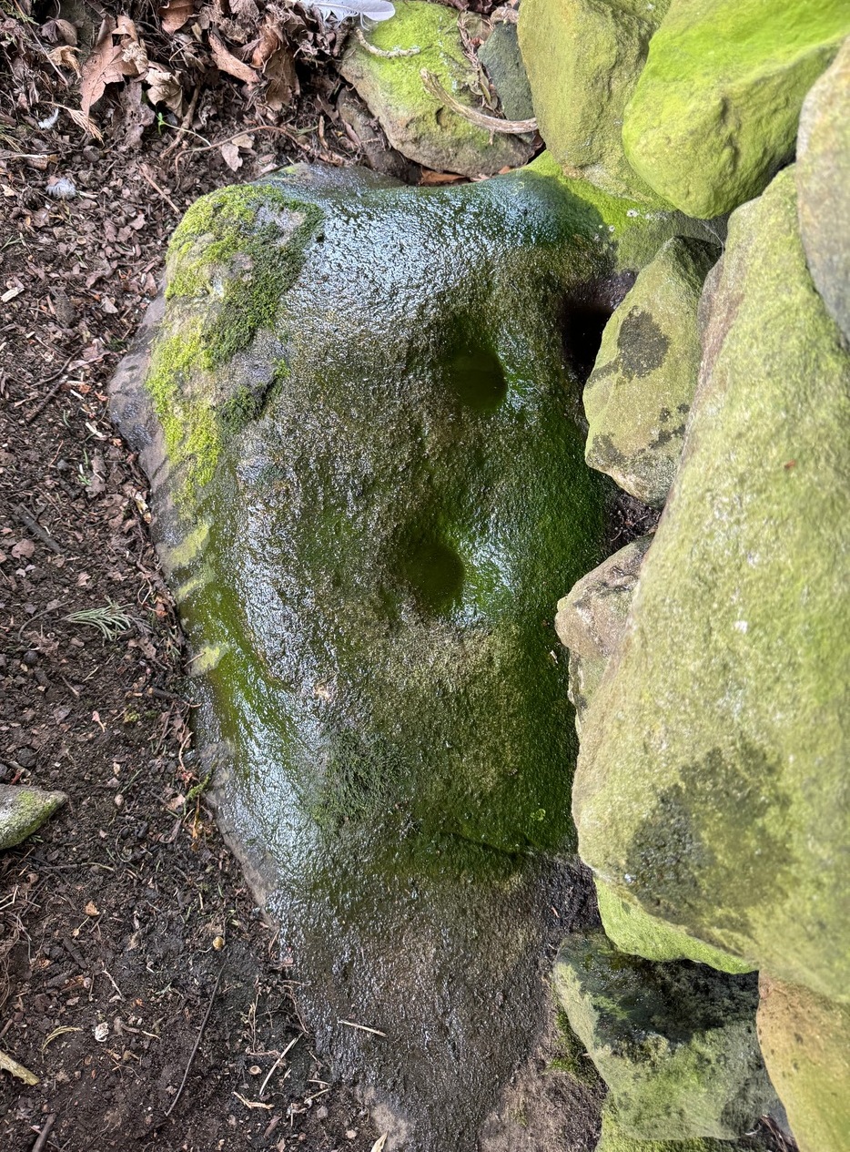
Discovered recently by the petroglyph explorer Thomas Cleland, this is one of two cup-marked stones in close attendance to each other. It’s nowt special to look at—unless you’re an ardent rock art buff!—as it consists of just two large well-formed cup-marks on its near-vertical face: the most distinct one being some two-inch across and a half-inch deep. The stone was obviously rolled here from very close by and just piled up against the wall and has been broken from a larger piece of rock, but we could see no other cup-marks on the others laid around it (although we couldn’t lift and turn the others over to see if there was anything on their undersides). The earthfast High Brunthwaite (2) cup-marked stone is just a yard away at the base of the wall.
Acknowledgements: Massive appreciation to Thomas Cleland for finding this carving and showing us it’s whereabouts.
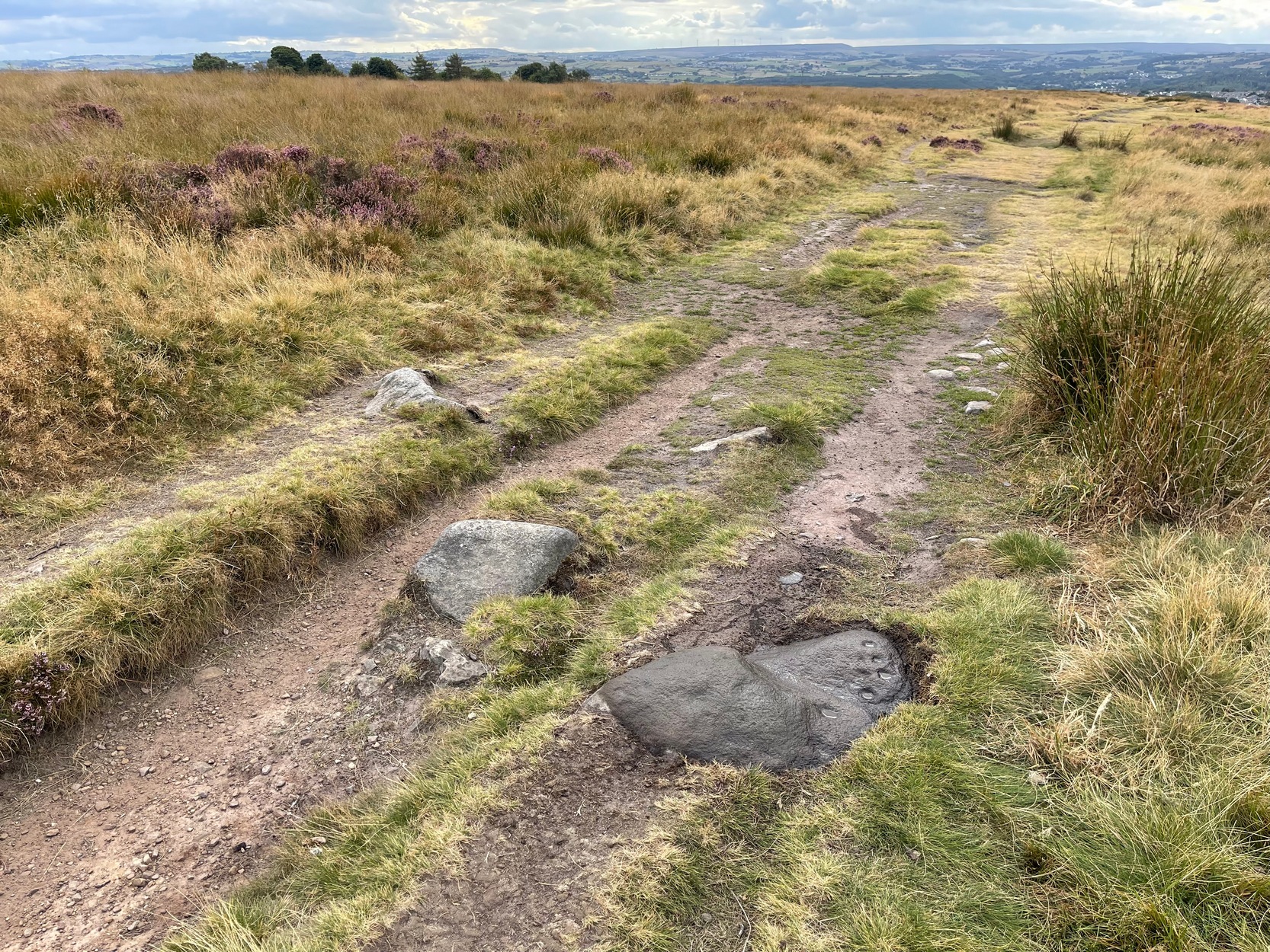
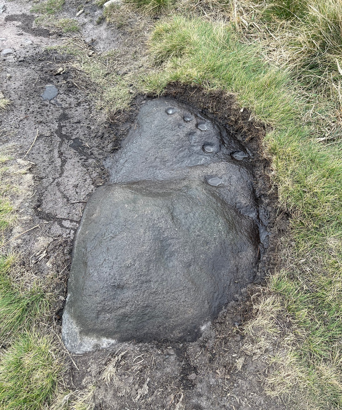
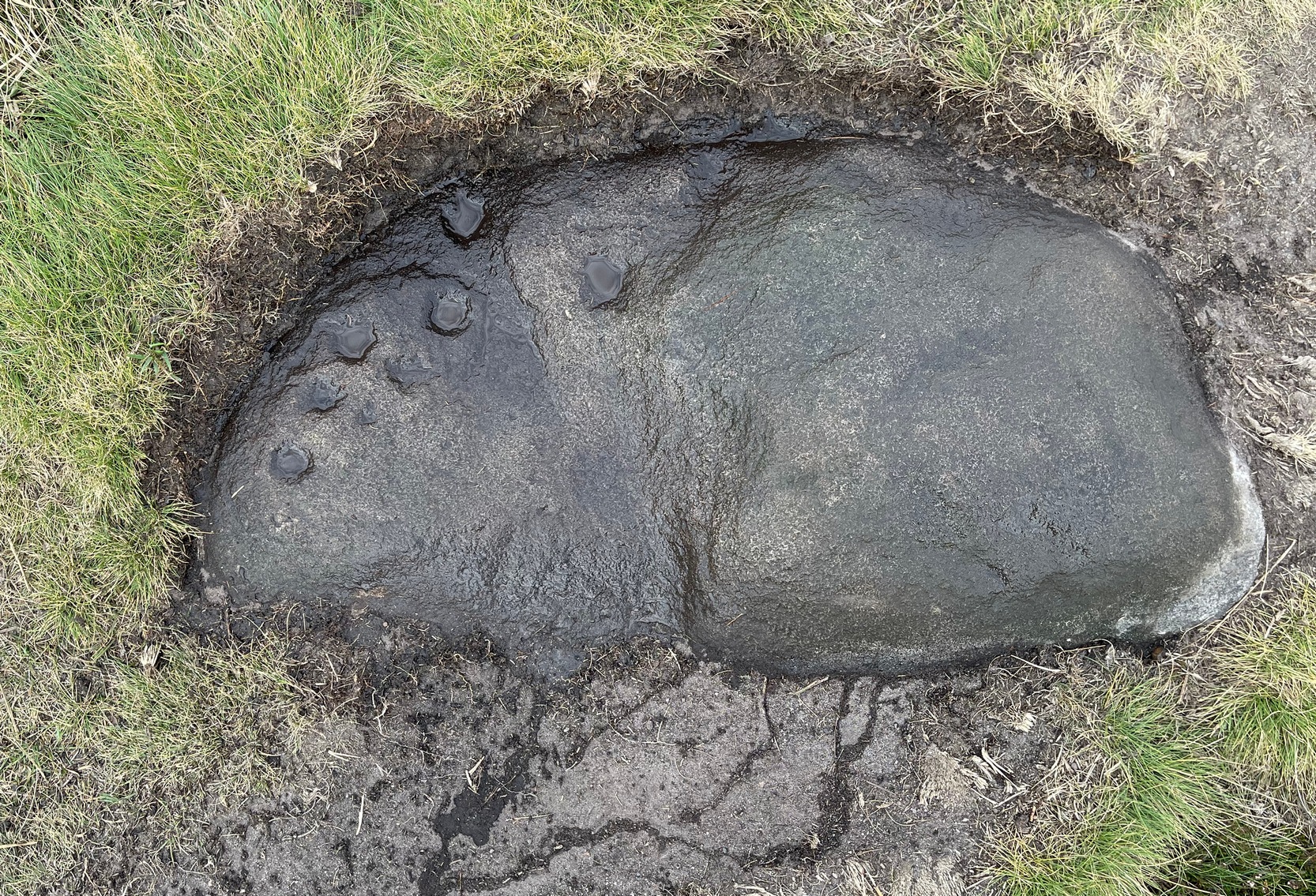
From the Cow & Calf car-park, walk towards and past the gigantic Calf rock, swerving round the fallen mass of rocks and into the trees at the back. Walk uphill to the Hanging Stones cup and ring stones, then keep heading—down the slope then back up the next one—west, for barely 100 yards until you’re on the level ground again, following the footpath alongside the heather. Barely 50 yards along, keep your eyes peeled in the heather for a low flat rock just a few yards in. Forage around and you’ll find it.
Archaeology & History
You’ll no doubt be seeing this carving after you’ve visited the impressive Hanging Stones petroglyphs 150 yards to the east. And you’ll probably be disappointed in its lack of visual grandeur when compared to its more ornate eastern neighbour. But the petroglyph fans among you should give it your attention.
Hedges 1986 sketchLooking to the SE
When the dawn or evening daylight cuts across the rock, the design looks much better than at sun high, perhaps telling us that the message of the stone coincided with those periods of the day. The gentle folds of the stone itself morph into the carving: evening and morning light cutting subtle shadowy folds across the rock, giving it an organic texture that our aboriginal ancestors told to be a vital essence of stone itself. The two small clusters of cup-marks upon this stone become greater than their basic design when brushed with the shadows and glows of a sunset. And when our aboriginal peoples painted them in ochre and other colours, an even greater mythos emerged—but sadly it is forgotten here….
When looked at with the simplistic eyes of the archaeo-mind, this and its compatriots are little more than a number of marks on lifeless rocks. This stone for example was described in John Hedges’ (1986) survey as being just “two groups of four and five cups and grooves”—nothing more—with naught but an echo in Boughey & Vickerman’s (2003) later work. The carving has neighbours even more basic in the heather close by…
References:
Boughey, Keith & Vickerman, E.A., Prehistoric Rock Art of the West Riding, WYAS: Wakefield 2003.
Hedges, John (ed.), The Carved Rocks on Rombalds Moor, WYMCC: Wakefield 1986.
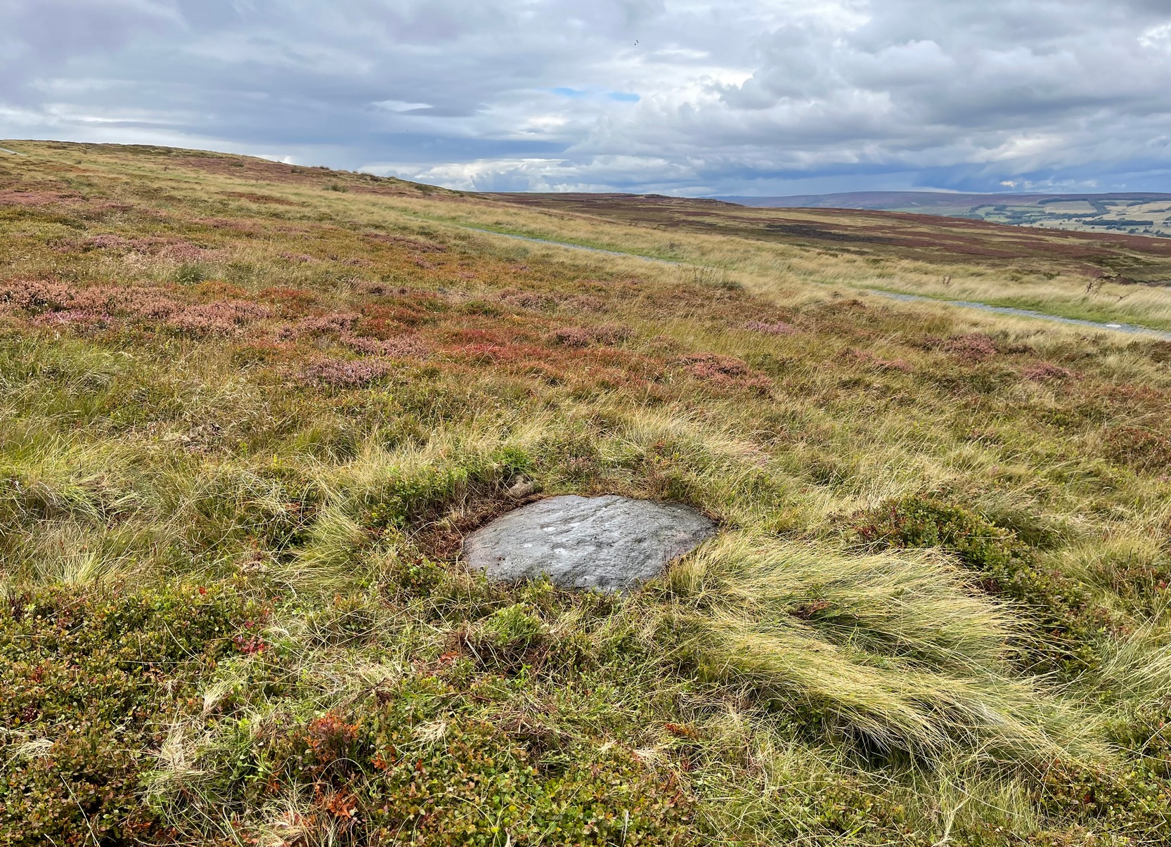
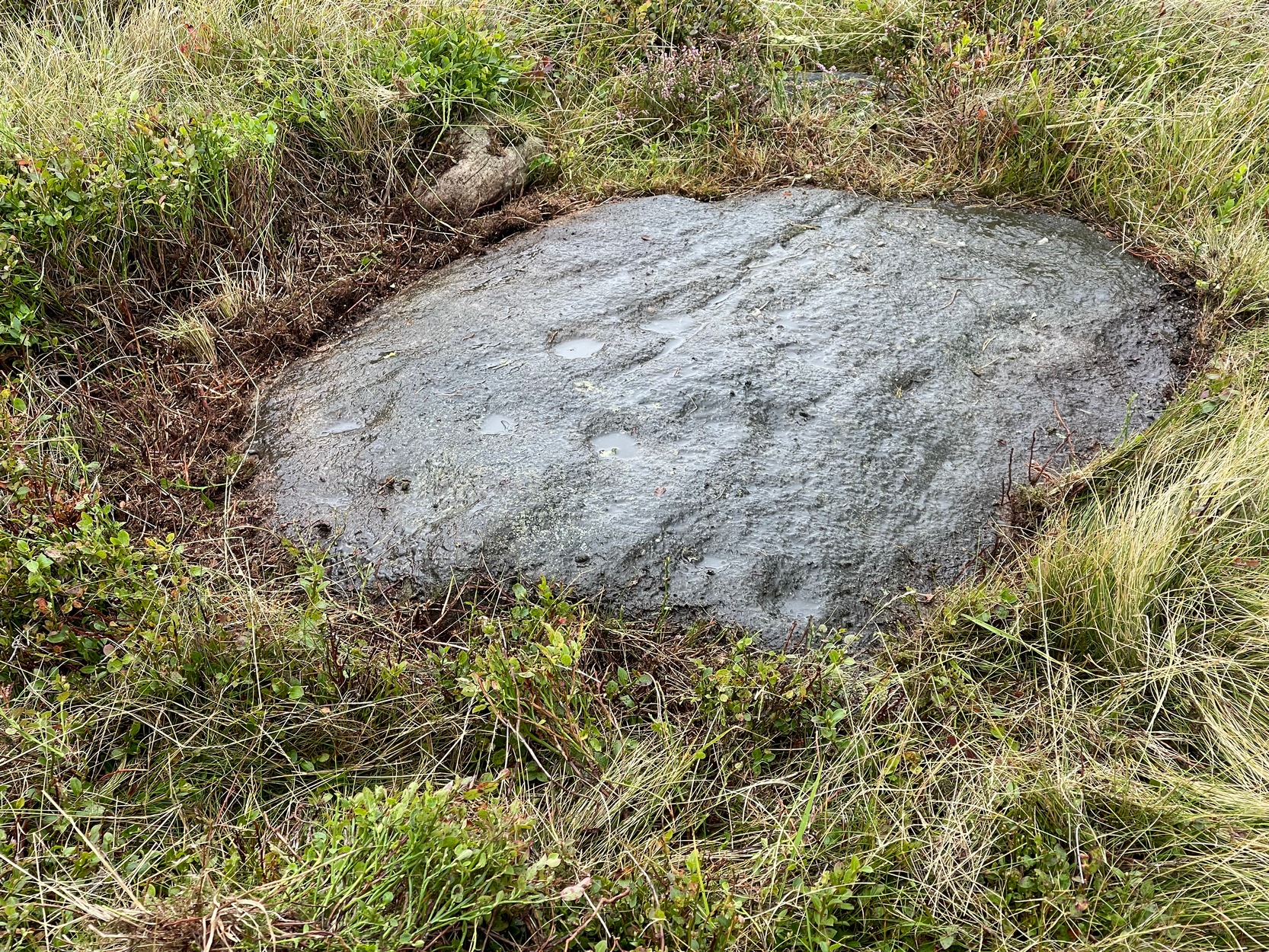
Probably best if you start from the car-parking spot at Acrehowe, by taking the road up through Baildon village, across at the roundabout up Northgate and up onto the moor, then after a few hundred yards turn left on the Bingley Road. The Acrehowe parking spot is a half-mile up on your right. From here, cross the road and bear right to take the footpath that follows the contour at the edge of the hillside, walking past the Baildon Moor (184) carving on the way. About 250 yards past this carving, on the right-side of the track as you’re heading to Dobrudden, is this low-lying almost innocuous stone. Keep your eyes peeled and you’ll see it.
Archaeology & History
The carving looking WCup-marks clearly visible
This cup-marked stone was first unearthed by fellow rock art explorers Mike Short and Dave Spencer in 2012 after they’d been looking at some of the other carvings hereby. In peeling back the turf on the stone, otherwise hidden cups—perhaps nine in all—were uncovered that had been hidden for centuries. Most of them are quite distinct, but it seems that a couple of the cups may have been left unfinished, as their size isn’t consistent with the others on this and other carvings close by.
The carved stone—located on the northern edge of the Low Plain prehistoric cemetery—is one in a line of several low earthfast rocks that crosses the track hereby and it’s possible that it was part of some prehistoric walling. Linear remains of walls and ditches were reported here in the 19th century and some of them can still be seen in some places on this part of the hill, but much of it has been destroyed.
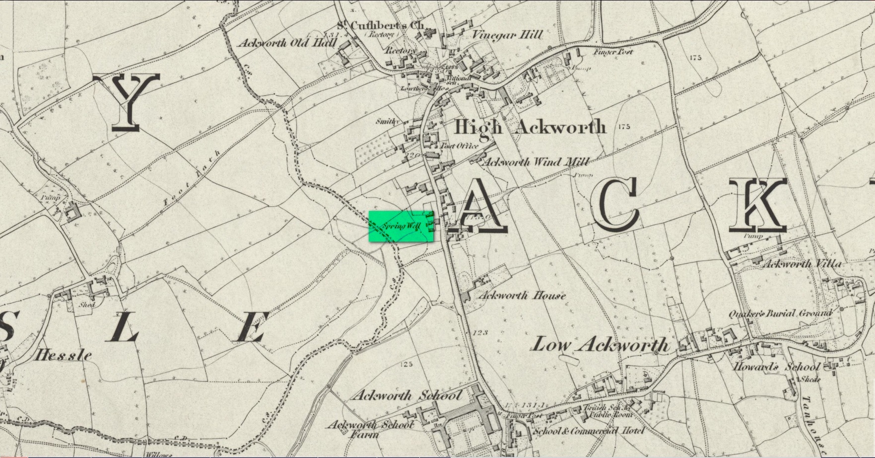
Somewhere close to the aptly-named Ladywell House (now a beauty salon) on the south-side of High Ackworth (just as you’re going into the village on your left) there was once a holy well, seemingly no longer with us. It was described in Saywell’s (1894) history of the town as one of the “antiquities” in the area. He told that,
Spring Well – Lady Well?
“This very ancient well is one of the several public wells, which has in recent years somehow become enclosed. From what it derived its name is not known, but from the fact of its being the oldest, it is not unlikely that it was originally set apart by some religious service, and dedicated to ‘Our Lady’ for the use of the inhabitants of the village. In pre-reformation times this custom was common, some wells having miraculous powers ascribed to their waters by the superstitious, like the well of St. Keyne, and in modern times, the ‘Holy Wells’ in Ireland; but nothing of the sort attaches to the well of ‘Our Lady’ at Ackworth.”
To the rear of the old cottages was once a ‘Spring Well’, as shown on the 1852 Ordnance Survey map. It’s possible that this was our Lady Well, dedicated in ancient times to St. Mary. Does anyone know? And is it still there?
References:
Saywell, Joseph L., The Parochial History of Ackworth, James Atkinson: Pontefract 1894.
Acknowledgements:Huge thanks for use of the Ordnance Survey map in this site profile, reproduced with the kind permission of the National Library of Scotland.
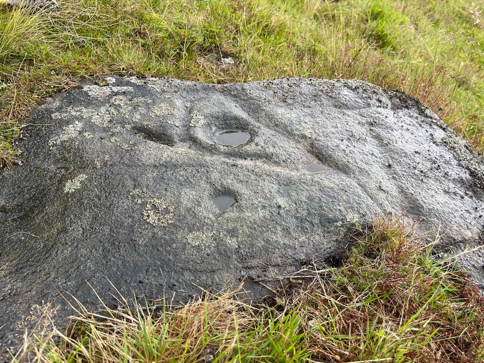
You can walk up from Menston, up Moor Lane north-west towards the moor, then turning left when you hit the moorland road of Hillings Lane. Nearly 350 yards along, turn right up the track known as Occupation lane onto the moor. More than half-a-mile up, past the gate at the Bee Stone, where the track splits, keep to the left and head further uphill, roughly parallel with the fence on your left. Literally ¼-mile (0.4 km) up from the split, you’re looking almost straight down at the reservoir; but to your left, walk towards the fence. Zigzag about! You can also approach it from the Grubstones and Great Skirtful area, by following the Occupation Lane track eastwards down the slope until you’re roughly level with the same reservoir.
Archaeology & History
On this somewhat isolated stone on the northern sloping edge of Craven Hall Hill we find a small cluster of shallow cup-marks, first noted in the 1980s and eventually mentioned in a survey by Boughey & Vickerman (2003) where they described it as a,
“Low, medium striated rock lying in slope of hill. SE end carries possibly up to eleven cups, possibly two sets grouped in arcs running into natural striations of rock, one of which may have been artificially enhanced by pecking.”
Shallow cup-marks
The view from here is quite something: gazing east to the heathen hilltop of Otley Chevin (Beltane rites and rock art — albeit not much), north-east to the far uplands of the White Horse of Kilburn, then across the northern panoramas of Askwith and Denton Moors, and beyond. Some archaeologists have started to believe that such vistas may have had relevance with such carvings, sometimes. They’ve caught up at last! 🙂 Anyhow, the carving itself is pretty simplistic and probably only of interest to the real petroglyph nuts amongst you – although it’s mebbe worth checking out if you’re visiting the Great Skirtful giant cairn and its very impressive hengi-form neighbour.
References:
Boughey, Keith & Vickerman, E.A., Prehistoric Rock Art of the West Riding, WYAS: Wakefield 2003.
Boughey, Keith & Vickerman, E.A., Prehistoric Rock Art of the West Riding – Supplement, YAS 2018.
Acknowledgements: With thanks to Tom Cleland for help in relocating the site on a recent visit.
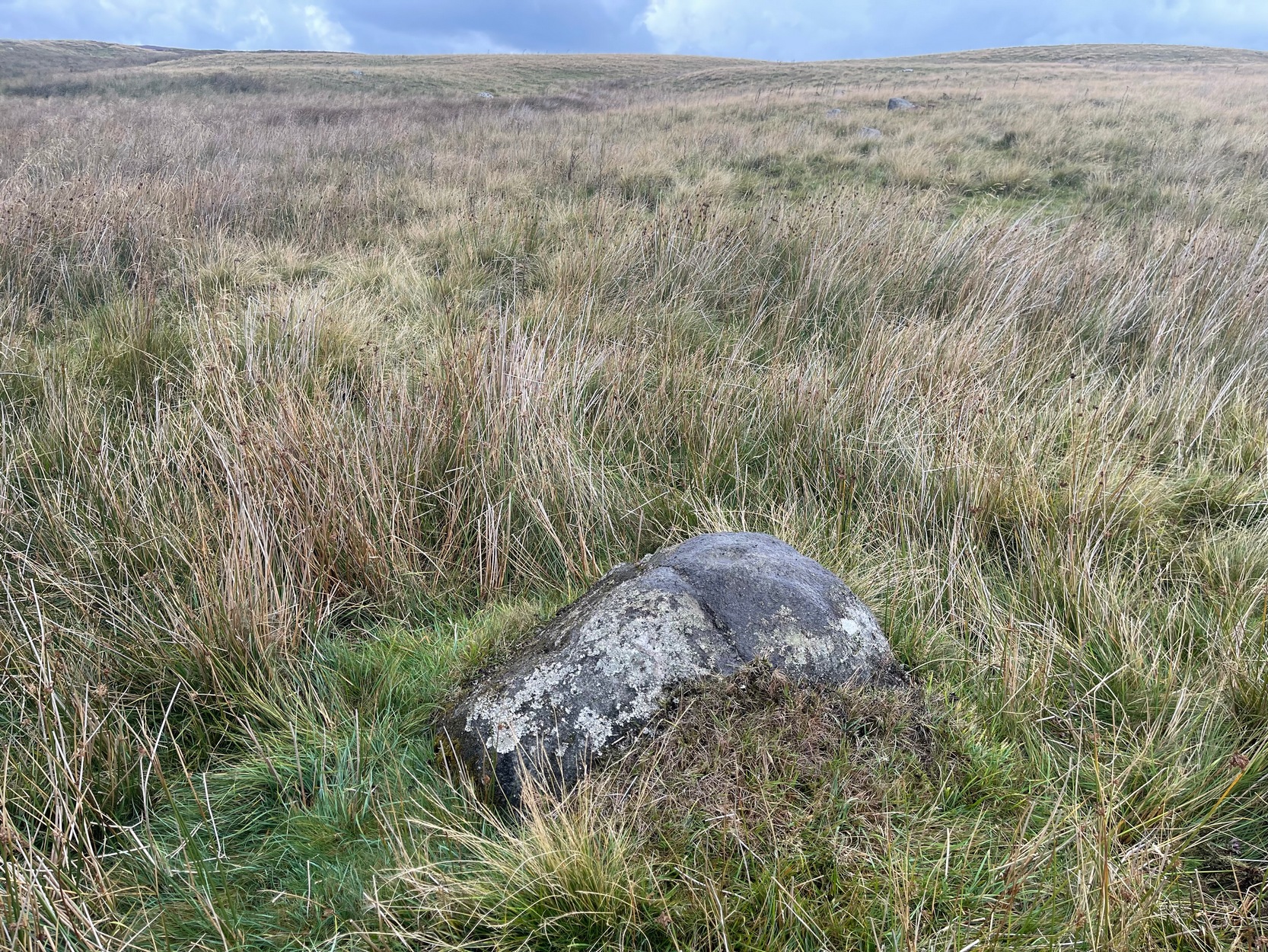
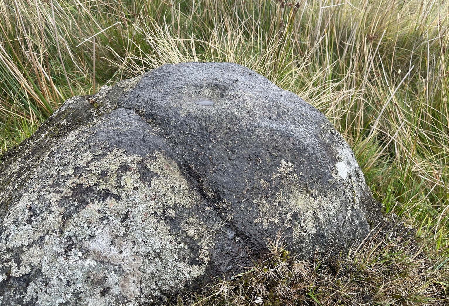
Numerous ways to get here: probably the easiest (direction wise) is if you’re coming from Dick Hudson’s public house on the southern road surrounding Rombalds Moor. From the pub, head left (east) along Otley Road (passing Weecher reservoir) for 1.9 miles (3.1km) until you reach Reva reservoir where a track leads you to the waters. A small parking spot is on the left-side of the road. From here, go through the gate and along the footpath across the field for nearly 300 yards to the next gate. Go through here and immediately follow the walling down to your left for about 135 yards to the edge of the rushes. It’s there!
Archaeology & History
Single cupmark nr the top
On a recent visit to the Fraggle Rock carving, Tom Cleland foraged about at the edge of what was, in centuries gone by, a good flowing stream below the west slope of Reva Hill. An old pathway cut across one section of it near where the walling now runs, covered these days in the mass of Juncus reeds, typical of mashy grounds. And here, just where folk would cross the waters, Tom found a good sized stone with a single deep cup-mark on its crown, calling through a feast of lichens to be seen once more. There may be a second cup-mark by its side, but the light wasn’t good when we were here, so that’ll be worked out some other day. Anyhow, this one’s probably only for the crazy petroglyph hunters out there. It’s the Fraggle Rock and its companios that you’re gonna be looking for, nearby….
In Steeton, walk up the High Street and after a hundred yards or so, turn right to go up to Quarry House (opposite Falcon Cliffe), up past Quarry Cottages to the end where it turns into a track. Follow the track for 200 yards, where it bends left, then immediately right go into the field, following the wall along for 450 yards where you’ll go through a gate to another rocky steep hill-slope. Walk up by the side of the walling here, at the edge of the trees and, once at the top, bear right and a few yards along keep your eyes peeled. You’re virtually on top of it!
Archaeology & History
Not previously recorded, this is an unusual design: unusual in more ways than one. Firstly, it’s not entirely ‘ancient’; and secondly, the linearity in some of the carved lines around the cup-marks is unusual. It reminded me a little of the Hanging Stones above Ilkley, with its deeply cut lines, swerving around cup-marks, whose lack of ‘ancient’ guise is somewhat betrayed by the fact that Victorian quarry operations uncovered them—much like happened here…
It was first noticed in 2024 by Collette Walsh during a petroglyphic foray in the area. She noticed the distinct cup-marks on the rock surface, but then when she noticed a distinct quarrying mark, she dropped the idea that it was prehistoric. But this distinct quarry or stone-mason mark—executed sometime in the 19th century when the Industrialists were working here—shouldn’t take our attention away from the cup-marks; nor indeed all aspects of the other carved lines that swing round the edges of the deepest of the three cups, which is surrounded by a long curved triangle, some of which was carved into a natural crack, highlighting it more. The single outlying cup looked, from some angles when wet, that it may have had a partial ring around it—but we were unsure and it may have just been a trick of the light, along with our desire to see more than there actually is. Anyhow, it’s worth seeing. But we could do with a stonemason to check it out, enabling us a better assessment of which bits of this design are old and which are not-so-old.
Acknowledgements: To Collette Walsh for uncovering this design; and to Tom Cleland for showing me where it lives!
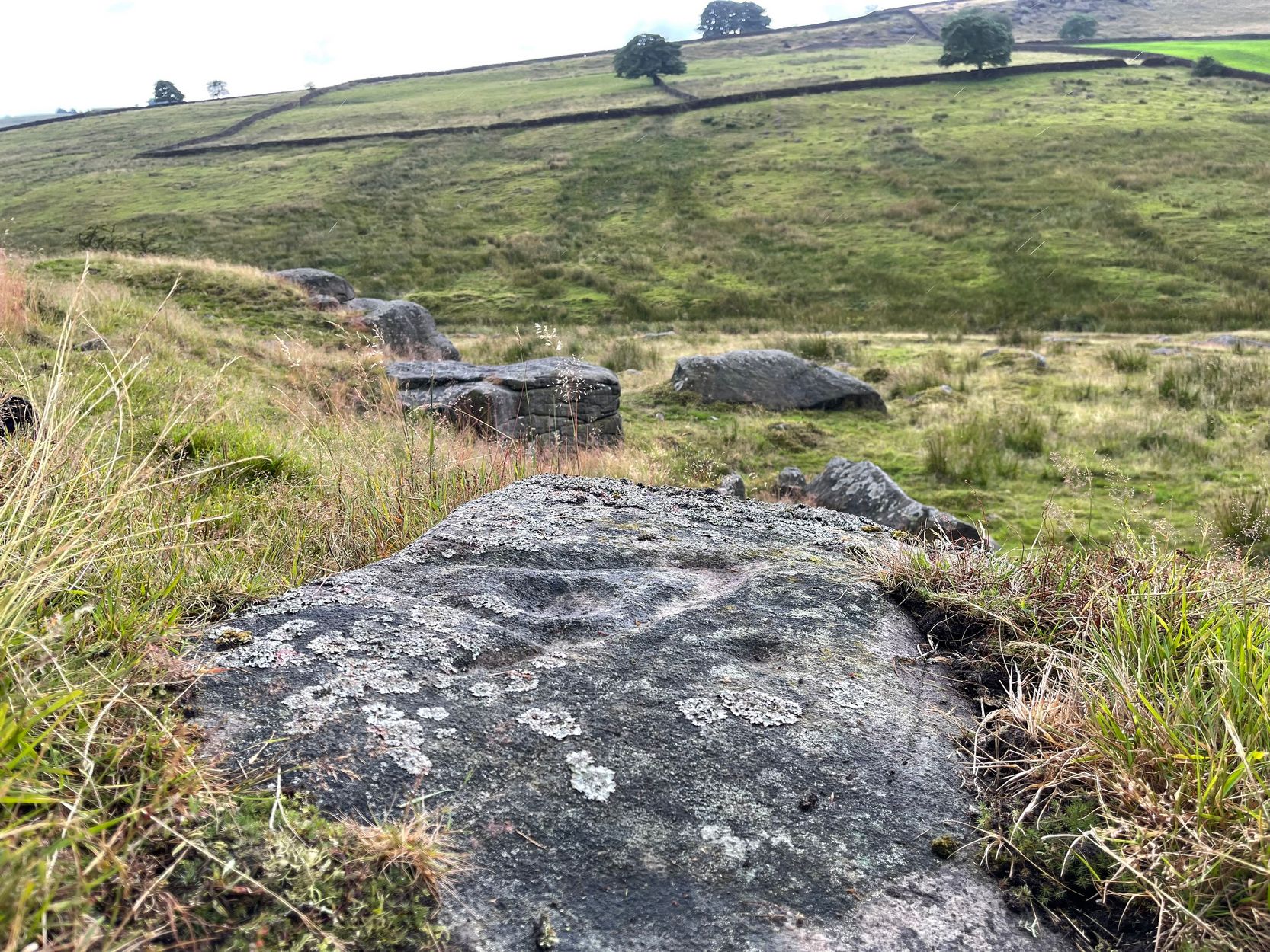
Your best starting point is from the Great Skirtful of Stones giant cairn. From here follow the fencing that runs down the slope to your left (south-east) for roughly 160 yards (148m) – past the Great Skirtful Ring – until you reach the gate. Go through it and keep walking down the same fence-line for 300 yards then walk south onto the moorland proper (there are no paths here). You’ll pass over several undulations in the heather (some of these are the edges of ancient trackways) and 55-60 yards south from the fencing you’ll walk over and into this overgrown prehistoric ring. It’s very difficult to see when the vegetation is deep, so persevere!
Archaeology & History
Site shown on 1851 map
This is an interesting site. Marked on the 1851 Ordnance Survey map as a “barrow” (right), it is shown with trackways on either side of it to the north and south, and with an opening or entrance on its northwestern side. Yet since that date, very little archaeological attention has been given to it and the site remains unexcavated, despite its location being repeated on all subsequent maps since then. The designation of the site as a barrow or burial site, without being excavated, was educated guesswork at the time as the place seems to be what we today define as a ring cairn. And whilst this seems likely, there are some oddities here.
Measuring roughly 25 yards (SE – NW) by 21 yards (NE – SW), this overgrown oval ‘ring’ is a similar architectural structure to the more famous Roms Law circle more than half-a-mile northwest of here—but bigger! And, unlilke Roms Law, this overgrown circle seems to have been untouched for many centuries. The oval surrounding ‘ring’ itself is composed of thousands of small packing stones between, seemingly, a number of much larger upright stones, reaching a maximum height of more than three feet high at the northernmost edge. The ‘ring’ ostensibly looks like a wide surrounding wall which measures two yards across all round the structure.
Track running into the ringRaised line into the ring
Internally, there seems little evidence of a burial — although our recent visits here, as the photos indicate, took place when the moorland vegetation was deep and covered almost the entire site. The outline of the site is obviously visible, even in deep heather, but the smaller details remain hidden. But in addition to the main ring, another very distinct ingredient here is the existence of an extended length of man-made parallel walling, probably a trackway, that runs into the circle from the southeast all the way through the circle and out the other side and then continuing northwest heading roughly towards the Great Skirtful giant cairn on the horizon 500 yards to the northwest.
Stone at NE arc of walling
Due to the landscape being so overgrown, it’s difficult to ascertain where this ‘trackway’ begins and ends. Added to this, we find that there are additional ‘trackways’ that run roughly parallel to the one that runs through the circle—and these ‘trackways’ are very old indeed, some of them likely have their origins way back in prehistory. The one that runs through the middle of this ring cairn may be a ceremonial pathway along which, perhaps, our ancestors carried their dead. If we follow it out from here and keep walking along the track 300 yards to the southeast, we eventually run right to the edge of the Craven Hall (3) circle. Parallel to this is another ancient trackway that runs northwest to the edge of the Roms Law circle. It seems very much as if we have ceremonial trackways linking sites to each other: ancestral pathways, so to speak.
Have a gander at this when you’re next in the area. There are many other sites nearby that are off the archaeological radar. In recent years, a number of northern antiquarians wandering over this landscape are finding more and more ancient remains: walling, circles, cairns, trackways. It’s a superb arena—but sadly, most of it is hidden beneath deep moorland vegetation.
References:
Faull, M.L. & Moorhouse, S.A. (eds.), West Yorkshire: An Archaeological Guide to AD 1500– volume 1, WYMCC: Wakefield 1981.
Acknowledgements:Huge thanks for use of the Ordnance Survey map in this site profile, reproduced with the kind permission of the National Library of Scotland.
Cup-Marked Stone (removed): OS Grid Reference – SE 1579 3995
Archaeology & History
Jenny Lane carving
A small, seemingly broken cup-marked stone that may have once been part of a prehistoric tomb, found itself being included in an old wall at some time in the not-too-distant past: in the south-facing wall of the cricket ground at the top end of town. No one seemed to know it was there until it was noticed in the 1950s by a local man who brought it to the attention of Sidney Jackson (1958), editor of the local Bradford archaeology mag at the time. Jackson visited the site and thankfully did a sketch of what it looked like, before it was removed at a later date. He wrote:
“The small rectangular stone bearing four cup-shaped hollows…is another of Mr George Pritchard’s finds. It forms part of the high wall which bounds the Baildon Cricket Club’s ground in Jenny Lane… Its appearance suggests that it is part of a Bronze age cup-marked rock which was split to make building stones.”
Following its removal more than twenty years ago, it ended up in the hands of a dude from Cononley called Gerald Wright. I’m not sure whether it still lives over there or has subsequently found a new abode. Does anyone know what’s become of it…?
Folklore
Although there’s nothing specific to this carving, the place where it was found, on Jenny Lane, was where a phantom black dog used to be seen in bygone years. It was renowned as the harbinger od death.
References:
Jackson, Sidney, “Cup-Marked Stone in Jenny Lane, Baildon,” in Cartwright Hall Archaeology Group Bulletin, volume 3, part 10, 1958.
 The stone seems to be earthfast and may have remained in the same spot, untouched, since when it was first carved four or five thousand years ago—and certainly the depths of the cups suggest that its it’s been pretty much covered over for most of its life. The walling that’s been built on top of it is pretty recent by comparison; but it’s notable that its petroglyphic neighbour, the High Brunthwaite (3) carving, 175 yards to the east, is also an earthfast rock with the field-wall built on top of it.