Standing Stones: OS Grid Reference – NN 94624 52118
Also Known as:
- Balnaguard Farm
- Gallows Stone
Getting Here

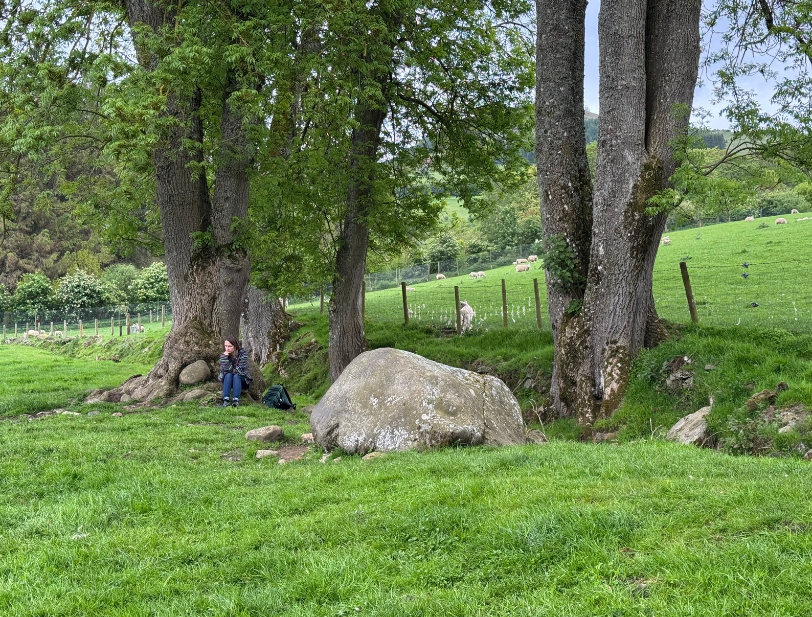
Just as you’re coming into Balnaguard village on the B898 road from the eastern side (as if you’ve come via the A9 from near Pitlochry), just where the road crosses a small burn (stream), take the first farm-track on your right and walk down to the end where it meets the field. Here, walk to your left left and you’ll see a gate that takes you into the field. You should have already noticed the standing stone before you even open the gate! It’s about 100 yards in front of you. You can’t really miss it.
Archaeology & History
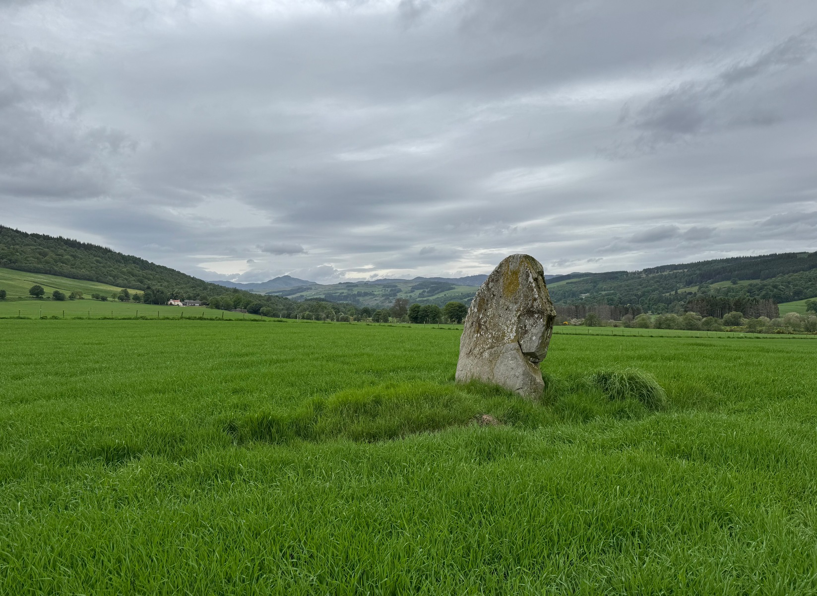
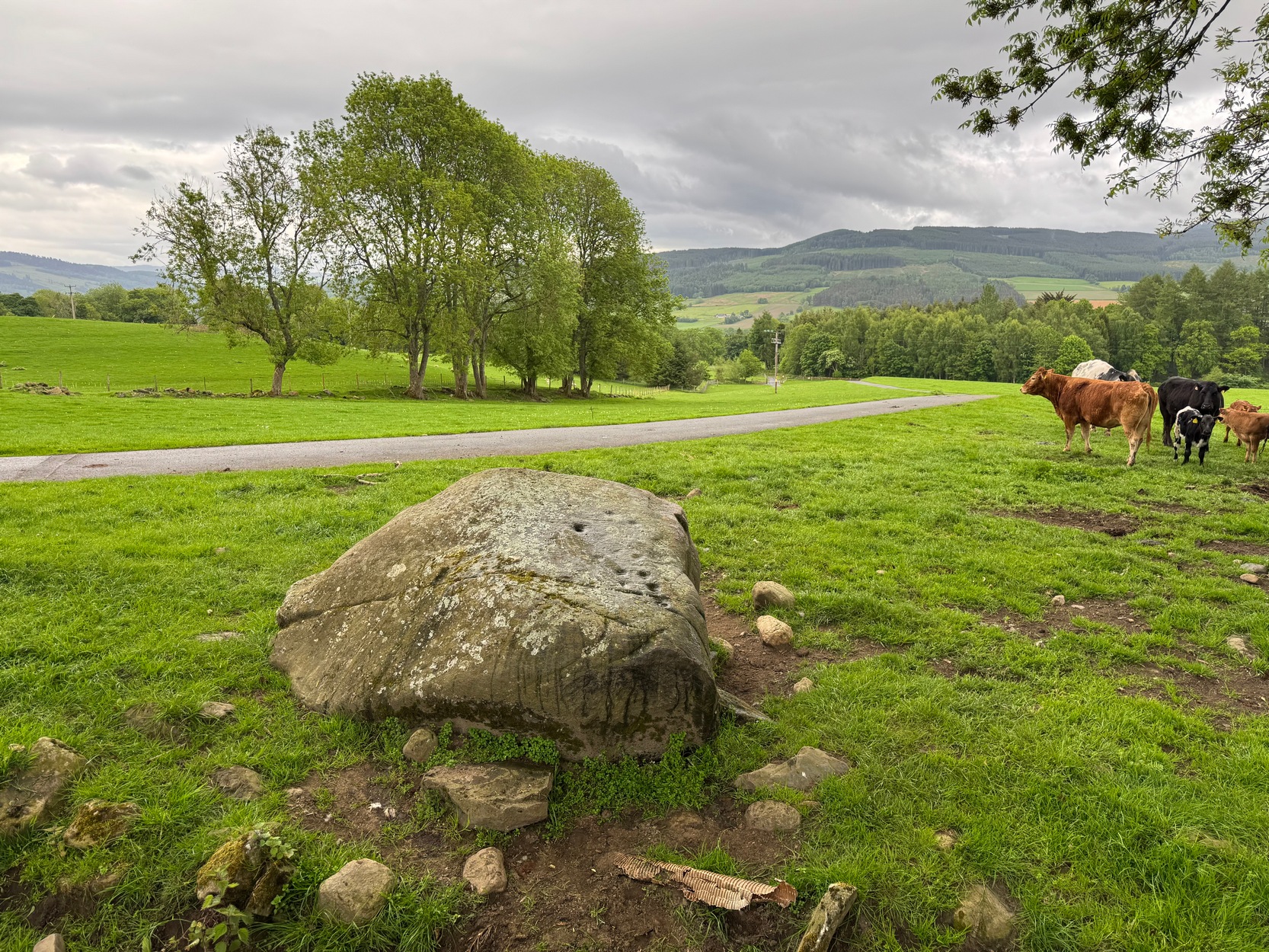
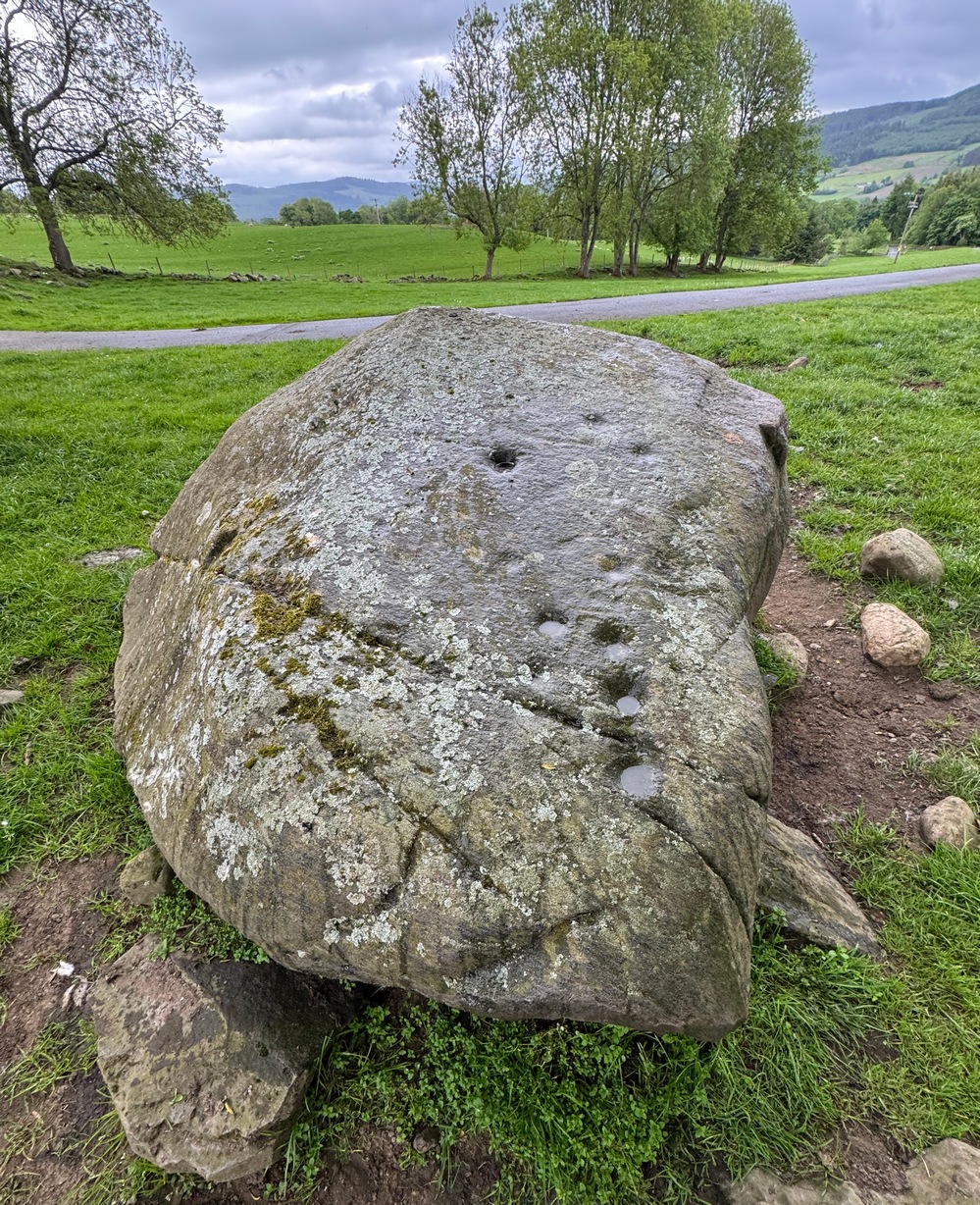
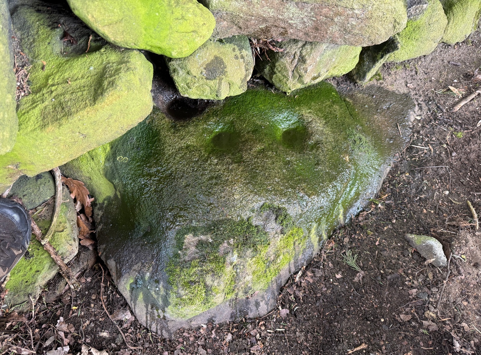
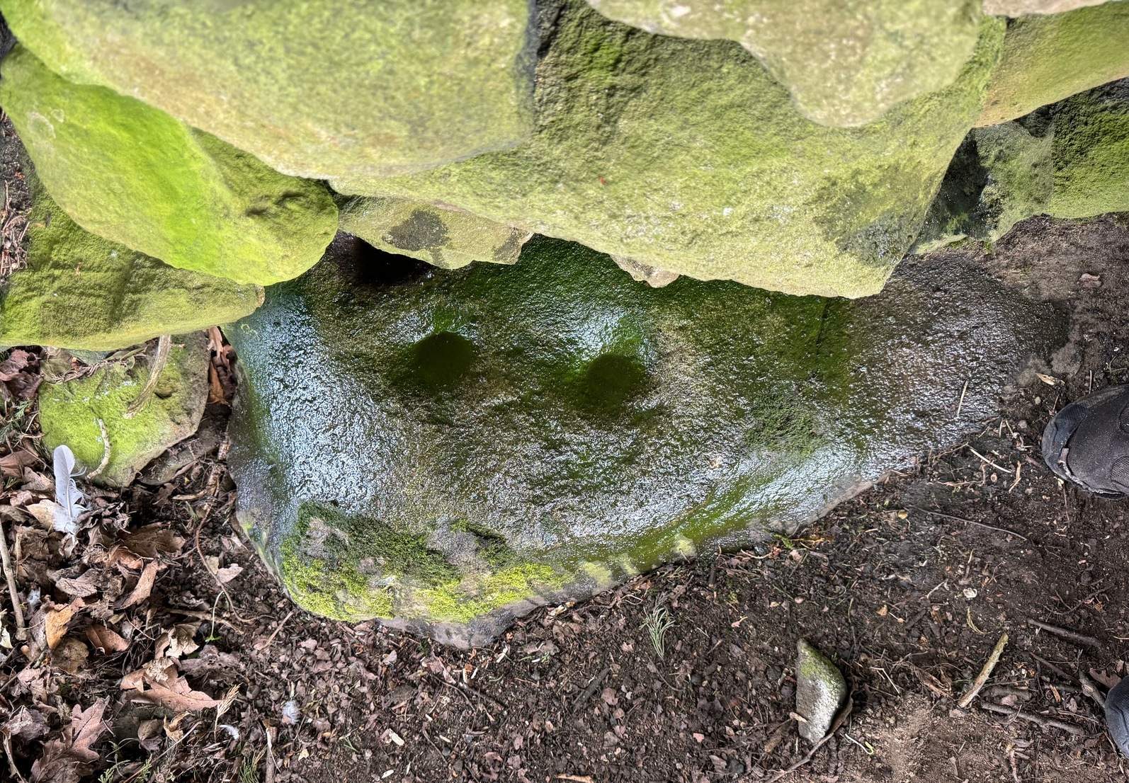
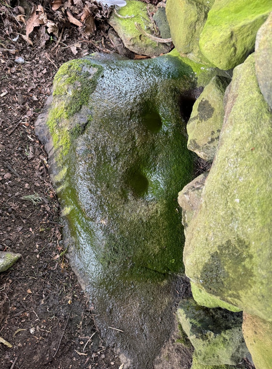
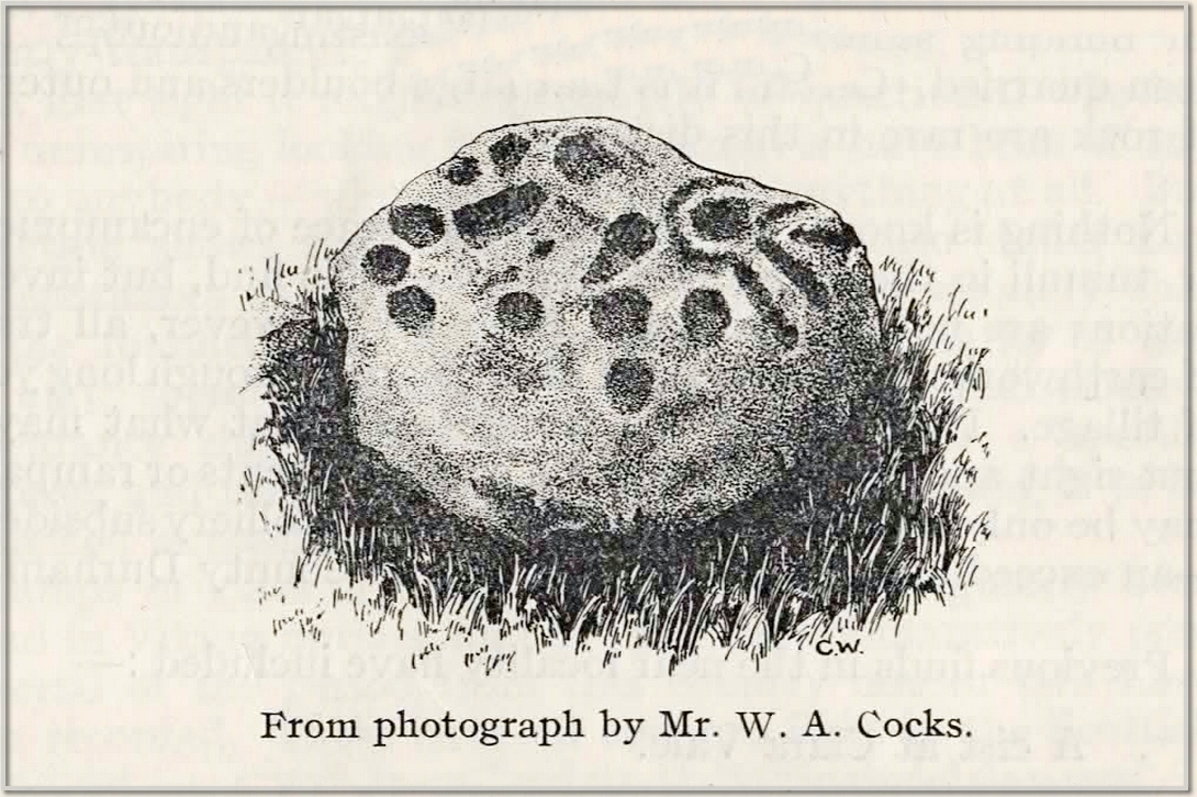
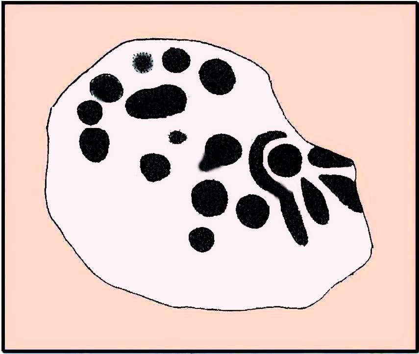
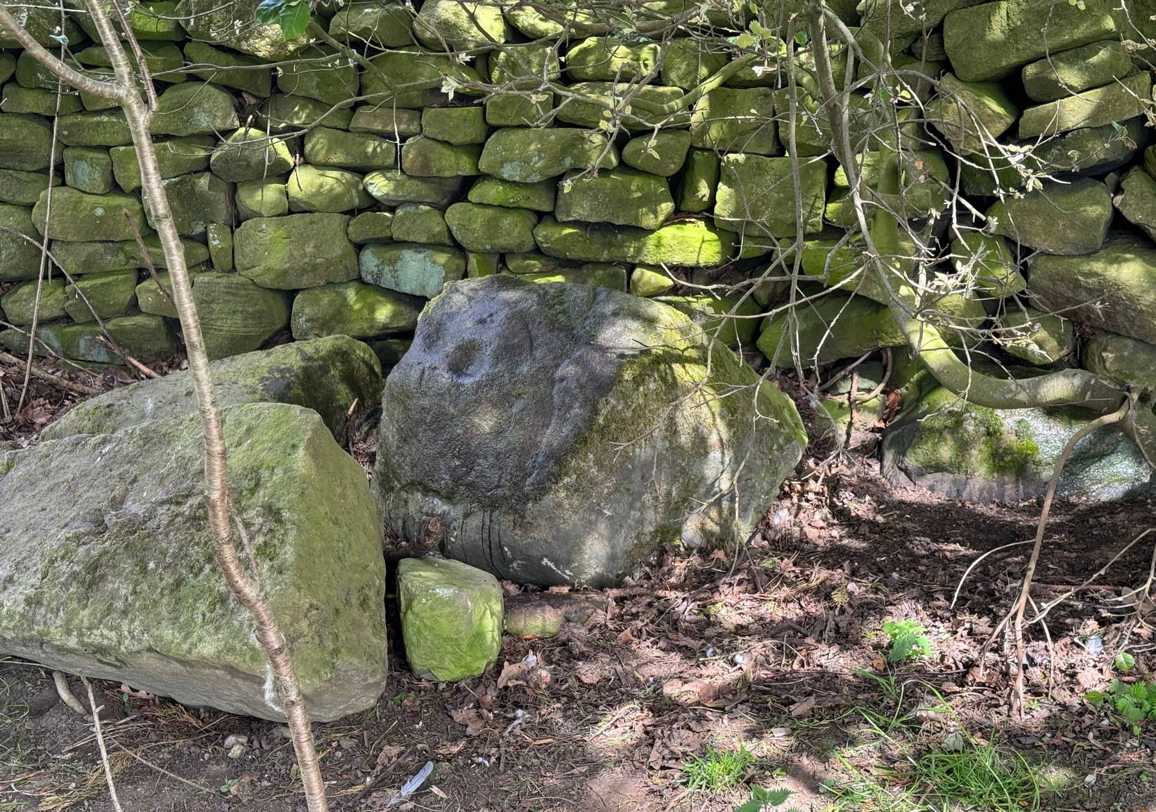
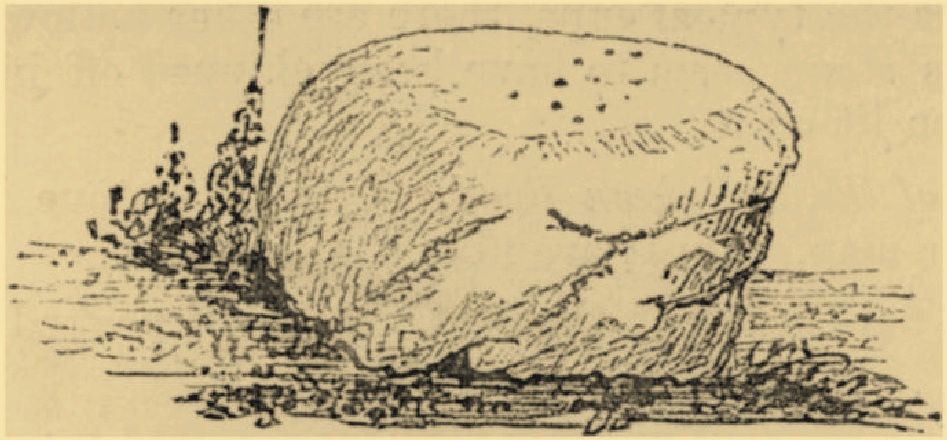
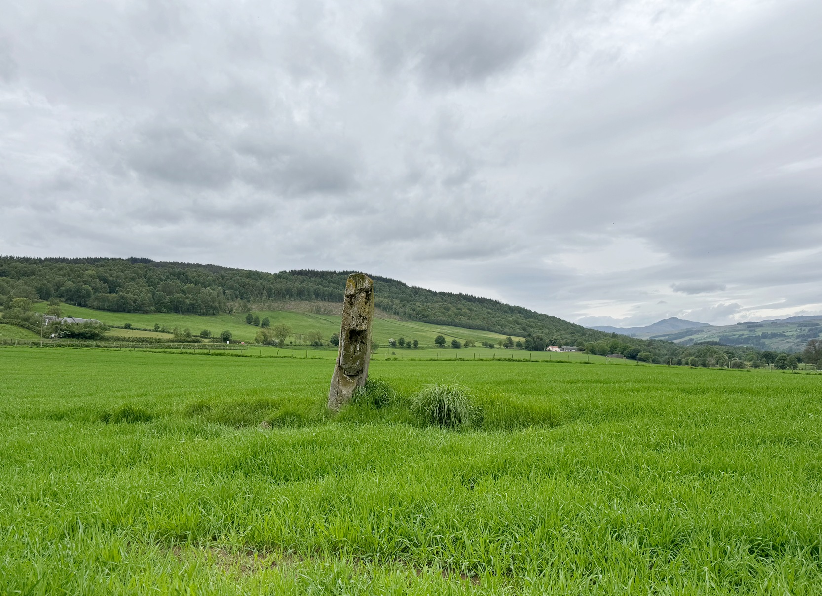
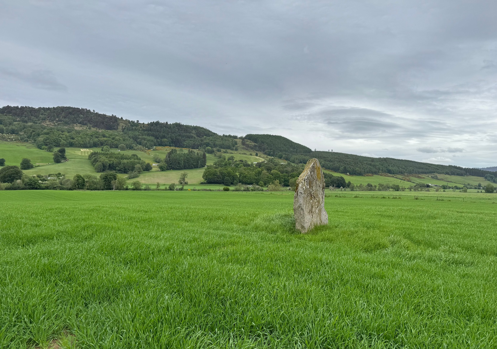
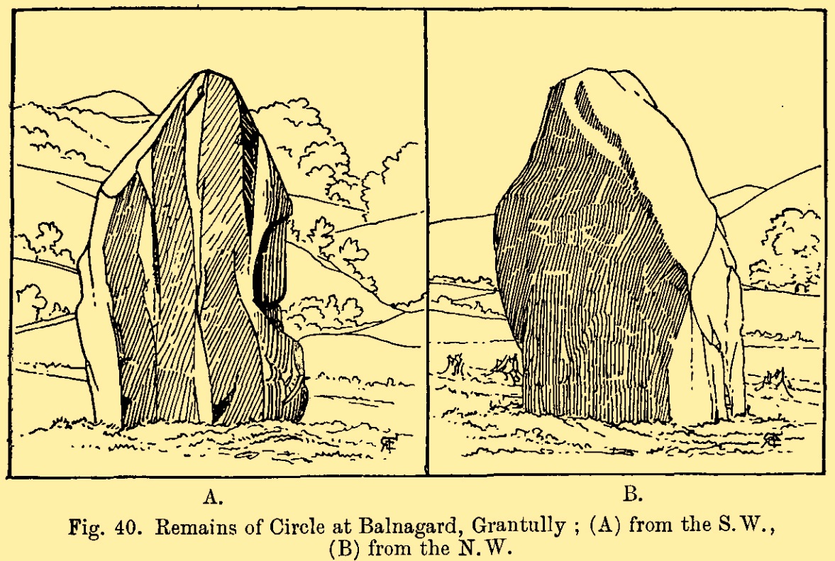
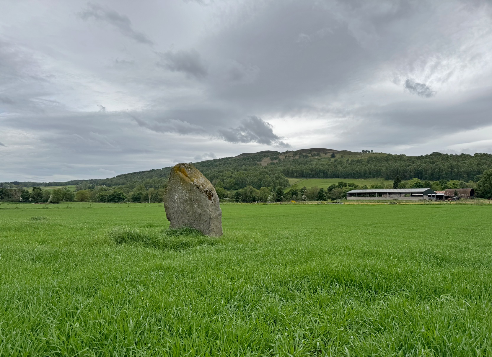
Standing alone in this field a short distance south of the River Tay is this fine old standing stone, nearly seven feet high, from whose locale we gaze west to the opening of the Perthshire mountains—but in times gone by it wasn’t alone. Less than 10 yards east of the Clach na Croiche stood another seven-foot tall standing stone and, some six yards further east (and along the same axis) there may have stood another one, some 7½ feet high. This alignment ran east-west in line with the rising and setting of the sun at the equinoxes. (whether that was deliberate or not is another matter altogether) and was first noticed by the great antiquarian Fred Coles (1904) in one of his many megalithic ventures. He wondered “whether they (were) fallen Standing Stones, or the covers of cists” and when they were looked at by Margaret Stewart in 1971 she found that one of them laid beside “a shallow socket outlined with packing stones”—meaning that it had stood upright. The other stone didn’t seem as certain, although Stewart did report finding “a single cupmark…on the eastern side of the upper surface.” We’ve yet to see a photo of this carving.
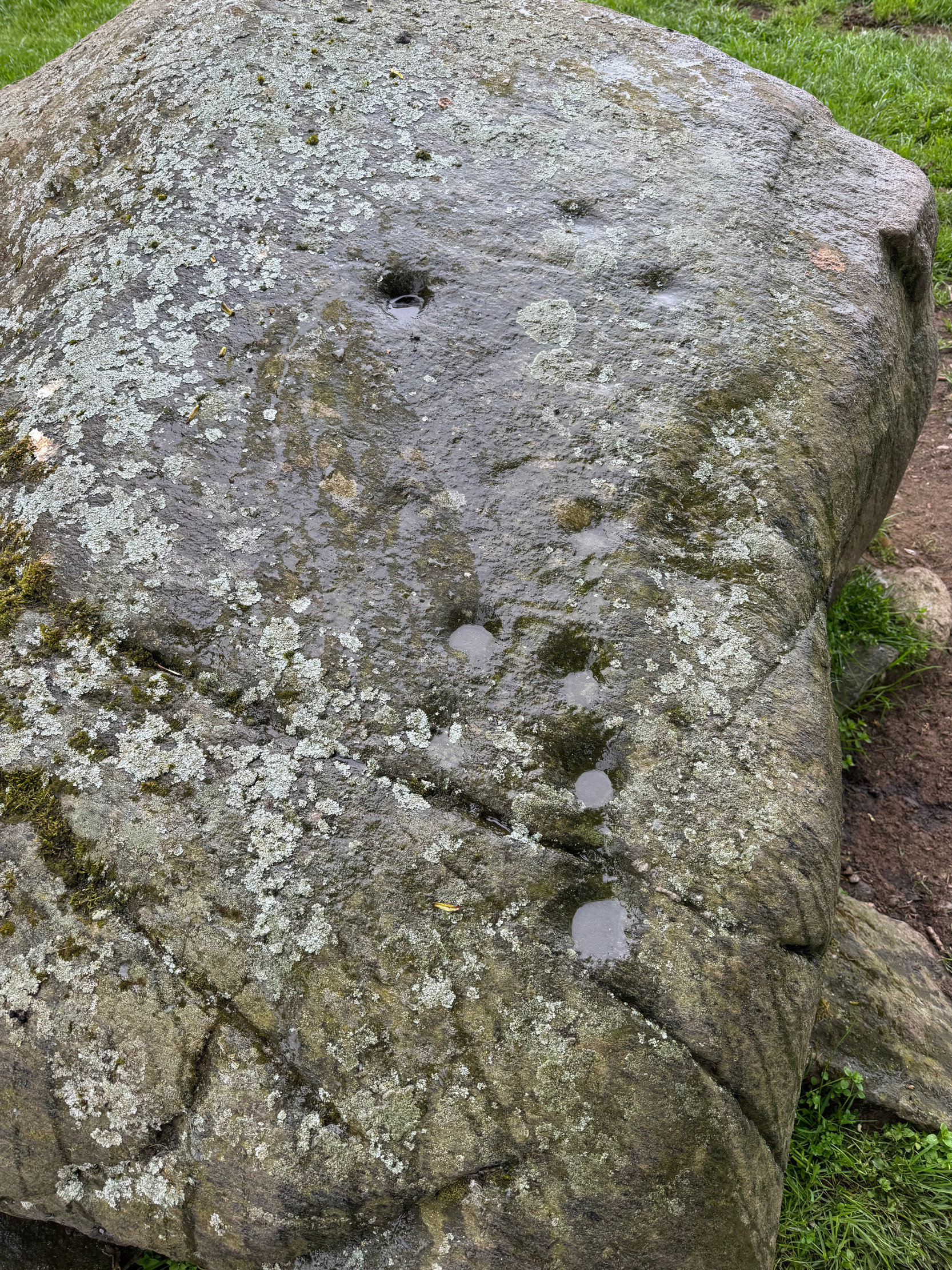
The Clach na Croiche also has its own cup-markings, just above the bottom of the stone on its southern-face. Margaret Stewart described them as being “strung out irregularly across the face.” Sounds about right! Sadly, somehow, I didn’t get any photos of these when I last visited, but will grab some the next time I’m there.
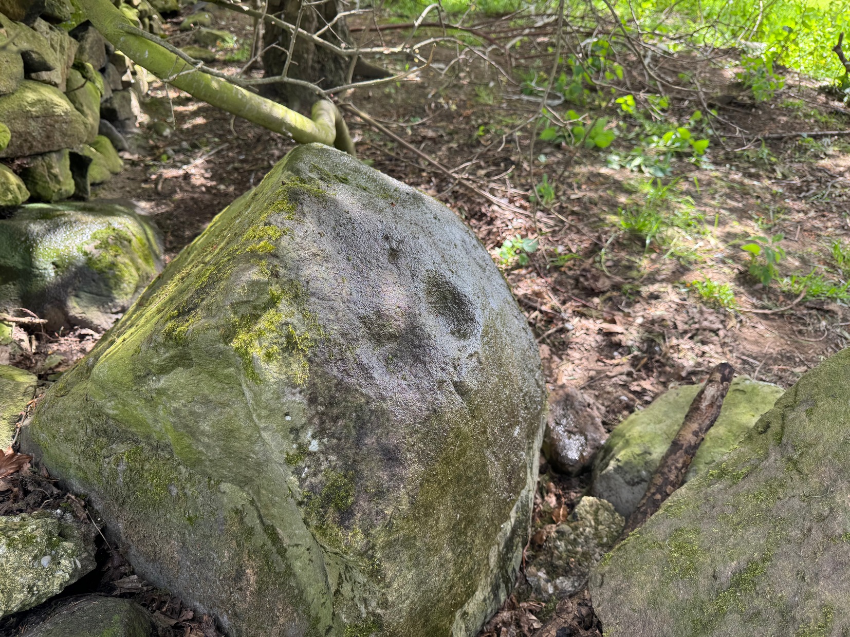
In the fields either side of the stones, ancient tombs have been found. Around 1887, the Duke of Atholl dug under some of the stones in the field and found a “cup” or urn which Coles reported “was found in a cist in the haugh near Tom-na-Croiche.” Then, in 1969, the farmer John MacBeth was ploughing the field and unearthed another cist some 15 yards north-west of the present upright. The base of the cist was cobbled and whilst whilst the tomb itself was filled-in, the farmer moved the covering stone to the fence at the west-side of the field (NN 9455 5205). Also, on the eastern side of the field in 1971, Stewart reported finding what she thought were the remains of cremated bones that seemed to have been part of another prehistoric structure.
Nearly 250 yards to the west of the stone, in the adjacent field, a huge prehistoric cairn—known as the Sketewan Cairn—was uncovered and fully excavated in the late 1980s. It originally stood some four feet high and was nearly seventy feet across. Within the cairn complex, a small standing stone accompanied some cremations. Unfortunately this entire archaeological site has since been completely covered over. You wouldn’t even know it was there if you stood right next to it! But if you want to see Balnaguard’s remaining tombs, head for the Fairy Mound right in the heart of the village…
References:
- Coles, Fred, “Report on Stone Circles Surveyed in Perthshire – North Eastern Section,” in Proceedings Society Antiquaries Scotland, volume 42, 1908.
- Dixon, John H., Pitlochry, Past and Present, L. Mackay: Pitlochry 1925.
- Kennedy, James, Folklore and Reminiscences of Strathtay and Grandtully, Munro Press: Perth 1927.
- Omand, Donald (ed.), The Perthshire Book, Birlinn: Edinburgh 1999.
- Stevenson, J., “Prehistory,” in Omand’s The Perthshire Book, Edinburgh 1999.
- Stewart, Margaret E.C., “Perthshire: Balnaguard”, in Discovery & Excavation in Scotland, 1971.
- Swarbrick, Olaf, A Gazetteer of Prehistoric Standing Stones in Great Britain, BAR: Oxford 2012.
- Yellowlees, Sonia, Cupmarked Stones in Strathtay, Scotland Magazine: Edinburgh 2004.
Acknowledgements: Huge thanks for use of the Ordnance Survey map in this site profile, reproduced with the kind permission of the National Library of Scotland.
© Paul Bennett, The Northern Antiquarian