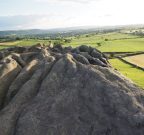
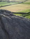
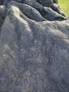
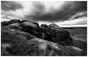
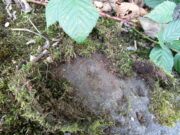
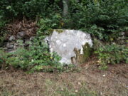
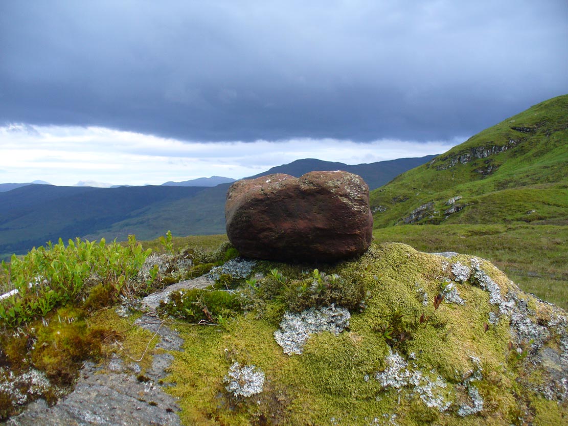
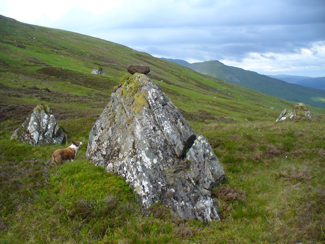
Little Almscliffe Crags, Stainburn, North Yorkshire

Legendary Rocks:  OS Grid Reference – SE 23237 52275

Also Known as:

  1. Little Almes Cliffe
  2. Little Almias Cliff Crag

Getting Here

Little Almscliffe Crag (photo – James Elkington)

Coming from Harrogate, take the B6162 and B6161 road to Beckwithshaw, through the village and, 4-500 yards on, turn right onto Norwood Lane.  2 miles along, keep your eyes peeled on your left for a gravelled parking spot and you’ll see the large rock outcrop 200 yards south of the road. …Otherwise, from Otley: go over the river bridge and turn right up Farnley Lane and follow the B6451 for a few miles, thru Farnley village up the Washburn valley, past Norwood and at Bland Hill, turn right along Broad Dubb Road for 1¾ miles where you’ll reach that same gravelled parking spot.

Archaeology & History

Very much the ‘little brother’ of Great Almscliffe, 3 miles (4.83km) to the southeast, this site would be more of interest to the travelling geologist, perhaps, than to antiquarians.  But that depends what tickles y’ fancy I s’ppose.

In 1702 when the northern antiquarian Ralph Thoresby mentioned this and its big brother to the southeast, he described the “two famous crags of Almes Cliff—in some old writings called Aylmoys ut dicitur—but have seen nothing memorial of it, saving its remarkable lofty situation.”  He missed the cup-and-ring carving on the east-side of the crags, obviously, which indicates that it had some form of animistic sanctity in ancient times.

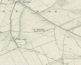
The location on 1851 map
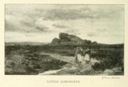
Little Almscliffe c.1900

Little Almscliffe was one of many impressive places located within the ancient Forest of Knaresborough; and although it wasn’t on the original boundary line, a perambulation (i.e., annual ritual walking to the old stones, trees and wells defining the region) of the area written in 1770, in what Mr Grainge called “the Copyhold Forest”, was undertaken by the Enclosure Commissioners.  It differed from the more ancient perambulation rite, in that the newer one included a mention of,

“five bounder stones also marked F to an earth-fast stone, lying northeast of Little Almes Cliffe, marked also with an F; (and) from thence by other four bounder stones marked F to Sandwith Wath…”

The letter ‘F’ here signifying the word ‘forest’, as in the Forest of Knareborough.

William Grainge (1871) also believed these crags to have been a place of druidic worship.  He wasn’t the only one.  Many other writers of the time thought the same thing; and although we have no concrete evidence to prove this, it is highly likely that these rocks would have served some ritual purpose in pre-christian days.  Certainly in more recent times (during the 1980s and ’90s) we know that ritual magickians used this site for their workings.  On a more mundane level, the crags were previously used as a site for for beacon fires.  One was erected here in 1803 when the first Bonaparte threatened to invade England; but I can find no written accounts of earlier beacons here.

References:

  1. Bennett, Paul, The Old Stones of Elmet, Capall Bann: Milverton 2001.
  2. Bogg, Edmund, From Eden Vale to the Plains of York, James Miles: Leeds 1895.
  3. Bogg, Edmund, Higher Wharfeland, James Miles: Leeds 1904
  4. Cowling, E.T., Rombald’s Way, William Walker: Otley 1946.
  5. Grainge, William, History & Topography of Harrogate and the Forest of Knaresborough, J.R. Smith: London 1871.
  6. Parkinson, Thomas, Lays and Leaves of the Forest, Kent & Co.: London 1882.

© Paul BennettThe Northern Antiquarian 

Altar Stone, Stobo, Peeblesshire

Legendary Stone:  OS Grid Reference – NT 15710 35754

Also Known as:

  1. Arthur’s Stane

Getting Here

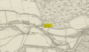
Altar Stone on 1859 map

Various ways to get here.  From Peebles take the A72 road west to Kirkurd, but after 4 miles turn left onto B712.  Several miles down, go past Stobo village and before crossing the bridge over  the River Tweed, turn left up minor road leading to Dreva and Broughton.  The track into Altarstone Farm is about a mile along and the stone is across the road from there.  The other way is going south along the A701 from Broughton village, where you take the left turn towards Stobo.  Go along here for just over 3 miles where you reach the woodland (park here where the small track goes into the woods).  A coupla hundred yards further along is Altar Stone Farm on your right and the stone is above the verge on your left.

Archaeology & History

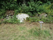
Altar Stone, Stobo

Archaeologically speaking, there’s nowt much to say about this site apart from the usual tedium of its measurements and the rock-type.  I’ll give the latter a miss, but the stone stands at nearly five feet high and nearly as broad; with its upper face relatively smooth and the top of it pretty flat.  A section from the top of this stone was cut and sliced off a few centuries ago and this was said to have been taken to Stobo church a few miles away, where it was fashioned into a stone font for baptisms.  If this is true, then it’s possible that this was once an authentic prehistoric standing stone, but we’ll probably never know for certain.  Also on top of the stone you can see a number of geophysical scratches, one of which looks as if it may have been worked by human hands and which has some relevance to the folklore of the stone.

It is shown on the 1859 OS-map of the area and was mentioned in the Ordnance Name Book where they told how it was “supposed to have formed the Altar of a druids Temple or some such object,” but they could find no local verification of such lore at the time of their visit… or at least, no one was telling them anything about it…

Folklore

This fascinating bit of rock—or possible sliced standing stone—is of note due to its association with that old shaman of shamans known as Merlin!  Near the end of His days, when He’d truly retired from the world of men and wandered, they say, mad amidst the great lowland forests, an old christian dood by the name of Kentigern—later known as St Mungo—who’d been trying to convert our old magickian away from the animistic ways of Nature.  Legend says that He succeeded.  The old Scottish traveller Ratcliffe Barnett (1925) wrote:

“Merlin is the real genius of Drumelzier.  Dumelzier means the Ridge of Meldred, a pagan prince of the district.  And it was Meldred’s shepherds that slew Merlin the bard.  The heathen bard was present at the battle of Arthuret in the year 573, when the christian army gained a victory over the Heathen Host.  Merlin fled to the forest of Caledon at Drumelzier and there ever after the old Druid spent his life among the wild hills with a repute for insanity.  This poet priest was doubtless heart-broken at the defeat of his pagan friends.  The old order was changing.  But the christian king had brought his friend, St Kentigern or Munro, to preach the gospel in upper Tweedside at Stobo.  One day Kentigern met a weird-looking man and demanded who he was.  “Once I was the prophet of Vortigern (Gwendollen).  My name is Merlin.  Now I am in these solitudes enduring many privations.”

“So Kentigern preached the gospel to the old nature worshipper and won him to Christ.  Up yonder, at the east end of the Dreva road, you will find the rude Altar Stone where, it is said, Kentigern received the Druid into the christian church and dispensed the sacrament.  But in those dark days of the faith, the Druids and their pagan adherents fought hard against the new religion.  So immediately after the admission of Merlin to the Church, the shepherds of Meldred sought him out, stoned him to death on the haugh of Drumelzier, and there, where the Powsail Burn falls quietly into Tweed, Merlin the Martyr was buried.  For long his grave was marked by a hawthorn tree.”

These shepherds were said to have stoned him and then threw his body upon a sharp stake and then into the stream. (stone – wood – water)

If there is any hint of truth in this tale, it is unlikely Merlin would have given himself over to the christian ways unless—as any shaman would—he knew of his impending death.  In which case it would have done him no harm to pretend a final allegiance to the unnatural spirituality that was growing in the land.  But whatever he may have been thinking, it is said that this Altar Stone was where he made such a deed.

Scratch-marks of the mythic hare
Altar Stone, Stobo

An equally peculiar legend—variations of which are found at a number of places in the hills of northern England and Scotland—speaks of another shamanic motif, i.e., of humans changing into animals and back.  For here, legend tells, an old witch was being chased (by whom, we know not) across the land.  She’d turned herself into the form of a hare and, as she crossed over the Altar Stone, her claws dug so deeply into the rock that they left deep scars that can still be seen to this day.  From here, the hare scampered at speed downhill until reaching the River Tweed at the bottom, whereupon transforming itself back into the form of the witch, who promptly fled into the hills above on the far side of the river.

One final thing mentioned by Barnett (1943) was the potential oracular property of the Altar Stone:

“You have to only place your hand on top of this rude altar, shut your eyes, and if you have the gift you will see visions.”

References:

  1. Ardrey, Adam, Finding Merlin, Mainstream 2012.
  2. Barnett, Ratcliffe, Border By-Ways and Lothian Lore, John Grant: Edinburgh 1925.
  3. Buchan, J.W. & Paton, H., A History of Peeblesshire – volume 3, Glasgow 1927.
  4. Crichton, Robin, On the Trail of Merlin in a Dark Age, R. Crichton 2017.
  5. Glennie, John Stuart, Arthurian Localities, Edmonston & Douglas: Edinburgh 1869.
  6. Moffat, Alistair, Arthur and the Lost Kingdoms, Phoenix: London 1999.
  7. Rich, Deike & Begg, Ean, On the Trail of Merlin, Aquarian: London 1991.
  8. Wheatley, Henry B., Merlin, or, The Early History of King Arthur – 2 volumes, Trubner: London 1865.

Acknowledgements:  Big thanks for use of the 1st edition OS-map in this site profile, Reproduced with the kind permission of the National Library of Scotland

© Paul BennettThe Northern Antiquarian

Little Almscliffe, Stainburn, North Yorkshire

Cup-and-Ring Stone:  OS Grid Reference – SE 23242 52260

Also Known as:

  1. Little Almes Cliffe
  2. Little Almias Cliff Crag

Archaeology & History

Little Almscliffe Crag (photo by James Elkington)

The crags of Little Almscliffe are today peppered with many modern carvings, such as are found on many of our northern rock outcrops.  Yet upon its vertical eastern face is a much more ancient petroglyph – and one that seems to have been rediscovered in the middle of the 20th century.  When the great northern antiquarian William Grainge (1871) visited and wrote of this place, he told us that, “the top of the main rock bears…rock basins and channels, which point it out as having been a cairn or fire-station in the Druidic days; there are also two pyramidal rocks with indented and fluted summits on the western side of the large rock” – but he said nothing of any prehistoric carvings. Curiously , neither the great historian Harry Speight or Edmund Bogg saw anything here either.

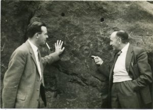
Stuart Feather & Joe Davies here, c.1955
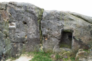
Cup&Ring, left of ‘door’ (photo by James Elkington)

This singular cup-and-ring design seems to have been reported first in E.S. Wood’s (1952) lengthy essay on the prehistory of Nidderdale. It was visited subsequently by the lads from Bradford’s Cartwight Hall Archaeology Group a few years later; and in the old photo here (right) you can see our northern petroglyph explorer Stuart Feather (with the pipe) and Joe Davis looking at the design.  In more recent times, Boughey & Vickerman (2003) added it in their survey of, telling briefly as usual:

“On sheltered E face of main crag above a cut-out hollow like a doorway is a cup with a ring; the top surface of the rock is very weathered and may have had carvings, including a cupless ring.”

Close up of design

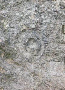
Indeed… although the carving is to the left-side of the large hollow and not above it.  Scattered across the topmost sections of the Little Almscliffe themselves are a number of weather-worn cups and bowls, some of which may have authentic Bronze age pedigree, but the erosion has taken its toll on them and it’s difficult to say with any certainty these days.  But it’s important to remember that even Nature’s ‘bowls’ on rocks was deemed to have importance in traditional cultures: the most common motif being that rain-water gathered in them possessed curative properties.

References:

  1. Bennett, Paul, The Old Stones of Elmet, Capall Bann: Milverton 2001.
  2. Bogg, Edmund, From Eden Vale to the Plains of York, James Miles: Leeds 1895.
  3. Bogg, Edmund, Higher Wharfeland, James Miles: Leeds 1904
  4. Cowling, E.T., Rombald’s Way, William Walker: Otley 1946.
  5. Grainge, William, History & Topography of Harrogate and the Forest of Knaresborough, J.R. Smith: London 1871.
  6. Parkinson, Thomas, Lays and Leaves of the Forest, Kent & Co.: London 1882.

Acknowledgements:  Huge thanks to James Elkington for use of his fine photos on this site.

© Paul BennettThe Northern Antiquarian

St. Bride’s Well, London, Middlesex

Holy Well (covered):  OS Grid Reference – TQ 3157 8111

Archaeology & History

St Brides Well on 1896 map

Close to the centre of that corporate money-laundering place of homo-profanus that is the City of London, was once a site that represents the antithesis of what it has become.  Tacked onto the southeastern side of St. Bride’s church along the appropriately-named Bride Lane, the historian Michael Harrison (1971) thought the Holy Well here had Roman origins.  It “was almost certainly,” he thought,

“in Roman times, the horrea Braduales, named after the man who probably ordered their construction: Marcus Appius Bradua, Legate of Britain under Hadrian, and the British Governer in whose term of office the total walling of London was, in all likelihood, begun.”

This ‘Roman marketplace of Bradua’ that Harrison describes isn’t the general idea of the place though.  Prior to the church being built, in the times of King John and Henry III, the sovereigns of England were lodged at the Bridewell Palace, as it was known.  Mentioned in John Stow’s (1720) Survey of London, he told:

“This house of St. Bride’s of later time, being left, and not used by the Kings, fell to ruin… and only a fayre well remained here.”

The palace was eventually usurped by the building of St. Bride’s church.  The most detailed account we have of St. Bride’s Well is Alfred Foord’s (1910) magnum opus on London’s water supplies.  He told:

“The well was near the church dedicated to St. Bridget (of which Bride is a corruption; a Scottish or Irish saint who flourished in the 6th century), and was one of the holy wells or springs so numerous in London, the waters of which were supposed to possess peculiar virtues if taken at particular times.  Whether the Well of St. Bride was so called after the church, or whether, being already there, it gave its name to it, is uncertain, more especially as the date of the erection of the first church of St. Bride is not known and no mention of it has been discovered prior to the year 1222.  The position of the ancient well is said to have been identical with that of the pump in a niche in the eastern wall of the churchyard overhanging Bride Lane.  William Hone, in his Every-Day Book for 1831, thus relates how the well became exhausted: ‘The last public use of the water of St. Bride’s well drained it so much that the inhabitants of the parish could not get their usual supply.  This exhaustion was caused by a sudden demand on the occasion of King George IV being crowned at Westminster in July 1821.  Mr Walker, of the hotel No.10 Bridge Street, Blackfriars, engaged a number of men in filling thousands of bottles with the sanctified fluid from the cast-iron pump over St. Bride’s Well, in Bride Lane.”  Beyond this there is little else to tell about the well itself, but the spot is hallowed by the poet Milton, who, as his nephew, Edward Philips records, lodged in the churchyard on his return from Italy, about August 1640, “at the house of one Russel a taylor.”

In Mr Sunderland’s (1915) survey, he reported that “the spring had a sweet flavour.”

Sadly the waters here have long since been covered over.  A pity… We know how allergic the city-minds of officials in London are to Nature (especially fresh water springs), but it would be good if they could restore this sacred water site and bring it back to life.

Folklore

Bride or Brigit has her origins in early British myth and legend, primarily from Scotland and Ireland.  Her saint’s day is February 1, or the heathen Imbolc (also known as Candlemas).  Although in christian lore St. Bride was born around 450 AD in Ireland and her father a Prince of Ulster, legend tells that her step-father (more probably a teacher) was a druid and her ‘saintly’ abilities as they were later described are simply attributes from this shamanic pantheon. Legends—christian and otherwise—describe Her as the friend of animals; possessor of a magickal cloak; a magickian and a healer; and whose ‘spirit’ or genius loci became attached to ‘sacred sites’ in the natural world, not the christian renunciation of it.  St Bride was one of the primal faces of the great prima Materknown as the Cailleach: the Gaelic deity of Earth’s natural cycles, whose changing seasons would also alter her names, faces and clothes, as Her body moved annually through the rhythms of the year.  Bride was (and is) ostensibly an ecological deity, with humans intrinsically a part of such a model, not a part from it, in contrast to the flawed judaeo-christian theology.

References:

  1. Foord, Alfred Stanley, Springs, Streams and Spas of London: History and Association, T. Fisher Unwin: London 1910.
  2. Gregory, Lady, A Book of Saints and Wonders, Colin Smythe: Gerrards Cross 1971.
  3. Harrison, Michael, The London that was Rome, Allen & Unwin: London 1971.
  4. McNeill, F. Marian, The Silver Bough – volume 2, William MacLellan: Glasgow 1959.
  5. Morgan, Dewi, St Bride’s Church, Fleet Street, in the City of London, Blackfriars: Leicester 1973.
  6. o’ Hanlon, John, Life of St. Brigid, Joseph Dollard: Dublin 1877.
  7. Sunderland, Septimus, Old London Spas, Baths and Wells, John Bale: London 1915.

© Paul BennettThe Northern Antiquarian


Jim Craven’s Well, Thornton, West Yorkshire

Sacred Well:  OS Grid Reference — SE 0967 3251?

Archaeology & History

Is this the site of the lost Jim Cravens Well on the 1852 map?

Another well with considerable supernatural renown was this little-known site near the old village of Thornton, on the western outskirts of Bradford.  We’re not 100% sure about its exact location, but the grid-reference cited here is of an old ‘Well’ that was highlighted on the first Ordnance Survey map of the region, at the end of solitary path which led to it and nowhere else.  Our only documentary information comes from Elizabeth’s Southwart’s (1932) fine old book on the folk life of the old village, as it once was.  At a place once known as Bent Ing Bottom, just south of the old village, is where it used to be known.  The name of this Well is also curious, as no historian has yet worked out who the ‘Jim Craven’ was, nor what his relationship to the site might have been.  It’s the folklore of it, however, which brings it the attention it deserves.

Folklore

In Elizabeth Southwart’s (1923) work, she told us that the place once known as “Bent Ing Bottoms have lost their romance.” She continued:

“Whether the golfers have driven it away—for the fields now form part of the Thornton Golf Links—or whether the advance of modernity in other forms is to blame, it is difficult to say.  Once they were the haunts of “Peggy-Wi-T’-Lantern” and the Bloody-tongue.  Peggy, a dame in a white mob cap, kilted skirt and white stockings, walked about with a lantern, enticing the unwary traveller to his doom.  She was given to wandering, for, they say, Jim Craven Well, half a mile away, was a place to be avoided after nightfall.

“The Bloody-tongue was a great dog, with staring red eyes, a tail as big as the branch of a tree, and a lolling tongue that dripped blood.  When he drank from the beck (known as the Pinch Beck, PB) the water ran red right past the bridge, and away down—down—nearly to Bradford town.  As soon as it was quite dark he would lope up the narrow flagged causeway to the cottage at the top of Bent Ing on the north side, give one deep bark, then the woman who lived there would come out and feed him.  What he ate we never knew, but I can bear testimony to the delicious taste of the toffee she made.

“When the dark was coming we used to sit on the filled-in pit, which makes a hump in the middle of the field, and wait for him.  The sun would sink redly, through the arches of the viaduct, the trees that lined the beck would grow an ever darker green until they became black, the beck would begin to gurgle and gulp in a queer way; and down in the hollow we would hear a whimper, a whine, a moan, a snarl.  Then, with scalps and spines playing queer tricks, we would wait and wait.  But none of our little band ever saw him, except one girl, and she saw him every time.

“One Saturday a girl who lived at Headley came to a birthday party in the village, and was persuaded to stay to the end by her friends, who promised to see her ‘a-gaiterds’ if she would.  As soon as the party was over the brave little group started out.  But when they reached the end of the passage which leads to the fields, and gazed into the black well, at the bottom of which lurked the Bloody-tongue, one of them suggested that Mary should go alone, and they would wait there to see if anything happened to her.

“Mary was reluctant, but had no choice in the matter, for go home she must.  They waited, according to promise, listening to her footsteps on the path, and occasionally shouting into the darkness:

““Are you all right, Mary?”

““Ay!” would come the response.

“And well was it for Mary that the Gytrash had business elsewhere that night, for her friends confess now that at the first sound of a scream they would have fled back to lights and home.

“We wonder sometimes if the Booody-tongue were not better than his reputation, for he lived there many years and there was never a single case known of man, woman or child who got a bite from his teeth, or a scratch from his claws.  Now he is gone, nobody knows whither, though there have been rumours that he has been seen wandering disconsolately along Egypt Road, whimpering quietly to himself, creeping into the shadows when a human being approached, and, when a lantern was flashed on him, giving one sad, reproachful glance from his red eyes before he vanished from sight.”

Southwart later tells us that the ghostly dog travelled into the north and vanished.  From the description she gives of the children walking their friend to “the end of the passage which leads to the fields, and gazed into the black well, at the bottom of which lurked the Bloody-tongue,” I can only surmise that the solitary well shown on the very first OS-map of Thornton at the coordinate given above is the place in question.

The ‘Bloody Tongue’ is first mentioned in Yorkshire folklore, I think, by Roger Storrs, in his article on holy wells in 1888, where he tells it to be one of the mysterious beings that live, usually at the bottom of the waters and almost universally used “to deter children from playing in dangerous proximity to a well.”

From the description of the waters turning red when the ghostly dog drank from it, we have a mythic account of when the waters occasionally turned red from the iron-bearing waters (chalybeate) which, obviously, wasn’t like this at all times.  Whether this was a sporadic, unpredictable flow of iron in the waters, or a cyclical pattern of the water-flows, we are not told (which would imply, moreso, that it was sporadic).  The folklore about this ghost and its appearance with another elemental creature along an old straight track running north from Upper Headley Hall to Thornton is intriguing—as in many old pre-christian traditions, North is the airt, or direction, representing Death; and black dogs are traditionally guardians of underworld treasures in the land of the Dead.  With the plethora of other animistic folktales once known in this district (boggarts or goblins were known in nearby woods, wells and farms) it is likely that the origin of such folklore dates way back into antiquity.

References:

  1. Bennett, Paul, Ancient and Holy Wells of West Yorkshire, forthcoming
  2. Southwart, Elizabeth, Bronte Moors and Villages: From Thornton to Haworth, John Lane Bodley Head: London 1923.
  3. Storrs, Roger, ‘Legends and Traditions of Wells,’ in Yorkshire Folk-lore Journal – volume 1 (ed. J. Horsfall Turner) 1888.

© Paul BennettThe Northern Antiquarian


Pitcur Souterrain (3), Kettins, Perthshire

Souterrain:  OS Grid Reference – NO 2529 3738

Also Known as:

  1. Canmore ID 30539
  2. The Cave
  3. Pitcur II (Wainwright)

Getting Here

Pitcur souterrain entrance

From Coupar Angus, take the A923 road southeast for nearly 2½ miles where you reach the crossroads.  Keeping walking along the A923 for just over 300 yards, then where you come to the second field on your left, follow the line of fencing the slope until you reach an overgrown fenced section.  It’s in there!

Archaeology & History

This is a mightily impressive site, which I’ve been looking forward to experience for many an age.  And—despite Nature covering it in deep grasses—it was even better than any of us anticipated.  Souterrains are ten-a-penny in this part of Scotland, but this one’s a beauty!  Here, dug 6-8 feet into the ground are at least two long curvaceous passageways, linked by another stone-roofed passageway—with the longest central passage leading at one end into a completely covered stone hallway, whose end is blocked by a massive fall of earth.  Outside this entrance, laid on the ground, is what looks like a possible old stone ‘door’ that may have once blocked the entrance, now fallen into disuse.  It is too small to have been a roofing stone.  In the walling just outside the entrance, on your left, you will see a faint cup-marked stone (Pitcur 3:5) and a larger cup-and-ring stone (Pitcur 3:6), both just above ground-level.
Inside looking out (photo by Frank Mercer)

Outside looking in (photo by Frank Mercer)

The site is evocative on so many levels: not least because we still don’t know what the hell it was used for.  The over-used idea that souterrains were cattle-pens makes no sense whatsoever here; the idea that they were food storage sites is, I suppose, a possibility; that they were possible shelters for people during inter-tribal raids is another; and equally as probable is that the deep dark enclosed construction was used by shamans, or neophytes enclosed for their rites of passage.  Iron Age archaeology specialist Ian Armit (1998) thought there may well be some as yet undiscovered “timber roundhouse” associated with this souterrain, awaiting excavation.  He may be right.  When we came here the other week we found previously unrecorded cup-and-ring carvings, at a site already renowned for decent petroglyphs.  A post-winter visit will hopefully bring us more finds.

The general history of this strange site is captured in Wainwright’s (1963) survey of souterrains, in which he wrote:

“Pitcur II was discovered in 1878 when a large stone, hit by a plough, was removed to reveal an underground passage.  Mr John Granger, tenant of Pitcur farm, excavated the souterrain himself, and twenty-two years later his son, Mr A. Granger Heiton, said that the only objects found by members of his family were ‘a small red clay bowl of Samian ware in pieces’ and ‘a Roman coin.’  The latter, according to David MacRitchie, ‘has been lost sight of’.  Mr Granger Heiton also told McRitchie that ‘one or two other coins were reported as having been found’, but were not seen by his father.

“As an excavation, Mr Granger’s effort seems to have been unsatisfactory by any standards, and it was followed by a ‘supplementary excavation’ conducted by Mr R. Stewart Menzies.  This was more successful as a relic-hunting operation, if not as an archaeological excavation, for between one hundred and two hundred finds are reported, including ‘a bronze pin’ and ‘a quantity of stones, beads, etc.’  But these too ‘seem to have been mislaid.’
Newly-found Pitcur 3:2 carving

Curiously Mr Wainwright made little mention of the impressive petroglyphs within this complex, save to say that “they were too heavy to be removed and ‘mislaid’.”  There are at least seven of them at Pitcur-3: four complex cup-and-ring designs and three basic cup-marked stones (described individually in separate site-profiles).  They have all been incorporated into the walls and roofing stones. At least one of these is so eroded (Pitcur 3:2) that there is little doubt it was re-used from a now-lost neolithic structure; the rest may have been from Bronze Age sites (also lost) and their respective lack of erosion shows they have been inside this Iron Age structure, away from Nature’s wind and weathering effects. It is likely that the re-use of these carvings in Pitcur-3 was of significance to the builders; although we cannot be sure as to what their function may have been within the souterrain.  It’s quite possible that some form of ‘continuity of tradition’ as posited by David MacRitchie (1890) was in evidence, over that huge time scale from the neolithic into the Iron Age, relating specifically to the animistic plinth implicit in all early agrarian cultures.

But the first real overview of the site was written at the end of the 19th century by David MacRitchie (1900), over twenty years after its rediscovery in 1878.  His account was a good one too:

“The Pitcur house consists of one long subterranean gallery, slightly curved throughout most of its length, and bending abruptly in a hook shape at its western end. From this western end a short broad gallery or room goes off, curving round the outside of the ‘hook.’ The length of the main gallery, following the medial line, and measuring from the extreme of the entrance at either end, is almost 190 feet; while the subsidiary room is 60 feet long. For most of its length, this subsidiary room is 10 feet wide, measuring at the floor level. On account of this unusual width, it is reasonable to suppose that its roof was of timber; for although the walls slightly converge at the top, reducing the intervening space to 8 or 9 feet, the span is still so great that a flagged roof would scarcely have been practicable. To be sure, the walls might have been raised several courses higher, in the usual ‘ Cyclopean arch,’ and thus the interval to be bridged would become sufficiently narrowed at a height of say 12 feet. But there is no indication that the walls of any portion of this earth-house ever rose higher than the present level of their highest parts. Thus the inference is that this subsidiary room may have been roofed with timber.”

Modern groundplan (after RCAHMS, 1994)

MacRitchie’s 1900 groundplan

It may, but we have no remaining evidence to tell us for sure. MacRitchie cited possible evidences from elsewhere to add weight to this thought, but had the humility to leave the idea open, telling simply how “no vestige of a roof is visible at the present day, and the whole of this side room is open to the sky,” as with the majority of this entire souterrain.  In my opinion, more of it would have been roofed in stone slabs, but these would seem to have been robbed.  Certainly a well-preserved cup-marked stone (Pitcur 3:3) laying up against one of the walls appears to have slid from its topmost covering position into where it now rests in the passageway (near ‘b‘ in MacRitchie’s plan).

Continuing with Mr MacRitchie’s account, he (like most of us) found the underground section most impressive, telling:

“This covered section is unquestionably the most interesting and instructive of the whole building; for, as already stated, the other parts are more or less ruined and roofless. A few remaining flags lying in the unroofed part of the main gallery show, however, that it once possessed the usual stone roof throughout its entire length. This was rendered possible by the comparative narrowness of the main gallery, the width of which on the floor averages about 6 feet. The greater breadth of the subsidiary gallery will be realised by glancing at the cross section, a-b in the plan.

“The Pitcur earth-house had at least three separate entrances, namely, at the points hi, and j.  The subsidiary room appears also to have had an independent connection with the, outside world, at the point g, and perhaps also f, though the latter may only mark a fireplace or air-hole, for the condition of the ruin makes it difficult for one to speak with certainty. The entrance at i, which slopes rapidly downward, is roofed all the way to d; and consequently this short passage remains in its original state.

“Within the covered portion, and quite near its entrance, a well-built recess (e in the plan) seems clearly to have been used as a fireplace, although the orifice which presumably once connected it with the upper air is now covered over.  Another and a smaller recess in the covered portion (k in the plan) can hardly have been a fireplace, and it is difficult to know what it was used as.

“One other point of interest is the presence of two cup-marked stones (p and q on the plan). Of these, the former is lying isolated on the surface of the ground near the entrance i, while the latter forms one of the wall stones beside the doorway c.”
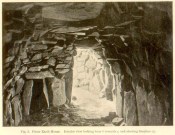
‘Fireplace’ near the entrance

The internal ‘cave’ section has that typical damp smell and feel to it, beloved of underground explorers.  As we can see in MacRitchie’s old photo of the site, the seeming ‘fireplace’ that he mentions is very obvious. Frank Mercer posited the same idea about this underground alcove when he first saw it, and it makes a lot of sense.  On the left-upright stone in the photo (right) you can just make out a single cup-marking (Pitcur 3:7) which we found when we visited; another one may be on the inside edge of the same fireplace.  If you climb up on top of the souterrain close to where the opening of the fireplace would have been, you’ll see the impressive Pitcur 3:5 petroglyph; whilst the Pitcur 3:1 carving is difficult to see (though Mr Mercer noticed it), just above ground-level, beneath the covering stone ‘m‘ in MacRitchie’s plan.  All in all, a bloody impressive place!

Folklore

In earlier centuries the site was known locally as The Cave, yet considering how impressive it is, folklore and oral tradition seem sparse.  Even David MacRitchie (1897) struggled to find anything here.  But in one short article he wrote for The Reliquary, he thought that stories of little-people may have related to Pitcur-3:

“A tradition which a family of that neighbourhood has preserved for the past two centuries, has, in the opinion of the present writer, a distinct bearing upon the “cave” and its builders.

“This is that, a long time ago, a community of “clever” little people, known as “the merry elfins,” inhabited a “tounie,” or village, close to the place. The present inheritors of the tradition assume that they lived above ground and do not connect them at all with this “cave,” of whose existence they were unaware until a comparatively recent date. But, in view of a mass of folk-lore ascribing to such “little people” an underground life, the presumption is that the “tounie” was nothing else than the “cave”. This theme cannot be enlarged upon here; but a study of the traditions relating to the inhabitants of those subterranean houses will make the identification clearer.

“It may be added that the term “Picts’ house” applied to the Pitcur souterrain, is in agreement with the inherited belief, so widespread in Scotland, that the Picts were a people of immense bodily strength, although of small stature.”

References:

  1. Armit, Ian, Scotland’s Hidden History, Tempus: Stroud 1998.
  2. Barclay, Gordon, “Newmill and the ‘Souterrains of Southern Pictland’”, in Proceedings Society of Antiquaries, Scotland, volume 110, 1980.
  3. Mackenna, F.S., “Recovery of an Earth House”, in The Kist, volume 4, 1972.
  4. Mackie, Euan, Scotland: An Archaeologial Guide, Faber: London 1975.
  5. MacRitchie, David, The Testimony of Tradition, Kegan Paul: London 1890.
  6. MacRitchie, David, “Pitcur and its Merry Elfins,” in The Reliquary, 1897.
  7. MacRitchie, David, “Description of an Earth-house at Pitcur, Forfarshire,” inProceedings Society of Antiquaries, Scotland, volume 34, 1900.
  8. Neighbour, T., “Pitcur Souterrain (Kettins parish)”, in Discovery & Excavation Scotland, 1995.
  9. Royal Commission on the Ancient & Historical Monuments of Scotland, South-East Perth: An Archaeological Landscape, HMSO: Edinburgh 1994.
  10. Wainwright, F T., The Souterrains of Southern Pictland, RKP: London 1963.
  11. Warden, Alex J., Angus or Forfarshire: The Land and People – Descriptive and Historical – 5 volumes, Charles Alexander: Dundee 1880-1885.
  12. Young, Alison, “Cup-and ring Markings on Craig Ruenshin, with some Comparative Notes“, in Proceedings Society of Antiquaries, Scotland, volume 72, 1938.

Acknowledgements:  This site profile would not have been made possible were it not for the huge help of Nina Harris, Frank Mercer & Paul Hornby.  Huge thanks to you all, both for the excursion and use of your photos in this site profile. 🙂

© Paul BennettThe Northern Antiquarian


Overlee, Clarkston, Renfrewshire

Souterrains & Settlement (destroyed):  OS Grid Reference – NS 577 572

Also Known as:

  1. Canmore ID 43802

Archaeology & History

Overlee Farm in 1896 – no remains highlighted

This was an astonishing-sounding place, little-known beyond the pages of specialist historians.  It has been described in modern terms as simply “subterranean structures”, “weems”, or “prehistoric underground houses”; but were this site still in evidence it would be a huge attraction!  From the literary descriptions we possess, the extensive remains found and destroyed sound very much like the much-visited fogous found throughout Cornwall, or more commonly known as ‘souterrains’ in Scotland—although there’s no mention of the place in Wainwright’s (1963) singular study on such monuments.  Despite this, here, on the south-side of modern Clarkston, it seems we once had a Renfrewshire equivalent to the prehistoric Cornish village and fogous known as Carn Euny.

The first known account of this site was written by James Smith (1845) in the survey for the New Statistical Account, who thankfully gave us a reasonably lengthy account of what was once here.  He told:

“About thirty years ago, on the farm of Overlee, which lies on the north bank of the river Cart, in the south-west angle of the parish, Mr Watson, the proprietor, on removing the earth from a quarry which he wished to open, discovered a great many subterraneous houses ranged round the slope of a small swelling hill. Each house consisted of one apartment, from eight to twelve feet square. The sides, which were from four to five feet high, were faced with rough undressed stone, and the floors were neatly paved with thin flag stones which are found in the neighbourhood.  In the centre of each floor was a hole scooped out as a fire-place, in which coal-ashes still remained, and seemed to indicate that their occupiers had left the place on a sudden.  That coal and not wood or peat had been employed as fuel, seemed at first an argument against the antiquity of the houses, until it was remembered that many seams of coal crop out on the steep banks of the river in the immediate vicinity, which may have been picked out for firing by the aboriginal inhabitants, as is still done to a limited extent by a few of the poorer classes in the neighbourhood. Near the fire-places were found small heaps of water-worn pebbles, from two to three inches in diameter, the use of which it is difficult to conjecture. They may have been used as missiles for attack or defence in the rude warfare of ancient days, or more probably they served the purposes of an equally rude system of cookery, by which meat was prepared for being eaten by heated stones placed round it, as is still done in many of the South Sea islands.  The floors of the houses were covered to the depth of about a foot with a rich black vegetable mould, which was in all likelihood the decayed remains of the roofs mixed with soil filtered from the surface.  As was gathered from the different appearances of the soil, in and over them, the houses were partly excavated from the hill and partly built above ground, and a level approach to the entrances was dug out of the slope.  The number discovered amounted to forty-two, of which thirty-six formed the arc of a lower and larger circle, and the remaining six, also circularly ranged, stood a little higher up the hill.  The writer is informed that the ruins of villages of a similar description have been discovered in several parts of Scotland; and there is an account of one very much the same as the above, recorded in the third volume of the Transactions of the Antiquarian Society of Scotland.  About twelve querns or small hand-mills were found near the site of these houses, and a grave lined with stone containing a rude urn filled with ashes.  These latter relics, however, may have belonged to a still distant but less remote antiquity. The old castle of Lee or Williamwood was erected near the place, and it is not improbable that, in procuring materials for the building from the freestone, of which the hill consists, the soil, which for so many centuries concealed the remains of the village, was thrown down upon it. Several years ago, the proprietor, in clearing away the old foundations of the castle, which interfered with the rectilineal operations of the plough, found within the square which they enclosed many human bones, which he avers were of almost superhuman magnitude.

“If the natives of the village, described above, deserted their homes hastily, as may be conjectured from the fact of the fuel remaining on their hearths, it may have been in terror of the Romans—one division of whose invading army must have passed not far from the place. In a direct north-east line from this hill, without any intervening eminence, and at the distance of about two miles, there are still very distinct traces of a small Roman encampment on the summit of a hill, the name of which, from the circumstance, is Camp Hill…”

Although the modern official description of these remains is simply that of “a settlement”, the idea that some of the remains here were souterrains seems beyond doubt.  The comparison James Smith makes with remains that were found shortly afterwards that were “very much the same”, unearthed at Cairnconon—or the West Grange of Conon, as Canmore call it—northwest of Arbroath, confirms this idea.

Just over a decade after Mr Smith’s initial account, the Glaswegian historian James Pagan (1856), in his huge History of Glasgow, included another description of the place from the pseudonymous 19th century writer “J.B.”  In what were called Desultory Sketches, much of what he wrote merely echoed the original notes by Smith, but they are still worth repeating:

“Specimens of the winter houses, or weems, were to be seen, till recently, in our own district, at Cartland Craigs, near Stonebyres, on the Clyde; and one very interesting example of the pit-houses was revealed in 1808, on the farm of Overlee, near Busby, in the vicinity of Glasgow.  The following particulars regarding these were communicated to the writer of this sketch, by the parish minister of Cathcart, who had his information from an eye-witness.

“While the farmer was removing soil to get at freestone, for building a new steading, he came on a cluster of subterranean aboriginal huts. They were forty in number, and ranged round the face of the hill on which the farm-house of Overlee now stands. These huts were of the most primitive kind. They were mere semicircular pits, cut out of the hillside, with a passage to the door, also dug out of the slope, on a level with the floor, as indicated by the different colour of the soil. Each consisted of one small apartment, about twelve feet square, five feet high, and faced with stone. The floors were neatly paved with thin flag-stones, found in the neighbourhood. In the centre of each was a hole for a fireplace, in which ashes were still visible. Near the fireplace were small piles of water-worn stones, two or three inches in diameter, probably for cooking food, by placing heated stones round it, as is yet done by some of the islanders in the Pacific Twelve hand-querns of stone for grinding grain were found in the houses. At a short distance, a grave was discovered, lined with stone, and containing rude urns filled with ashes, thus indicating that the inhabitants of this primitive cluster, near what is now Glasgow, burned their dead. Unfortunately, the whole of these curious pit-houses were ruthlessly destroyed.

“In some of the weems and pit-houses, small groups of pretty oyster-shells have been found, perforated with small holes, as if they had been strung together, and formed an ornamental necklace—shall we say for the lady-savage of that distant epoch?  In others were discovered bodkins and skewers, made of horn, probably to hold together the folds of the wild beasts’ skins forming the savages’ winter covering; the bones of oxen, neatly notched, as if for ornament; bowls made of stone, the hollow having been drilled out by the circular action of another stone, sharper and harder, aided by the grit of sand (one of which is now before me); arrow-heads and lances formed of flint or bone, some of the former of which I happen to possess; —nay, swords have been found, fashioned from the bone of a large fish! Heavy oaken war-clubs, too, must not be omitted from this curious catalogue.”

Although highly unlikely, there is the remote possibility that some remains of these underground ‘houses’, or souterrains, could possibly still be unearthed hereby.  In recent years we’ve encountered a number of good farmers and land-owners who’ve told us about souterrains beneath their fields that are not in any record-books.  Intriguingly, each one asked us, “who are you working for?” – and when we’ve assured them that we have nothing to do with the ‘official’ bodies, they’ve opened up and showed us.  In one instance, a land-owner in Angus told us how he was farming the field as he’d always done, “when my tractor fell into a huge hole in the ground – and there was another souterrain!”

Why am I telling you this?  Well, if you’re a local, maybe get round to Overlee and ask around some of the olde local people.  You never know what you might find!  And we could perhaps try find more about the other souterrain which the pseudonymous ‘J.B.’ said was “at Cartland Craigs, near Stonebyres, on the Clyde.”

References:

  1. McBeath, H.D., Walks by Busby and Thorntonhall, with Historical Notes on the Area, EKDC: East Kilbride 1980.
  2. Pagan, James (ed.), Glasgow, Past and Present – volume 2, David Robertson: Glasgow 1856.
  3. Ross, William, Busby and its Neighbourhood, David Bryce: Glasgow 1883.
  4. Smith, James, “Parish of Cathcart,” in New Statistical Account of Scotland – volume 7: Renfrew, William Blackwood: Edinburgh 1845.
  5. Stuart, John, “Notice of Underground Chambers recently Excavated on the Hill of Cairn Conan, Forfarshire,” in Proceedings Society of Antiquaries, Scotland – volume 3, 1862.
  6. Wainwright, F T., The Souterrains of Southern Pictland. RKP: London 1963.

© Paul BennettThe Northern Antiquarian


Borgie Souterrain, Tongue, Sutherland

Souterrain:  OS Grid Reference –  NC 6762 5929 

Getting Here


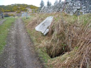
The Borgie souterrain

From Bettyhill village, take the A836 road west towards Tongue.  Several miles along the road, keep your eyes peeled for Borgie and Skerray on your right.  Go down here for half-a-mile or so until, a hundred yards or so before the Borgie Hotel, a dirt-track on your right takes you down into some trees.  As you enter the edge of the woodland, right by the trackside on your left, a large stone lays in the grass.  A few yards from this is the hole in the ground.

Archaeology & History

When I was first shown this place, I could find no previous description of it in any of the archaeological records.  I was fortunate in being taken here by one of the land-owners hereby, who told me that it had been known about locally for some years – but informing the archaeologists (patronizing as they were to the people hereby, as can be the case sometimes) was the last thing on their minds….

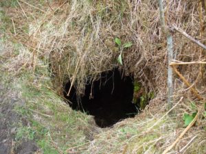
Entrance to an underworld
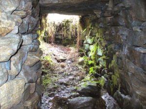
Looking out from inside

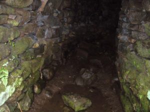
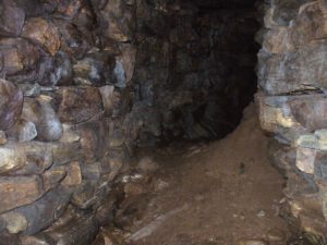
Immediately beneath the ridge where the Borgie chambered cairn once stood, the site was uncovered quite by accident when a local man went to move a large stone on the grassy embankment, to make use of it in walling or something similar.  But much to his surprise, the boulder covered the entrance to an underground chamber known as a souterrain – inside which, local lore tends to tell, the little people once stayed.  It’s an impressive structure!  When Donna Murray took me to see this a few months ago, she said it was only a few yards long – but once I’d got inside, found it to be much longer than this.  After dropping perhaps six feet down into the hollow, the very well-preserved wide chamber beneath – some 6-8 feet across – curved around to the north-northeast and into pitch blackness.  I walked perhaps ten yards into the chamber, completely upright, and as the chamber curved and went further into the Earth, the pitch black stopped me venturing more.

Looking into the darkness
Line of roofing stones

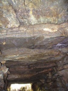
The walls of the souterrain were very well structured indeed and were made up of hundreds of good-sized stones, akin to those used to build old stone walling in our northern hills.  The floor was, typically, muddy and apart from a scatter of a few stones I could see little by way of a ‘floor’ beneath my feet (but it was dark!). However, the roofing was made up of large flat stones measuring 6-8 feet across, as wide as the structure itself, running parallel all along the chamber.  I did not walk to the end of the chamber – but would assume that this roofing continued to the end of the souterrain.

In a number of souterrains we find examples of cup-and-ring carvings (the one at Pitcur, Perthshire, being one of the very best), but I could discern no such petroglyphs inside this chamber.  However, considering how dark it was, another investigation with torches is necessary before any definitive remarks regarding internal petroglyphs can be made.


Curving into the darkness

It’s in damn good condition indeed and is well worth looking at if you venture this far north.  Other unrecorded prehistoric monuments are found all over this remote landscape – from cup-and-rings, to stone circles, to tombs, enclosures, cairns, you name it!  If anyone knows of any permanent rental properties up here – please let me know and get in touch so that I can spend the rest of my life working here meandering, discovering and recording the prehistory of this truly archaic landscape!  I’m serious!

Acknowledgements:  Immense thanks to Donna from Borgie, for showing me this ancient monument and other sites.

© Paul BennettThe Northern Antiquarian

Clach na Foinne, Glen Lochay, Perthshire

Legendary Stone:  OS Grid Reference – NN 50 38

Also Known as:

  1. Clach an Dlogh
  2. Wart Stone

Archaeology & History

Wart Stone, looking south

There is no written history of this site; only the quiet murmurings of a few locals whose families go back to when the english came and destroyed the people and their lives in the 18th and 19th century in the ethnic cleansing we known as The Clearances.  As with the Darach nan Sith (the Oak of the Fairies) a few miles away, the local traditions were lost, and ancient monuments destroyed.  Thankfully, due to the remote location of this site, its status remains….

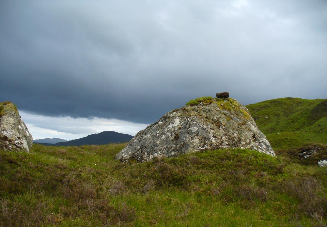
It is found 2000 feet up, near an old derelict village (english academic romancers term it as ‘sheilings’).  An ancient track and stone bridge runs over the burn nearby, place-names evidence tells of a prehistoric tomb a few hundred yards west, and there’s a dispersal of forgotten human evidences scattering the south-side of the mountain all along here.  The clach (stone) sits on the very top of a large earthfast rock; is an elongated loaf-sized smooth red-coloured stone, about 14 inches long and 8 inches wide, and of a different type and much heavier than the local rock hereby.  It is said to have been a healing stone, used in earlier times to cure warts and other ailments.

Folklore

The Wart Stone itself

My first venture here was, like many in this area, amidst a dreaming.  Those who amble the hills properly, know what I mean.  I cut across the mountain slopes diagonally, zigzagging as usual, always off-path, resting by mossy stones and drinking the waters here and there.  My nose took me to the mass of giant rocks hedging into the higher regions of Allt Ghaordaidh: a pass betwixt the rounded giants of Meall Ghoaordie and Meall Cnap Laraich, where only eagles and Taoist romancers might roam.

The great rock comes upon you pretty easily.  Approaching it for the first time I wondered whether there might be petroglyphs on or around it, but the rich depth of lichens and its curious crowning elongated stone stopped any further thought on the matter.  The setting, the eagles, the colour of day and the fast waters close by, stole all such thoughts away.  In truth I must have walked back and forth and near-slept below the place for an hour or two before I gave way to rational focus!  And then my  curiosity got even more curious.

“This must be the place,” I mused, several times.

As you can see in the photo, a large natural earthfast boulder, six feet high or more, like a giant Badger Stone covered in centuries of primal lichens, has a large deep red-coloured stone on its very crown.  The stone is unlike any of the local rock and is very heavy.  I found this out when trying to prize it from its rocky mount, dislodging it slightly from the seeming aeons of vegetation that held it there.  But the moment I moved it, just an inch or so above its parent boulder, a quiet voice inside me rose sharply into focus.

“You shouldn’t have done that!”

The Wart Stone. looking east

Quickly I set it back into place, shaking my head at what I’d done.  One of those curious feelings you get at these places sometimes wouldn’t leave me, however much I tried to shake it off.  …Silly though it may sound, the echoes inside kept saying over and over to me, “you’re gonna get warts now you’ve done that!” Logically, of course, that made no sense whatsoever.  I’d only ever had one wart in my life, a couple of decades ago.  And yet, a few days later, one of the little blighters emerged on my finger!  So there was only one thing for it!  If this was a Wart Stone, I should revisit it again and place my afflicted finger back onto the wart and ask it to be taken back into the stone.

A week or so later, I clambered all the way up the mountainside again and asked the place to forgive my stupidity and take back the wart.  Apologising to the spirit of the stone, I rubbed my finger on the curious coloured rock and, I have to be honest, didn’t know what to expect.

I spent the next few hours meandering here and there over the hills and cast the thought of the Wart Stone back into my unconscious.  But a few days later it had started shrinking – and within a week, had completely gone!  This faint relic of an older culture, this Clach na Foinne had performed its old ways again, as in animistic ages past…

© Paul BennettThe Northern Antiquarian 


St. Patrick’s Stone, Portpatrick, Wigtownshire

Cup-Marked Stone (destroyed):  OS Grid Reference – NX 0010 5411

Archaeology & History

Very little is known about this long-lost carving, whose primary information comes from the folklore records.  Apparently it was found on a rock a short distance south of the destroyed St. Patrick’s Well and the two sites seem to have had a traditional relationship with each other.  The carving had a foot-shaped motif on the rock, and a number of other cup-markings; but I can find no account as to whether the ‘foot’ carving possessed ‘toes’, as seen on the impressive Cochno Stone, north of Glasgow.  It may have been little more that the petroglyphic ‘feet’ seen on the recently discovered and aptly-named Footprint Stone, or those on the newly rediscovered Witches Stone; but we cannot discount it being larger, like the Footprint Stone of Dunadd.  If we could locate an early sketch of the stone, all would be revealed!   Sadly, as E.M.H. M’Kerlie (1916) told us,

“this rock was blasted at the time when the government essayed to make the harbour one of great importance”,

several years after the nearby holy well had been re-routed. Fucking idiots!  Any further info on this site would be most welcome.

Folklore

The local story that was told about St. Patrick creating these carvings seems to have been described first of all by Andrew Agnew (1864), who wrote:

“Once, when about to revisit his native land, he crossed the Channel at a stride, leaving the mark of his foot distinctly impressed on one of the rocks of the harbour; unfortunately, in making a new jetty, this interesting memento was destroyed.”

(The mention of the jetty would seem to imply that the carving was closer to the sea than the grid-reference cited above.) In another tale, St. Patrick rested his hand onto the same rock and the marks of his hand and fingers were left there.  This folklore motif is found across the world.  It relates to cosmological creation myths of indigenous spirits and deities in the tribes and cultures who narrate it.  In this instance, the myth of St Patrick replaced a much earlier mythic tale of another giant or deity, whose name we have lost.  Unless, of course, such petroglyphs were still being carved in Galloway by local people in the 4th-5th centuries.

A further tale of St Patrick, at Portpatrick, replaced a quite obvious shamanistic tale. When he journeyed back from Ireland to Galloway, Agnew again told us:

“Having preached to an assembly on the borders of Ayrshire, the barbarous people seized him, and, amidst shouts of savage glee, struck his head from his body in Glenapp.  The good man submitted meekly to the operation; but no sooner was it over than he picked up his own head, and, passing through the crowd, walked back to Portpatrick, but finding no boat ready to sail he boldly breasted the waves and swam across to the opposite shore, where he safely arrived (according to the unanimous testimony of Irishmen innumerable), holding his head between his teeth!”

Legends such this are found in shamanistic pantheons worldwide.  Shamans primary renown is their ability to travel and recover from the Lands of the Dead, always journeying into impossible and inhospitable arenas, with tales of being dismembered, beheaded, dying, and returning to life to help the tribe with whatever it was that required such a task (usually a healing function).  This story of St Patrick – and many other saints – are mere glosses onto the earlier animistic stories, then abridged as being better, more spiritually mature, more egocentric. But their roots are essentially animistic.

References:

  1. Agnew, Andrew, The Agnews of Lochnaw: The History of the Hereditary Sheriffs of Galloway, A. & C. Black: Edinburgh 1864.
  2. Agnew, Andrew, The Hereditary Sheriffs of Galloway – volume 1, David Douglas: Edinburgh 1893.
  3. Conway, Daniel, “Holy wells in Wigtonshire,” in Archaeological & Historical Collections Relating to Ayr & Wigton, volume 3, 1882.
  4. Harper, Malcolm MacLachan, Rambles in Galloway, Edmonston & Douglas: Edinburgh 1876.
  5. M’Kerlie, E.M.H., Pilgrim Spots in Galloway, Sands: Edinburgh 1916.
  6. MacKinlay, James M., Folklore of Scottish Lochs and Springs, William Hodge: Glasgow 1893.
  7. Morris, Ruth & Frank, Scottish Healing Wells, Alethea: Sandy 1982.
  8. Royal Commission Ancient & Historical Monuments of Scotland, Inventory of Monuments and Constructions in Galloway – County of Wigtown, HMSO: Edinburgh 1912.
  9. Walker, J. Russel, “‘Holy Wells’ in Scotland,” in Proceedings of the Society of Antiquaries of Scotland, vol.17 (New Series, volume 5), 1883.

© Paul BennettThe Northern Antiquarian