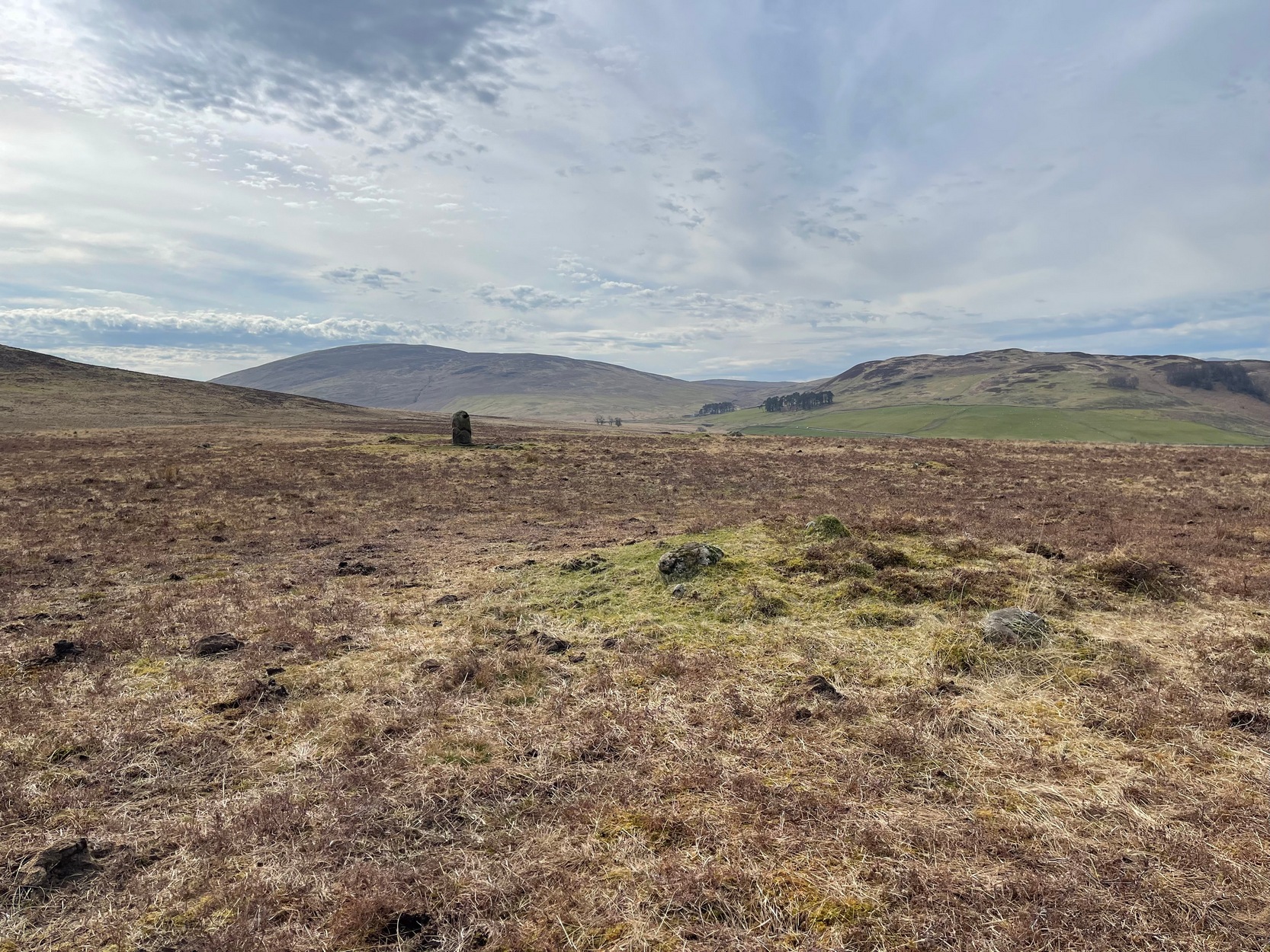
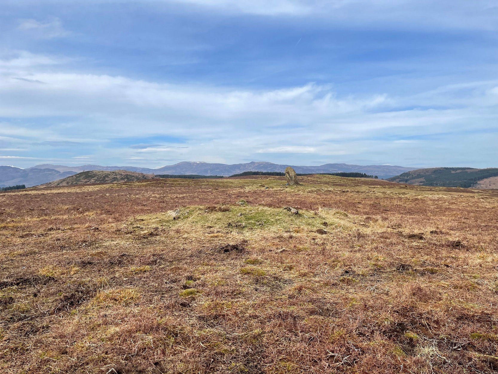
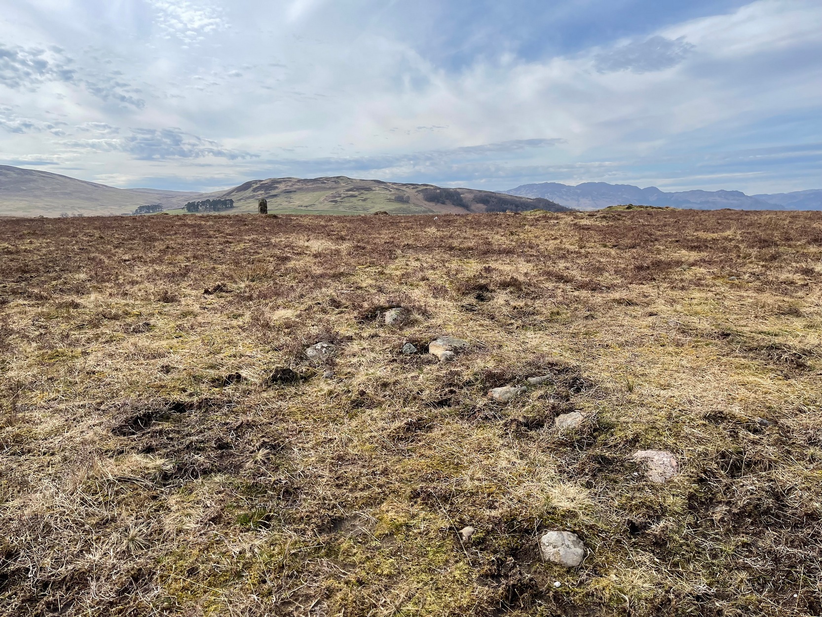
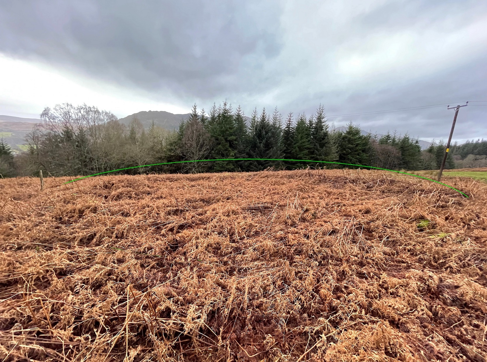
Simply follow the directions to reach the Dunruchan monoliths ‘D’ and ‘E’ and then zigzag through the heather to their immediate south—from just a few dozen yards away, to up to 300 yards west. Keep your eyes peeled for the stoney little rises in the heather as you walk back and forth and you’ll see at least some of these cairns.
Archaeology & History
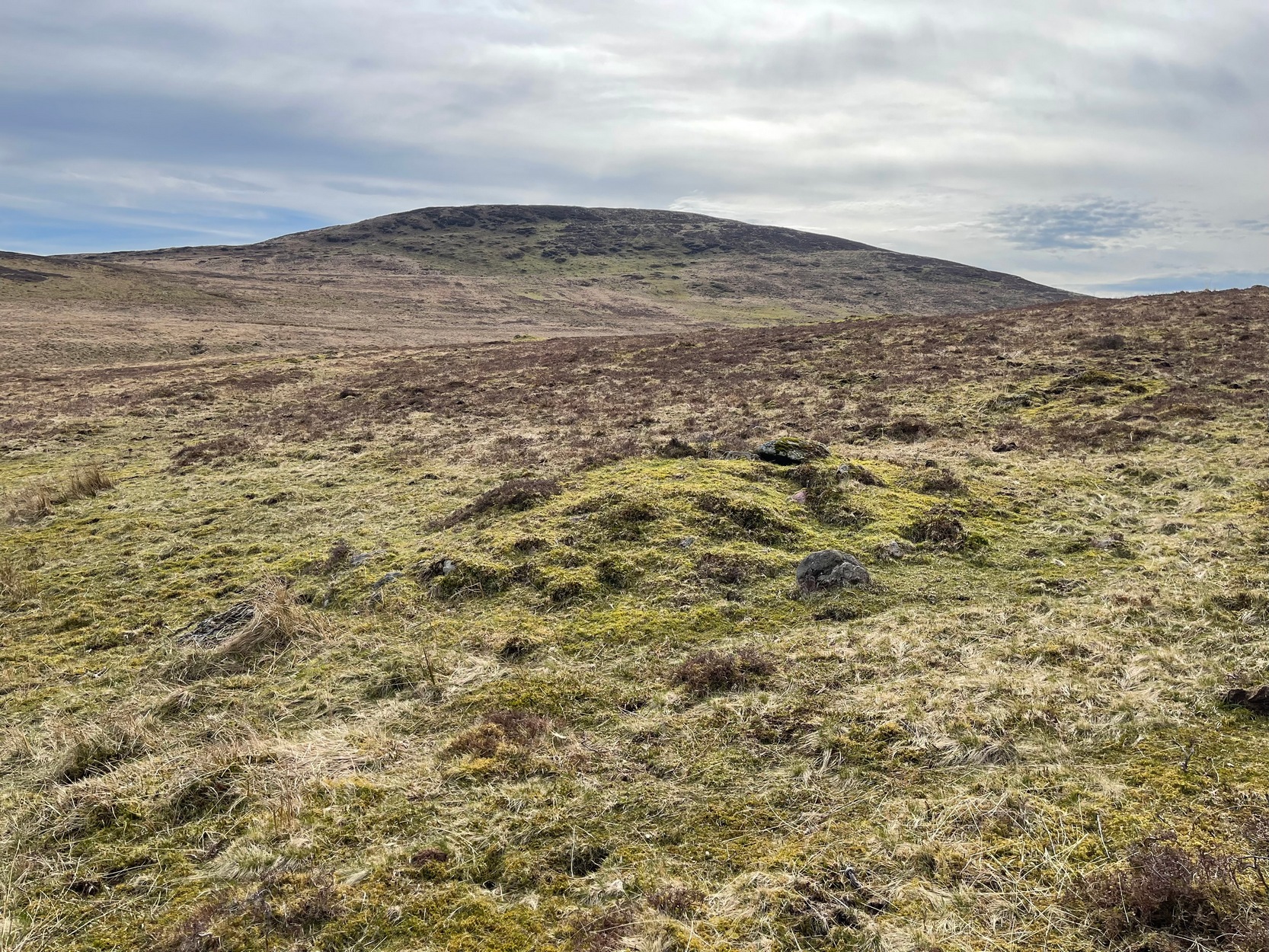
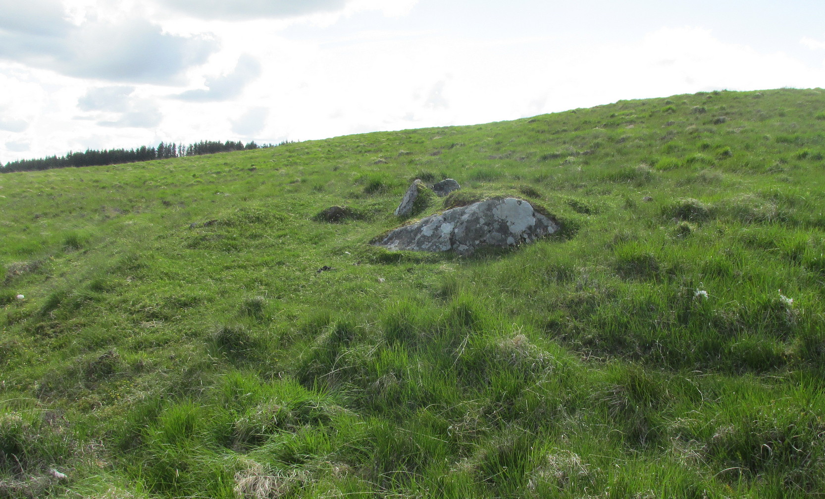
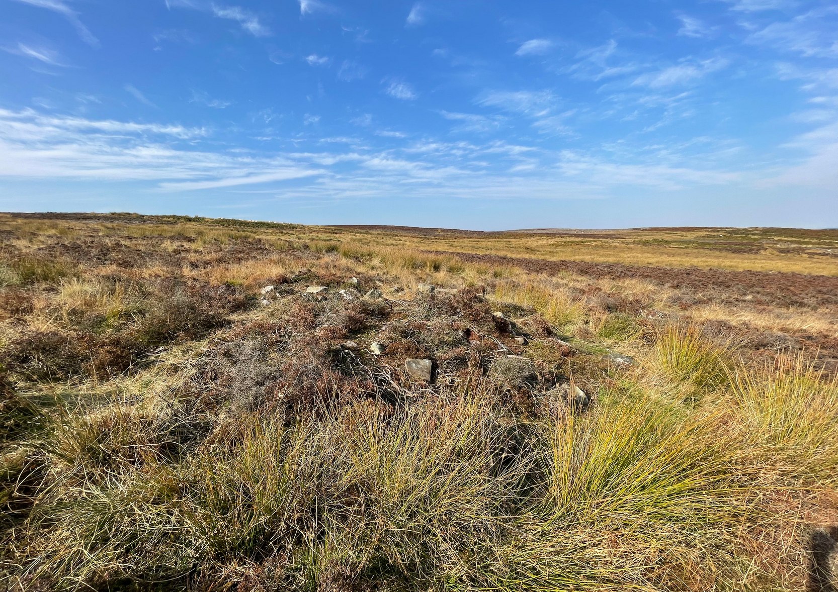
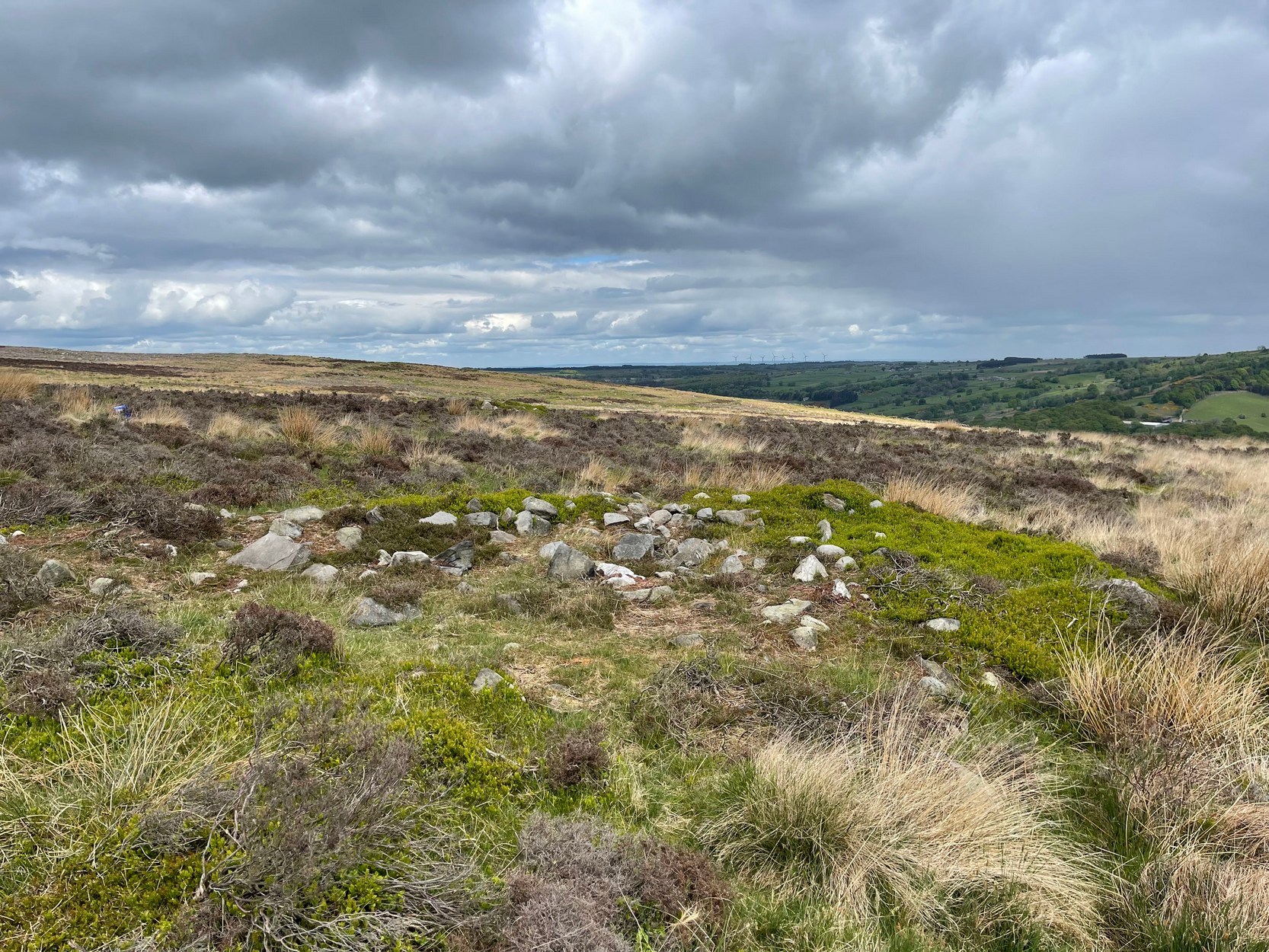
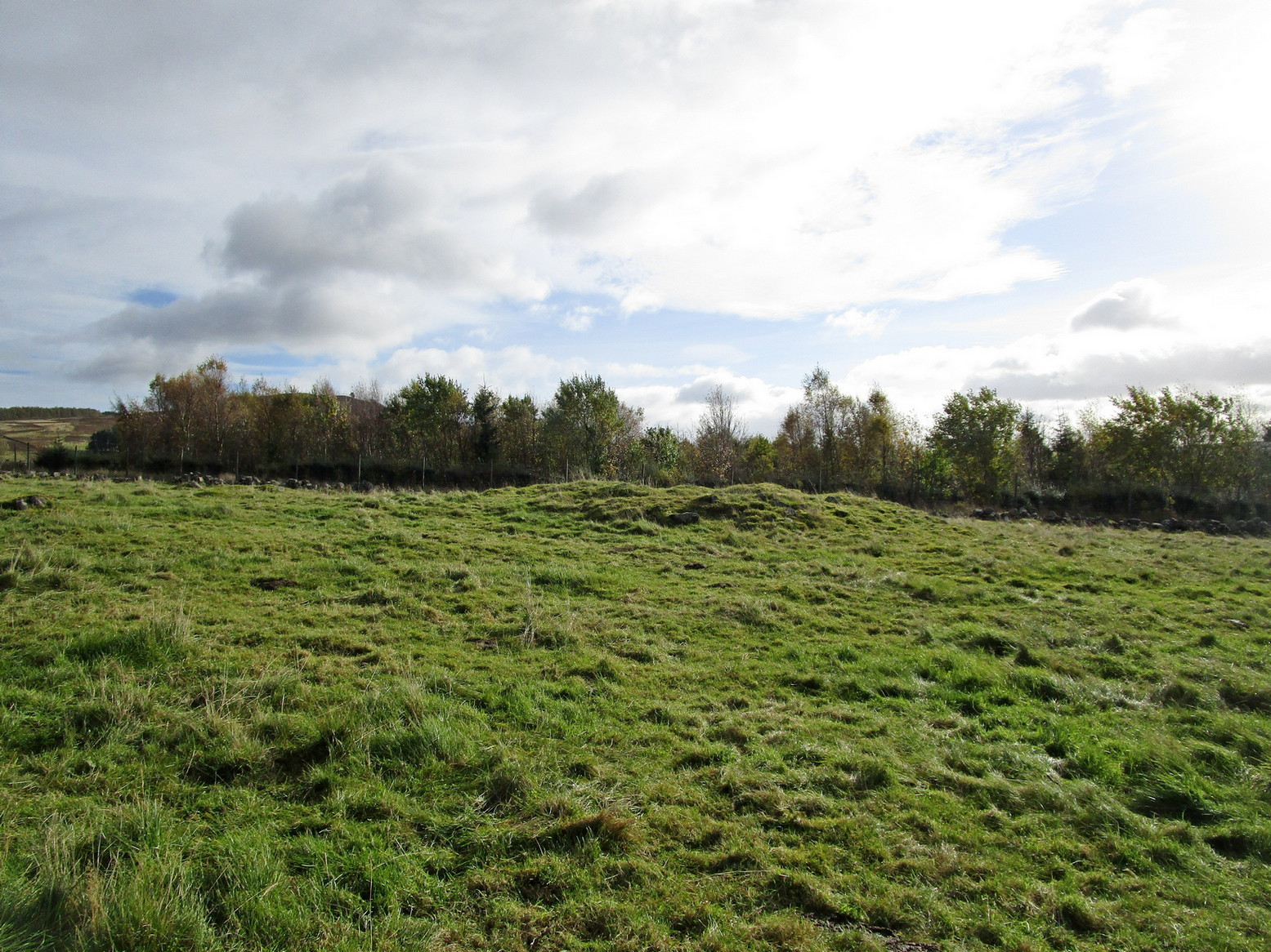
Not to be confused with the large cairn scatter on the grassy plain of Aodann Mhor a short distance north-west (whereon stands the magisterial Dunruchan A monolith), many of which which may be just field clearance cairns. This small group found a short distance east, south and west of Dunruchan stones ‘D’ and ‘E’ are more typical burial cairns. They each average between five and six yards across and none are more than three feet high. We first noticed them about ten years ago and on subsequent visits kept looking them over, but the deep heather ensured they were hard to see. But, after a recent heather-burning exercise on the moors, they are at thankfully visible—for a short time at least.
Cairn SE of Dunruchan ‘D’Cairn S of Dunruchan ‘D’
At the time of writing, probably the best one to see is found 40 yards south of Dunruchan D and 47 yards north-east of Dunruchan E and may have the astronomers amongst you running for the theodolites! It has that distinct look about it when you see it in context with the landscape and adjacent standing stones. The westernmost cairn that’s (presently) known here is 300 yards west of the Dunruchan E stone, just past the Dunruchan enclosure, at NN 7873 1676. It’s likely that there are other unrecorded prehistoric sites in this area.
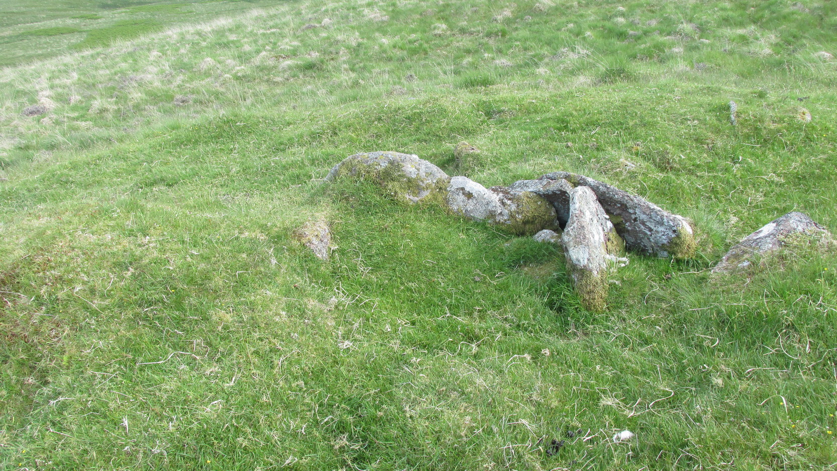
Low line of ancient walling
Amidst this section of the moors is a line of very low walling that runs a short distance east-to-west, towards the Dunruchan ‘E’ stone. A lot of old walling exists hereby, mainly visible in the fields to the east, but this particular line is much smaller and of a different age by the look of things, presumably older. It has the appearance of walling more usually associated with prehistoric hut circles, but in this case runs in a straight line towards the standing stone. Curious…
Folklore
The standing stones on this plain and the cairns here are said to be the graves of fallen Roman soldiers, slain by our tribal Scots two thousand years ago. In all honesty though, these are likely to be much older than any of those Roman savages.
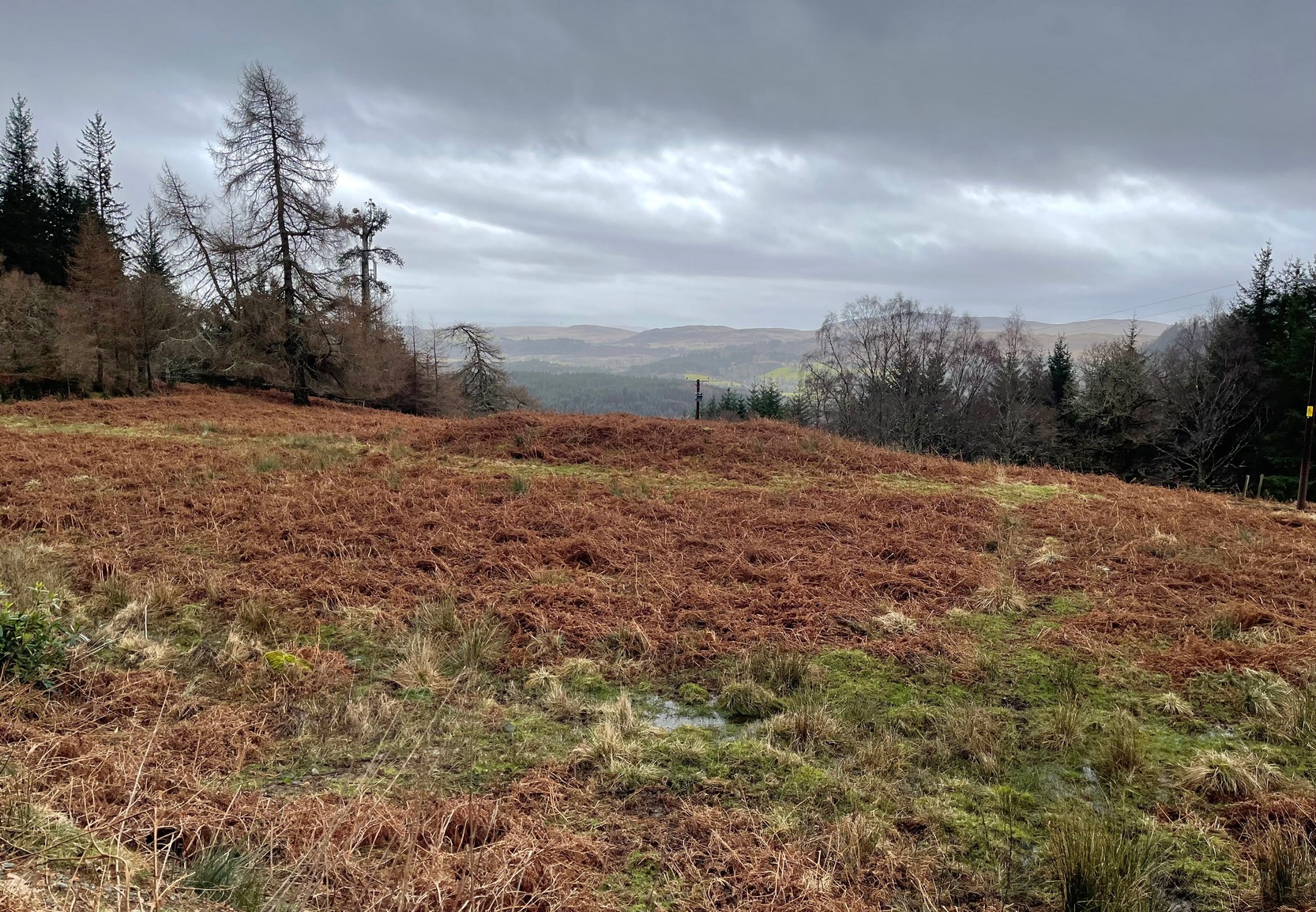
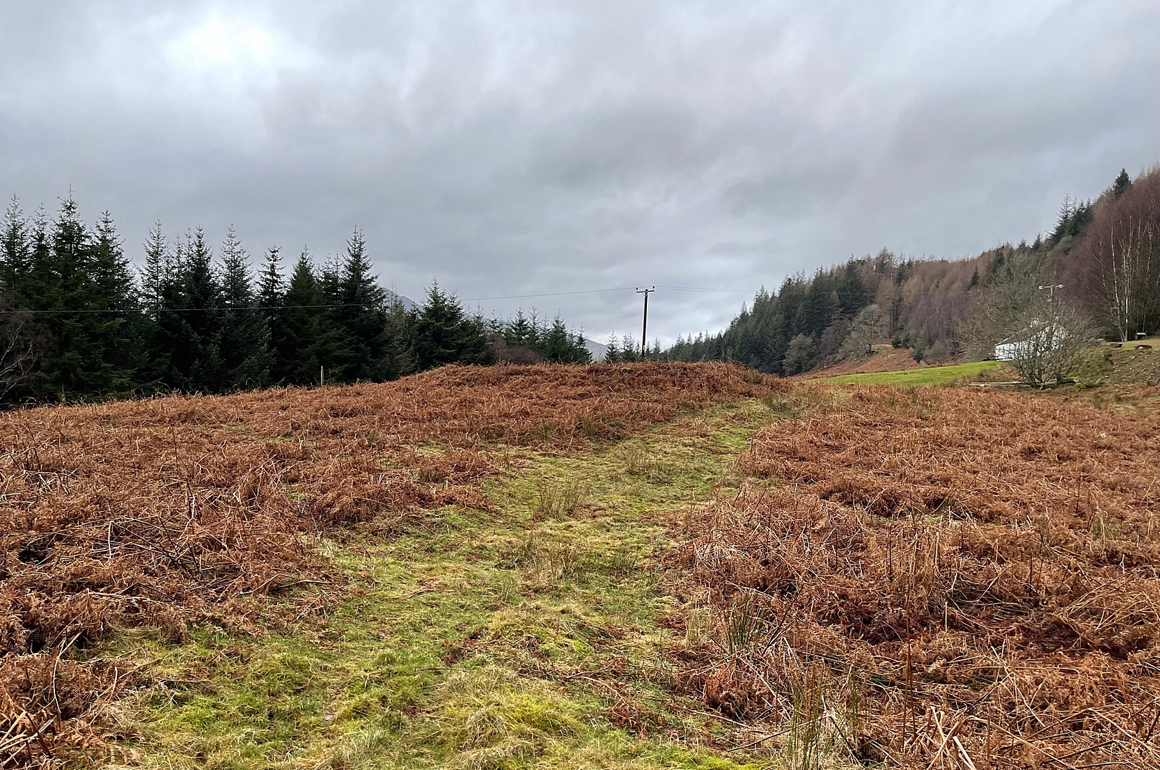
Along the A85 road between Comrie and St Fillans, just over a mile out of Comrie, on the right-hand side (north) of the road is the small farm-track into the fields where the ruined stone circle of Tullybannocher lives. Walk up this track (known as Maam Road), past the stones, and keep going uphill for more than a mile (literally 1 mile up, another track turns sheer right, but ignore it) where the track eventually levels-out; keep walking for another 600 yards, slightly downhill, until you reach a distinct fork in the track where you need to veer right, uphill, and keep walking up the track for ⅔-mile (1km) where you’ll see a cottage ahead of you. About 50 yards before the house, down the slope on your left, a large rounded mass covered in bracken is the site you’re after.
Archaeology & History
This is an odd site, in more ways than one. In the 18th and 19th century, local people told that it was “a very ancient churchyard, so old, indeed, that the grave-stones among the rank grass are scarcely discernible.” (Carment 1882) This lore was reinforced by the fact that, as James Gow (1888) put it,
“within living memory that a burial took place here, and the tradition is that people came to bury the “wee unchristened bairns” from long distances, such as Loch Tayside, Glendochart, Balquhidder, and Strathyre.”
Looking W, at the circleThe old mound, looking SE
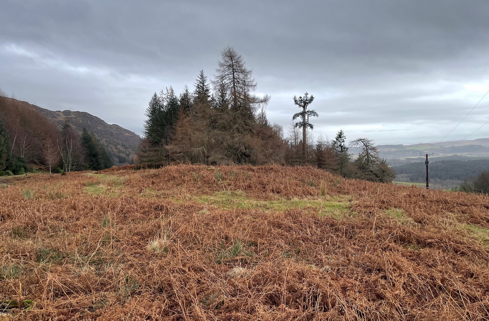
That’s a lot of effort and a considerable distance for some people to travel! But the age and nature of this site is curious. It very name, Drum-na-kill derives from either “ridge of the burial ground” or the “hill of the chapel” (and variants thereof)—yet there are no records of any such early church or religious cell here. That doesn’t mean, of course, that there never was one. A wandering Culdee priest may have set up camp here more than a thousand years ago after doing his service with the fading druids of Dull, less than 20 miles to the north. Such things, never written down, will obviously have happened in these mountains and cannot be discounted merely due to a lack of scripts. But we simply don’t know. When Mr Gow described the place—as “a raised enclosure 25 to 30 feet in diameter, with, a turf-covered wall or rampart 3 or 4 feet high surrounding it”—he emphasized that “in former times (it) was used as a burying ground for unbaptised infants.” (large numbers of Highlanders weren’t in the slightest bit interested in the ways of the Church) So how far back in time did this tradition go…?
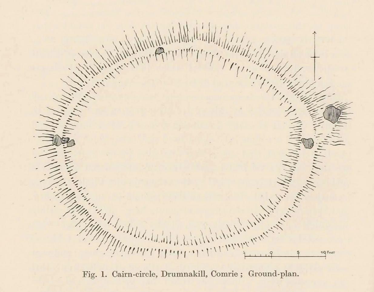
Well, Gow thought the place to be an early christian site. But when Fred Coles came here more than thirty years later, during his massive survey of the Perthshire stone circles, he deemed it to be a much earlier construction. A “cairn circle” no less—which would give it a more Bronze Age footprint. And this definition has stuck. Coles (1911) told that,
Coles’ 1911 diagramRaised ‘walling’ highlighted
“This Cairn-circle is about seventy yards east of the shepherd’s cottage, and it slightly resembles others already noticed in Perthshire. It measures from crest to crest of its circular ridge 44 feet 3 inches east and west by 37 feet 10 inches north and south. Several large blocks of stone lie exposed on the crest, and many others can be felt as one walks along it. The ridge is completely oval-circular, having no break or passage-way, and encloses a flattish, rather uneven space measuring about 34 feet in diameter. The height above the outside ground at the best-preserved portions is fully 4 feet.”
More than a century later, its not changed much—although if you were to believe the updated Trove website, “the cairn has been destroyed in the process of land improvement.” Which is untrue. As the albeit darkened photos here show (we visited it on a truly dark grey day), the raised cairn, despite being covered in a mass of deep bracken, is clearly in a condition similar to what Coles described. It looks like a typical example of this type of monument, of considerable size, with reasonably well-defined edges and comprising the usual scattered mass of stones in and around it. The large boulders that Coles described don’t seem to be in evidence, but these were apparently shifted a few decades back and added to the enclosure walling to the east. To honest, only the untrained eye would miss the place! Check it out when you’re looking at the cup-marked stone, less than a hundred yards to the east…
References:
Carment, Samuel, Scenes and Legends of Comrie, James P. Mathew: Dundee 1882.
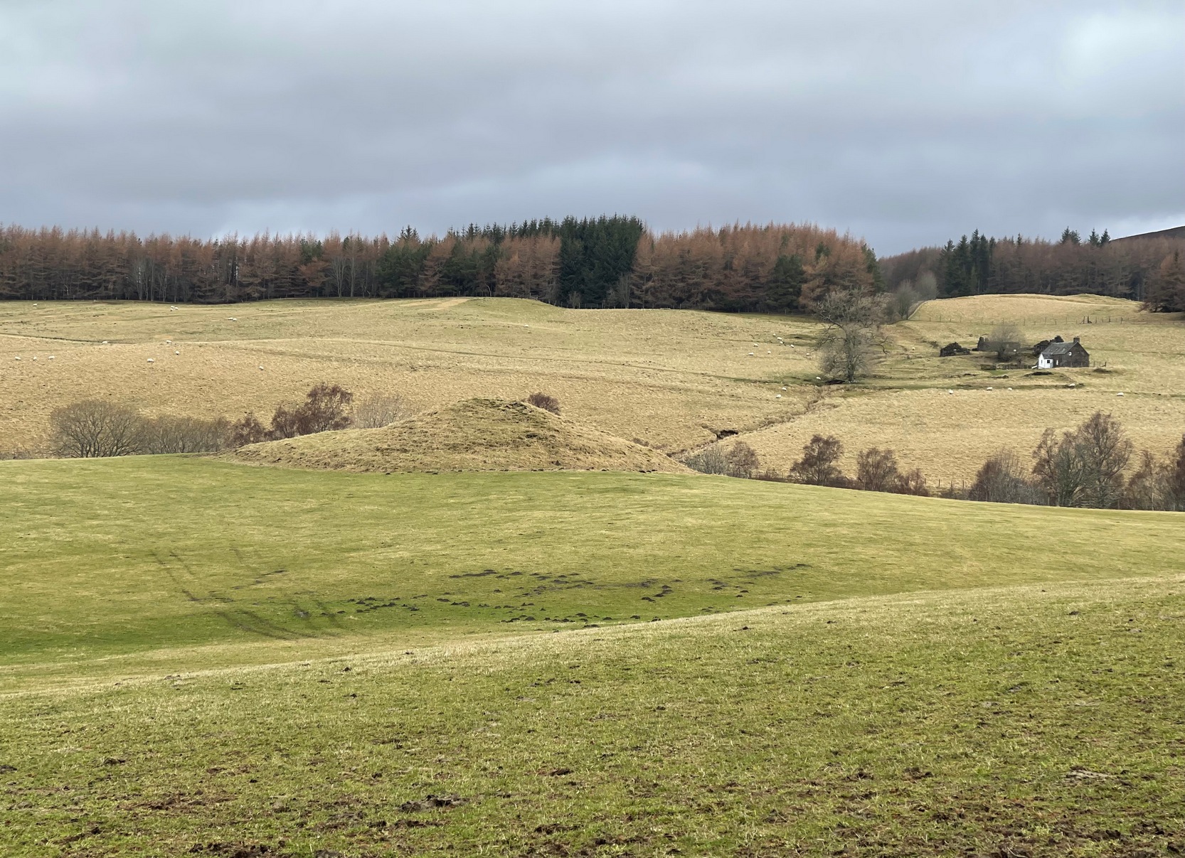
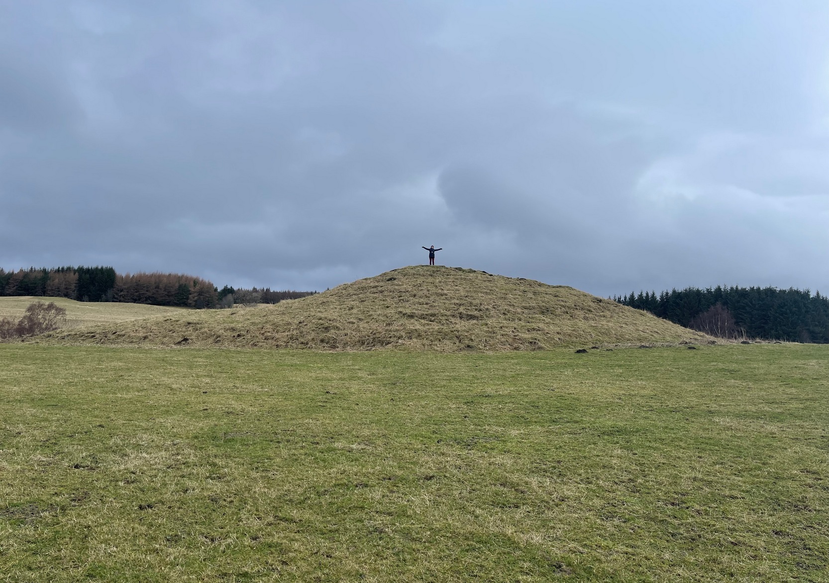
Along the B8079 road in Blair Atholl village, take the minor road signposted to the Bridge of Tilt. After half-a-mile, where the road splits, keep to the right and head further uphill and, where the almost-track-like road splits again another quarter mile up, bear to the right again and just keep going uphill for nearly two miles until your reach the large car-park on the left. Park here and then take the dirt-track to the farm (truly friendly helpful folk) where, in the field to the rear of the buildings, a large unmissable mound rises up!
Archaeology & History
This is a bit of a beauty! Hiding away on the southern edges of the Cairngorms we find this huge archetypal burial mound, 35 yards across and all but covered nowadays in deep layers of soil. But it looks good. When you walk onto its crown, about twelve feet up, you see and feel beneath you the scattered mass of small rocks and stones that comprise the monument as a whole, from top to bottom. On its south-western side, the cairn is lower and elongated: this is due, on the whole, to where field clearance stones were pushed up against the monument many decades ago, making that side of it look bigger than it originally was.
Naomi on top for size!Monzie cairn, looking W
Curiously perhaps, no archaeological attention of any worth has been give to the site apart from the usual estimates of its size and a guesstimate of it being neolithic or Bronze Age in nature (an easy thing to suggest). On top, just beneath the grasses, is what may be the section of a small cist, but this may just be a fortuituous formation. Excavation is required! It’s one of a small number of old cairns and tombs in this locale, but this seems to be the biggest — unless, of course, the lost but legendary Carn Deshal, less than a mile to the south, stood larger…
Acknowledgements: To my awesome Naomi – for getting us up here.
Your best starting point is from the Great Skirtful of Stones giant cairn. From here follow the fencing that runs down the slope to your left (south-east) for roughly 160 yards (148m) – past the Great Skirtful Ring – until you reach the gate. Go through it and keep walking down the same fence-line for 300 yards then walk south onto the moorland proper (there are no paths here). You’ll pass over several undulations in the heather (some of these are the edges of ancient trackways) and 55-60 yards south from the fencing you’ll walk over and into this overgrown prehistoric ring. It’s very difficult to see when the vegetation is deep, so persevere!
Archaeology & History
Site shown on 1851 map
This is an interesting site. Marked on the 1851 Ordnance Survey map as a “barrow” (right), it is shown with trackways on either side of it to the north and south, and with an opening or entrance on its northwestern side. Yet since that date, very little archaeological attention has been given to it and the site remains unexcavated, despite its location being repeated on all subsequent maps since then. The designation of the site as a barrow or burial site, without being excavated, was educated guesswork at the time as the place seems to be what we today define as a ring cairn. And whilst this seems likely, there are some oddities here.
Measuring roughly 25 yards (SE – NW) by 21 yards (NE – SW), this overgrown oval ‘ring’ is a similar architectural structure to the more famous Roms Law circle more than half-a-mile northwest of here—but bigger! And, unlilke Roms Law, this overgrown circle seems to have been untouched for many centuries. The oval surrounding ‘ring’ itself is composed of thousands of small packing stones between, seemingly, a number of much larger upright stones, reaching a maximum height of more than three feet high at the northernmost edge. The ‘ring’ ostensibly looks like a wide surrounding wall which measures two yards across all round the structure.
Track running into the ringRaised line into the ring
Internally, there seems little evidence of a burial — although our recent visits here, as the photos indicate, took place when the moorland vegetation was deep and covered almost the entire site. The outline of the site is obviously visible, even in deep heather, but the smaller details remain hidden. But in addition to the main ring, another very distinct ingredient here is the existence of an extended length of man-made parallel walling, probably a trackway, that runs into the circle from the southeast all the way through the circle and out the other side and then continuing northwest heading roughly towards the Great Skirtful giant cairn on the horizon 500 yards to the northwest.
Stone at NE arc of walling
Due to the landscape being so overgrown, it’s difficult to ascertain where this ‘trackway’ begins and ends. Added to this, we find that there are additional ‘trackways’ that run roughly parallel to the one that runs through the circle—and these ‘trackways’ are very old indeed, some of them likely have their origins way back in prehistory. The one that runs through the middle of this ring cairn may be a ceremonial pathway along which, perhaps, our ancestors carried their dead. If we follow it out from here and keep walking along the track 300 yards to the southeast, we eventually run right to the edge of the Craven Hall (3) circle. Parallel to this is another ancient trackway that runs northwest to the edge of the Roms Law circle. It seems very much as if we have ceremonial trackways linking sites to each other: ancestral pathways, so to speak.
Have a gander at this when you’re next in the area. There are many other sites nearby that are off the archaeological radar. In recent years, a number of northern antiquarians wandering over this landscape are finding more and more ancient remains: walling, circles, cairns, trackways. It’s a superb arena—but sadly, most of it is hidden beneath deep moorland vegetation.
References:
Faull, M.L. & Moorhouse, S.A. (eds.), West Yorkshire: An Archaeological Guide to AD 1500– volume 1, WYMCC: Wakefield 1981.
Acknowledgements:Huge thanks for use of the Ordnance Survey map in this site profile, reproduced with the kind permission of the National Library of Scotland.
Along the A84 road as you’re heading into Callander, just 300 yards before you reach the the Keltie Bridge caravan park, take the tiny road on your left (north) and barely 100 yards along where a small crossroads can be said to exist, go straight forward up the tiny single-track road ahead of you. Keep all the way up for a mile until you reach Bracklinn Farm (when you meet a split in the road, keep left – and make sure you have parked way further down track of here). Walk up the track past Bracklinn Farm for just over a mile (1.85km), until where the track and the large burn runs roughly alongside each other (past the small Eas Uilleam cairn up to your right) and go through the gate. From here, go immediately left (SW) and walk alongside the dead straight fence for just over 300 yards, then slowly zigzag up the sloping hill. If you reach the derelict walling, you’ve gone too far.
Archaeology & History
West Bracklinn from below
For a site marked as ‘Chambered Cairn’ on the OS-maps, you might be expecting a little bit more when you get here. Sadly, it’s not what it once was. Much of the covering stones from the cairn have been severely robbed and obviously used in the old and curiously-named ruin of Bothan na Plaighe below, and the large sheep-fold structures barely 50 yards to the north. All that’s really left to see here is the internal chamber, aligned roughly east-west, which seems to have originally been split into two sections. The remaining overgrown edges of the monument, barely two feet high at the most, measures roughly 8 yards by 9 yards, but is much denuded and can really only be noticed when you’re almost stood on top of it!
The landscape reaching out from here takes the eyes way way into the distance along the fading horizon, from north-east to south-east. This expansive view, this reaching landscape, may have been an important element in the placement of the tomb – and it’s certainly something to behold on a good day. It might be a bit of a walk to get here, but if you want some good countryside, scenery and a bit of ancient history, this is one helluva good place to go!
References:
Royal Commission Ancient & Historical Monuments of Scotland, Braes of Doune: An Archaeological Survey, RCAHMS: Edinburgh 1994.
Acknowledgements:Huge thanks for use of the Ordnance Survey map in this site profile, reproduced with the kind permission of the National Library of Scotland.
From Bainbridge, take the A684 road east to Aysgarth. Just out of the town, 200 yards over the bridge, take the right turn down Blean Lane. Nearly ½-mile along, take the minor road on your left and go along here for 1½ miles where, a few hundred yards before the solitary farm of Carpley Green (lucky buggers!), you can park up. (keep plenty of room for a tractor to get in the fields) Walk down the track past the farm and 250 yards along, where the first field ends, a gate leads you into the hills on your left. Go through here and then the next gate 120 yards on, then walk straight along th elong geological ridge ahead of you, veering to the top-side until it meets the walling. You’ll see the giant Stoney Raise cairn on the other side.
Archaeology & History
Stony Raise from above
The remains we find here are nigh-on immense! If giant cairns get you going (like the Great Skirtful of Stones or the denuded Devil’s Apronful near Pendle, etc), this one will blow you away! Along its widest axis, to this day it’s nearly 40 yards across and nearly 7 feet high! But in earlier times it was even bigger—much bigger! The first known description of the site was made by one Charles Fothergill, a Yorkshire-born politician and ornithologist, who wrote a diary of his walking excursions to various places in North Yorkshire at the beginning of the 19th century. (Romney 1984) His account of it was a good one for that period and thankfully he recorded information that would otherwise have been forgotten. After his visit here in September 1805, he told about this,
“wonderful tumulus called Stone raise which is a great curiosity: it is formed entirely of large stones piled up without earth or gravel, differing in that respect from any I have seen. Notwithstanding that upwards of a thousand, nay ’tis said several thousand, loads of stones have been led away from it to build walls with, it yet remains a stupendous monument of this species of antiquity: we measured the base of it as well as we could by our strides and made it 369 feet in circumference and of such an height as to be seen for a considerable distance. It has been most completely rifled…and it now presents a number of small craters formed by the investigations of the money searchers. It is situated upon a hill about half a mile south of Addlebrough. In addition to the particulars I formerly mentioned, I may say the men who first opened it about 50 years ago worked incessantly for 33 days. It stands on Thornton moor, and tho’ the Thornton men would not assist in the labour, they intended to share in the profit if there was any; but the adventurers who had all the work resolved they should not and they carried a large sword with them every day to defend the treasure in case they found any; the wise man who read ’till the stones shook and rattled was a schoolmaster at Bainbridge: the teeth they found were deposited in a hollow place in the bottom of the tumuli formed long and narrow like a coffin by a walling of stones. Tho’ the tumulus has apparantly been compleatly rifled, I do not believe the whole base has been sufficiently searched, but if it was to commemorate one great individual, which appears to have been the case, perhaps nothing more may be found.”
Fothergill’s description of “upwards of a thousand” cartloads of stone being removed from Stony Raise has been doubted by some archaeologists, but this claim should not be dismissed so lightly without evidence. There are immense tombs from northern Scotland to the unholy South that have remained untouched by the hand of industrialists that easily enter the category of such giants and this may have had equal stature.
A few years after Fothergill’s visit, Thomas Whitaker (1823) briefly described the site in his magnum opus, but added very little, simply telling that on the hills behind Addlebrough,
“there is still on that elevated spot a cairn, called Stone Raise, about 120 yards in circumference at the base, to which the usual tradition of its containing a treasure of gold having been attached, two persons were several years ago induced to make the experiment; but having penetrated to the centre, found, to their great disappointment, what an antiquary would have prepared them to expect, namely, a kist vaen of flag stones, with the remains of a human skeleton, the teeth of which were still pretty perfect.”
To this day the site remains unexcavated, so we don’t know too much about the place. It’s likely to have been constructed in neolithic times and its ancestral nature quite obviously venerated. It may have been re-used during the Bronze Age, but without excavations we may never know. A decent dig into this site is long overdue!
Folklore
This gigantic tomb is, not surprisingly, said to be haunted. Strange sounds and visions have been encountered here in bygone times. But the most well-known tale is that it was the site of a great treasure—perhaps hinted at by Fothergill. There are variations on the theme, but this is overall story:
Structured stonework
The tomb was said to be where a local giant had fallen and with him was buried a great chest of gold which he had dropped before he died. Some say that the ‘giant’ was a Brigantian chief – others a great warrior. The great treasure chest beneath the cairn is said to be looked over by a fairy who once lived by the giant’s tomb. It was this tale which gave the site its local name, the ‘Golden Chest on Greenber’. Several attempts have been made to find the treasure, but all have failed.
However, when the roving antiquarian Edmund Bogg came to write of the place in 1908, the giant had by all accounts been found within! He told us that,
The giant’s cist cover?
“this Kist-vaen was opened, many years back, and the skeleton of a chieftain of great stature was unearthed; the treasure chest of that or some other primal savage was not, and has not yet been discovered – for, take heed ye matter-of-fact money hunters, it is said the lucky one must first see the wraith of the ancient warrior to whom it belonged, who will then shew under which part of the immense Raise it is hidden! May this help any reader who is imaginative enough to find it – having seen the wraith he must keep silence – he has then but to stretch out his hand, and draw it forth.”
There are variations on this tale that have subsequently been penned by a number of Yorkshire folklorists, but this is the general lore. There was also a short rhyme told of Stoney Raise, that speaks of its apparent use through history by various races:
Druid, Roman, Scandinavia,
Stone Raise in Addlebro’.
References:
Bogg, Edmund, Wensleydale and the Lower Vale of the Yore, E. Bogg: Leeds 1906.
Bogg, Edmund, Richmondshire, James Miles: Leeds 1908.
Elgee, F. & H.W., The Archaeology of Yorkshire, Methuen: London 1933.
Gutch, Mrs E., Examples of Printed Folklore Concerning the North Riding of Yorkshire, David Nutt: London 1899.
Lofthouse, Jessica, Countrygoer in the Dales, Hale: London 1964.
Parkinson, Thomas, Yorkshire Legends and Traditions – volume 2, Elliot Stock: London 1889.
Pontefract, Ella, Wensleysdale, J.M. Dent: London 1936.
Romney, Paul (ed.), The Diary of Charles Fothergill, 1805, Yorkshire Archaeological Society: Leeds 1984.
Whitaker, Thomas Dunham, An History of Richmondshire – volume 1, Longman Hurst: London 1823.
White, Robert, A Landscape through Time, Great Northern: Ilkley 2002.
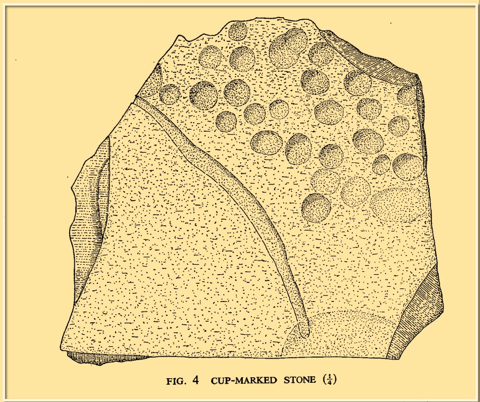
Cup-Marked Stone (lost): OS Grid Reference – NU 2299 2989
Archaeology & History
Tait’s 1971 sketch of the carving
When the Beadnell Caravan Park was being constructed in 1970, in cutting into the Earth the workmen destroyed a couple of prehistoric tombs—but not before one of them (the northernmost one of the two) was thankfully excavated. It was looked at by John Tait (1971), who described the covering cairn as measuring “nineteen feet in diameter and four feet high”. Beneath it, within a cist that had been modified at two very different periods in time, were a large number of human remains that had been deposited over equally extended periods, suggesting it was a place of considerable importance to either one family lineage or the tribal lineage (unless it was just a dumping spot for any old Tom, Dick and Harry!). Outside of the cist itself, but within the rocky mass of the cairn, this cup-marked stone was found (illustrated). It had already been moved by the workmen before Tait came to excavate it, so he was unable to ascertain its precise position in the tomb. Carved into a piece of sandstone were a number of odd-sized cup-marks, smaller than usual. Tait wrote:
“It measures 38cm by 36cm and bears 29 small cup-marks and one slightly sinuous duct leading into what may be part of an earlier and larger cup. It also seems probable that additional cups were added in antiquity, since some are distinctly more shallow than others and, in one instance, two cups impinge upon one another. The stone had been broken in antiquity and may have come from a larger inscribed slab, as is perhaps the case with some other “portable” stones of burials or cairns and other monuments of the second this nature.”
It is thought that the carving was laid back in the ground whence it was found.
References:
Beckensall, Stan, Prehistoric Rock Motifs of Northumberland – volume 1, Abbey Press: Hexham 1991.
Beckensall, Stan, Prehistoric Rock Art in Northumberland, Tempus: Stroud 2001.
Cist (destroyed): OS Grid Reference – NS 872 825 (approximation)
Antiquarian Notes
Writing in the “Transactions of the Stirling Natural History & Archaeological Society” in 1882, Mr Thomson told:
“About the middle of last month I was informed by Mr Bruce that the Council of the Field Club had asked the rector and myself to go and examine a cist alleged to have been discovered in a field near Stenhousemuir. I arranged with the rector to go the following Saturday. As he was suffering from cold, and it was stormy, he was unable to go. I thought I would risk cold and storm, and at the station met Mr Taylor of Morrison & Taylor, who was just returning to Larbert. Learning my errand he kindly promised me every assistance. During tea Miss Taylor procured for me the account of the opening of the cist which had appeared in the Falkirk Herald. It ran as follows:
“‘Discovery of Human Remains – On Tuesday last, the workmen employed by the Carron Company in excavating the Sand Hills, about a quarter of a mile to the south of the village of Stenhousemuir, made a discovery which has caused some excitement in the district. At the depth of four feet from the surface the workmen came in contact with a stone coffin or grave, 3 feet 9 inches long by 2 feet broad, very substantially built, and containing the remains of a human body. When the discovery was made, parts of the skull were in good preservation, but soon after being exposed to the air they crumbled away. The remains have been carefully collected, and are now in possession of the workmen at the hut at the Sand Quarry. On Wednesday a great many people visited the place, prompted by a natural curiosity to see these relies thus suddenly brought to light, the history of which, it is to be feared, must ever remain a mystery. ’”
“After tea, Mr Taylor and I went to the place where the cist was railed off. It is in the middle of a field acquired by the Carron Company to take sand for their castings from, and the excavation that revealed the cist had been made with a view of getting a new bed of sand. About 200 yards west of the gate of Carron Park House, and close by a railway for waggons, where the workmen had been digging pits, partly with a view to find, as I understood, the lie of the sand, and partly also to arrange the course of a waggon railway for the new sand pit, they came upon traces of a disturbance in the sand. On digging down they came upon some large stones. On lifting them they found some bones, among the rest the top of the skull. The latter was injured somewhat by the spade, and it seems soon to have crumbled away.
“When I went along with Mr Taylor to the spot, which, as we have said, had been railed off by the kindness of Mr Cowan, the manager, we found that the cist had been somewhat dismantled, the upper large stones were lying about the side of the cist, and along with them several smaller ones. We noted that the depth below the surface had been exaggerated in the Falkirk Herald, from the reporter having failed to notice that the earth had been heaped up on the spot when the present waggon railroad was made. We measured the cavity carefully: the length was 3 feet 8 inches, the greatest breadth 16½ inches, and the least 14 inches, the greatest depth to the bottom of the stones still standing was 15 inches. There were three large stones, each about 2 feet by 16 inches, which had been the roof of the cist. A young man who had watched our movements with some curiosity, went and brought an old man who had been present when the cist was opened — he told us strange tales of how these three large stones had all been one but were “jist fair rotten.” The fact that the stones showed no signs of ever having been one, and that their thicknesses being different — one being 5 inches, another 7½ inches, and a third 2½ inches — did not unduly disconcert him when questioned by Mr Taylor in cross-examination, but brought out from him the somewhat irrelevant information that he was seventy-nine and had been under “sax managers in Carron, and he should ken a’ aboot it.” He further declared that the smaller stones had been one stone also. This was even more difficult to believe, and when he proceeded to tell of a layer of fine powdered lime being laid between the stones we suspected his years had brought dotage, not increase of knowledge. I learned that the bones had been removed from the hut, and were in the keeping of the manager, so Mr Taylor kindly took me to see him in his house some two miles or so from the place where the cist was found. He told us that he had arranged for their safe custody, but had never seen them, and asked me to come some other day, not a Saturday.
“I went again on Friday week, and saw another of the workmen, and a gentleman from Carron works. This other workman had not his friend’s great age, and admitted that the stones were not one originally, and that the small ones formed part of the sides. If those small stones were built up on the existing walls of the cist, their height would be brought up to about 2 feet in all.
“I noted carefully that the joints were not filled up with clay, and that neglecting the variation of the compass, the cist lay due north and south. The gentleman who had been sent by Mr Cowan, when asked about the bones, took out of his pocket what seemed a box for holding twelve gross of pens, and opened it; it was filled with a mass of small fragments of bone quite friable and utterly indistinguishable…”
Further Reading:
Royal Commission on the Ancient & Historical Monuments Scotland, Stirling – 2 volumes, HMSO: Edinburgh 1963.
Thomson, J., “The Cist at Stenhousemuir”, in Transactions Stirling Natural History & Archaeological Society, no.4 1882.
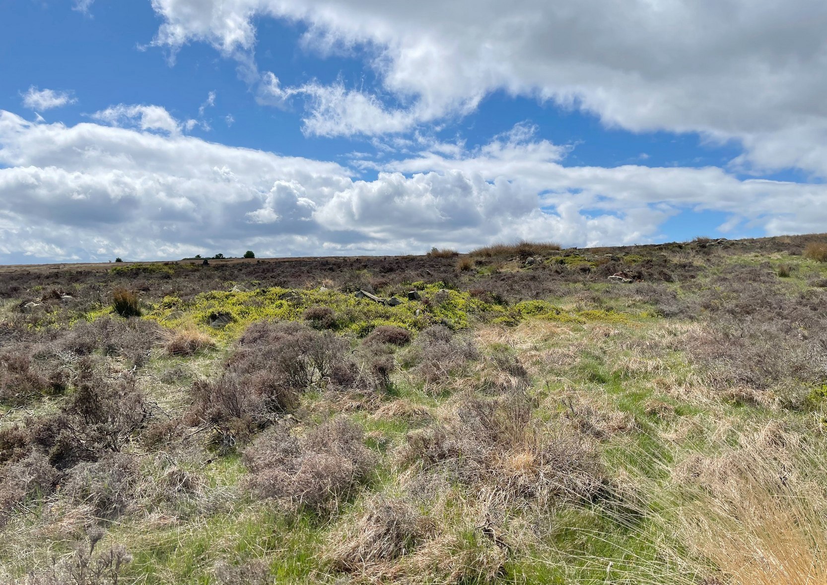
Park up at the singular dusty car-park on the east-side of Askwith Moor Road. If you walk to the sloping eastern edge of the car-park and then go down and over the collapsed fence onto the moorland immediately east, walk in the direction of the Tree of Life Stone to the north-east (be aware that there’s no footpath here and it’s boggy as fuck in places) . Just over halfway towards the carving, nearly 400 yards from where you’ve parked, you’ll begin to see various ruinous piles and scatters of stone. You can’t really miss them!
Archaeology & History
Cairn, looking north
In a region teeming with prehistoric sites, the great Eric Cowling (1937) seems to have been the person who stumbled across this “barrow group”, as he called it, during one of his rock art forays in this neck o’ the woods. Little has been written of them since. Not to be confused with the Snowden Moor cairnfield more than 350 yards to the north, at this place we find at least a dozen quite distinct cairns scattered around the grid-reference cited, most of them much larger in size than the cairns to the north, ranging between five to twelve yards across and up to three feet high. They have all been opened and robbed, with considerable disturbance on the largest of the ‘barrows’. We know not who may have done this, but there’s been a history of quarrying close by and it may have been some of the workmen who did the damage, knowingly or otherwise.
Large scatter of cairn-spoil
Cairn covered in bilberries!
As far as I’m aware, no burial or funerary remains have been found here—but there’s been negligible archaeological attention given to any of the sites on this moorland, meaning that we can draw no real conclusions about the nature of the cairns. They seem to be far too large to be clearance cairns; and the proximity of large scale prehistoric settlements and rock art all round here would strongly suggest they possessed a funerary nature. Several impressive petroglyphs exist right at the edge of this group, literally yards away from them. Check them all out out the next time you see the Tree of Life stone…
References:
Cowling, Eric T., ‘Cup and Ring Markings to the North of Otley,’ in Yorkshire Archaeological Journal, volume 33 (part 131), 1937.
Cowling, Eric T., Rombald’s Way: A Prehistory of Mid-Wharfedale, William Walker: Otley 1946.
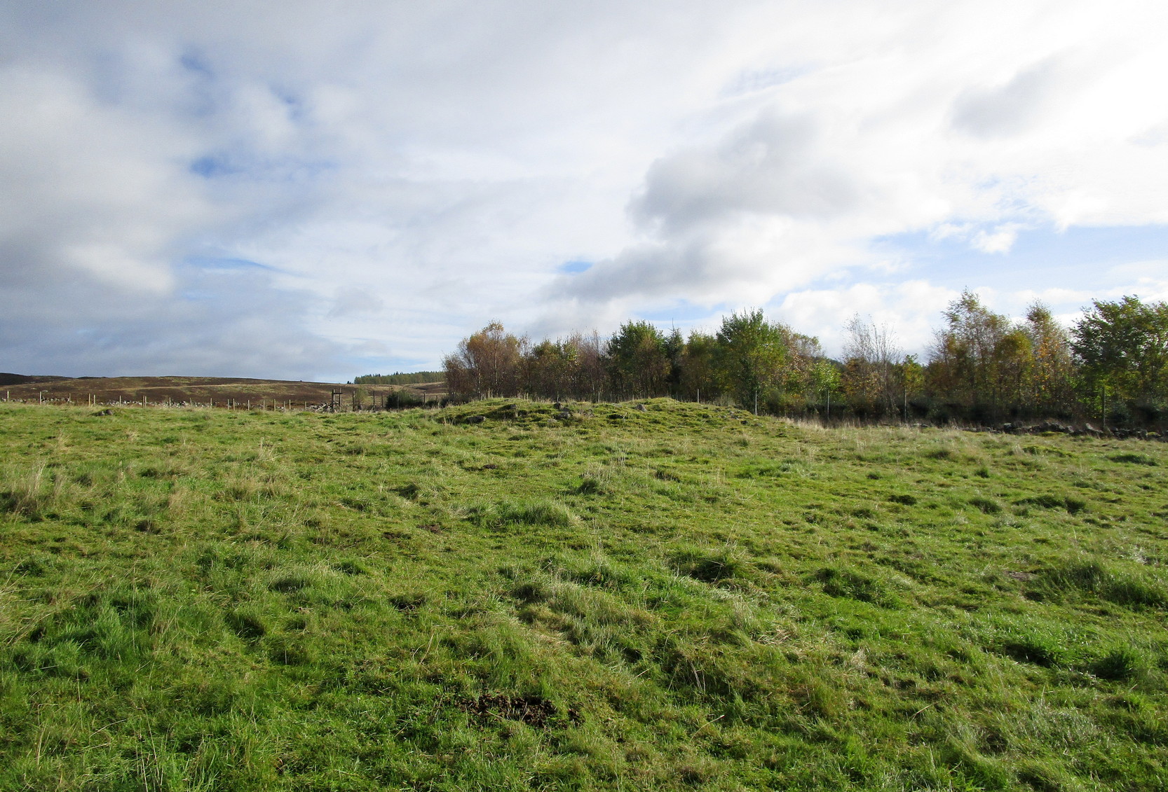
From Kirkmichael village take the A94 road 2 miles south to the Balnabroich standing stone and another 100 yards past it, on the left (east) take the dirt-track uphill, following the directions to reach the Balnabroich hut circles. You’ll see the large prehistoric rock pile of the Grey Cairn on the near skyline just above the huts and roughly on the same level, 50 yards away to the south, you’ll see this scruffy lumpy dump of a cairn, all overgrown.
Archaeology & History
The cairn, looking S
Amidst the veritable scatter of a thousand clearance cairns (yes, that’s the estimate), there are a few up here that had more funerary functions than the rest. This being one of them. When Allan Stewart (1795) wrote about them all in the Statistical Account, he couldn’t have missed this one—and yet he made no mention of it. We had to wait another seventy years before the outside world became aware of its existence. Then, along with “a band of between twenty and thirty workmen,” John Stuart (1865) set out to see what lay beneath the rocky pile. In truth, much more attention was given to the huge Gray Cairn close by (understandably so), but at least some attention was given here. Stuart described this cairn as,
“about 9 yards across, defined by large boulders, with a raised ridge around, and a cup in the centre. The raised ridges and centre were all formed of small stones and earth. A trench was cut through it from the southeast, which showed that in the centre, at a depth of 2 feet, a deposit had been made, of which the remains were charred wood and fragments of charred bone, with traces of blackish matter, which had filtered into the yellow subsoil, as in the case of the graves at Hartlaw.’ Many fragments of white quartz pebbles appeared near the centre, as in other cairns to the east.”
Indeed, at least one of the “cairns to the east” is made entirely of quartz stones! Since Mr Stuart’s dig into the tomb, it has widened out slightly as rummaging cattle and other damage has been inflicted, and the grasses have coloured the tomb with their life. Check it out when you’re up here!
References:
MacLagan, Christian, The Hill Forts, Stone Circles and other Structural Remains of Ancient Scotland, Edmonston & Douglas: Edinburgh 1875.
Ramsay, John S., Highways and Byways of Strathmore and the Northern Glens, Blairgowrie Advertiser 1927.
Royal Commission on the Ancient & Historical Monuments of Scotland, North-East Perth: An Archaeological Landscape, HMSO: Edinburgh 1990.
Stewart, Allan, “Parish of Kirkmichael,” in Statistical Account of Scotland – volume 15, 1795.
Stuart, John, “Account of Excavations in Groups of Cairns, Stone Circles and Hut Circles on Balnabroch, Parish of Kirkmichael, Perthshire,” in Proceedings Society Antiquaries, Scotland, volume 6, 1865.
Acknowledgements:Huge thanks for use of the Ordnance Survey map in this site profile, reproduced with the kind permission of the National Library of Scotland.