Brackendale Mills, Thackley, Bradford, West Yorkshire

Cup-Marked Stone (missing):  OS Grid Reference – SE 1687 3868

Archaeology & History

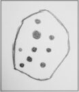
Sketch of the missing cup-marked stone

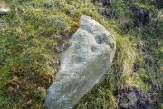
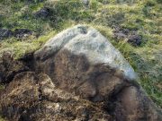
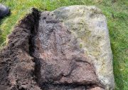
This carving was originally located somewhere close to the old disused Brackenhall Mills on the edge of Thackley, just before you drop down to Thackley tunnel.  It was uprooted sometime in the 1950s and taken several miles away to the Cartwright Hall Museum at Manningham, Bradford, where it sat outdoors behind some fencing for many a-year, accompanied by the large fossil of an ancient tree.

I first saw it there when I lived close by in 1981, in the days before I had such a thing as a camera.  Hence I only have this scruffy old sketch of the design, which I did without adding any notes to help remind me which carving it was!  So this sketch has sat, all-but-forgotten, on a scrap of paper since then, until I recently sussed out which carving it was!

The stone itself was akin to a very large portable rock, with a simplistic design consisting of at least nine cup-marks cut into one of the rounded faces.  One account of the stone suggested there may have been a possible incomplete ring around one of the cups.  When I went back to see the stone about 20 years ago, it had gone.  So I called into the adjacent museum to inquire what had become of it.  The curator (or whoever it was) that I spoke with told me that the stone had been put into a box and placed in the cellars, but refused to let me see it.  I asked to make an appointment to see the stone and he refused that too.  It has not been seen since.  Does anyone know what’s become of it?

References:

  1. Keighley, J.J., “The Prehistoric Period,” in Faull & Moorhouse’s, West Yorkshire: An Archaeological Survey to AD 1500 (WYMCC: Wakefield 1981).
  2. Yorkshire Observer, January 17, 1953

© Paul BennettThe Northern Antiquarian


Scout Willie’s Well, Idle, Bradford, West Yorkshire

Healing Well (destroyed):  OS Grid Reference –SE 1672 3866

Archaeology & History

Along the footpath below the family graveyard at Thackley, the great genealogist and industrial historian J.H. Turner (1878) told that, “at the right hand side of the wood, at the bottom, is Scout Willie’s Well, formerly noted for its medicinal properties” – though whatever curative aspects it possessed have long since been forgotten.  It was also known as the Sweet Willie Well.  I perused the woodlands here searching for the well in my younger days but could find no trace of it; nor is anything shown on the early OS-maps of the area.  

References:

  1. Turner, J. Horsfall, Idle Upper Chapel Registers and Graveyard Inscriptions, Bingley 1878.

© Paul BennettThe Northern Antiquarian

Market Cross, Baildon, Shipley, West Yorkshire

Cross:  OS Grid reference – SE 15475 39743

Archaeology & History

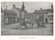
Located next to the old stocks by the main roundabout right in the middle of the town is this tall market cross, nearly ten feet high and well known to the local people.  It has been described by several local historians, although its recognition as a “market cross” is slightly contentious as it seems there are no written records to indicate that a market ever existed here.  The great Baildon historian, W. Paley Baildon (1912) was unable to find any info about such a market, commenting simply that “most villages…had crosses in medieval times, many of which still exist; so that the presence of a cross at Baildon is (not necessarily) evidence of a market.”

His description of its form is as valid then as it is to this day:

Old sketch, c.1900
Old photo of the cross c.1900

“The cross, as we see it to-day, is not an interesting object. The square platform of two stages, with its well worn stones, looks as though it might be medieval, and part of the original work.  In the centre of this is a large square block of stone, from which rises a tall cylindrical shaft.

The base is square, with chamfered corners, and a plain roll moulding at the upper edge; the cap is a plain square block, without any attempt at ornament.”

One of Bradford’s industrial historians, William Cudworth (1876) thought that the present cross replaced an earlier one, and that this one was erected by a member of the wealthy Butler family a few centuries ago.  Mr Baildon wasn’t quite as sure as Mr Cudworth.  Nevertheless they both agreed that this edifice replaced an earlier one.  Baildon said:

“My own view is that there was probably a cross here in medieval times; that it was destroyed, either after the Reformation (as so many were), or by the Puritan soldiery during the Civil War; that the steps and perhaps the base remained; and that in the eighteenth century, when the Butlers were one of the leading families in the place, one of them may have erected a new shaft on the old site.”

In much earlier days it was said to have been surrounded by a grove of trees and a brook ran by its side.  Villagers would gather here as it was “a favourite gossiping resort.”  At the beginning of the 20th century, an old gas light surmounted this old relic.

References:

  1. Baildon, W. Paley, Baildon and the Baildons – volume 1, St. Catherine’s Press: Adelphi 1912.
  2. Cudworth, William, Round about Bradford, Thomas Brear: Bradford 1876.
  3. la Page, John, The Story of Baildon, William Byles: Bradford 1951.

© Paul BennettThe Northern Antiquarian

Cottingley Woods (3), Bingley, West Yorkshire

OS Grid-Reference – SE 09825 37861

Getting Here

Follow the same directions as if you’re visiting the impressive Fairy Stone carving, then 3 yards east is the Cottingley 2 double cup-and-ring, keep walking past through trees for another 5-6 yards  where you’ll come across this reasonably large curved flat stone.  Y’ can’t really miss it

Archaeology & History

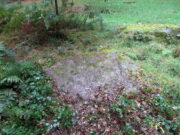
Cup, with ring faintly visible

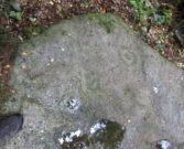
This was another carving in the small cluster by the Fairy Stone that I found on my visit here in the 1980s—but it’s a pretty innocuous one to be honest.  There’s a faded incomplete “ring” (not really visible on my photos due to pouring rain and very poor light when I was here) with a distinct cup-mark in the middle.  Several inches away from the cup-and-ring is a carved line that arcs around it creating an incomplete oval design; and what seems to be a single cup-mark is visible at the top of this oval.  Other marks on the stone are both natural as well as recent ‘scratches’.

Some elements of this carving—as with others in this petroglyph cluster—seems to be modern.  The cup-and-ring seems to be the real deal, but the ‘oval’ seems to have been added much more recently, perhaps by the scouts who play around in this part of the woods.

© Paul BennettThe Northern Antiquarian

Cottingley Woods (5), Bingley, West Yorkshire

Cup-and-Ring Stone:  OS Grid-Reference – SE 09843 37869

Getting Here

Cottingley Woods CR-5

Get yerself to the Fairy Stone, then walk east past the adjacent woodland carvings—numbers 2, 3 and 4—from where you should walk about another 10 yards east across the grass, keeping your eyes peeled for a large flat stone measuring about 6ft by 10ft just as you go back into the tree cover north-side.  You’ll find it.

Archaeology & History

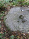
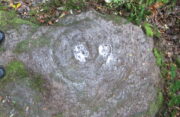
This large carved rock is the easternmost known petroglyph in this small woodland cluster of five. (a sixth one can be found, but it’s several hundred yards east from here)  Consisting of two distinct cup-and-rings in relative proximity to each other on the northern section of the stone, this design—unlike others in this group—has a greater sense of stylistic authenticity to it.  Despite this, one of the two cup-and-rings seems to be a more recent addition to the rock, as close inspection shows peck marks that aren’t very well eroded as you’d expect on rock of this type if it was truly ancient.  The more faded cup-and-ring on its northwestern section looks to have a greater sense of age about it when we look at its erosion level….perhaps…

The 2 Cup & Rings
The 2 cup-and-rings

We have to take into consideration when looking at this carving and the others nearby that possess some quite peculiar design-elements, that this section of woodland is used extensively by boy scouts who do what boy scouts do in their teenage ventures: from making fires, climbing trees and, perhaps, scribing on stones if/when their elders aint looking.  It’s an important ingredient that has to be taken into consideration when looking at the more rash motifs hereby—this carving included.  The more faded cup-and-ring on this, however, may be the real deal.  And hopefully, next time I visit this site, She’ll not be dark and pouring with rain (much though I love such weather), so I’ll be able to get some better photos!

© Paul BennettThe Northern Antiquarian

Cottingley Woods (2), Bingley, West Yorkshire

Cup-and-Ring Stone:  OS Grid-Reference – SE 09819 37862

Getting Here

The carving in situ

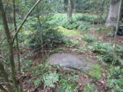
Follow the same directions as if you’re visiting the impressive Fairy Stone carving, then check out the overgrown rock three yards away, to the east.  You might have to rummage under the scrubbage to see it, but you’ll find it if you want to!

Archaeology & History

I first found this stone in the 1980s when I’d been shown the Fairy Stone carving which, at the time, was thought to be all alone.  But I used the olde adage: “where’s there’s one cup-and-ring, others tend to be“—and found this and several others closed by.

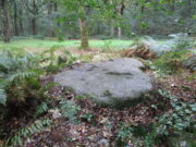
Large messy cup-and-ring

It’s a relatively small, slightly-domed earthfast rock, upon which we find an unusually large cup-and-double-ring design with a carved line running from the large central cup out to the edge of the stone.  However, the carved lines that constitute both the inner and outer rings are ‘crude’ in form and style when compared to the vast majority of other British petroglyphs; and for some reason, this aspect of the design has me casting doubts over its prehistoric authenticity.  I hope I’m wrong!

References:

  1. Bennett, Paul, ‘Tales of Yorkshire Faeries,’ in Earth 9, 1988.
  2. Bennett, Paul, The Old Stones of Elmet, Capall Bann: Milverton 2001.

© Paul BennettThe Northern Antiquarian

Dragon Well, Eccleshill, Bradford, West Yorkshire

Sacred Well (destroyed):  OS Grid Reference – SE 17567 35473

Also Known as:

  1. Pendragon Well

Archaeology & History

Site on the 1893 map

A most curious place:  this ‘Well of the Dragon’ as it was first called (on the 1852 OS-map) and subsequently the ‘Pendragon Well’ (on the 1922 map) just off Pendragon Lane, seems to have been forgotten in both folklore and history.  I grew up round here and no legends of dragons were known, either in my life, nor that of the old folks I knew; nor any pub of that name that might account for it.

Equally unexplained is the name of the adjacent ‘Pendragon Lane’, which has been known as that for some 175 years.  We have no Arthurian myths anywhere in West Yorkshire that remains in folk memory—and certainly nothing hereby that accounts for it.

As for possible landscape associations (i.e., serpentine geological features), nothing in the vicinity has any bearing on the name.  Indeed, the only thing of any potential relevance was the former existence of a healing rock known as the Wart Stone, some 100 yards to the east at Bolton Junction.  Such stones are usually possessed of naturally-worn ‘bowls’ of some sort on top of the rock—akin to large cup-markings—into which water collected that was used to rid the sufferer of warts or similar skin afflictions.  But such an association seems very unlikely.

The only thing we can say of this Dragon Well is that probably, in times gone by, a folktale or legend existed of a dragon in the neighbourhood that had some association with the waters here.  Dragons are invariably related to early animistic creation myths, and this site may have been all that remained of such a forgotten tale.  The nearest other place in West Yorkshire with dragon associations is six miles northwest of here on the south-side of Ilkley Moor.  In Britain there are a number of other Dragon Wells, the closest of which is in South Yorkshire.

© Paul BennettThe Northern Antiquarian

Cow and Calf Stones, East Bierley, West Yorkshire

Crosses / Legendary Rocks (destroyed):  OS Grid Reference – SE 1975 2909

Archaeology & History

Site location at Cross House

Not to be confused with a much more renowned namesake above Ilkley, this was the name given to two old stones that once existed in the middle of the East Bierley hamlet (as it was then) southeast of Bradford.  They were two large boulders next to each other, not far from the early farmstead of Cross House (see map, right) and were described in James Parker’s (1904) historic collage of the area, where he informed us that:

“On the village green (are) the primitive large stones locally called the “Cow and Calf stones,” which used to be in days gone by a Preaching Cross and Market Cross.”

When William Cudworth (1876) described the place nearly thirty years prior, he only mentioned a single cross, telling us:

“There is a lane which has long been called Kirkgate at Birkenshaw, leading up to an ancient cross on the hill.  The fact of this cross being on the hill must have given rise to the name Kirk (church) gate, as there was not, until a few years ago, any church at Birkenshaw.  In a previous paper we had occasion to notice the existence of the cross as an evidence of a pre-church period.”

The meaning behind the name Cow & Calf is unexplained by our respective authors, although Cudworth’s citation of “the cross as an evidence of a pre-church period” is probably not without merit here.  It seems very likely that the animal names of the two large stones—akin to the Cow & Calf Rocks at Ilkley and others of the same name elsewhere in the country—that sat near the top of the hill, probably possessed a creation myth similar to others of the same name.  From this, it seems logical that local folk held the rocks as important, which would have obviously attracted the regressive attention of Church; so they stuck a cross here to christianize the place and in doing so ensured that local people could continue using the place as a meeting place.  This practice (as if you didn’t already know) was widespread.

Although Mr Cudworth seems to give the first real account of the place, field-name records of 1567 listed a ‘Cowrosse’, which may have been the “cross on the Cow” stone.  A.H. Smith (1961) listed the site and suggested the element –rosse may derive from a local dialect word meaning a marsh, but a ‘cow’s marsh‘ seems a little odd.  It is perhaps just as likely that an error was made in the writing of rosse instead of crosse.

References:

  1. Cudworth, William, Round about Bradford, Thomas Brear: Bradford 1876.
  2. Parker, James, Illustrated History from Hipperholme to Tong, Percy Lund: Bradford 1904.
  3. Smith, A.H., The Place-Names of the West Riding of Yorkshire – volume 3, Cambridge University Press 1961.

© Paul BennettThe Northern Antiquarian 

Chellow Heights, Heaton, Bradford, West Yorkshire

Cist (destroyed):  OS Grid Reference – SE 117 353

Archaeology & History

High up in the landscape on the northwestern edges of Bradford, where we now find the Chellow Heights reservoirs, ancient man saw fit to place the remains of their dead.  It’s in a damn good location too, typical of burial sites.  The views to the immediate north are directly at Rombalds Moor where, as we all know, Bronze Age and other prehistoric remains are found in huge numbers.

It was during the construction of the Chellow Heights reservoirs when the site was uncovered.  Twas here, in June 1921, where segments of three urns and,

“an incomplete incense cup, 2 inches high and 3 inches diameter at its base, were found together with partly burnt bones”,

of what were thought to be a young female adult. There are few other details.  The fact that there was no mention of any covering mound, nor mass or stones, strongly implies that neither a tumulus or cairn covered these urns—and neither place-name evidences nor early maps indicate anything to suggest such a monument—so it would be fair to surmise they had been deposited in a stone cist.

References:

  1. Barnes, Bernard, Man and the Changing Landscape, Merseyside County Council 1982.
  2. Longworth, Ian, Collared Urns of the Bronze Age in Great Britain and Ireland, Cambridge University Press 1984.
  3. Rowe, J.H., “An Ancient Burial at Chellow, near Heaton,” in Heaton Review, volume 2, 1928.

© Paul BennettThe Northern Antiquarian

Low Well, Bradford, West Yorkshire

Sacred Well (destroyed):  OS Grid Reference – SE 1589 3132

Archaeology & History

Low Well on 1852 map

Along the now-lost Low Well Road between Little Horton and West Bowling, could once be found this innocuous-sounding water source.   Shown on the 1st OS-map of the area in 1852, the site was deemed to be little other than a ‘public well’.  At the end of the 19th century, a small well-house was built over the waters; and the years following that saw its complete demise.  Its name you would think relates to a position in the land, but the dialect word low, or lowe can mean “a flame, blaze, light, glow”, it can also refer to a prehistoric tomb.  However in this case it most likely derives from “a pond or standing pool”.

…And if some of you wonder why I have given this so-called Public Well the provenance of being a “sacred well”, please keep reading…

Folklore

Although it was deemed a simple ‘public well’ by historians and the public water authority, local folk knew there was much more to it than that!  In the Bradford area, this innocuously-named Well is the most promiscuously supernatural of all water sources, with a hidden history of magickians, ghosts and black dogs haunting its once ancient flow.  It was a site remembered as having oracular powers, where local people used it in scrying the future.  For such powers to work here, one had to gaze into the waters as they stilled at 6 o’ clock in the morning – a common time used by ritual magickians for the invocations of spirits.

The Bradford historian William Scrotum (1889) told us that in the 1860s, local people reported that the phantom black dog—or Bharguest as it was known—with its glowing red eyes, was seen coming out of the well after dark and scaring people half out of their wits.  Very soon people would not even venture out after dark for fear of encountering this great harbinger of Death.  Several years passed before local people called upon the abilities of a ritual magickian in the hope that he could lay the ghostly hound and bring peace and stability back to the hearts and minds of those living hereabouts.  Eventually, after much work, the magickian exorcised the waters and cast the black dog back into the depths of the Earth from whence it had come and, to this day, sightings of the spectral hound have stopped.

Water sources that possess ingredients of hauntings, magic and oracular properties are universally ascribed as ‘sacred’ in one way or the other.  In pre-industrial times I have little doubt that, amongst the animistic pantheon of local Bradfordians, this was no exception.

References:

  1. Scruton, William, Pen and Pencil Pictures of Old Bradford, Thomas Brear: Bradford 1889.
  2. Wright, Joseph, The English Dialect Dictionary – volume 3, Henry Frowde: London 1902.

© Paul BennettThe Northern Antiquarian