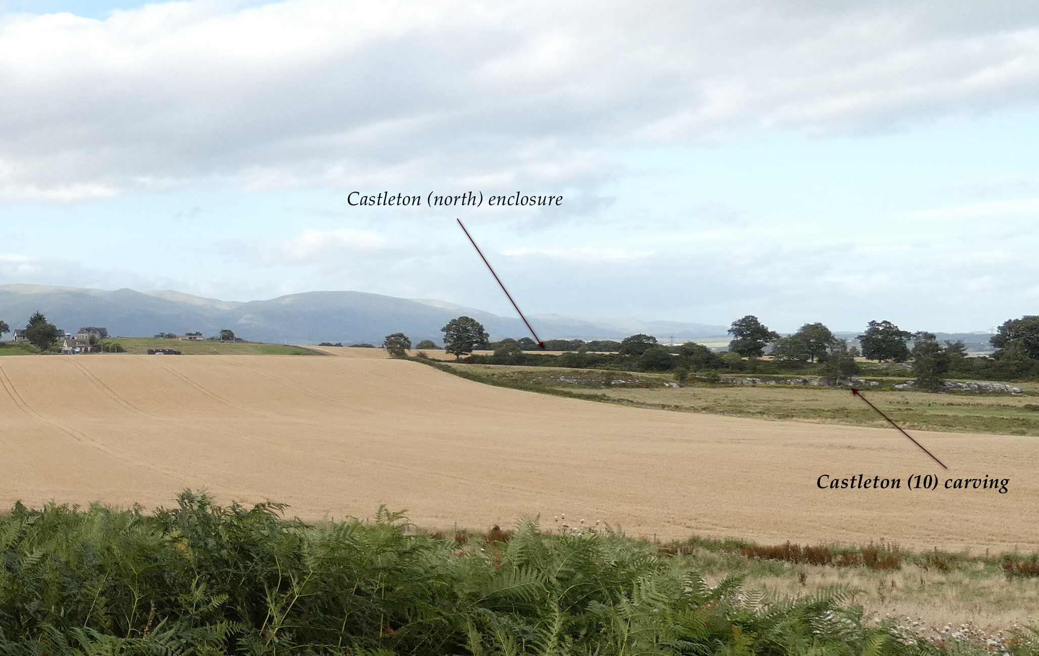
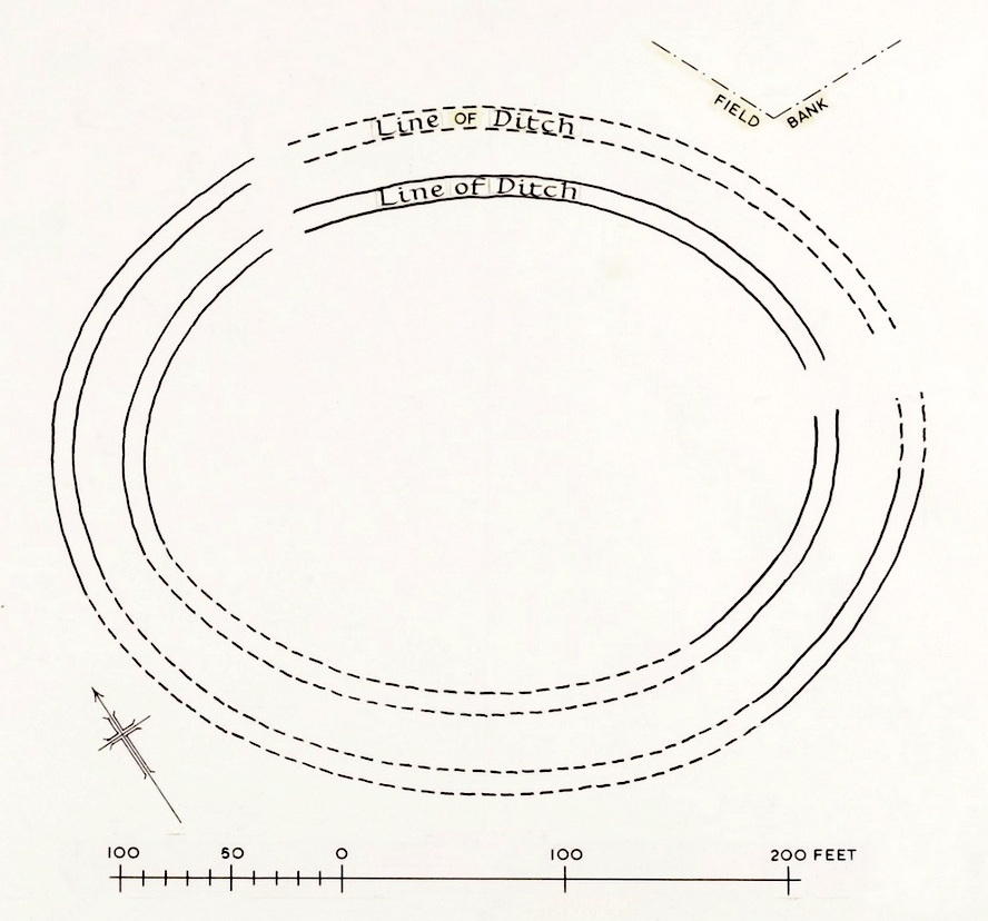
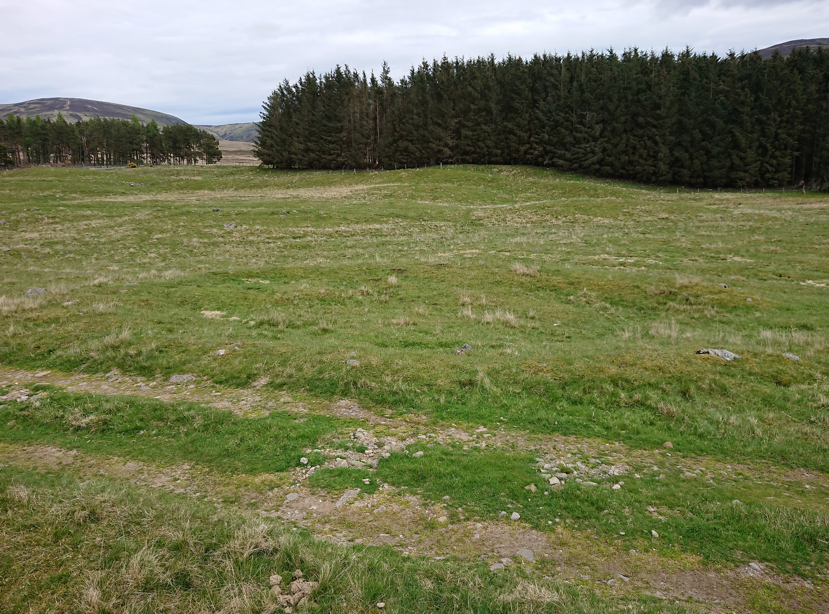
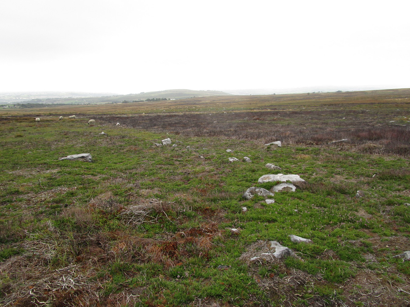
In the fields immediately above the northernmost of the Castleton petroglyphs, there was, in bygone times, a prehistoric settlement, forgotten and cast even from folk memory until very recently, when aerial photography revealed the ghostly outline of its former existence. Similar in design, but somewhat smaller than the prehistoric Gallamuir enclosure a half-mile southwest of the Castleton carvings, this double-ringed oval enclosure—thought by archaeologists to have been defined all round with large wooden stakes, or palisaded—measures, from outer edge to outer edge, 65 yards (SE to NW) across its longer axis, by 55 yards (SW to NE). The gap between the trenches that define the inner and outer wooden ‘walls’ is between five and six yards apart all round it. The entrance to the enclosure seems to have been on its southeastern side—although an excavation is needed to be sure about this. Sadly, almost nothing can be seen of the site at ground level. An archaeo-dig would be a good idea. 🙂
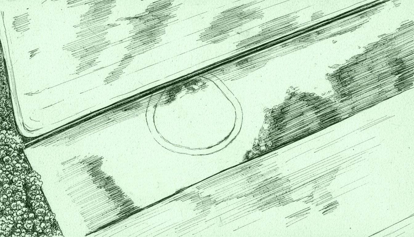
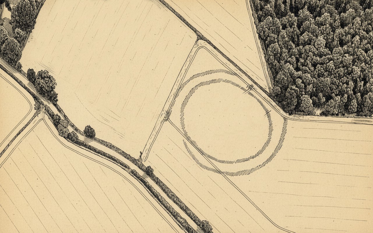
Rough sketch of site-plan
‘Palisade enclosures’ tend to be neolithic in origin and were in use for many centuries, sweeping into the Bronze Age. I highlight this long period in time due to the proximity of the extensive and very ornate cup-and-ring carvings that start just 300 yards southwest of the settlement on the first rock outcrop that you meet. It’s a good one too! Petroglyphs were also created mainly during the neolithic and Bronze Age periods; and as the enclosure here is on the slight rise in the land overlooking the various small rocky ridges below, many of which are decorated in ornate cup-and-rings, it’s likely that some of the people who lived here were probably the people who did them…
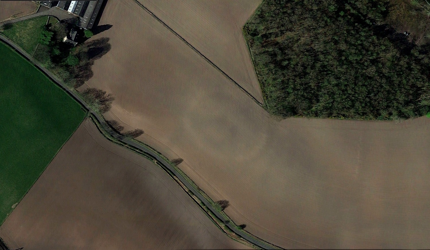
Just over a half-mile (1km) south-west of the major rock art complex at Castleton, in the fields just east of Gallamuir Farm on the north side of the B9124 road, could once be seen a decent double-ringed enclosure, prehistoric in nature. At ground level today there is nothing to be seen as agricultural practices have ever so slowly eroded it away. It wasn’t in a good state when the dudes from Royal Commission (1963) had a look at it in October, 1951—although they did tell us that some faint remnants were discernible, but it was fading fast! They wrote:
“No traces of this structure can normally be seen on the surface, but at the date of visit, when the site was covered with wheat stubble, stretches of both ditches were clearly visible, as shown on the plan (below), by reason of the stronger growth of the stubble overlying them. The ditches are from 20ft to 30ft apart, and the enclosed area measures 300ft from ESE to WNW, by about 240ft transversely. Two narrow gaps in the inner ditch on the north and east arcs respectively, may represent original entrances.”
Outline sketch of the enclosureRoyal Commission plan
Nothing remains of it today apart from the shadow-marks of its former existence when looked down from above. The double embankment that constituted the enclosure initially suggested it to be Iron Age in nature, akin to the larger hillforts up and down the country, but the outline is more consistent of a standard settlement enclosure. As far as I’m aware, no excavations have taken place here, so we’re at a loss to know whether the people living here had anything to do with the rock art just across the fields at Castleton. If we found that it had a Bronze Age or neolithic date, a connection could be likely. But we may have to look at the enclosure immediately north of the Castleton complex to be more sure of our petroglyphic culprits….
References:
Lock, Gary & Ralston, Ian, An Atlas of Hillforts of Great Britain and Ireland, Edinburgh University Press 2022.
Royal Commission on the Ancient & Historical Monuments Scotland, Stirling – volume 2, HMSO: Edinburgh 1963.
Royal Commission on the Ancient & Historical Monuments of Scotland, Archaeological Sites and Monuments of Stirling District, Central Region, Society of Antiquaries of Scotland 1979.
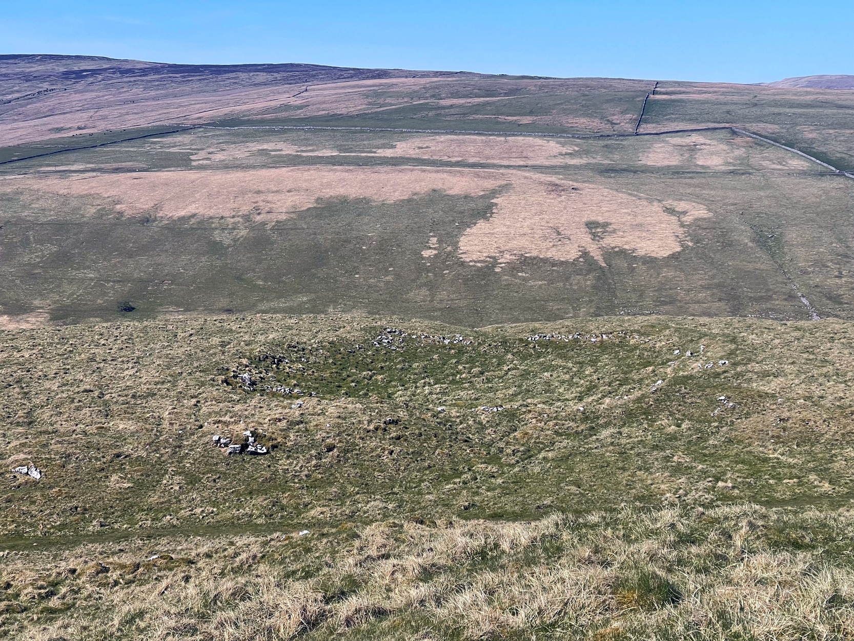
From Arncliffe village, walk past the front of the Falcon Inn village pub and along the track called the Monk’s Road. After a short distance it becomes a dirt-track where the old house lives. Less than 200 yards past the old house, a footpath takes you over the wall, then you walk 200+ yards southwest and through another wall, then up the curvaceous footpath diagonally WSW up the steep hill until you go over another wall where the land levels out. Follow the footpath along the edge of the steep drop for just over a mile where you’ll cross the fifth wall (the Clowder (1) enclosure is up above you by the rock outcrop to the left) and 100 yards along, just north of the footpath, you’ll see a large hollow defined by rocks and low walling. You’ve arrived!
Archaeology & History
The south & eastern walls
Amidst the scattered remains of the extensive Dewbottoms settlement complex, this large hollowed walled enclosure is pretty clear to see. Measuring 40 yards north-south across its longest axis and 31 yards east-west, the structure is like an erratic rectangle in shape, with entrances in the middle of its northern wall and, perhaps, another along the southern side too. It’s quite deep too, being several feet lower than the land around it, keeping it protected from any strong winds above: an ingredient that would obviously have been taken into consideration when it was being built. The walling that defines the structure is a contrived mix of Nature’s own semi-circle of earthfast limestone rock, with intermittent gaps filled-in with thousands of small stones placed there by humans, 2-3000 years ago. It’s quite impressive when you see it in the flesh.
Northern wall & dipped entranceThe west & northern walls
The site appears to have an Iron Age to Romano-British pedigree – although I’m hedging a bet that the place was probably still in use during medieval times. The enclosure has the appearance of some sort of prehistoric village hall. There are no hut circles or any other walled structures inside the overall enclosure, meaning it may have been used, perhaps, for tribal village gatherings; or it might just have been a large enclosure for cattle. Only an excavation would tell us one way or the other.
Anyhow, if you’re coming up to see the Dewbottoms complex from Arncliffe, this is the first main thing that you’ll come across. From here, to your immediate south and west, there’s a mass of prehistory beneath your feet. Make a long day out of it as you’re gonna be somewhat overwhelmed by the magnitude of it all.
References:
Charlesworth, D., ‘Iron Age Settlements and Field Systems,’ in Proceedings of the Archaeological Journal, 125, 1968.
Dixon, John & Phillip, Journeys through Brigantia – volume 2, Aussteiger: Barnoldswick 1990.
Raistrick, Arthur & Holmes, Paul F., Archaeology of Malham Moor, Headley Brothers: London 1961.
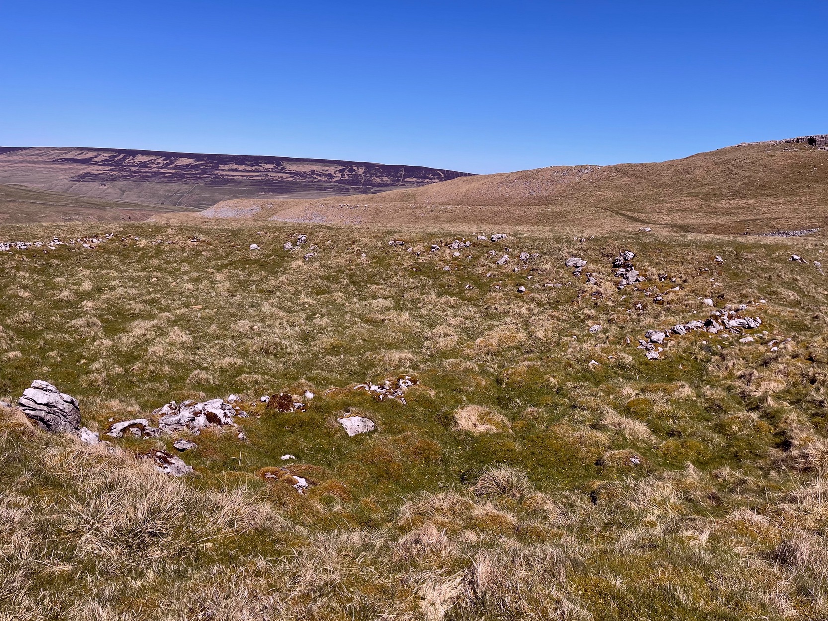
Going along the B6160 road from Grassington to Kettlewell and taking the little road to Arncliffe on your left just a few hundred yards past Kilnsey Crags, after ¾ of a mile keep your eyes peeled for the small parking spot on the left-side of the road, with the steep rocky stream that leads up to the Sleet Gill Cave. Walk up this steep slope, following the same directions to reach the Sleets Gill Top enclosure. From here you’ll notice a large gap in the rocky crags about 200 yards WSW that you can walk through. On the other side of this gap, along a small footpath about another 200 yards along you’ll reach a large ovoid rock. Just before this, on your right, is a long rocky rise with distinct drystone walling below it. That’s the spot!
Archaeology & History
Walled section, looking S
Encircling a slightly sloping area of ground that stretches out beneath a long line of limestone crags is this notable walled enclosure running almost the full length of the rocky ridge. Measuring 40 yards (36m) in length by 10 yards (9m) across at its greatest width, this elongated rectangular enclosure has all attributes of being Iron Age in origin, much like many others in this area. However, in comparison with the others close by, this is a pretty small construction and—if used for human habitation, as is likely—would have housed only two or three families.
Western end of enclosure
Within the enclosure itself, near its western end, we find an internal line of walling that creates a single room: enough for a single family, or perhaps even where animals were kept. Only an excavation would tell us for sure.
Curious stone ‘cupboard’
One notable interesting feature exists roughly halfway along the enclosure, up against the crag itself: here is small man-made stone “cupboard” of sorts, akin to some modern pantry. You’ll get an idea of it in the photo. At first I wondered if this would have been a sleeping space, but, unless it was where a shaman liked to encase him/herself inside a domestic household cave (highly improbable), it would have served a simple pragmatic function. Make up your own mind.
I liked this place. It’s surrounded by crags on almost all sides with some ancient spirit-infested rocky hills very close by, giving it a beautiful ambience. Immediately below the enclosure is what looks to be a large dried-up pool, which was probably well stocked with fish. A perfect living environment. Check it out!
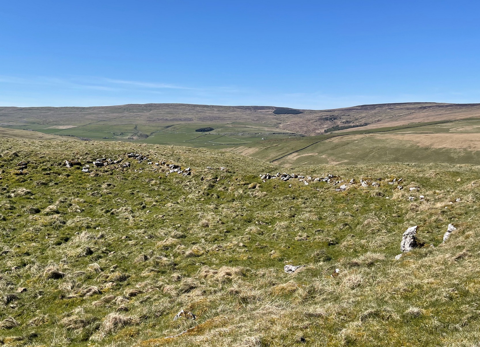
Go up the B6160 road from Grassington to Kettlewell and just a few hundred yards past the famous Kilnsey Crags, take the little road to Arncliffe on your left. After ¾ of a mile, keep your eyes peeled for the small parking spot on the left-side of the road, with the steep rocky stream that leads up to the Sleet Gill Cave. Walk up to the cave, then keep going up the same steep slope to the wall/fence above. You can get over the wooden fence and keep following the wall until it just about levels out nearly 200 yards up. From here, walk 100 yards to your right where the land rises up and you’re at the edge of the walled enclosure. Look around.
Archaeology & History
Walled section, looking W
On top of a small rise in the land is this large, roughly rectangular walled enclosure measuring about 55 yards across at its longest axis (roughly WNW to ESE) and averaging 24 yards wide. The walling is pretty low down and, in some areas (mainly on its eastern edges) almost disappears beneath the vegetation—but you can still make it out – just! The southernmost edge of the enclosure is built upon a the edge of a natural rocky outcrop (typical of many enclosure and settlement sites in this neck o’ the woods) and when you stand on this section you see a very distinct rectangular enclosure, sloping down from here. This would likely have been where animals were kept as it makes no sense as a human living quarter due it being on a slope. But below this, where the land levels out, another low line of ancient walling reaches towards the high modern walls. This is one of three lines of ancient walling running, roughly parallel to the more modern walls (which themselves may have an Iron Age origin) from the main enclosure.
Aerial view of site
The entire structure is Iron Age in origin, but the site would have been in continual use throughout the Romano-British period and possibly even into early medieval centuries (though only an excavation would confirm that). Its basic architecture is replicated in the many other prehistoric settlements that still exist on the hills all round here (there are dozens of them). You’ll see this clearly when you visit the High Sleets enclosure less than 400 yards southwest from here.
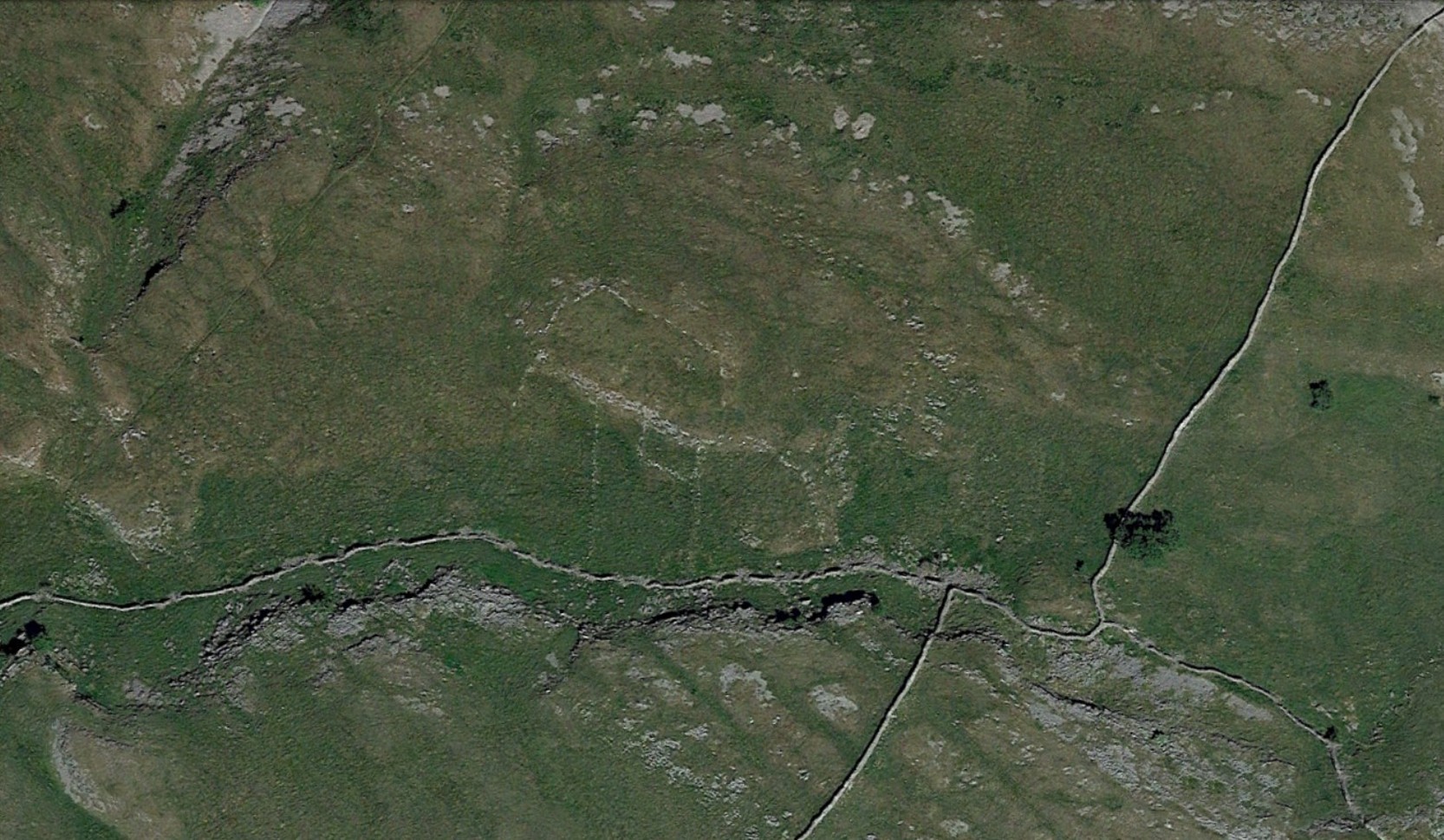
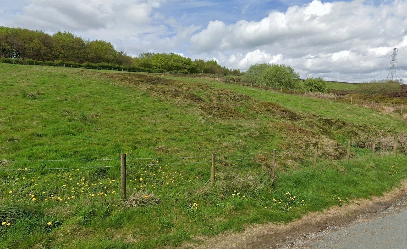
If you’re coming via Ripponden, take the B6113 road uphill to Barkisland; but if from the Huddersfield direction, take the B6114 to Barkisland. Once in the village, stick to the B6114 Saddleworth road going south. After passing the unmissable Ringstone Edge reservoir (the Ringstone circle is on its far side) the Saddleworth road begins to straighten out and you hit the large quarry on your right. But before the quarry entrance, keep your eyes peeled on your left for the minor Scammonden Road that slopes downhill. 50 yards down, a gate and stile allows you into the field on your left (north) where you’ll see the scruff of earthworks. Y’ can’t really miss it
Archaeology & History
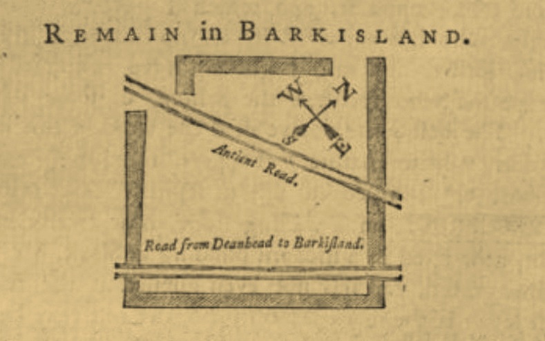
Watson’s 1775 plan
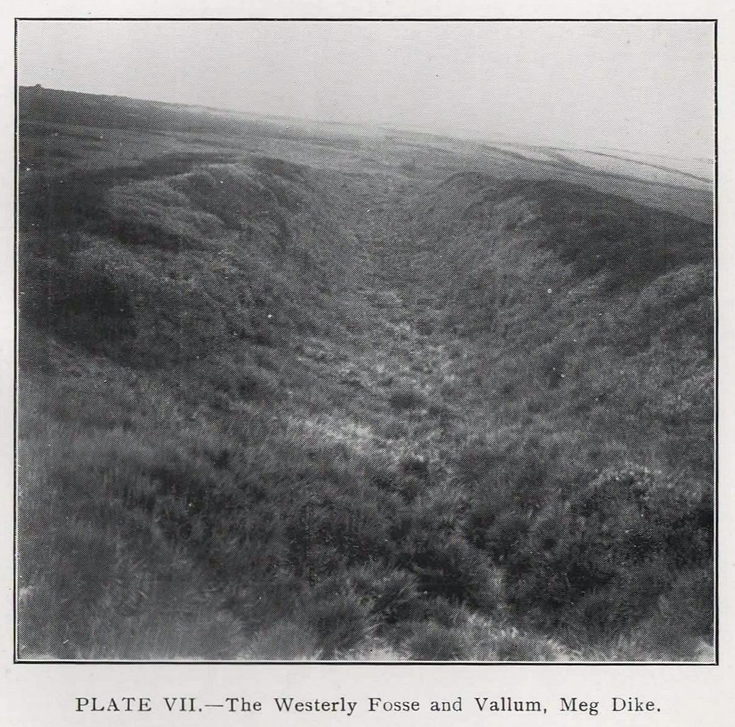
On the face of things, this is nowt much to look at unless you’re a prehistoric settlement freak! It is however a very notable rectangular set of ditches and embankments, with the ditches averaging between 10-12 feet across and 3-4 feet deep in places; whilst the raised banks vary between 13-20 feet across. The place was quarried into sometime at the end of the 19th century, casusing obvious damage, but its outer ramparts are still plain to see. It’s been known about for quite a few centuries too. Even before the Ordnance Survey lads had stuck it onto their brilliant mapping system, the great John Watson (1775) described these old ruins as,
“a piece of ground inclosed within deep ditches, on the side of the hill called Pikelow, one of which, to the west, is fifty-three yards long, full five yards wide, and about two yards deep; the opposite side to this cut by a wall and a road, but is very visible in the adjoining field, the plough not having yet been able to destroy it. The ditch to the south measures also fifty-three yards, but it is not so entire as the other. There is an opening at each corner of the western ditch which, if continued, would make the whole to be ninety-six (sic) yards each way. One of the sides towards the east is nearly levelled, the rest is in good preservation.”
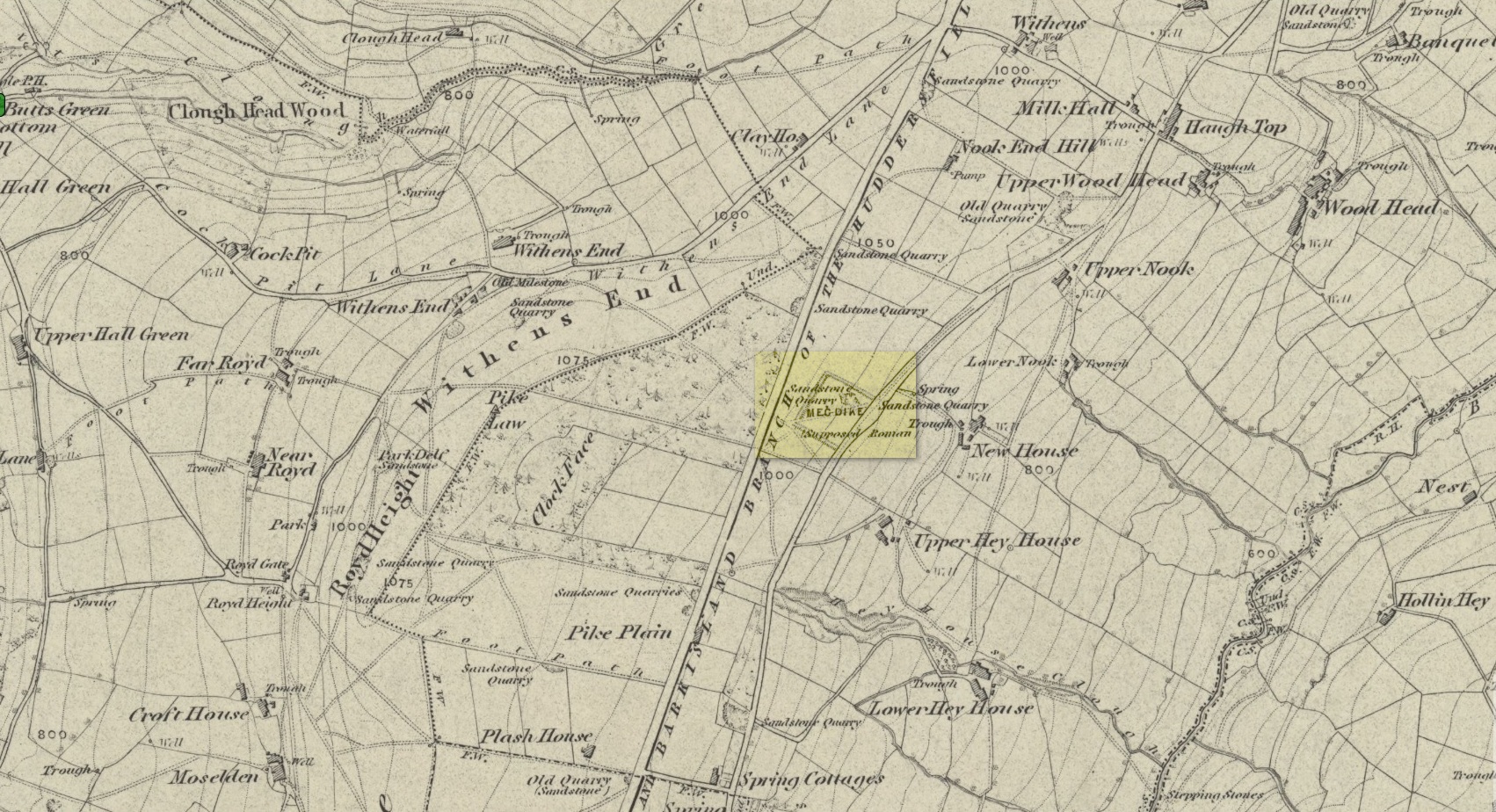
Meg Dyke on 1854 OS-mapPetch’s 1933 photo
He thought the remains to be Roman—a sentiment echoed by local archaeologist James Petch in 1924. More recently however, following a small excavation at the site by the Huddersfield Archaeology Group, Faull & Moorhouse (1981) suggested it to be Iron Age in nature—though with no hardcore evidence to confirm one way or the other. When Arthur Longbotham (1933) assessed Meg Dyke in his short rare work, the Roman question was explored—and ditched. Instead he thought that this settlement was “very likely the place of assemblage of all the warrior Brigantes from the surrounding hills and villages.” I think it’s likely that this is pretty close to the mark. My take on the place is a similar one, i.e., it’s either Iron Age or Romano-British in nature, simply due to its similarity with other remains from those periods: the Cowling’s enclosure on Askwith Moor being one such example.
References:
Faull, M.L. & Moorhouse, S.A. (eds.), West Yorkshire: An Archaeological Guide to AD 1500 – volume 1, WYMCC: Wakefield 1981.
Longbotham, Arthur T., Prehistoric Remains in Barkisland, Halifax 1933.
Petch, James A., Early Man in the District of Huddersfield, Tolson Memorial Museum: Huddersfield 1924.
Watson, John, The History and Antiquities of the Parish of Halifax, T. Lowndes: London 1775.
From Kirriemuir town centre up the B956 Kinnordy Road, turn left where it goes along the B955 road for several miles towards Cortachy, following the same route as if you’re going to the curious Whitehillocks stone circle. Literally two miles (3.2km) along the road past Whitehillocks farmhouse, a large “parking” spot is at the right-hand side of the road. From here, walk along the road for 230 yards and go thru the gate on your left. The first low-rise hut circle is to your immediate right; and from here, meander along the track ahead of you, keeping your eyes peeled…
Archaeology & History
Despite being initially difficult to make out (as the photos here indicate), once your eyes have adjusted to the landscape morphology, you realise what an impressive prehistoric complex you’re wandering through. Saying that, it’s primarily a site that’s gonna be of interest to antiquarians, archaeologists and historians, as this is a settlement you’re looking at, lacking in megaliths, petroglyphs and similar ritual sites.
First enclosure, through the gate on your rightCairn in the meadows
The first site that you’ll probably notice is visible from the road—but it’s not the first part of the settlement that you’ll pass. Immediately through the gate (as I’ve said) is the embanked rise of earth—only one or two feet high—making up the first notable hut circle (NO 36612 70453), measuring roughly 15 yards across. The shape and form of this circle typifies the others in the arena ahead of you, so that once you’ve made yourself aware of what this one looks like, you’ll be able to see the others with greater ease. Another low embanked circle of roughly the same size is just a few yards away at NO 36605 70439.
Straight back onto the track you’ll notice another larger D-shaped enclosure immediately on your left (NO 36622 70406), about 17 yards across; this is accompanied by what looks like a cairn immediately right of the track (NO 36609 70413), but this is actually a much smaller D-shaped enclosure, just right for one or two people.
The small rounded hill in front of you has what may be a circular enclosure on its top, but I wasn’t too sure about it. But looking down from this hill is the most visible of all the structures in the settlement (NO 36580 70307)—and the one I mentioned as being visible from the road. At first it’s a little deceptive in appearance, as you get the impression that the oval of stones (top photo) is what constitutes this hut circle, when in fact this element may be mediaeval in nature as it’s been built on top of an earlier Iron Age (?) enclosure. You can barely see this earlier form at ground level, so it’s best to walk back up the rounded hillock and cast your gaze back and forth and round the side of the ring of stones. You’ll see, eventually, the shallow overgrown walling of a larger oval-shaped enclosure, measuring eighteen yards across, whose edges start from the bottom of the hillock and arc around to the outer edges of the stone construction.
Hut circle, NO 36573 70230
Back onto the track and further into the meadows, the next hut circle you’ll meet is (keep your eyes peeled) right by the track-side (NO 36573 70230). It has wide embanked walls that are low to the ground and completely overgrown, measuring 15 yards (E-W) by 18 yards (N-S), with what looks to be the original entrance or door on its south-side. A similar large circle exists on the other side of the track a little bit further along (NO 36499 70138).
There’s much more to this settlement, including lengths of walling in the grasslands below the last two circles and where, if you look carefully, you’ll see one of at least two cairns in this area. On the other side of the road are one or two other small hut circles and a much larger construction in the field further down the road, measuring 25 yards in length (NO 36569 70481). This would seem to be the largest of the lot.
The age of this settlement probably covers a considerable period of time: beginning perhaps in the Bronze Age, certainly in the Iron Age and all the way through into the mediaeval period where, all down Glen Clova, remnants of such hamlets still live beneath the soil. This entire arena is bathed in silence, save the wind and call of the birds. Tis a beautiful space to spend a few endless hours…
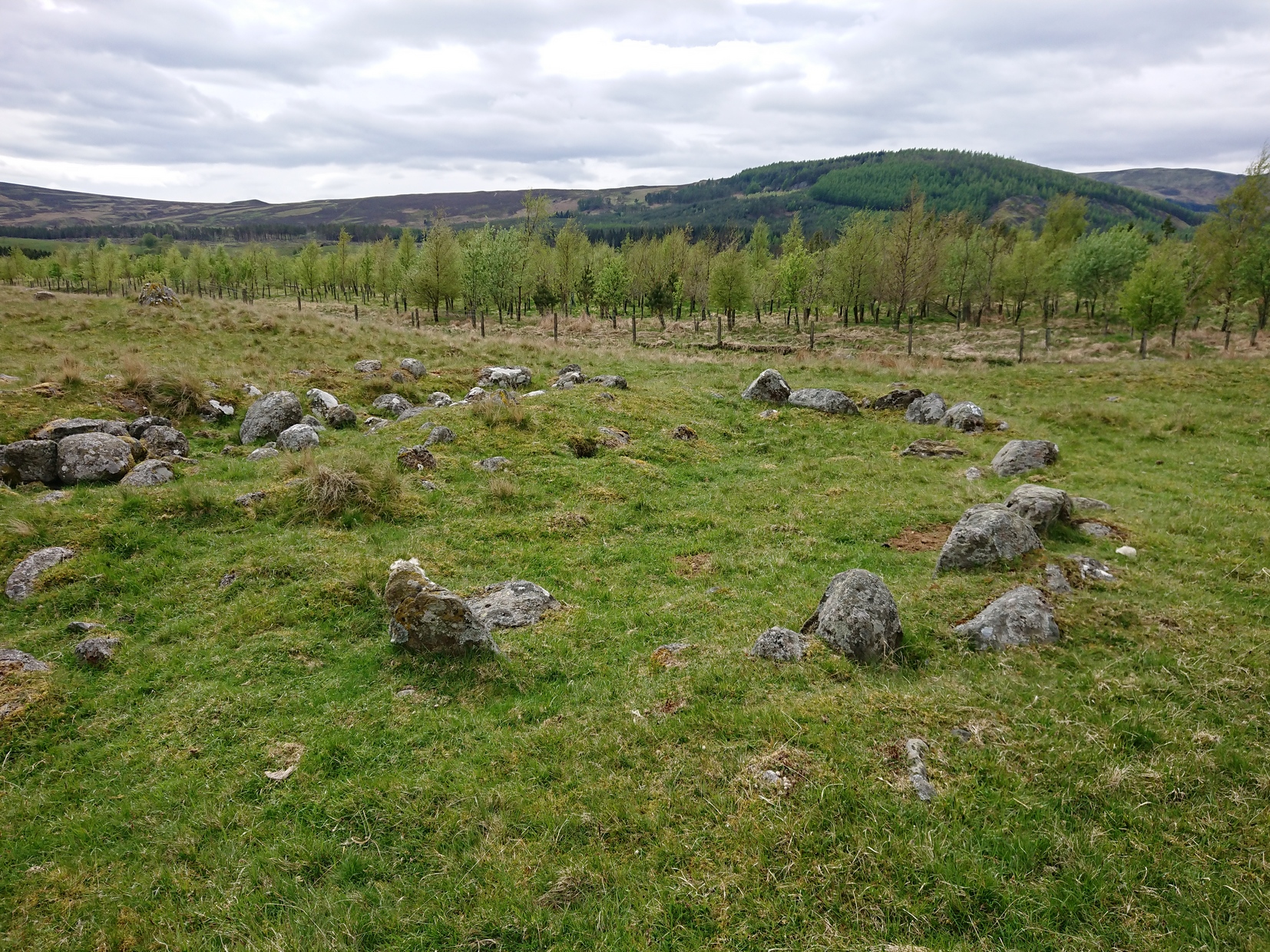
Coming up from Otley, make your way up to the Askwith Moor road (the only one that goes across the moors) and park up on the rough parking spot on the right-side (east) of the road. You can’t really miss it. From here walk up the road for less than 500 yards until your reach the rickety gate and the path onto the moors. From here I walked 600 yards east, thru the heather until I reached the wall (close to the Tree of Life Stone) and then followed the wall up for 150 yards, then back up (west) onto the moor again and, about 50 yards along at the foot of the slope, keep your eyes peeled for the earthworky undulations beneath your tiny feet!
Archaeology & History
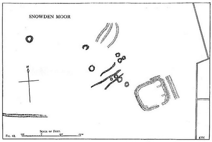
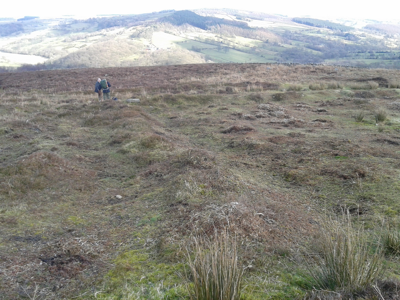
Just below the scattered Snowden Moor settlement we find this curious large structure, first described 75 years ago by the northern antiquarian Eric T. Cowling (1946). Since then, apart from a cursory overview, archaeologists haven’t really paid it much attention.
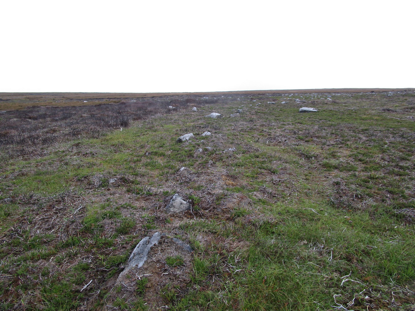
Eastern ditch, looking NEastern ditch, looking S
It’s a large site – and one which Cowling thought was constructed in the Iron Age. He may have been right, but there’s such a profusion of ancient sites on this small moorland area—dating from Neolithic times onwards—that it could be earlier than he thought. It’s an odd site too! Unlike the prehistoric D-shaped enclosure and settlement on the top of the slope less than 100 yards away, and an equivalent D-shaped enclosure to the south, the area inside Cowling’s enclosure ostensibly is on quite sloping ground, with barely a flat level area anywhere inside it. As a result of this, we can safely conclude that it wasn’t where people lived; and the complete lack of any inner hut circles (which you’d expect in a standard enclosure of this size) encourages this view. It’s a bit of a puzzle! Cowling opted for the idea that it was built to enclose cattle – which may be right; but again, even this must be questioned, as there is ample space on more level ground where this could have been done. His description of the site is as follows:
“The most prominent feature (on these moors) is a D-shaped enclosure which covers the nose of the spur; the area is eighty feet from north to south and seventy feet from east to west. The enclosing bank is of piled boulders, three feet high and eight feet wide. Cuttings across the north side revealed no evidence of dry walling, but rather a bank to carry a heavy stockade. A shallow trench runs inside the bank, which is doubled where it is overlooked by higher ground at the northeast corner. A second outer bank at the eastern side has an outer trench. Along the ridge to the east are circles of varying size, probably a hut group. A larger circle (?) of heavy material, some thirty feet in diameter, is isolated on the shelf above Snowden Crags to the west. Strips of wall and remains of enclosures of circular shape abound.”
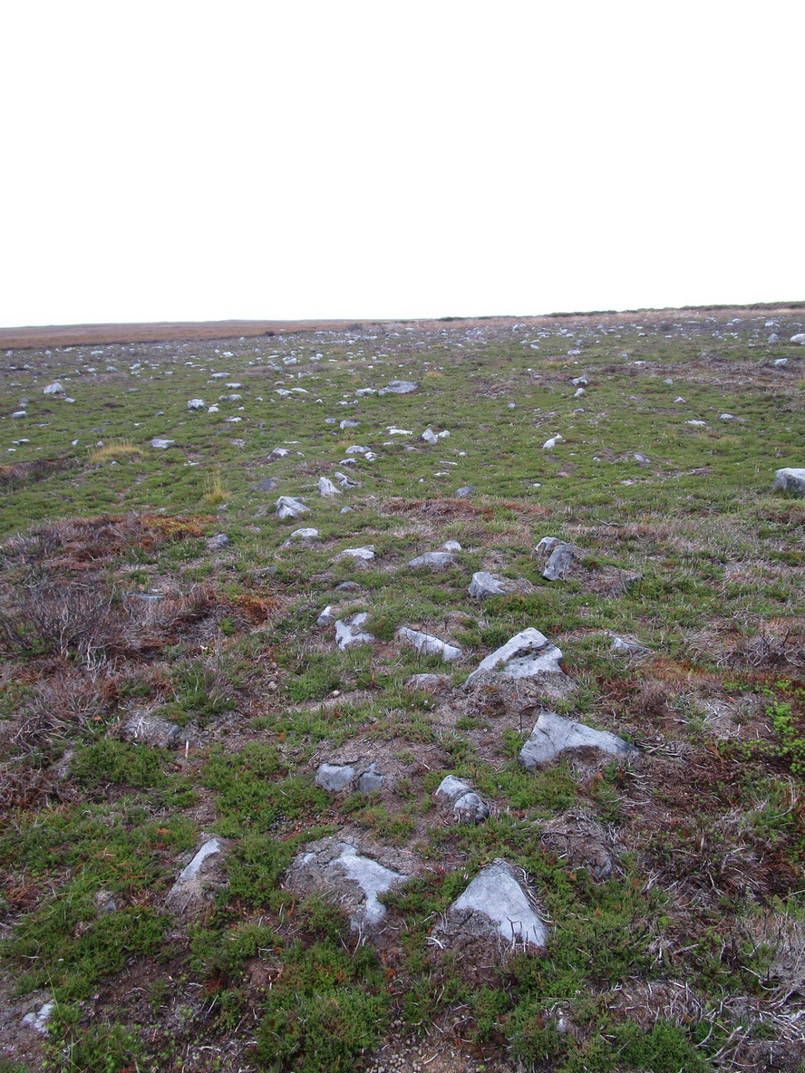
Cowling’s plan of the siteNorthern bank, looking E
Cowling’s initial measurements of the site underestimated its real size, as the bank and ditch that runs roughly north-south is close to 52 yards—nearly twice as long! The same was found along its east-west size: being 56 yards, which is more than twice what Cowling measured. Altogether, the enclosure measures approximately 225 yards around its outer edges. In fairness, Cowling’s error was probably due to it being covered in vegetation when he came to do his measurements here. …So, if you’re gonna check this place out, make sure you do it in the winter or early spring months, before the bracken encroaches.
There’s a real abundance of prehistoric sites all over this part of the moor, from more settlement remains, cairns, ring cairns and petroglyphs. Make a day out of it.
References:
Cowling, Eric T., Rombald’s Way, William Walker: Otley 1946.
Make your way to the Black Beck tomb and walk west for some 50 yards. If the heather has grown any more than a foot tall, it’s impossible to see.
Archaeology & History
Near the northernmost section of the Hawksworth Shaw prehistoric graveyard, some 50 yards west of the Black Beck cairn, exists the remains of a small prehistoric enclosure whose walling is deeply embedded in the peat. Although I describe the place as an ‘enclosure’, we don’t know for certain whether it is a ruined settlement or large hut circles (although this latter idea is the more improbable).
Walling, looking NArc of walling, looking S
Two large open arcs of walling—like large letter “C’s”—with their open sides to the east, have been constructed next to each other, virtually coming together in the shape of an inverted number “3”. The walling in the southern arc—measuring some 33 yards in length and barely higher than 1 foot above ground level—consists of standard stones and rubble, similar to some of the hut circles that are found in greater abundance on the north-side of Ilkley Moor. The smaller, less visible arc of stones—some 18 yards of it—is lower in the earth. Both lines of walling may have been robbed in part to construct some of the extensive cairns close by, as neither of the two arcs were very high and it was very difficult to work out even what sort of structure they might have been.
Like many other prehistoric sites on Rombalds Moor, only an excavation is going to tell us precisely what was going on here…
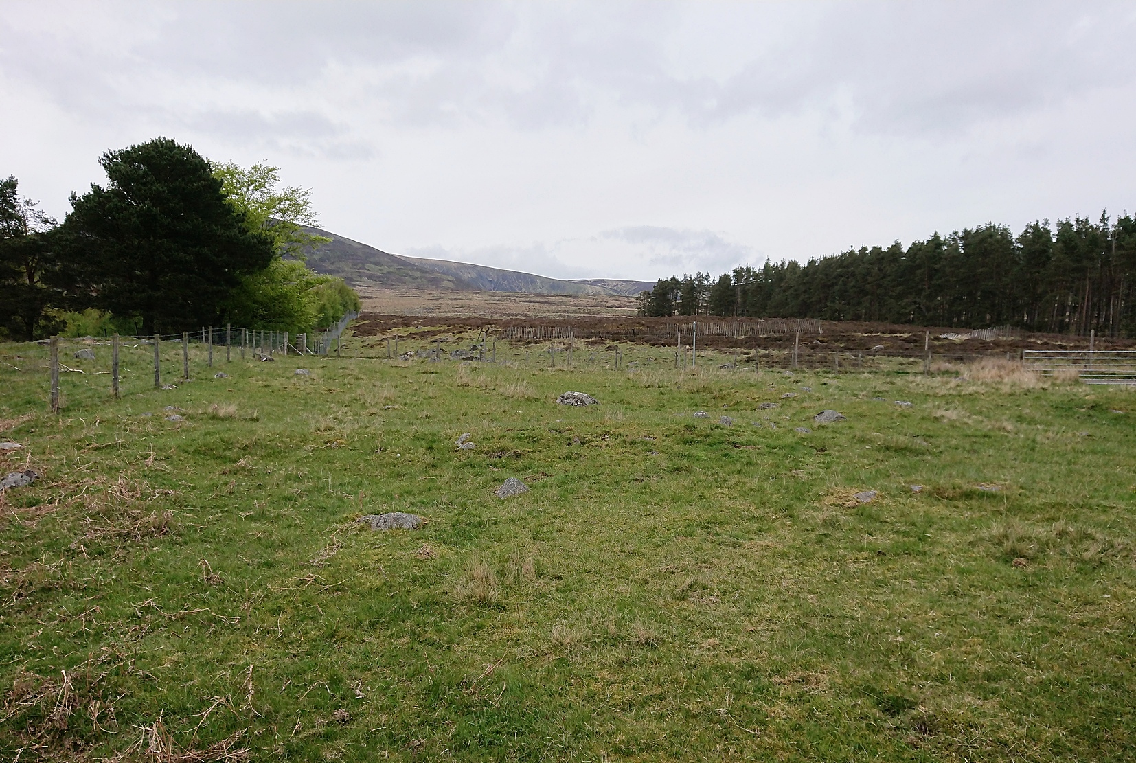
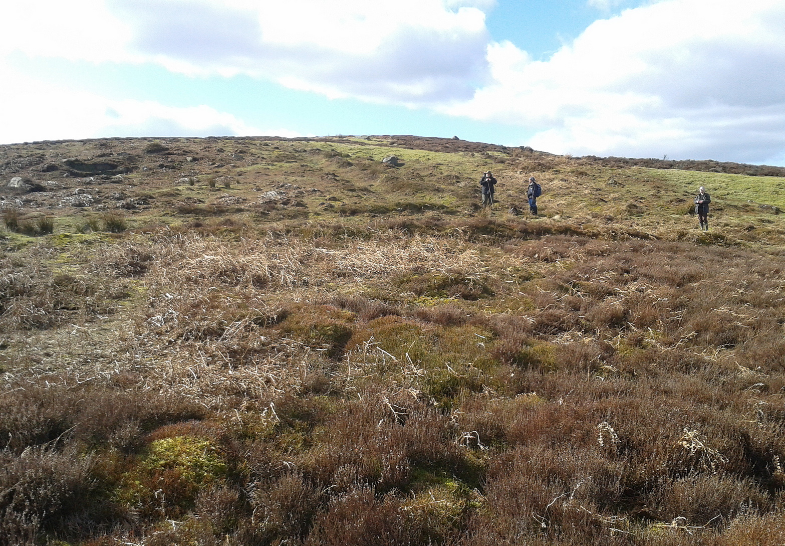
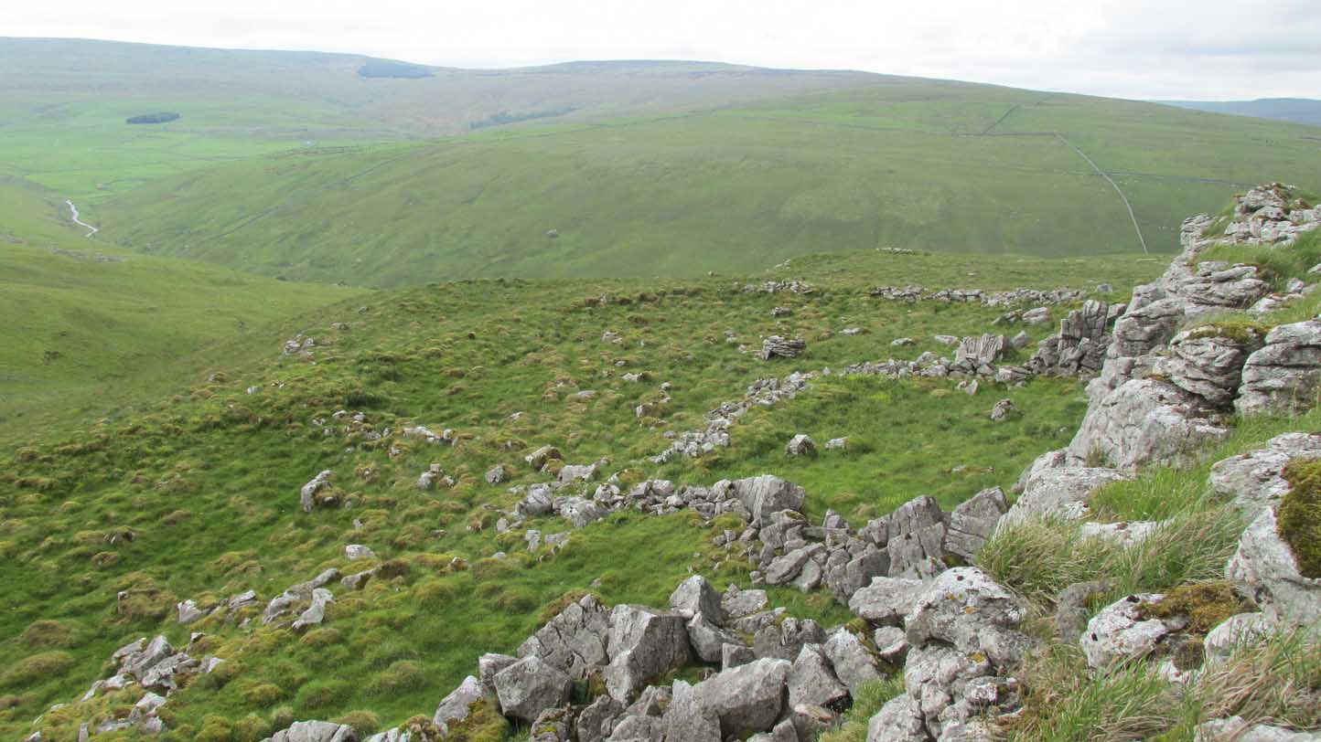
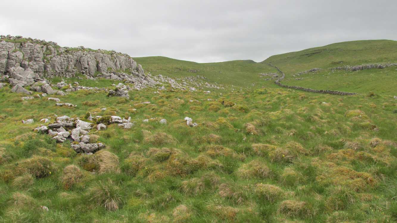
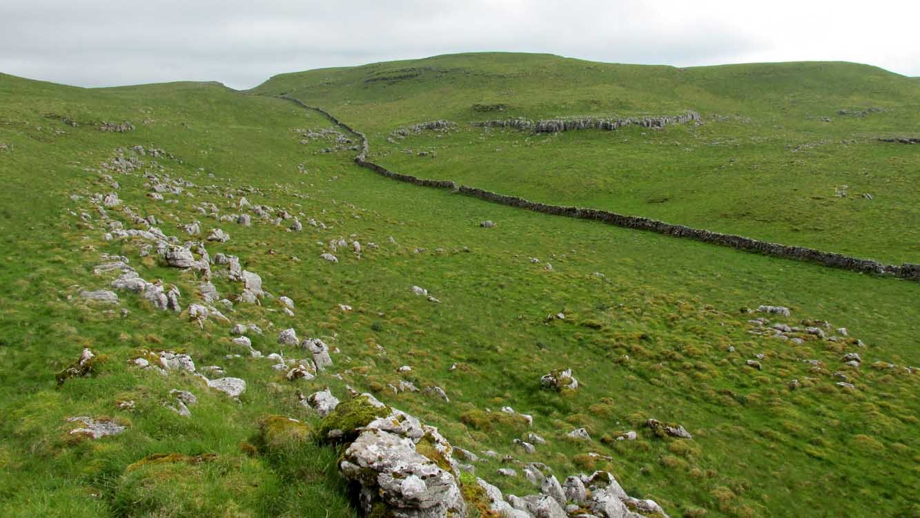
To the right of The Falcon Inn across from Arncliffe village green is a trackway called the Monk’s Way. Walk up here for about 450 yards until there’s a stile on your right which is the start of the diagonal footpath SW up the hillside. Once you hit the limestone ridge several hundred yards up, keep on the path that curves round the edge of the hill for 1.3 miles (2.1km), going over 5 walls until, at the 6th one, you should look uphill, east, at the small cliff-face 100 yards above you. That’s where you need to be!
Archaeology & History
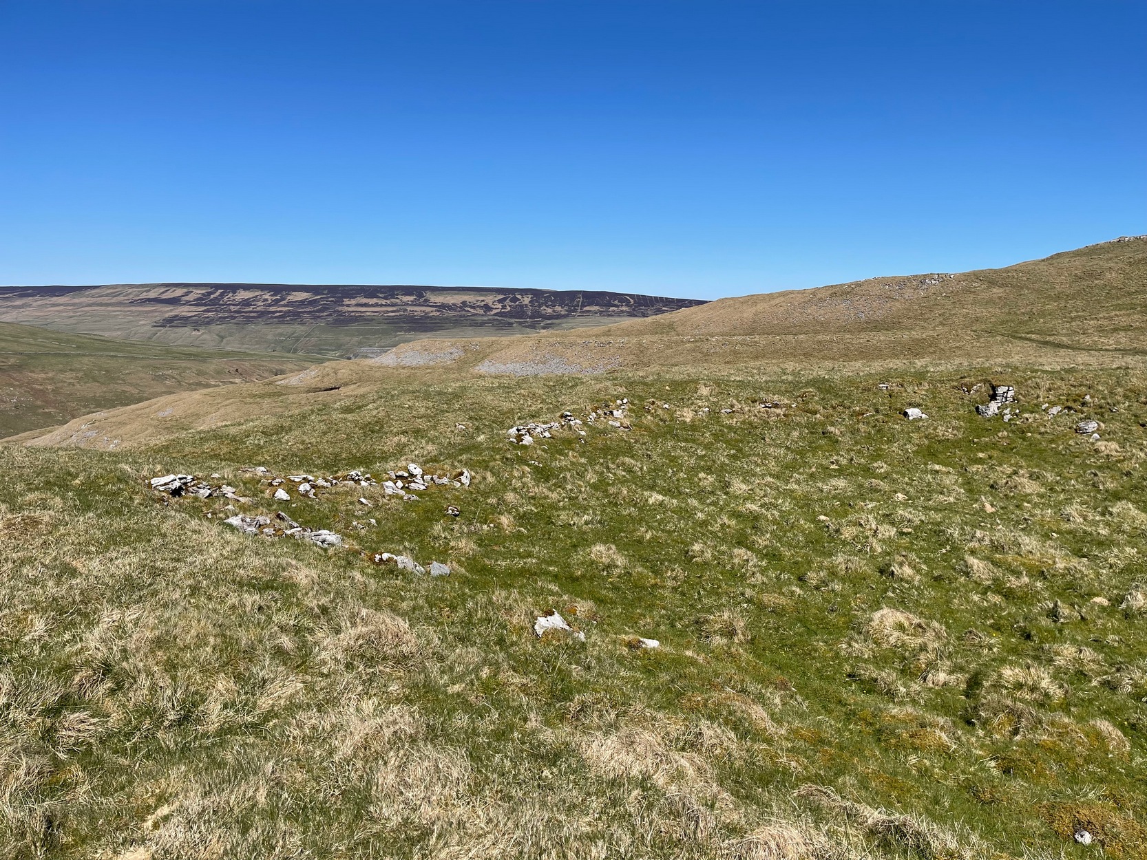
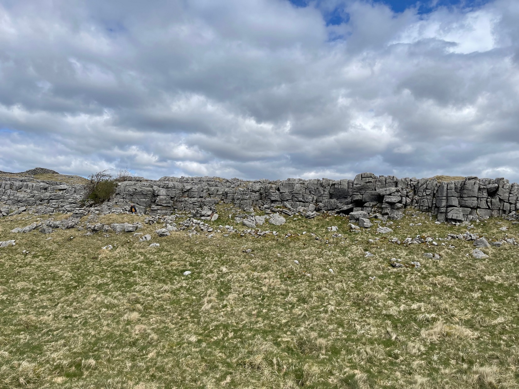
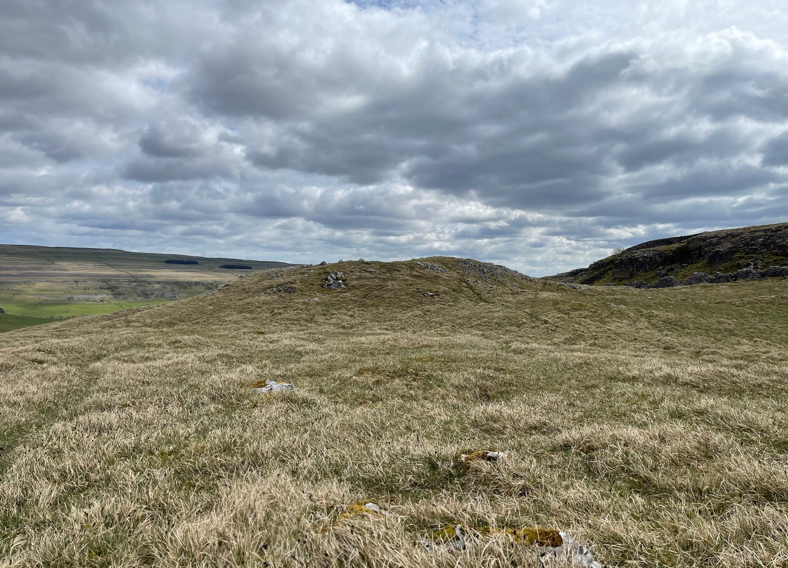
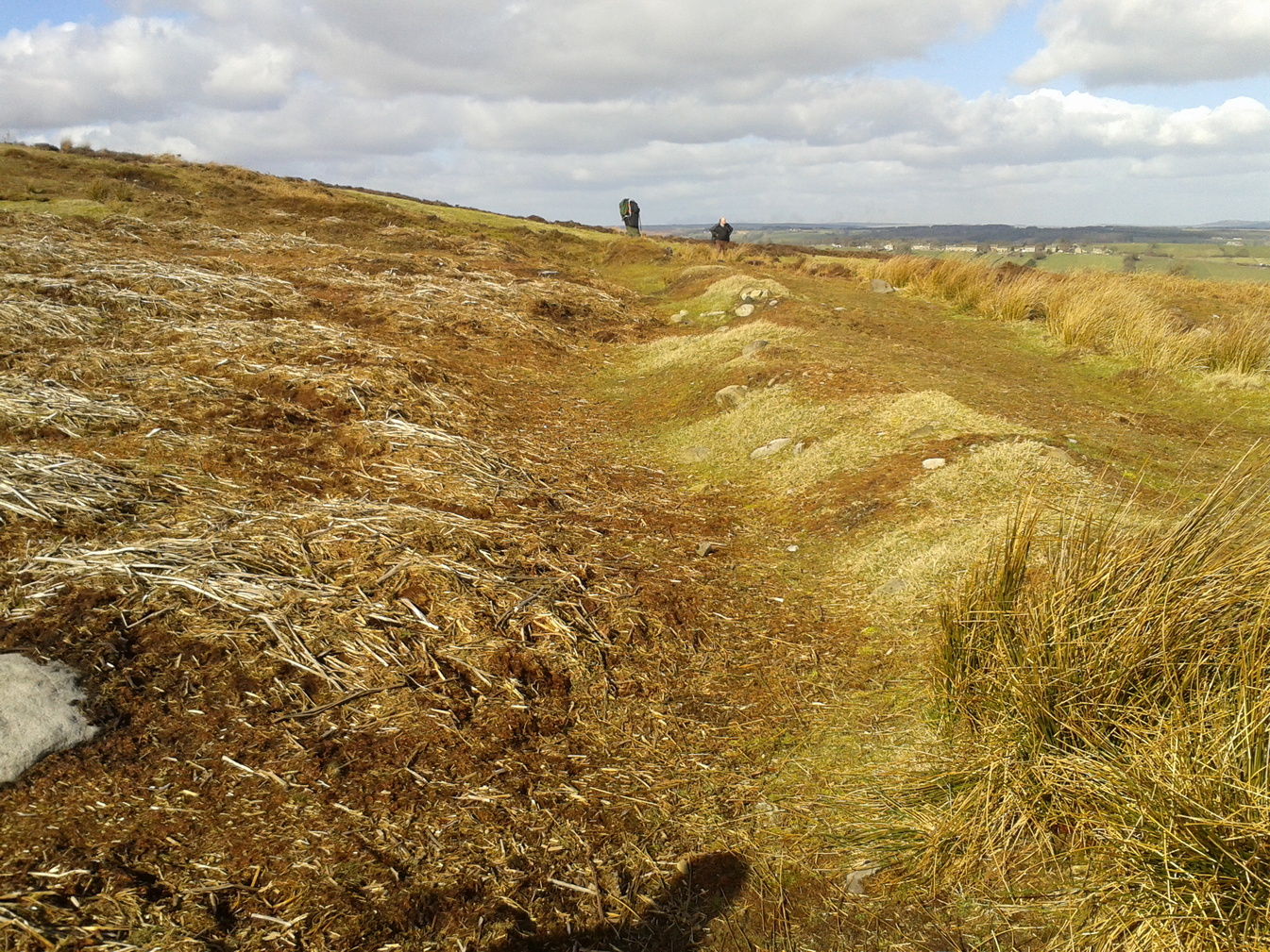
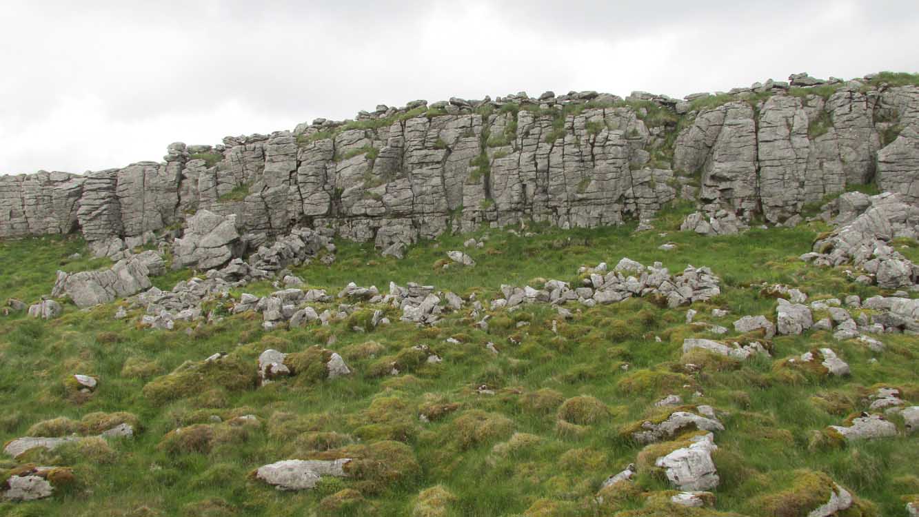
This is one of several clusters of large prehistoric enclosures and settlements in the expanse of land known as Clowder, on the hills 1.65 miles (2.63km) southwest of Arncliffe. It’s in a very good state preservation and, surprisingly, almost nothing has been written about it.
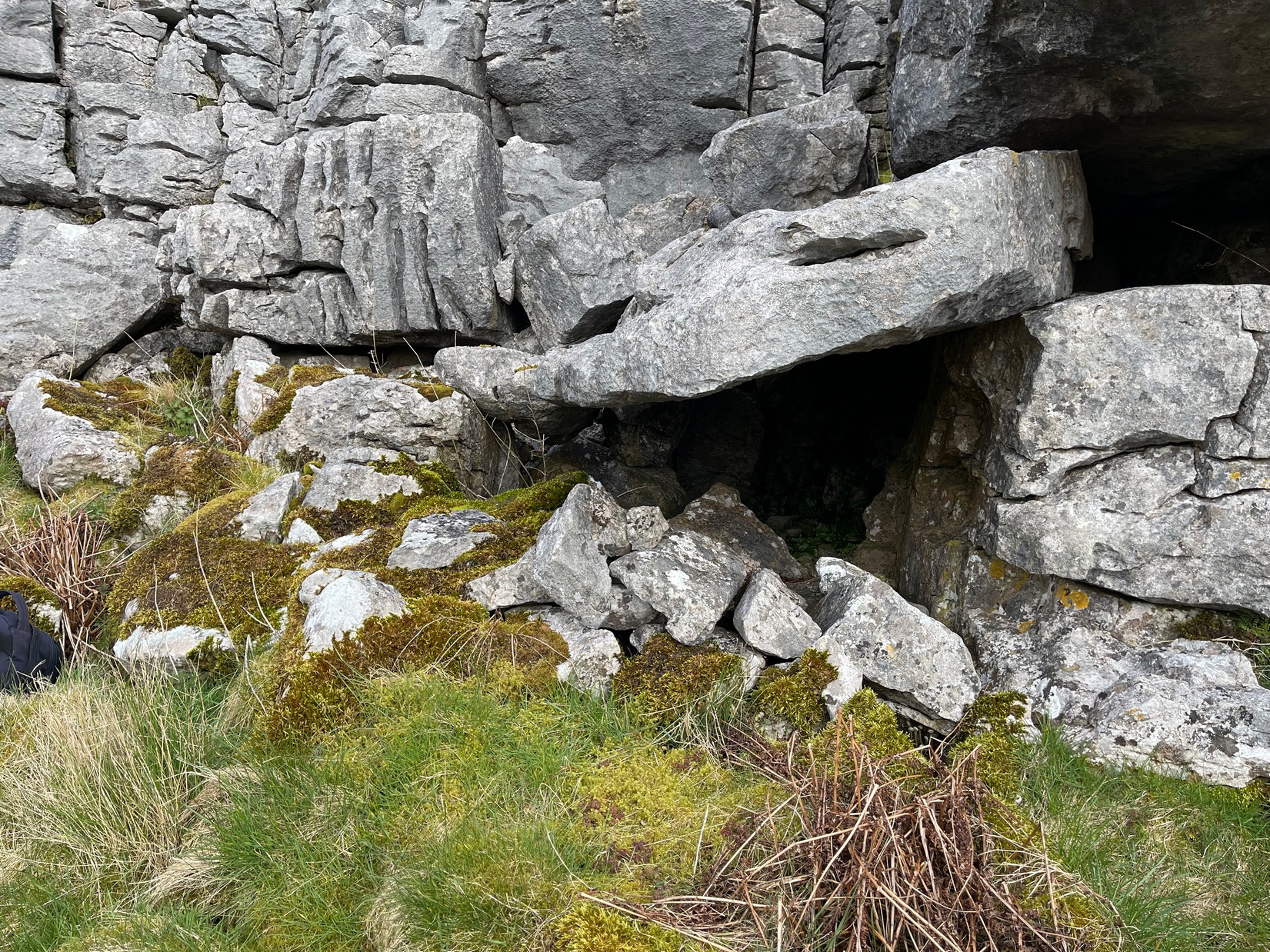
Covered hut circle on NW edgeCliffs & walls of Clowder-1
A multi-period site whose construction probably began sometime in the Iron Age (although the old Yorkshire Dales archaeologist, Arthur Raistrick, thought the settlements up originated in the Bronze Age), we can say with some certainty that parts of this complex were definitely being used until medieval times due to the lack of growth on some of the walling.
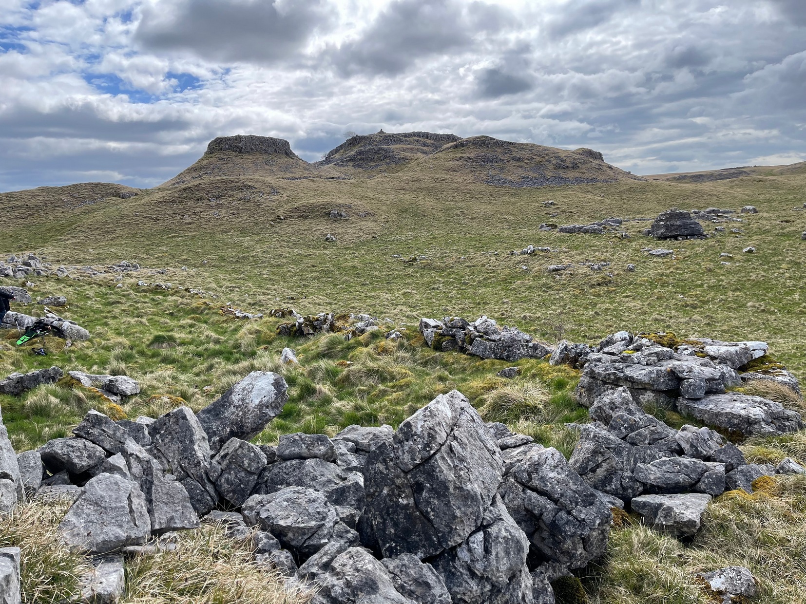
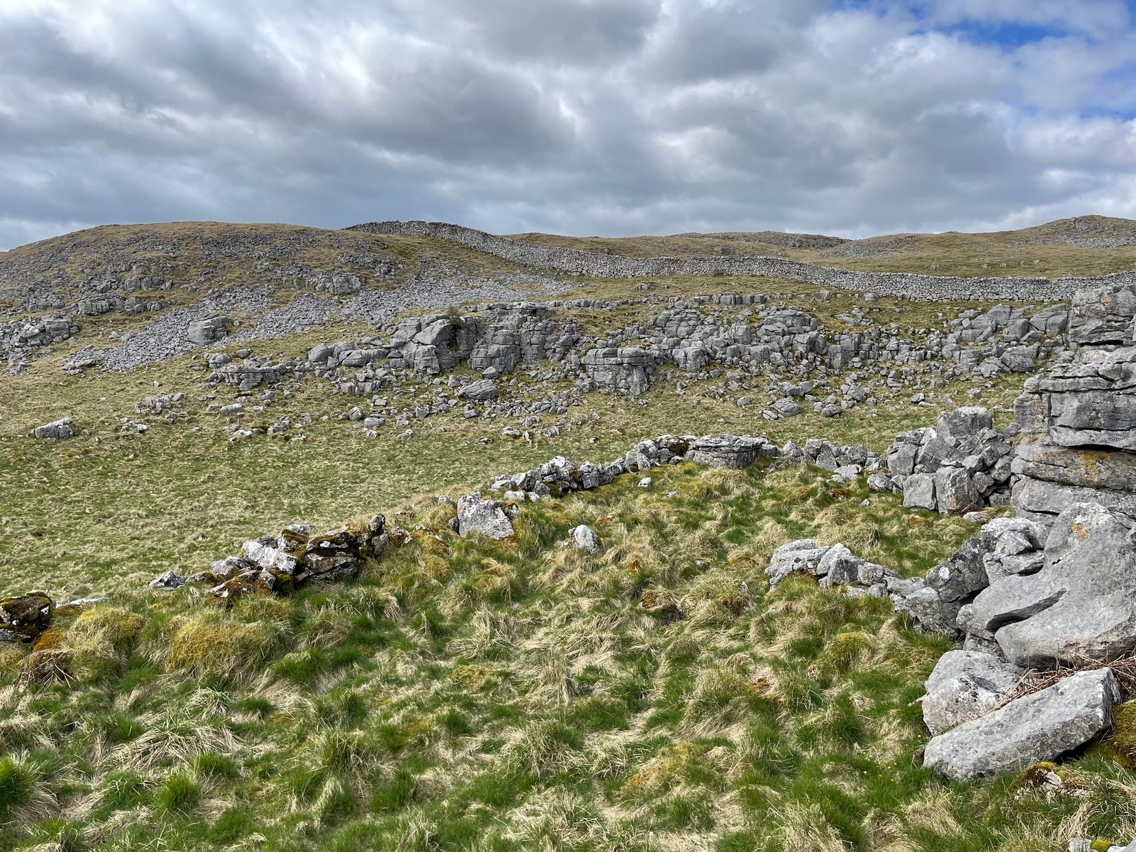
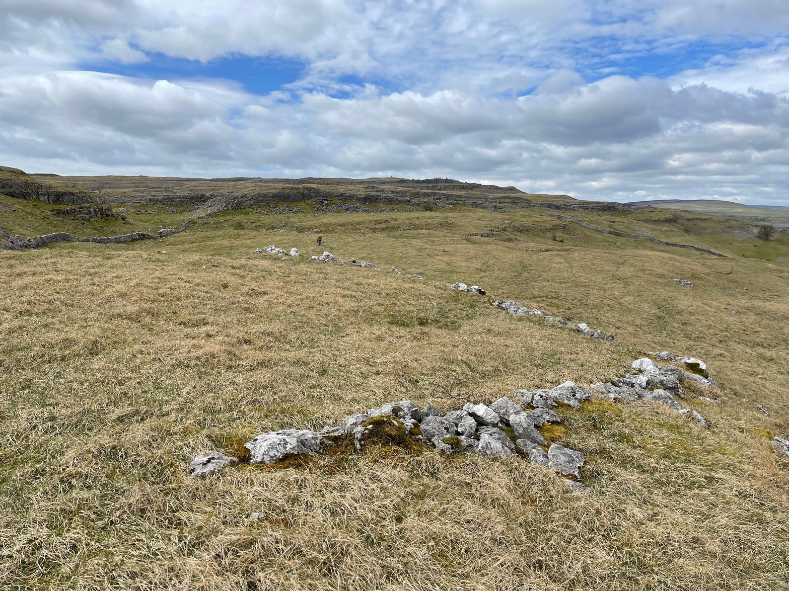
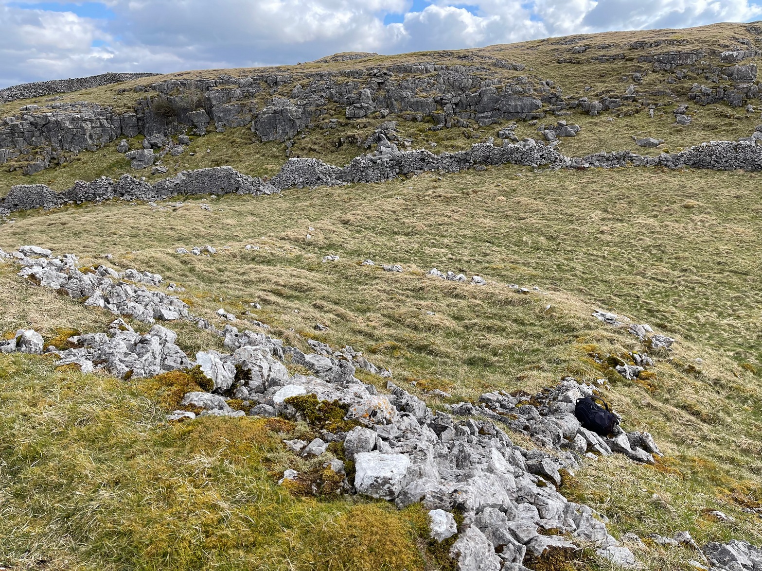
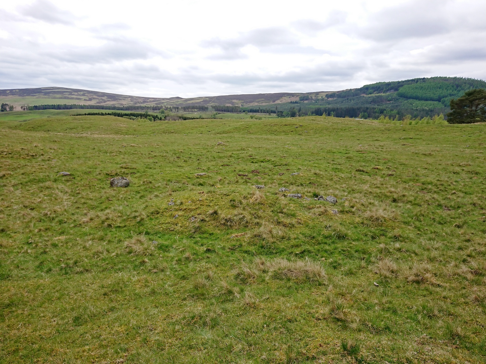
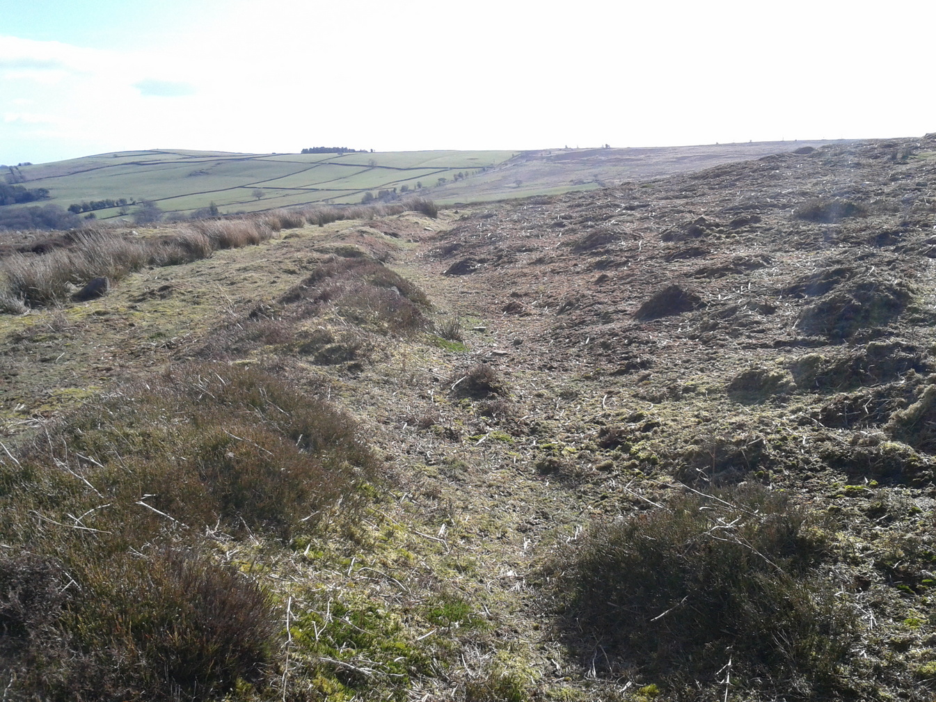
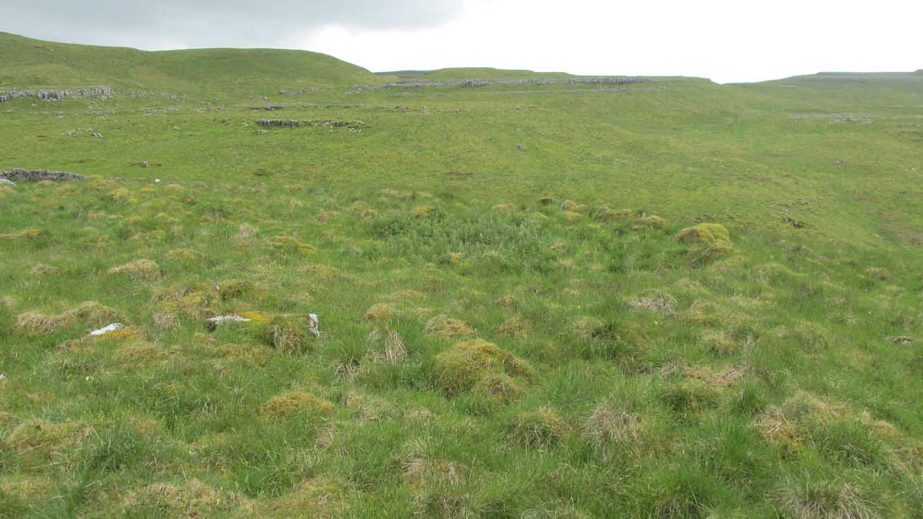
The entire complex comprises of a series of interlinked walled enclosures running roughly north-south for a distance of more than 200 yards. Along the 200 yards are at least eight conjoined walled sections of varying shapes and sizes. Some of the walling, particularly along its western edges, measuring up to 10 feet across (some of this will be due to collapse) is very overgrown indeed and is probably the oldest aspect of the enclosure. The inner walled sections, much of it leading up to the small cliff face, are rough rectangular structures, each of them averaging 30 yards from their western edge to the eastern cliff and rock faces.
Most recent walled section
Within the largest and best preserved section at the northern end, a smaller and more recent walled rectangular enclosure would seem to have been used for either cattle or storage of some form, as it’s on too much of a slope to have been viable as a living quarter. Also on the very northern edge is a well-preserved but much overgrown hut circle, between 8-9 yards across.
Faint walling looking south
The entirity of Clowder-1 is difficult to assess without an archaeological dig. Despite this, as half of the walled enclosures (in the northern half) are on slopes leading up to the cliffs they would seem unsuitable for people to live in. It is more probable that these sections were used for livestock and other storage. At the more southern end however, the land begins to level out and this would be feasible as good living quarters. There was also once a good source of water immediately beneath the entire complex, but with deforestation the waters eventually fell back to Earth.Back to its southern end and down towards the modern-day walling, some 70 yards on we find more ancient structures of the same architectural form that we’ve just walked along. This lower section has just one notable singular oval-shaped hut circle, 20 yards east-west by 29 yards north-south. Other probable man-made structures seem to be just below this; and this part of the settlement then continues on the other side of the walling, into the large Dew Bottoms (5) settlement complex.
Folklore
Weather lore of the ‘Clauder’ hill tells that it “draws the skies down” – i.e., as Halliwell Sutcliffe (1929) put it:
“A deluge may be in process on each side of the Clouder when lower down the sun is hot on tired pastures.”
We encountered just such a truth when James Elkington, Chris Swales and I visited the sites up here just a week or so ago…
References:
Dixon, John & Phillip, Journeys through Brigantia – volume 2, Aussteiger: Barnoldswick 1990.
Sutcliffe, Halliwell, The Striding Dales, Frederick Warne: London 1929.
Acknowledgements: Huge thanks to James Elkington and Chris Swales, without whose guidance this site profile would never have been written.