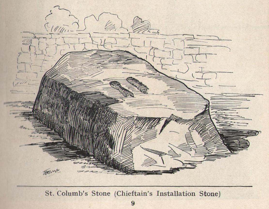
To be found in the grounds of Belmont House School, just 1¾ miles (2.8km) north of Derry’s otherColumba’s Stone, this is one of the many petroglyphic “footprints” that folklore ascribes to Ireland’s saint Columb/Columba/Columbkille (and other variants). Said to have originally been carved at the great fortress of Grianan of Aileach, 4½ miles (7.2km) to the west, this great block of stone—roughly 6 feet square on top—has the distinct sculpturings of two feet, each about 10 inches long, etched into its sloping surface. Archaeologically speaking, there’s little more to say about the stone; but its traditions are another thing altogether and are of considerably greater importance…
Folklore
Like the carved footprint on top of Dunadd in Argyll with its association of tribal initiations, the traditions relating to this footprint follows the same path, so to speak. It was H.P. Swan (1938) who gave us a good summary of the olde lore here, telling that,
“It is almost absolutely certain that it was brought from the Grianan of Aileach after its destruction, probably by an O’Doherty for his own installation. If so, the task of removal was no joke, for the stone weighs some seven tons. It was the “crowning stone” of the Kinel-Owen, or, in other words, the stone upon which the chieftains of the great O’Neill clan were inaugurated. They reigned in Aileach for many centuries.
“At his installation, as supreme head of the clan, the newly-chosen chief was placed upon this stone, his bare feet in the footmarks; a peeled willow wand was put into his hand, as an emblem of the pure and gentle sway he should exercise over his tribe; an oath was administered to him by the chief ecclesiastic in the neighbourhood, that he should preserve inviolable the ancient custom of his country, and deliver the succession peaceably to his tanist (successor); after which, descending from the stone, he turned himself thrice backwards and thrice forwards, to signify that he was ready to meet all foes, from whatever quarter they might come; and was then, with wild acclamations, hailed as their chief by his assembled clan.
“At the time of Ireland’s conversion to christianity by St Patrick, that holy man visited the Grianan (about AD 443), where this stone had been so used for centuries before; Owen was then King; he was converted from Paganism to the new faith and baptised by Patrick; at the same time, the saint consecrated this stone, and blessed it as the crowning-stone of the Kinel-Owen for ever. Time, however, has proved his blessing futile, as may be read in the account of the Grianan, which was deserted by the Kinel-Owen after its destruction by the O’Briens in 1101.”
The ritual described here cannot be taken lightly, nor seen as a presentation of fiction, for its ingredients are found echoed in kingship rites in many cultures.
References:
Swan, Harry Percival, The Book of Inishowen, William Doherty: Buncrana 1938.
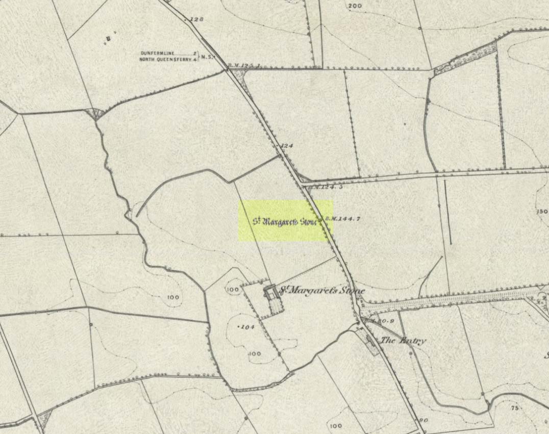
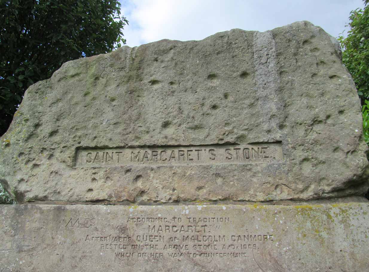
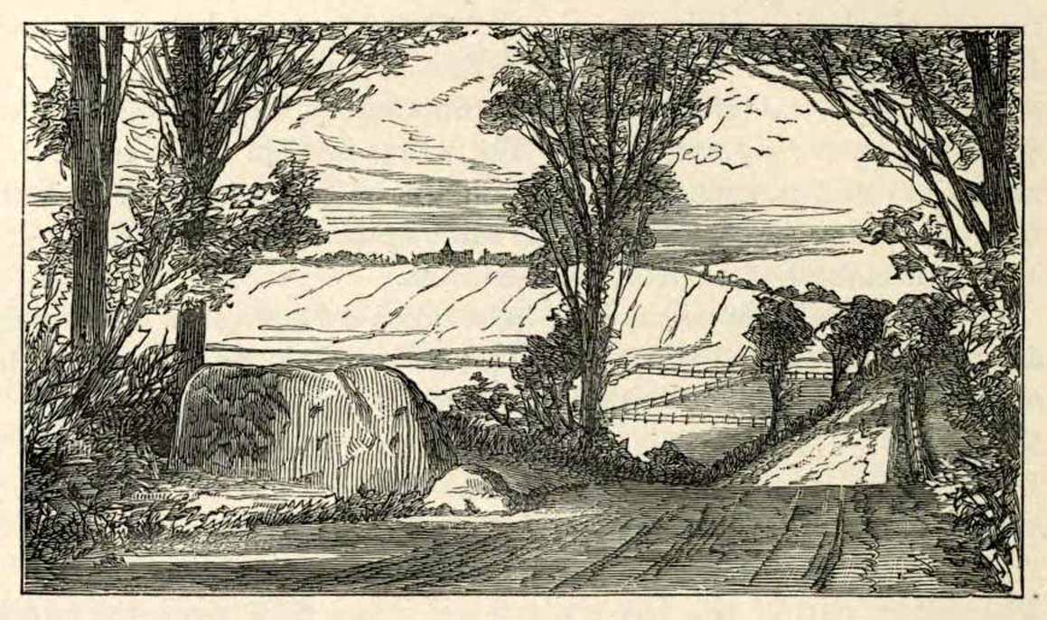
Take the A823 road out of Dunfermline south towards Rosyth. A half-mile before you hit the motorway roundabout, at the roundabout where Carnegie Avenue takes you east, turn west and park up along the road where the modern business park lives. 30-40 yards from the roundabout, set back on the pavement, you can’t really miss the huge flat slab of stone, covered in cup-markings, resting on a stone plinth with ‘St Margaret’s Stone’ stamped on it!
Archaeology & History
On the 1856 OS-map of this area, St Margaret’s Stone is shown at the roadside just above a farm of the same name, a short distance away from its present location. In October 1879, Alexander Stewart (1889) told us that funds were raised and steps taken to properly fix and preserve this ancient ‘resting-place’ of Queen Margaret on the Queensferry Road. It was quite a few years later before it was moved the few hundred yards further to its present location.
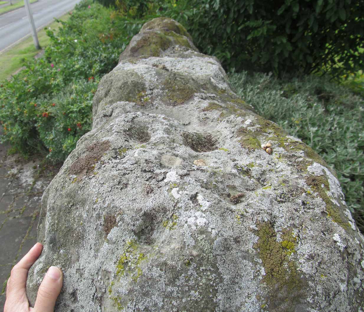
Cups on stone’s edge
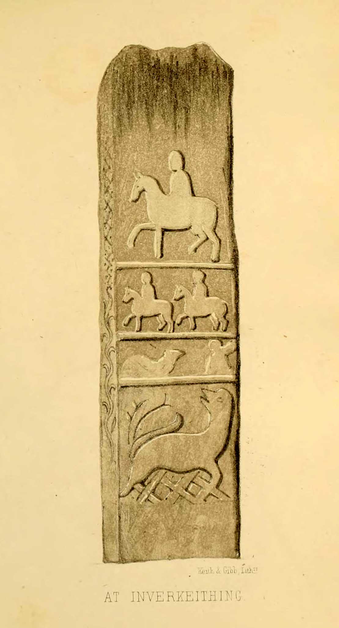
Early writers tell us that originally its position in the landscape was on the crest of one of the rises in the land between Dunfermline and the sea, making it visible for some considerable distance. This would seem to have been a deliberate placement. In my mind, and in accordance with the placement of many a prehistoric tomb, St Margaret’s Stone may originally have been part of a neolithic or Bronze age cairn, long since gone. The size and shape of the rock implies it too, with similarities here of the impressive cist or gravestone found inside the Netherlargie North cairn at Kilmartin. However, this wasn’t the thought of the prodigious Scottish historian, William Skene. He thought that St Margaret’s Stone originally stood upright, being a Pictish-style standing stone that was mentioned in the first Statistical Account of the area. The brilliant Scottish antiquarian, John Stuart (1856)—who gave us an illustration of the ‘standing stone’ in question—told us:
“It has been supposed by some that “St. Margaret’s Stone,” a block now lying on the side of the highway leading from Inverkeithing to Dunfermline, and about midway between these places, can be identified with the standing stone referred to in the Statistical Account. Mr Skene has noted below a sketch of St. Margaret’s Stone:- “The sculpture upon this stone has been lately chipped off in mere wantonness, so as to leave few traces of the subject recorded upon it.” He farther states that it formerly stood erect, and was called “The Standing Stone.” According to Mr. Skene’s measurement, St. Margaret’s stone is about nine feet and a half in length, one foot in thickness, and four feet broad at the widest end, and broken off to a narrow point at the other.”
The missing ‘standing stone’
In this instance, Skene was confusing St Margaret’s Stone with the lost Pictish monolith (left) that used to exist nearby, which had carved horse figures and other memorial designs upon it and which he thought had faded away. Whereas the large slab we are looking at here, and which Skene visited and measured, is covered on one side by a gathering of prehistoric cup-markings—much earlier than any Pictish or early christian carvings. At first glance, it seems that some of these cups may well be natural, but it has to be said that some of them are distinctly man-made. And if we were to believe the archaeo-accounts of the stone, the cupmarks are only to found on one side of the stone. This is incorrect. As we can see here, a number of cupmarks run along the edge of the stone. We cannot say for sure whether all of them are artificial, but they certainly look like it! Also, on the other side of the flat surface, one or two single cups are visible. It would be good if we could get an artist to give us a detailed impression of the prehistoric carvings without the modern engraving of St Margaret’s Stone etching on the main face. (is there anybody out there!?)
The Royal Commission (1933) lads visited the stone in 1925 and, several years later in their write-up, told us simply:
“This stone…stands with its main axis due north and south and measures 8 feet 6 inches, by 4 feet 7 inches, by 1 foot 6 inches. On one side the entire surface is cup-marked, the markings varying in size from 1¼ inches to 3¼ inches and having an average depth of from ½ to ¾ inch.”
When the Scottish petroglyph writer and explorer, Ron Morris (1968) came to the site, he gave it an equally brief description, merely telling us:
“On standing stone (8 1/2 feet high, 4 1/2 feet wide), built in to roadside fence, over 80 cups, up to 4in in diam, 3/4in deep, some run together as rough dumbells.”
It’s well worth checking out!
Folklore
St Margarets Stone in 1825
When the Saxon Queen Margaret landed on the shores just west of Queensferry at Rosyth Castle (NT 1087 8200), legend reputes that she and her entourage made Her way north towards Dunfermline. Halfway along the ancient track She rested at this large stone which, thereafter, gained the name by which we know it today. It was said that Queen Margaret subsequently visited the stone on a regular basis for periods of solitude. The tale probably has some germ of true in it. Additional ingredients also told that,
“The large stone here is associated with St Margaret and was visited by women who hoped to conceive or sought a successful birth. The eight-foot high stone is said to mark the resting place of St Margaret when she journeyed between Queensferry and Dunfermline. Margaret had eight successful pregnancies and probably needed to rest quite a few times on her travels!”
The fertility aspects of the rock were not the only pre-christian virtues attached to it. We also find that oft-cited motif of rocks moving of their own accord: in this case, as J.B. MacKie (1905) told us, local people had always
“been told that the stone rose from its bed and whirled thrice round in the air every time it heard the cock at the adjoining farm crow.”
Cocks crowing are symbolic of sunrise, obviously, and this lore may simply represent a folk memory of the spirit in/of the stone being animated at that time of day. It’s a motif found at ancient sites all over the place!
Royal Commission Ancient & Historical Monuments of Scotland, Inventory of Monuments and Constructions in the Counties of Fife, Kinross, and Clackmannan. HMSO: Edinburgh 1933.
Rupert-Jone, John A., Rosyth, A. Romanes: Dunfermline 1917.
Stewart, Alexander, Reminiscences of Dunfermline and Neighbourhood, Scott Ferguson: Edinburgh 1889.
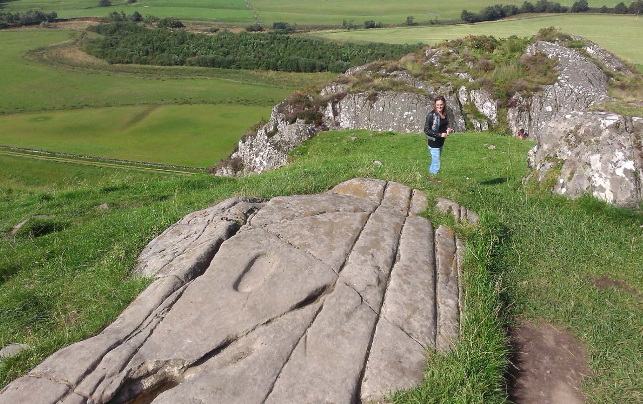
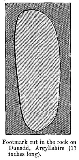
From Lochgilphead, take the A816 road north for several miles (towards the megalithic paradise of Kilmartin), keeping your eyes peeled for the road-signs saying “Dunadd.” Turn left and park-up a few hundred yards down. Go through the gate and walk up Dunadd. Just before the flattened plateau at the top, a length of smooth stone is accompanied to its side by the deep cup-and-ring of the Dunadd Basin. Three or four yards away, you’ll see the long ‘footprint’.
Archaeology & History
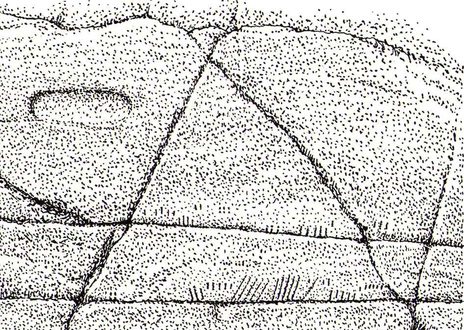
Near the top of Dunadd’s Iron Age ‘fortress’ and overlooking the megalithic paradise of the Kilmartin valley, several man-made carvings are in evidence very close to each other, all with seemingly differing mythic content. This one—the footprint—stands out; but it’s not alone! Faint etchings of at least one other ‘foot’ is clearly visible. The first literary account of it was by Ardrishaig historian R.J. Mapleton (1860), who told,
“There is on the top of Dunadd a mark that strikes me as interesting; it is like a large axe-head, or a rough outline of a foot. My impression is that it may have been the spot on which the chief would place his foot when succeeding to the headship of his tribe. The footmark was always considered among the people here as a mould for an axe-head, and I was rather laughed at for suggesting an inaugurating stone.”
Dunadd Footprint (after Royal Commission 1988)F.W.K. Thomas’ 1879 sketch
Be that as it may, a few years later the carving had caught the attention of the Scottish Society of Antiquaries. In his article exploring the potential for ritual inaugurations at Dunadd, Captain F.W.L. Thomas (1879) explored, not only the footprint, but the mythic functions of this symbol, looking at parallels with petroglyphs elsewhere in the world where the ‘foot’ was known to be a ritual inauguration symbol (amongst other things). He gave us the first real detailed account of the carving:
“About 10 or 12 feet below, and to the northward of the highest point, the living rock is smooth, flat and bear of sward, and in it is engraved an impression of a footmark, not of a naked foot, but such as would be made when the foot is clothed by a thick stocking or cuaran… The engravure is for the right foot; and it exactly fitted my right boot. The footmark is sunk half-an-inch deep, with perpendicular sides, the surface is smoothed or polished, and the outline is regular… It has probably been sheltered by the turf until recently. The footmark is 11 inches long, nearly 4½ inches broad where broadest, and 3½ inches across at the heel. When a person stands with his foot in the depression, he looks a little easterly of north.”
A century or so later when the Royal Commission (1988) boys got here, they found not one, but two ‘feet’ carved into the rock! A few feet away, near to the carved boar,
“At the south end of the main rock surface there is the lightly-pecked outline of a shod right foot. 0.24m long and 0.1m in maximum width, with a pronounced taper to the heel. There are further peck marks within the outline, and a sunken footmark was intended but not completed. This print is on almost the same alignment as the more prominent footprint some 2m to the north, which measures 0.27m from NNE to SSW, by 0.1m in maximum width and 25mm in depth. It is somewhat broader at the heel than the incomplete mark, and its sides are straighter.”
Close-up of the carving
They then emphasize how we’re unable to date the footprints, although point out how such carvings are “found in Britain from the Iron Age onwards.” But footprints have be found on other petroglyphs in Scotland (much less in England) and date between the neolithic and Bronze Age periods—but whether Dunadd’s example goes that far back, we cannot say. Extensive excavations occurred at Dunadd between 1980-81 and most of the finds were Iron Age and early medieval in nature (this carving and the cup-and-ring barely got a mention in Lane & Campbell’s [2000] extensive summation). But we may be looking at an evolutionary developmental relationship in symbolism and form, if the traditions of the place have any substance. This is something I’ll return to when writing of the Boar Carving, just a few feet away…
Folklore
The legends behind this seemingly insignificant mark near the top of Dunadd ostensibly echo and relate to the huge cup-and-ring of Dunadd Basin four yards away. I can only repeat what I said in that site profile.
R.J. Mapleton (1860) said that Dunadd was known by local people to be a meeting place of witches and the hill of the fairies, whose amblings in this wondrous landscape are legion. Legends and history intermingle upon and around Dunadd. Separating one from the other can be troublesome as Irish and Scottish Kings, their families and the druids were here. One such character was the ever-present Ossian. Mapleton told:
“From these ancient tales we turn to a much later period of romance, when Finn and his companions had developed into extraordinary and magical proportions; a story is current that when Ossian abode at Dunadd, he was on a day hunting by Lochfyneside; a stag, which his dogs had brought to bay, charged him; Ossian turned and fled. On coming to the hill above Kilmichael village, he leapt clean across the valley to the top of Rudal hill, and a second spring brought him to the top of Dunadd. But on landing on Dunadd he fell on his knee, and stretched out his hands to prevent himself from falling backwards. ‘The mark of a right foot is still pointed out on Rudal hill, and that of the left is quite visible on Dunadd, with impressions of the knee and fingers.’”
As Mr Thomas (1879) clarified:
“The footmark is that of the right foot, and the adjacent rock-basin is the fabulous impression of a knee.”
References:
Bord, Janet, Footprints in Stone, Heart of Albion Press 2004.
Campbell, Marion, Mid-Argyll: An Archaeological Guide, Dolphin Press: Glenrothes 1984.
Campbell, M. & Sanderman, M., “Mid-Argyll: An Archaeological Survey,” in Proceedings of the Society Antiquaries, Scotland, volume 95, 1962.
Craw, J.H. “Excavations at Dunadd and other Sites,” in Proceedings of the Society Antiquaries, Scotland, volume 64, 1930.
Lane, Alan & Campbell, Ewan, Dunadd: An Early Dalriadic Capital, Oxbow: Oxford 2000.
Mapleton, R.J., Handbook for Ardrishaig Crinan Loch Awe and Pass of Brandir, n.p. 1860.
Morris, Ronald W.B., The Prehistoric Rock Art of Argyll, Dolphin Press: Poole 1977.
Royal Commission on the Ancient & Historical Monuments of Scotland, Argyll – Volume 6: Mid-Argyll and Cowal, HMSO: Edinburgh 1988.
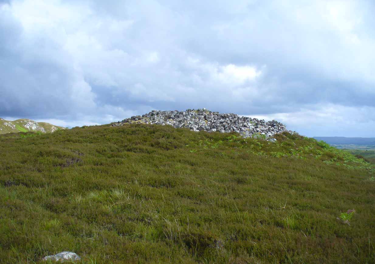
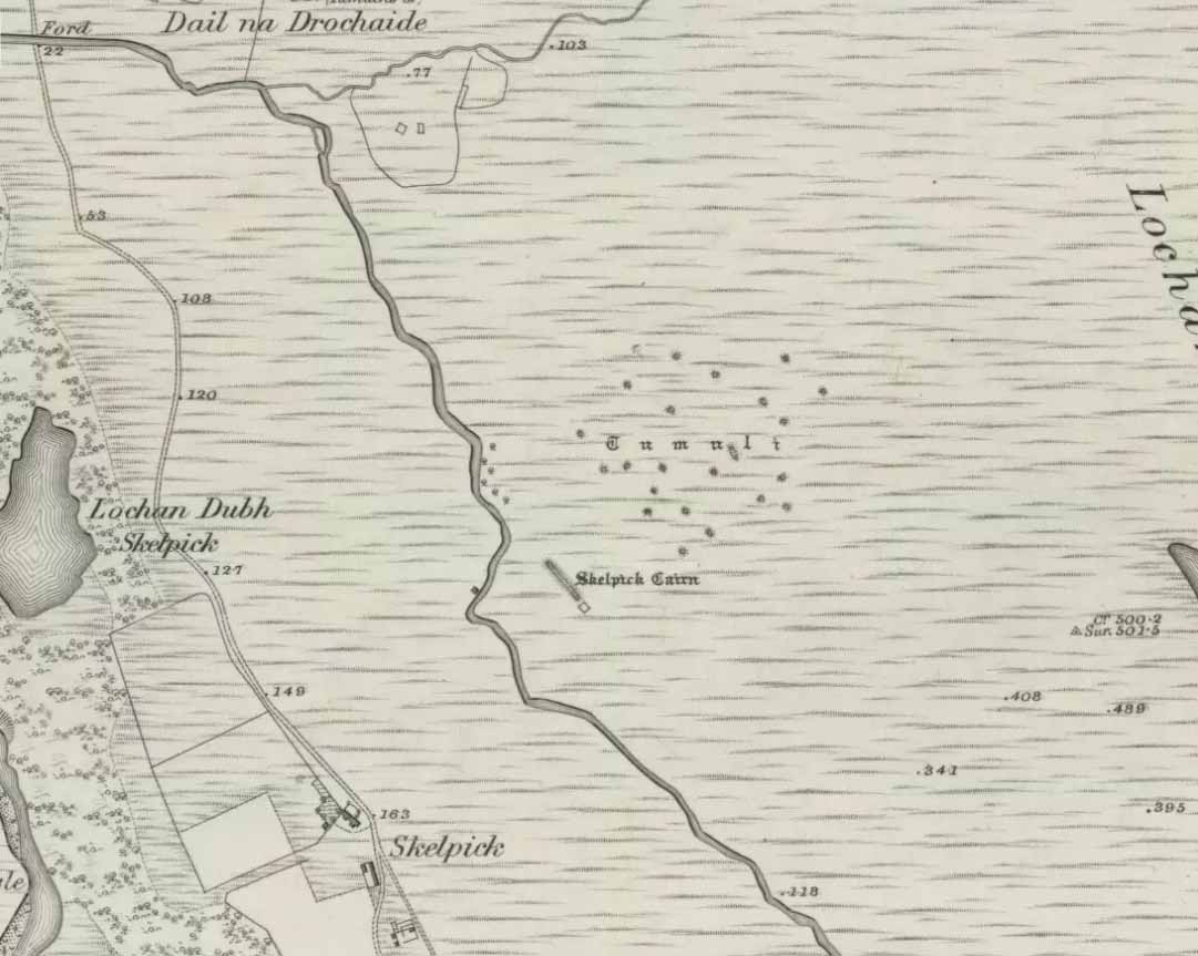
From Bettyhill village, take the road east towards Tongue and Durness. A half-mile out of the village, at the bottom of the hill, just before you cross the small metal bridge across the River Naver, a very minor road, left, takes you to Skelpick. Go down here and follow the directions to reach the giant long cairn of Skelpick Long. Once there, walk east up the moorland hill (there are no footpaths) for about 150 yards. Once on top of the rise, the moorland levels out a little and there, before you, amidst the small overgrown undulations of many old cairns, a giant one rises up to greet you about 100 yards away. Y’ can’t really miss it!
Archaeology & History
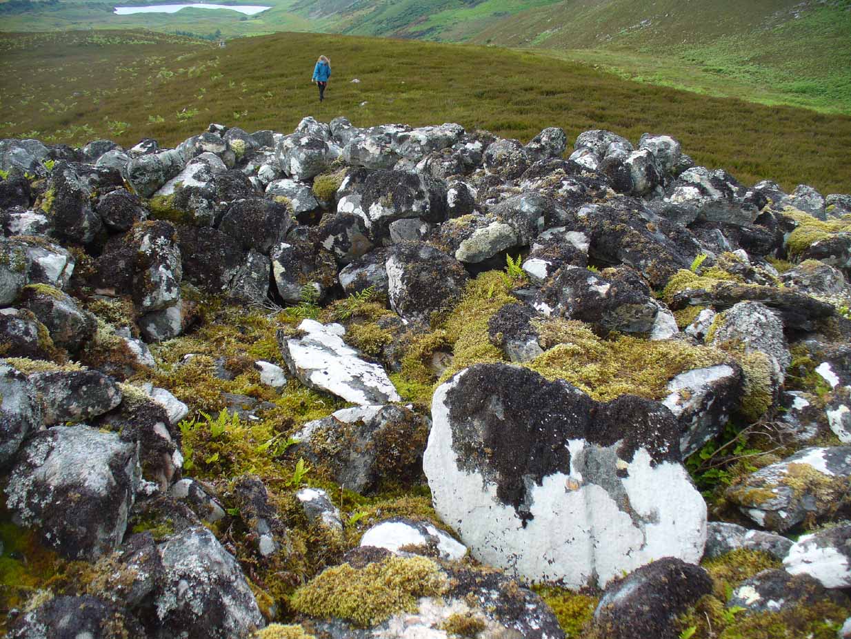
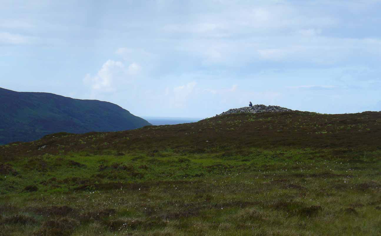
Neolithic in nature, this giant circular cairn, standing on the ridge above the hugely impressive chambered long cairn of Long Skelpick, isn’t quite as grandiose as its neighbour below, but it’s still an impressive feature in this beautiful moorland landscape. Comprised of tens of thousands of small stones raised to a height of 10 feet above the moorland peat, several ‘pits’ have been dug into the top of this undoubted tomb of regal nature; but whether it was originally the burial-place of a single person, to which were later added members of the same family, is simply unknown.
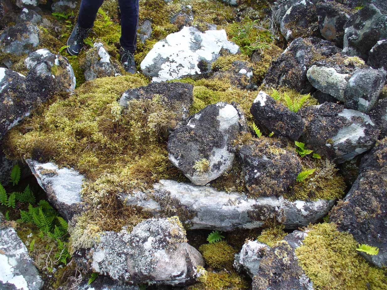
Moss-covered capstoneDepression atop of cairn
On the top of the cairn, at least one of the so-called ‘pits’ that drop into the centre is covered by a large heavy tombstone with a small upright monolith at its side. Although the late great Miss Henshall (2005) thought no ‘chamber’ was here, it is quite possible that a chamber might be found beneath this large moss-covered flat rock (see photo). When we visited here, it looked as if there was a hollow beneath it, but only an excavation would tell us for sure.
Mass of sites on 1878 map
Highlighted on the earliest Ordnance Survey map, it was shown to be just one cairn amidst the mass of other smaller surrounding tombs—most of which were probably built for people from the same tribal group. None of these small cairns have been excavated, but they were probably built after the construction of the major Queen’s Cairn.
The Royal Commission lads visited the site in 1909, but said very little of the place (probably over-awed by Long Skelpick, Coillie na Borgie and other nearby giants!), merely that this large circular cairn has
“a diameter of about 54′. It is about 8′ high, and though the stones have been pulled about here and there on the top, it does not appear to have been excavated.”
Queen’s Cairn, looking N
And so it remains to this day—although the cairn is slightly larger than the dimensions given by the Commission boys. Beneath the encroaching heather, the cairn is closer to 67 feet (10.23m) across, with a circumference of 210 feet (64.25m).
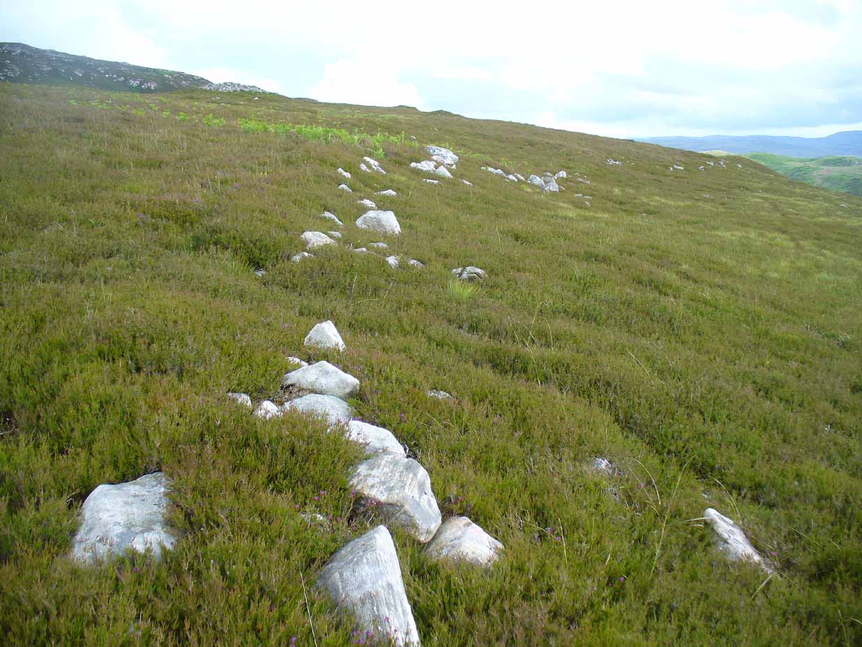
Line of ancient wall nearby
The monument sits on a plateau immediately above the giant Long Skelpick cairn—although neither can be seen from each other. But if you walk only a short distance from the Queen’s Cairn towards the long cairn below, a very notable and extensive line of ancient walling runs along the edge of the geological ridge separating the two tombs, as if deliberately keeping them apart. Other lines of ancient walling run closer to the cairn, seeming to indicate that a settlement of some form was also apparent on this ridge, in close connection with the group of smaller burial cairns.
It’s a gorgeous arena with many prehistoric sites and puzzles to behold, and plenty of unrecorded ones nestling quietly in the heather. It’s bloody superb to be honest!
References:
Gourlay, Robert, Sutherland: An Archaeological Guide, Birlinn: Edinburgh 1996.
Henshall, Audrey S. & Ritchie, J.N.G., The Chambered Cairns of Sutherland, Edinburgh University Press 2005.
Royal Commission Ancient & Historical Monuments, Scotland, Inventory of Monuments and Constructions in the County of Sutherland, HMSO: Edinburgh 1911.
An unexcavated ring cairn in a very good state of preservation can be seen in the field immediately west of the River Halladale. Measuring more than 14 yards across east-west and 15 yards north-south, the site stands in association with several other unexcavated cairns.
Folklore
Although some of the cairns here have been found with prehistoric burials in them, tradition tells that the cairns here were the result of “a great battle between the native Pictish inhabitants and the invading Norsemen.” So wrote George Sutherland, many moons ago. He continued:
“The Norsemen were defeated in that battle, and Halladha, their leader, was slain. It is from him that the river and the dale take their name. The battle was fought on a hillside, on the east side of the river and that hillside is covered with cairns which are supposed to mark the graves of those slain in this battle, but the body of Halladha, the norse leader, was interred on the west side of the river, and his sword was laid in the grave beside his body. Near the circular trench where he is said to have been buried there are several heaps of stones which are supposed to mark the graves of other Norsemen of note who fell in the battle.”
References:
Sutherland, G., Folklore Gleanings and Character Sketches from the Far North, John o’ Groats Journal: Wick 1937.
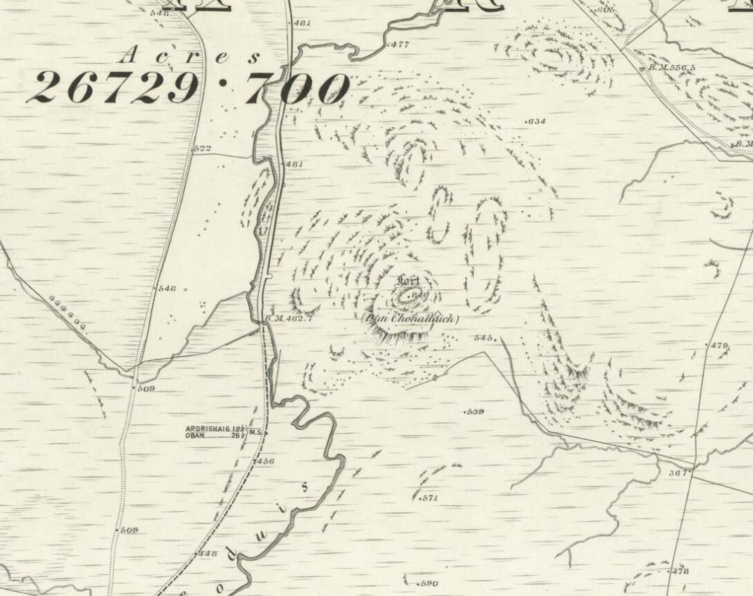
There’s two real ways to get up here: one from the Oban-Kilmartin roadside; the other from Ford village. I’d go for the latter as it avoids the traffic. Walk up the track to Salachary from the village centre, heading west. It’s a gradual uphill climb and after about half-a-mile (past six or seven cup-marked rocks) the great hill rises to your left. Dun Dubh is to your right. Climb over the fence and head for the hilltop.
Archaeology & History
It’s my opinion that this fort, above all others in the region apart from Dunadd, was of paramount importance to our prehistoric ancestors. The reason being that it’s the great pyramidal hill to which the line of tombs in the Kilmartin Valley align, three miles to the south. This prehistoric alignment was quite intentional (if you’ve got your doubts, gerrup there & have a look for y’self — you’ll soon change yer mind).
Curious carved stone found here
The main part of the structure is an irregularly-shaped construction with walling on all sides, measuring about 40 yards by 20 yards. Much of it is pretty well defined – though has been vandalized by various doods in the past: one bunch being a film-crew who used the site in the early 1980s! Inside the main walled fortress are several ruins. The Royal Commission (1988) report told:
“Much of the interior is occupied by a rock spine which is surmounted by a modern cairn, but the NW half is relatively level and it contains, in addition to the modern round-house…and and an S-shaped structure associated with film-making, a number of ruined stone foundations. On the north side there is a rectilinear building, and between the modern round-house and this rectilinear building, there is a further structure…an arc of walling, but its precise shape cannot now be determined without excavation.”
Dun Chonallaich means “the fort of King Connal’s people,” and although much denuded, is well worth the clamber for a short archaeological day out. A curious “gaming-board” was found here (see photo). A portable cup-marked stone in the fort’s southern wall is a modern artifact.
It’s a lovely view from up here too. This is one of many places I’ve sat during a raging thunderstorm. One helluva buzz, believe me!
References:
Gillies, H. Cameron,The Place-Names of Argyll, David Nutt: London 1906.
Royal Commission for Ancient & Historic Monuments, Scotland, Argyll – volume 6, HMSO 1988.