From the red phone-box at the road junction in Strathtay village, walk aling the road, east (slightly downhill) for less than 50 yards then turn left and walk up the track. After 70-80 yards, keep your eyes peeled for the footpath that runs up the slope into the tgrees (don’t head to the house in front of you). After a half-mile you reach the gorgeous old Tullypowrie farmhouse on your left; keep walking uphill for another 300 yards until your reach a large tree on your left, above which, sat on some very low walling, you’ll see a small upright stone.
Archaeology & History
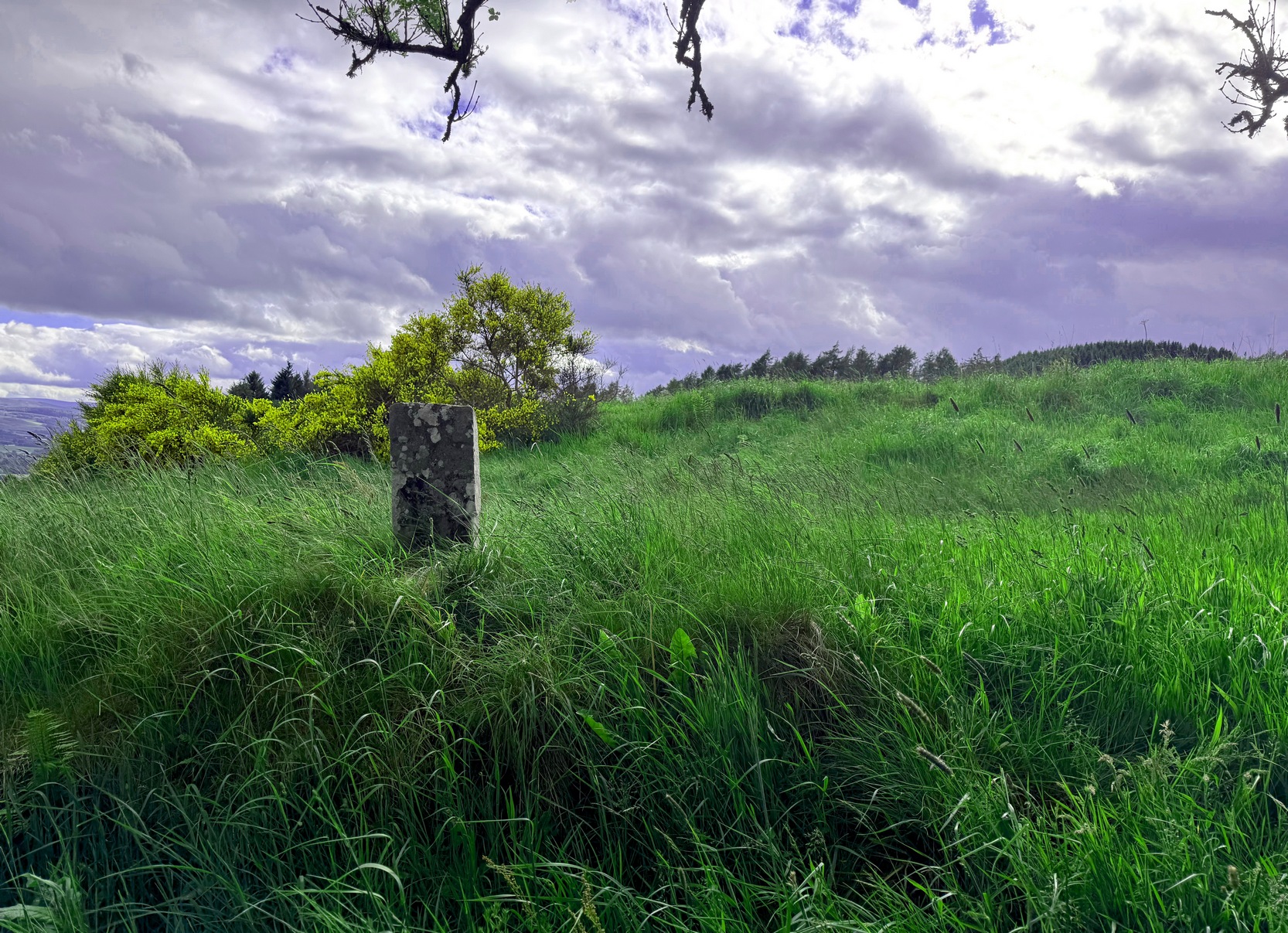
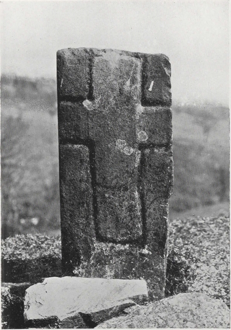
Faint cross on western face
This little-known early christian carved stone, sitting on the vague remains of an old Roman Catholic church, located on what local folks used to call “the route to the stones” (meaning to the Clachan an Diridh, much to the minister’s considerable disdain), has had less said of it than the more ancient stone circle a little further up the footpath. But then, not much is known of either the carving or the church itself, whose remains can barely be seen amongst the grasses. But the upright ‘cross’ at least proclaims itself to the eye.
On our recent visit here, the crosses (on both side of the stone) were somewhat faint, as my photos show. But it wasn’t always this way. During a visit to nearby Aberfeldy in September 1900, the antiquarian Dave Landsborough (1901) found himself ambling about “among the ruins of a small hamlet” that was the olde settlement of Tullypowrie and came upon this little-known monument. He subsequently wrote an excellent description of the stone, which cannot be equalled. “The cross,” he told,
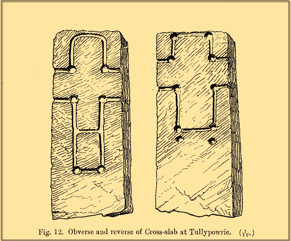
Landsborough’s sketch
“is of the rudest character, consisting of a schistose slab 30 inches in length, 11⅜ inches in width at the top, about half an inch wider at the bottom, and about 4½ inches in thickness. It is roughly squared at the top and sides, but at the bottom the base is unsquared, one side being longer than the other. On both faces of the slab a cross is formed by a shallow incised sinking, a little more than an inch in breadth, with circular sinkings slightly deeper than the rest of the outline at each corner of the shaft and summit of the cross, and at the intersections of the arms with the shaft and summit. The cross on the east face of the stone has its top almost level with the top of the slab, but the shaft does not reach nearly to the bottom. The top part of the cross above the arms is 4½ inches high by 4½ inches in width. The arms reach across the whole width of the slab, and the shaft is little more than the length of the part above the arms, the base being somewhat rounded. Below the termination of the shaft are two slight circular sinkings almost in line with the perpendicular outlines of the sides, but at unequal distances from their terminations, the one being 1½ inches and the other 2½ inches below the similar sinkings which mark the corners of the shaft. The cross on the west face of the slab is in every way similar, except that the shaft is longer, reaching to a length of 10½ inches below the arms, and the circular sinkings at the top are nearly effaced. It has, however, the curious feature of a slight cut-off at about the same length as the shaft of the other cross, but the circular sinkings occur at the top and bottom, and at the intersections as in the case of the other cross.
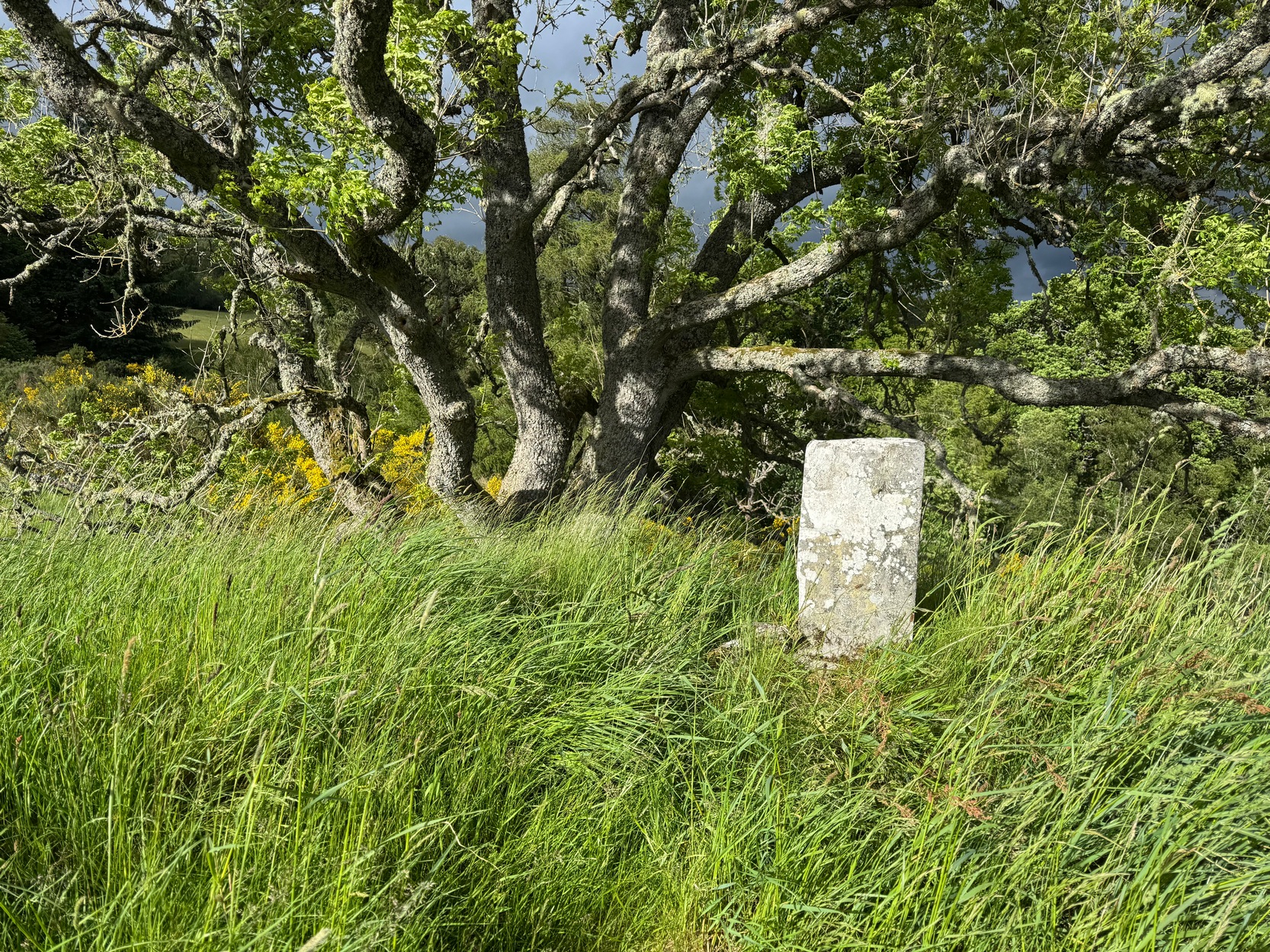
“The slab is not fastened in a socket, but is kept nearly erect leaning against a large stone, while smaller stones keep it firm at the back. I have since been told by the Rev. Mr McLean of Grandtully that the place where it stands is the site of an old and very little chapel, the south wall of which may still be recognised by its remaining foundations.”
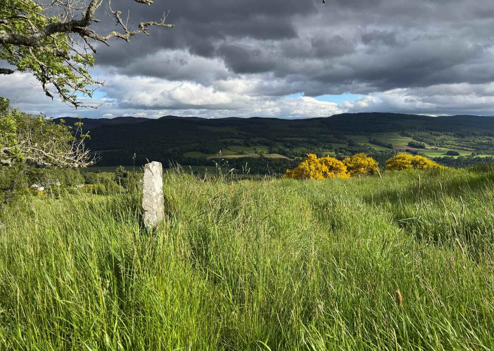
Tullypowrie cross looking SDixon’s old photo
On the other side of the burn from here was the great Whooping Cough Well, with the heathen Clach na Buidseach against the wall of Tullypowrie Farm just below (subsequently moved to the field west of the cross). These sites (and others nearby) and the animistic traditions associated with them, probably had something to do with the positioning of the church here, and the cross would be the attempt to give a Christian veneer to usurp the more archaic natural practices. We don’t know that for sure, but it’s more than likely. The old Logierait schoolmaster James Kennedy (1927) makes constant references to the animistic lore of the region, which was legion until quite recently.
No additional lore, sadly, is known of this old cross, which is deemed to be medieval in origin. Both Mitchell (1923) and Dixon (1925) make mention of the monument in their respective guidebooks, but add no further information.
References:
Dixon, John H., Pitlochry, Past and Present, L. Mackay: Pitlochry 1925.
Kennedy, James, Folklore and Reminiscences of Strathtay and Grandtully, Munro Press: Perth 1927.
Landsborough, David, “Rubbings of both Faces of an Erect Incised Cross-slab, at Tullypowrie, near Grandtully, Perthshire,” in Proceedings Society of Antiquaries, Scotland, volume 35, 1901.
Mitchell, Hugh, Pitlochry District: Its Topography, Archaeology and History, L. Mackay: Pitlochry 1923.
Park up at the red phone-box in Strathtay village (by the road junction) and walk east along the road (slightly downhill) for less than 50 yards, then turn left and walk up the track. 70-80 yards up, keep your eyes peeled for the distinct footpath on your right (don’t head up to the house) that runs into the trees and keep walking uphill for literally ½-mile where you’ll reach the gorgeous overgrown scented orchard of Tullypowrie farmhouse on the left. Keep walking along the path past the farm and, if you fancy, cross the burn (stream) anywhere hereby. The well is on the other side of the burn, somewhere…..
Archaeology & History
We ventured up here recently to look at several sites, but when we came to find this long lost well we were hindered severely by the mass of vegetation that was teeming with ticks—so thought it most sensible to come back here again at the end of winter when we’d have a clean slate of landscape to look at. (the ticks have got fucking awful in this neck o’ the woods in recent years!) It has almost fallen out of history, with no one writing about the place for more than a hundred years, yet it was a place of considerable importance in the folk traditions of Strathtay.
In some previously unpublished notes written by the historian Charles Robertson sometime at the beginning of the 20th century, he told of a lady from Pitlochry called Mrs Anderson who informed him of an important water source known locally as Sput na-fruith-chasd which,
“comes spouting out of a high rock on the east side of the Tullypowrie Burn opposite Tullypowrie farm, and was resorted to of old for the cure of whooping cough. The sufferer who came here and drank of the water always got better too.”
It was described by the Logierait schoolmaster James Kennedy (1927) as one of “the three most important (wells) in the Tay Valley”—and there are a lot of wells in the Tay Valley!
There’s a slight discrepancy regarding the exact location of the well: whilst Mr Robertson’s notes told that it was found “opposite Tullypowrie farm”, in Hugh Mitchell’s (1923) survey of local antiquities he told that,
“On the oppsite side of the burn from the mill there is a drip well, the water from which was for long regarded as a certain cure for whooping cough”—
which would place the well a hundred yards or so further upstream. (the very low-lying walls of the mill can just be discerned a short distance above the farmhouse) I’m sure that a good search of the area after Winter has laid the vegetation to rest will tell us one way or the other precisely where this curative well is hiding.
Across the burn from the well is the barely visible ruins of an old church: Roman Catholic according to tradition, with a singular short carved cross standing on the low remains of its eastern wall. Close to this, but now in the field a few hundred yards west, was the curious bullaun stone known as Clach na Buidseach, or Witchcraft Stone. This bullaun would seem to have been used in rites related to the Whooping Cough Well, but the precise nature of these rites has been lost.
References:
Dixon, John H., Pitlochry, Past and Present, L. Mackay: Pitlochry 1925.
Kennedy, James, Folklore and Reminiscences of Strathtay and Grandtully, Munro Press: Perth 1927.
Mitchell, Hugh, Pitlochry District: Its Topography, Archaeology and History, L. Mackay: Pitlochry 1923.
Holy Well (destroyed): OS Grid Reference – NN 9677 5199
Also Known as:
Fuaran Chad
St. Cedd’s Well
Archaeology & History
All trace of this once renowned holy well seems to have gone. It was located, according to the local historian James Kennedy (1927) “on the terrace behind the Church”; although Charles Stewart (1880) earlier told that it was found on the hillside above the church. On our recent visit here, the level piece of land just above the River Tay, “on the terrace behind the Church” as Kennedy told, had no notable spring of water upon it—but we didn’t check the slope above the road to see if there was anything there. By all accounts it’s long since gone.
There’s also slight confusion regarding the dedication of this well. Kennedy, once more, ascribed it to have been St Cedd’s Well, the brother of St Chad, and not Chad himself who was venerated here. But this wasn’t the view of MacKinlay (1893) or Knight (1933) in their major studies. But let’s leave that element to the hagiologists for the time being!
Tradition told that the spirit of the waters was deeply offended when the annual market in Logierait—dedicated to St Chad/Ched on his saint’s day of August 22—was stopped. As a result the waters removed themselves and fell back to Earth. This curious motif is found at a number of wells in other parts of the country.
References:
Kennedy, James, Folklore and Reminiscences of Strathtay and Grandtully, Munro Press: Perth 1927.
Knight, G.A.F., Archaeological Light on the Early Christianizing of Scotland – volume 2, James Clarke: London 1933.
MacKinlay, James M., Folklore of Scottish Lochs and Springs, William Hodge: Glasgow 1893.
MacKinlay, James M., Influence of the Pre-Reformation Church on Scottish Place-Names, William Blackwood: Edinburgh 1904.
Mitchell, Hugh, Pitlochry District: Its Topography, Archaeology and History, L. Mackay: Pitlochry 1923.
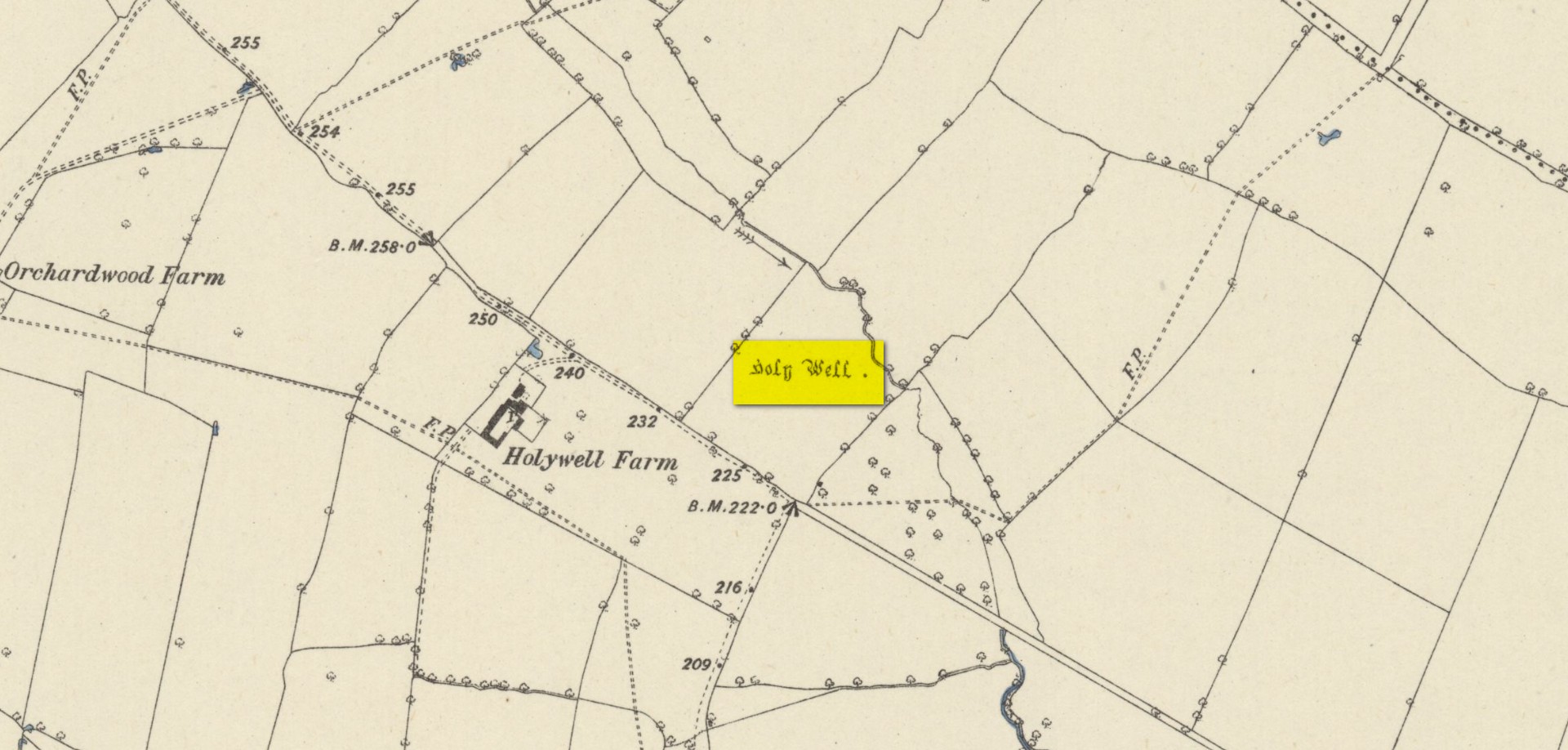
Found on the south-side of the stream a few hundred yards northeast of the aptly-named ‘Holywell Farm’ and highlighted on the early Ordnance Survey maps of the region, this once important sacred site is today, according to local folk, little more than an overgrown muddy patch, visited by very few and hard to see underfoot. It was described, albeit briefly in Leonard Jacks’ (1882) beautiful work, where he told that, “About a mile from the house is to be seen a holy well, a place of interest, which is undoubtedly connected with the past history of the place.”
In medieval times, the manor of Winkburn was the seat of the religious Order of the Knights Hospitallers, otherwise known as the Knights of St John of Jerusalem, to whom Bob Morrell (1988) professed this well to have been dedicated. He described there being a small structure around the water source, wondering whether it may have been a bath of sorts to convey water to the nearby house, but remains of this can no longer be seen. It would seem that a good ground survey of the site is required, at the end of Winter when all the vegetation has fallen back, to see if the waters can be recovered and the Holy Well brought back to life for local people. Fingers crossed! 🙂
Folklore
The water from St. John’s Well was said to be good for sore eyes. The religious celebration day of St. John is traditionally around June 24, usually overlaying earlier summer solstice celebrations.
References:
Jacks, Leonard, The Great Houses of Nottinghamshire and the County Families, W. & A.S. Bradshaw: Nottingham 1882.
Gover, J.E.B., Mawer, Allen & Stenton, F.M., The Place-Names of Nottinghamshire, Cambridge University Press 1940.
Morrell, Robert, Nottinghamshire Holy Wells and Springs, Nottingham 1988.
Acknowledgements:Huge thanks for use of the Ordnance Survey map in this site profile, reproduced with the kind permission of the National Library of Scotland.
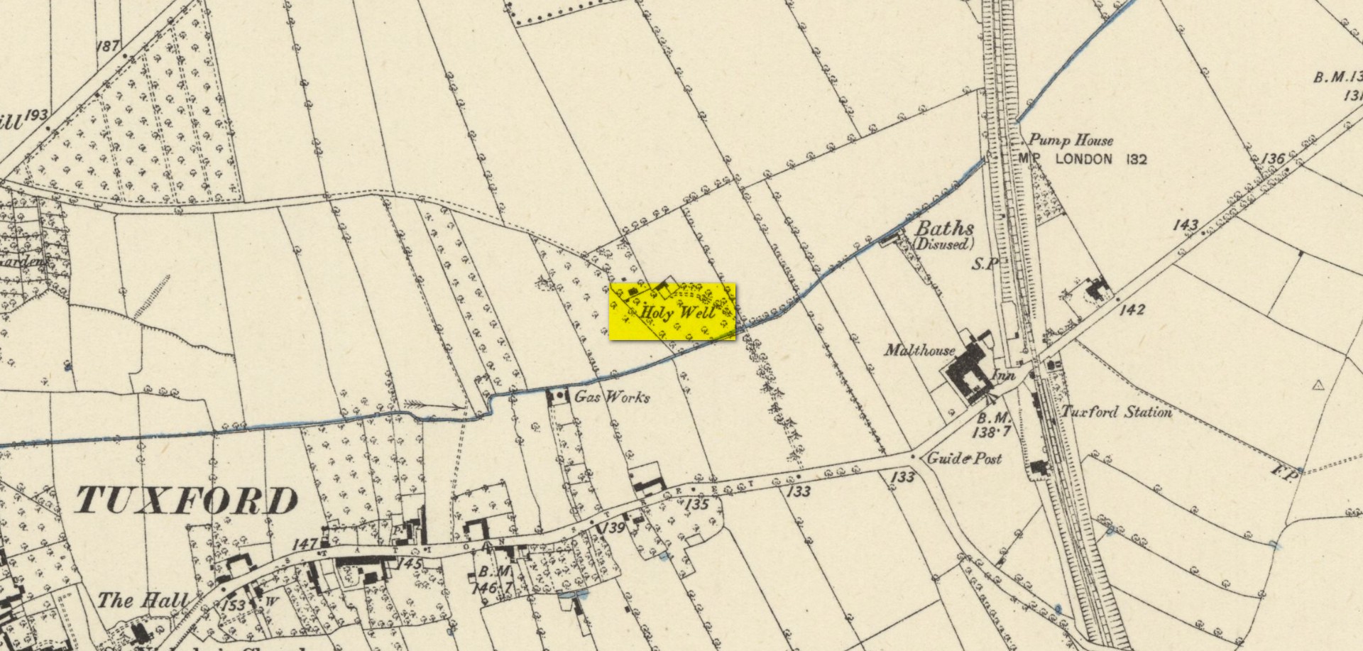
Highlighted on the early Ordnance Survey map of the region by the appropriately named ‘Holywell Farm’, this once important sacred water source would seem to be little more than a muddy patch nowadays. Not good. Its cold waters were reputedly good for curing skin diseases such as scurvy, along with aiding in the affliction of rheumatism.
Local folklore attributed the site to have once fed some Roman baths, but this idea seems to have been a diluted version of it once, historically, supplying some baths a few hundred yards east, albeit in the 19th century and not way way back in Caesar’s days! Of course, the waters of the well would have been used in ancient times, but we have no archaeology or unbroken traditions telling us such things. It was last known to be used as a local water supply in the 1920s. The fact that the spot where it used to run free is still sometimes boggy means that it could be re-animated with a bit of effort from local people.
References:
Morrell, Robert, Nottinghamshire Holy Wells and Springs, Nottingham 1988.
Acknowledgements:Huge thanks for use of the Ordnance Survey map in this site profile, reproduced with the kind permission of the National Library of Scotland.
Hiding away in the Title Deeds of the Willoughby Family of Wollaton, written around 1280 CE, a somewhat lengthy entry on land ownership around the parish of Cossal, showed there once existed a little-known St. Helen’s Well: long since lost it would seem. The account, known as the “Quitclaim (of) William son of Adam le Gaoler,” cited the following information:
“Release by William, son of Adam le Gaoler of Nottingham, and Beatrice (his wife) and Agnes (heirs once of Adam de Cossale in Nottingham) to William de Barre and his wife Dionise [Denyse] of all claims to toft and croft with all its appurtenances, with 10 seliones of arable land with appurtenances in various parcels and sites in town and territory of Cossall; the toft and croft lie between land of Dionise on each side; 3 seliones lie together on Brochisale, 2 lie on Elrinstubbe between land of Robert de Marisco and William Baret, 2 lie on Smalethornchis between land of Henry and Robert son of Adam, 2 lie a square furlong ‘quarentelam’of the spring of St. Elena between land of Stacy le Greyne and Nicholas de Marisco and 1 selione lies on le Westfeld between 2 boundaries.”
A few years later in an early 14th Century Feet of Fines there is another mention of the well, which gave a slightly better description of its whereabouts. It mentions items known as ‘sellions’, which are strips of arable land. The account told of,
“two selions lying together at St Helen’s Well between the land of the church of St Katherine of Cossale on one side, and the land of the said Eustace on the other side, abutting at one end on the croft that Walter Talpe holds, and at the other end upon the north conduit…”
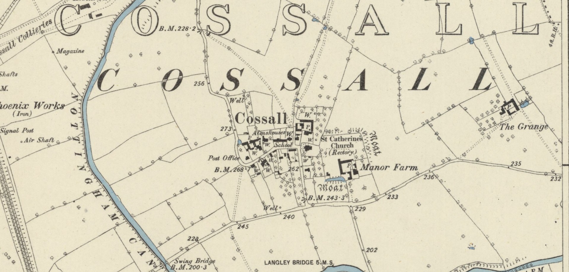
This indicates that the well was close to the village—perhaps even within the village itself. On the early Ordnance Survey maps of Cossall, several wells are shown, and any one of them could be the St. Helen’s Well in question. Does anyone know which one is the forgotten holy well of the village…?
Folklore
St Helen’s feast day is August 18.
References:
Gover, J.E.B., Mawer, Allen & Stenton, F.M., The Place-Names of Nottinghamshire, Cambridge University Press 1940.
Morrell, Robert, Nottinghamshire Holy Wells and Springs, Nottingham 1988.
Acknowledgements:Huge thanks for use of the Ordnance Survey map in this site profile, reproduced with the kind permission of the National Library of Scotland.
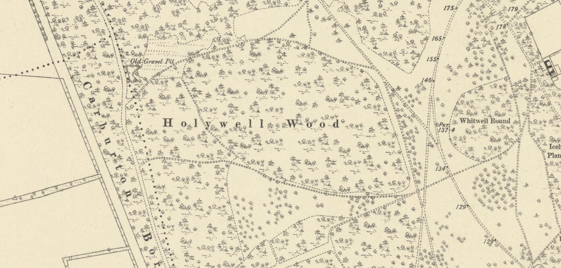
The precise whereabouts of this holy well—in the aptly-named Holywell Wood—is hard to pin down. It was first recorded in the Dukery Records of 1232 as Holywell Dale and the woodland that owes its name to the site was recorded on the 19th Century Ordnance Survey maps (right). Bob Morrell (1988) added the site to his survey of Nottinghamshire holy wells, but he was unable to locate it and its position remains elusive. One account suggested that it marked the line of an ancient boundary—which would place it on the western side of the present woodland. It’s alternative name, the Allenwell, may suggest a dedication to St. Helen. I add the site here in the hope that a local antiquarian might be able to locate it. Please let us know if you re-discover it!
References:
Gover, J.E.B., Mawer, Allen & Stenton, F.M., The Place-Names of Nottinghamshire, Cambridge University Press 1940.
Harte, Jeremy, English Holy Wells – 3 volumes, Heart of Albion press: Wymeswold 2008
Morrell, Robert, Nottinghamshire Holy Wells and Springs, Nottingham 1988.
Acknowledgements:Huge thanks for use of the Ordnance Survey map in this site profile, reproduced with the kind permission of the National Library of Scotland.
From Comrie village, take the long winding steep road up past the Devil’s Cauldron towards Glen Lednock. After 1½ miles the road begins to level-out and you come out from the trees and about 400 yards along there’s a dirt-track on your left. Park here! OK, now walk further along the road (not the dirt-track) for less than 100 yards and take the footpath up the slope (if this is blocked—it shouldn’t be!—you can walk further along until your reach the next track on your left). Go up this footpath for 200 yards till you reach the track by the large bend; and then walk up it for another 200 yards where there’s another large bend. On your right, past the solitary big rock, you’ll see the sign…
Archaeology & History
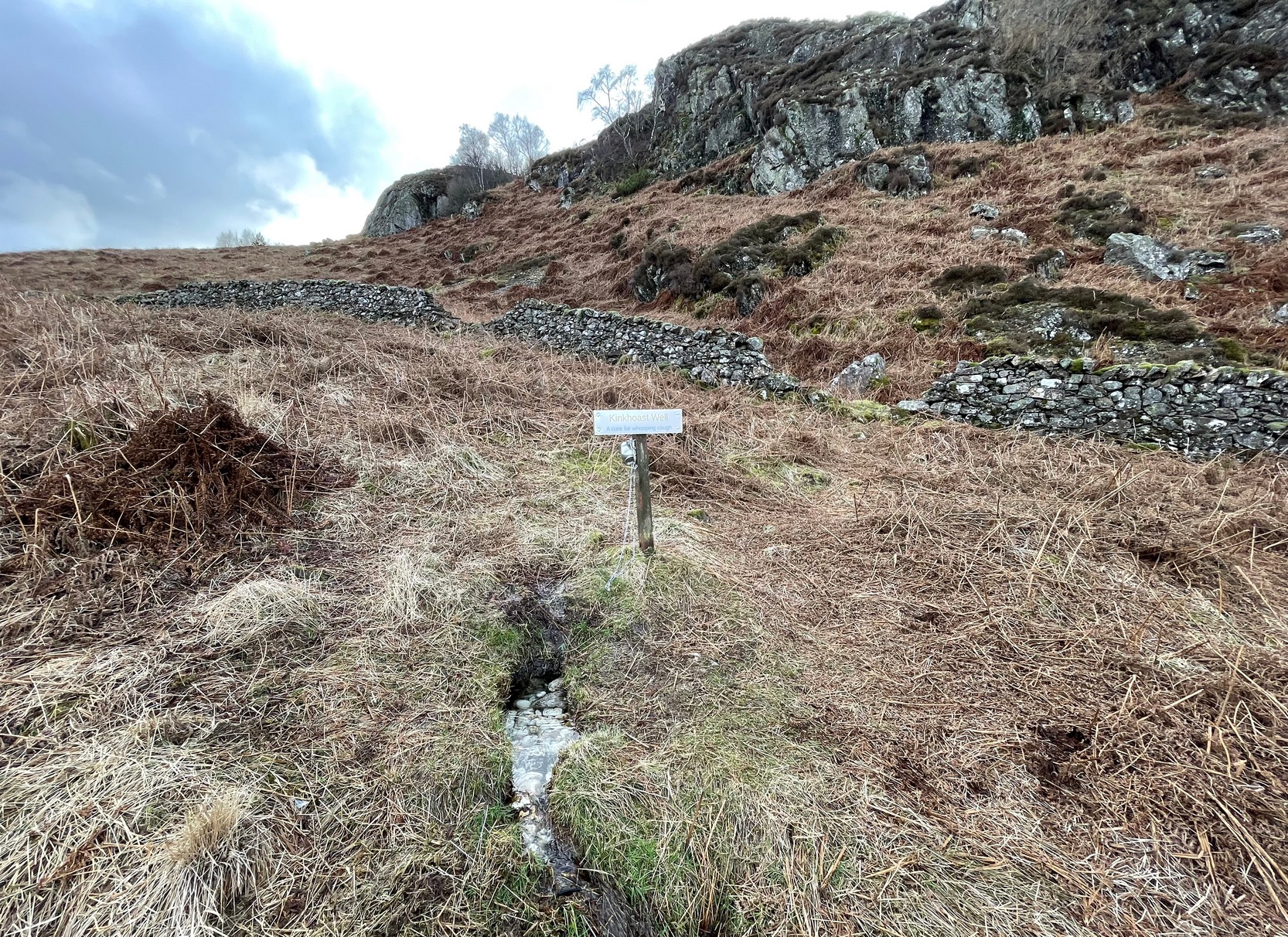
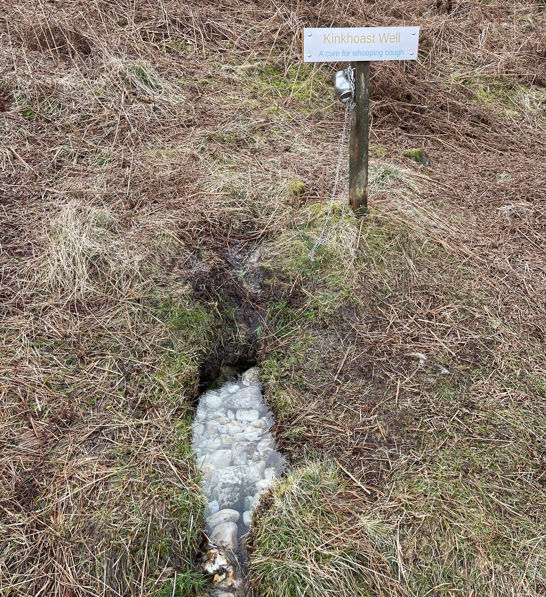
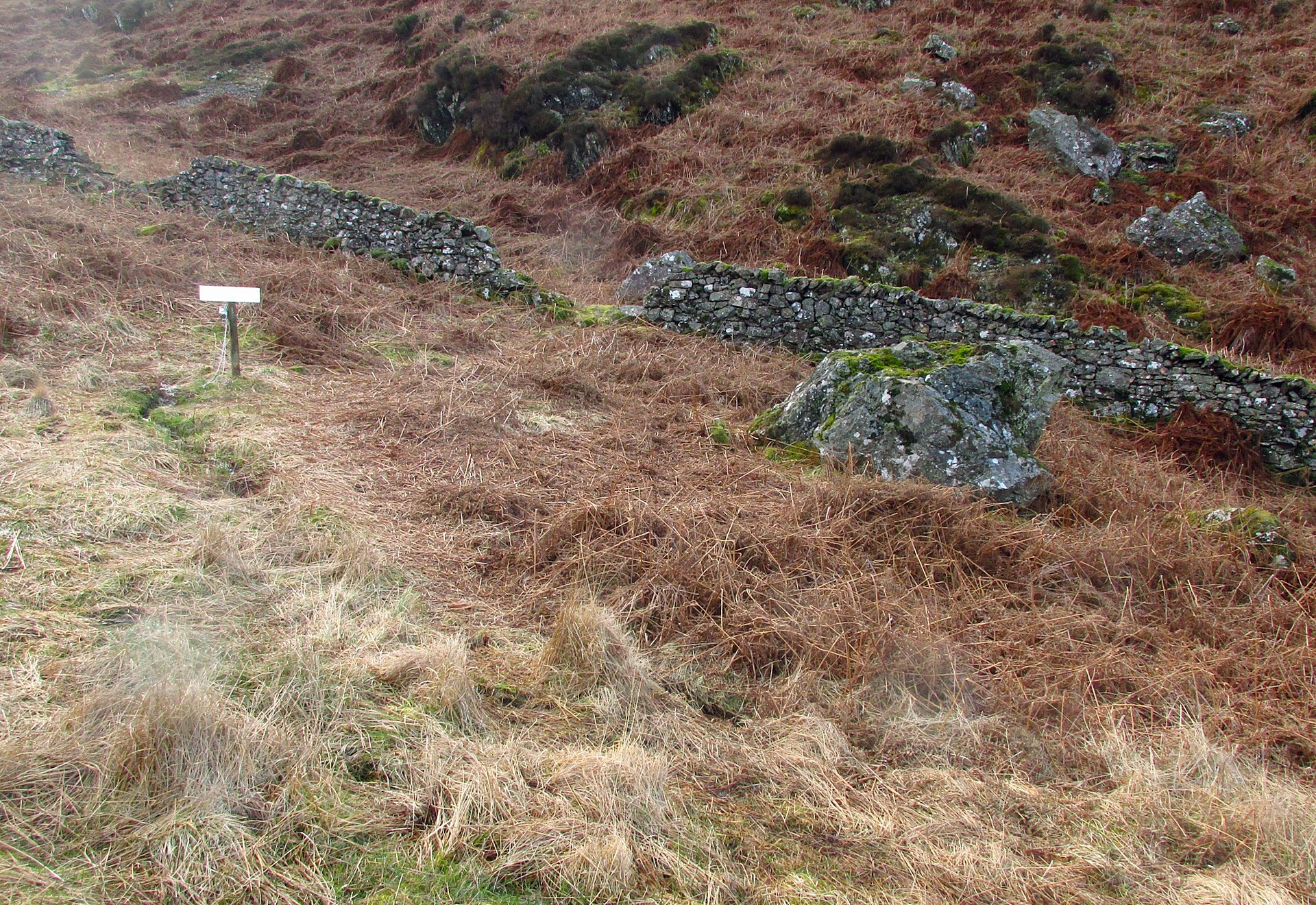
Sign of the Kinkhoast Well
A little-known healing well that all but fell out of existence until, thankfully, some local folks recently decided to revive it. A sign stands above the back of this spring of water as it emerges from the Earth telling you that it’s the Kinkhoast Well. Its clear waters form into a very small pool, wherein are dozen of small white pebbles and and quartz pieces, very smooth and obviously worn by decades, if not centuries, of local folk giving the spirit of these waters—the genius loci—and offering in exchange for its healing virtues in the hope that it cures them of the whooping cough, of which this well is renowned.
It’s one of many whooping cough wells that are found in the Perthshire hills—and most are actually large boulders with hollows into which the rainwater collects and it is this that is used medicinally and not necessarily the spring water. A curious thing indeed…. and I’ve come across Highland folk who were taken to them when they were young children who’ve told me that their whooping cough was subsequently cured! Intriguingly, there is a large boulder just below this well, upon whose top is a natural bowl in which rainwater collects—and although I can find nothing specific telling of such a tradition here, above Comrie, it’s possible that the relationship between stones and wells, found at other places in the Highlands, also existed here.
Small pool full of white offering stonesWell & stone in close attendance
The name Kinkhoast itself (and variables thereof) is a Scottish dialect word, found from Galloway and into the Highlands. Jamieson (1880) describes it as literally “hooping cough”, with a brief note on the disease being cured by water drank from a shell. Meanwhile, in Grant & Morison’s (1960) massive work, they give numerous examples of the term, most of which relate to the same “whooping cough”, with some examples of folk remedies to abate the disease, including one of parents sending their children to take a drink from the “Kinker Steen Wall”—in that case from the parish of Logie. Examples of the very same tradition are known at other kinkhost sites. Check the place out when you’re in the area—and rest for a while to drink in the beautiful views…
References:
Anonymous, “Comrie Folklore – Kingcough Well,” in Crieff & District Post, no.31, August 2012.
Grant, William & Morison, David D. (eds), The Scottish National Dictionary – volume 5, SNDA: Edinburgh 1960.
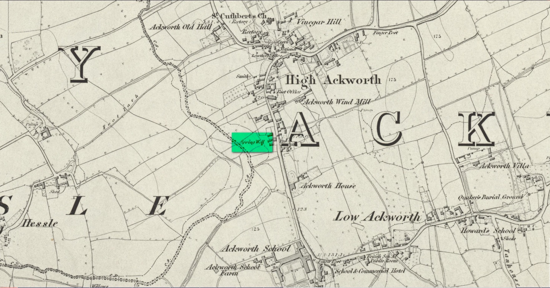
Somewhere close to the aptly-named Ladywell House (now a beauty salon) on the south-side of High Ackworth (just as you’re going into the village on your left) there was once a holy well, seemingly no longer with us. It was described in Saywell’s (1894) history of the town as one of the “antiquities” in the area. He told that,
Spring Well – Lady Well?
“This very ancient well is one of the several public wells, which has in recent years somehow become enclosed. From what it derived its name is not known, but from the fact of its being the oldest, it is not unlikely that it was originally set apart by some religious service, and dedicated to ‘Our Lady’ for the use of the inhabitants of the village. In pre-reformation times this custom was common, some wells having miraculous powers ascribed to their waters by the superstitious, like the well of St. Keyne, and in modern times, the ‘Holy Wells’ in Ireland; but nothing of the sort attaches to the well of ‘Our Lady’ at Ackworth.”
To the rear of the old cottages was once a ‘Spring Well’, as shown on the 1852 Ordnance Survey map. It’s possible that this was our Lady Well, dedicated in ancient times to St. Mary. Does anyone know? And is it still there?
References:
Saywell, Joseph L., The Parochial History of Ackworth, James Atkinson: Pontefract 1894.
Acknowledgements:Huge thanks for use of the Ordnance Survey map in this site profile, reproduced with the kind permission of the National Library of Scotland.
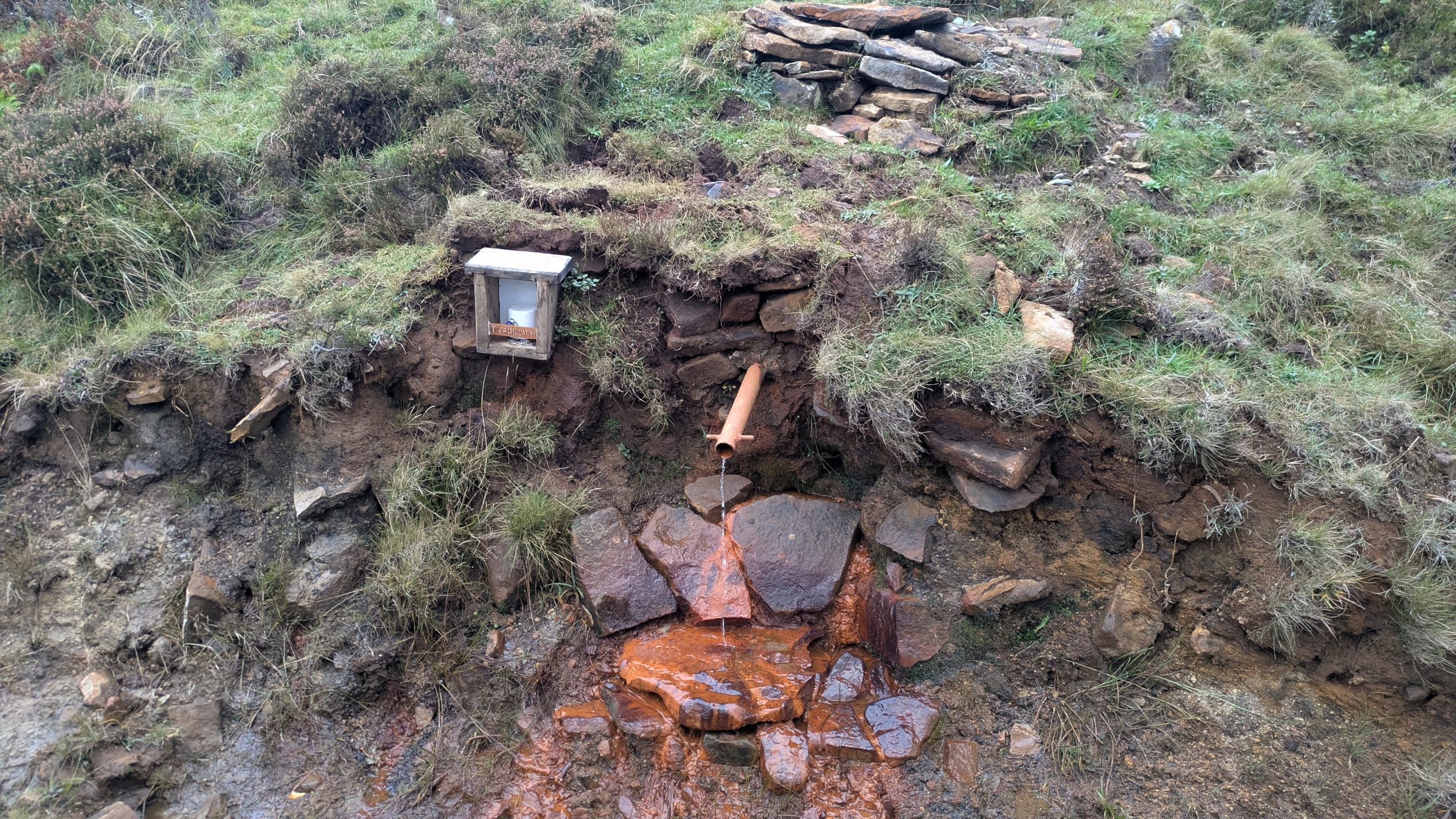
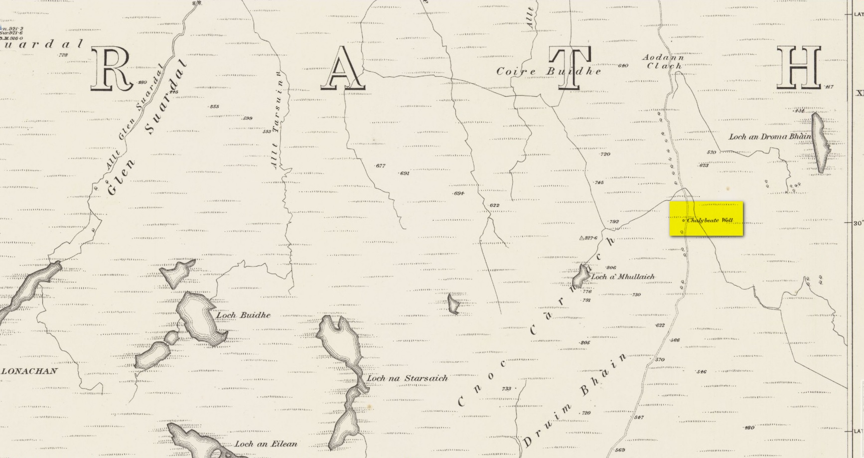
Highlighted on the earliest Ordnance Survey maps of the island, roughly halfway along the Broadford to Heaste road on the right (west) side you will come across the Tabar Ruadh (Gaelic for “Red Well”). For many generations at this point was a Chalybeate well where villagers would stop and drink in a pewter mug from outlet of cast iron pipe which connected to the stone well some nine feet from the road. It was a major stopping point for their horses and ponies to take a drink too.
This set up was functioning in the early 1980’s. At that time I talked to Heaste locals who remembered fishermen from their village taking bottles of this water to pregnant women in the village of Elgol. It was known then for it’s healing properties; this was the early 20th century. The pewter mug was stolen and with road widening and the pipe removed, the site was becoming increasingly overgrown and in danger of being lost for ever.
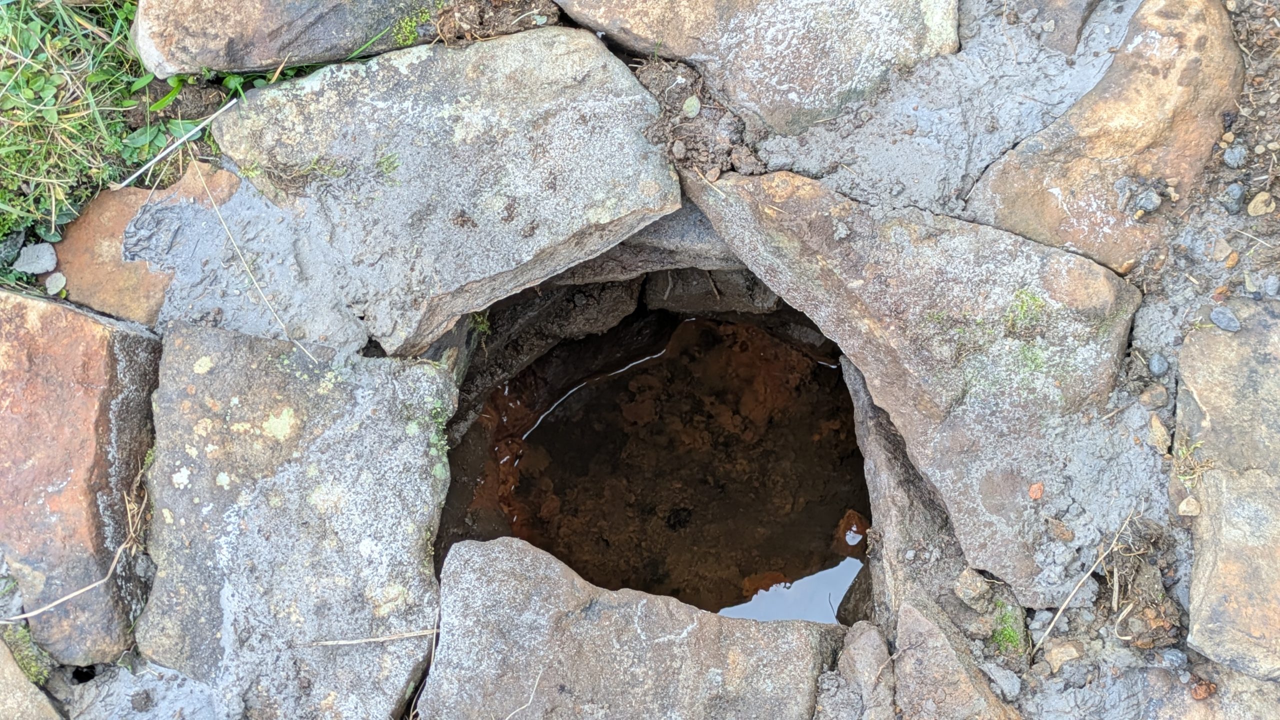
Site shown on 1881 mapWater under the well cover
For the last fifteen years I have been walking this road and had made it a determination to find this well. Success this summer! — and the hidden overgrown well was cleaned out a new steel pipe added. Chalybeate water now flows and a wooden box is at the roadside with a tin mug. On a wet roadside ditch this red water is very obvious where it joins the road.
Acknowledgements:Huge thanks for use of the Ordnance Survey map in this site profile, reproduced with the kind permission of the National Library of Scotland.