Holy Well (lost): OS Grid Reference – SK 48 42
Also Known as:
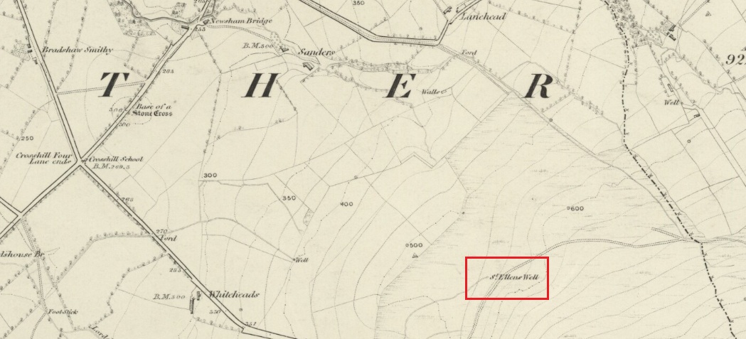
- St Elena’s Well
Archaeology & History
Hiding away in the Title Deeds of the Willoughby Family of Wollaton, written around 1280 CE, a somewhat lengthy entry on land ownership around the parish of Cossal, showed there once existed a little-known St. Helen’s Well: long since lost it would seem. The account, known as the “Quitclaim (of) William son of Adam le Gaoler,” cited the following information:
“Release by William, son of Adam le Gaoler of Nottingham, and Beatrice (his wife) and Agnes (heirs once of Adam de Cossale in Nottingham) to William de Barre and his wife Dionise [Denyse] of all claims to toft and croft with all its appurtenances, with 10 seliones of arable land with appurtenances in various parcels and sites in town and territory of Cossall; the toft and croft lie between land of Dionise on each side; 3 seliones lie together on Brochisale, 2 lie on Elrinstubbe between land of Robert de Marisco and William Baret, 2 lie on Smalethornchis between land of Henry and Robert son of Adam, 2 lie a square furlong ‘quarentelam’of the spring of St. Elena between land of Stacy le Greyne and Nicholas de Marisco and 1 selione lies on le Westfeld between 2 boundaries.”
A few years later in an early 14th Century Feet of Fines there is another mention of the well, which gave a slightly better description of its whereabouts. It mentions items known as ‘sellions’, which are strips of arable land. The account told of,
“two selions lying together at St Helen’s Well between the land of the church of St Katherine of Cossale on one side, and the land of the said Eustace on the other side, abutting at one end on the croft that Walter Talpe holds, and at the other end upon the north conduit…”
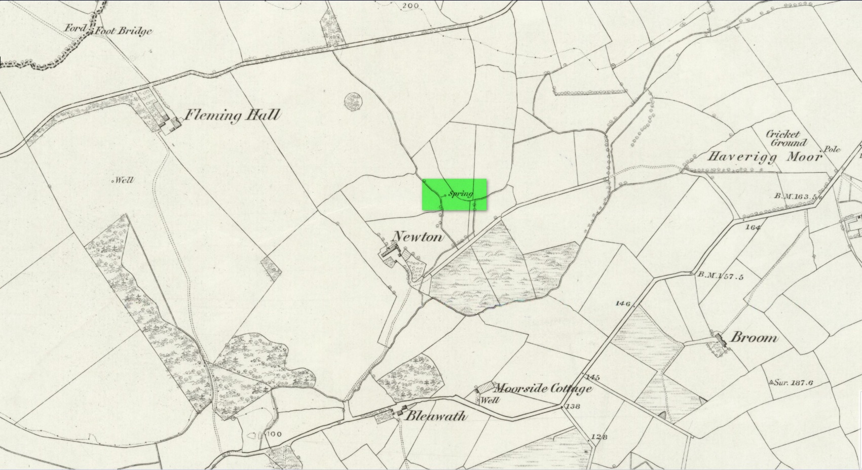
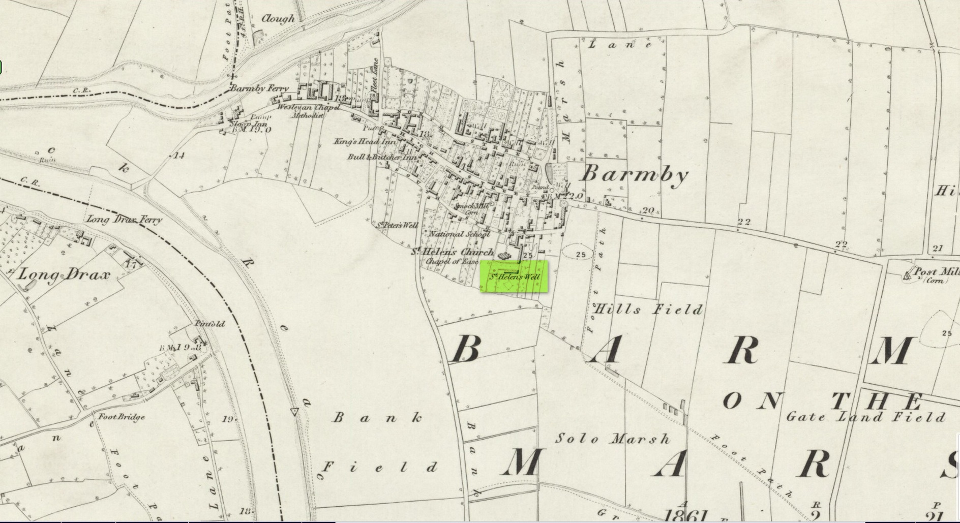
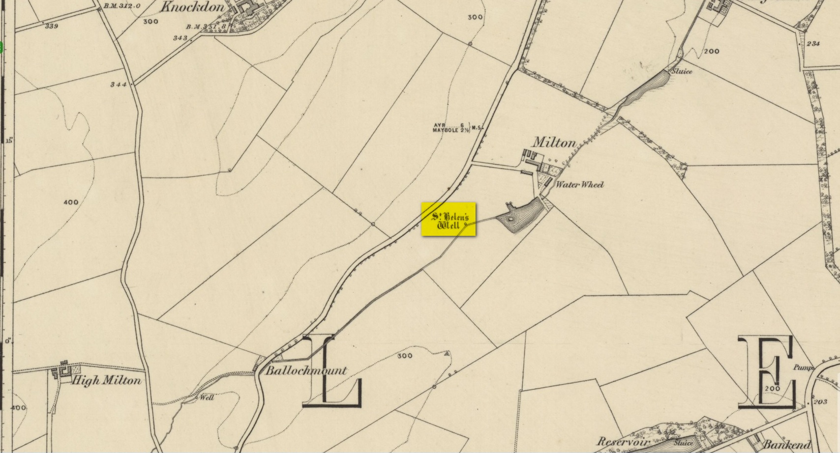
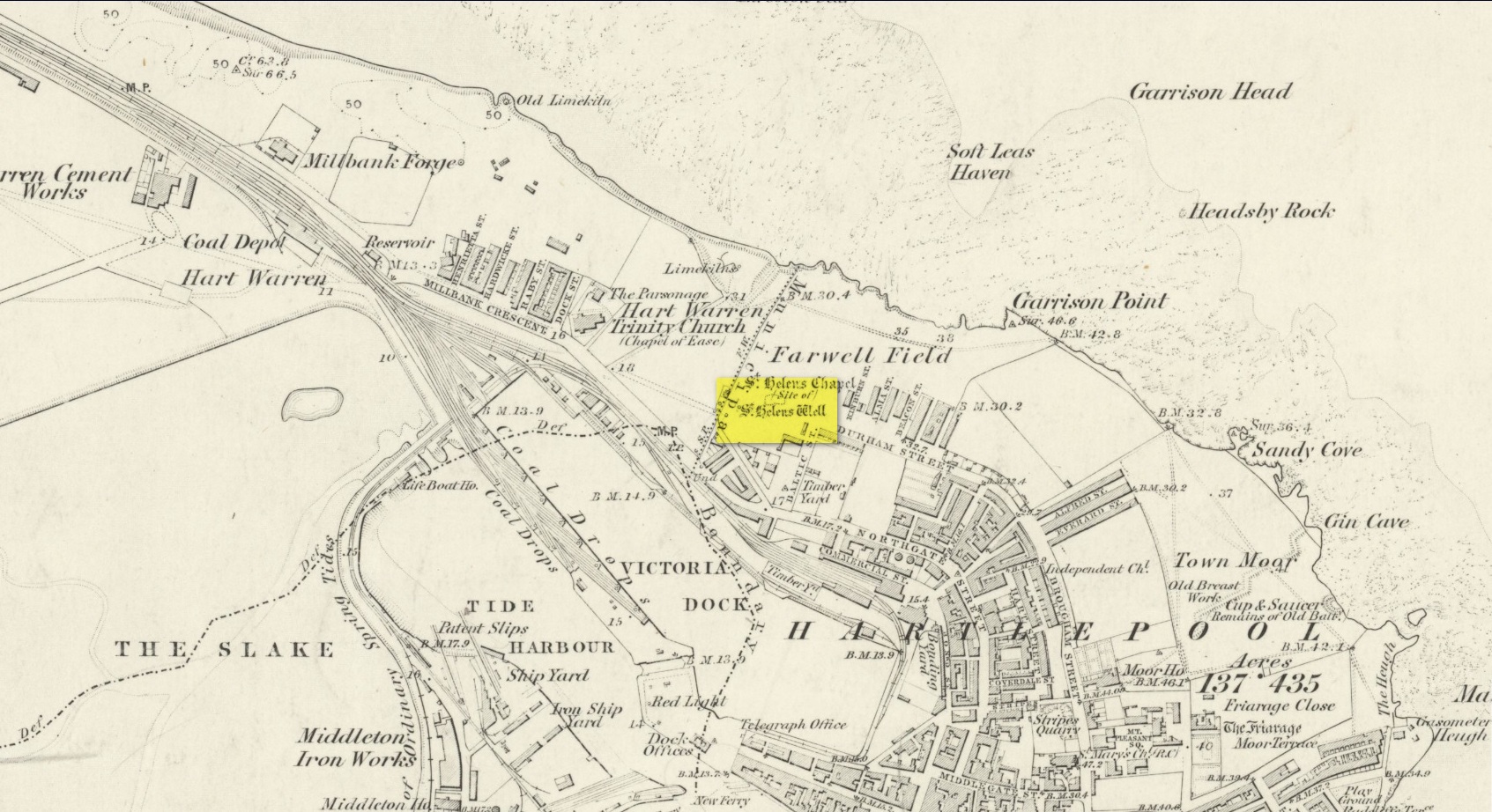
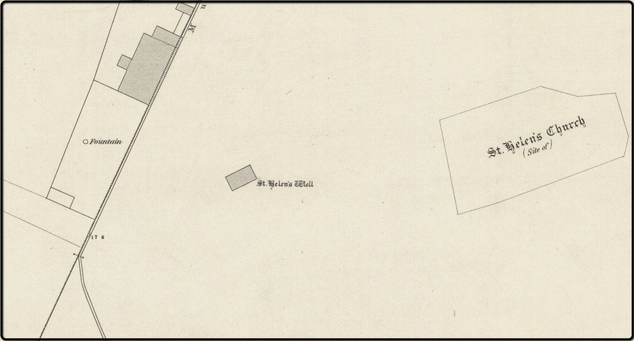
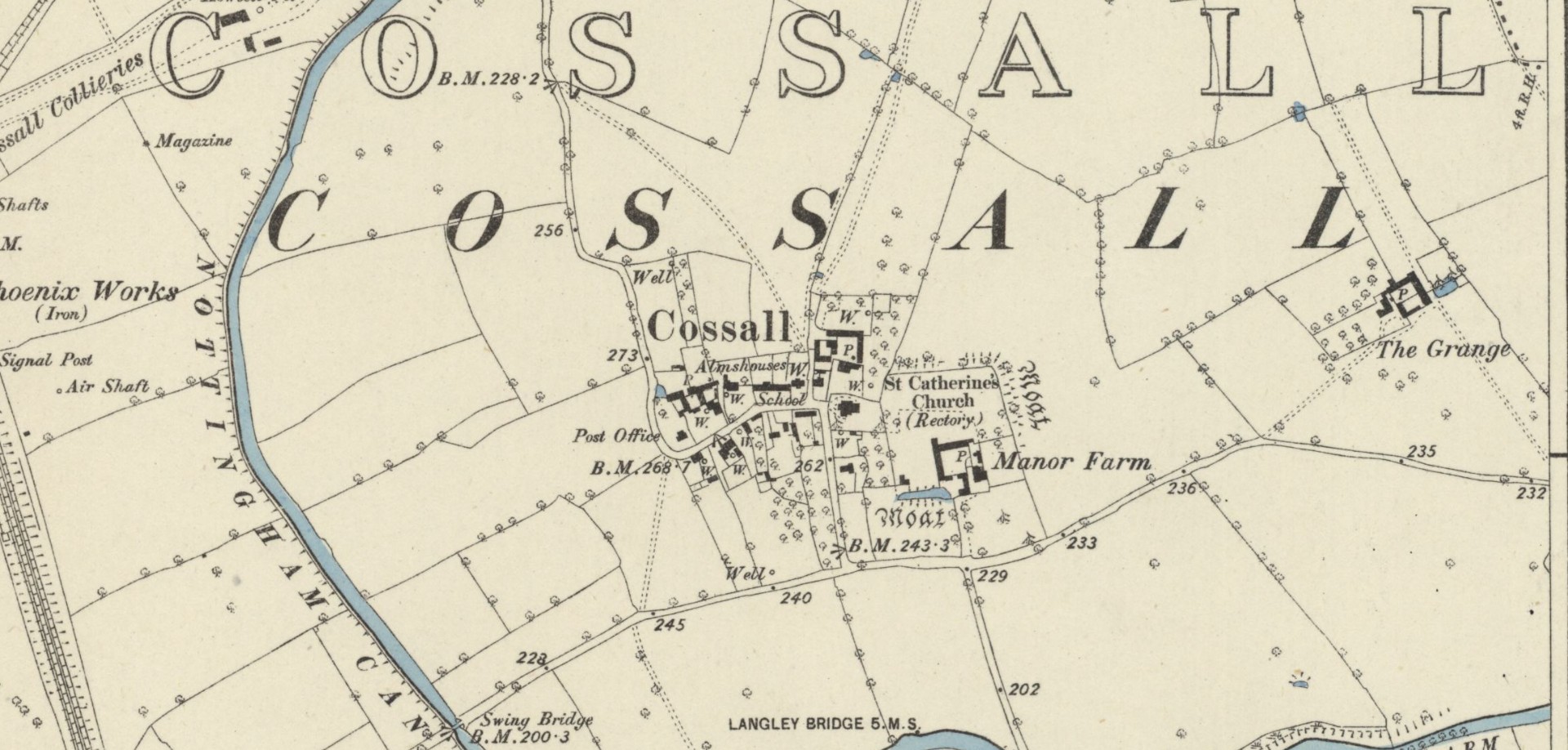
This indicates that the well was close to the village—perhaps even within the village itself. On the early Ordnance Survey maps of Cossall, several wells are shown, and any one of them could be the St. Helen’s Well in question. Does anyone know which one is the forgotten holy well of the village…?
Folklore
St Helen’s feast day is August 18.
References:
- Gover, J.E.B., Mawer, Allen & Stenton, F.M., The Place-Names of Nottinghamshire, Cambridge University Press 1940.
- Morrell, Robert, Nottinghamshire Holy Wells and Springs, Nottingham 1988.
Acknowledgements: Huge thanks for use of the Ordnance Survey map in this site profile, reproduced with the kind permission of the National Library of Scotland.
© Paul Bennett, The Northern Antiquarian