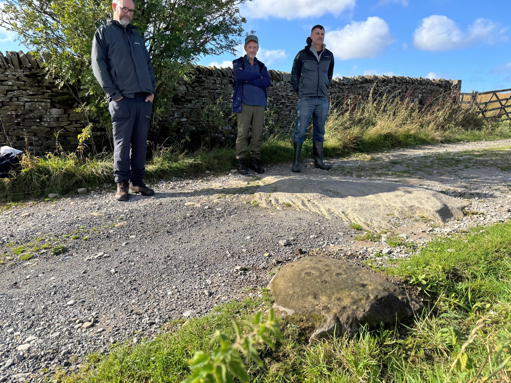
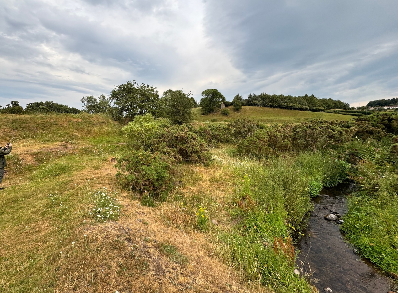
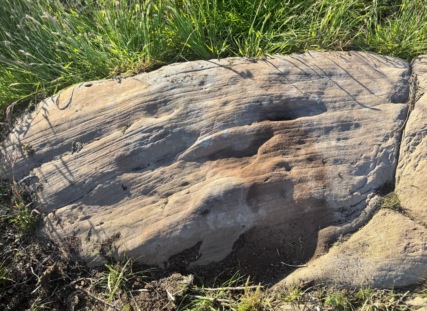
The best description to get here is, from Ilkley, to go up Wells Road, over the cattle grid, and about 500 yards past the cattle grid take the left turn up Keighley Road. This becomes a truly dodgy dirt-track when you hit the road to the Silver Well cottage on your right, but keep going uphill for another after a short while, but keeping walking uphill for another 500 yards till you reach a good-sized footpath on your right. Walk along here for 50-60 yards and then walk into the vegetation on your right and, just a few yards along, you’ll see a good-sized elongated stone in front of you.
Archaeology & History
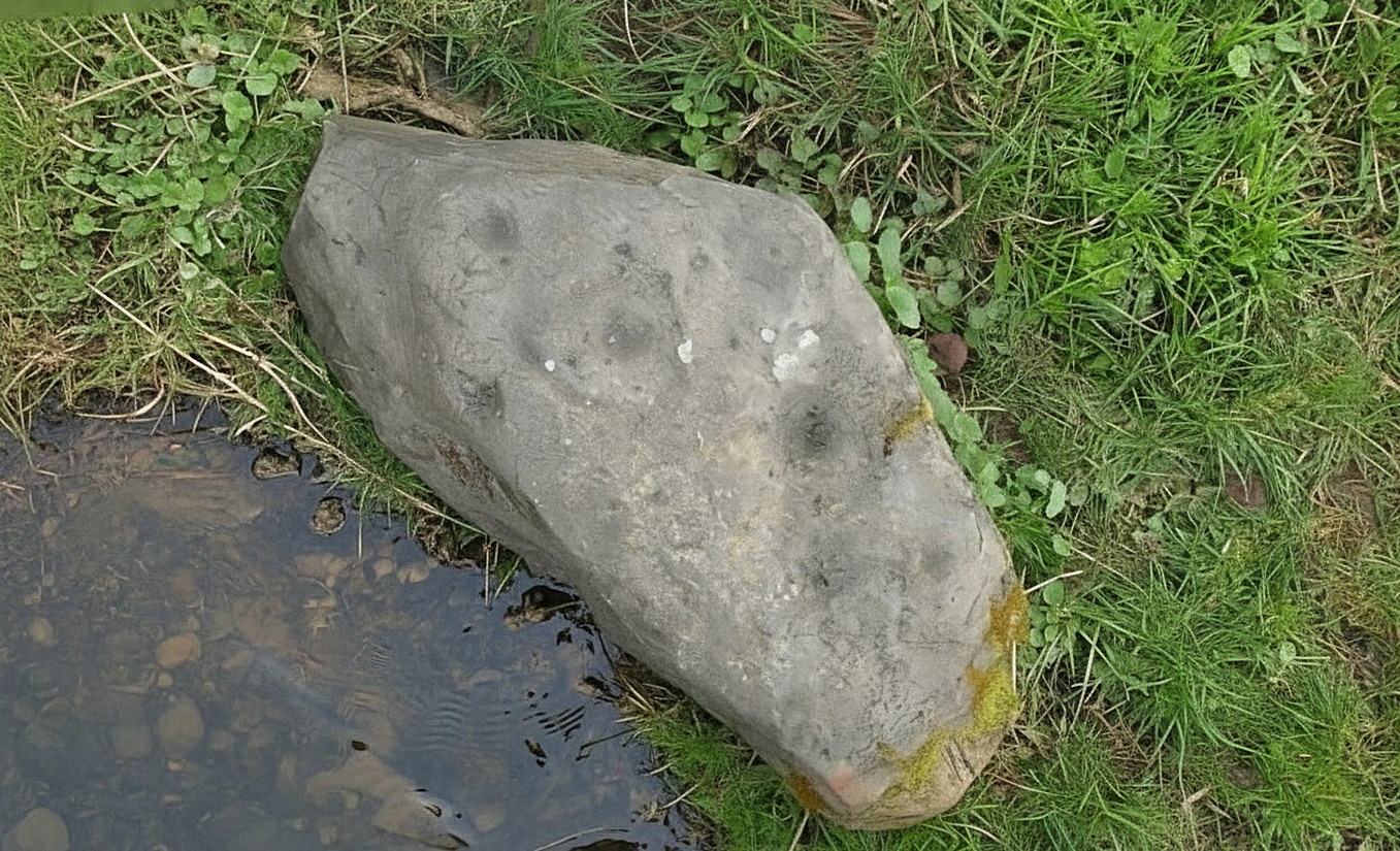
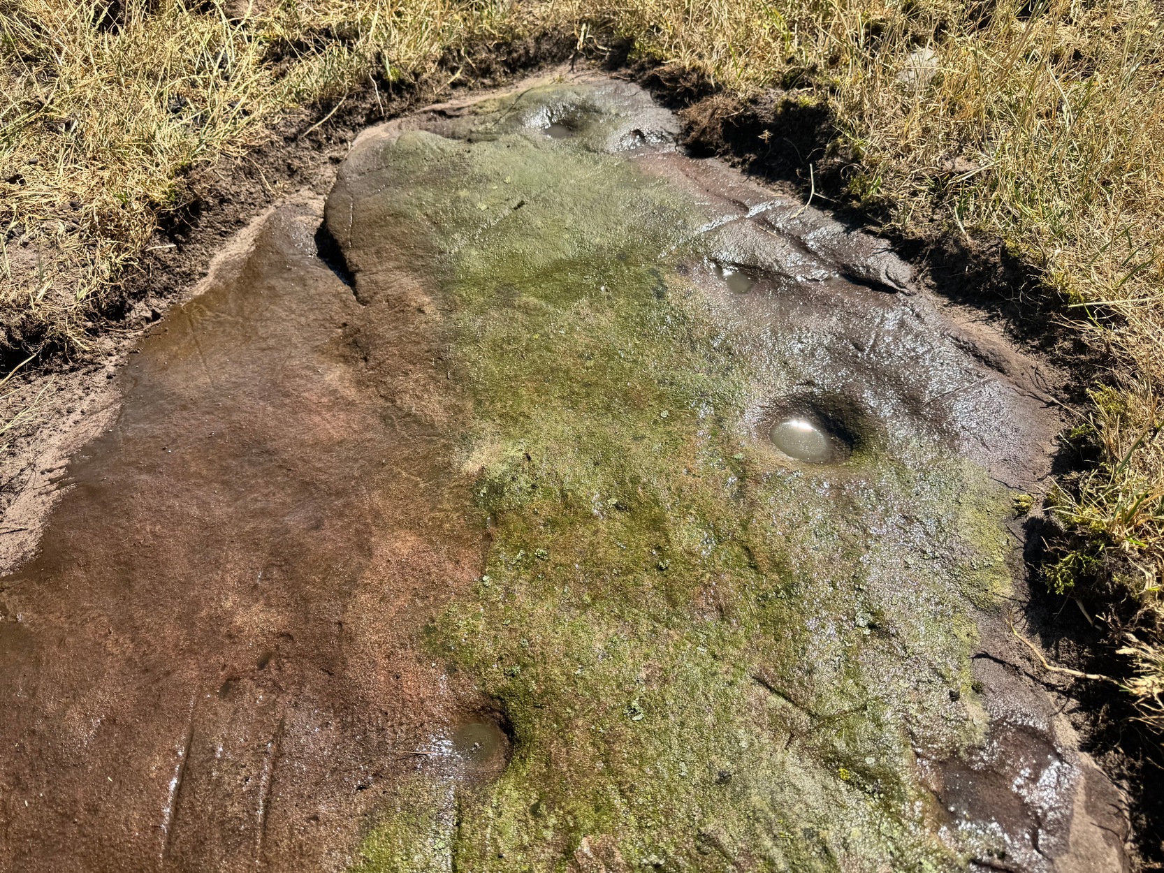
Looking down on the cups
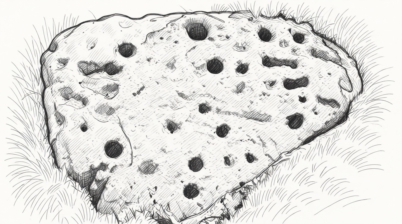
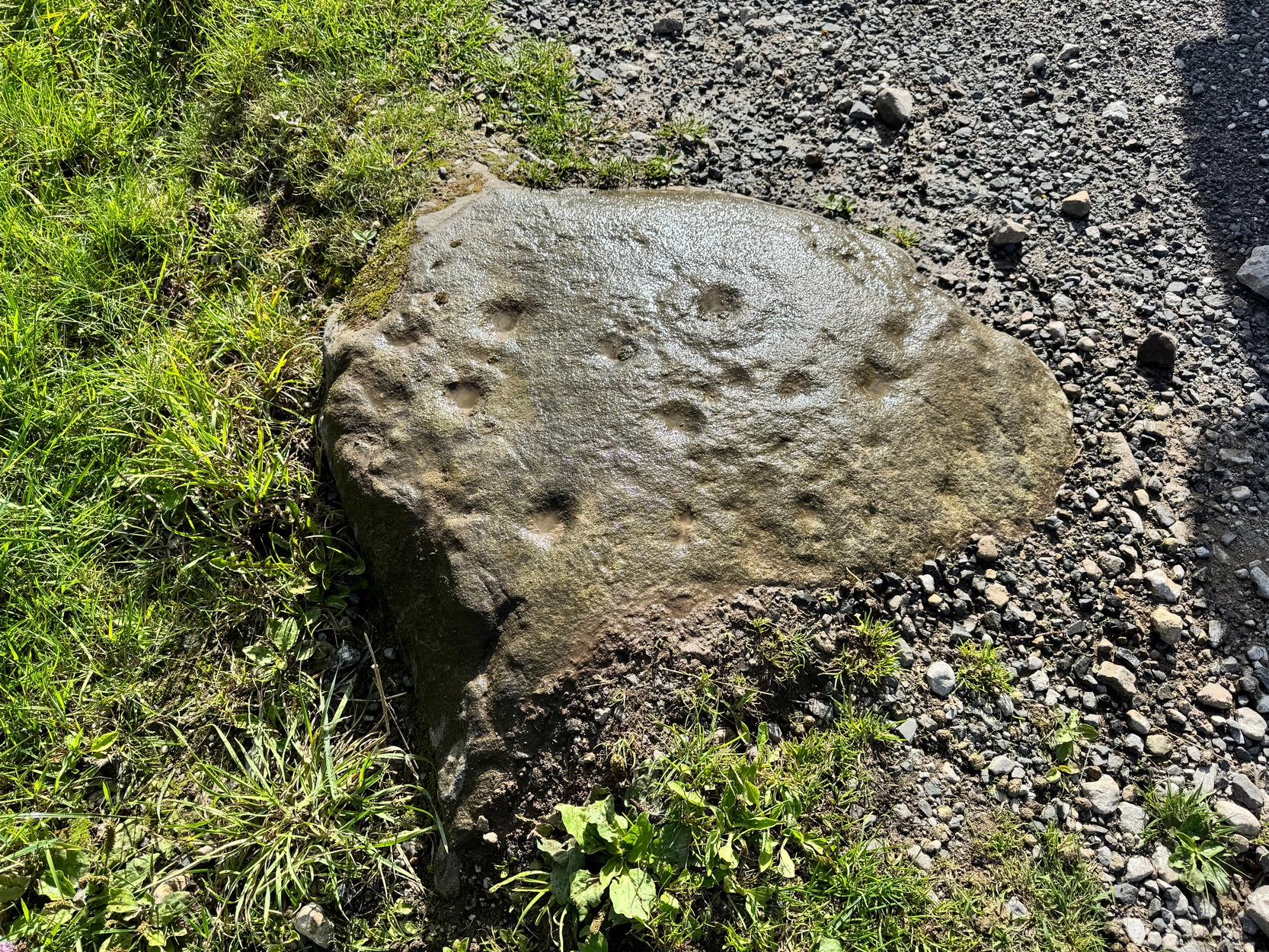
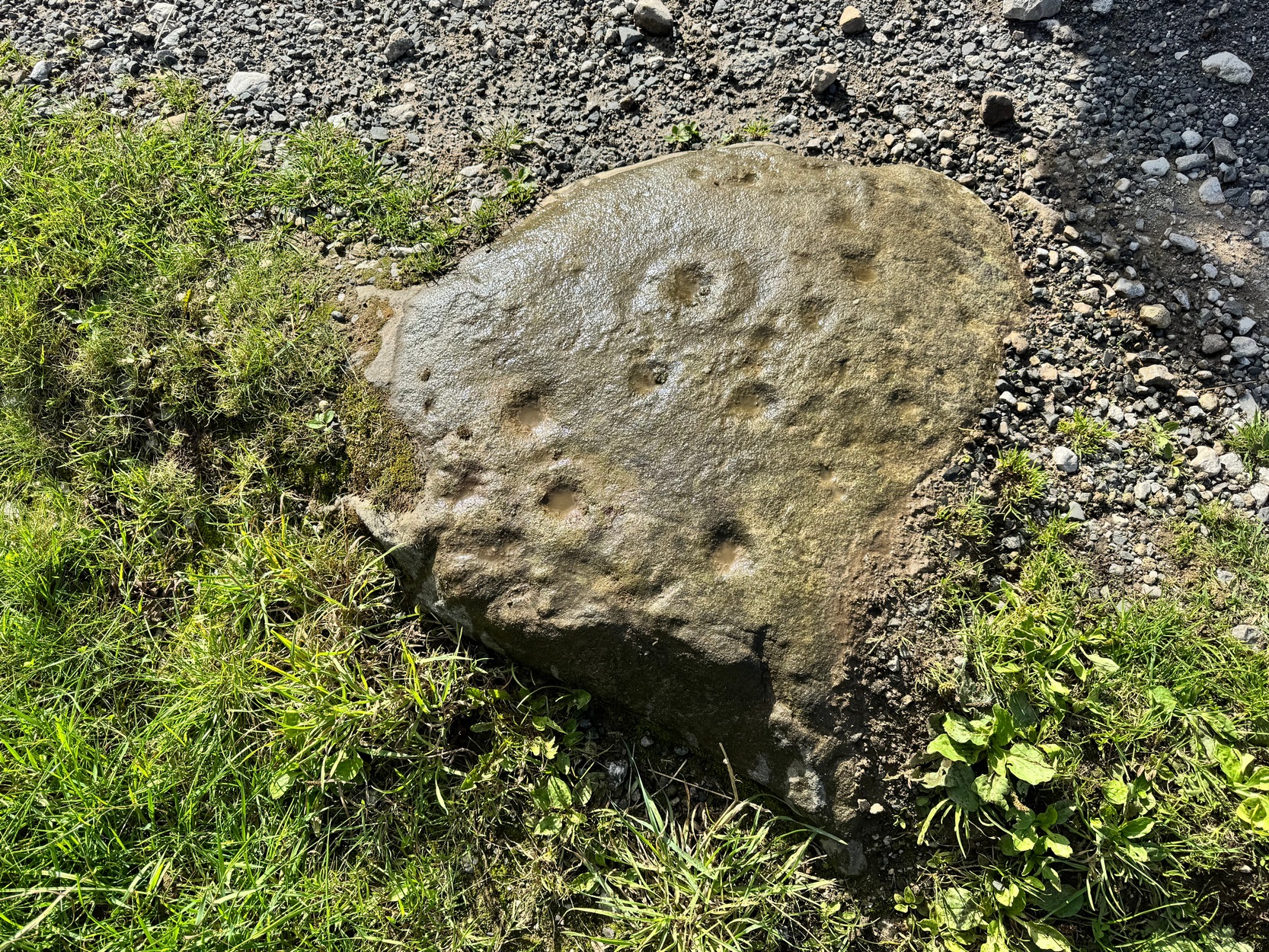
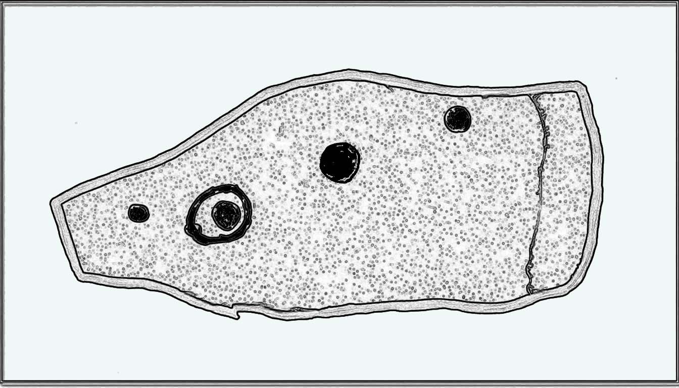
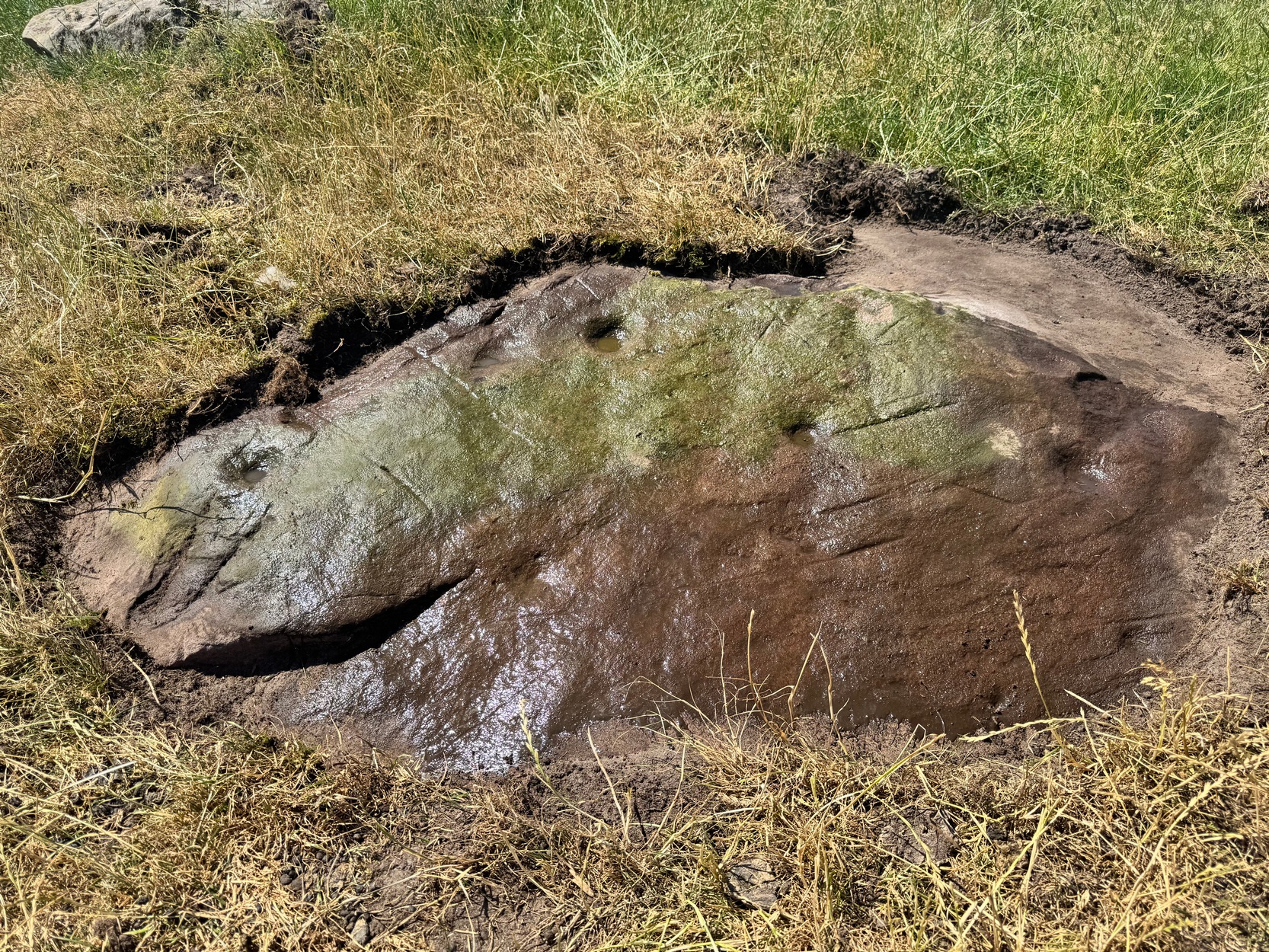
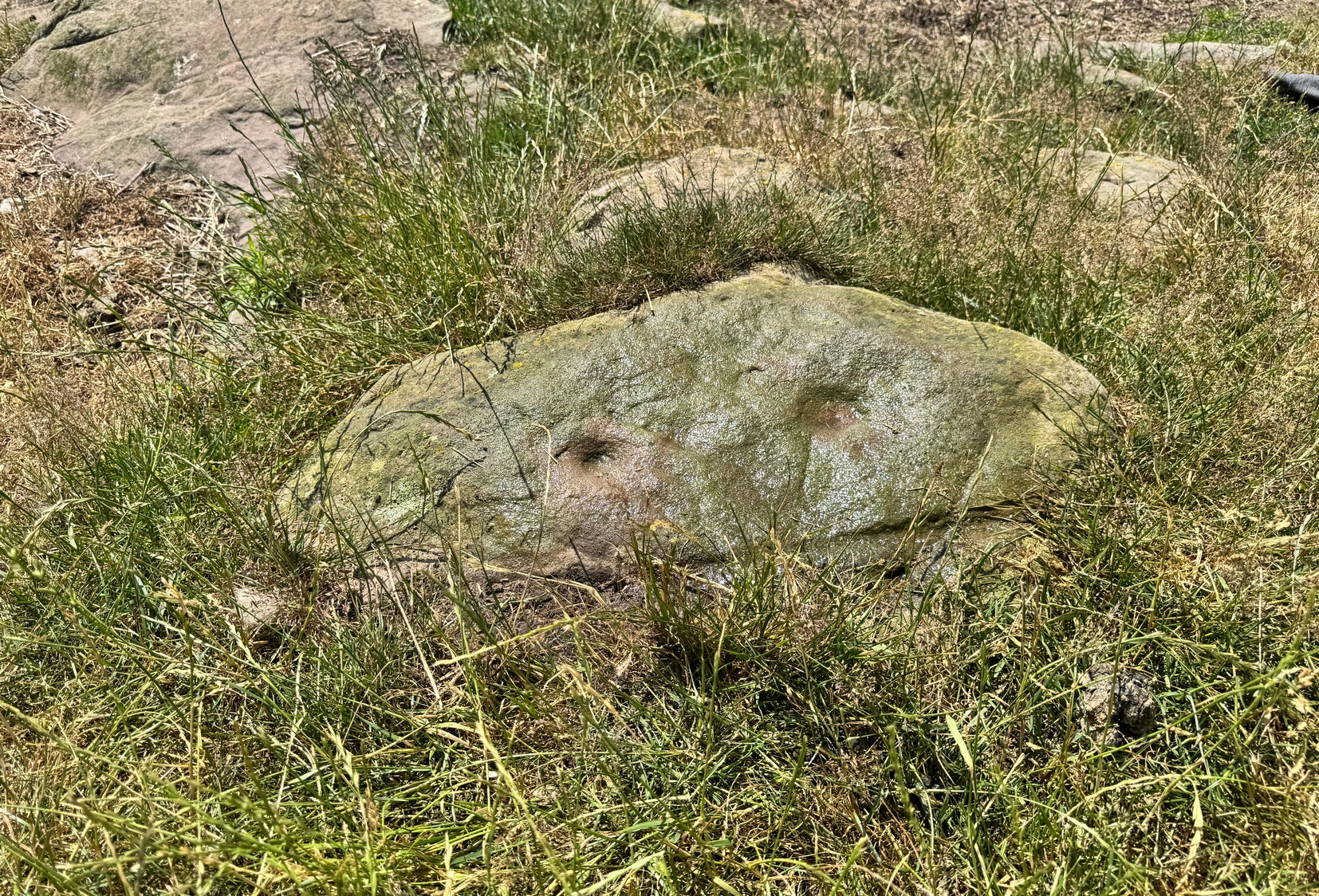
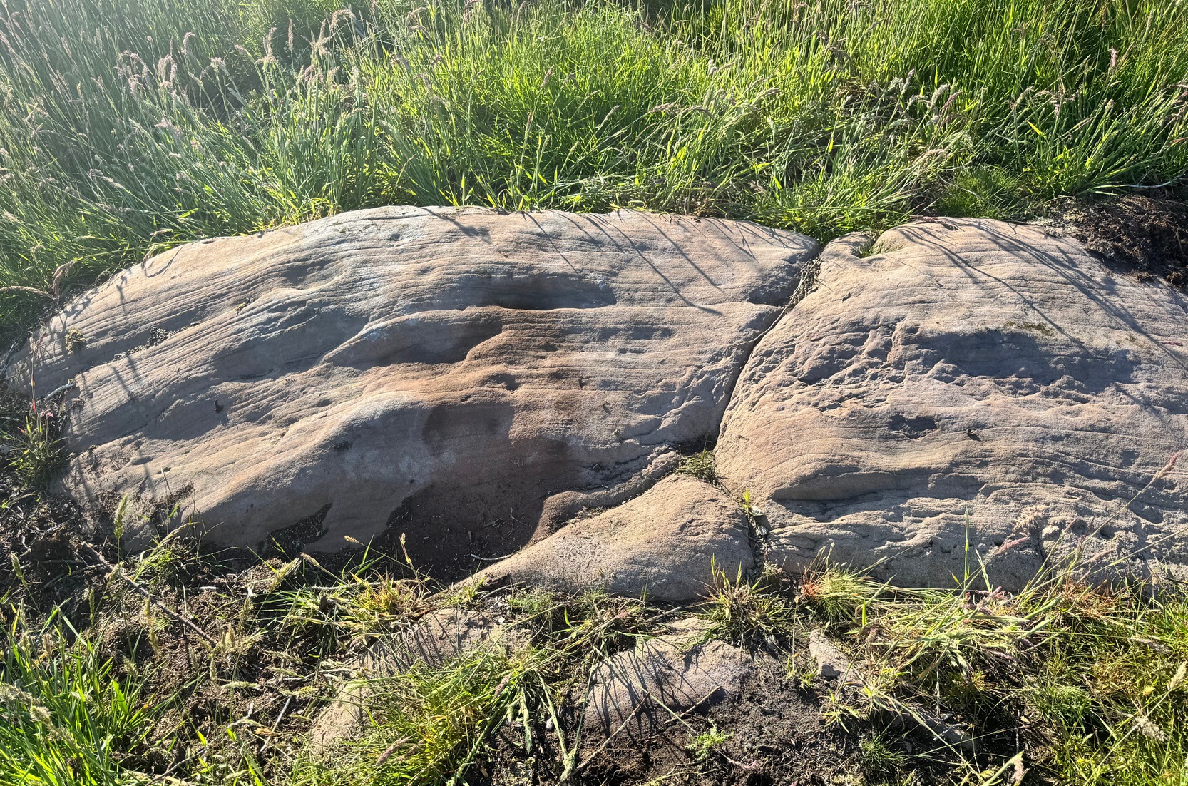
This large boulder has about nine cup-marked impressions, both on its eastern topmost part and others a few feet away on a lower south-facing section of the stone. But they’re not all man-made. The cups on the top-east surface are the ones we should be paying attention to. Of the three or four that we can see, at least two of them are man-made: it’s possible that all of them have been man-affected, but without a detailed geomorphological analysis, we’ll never know for sure. The cups and dips on the other, lower section of the rock are Nature’s handiwork. That doesn’t mean they had no importance in the overall mythic nature of the carving but, as with most British petroglyphs, we may never know one way or the other.
References:
Boughey, Keith & Vickerman, E.A., Prehistoric Rock Art of the West Riding, WYAS: Wakefield 2003.
Cup-and-Ring Stone: OS Grid Reference – SE 0467 6373
Archaeology & History
Hartlington Moor (2) stone
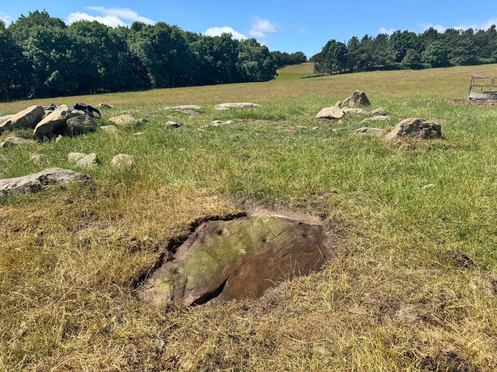
After visiting the Hartlington Moor Lane carving, walk further up the track for bang-on 400 yards and you’ll reach a gate on your right. In the field here, about 150 yards in, is an ornate cup-marked stone, which has had the dung of a hundred animals and other natural effects dumped upon it in recent years and, as a result, remains hidden at the mo. A sketch of it was made some time back, showing it’s general design, but it would be good to get some good photos of it (let us know if you manage to locate it).
The carving covers most of the surface of this low rounded stone and a number of the cups are quite deep, which suggests that it had been hidden from view for a long time. There are up to 54 cups, several of which are linked together by carved grooves, giving it what some folk call an ‘hour-glass’ feature. Near the middle of the stone it looked as if there was a faint cup-and-ring with a carved line running out of it.
The worst part about getting to this stone is finding somewhere to park on the B6265 road if you’re visiting by car! The best spot (as of writing) seems to be a small clearing that the farmer has made by the roadside near one of his gates. From Hebden village travel literally one mile (1.62km) east up the B6265 road and (keep your eyes peeled!) you’ll reach the small left-turn down to Hartlington Raikes (and on your left is a dirt-track) – but keep going straight on past this turning for another 450 yards where the farmer’s cleared the edge of the road against his field. Do not obstruct his field! (he’ll have every right to move it with his tractor if you’re an idiot) Naathen – walk back on yourself to the dirt-track (known as Hartlington Moor Lane) 450 yards away and walk up it for 300 yards where there’s a small tree on to your left. On the opposite side of the track, just below the wall right at the very edge of the track itself, you’ll see the small rounded carved stone.
Archaeology & History
Adjacent to a large, flat, elongated ovoid stone that nearly covers the width of the dirt-track is this much smaller stone with a decent scatter of cup-marks on it that was rediscovered only a few years ago by Yvonne Luke of Ilkley.
A rock art menagerie of Morley, Chappell & HothamHartlington Moor Lane (1)
The petroglyph comprises of two standard cup-and-rings, one of which has a carved groove running from the cup to the ring. There may be up to nine other single cup-marks on the stone, many of them quite worn (as you’d expect with it living on a track!); but some of these may be the result of natural erosion. Nonetheless, most of them seem to be the real deal. There are also several oval ‘notches’ on the design, but these may have been made by agricultural/farm machinery scratching across the stone.
From this carving, if you venture another 400 yards up the Hartlington Moor Lane track and go through the gate on your right, about fifty yards into the field is another carving at grid-ref SE 0467 6373, covered in cup-marks, but now covered over in vegetation. If you get a chance to make the stone visible again, let us know! It’s likely that other unrecorded carvings are hiding away in the adjacent fields.
Acknowledgements: With appreciations to Tony Morley, John Hotham and Graeme Chappell for getting us up to this olde stone. Cheers fellas!
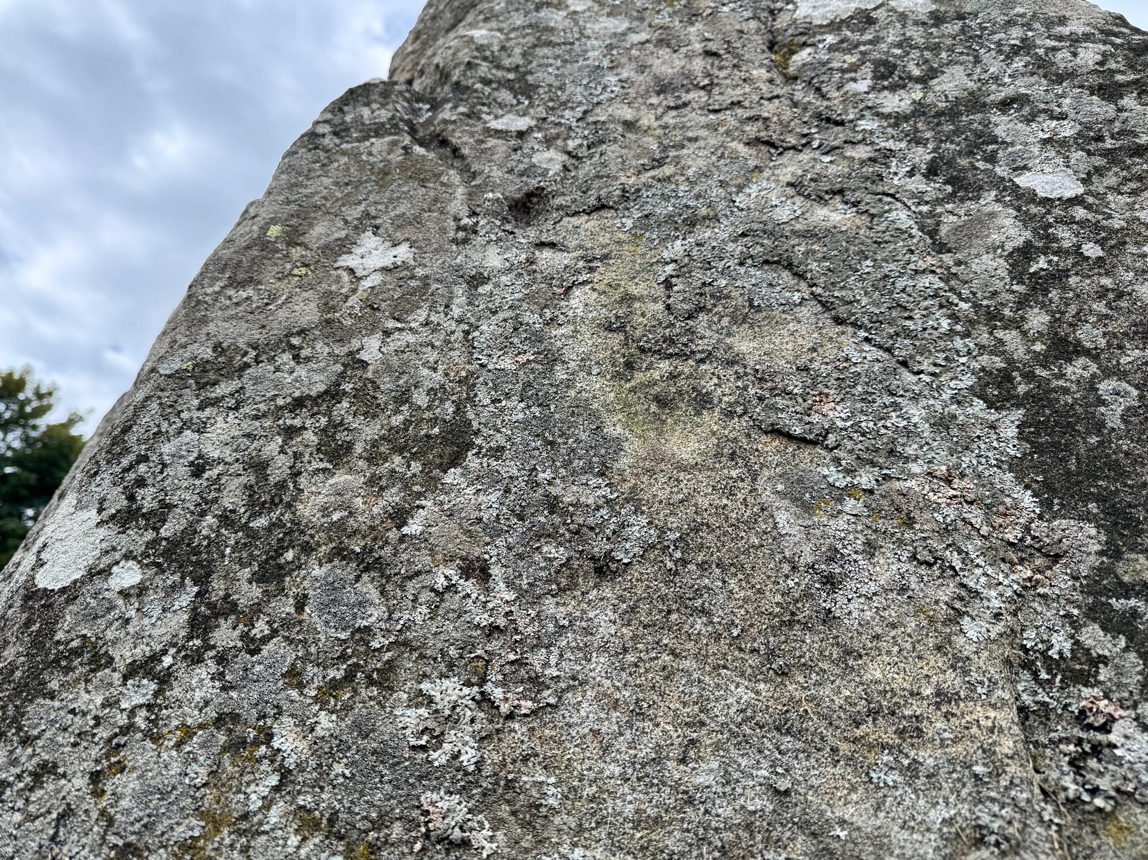
In Adam Welfare’s (2011) second volume to his grand megalithic inventory, he described there being, next to the cup-marked Loanhead of Daviot (1) stone, another, that “has two on its outer face”— i.e., the east-facing vertical surface of the standing stone. It looked as if there were three cup-marks when we visited here recently, but I may be wrong. The main one, visible in the attached photo, is about two-inches across and a half-inch deep; another is above this and the other one is below it (you can just about see them in the attached photo). The design is in no way impressive.
Cup-mark to centre
Aubrey Burl (1979) suggested that the cup-marks on the neighbouring Loanhead of Daviot (1) stone were symbolic of the Moon, whose movement across the sky was recorded in the architecture of the circle itself. When he wrote such words, this secondary cup-marked stone hadn’t been noticed and, as it faces the opposite directly looking eastwards, it makes you wonder what he might have thought this design represented. (Welfare [2011] also reported that on the standing stone flanking the east-side of the recumbent stone, there is “a single cupmark a little above the ground surface on its inner face”.)
References:
Burl, Aubrey, Rings of Stone, Frances Lincoln: London 1979.
Welfare, Adam, Great Crowns of Stone – 2 volumes, RCHAMS: Edinburgh 2011.
Acknowledgements: Massive appreciation to Michelle and Steve Allan of Montrose for taking us to this site. Huge thanks to you both.
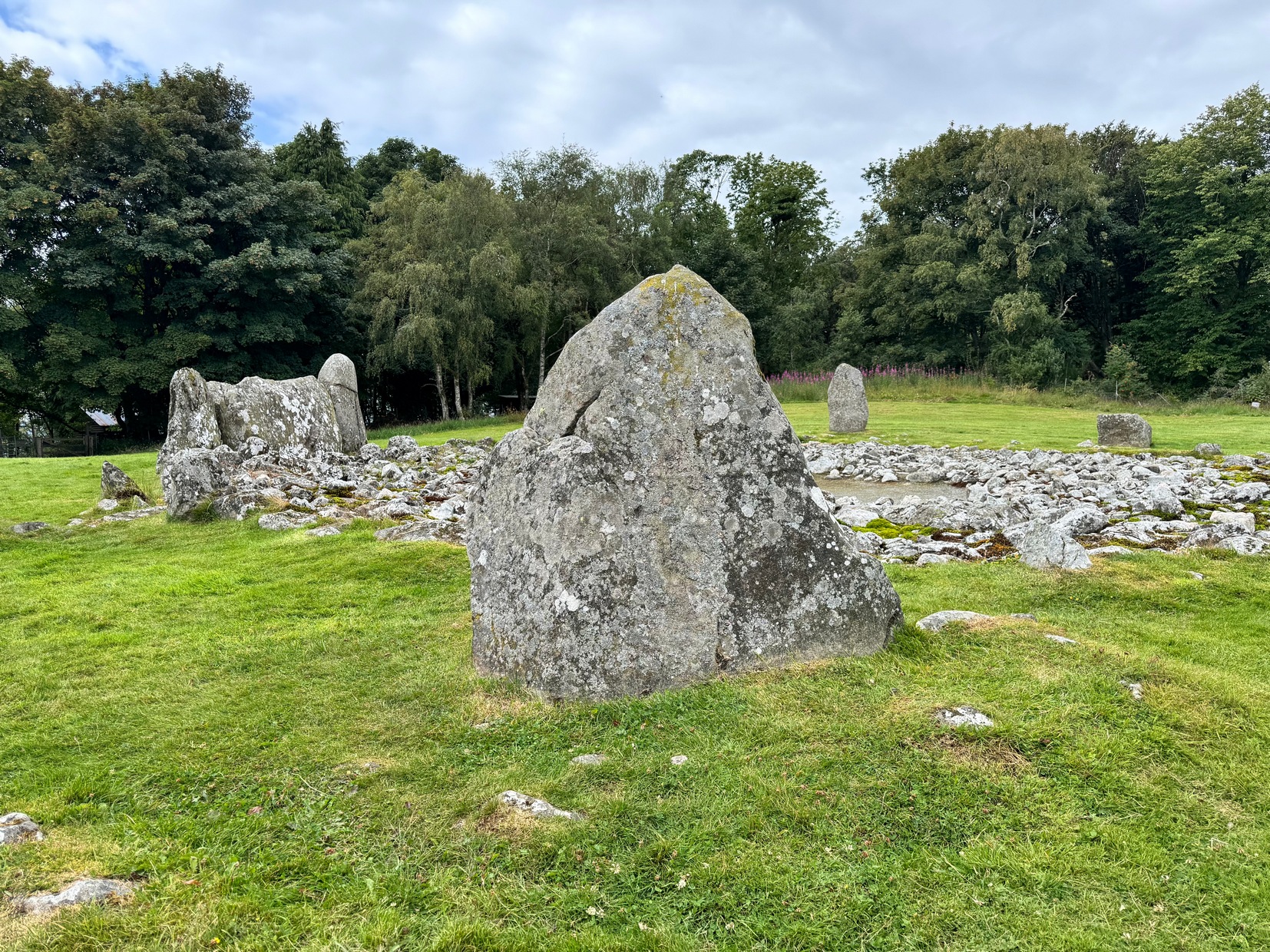
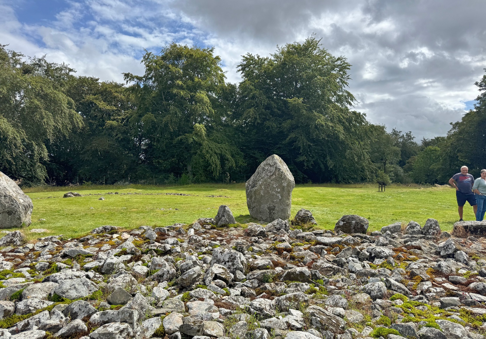
As you walk through the gate towards the stone circle, veer to the long fallen recumbent stone and, past the large upright that flanks the recumbent on the right-hand side, walk to the next standing stone along from here. That’s the one you need to be looking at!
Archaeology & History
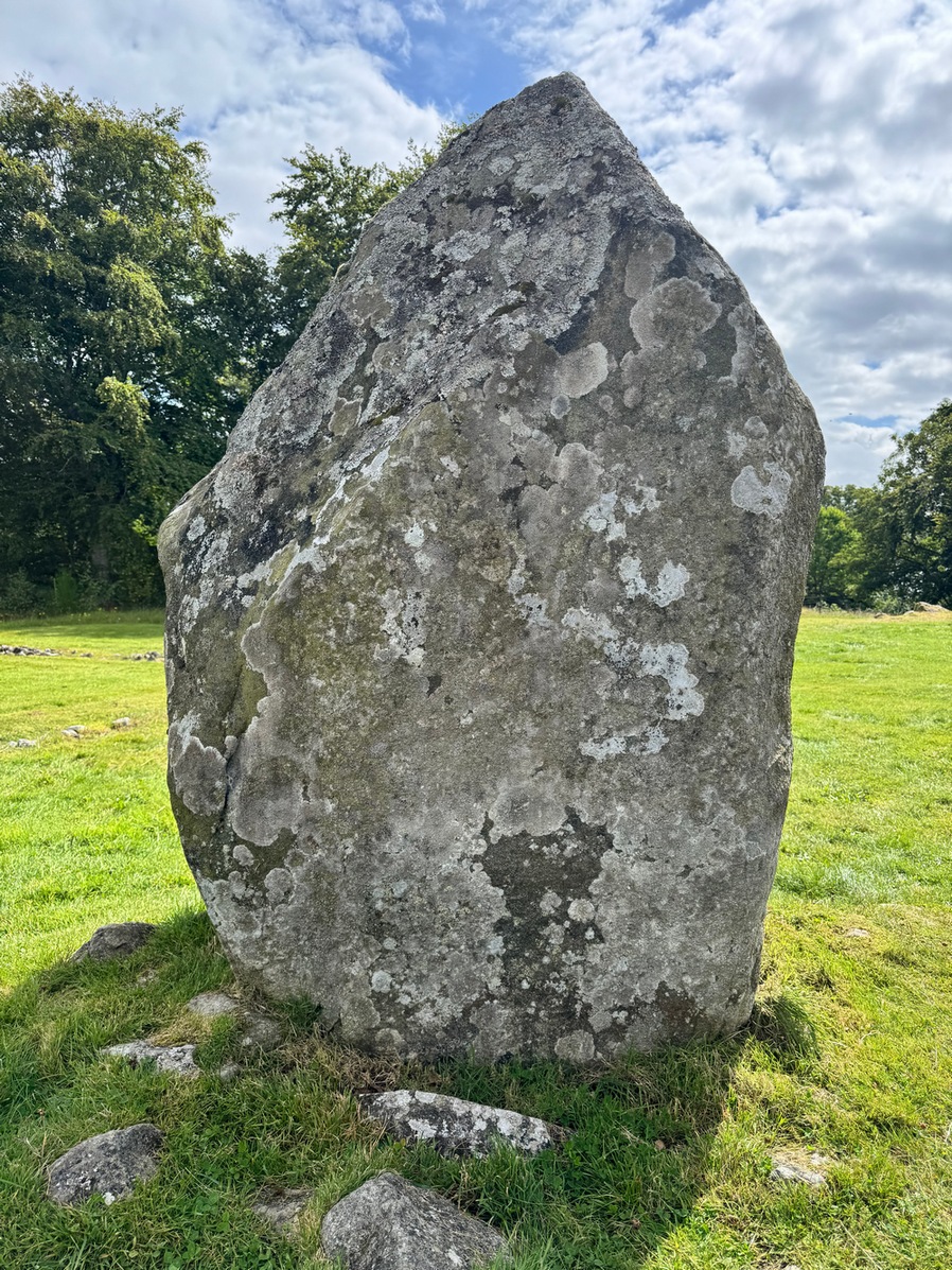
This is one of at least two petroglyphs within the Loanhead of Daviot circle. Difficult to see unless the light is good (oh how often that’s the case!), on our visit here—under the fine guidance of Michelle and Steve Allan—the cups were hard to see clearly, and they proved troublesome getting good photos of them (we’d forgot our standard water-enhancing bottles this day too!). But we could just about make them out, as our fingers fondled their depressions.
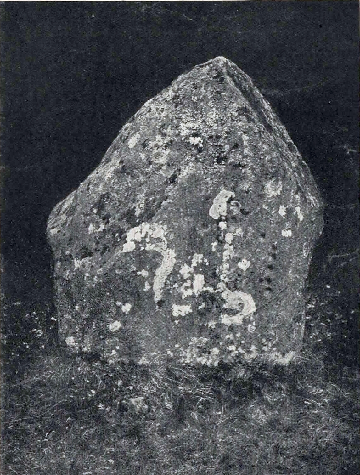
It seems that the carvings were first noticed (please correct me if I’m wrong) by the Aberdeenshire antiquarian James Ritchie (1918) who, in a lengthy essay on rock art and megalithic rings, described seeing “twelve plain cups” on the standing stone in question. They are situated on the north-facing side of the stone, or, as Ritchie wrote,
The carved stoneRitchie’s early photo
“on the inner face of the stone, which points towards the centre of the circle…. Near the western edge of the stone five cups are placed, one above another, in an almost perpendicular line. Each of the three lower members of this group is 2 inches in diameter and ½ inch in depth, while the two upper members are ½ inch less in diameter and only ¼ inch deep. A little to the left, near the upper end of the group, there is a single cup, 1 inch in diameter and ¼ inch in depth. Near the centre of the stone there is another group of cups very similar in appearance to that already described. It also consists of five cups in an almost perpendicular line, with a sixth, a little to the left, nearly in the middle of the stone. All the cups in this second group are about 1 inch in diameter and very shallow.”
The second group of cup-marks that Ritchie described were the most difficult to see on our visit here, due to the bright daylight. Under the Moon, or early sunrise when the stone is wet, they should stand out nice n’ easy. Thankfully, most of them are visible in Mr Ritchie’s old photo of the stone (above), taken in 1917.
An interesting idea was posited by Mr Browne (1921) in his classic on the Aberdeenshire sites, where he thought that the cup-marks here are marks that denoted “the registers of the magician in charge” of rituals at the Loanhead circle. More recently, the great megalithic archaeologist Aubrey Burl (1979) suggested that the cup-marks on this stone were representative of the cyclical movement of the Moon, as observed from this stone circle.
The second cup-marked stone at this stone circle is on the next stone along, going anticlockwise (east): on ‘Stone 5’ (as designated in the Royal Commission survey).
References:
Beckensall, Stan, British Prehistoric Rock Art, Tempus: Stroud 1999.
Beckensall, Stan, Circles in Stone: A British Prehistoric Mystery, Tempus: Stroud 2006.
Browne, G.F., On Some Antiquities in the Neighbourhood of Dunecht House, Aberdeenshire, Cambridge University Press 1921.
Burl, Aubrey, Rings of Stone, Frances Lincoln: London 1979.
Cup-Marked Stone (missing): OS Grid Reference – NJ 747 289
Archaeology & History
When James Ritchie’s (1918) wrote his lengthy essay on the cup-and-ring designs on the megaliths of Aberdeenshire, he mentioned one of the two known carvings that are in Loanhead of Daviot stone circle, but also mentioned one “in the wood, a short distance to the northwest of the circle.” It’s not been seen since he wrote about it. Ritchie described there being several rocks in the trees and, “on the upper surface of one of these, two plain cups are to be seen.” He told them to be “similar in size and appearance to those on the standing-stone” in the Loanhead stone circle a short distance below, but he thought there was no connection between the two sites. The carving is likely to be still there, beneath the undergrowth. It would be worthwhile seeking it out during the Winter and Spring months, before the vegetation returns.
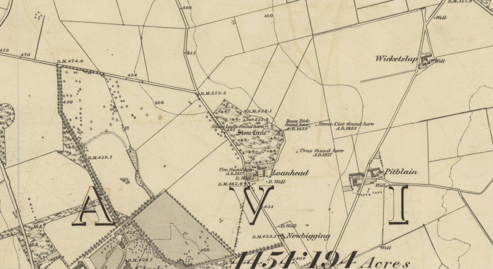
Acknowledgements: Huge thanks for use of the Ordnance Survey map in this site profile, reproduced with the kind permission of the National Library of Scotland.
From Wooler High Street, walk east past Market Place and then down The Peth, across the A697 road, go over the river bridge and then left up the long dead straight Brewery Road. It bends left about half-a-mile up and just over 100 yards past the bend (just where another sharp bend in the road occurs), make sure to take the hidden footpath that runs into the shrubs. 700 yards along, the path levels-out as you hit the edge of the moor and you reach a ‘crossroads’ of paths. Bear left (NE) and walk another 800 yards (past a gate or 2) where you hit a small woodland; keep walking straight along the same path until you hit the next copse of trees on your left, and here walk sharp right, through the field for 300 yards (past some more trees), through the gate and another 100 yards or so through the next gate. Ahead of you is a covered rocky ridge with some gorse bushes. Look around!
Archaeology & History
…from another angle
We were fortunate on our first visit here. For, in spite of what several tomes and local guides have said of this carving—i.e., “the site is hard to find as it’s covered by gorse bushes”—local folk have cleared it and made it accessible and much easier to find. Thank fuck! For on the day we came here, in spite of considerable cloud cover, it was very hot and humid—and the last thing I needed was working to rummage through vegetation on a day like that!
It was certainly in a crappy state when the old rock art writer Maarten van Hoek (1982) came here: “covered by sheep dirt” as he called it! But he cleaned it up – and thankfully the tradition amongst the local folks continues.
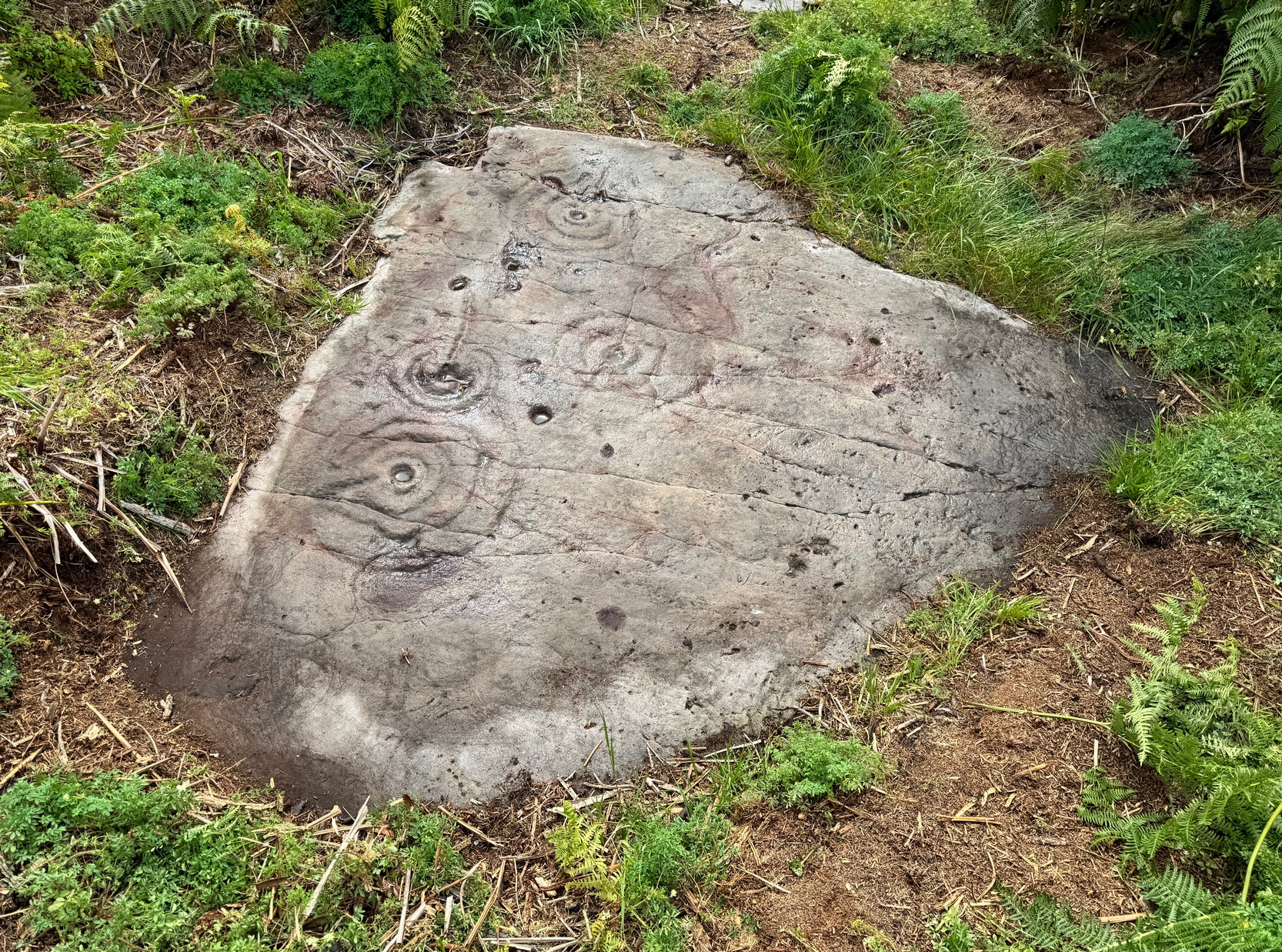
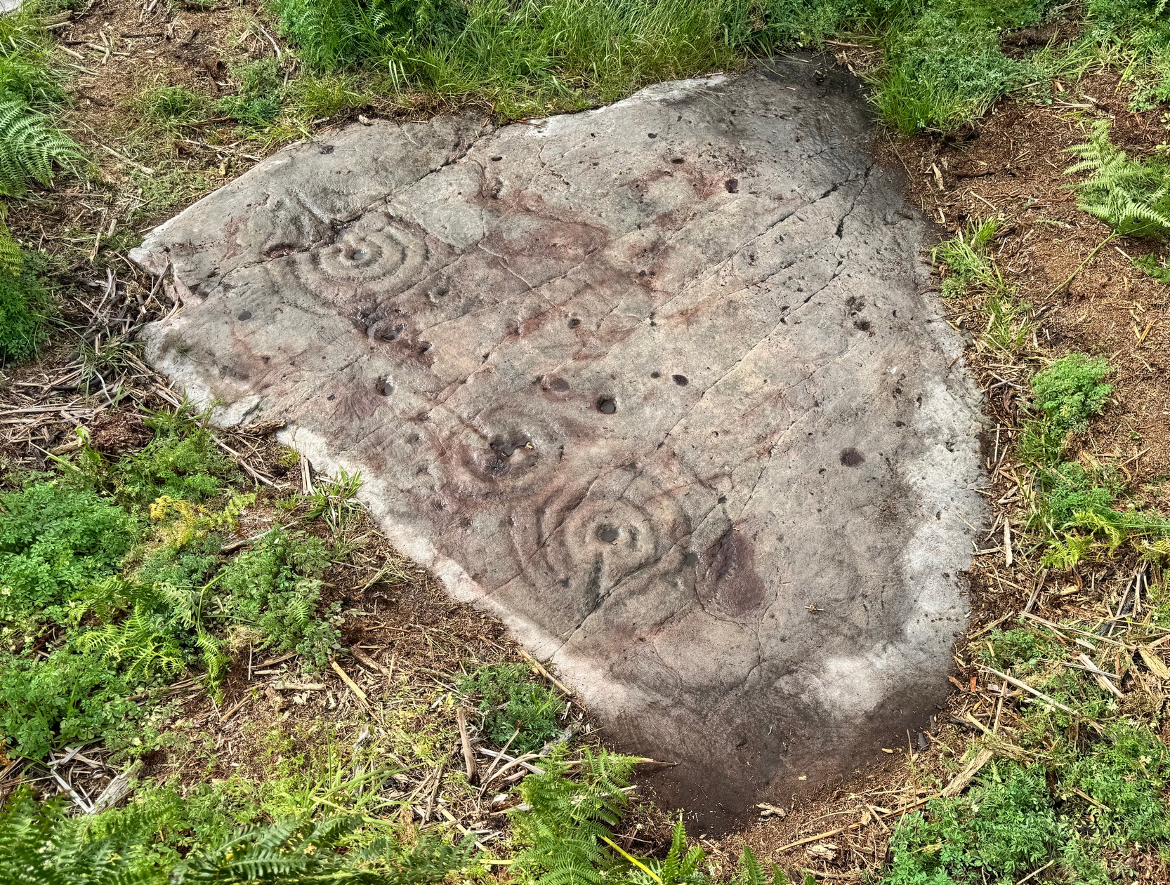
Arc of cups & double-ringClose-up of main design
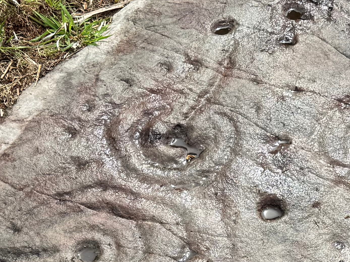
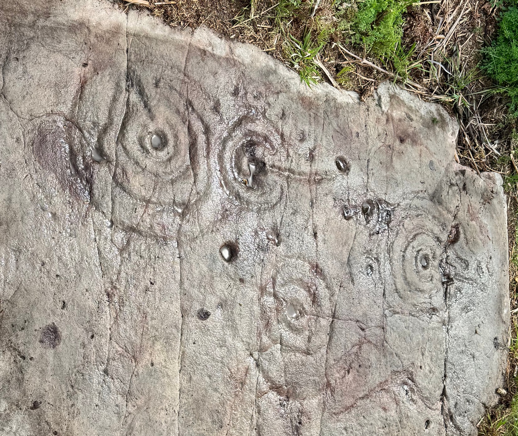
Cut into a rounded triangular-shaped flat rock are a series of multiple cup-and-ring designs, each with lines running in various directions to, or from, the central cup-mark. One of them—the smallest of the lot near the top-middle of the stone—is an incomplete double-ring, and all round the outer south- and western edge is a semi-circle of eight or nine cup-marks which, from my unconscious mind, brought about feelings of lunar phases defined by the cups as the Moon moved through the heavens—and then back on itself along the same movements through the skies. This simple ‘flash’, so to speak, was the unconscious of my youthful astronomical mind that brought it to the fore—and although ‘time’ in the neolithic was defined by the Moon (menstrual rites & all…), this impression, this ‘dreaming’ lacks consensus recognition and so, in the social Darwinian paradigm of modern archaeology, would be promptly put to bed! I still like the impression though; but it begs the question as to what mythos might underlie the rest of the design!
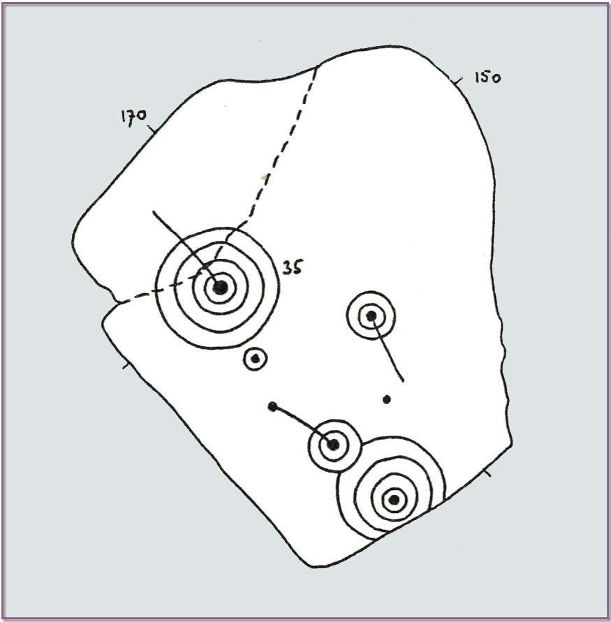
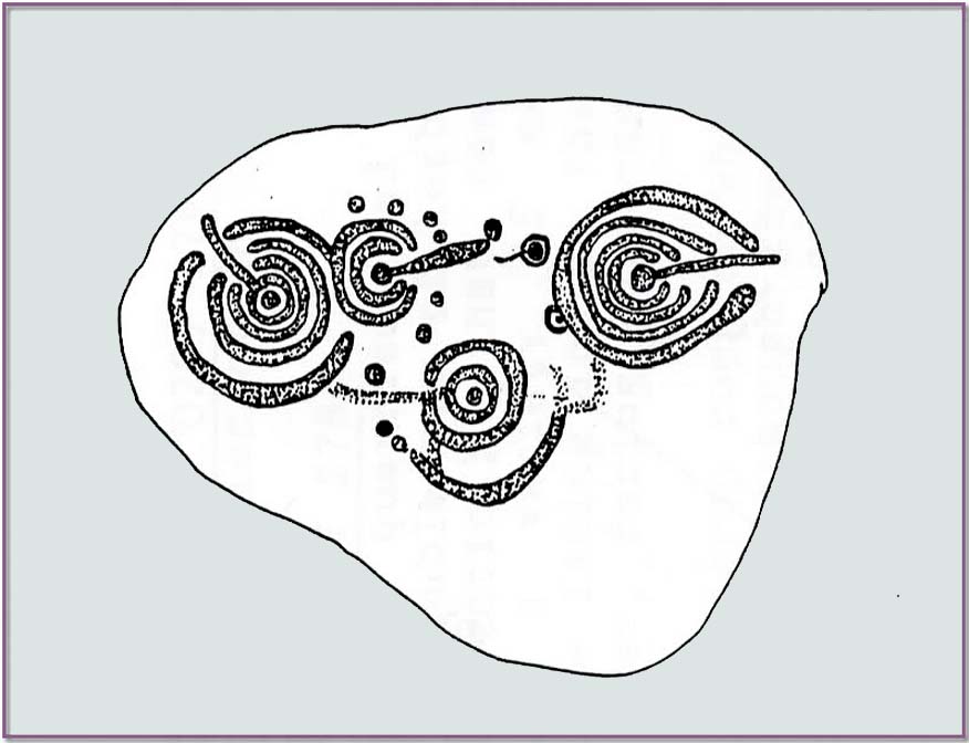
No such impression seems to have hit Maarten van Hoek (1982) upon his visit here. He described the carving thus:
van Hoek’s 1982 sketchBeckensall’s 1991 sektch
“7 cupmarks, 5 of them surrounded by rings. On the N part is a cup and 4 rings with a tail from the cup running to the NW. Through this carving runs a large crack in the rock. Almost touching its outer ring to the S is a small cup and 1 ring. Further E is a cup and 2 rings with a tail from the cup running SE. Near the end of this tail is a single cupmark.
On the S part is a more complex figure: it is a cup and 4 rings, the two outer rings broken off at the edge of the rock. The outer ring is gaped to the NW to enclose the outer ring of a cup and 2 rings. From the central cup of this cup and 2 rings runs a tail to the NW ending in another cupmark.”
On van Hoek’s visit, it was obviously a cloudy grey day, as there are some obvious ‘extras’ on the design that he missed (somehow missing the distinct arc of cups surrounding the double-ring for one thing!). Beckensall (1983) wrote about the carving a year later and picked-up on the omissions, and subsequently updated the details in his later (1991) tome—as we can see from their respective drawings (above); although he too missed a cup or two along the same arc. It’s easily done…
References:
Beckensall, Stan, The Prehistoric Carved Rocks of Northumberland, Frank Graham: Newcastle-upon-Tyne 1974.
Beckensall, Stan, Northumberland’s Prehistoric Rock Carvings – A Mystery Explained, Pendulum: Rothbury 1983.
Beckensall, Stan, Prehistoric Rock Motifs of Northumberland – volume 1, Abbey Press: Hexham 1991.
Beckensall, Stan, Prehistoric Rock Art in Northumberland, Tempus: Stroud 2001.
van Hoek, Maarten, The Carved Rocks near Wooler, privately printed: Oisterwijk 1982.
Cup-and-Ring Stone (lost): OS Grid Reference – NT 98491 28424
Archaeology & History
Highburn House C&R, 2015
This carving was rediscovered by rock art explorer Jan Broewer in September, 2007, a few hundred yards out of Wooler on the way to Akeld and Kirknewton, in the field on the right-hand side of the road, on the embankment just a few inches above the waters of the High Burn. On a recent visit here by Tom Cleland and I, despite us rummaging amidst the gorse and other herbage all along the edge of the waters, we were unable to locate the carving and presume that it has either been destroyed or re-housed in someone’s garden, living a more comfortable life. We certainly hope it’s the latter!
Sketch of the designHome of the lost carving
It’s design is nothing special: merely a singular, albeit scruffy cup-and-ring, with two other distinct pecked cup-marks and, possibly, a third shallow one just to the side of the cup-and-ring (but this is, in my opinion, highly suspect). The stone was obviously not in its original position when Jan first found it, and would seem to have come originally from the slope above the stream where a number of earthfast stones can be found. The numerous scratches across its surface shows that it’s been hit a few times by some (probably) metallic objects, or perhaps horses hooves, thus dislodging it from the slope above and rolling into the spot where Jan found it. Anyhow, we presently don’t know where it is or what’s become of it. Does anyone in Wooler know where it’s living?
Acknowledgements: Huge thanks to Pete Chattaway for use of his photo; and to Tom Cleland for helping the search party!
We took the B6348 road up east, from Wooler, turning left 2 miles up and crossing the small river bridge, going past Weetwood Hall where the road bends to the right and goes uphill for about a mile where, just before West Horton farm, there’s a a dirt-track on your left. 200 hards up, walk past the farm up and along the dead straight track for another 400 yards until you hit the field. Diagonally ahead of you (NW) less than 100 yards away, a small hillock rises in the field where a large metal animal feed-trough sits. Once there, the slope to your right (east) is where the stone lives. If you potter about you’ll find it.
Archaeology & History
On a visit to the impressive West Horton carvings on one of the searing hot days recently, Tom Cleland and I thought to check on an otherwise unimpressive petroglyph on a rocky rise of land before heading to the beauties 250 yards northwest of here. The covering soil around a scatter of earthfast rocks on this rise in the land had been eroded by cattle and on one of them we noted what seemed to be a distinct cup-marking. And, as happens when you look closer, a more expansive design came into being.
Main design from aboveFaint ring round the cup
On the east-sloping-face of this rock are between six and seven cup-marks, most of them quite distinct. The topmost of the cups has a faint incomplete ring round it which you can just make out in a couple of the photos. It seemed that there was another even fainter ring around one of the other cups, but on the day we visited this the heat was taking its toll of me and I could only stand a short time before we had to move, so we left without getting any good images of the other ring.
More recent cup-marks
It’s more then likely that other unrecorded carvings are hiding beneath the soil which, no doubt, the cattle will slowly help uncover as the years go by. 🙂 A little further up the slope from here, approaching the West Horton (1b) carving, a small oval-shaped rock has what looks like a single cup-mark on it and another, more recent marking at its side. This impression is likely due to an incision made by the metal legs of one of the animal feeders and is unlikely to be prehistoric.
To find this carving, follow the same directions as if you’re visiting the carving I’ve simply labelled Netherglenny. From here, walk up the slope (north) barely twenty yards and you’ll see the folds of another elongated piece of rock, similar in form to the one you’ve just been to.
I found this stone when rushing near the end of a red hot day and needed to get back under some shelter, so I didn’t get chance to highlight it as I usually do. Hence, the info and the photos of the carving aren’t impressive. But then, the design on the stone isn’t impressive either. I could discern just two distinct cup-marks: one above the deep elongated slit (vulva-esque) and the other below it. The cup-mark above it comes out clearly in the photos; but the other one is just about hidden in the shadows. There may be a third possible cupmark close to the less visible one. I’ll get some better photos when I’m next up there (he sez, hopefully…)
Shallow cup, top-middle
This carving lies very close indeed to an official site entry known simply as a ‘Nether Glenny’ carving (grid-ref NN 56130 01969), which became lost when forestation took effect here more than 30 years ago. However, the description given to that stone, of “at least six cups on the upper surface of the boulder” isn’t consistent with the marks on this rock. There are several other marks on this stone that may give the impression of them being cup-marks, but they’re entirely natural. Hopefully we can recover the lost ‘official’ stone on our next visit.
(The entry title of this site needs amending, as the entire Menteith rock art complex (more than a hundred carvings in little over a square mile) needs re-assessing and assembled under a singular umbrella. The scattering of place-names, sometimes erroneously, relating to the many so-called ‘Nether Glenny’ carvings [dozens of them], is confusing unless you know the area intimately—and most people don’t! So forgive the title I’ve given this minimalist cup-marked stone. It will be adjusted when we’ve been back and correctly mapped the others in this locale. If anyone wants to help out in this project, please get in touch.)