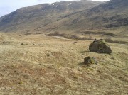
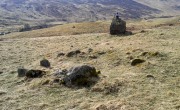
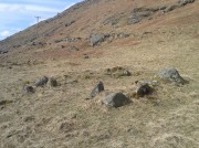
High Sleets, Hawkswick, North Yorkshire

Enclosure:  OS Grid Reference – SD 95415 69019
Getting Here

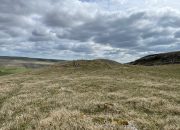
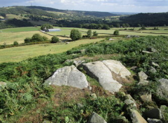
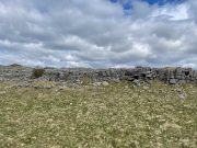
Enclosure walls beneath the long crags

Going along the B6160 road from Grassington to Kettlewell and taking the little road to Arncliffe on your left just a few hundred yards past Kilnsey Crags, after ¾ of a mile keep your eyes peeled for the small parking spot on the left-side of the road, with the steep rocky stream that leads up to the Sleet Gill Cave. Walk up this steep slope, following the same directions to reach the Sleets Gill Top enclosure. From here you’ll notice a large gap in the rocky crags about 200 yards WSW that you can walk through. On the other side of this gap, along a small footpath about another 200 yards along you’ll reach a large ovoid rock.  Just before this, on your right, is a long rocky rise with distinct drystone walling below it.  That’s the spot!

Archaeology & History
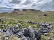
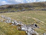
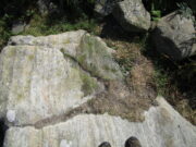
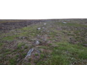
Walled section, looking S

Encircling a slightly sloping area of ground that stretches out beneath a long line of limestone crags is this notable walled enclosure running almost the full length of the rocky ridge.  Measuring 40 yards (36m) in length by 10 yards (9m) across at its greatest width, this elongated rectangular enclosure has all attributes of being Iron Age in origin, much like many others in this area.  However, in comparison with the others close by, this is a pretty small construction and—if used for human habitation, as is likely—would have housed only two or three families.
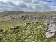
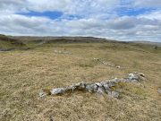
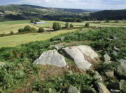
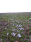
Western end of enclosure

Within the enclosure itself, near its  western end, we find an internal line of walling that creates a single room: enough for a single family, or perhaps even where animals were kept.  Only an excavation would tell us for sure.
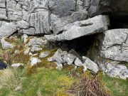
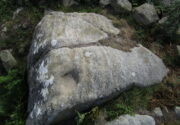
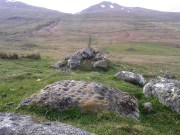
Curious stone ‘cupboard’

One notable interesting feature exists roughly halfway along the enclosure, up against the crag itself: here is small man-made stone “cupboard” of sorts, akin to some modern pantry.  You’ll get an idea of it in the photo.  At first I wondered if this would have been a sleeping space, but, unless it was where a shaman liked to encase him/herself inside a domestic household cave (highly improbable), it would have served a simple pragmatic function. Make up your own mind.

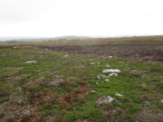
I liked this place. It’s surrounded by crags on almost all sides with some ancient spirit-infested rocky hills very close by, giving it a beautiful ambience.  Immediately below the enclosure is what looks to be a large dried-up pool, which was probably well stocked with fish.  A perfect living environment.  Check it out!

References:

  1. Raistrick, Arthur, Prehistoric Yorkshire, Dalesman: Clapham 1964.

© Paul BennettThe Northern Antiquarian
Sleets Gill Top, Hawkswick, North Yorkshire

Enclosure:  OS Grid Reference – SD 95735 69145

Getting Here

Sleets Gill enclosure hillock

Go up the B6160 road from Grassington to Kettlewell and just a few hundred yards past the famous Kilnsey Crags, take the little road to Arncliffe on your left.  After ¾ of a mile, keep your eyes peeled for the small parking spot on the left-side of the road, with the steep rocky stream that leads up to the Sleet Gill Cave. Walk up to the cave, then keep going up the same steep slope to the wall/fence above. You can get over the wooden fence and keep following the wall until it just about levels out nearly 200 yards up.  From here, walk 100 yards to your right where the land rises up and you’re at the edge of the walled enclosure.  Look around.

Archaeology & History

Walled section, looking W

On top of a small rise in the land is this large, roughly rectangular walled enclosure measuring about 55 yards across at its longest axis (roughly WNW to ESE) and averaging 24 yards wide.  The walling is pretty low down and, in some areas (mainly on its eastern edges) almost disappears beneath the vegetation—but you can still make it out – just!  The southernmost edge of the enclosure is built upon a the edge of a natural rocky outcrop (typical of many enclosure and settlement sites in this neck o’ the woods) and when you stand on this section you see a very distinct rectangular enclosure, sloping down from here.  This would likely have been where animals were kept as it makes no sense as a human living quarter due it being on a slope.  But below this, where the land levels out, another low line of ancient walling reaches towards the high modern walls.  This is one of three lines of ancient walling running, roughly parallel to the more modern walls (which themselves may have an Iron Age origin) from the main enclosure.

Aerial view of site

The entire structure is Iron Age in origin, but the site would have been in continual use throughout the Romano-British period and possibly even into early medieval centuries (though only an excavation would confirm that).  Its basic architecture is replicated in the many other prehistoric settlements that still exist on the hills all round here (there are dozens of them).  You’ll see this clearly when you visit the High Sleets enclosure less than 400 yards southwest from here.

References:

  1. Raistrick, Arthur, Prehistoric Yorkshire, Dalesman: Clapham 1964.

© Paul BennettThe Northern Antiquarian
Mixing Stone, Low Snowden, Askwith, North Yorkshire

Cup-and-Bowl Stone:  OS Grid Reference – SE 18074 51241

Getting Here

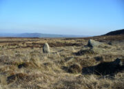
Follow the directions to reach the Ancestors’ Stone and the Sunrise Stone; and there, roughly halfway between them, right by the edge of the old collapsed walling, you’ll see this rise of a stone with a large ‘bowl’ on top.  That’s it!

Archaeology & History

Mixing Stone, looking E

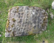
Laid upon the same geological ridge as our Ancestors’ and Sunrise carvings, there are one, possibly two faint cup-marks visible on the low flat surface near the edge of this rock, barely visible unless the light’s right.  But the important element here, perhaps regardless of the cup-marks, is the ‘bowl’ or rock basin on top of the stone.  Internally, it’s smoothed equally on all sides and, due to being in-between the two impressive petroglyphs, may well have had a practical function to it.  Bear with me on this one…

The Mixing Stone’s bowl

Stone ‘bowls’ or cavities—natural and otherwise—have been made use of in many cultures for simple functional purposes, such as grinding flour, herbal mixes, etc.  We find such traditions in some of the bullauns of Ireland and Scotland; whereas in similar stone bowls known as cat troughs in nearby Haworth, milk was poured to appease the spirits of the land (this tradition was still being maintained in 2001!).  Folklore and traditions of such rock basins spread far and wide beyond the UK: one of the German terms for rock basins is Opferkessel, meaning ‘sacrificial basin’ and suggests ritualistic usage by early societies.  Elsewhere on Earth there are numerous accounts of the ritual use of petroglyphs in which indigenous peoples tell of their use of plant- or rock-based paints (in many cases red ochre) to decorate the carvings.  And it’s this element that I’m interested in here.

Water-painted cupmarks

The Sunrise and Ancestors’ Stones 10-15 yards either side of this Mixing Stone are ideal candidates for such petroglyphic paintings using early ochre and other stone or plant-based agents.  Such activities would always have been ritualised, either in honour of ancestors, genius loci, calendrical rites, or whatever the pertinent ingredient was at that place and time.  I’m suggesting simply that the rock basin on the Mixing Stone was used for just such purposes.  This is no spurious suggestion, but at the same time it’s important to recognise that my thoughts here represent merely an idea, nothing more—not a fact.  Whilst we know full well that these carvings were imbued fundamentally with animistic properties—a simple ‘fact’—this functional idea is just that—an idea.  Students and petroglyph-nuts need to understand this.  And the faded cup-marks at its edge are perhaps merely incidental…. though I don’t buy that misself!

© Paul BennettThe Northern Antiquarian 
Ancestors’ Stone, Low Snowden, Askwith, North Yorkshire

Cup-and-Ring Stone:  OS Grid-Reference – SE 18083 51229

Also Known as:

  1. Carving no.606 (Boughey & Vickerman)

Getting Here

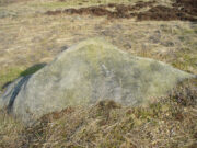
The Ancestors Stone

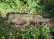
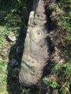
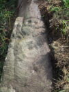
If you’re coming up from Otley or Askwith, take the same directions as if you’re going to visit the impressive Naked Jogger Carving (stone 612), not far from the well-known Tree of Life Stone.  From the Naked Jogger carving, walk up to the small outcrop of rocks that bends above you.  There’s a small collapsed line of walling just behind the outcrop.  Walk along this up the slope as if you’re heading for the Sunrise Stone carving, but only 30 yards along, low down and right into the edge of the wall itself, you’ll see this elongated piece of stone.  That’s the spot!

Archaeology & History

If you’ve caught the petroglyph-bug, you’ll like this one!  It received its name from the curious fusion of natural cracks with the man-made pecked lines that shows, quite distinctly when the light is right and the stone is wet, the outline of two humanesque forms joined to each other.  Figurative rock engravings of ancestors in the UK are extremely rare and when we came across this example, we noticed how the design could be interpreted as two Askwith Moor ancestor figures. Figurative rock art images elsewhere in the world such as the magnificent Wandjina paintings and the extensive galleries of figures engraved at Murujuga (Burrup Peninsula) in Western Australia, might provide an initial comparison, though more specific work needs to be done to better understand this unique petroglyph.

Sketch of the carving

You can almost make out the figures in the above photo: the upper torsos of two beings on the right-hand side of the rock, almost fused together.  And the carved shapes of these “ancestral beings” are morphically similar to some elements in the Sunrise Stone just 50 yards away – which themselves remind me of a Northumbrian carving near Doddington known as West Horton 1a. (Beckensall 1991)  But we should’t get too carried away by the idea because—as we can see here in the sketch of the carving—when looked at from a different angle above, we could infer the right-hand carved elements to be representative of an animal: a deer, perhaps.  Rorscharch’s once more tickle the exploring mind….

The rock has been quarried into at same time in the past (just like the nearby Sunrise Stone), leaving us to wonder what the complete carving might have looked like.  No doubt some pieces of it will be in the collapsed walling either side of the stone.  All we have left to see are the two unfinished cup-and-rings above the natural cracks that give rise to the “ancestral being” appearance.  The faint double cup-and-ring has curious linear arcs to its side, with two well-defined cups enclosed by two of them.  It’s a nice-looking carving when the light is good.  The petroglyph was carved over a long period of time, as evidenced by the differing levels of erosion in different sections of the design.  It’s a common attribute.  The oldest section is the faint double cup-and-ring, whose mythic nature was added to / developed at a much later date, perhaps even centuries later.

In the always-expressive archaeocentric description of Boughey & Vickerman’s (2003) otherwise valuable tome, they told this carving to be,

“Long, narrow, thick rock of medium grit. Six cups, one with a double ring with a tab out and two with at least partial single rings, grooves.”

Evocative stuff!

It’s very likely that this carving had some mythic relationship with its close neighbours either side of it, probably over a very long time period and I’m inclined to think it somehow related to the rising of the sun, just like its solar companion further up the slope.  Please note how I emphasize this ingredient in the site profile of its neighbour, the Mixing Stone 10-15 yards away—roughly halfway between this and the Sunrise Stone.   A distinct place of ritual was happening in this close-knit cluster of carvings…

References:

  1. Beckensall, Stan, Prehistoric Rock Motifs of Northumberland – volume 1, 1991.
  2. Boughey, Keith & Vickerman, E.A., Prehistoric Rock Art of the West Riding, WYAS: Leeds 2003.
  3. Reeder, Phil, “Snowden Carr Rock Carvings,” in Northern Earth Mysteries, no.40, 1990.

© Paul BennettThe Northern Antiquarian
Black Beck enclosure, Hawksworth Moor, West Yorkshire

Enclosure:  OS Grid Reference – SE 1413 4397

Getting Here

Arc of low walling

Make your way to the Black Beck tomb and walk west for some 50 yards.  If the heather has grown any more than a foot tall, it’s impossible to see.

Archaeology & History

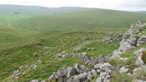
Near the northernmost section of the Hawksworth Shaw prehistoric graveyard, some 50 yards west of the Black Beck cairn, exists the remains of a small prehistoric enclosure whose walling is deeply embedded in the peat.  Although I describe the place as an ‘enclosure’, we don’t know for certain whether it is a ruined settlement or large hut circles (although this latter idea is the more improbable).

Walling, looking N
Arc of walling, looking S

Two large open arcs of walling—like large letter “C’s”—with their open sides to the east, have been constructed next to each other, virtually coming together in the shape of an inverted number “3”.  The walling in the southern arc—measuring some 33 yards in length and barely higher than 1 foot above ground level—consists of standard stones and rubble, similar to some of the hut circles that are found in greater abundance on the north-side of Ilkley Moor.  The smaller, less visible arc of stones—some 18 yards of it—is lower in the earth.  Both lines of walling may have been robbed in part to construct some of the extensive cairns close by, as neither of the two arcs were very high and it was very difficult to work out even what sort of structure they might have been.

Like many other prehistoric sites on Rombalds Moor, only an excavation is going to tell us precisely what was going on here…

© Paul BennettThe Northern Antiquarian
East Wall Stone, Burley Moor, West Yorkshire

Cup-Marked Stone:  OS Grid Reference – SE 13924 45493

Getting Here

East wall stone on the right

Follow the directions to reach the impressive Woofa Bank prehistoric enclosure.  You need to find the walling that constitutes the enclosure itself and walk along to its eastern side where you’ll reach an ‘opening’, as if it may once have been an entrance at that side of the enclosure.  A reasonably large sloping rock is on one side of this ‘entrance’.  You can’t really miss it!

Archaeology & History

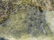
Unlike many of the other petroglyphs found within the Woofa Bank enclosure, the design on this one is faint — very faint indeed (much like the recently uncovered triple-ring petroglyph by the Thimble Stones).  Comprising simply of a small cluster of cup-marks, you’ll struggle to see this one — unlike its compatriot on the western wall of the enclosure.

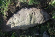
Looking down on the rock
Some very faint cupmarks

It consists of a single cup-mark on the northern edge of the stone, whilst on the sloping southern part of the rock are a number of very faint cups, eroded by them there millenia of Nature’s wind and weathering.  One or two of the cups are just visible in good lighting, but what are almost certainly a few more can be seen when the rock is wet and in low daylight hours.  It’s a design that’s probably only of interest to the hardcore petroglyph fanatics, but without doubt this is yet another carving within this obviously important prehistoric enclosure.

© Paul BennettThe Northern Antiquarian
Cliff Cottage Circle, Broad Haven, Pembrokeshire

Stone Circle (destroyed):  OS Grid Reference – SM 8615 1428

Archaeology & History

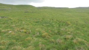
Described in context with an extant standing stone 100 yards to the north, this stone circle seems to have been destroyed in the latter half of the 19th century.  It was described in the Royal Commission’s huge Pembrokeshire (1925) survey, after they had visited the site and viewed the remains.  They told us:

“On the side of the road immediately opposite to Cliff Cottage, and constituting part of the garden walls of Upper Lodge, are numerous boulders which formed a well-defined stone circle.  A few years ago they were moved, dressed, and used for walling.  The entrance to the circle is said to have faced north-east.  The southern portion was still visible about the year 1896.”

As far as I’m aware, local people report that a couple of the stones are still visible in the overgrown walling.  Students working for the Welsh Coflein database allege that the remaining stones “are of doubtful antiquity.”  Unless they have some substantial evidence to validate this statement (none is given) their remarks should be taken with a pinch of salt.

References:

  1. Royal Commission Ancient & Historical Monuments, Wales, An Inventory of the Ancient Monuments in Wales & Monmouthshire: VII – County of Pembroke, HMSO: London 1925.

© Paul BennettThe Northern Antiquarian
Clowder (1), Arncliffe, North Yorkshire

Enclosures:  OS Grid Reference – SD 9165 6968

Also Known as:

  1. Clouder

Getting Here

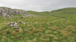
Looking down on Clowder-1

To the right of The Falcon Inn across from Arncliffe village green is a trackway called the Monk’s Way.  Walk up here for about 450 yards until there’s a stile on your right which is the start of the diagonal footpath SW up the hillside.  Once you hit the limestone ridge several hundred yards up, keep on the path that curves round the edge of the hill for 1.3 miles (2.1km), going over 5 walls until, at the 6th one, you should look uphill, east, at the small cliff-face 100 yards above you.  That’s where you need to be!

Archaeology & History

This is one of several clusters of large prehistoric enclosures and settlements in the expanse of land known as Clowder, on the hills 1.65 miles (2.63km) southwest of Arncliffe.  It’s in a very good state preservation and, surprisingly, almost nothing has been written about it.

Covered hut circle on NW edge
Cliffs & walls of Clowder-1

A multi-period site whose construction probably began  sometime in the Iron Age (although the old Yorkshire Dales archaeologist, Arthur Raistrick, thought the settlements up originated in the Bronze Age), we can say with some certainty that parts of this complex were definitely being used until medieval times due to the lack of growth on some of the walling.

The entire complex comprises of a series of interlinked walled enclosures running roughly north-south for a distance of more than 200 yards.  Along the 200 yards are at least eight conjoined walled sections of varying shapes and sizes.  Some of the walling, particularly along its western edges, measuring up to 10 feet across (some of this will be due to collapse) is very overgrown indeed and is probably the oldest aspect of the enclosure.  The inner walled sections, much of it leading up to the small cliff face, are rough rectangular structures, each of them averaging 30 yards from their western edge to the eastern cliff and rock faces.

Most recent walled section

Within the largest and best preserved section at the northern end, a smaller and more recent walled rectangular enclosure would seem to have been used for either cattle or storage of some form, as it’s on too much of a slope to have been viable as a living quarter.  Also on the very northern edge is a well-preserved but much overgrown hut circle, between 8-9 yards across.

Faint walling looking south

The entirity of Clowder-1 is difficult to assess without an archaeological dig.  Despite this, as half of the walled enclosures (in the northern half) are on slopes leading up to the cliffs they would seem unsuitable for people to live in.  It is more probable that these sections were used for livestock and other storage.  At the more southern end however, the land begins to level out and this would be feasible as good living quarters.  There was also once a good source of water immediately beneath the entire complex, but with deforestation the waters eventually fell back to Earth.Back to its southern end and down towards the modern-day walling, some 70 yards on we find more ancient structures of the same architectural form that we’ve just walked along.  This lower section has just one notable singular oval-shaped hut circle, 20 yards east-west by 29 yards north-south.  Other probable man-made structures seem to be just below this; and this part of the settlement then continues on the other side of the walling, into the large Dew Bottoms (5) settlement complex.

Folklore

Weather lore of the ‘Clauder’ hill tells that it “draws the skies down” – i.e., as Halliwell Sutcliffe (1929) put it:

“A deluge may be in process on each side of the Clouder when lower down the sun is hot on tired pastures.”

We encountered just such a truth when James ElkingtonChris Swales and I visited the sites up here just a week or so ago…

References:

  1. Dixon, John & Phillip, Journeys through Brigantia – volume 2, Aussteiger: Barnoldswick 1990.
  2. Sutcliffe, Halliwell, The Striding Dales, Frederick Warne: London 1929.

Acknowledgements:  Huge thanks to James Elkington and Chris Swales, without whose guidance this site profile would never have been written.

© Paul BennettThe Northern Antiquarian
Tombreck (07), Ben Lawers, Kenmore, Perthshire

Cup-Marked Stone:  OS Grid Reference – NN 65022 38285

Also Known as:

  1. Canmore ID 238573

Getting Here

Tombreck 7 carving, beneath Ben Lawers

Tombreck 7 carving, beneath Ben Lawers

Take the A827 road that runs alongside Loch Tay between Killin and Kenmore, and about 6 miles from Killin watch out for the signposts for The Big Shed.  Stop and walk NW up the track across the road from there, up toward Ben Lawers.  Several hundred yards up, past the sheep-fold on the left-side of the track, a line of ruinous walling runs straight over the grasslands. Walk along here until it meets with the next walling that runs uphill.  Look down into where the wall has collapsed.  It’s under your nose!

Archaeology & History

This is a fascinating and pretty impressive example of a simple cup-marked stone.  It’s the design that does it I suppose – similar in some ways to the well-known Idol Stone carving on my old playground of Ilkley Moor (that’s what this one reminded me of when I first clapped eyes on it)—but much better!

Lines of cups from above

Lines of cups from above

The carving from the east

The carving from the east

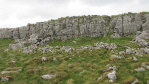
Its similarity lies in the series of parallel rows of cup-marks running very close together along the line of the low-lying rock, found at the base of some ancient walling that runs up the mountain for several hundred yards.  Not only that, but the line of walling itself also has a parallel line of walling running adjacent for the same distance up the mountainside — more than half-a-mile from start to finish.  This “parallel” feature of walling and cup-markings is a curious coincidence, perhaps.  But certainly the linearity of the cup-marks was itself a very deliberate feature by the person who carved it, representing something ‘structural’, in whatever mythic form that may have been!

The carving in its walling

The carving in its walling

Of the rows of cups constituting this petroglyph, four of them run completely from one side of the stone to the other, rough north to south; with four other shorter rows running only halfway across the rock surface.  Altogether there are perhaps seventy cups etched onto the rock.  No rings or semi-circles of any form were visible in our visit here—although the skies were grey and overcast, making any decent visual analysis more difficult.

A damn good carving and well worth checking out by anyone into prehistoric rock art!

© Paul BennettThe Northern Antiquarian

Conichan East, Glen Almond, Perthshire

Settlement:  OS Grid Reference – NN 84645 32074  —  NEW FIND

Getting Here

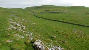
The setting of the remains

The setting of the remains

Park up and walk the long estate track up Glen Almond for nearly three miles until, on your left, you’ll see a small pond.  From here, walk up the slope and, about 100 yards above you, note the large solitary boulder ahead, above the dyke of a small walled stream, where the land levels out.  Just past the rock itself is the first of several remains.

Archaeology & History

First things first: the grid-reference cited here is centred upon the largest of several rings of stone found on this small grassy plateau, 150 yards north above the River Almond, just past the huge boulder.  It’s an impressive site – and a previously unrecorded one.

The raised ring of Conichan

The raised ring of Conichan

Looking southeast

Looking southeast

At least three large hut circles can be clearly seen on this small ridge, amidst a sea of prehistoric sites scattered all down this lonely Scottish glen.  When Paul Hornby, Lara Domleo and I meandered up here the other day (to visit the Clach na Tiompan megaliths), extensive prehistoric walling called my nose up the slopes to see if anything was hiding away—and a large prehistoric ring, more reminiscent of the Derbyshire stone circles and ring cairns than any hut circle, appeared before me.

The first and largest that I came across is the one immediately north of the huge boulder (which may have slight traces of ancient walling running up to it).  The large ring is clearly raised onto a flat level platform, with an entrance on its southern edge.  The ring itself measures, from outer-wall to outer-wall some 12 yards wide (E-W) and 11 yards N-S.  The northernmost section of the walling or stone embanked structure is built into the sloping hill to the rear, with the east and western walls constructed simply onto the flat land.  The walling itself is typical of prehistoric structures, comprising the usual mass of small stones packed within a number of larger upright stones; although much of it is very overgrown with centuries of vegetation.  The walling that constitutes the ring itself is between 1-2 yards across and about two-feet high above the present ground-level.

Second circular remains

Second circular remains

...and from another angle

…and from another angle

To the east of this is a smaller, roughly circular construction of similar form.  The rocks that make up this site are much more visible and may have been robbed and used in the more extensive walling above and the dykes below.  It is unclear whether the nature of this site is the same as that of the more defined circular enclosure we have just described.

The remains of a third structure was clearly evident a short distance to the east of this, but I didn’t have much time here and another visit is needed to make further assessments.  Iron Age walling and other undocumented prehistoric remains were also found close by.

Acknowledgements:  Many thanks to the noses of little Lara Domleo and Prof. Paul Hornby for their bimbling aid to relocate this site – and one or two others that have been off the radar for many-a-century.

© Paul BennettThe Northern Antiquarian