Stone Circle (destroyed): OS Grid Reference – NY 549 182
Archaeology & History
This site has been completely destroyed by the huge eyesore of a quarry that we all see when we’re travelling up the M6 north, above Shap. John Waterhouse (1985) told that “a rescue excavation” was carried out here with help from the kids at Penrith Queen Elizabeth School, shortly before its destruction in 1952, but now there is no trace left of it. When it was first described by J.E. Spence (1935), the circle had already been damaged by a wall that cut right through its centre. He told:
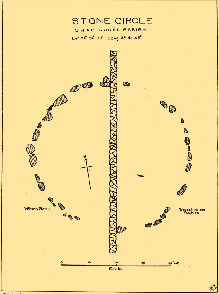
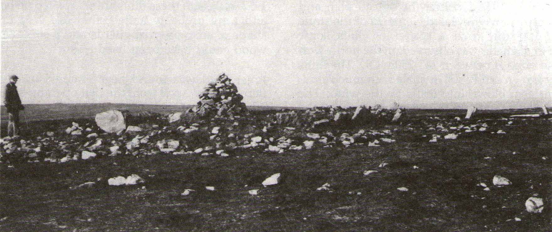
Spence’s 1935 plan
“The circle, which is 6o feet in diameter, is composed of 35 stones, 20 being on the west and 15 on the east side of the boundary wall running through the circle from north to south. The stones of which the circle is composed are Borrowdale erratics, a large number of which are scattered over the adjoining ground on both sides of the wall but more thickly in Sweet Holme Pasture. The stones, which vary up to 5 feet 9 inches by 3 feet, are larger and more numerous in the north-west quadrant where the tallest stands 1 foot 8 inches above the level of the turf. The ground within the circle is level, but to the south and west it slopes gently down from the edge of the circle in such a manner as to suggest that the area within the circle has been levelled.”
1952 plan laid over Spence’s 1935 plan
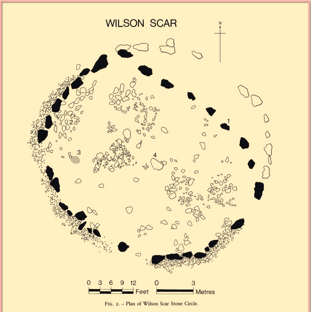
Spence told that an ancient “sunken trackway” led outwards from the circle to the south-west in the direction of Rosgill, but when the 1952 excavation occurred, no remains of such a track were found; nor was the wall that had cut through it; and the north-easterly section of the circle had been cut into and re-laid, presumably by the quarrymen. It was quite plain, wrote G.G. Sieveking (1984), “that this portion of the monument was encroached upon in the summer of 1952, and hastily reconstructed for the benefit of the archaeologists.”
Their excavation found that some internal sections of this ring had been paved with thin limestone slabs and they also uncovered two small cairns, neither of which possessed anything. However, they did find four funerary deposits within the monument: one at the northeastern section of the circle (no.1); another near the centre (no.4); and remains of a cremation west of centre (no.3); but the most complete find was at the western side of the ring, where a “disarticulated inhumation burial was lying immediately beneath the turf line in a shallow grave 1.35 m long, surrounded by a setting of small boulders.” It was a near complete human skeleton. This place was obviously, at times, used in ceremonies for the dead.
Shortly after the archaeological examination of the site, it was blasted away by quarrying. Gone!
References:
Barnatt, John, Stone Circles of Britain– volume 2, BAR: Oxford 1989.
Burl, Aubrey, The Stone Circles of Britain, Ireland and Brittany, Yale University Press 2000.
Farrah, Robert W.E., A Guide to the Stone Circles of Cumbria, Hayloft: Kirkby Stephen 2008.
Seton, Ray, The Reason for the Stone Circles in Cumbria, privately published: Morecambe 1995
Sieveking, G.G., “Excavation of a Stone Circle at Wilson Scar, Shap North 1952,” in Transactions Cumberland & Westmorland Antiquarian & Archaeological Society, volume 84, 1984.
Spence, J.E., “A Stone Circle in Shap Rural Parish,” in Transactions Cumberland & Westmorland Antiquarian & Archaeological Society, volume 35, 1935.
Waterhouse, John, The Stone Circles of Cumbria, Phillimore: Chichester 1985.
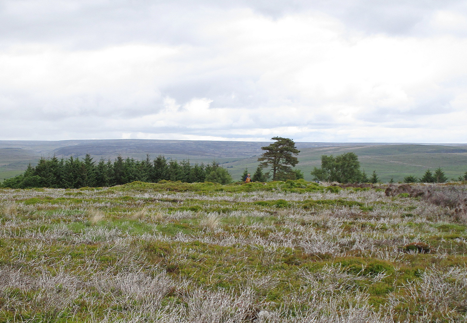
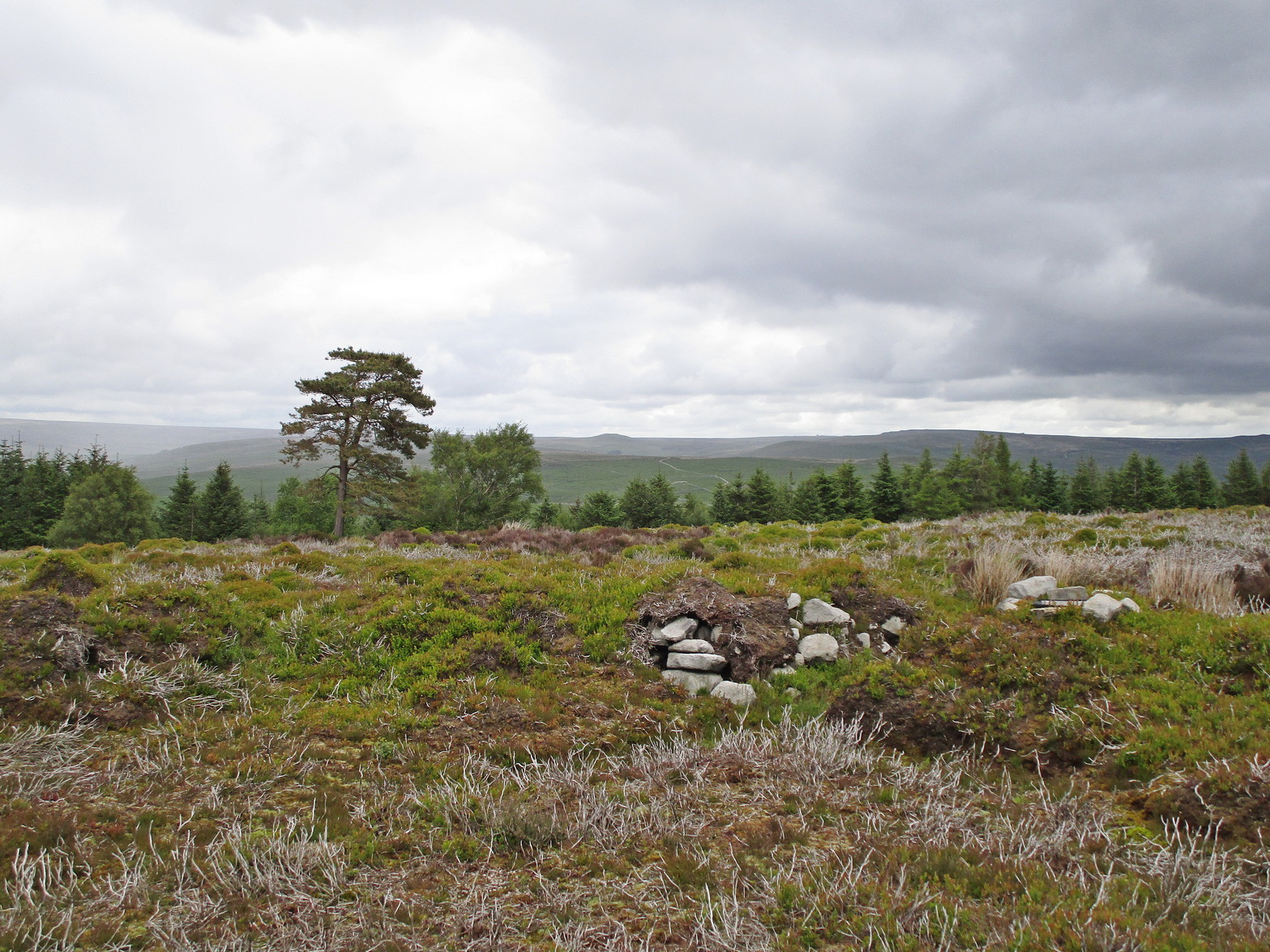
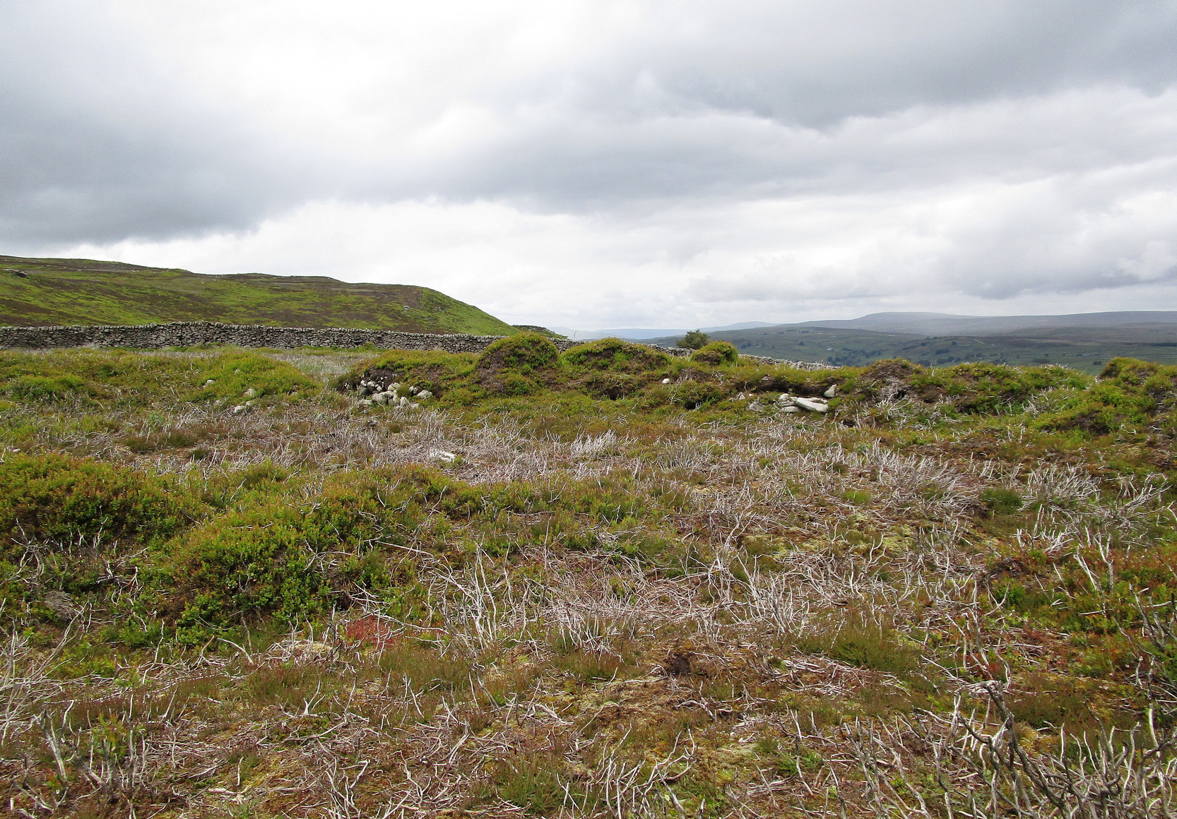
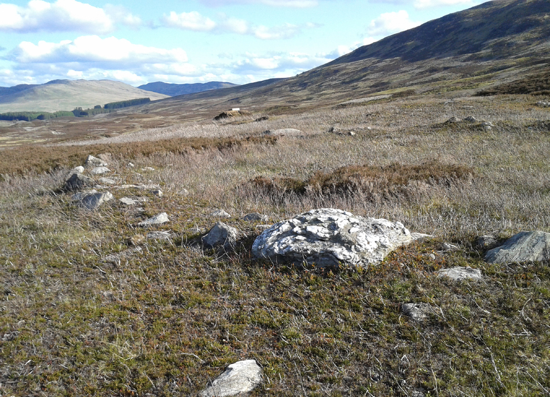
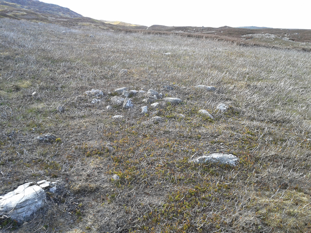
From the Askwith Moor car-park (SE 1757 5067), walk along the road north for several hundred yards and go through the gate on your right. Head northeast through the heather to the Death’s Head carving and keep along the same direction for barely another hundred yards onto the ever-so-slight crown of a small hillock. This is a hut circle you’re standing in/on. A few yards away just to the southeast of where you’re standing is the very denuded remains of this ring cairn.
Archaeology & History
Low remains of rubble wall
Not visible when the heather’s in full growth, it’s nonetheless worth visiting if you’re trying to get a picture of the prehistoric landscape hereby. Less than 10 yards southeast of the notable hut circle on the small crown of a hill, it was first noticed by Sarah Walker on a group visit here recently. Roughly 12 yards across, the most notable section of the circle is the remains of the rubble bank on its east and southeastern sides, raised a few feet above ground level. The majority of the monument comprises of a scatter of various rocks and small stones within and round the edges of the circle. There’s a lot of scattering from other adjacent remains, such as the hut circle and nearby walling, that give the initial impression of it being little more than a spurious mess of stone; but the more you walk around and inside it, the more you come to recognize its structure.
It has that Bronze Age hallmark look about it, but without an excavation this is just educated guesswork. It might actually be older. The widespread mass of prehistoric remains all round here shows that it was once a mass of activity in prehistoric times. It’s a brilliant area, even if you can’t find this particular site!
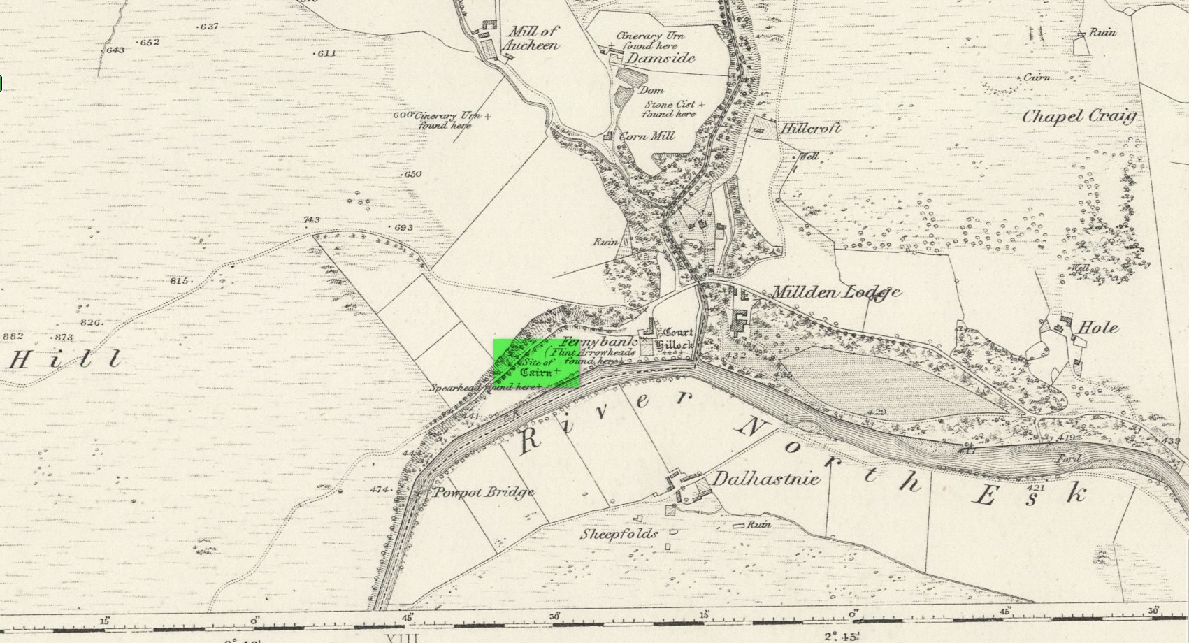
Ring Cairn (destroyed): OS Grid Reference – NO 5381 7877
Archaeology & History
Location of site on 1864 OS-map
This is one of many sites that were thankfully recorded by the fine pen of Andrew Jervise (1853) in the middle of the 19th century, without whose diligence in antiquarian interests all knowledge would have vanished. His works remind me very much of those by the late-19th early-20th century writer Harry Speight in Yorkshire, whose veritable madness on that region’s history remains unsurpassed even to this day. But I digress…
Jervise told us that,
“About the year 1830, while the tenant of Fernybank was levelling a hillock in the haugh between the farm-house and the Powpot Bridge (about two miles north-west of Colmeallie), he removed a number of stones varying in length and breadth from eighteen to twenty-four inches. They were ranged singly, and stood upright in a circle at short distances from each other, enclosing an area of about twelve feet in diameter. On the knoll being trenched down, the encircled part (unlike the rest of the haugh, which was of a gravelly soil) was found to be composed of fine black earth; but on several cart-loads being removed, operations were obstructed by a mass of stones that occupied much the same space and form as the layer of earth. Curiosity prompted the farmer to continue his labours further, but after digging to the depth of three or four feet, and finding stones only, he abandoned the work in despair, without having discovered anything worthy of notice… Had this cairn been thoroughly searched, it is probable that some traces of sepulture might have been found in it.”
A short time after this however, Jervise reported the finding of “old warlike instruments, both in the shape of flint arrow-heads and stone hatchets, have been found in the same haugh, and so late as 1851 a spear-head made of iron, and about fifteen inches long, was also discovered; it was much corroded, but had part of the wooden hilt in it.” These were prehistoric artifacts that were subsequently moved to Edinburgh’s central museum where, I presume, they remain to this day.
About ten years later the Ordnance Survey lads came here and were fortunate to be able to meet with the same man who’d uncovered the site. They told that,
“in contradiction to (Jervise’s narrative), the tenant of Fernybank who gave the information to Mr. Jervise, states that he continued the search to the bottom of the Cairn and found a quantity of Charred wood.”
There were a number of other prehistoric sites in this neck o’ the woods, many of which were also destroyed but, again, were thankfully recorded by Mr Jervise.
References:
Jervise, Andrew, The History and Traditions of the Land of the Lindsays in Angus and Mearns, Sutherland and Knox: Edinburgh 1853.
Acknowledgements:Huge thanks for use of the Ordnance Survey map in this site profile, reproduced with the kind permission of the National Library of Scotland.
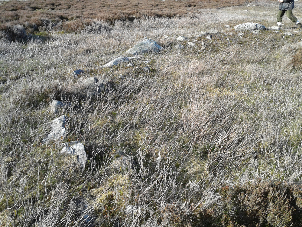
It’s easier to explain how to get here if you’re coming from the Burnsall-side of the B6160 road that leads to Bolton Abbey. A half-mile out of Burnsall village you a small woodland with a small parking spot. From here, a footpath runs up the steep hill above the parking spot. It zigzags a little and you eventually come out on the south-side of the trees where it meets some tall walling. Follow this walling further uphill for more than 600 yards (past more woodland) until the land starts to level out. Hereby, go thru an opening in the wall and less than 100 yards away (west) amidst the overgrown heather, you’ll see what you’re looking for.
Archaeology & History
A large but peculiar site resting on a moorland plateau on the eastern edges of the mighty Barden Moor. Peculiar inasmuch as it’s completely isolated from any other monument of the same age and type anywhere on these huge moors. A few miles east, on the moors around Appletreewick, Thruscross and Beamsley we have a plethora of prehistoric sites—but up here on Barden Moor there’s apparently nowt else! I find that hard to believe….
Inner rubble wallingRubble walling, looking N
Listed on official websites as being a ring cairn, it’s difficult without a detailed excavation of the site (there hasn’t been one) so say that’s what it is. But we’ll stick with it for the time being. My initial impression of the site was that it was a crude form of a collapsed Scottish dun: impressive large circular monuments—buildings if you like—with very well-built large stone walls, usually several yards thick, a little bit like the Scottish brochs (mighty things indeed!). This thing at Folly Top isn’t quite as impressive, but it’s like a collapsed version of a dun.
Arc of western walling
The site consists of large ring of raised collapsed rubble walling, more than a yard high in places, and about three yards thick all the way round, measuring roughly 21 yards (N-S) by 19 yards (E-W) from outer wall to outer wall. There are “entrances” on the east and west sides; but there seemed to be little of any note in the middle of the ring, although the site was somewhat overgrown on our visit here. Outside of the ring there was also nothing of any note. It’s a pretty isolated monument which seems to have more of an Iron Age look about it than the Bronze Age—but until there’s an excavation, we’ll not know for sure.
It’s well worth checking out—and from here, walk onto the huge moorland above you to the west….
Acknowledgements: Huge thanks to the Crazy-gang of Sarah, Helen and James for their awesome assistance on our venture up here. A damn good day indeed! Cheers doods. 🙂
When the Ordnance Survey lads visited this area in 1860, they stood upon this small knoll that was known as Torrnacloch – or the Knoll of the Stone. They were informed that a ring of stones had stood here, but had been destroyed about 1840, apparently by a local farmer. The stones were described as being about 3 feet high. They subsequently added it on the earliest OS-map of the area, but also made note that a cist was found within the site. The circle was included and classed as a stone circle in Aubrey Burl’s (2000) magnum opus, but had previously been classed as a cairn with “a kerb of large boulders” by the Royal Commission doods. (1983) They based their assessment on the appearance of some of the stones found on a gravel mound behind the farm which had apparently been removed from the circle when it was destroyed. Andrew Jervise (1853) gave us the following account:
“The Chapelry of Dalbog was on the east side of the parish, due west of Neudos. The time of its suppression is unknown; and though no vestige of any house remains, the site of the place of worship is still called the “chapel kirk shed” by old people, and, in the memory of an aged informant, a fine well and hamlet of houses graced the spot. This field adjoins the hillock of Turnacloch, or “the knoll of stones,” which was probably so named, from being topped in old times by a so-called Druidical circle, the last of the boulders of which were only removed in 1840. Some of them decorate a gravel mound behind the farm house; and, on levelling the knoll on which they stood, a small sepulchral chamber was discovered, about four feet below the surface. The sides, ends, and bottom, were built of round ordinary sized whinstones, cemented with clay, and the top composed of large rude flags. It was situate on the sunny side of the knoll, within the range of the circle; but was so filled with gravel, that although carefully searched, no relics were found.”
The emphasis on this place being where a stone circle stood is highlighted in the place-name Torrnacloch, or the hillock of stones/boulders. Both Dorwood (2001) and Will (1963), each telling it to be where a stone circle stood; with Will adding that parts of the circle “may yet be seen in rear of the steading of Dalbog.” If this had been where a cairn existed, some variant on the word carn would have been here.
References:
Burl, Aubrey, The Stone Circles of Britain, Ireland and Brittany, Yale University Press 2000.
Dorwood, David, The Glens of Angus, Pinkfoot: Balgavies 2001.
Jervise, Anrew, The History and Traditions of the Land of the Lindsays in Angus and Mearns, Sutherland & Knox: Edinburgh 1853.
MacLaren, A. et al, The Archaeological Sites and Monuments of Central Angus, RCAHMS: Edinburgh 1983.
Will, C.P., Place Names of Northeast Angus, Herald: Arbroath 1963.
Acknowledgements: Big thanks for use of the 1st edition OS-map in this site profile, Reproduced with the kind permission of the National Library of Scotland.
From Pickering take the moor road towards Whitby (A169) for approx. 12 miles. After passing the huge Fylingdales Early Warning radar on the right (you can’t miss it), the road dips down to cross Eller Beck as a dog leg. After a half mile turn off left (west) towards Goathland (signposted). There’s a free car park on the left where you can sit for awhile and enjoy the views. Follow the road under the North Yorks Moor railway bridge, and after a third-of-a-mile the road turns slightly left. Park in the little lay-by and follow the track onto the moors. Cross the small stream and walk along the narrow track through gorgeous heather for a mile and a half. Ahead you will see Simon Howe prominent on a ridge, with a stone row leading to it.
Archaeology & History
This impressive prehistoric tomb was first described in deeds as early as 1335 as Simondshou, which A.H. Smith (1928) translates to mean ‘Sigemund’s mound’ – alluding it to have been either the burial of someone with that name, or a name given to it by the incoming Vikings, oh so many centuries ago. The latter is the more probable of the two…
Simon Howe (photo by James Elkington)Hayes’ 1947 photo of Simon Howe
With excellent views in all directions, this monument is found high up in the landscape at the meeting of four paths that are closely aligned to the cardinal directions. It was highlighted as a tumulus on the 1854 OS-map of the region and subsequently included in Windle’s (1909) listings as a “round barrow”, found in association with “three upright stones” running to the northeast. There are in fact four stones.
Not much has been written about it in archaeological circles. Thankfully a brief survey of it was undertaken in 1947 by Raymond Hayes (1988) after a moorland blaze had cleared the heather, enabling good conditions to see the site more clearly. He told that,
“Simon Howe…is very mutilated, what survives indicates that it was 11.50m in diameter and it is clear that it incorporated a stone kerb.”
This “stone kerb”, or surrounding ring of stones, is a feature found at other tombs on these hills—Flat Howe (1) being just one example. However, in contrast to Flat Howe (1), Simon Howe has had most of its central mound totally stripped by peoples unknown a few centuries ago. The remains we see today look more like a small ruined stone circle with internal rubble and a new walker’s cairn growing slowly from its centre. Outside the cairn, just a few yards northeast, a fascinating megalithic stone row emerges. Whether these were erected at the same time (in the early to mid-Bronze age, in my opinion) only an excavation would tell.
Acknowledgements: A huge thanks to James Elkington for use of the photograph in this site profile, as well as telling us about Getting Here. And the map accompanying this site profile is Reproduced with the kind permission of the National Library of Scotland.
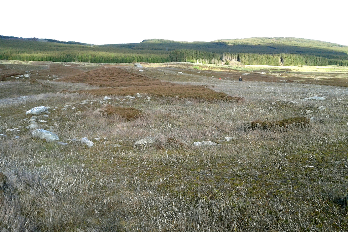
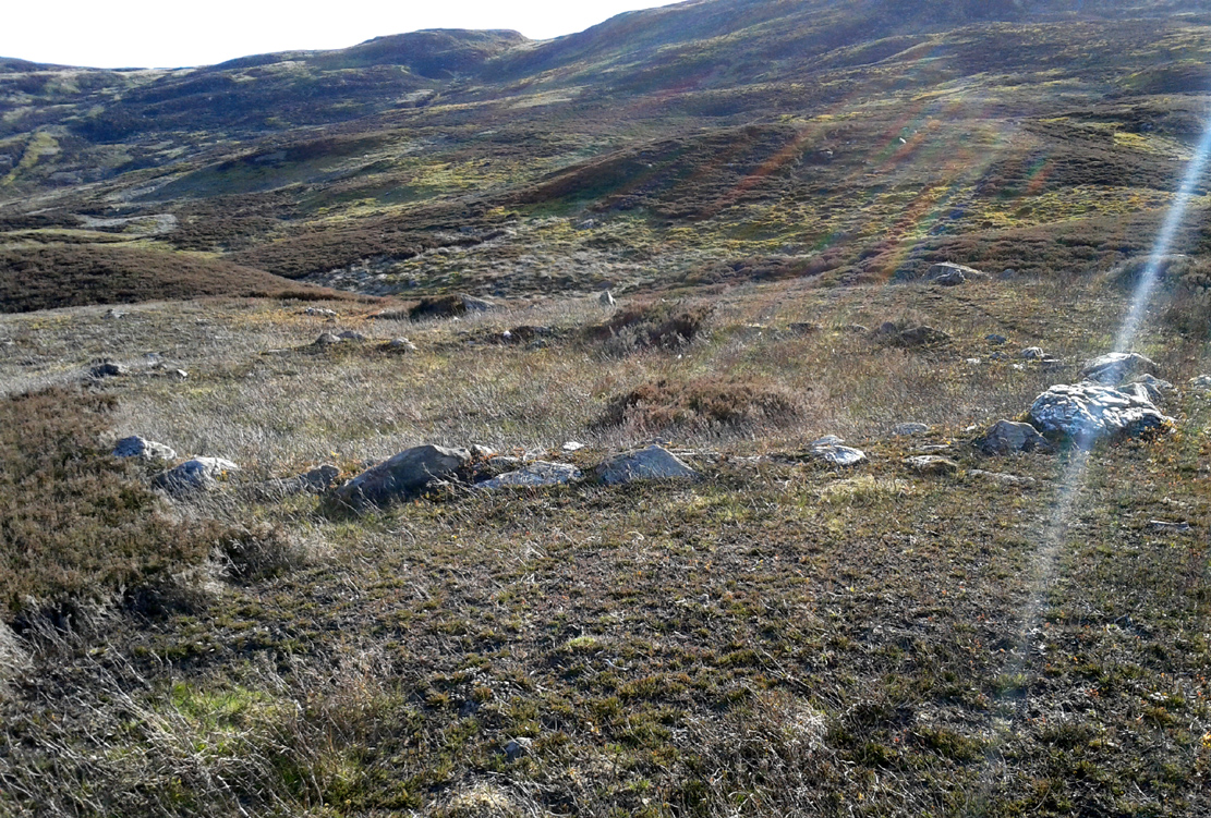
Take the same directions to reach the impressive Carn Ban prehistoric tomb. From here, walk along the winding track past the giant cairn onto the moors for about 350 yards, until the track goes dead straight and heads NNW uphill. Walk up here for another 350 yards keeping your eyes peeled on the rounded pyramidal hill with the large rock on top. The circle is 20 yards off the track as you head up to the pyramidal hill stone.
Archaeology & History
Although this site is mentioned in notes by the Scottish Royal Commission and highlighted by Ordnance Survey, information thereafter is pretty scarce. Which is surprising when you check this place out first-hand. It’s bloody impressive! David Cowley (1997) describes the area, but not in much detail.
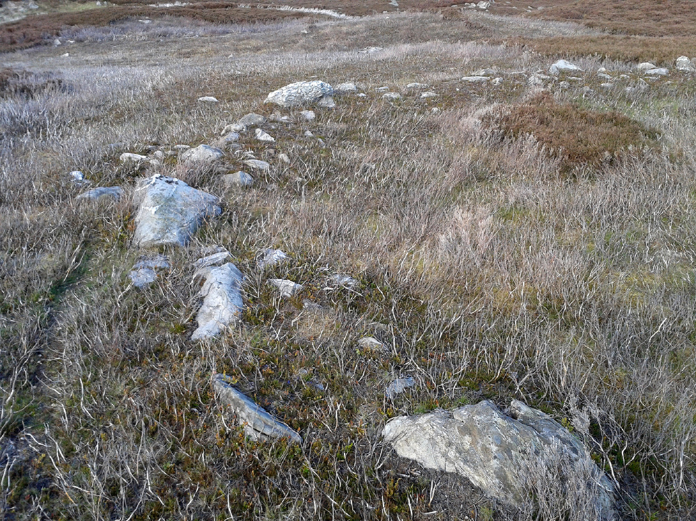
Northern arc of walling
Eastern arc of walling
The circle seems to have been rediscovered first of all by the dowser J. Scott Elliott (1964), who thought it was a cairn circle – which is understandable. However, it has been classified by the Royal Commission lads as a “hut circle”, so we’ll stick with that for the time being.
An entrance to the circle doesn’t stand out. There may be one on the southeastern side, but this isn’t clear; and what looked like a possible entrance on its northern edge was discounted, as a larger stone blocked this on the outside. There was no immediate evidence of any internal structure, no hearth, no tomb – merely a small stone at its centre, deeply embedded in the peat. This may, however, cover a central cist – which would make this a cairn circle and not a large hut circle. But that’s guesswork on my behalf!
Arc of ring from east to southWNW arc of walling
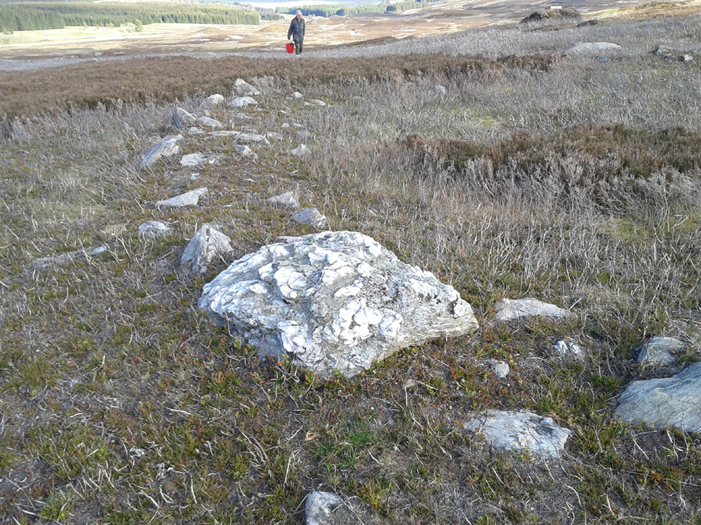
Never excavated, what we’ve got here is a very well-preserved, large ring of stones, more typical of Pennine and Derbyshire ring cairns than any standard hut circles. But this is Scotland we’re talking about! This impressive ring measures outer-edge to outer-edge 12 yards in diameter (north-south), by 11 yards (east-west), with the stone walling that defines the ring being between 3 and 4 feet across all round, and between 1-2 feet high. And it’s in damn good nick! More similar in structure to the likes of Roms Law, a number of notably large stones define the edges, but many hundreds of smaller packing stones build up the ring walls. Of the larger rocks in the ring, the most notable one is a large white quartz crystal stone on its NNE side.
Quartz rock reflects the sun, looking W
It’s an impressive site whatever it may be! – in very good condition for its age (Bronze Age by the look of it) and, whilst still visible above the heather, well worth checking out if you like your stone circles and prehistoric rings. The small prehistoric graveyard 30-40 yards south and east, plus the extensive settlement systems all over these moors are all worth exploring if you visit this place.
References:
Cowley, David C., “Archaeological Landscapes in Strathbraan,” in Tayside & Fife Archaeological Journal, volume 3, 1997.
Scott-Elliot, J., “Kinloch House, Amulree,” in Discovery & Excavation in Scotland, 1964.
Scott-Elliot, J., Dowsing – One Man’s Way, Neville Spearman: London 1977.
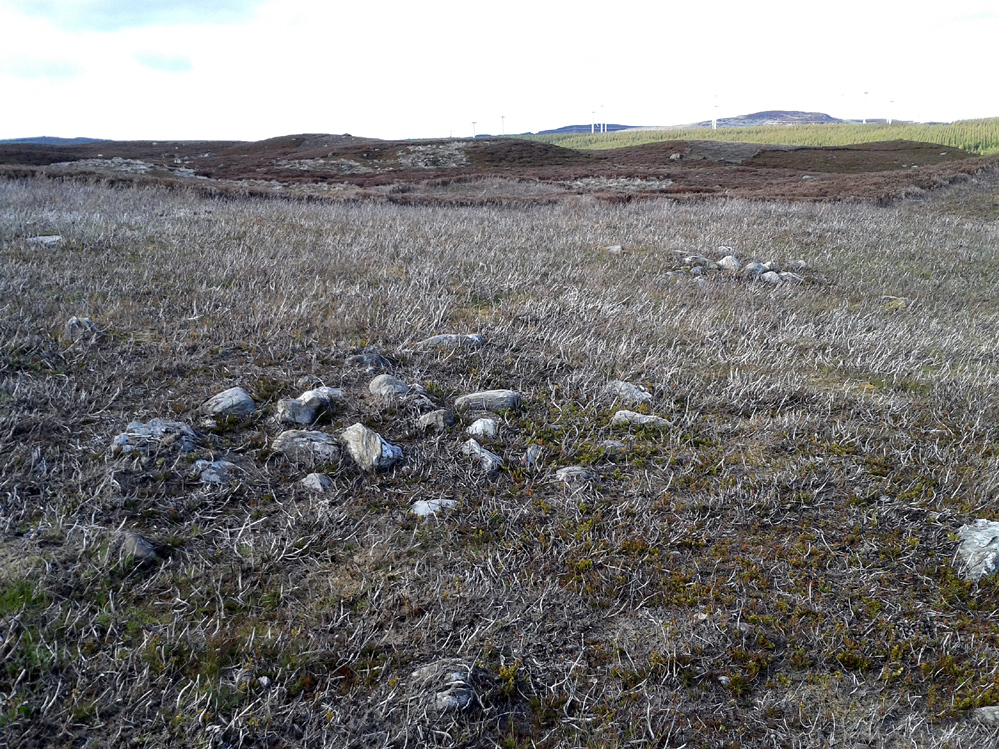
Take the A826 road south out of Aberfeldy, uphill, till you reach the White Cairn or Carn Ban, then follow the dirt-track for 700 yards onto the moors until you reach the Glen Cochill Circle 1. From here, look at the large stone atop of the very notable rounded hillock barely 50 yards east (at NN 90367 41478) and meander on the slopes immediately below it on the south and west. If the heather’s grown back, you don’t stand a chance!
Archaeology & History
As far as I’m aware, despite there being some brief notes of cairnfields in and around the rich prehistoric arena of Glen Cochill, I can find no data indicating that the five small single cairns a short distance south and southeast of the Glen Cochill Ring (01), have been described before.
Cairn 1 – looking north
Cairn 2 – looking north
Deeply embedded into the peat, they are only visible when the heather has been burnt away, as highlighted in the accompanying photos. Each cairn is of roughly the same size and structure: 2-3 yards across and only a couple of feet above ground-level, consisting of the traditional small rounded stones, each probably constituting a single burial or cremation.
Cairn 4, below the hilltop rock
Of at least five cairns that we found here (there may be others beneath the covering heather), it was very notable that they’re on edges of a rounded pyramidal hillock, whose top is surmounted by a large pointed stone – probably a glacial erratic. We looked at this rock in the hope of finding some cup-markings, but there were none. However, it seemed as if the cairns and this crowning stone were related to each other, as if rites for the dead were proclaimed here for those in the tombs. It may sound silly, but go there and take a look at it yourselves – before the heather grows back. Just as a priests today, and shamans throughout history, have used an altar or plinth to make commemorations to the dead, so this crowning stone may equally have been used. It makes sense. And, as if to add validating ingredients: if we look east, past the crowning stone and across the River Cochill, we see the great rocks in the forest known as Creag a Bhaird, or the Crag of the Bard, from whence orations and tales were known to be told… But that’s another site with its very own story…
Acknowledgements: Once again, thanks must be given to Mr Paul Hornby for his help in finding these sites.
Take the dirt-track, off-road, up to the start of Glen Almond, for more than 4 miles — past the curious Conichan Ring, and past the standing stone of Clach an Tiompan, until you see the large modern walled circle in the field on your left. Go into that field and you’ll notice a ruined pile and small standing stones 56 yards (51m) WSW. Y’ can’t really miss it!
Archaeology & History
Sitting upon a flat grassland plateau close to the confluence of the Glenshervie Burn with the River Almond, the visitor here will notice an overgrown ovoid mass of old worn stones in the form of a prehistoric cairn, with two upright standing stones on the western edges of the pile. This is the remains of what the megalithic magus Aubrey Burl (1988) called the Glenshervie “four poster” stone circle.
Glenshervie stones, looking N
Glenshervie stones, looking W
Structurally similar to the neighbouring four-poster of Clach an Tiompan 470 yards (427m) to the ESE, and less damaged than the remaining megaliths of Auchnafree 568 yards (520m) to the northwest, this megalithic ruin was first mentioned in passing by Audrey Henshall (1956) in her survey of the giant Clach an Tiompan tomb and its adjacent ring. She told that,
“In meadowland beside the Almond, a small circle of standing stones, hitherto unrecorded, protrude through the water-worn material of a low cairn. This is a similar type of monument to the ruined site at Clach na Tiompan.”
Close-up of cairn & stones
Glenshervie ruins, looking S
Indeed it is! Sadly however, it remains unexcavated — so we know not what its precise nature and function may have been. When Burl included the site in his 1988 survey, he could add nothing more than I can; but curiously described the two standing stones here as being only “about 1 ft (30cm) high.” They’re between two and three feet tall respectively, and the remaining cairn is between 5 and 6 yards in diameter, with the central rubble rising between 1 and 2 feet above the natural ground level.
The landscape at the point where this circle was built enables you to look up and down the glens of Almond and Shervie in three different directions. Whether or not this was deliberate, we cannot know for sure. But the setting on the whole, in the middle of where the glen widens out and hold this and the nearby monuments, is a beautiful setting indeed…
References:
Burl, Aubrey, Four Posters: Bronze Age Stone Circles of Western Europe, BAR 195: Oxford 1988.
A recent visit to try find this intricate carving—the only one of its kind in Clackmannanshire—proved unsuccessful, and so I add it here in the hope that someone might know where it is and bring it back to light. It looked like quite an impressive petroglyph. If the stone isn’t hiding in undergrowth at the edge of someone’s garden, it may well have been destroyed—which would be appalling. As a unique design, this important carving should have been preserved. Even when the Victorian explorers found it, the covering stone circle had been greatly damaged and many stones in the ring had been removed. This carved stone remained intact however. When Mr R. Robertson (1895) and his friend visited the site, it was covered in sand and dirt and had fallen to the side of an internal cist:
“On clearing this away a remarkable feature was brought to light. The block was found to be elaborately ornamented on its sides and upper surface, with rings, spirals and lines. The labour of cutting these in the hard granite with primitive tools of the period must have been very great. Several successful photos of the stone and its carvings were taken by Provost Westwood, Dollar…. This stone has now been removed to the vicinity of Tillicoultry for safety.”
In the same article, George Black told slightly more of the design:
“The covering stone of the cist…bears on the face a series of concentric circles, and spirals springing from one of the groups of circles, Four grooves also unite the same set of circles with the left-hand edge of the stone. On the edge shown in the photograph there is another group, consisting of two concentric circles. The unevenness of the surface of the stone appears to have been of no moment to the sculptor of the circles, as the incisions follow the surface into its sinuosities and depressions.”
Not long after Robertson & Black’s visit, the great megalithomaniac Fred Coles (1899) came here—and he found that the “spirals” that Mr Black described were nothing of the sort.
“The huge irregularly-shaped diorite boulder which covered the cist has several cup-and-ring marks on one face and one side…. These marks are now, so I was informed when inspecting them, very much less distinct than they were when the photograph was taken (above) in 1894. It would be difficult now to describe the incised markings with accuracy; it is difficult even to see them when wet. But…I must take exception to the term ‘spirals’ as applied to any of these ‘rings.’ There are three groups of rings so placed as to make the outermost ring in each group touch that of the others (not an uncommon form), but there is no one true volute.
“…What is more noteworthy is the group of four long parallel, nearly perpendicular grooves issuing (probably) from the outermost ring of the group of five rings, and ending at the edge of the boulder.”
Alison Young’s 1937 sketch
Cole also noted that the carvings were to be found on the upper surface of the stone. It would seem very probable that the excessive erosion which Cole described was due to the fact that the stone was, many centuries earlier, exposed to the elements within the stone circle and not buried as it later came to be. It makes sense.
The excessive erosion was spoken of by the Royal Commission (1933) lads, aswell as the last person to describe the site, Ronald W.B. Morris (1981), who said that during his visits here between 1966-75,
“the author has only found traces of possible cups visible on the rough surface, which has flaked badly.”
Morris (1981) said that the stone measured “1½m by 1¾m by ½m (5½ft x 4½ft x 2ft)”—and was last known to be some 10 yards NW of the Tillicoultry House cottage, but we could locate no trace of the stone or its carving. If anyone is aware of the whereabouts or fate of this important neolithic carving, please let us know.
Morris, Ronald W.B., “The Cup-and-Ring and Similar Early Sculptures of Scotland; Part 2 – The Rest of Scotland except Kintyre,” in Transactions of the Ancient Monuments Society, volume 16, 1969.
Morris, Ronald W.B., The Prehistoric Rock Art of Southern Scotland, BAR: Oxford 1981.