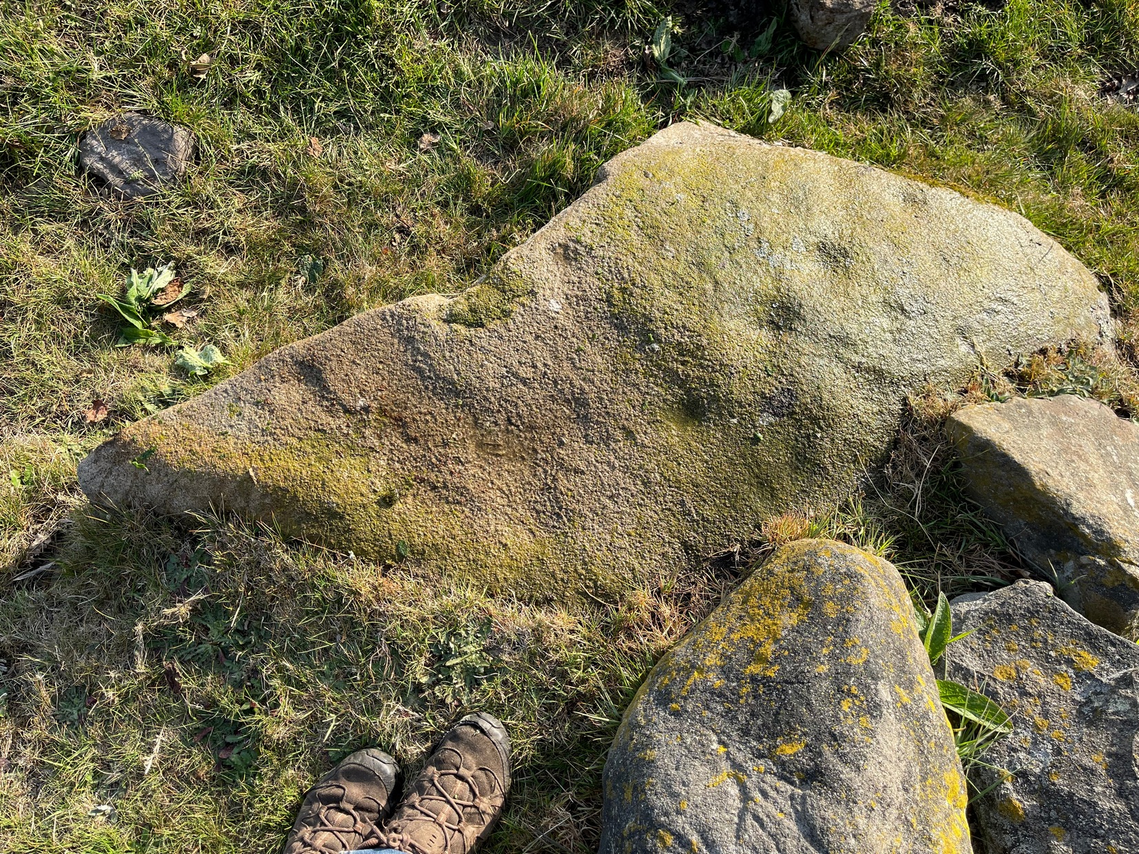
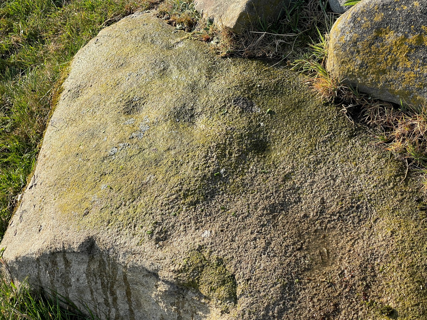
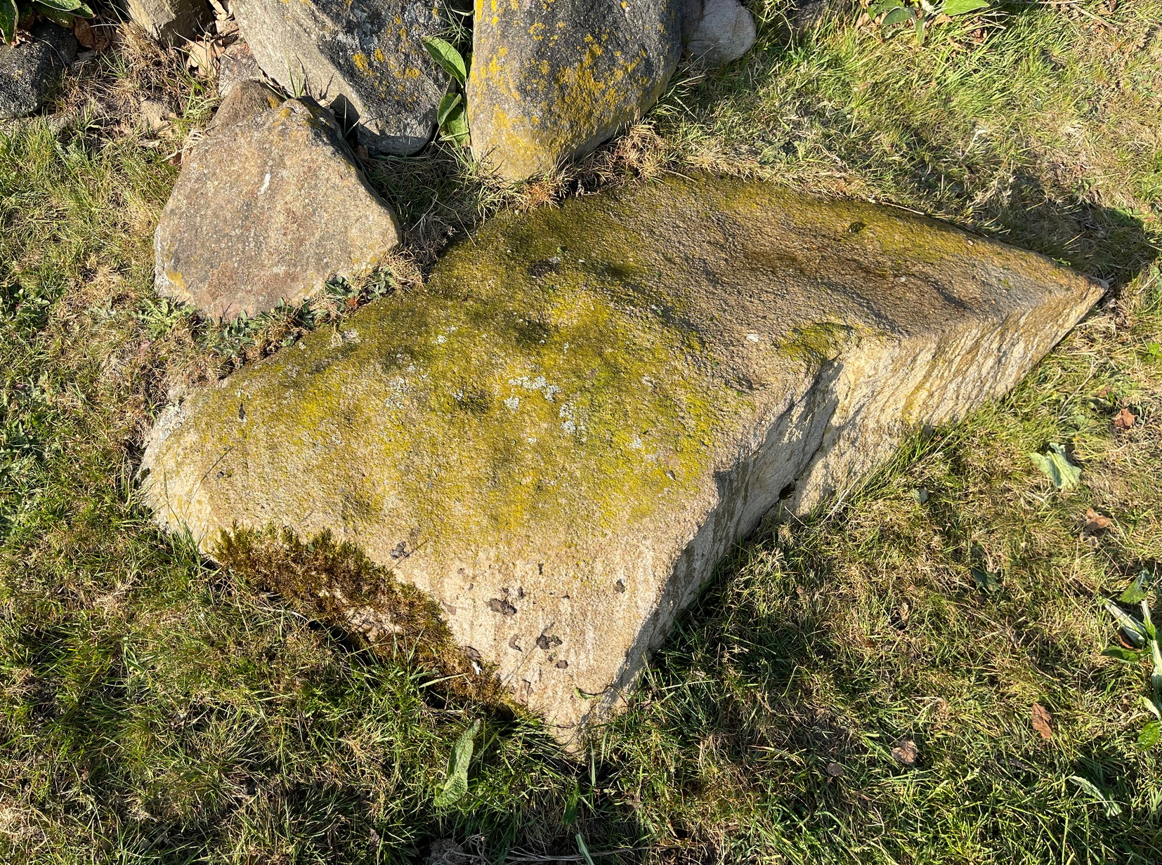
Cross (destroyed): OS Grid Reference – SE 2546 3537
Archaeology & History
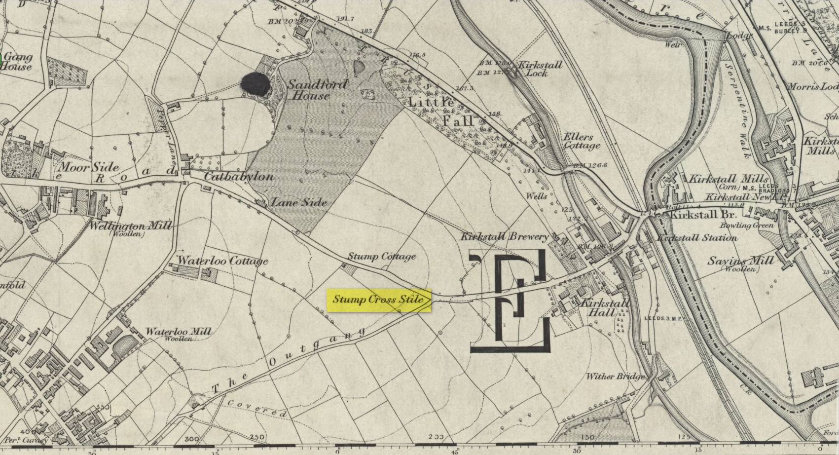
Location of the old cross
In medieval times an old stone cross was erected at the edge of Bramley where two old tracks once met, and which today is the junction where Broad Lane meets with Outgang Lane. The cross is long gone – and even the stone cross base on which it stood no longer existed when the Ordnance Survey lads came here in the 1840s. All that remained when they came here were the place-names which have forever kept a memory of its former existence: Stump Cross Stile and Stump Cottage. It was mentioned, albeit briefly, in Wardell’s (1890) survey of Kirkstall Abbey where he told simply that a
“stone cross formerly stood some distance south of the Abbey by the side of the Old Road to Bradford, at the junction of the lane leading to Bramley, called the Outgang, but no remains of it are left; the site, however, is still known by the name of ‘Stump Cross Stile.’ Whether this cross marked the extent of some boundary, or was erected by the monks or others for the purposes of devotion for wayfarers, I am unable to ascertain.”
References:
Wardell, James, An Historical Account of Kirkstall Abbey, Yorkshire, Samuel Moxon: Leeds 1890.
Acknowledgements:Huge thanks for use of the Ordnance Survey map in this site profile, reproduced with the kind permission of the National Library of Scotland.
Cross (destroyed): OS Grid Reference – SE 3071 3463
Archaeology & History
In James Wardell’s (1890) work on Kirkstall Abbey he describes several of the long lost stone crosses that used to exist in the area. This one,
“formerly stood by the road side at the south end of Sheepscar Bridge, in Leeds.”
The cross had already been destroyed by the time the Ordnance Survey lads explored the area in the 1840s, as there’s no showing of it on any of their maps. Wardell further stated that it was,
“called Killingbeck Cross, from being erected by either the Abbot of Kirkstall or the Vicar of Leeds, of that name.”
References:
Wardell, James, An Historical Account of Kirkstall Abbey, Yorkshire, S. Moxon: Leeds 1890.
In Hawksworth village, less than 100 yards past the primary school, take the footpath on your left into the open fields. 200 yards down the fields, go over the stile on your right, into the next field and walk diagonally across it (SW) for 250 yards until you reach the wall; then walk alongside it, west, for another 150 yards where the walling goes due south and walk down here for 135 yards, going through the gate at the bottom into the next field and, at the bottom of this one go through the gate and bear right. OK, now walk along the wall-side for 55 yards and you’re just about standing on it! Alternatively you can reach it via the Hawksworth Spring (1) and (4) carvings, following the wall along for roughly 150 yards till you reach the gate. Go through here and walk diagonally NNW across the field for nearly 150 yards where you’ll see the stone stuck out in front of the wall.
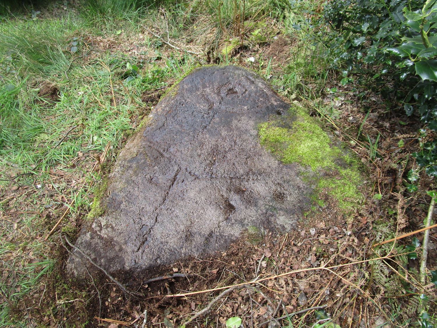
Archaeology & History
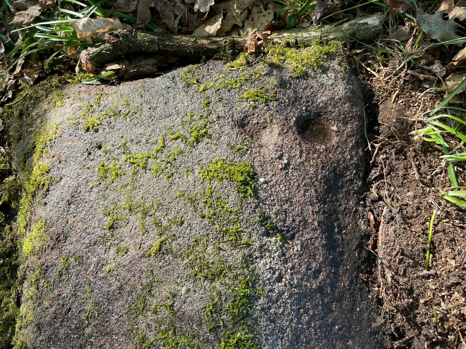
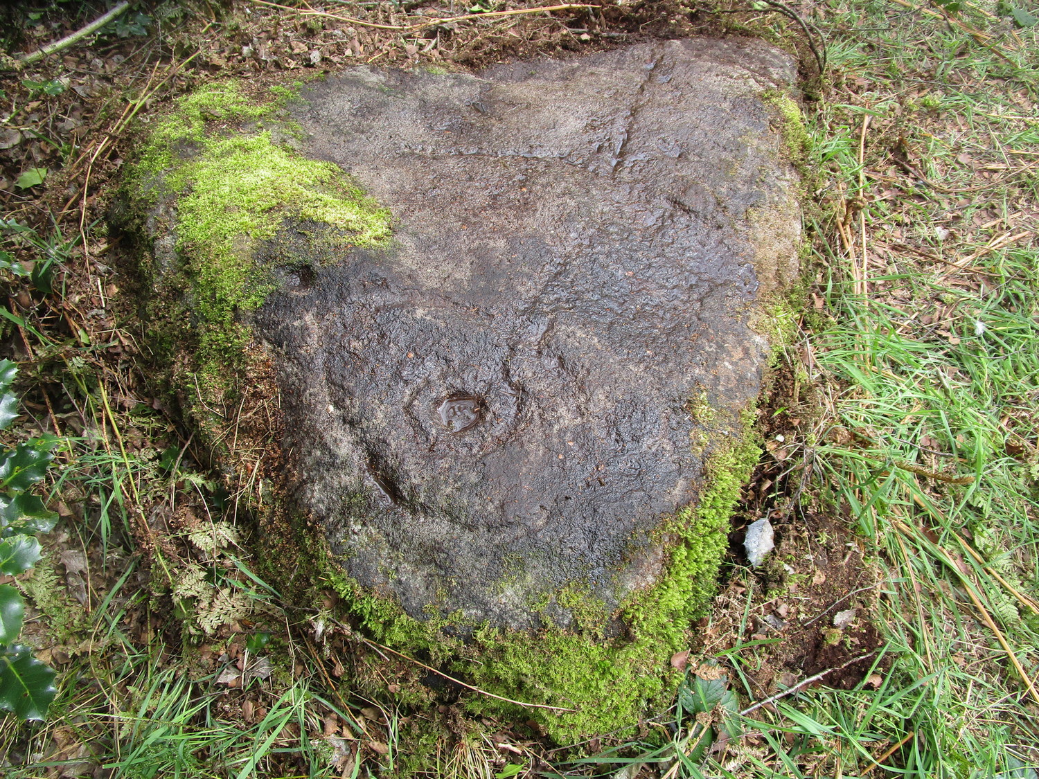
My first sight of this came about as I walked alongside the walling. Approaching the stone, I noticed what looked like a recent cup-like marking with a curved line emerging from it on its eastern surface; but it didn’t look too old and was more like the scratch-marks you see sometimes when farmers have been dragging rocks along to be used in walling. So I shrugged in slight disappointment—until the far-side, the western-side of the stone came into view.
Line of cupsMain scatter of cups
Sloping ever-so-slightly down into the ground, the surface of the stone had a cluster of quite worn, shallow, but distinct cup-markings between one and two inches across, four of which ran in a line from the top to the edge of the stone in a slight curve. As I walked round it, looking from different angles, it became obvious that two or three other cups existed—mainly from the top to the western side of the rock. One seemed to exist near the edge, whilst two other faint ones sat to the side of the line-of-four—almost creating a square formation. From some angles it looked as if there may be faint lines running between some of the cups but (as usual) the sunlight didn’t really help highlight them and they could just be faded erosion lines.
Looking down at the cupsWater & sunlight & cups
It was obvious that a section of the stone on its southern edge had been broken off in the not-too-distant past, raising the idea that the design may originally have been larger than its present form. This thought returned when I walked another 60 yards west along the wall and came across a broken section of stone that had been placed into it, pretty recently, and on its vertical face noticed a single cup-mark in a good state of preservation, indicating that it had either been cut recently or instead been dug out of the ground not too long ago and shown intself to the world after a sleep of several millenia. Look at it when you have a gander at the main carving here and make up your own mind….
Take the same directions as if you’re going to visit the Hawksworth Spring (1) carving. From here, the small footpath at its side keeps going uphill, curving to the right and following the line of walling. After about 20 yards where the land begins to level out, keep your eyes peeled for a small elongated earthfast rock, less than three feet long, just to the left of the path and only three or four yards away from the wall. If the leaves have covered the stone, get on your hands and knees and scrub around a bit. You’ll find it!
Archaeology & History
Primary cup-marking
This was a frustrating find as there are several elements on the stone, only one of which I could be 100% certain about – and that’s the singular cup-marking on the top-left of the stone. Just next to this is what looks to be another one, unfinished, cut into a natural fissure in the rock—but the daylight was frustrating, allowing only glimpses of visual clarity on the stone. At the other end of the stone, as the photo shows, are what stand out as two or three more cup-marks, but these seem geophysical in nature—although examples such as these scatter the works of Boughey & Vickerman (2003; 2018) as authentic, which shows the problem we all have as rock art students. Anyhow, at least one of these cups is the real deal. I’ll let the computer-tech lads sort the rest of it out for us…
Once you’ve located the carvings of Hawksworth Spring (1) and (2), walk up the slope towards the topmost section of the walling where the land begins to level out. Hereby you’ll see the Hawksworth Spring (4) carving (if it’s not covered in leaves) several yards below the wall. Turn around and look diagonally to your left, into the trees, where you need to walk into and beneath the overhanging holly branches. Here you’ll reach the large earthfast rock whose edge rests up against the trunk of a larger tree. You can’t miss it!
Archaeology & History
Notable curious “cups”
I’m not 100% convinced that this a prehistoric design, despite it being listed as such in Boughey & Vickerman’s (2003) survey—although, to be fair, they do suggest it as being “doubtful.” The two most notable so-called “cups” have more of a recent hallmark to them and the other elements are troublesome to see with any certainty, but they may be geophysical in nature. Their description of it told us this was a “fairly large fine-grained rock with some included pebbles. Two pairs of cups, one pair connected by groove”. Make of it what you will….
References:
Boughey, Keith & Vickerman, E.A., Prehistoric Rock Art of the West Riding, WYAS: Wakefield 2003.
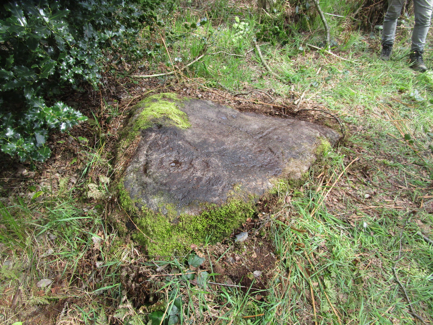
Follow the same directions as if you’re visiting the Gab Woods (1) carving—which you’re probably visiting if you’re checking this one out. Walk south into the middle of the woods and you’ll soon notice the road/houses on the other side of the trees. Once here, staying in the woods, follow the walling down for about 100 yards, keeping your eyes peeled for a reasonably large flat stone about 15 yards from the wall in the trees. If you can’t find it at first, patiently zigzag back and forth until it eventually appears!
Archaeology & History
One of two known petroglyphs in this woodland (there may be more hidden away) that was first found in the 1940s by Dan Cole. The main feature here consists of a cup-mark encircled by two large, well-defined oval-shaped “rings”, a bit like a large eye. From the central cup, a long carved line runs down the gently sloping surface of the stone and, roughly halfway down from the cup-and-ring to the edge of the stone, another carved line cuts across at rough right-angles, giving the carving a slight anthropomorphic (human-like) appearance when looking up the stone. This humanesque figure may have been the intention—though for my part I have to say that I’m slightly skeptical about it. We may never know either way. Several other single cups are on the stone: one to the side of the large “eye” and two or three below the elongated “arms.”
Vague humanesque figureLarge eye-shaped element
An additional, interesting non-petroglyphic feature is the name of the woodland in which the stone resides. In Thomas Wright’s massive dialect work, Gab is a northern dialect word meaning “to talk”, or “idle chatter” (and variants thereof); this is echoed in Blakeborough’s (1911) Yorkshire survey; and Wilkinson’s (1924) local study tells simply it’s “idle talk…able to talk glibly and with much plausibility—a Town Hall Square orator for instance.” This makes the place as something akin to being “the woodland that talks”, “the chattering woods” or “the talking woodland”, etc. You can make up your own mind as to what this might mean… *
References:
Blakeborough, Richard, Wit, Character, Folklore and Customs of the North Riding of Yorkshire, W. Rapp: Saltburn 1911.
Acknowledgements: Huge thanks must go to Peter Murphy for recovering this impressive carving from the archives, and from beneath the carpet of soil and vegetation, so enabling it to see the light of day once again. Also big thanks to the usual culprit of James Elkington, as well as Sarah Walker and Sarah Jackson.
* a Scottish dialect variant of gab relates to the mouth, tongue, taste.
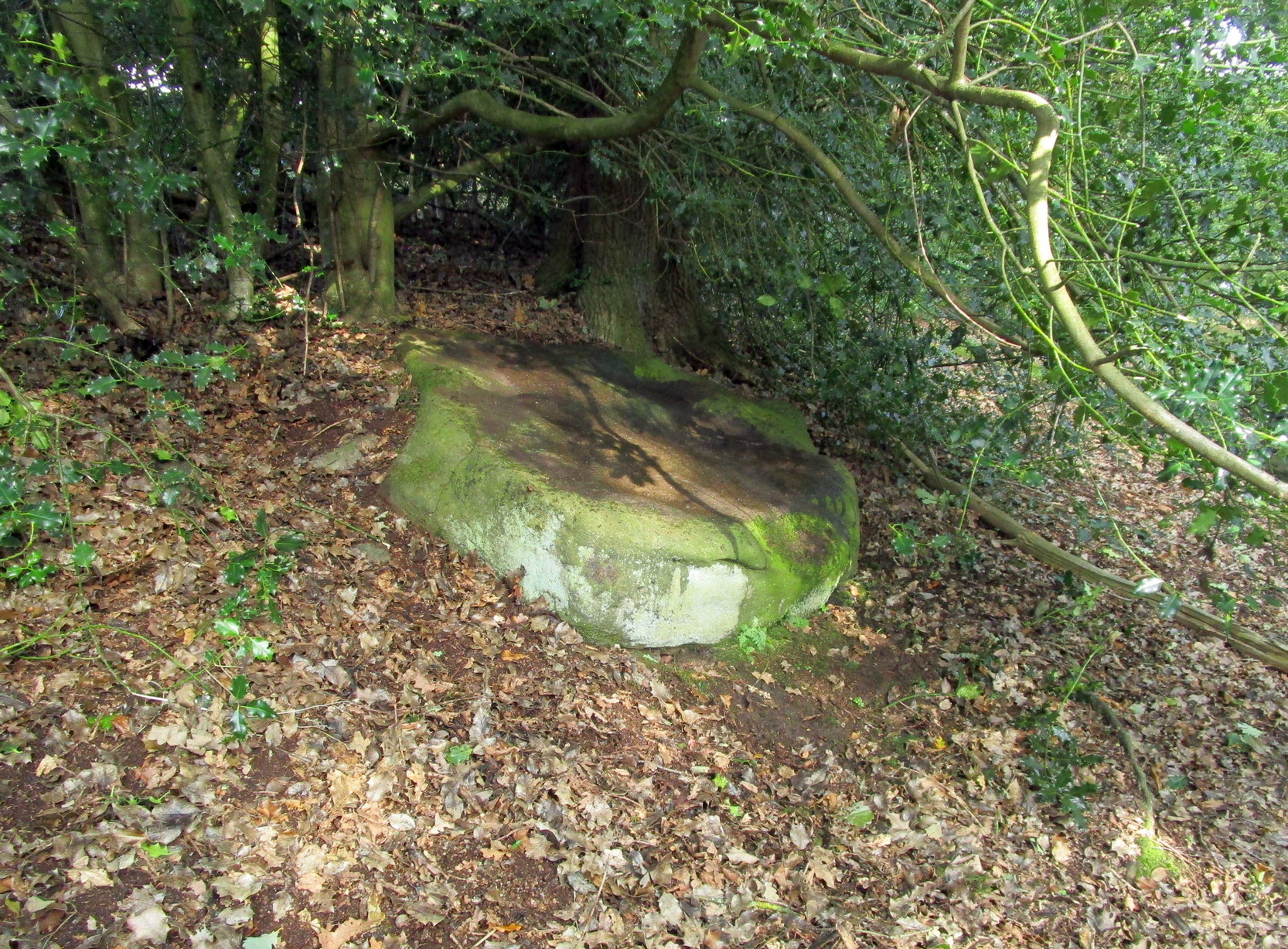
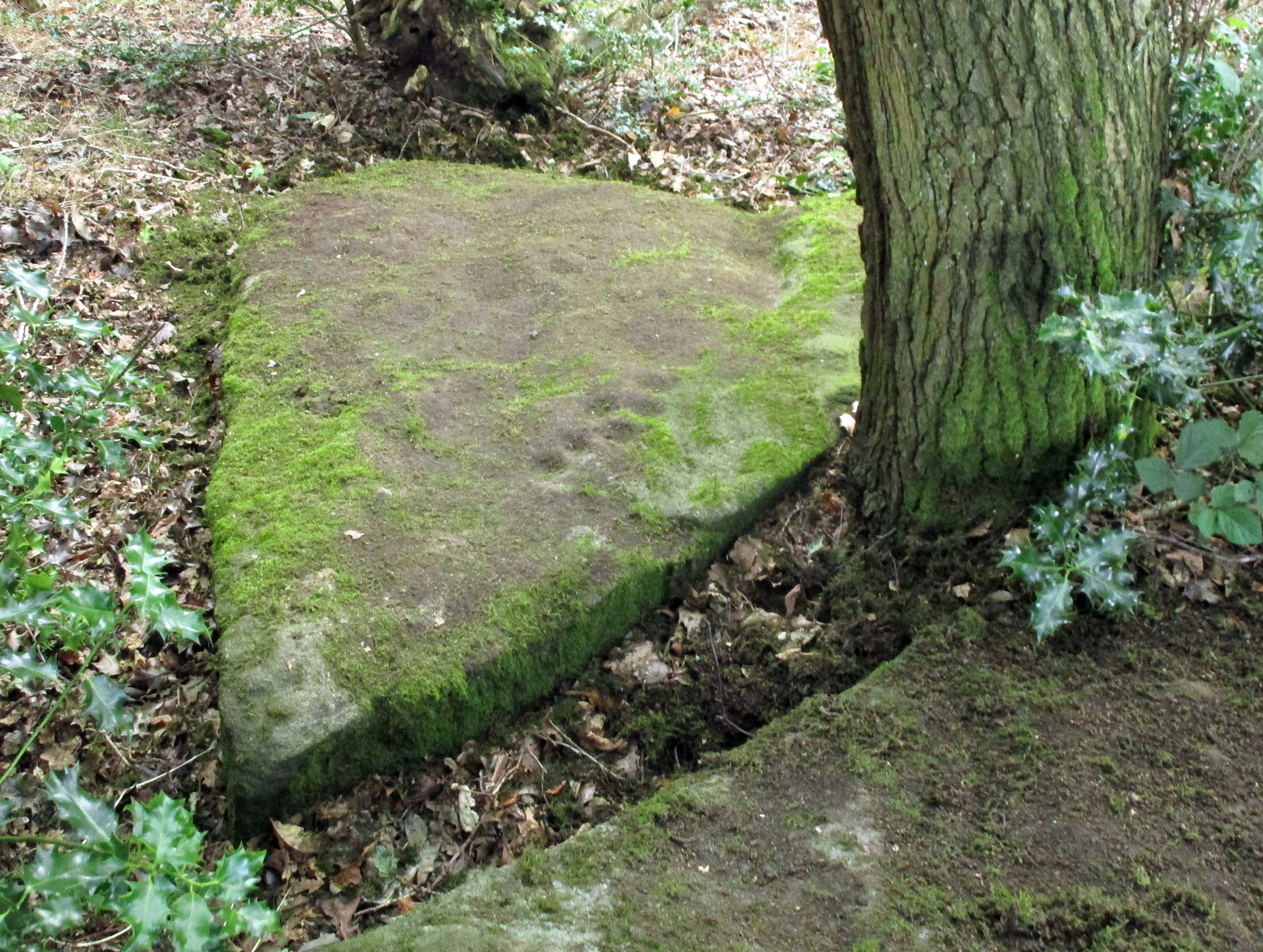
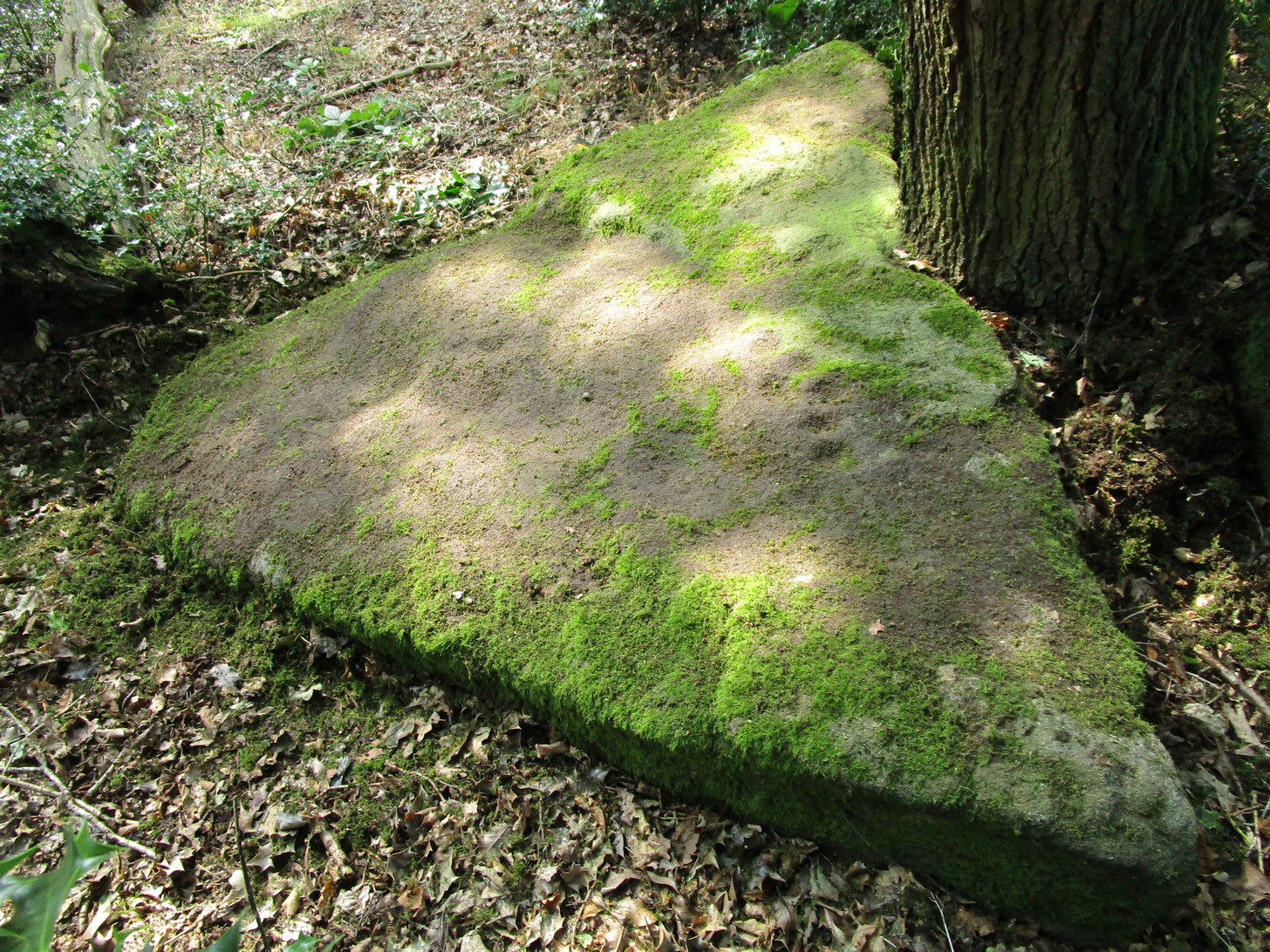
On the north side of Cookridge, find Smithy Lane and go to the western-end, where it meets up with a dirt-track. Walk straight along here by the side of the cricket-pitch and then take the first turn left where you walk along the other edge of the cricket pitch. About 150 yards along, the track hits the woods; keep along here for about another 200 yards where you’ll find a small footpath on your left goes into the woods. Once you’re in in the trees, walk to your right, following the wall, for about 50 yards where you’ll see a large flat stone by the holly trees. That’s it!
Archaeology & History
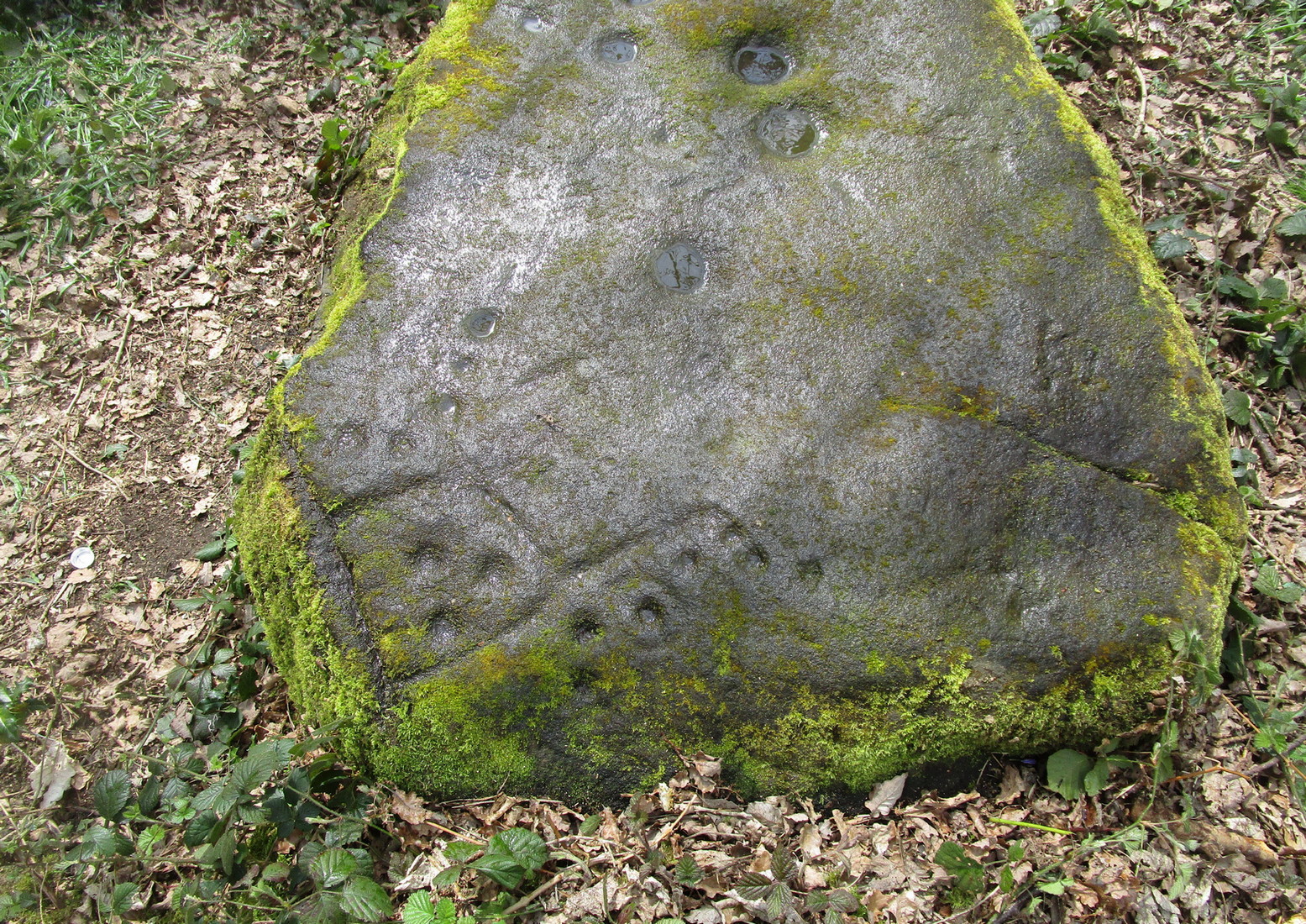
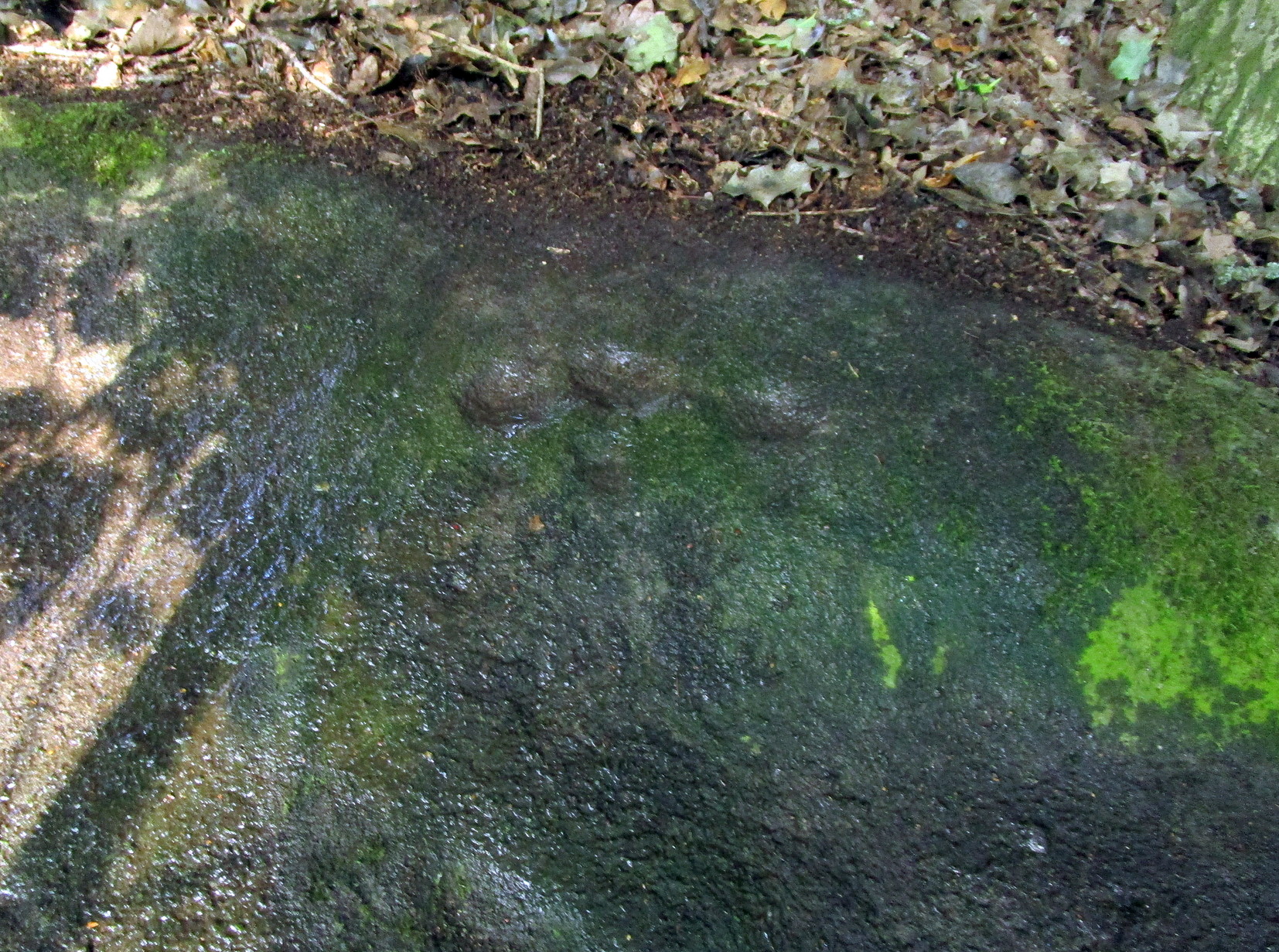
Rediscovered by the Leeds historian Don Cole in the 1940s, this complex multi-period carving etched onto a flattened rock surface is an unusual outlier from the Rombalds Moor complex several miles to the west. At its heart, around the semi-natural deep “cups” near the middle of the southern side of the stone, is the oldest part of the carving comprising a very faint incomplete triple-ring design which, as we move around it, almost has the look of a Newgrange-lozenge form to it. But I’m unsure…
Very faint incomplete triple-ring at top-middleWaves & cups and rings
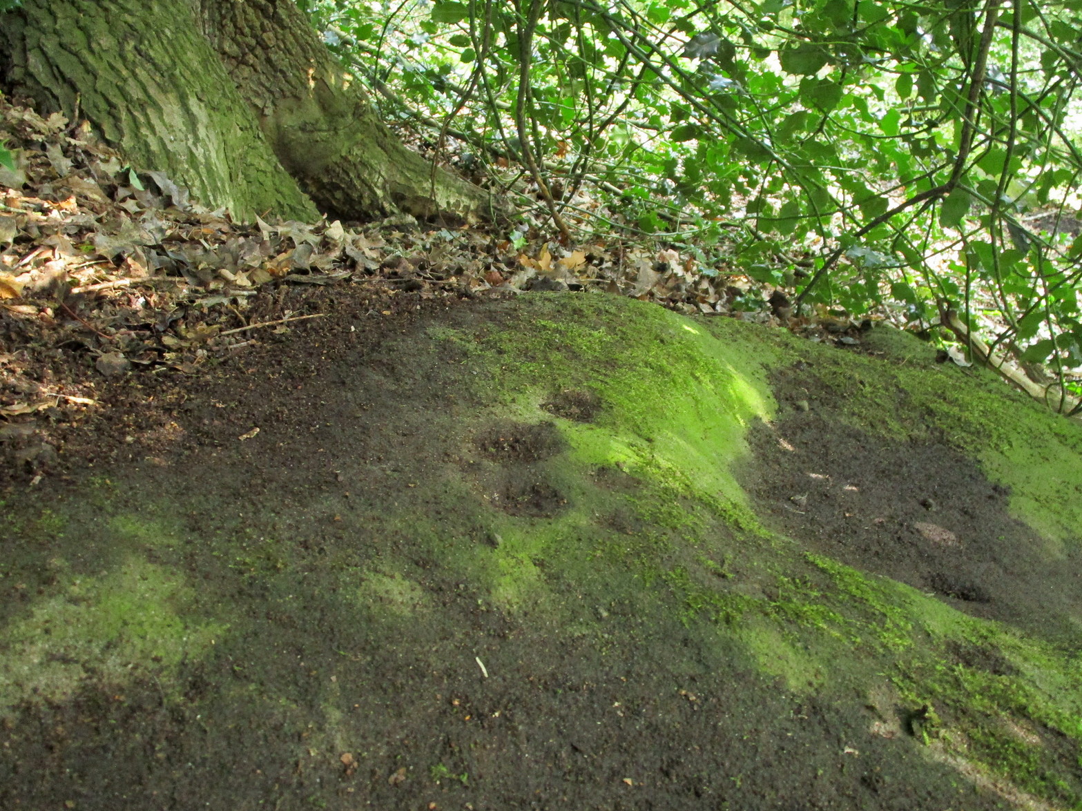
More obvious (apart from the deep “cups”), and the first thing you notice as you approach the stone, are the later and much more well-defined elements on the east side of the stone: a curious wave-form writhes from the edge of the rock across its smooth surface, beneath which we find a cup-and-ring and a number of single cup-marks, some enclosed inside a rounded box, with others sat between the curved carved line and the stone’s edge. The “rounded box” with its three cups at first seems to be on its own, but as the light changes you’ll notice a much fainter (possibly older) rectangular box attached to it; no cups are visible inside this.
A hundred yards due south in the same woodland you’ll find the Gab Woods (2) carving.
One interesting feature is the name of the woodland in which the stone resides. In Thomas Wright’s massive dialect work, Gab is a northern dialect word meaning “to talk”, or “idle chatter” (and variants thereof); this is echoed in Blakeborough’s (1911) Yorkshire survey; and Wilkinson’s (1924) local study tells simply it to be “idle talk…able to talk glibly and with much plausibility—a Town Hall Square orator for instance.” This makes the place as something akin to being “the woodland that talks”, “the chattering woods” or “the talking woodland”, etc. You can make up your own mind as to what this might mean… *
References:
Blakeborough, Richard, Wit, Character, Folklore and Customs of the North Riding of Yorkshire, W. Rapp: Saltburn 1911.
Wright, Joseph, English Dialect Dictionary – volume 2, Henry Frowde: London 1900.
Acknowledgements: Huge thanks must go to Peter Murphy for recovering this impressive carving from beneath the carpet of soil and vegetation, and so enabling it to be seen by others once more. Also big thanks to the usual culprit of James Elkington, as well as Sarah Walker and Sarah Jackson.
* a Scottish dialect variant of gab relates to the mouth, tongue, taste.
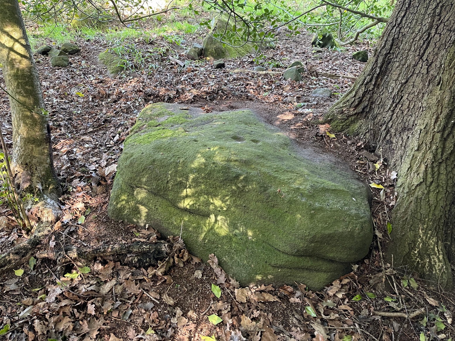
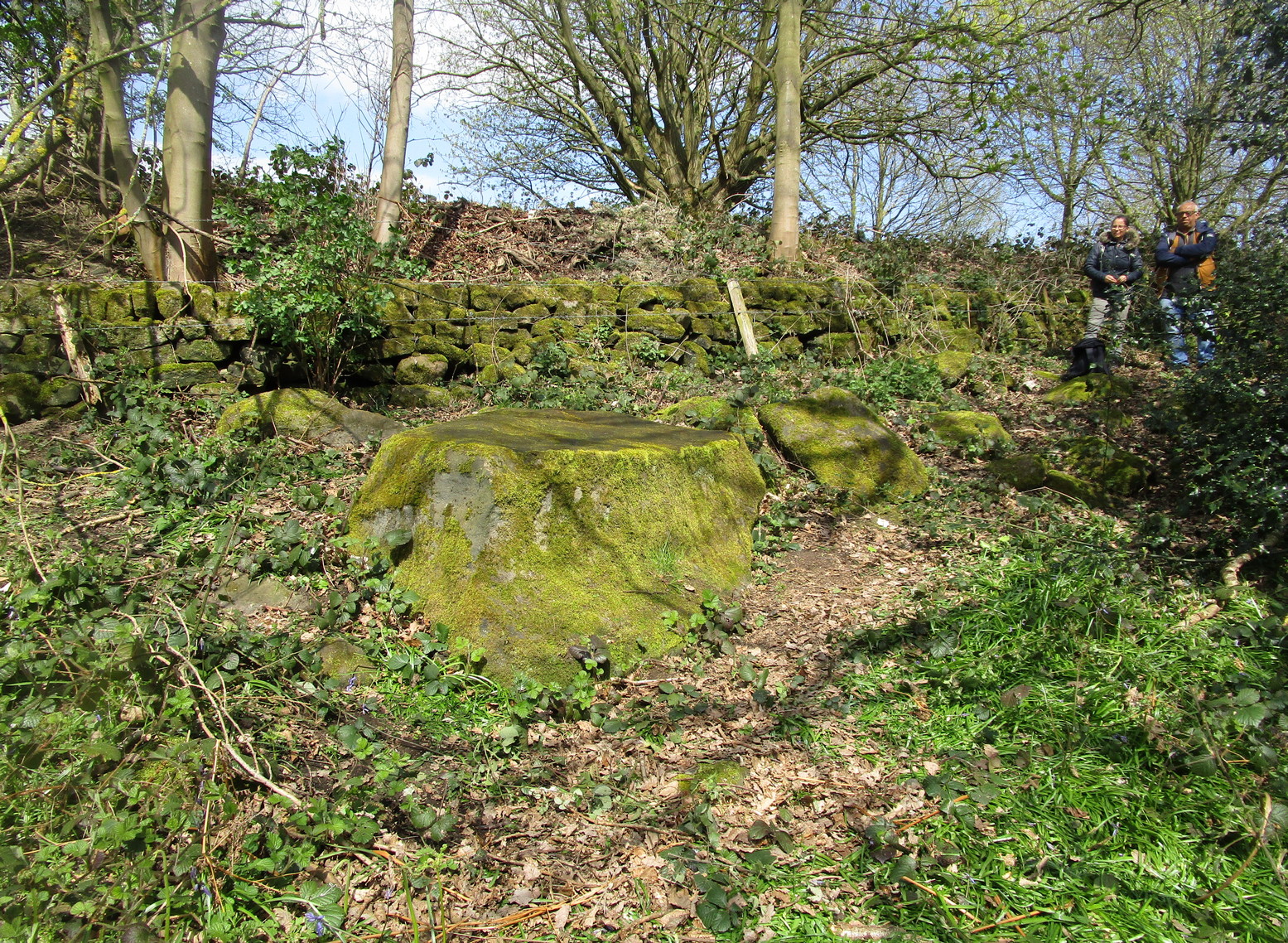
You can take the same directions to get here is you follow the route for the Hawksworth Spring (01) carving, or take this alternative route. Take the standard road from Guiseley along Hawksworth Road. When you reach the first row of old houses in the village, a couple of hundred yards on you reach the village school and, shortly after the footpath is sign-posted. Walk left (downhill) through the field for half-a-mile until you reach the woods. 100 yards into the into the trees, walk to your right and follow the line of walling straight for 400 yards, then veering right up the slope and it then slowly bends round, keeping to the wallside all along. It then starts heading back downhill. As it does so, 10 yards from the wall into the woods you’ll see the broken triangular rock of the Hawksworth Spring (01) carving. Walk another 10 yards where the large holly bushes are and you’ll see the large sloping stone in front of you.
Archaeology & History
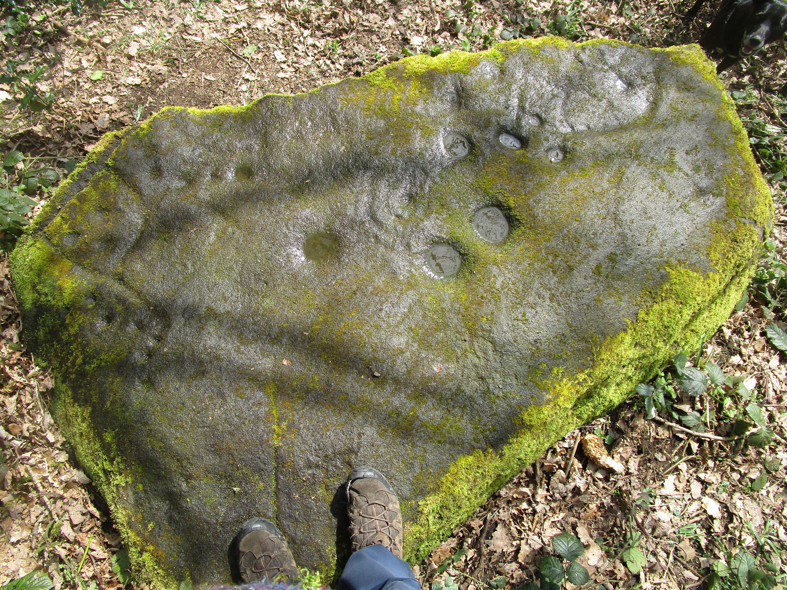
This carving is similar in nature to its companion 10 yards away, inasmuch as each of them possess two small arcs of cup-marks almost in the same format, very close together, one above the other near the top of the stone. It’s possible that the mythic nature/function of this particular element of arcs is the same on each stone—although fuck knows what it might be!
Clear line & faint line of arcsClear arc of cups
Below this double arc (only one of which is clearly visible in the photos) we see a scatter of other cup-marks—perhaps six, perhaps seven—one of which appears to have a very faint incomplete ring round it. When Liz Sykes and I visited the place, the light of day and the shadows across the rock didn’t help to convince us one way or the other, so we await news from other visitors who get better light conditions to tell us whether our hopeful eyes were deceiving us or not. There are a number of other marks on its surface, but these are much more recent and very obviously cut, or rather scratched, by metal artifacts with no bearing on the prehistoric design.
References:
Boughey, K.J.S. and Vickerman, E.A., Prehistoric Rock of the West Riding (Supplement), Shipley 2018.
Acknowledgements: Huge thanks to Liz Sykes for her renowned cleaning skills!
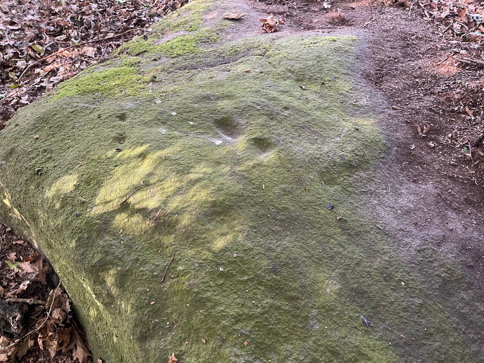
Through Baildon town centre, take the road onto Baildon Moor, but instead of turning left up to Baildon Hill, keep straight on the Hawksworth road and 100 yards along you’ll see a car-park is on the right-hand side, just before you start going downhill. From here, walk down the road a couple of hundred yards until you see the footpath (keep your eyes peeled!) turning right towards The Whitehouse, and from there take the footpath dead straight down to the woods below. Cross the stream, turn right, then immediately left uphill by the wall-side. Shortly before reaching the top you’ll see a large triangular sloping slab of rock with a tree at its top. That’s it! Alternatively you can come via Hawksworth village by following the directions to the Hawksworth Spring (02) carving, which is just 10 yards east of this one. Easy!
Archaeology & History
Sketch of carving (after Hedges 1986)Note the faint cup, top-right
This minimalist design is best seen from above the adjacent rock which, in times gone by, was attached to this very same stone. The main aspect of the carving are the two short rows of three cups, running almost alongside each other, in a likeness which my compatriot Liz Sykes said “was like some animal footprints.” It’s not a bad description to be honest (this same motif is found on a companion petroglyph just a few yards to the east: the Hawksworth Spring [2] stone). If you follow the direction of the “animal tracks” to the western end of the stone, you’ll see another isolated cup with a faint incomplete ring around it. You can just make it out on the photo to the right. Another single cup-mark seems apparent two-thirds the way down the stone.
References:
Hedges, John (ed.), The Carved Rocks on Rombalds Moor, WYMCC: Wakefield 1986.
Acknowledgements: Huge thanks to Liz Sykes for her renowned cleaning skills!
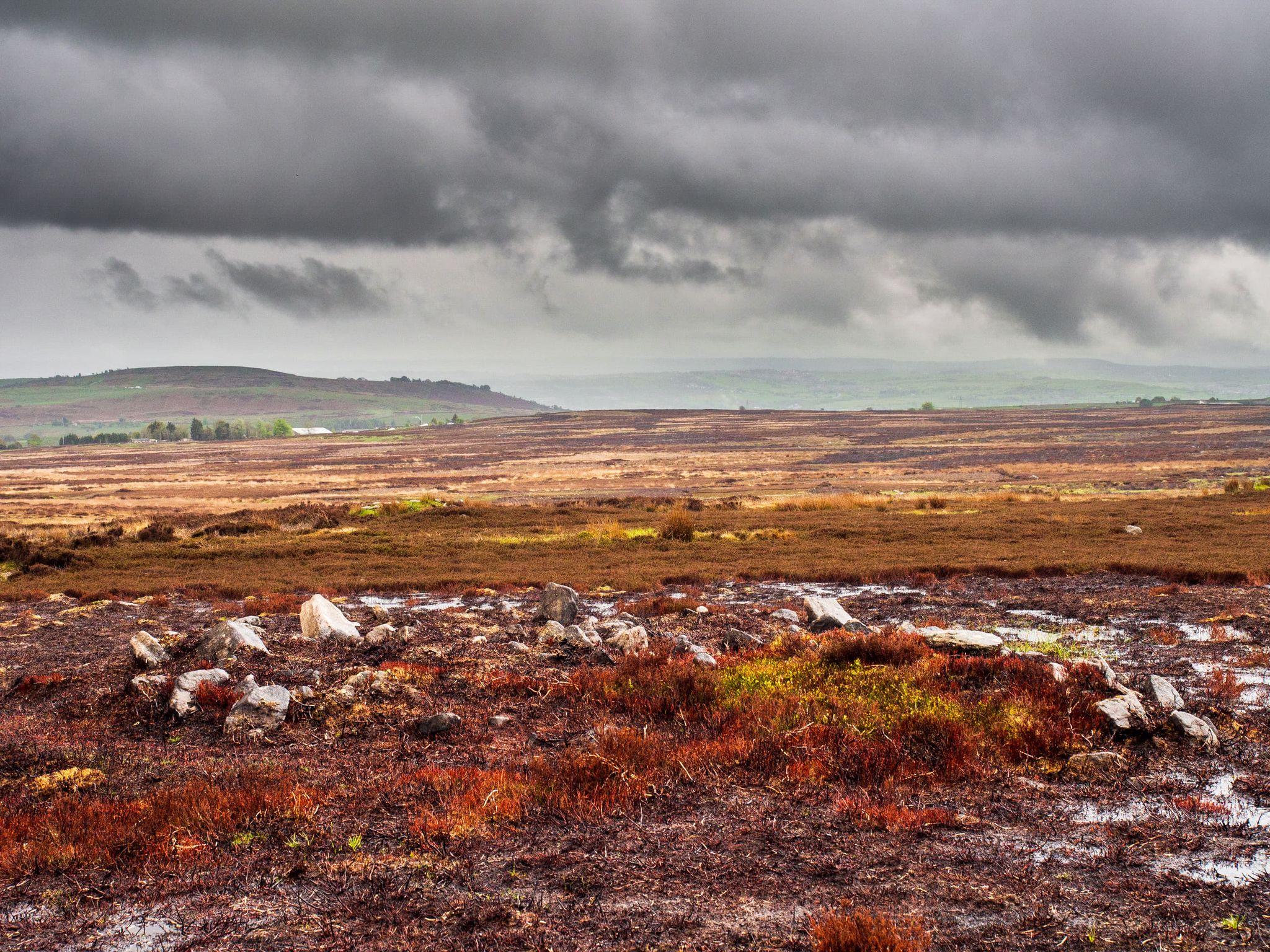
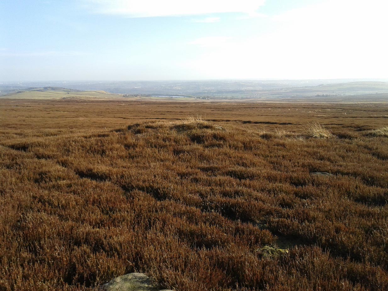
It’s a bittova pain-in-the-arse locating this site unless you’re into walking off-path, through excessive dense heather or burnt coarse ground. You can either follow the directions to the Black Beck tomb, or set off from Horncliffe Circle and walk up parallel to the fencing for nearly 300 yards (275m). From here, walk due east for nearly half a mile through the deep heather until you reach an overgrown track that keeps you eastwards towards a line of grouse butts abaat 275 yards (250m) on. Naathen, walk on the north-side of this path-track and for a few yards and you’ll begin to see either small piles of stones, or heather-covered mounds. Zig-zag about. You’re in the middle of the cemetery!
Archaeology & History
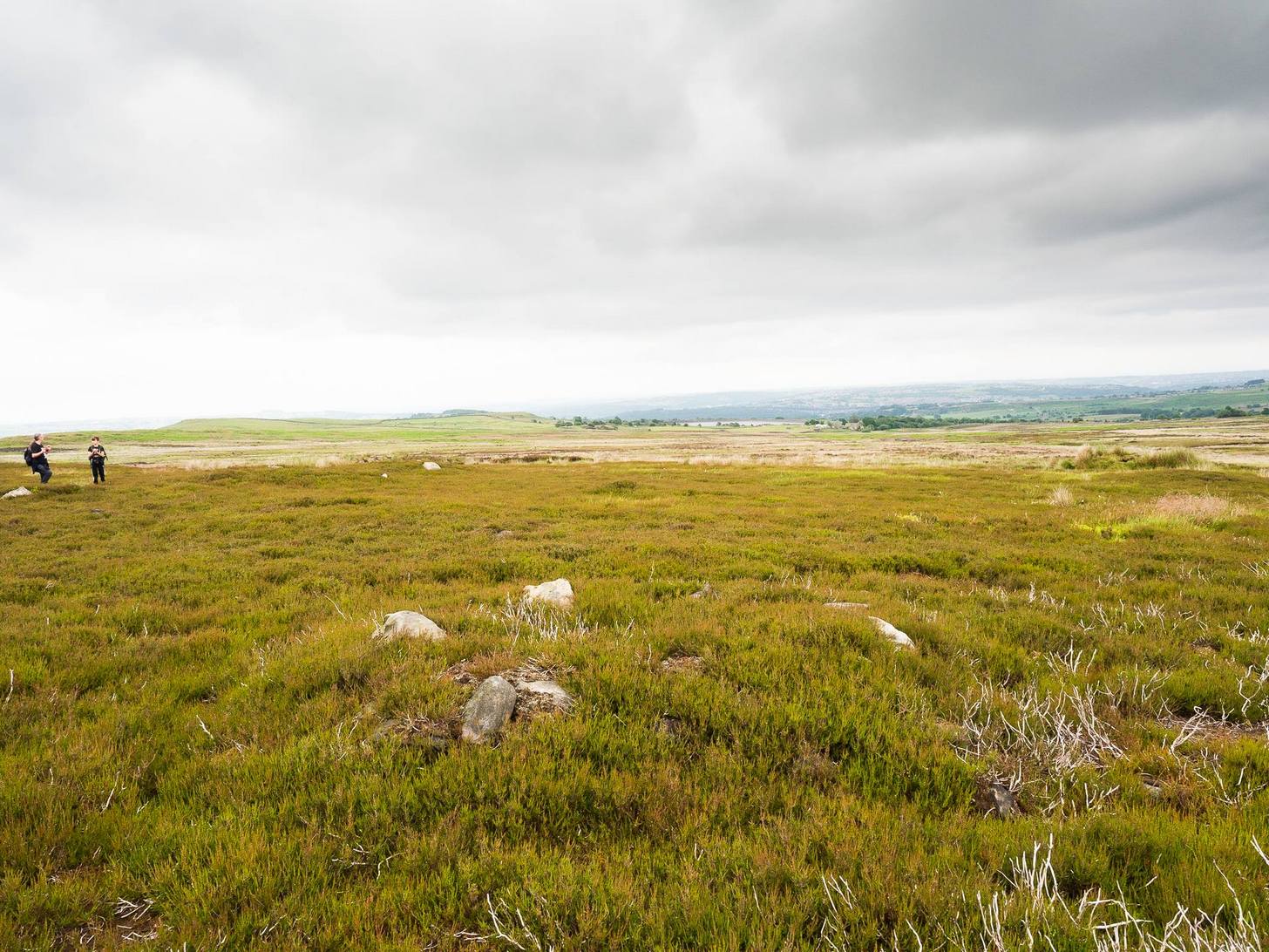
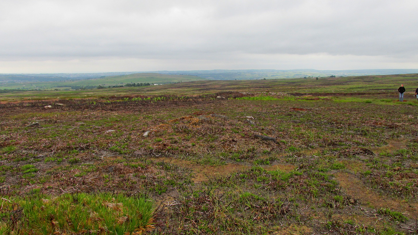
This cairnfield, or burial ground, or necropolis (choose whichever term you prefer) is a bittova beauty! Although some of the tombs here had been ‘officially’ noticed a few years back, the magnitude of it was understated to say the least. On a visit to the place a few months ago in the middle of one fuckova downpour, James Elkington and I found not only the large Black Beck tomb, but scattered clusters of many more cairns. But it wasn’t until a few weeks after that we got a longer time to check it over and, even then, I think the job was only half-done. So this site profile is merely an overview of some of what we found there. Along with the Black Beck tomb, we found more than thirty examples of prehistoric cairns—probably Bronze Age in nature—around the Hawksworth Shaw area near the middle of Hawksworth Moor, scattered around (seemingly) in no particular order.
…and another one…Round cairn in foreground
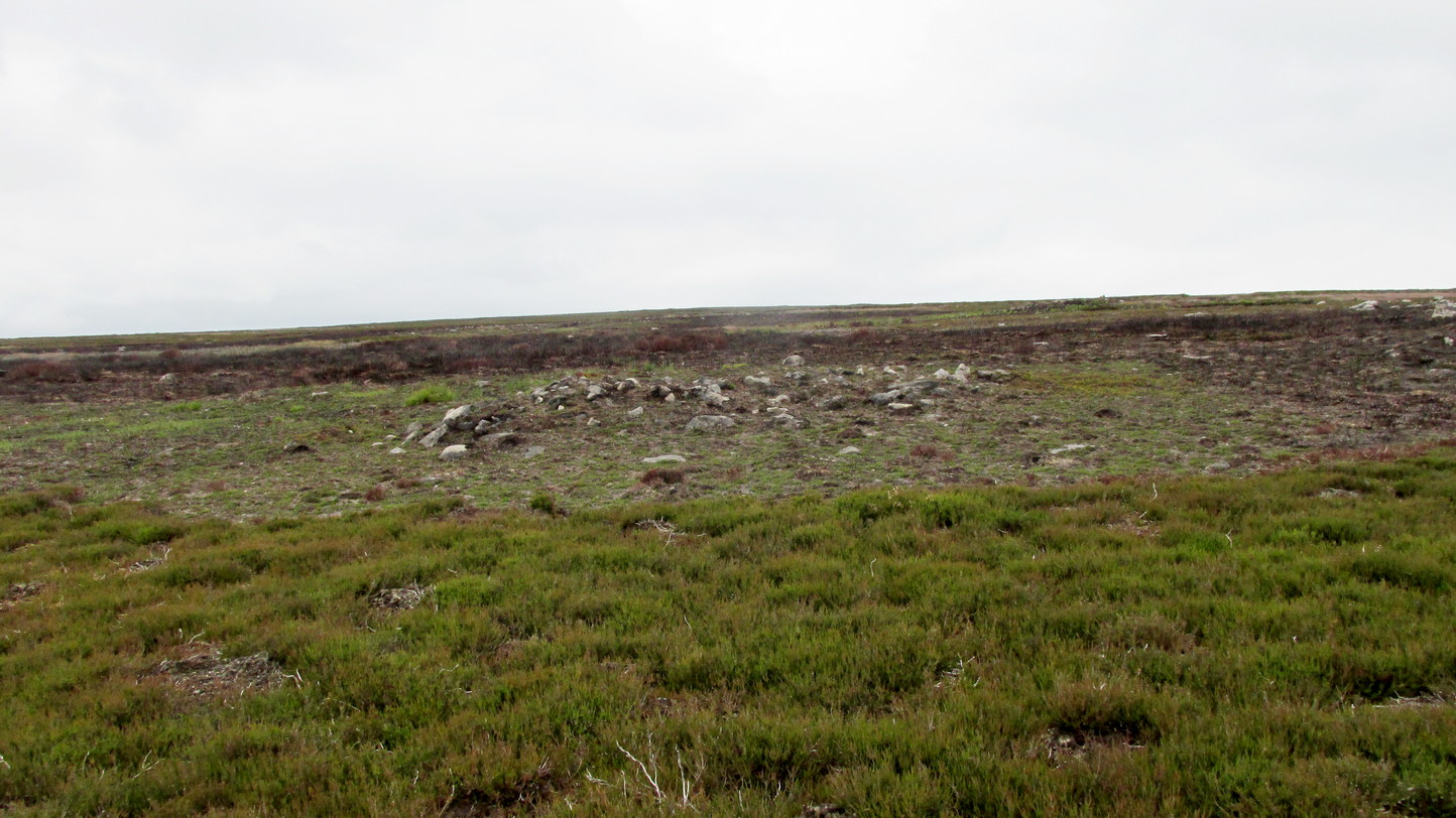
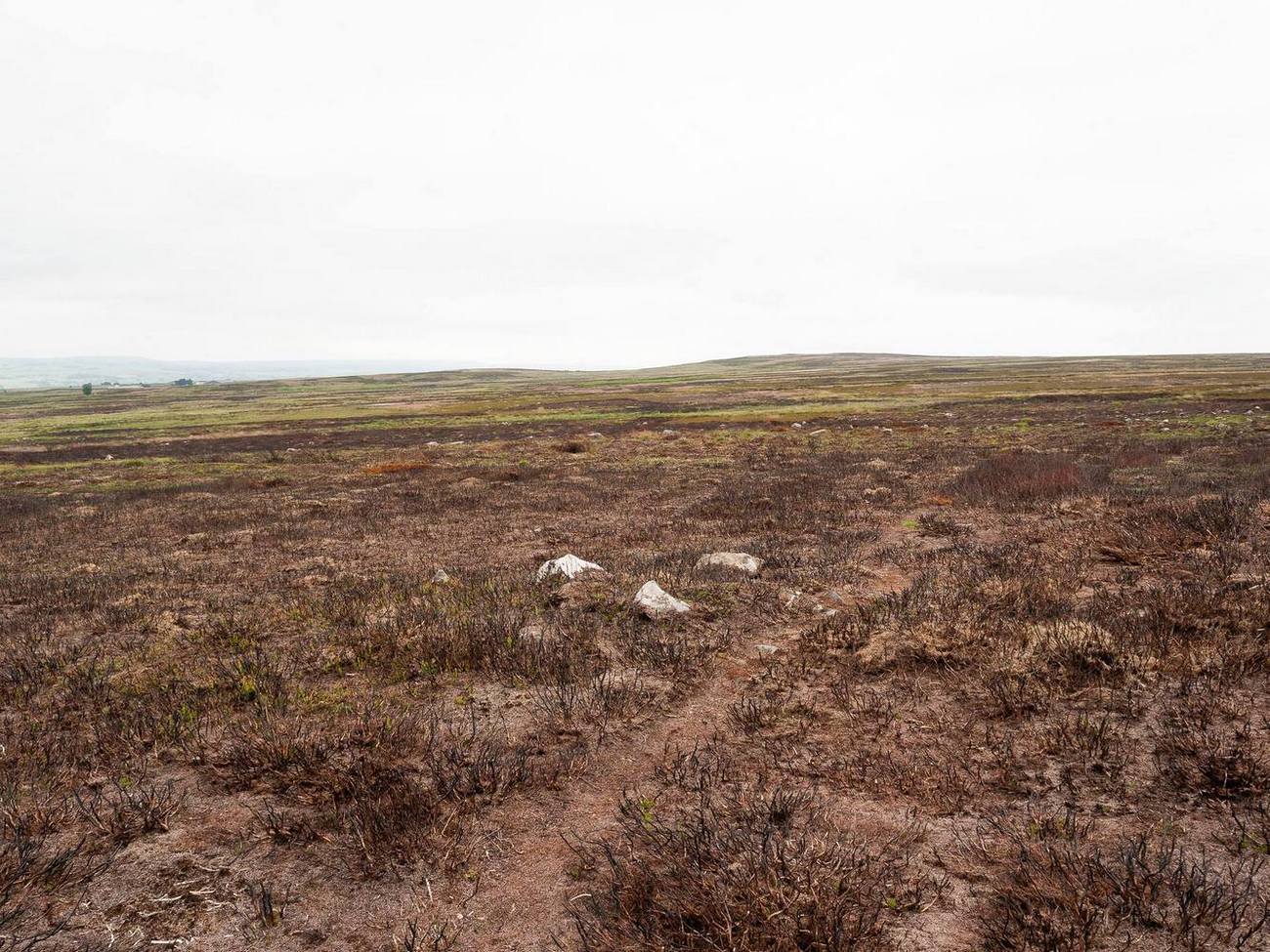
Three types of cairns were identified in this large cairnfield. The majority of them are of the standard circular form, averaging 3-4 yards across and rising to about two feet high. They are of the same architectural form as those found in the Hawksworth Moor cairnfield 4-500 yards northwest of here (there is the possibility that the two of them are part of the same necropolis, but unless we can locate an unbroken continuity between the two groups, it’s best to present them as separate clusters). When we looked at them a couple of weeks ago, most cairns of the ’round’ type were overgrown, albeit in low growth, as a couple of the photos here show. The main cluster of the round cairns are just a few yards off the aforementioned track, but there are others scattered here and there at other points on this part of the moorland. A number of these cairns seem to have have been damaged and robbed of stones to build a line of grouse butts close by.
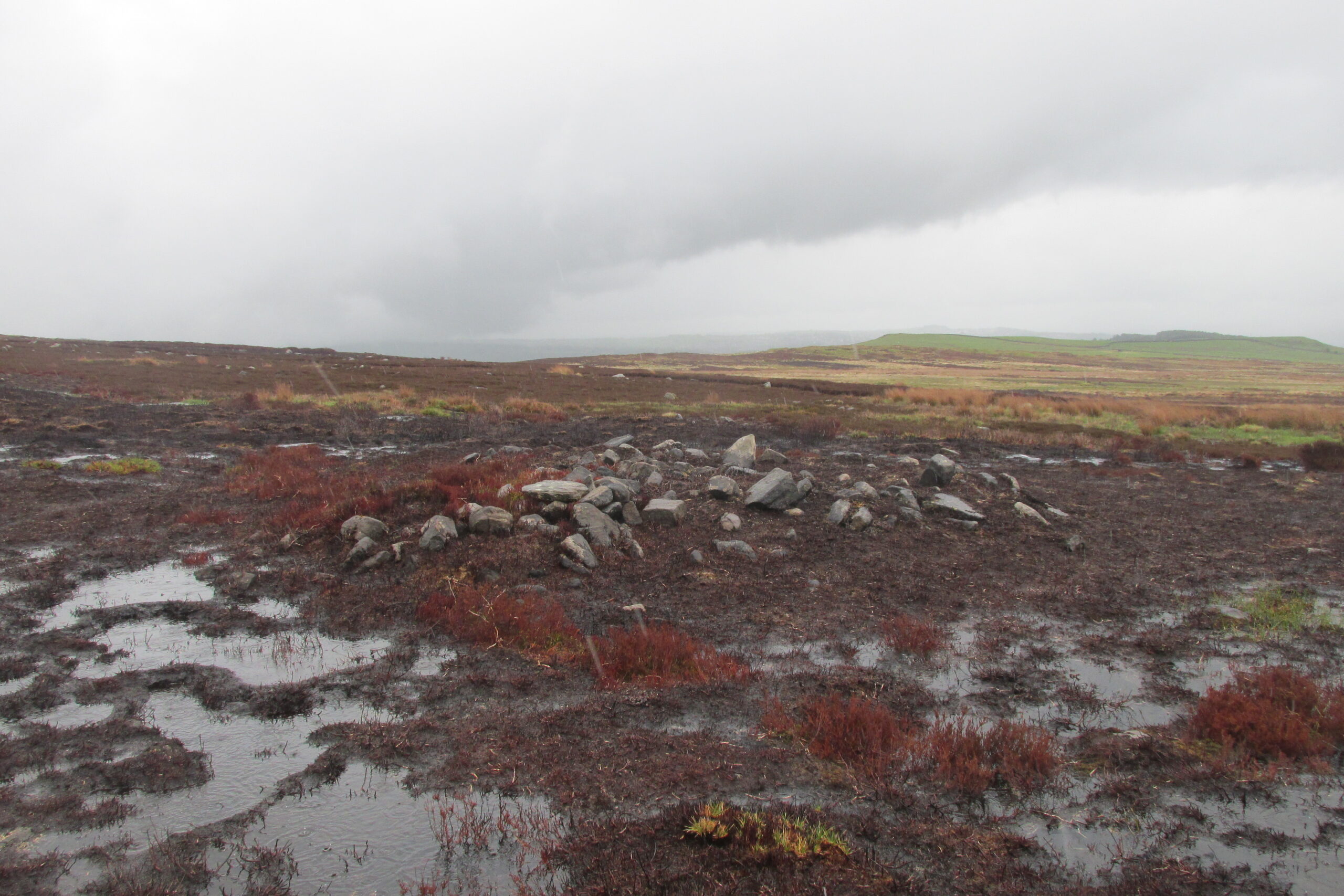
One of the ‘long cairns’Another ‘long cairn’ during an utter downpour!
The second type of cairn in the necropolis—close to the main cluster of round cairns—are curious small, long cairns. Each one of them measures between 8-10 yards in length, are up to three yards across, and rise to a height of about one yard. They are built of the usual mass of small stones typical of the huge number of other cairns on Rombalds Moor, but have been constructed in an elongated form, in contrast to the more usual circular ones. Four of them are very close to each other with a fifth further away from this main group. A sixth one appears to be under the heather 50-60 yards away to the northeast. Unlike some of the nearby round cairns, this group looks as if it’s barely been touched by the hand of man, with only fallen scatters of stones around the outer edges of them. Tis an interesting group…
The third architectural cairn-types are scattered unevenly across the necropolis and are characterized as smaller, mini-versions of the round cairns, i.e, small piles of stones between 1-2 yards across and and just one or two feet high. Each of this type of cairn are more deeply embedded in the peat with more vegetational growth covering them due to their small size. This makes them much more difficult to see in comparison to their larger compatriots. One example (at SE 1423 4404) can be seen in the photo, above left, some 50-60 yards north of the Black Beck tomb; with another, above right, some 100 yards away to the southeast. There is the possibility they may be so-called ‘clearance cairns’, although I have some doubts about this and believe they are more likely to be individual graves…. but I could be wrong…
There’s little doubt that other tombs are hiding away in this area, waiting for fellow antiquarians to uncover them. Equally probable is the existence of hut circles or similar living-quarters lost beneath the heather. Two such sites have been found on recent ventures here: one a short distance west of the Black Beck tomb and another hiding away nearly 300 yards southwest, right beside the Black Beck. The main thing lacking up here are cup-and-ring stones. Apart from several uninspiring cup-marked rocks it seems few exist hereby; but there are, no doubt, some hiding away that have been hidden for millenia…
One final thing: the grid-reference given for this necropolis is based loosely on where some of the cairns can be found, but there are others whose positions lies slightly beyond that grid-ref, as you’ll find if you potter about.
Acknowledgements: With huge thanks, as always, for James Elkington for use of his photos. Also to the evolving megalith and landscape explorer Mackenzie Erichs; and to Linzi Mitchell, for additional input…