From Bettyhill village, take the A836 road east (as if you’re heading towards Thurso) for literally 1½ miles (2.4km) and take the left turn to Farr (signposted). Exactly a mile along, just past the gated house above the road on your right, in the sloping field below it, you’ll notice a seemingly innocuous scatter of stones doing nothing in particular in the grassland. That’s it!
Archaeology & History
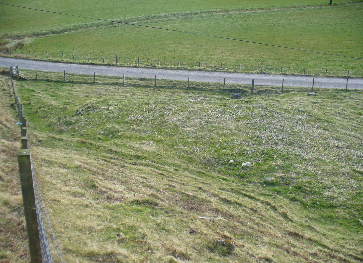
There’s not too much to look at here, apart from a very overgrown mass of loose stones seemingly piled up near the bottom of the sloping hillside. It was first noted when James Horsburgh (1870) explored the prehistoric sites of the region, but even then the site was mentioned with some brevity, telling simply:
“On the way from Farr to Borve Castle, there are the foundations of a Pictish tower at Clarkhill, the stones of which are larger than usual, being square blocks.”
Looking down on the ruins
His description regarding its precise whereabouts wasn’t very clear, but it was located some years later by the Royal Commission (1911) who subsequently added the site to their Inventory. They found that the broch was “at the extreme west end of a low rocky ridge on which are situated the buildings of a croft bearing the name of The Dun.” They reported, even then, that only a few large stones of the broch remained visible. `
The site was included in Euan Mackie’s (2007) magnum opus, where he described the only remains left of this “possible broch” to be “the basal course of the outer wall…forming an arc about 9.0m long.”
MacKie, E W., The Roundhouses, Brochs and Wheelhouses of Atlantic Scotland c.700 BC-AD 500 – volume 2, British Archaeological Report: Oxford 2007.
Royal Commission Ancient & Historical Monuments, Scotland, Second Report and Inventory of Monuments & Constructions in the County of Sutherland. HMSO: Edinburgh 1911.
Acknowledgements: With thanks to the old crew of Aisha and her little Lara for getting me up here, oh so many years ago now…..
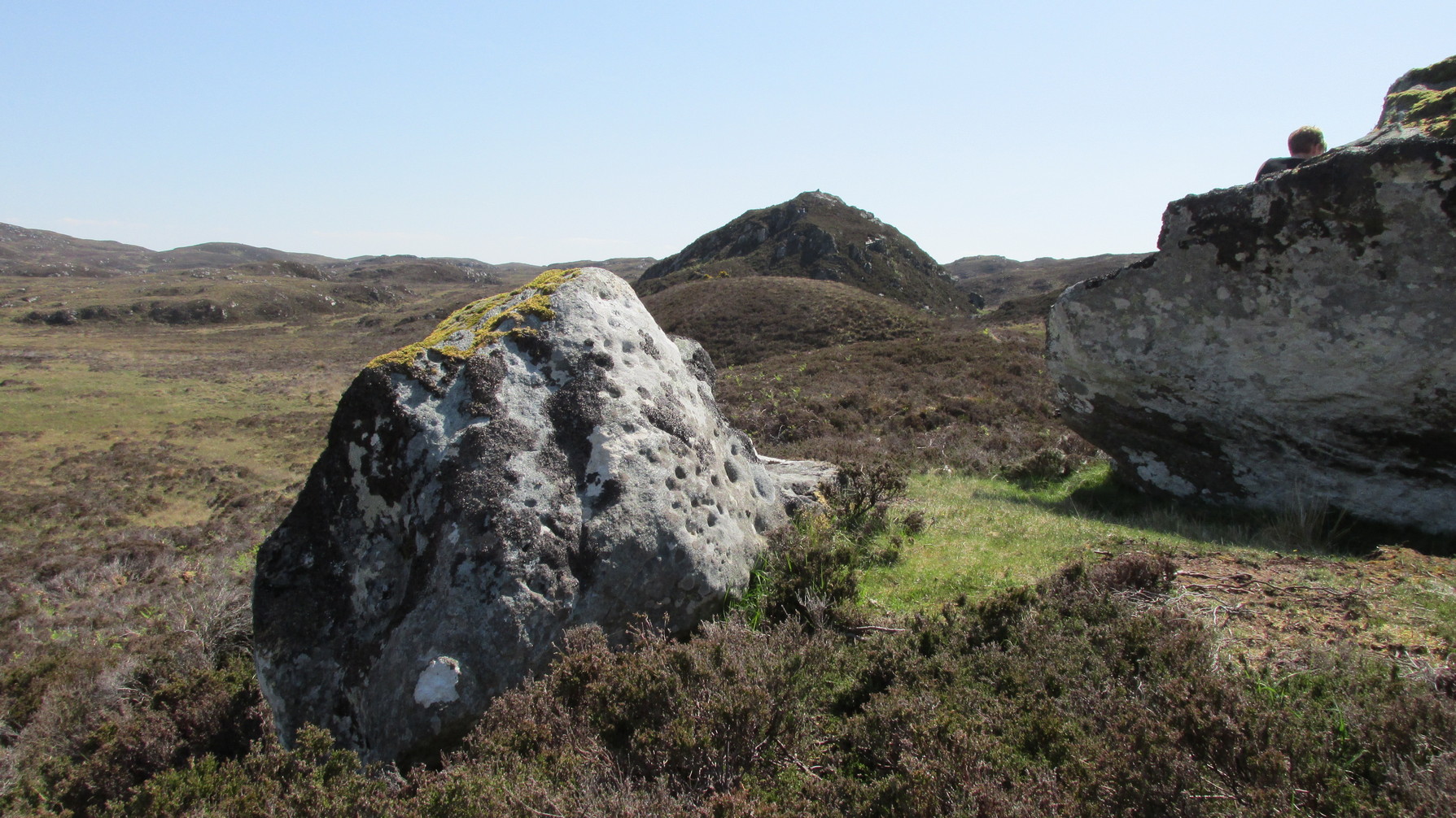
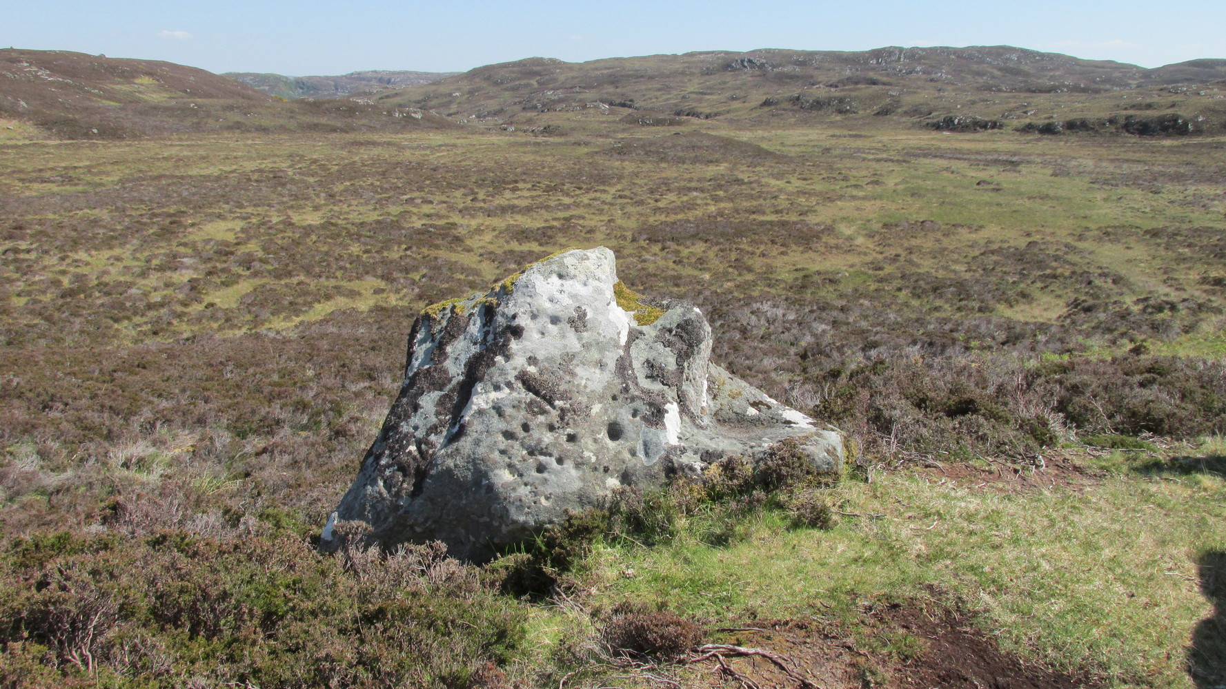
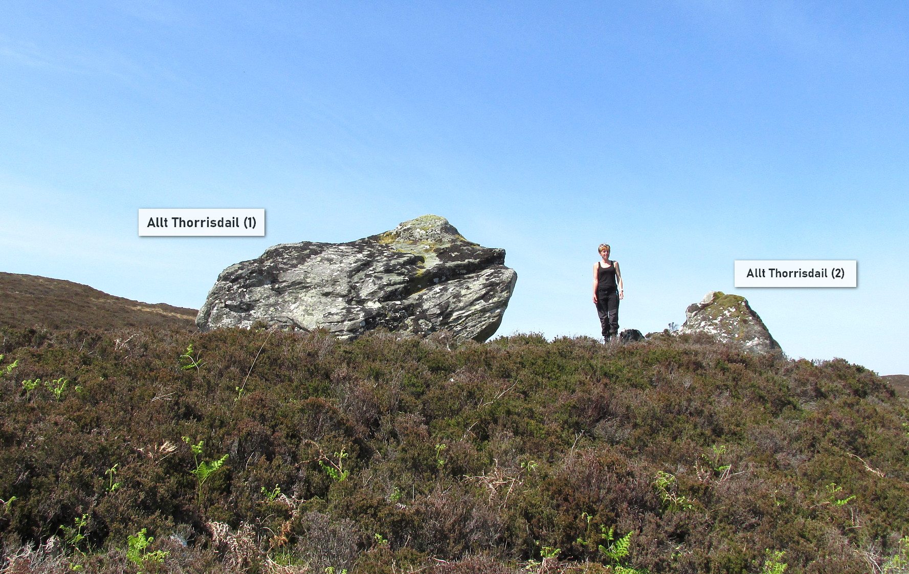
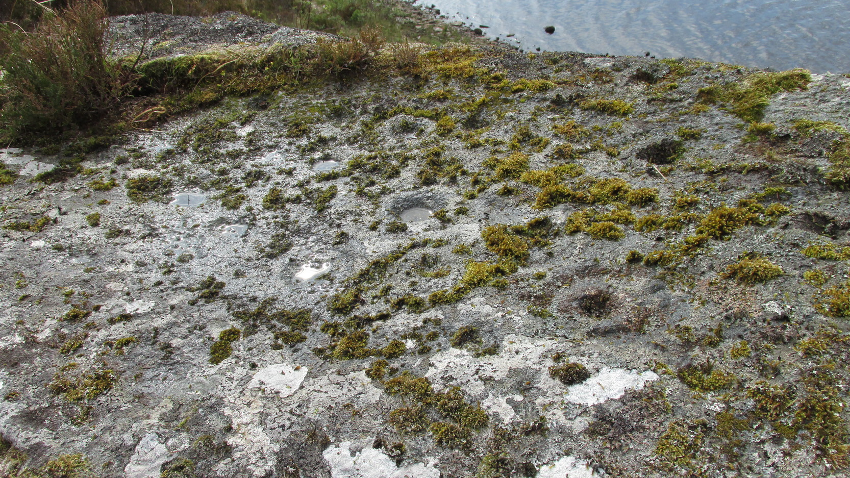
Simply follow the same directions as if you’re going to the Allt Thorrisdail (1) petroglyph, and the large, roughly oval-shaped boulder just a few yards away is the one you’re after. You can’t miss it!
Archaeology & History
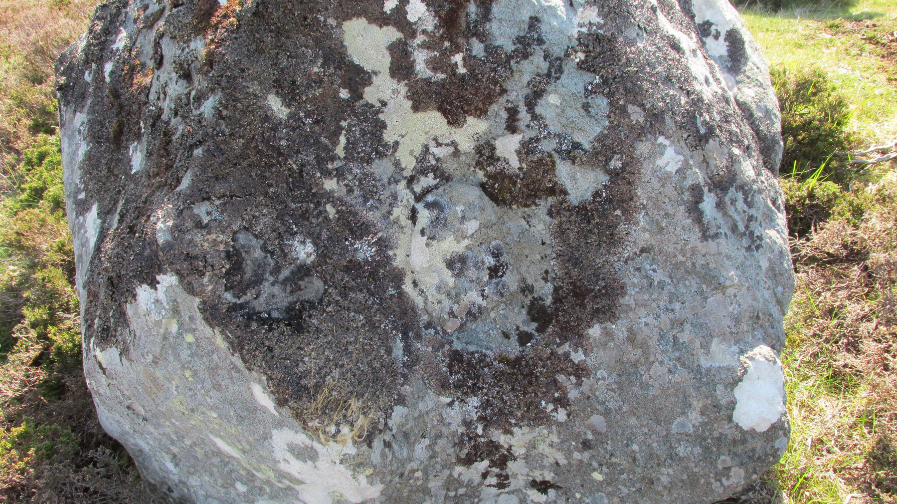
This large, earthfast, ovoid ball of rock has a series of cup-marks on three of its curvaceous faces, some of which seem to be natural, with a number of them “enhanced” by human hands at some time in the long long ago….
The main cluster of these cups can be found on its near-vertical western-face: an unusual feature in itself! There are several cups on its southern curve and, further round, low down on the east side of the rock we see a few more of them hiding away. These, too, seem to have been Nature’s handiwork, then enhanced by the hands of wo/men. The carving was described in Hew Morrison’s (1883) work as possessing two groups of cup-marks,
“similar to that on the neighbouring stone, one of eighteen small and one large cup, and another of eleven small marks. There is a solitary mark on the summit of this stone, and its southern face is marked by lines crossing each other, but without any apparent order or design.”
On its northern face we see a large oval hollow, an inch or so deep throughout, that has all the hallmarks of being a primitive face. There is a tradition of such a rock “face” carving somewhere close by, which seems to be lost—and this would seem to be culprit! If you visit the place, let us know what you think!
One feature that stands out at this site is the nearby pyramidal hill whch, I think, had some mythic relationship with the carvings. Impossible to prove, obviously, but the pyramid is such a dominant feature in this landscape that a relationship seems inevitable. I can only echo what I’ve said in the site profile for the adjacent carving here: tis a ritual place indeed – without any shadow of doubt. And I don’t say such things lightly. This place is truly superb!
References:
Mercer, R.J., Archaeological Field Survey in Northern Scotland 1976-1979, University of Edinburgh 1980.
Royal Commission on Ancient & Historical Monuments, Scotland, Second Report and Inventory of Monuments and Constructions in the County of Sutherland. HMSO: Edinburgh 1911.
Acknowledgements: Huge thanks to Sarah MacLean for her company and landscape knowledge in visiting this and other nearby antiquarian sites. And to Aisha Domleo, for getting me into this neck o’ the woods in the first place….where’er She may be….
Holy Well (lost): OS Grid Reference – NC 725 538 (approximation)
Archaeology & History
It would appear that there’s only one literary reference to this seemingly lost holy well, located halfway down megalithic Strathnaver, somewhere close to the legendary Loch ma Naire. James Horsburgh’s (1870) essay on the antiquities of this area mentioned it, almost in passing, in his description of the Dun Viden broch. He told that,
“Close to Dun Viden is Loch Manaar, where dozens of people come twice every year for the cure of diseases. They come before sunrise, bathe in the loch, walk round it, drink from a holy well (my emphasis), and throw some pieces of money into the loch. There is a legend about this loch, which I forget; but a woman was chased by a priest, and threw something in it, and called out that it was Loch Manaar—that is, the loch of my shame. “
The holy well is referred to in Historic Scotland’s Canmore entry, citing both the New Statistical Account and Name Books as referrals to the site, yet neither of them include this well in their surveys; it is only through Horbugh that we hear of this site—and we know not where it lived! In the event that it still exists, we’d expect it to be not more than 2-300 yards from the edge of Loch ma Naire; or perhaps it may be the source of the Loch ma Naire burn itself, nearly a mile to the east…. Seek and thee shalt find, as the old saying goes…
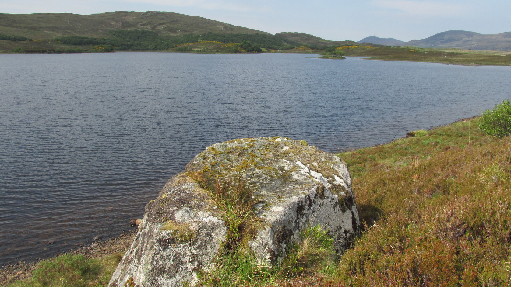
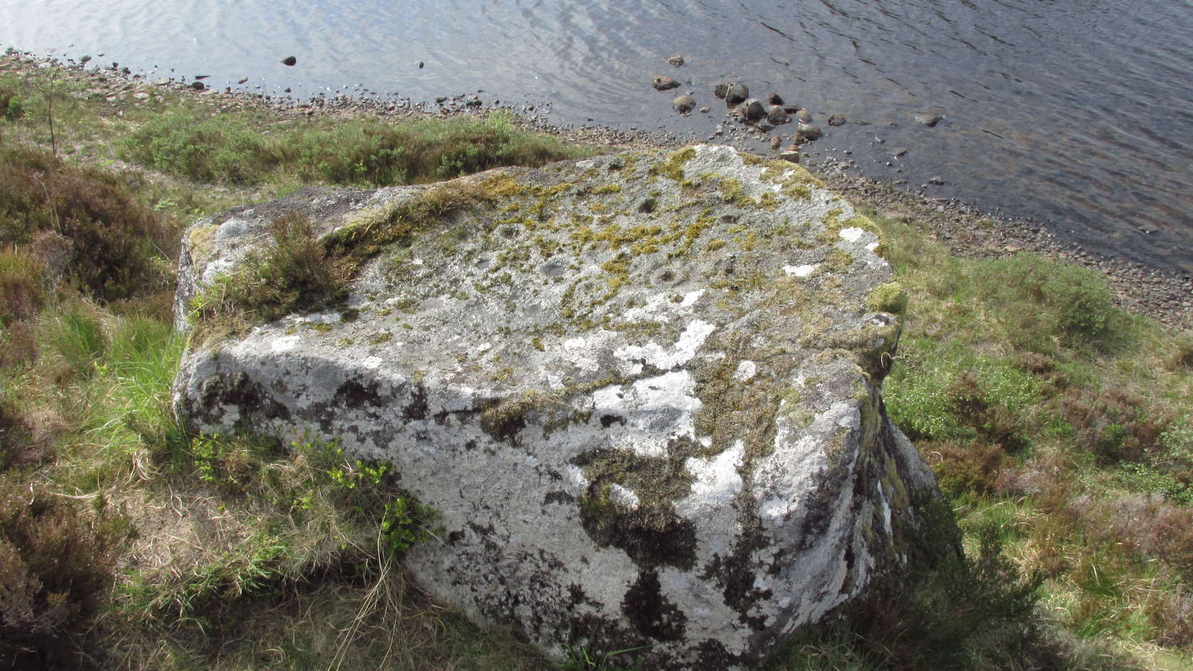
Roughly halfway between Bettyhill and Tongue on the A836 road, keep your eyes peeled for the sign to Skerray (4 miles) and travel down that road. About 1¾ mile on, take the tiny lane on your left up the slope for 0.6 miles (1km), and just before the sharp bend in the road (across a small bridge) there’s a gate on your left. Go thru here and follow the tiny path alongside the burn (stream) westwards for half-a-mile until where the waters become a bog within a wide oval bowl in the landscape. At the far-side you’ll see two large boulders sat above this watery bowl. That’s where you need to be!
Archaeology & History
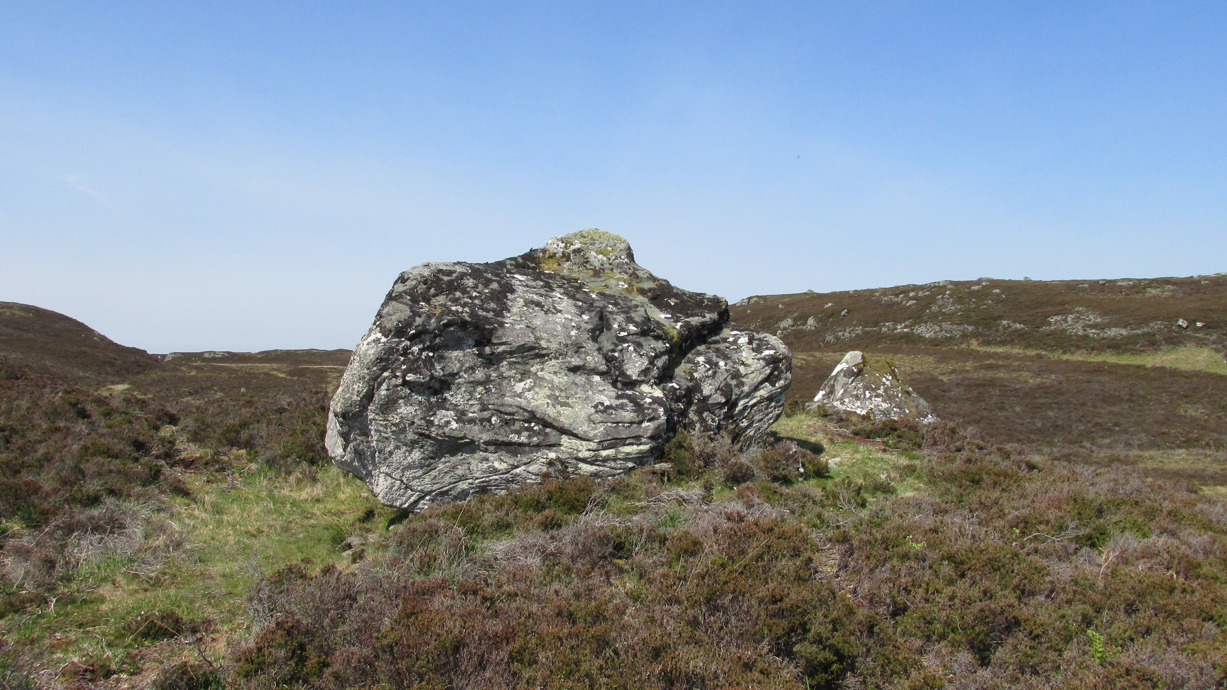
The big fella of the two
This is carving “number one” of two great incised boulders that are sat upon a natural ridge overlooking a dried-up lochan. An impressive spot that give a thoroughly distinct impression of altar stones above the sunken waters, from whence rites and proclamations were performed. It has that look and feel about it—and any animist would tell you the same. My hardcore dreams aside though…
This profile is for the larger of the two boulders that live here (Allt Thorrisdail 2 is here). It has very curious petroglyphic attributes—much like its compatriot—unlike many of those in these northern lands. The pair of them seem to have been described for the first time in Hew Morrison’s (1883) fine meanderings through the mythic history of the region. He told that,
“About a mile distant (from Torrisdale) two large cup marked boulders lie on the slope of a hill. The marks are disposed in groups of one large and nine smaller cups. On the larger boulder there are two of these groups and seven separate marks.”
There are slightly more than that, and this was pointed out when the Royal Commission (1911) lads came to see it:
“The largest boulder, that situated furthest west, is about 8 feet high and 14 feet in length. On its south side, chiefly on the flat and less abrupt face of the stone, are groups of cup-marks of from 2in to 3in in diameter, the deepest being about 1in in depth, while a number are now almost obliterated. The extent of the markings is not very definite, but there appear to be two groups containing about twelve cup-marks each.”
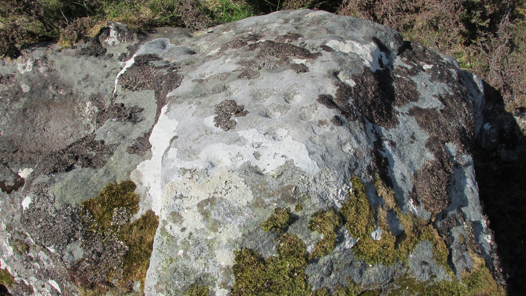
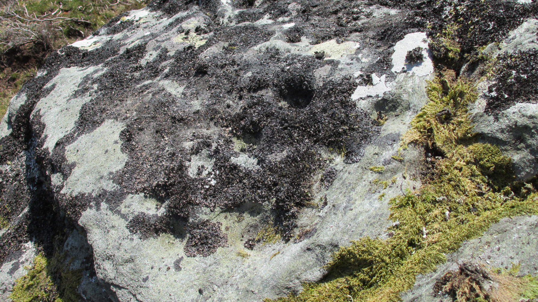
Another chorus of cupsLichen-dappled cupmarks
But this only tells of half the stone’s symbolic story. For on the vertical northern face of the rock, from just above ground-level, we have a distinct almost straight line of many cup-marks, going up diagonally, at an angle of about 35º. I took a number of photos of this aspect of the stone, but the covering of lichens didn’t highlight them clearly at all. When you’re stood looking at them they stand out like a sore thumb!
I have to be honest and say that I bloody well love this site! You have to paint the entire environment in the right light, as it was when the stone was first carved, surrounded by the scattered woodland of birch, pines and rowan all across where now we have stunning barren moorlands. Tis a ritual place indeed – without any shadow of doubt!
References:
Mercer, R.J., Archaeological Field Survey in Northern Scotland 1976-1979, University of Edinburgh 1980.
Royal Commission on Ancient & Historical Monuments, Scotland, Second Report and Inventory of Monuments and Constructions in the County of Sutherland. HMSO: Edinburgh 1911.
Acknowledgements: Huge thanks to Sarah MacLean for her company and landscape knowledge in visiting this and other nearby antiquarian remains. And to Aisha Domleo, for getting me into this neck o’ the woods.
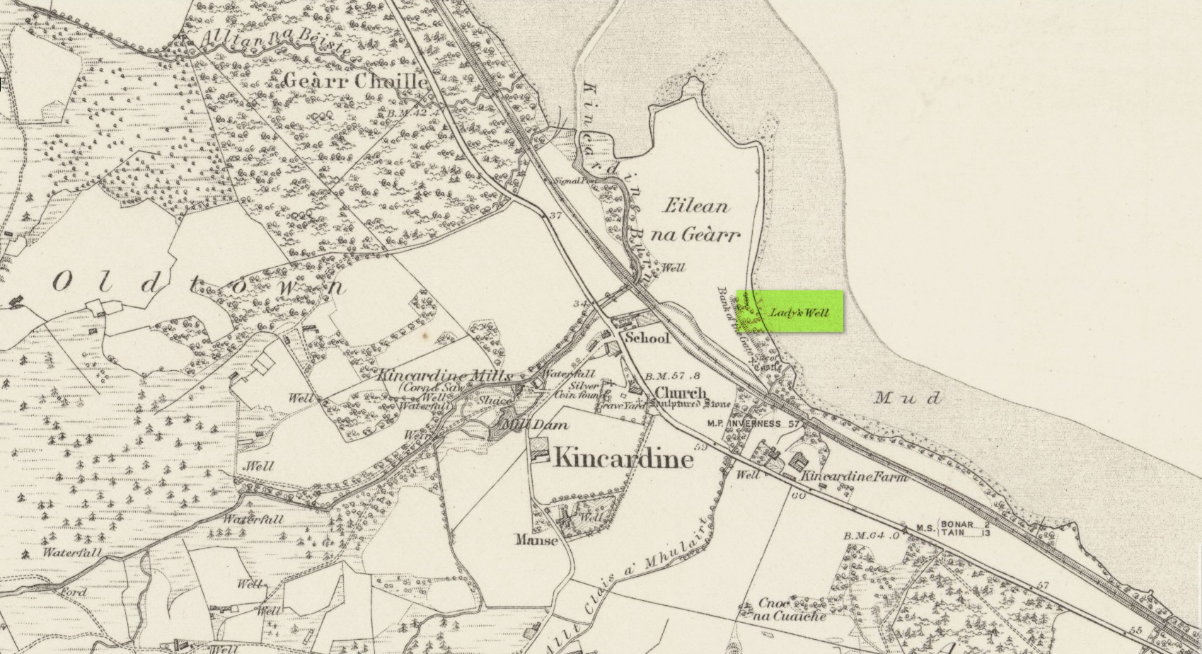
Holy Well (lost): OS Grid Reference – NH 6072 8954
Archaeology & History
Site shown on 1879 map
First highlighted on the 1879 Ordnance Survey map, information on this site is sparse, save for those reliable Statistical Accounts and Name Books, which simply give us its location. The only context that our Old Statistical lads gave us was its relationship and proximity to a castle, “the most ancient residence” of the Clan Ross Highland Chiefs which could “be seen in a beautiful field between the church and the sea side.” At the end of this field is “a steep bank, hanging over the sea at high water called the ‘Bank of the Gate’, and at the bottom there is a spring of excellent water, called the Lady’s Well.”
The water’s dedication to Our Lady was obviously grafted onto it by those in the church above, glossing over, no doubt, earlier dedications by local people, whose practices seem to have been lost. The site was included in the regional Name Book of the Ordnance Survey doods who, it seems, merely copied the notes about the place from the old Statistical Account. In what seems to have been their last visit, no trace of the well was evident. They concluded it “was under water at time of visit.”
It would be good to hear from local folk if this sacred site can still be found at the tree-line just above the sea, or whether Nature has taken it away from Her animals.
Acknowledgements: Big thanks for use of the early edition OS-map in this site profile, Reproduced with the kind permission of the National Library of Scotland.
Souterrain (lost): OS Grid Reference – NC 6601 6315
Archaeology & History
In the middle of the 19th century the opening to a prehistoric souterrain used to be in evidence on the north-side of the single track road running past old Skerray Mains house. It was mentioned in Hew Morrison’s (1883) historical guide, albeit briefly and without ambiguity:
“Below the house of Skerra Mains is an artificial cave that enters from below the road and extends 40 or 50 yards in length. Two urns were found it when it was discovered but they soon crumbled away on being exposed to the air.”
More than thirty years later, the Royal Commission (1911) lads ventured to check it out, only to find that it had just recently been covered up:
“At the farm of Skerray Mains is an earth-house, the mouth or entrance to which was recently exposed by the farmer. It is situated about 15 feet distant from the northeast window of the dwelling-house, and is now entirely covered over again.”
Of the old locals I met here, only one of them remembers hearing of it, but the precise location of its entrance had been forgotten. Surely it aint gonna be toooo difficult to find it again?
References:
Morrison, Alex, “Souterrains in Sutherland,” in J.R. Baldwin’s Province of Strathnaver, SSNS: Edinburgh 2000.
Royal Commission on Ancient & Historical Monuments, Scotland, Second report and inventory of monuments and constructions in the county of Sutherland. HMSO: Edinburgh 1911.
Take the directions to find the unusual and impressive West Strathan petroglyph, and keep following the road up past the carving until you reach the dead-end. A footpath takes you down to the river, where a rickety bridge takes you to the other side. From here, a footpath to your right goes up the slope at an easy angle and into the wilds ahead. Just a couple of hundred yards up, keeps your eyes peeled some 10-20 yards above you, to the left. It is a little difficult to see, and perhaps is better looked at from above the footpath, then looking down onto it. If you’re patient, you’ll find it!
Archaeology & History
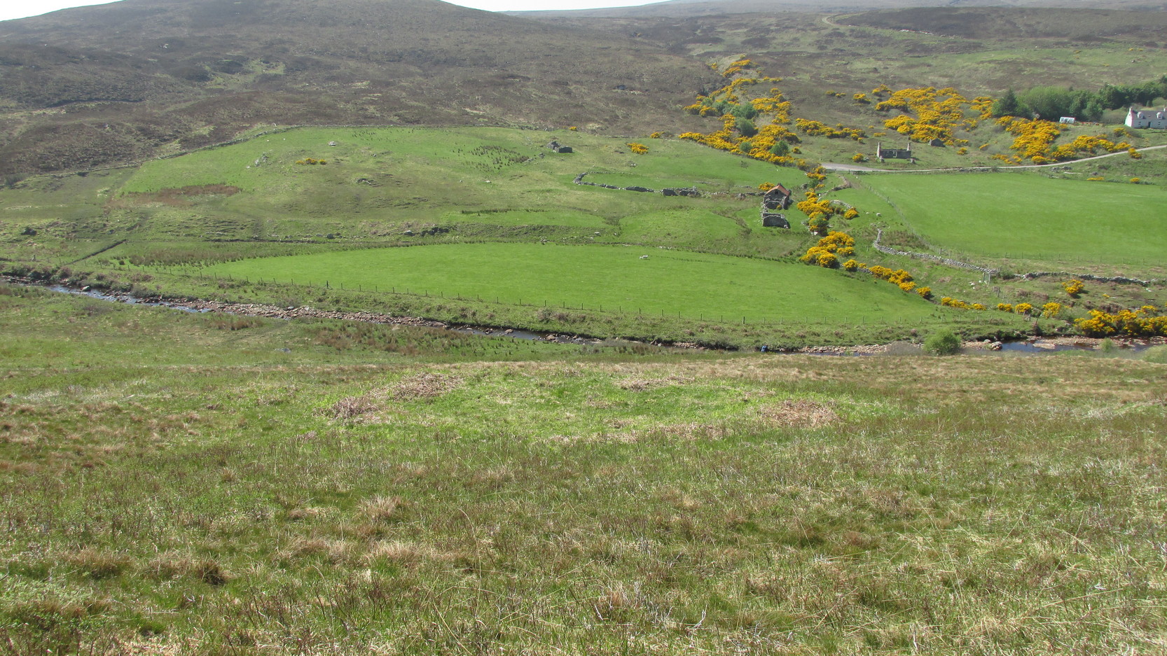
Stuck out on its own, way off the beaten track, this seemingly isolated ‘hut circle’—as it’s been officially termed—rests on a small level piece of land some 400 yards north from the ruins of Dalvraid’s chambered cairn. It’s nowt much to look at to be honest, and is probably only gonna be of interest to the hardcore antiquarians amongst you.
When I came here, the walling was mainly covered in dead bracken and internally is a veritable lawn!—but it was pretty easy to make out. Slightly ovoid in form, with its entrance on the southern side, the circle is 10 yards across; and the although the low walling is barely a yard high on three sides, on the eastern section the natural slope was dug into to create a higher wall on that side.
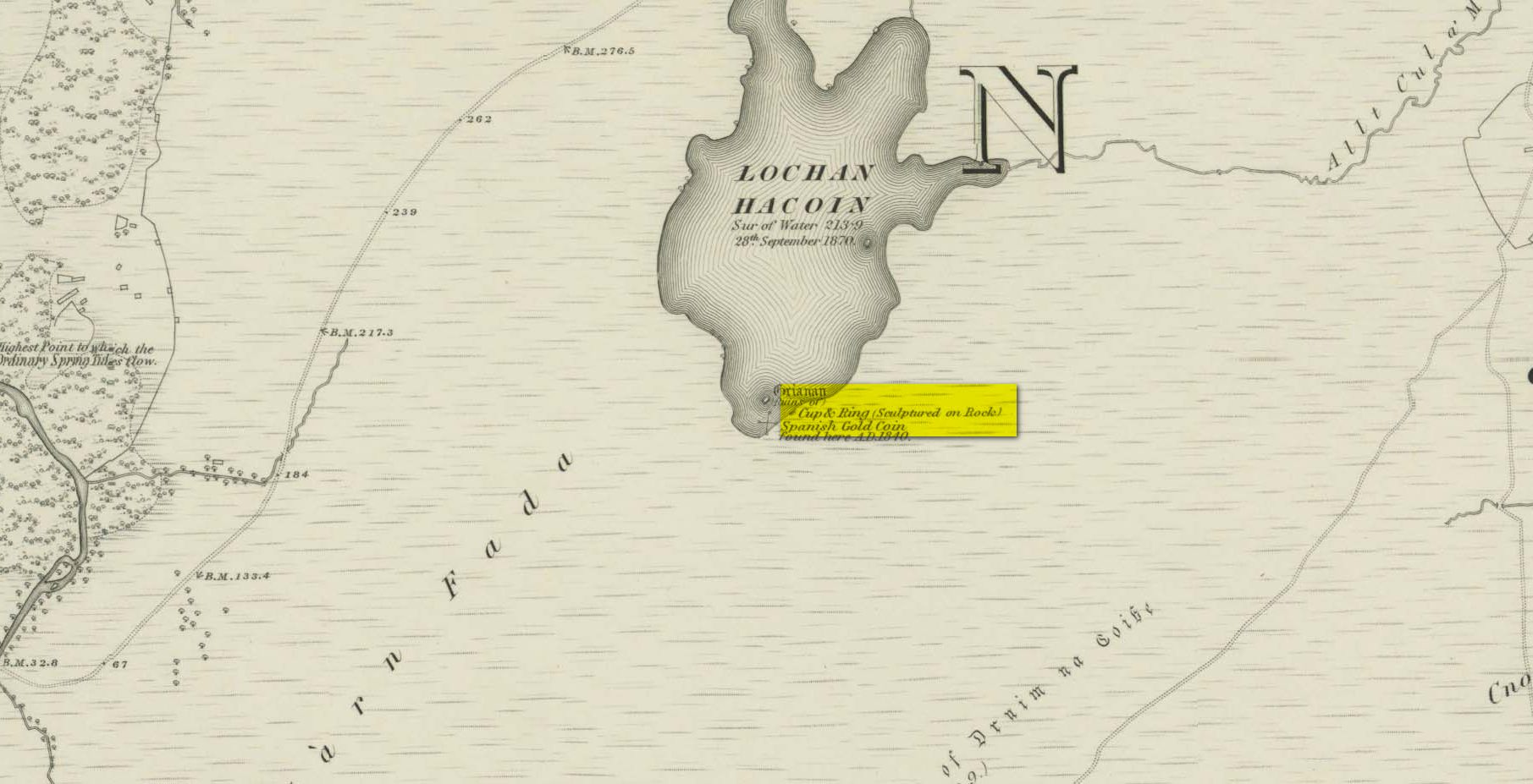
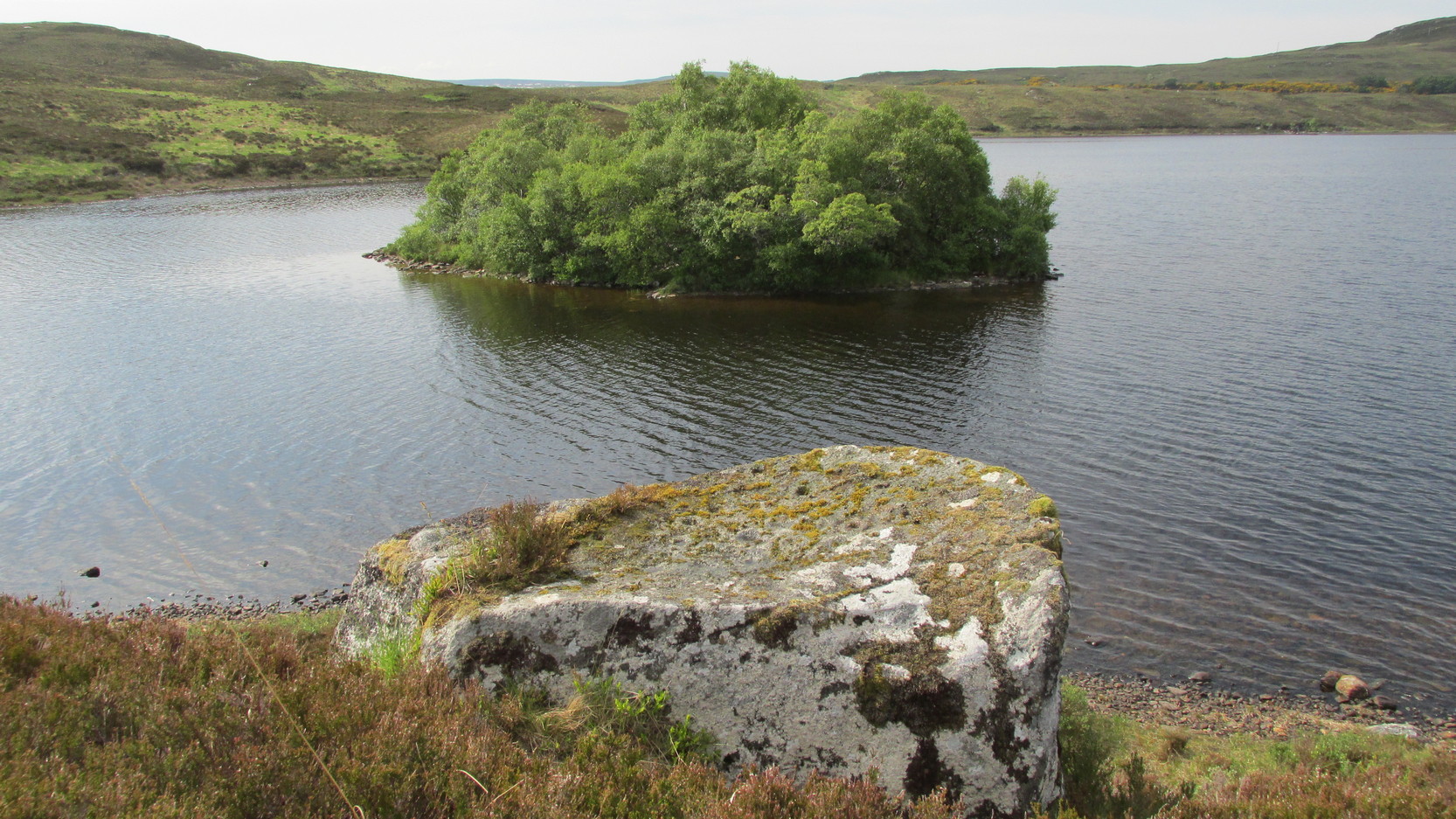
Whether you take the A836 or A838 into Tongue (through truly beautiful wilderness), make sure you go into the village itself—and then keep going, south, along the tiny country road. Nearly 2½ miles along, note the small loch of Lochan na Cuilce on your right. A few hundred yards past this, on the other side of the road (barely visible at first) is Lochan Hakel. Walk around to the south-side of the loch until you find the Lochan Hakel 1 carving. Then look up at the rock right above you. That’s the one!
Archaeology & History
In James Simpson’s (1867) primary work on British petroglyphs, he mentions this site as being in the lands of “Ribigill, near Tongue”, although it is a little further to the south. He said that a certain “Mr Mitchell” had come across it in one of his many rambles in the hills (this was probably Arthur Mitchell, author of the 1880 book, The Past in the Present). Simpson told that he had:
“discovered cups and circles upon a large stone, about nine feet square, apparently lying in its original position, close to the edge of a loch, which contains the remains of an old castle… The surface of the stone shows eighteen or twenty round cup excavations, about an inch deep. There is a ring of ‘hollow around each cup.'”
Although there aren’t rings around every cup, a great number of clear and impressive rings exist around many of them and are, thankfully, still reasonably visible amidst the mass of lichens.
Around the same time as Mr Simpson’s description, James Horsburgh (1868) wrote about the carving, telling us:
The rock and its islandSome of the cup-and-rings
“On the edge of the precipitous bank of the loch, and exactly opposite the island, there is a large boulder with a flat top, and on this there are a number of cups and rings… This stone is not generally known. Old Ross, the gamekeeper at Tongue, first told me of it, and he and I scraped off the moss and exposed the whole. He thought it was for playing some game. On the left of the stone, on a bit separated by a crack, there is a sort of a figure which appears to have been formed by cutting away the stone around it and leaving it in relief, and also some artificial cutting on the right, a sort of circular groove.”
A better description of the carving came near the beginning of the 20th century, when the Scottish Royal Commission (1911) lads included the site in their inventory. They told:
From the rock, looking NThe carving from above
“At the S end of Lochan Hacoin, to the SE of the islet on the top of the bank, is a large earth-fast boulder, on the flat upper surface of which are a number of cup and ring marks placed irregularly over it. The total number of undoubted markings is thirty-four, of which those surrounded by a ring number eleven. No cup with a double ring round it is observable. The best defined cup-mark measures 3″ across by 1¼” deep, and the enclosing ring is 7″ in diameter. Eight of the markings are well defined; the others less noticeable. At the S end there is a boss or projection, roughly rectangular, measuring 12″ x 6″. A sketch of this stone, made about the year 1866 by Mr James Horsburgh, is preserved in the library of the Society of Antiquaries of Scotland.”
Does anyone know if this drawing still exists? Anyhow, whilst you’re stood here looking at this petroglyph, don’t forget to look at the other one on the rock below you closer to the loch-side.
Folklore
In Horsburgh’s essay on the prehistoric remains of the area, he said how local people told that the cup-and-rings “were made by the high heels of a fairy who lived in the castle” on the island of Grianan, just 40 or 50 yards away.
References:
Close-Brooks, Joanna, Exploring Scotland’s Heritage: The Highlands, HMSO: Edinburgh 1995.
o’ Reilly, Kevin, What to See Around the Kyle of Tongue, privately printed 1980.
Royal Commission on Ancient & Historical Monuments & Constructions of Scotland, Inventory of Monuments and Constructions in the County of Sutherland., HMSO: Edinburgh 1911.
Simpson, James, Archaic Sculpturings of Cups, Circles, etc., Upon Stones and Rocks in Scotland, England and other Countries, Edmonston & Douglas: Edinburgh 1867.
Acknowledgments: Huge thanks to Sarah MacLean for guiding me to this carving, and also for the kind use of her photos in this site profile. Cheers Sarah! And to Donna Murray again, for putting up with me whilst in the area! Also – Huge thanks for use of the 1st edition OS-map in this site profile, Reproduced with the kind permission of the National Library of Scotland.
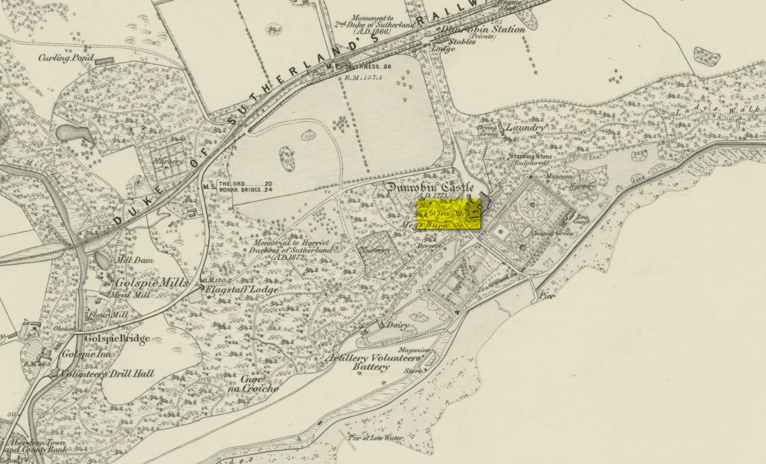
Very little has been written of this site due to the fact that little seems to known about it. A few of the usual ‘official’ on-line catalogues mention it but information on the site is truly scant. It is shown on the earliest Ordnance Survey map of the region and the same cartographers describe it in the Ordnance Name Book (1873), saying briefly how St John’s Well,
“Applied to a very deep pump well situated in the court of the ancient portion of “Dunrobin Castle”. No information respecting the dedication or origin of this name can be obtained in the District.”
But an earlier reference than this is cited in Fraser’s (1892) work, telling us that,
“In the midst of the court within the castle there is one of the deepest draw-wells in Scotland, all lined with ashlar-work, which was built and finished before the house was begun. The well was known as that of St. John. In the year 1512 sasine (i.e. delivery of feudal property) of the earldom and castle was taken at the well. At other times sasine was taken at the castle, at its gates, or near the well.”
Subsequent to this, we read in Cumming’s (1897) definitive folklore work of the region how,
“(it) looks as if there had been a chapel of St. John on Drumrabyn. In that case it may have been one dependent upon Kileain (=Kirk of John) on Loch Brora, which was only ½ a mile further than Kilmalin.”
Having not visited the castle, I’m unsure whether or not the well can still be seen. Does anyone know…?
Fraser, William, The Sutherland Book – volume 1, Edinburgh 1892.
Acknowledgements: Big thanks for use of the 1st edition OS-map in this site profile, Reproduced with the kind permission of the National Library of Scotland.
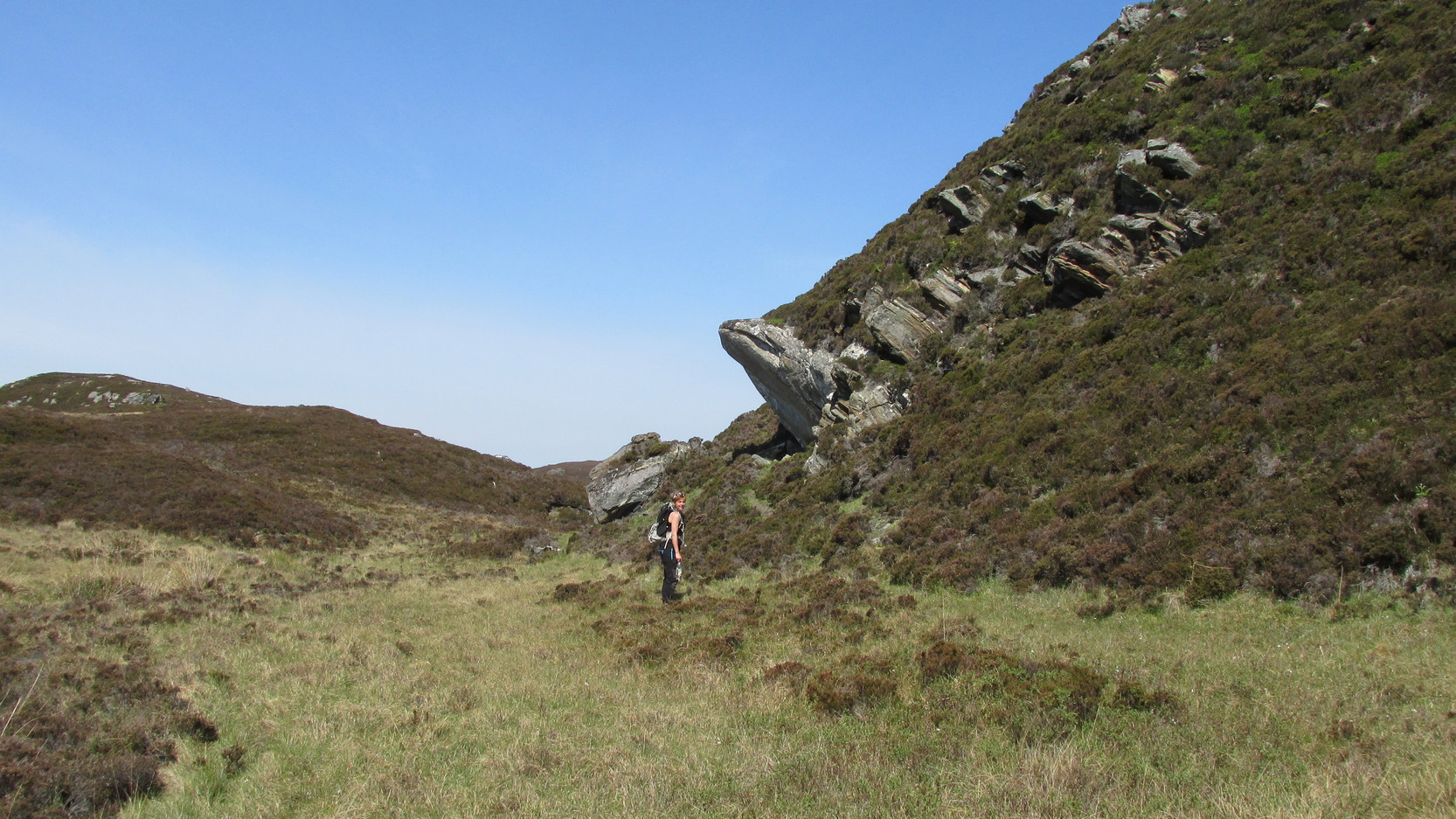
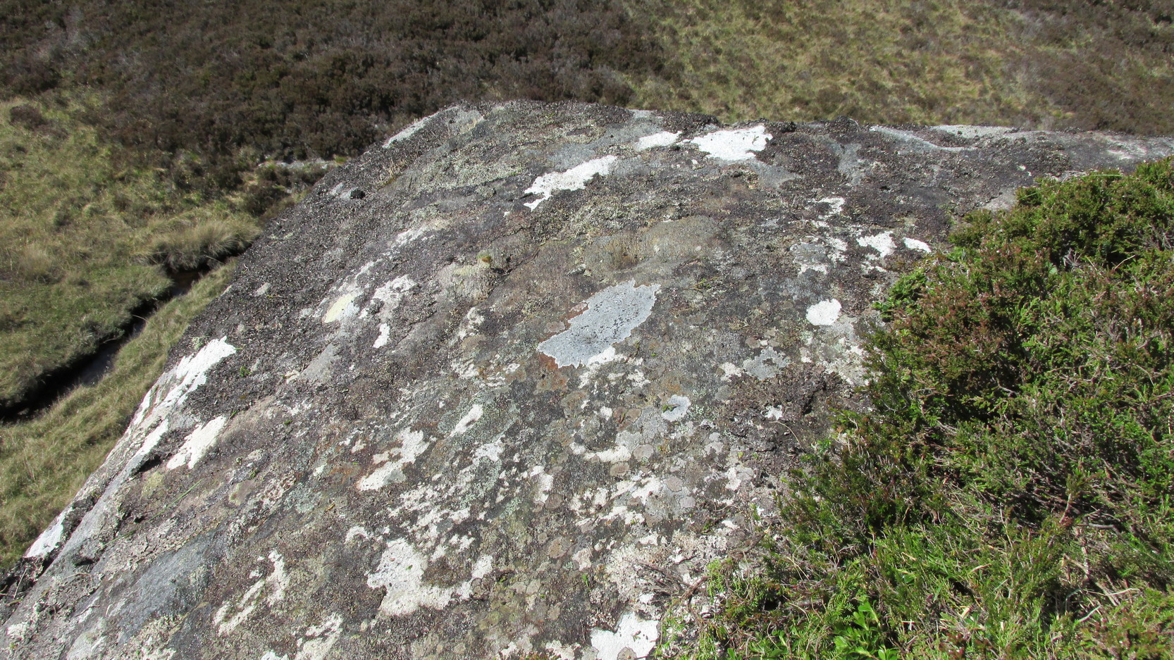
Difficult to reach, this large protruding rock on the west side of Thorrisdail Hill, was known as the Thorrisdail Stone in the old boundary records. It’s a bittova giveaway when you find it, as its name is inscribed on the lower face of the stone – etched a century or two ago by the look of it.
Thorrisdail Stone, with Sarah stood belowOne of the cupmarks highlighted, upper middle
It’s a difficult rock to climb upon if you aren’t used to such things – and you need to do this if you want to see the cupmarks; although they’re hardly worth seeing unless you’re a petroglyph freak! If you go to the trouble so see them, make sure to squat down carefully, being even more careful not to fall off (you’re screwed if y’ do). Once in position, you’ll see between three and five very faint shallow cups etched onto its flat surface. You can just make one of them out in the photo here. The more impressive thing to see here is the small standing stone that seems to artificially crown the top of the rounded hill to which the Thorrisdail Stone is attached.
Acknowledgements: Huge thanks to Sarah MacLean for her company and landscape knowledge in visiting this and other nearby antiquarian remains. And to Aisha Domleo, for getting me into this neck o’ the woods.