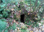
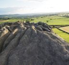
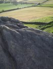
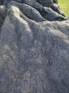
Almscliffe Crag carving, North Rigton, North Yorkshire

Cup-and-Ring Stone:  OS Grid Reference – SE 26777 48952

Also Known as:

  1. Ormscliffe Crags

Getting Here

Almscliffe’s cup-&-ring

This is an outstanding site visible for miles around in just about every direction – so getting here is easy! If you’re coming from Harrogate, south down the A658, turn right and go thru North Rigton.  Ask a local.  If you’re coming north up the A658 from the Leeds or Bradford area, do exactly the same! (either way, you’ll see the crags rising up from some distance away)  As you walk to the main crags, instead of going to the huge central mass, you need to follow the line of walling down (south) to the extended cluster of much lower sloping rocks.  Look around and you’ll find it!

Archaeology & History

On the evening of May 27, 2024, I received a phone call from a Mr James Elkington of Otley.  He was up Almscliffe Crags and the wind was howling away in the background, taking his words away half the time, breaking the sentences into piecemeal fragments.  But through it all came a simple clarity: as the sun was setting and the low light cut across the rocky surface, a previously unrecorded cup-and-ring design emerged from the stone and was brought to the attention of he and his compatriot Mackenzie Erichs.  All previous explorations for rock art here over the last 150 years had proved fruitless—until now!

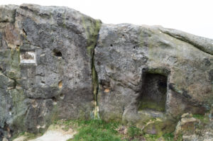
Looking northwest
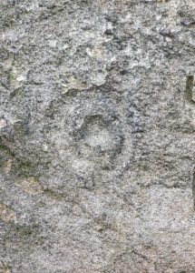
Central cup-&-ring

On the east-facing slope of the stone, just below the curvaceous wind-and-rain hewn shapes at the very top of the boulder, is a singular archetypal cup-and-ring.  It’s faint, as the photos show, but it’s definitely there.  What might be another cup-and-ring is visible slightly higher up the sloping face, but the site needs looking at again when lighting conditions are just right! (you can just about make it out in one of the photos)  But, at long last, this giant legend-infested mass of Almscliffe has its prehistoric animistic fingerprint, bearing fruit and giving watch to the countless heathen activities going back centuries.  Rombald’s wife Herself might have been the mythic artist of this very carving! (if you want to read about the many legends attached to the major Almscliffe rock outcrop, check out the main entry for Almscliffe Crags)

References:

  1. Bennett, Paul, “Almscliffe Crags, North Rigton,” Northern Antiquarian 2010.

© Paul BennettThe Northern Antiquarian

Holy Well, Strathnaver, Farr, Sutherland

Holy Well (lost):  OS Grid Reference – NC 725 538 (approximation)

Archaeology & History

It would appear that there’s only one literary reference to this seemingly lost holy well, located halfway down megalithic Strathnaver, somewhere close to the legendary Loch ma Naire.  James  Horsburgh’s (1870) essay on the antiquities of this area mentioned it, almost in passing, in his description of the Dun Viden broch.  He told that,

“Close to Dun Viden is Loch Manaar, where dozens of people come twice every year for the cure of diseases.  They come before sunrise, bathe in the loch, walk round it, drink from a holy well (my emphasis), and throw some pieces of money into the loch.  There is a legend about this loch, which I forget; but a woman was chased by a priest, and threw something in it, and called out that it was Loch Manaar—that is, the loch of my shame. “

The holy well is referred to in Historic Scotland’s Canmore entry, citing both the New Statistical Account and Name Books as referrals to the site, yet neither of them include this well in their surveys; it is only through Horbugh that we hear of this site—and we know not where it lived!  In the event that it still exists, we’d expect it to be not more than 2-300 yards from the edge of Loch ma Naire; or perhaps it may be the source of the Loch ma Naire burn itself, nearly a mile to the east….  Seek and thee shalt find, as the old saying goes…

References:

  1. Horsburgh, James, Notes of Cromlechs, Duns, Hut-circles, Chambered Cairns and other Remains, in the County of Sutherland“, in Proceedings Society of Antiquaries, Scotland, volume 7, 1870

© Paul BennettThe Northern Antiquarian


Little Almscliffe Crags, Stainburn, North Yorkshire

Legendary Rocks:  OS Grid Reference – SE 23237 52275

Also Known as:

  1. Little Almes Cliffe
  2. Little Almias Cliff Crag

Getting Here

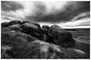
Little Almscliffe Crag (photo – James Elkington)

Coming from Harrogate, take the B6162 and B6161 road to Beckwithshaw, through the village and, 4-500 yards on, turn right onto Norwood Lane.  2 miles along, keep your eyes peeled on your left for a gravelled parking spot and you’ll see the large rock outcrop 200 yards south of the road. …Otherwise, from Otley: go over the river bridge and turn right up Farnley Lane and follow the B6451 for a few miles, thru Farnley village up the Washburn valley, past Norwood and at Bland Hill, turn right along Broad Dubb Road for 1¾ miles where you’ll reach that same gravelled parking spot.

Archaeology & History

Very much the ‘little brother’ of Great Almscliffe, 3 miles (4.83km) to the southeast, this site would be more of interest to the travelling geologist, perhaps, than to antiquarians.  But that depends what tickles y’ fancy I s’ppose.

In 1702 when the northern antiquarian Ralph Thoresby mentioned this and its big brother to the southeast, he described the “two famous crags of Almes Cliff—in some old writings called Aylmoys ut dicitur—but have seen nothing memorial of it, saving its remarkable lofty situation.”  He missed the cup-and-ring carving on the east-side of the crags, obviously, which indicates that it had some form of animistic sanctity in ancient times.

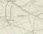
The location on 1851 map
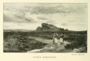
Little Almscliffe c.1900

Little Almscliffe was one of many impressive places located within the ancient Forest of Knaresborough; and although it wasn’t on the original boundary line, a perambulation (i.e., annual ritual walking to the old stones, trees and wells defining the region) of the area written in 1770, in what Mr Grainge called “the Copyhold Forest”, was undertaken by the Enclosure Commissioners.  It differed from the more ancient perambulation rite, in that the newer one included a mention of,

“five bounder stones also marked F to an earth-fast stone, lying northeast of Little Almes Cliffe, marked also with an F; (and) from thence by other four bounder stones marked F to Sandwith Wath…”

The letter ‘F’ here signifying the word ‘forest’, as in the Forest of Knareborough.

William Grainge (1871) also believed these crags to have been a place of druidic worship.  He wasn’t the only one.  Many other writers of the time thought the same thing; and although we have no concrete evidence to prove this, it is highly likely that these rocks would have served some ritual purpose in pre-christian days.  Certainly in more recent times (during the 1980s and ’90s) we know that ritual magickians used this site for their workings.  On a more mundane level, the crags were previously used as a site for for beacon fires.  One was erected here in 1803 when the first Bonaparte threatened to invade England; but I can find no written accounts of earlier beacons here.

References:

  1. Bennett, Paul, The Old Stones of Elmet, Capall Bann: Milverton 2001.
  2. Bogg, Edmund, From Eden Vale to the Plains of York, James Miles: Leeds 1895.
  3. Bogg, Edmund, Higher Wharfeland, James Miles: Leeds 1904
  4. Cowling, E.T., Rombald’s Way, William Walker: Otley 1946.
  5. Grainge, William, History & Topography of Harrogate and the Forest of Knaresborough, J.R. Smith: London 1871.
  6. Parkinson, Thomas, Lays and Leaves of the Forest, Kent & Co.: London 1882.

© Paul BennettThe Northern Antiquarian 

Little Almscliffe, Stainburn, North Yorkshire

Cup-and-Ring Stone:  OS Grid Reference – SE 23242 52260

Also Known as:

  1. Little Almes Cliffe
  2. Little Almias Cliff Crag

Archaeology & History

Little Almscliffe Crag (photo by James Elkington)

The crags of Little Almscliffe are today peppered with many modern carvings, such as are found on many of our northern rock outcrops.  Yet upon its vertical eastern face is a much more ancient petroglyph – and one that seems to have been rediscovered in the middle of the 20th century.  When the great northern antiquarian William Grainge (1871) visited and wrote of this place, he told us that, “the top of the main rock bears…rock basins and channels, which point it out as having been a cairn or fire-station in the Druidic days; there are also two pyramidal rocks with indented and fluted summits on the western side of the large rock” – but he said nothing of any prehistoric carvings. Curiously , neither the great historian Harry Speight or Edmund Bogg saw anything here either.

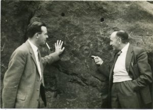
Stuart Feather & Joe Davies here, c.1955
Cup&Ring, left of ‘door’ (photo by James Elkington)

This singular cup-and-ring design seems to have been reported first in E.S. Wood’s (1952) lengthy essay on the prehistory of Nidderdale. It was visited subsequently by the lads from Bradford’s Cartwight Hall Archaeology Group a few years later; and in the old photo here (right) you can see our northern petroglyph explorer Stuart Feather (with the pipe) and Joe Davis looking at the design.  In more recent times, Boughey & Vickerman (2003) added it in their survey of, telling briefly as usual:

“On sheltered E face of main crag above a cut-out hollow like a doorway is a cup with a ring; the top surface of the rock is very weathered and may have had carvings, including a cupless ring.”

Close up of design

Indeed… although the carving is to the left-side of the large hollow and not above it.  Scattered across the topmost sections of the Little Almscliffe themselves are a number of weather-worn cups and bowls, some of which may have authentic Bronze age pedigree, but the erosion has taken its toll on them and it’s difficult to say with any certainty these days.  But it’s important to remember that even Nature’s ‘bowls’ on rocks was deemed to have importance in traditional cultures: the most common motif being that rain-water gathered in them possessed curative properties.

References:

  1. Bennett, Paul, The Old Stones of Elmet, Capall Bann: Milverton 2001.
  2. Bogg, Edmund, From Eden Vale to the Plains of York, James Miles: Leeds 1895.
  3. Bogg, Edmund, Higher Wharfeland, James Miles: Leeds 1904
  4. Cowling, E.T., Rombald’s Way, William Walker: Otley 1946.
  5. Grainge, William, History & Topography of Harrogate and the Forest of Knaresborough, J.R. Smith: London 1871.
  6. Parkinson, Thomas, Lays and Leaves of the Forest, Kent & Co.: London 1882.

Acknowledgements:  Huge thanks to James Elkington for use of his fine photos on this site.

© Paul BennettThe Northern Antiquarian

St. Bride’s Well, London, Middlesex

Holy Well (covered):  OS Grid Reference – TQ 3157 8111

Archaeology & History

St Brides Well on 1896 map

Close to the centre of that corporate money-laundering place of homo-profanus that is the City of London, was once a site that represents the antithesis of what it has become.  Tacked onto the southeastern side of St. Bride’s church along the appropriately-named Bride Lane, the historian Michael Harrison (1971) thought the Holy Well here had Roman origins.  It “was almost certainly,” he thought,

“in Roman times, the horrea Braduales, named after the man who probably ordered their construction: Marcus Appius Bradua, Legate of Britain under Hadrian, and the British Governer in whose term of office the total walling of London was, in all likelihood, begun.”

This ‘Roman marketplace of Bradua’ that Harrison describes isn’t the general idea of the place though.  Prior to the church being built, in the times of King John and Henry III, the sovereigns of England were lodged at the Bridewell Palace, as it was known.  Mentioned in John Stow’s (1720) Survey of London, he told:

“This house of St. Bride’s of later time, being left, and not used by the Kings, fell to ruin… and only a fayre well remained here.”

The palace was eventually usurped by the building of St. Bride’s church.  The most detailed account we have of St. Bride’s Well is Alfred Foord’s (1910) magnum opus on London’s water supplies.  He told:

“The well was near the church dedicated to St. Bridget (of which Bride is a corruption; a Scottish or Irish saint who flourished in the 6th century), and was one of the holy wells or springs so numerous in London, the waters of which were supposed to possess peculiar virtues if taken at particular times.  Whether the Well of St. Bride was so called after the church, or whether, being already there, it gave its name to it, is uncertain, more especially as the date of the erection of the first church of St. Bride is not known and no mention of it has been discovered prior to the year 1222.  The position of the ancient well is said to have been identical with that of the pump in a niche in the eastern wall of the churchyard overhanging Bride Lane.  William Hone, in his Every-Day Book for 1831, thus relates how the well became exhausted: ‘The last public use of the water of St. Bride’s well drained it so much that the inhabitants of the parish could not get their usual supply.  This exhaustion was caused by a sudden demand on the occasion of King George IV being crowned at Westminster in July 1821.  Mr Walker, of the hotel No.10 Bridge Street, Blackfriars, engaged a number of men in filling thousands of bottles with the sanctified fluid from the cast-iron pump over St. Bride’s Well, in Bride Lane.”  Beyond this there is little else to tell about the well itself, but the spot is hallowed by the poet Milton, who, as his nephew, Edward Philips records, lodged in the churchyard on his return from Italy, about August 1640, “at the house of one Russel a taylor.”

In Mr Sunderland’s (1915) survey, he reported that “the spring had a sweet flavour.”

Sadly the waters here have long since been covered over.  A pity… We know how allergic the city-minds of officials in London are to Nature (especially fresh water springs), but it would be good if they could restore this sacred water site and bring it back to life.

Folklore

Bride or Brigit has her origins in early British myth and legend, primarily from Scotland and Ireland.  Her saint’s day is February 1, or the heathen Imbolc (also known as Candlemas).  Although in christian lore St. Bride was born around 450 AD in Ireland and her father a Prince of Ulster, legend tells that her step-father (more probably a teacher) was a druid and her ‘saintly’ abilities as they were later described are simply attributes from this shamanic pantheon. Legends—christian and otherwise—describe Her as the friend of animals; possessor of a magickal cloak; a magickian and a healer; and whose ‘spirit’ or genius loci became attached to ‘sacred sites’ in the natural world, not the christian renunciation of it.  St Bride was one of the primal faces of the great prima Materknown as the Cailleach: the Gaelic deity of Earth’s natural cycles, whose changing seasons would also alter her names, faces and clothes, as Her body moved annually through the rhythms of the year.  Bride was (and is) ostensibly an ecological deity, with humans intrinsically a part of such a model, not a part from it, in contrast to the flawed judaeo-christian theology.

References:

  1. Foord, Alfred Stanley, Springs, Streams and Spas of London: History and Association, T. Fisher Unwin: London 1910.
  2. Gregory, Lady, A Book of Saints and Wonders, Colin Smythe: Gerrards Cross 1971.
  3. Harrison, Michael, The London that was Rome, Allen & Unwin: London 1971.
  4. McNeill, F. Marian, The Silver Bough – volume 2, William MacLellan: Glasgow 1959.
  5. Morgan, Dewi, St Bride’s Church, Fleet Street, in the City of London, Blackfriars: Leicester 1973.
  6. o’ Hanlon, John, Life of St. Brigid, Joseph Dollard: Dublin 1877.
  7. Sunderland, Septimus, Old London Spas, Baths and Wells, John Bale: London 1915.

© Paul BennettThe Northern Antiquarian


Our Lady’s Well, Stirling, Stirlingshire

Holy Well (destroyed):  OS Grid Reference – NS 7932 9454 

Also Known as:

  1. Whiskey Well
  2. Whusky Well

Archaeology & History

Fleming's 1898 drawing of Our Lady Well

Fleming’s 1898 drawing of Our Lady Well

Once found beneath the northern foot of Gowan Hill, below the old hillfort and close to Stirling’s famous castle, the Industrialists, as usual, built over and destroyed this piece of ancient heritage in the 20th century, leaving us only a few words and an old drawing to remember it by.  It was one of several holy wells in and around Stirling, most of which have fallen prey to the same scavengers in the march they call ‘progress.’

Thankfully the local writer J.S. Fleming’s (1898) talked about the well in his fine work, where he told:

“This Well is situated at the foot of the Gowan Hills, and adjacent to the skating pond, as shown in (the) sketch.  Though part of the waters of this Well have been abstracted, and led, by means of a pipe, to a neighbouring factory, it still gives off a considerable flow of water.  The local name, “Whusky Well” is supposed to be given this Well on account of the virtues of its waters for mixing with whisky, without any perceptible deterioration of the latter.  We can find no allusion to this Well in any of the Burgh Records, and Dr. Rogers gives no reason for its dedication to the Virgin Mary.  We do know, however, that “St. James’s Chapel of the Crag” was situated only 200 or 300 yards distant, and is referred to frequently as receiving alms from King James IV, especially on 26th July, 1496, of 14s.  We learn from a charter by Robert III to the Canon of Cambuskenneth Abbey, dated 10th March, 1402, that he grants “to God, and the blessed Virgin Mary, and to the said Canon,” this Chapel, or Hospital of St. James, at the end of the roadway of the Bridge of Stirling; and that King James II, on 24th June, 1456, grants the said Chapel, or Hospital, to the town of Stirling, ” to the praise and honour of God, the blessed Virgin Mary, his mother, and Saint James the Apostle.” May not this well have had connection with St. James’s chapel, an appanage of Cambuskenneth Abbey, dedicated to our Lady the Virgin, and thus give reason for its name, ” Our Lady Well? ” Saint James’s Chapel was held by Sir Robert Cristisoun, as part of his emoluments as master of the Grammar School, whose right was challenged in 1522; and in November, 1562, having become ruinous, the stones of the Chapel were directed by the Magistrates to be “brocht to the utility and profit of the common work,” — strengthening the town’s wall.  A northern boundary, in a charter of the Abbot of Aberbrothock, dated 1299, of lands in the burgh, is described as “the land of Saint Marie of Strivelin.” There is also “a Ladyrig,” but its situation is not indicated and, therefore, its connection with the Well is hypothetical.”

In early references of the site by Ordnance Survey in the 1860s and 1890s, it was only described and shown as the Whiskey Well.

References:

  1. Bennett, Paul, Holy Wells and Healing Springs of Stirling and District, forthcoming
  2. Fleming, J.S., Old Nooks of Stirling, Delineated and Described, Munro & Jamieson: Stirling 1898.
  3. Roger, Charles, A Week at Bridge of Allan, Adam & Charles Black: Edinburgh 1853.

© Paul BennettThe Northern Antiquarian


Chapel Well, Cambusbarron, Stirlingshire

Holy Well:  OS Grid Reference – NS 7781 9251

Also Known as:

  1. Bruce’s Well
  2. Canmore ID 46248
  3. Christ’s Well

Getting Here

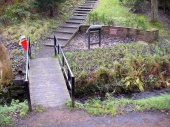
Site of the Chapel Well

Site of the Chapel Well

Along the Main Street in Cambusbarron, walk down Mill Hill for a hundred yards or so, to The Brae.  Just here, a paved footpath goes to the right.  Walk along here for about 120 yards until you reach a small footbridge crossing the stream.  On the other side of this bridge you’ll notice a notice board and a sign.  You’re here!

Archaeology & History

Today, all that remains of this spring of water that was sacred in the animistic pantheon of our ancestors, is a notice board and an epitaph, reading “Site of the Chapelwell (or Christ’s Well)”; but in times past this simple spring of water was a place of considerable activity.  Not only did the local people of Cambusbarron get their water supply from this (and others close to the Main Street), but it was also a place of ritual and reverence.  We know this from early church accounts—most of which were complaints about the traditions performed by local people, in contravention to the christian cult.

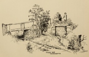
J.S. Fleming's old drawing

J.S. Fleming’s old drawing

The best account of the site is found in J.S. Fleming’s (1898) work, in which we find it also referred to as the ‘Christ’s Well’.  This attribution adds further mystery and controversy regarding another Christ’s Well a few miles away at Blair Drummond, whose position by the academic community is questioned by local historians.  Be that as it may, Mr Fleming’s words on this Chapel Well are worth reading.  He wrote:

“the most famous of all the Stirling Holy Wells, was, early in this century and is still, known by the name of ‘Chapel Well,’ and its water, up till a recent date, was used for domestic purposes by the villagers.  It originally consisted of a square, stone-built, open well, with parapets, but its walls are now built up and roofed, and it has a door, now shut up, however, and the well closed by the sanitary authorities of the district.  The well is situated on the brink of what we assume to be Glenmoray Burn, here crossed by a rustic wooden bridge in a part of the Chapel Croft garden, containing the alleged site of the chapel, from which it is distant a few feet.  The stump of an ancient thorn is shown on the right hand of the sketch.  The overflow of water empties itself into the adjoining burn.  The site of this famous well has been so variously described as to almost challenge its identity, but the authorities examined, all, with one single exception, afternoted, virtually agree in its situation:

“1) Sutherland, about a hundred years ago, writes:  “Not far from St. Thomas’ Well there is another, on the farm of Chapel Croft, called ‘Christ’s Well,’ of great repute, and visited by women, etc.”

“2) Dr. Rogers, later, after referring to the Chapel of Cambusbarron, says ”two of the three wells connected with the establishment still exist near its site by the margin of Glenmoray stream.”

“3) Another writer says: ‘”Christ’s Well,’ now called ‘ Chapel Well,’ is at bottom of a small dell called Glenmoray, immediately adjoining Cambusbarron, and there is a tradition that here the water was got for the religious services at the Battle of Bannockburn, one redeeming quality of the superstition which would consecrate its water.”

“4) A writer, over the initials “S.I.,” in the Stirling Observer of 27th September, 1866, says:  “Within its Chapel King Robert the Bruce partook of the sacrament on the eve of the Sabbath preceding the Battle of Bannockburn, and its sacred font was the resort at Beltane of the superstitious of a former age, as may be seen from extracts from kirk session records.”

“These all agree that ‘Christ’s Well’ was situated not far from St. Thomas’ Well, on Chapel Croft; that it and other two wells existed some few years ago near the site of the Chapel, on the margin of Glenmoray stream, by the name of “Chapel Well”; ” is situated in a small dell called Glenmoray, and is immediately adjoining Cambusbarron; and that it retains, and is presently known by, no other name than the “Chapel Well.”  Further, a small distillery, now removed, situated a few yards from the Chapel on this burn, taking its name from the glen and burn, was called Glenmoray Distillery…”

“However, a writer in the Stirling Observer of 7th September, 1871, in an article on “Touch Glen,” says that not far from the road leading to the three reservoirs on Touch Hills, two of the three Wells connected with the Chapel (which, he states, is 1000 yards distant from Gartur Lodge) still exist, and may be seen near the brink of a little burn which trickles from the miniature glen of Glenmoray, visible on the hillside just below the lowest reservoir. This burn is crossed by a small stone bridge on the main road, and is known as “Johnnie’s Burn.” These Holy Wells, including Chapel Well, would thus, according to this writer, be about a mile, if on “Johnnie’s Burn,” and if near the lower reservoir, on Touch Hill,’ fully a mile and a half from Chapel Croft and the Chapel…

“…The Church dealt severely with the devotees—principally women—who resorted to the virtues of “Christ’s Well,” as is shown by the session records, from which we make a few extracts: —

“July 12, 1610. — The quhilk day compeirit Grissal Glen and Marioun Gillaspie quha for ther superstitione in passing in pilgrimmage to ‘Christe’s Well’ as they confessit the last day ar ordeinit to mak publick repentance the next Sonday in lining claithis.”

” 1 June, 1630. — The quhilk day compeirit Elspet Aiken, spous to Anclro Cuyngham, tinckler; Jonet Harvie, William Huttoune, cutler; Margaret Mitchell, dochter to Alex Mitchell; Jonet Bennet, dochter to James Bennet, cuick; James Ewein, son of John Ewein, wobster, Margt. Wright, James Watsoune, who confessis passing in pilgrimmage to ‘Christe’s Well’ in Mai, and thairfoir they ar ordeaned to mak publik repentance the nixt Sabbat in thair awin habeit, under the paine of disobedience.”

” Lykway I, Mr. Patrik Bell, am ordeaned to desyre the breithren of the Presbyterie to appoint ane actuale minister for to preach upon Sonday nixt for to tak ordour with the said persounes above writen.” (Note — This offence seems a mere ploy of young people observing May morning, as is done at the present day on the first of May, and the responsibility “of asking” an “actual minister’s aid” to take “order” with the accused seems treating the offence too seriously.)

“6 October, 1631. — The quhilk day compeirit Jonet Norbell, in Cambusbarron, for going for water to help her sick son; and Jonet Main, in Cambusbarron, going to ‘Christe’s Well’ for water for help to her bairns; “and for another offence are ordained” to sair the pulpit on Sonday nixt in her ain habit to mak repentance.”

Mr Fleming seemed to think the traditions of Mayday a healthy thing and wrote well of local traditions, speaking of the healing virtues of the dew on May morning, used by people all over the country; also remembering a song that would be sung in honour of “the delightful custom of maying”:

I, been a rambling all this night,
And some time of this day ;
And now returning back again,
I brought you a garland gay.

Why don’t you do as we have done
The very first day of May ?
And from my parents I have come,
And would no longer stay.

Chapel Well on 1865 map

Chapel Well on 1865 map

Modern plaque at the site

Modern plaque at the site

The fact that Mr Fleming cites the Chapel Well to be known locally as the ‘Christ’s Well’ needs to be remembered when you visit a site of the same name 5 miles northwest of here at Blair Drummond.  It was a place of considerable renown and much used by local people for a variety of indigenous rites and customs for many miles around.  The ancient Scottish practices were still very much alive…

References:

  1. Fleming, J.S., Old Nooks of Stirling, Delineated and Described, Munro & Jamieson: Stirling 1898.
  2. MacKinlay, James M., Folklore of Scottish Lochs and Springs, William Hodge: Glasgow 1893.
  3. Morris, Ruth & Frank, Scottish Healing Wells, Alethea: Sandy 1982.
  4. Roger, Charles, A Week at Bridge of Allan, Adam & Charles Black: Edinburgh 1853.

© Paul BennettThe Northern Antiquarian


Christ’s Well, Blair Drummond, Stirlingshire

Sacred Well:  OS Grid Reference – NS 72919 98903

Also Known as:

  1. Canmore ID 46067
  2. Fountain Head

Getting Here

Christ's Well (allegedly...)

Christ’s Well (allegedly…)

Along the A84 Stirling-Doune road, watch out for the minor Cuthill Brae road to the caravan park. Go past the caravan place (ignore the grumpy fella there who tells you “this is private”) over the cattle grid and walk immediately to your right, along the top of the field, going through the first rickety gate 150 yards along.  Follow the overgrown circular woodland path around, and as you see the Safari Park and Blair Drummond House ahead of you, walk just another 100 yards or so along the path until you reach a boggy hollow in the ground with an old small building inside it. That’s it!

Archaeology & History

For a variety of reasons, this little known site hiding away and all but lost in the mythic lives of homo-profanus, is one of the most important sites in the Stirlingshire region due to it being a site where animistic rites and practices were regularly enacted by local people in the 15th century—and before, no doubt!  We know this because we have a veritable list of, albeit, ranting christian accounts from some early church records, that were thankfully transcribed at the end of the 19th century by local writer R.F. Menzies. (1899)  Despite the seemingly “christian” title given to this old well, the local people used it extensively for their magick, their traditions, their healing, their solace and their spirituality.

The waters within...

The waters within…

Before we start, it’s important to note that the geographical position stated here, in the trees at Blair Drummond, is taken from the reference at Canmore, who do not cite a literary source or oral account which affirms this to be the exact spot.  I mention this as there has been a problem regarding its exact location, not only by Mr Menzies, but also in the texts by MacKinlay (1893) and Morris (1982), each of whom said that the well was in the parish of Menteith, several miles to the west.  In Menzies (1905) history of Logie parish, a footnote is added in relation to the position of the site:

“Mr W.B. Cook considers that ‘there is no authority for saying the well was in Kincardine-in-Menteith.  An exhaustive enquiry by me has narrowed its locality down to two possible places, viz. Walton (i.e., well-town) and Bridge of Teith, both sites of pre-Reformation chapels, in the parish of Kilmadock.  It is as nearly certain as can be that Christ’s Well in Menteith was near the ancient chapel at Bridge of Teith, the remains of which—along with the well itself—are still to be seen.’”

This would therefore differ from the position presently cited by Canmore and the official records.  The ruins of the chapel described by Mr Cook were noted by the Ordnance Survey team at the Bridge of Teith when they visited in 1862 and it was highlighted on their maps four years later.  No “well” was noted however—and although we have Mr Menzies (1899) to thank for the presently accepted spot for this Christ’s Well, we don’t know for certain that this is the correct place.  The situation is made more troublesome if we refer to Moray Mackay’s (1984) definitive history of the adjacent parish of Doune.  Mr Mackay wrote his work in the early 1950s and, like other local historians, was both fascinated and puzzled about this well. He wrote:

“Many writers in the past have been content with placing this well “in Mentieth” and leaving it at that, but my curiosity was aroused by the fact that more than one reference indicated that it was ‘near to Doune,’ and I set about locating it.  It was a somewhat involved process, but I give here a resume of my findings which I published in the Stirling Observer of April 22, 1954.

“Firstly I was led to a paper of modern origin in Blair Drummond Estate Office which gave the site of Christ’s Well as ‘in the fernery at Blair Drummond.’  I found the fernery and also a rather fine well, over which a stone covering has been raised at an unknown date, and thought my quest ended. Later however…a reference in the Register of the Secret Seal, dated 1519, very strongly indicated Bridge of Teith as the site of Christ’s Well, and I was led to a very old well between the back door of the church there and the brink of the river.

“Still later I came across a pencilled note on a map in Doune Lodge Estate Office which read ‘Walton or Christwell unentailed’ as applying to a piece of ground immediately east of the Walton or Welltown site…

“There were, therefore, three alternative sites for Christ’s Well, only one of which had all the qualifications implied in the records as being (1) near Doune; (2) associated with a chapel; (3) in Kilmadock parish.  Consequently, I am convinced that the very old, dry-stone well at Bridge of Teith is, in fact, the once-famous Christ’s Well in Menteith.”
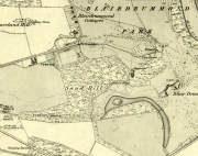
Christ's Well (as 'Fountain Head') on 1866 map

Christ’s Well (as ‘Fountain Head’) on 1866 map
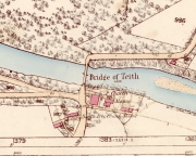
Cook & Mackay's site of Christ's Well, by the chapel

Cook & Mackay’s site of Christ’s Well, by the chapel

The site that Mr Mackay and W.B. Cook believe to be the Christ’s Well is 1.5 miles (2.43km) north of the position cited by Canmore (at NN 7221 0121).  As if to make things even more complicated, if we travel exactly 5 miles (8.05km) southeast to Cambusbarron, anothersite of the same name (later to be called the Chapel Well and associated with ancient ruins) is found!  J.S. Fleming (1898) describes it in some detail.

Carved stone dated 1690

Carved stone dated 1690

Carved stone dated 1678

Carved stone dated 1678

However, for the time being at least, if we assume that the Canmore entry is the real Christ’s Well, if you visit the place you will find an old well-house that has been built over a redirected spring of water which seems to have originally rose just a few yards to the rear of the structure.  Above the open front of the well-house—also constructed only a few hundred years ago—are placed two separate inscribed stones: one with the letters “CD ER” and the year 1690 beneath them; and above this an older stone, with the date 1678 etched on it.  These may be the dates when an earlier stone structure, whose scattered rocky edges are visible beneath the vegetation around and behind the present well-house, were demolished and then rebuilt.  But this is guesswork on my behalf!
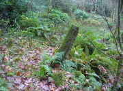
'Standing Stone' to the rear

‘Standing Stone’ to the rear

The entire structure is built inside a deep hollow which has no doubt been created and eroded into being by the spring of water itself.  On the rise at the back of this hollow is a curious standing stone which, as Penny Sinclair pointed out when we visited here a few days ago, was made out of a fossilized tree. This standing stone is only a few centuries old and either marks the original rise of the spring, or was erected at the same time of the well-house.

Less confusing were the activities performed here by local people in the 16th century—and way before that no doubt.  We have a lengthy set of accounts that describe how local people visited the Christ’s Well at the traditional dates of Beltane, Midsummer, etc, performing a variety of rites typical of those found in animistic cultures the world over. Sadly, it was the activities of the incoming christian cult that put an end to such ancient traditions by persecuting local people, as we know it has done everywhere that its virulent tendrils have infested.  Anyway, I hope that readers will forgive me citing the entire length of the accounts described by Mr Menzies (1899) about this well; but I think they give us vital insights into traditional healing practices that were just about destroyed by that corrupt institution that is the Church (for ease of reading, I’ve edited and modernized to some degree the repetitive and fragmentary language of the early written accounts):

“The brethren of the Presbytery of Stirling and various Kirk Sessions within the bounds were much exercised and troubled by frequent pilgrimages to a holy well, called Christ’s Well, situated somewhere in the neighbourhood of Ochtertyre, in the parish of Kincardine. For at least thirty years after 1581, pilgrimages were undertaken by certain people, who imagined they could obtain cures for certain diseases at this well. The wonderful thing is that tradition is dumb regarding the exact site of the holy spring.  There is a fine spring situated within the grounds of Blairdrummond, which may have been the Christ’s Well, the supposed virtue of which was, on the one hand, so consequential to the public health, and on the other, so troublesome to the Kirk.

“On 20th August, 1581, the Presbytery Record runs: ‘The brethren understands that a papist pilgrimage began of late at the Christ’s Well, and ordains every minister within their own bounds to try those persons who resort to it, and to call them before the particular Sessions that they can be convicted…’

“Two years later the evil crops up again, and on 7th May, 1583, ‘The brethren understand that a great abuse by the rascal sorts of people that pass in pilgrimage to Christ’s Well and use it for great Idolatry and superstition that are expressedly against God’s law; and because the Kings Majesty with advice of his three estates of parliament, (there shall be) certain punishments as well as corporal pains as pecuniary sums of money to be executed against such persons; and for execution of which against persons passed and to the said Well, the brethren understands my Lord of Doune Stewart of Menteith has commission given to him to that effect to see that punishment is executed in conformity with the said Act.  Therefore the brethren ordains and gives commission to Mr. Andro Zung (Minister at Dunblane), Mr. William Stirling (at Kilmadock), and Michael Lermonthe (at Kilbryde) to pass to my Lord of Doune to treat with him for execution of punishment against the persons according to the said Act and his commission.”  On 4th May, 1583, “The brethren ordains and gives commission to the brothers dwelling in Dunblane or any three of them to pass to Christ’s Well this next Saturday evening, accompanied with such persons as you may have to espy which persons comes to the said Well and report the names of such persons you can get to the brethren.’

“On 28th May, 1583, “On which day the brethren understanding that a great number of people have resorted to, and resorts in pilgrimage to Christ’s Well, using yet superstition and Idolatry expressedly against God’s law and the acts of parliament.  Therefore…the brethren ordains summons to be directed to charging of such the said persons, whose names shall be given in writing to the clerk to appear before the brethren to answer therefore, to the effect that orders may be taken with them that have been there, to the glory of God and execution of the Kings Majesty’s laws and in example of others to do the same.’

“On 4th June, 1583, “Margaret Wright in Cambus, Janet Kidstoun in Cambus, and Thomas Patersone in Black Grainge” did not appear in courtto answer “for passings in pilgrimage to Christs Well,” and were summoned the second time under pain of excommunication. On 11th June, “Janet Tailzor (spouse to Robert Cowane) in Touch, Marione Watsone in Touch, Marjorie Fargusson in Touch, Margaret Downy in Polmais,” also for the same “compeared not.” (i.e., did not appear in court, as ordered – PB)

“The depositions given in excuse referred to some disease or ailment: One, “confessed she passed there to get help for a  soreness in her side and confessed she passed about the well and prayed to Christ’s Well on Sunday and drank of the Well and washed her side with the water thereof and left behind her a  sown thread” (as offering).  Another, “passed….because she was sick in her heart and in her head and lipnit (trusted) that the Well would have helped her sicknesses…and she passed about the Well and cast the water over her shoulder and drank of it and left one piece of silver behind her.”

Ten years later several cases of pilgrimage to Christ’s Well come before the Presbytery.  22nd May, 1593, “On which day the brethren are credibly informed that Malcolme Alexander in Menstrie, James Baird at Muckart mill, and Jonet Mairschell, his spouse, passed in pilgrimage to Christ’s Well and visit superstition and Idolatry thereat. Therefore the brethren ordains them and such others who have done such like within their bounds to be summoned to answer for the same and unduly discipline them therefore under the pain of disobedience; and ordains each Minister to travel with one or two gentlemen in his parish to pass to the said Well on Saturday evening and espy what persons come there and what they do and relate the information to the minister, and see that each minister take Inquisition in his own Eldership what passes at the said Well and relate them to the presbytery.”

29th May, 1593, *On which day the summoned James Baird…to answer for passing in pilgrimage to Christ’s Well appeared in court, the said James, and confessed that through earnest persuasion of his wife (who was also moved to be there by other people), he passed with her to Christ’s Well on Saturday the 12th day of May instant, and that she two hours before the sun went down on Saturday evening drank of the said well and washed her legs and arms in it and did no fairer; he did nothing with the water, for his errand there was only with his wife who was persuaded to go there for her healing by Issobel Scotland.  He confessed that there was at the said Well this year Ewffam Wilsone in Blairhill.  Alaster Leany who was some time servant to Alexander Ezat in Culross.  He confesses that David More is he whom bears aqua-vitae and being oft times in David Fargus house in Alva, said to his wife that there was money brought to that Well…; and that Crystie cadzear in Alva confessed to him when he and his wife came home from the well, that he was three or four times at Christ’s Well and was the better, he confesses that his wife is sick and cannot come to court this day and obey the summons and therefore desires that his excuse for her may be admitted. The brethren having considered the said James Baird’s fault, ordains him to make repentance therefore in Dollar kirk as it is adjacent to him the next Sunday in secclayth (???), and that the plaintiff above written be summoned to answer for the said offence under the pain of disobedience.”

Another case falls to the ground for want of proof.  On 5th June, 1593, “One summons upon Malcolme Alschunder in Menstrie…to answer for passing to Christ’s Well and using superstition and Idolatry there at, but there is no appearance in court.  He appears on 12th June, “And denies that he passed to Christ’s Well or was bewast (to the west of – PB) Teith at any time in May, and therefore the said matter remains to be proven.” On 3rd July, “Inquisition being taken, asks if there be any witnesses that can prove Malcolme Alexander was at Christ’s Well, there is none found, and therefore it is thought good to proceed no farther against him for the said offence.”

On 14th May, 1595, James Duncansone in Fossoway, and Helen Jameson, his spouse, are charged to answer “For superstition and Idolatry in passing to Christ’s Well in pilgrimage… The said Helen confesses she passed to Christ’s Well through the year to get her bairns eye healed which was blind a month before.  She washed his eye thrice with the water thereof, and alleged that the bairn saw or he come home; and confesses that she passed there this year also to give thanks for the benefit she received the year preceding, and left a shirt of the bairns behind her, which was on the first Sunday of May…  The said James Duncansone denies that he passed to the said well with her, but only to Ochtertyre, where he was all night—well the morning that she come to him, and then they passed together to Dunblane.  The brethren finds him also culpable as his wife in her said fault, seeing he has known thereof and past with her to Ochtertyre, which is the most part of the way, where he ought and should have stopped her, and therefore they are ordained to make public repentance in linen clothes the next three sabbath days bare-footed.”

James Duncansone’s wife appears to have refused to obey the Presbytery, and on 16th July, 1595, she is summoned to appear in court, “beand chair- git as said is to heir and sie hir self decernit to be excommunicated for not completing the injunctions to her for passing in pilgrimage to Christ’s Well two different times, who being oft times called, appeared not. Therefore the brethren ordains her to be summoned de novo to the effect aforesaid with certification.”

“As no further mention is made of this woman’s case, she must ultimately have satisfied (them).  The resorting to this well comes before the Presbytery (again) on 23rd April, 1600: ‘The brethren being credibly informed of the great abuse and superstitions of visits by many people at Christs Well, namely in the night immediately preceding the Sabbaths in the month of May; for remaid thereof the brother of the Ministry within their boundaries are ordained that publicly in their kirks the next Sabbath inhibit and forbid in the name of God and his kirk that no persons shall pass to the said Well… And to the end that such abusers that go there may be stopped from their superstition.  The brethren ordains the ministers of Kilmadock and Kincardine with the special gentlemen of their flocks, to await vicissim (in return) at the said well on the night preceding the Sabbath during all the month of May; and to that effect the brethren ordains the clerk to write in the names (of visitors) to the gentlemen of the said parishes.’

“The members of Presbytery were determined to put a stop to such superstitious practices, and ere long, their efforts met with success.  In the meanwhile however, isolated cases came before them for judgment . Thus on 29th July, 1601, “Jonet Rob in Pendreich” is summoned to appear to answer “for disobedience to the elders of her parish church of Logie, conjoined with slandering the kirk by passing in pilgrimage to Christ’s Well.” She does not appear, and is summoned pro tertio, but apparently having satisfied the “eldership” of Logie, the matter is not again referred to.

“The last mention of Christ’s Well is at the meeting held on 1st July, 1607, when a batch of nine penitents from the parishes of Airth and Bothkennar, “Compare and confess they were at Christ’s Well to heal their diseases, and took some of the water and left something behind, every one of them, at the well. The brethren finds that they have committed superstition and have dedicated to Satan that thing they have left behind them (at the well), and are therefore ordained to make public repentance at the next adjacent kirks of Airth and Bothkennar.”

Menzies noted another mention of people using the waters here a few years later, telling:

“As late at June 6, 1630, the Kirk Session Records of Stirling contain an entry, where five women and two men, “confesses passing in pilgrimage to Christ’s Well in May, and therefore they are ordained to make public repentance at the next sabbath, in their own habit, under pain of disobedience.”

In these records we can clearly see that a bunch of incoming religious fanatics have arrived and set themselves up to engage with the Scottish people so as to undermine and destroy the indigenous traditions and practices prevalent at that time, by imposing laws against them which were not for the benefit of the local people.  Indeed, the laws were preposterous!  The initial description that the rituals performed by the local people were ‘papist’ in nature is, of course, a cover—as was the name, Christ’s Well—in an attempt to avert the christian cult from attacking their traditional places of healing and rites.  This failed—but at least we have the accounts describing the outlandish presbyterian impositions.

Penny sits guarding the well

Penny sits guarding the well

However, even with these accounts it is difficult to say with any certainty where the original Christ’s Well emerged.  The position Penny Sinclair and I visited, as marked on the modern OS-maps, is congruous for rites of solitude as described in the church accounts; and a distinct genius loci feels to be just beneath the surface.  However, it is difficult to see how people visiting here would have been noticed by the christian enforcers, as it is away from prying eyes.  However, if the well was at the Bridge of Teith, it would explain how so many people were “caught in the act” of performing their rites, as an old chapel was adjacent to the well.  More research is required, obviously…

In the meantime, I truly recommend visiting this place to those who enjoy the quietude of sacred sites.  Tis a fine secluded place—although it could do with a good tidying-up to free its fresh waters once again…

References:

  1. Bennett, Paul, Holy Wells and Healing Springs of Stirling and District, forthcoming
  2. Bradley, Ian, Water—A Spritual History, Bloomsbury: London 2012.
  3. Eliade, Mircea, Patterns in Comparative Religion, Sheed & Ward: London 1958.
  4. Eliade, Mircea, The Sacred and the Profane, Harcourt: New York 1959.
  5. Fergusson, R. Menzies, Alexander Hume: An Early Poet-Pastor of Logie, Alexander Gardner: Paisley 1899.
  6. Fergusson, R. Menzies, Logie: A Parish History – volume 1, Alexander Gardner: Paisley 1905.
  7. Fleming, J.S., Old Nooks of Stirling, Delineated and Described, Munro & Jamieson: Stirling 1898.
  8. Grant, William (ed.), The Scottish National Dictionary – volumes 1-10, SNDA: Edinburgh 1931-1976.
  9. Mackay, Moray S., Doune – Historical Notes, Forth Naturalist: Stirling 1984.
  10. MacKinlay, James M., Folklore of Scottish Lochs and Springs, William Hodge: Glasgow 1893.
  11. Morris, Ruth & Frank, Scottish Healing Wells, Alethea: Sandy 1982.
  12. Wright, Joseph (ed.), English Dialect Dictionary – volumes 1-6, Henry Frowde: London 1898-1905.

Acknowledgements:  Huge thanks to Penny Sinclair for the venture over and help to locate this fascinating site.

© Paul BennettThe Northern Antiquarian


Witch Tree, Aberuthven, Perthshire

Sacred Tree:  OS Grid Reference – NN 9621 1587

Getting Here

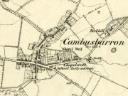
Witch Tree on 1901 OS-map

Witch Tree on 1901 OS-map

Just off the A9 between Stirling and Perth is Aberuthven village.  Down the Main Street and just south of the village, turn west along Mennieburn Road.  A half-mile on, just past Ballielands farm, you reach the woods.  Keep along the road for another half-mile, close to where the trees end and go through the gate where all the rocks are piled. Walk up to the tree-line 50 yards away and follow it along the line of the fence east, til it turns down the slope.  Naathen – over the barbed fence here, close to the corner, about 10 yards in, is the tree in question…

Archaeology & History

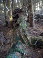
Witch Tree03

Looking along the fallen trunk

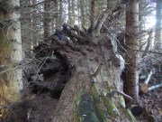
Laid down on the peaty earth, fallen perhaps fifty years ago or more, are the dying remains of this all-but forgotten Witch Tree.  To those of you who may strive to locate it—amidst the dense eye-poking branches of the surrounding Pinus monoculture—the curious feature on this dying tree are a number of old iron steps or pegs, from just above the large upturned roots.  About a dozen of them were hammered into the trunk some 100 years or more ago and, were it to stand upright again, reach perhaps 30 feet high or more.  These iron pegs give the impression of them being used to help someone climb the tree when it was upright; but their position on the trunk and the small distance between some of them shows that this was not their intention.  Their purpose on the tree is a puzzle to us (does anyone have any ideas?).

Embedded pieces or iron from roots...

Embedded iron from the roots

Embedded iron 30-40ft along

Embedded iron 30-40ft along

The fallen trunk has broken into two main sections, each with iron pegs in them.  The very top of the tree has almost completely been eaten back into the Earth.  Unfortunately too, all the bark has completely rotted away and so identifying the species of the tree is difficult (though I’m sure there are some hardcore botanists out there who’d be able to enlighten us).  The possibility that the early map-reference related to a Wych-elm (Ulmus glabra) cannot be discounted, although this would be most unusual for Ordnance officers to mistake such a tree species with a ‘witch’.  Local dialect, of course, may have been a contributing factor; but in Wilson’s (1915) detailed analysis of the regional dialect of this very area, “wych elm” for witches does not occur.  Added to this is the fact that the indigenous woodland that remains here is an almost glowing birchwood (Betula pendula) in which profusions of the shaman’s plant, Amanita muscaria, exceed.  There were no wych elms hereby.

The tree was noted by the Ordnance Survey team in 1899 and was published on their maps two years later, but we know nothing more about it.  Hence, we publish it here in the hope that someone might be able top throw some light on this historical site.

Folklore

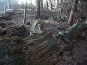
Looking along the fallen trunk

Halfway along the fallen tree

We can find nothing specific to the tree; but all around the area there are a plethora of tales relating to witches (Hunter 1896; Reid 1899)—some with supposedly ‘factual’ written accounts (though much of them are make-believe projections of a very corrupt Church), whilst others are oral traditions with more realistic tendencies as they are rich in animistic content. One of them talks of the great mythical witch called Kate McNiven, generally of Monzie, nearly 8 miles northwest of here.  She came to possess a magickal ring which ended up being handed to the owners of Aberuthven House, not far from the Witch Tree, as their associates had tried to save her from the crazies in the Church.  This may have been one of the places where she and other witches met in bygone centuries, to avoid the psychiatric prying eyes of christendom.

Until the emergence of the Industrialists, trees possessed a truly fascinating and important history, integral to that of humans: not as ‘commodities’ in the modern depersonalized religion of Economics, but (amongst other things) as moot points—gathering places where tribal meetings, council meetings and courts were held. (Gomme 1880)  The practice occurred all over the world and trees were understood as living creatures, sacred and an integral part of society.  The Witch Tree of Aberuthven may have been just such a site—where the local farmers, peasants, wise women and village people held their traditional gatherings and rites.  It is now all but gone…

References:

  1. Gomme, Laurence, Primitive Folk-Moots, Sampson Lowe: London 1880.
  2. Hunter, John, Chronicles of Strathearn, David Philips: Crieff 1896.
  3. Reid, Alexander George, The Annals of Auchterarder and Memorials of Strathearn, Davdi Philips: Crieff 1899.
  4. Wilson, James, Lowland Scotch as Spoken in the Lower Strathearn District of Scotland, Oxford University Press 1915.

© Paul BennettThe Northern Antiquarian


Beltane Well, Kenmore, Perthshire

Sacred Well:  OS Grid Reference – NN 7867 4725

Also Known as:

  1. An Tobar
  2. Holy Well of Inchadney

Getting Here

An Tobar, or Beltane Well, on the 1867 map

An Tobar, or Beltane Well, on the 1867 map

From Kenmore village on the north-side of the river, over the bridge, take the small road on your right towards Dull.  After a very short distance the road runs alongside the woodland for nearly 1½ miles until, on your left, you’ll reach Drummond Cottage.  Across from here a dirt-track takes you into the trees.  Barely 100 yards along, watch for the overgrown path that runs down the slope on your left.  At the bottom a small stream has several feeds – one of which is surrounded by a ring of bright quartz stones.

Archaeology & History

Shown on the early Ordnance Survey maps as An Tobar (meaing simply “a well”), this somewhat nondescript title betrays a much more colourful folk history, albeit dissolved by those common culprits of Church and disrespectful incomers (which shows little sign of diminishing).

Lara by the Well

Lara by the Well

Close-up of quartz surround

Close-up of quartz surround

In the field immediately south, back up the slope above the well and through the trees, was once an ancient church whose existence has all but vanished.  Hereby was held an ancient fair known as Feill nam Bann Naohm, or the Fair of the Holy Women, named after a group of nuns whose lived here, who William Gillies (1938) and others proclaim were the legendary Nine Maidens, whose dedications at wells, trees and other sites scatter Scotland. But the fair was ended in 1575 and moved to Kenmore; then, several years later in 1579, the church also moved onto Eilean nam Ban Naomh (NN 7664 4536) on Loch Tay.

The old well however, after being left by the descendants of the Holy Women or Nine Maidens, continued to be frequented by local people.  Gillies (1938) wrote:

“The Holy Well of Inchadney is situated at the foot of the terrace, about five hundred yards to the north of the churchyard… Up to the middle of last century the well used to be visited by great numbers of people on the morning of Bealtuinn, the first day of May.”

In Ruth & Frank Morris’ survey (1981) they told how the site had become much overgrown and,

“The well was cleaned out in 1914 and among articles found was a stone 21 inches by 16 inches, with a rude St Andrew’s cross scratched on it, a George III farthing among other copper coins, a rudely made stone cup 2½ inches high and 7 inches in diameter, three metal buttons, a glass bead and six pins.”

No such offerings seemed in evidence when we visited a few weeks ago; but we were told that people are still seen visiting the well.

Looking down into the pure waters

Looking into the pure waters

A small stone-laid footpath runs towards the adjacent burn from the circular well, which is almost completely surrounded by large quartz rocks.  In the well itself was a small fish, showing how clean the waters are—or as would be deemed in times of olde: a ‘guardian’ of the waters.

We must also make note of the fact that, just two fields away to the north, according to the antiquarian Fred Coles (1910), a stone circle was once in evidence.  This old well sat neatly between the sites of megalithic ring and church.

Folklore

In the field in front of the well, Hilary Wheather (1982) told that there once lived a legendary water bull, but she lamented on his passing.  With the coming of the modern-folks and their unnatural ways,

“and having great timber lorries rumbling past your home every day is no fun for a peace-loving waterbull living in Poll Tairbh, the Bull’s Pool opposite the Holy Well.  Gone are the days when he was the revered Spirit of the Meadow, passed with trembling and fear by all the young maids of the Parish lest he should jump out and carry them off to his watery lair. Half the calves of the area were sired by him and it was always easily seen which cow had the attentions of the Great Waterbull.  Her calf was always the biggest and the best.  But he hasn’t been seen by his pool for many a year…”

The waters are cited by Geoff Holder (2006) to be good for toothache.

References:

  1. Coles, Fred, “Report on Stone Circles Surveyed in Perthshire (Aberfeldy District),” in Proceedings of the Society of Antiquaries, Scotland, volume 44, 1910.
  2. Gillies, William A., In Famed Breadalbane, Munro Press: Perth 1938.
  3. Holder, Geoff, The Guide to Mysterious Perthshire, History Press 2006.
  4. McHardy, Stuart, The Quest for the Nine Maidens, Luath Press: Edinburgh 2003.
  5. Miller, Joyce, Magic and Witchcraft in Scotland, Goblinshead: Musselburgh 2010.
  6. Morris, Ruth & Frank, Scottish Healing Wells, Alethea: Sandy 1982.
  7. Wheater, Hilary, Kenmore and Loch Tay, Appin Publications: Aberfeldy 1982.

Acknowledgements:  Big thanks to the bunch who got us here:  to Paul Hornby, Nina Harris, Aisha Domleo & Lara Domleo (ooh – and Leo too!).

© Paul BennettThe Northern Antiquarian