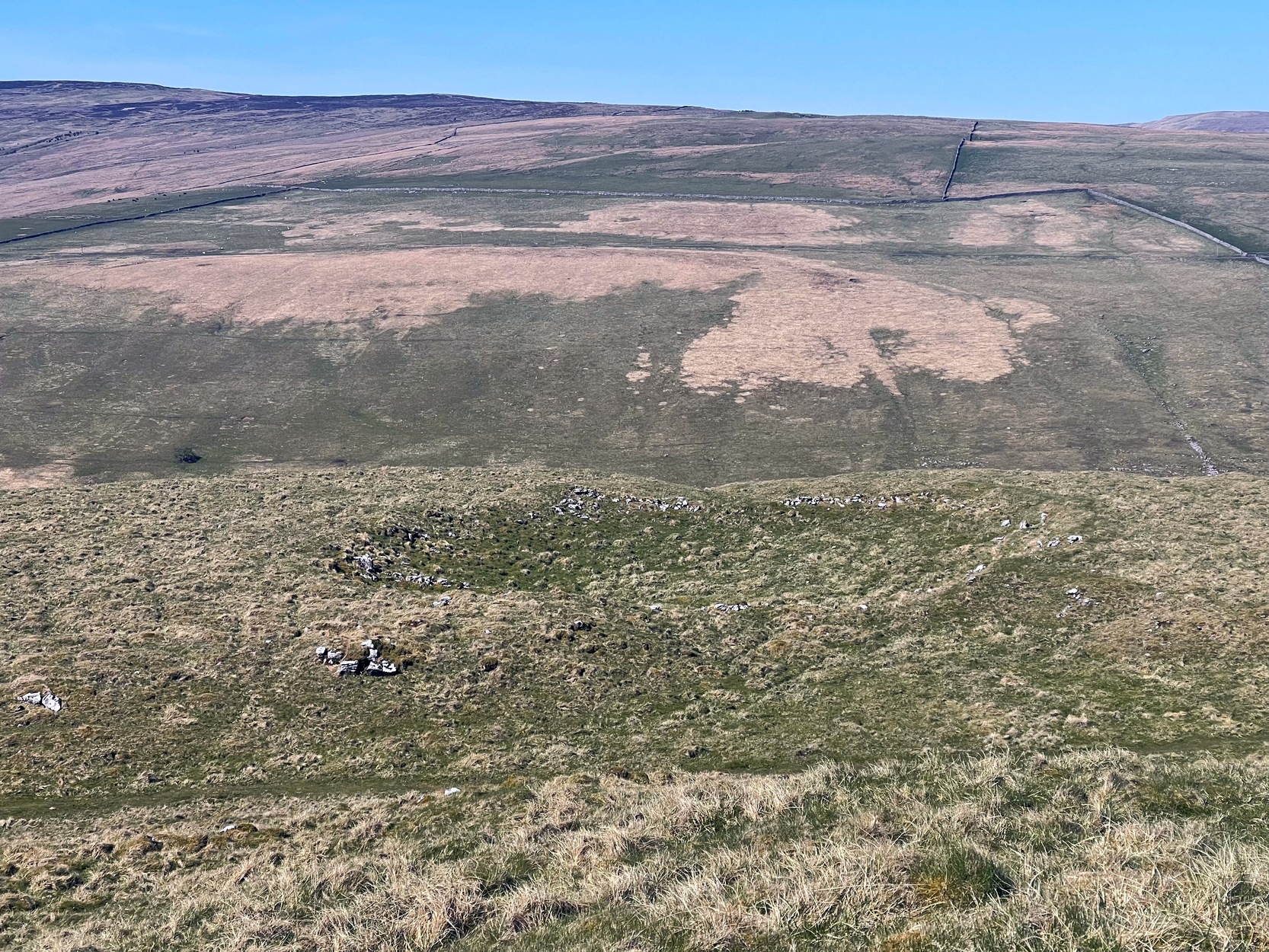
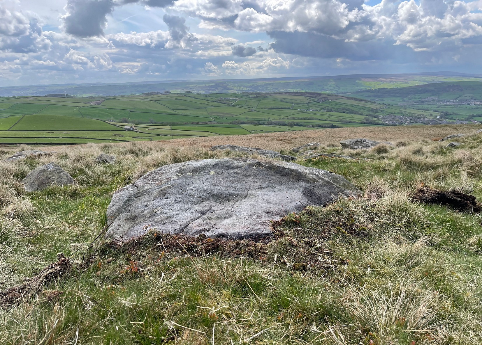
From Arncliffe village, walk past the front of the Falcon Inn village pub and along the track called the Monk’s Road. After a short distance it becomes a dirt-track where the old house lives. Less than 200 yards past the old house, a footpath takes you over the wall, then you walk 200+ yards southwest and through another wall, then up the curvaceous footpath diagonally WSW up the steep hill until you go over another wall where the land levels out. Follow the footpath along the edge of the steep drop for just over a mile where you’ll cross the fifth wall (the Clowder (1) enclosure is up above you by the rock outcrop to the left) and 100 yards along, just north of the footpath, you’ll see a large hollow defined by rocks and low walling. You’ve arrived!
Archaeology & History
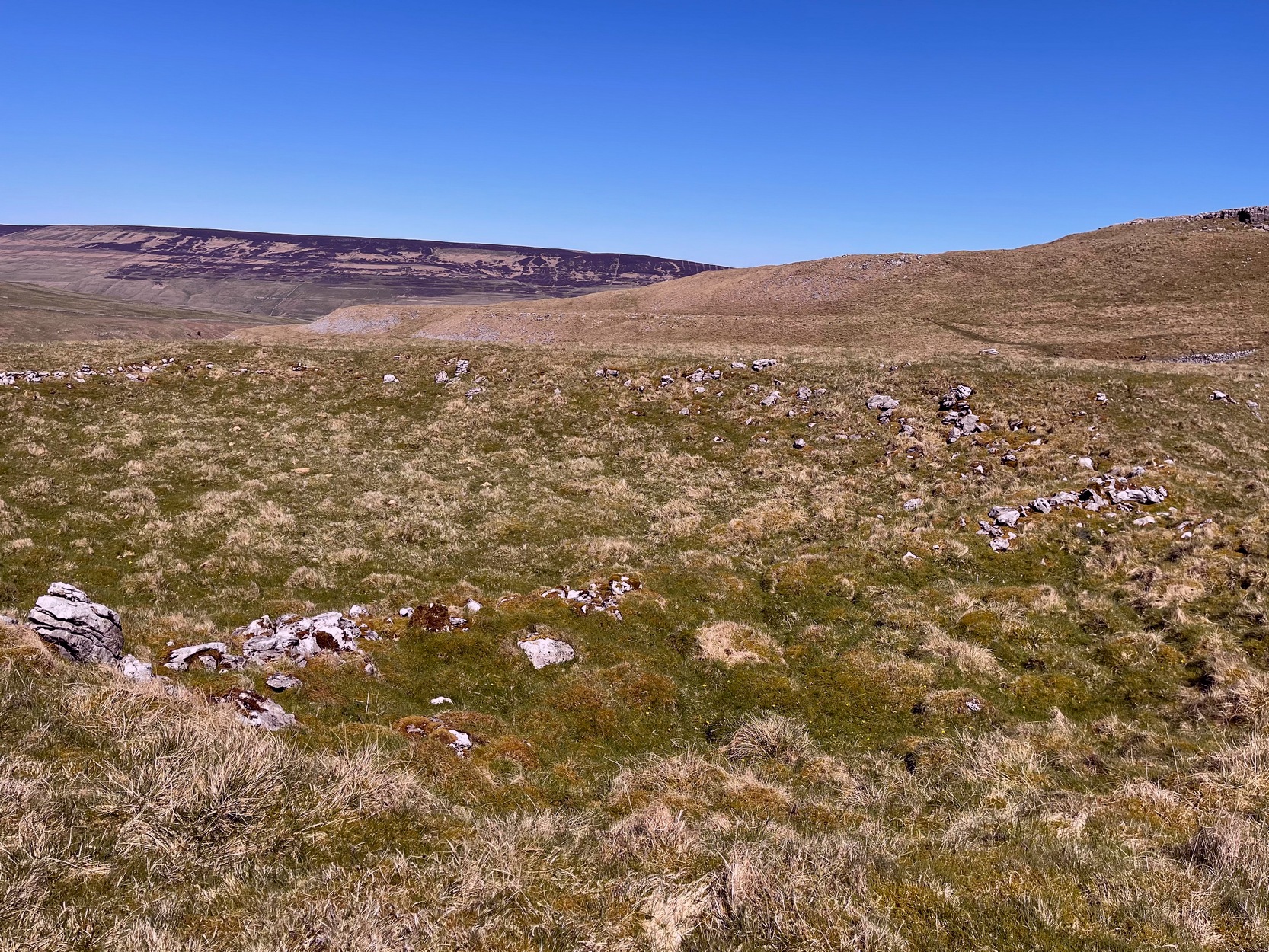
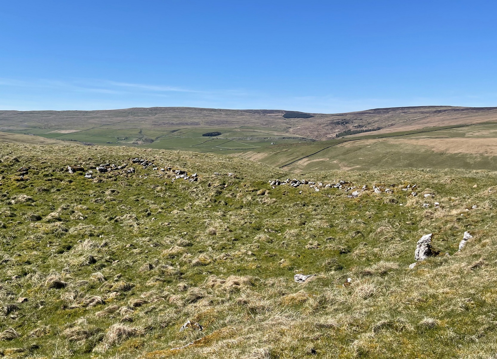
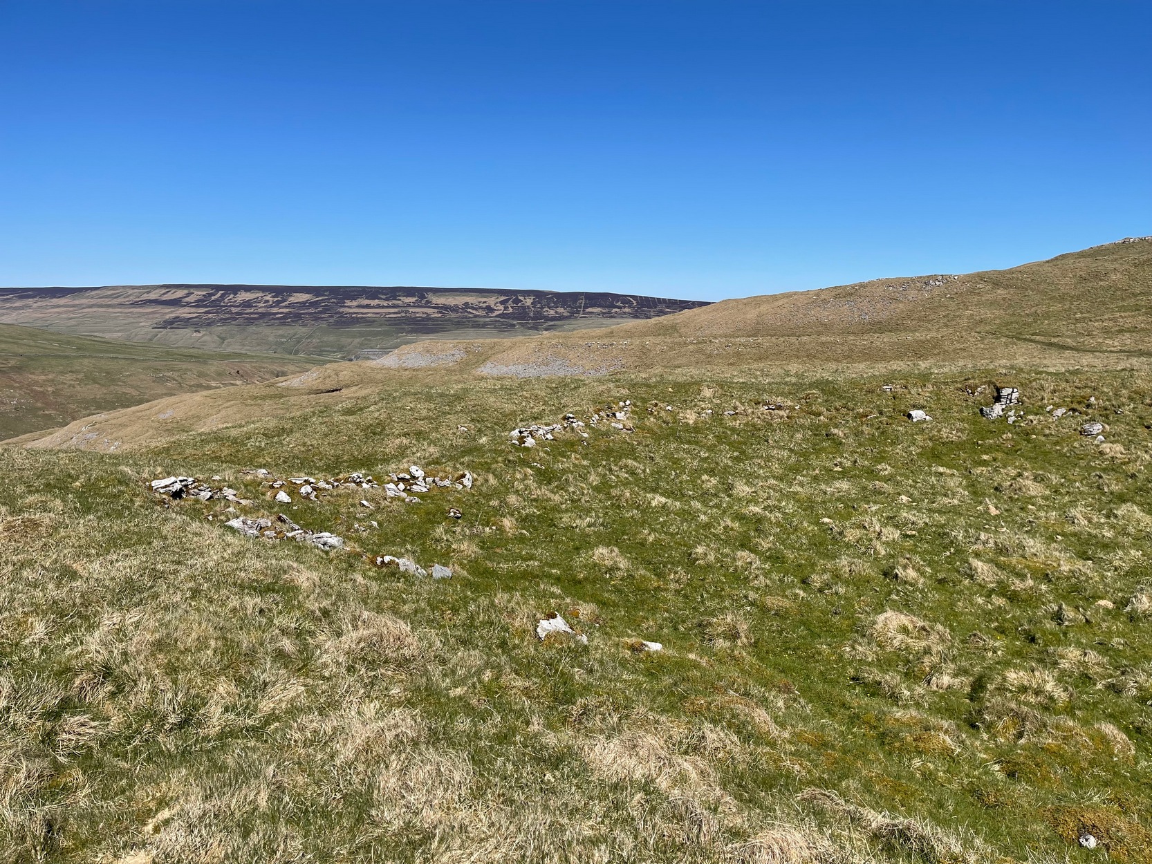
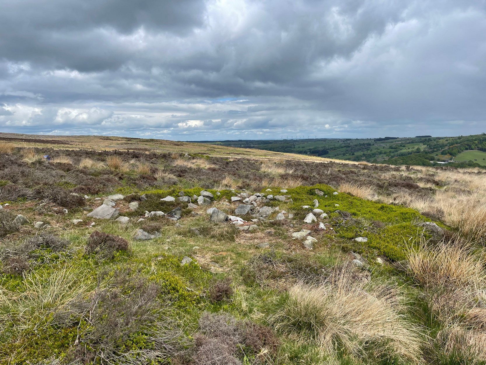
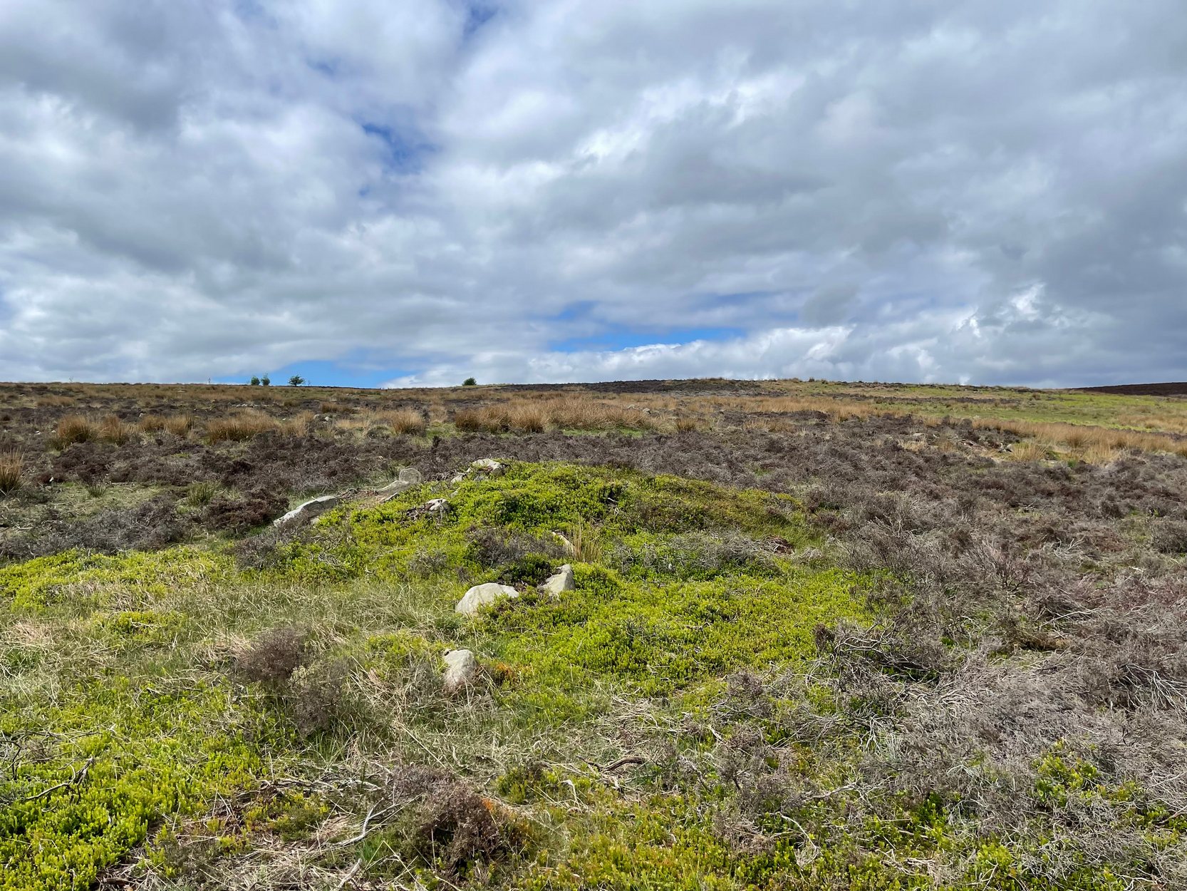
The south & eastern walls
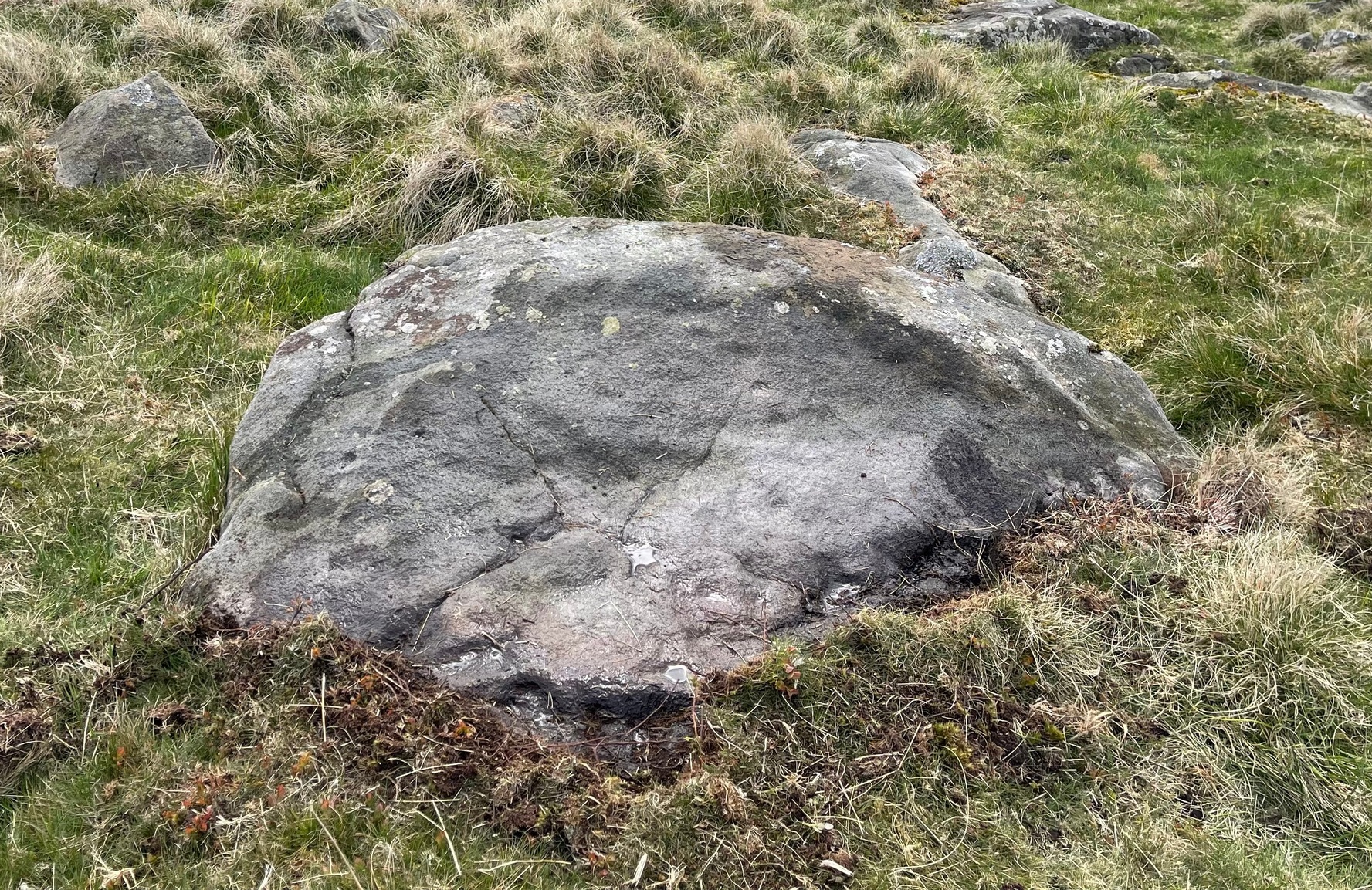
Amidst the scattered remains of the extensive Dewbottoms settlement complex, this large hollowed walled enclosure is pretty clear to see. Measuring 40 yards north-south across its longest axis and 31 yards east-west, the structure is like an erratic rectangle in shape, with entrances in the middle of its northern wall and, perhaps, another along the southern side too. It’s quite deep too, being several feet lower than the land around it, keeping it protected from any strong winds above: an ingredient that would obviously have been taken into consideration when it was being built. The walling that defines the structure is a contrived mix of Nature’s own semi-circle of earthfast limestone rock, with intermittent gaps filled-in with thousands of small stones placed there by humans, 2-3000 years ago. It’s quite impressive when you see it in the flesh.
Northern wall & dipped entranceThe west & northern walls
The site appears to have an Iron Age to Romano-British pedigree – although I’m hedging a bet that the place was probably still in use during medieval times. The enclosure has the appearance of some sort of prehistoric village hall. There are no hut circles or any other walled structures inside the overall enclosure, meaning it may have been used, perhaps, for tribal village gatherings; or it might just have been a large enclosure for cattle. Only an excavation would tell us one way or the other.
Anyhow, if you’re coming up to see the Dewbottoms complex from Arncliffe, this is the first main thing that you’ll come across. From here, to your immediate south and west, there’s a mass of prehistory beneath your feet. Make a long day out of it as you’re gonna be somewhat overwhelmed by the magnitude of it all.
References:
Charlesworth, D., ‘Iron Age Settlements and Field Systems,’ in Proceedings of the Archaeological Journal, 125, 1968.
Dixon, John & Phillip, Journeys through Brigantia – volume 2, Aussteiger: Barnoldswick 1990.
Raistrick, Arthur & Holmes, Paul F., Archaeology of Malham Moor, Headley Brothers: London 1961.
Cup-Marked Stone (lost): OS Grid Reference – SD 950 488
Archaeology & History
When the archaeology assistant Stuart Feather ventured over to look at the prehistoric enclosure on the northwest slope of Raygate Hill, a mile or so south-west of Carleton, like any good petroglyph explorer he looked out for any rock art and—like y’ do sometimes—came across a cup-marked stone that hadn’t been recorded before. He wrote down his finds at home and, following his death, those records were thankfully sent to the Manor House Museum in Ilkley, from where these brief notes are taken. There was at the time of his visit, he said, a
“Rock outcrop with two cup-marks, on August 6th 1960 this outcrop was intact. On a second visit the top layer of the rock had become detached and split into two. The pieces were then removed for preservation.”
By “removed for preservation”, he meant that he took it home to Fernbank Avenue in Keighley (he did this with a few of our old cup-and-rings). However, this one has not been found since and it may simply have been buried in his garden. Does anyone know more about it?
He described another less likely contender of a carving a little closer to the enclosure, telling briefly: “Cup-marked rock, cups only possibly man-made. In close proximity, 75 yards, to (the) earthwork marked on the 6” O.S. map.”
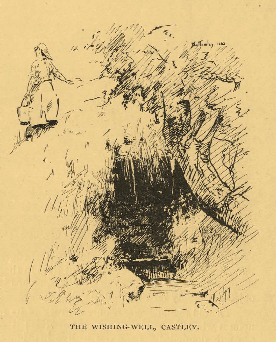
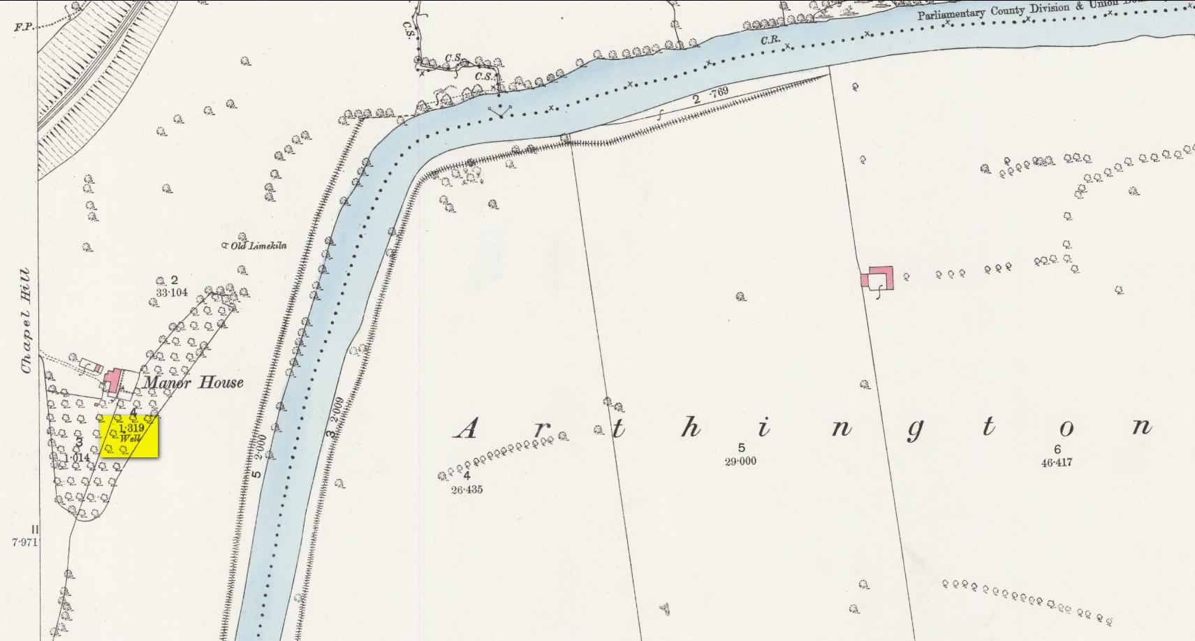
An important water source for local folk in Castley hamlet in previous centuries, this was one of several so-called ‘Wishing Wells’ above the higher banks of the River Wharfe a few miles from each other. It’s a title which, to be honest, was afforded the place when its original local name was removed. It was quite obviously a sacred well in earlier times, as it’s found beneath the slope of Chapel Hill, looking eastwards towards the rising sun, when the waters here (as at countless others) had their greatest remedial or magickal powers. Tradition told there was once a small chapel above the well itself. The spring was highlighted on early Ordnance Survey maps, but all that seems left here today is an occasional boggy mass in the trees at the bottom of the sloping hill.
The old folklorist and antiquarian Edmund Bogg (1904) wrote the following about it:
‘Wishing’ Well on 1888 map
“On the terraced bank near the garden, ’neath an overhanging hawthorn, is a beautiful spring of clear sparkling water, which is locally known as Castley ‘wishing-well.’ More than once we have heard the women-folk declare how, in their maidenhood, they loitered down the bank to the well, usually at eventide, when the birds were warbling their vesper song, and placed their offerings there in silence, yet breathing, as it were, the mute longing of their heart’s desire. It is a natural grotto fit habitation of fairies or the traditional elves. The bank, in which the well is situated, is known as ‘Snake Bank.’”
References:
Edmund Bogg, Higher Wharfeland, James Miles: Leeds 1904.
Acknowledgements:Huge thanks for use of the Ordnance Survey map in this site profile, reproduced with the kind permission of the National Library of Scotland.
From Bainbridge, take the A684 road east to Aysgarth. Just out of the town, 200 yards over the bridge, take the right turn down Blean Lane. Nearly ½-mile along, take the minor road on your left and go along here for 1½ miles where, a few hundred yards before the solitary farm of Carpley Green (lucky buggers!), you can park up. (keep plenty of room for a tractor to get in the fields) Walk down the track past the farm and 250 yards along, where the first field ends, a gate leads you into the hills on your left. Go through here and then the next gate 120 yards on, then walk straight along th elong geological ridge ahead of you, veering to the top-side until it meets the walling. You’ll see the giant Stoney Raise cairn on the other side.
Archaeology & History
Stony Raise from above
The remains we find here are nigh-on immense! If giant cairns get you going (like the Great Skirtful of Stones or the denuded Devil’s Apronful near Pendle, etc), this one will blow you away! Along its widest axis, to this day it’s nearly 40 yards across and nearly 7 feet high! But in earlier times it was even bigger—much bigger! The first known description of the site was made by one Charles Fothergill, a Yorkshire-born politician and ornithologist, who wrote a diary of his walking excursions to various places in North Yorkshire at the beginning of the 19th century. (Romney 1984) His account of it was a good one for that period and thankfully he recorded information that would otherwise have been forgotten. After his visit here in September 1805, he told about this,
“wonderful tumulus called Stone raise which is a great curiosity: it is formed entirely of large stones piled up without earth or gravel, differing in that respect from any I have seen. Notwithstanding that upwards of a thousand, nay ’tis said several thousand, loads of stones have been led away from it to build walls with, it yet remains a stupendous monument of this species of antiquity: we measured the base of it as well as we could by our strides and made it 369 feet in circumference and of such an height as to be seen for a considerable distance. It has been most completely rifled…and it now presents a number of small craters formed by the investigations of the money searchers. It is situated upon a hill about half a mile south of Addlebrough. In addition to the particulars I formerly mentioned, I may say the men who first opened it about 50 years ago worked incessantly for 33 days. It stands on Thornton moor, and tho’ the Thornton men would not assist in the labour, they intended to share in the profit if there was any; but the adventurers who had all the work resolved they should not and they carried a large sword with them every day to defend the treasure in case they found any; the wise man who read ’till the stones shook and rattled was a schoolmaster at Bainbridge: the teeth they found were deposited in a hollow place in the bottom of the tumuli formed long and narrow like a coffin by a walling of stones. Tho’ the tumulus has apparantly been compleatly rifled, I do not believe the whole base has been sufficiently searched, but if it was to commemorate one great individual, which appears to have been the case, perhaps nothing more may be found.”
Fothergill’s description of “upwards of a thousand” cartloads of stone being removed from Stony Raise has been doubted by some archaeologists, but this claim should not be dismissed so lightly without evidence. There are immense tombs from northern Scotland to the unholy South that have remained untouched by the hand of industrialists that easily enter the category of such giants and this may have had equal stature.
A few years after Fothergill’s visit, Thomas Whitaker (1823) briefly described the site in his magnum opus, but added very little, simply telling that on the hills behind Addlebrough,
“there is still on that elevated spot a cairn, called Stone Raise, about 120 yards in circumference at the base, to which the usual tradition of its containing a treasure of gold having been attached, two persons were several years ago induced to make the experiment; but having penetrated to the centre, found, to their great disappointment, what an antiquary would have prepared them to expect, namely, a kist vaen of flag stones, with the remains of a human skeleton, the teeth of which were still pretty perfect.”
To this day the site remains unexcavated, so we don’t know too much about the place. It’s likely to have been constructed in neolithic times and its ancestral nature quite obviously venerated. It may have been re-used during the Bronze Age, but without excavations we may never know. A decent dig into this site is long overdue!
Folklore
This gigantic tomb is, not surprisingly, said to be haunted. Strange sounds and visions have been encountered here in bygone times. But the most well-known tale is that it was the site of a great treasure—perhaps hinted at by Fothergill. There are variations on the theme, but this is overall story:
Structured stonework
The tomb was said to be where a local giant had fallen and with him was buried a great chest of gold which he had dropped before he died. Some say that the ‘giant’ was a Brigantian chief – others a great warrior. The great treasure chest beneath the cairn is said to be looked over by a fairy who once lived by the giant’s tomb. It was this tale which gave the site its local name, the ‘Golden Chest on Greenber’. Several attempts have been made to find the treasure, but all have failed.
However, when the roving antiquarian Edmund Bogg came to write of the place in 1908, the giant had by all accounts been found within! He told us that,
The giant’s cist cover?
“this Kist-vaen was opened, many years back, and the skeleton of a chieftain of great stature was unearthed; the treasure chest of that or some other primal savage was not, and has not yet been discovered – for, take heed ye matter-of-fact money hunters, it is said the lucky one must first see the wraith of the ancient warrior to whom it belonged, who will then shew under which part of the immense Raise it is hidden! May this help any reader who is imaginative enough to find it – having seen the wraith he must keep silence – he has then but to stretch out his hand, and draw it forth.”
There are variations on this tale that have subsequently been penned by a number of Yorkshire folklorists, but this is the general lore. There was also a short rhyme told of Stoney Raise, that speaks of its apparent use through history by various races:
Druid, Roman, Scandinavia,
Stone Raise in Addlebro’.
References:
Bogg, Edmund, Wensleydale and the Lower Vale of the Yore, E. Bogg: Leeds 1906.
Bogg, Edmund, Richmondshire, James Miles: Leeds 1908.
Elgee, F. & H.W., The Archaeology of Yorkshire, Methuen: London 1933.
Gutch, Mrs E., Examples of Printed Folklore Concerning the North Riding of Yorkshire, David Nutt: London 1899.
Lofthouse, Jessica, Countrygoer in the Dales, Hale: London 1964.
Parkinson, Thomas, Yorkshire Legends and Traditions – volume 2, Elliot Stock: London 1889.
Pontefract, Ella, Wensleysdale, J.M. Dent: London 1936.
Romney, Paul (ed.), The Diary of Charles Fothergill, 1805, Yorkshire Archaeological Society: Leeds 1984.
Whitaker, Thomas Dunham, An History of Richmondshire – volume 1, Longman Hurst: London 1823.
White, Robert, A Landscape through Time, Great Northern: Ilkley 2002.
Park up at the singular dusty car-park on the east-side of Askwith Moor Road. If you walk to the sloping eastern edge of the car-park and then go down and over the collapsed fence onto the moorland immediately east, walk in the direction of the Tree of Life Stone to the north-east (be aware that there’s no footpath here and it’s boggy as fuck in places) . Just over halfway towards the carving, nearly 400 yards from where you’ve parked, you’ll begin to see various ruinous piles and scatters of stone. You can’t really miss them!
Archaeology & History
Cairn, looking north
In a region teeming with prehistoric sites, the great Eric Cowling (1937) seems to have been the person who stumbled across this “barrow group”, as he called it, during one of his rock art forays in this neck o’ the woods. Little has been written of them since. Not to be confused with the Snowden Moor cairnfield more than 350 yards to the north, at this place we find at least a dozen quite distinct cairns scattered around the grid-reference cited, most of them much larger in size than the cairns to the north, ranging between five to twelve yards across and up to three feet high. They have all been opened and robbed, with considerable disturbance on the largest of the ‘barrows’. We know not who may have done this, but there’s been a history of quarrying close by and it may have been some of the workmen who did the damage, knowingly or otherwise.
Large scatter of cairn-spoilCairn covered in bilberries!
As far as I’m aware, no burial or funerary remains have been found here—but there’s been negligible archaeological attention given to any of the sites on this moorland, meaning that we can draw no real conclusions about the nature of the cairns. They seem to be far too large to be clearance cairns; and the proximity of large scale prehistoric settlements and rock art all round here would strongly suggest they possessed a funerary nature. Several impressive petroglyphs exist right at the edge of this group, literally yards away from them. Check them all out out the next time you see the Tree of Life stone…
References:
Cowling, Eric T., ‘Cup and Ring Markings to the North of Otley,’ in Yorkshire Archaeological Journal, volume 33 (part 131), 1937.
Cowling, Eric T., Rombald’s Way: A Prehistory of Mid-Wharfedale, William Walker: Otley 1946.
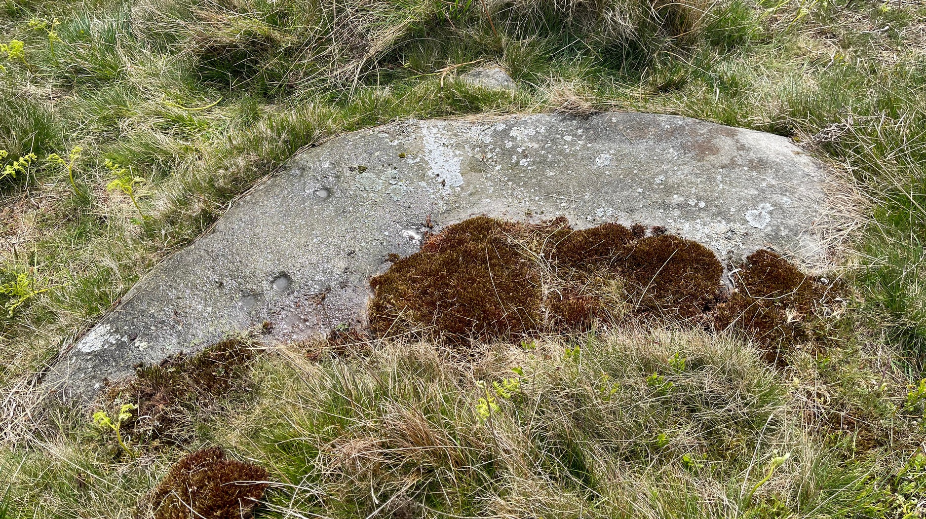
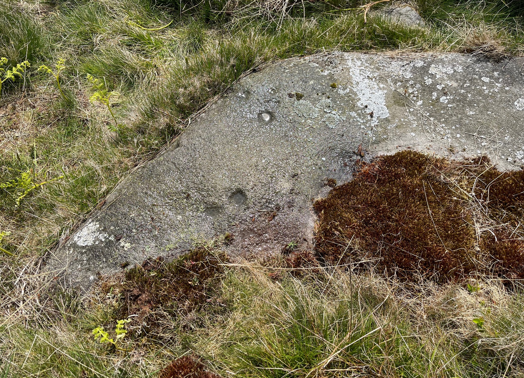
If you’re looking for this carving, you’ll have been to the impressive Tree of Life stone first. From there, you need to walk further away from the walling, 30-35 yards southwest, across the other side of the footpath. There’s a scattered mass of stones all over the ground here: you’re looking for a low-lying long curved stone—longer than most of them hereby. If the heather’s grown back over the stone, it might take some finding!
Archaeology & History
Close to a line of prehistoric walling (seemingly a section of a settlement), this typically curvaceous female stone is possessed of two pairs of faint cup-marks on the eastern side of the rock. It was included in Boughey & Vickerman’s (2003) survey where they described the carving as being, “two small cups visible and two further cups under heather.” A third possible cup exists close to one of the pairs. The carving is found in an area rich in untouched prehistoric remains.
References:
Boughey, Keith & Vickerman, E.A., Prehistoric Rock Art of the West Riding, WYAS 2003.
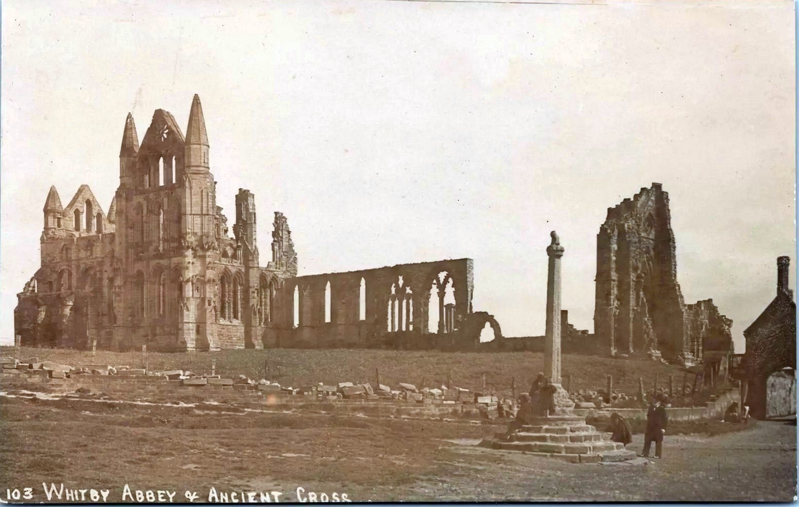
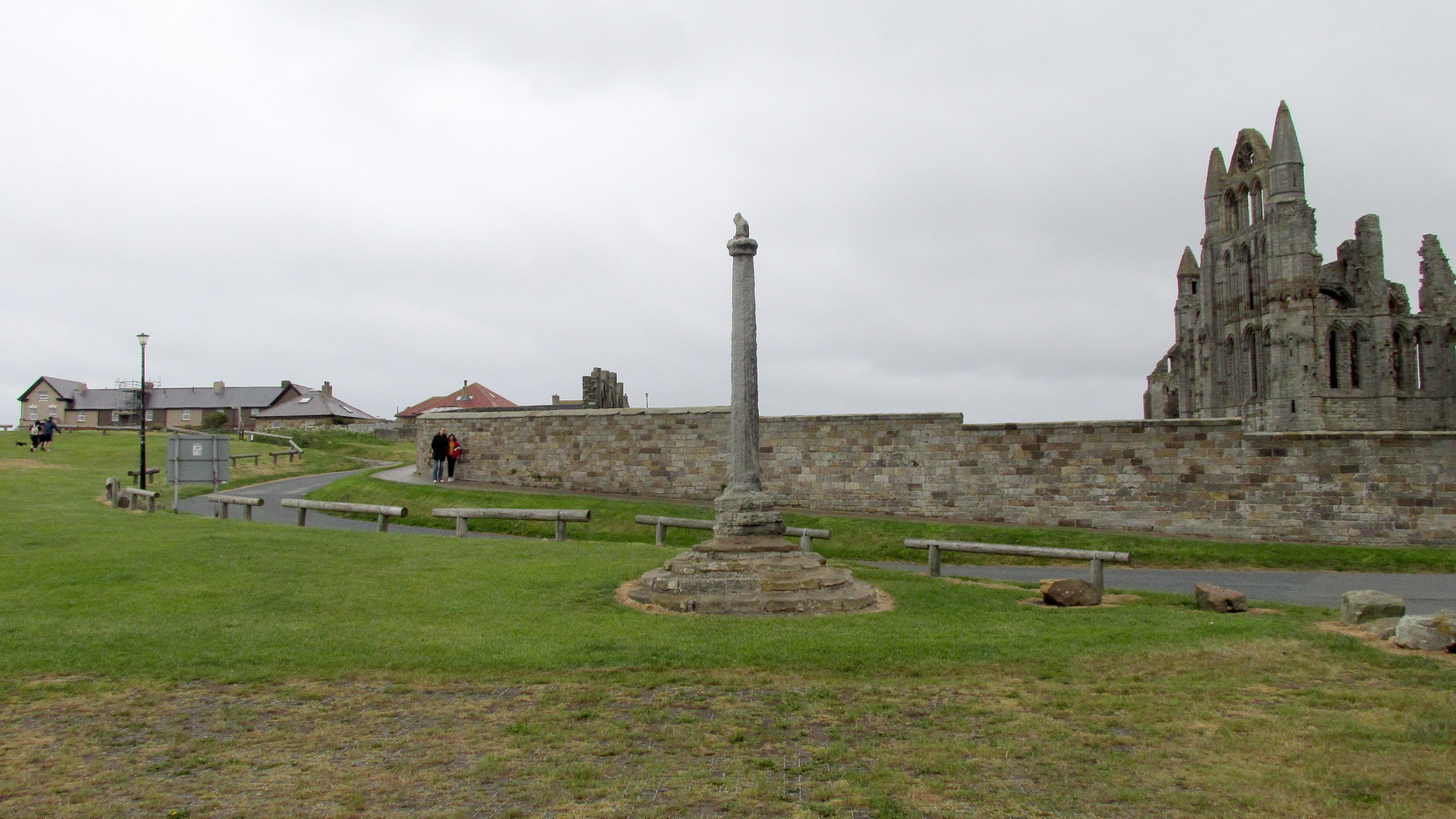
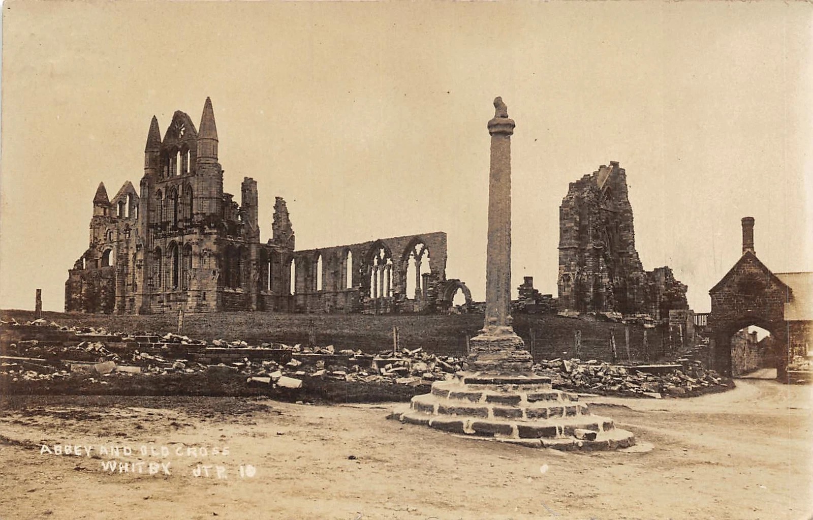
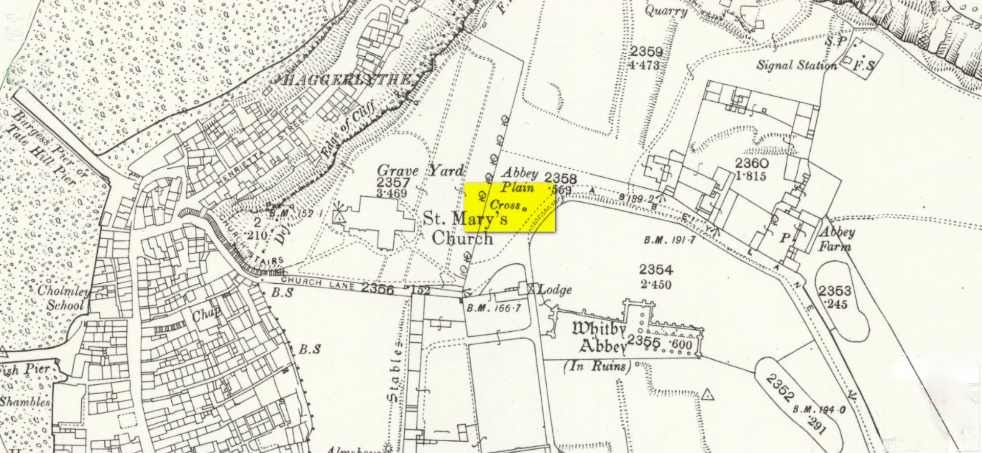
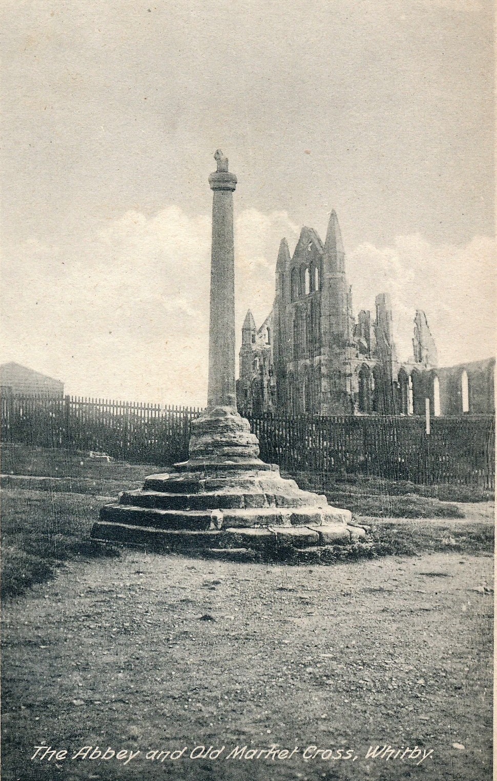
Pretty easy to find: from Whitby town centre, head uphill to the great ruins of Whitby Abbey. You go past Caedmon’s Cross and past the more recent church and graveyard to the car-park at the top, outside the abbey. At the edge of the car-park on the grass, you’ll see this tall hard upright, nice and erect!
Archaeology & History
Cross shown on 1894 map
Highlighted on the earliest OS-maps and not to be confused with the nearby and more modern Caedmon’s Cross, this tall large monolith stands upon a stepped plinth comprising of six steps (originally five), about 18 feet high. The top of the cross was knocked off a century or two ago, when it was reported to have been twenty feet! Initially it stood about fifty yards closer to the Abbey, but was removed to its present position following the Dissolution.
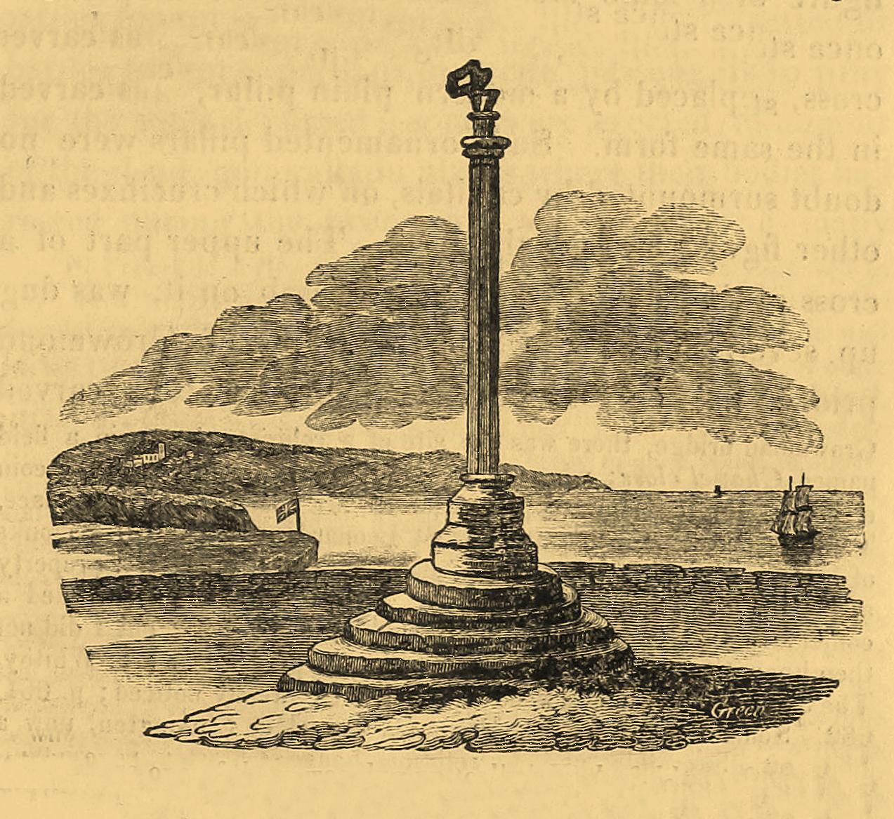
The brief history regarding its origin was described in George Young’s (1817) major work, in which he told that in 1474, on John Nightingale, rector of Sneaton parish, in his will “appointed his burial to be on the north side (of the Abbey), before the cross,” which was already standing at that time. Young wrote:
“By this it would appear that the ancient cross, now standing in the abbey plain was then within the cemetery of the abbey.”
Abbey Cross, c.1900Young’s 1817 sketch
This has subsequently been taken as the standard regarding its origin. Tradition also told that it was an old market cross, but this was treated with considerable scepticism by George Young, who believed that the monks here simply wouldn’t have allowed such a thing at the edge the abbey and burial ground. He found evidence to indicate that it “was at the port or harbour of Whitby that corn was bought or sold, that here were kept the standard bushels for measuring corn, and that here the market-clerk had his station.” In spite of this, T.H. Woodwark (1934) reported that fairs had been held at the cross early in the 20th century. In a thoroughly profane way, electrical wiring was wrapped around the bottom of the cross and led to a generator, along with washing-lines running from it to a caravan! Mr Young would have been apoplectic!
References:
Atkinson, J.C., Memorials of Old Whitby, MacMillan: London 1894.
Holt, Robert B., Whitby, Past and Present, Copas: London 1890.
Woodwark. T.H., The Crosses on the North York Moors, Whitby Literary & Philosophical Society 1934.
Young, George, A History of Whitby and Streonshalh Abbey (2 volumes), Clark & Medd: Whitby 1817.
Acknowledgements:Massive thanks to Lindsay (wherefore art thou…?) Mitchell for getting us up here… Huge thanks for use of the Ordnance Survey map in this site profile, reproduced with the kind permission of the National Library of Scotland.
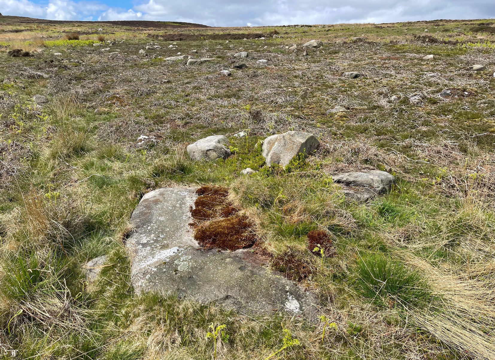
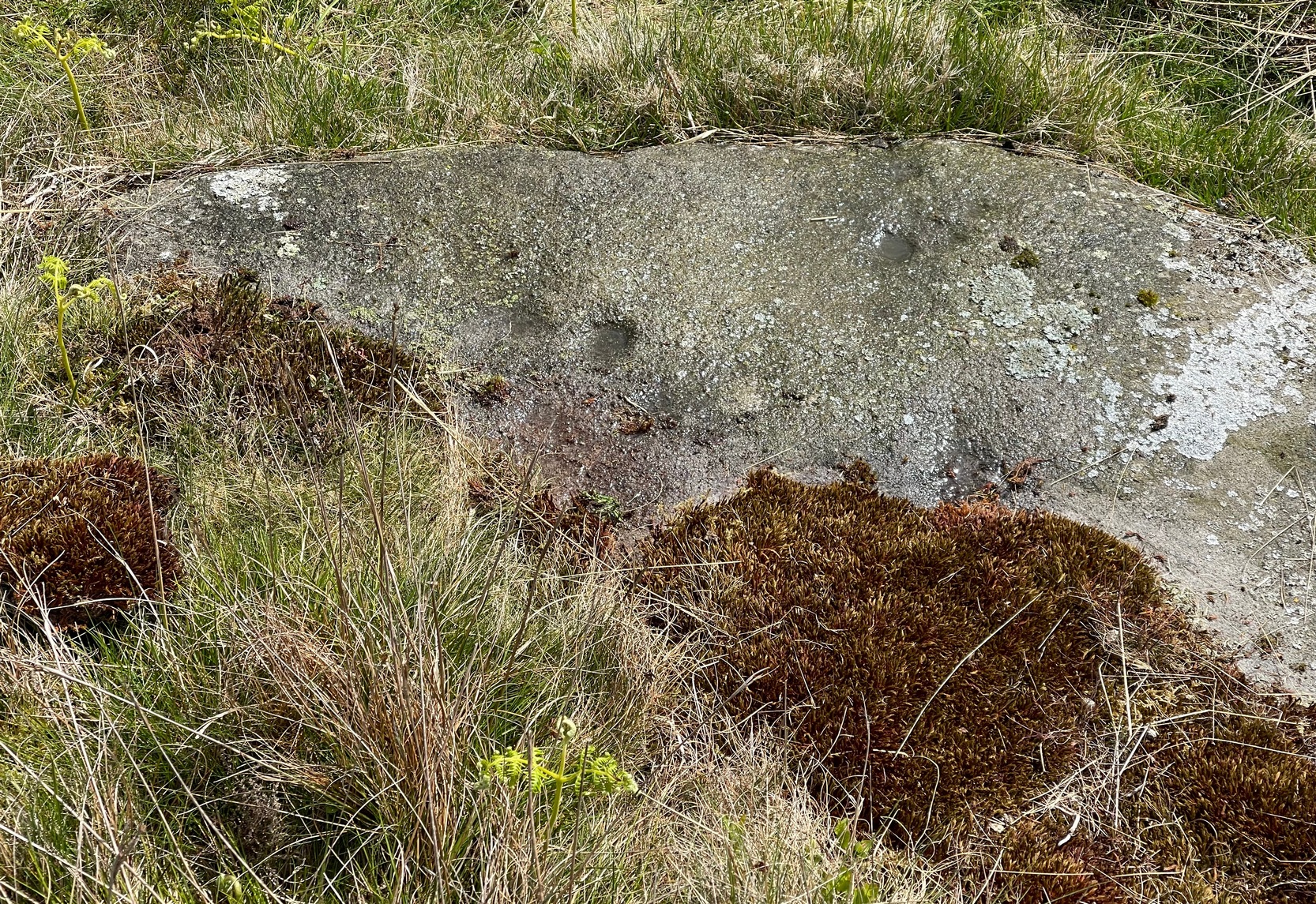
In High Bradley village, you need to go up Mill Lane for 140 yards and then bear left up High Bradley Lane for just over a half-mile, past the last row of houses on your left where it becomes a dirt-track and park-up a short distance up here. 400 yards up, in the field past the new house on your left, walk up the hill over the field, past the wall at the top and head for the large protruding boulder a few hundred yards further up on the near skyline. Once here, walk to the right of it and there’s a scatter of rocks and stones. Look around!
Archaeology & History
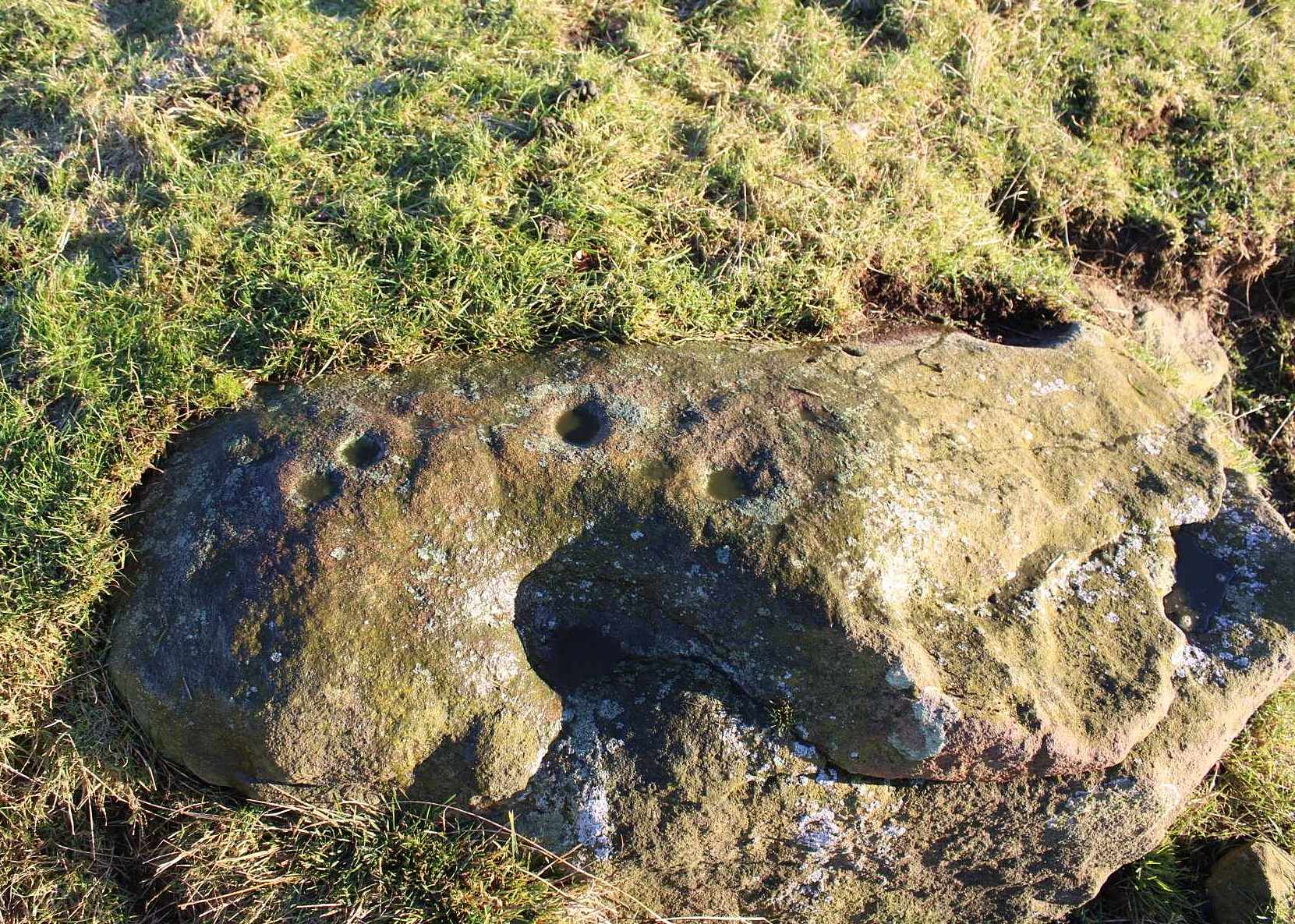
In an area that was extensively cut up by the Industrialists in the 18th and 19th century, Thomas Cleland came across this scarce example of a cup-marked, possibly cup-and-ring marked stone in March 2025 high up on Millstone Hill, where extensive views reach out to the south, east and west, gazing with particular attention to the mightily impressive King and Queen’s cairns, more than 1½ (2.6km) south of here—and which would have stood out much more back then than they do today.
Close-up of faint arc
An arc of cups is faintly visible on the more western-side of the stone—five, perhaps six of them. Several others are in a typically chaotic scatter across the rock, with one or two looking as if they may have been affected by the heavy industrial actions that occurred up here. When Tom first found the carving, he could see a faint ring around one of the cups near the middle of the stone, but on our visit here the sun was near its apogee and due to the slope of the rock to the north where the cups are carved, this was nigh on impossible to make out. Near the bottom edge however (as shown in the photos), a cup-and-incomplete ring seems evident; although we didn’t notice this on our visit here and it may just be a fortuitous play of the light (but I hope I’m wrong!). This is a design that mainly comes to life, so to speak, is more easily visible, when the sun is either rising or setting. (typical of many petroglyphs on flat rocks)
Acknowledgements:Huge thanks to Thomas Cleland for use of his photos in this site profile.
Cup-Marked Stone (lost): OS Grid Reference – SE 2556 4687
Also Known as:
Carving no.556 (Boughey & Vickerman)
Archaeology & History
We know very little about this carving, which was first highlighted on Eric Cowling’s (1940) map of Wharfedale petroglyphs. Described simply as one of the “cup-marked rocks”, he mentioned it briefly in Rombald’s Way (1946) as being “the most easterly carving” in mid-Wharfedale—which it was at the time (a very recent find by Benn Potts of a cup-marked stone at Weeton has pushed the boundary further eastwards). Oddly for Cowling, he left no further notes nor sketch of the carving and when Stuart Feather (1961) came to write of it, he merely copied Cowling’s earlier words. It’s not been seen since. In Boughey & Vickerman’s (2003) survey, they could find no cup-marked stone in the wood but thought instead that,
“this may be due more to confusion than to loss of the carving. Riffa Wood does contain a carving: of a Native American on a conspicuous rock alongside one of the many woodland paths. Furthermore, one or two local residents recall a German prisoner carving something on a rock in Riffa Wood during the Second World War. Presumably, this is the origin of the Native American carving. Could it be that this man added something of his own to what was already a carved rock, in which case the Native American as he now appears is the site noted by Cowling before the War?”
No cup-marks exist on this Native American carving, and it’s highly unlikely that Cowling would have made such an elementary mistake. The carving no doubt lies covered in woodland vegetation waiting, once more, for the day that someone comes along and exposes its visage to the world again. Let us know if you manage to find it…
References:
Boughey, Keith & Vickerman, E.A., Prehistoric Rock Art of the West Riding, WYAS: Wakefield 2003.
Cowling, E.T., ‘A Classification of West Yorkshire Cup and Ring Stones,’ in Archaeological Journal, volume 97, 1940.
Cowling, E.T., Rombald’s Way: A Prehistory of Mid-Wharfedale, William Walker: Otley 1946.
Feather, Stuart, “Mid-Wharfedale Cup-and-Ring Markings,” in Cartwright Hall Archaeology Group Bulletin, volume 6, no.3, March 1961.
Acknowledgements:Huge thanks for use of the Ordnance Survey map in this site profile, reproduced with the kind permission of the National Library of Scotland.
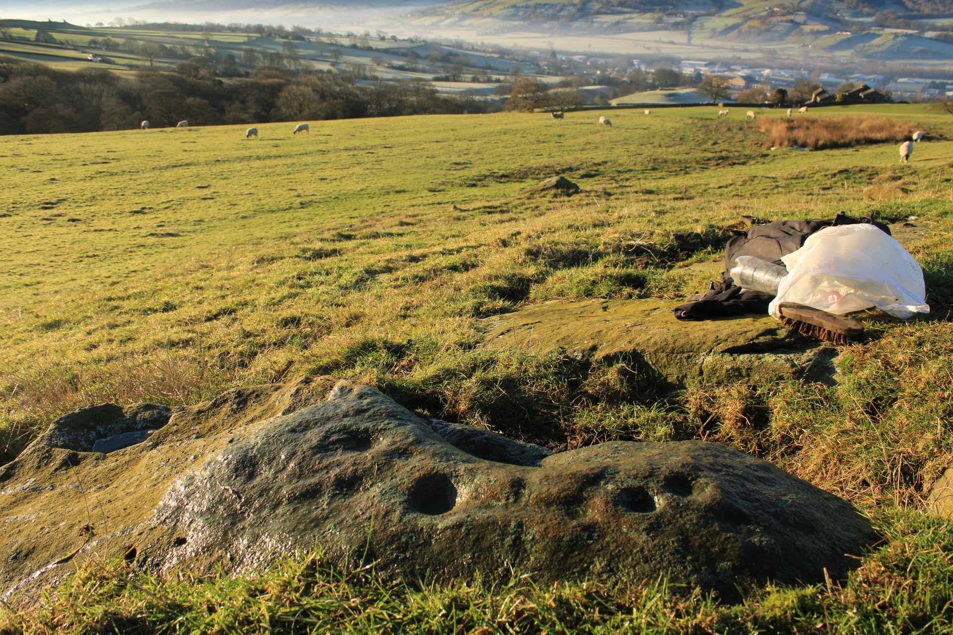
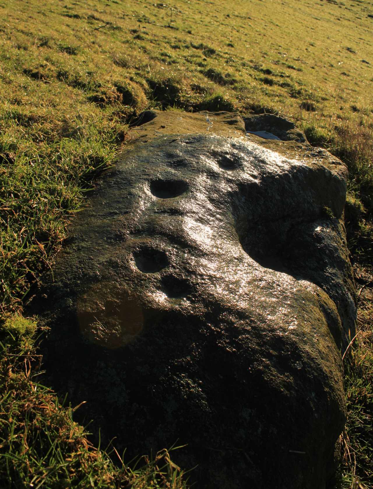
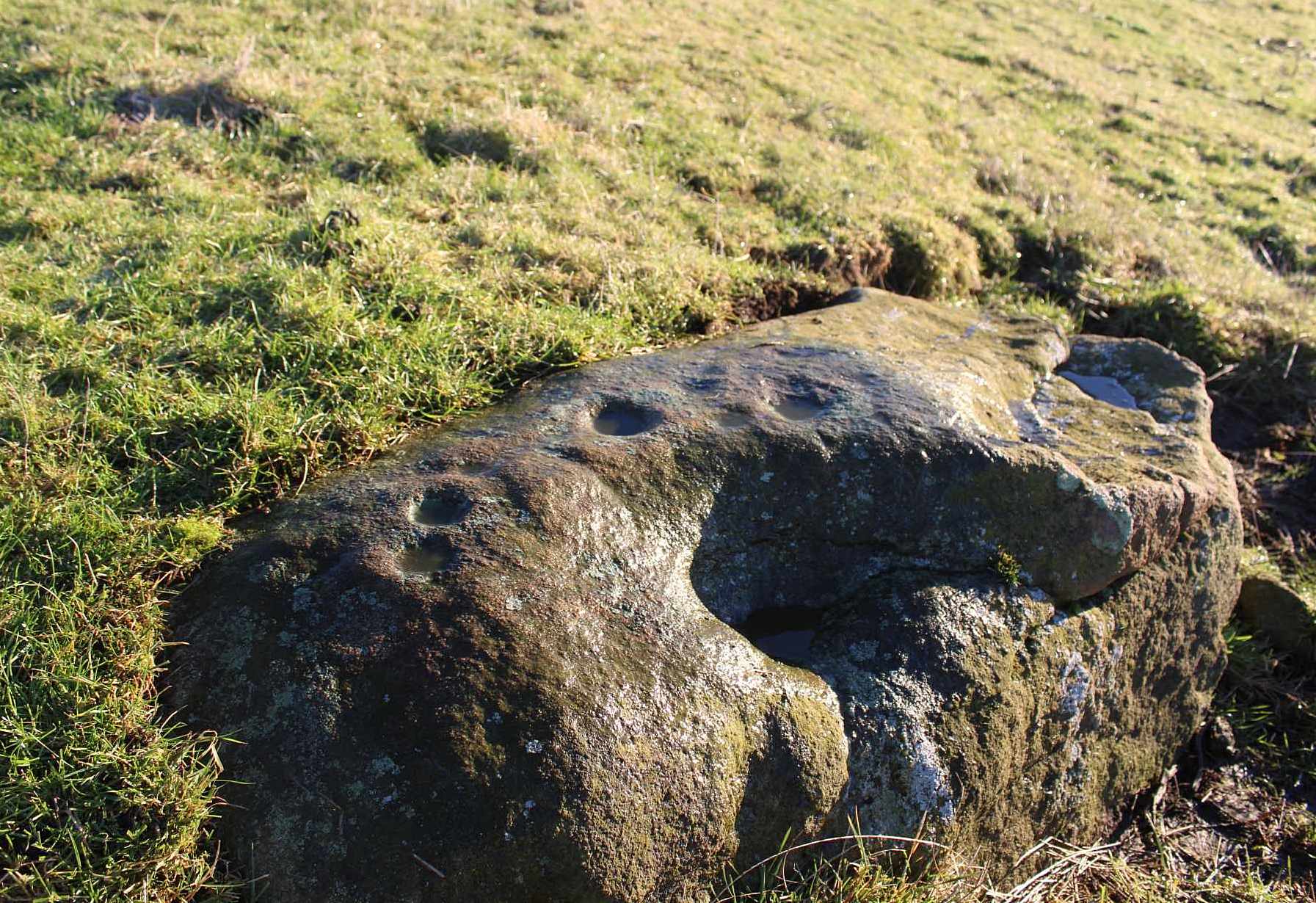
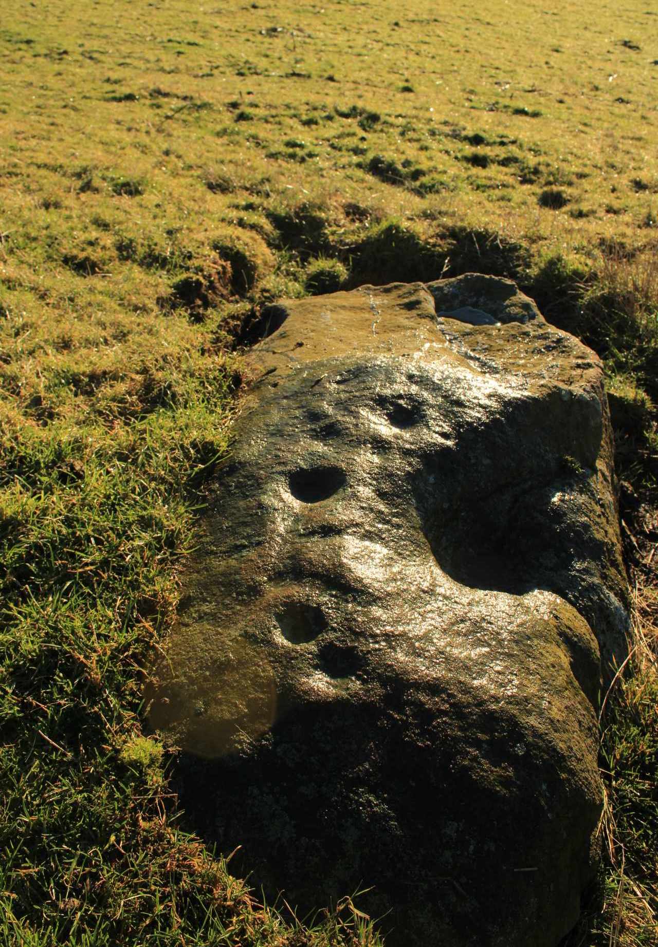
From near Skipton town centre, at the Cross Keys Inn along Otley Road, go up Short Bank Road all the way to the very top and then into the trees onto the Dales High Way footpath. Walk up for literally ¼-mile (0.4km) and where the path bends and heads ENE, notice here a footpath that takes you over the wall. Once on the other side, the path splits with one heading SE and the other roughly alongside the walling to the SW, which is where you need to go. About 200 yard on, go through the gate into the field and then another 375 yards on you’re into another field (copse of trees in front of you). Just as you’ve gone into this field, walk immediately left, uphill, by the walling for about 100 yards, over the marshy dip, then head into the field where, about 75 yards in, you’ll see some rocks scattered about…
Archaeology & History
Cleland Stone, looking S
In an area that’s had some considerable quarrying done to it, we’re lucky to find that this carving still exists. It was rediscovered by Thomas Cleland (hence its name!) in the summer of 2024. It consists of four distinct cups, with a possible fifth (and maybe more?) on its smooth elongated surface. The cups, as we can see, are quite deep and unmistakable. An incomplete ring seems to be around at least one of the cups; and there seems to be a carved straight line running between another two of them. A simple but distinct design and in a lovely setting gazing cross the Airedale valley from here.
There are very few other carvings in this neck o’ the woods (the Great Laithe Wood carving aint too far away), but the fact that this has been found would suggest that others are probably hiding away in the undergrowth. Check out the Iron Age Horse Close Hill enclosure while you’re up here too.
Acknowledgements: A huge thanks to Thomas Cleland, not only for finding the carving, but also for allowing use of his photos in this site profile.