Holy Well (destroyed?): OS Grid Reference – NS 7787 9252?
Archaeology & History
A small but ancient chapel once existed in Cambusbarron, long ago, located about one hundred yards east of the Chapel or Christ’s Well. William Drysdale (1904) told that, apart from the Chapel Well and nearby St. Thomas’ Well, “several other wells in the locality were believed to possess healing virtues.” It was J.S. Fleming (1898) who said that, “attached to Cambusbarron Chapel two other holy but nameless wells are stated to have been in existence in 1866, on the brink of Glenmoray Burn, near the chapel itself.”
A writer for the Stirling Observer in 1871 told that one of these holy wells was in fact to “be seen near the brink of a little burn which trickles from the miniature glen of Glenmoray, visible on the hillside, just below the lowest reservoir” above Touch, more than a mile away (heading up towards St Corbet’s Well). The other was said to be near Johnnie’s Burn, a mile to the west. In Fleming’s (1898) opinion however, neither of these sites were feasible, as he walked all along the course of both burns and could find no other wells. Does anyone know any different?
References:
Drysdale, William, Auld Biggins of Stirling, Eneas Mackay: Stirling 1904.
Fleming, J.S., Old Nooks of Stirling, Delineated and Described, Munro & Jamieson: Stirling 1898.
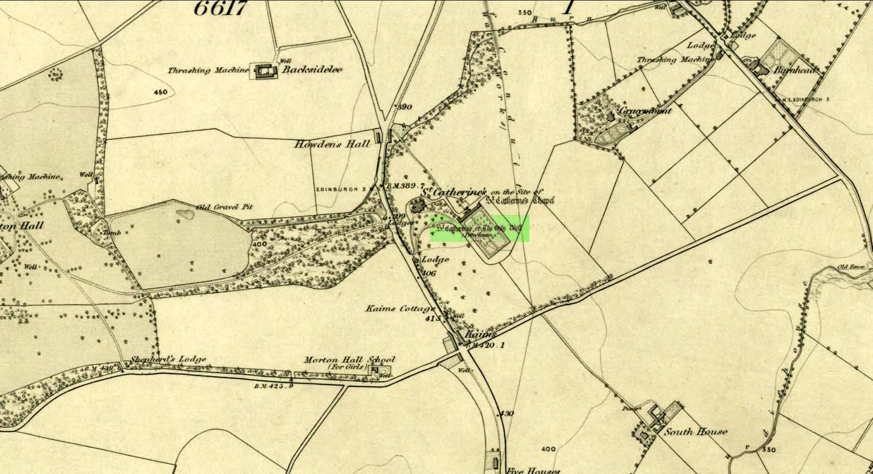
Take the A701 road from the east end of Princes Street south—down North Bridge, South Bridge, Nicolson Street, onto Liberton Road and then Liberton Gardens—towards Penicuik. 3¾ miles along, in the parish of Liberton itself, where the A701 is called Howden Hall Road, keep your eyes peeled for the turning into the Toby Carvery on your left. Park up and walk across the grass and look behind the trees ahead of you (if you can’t find it, ask the people in the pub). .
Archaeology & History
Located south of Liberton village—a few hundred yards west of the long-gone chapel erected by St. Margaret in honour of St. Catherine—this famous holy well is now in the grounds of a public house and is easily accessed. It has been described by many historians through the centuries, from Matthew Mackaile’s (1664) short work to more recent tourist guides. When the local historian George Good (1893) told about it, local lore still spoke of the old church. “These lands,” he wrote,
“belonged to a very ancient chapel dedicated to St. Catherine, which stood with its burying-ground near the modern mansion of St. Catherine’s. All trace of this chapel has disappeared, but at the end of last century its ruins were still extant. It was reputed to be the most ancient place of worship in the parish, and the ground around the chapel was consecrated for burials. Hither came annually in solemn procession the nuns from the Convent of Sciennes, a foundation due to the piety of one of the St. Clairs of Rosslyn, who may possibly have also been connected with the origin of the Chapel of St. Catherine.”
Its relationship with the world-famous Roslyn Chapel, less than 4 miles to the south, remains (to my knowledge) unproven, but it’s an association that would not be unlikely. This aside, St Catherine’s Well has a long history. Described in Hector Boece’s Latin text Scotorum Historia (1526), we have one John Bellenden to thanks for a wonderful translation into early english under the title of The History and Chronicles of Scotland in 1536. Herein one of the later editions we read, in that quaint old dyslexia:
“Nocht two miles fra Edinburgh is ane fontane dedicat to Sanct Katrine, quhair sternis of oulie springs ithandlie with sic abundance that howbeit the samin be gaderit away, it springis incontinent with gret abundance. This fontane rais throw ane drop of Sanct Katrine’s oulie, quhilk was brocht out of Monte Sinai, fra her sepulture, to Sanct Margaret, the blissit Quene of Scotland. Als sone as Sanct Margaret saw the oulie spring ithandlie, by divine miracle, in the said place, sche gart big ane chapell thair in the hounour of Sanct Katrine. This oulie has anr singulare virteu agains all maner of kankir and skawis.”
In the middle of the 17th century, its medicinal virtues were brought to the attention of the surgeon Matthew Mackaile who, in 1664, wrote:
“In the paroch of Libberton, the church whereof lyeth two miles southward from Edinburgh, there is a well at the Chapel of St. Catherine’s, which is distant from the church about a quarter of a mile, and is situate toward the south-west, whose profundity equaleth the length of a pike, and is always replete with water, and at the bottom of it there remaineth a great quantity of black oyl in some veins of the earth. His Majesty King James VI, the first monarch of Great Britain, of blessed memory, had such a great estimation of this rare well, that when he returned from England to visit his ancient kingdom of Scotland in anno 1617, he went in person to see it, and ordered that it should be built with stones from the bottom to the top, and that a door and a pair of stairs should be made for it, that men might have the more easy access into its bottom for getting of the oyl. This royal command being obeyed, the well was adorned and preserved until the year 1650, when that execrable regicide and usurper, Oliver Cromwell, with his rebellious and sacrilegious complices, did invade this kingdom, and not only defaced such rare and ancient monuments of Nature’s handiwork, but also the synagogues of the God of nature.”
St Catherine’s Well today
This historical appraisal has been echoed by other writers and is very probably accurate. Some years after Cromwell and his murderers had desecrated the land and people in this area, the well was again repaired to its former condition and slowly, quietly, people began traditionally using the site for ritual and healing once more. But over the next two hundred years, probably through religious persecution by the Church, the site was used less and less and, by the time Thomas Muir (1861) visited and wrote about it, the well-house had become “dilapidated”. A few years later when the holy wells writer J.R. Walker (1883) visited the place, he found that not only was it still,
“celebrated for the cure of cutaneous diseases, (but) it is still visited for its medicinal virtues”; and was “now carefully protected and looked after.”
In James Begg’s (1845) account of the well for the Statistical Account, he told:
“At St. Catherine’s is a well which contains a quantity of mineral oil or petroleum, obtained most probably from the spring flowing over some portion of the coal beds. This bitumous matter floats copiously on the surface of the water, and is also partially dissolved in it. The spring is reckoned medicinal by the country people, and may have some slight efficacy in cutaneous eruptions…
“At St Catherine’s, there is the famous well, before alluded to, anciently called the Balm Well. Black oily substances constantly float on the surface of the water. However many you remove they still appear to reside in this well, and it was much frequented by persons afflicted with cutaneous complaints. The nuns of the Sheens made an annual procession to it in honour of St Catharine. King James VI visited it in 1617, and ordered it to be properly enclosed and provided with a door and staircase, but it was destroyed and filled up by the soldiers of Cromwell in 1650. It has again been opened and repaired, and is now in a good state of preservation.”
The “nuns of the Sheens” who made the annual pilgrimage here were the nuns of St. Catherine’s of Sienna, in Italy! This crazy-sound journey is more than one thousand miles long and its nature and origin needs exploring in greater depth—although a “Nunnery of St. Catherine of Siena at Edinburgh” was founded in 1516 at Sciennes in Edinburgh, less than three miles away. Much easier! 🙂
It would have been more than just the healing properties of the oily waters that called the nuns across their incredible journey, but they would, no doubt, have been of considerable mythic importance. All of the early writers comment about it and seem confident in its abilities. As the Liberton historian George Good (1893) said,
“…there can be little doubt that its waters had a healing tendency. Oils when rubbed on the skin have often been found to produce most beneficial results in skin diseases. The tarry substance or petroleum mixture discovered in this spot was no doubt due to the presence of the coal or shale strata of the district. The existence of the oil-works at Straiton and elsewhere cannot fail to throw a light upon the history and peculiarities of the so-called Balm Well of St. Catherine’s, which even yet has an occasional visitor.”
This oily substance was examined for medical potential by Dr. George Wilson in the mid-19th century, who found:
“The water from St Katherine’s Well contains after filtration, in each imperial gallon, grs. 28.11 of solid matter, of which grs. 8.45 consist of soluble sulphates and chlorides of the earths and alkalies, and grs. 19.66 of insoluble calcareaous carbonates.”
I am not aware of any modern accounts of cures attached to St Catherine’s waters, but have little doubt that some people will have found it useful….
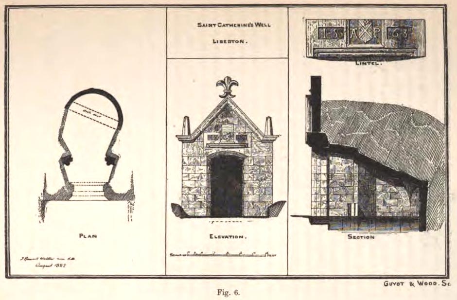
The architecture of the small well-house covering the waters would seem insubstantial, but the Royal Commission (1929) account told:
“The well is housed within a tiny vaulted structure. The Renaissance front is relatively modern, but it contains a door lintel, probably quite unconnected with the structure, on which is inscribed the date 1563 within recessed panels flanking a central panel, which contains a shield flanked by the initials A.P. The shield bears a saltire, in the sinister quarter of which is a Latin cross placed horizontally, i.e., with the shaft towards the fess point (? a merchant’s mark); the upper quarter contains a much worn object resembling a broad arrow, point uppermost.”
Plan of site in 1883
The iron-clad door is locked, as the visitor will see. Please enquire at the hotel regarding it being opened to look inside. Upon our visit here in June 2017, the waters, as in J.R. Walker’s (1883) day, were still bubbling up and were quite high, but it looked as if the inside needed cleaning. For a change, we didn’t drink the water…..
Folklore
Although various writers have posited that the oily waters are probably due related to the nearby coalfields, legend tells otherwise:
“It owes its origin, it is said, to a miracle in this manner: St. Katherine had a commission from St. Margaret, consort of Malcolm Canmore, to bring a quantity of oil from Mount Sinai. In this very place, she happened, by some accident or other, to lose a few drops of it, and, on her earnest supplication, the well appeared as just now described.” (Thomas Whyte 1792)
References:
Banks, M. MacLeod, British Calendar Customs: Scotland – volume 1, Folklore Society: London 1937.
Begg, James, “Parish of Liberton“, in New Statistical Account of Scotland – volume 1: Edinburgh, William Blackwood: Edinburgh 1845.
Muir, Thomas S., Characteristics of Old Church Architecture,in the Mainland and Western Isles of Scotland, Edmonston & Douglas: Edinburgh 1861.
Royal Commission on the Ancient & Historical Monuments of Scotland, Inventory of Monuments and Constructions in the Counties of Midlothianand West Lothian, HMSO: Edinburgh 1929.
Walker, J. Russel, “Holy Wells’ in Scotland,” in Proceedings of the Society of Antiquaries of Scotland, volume 17, 1883.
Watson, W.N.B., “The Balm-Well of St Catherine, Liberton,” in Book of the Old Edinburgh Club, volume 33, 1972.
Whyte, Thomas, “An Account of the Parish of Liberton in Midlothian, or County of Edinburgh,” in Archaeologica Scotica, volume 1, 1792.
Wilson, Daniel, Memorials of Edinburgh in the Olden Times – 2 volumes, Edinburgh 1891.
Acknowledgements:Huge thanks for use of the Ordnance Survey map in this site profile, reproduced with the kind permission of the National Library of Scotland.
This long lost holy well used to be found somewhere on the south-side of the Water of Leith, close to Powderhall, between Warriston and Broughton. References to it are minimal. Whilst Ruth & Frank Morris’ (1981) thought it might have been an alternative name of the Bonnington Mineral Spring—aka St. Cuthbert’s Well—a half-mile to the north-east, we know from John Russel’s (1933) article that it was a quite separate site; but all he could tell us was that St. Leonard’s Well was “a now forgotten mineral well”. The clearest indicator telling of its whereabouts is in John Geddie’s (1896) lovely work on the history of the Leith watercourse, where he described this “forgotten mineral spring” as being below Powderhall “beside the Water”, i.e., the river Leith. A few miles south, a crag at Arthur’s Seat was once dedicated to St. Leonard. (the grid-reference to this site is an approximation).
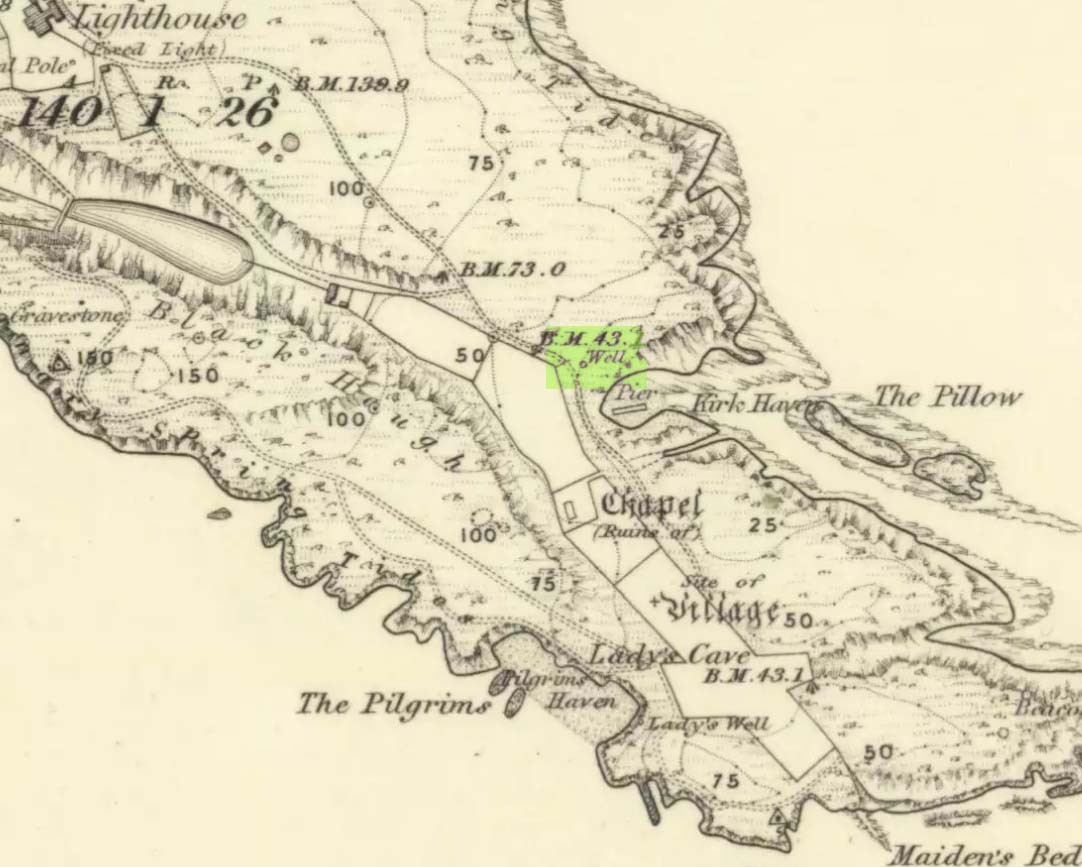
This seems to be the only ‘St John’ dedication on the Isle of May: a small island littered with more saint’s names, seemingly, than Iona and Lindisfarne combined! Illustrated on the 1855 OS-map, without name—and on the present-day large-scale OS-maps too, 20 yards or so from its 1855 position—the standard archaeo-historical records say nothing of the place. Thankfully antiquarian and folklore accounts have preserved evidence of its title. When the Victorian traveller Thomas Muir (1868; 1883) visited the Isle of May, he told how the islanders struggled to maintain a good water supply during a drought there in the 1860s. St. John’s Well was, he told,
“A pump standing by the path above Kirk Haven. The water good, but a little brackish. During all the drought of this summer we pumped water out of this well to supply our cattle.”
After Æ. J.G. Mackay’s (1896) visit to the island he told that here, along with the other holy wells on May,
“their brackish waters have lost the magic virtue they were credited with in early christian, possibly in pagan times.”
In more recent times it was described in W.J. Eggeling’s (1985) natural history survey. St. John’s Well was,
“the well within the high, cylindrical, whitewashed wall-surround lying across Haven Road from the Coal House. Also known as the Pump Well. It is a guiding mark for boats entering Kirk Haven.”
Folklore
St. John’s Day (June 24) was the christian name given to the traditional Midsummer Day, or days, around which good heathen festivals occurred; but we can find no ritual accounts of activity specific to this Well. Help!
References:
Dickson, John, Emeralds Chased in Gold; or, The Isles of the Forth, Oliphant: Edinburgh 1899.
Muir, Thomas S., The Isle of May – A Sketch, Edinburgh 1868.
Muir, Thomas S., Ecclesiological Notes on some of the Islands of Scotland, David Douglas: Edinburgh 1883.
Simpkins, John Ewart, Examples of Printed Folk-lore Concerning Fife, with some Notes on Clackmannan and Kinross-shires, Sidgwick & Jackson: London 1914.
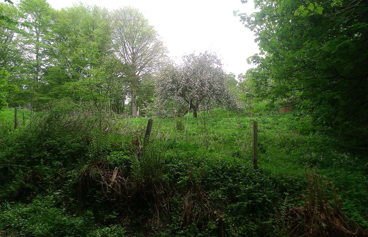
A fascinating site that was described in Johnston & Tullis (2003) local history work on the parish of Muckhart. Amidst an area bedevilled with faerie, boggarts, ghosts and historical shamanic moot sites we find more curious folklore pointing at a long forgotten site, whose age and precise nature remains a mystery. Adjacent to the old boundary line, close to the meeting of streams, the Muckhart authors told that,
“an orchard above the old farmhouse to this day remains mainly untouched. It was the burial site of warlocks from the parish and it is thought some may have even been burned at the Mill. It has always been said that this ground should never be touched! There is an ancient rubble bridge over the Hole Burn which has a Masonic Eye painted on it to ward off any unwelcome spirits. Despite the eye, both the Farmhouse and the Millhouse have been home to many strange and ghostly manifestations.”
The folklore sounds to be a mix of archaic and medieval animistic traits: perhaps of a prehistoric cairn, visited and maintained by local people (as found throughout Britain) until the Burning Times, when christian fanatics arrived, debasing the cultural rites and murdering local innocent people. …Perhaps not.
Looking down on the orchard
When Paul, Maggie and I explored the area a few days ago, we were greeted most cordially by the owner of Muckhart Mill, who knew of the folklore, but didn’t know the exact whereabout of the grave. We couldn’t find any clues as to its exact location either. Apart, perhaps, from the top of the hill immediately above the orchard where, alone and fenced off with an old covered (unnamed) well, a solitary Hawthorn tree stood. We each recalled the aged relationship that Hawthorn has in witch-lore… but that’s as far as it went. The grave remains hidden and may have been destroyed. If anyone discovers its whereabouts, please let us know so that a preservation order can be made to ensure its survival.
References:
Johnston, Tom & Tullis, Ramsay (eds.), Muckhart, Clackmannanshire: An Illustrated History of the Parish, MGAS 2003.
Healing Well (destroyed): OS Grid Reference – NT 2511 7322
Archaeology & History
Like many others in the city centre, this old well has long since passed into history. Said by Stuart Harris (1996) to have been “about twenty-five yards east of the eastern corner of Lady Lawson Street”, the Victorian writer Alison Dunlop (1890) told it to be by “a narrow close and an outside stair gave (which) entrance to the Court-house.” It was the focus of much social activity in ages past; and although a number of public wells could be found in this part of the city, south of the Castle, the Westport Well was the most renowned. Miss Dunlop told that,
“…its waters (were) of excellent repute (and) had to satisfy the necessities of all the inhabitants of the district. The early morning never failed to see a long line of water-stoups stretching from it in either direction like the queue at a French theatre door. Not so quiet, however, for tongues, mostly feminine, wagged freely, and the ‘Waal’ news and gossip were then the equivalent for a racy morning newspaper.”
According to her account, the patience of the people collecting the water was exemplary:
“All crowding-in was fiercely resented; gentle and simple had to stand their turn; only the water-caddies had the abiding right of precedence, and satisfied their customers at the moderate rate of two stoupful for a penny. We have already mentioned these ancient aquarian vessels peculiar to Scotland. In the event of a marriage taking place—in which case the bride was responsible for an amount of house plenishing not considered incumbent or even fashionable now-a-days—the ‘stoups’ were invariably purchased by the intending husband. Indeed, the Weetin’ o’ the Stoups was the synonym for the last bachelor supper prior to matrimony. Such festivities are understood to be hilarious, happy, hopeful; and the weetin’ o’ the stoups in Old Portsburgh, as in Old Edinburgh, was sometimes very wet indeed.”
From the B6265 valley road between Bingley and Keighley, just near Riddlesden Hall, take the road up and over the canal into Riddlesden, bearing left up past West Riddlesden Hall and up Banks Lane. As you reach the T-junction at the top, where you hit the Silsden Road that goes round the moors, park up. Cross the road and follow the footpath up the field, go over a stile and continue up the track to the next gate. Once through this gate, go across the field to another gate which leads to a narrow track. The stone is situated on the left hand side about 75 yards from the gate.
Archaeology & History
Not previously recorded, this carving comprises of a large cup on the vertical surface of the stone with a faint surrounding ring mark.
Healing Well (destroyed): OS Grid Reference – SE 1174 3443
Archaeology & History
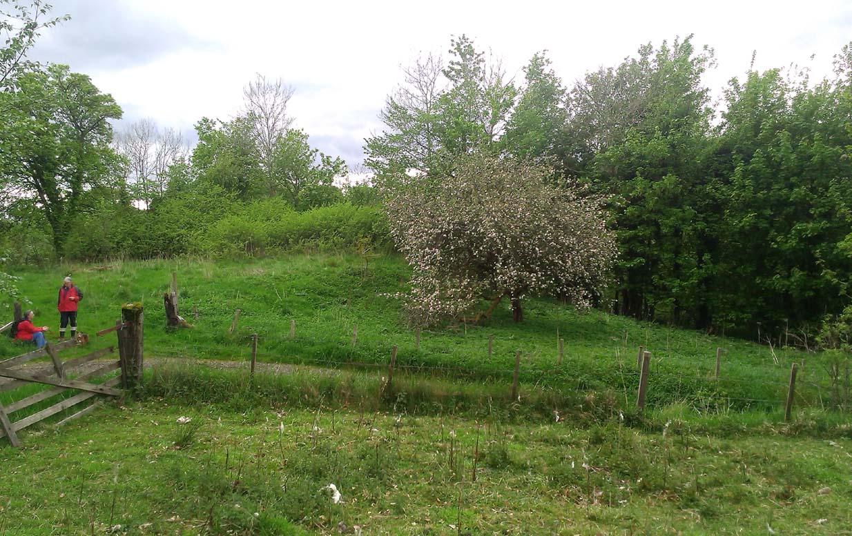
Ing Well on 1852 map
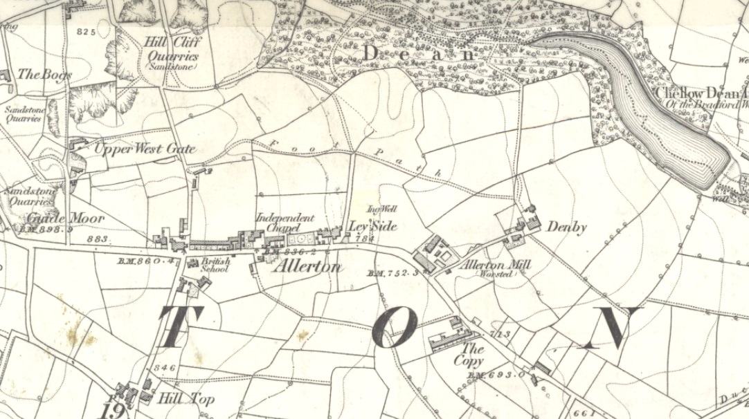
This ‘Well of the Meadow”, or Ing Well, is one of countless springs in and around the Bradford metropolis that have been destroyed by that thing they call ‘development’. It was one of the main water sources for the villagers of Allerton village in the 19th century and earlier. Highlighted on the 1852 OS-map of the region, a singular footpath once led to the waters and no further. There appear to be no antiquarian or historical references detailing its traditions or medicinal qualities—unless of course, you know different.
The name Ing Wells is one of the most common of all titles given to water supplies in England, meaning having the same meaning and general history just about everywhere it occurs. The place-name itself was given extensive attention in two separate studies by Eilert Ekwall (1962) and Sigurd Karlstrom (1927).
References:
Ekwall, Eilert, English Place-Names in -Ing, Lund: Uppsala 1962.
Karlstrom, Sigurd, Old English Compound Place-Names in -Ing, Lund: Uppsala 1927.
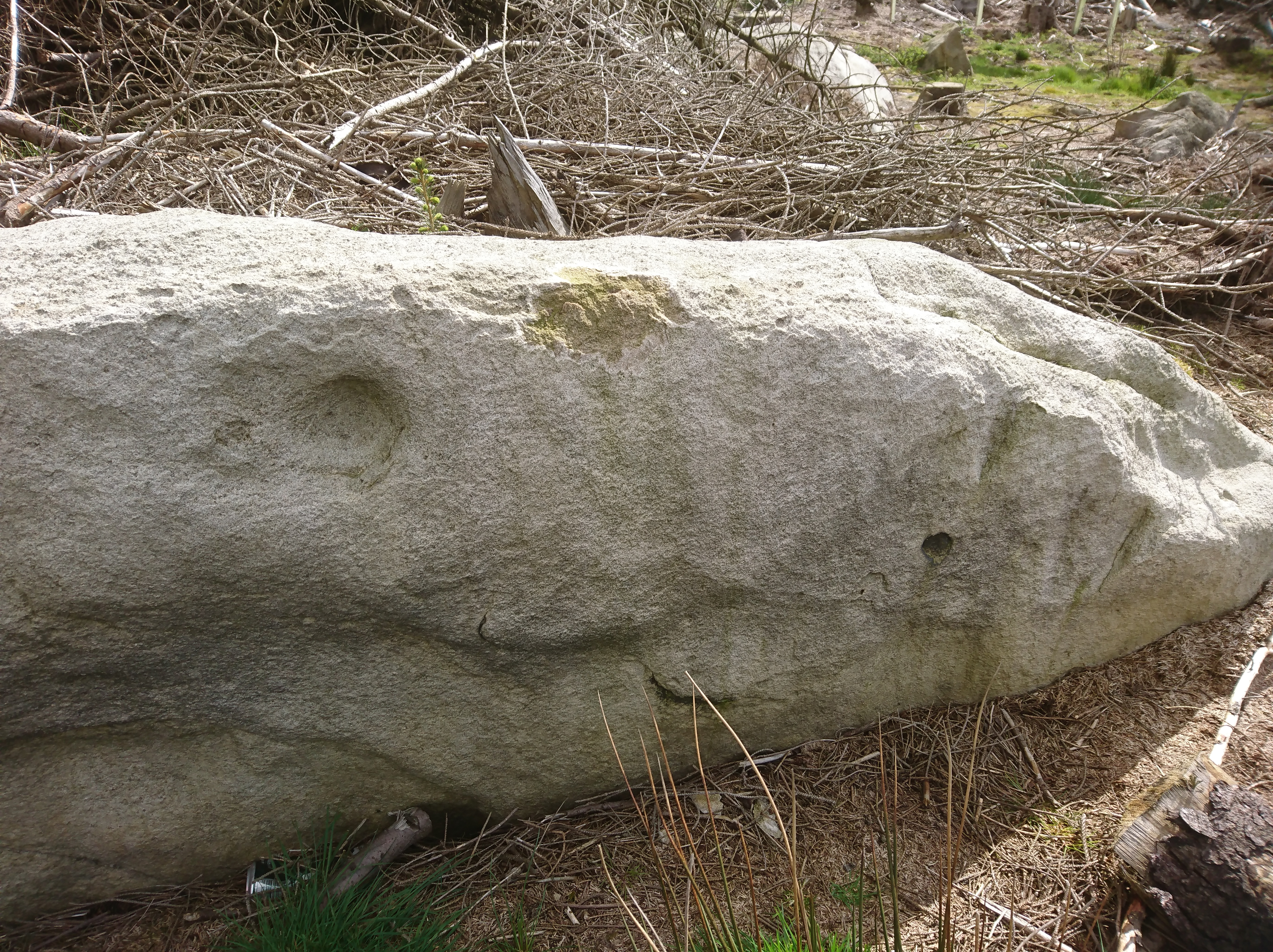
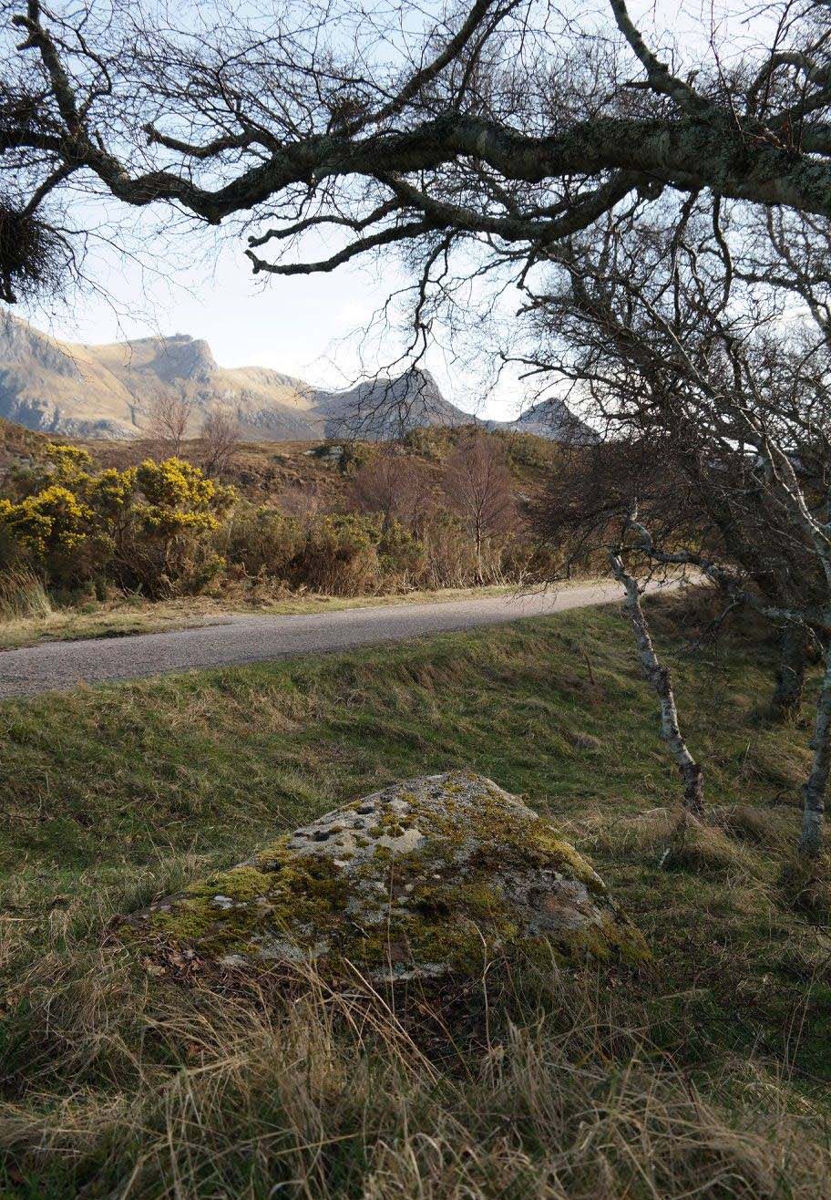
Whether you take the A836 or A838 into Tongue (through truly beautiful wilderness), make sure you go into the village itself—and then keep going, south, along the tiny country road for 3 miles. Hereby, keep your eyes peeled for Lochan na Cuilce on your right; keep going past here, into and through the old trees where you’ll then see Lochan Hakel on your left. Keep going past here until your reach the next small copse on your right. Stop here. A small pool is yards into the trees and here you’ll see a single stone between that and the roadside. You can’t really miss it!
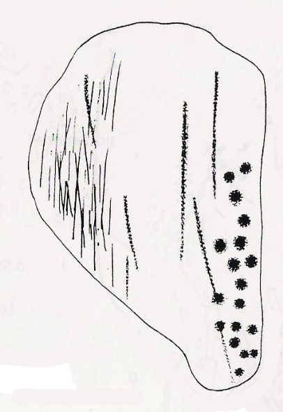
Archaeology & History
Close-up of some cups (by Donna Murray)
An apparently isolated cup-marked stone, some 3 feet by 5 feet, that was first described in Morrison’s (1883) meanderings amidst Sutherland’s awesome wilderness. It’s quite plain compared to Lochan Hakel 2 and many other carvings, simply consisting of 18 cups of various sizes, mainly on the eastern side of the rock. Sarah MacLean pointed out that a line running along the length of the stone seemed, in parts, to have been artificially enhanced by the hand of man, or woman. I have to agree with her.
The Royal Commission (1911) lads included this petroglyph in their superb survey of Sutherland, telling:
“On the W. side of the road to Kinloch, about ½ m. N of the bridge over the Kinloch River (Amhainn Ceann Locha), and on the N edge of a gravel pit close to the road, is a large earthfast boulder, 5′ in length as far as exposed, and 3′ 10″ in breadth, showing on its upper surface eighteen cup-marks of various depths, of which the most distinct is towards the N end of the stone, measuring about 3″ in diameter and 1″ in depth. The whole length of the stone is not visible, but the markings do not seem to extend to the portion covered…”
Carving in situ (by Donna Murray)by Kevin o’ Reilly
Simulacra lovers will love the form of this stone in relation to the background of the mountains, as its shape is echoed in that of the rising hills several miles to the south. …Of course, the depersonalizing ones amongst you lacking an understanding of animism would reject any such association due to your projection of disbelief. However—and equally—as we lack any ethnographic data on the carving we must also assume some caution…
A fascinating site – and one which is likely to have neighbours hidden in the surrounding moorlands…
References:
Gourlay, Robert, Sutherland: An Archaeological Guide, Birlinn: Edinburgh 1996.
Michell, John, Simulacra, Thames & Hudson: London 1979.
Morrison, Hew, Tourist’s Guide to Sutherland and Caithness, D.H. Edwards: Brechin 1883.
Royal Commission on Ancient & Historical Monuments, Scotland, Second report and inventory of monuments and constructions in the county of Sutherland, HMSO: Edinburgh 1911.
Acknowledgments: Huge thanks to Donna Murray for use of her photos in this site profile (aswell as for putting up with me whilst in the area); and also to Sarah MacLean for taking us to the carving in the first place. Many many thanks indeed. See y’ again soon, hopefully!
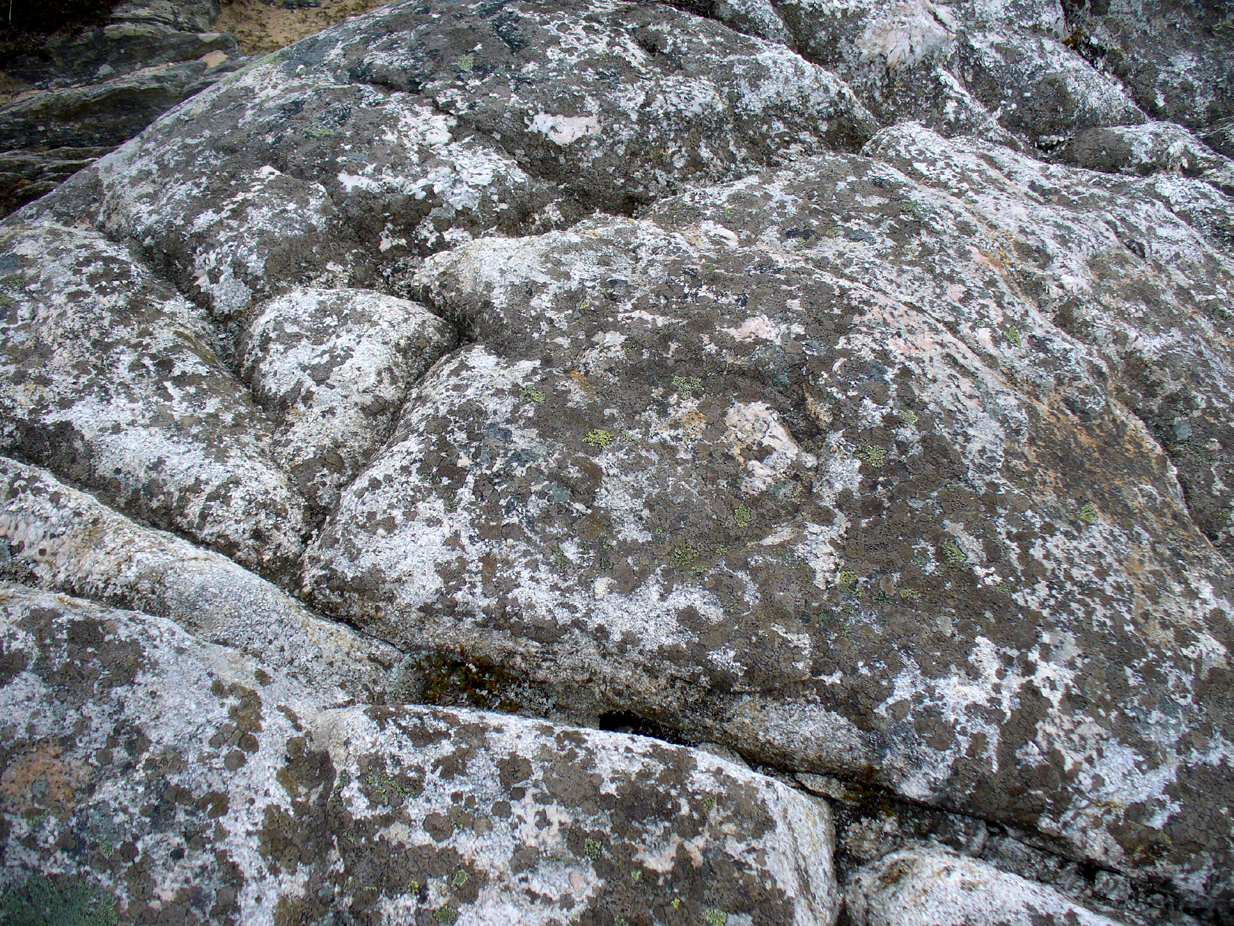
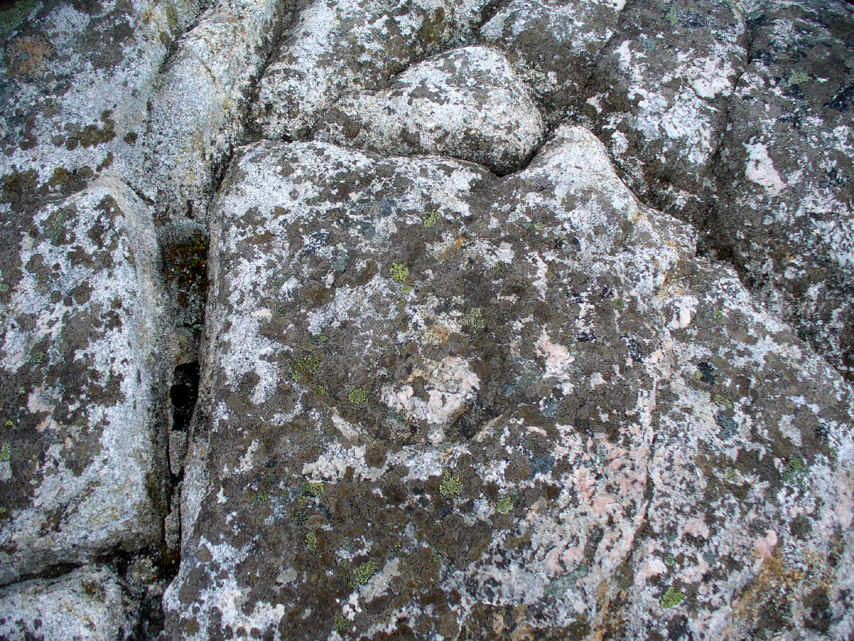
Take the A836 road between Tongue and Bettyhill, turning down at Borgie Bridge for 1.8 miles (2.87km) until you reach the little information sign at the roadside. Walk downhill and cross the little bridge and wander onto the west side of the beach. You’re likely to end up daydreaming… so once you’ve re-focused, head into the middle of the beach and walk up the steep-ish sand-banks to your right (south). Once at the top, you’ll see a gigantic rock—the Ringstone—bigger than a house. Walk up the hill above this until your reach the rocky plateau where things roughly level out. Look around!
Archaeology & History
This previously unrecognised carving on the edge of the rocky promontory that drops down to the stunning Torrisdale Bay—above the gigantic and legendary Ringstone boulder—is very much like the curious ‘C’-shaped motif on the Fyfield Down petroglyph, a couple of miles east of Avebury, literally 499 miles (803km) to the south. Indeed, that’s all I kept thinking about when I found it!
Ringstone carving, looking S
The carving’s nowt special—apart from the fact that it’s seemingly isolated and has no apparent companions nearby. It’s an incomplete circle, perhaps more like a bell-shape than a circle, about six inches across and seems to have no inner cup-mark. Its general appearance on the rock surface seems to indicate it was carved by a metal tool, instead of being ‘pecked’—but it’s still very old. Initially, I wondered whether it was an ichnological fossil or stromatolite—but it isn’t.
(Note that the OS-grid-ref is just a 6-figure one. I was ambling about and didn’t make an exact note of the place, but it won’t take much finding on the rocky levels above the giant Ringstone if you zigzag about. Apologies for the poor photos too, but She was cloudy most of the day.)
Acknowledgments: Huge thanks to Donna Murray, for putting me up in this part of Paradise. Cheers Donna.