The site of the tree may be seen from the north side of the Kettins to Newtyle road, just before the Perthshire-Angus boundary sign. It stood on the south-west side of the dip at the far end of the field, next to the raised causeway.
Archaeology & History
Nothing now remains of the tree. The Ordnance Survey name book gives the following description, attested by Hugh Watson of Keillor, Thomas Mole of Denside and Charles Wood of High Keillor:
“[Situation] About 32 chains NE of Keillour. A large tree situated on the farm of Keillor. It is traditionally stated that Barons held their court under this tree, also that criminals were executed on it. Whence the name.”
Crown Tree stood left of the dip in front of the causeway
The tree was about 160 feet to the south-west of the boundary between the parishes of Kettins and Newtyle, on the Kettins side, both of which parishes were historically in the county of Angus, so it was likely also to have been an ancient boundary marker. Keillour, with the Parish of Kettins is now in Perthshire.
Based on the evidence of the 25″ OS maps, it seems the tree was felled sometime between 1900 and 1921.
Reference:
Ordnance Survey Name Book, Forfar (Angus) Volume 52, 1857-61
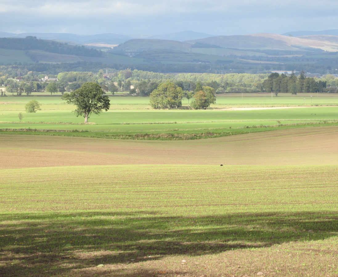
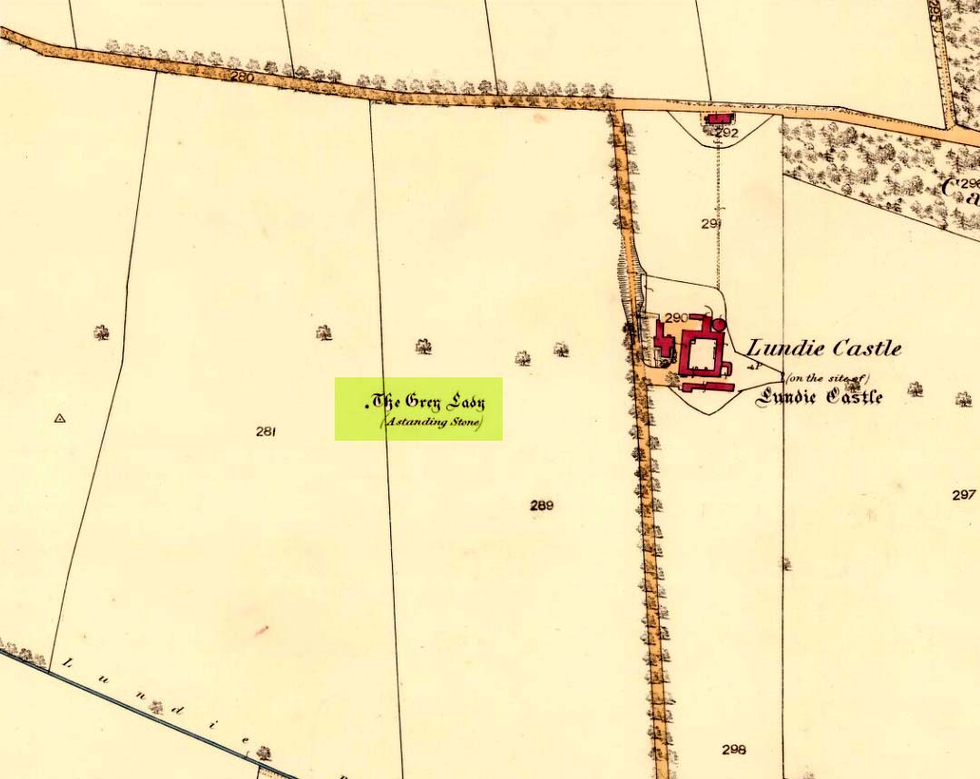
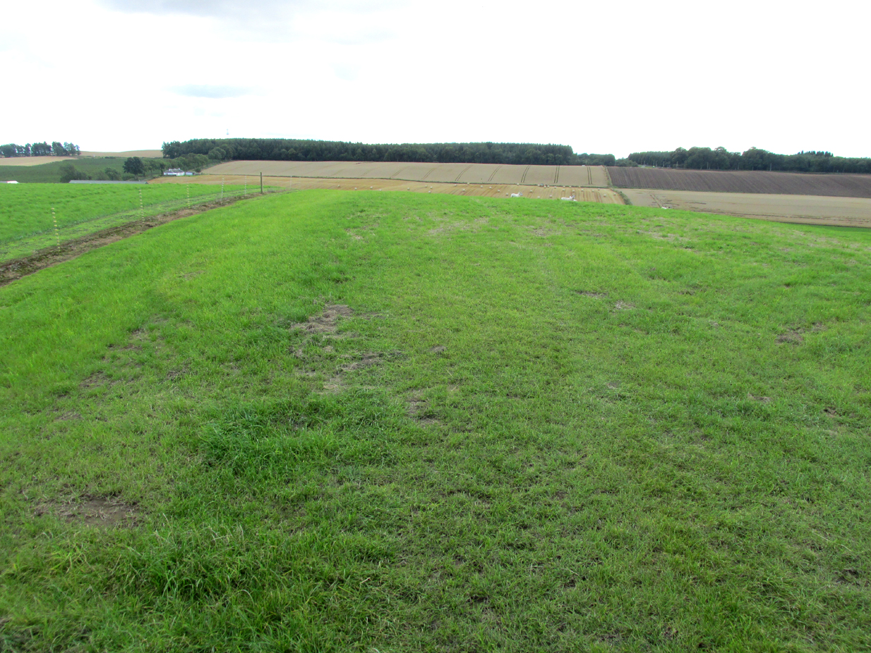
The site of the stone is on the top of a ridge due west of Lundie Castle and is best approached from the minor road between Lundie and Denhead, but at the time of my site visit a steel gate had been erected across the field just before the site of the stone together with a large festoon of electric fencing, which I did not cross.
Archaeology & History
The Grey Lady stood on the near grassy horizon
The Ordnance Survey name book describes the stone, the informants being Mr. Pattullo junior and Mr. Bett of Pitermo:
“This name is applied to a Standing Stone a little to the west of Lundie Castle. It is about 4 feet high, between two & three broad & rather a Kidney Shape. …Some think of druidical origin, but young Pattullo intends to blast it shortly“.
The rough grass probably marks where she stood.
And indeed it seems the feckless youth did have his wicked way with The Grey Lady, who had been a landmark for millennia, for she sadly no longer exists. In view of the folklore attaching to the stone, it may be worth speculating whether the kidney shape denoted a lunar symbolism for the stone.
Folklore
The OS name book states:
“The ladies of Lundie Castle have romance connected with it – that a white lady is to be seen walking round it on a certain night of every new moon.”
Reference:
Ordnance Survey Name Book; Forfarshire (Angus) volume 66 (1857-61)
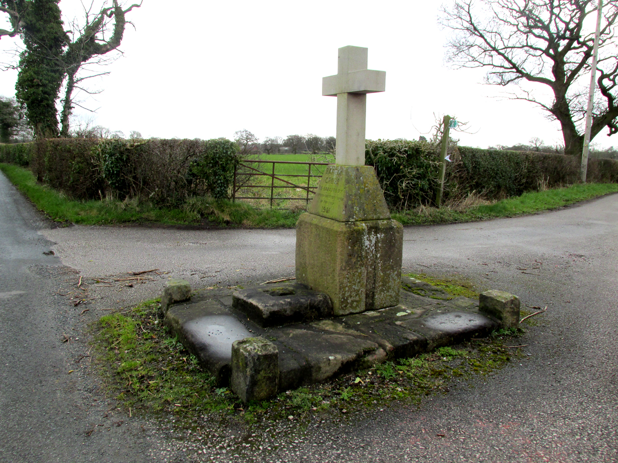
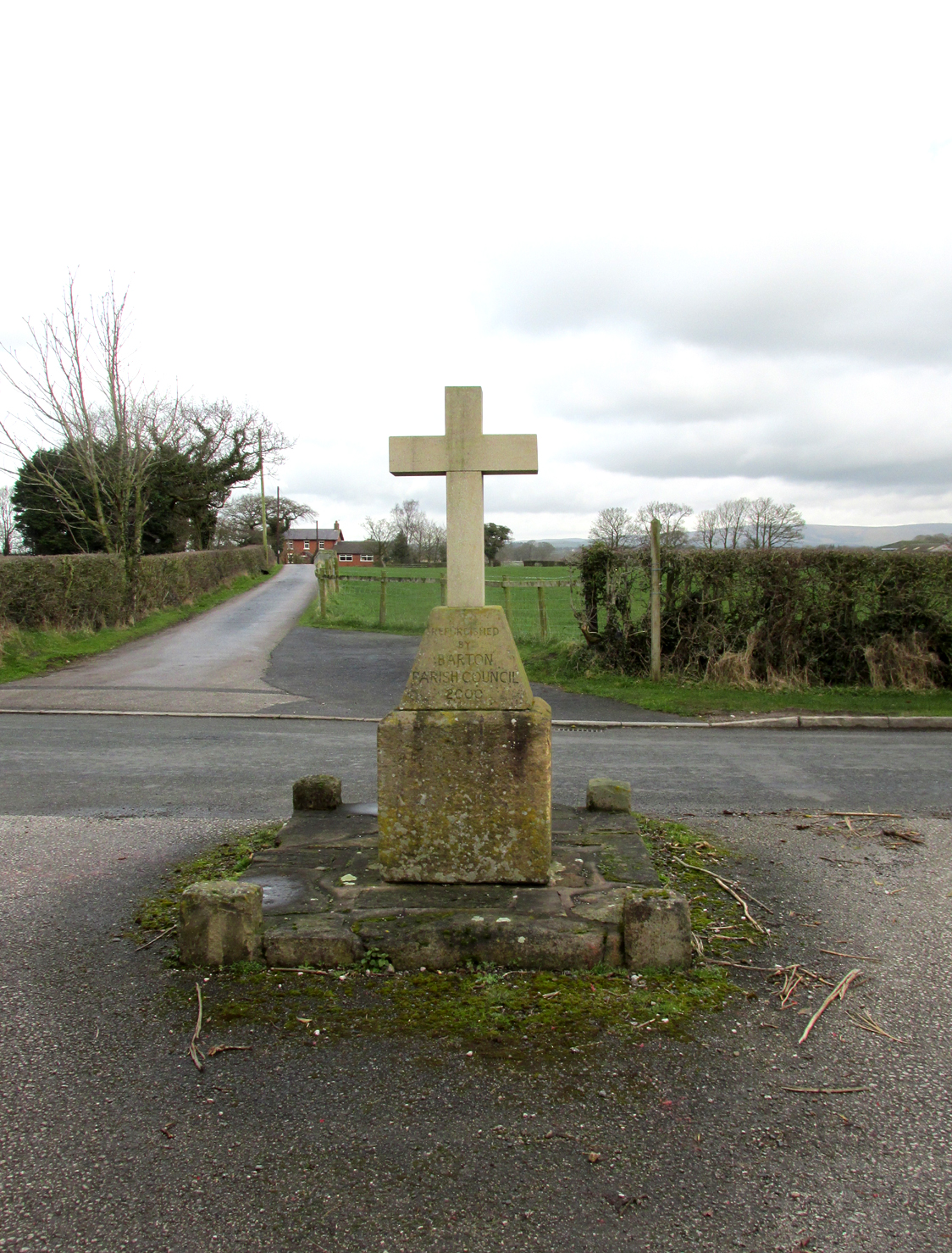
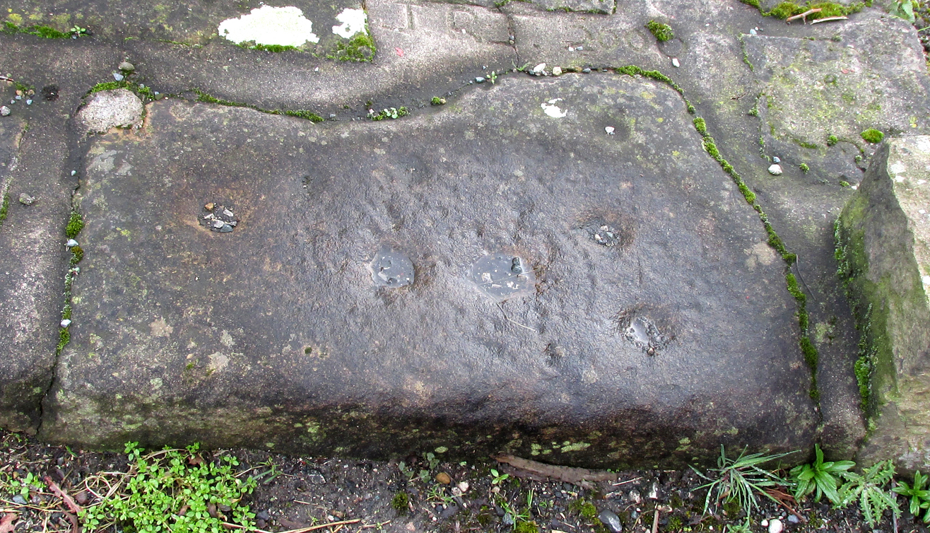
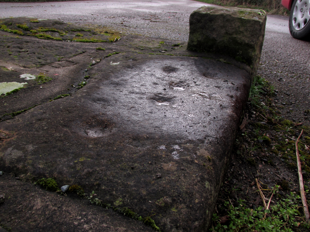
The Barton Cross from the road, showing the original socketed base and the cup marked paving stone to the right.
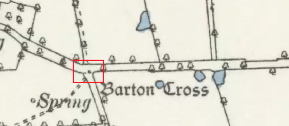
The cross is at the roadside on the south side of Barton Lane at the cross roads with the minor road between Cross House Farm and Barton House.
Archaeology and History
All that survives is the socketed base of a mediaeval cross on a raised paved platform with low raised square section pillars at each corner. Behind the original cross socket stands a large stone block (Described in the Historic England citation as “probably part of a cheesepress“) surmounted by a pyramidal block upon which a modern carved stone cross has been placed.
Henry Taylor (1906) writes in his Ancient Crosses and Holy Wells of Lancashire:
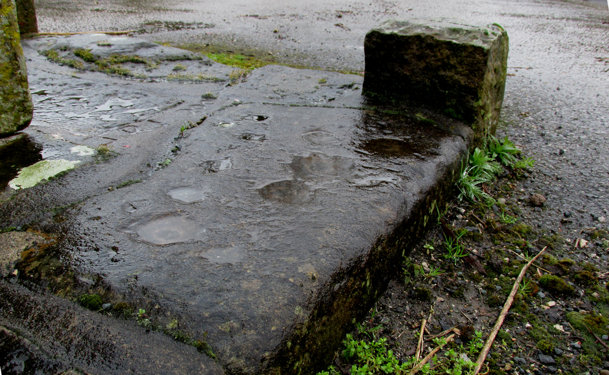
The South face of the Cross
“Barton Cross. These words occur on the map in ancient Gothic letters in Barton Lane, one and a half miles in a westerly direction from Goosnargh Church, showing that in the year 1848 a complete cross stood here. The site is at the intersection of country lanes, and the map shows a small recess or lay-bye in which the cross was planted. Mr. Collinson [Reverend S.E. Collinson, Vicar of Broughton] writes that the base was thrown into a neighbouring pit at the time Daniel’s pedestal was buried. The base and part of the shaft of the Barton Cross have lately been restored to the old site. A new cross has been erected just behind by Mr. Myerscough. Mr. Collinson tells me that in going through some of the old parish registers he found an entry referring to ‘Barton Christ’. He not unnaturally thinks that there must have been a figure on the Cross giving rise to the name. Nothing else would account for it. The neighbourhood of Barton (a pre-Norman settlement) is interesting and deserves a thorough investigation.”
The ‘Daniel’s pedestal’ refers to Daniels Cross, near Broughton, of which Taylor writes:
“The base was removed about sixty years ago. It is now in a neighbouring pit. The facts were obtained from an old man who helped at the destruction of this landmark.”
The 1895 6″ map showing the Cross, with the nearby marl-pits coloured blue
The pyramidal stone block upon which the modern cross stands is inscribed on the northern face: “Barton Cross re-erected by Councillor R. Myerscough of Preston 1901” while the southern face is inscribed: “Refurbished by Barton Parish council 2000“.
One of the paving stones that surround the cross has pre-historic cup markings on it, and is the subject of a separate site profile.
Bearing in mind what was written about the original cross having been ‘thrown into aneighbouring pit’, it may be worth probing the nearby marl pits to see whether the original could be found.
Reference:
Taylor, Henry, The Ancient Crosses and Holy Wells of Lancashire, Manchester, Sherratt and Hughes, 1906
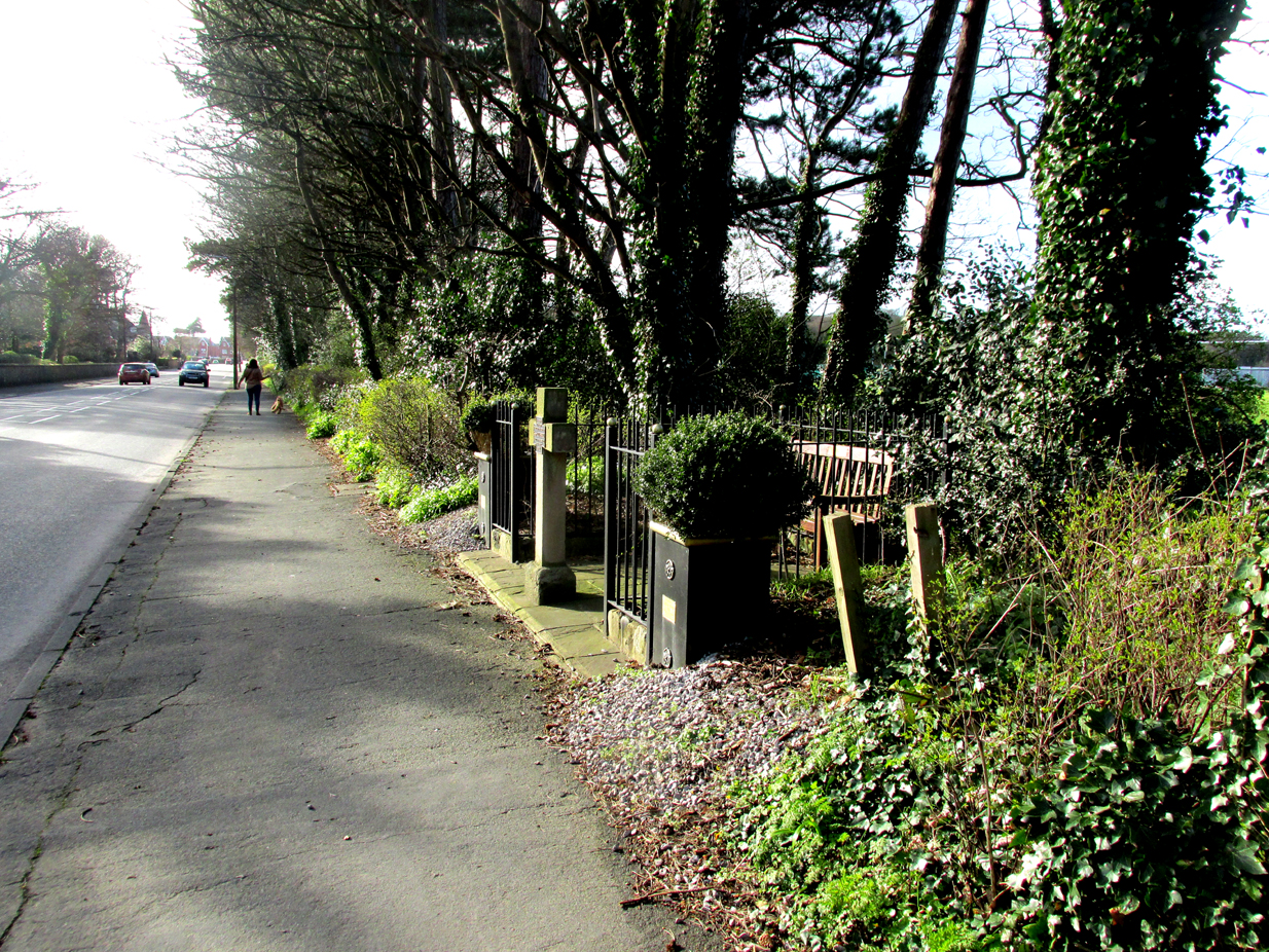
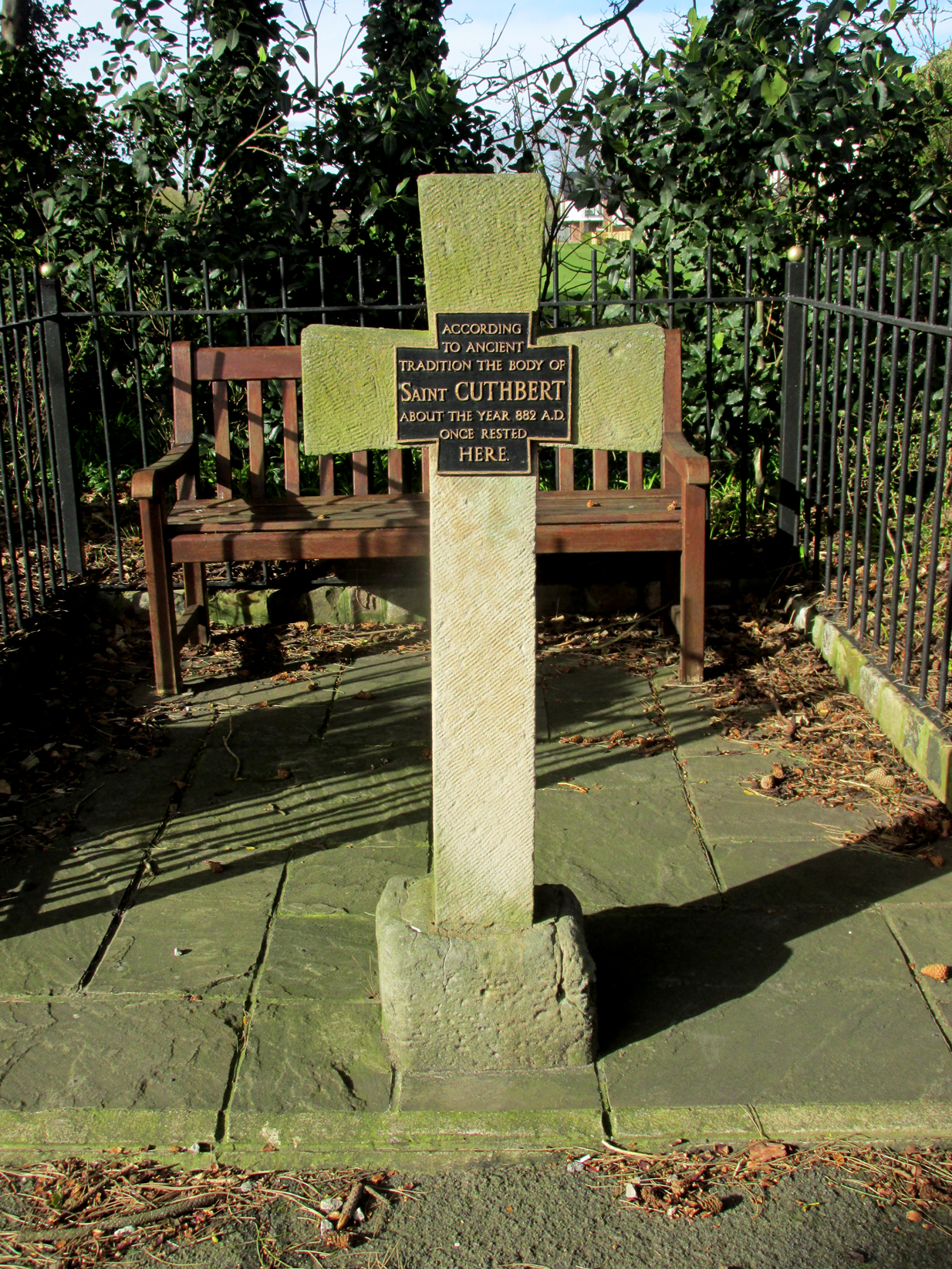
The cross is situated in a small railed enclosure adjoining the pavement on the North side of Church Road on the west side of Lytham, opposite Lowther Gardens.
Archaeology & History
Henry Taylor (1906), author of The Ancient Crosses And Holy Wells Of Lancashire, writes:
“The old market place of Lytham is triangular in shape…Church Road leads out of it, and not far from the church the pedestal of an ancient cross was at one time to be seen. The words ‘Site of Benedictine Priory’ occur on the map close to Lytham Hall, indicating the position of this small religious house, dedicated to SS Mary and Cuthbert, and subject to Durham.”
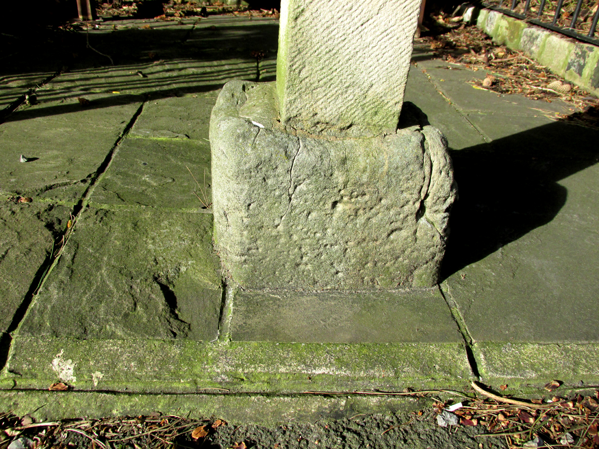
The mediaeval base set into the pavement in 2009
Lieutenant-Colonel Fishwick writes in his History of the Parish of Lytham:
“Not far from the Parish church on the road to Blackpool is still to be seen the stone socket of a cross, and tradition says that it marks one of the resting places of the body of St. Cuthbert when carried to Durham”
All that survives of the mediaeval original is the socketed base, into which a modern carved stone cross has been inserted. A bronze plaque attached to the cross reads: “According to ancient tradition the body of St Cuthbert about the year 882AD once rested here.”
The modern cross with its bronze plaque.
It is not known whether the destruction of the original cross was the handywork of the local ‘Cross Smasher’ Rev. Richard Wilkinson.
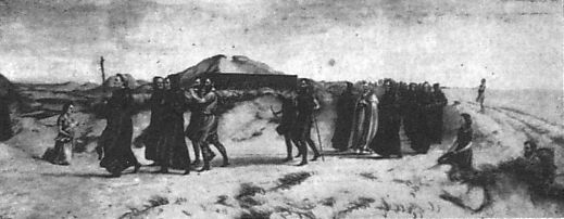
According to an online source, The Very Reverend Monsignor Gradley commissioned a painting by Charles E. Turner entitled: ‘The Monks of Lindisfarne arriving at Lytham with the body of St. Cuthbert, A.D. 878’, intended to be hung in St Joseph’s Seminary, Upholland. Gradley wrote in the October 1889 edition of MerryEngland magazine:-
” In 875 Halfdene invaded Bernicia, the northern portion of Northumbria, . . . Lindisfarne was no longer a safe place for the monks, and they dared no longer expose their great treasure, the relics of St. Cuthbert, to the ruthless impiety of the northern hordes, With their Bishop Eardulf they set out on a weary pilgrimage of seven years.… From Yorkshire they proceeded to Lancashire, and as we find that the holy relics rested at Mellor, near Blackburn, we may suppose they would journey through Ribblesdale, passing on their way the ruined city of Bolmetonacae, the modern Ribchester. They were a numerous company, for besides the venerable Bishop Eardulf there were the Abbot of Carlisle, the monks of Lindisfarne, and many of the natives of that island. In going to Lytham it is probable the party would pass through Preston, where a few houses had gathered about the church built in honour of St. Wilfrid, the great contemporary of St. Cuthbert.
‘The Monks of Lindisfarne arriving at Lytham with the body of St. Cuthbert, A.D. 878’, by Charles E. Turner.
Their way from Preston to Lytham lay through a country abounding in forest and fen. But they would have the advantage of the old Roman road as far as Kirkham. However, the pilgrims met with a hospitable reception, and to this day Lytham is the seaside home of St. Cuthbert on our western coast.”
A small plaque on an adjacent bench records that the cross was re-dedicated by the Very Reverend Michael Sadgrove, M.A., Dean of Durham on Sunday 6th September 2009.
References:
Taylor, Henry, The Ancient Crosses and Holy Wells of Lancashire, Manchester, Sherratt and Hughes, 1906.
Fishwick, Lieutenant-Colonel, The History of the Parish of Lytham in the County ofLancaster, Manchester, The Chetham Society, 1907.
Gradley, Most Reverend Monsignor, Article in the October 1889 edition of MerryEngland magazine, abstracted by www.amounderness.co.uk
Acknowledgements: With thanks to Sue Ybarras for directing me to this site.
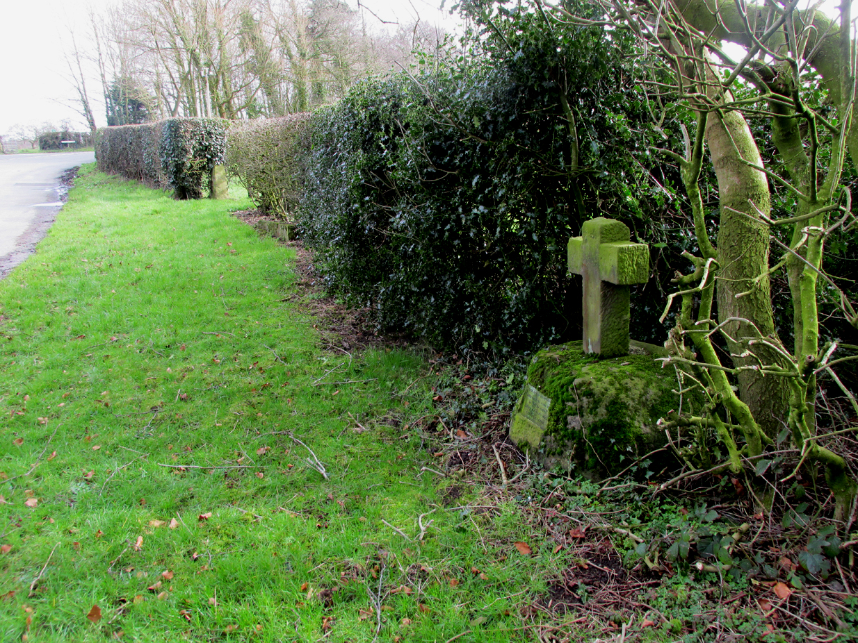
The cross is situated on the verge at the west side of the B5269 road near its junction with Ashley Lane at Stump Cross, north-east of Goosnargh.
Archaeology & History
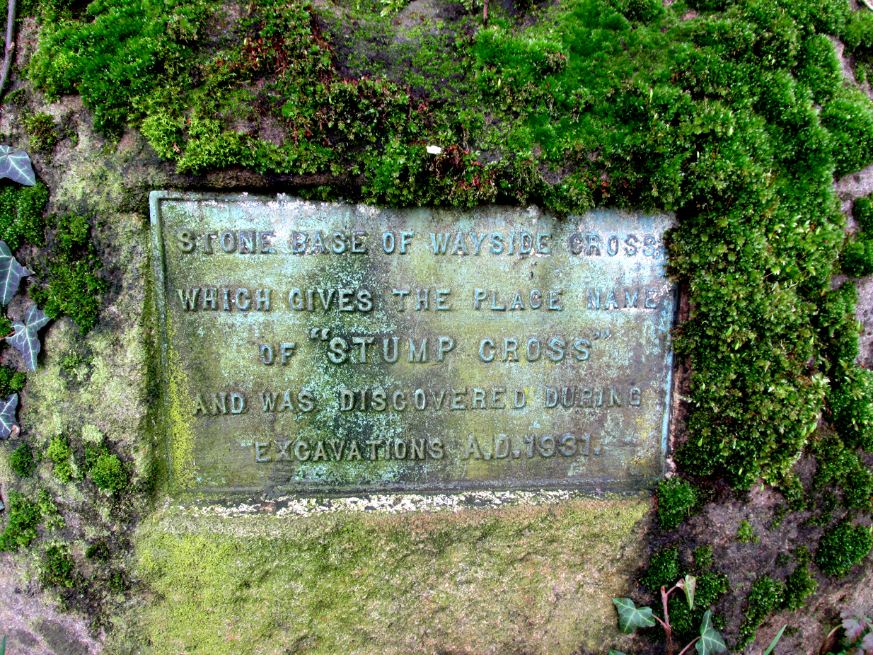
All that survives is the socketed base of the mediaeval cross, into which a small modern carved stone cross has been inserted. A bronze plaque attached to the base informs the reader that the cross gives its name to the locality, and that the base was discovered during excavations in 1931.
Richard Cookson (1888), in his Goosnargh Past & Present, writes:
“We have the remains of several upright crosses in this township called “cross stones” all being placed near to some public road or path. The corpses of the Roman Catholics are rested at those stones on their way to internment, and those funeral attendants who are of that persuasion kneel down and offer up a short prayer for the repose of the soul of the departed individual whose body they are conveying to the grave.”
Further to the destruction of crosses in the township, Cookson writes:
“…the Reverend Richard Wilkinson, late minister, of anti-Romanistic notoriety, in his frenzied hostility to the Roman Catholics, caused [the cross] to be broken up and removed…”
The site is listed by Henry Taylor, in his 1906 magnum opus on Lancashire crosses, and speaking generally on the destruction of wayside crosses in the Hundred of Amounderness, he writes:-
The bronze plaqueModern cross inserted into the Mediaeval socket
“The destruction of so many crosses, which at one time existed in this part of the Hundred, is due to the vandalism early in the nineteenth century of a vicar of Goosnargh, named Wilkinson. He was a vehement Protestant, and owing to his notoriety as a Prophet, was allowed to do much as he liked with these ancient monuments. Many crosses, indeed, it is said, were pulled down with his own hands. His prophesies foretelling the deaths of various persons often unfortunately came true, and he was thus, in this superstitious part of England, dreaded as a wizard. As this work of demolition took place before the date of the Ordnance Survey, there were in all probability many more crosses erected in Mediaeval times in this district than we have now any knowledge of, and it is quite possible that some of the crosses so recklessly destroyed may have been, like those at Halton and Heysham, of pre-Norman date and of great historical value. Fragments of them might even now be found were a diligent search be made.”
Further to this speculation as to the antiquity of these destroyed crosses, it is interesting to note the approximately parallel orientation of roads and field boundaries to the east of the Stump Cross. This may point to the area having been subjected to Roman survey, and the site of the Stump Cross having once been a shrine to the gods of the agrimensores (Roman surveyors) that had been Christianised.
References:
Cookson, Richard, Goosnargh: Past and Present, Preston, H.Oakey, 1888.
Taylor, Henry, The Ancient Crosses and Holy Wells of Lancashire, Manchester, Sherratt and Hughes, 1906.
Richardson, Alan, The Roman Surveyors in Cumberland, P3 Publications: Carlisle 2008.
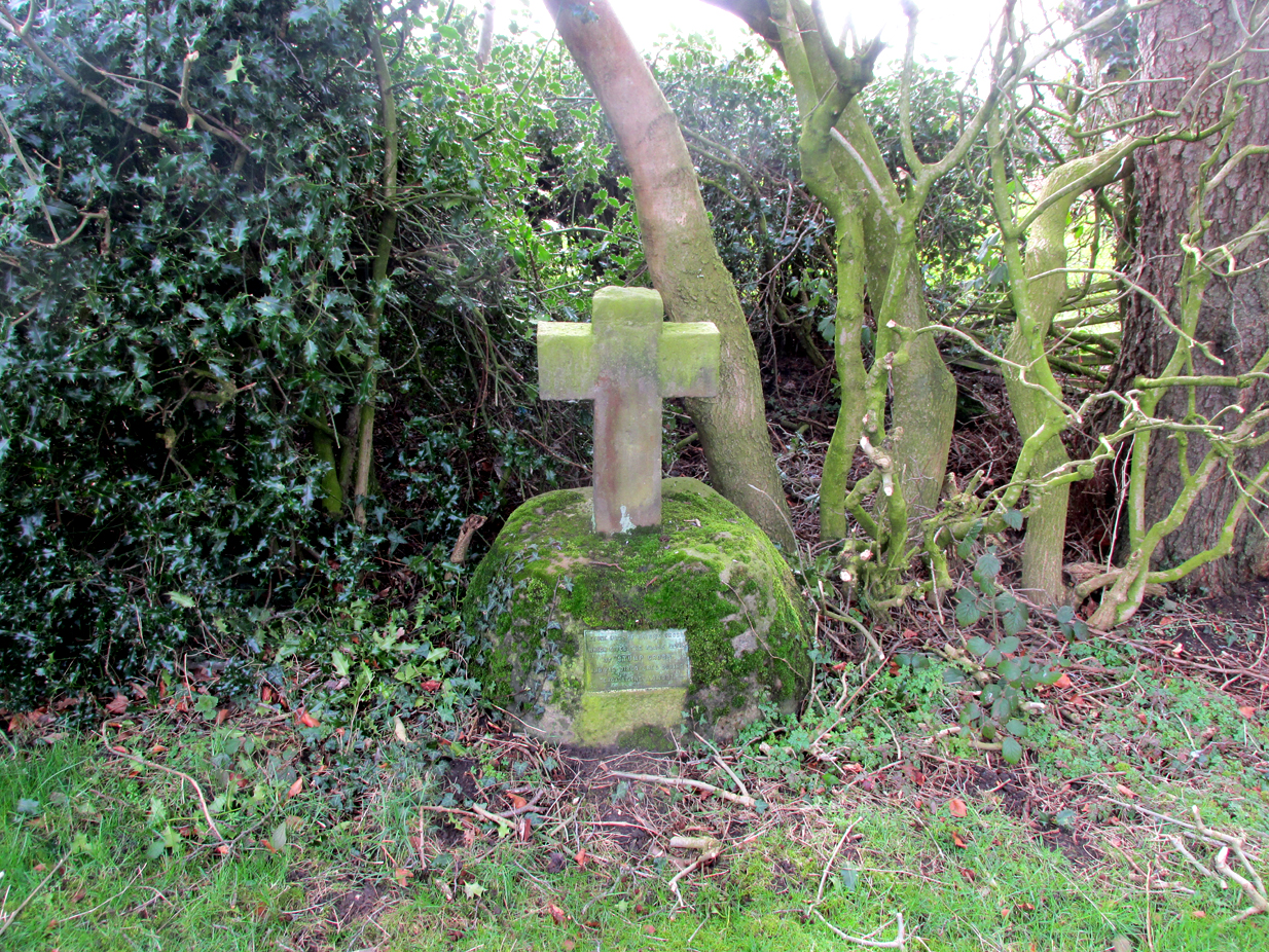
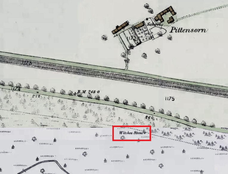
Park up at Murthly village, follow the farm road west, opposite the Kinclaven junction up to the cross roads, and turn right and go past Douglasfield Farm, following the road as it bends to the left; then through the metal gates and walk on until you come to an earth bridge over the ditch to your left. Cross the bridge and the low-lying Witches Stone is about 30 yards on to your left by the drainage ditch.
Archaeology & History
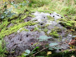
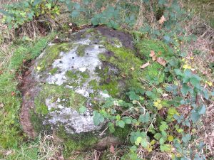
Not recorded on the Canmore online database, the Witches Stone is a low-lying, domed, earthfast rock bearing at least 12 cup marks. One cup mark has been drilled at some time in the past. Did the land owner do this as a preliminary to blowing it up with gunpowder? There is an interesting story relating to the origin of the cup marks, and it seems the name of the rock and its folklore may point to its ritual significance having passed down through oral tradition from the Bronze Age to historical times.
Folklore
The mid-nineteenth century Ordnance Survey Name Book has the following record, attested by Sir W.D. Stewart, Mr. T. Cameron & Mr. J. Cameron:-
Close-up of cupsBlackberries in cupmarks
“A small rock nearly level with the ordinary ground surface, underneath which it is traditionally held that a large sum of money is buried. In order to test the truth of this tradition, it is said that some years ago a man commenced to excavate the soil around the rock in order, if possible, to secure the hidden treasure, while so employed, a small dog suddenly appeared on the top of the rock and desired the man to desist, assuring him at the same time that the reputed treasure was really there, but it was never intended that the eye of mortal should behold it. There are some marks on the rock which the superstitious tell you are the prints of this very sagacious dog’s paws.”
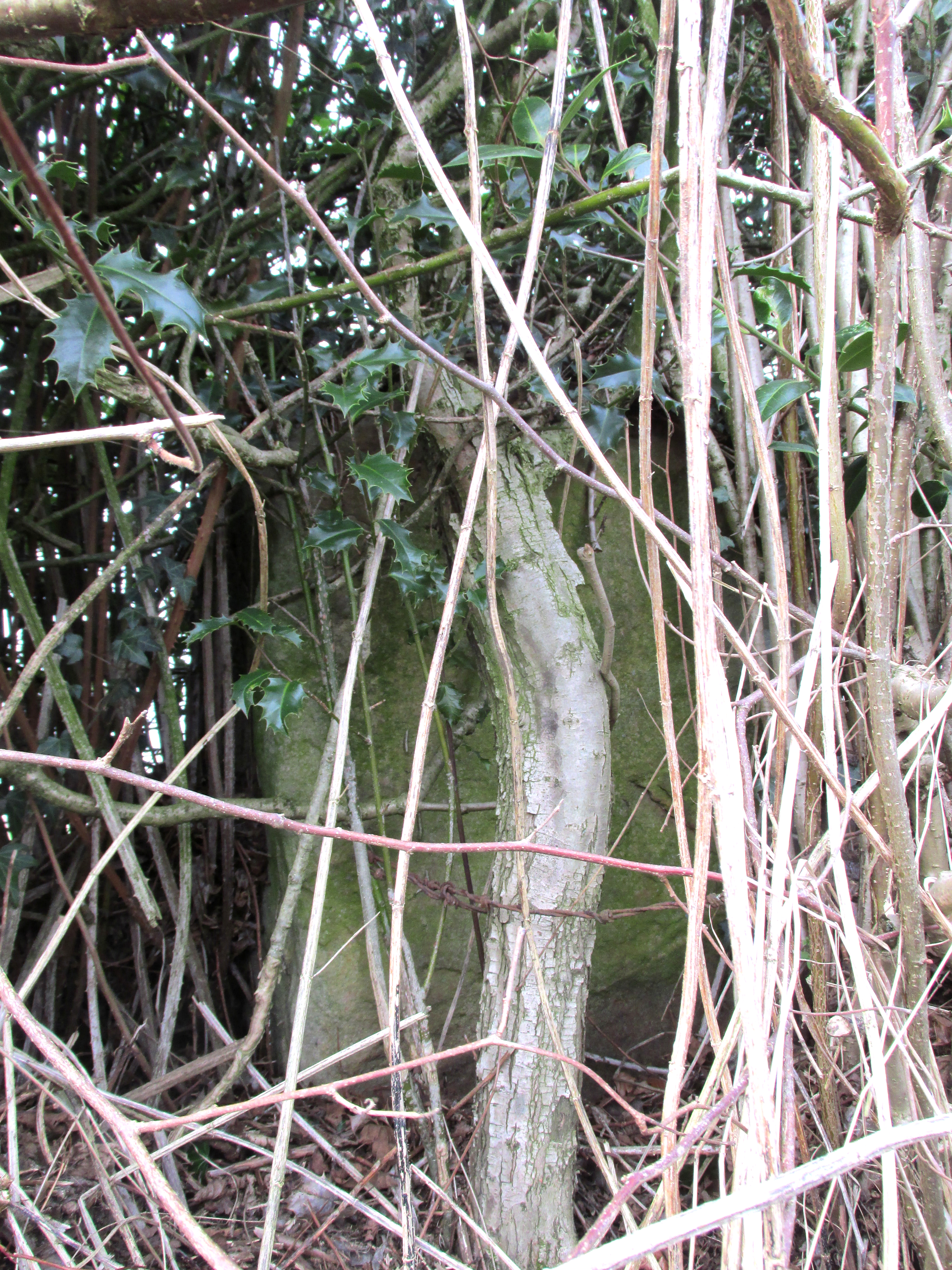
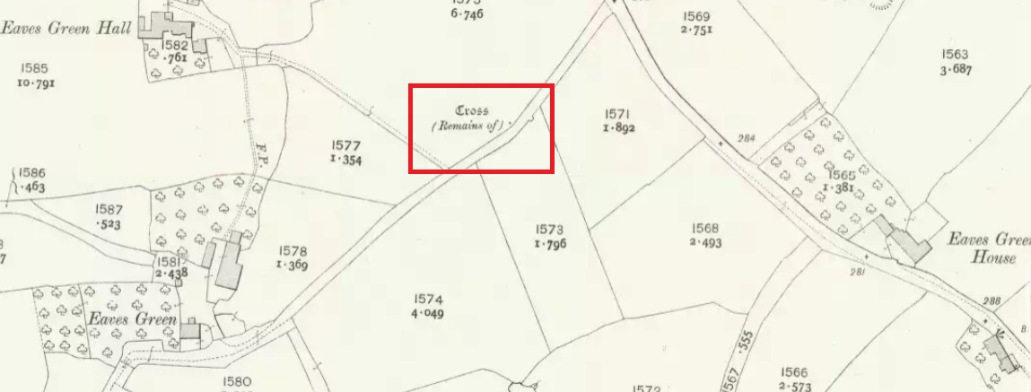
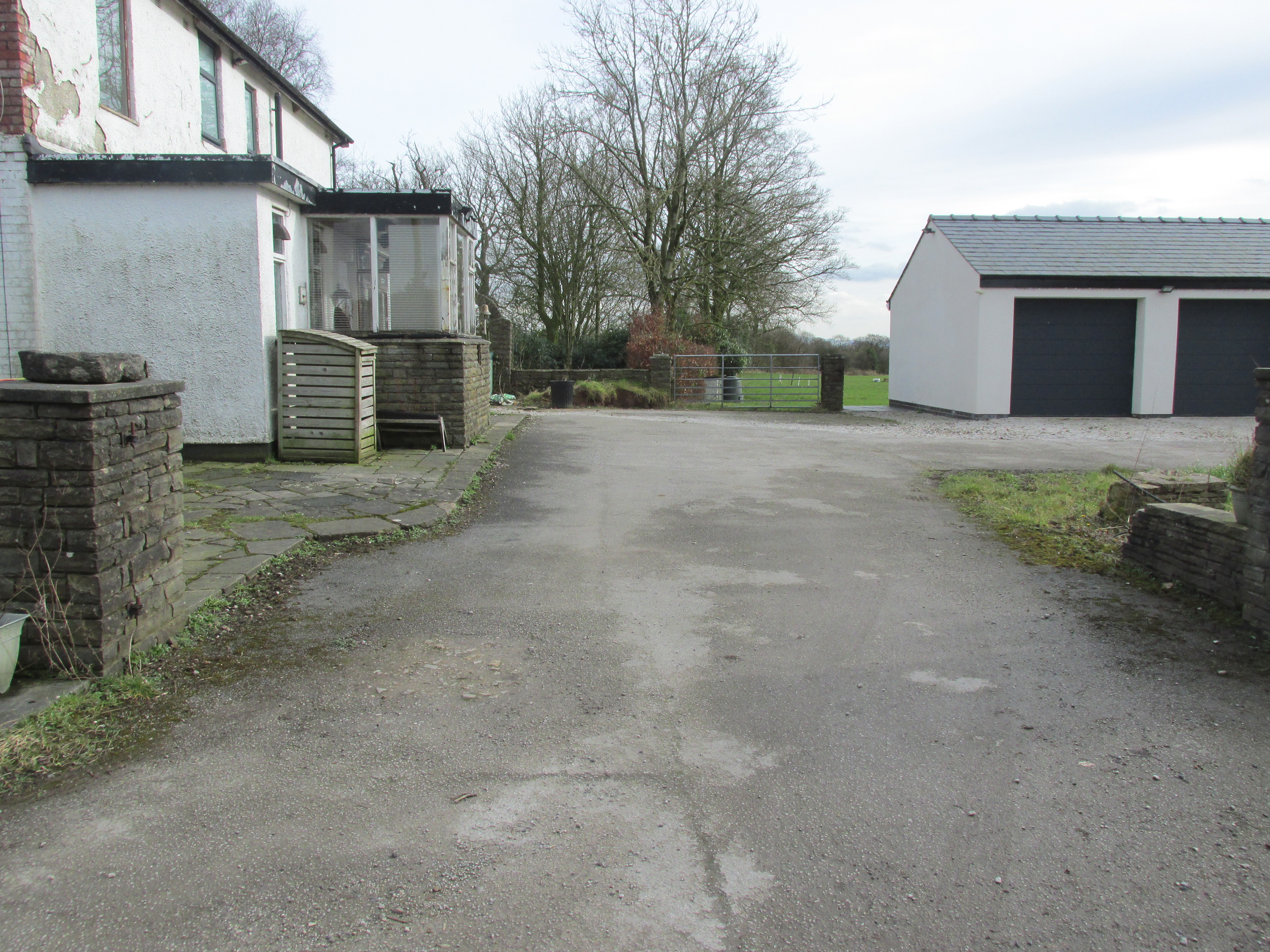
Travelling east out of Goosnargh on the B5269, go straight ahead onto Camforth Hall Lane, follow it northwards and take the left fork at Stump Cross onto Eaves Green Lane, and a lane will be seen on the left signposted Eaves Green. Walk along this lane and a white Snowcemmed house, ‘Bridle Mount’ will be seen on the left. The cross base will be found deep in the holly hedge opposite the driveway to the house.
Archaeology & History
This cross was not mentioned in the 1906 edition of Henry Taylor’s Ancient Crosses andHoly Wells of Lancashire, but was nevertheless marked on the 1910 25″ OS map (the earliest at my disposal) as “Cross (Remains of)”
The 1910 25″ OS Map
In 1958, the Ministry of Works Field Investigator commented: “The socket stone of a probable way-side cross situated on rising ground in a pasture field adjoining a lane. It measures 0.8m by 0.7m and is 0.9m high with a socket 0.2m by 0.15m and 0.2m deep. There are no traces of a cross or shaft.”
To locate the Cross, turn round 180º from this spot.
The current official description describes the remains as “Now missing”…
Well, no! – the intrepid TNA investigator has located it, buried deep in the boscage of a holly and ivy hedge, but he was lucky that the hedge had been very recently trimmed and he made his visit in late winter…
The Cross is registered on the Milestone Society Repository under reference: LAPR_GOO02.
At the roadside, on the south side of Barton Lane, where it crosses the minor road joining Cross House Farm and Barton House, you’ll see the Barton Cross standing upright. You can’t miss it!.
Archaeology & History
Carved stone cut to shape
Apparently never before described, this stone has very likely been removed from another locality and cut to shape to form part of the surrounding platform base to Barton Cross, where it is at the southwest corner. It has ten cup marks.
Until or unless more such stones are located, it is a unique example of rock art in this part of Lancashire.
Nine cups visible here10th cup nr camera, after rain
Henry Taylor, in his 1906 work The Ancient Crosses and Holy Wells of Lancashire writes inter alia about the Barton Cross that it had been demolished sometime after 1848, and that the base and part of of the Cross shaft had been ‘lately restored to the old site‘. Thus the cup-marked stone may or not be in its original position as part of the Cross surround, and may have just been a conveniently available slab of stone that was used, rather than a deliberate use of a pre-existing sacred stone.
References:
Taylor, Henry, The Ancient Crosses and Holy Wells of Lancashire, Sherratt & Hughes, Manchester, 1906.
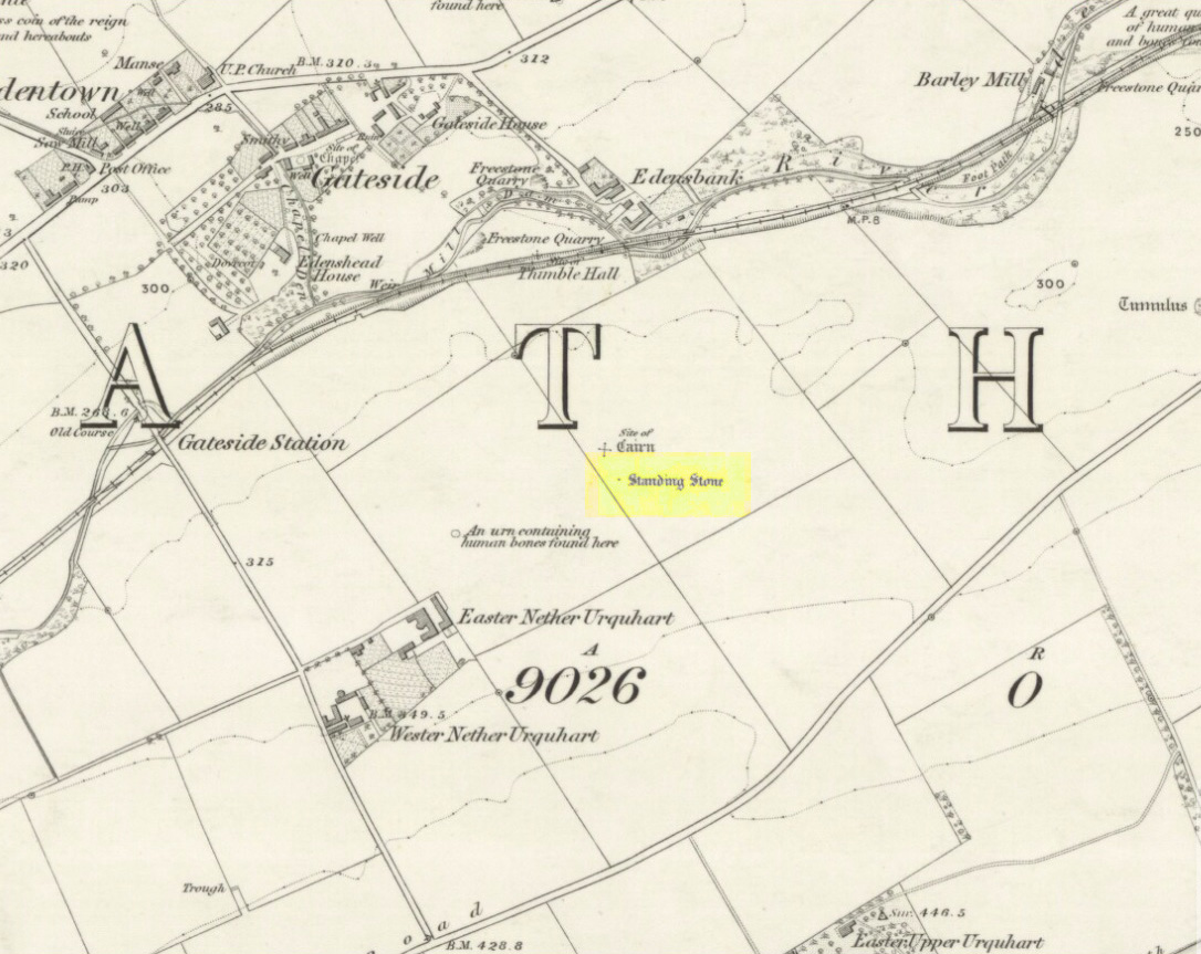
Turn off the A91 road at Gateside and go down Station Road, crossing the old railway line at the bottom. From here, cross the fields to your left and the site of the circle will be found in the field to the north east of Easter Nether Urquhart Farm.
Archaeology & History
Marked on the 1856 6″ Ordnance Survey map as a “standing stone,” earlier references record this as being the survivor of a stone circle. Not listed in Aubrey Burl’s (2000) magnum opus, this circle was on the edge of the site of a major battle between the Romans and the native defenders, and large amounts of human remains have been found in the vicinity. Referring to an adjacent cairn, Lieutenant-Colonel Miller wrote in 1829:
“A very fine Druid’s Temple stood on the south side of it, consisting of seven very large stones. All these were blasted with powder and removed, except half the one of them, which still marks the spot.”
Of the same cairn, the Reverend Andrew Small wrote in 1823:
“This cairn stood a little north of an ancient Druids’ temple, only one stone now remaining, out of ten of which it formerly consisted.”
The Ordnance Survey Name Book for 1853-55 imparts the following:
“This standing Stone is about 13 chains on the South side of the River Eden opposite Edensbank but whether it is the remains of a druid’s temple or set up to mark something relative to the battle contested between the Romans and Caledonians according to Messrs. Miller & Small, it is difficult to determine. It stands about 4 feet 10 inches high and its sides are about 2 feet broad…many of the inhabitants consider it to have been a druid’s temple…”
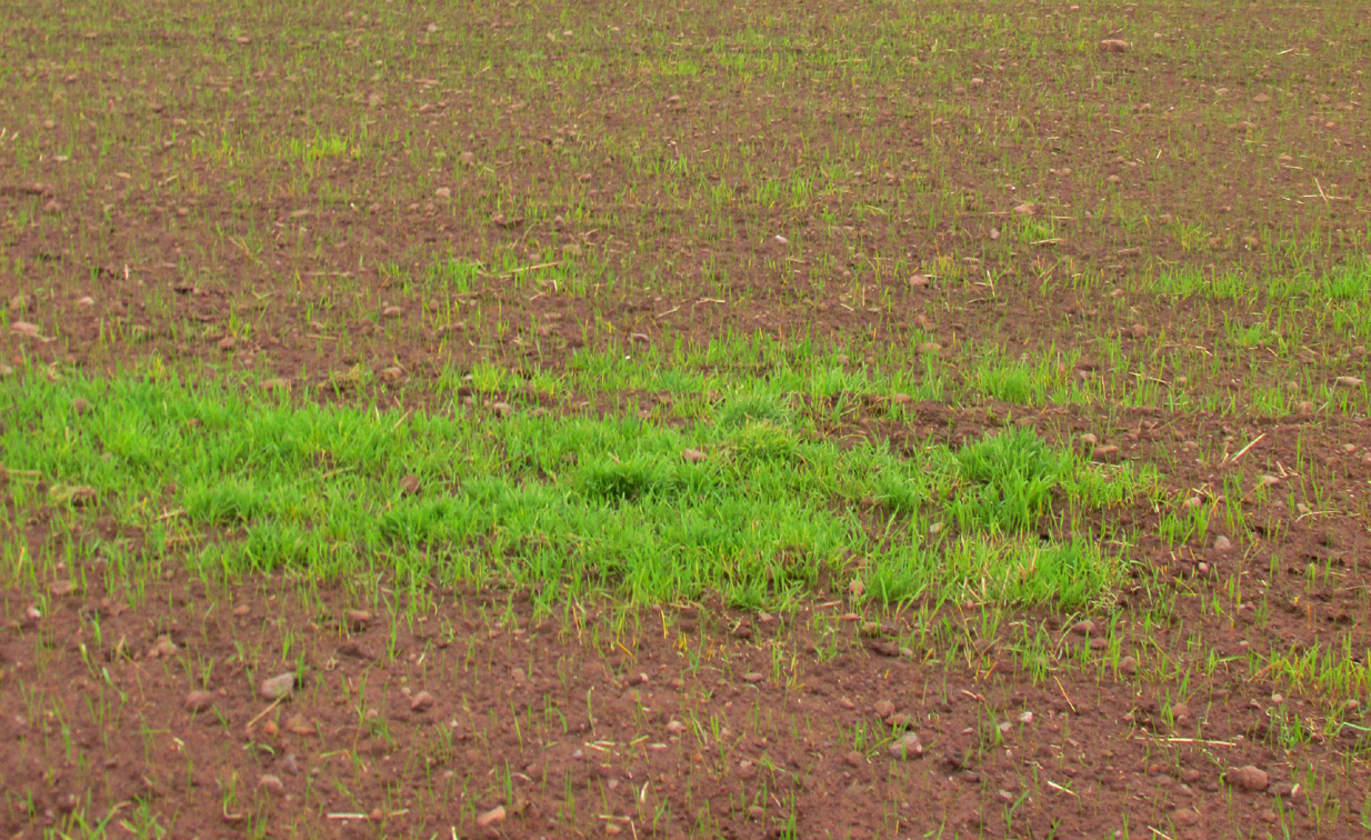
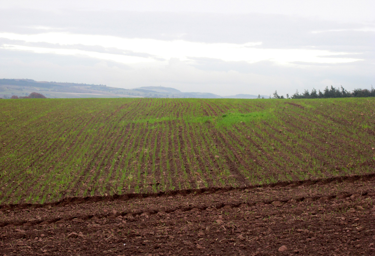
A close-up of the sitePosition of the circle, evident in crop-growth
J.S. Baird of Nether Urquhart informed an Ordnance Survey officer in 1956 that the remaining stone was broken up and removed around 1952, and measured 5 feet high with a girth of 9 feet at the base. Near the top of the stone, on the south-side were two slight cracks weathered to suggest a simple incised cross.
On the day of my November field-visit the winter barley was sprouting and it was interesting to see how much better it was growing at the place where the remaining stone had stood.
Burl, Aubrey, The Stone Circles of Britain, Ireland and Brittany, Yale University Press 2000.
Miller, Lieutenant-Colonel, “An Inquiry respecting the site of the battle of Mons Grampius (Read 27th April 1829 and 25th January 1830),” in Proceedings of the Society of Antiquaries of Scotland, Volume IV, 1857.
Small, Reverend Andrew, Interesting Roman Antiquities Recently Discovered in Fife Ascertaining the site of the Great Battle fought betwixt Agricola and Galgacus, John Anderson & Co: Edinburgh 1823.
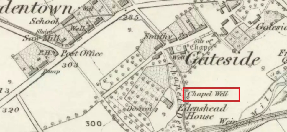
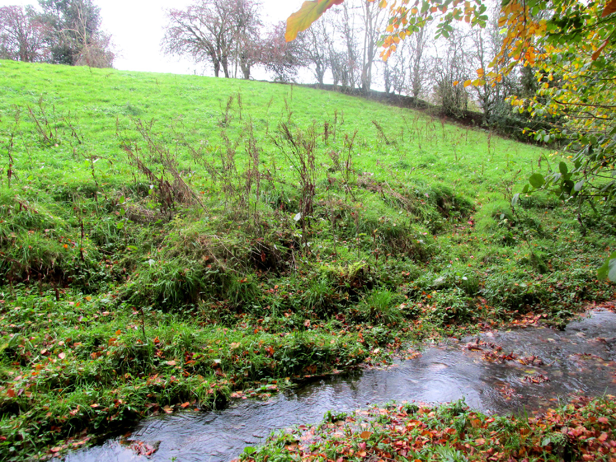
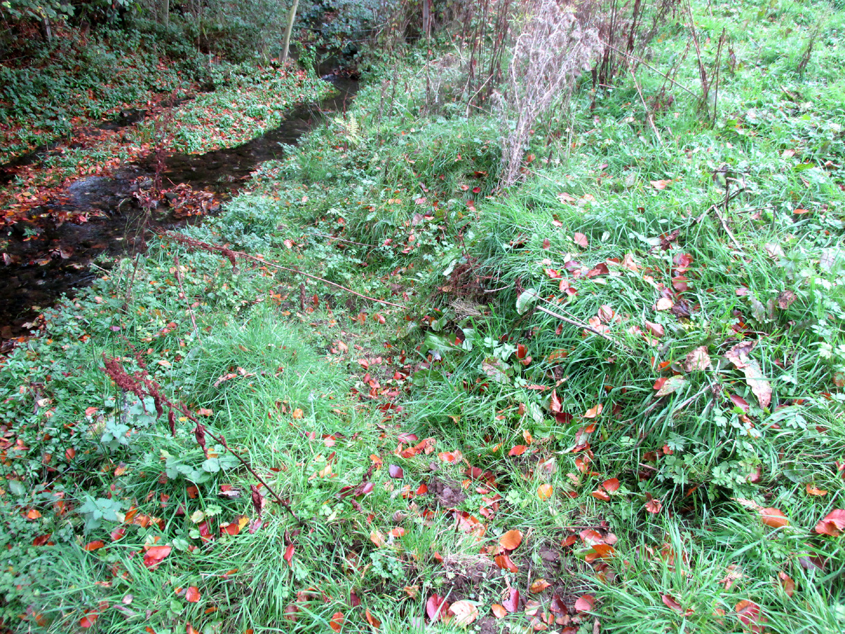
Travelling from Milnathort on the A91, in Gateside village, turn right down Old Town, and after the left bend in the road, park up. Access to the field where the Well is situated is through the gate on land next to the easternmost house on the south side of Old Town. Ask at the house first. Walk down the field towards the Chapel Den burn, and the ruins of the Well will be seen next to the burn just before the line of bushes that cross the field.
Archaeology and History
In his brief description of Strathmiglo parish, Hew Scott (1925) wrote:
“At Gateside…there was a chapel of St Mary, with Our Lady’s Well beside it.”
It was described in the nineteenth century Ordnance Survey Name Books by an informant:
“A small spring well on the north side of the Mill Dam. Supposed to have been used in the days of Popery as holy water and for other purposes when the building supposed to have been St Mary’s Chapel was in existence.”
Another informant wrote:
“…a Romish chapel is supposed to have been erected in this village and is borne out in a great measure by names of objects adjoining, namely Chapel Den, Chapel Well.”
And further:
“According to Doctor Small…it is stated, ‘The ancient name of this village called in old papers the Chapelton of the Virgin, changing its name at the Reformation.'”
Shown as Chapel Well in 1856
This latter statement would seem to imply that the part of modern-day Gateside south of the main road (the north side was known as ‘Edentown’) was a pilgrimage centre of the Cult of the Virgin. The chapel was erected by the monks of Balmerino to whom it was known as ‘Sanct Mary’s of Dungaitsyde’. It was highlighted as the Chapel Well on the 1856 OS-map.
The ruined Well from across the burnNature takes back the ruined masonry at this magickal spot
While no trace of the chapel remains, the Well is evidenced by some low ruins of what had once been a red sandstone structure, and it was just possible to make out in the field the line of the pilgrim’s path to the well. But what a lovely serene place next to the burn! An ideal spot to meditate or daydream… The spring no longer flows, and a manhole in the field probably indicates the water supply has been diverted, perhaps to serve the long since closed Gateside Distillery?
References:
Scott, Hew, Fasti Ecclesiae Scoticanae – Volume V, Oliver & Boyd: Edinburgh 1925.