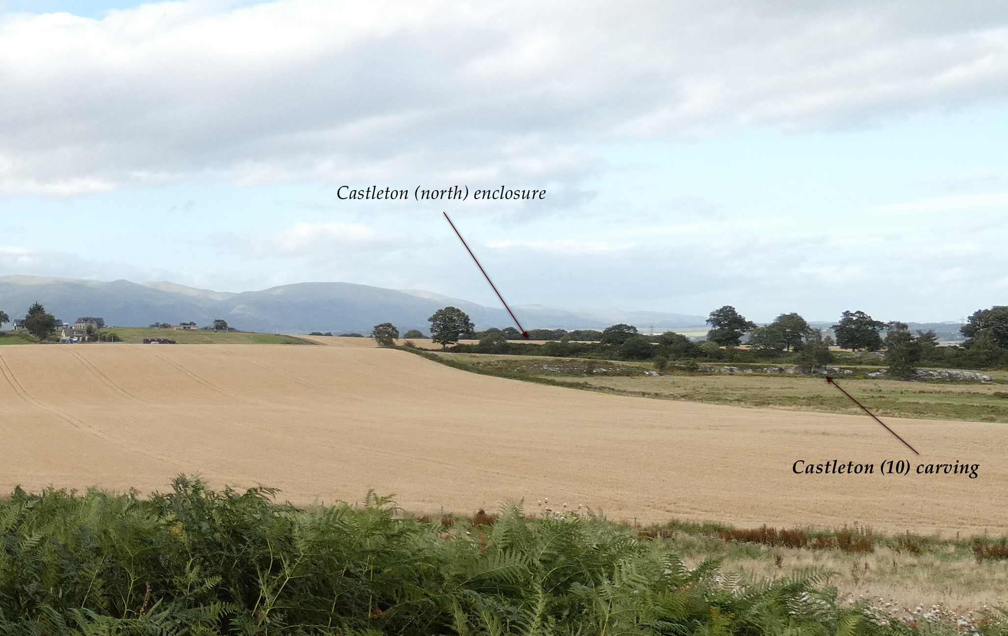
In the fields immediately above the northernmost of the Castleton petroglyphs, there was, in bygone times, a prehistoric settlement, forgotten and cast even from folk memory until very recently, when aerial photography revealed the ghostly outline of its former existence. Similar in design, but somewhat smaller than the prehistoric Gallamuir enclosure a half-mile southwest of the Castleton carvings, this double-ringed oval enclosure—thought by archaeologists to have been defined all round with large wooden stakes, or palisaded—measures, from outer edge to outer edge, 65 yards (SE to NW) across its longer axis, by 55 yards (SW to NE). The gap between the trenches that define the inner and outer wooden ‘walls’ is between five and six yards apart all round it. The entrance to the enclosure seems to have been on its southeastern side—although an excavation is needed to be sure about this. Sadly, almost nothing can be seen of the site at ground level. An archaeo-dig would be a good idea. 🙂
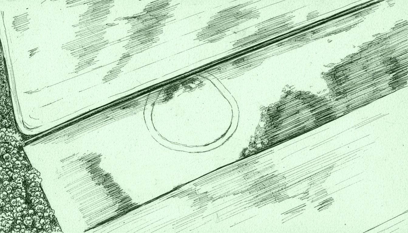
Rough sketch of site-plan
‘Palisade enclosures’ tend to be neolithic in origin and were in use for many centuries, sweeping into the Bronze Age. I highlight this long period in time due to the proximity of the extensive and very ornate cup-and-ring carvings that start just 300 yards southwest of the settlement on the first rock outcrop that you meet. It’s a good one too! Petroglyphs were also created mainly during the neolithic and Bronze Age periods; and as the enclosure here is on the slight rise in the land overlooking the various small rocky ridges below, many of which are decorated in ornate cup-and-rings, it’s likely that some of the people who lived here were probably the people who did them…
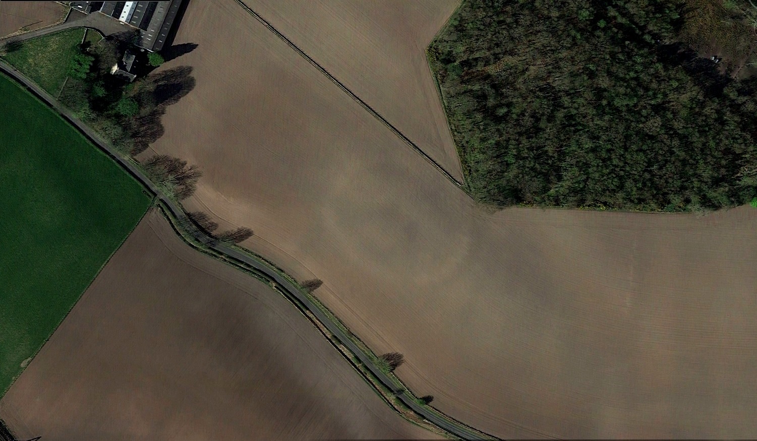
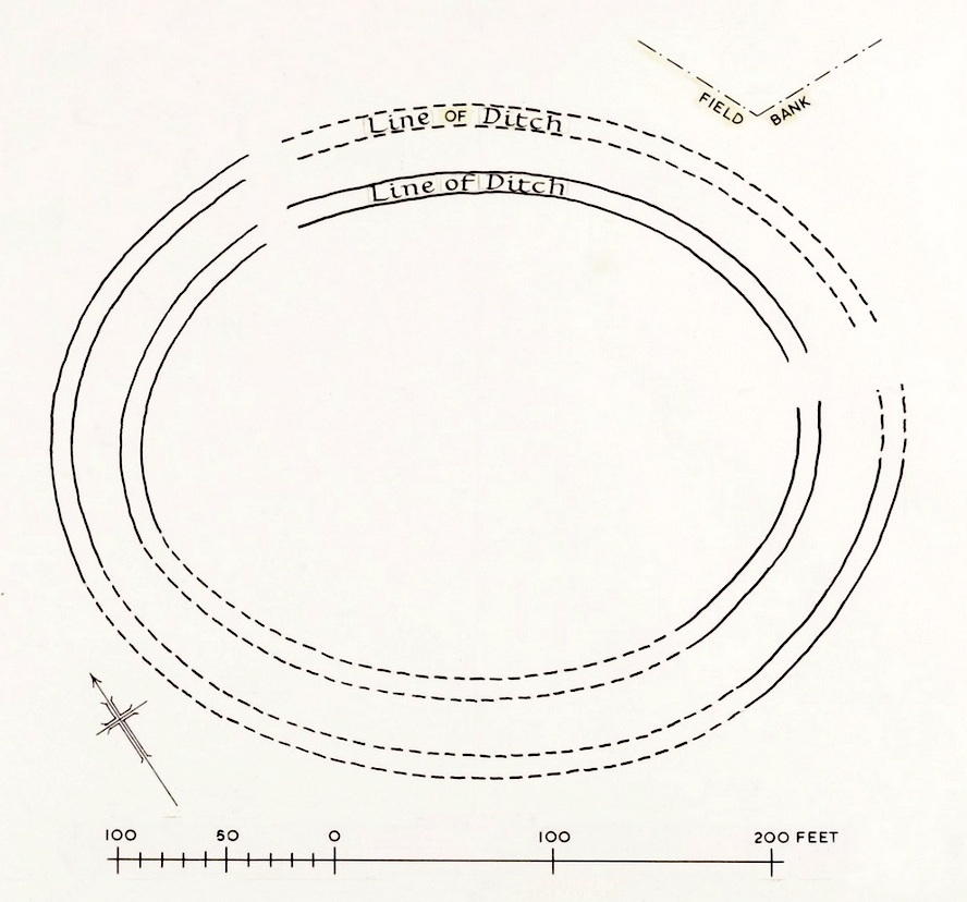
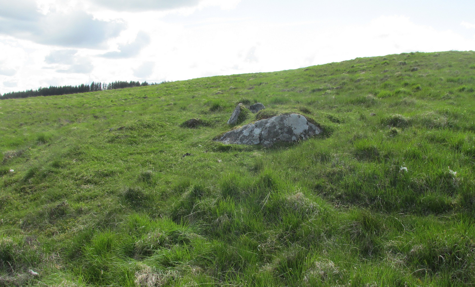
Just over a half-mile (1km) south-west of the major rock art complex at Castleton, in the fields just east of Gallamuir Farm on the north side of the B9124 road, could once be seen a decent double-ringed enclosure, prehistoric in nature. At ground level today there is nothing to be seen as agricultural practices have ever so slowly eroded it away. It wasn’t in a good state when the dudes from Royal Commission (1963) had a look at it in October, 1951—although they did tell us that some faint remnants were discernible, but it was fading fast! They wrote:
“No traces of this structure can normally be seen on the surface, but at the date of visit, when the site was covered with wheat stubble, stretches of both ditches were clearly visible, as shown on the plan (below), by reason of the stronger growth of the stubble overlying them. The ditches are from 20ft to 30ft apart, and the enclosed area measures 300ft from ESE to WNW, by about 240ft transversely. Two narrow gaps in the inner ditch on the north and east arcs respectively, may represent original entrances.”
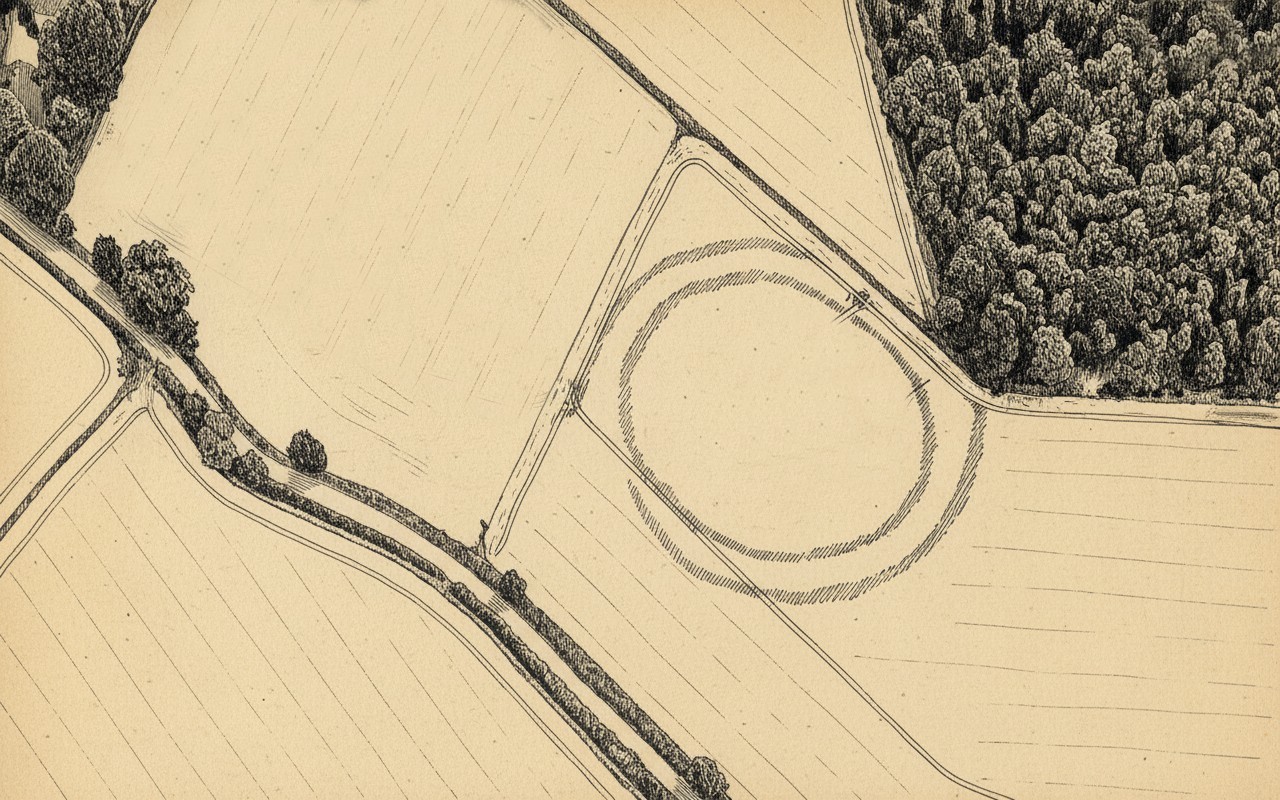
Outline sketch of the enclosureRoyal Commission plan
Nothing remains of it today apart from the shadow-marks of its former existence when looked down from above. The double embankment that constituted the enclosure initially suggested it to be Iron Age in nature, akin to the larger hillforts up and down the country, but the outline is more consistent of a standard settlement enclosure. As far as I’m aware, no excavations have taken place here, so we’re at a loss to know whether the people living here had anything to do with the rock art just across the fields at Castleton. If we found that it had a Bronze Age or neolithic date, a connection could be likely. But we may have to look at the enclosure immediately north of the Castleton complex to be more sure of our petroglyphic culprits….
References:
Lock, Gary & Ralston, Ian, An Atlas of Hillforts of Great Britain and Ireland, Edinburgh University Press 2022.
Royal Commission on the Ancient & Historical Monuments Scotland, Stirling – volume 2, HMSO: Edinburgh 1963.
Royal Commission on the Ancient & Historical Monuments of Scotland, Archaeological Sites and Monuments of Stirling District, Central Region, Society of Antiquaries of Scotland 1979.
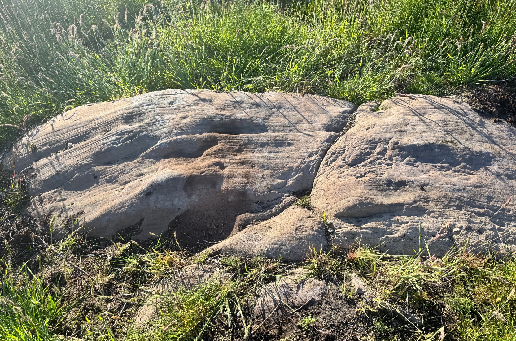
To find this carving, follow the same directions as if you’re visiting the carving I’ve simply labelled Netherglenny. From here, walk up the slope (north) barely twenty yards and you’ll see the folds of another elongated piece of rock, similar in form to the one you’ve just been to.
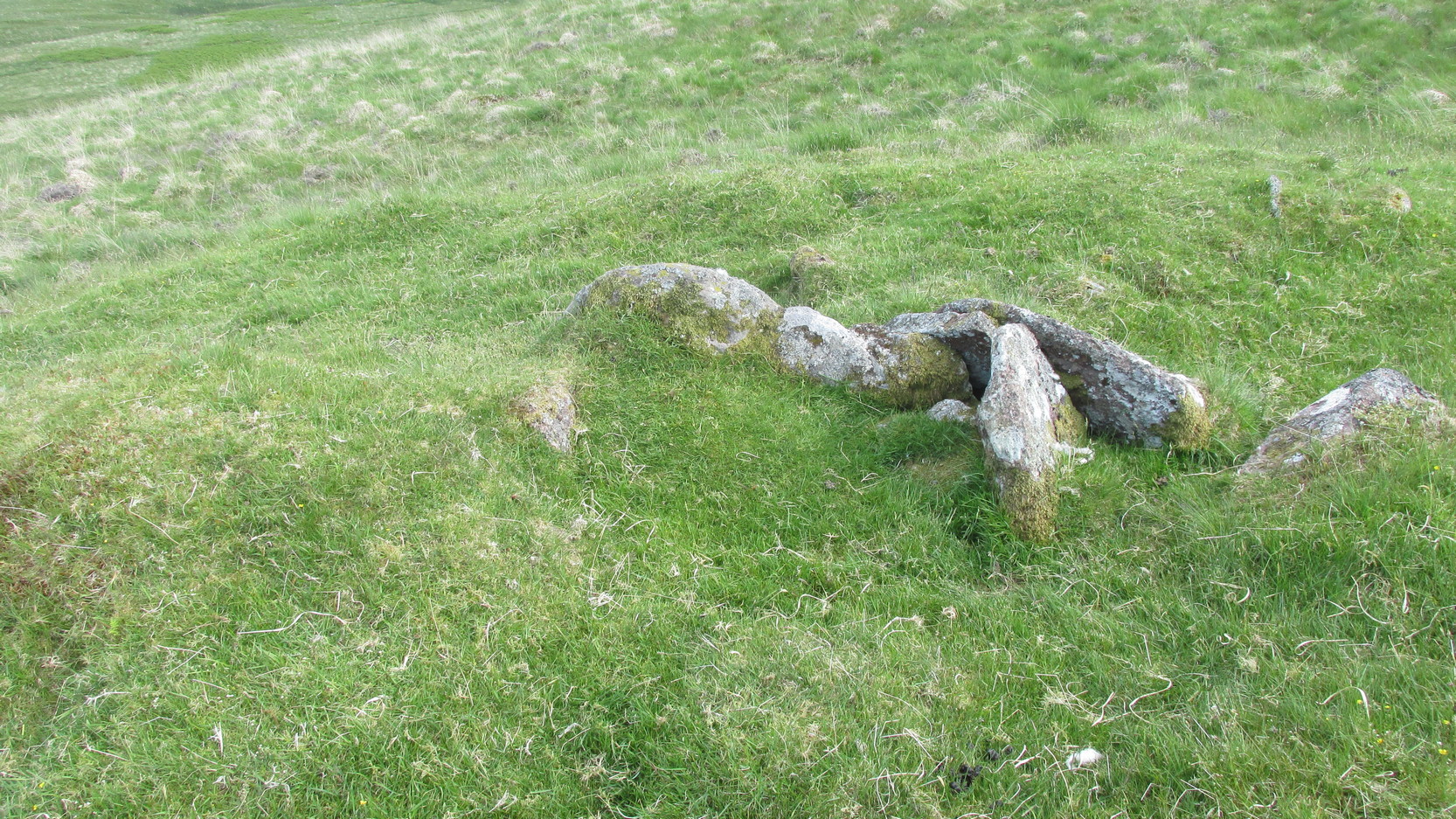
I found this stone when rushing near the end of a red hot day and needed to get back under some shelter, so I didn’t get chance to highlight it as I usually do. Hence, the info and the photos of the carving aren’t impressive. But then, the design on the stone isn’t impressive either. I could discern just two distinct cup-marks: one above the deep elongated slit (vulva-esque) and the other below it. The cup-mark above it comes out clearly in the photos; but the other one is just about hidden in the shadows. There may be a third possible cupmark close to the less visible one. I’ll get some better photos when I’m next up there (he sez, hopefully…)
Shallow cup, top-middle
This carving lies very close indeed to an official site entry known simply as a ‘Nether Glenny’ carving (grid-ref NN 56130 01969), which became lost when forestation took effect here more than 30 years ago. However, the description given to that stone, of “at least six cups on the upper surface of the boulder” isn’t consistent with the marks on this rock. There are several other marks on this stone that may give the impression of them being cup-marks, but they’re entirely natural. Hopefully we can recover the lost ‘official’ stone on our next visit.
(The entry title of this site needs amending, as the entire Menteith rock art complex (more than a hundred carvings in little over a square mile) needs re-assessing and assembled under a singular umbrella. The scattering of place-names, sometimes erroneously, relating to the many so-called ‘Nether Glenny’ carvings [dozens of them], is confusing unless you know the area intimately—and most people don’t! So forgive the title I’ve given this minimalist cup-marked stone. It will be adjusted when we’ve been back and correctly mapped the others in this locale. If anyone wants to help out in this project, please get in touch.)
We took the route up from the hidden Braeval car-park, on the left-side of the road, ⅔-mile (1km) east of the Aberfoyle roundabout (on the edge of town). From here, walk up the dirt-track and bear left 350 yards up where the track splits. Walk up here for 1½ miles, through and beyond the ruined forest until, on the far side of the remaining trees (they may have been cut when you’re reading this) the path eventually brings you out into pasture. At this point, veer immediate right and follow the fence/wall on your right for literally ⅓-mile (0.54 km). This is boggy and uneven all the way as there’s no path here. You’ve gone up and over a ridge and, as you’re coming down the slope, hop back over the wall where there’s a gap and walk about 30-40 yards into the debris. You’re damn close!
Archaeology & History
Rough sketch of design
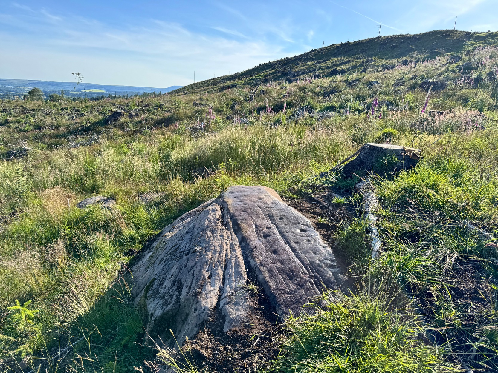
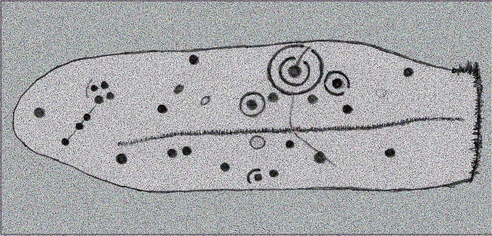
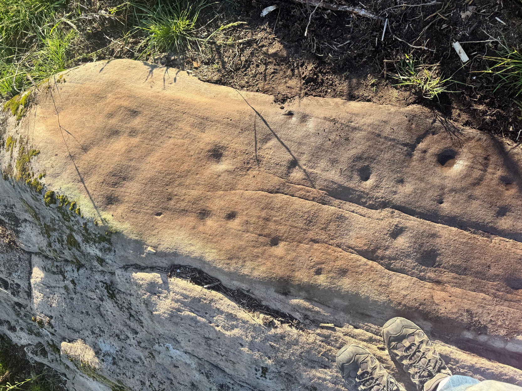
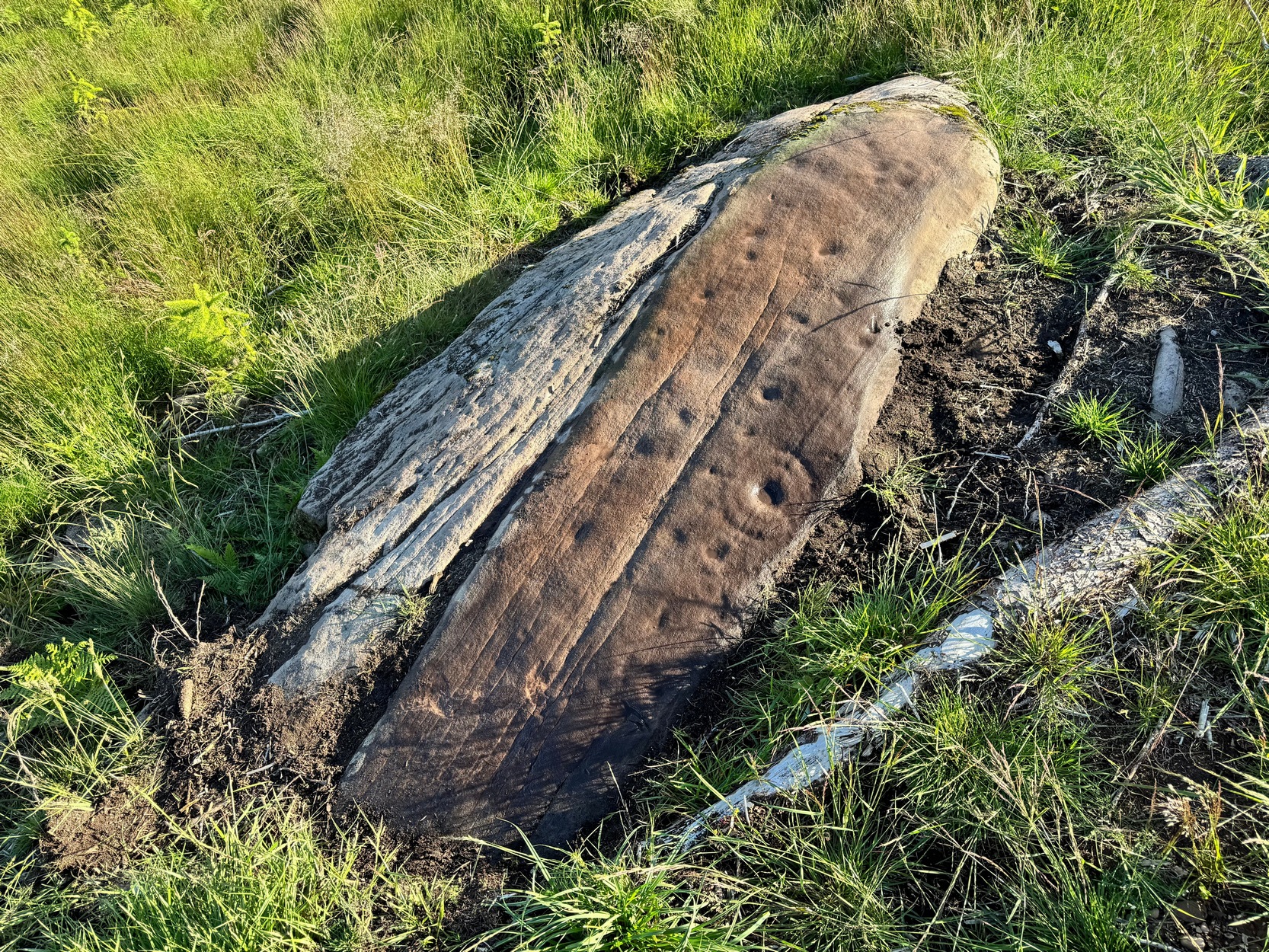
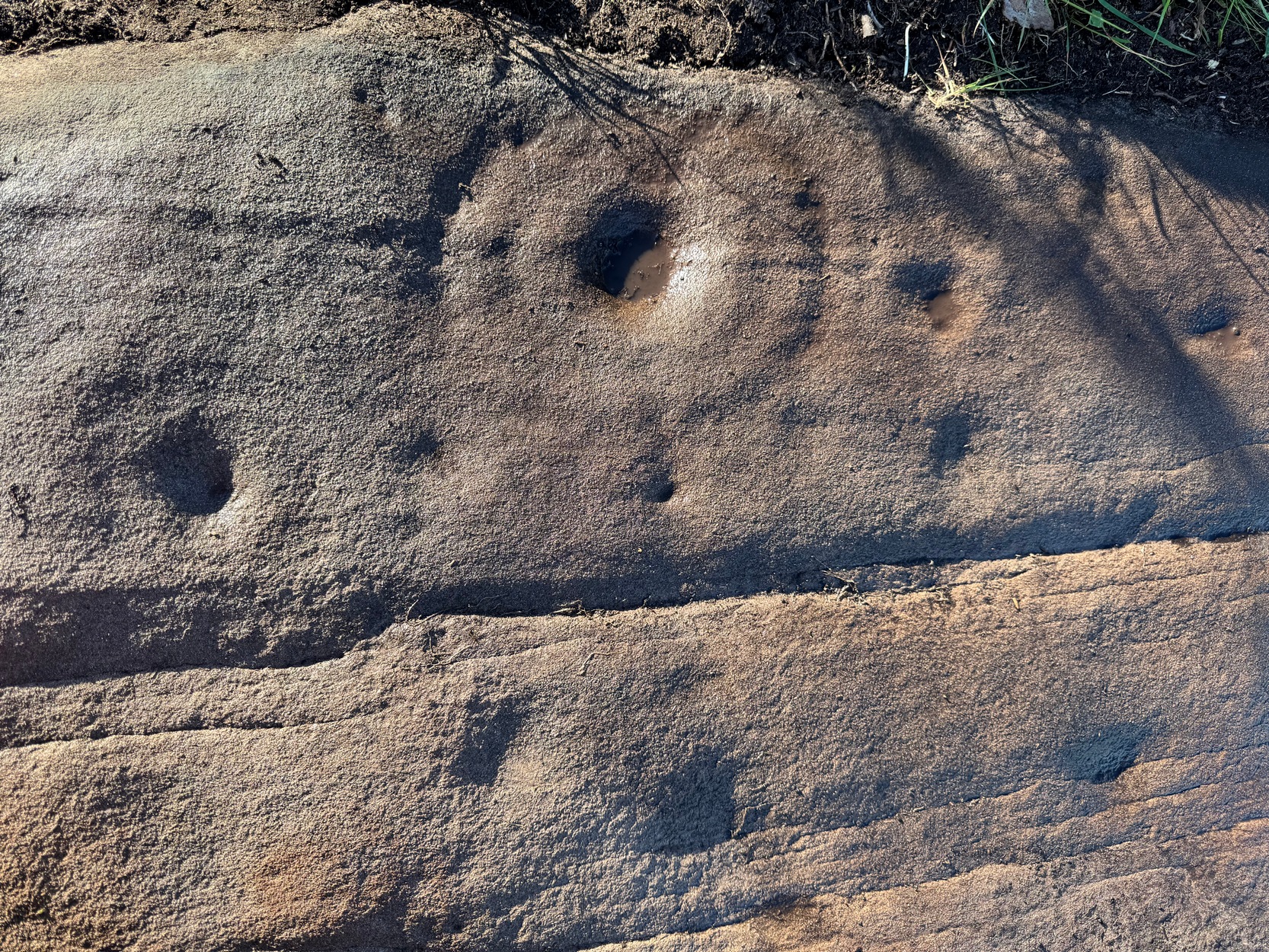
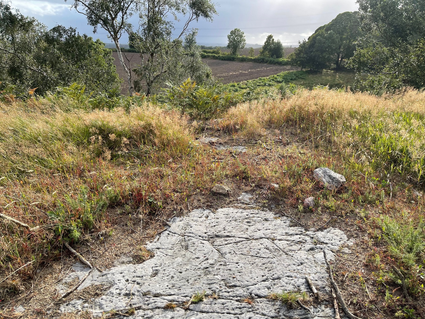
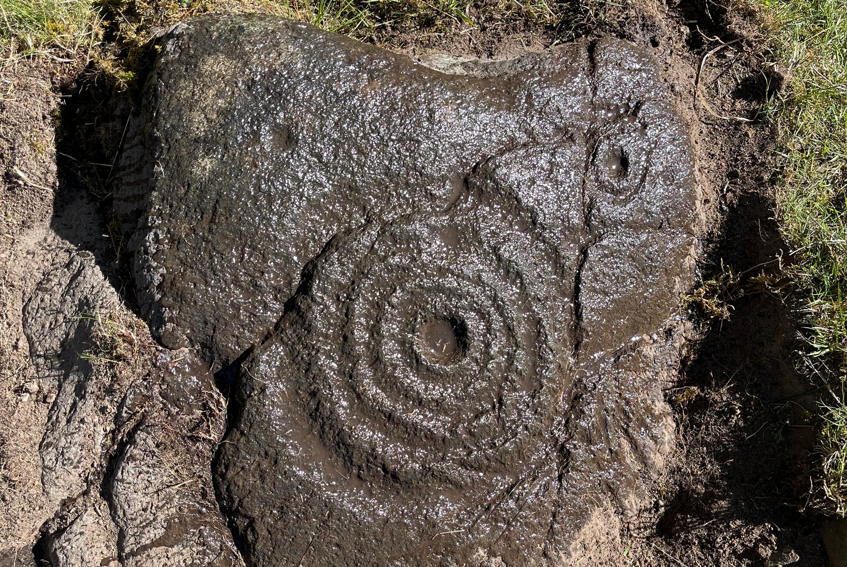
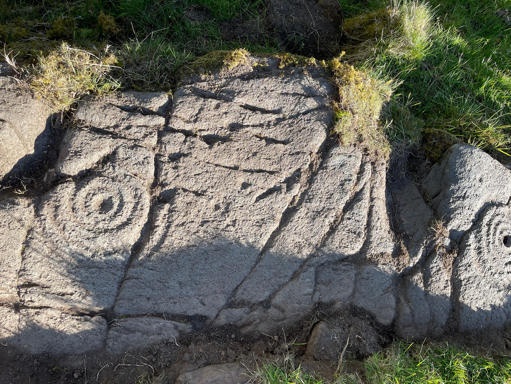
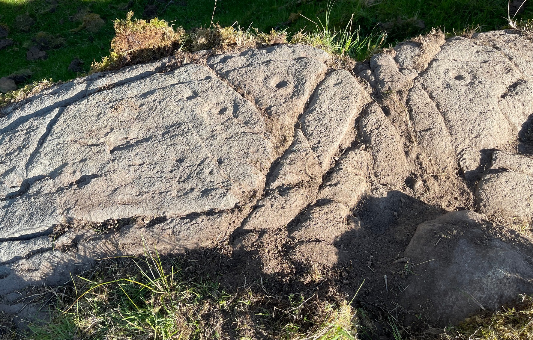
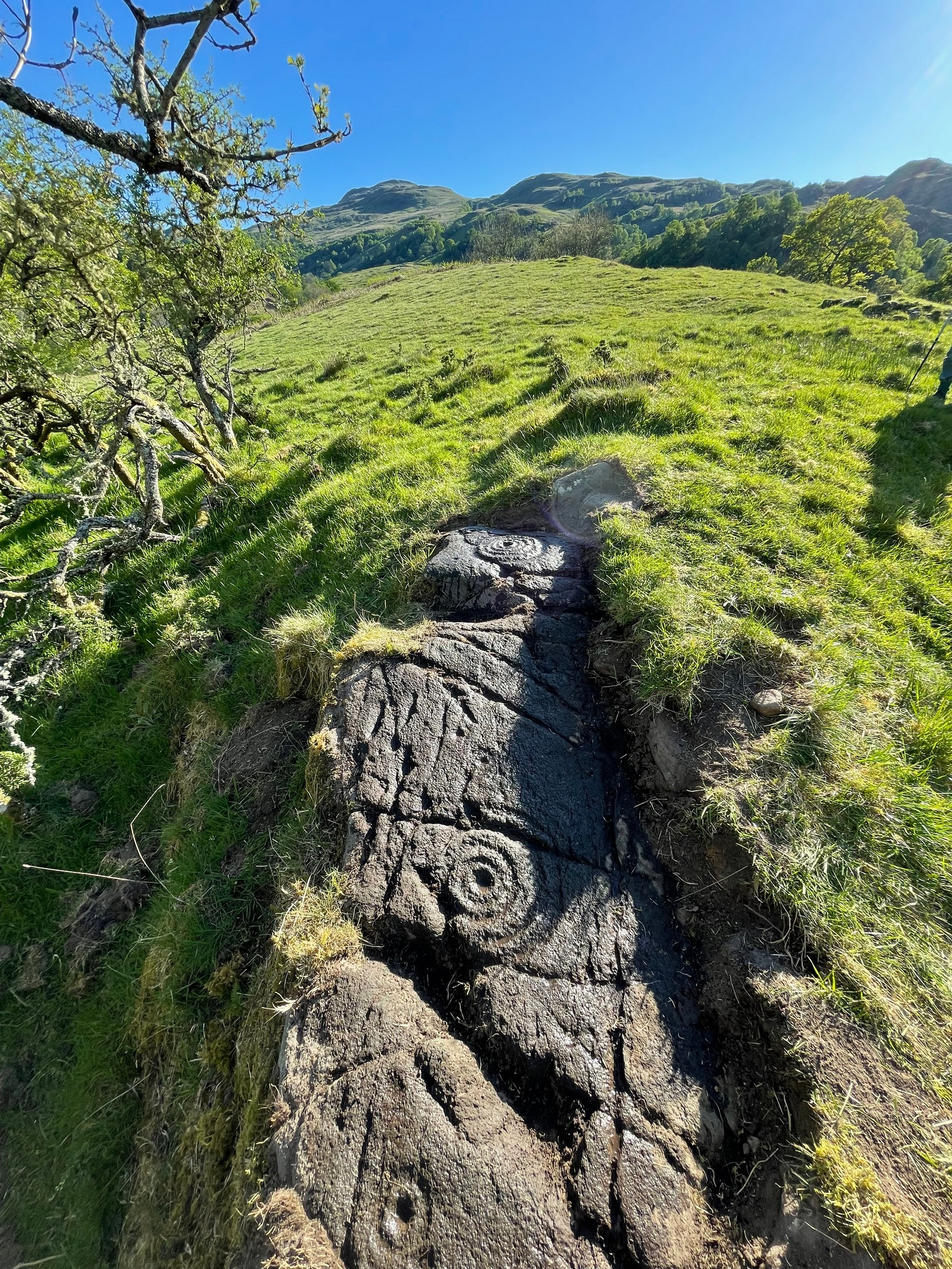
This is one of several previously unrecorded carvings I came across recently on the northwestern edge of the massive Ballochraggan rock art complex, on the slopes above the Lake of Menteith. I found it during one of the red-hot days we’ve just had —and, sadly, it had me running for home much quicker than usual! The heat beat me on this day (I’ve never been a lover of the sun), so hopefully you’ll forgive me if I missed a bit! 🙂 I was heading for the nearby Solar Stone carving near the bottom of the slope, when this partially-covered rock caught my eye—and I’m glad it did! For scattered along its long slender topmost surface, a number of the usual curious prehistoric symbols had been etched…
Western end of stonePetroglyph when wet!
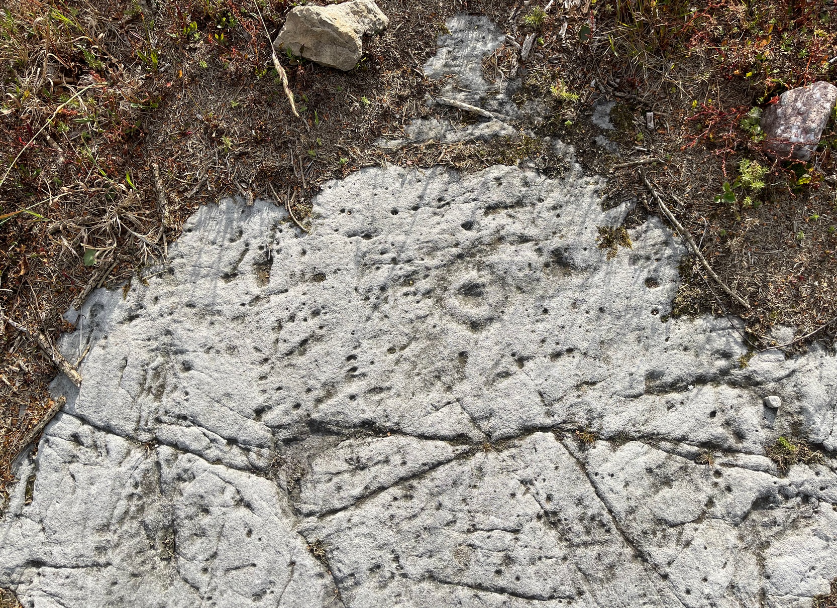
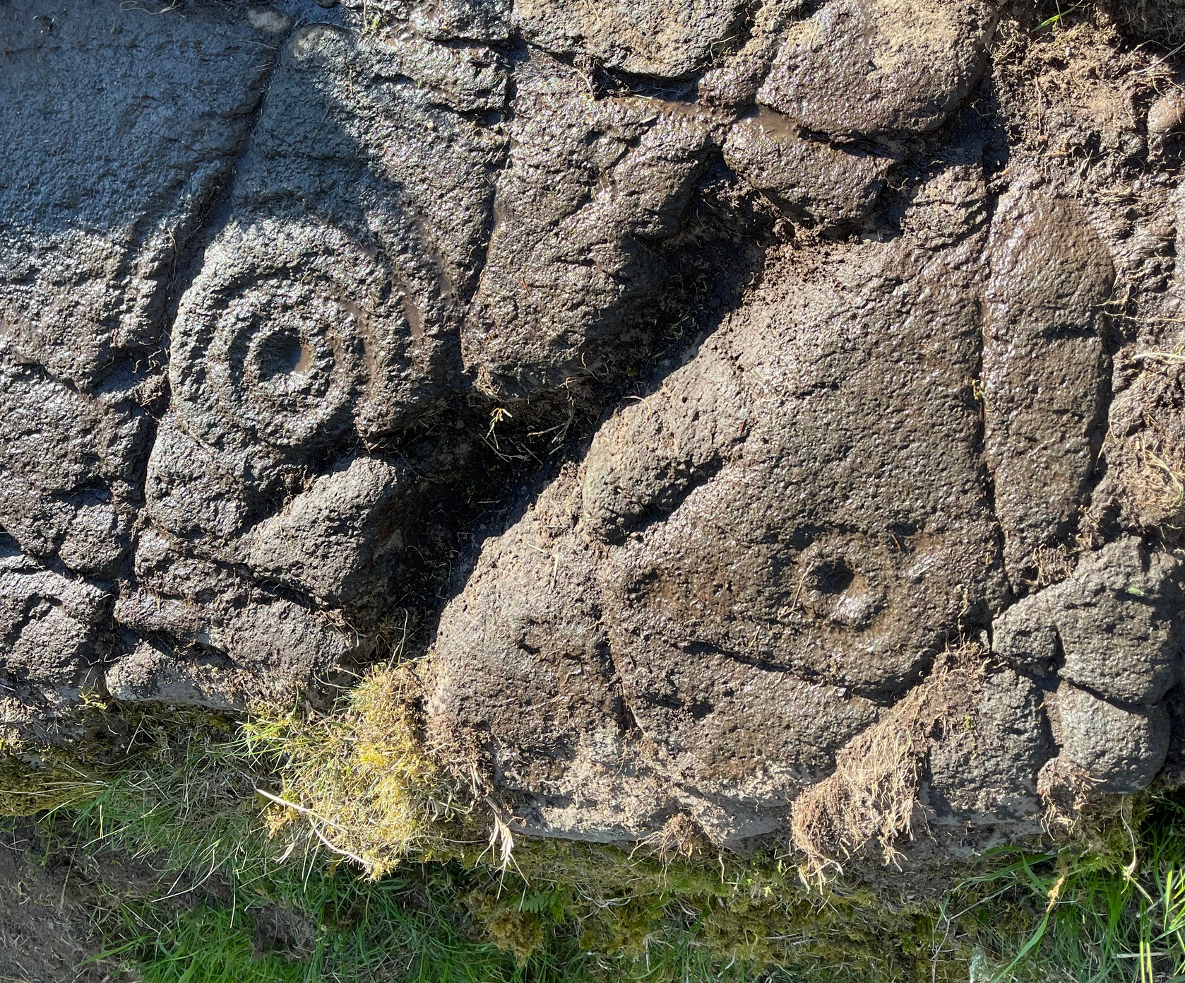
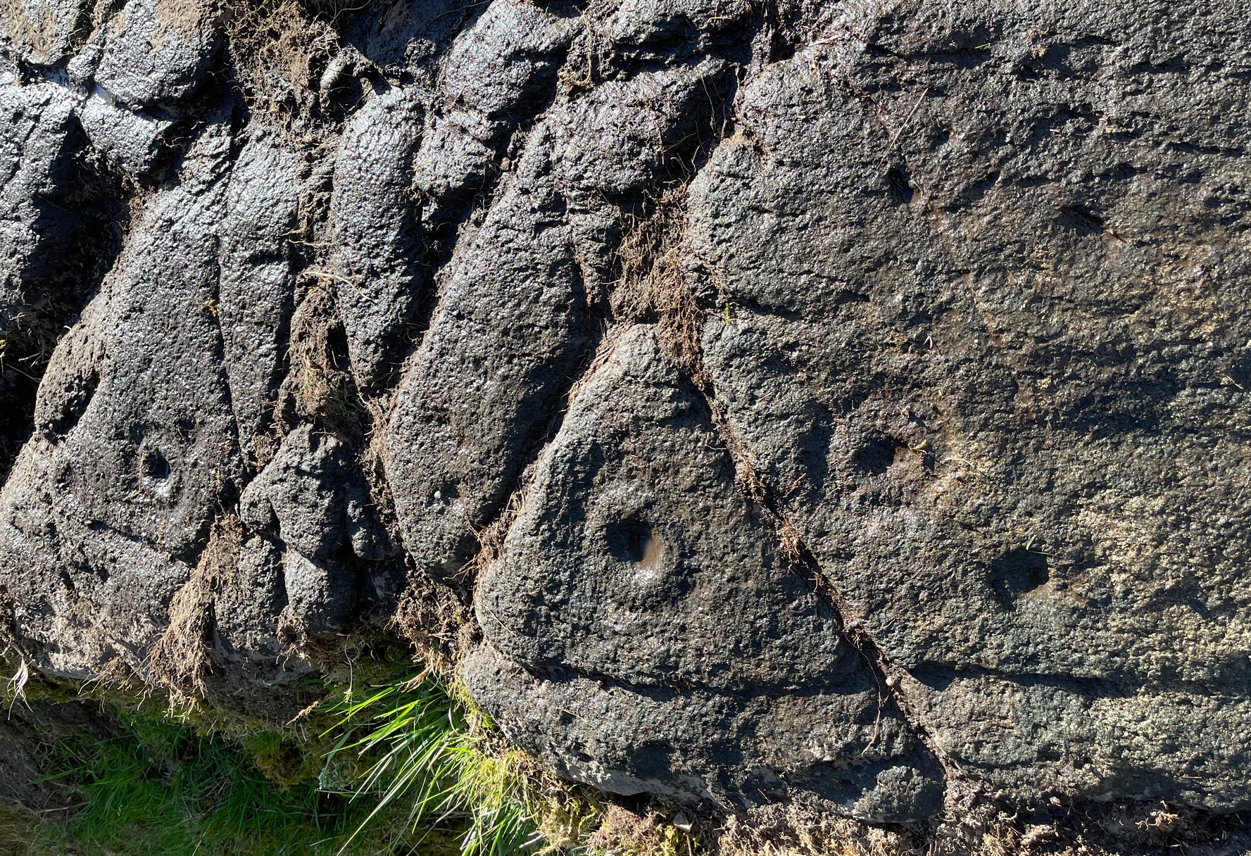
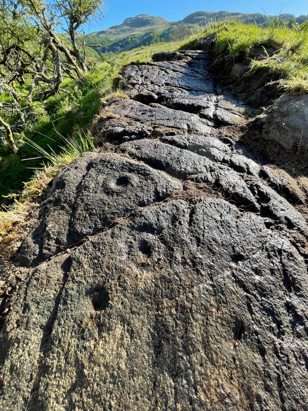
The first thing I noticed were a scatter of cup-marks at the western end of the stone: four of them in a close-knit cluster (this section reminded me of an old favourite on Shipley Glen), with several others seemingly running in a curved line down the slightly sloping stone with, possibly, one or two others also streaming away below this same cluster. But the main feature, as the photos and sketches illustrate, is the cup with a large double-ring near the middle of the stone, above a long natural crack that almost cuts the stone in half.
On either side of the double-ring are quite separate single cup-and-rings with (roughly) equal layers of erosion—although the central cups were probably re-carved, so to speak, many times over the centuries, as their erosion level is considerably less than that of the rings. This is a feature found at countless carvings across Britain and suggests regular “re-use” or rather re-animating the design on a regular basis. A faint half-ring can be seen round one of the smaller cups near the bottom of the carving. And a peculiar feature near the middle of the design is a simple ‘ring’ that was started but never finished (perhaps?), with no cup-mark in the centre. This is a feature found on quite a few Perthshire carvings, with some of the shallow ‘rings’ being nearly 12-inches across in some instances. Most odd!
Main double cup&ringLooking down at the design
Several of the single cup-marks on here appear to have started life as natural pock-marks in the stone, which would have made carving the design a little easier than just starting from scratch! And, about 10 yards below this carving, a small sloping rock has a distinct eroded ‘bowl’ on it, about six inches across and several inches deep and is perhaps relevant to this carving in a pragmatic sense (mulching colours, herbs, etc). These ‘bowls’—be they natural or enhanced—are much-overlooked features and their existence needs to be taken into consideration when they’re found within a mass of cup-and-ring stones, such as found here, on the outskirts of olde Aberfoyle. Check it out when you’re next up here…. and the cup-marked stone 20 yards further up the slope too. And lots of others!
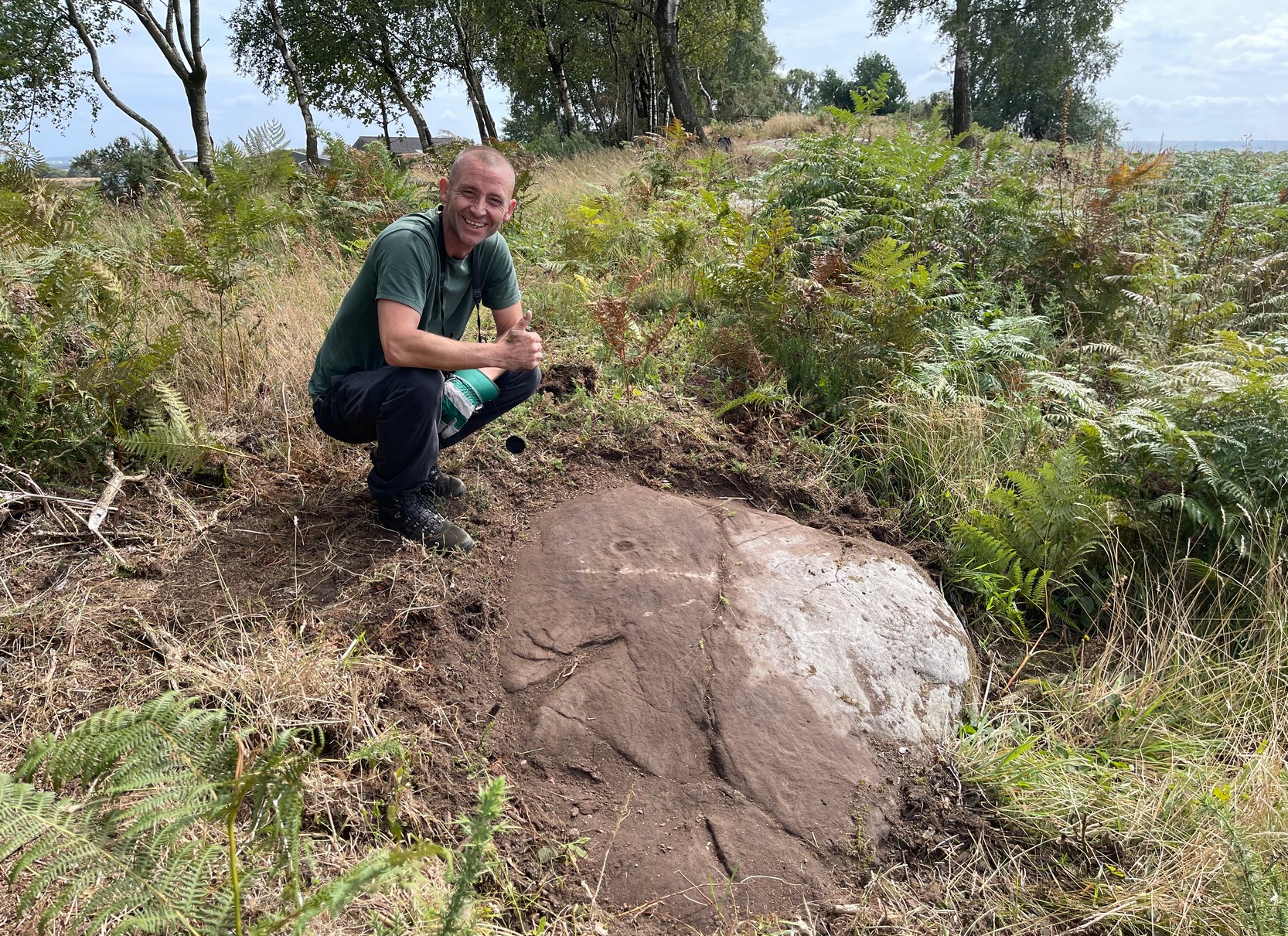
Acknowledgements: Big thanks to Prof Hornby for getting us up here on a scorching day!
If you start from the Castleton (2) carving, in the first small birch copse closest to the road, walk to its southeast side where there’s a small break before the next small birch copse begins which runs along the raised rocky crag to the southeast. Walk along the back lower east-side of these birches for about 100 yards until you reach a break in the copse (the next lot of trees are another 30-40 yards further on) and from here walk up the slope onto the first flat piece of rock on the crag itself. Zigzag hereabouts until you’re about two or three yards from the edge.
Archaeology & History
Single cup-and-ring
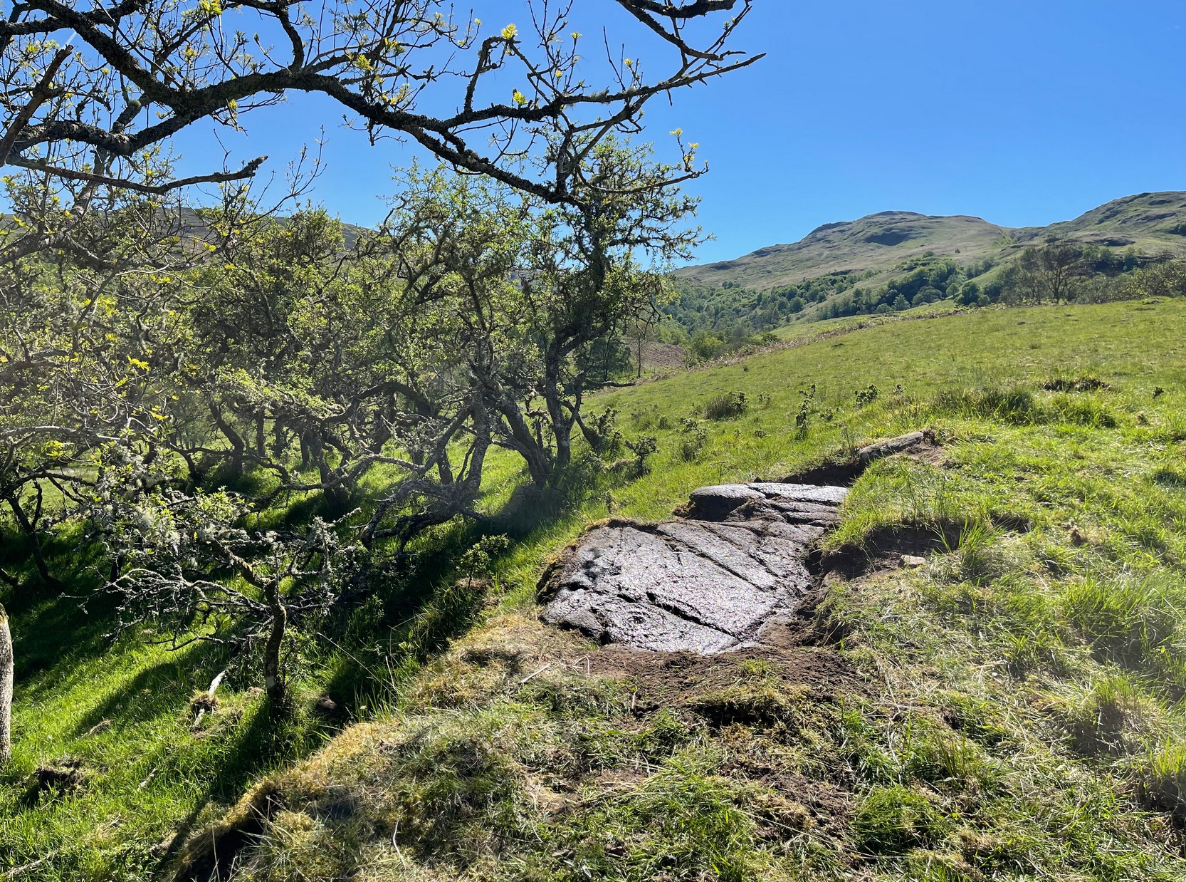
Once this rock surface is covered again by Nature’s carpet, you’ll struggle to find it. Unlike many of its more ornate neighbours, this seems to be a lonely solitary cup-and-ring design, cut near the edge of a large level piece of otherwise blank rock. Numerous geological nicks and scratches scatter the same surface, but the carved element is easy enough to see, as the photos here show. It was rediscovered in the 1980s by Morris & van Hoek (1986) who described it simply as “a single cup and one ring, 8cm in diameter on horizontal rock.” There may well be additional elements to this design beneath the soil.
References:
Morris, Ronald W.B. & van Hoek, Maarten, “Stirling District: Castleton 4d; Castleton 5e,” in Discovery & Excavation, Scotland, 1986.
Acknowledgments: Massive thanks to Thomas Cleland for helping to make this site visible again.
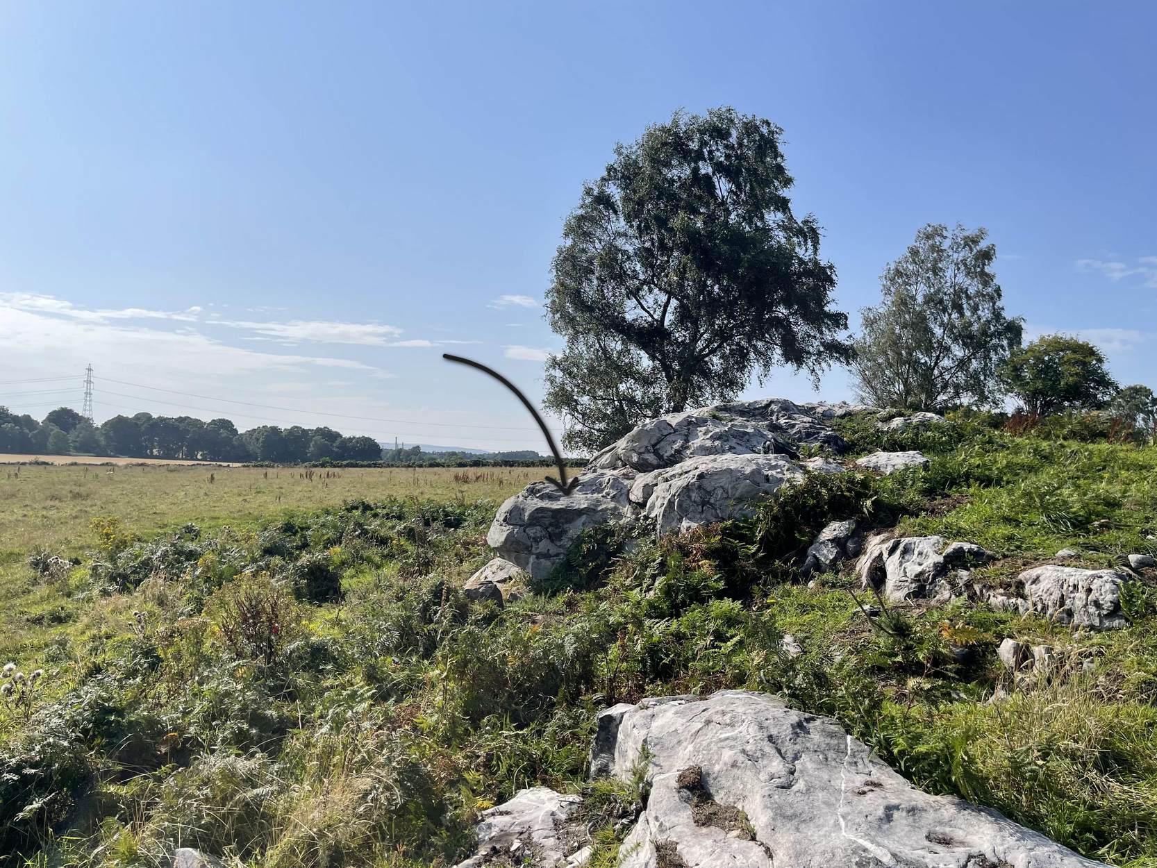
Start from the Castleton (2) carving, in the first small birch copse closest to the road and walk to its southeast side where there’s a small break in the trees before the next small birch copse begins, which runs along the raised rocky crag to the southeast. Walk to the front or western side of the trees there and along the very edge of the low crag. About thirty yards along, right on the edge of where the rocks begin, look for the smooth sloping earthfast boulder (about 20 yards before the mighty nine-ringer of Castleton 7). Rummage around and you’ll find it.
Archaeology & History
Castleton (7e) carving
This newly recorded petroglyph was rediscovered by Thomas Cleland on August 6, 2025. Initially it was thought to consist of just a single cup-and-ring with an opening from which a carved line ran outwards; but, once wet, there seemed to be the beginning of an outer second-ring on its left-side. You can see it clearly in the photos. And, the more we looked, the more it seemed there were one or two other very faded elements.
Above the main cup-and-ring is a faint, shallow cup-marking and surrounding this appears to be an incomplete dumb-bell-shaped ‘ring’ that you can only just make out in the photos. It’s very faded and would seem to pre-date the primary design by some considerable time (unless, of course, it was merely ‘outlined’, so to speak and never completed).
Cup & ring & faint ‘bell’Cup & ring & faint ‘bell’
Both Tom and I are convinced that there’s more to this carving than is presently visible. The rock is covered in deeply compacted soil and it would require a lot of work to uncover the rest of it. A job for the future maybe…..
Note to self: This carving and all the others in the Castleton complex need to be fully re-catalogued as their indexing is haphazard through various academic tomes and websites.
Acknowledgements: Massive thanks to Thomas Cleland for locating this carving, for the first time in millenia. 🙂
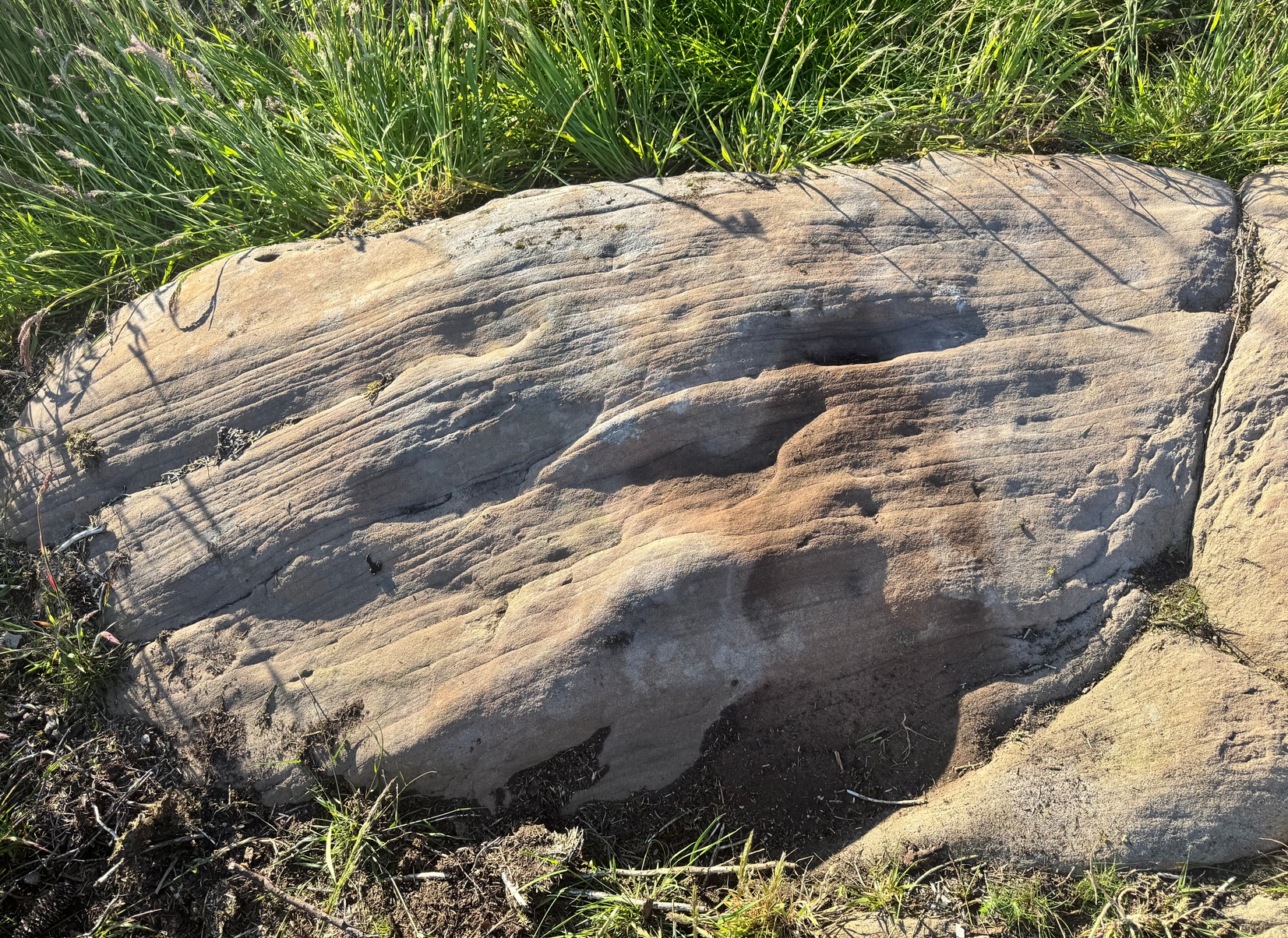
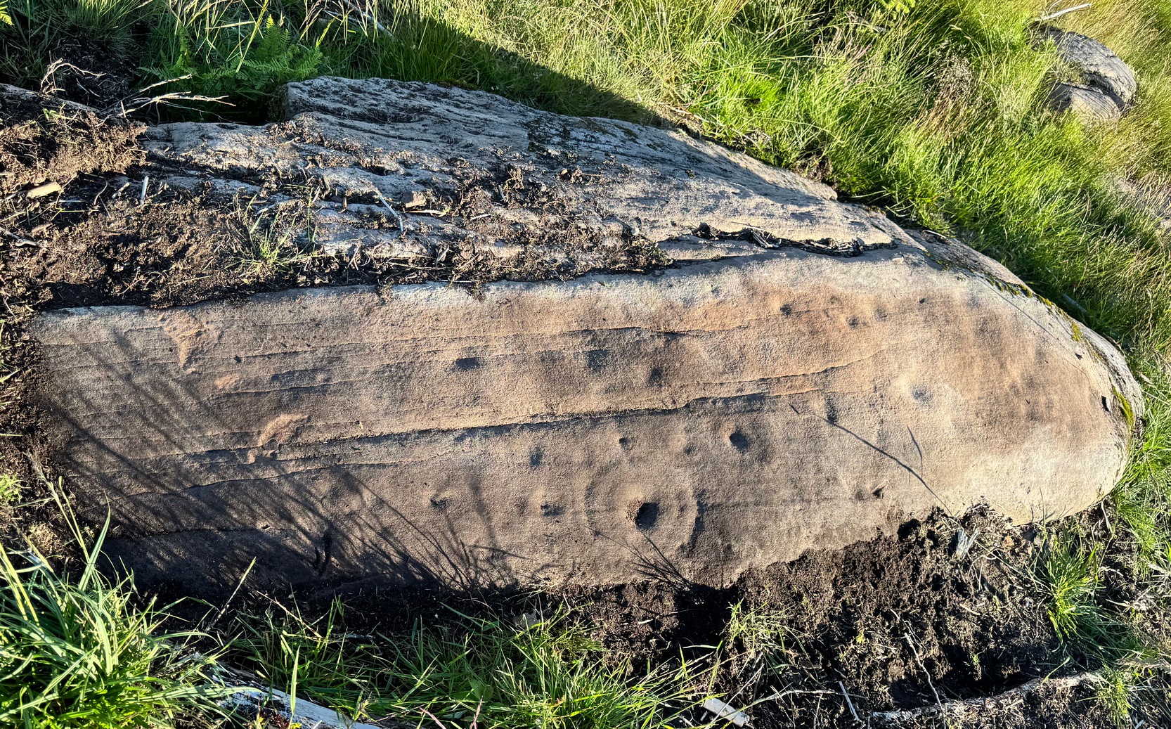
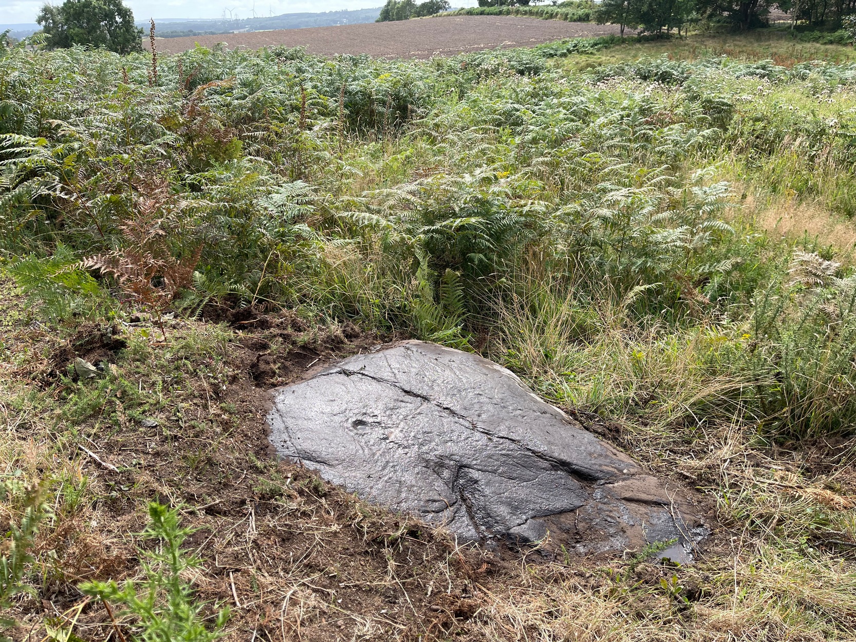
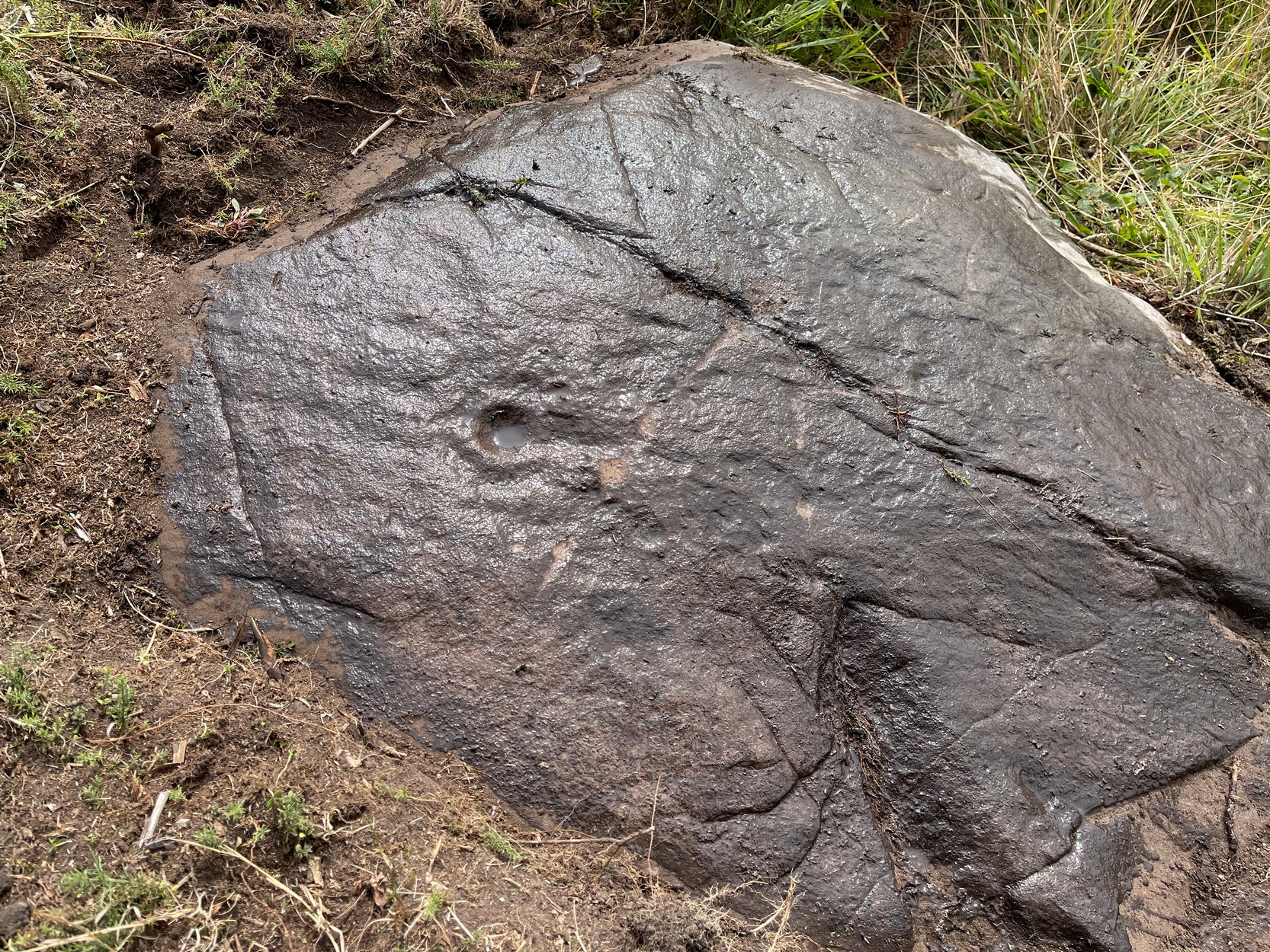
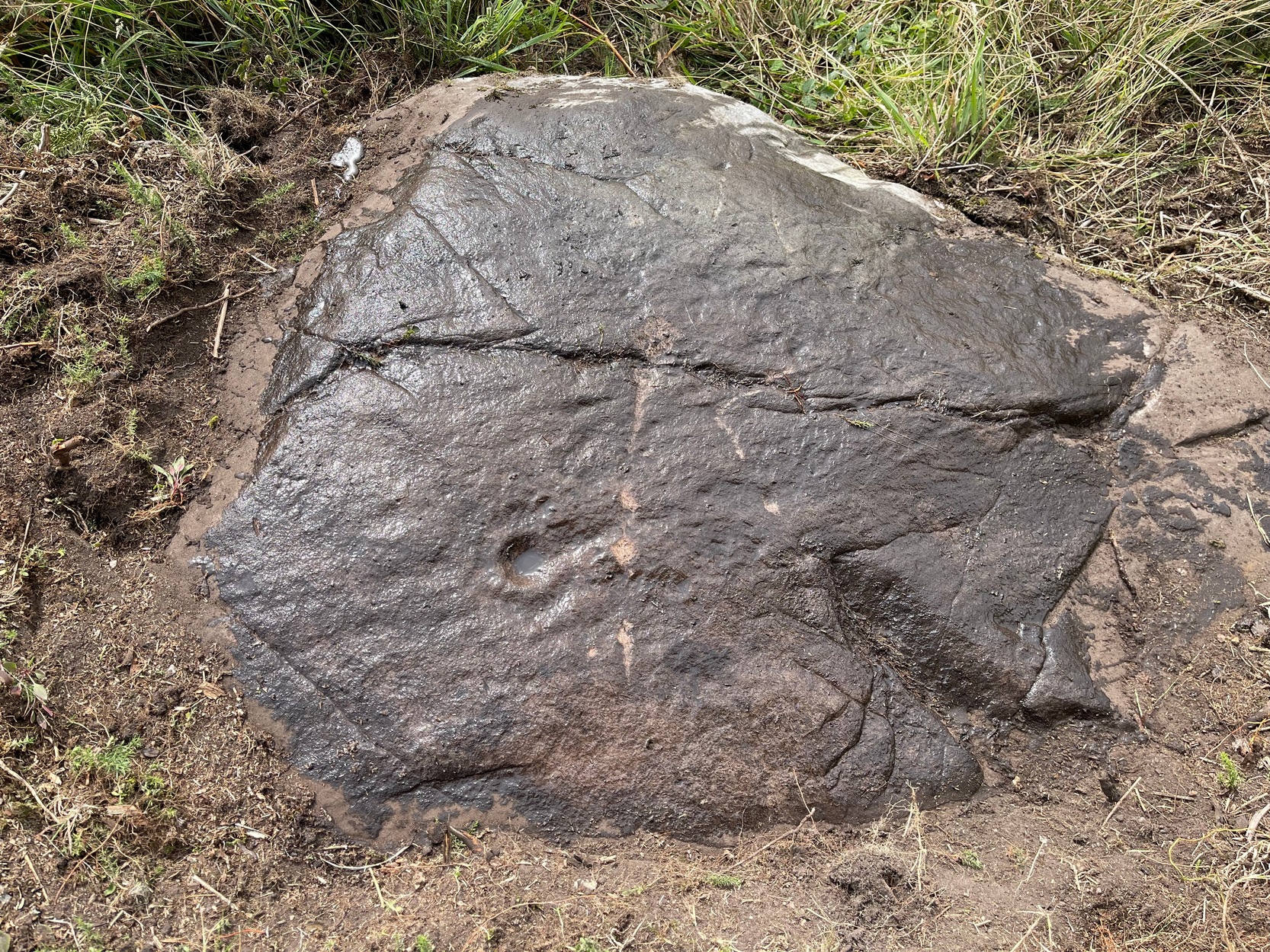
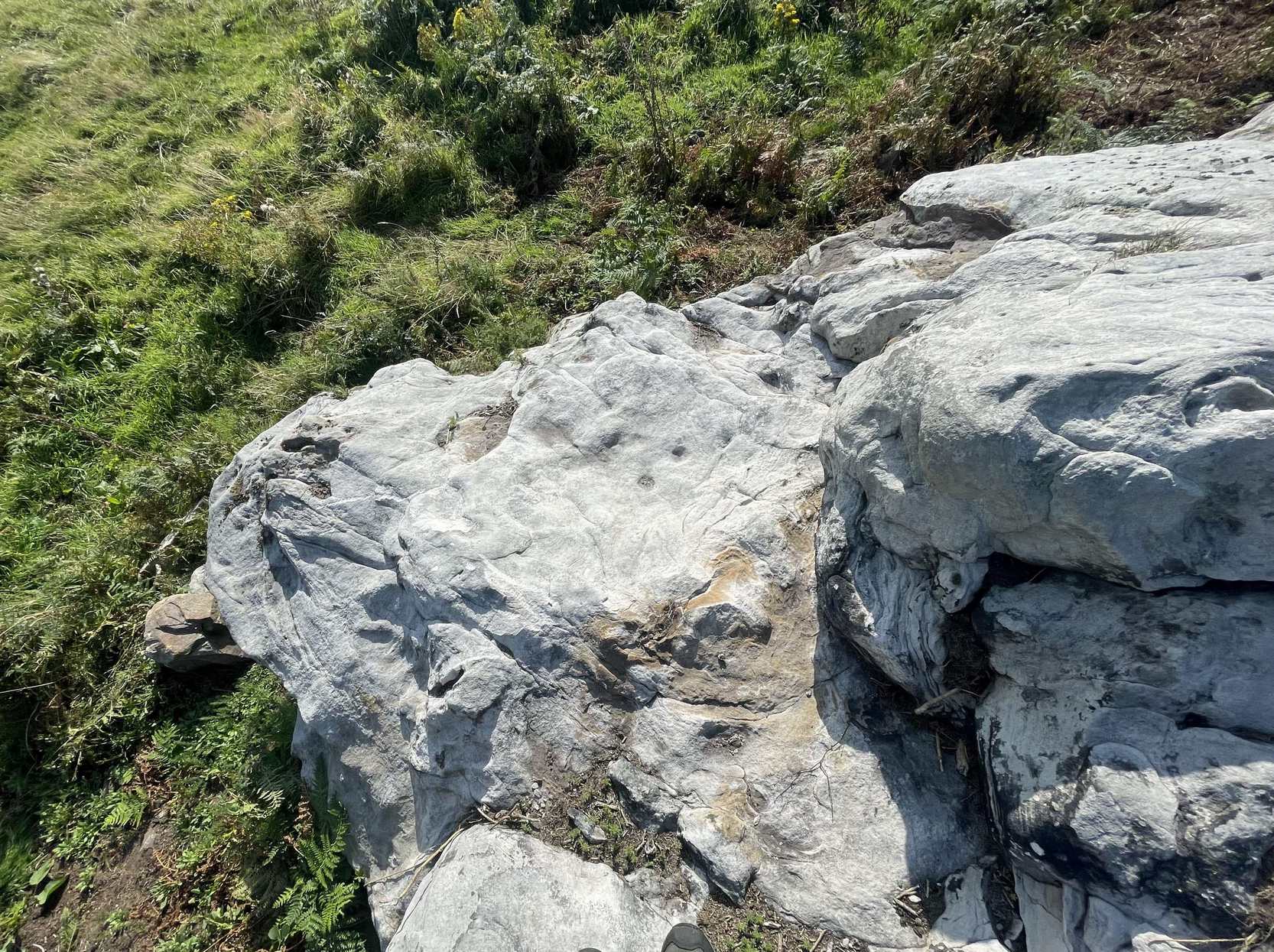
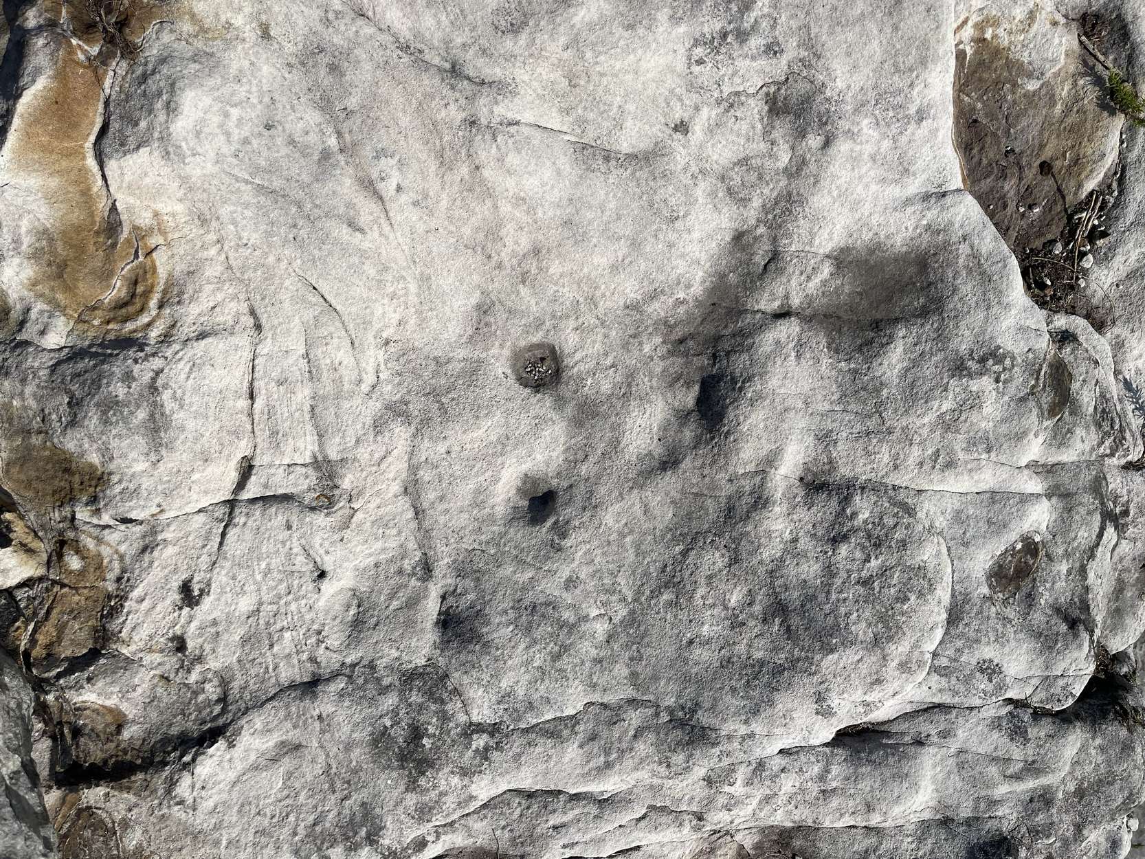
Follow the directions as if you’re visiting the impressive multi-ringed design of the Castleton (10) carving. Once there, walk south-east along the geological ridge for 45 yards where the small cliff drops down to the field. Just where this drop occurs, on a lower horizontal level of the rock face (only a small section) you’ll notice two distinct “cups”. You can’t really miss it!
Archaeology & History
This very basic cup-marked stone was, until recently, covered in dense gorse, making access to the site almost impossible. But following a fire that happened here not too long ago, the smoldering remains needed to be cleared and, once the job was done, we were able to see the two distinct ‘cups’ that were first described in Maarten van Hoek’s (1996) survey. But the cups that he described are, most likely, little more than Nature’s handiwork. I’m somewhat skeptical of them as being the real deal. In the same survey, he added another site, which are just natural bowls in the rock just over 100 yards southwest of here as being cup-marks — which they’re not!
References:
van Hoek, M.A.M.,”Prehistoric Rock Art around Castleton Farm, Airth,” in Forth Naturalist & Historian, volume 19, 1996.
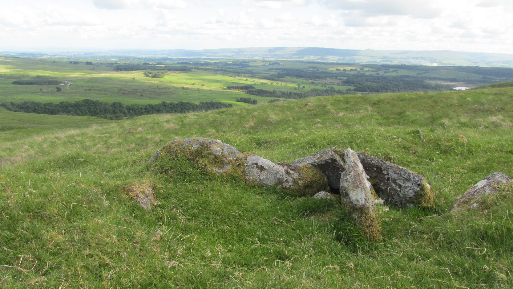
Along the A84 road as you’re heading into Callander, just 300 yards before you reach the the Keltie Bridge caravan park, take the tiny road on your left (north) and barely 100 yards along where a small crossroads can be said to exist, go straight forward up the tiny single-track road ahead of you. Keep all the way up for a mile until you reach Bracklinn Farm (when you meet a split in the road, keep left – and make sure you have parked way further down track of here). Walk up the track past Bracklinn Farm for just over a mile (1.85km), until where the track and the large burn runs roughly alongside each other (past the small Eas Uilleam cairn up to your right) and go through the gate. From here, go immediately left (SW) and walk alongside the dead straight fence for just over 300 yards, then slowly zigzag up the sloping hill. If you reach the derelict walling, you’ve gone too far.
Archaeology & History
West Bracklinn from below
For a site marked as ‘Chambered Cairn’ on the OS-maps, you might be expecting a little bit more when you get here. Sadly, it’s not what it once was. Much of the covering stones from the cairn have been severely robbed and obviously used in the old and curiously-named ruin of Bothan na Plaighe below, and the large sheep-fold structures barely 50 yards to the north. All that’s really left to see here is the internal chamber, aligned roughly east-west, which seems to have originally been split into two sections. The remaining overgrown edges of the monument, barely two feet high at the most, measures roughly 8 yards by 9 yards, but is much denuded and can really only be noticed when you’re almost stood on top of it!
The landscape reaching out from here takes the eyes way way into the distance along the fading horizon, from north-east to south-east. This expansive view, this reaching landscape, may have been an important element in the placement of the tomb – and it’s certainly something to behold on a good day. It might be a bit of a walk to get here, but if you want some good countryside, scenery and a bit of ancient history, this is one helluva good place to go!
References:
Royal Commission Ancient & Historical Monuments of Scotland, Braes of Doune: An Archaeological Survey, RCAHMS: Edinburgh 1994.
Acknowledgements:Huge thanks for use of the Ordnance Survey map in this site profile, reproduced with the kind permission of the National Library of Scotland.
This is a relatively new find that was uncovered in 2019 by members of the Association of Certified Field Archaeologists, on the western edge of a small bowl of blackthorn trees, just past one of the Corrycharmaig East carvings — and it’s a bit of a beauty!
Topmost part of carving
Corrycharmaig (9) stone
Described, albeit briefly, in the superb survey by Gardiner, King & MacInnes (2024), the carving here has been cut into a sloping straight line of rock along the ridge of a very tiny cliff and consists of cups, single rings and multiple rings. At its crown, so to speak, where the rock surface levels out and is flat, a very well-preserved multiple cup-and-ring greets our senses: a cup-and-four rings to be precise. The outermost edge of the rings cuts into a natural crack that runs to the edge of the stone; and close to where this crack reaches the edge, another standard cup-and-ring rests against it. On this same section you’ll see a single cup which, by the look of it, was intended to have a much wider ring surrounding it—but for some reason it was never executed.
Second multiple-ringer
Second multiple-ring
From the topmost section, the rock then slopes gradually downward and the design is broken by several natural splits in the stone before we reach a single unfinished cup-and-ring and a solitary cup-mark. These occur shortly before we reach a near-duplicate of the multiple-ringer that we’ve just seen on the flat top of the stone. The outer ring of this is broken and the edges of it are intruded (again) by natural cracks in the stone (a not uncommon feature). The erosion level of this and its fellow four-ringed compatriot at the top are much the same, suggesting that the two were executed at around the same time.
Lower-half with cup&rings
Close-up of cup&rings
As we move down the slope of the rock with its veritable scattering of geological splits, the rest of the design consists of several single cup-and-rings—at least three of them—over its lower-half, almost in a gentle arc over the surface. The one closest to the four-rings has a single cup-mark attached to its outer edge and another single one just a few inches away from it. The others don’t seem to have any additional carved features attached to them; although one or two other singular cup-marks can be seen on this, the lowest section of the carving.
Looking to the hills
From the bottom up
An interesting feature noted here is the direction that this line of rock points to: a dip between two distinct rocky peaks on the horizon and which is close to the winter solstice sunset. I should point out however, that the relationship between open air petroglyphs and astronomical alignments (in Britain at least) is very debatable. Even alignments from one carving to another are pretty meaningless, despite the attempts of some modern archaeologist to show otherwise. In my younger days when I raced into rock art studies, I threw everything I had to show astronomical and other alignments were involved in these carvings—but it turned out not to be…. Instead, it turns out that some of these seeming ‘alignments’ (and only a few) relate to pathways and ancient routes: pointers, if you like, to the way ahead. Makes sense…
References:
Gardiner, M., King, L. & MacInnes, Dugald, In the Glen of the Dark Goddess, Bell & Bain: Glasgow 2024.
Acknowledgements:Huge thanks for use of the Ordnance Survey map in this site profile, reproduced with the kind permission of the National Library of Scotland.
Cup-Marked Stone (lost): OS Grid Reference – NN 4808 0140
Archaeology & History
On the south-side of Loch Ard, just a few yards from the entrance to Rob Roy’s Cave (one of several), right by the water’s edge are the natural upstanding pillars known locally as Gog and Magog. In Peter Joynson’s (1996) work on Aberfoyle, this site is listed as one in a number of unrecorded cup-and-ring stones in the area. Discovered by a local lady—”the late Mrs Maitland”—here we have,
“two huge stones about 30ft high known as Gog and Magog situated at the mouth of Blan Ross Bay. They have numerous cup marks, but sadly have disappeared from view as they have been covered by forestry planting.”
This is an increasingly annoying problem that many rock art students are having to contend with! When we visited the site, the tops of these huge stones were, indeed, covered in depths of mosses and pine needles and the carving is hidden from sight. When the trees are felled, let’s hope someone can find it!
Folklore
These natural rocks were said to have been two giants that were turned to stone, the story of which seems to have been forgotten…
References:
Joynson, Peter, Local Past, privately printed: Aberfoyle 1996.