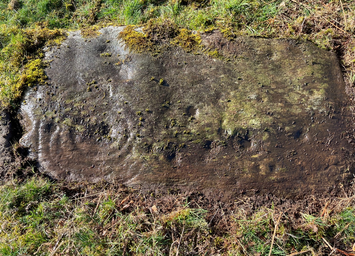
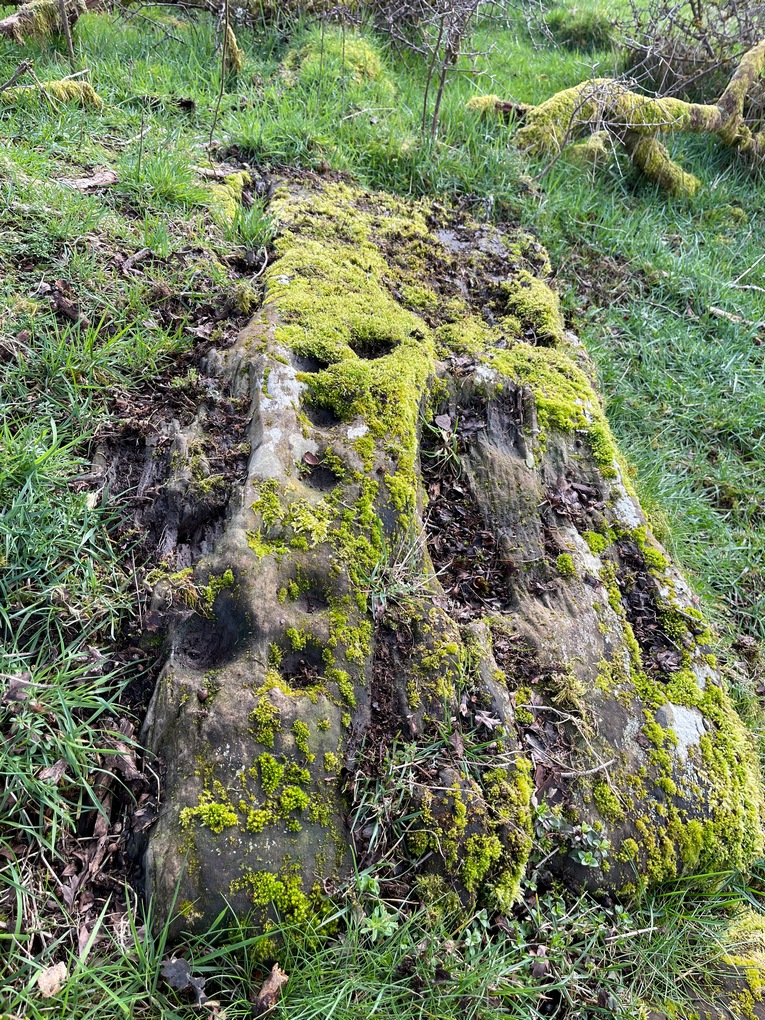
To find this carving, follow the same directions as if you’re visiting the carving I’ve simply labelled Netherglenny. From here, walk up the slope (north) barely twenty yards and you’ll see the folds of another elongated piece of rock, similar in form to the one you’ve just been to.
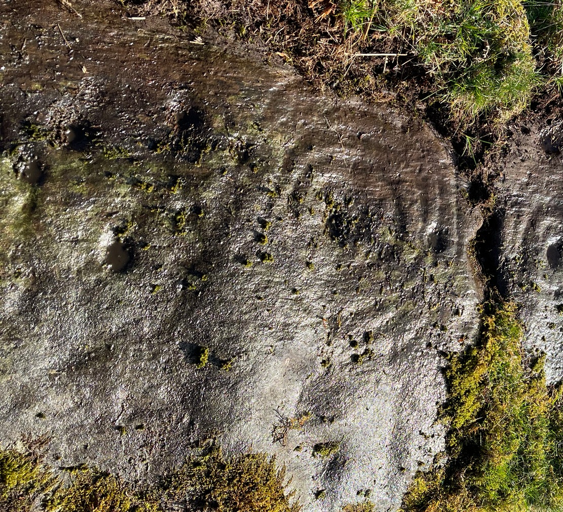
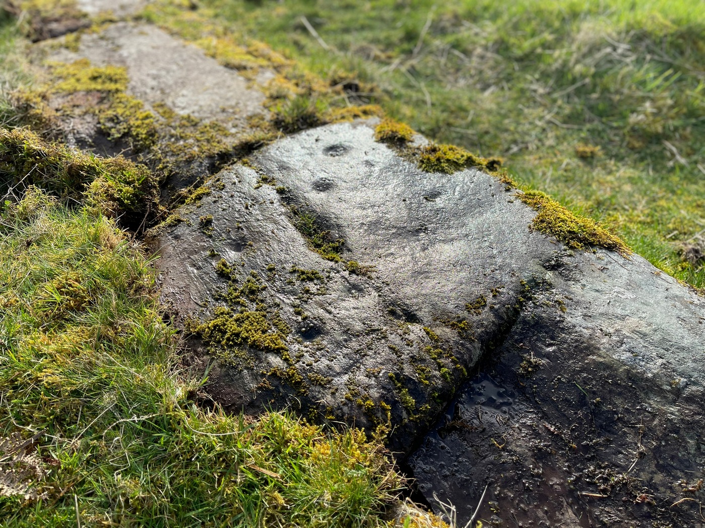
I found this stone when rushing near the end of a red hot day and needed to get back under some shelter, so I didn’t get chance to highlight it as I usually do. Hence, the info and the photos of the carving aren’t impressive. But then, the design on the stone isn’t impressive either. I could discern just two distinct cup-marks: one above the deep elongated slit (vulva-esque) and the other below it. The cup-mark above it comes out clearly in the photos; but the other one is just about hidden in the shadows. There may be a third possible cupmark close to the less visible one. I’ll get some better photos when I’m next up there (he sez, hopefully…)
Shallow cup, top-middle
This carving lies very close indeed to an official site entry known simply as a ‘Nether Glenny’ carving (grid-ref NN 56130 01969), which became lost when forestation took effect here more than 30 years ago. However, the description given to that stone, of “at least six cups on the upper surface of the boulder” isn’t consistent with the marks on this rock. There are several other marks on this stone that may give the impression of them being cup-marks, but they’re entirely natural. Hopefully we can recover the lost ‘official’ stone on our next visit.
(The entry title of this site needs amending, as the entire Menteith rock art complex (more than a hundred carvings in little over a square mile) needs re-assessing and assembled under a singular umbrella. The scattering of place-names, sometimes erroneously, relating to the many so-called ‘Nether Glenny’ carvings [dozens of them], is confusing unless you know the area intimately—and most people don’t! So forgive the title I’ve given this minimalist cup-marked stone. It will be adjusted when we’ve been back and correctly mapped the others in this locale. If anyone wants to help out in this project, please get in touch.)
We took the route up from the hidden Braeval car-park, on the left-side of the road, ⅔-mile (1km) east of the Aberfoyle roundabout (on the edge of town). From here, walk up the dirt-track and bear left 350 yards up where the track splits. Walk up here for 1½ miles, through and beyond the ruined forest until, on the far side of the remaining trees (they may have been cut when you’re reading this) the path eventually brings you out into pasture. At this point, veer immediate right and follow the fence/wall on your right for literally ⅓-mile (0.54 km). This is boggy and uneven all the way as there’s no path here. You’ve gone up and over a ridge and, as you’re coming down the slope, hop back over the wall where there’s a gap and walk about 30-40 yards into the debris. You’re damn close!
Archaeology & History
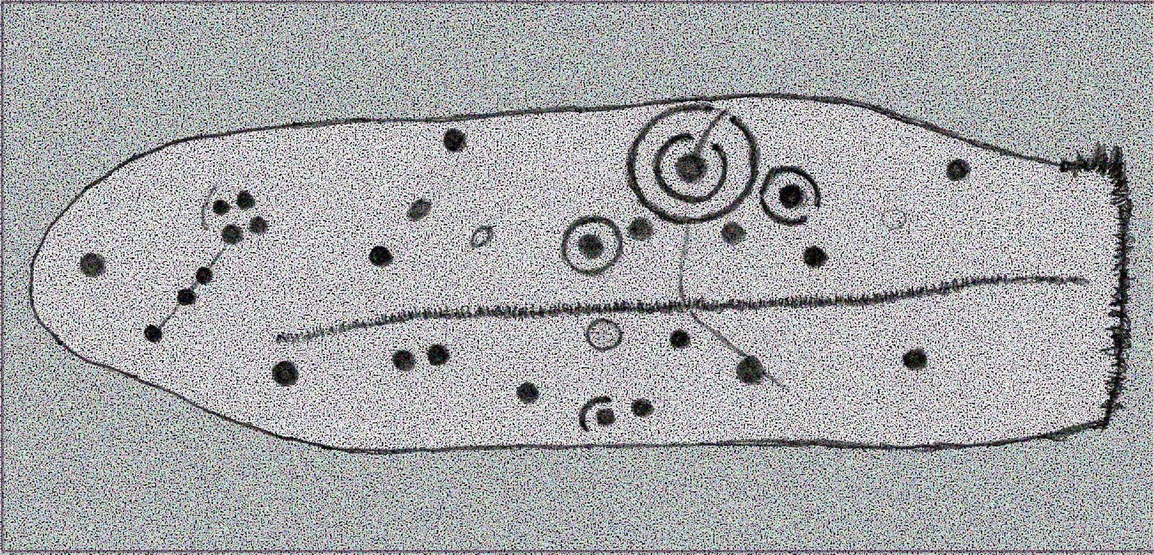
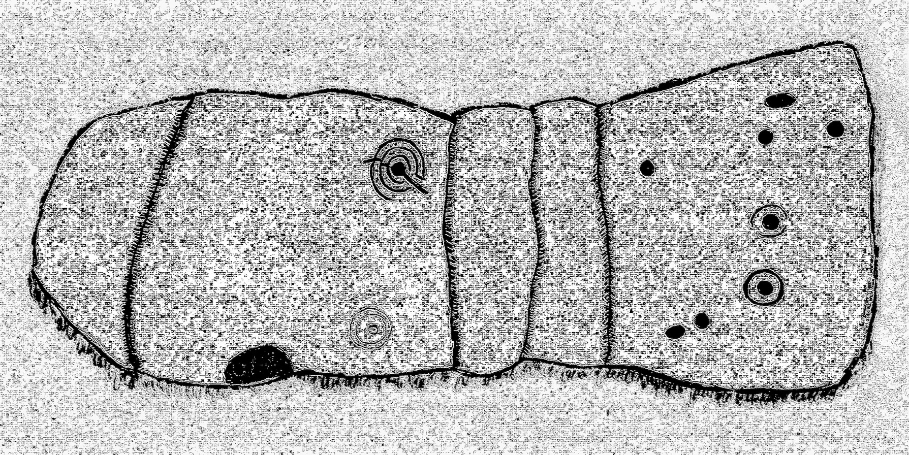
Rough sketch of design
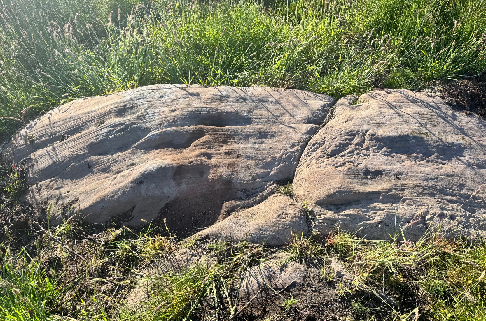
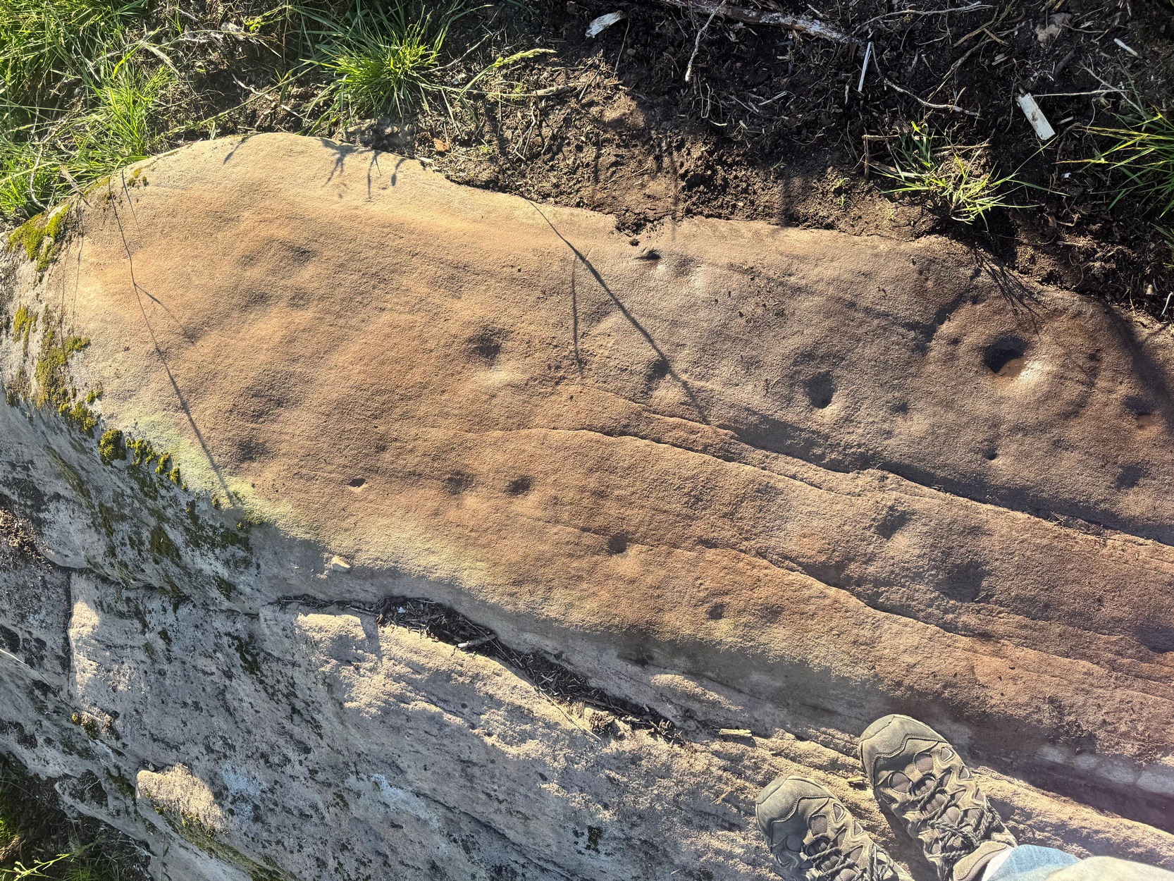
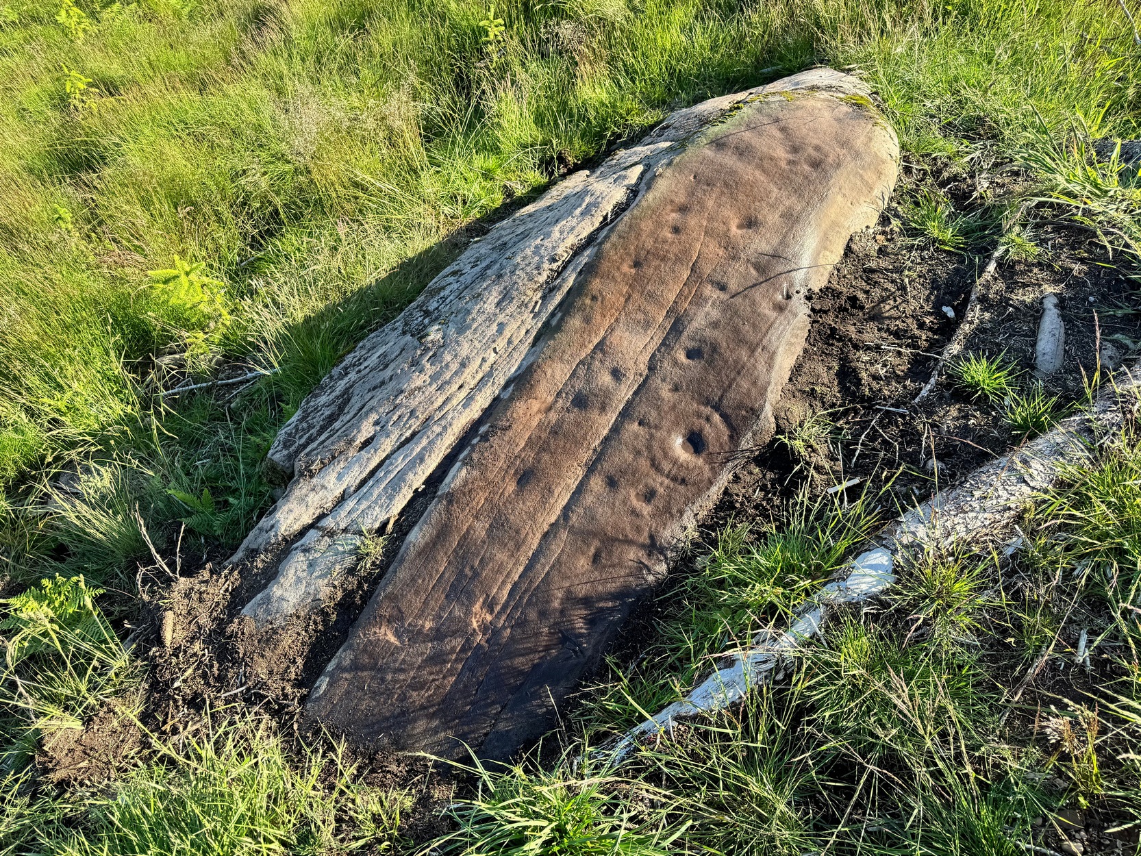
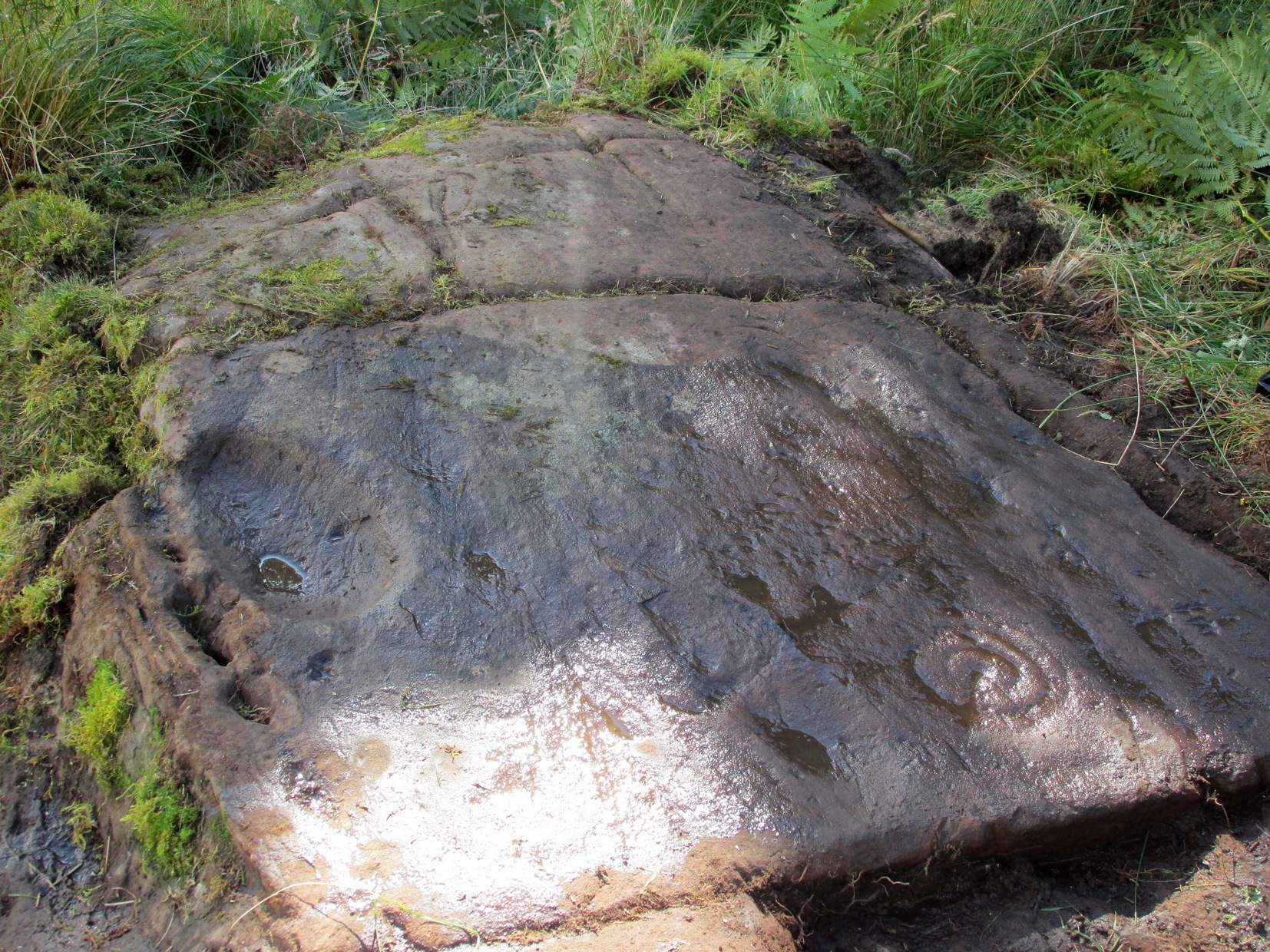
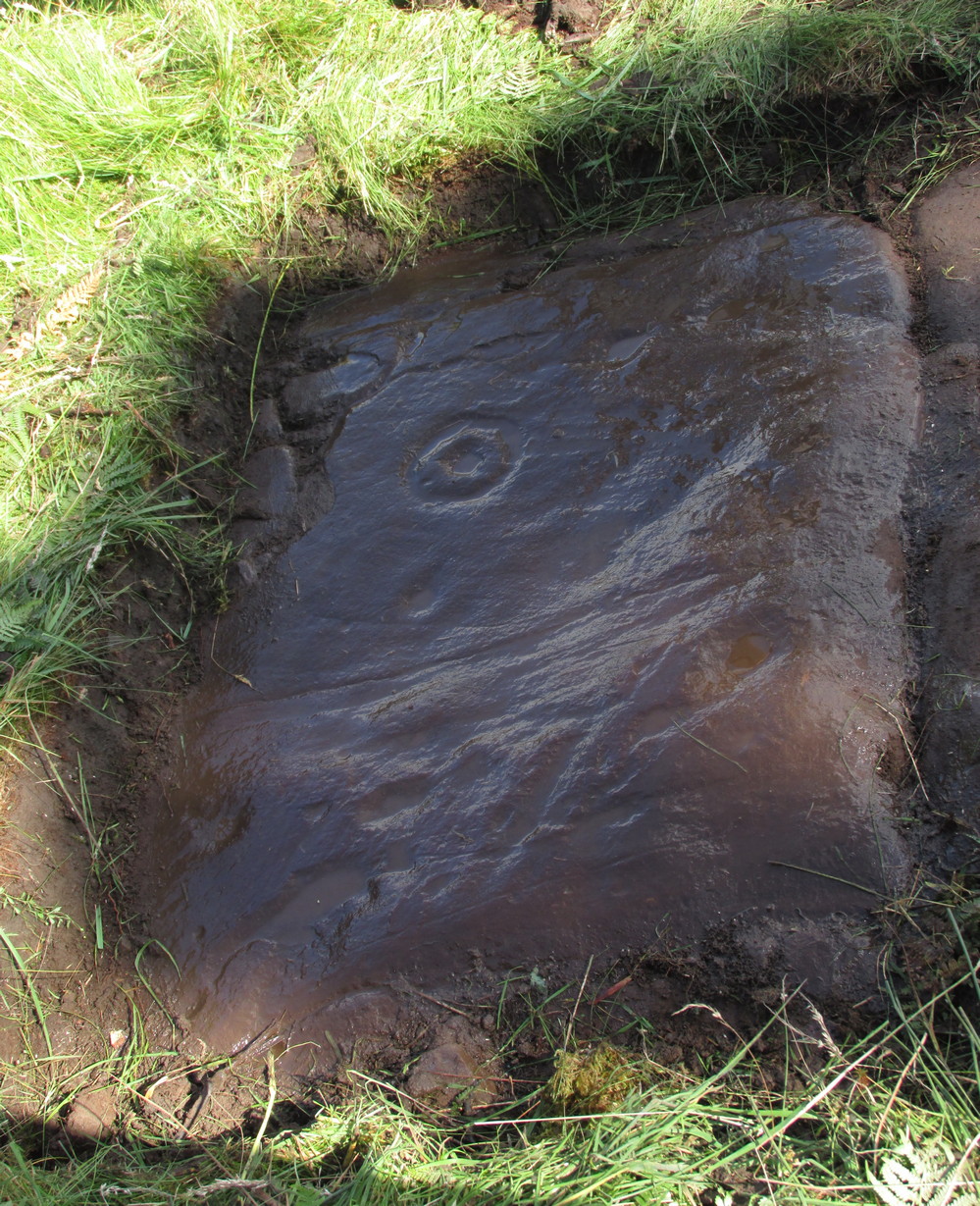
This is one of several previously unrecorded carvings I came across recently on the northwestern edge of the massive Ballochraggan rock art complex, on the slopes above the Lake of Menteith. I found it during one of the red-hot days we’ve just had —and, sadly, it had me running for home much quicker than usual! The heat beat me on this day (I’ve never been a lover of the sun), so hopefully you’ll forgive me if I missed a bit! 🙂 I was heading for the nearby Solar Stone carving near the bottom of the slope, when this partially-covered rock caught my eye—and I’m glad it did! For scattered along its long slender topmost surface, a number of the usual curious prehistoric symbols had been etched…
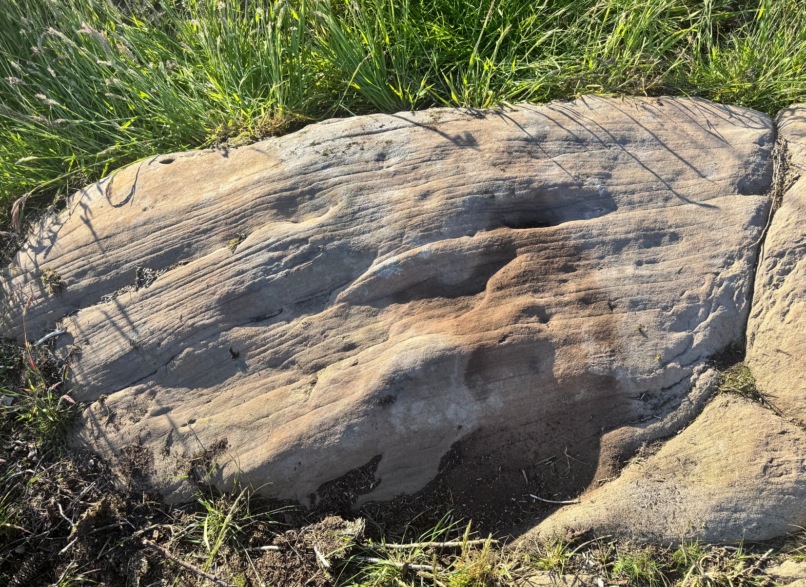
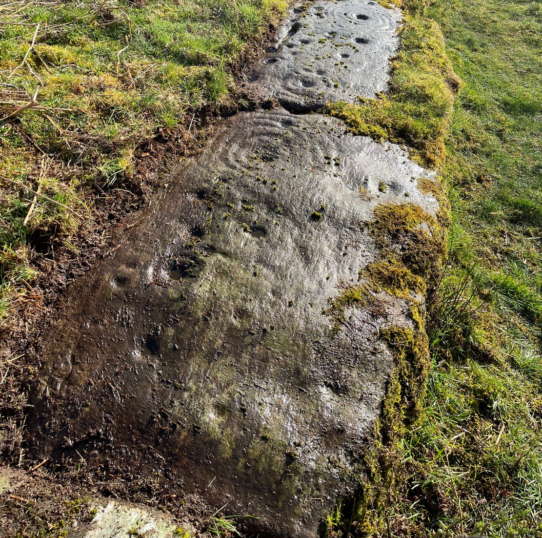
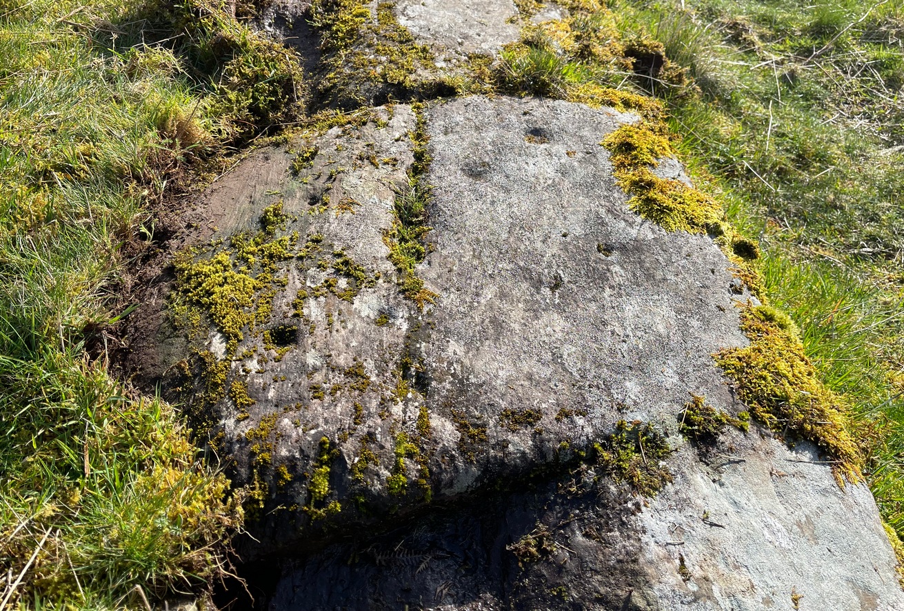
Western end of stonePetroglyph when wet!
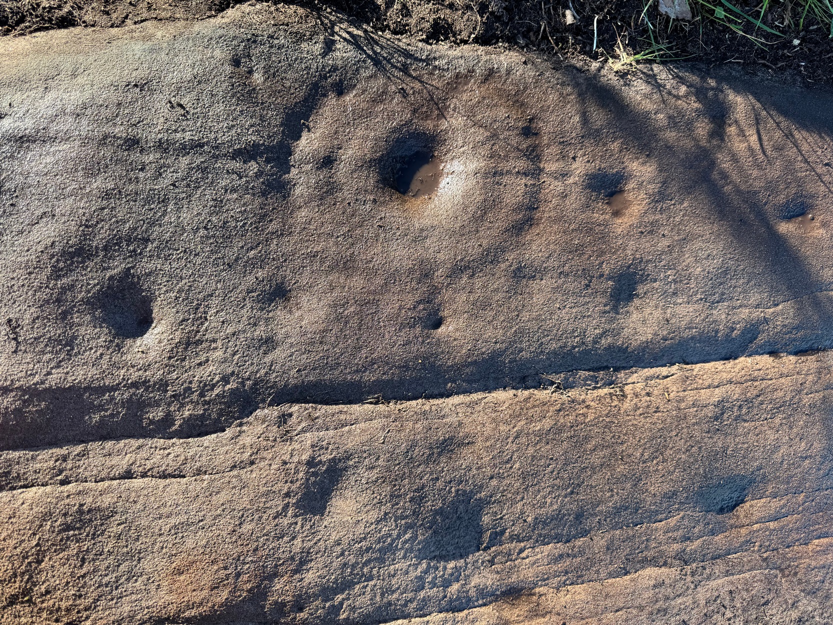
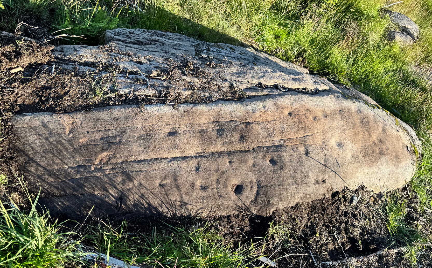
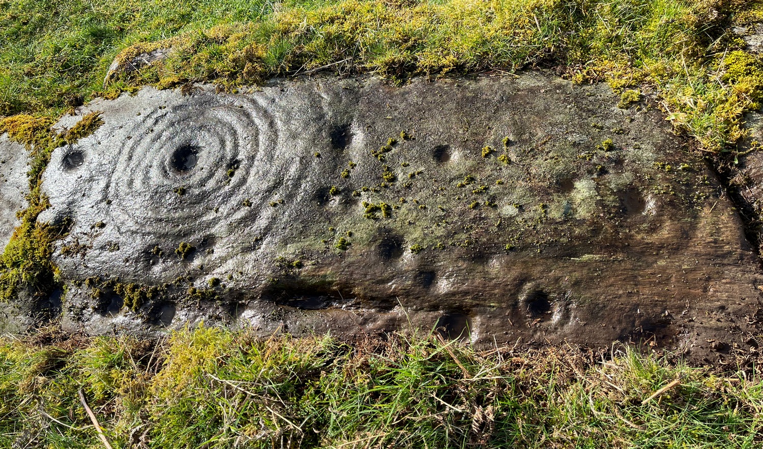
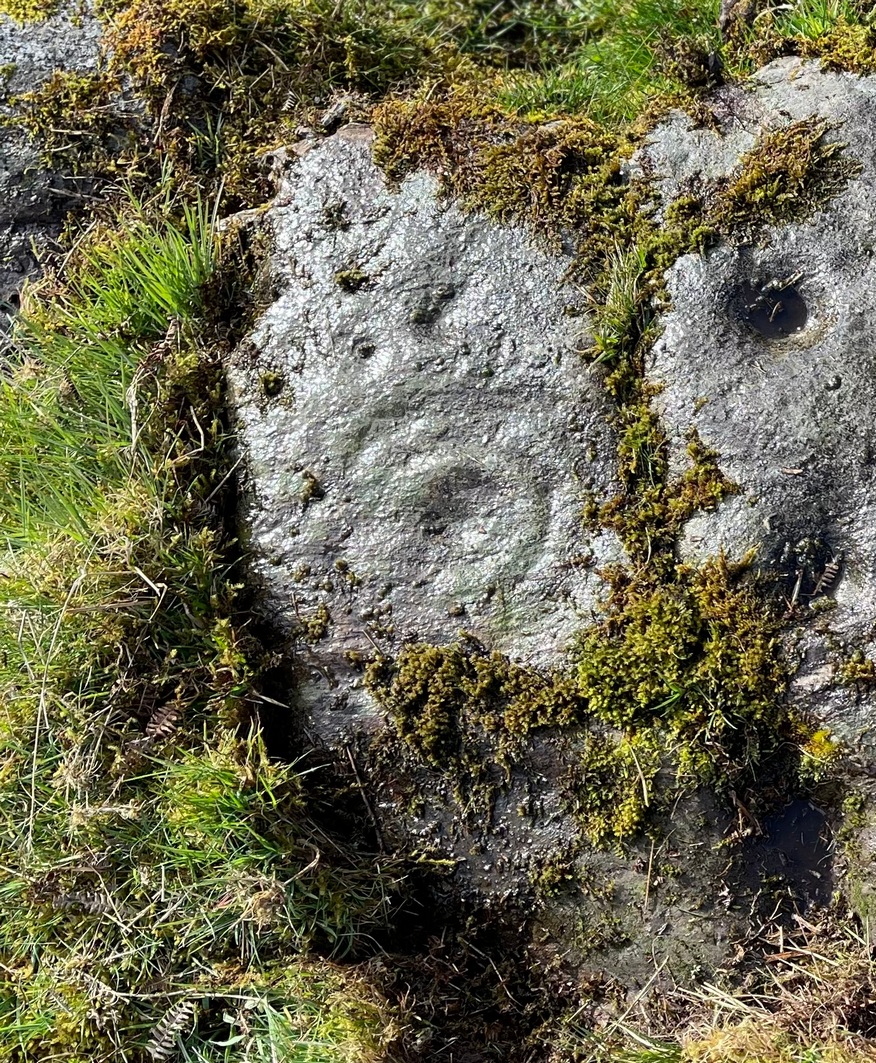
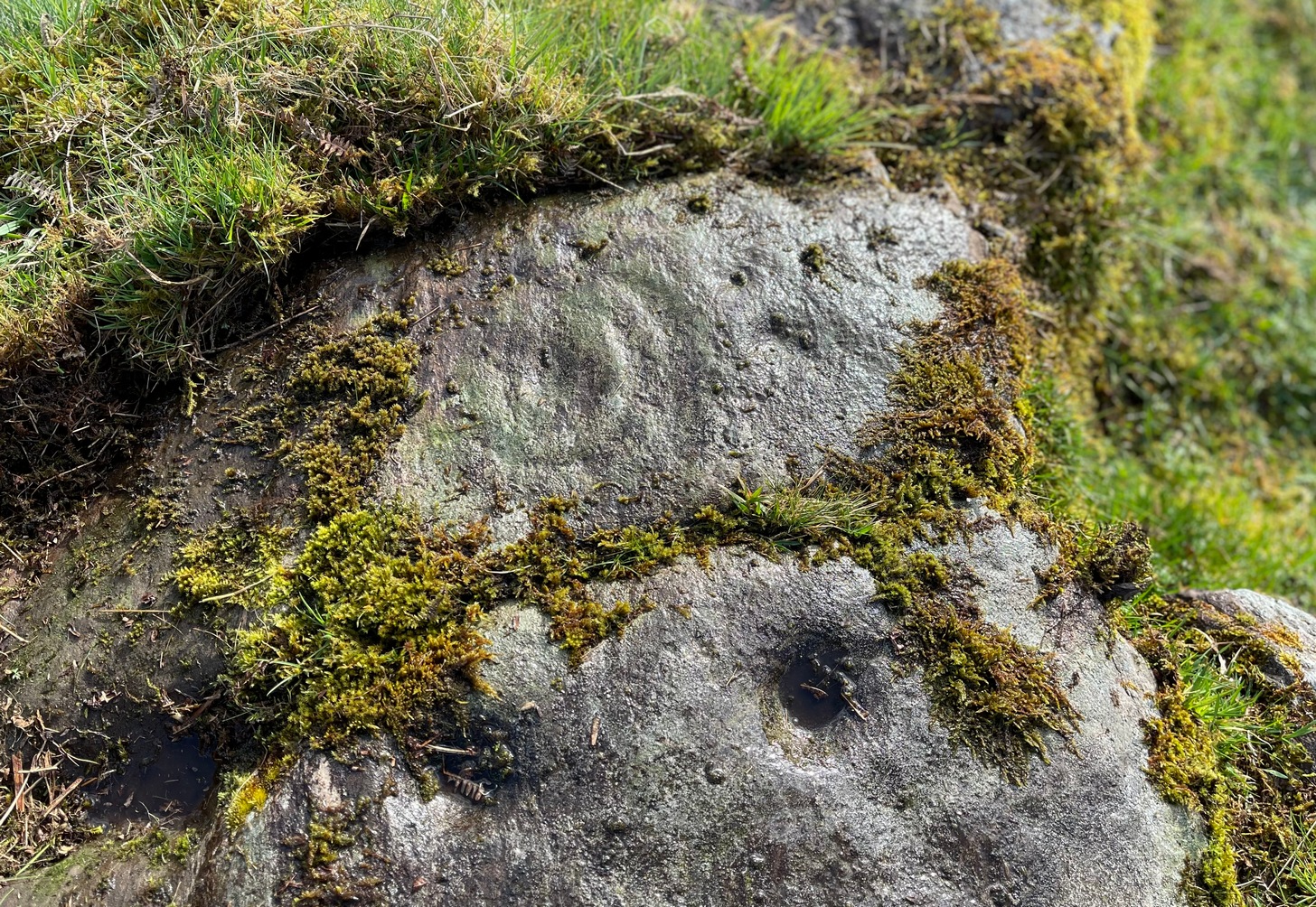
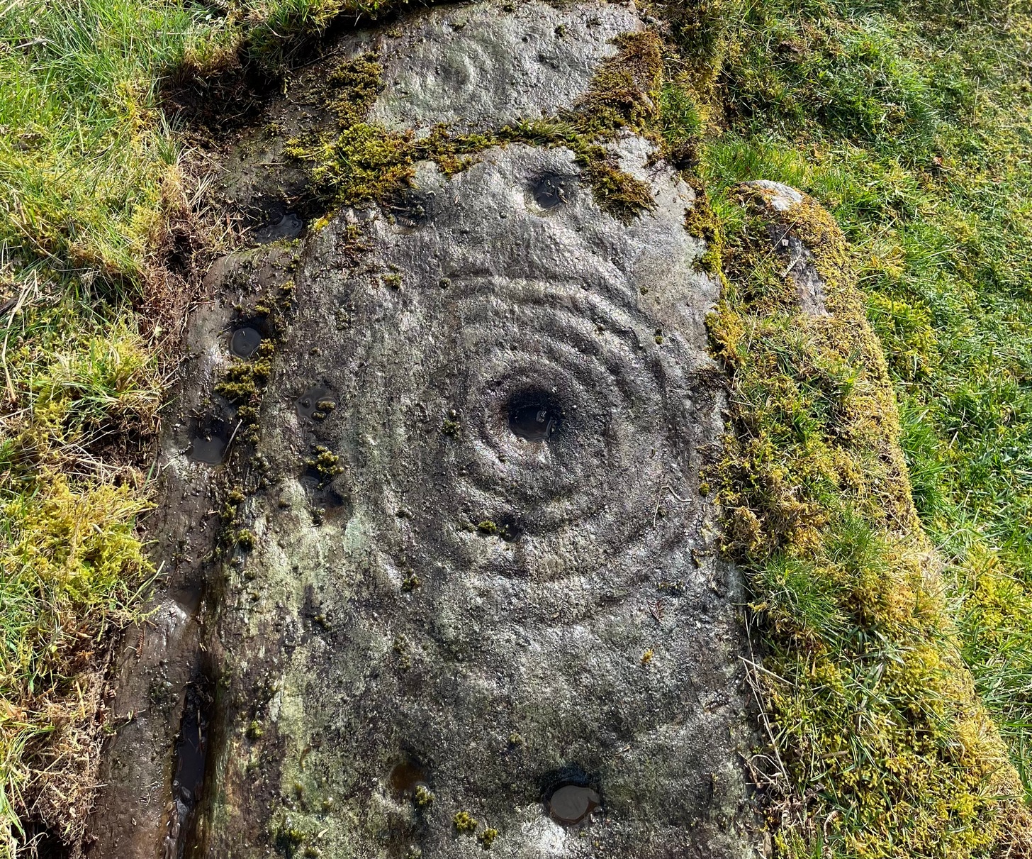
The first thing I noticed were a scatter of cup-marks at the western end of the stone: four of them in a close-knit cluster (this section reminded me of an old favourite on Shipley Glen), with several others seemingly running in a curved line down the slightly sloping stone with, possibly, one or two others also streaming away below this same cluster. But the main feature, as the photos and sketches illustrate, is the cup with a large double-ring near the middle of the stone, above a long natural crack that almost cuts the stone in half.
On either side of the double-ring are quite separate single cup-and-rings with (roughly) equal layers of erosion—although the central cups were probably re-carved, so to speak, many times over the centuries, as their erosion level is considerably less than that of the rings. This is a feature found at countless carvings across Britain and suggests regular “re-use” or rather re-animating the design on a regular basis. A faint half-ring can be seen round one of the smaller cups near the bottom of the carving. And a peculiar feature near the middle of the design is a simple ‘ring’ that was started but never finished (perhaps?), with no cup-mark in the centre. This is a feature found on quite a few Perthshire carvings, with some of the shallow ‘rings’ being nearly 12-inches across in some instances. Most odd!
Main double cup&ringLooking down at the design
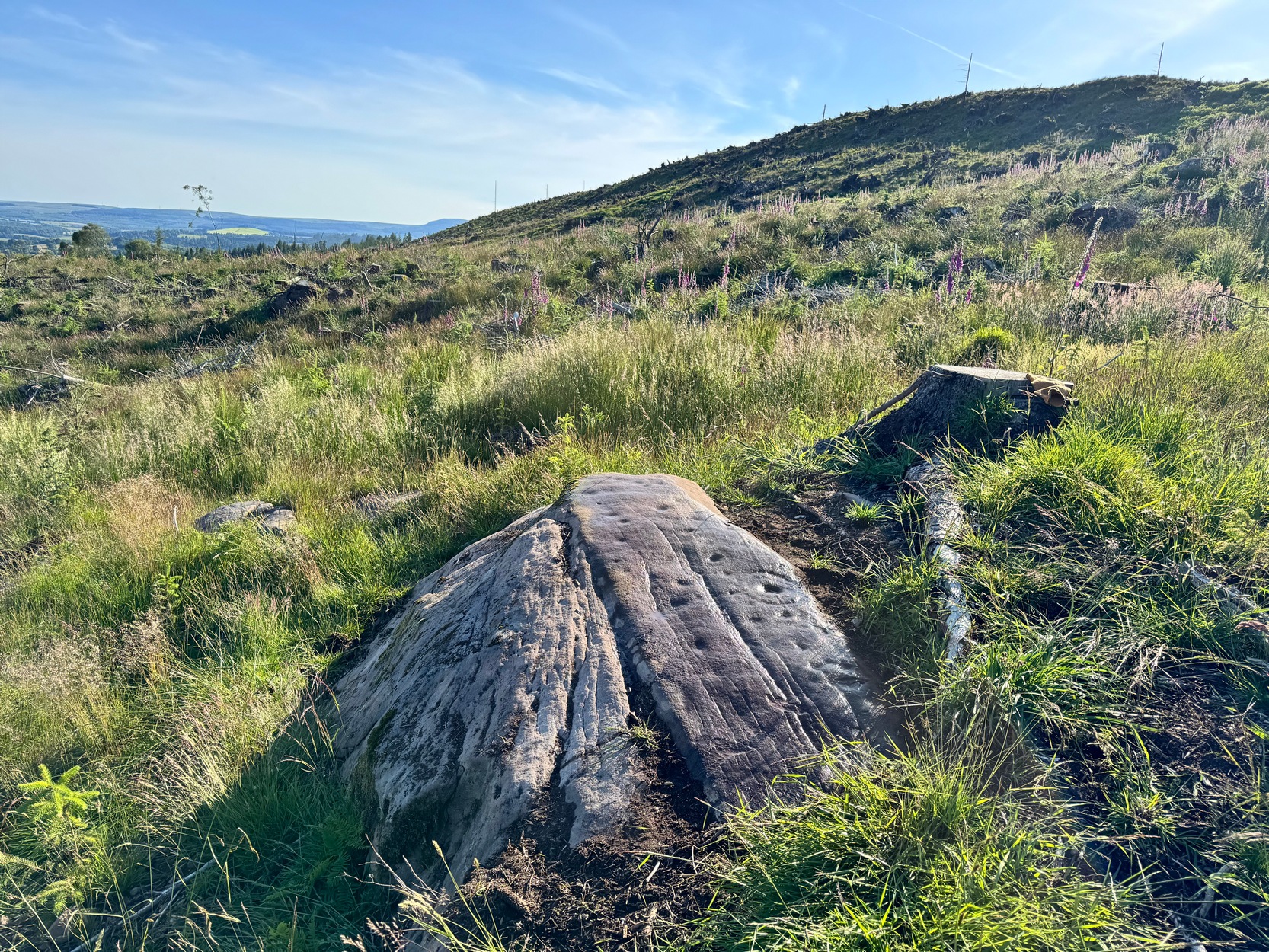
Several of the single cup-marks on here appear to have started life as natural pock-marks in the stone, which would have made carving the design a little easier than just starting from scratch! And, about 10 yards below this carving, a small sloping rock has a distinct eroded ‘bowl’ on it, about six inches across and several inches deep and is perhaps relevant to this carving in a pragmatic sense (mulching colours, herbs, etc). These ‘bowls’—be they natural or enhanced—are much-overlooked features and their existence needs to be taken into consideration when they’re found within a mass of cup-and-ring stones, such as found here, on the outskirts of olde Aberfoyle. Check it out when you’re next up here…. and the cup-marked stone 20 yards further up the slope too. And lots of others!
Acknowledgements: Big thanks to Prof Hornby for getting us up here on a scorching day!
In Miss Maitland’s (1935) article on the Ledard Stone carving, she also made a brief mention of “another cup-marked stone (that) lies on the edge of the burn, beyond the one described, above Loch Ard.” She gave no further information about this second stone. It remains lost and sounds to be only a short distance further uphill and on the west-side of the burn. If any local explorers are able to find this carving please let us know and, if possible, add some info and photos of it on our Facebook page. (the grid-reference for this site profile is an approximation)
References:
Maitland, Mrs, “Cup Marked Stones”, in The Scottish Country Woman, 1935.
This carving hasn’t seen the light of day, seemingly, since it was first reported by a local lady, a Miss Maitland in the 1930s—and who, it transpires, uncovered a number of petroglyphs in this neck of the woods. She found it on one of her many forays in the mountains hereby and took some old photos of it—although they’ve not reproduced too well for the sake of the site profile. (apologies)
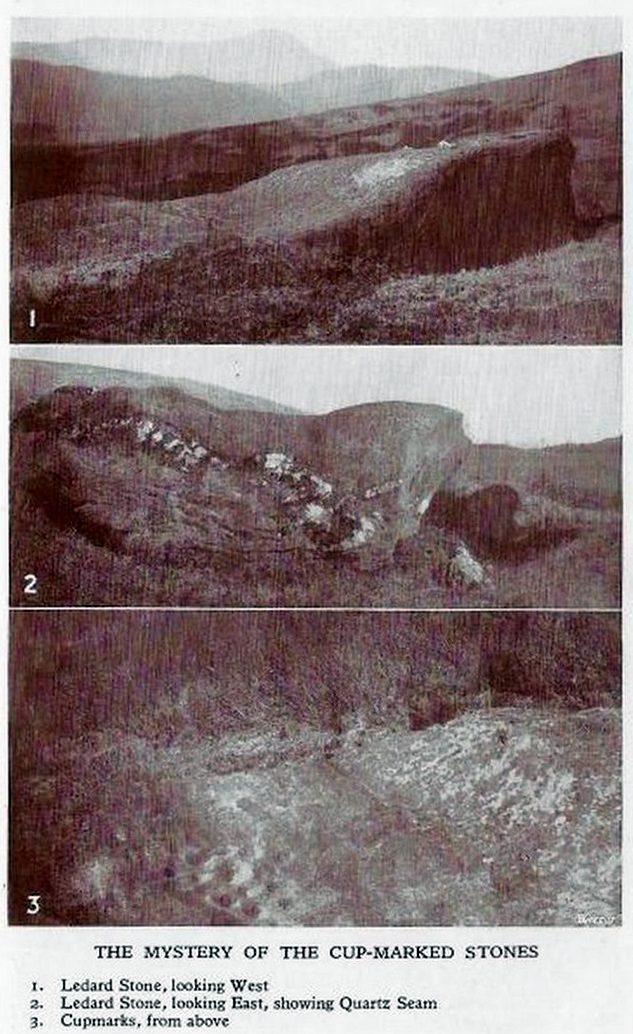
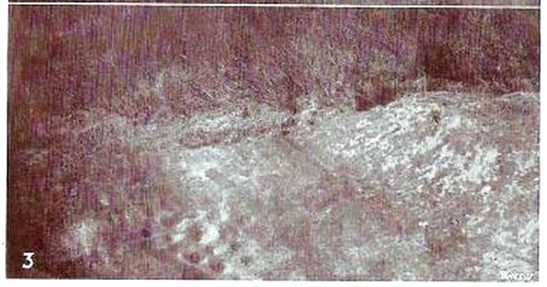
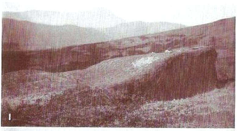
Since Miss Maitland’s days, the hillside has been covered in forestry plantation, making it extremely difficult to locate the carving. However, due to the reasonably large size of the stone, it should still be there (smaller cup-and-ring stones have been damaged and destroyed by forestry over the years); and as we can see in the middle photo, a long thick vein of quartz runs roughly along the middle of the stone—an ingredient which may have been significant for the people who carved the stone. In her article in the Scottish Country Woman magazine, Miss Maitland told:
cup-marks, bottom leftLedard Stone
“On the hill directly behind Ledard, on the north side of Loch Ard, a little to the west of the burn and a little to the east of the first grouse-butt, exactly 700 feet above sea level, lies a large boulder. Ice has smoothed and fashioned it and on the worn surface may be seen twenty-one, or so, small round hollows, varying in size and depth. The pattern made is roughly diamond-shaped, pointing directly east and west. I saw them for the first time as the sun was setting on New Year’s Eve, 1932. It was a solemn moment, for as far as I know no one else had looked upon them with such joy, and even awe, for perhaps a thousand years!”
She may have been right. And by the sound of her words, she’d certainly caught the petroglyph bug!
Anyhow, the carving doesn’t appear to have been seen since then. A “cup-marked boulder” was noted in the Royal Commission’s (1979) listings, but with no further details. We assume it must be the same carving, although they never visited it. It’s also possible that they were referring to another lost cup-marked stone a short distance further up the hill from here. If any local explorers are able to re-locate the carving, please let us know, and maybe add some info and photos of it on our Facebook page.
References:
Maitland, Mrs, “Cup Marked Stones”, in The Scottish Country Woman, 1935.
Royal Commission Ancient & Historical Monuments of Scotland, Archaeological Sites and Monuments of Stirling District, Central Region, Society of Antiquaries of Scotland 1979.
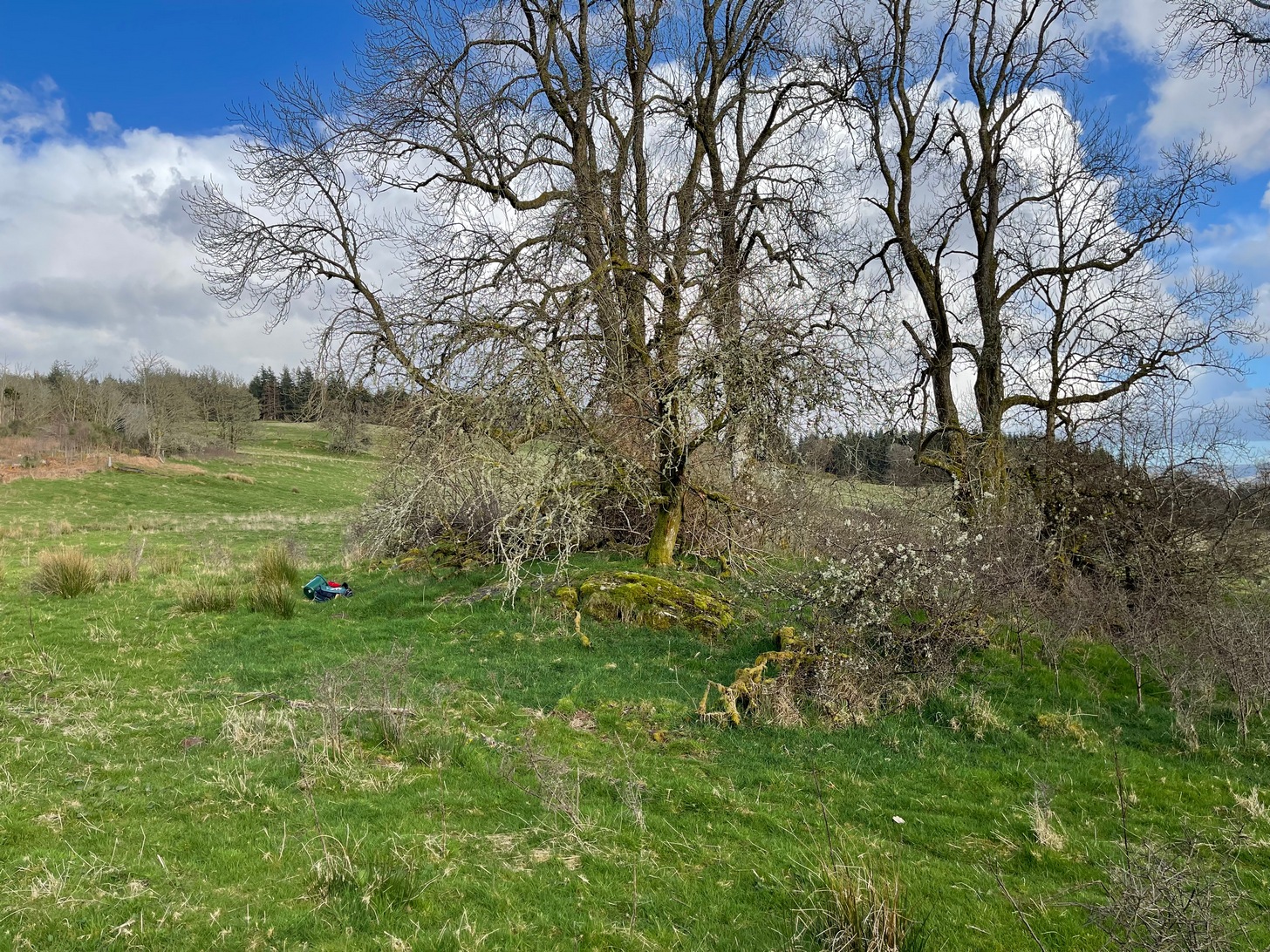
Along the A81 road from Port of Menteith to Aberfoyle, watch out for the small road in the trees running at an angle sharply uphill, nearly opposite Portend, up to Coldon and higher. Keep going, bearing right past Mondowie and stopping at the dirt-track 100 yards or so further up on the left (ignore the english fuckers up here who tell you it’s a pwivate road and they don’t want you parking there—unless you’re blocking the road obviously!). Walk up up here for ⅔-mile, as if you’re visiting the Over Glenny (5) carving, but as you get close to the defining sycamore tree, walk past it for about 60 yards towards the ruinous buildings. You’re looking for a reasonably large earthfast rock with a notable bowl about 12-inch across at the edge of the stone. That’s your defining feature.
Archaeology & History
Arty sketch of the design
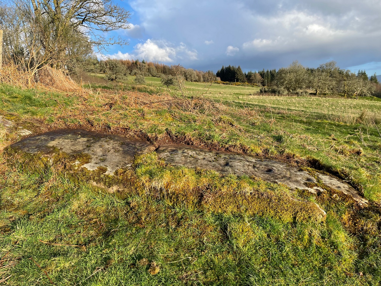
This is another decent design in the mass of petroglyphs on this plain overlooking the Lake of Menteith. On our first visit here ten yeas ago, only one half of the rock was visible—and half of that was covered with grasses! But with patience, we slowly rolled back the turf and slowly uncovered more and more, eventually seeing the main elements you can see in these photos and the arty sketch I’ve made here. (the Over Glenny [14] carving a few yards further east may be just be a continuation of this design)
Full length of the stoneThe triple cup-and-ring
When the carving was first noticed by George Currie (2010), he only noticed “a cup mark surrounded by two penannulars, an arc and a single radial”—ostensibly meaning, a cup-and-triple ring, with the outer ring incomplete, and a line running out from the central cup. But there’s more, obviously. On our second visit, a very faint but distinct cup-and-double-ring was noticed in low light on the same section of the rock where the triple-ringed element is carved. We weren’t able to get a photo that showed it, as the light wasn’t doing as we needed, but I’ve highlighted it on the sketch, where it’s to the right of the large ‘bowl’ at the very edge of the rock. This ‘bowl’ probably had utilitarian functions, whether it was for just crushing herbs or grains, or to make organic paints: and this function most likely had some relationship with the petroglyph—but we know not what! It’s possible that the people who lived in the adjacent ruin, several centuries ago, may also have made use of this.
East-end of the designEast-end angular pose
When we exposed the other half of the carving, a very well-cut and well-preserved cup-and-ring sat beside another much more eroded partner, which was almost impossible to see from some angles. You can just make it out in the photos here. You’ll also notice a scatter of several other cup-marks and elongated ‘cups’ on the same section of rock. It was difficult to work out whether some of these marks in the stone were Nature’s handiwork, or the result of human hands. Some were obviously man-made, but we need to look at it again when the daylight conditions are good, so that we can make a more accurate assessment.
Currie, George, “Port of Menteith: Upper Glenny (UG 1), Cup-and-Ring Marked Rocks”, in Discovery & Excavation, Scotland, New Series – volume 11, 2010.
Acknowledgements:Huge thanks to the crew: Paul Hornby, Lisa Samson & Fraser Harrick in making this carving come to life, and for use of a photo or two.
Cup-Marked Stone (lost): OS Grid Reference – NN 4808 0140
Archaeology & History
On the south-side of Loch Ard, just a few yards from the entrance to Rob Roy’s Cave (one of several), right by the water’s edge are the natural upstanding pillars known locally as Gog and Magog. In Peter Joynson’s (1996) work on Aberfoyle, this site is listed as one in a number of unrecorded cup-and-ring stones in the area. Discovered by a local lady—”the late Mrs Maitland”—here we have,
“two huge stones about 30ft high known as Gog and Magog situated at the mouth of Blan Ross Bay. They have numerous cup marks, but sadly have disappeared from view as they have been covered by forestry planting.”
This is an increasingly annoying problem that many rock art students are having to contend with! When we visited the site, the tops of these huge stones were, indeed, covered in depths of mosses and pine needles and the carving is hidden from sight. When the trees are felled, let’s hope someone can find it!
Folklore
These natural rocks were said to have been two giants that were turned to stone, the story of which seems to have been forgotten…
References:
Joynson, Peter, Local Past, privately printed: Aberfoyle 1996.
On the A81 road from Aberfoyle to Strathblane, about a mile south of Aberfoyle take the tiny right turn (keep your eyes peeled!) to Gartmore. Along the tiny curving road for exactly 1km (0.61 miles), where the road has straightened out there’s a small dirt-track with a parking spot along it. A few hundred yards along there’s a crossroads of dirt-tracks: walk to your left (SW) for nearly a mile (or exactly 1.5km) keeping your eyes peeled for a small distinct footpath leading down-slope on your left. Walk along this undulating path for just over 200 yards till you go through the gate, then walk immediately to your right down the side of the fence in the field for about 20 yards. Y’ can’t miss it!
Archaeology & History
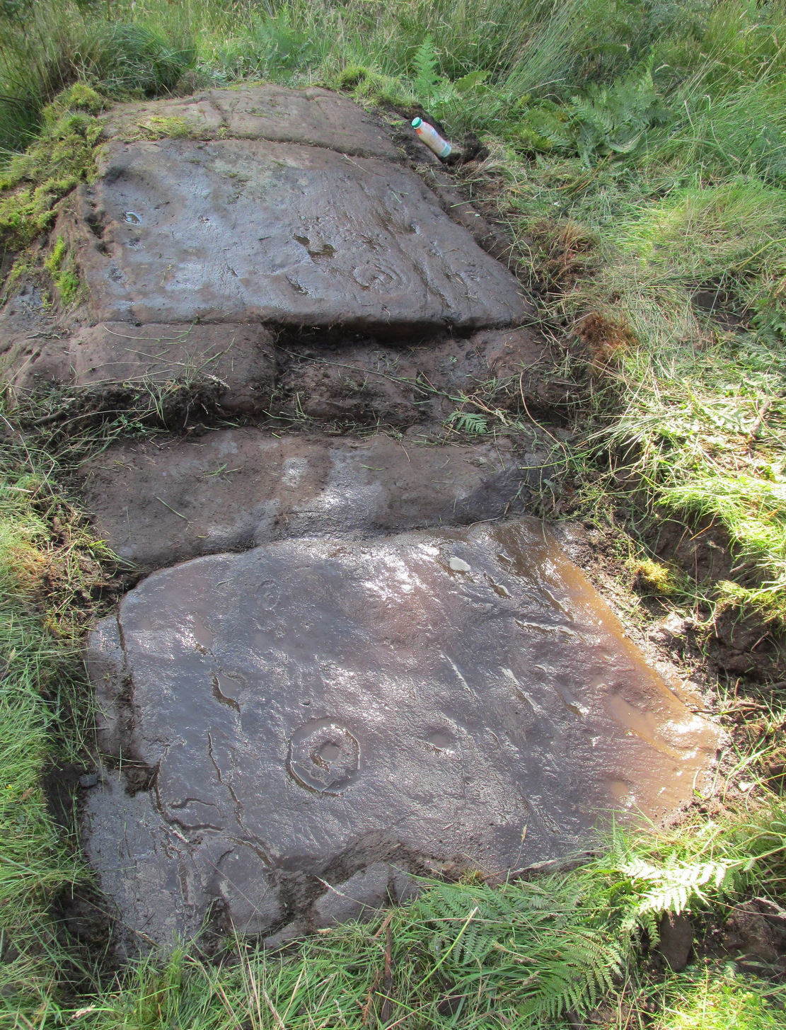
Blarnaboard (3), NE-SW
Located on the land of the early bards of Gartmore, we could speculate that those early orators told tales of, and from this old stone—but that’s all it would be: dreamy speculation. Instead, passing that aside, the petroglyph itself brings us a feast to drool over!
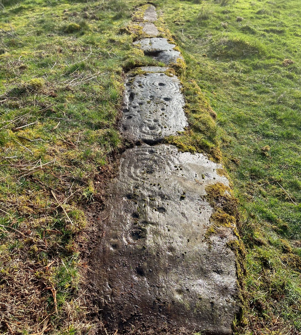
Made up of four distinct carved sections of almost interconnecting rock, this flat thin line of stone is covered with an impressive array of cups and multiple rings. Running downhill in a northeast to southwest line, it would appear to have been written about for the first time by Lorna Main (1988) who subsequently described it in the usual archaeological shorthand, simply telling that,
“There are at last 28 cups, 3 cup and one ring, 4 cup and two rings, 2 cup and three rings, 1 cup and five rings and 1 cup and seven rings.”
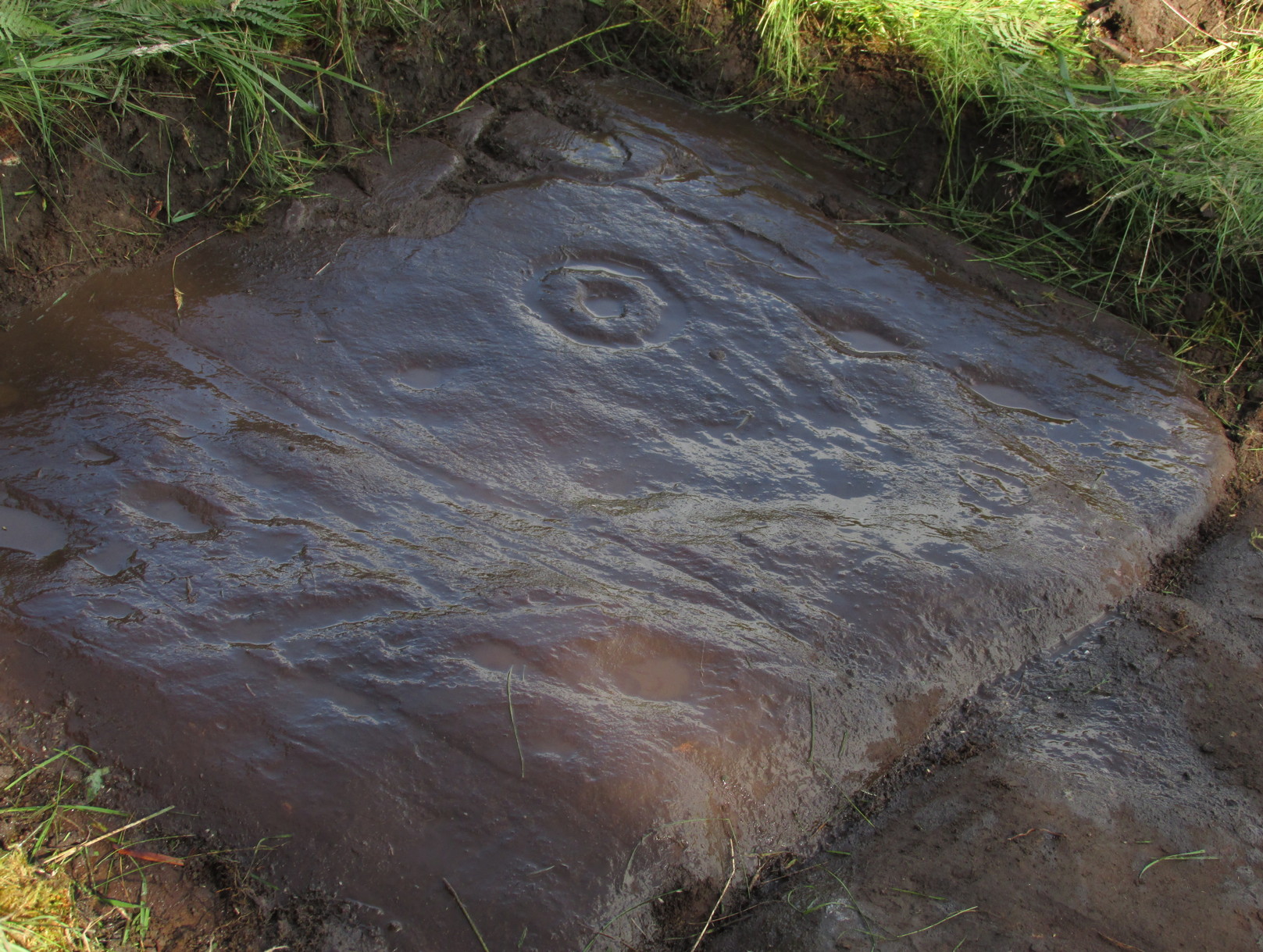
Multiple ringed elementSection 1 overview
…But, as usual, there’s much more to be said of it than that. Of the four sections, we’ll start at the uppermost northeastern section and work down the sloping ridge, looking at the respective symbols as we go. Section 1 has the largest surface area, but isn’t the most decorated of the bunch. Nonetheless, what we find here is impressive. About a dozen single cup-marks of various ages are scattered over the surface in what initially seems to be no recognizable order; these are accompanied by two single cup-and-rings: one of which could be said to be of standard size and form, whilst the other has a much larger and broken ring, near the middle of the rock, about 12 inches across. This larger ring has two or three of the cup-marks incorporated into its outer edges. The most impressive element of Section 1 is the large multiple-ringed design, five in all, radiating outwards or funneling inwards (depending on what was intended) around a central cup. The outer ring of this is incomplete.
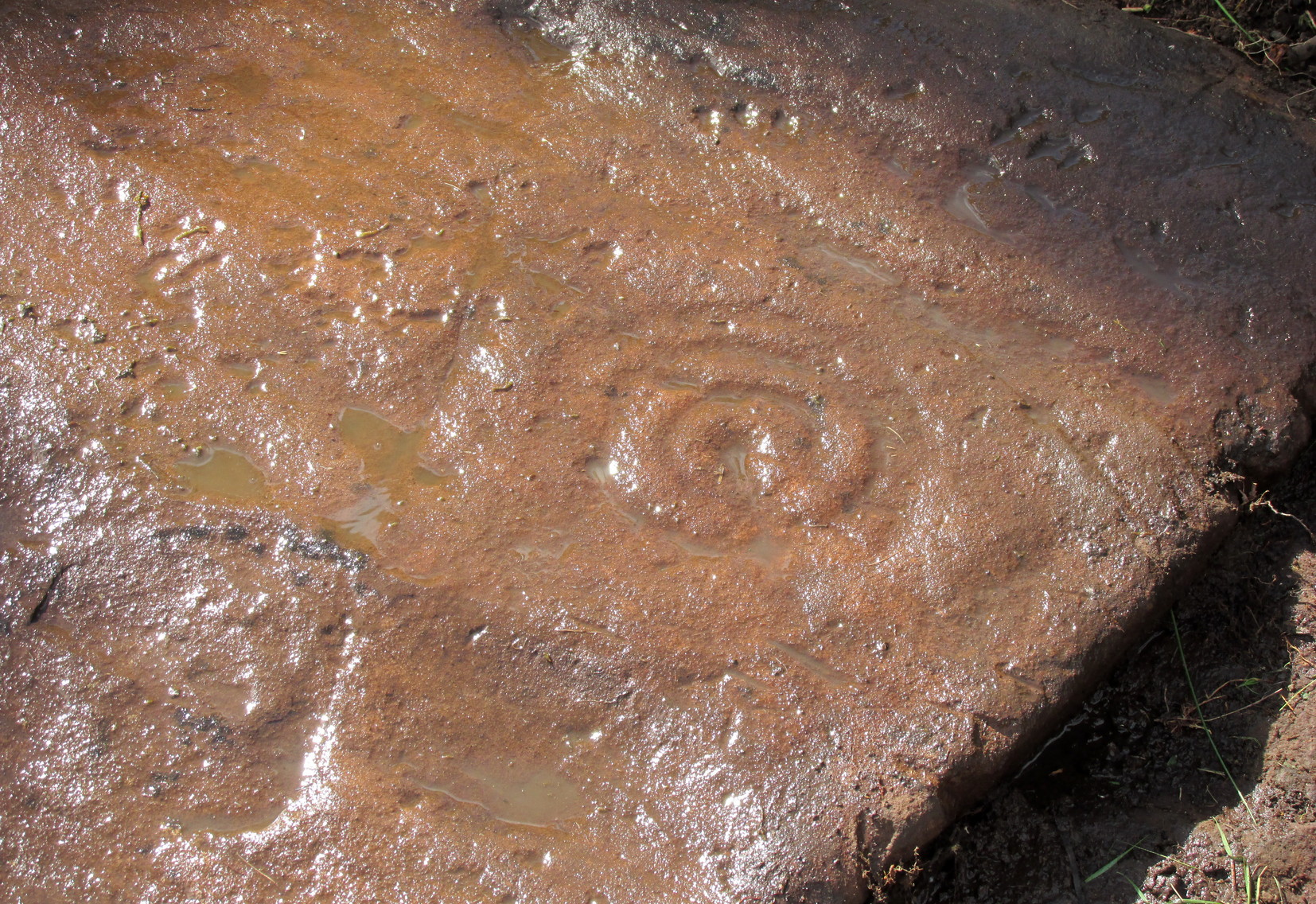
Impressive cup & 7 ringsScatter of cups & rings
Section 2 is the most visually impressive of all the Blarnaboard (3) carvings: almost an evolutionary development of what we see on the first part. A 2-dimensional panorama shows off a distinct cup-and-ring close to the edge of the soil, and there’s a somewhat wonky incomplete cup with double-ring below it. A very clear cup-mark to the right of this has another faint incomplete double-ring round it—but this is hard to see. The same cannot be said of the cup with seven concentric rings surrounding it! (the outer two of these are incomplete) As I walked round and round this section, drooling somewhat, it became obvious that a number of well-defined cup-marks had been carved around the outer edges of the rings, deliberately creating an eighth ring comprised purely of cup-marks. It gave me the impression of it representing heavenly bodies revolving around the central Pole Star; but also of it defining the movement of the Moon through the heavens during a calendar year. (the astronomy of my youth still comes through at times!)
Section 3 carvingFaint double cup-and-ring
By comparison, the third and smallest section of Blarnaboard (3) almost pales into insignificance, possessing a mere cup-and-double-ring—and a very faint one at that. From a certain angle it looked like it possessed a third ring, but this was probably more to do with me wanting to see more than there is! Just below this double-ring, a single cup has what might have once been another incomplete ring round it—but we’d need the computer graphic students among you to suss that bit out! You can’t make it out on the photos here, sadly…
Section 4 carvingFaint double-arc, lower cup
The fourth section is the most visually unimpressive of the entire cluster and was probably carved much later than the rest. The poor little fella has just five single cup-marks, with a sixth at the top-corner or northeastern part with what seems to be a small carved double-arc, or partial lozenge, that was started and never finished.
A couple of other exposed sections of stone running a few more yards further down the same line have no carvings on them—but there may well be more to this petroglyph hiding beneath the turf, which covers quite a large area. I have no doubt that other unrecorded carvings exist in close by, but due to excessive forestry plantations all around here, they’ll either be covered over or will have been destroyed. Don’t let this put you off looking for others though!
Cup-and-five-ringsCup-and-seven rings
An interesting feature of this long line of stone is its potential alignment. When we were photographing the site, a local man came over and got chatting with us. He knew of the carving and had been here many times and told us that his wife had looked at this one and found it aligned with another cup-and-ring on the south-side of Blarnaboard farm and another one (officially unrecorded) even further along. I checked this when I got home and found that this long line of petroglyphs did indeed line up with the Blarnaboard farm carving, perfectly. Whether this was intentional and/or possesses an astronomical function, we might never know. The third carving along the line has yet to be located. I must emphasize however, that the relationship between earthfast petroglyphs and alignments is very rare and, where found, is little more than fortuitous. But when we find cup-markings on alignments of standing stones and other prehistoric monuments, the relationship seems to be much more intentional and would have had a specific mythic function.
If y’ follow the fence-line from this carving down to the small burn, on the other side is the much less impressive Blarnaboard (2) cup-marked stone.
Folklore
Prior to Lorna Main’s (1988) short note on this petroglyph, local people had long known about the carving. As late as the 20th century, people with fevers were brought to this stone in the early morning to be cured of the illness. The idea was that medicinal herbs were collected and placed in some of the cup-marks, which were used like a mortar and pestle to prepare the plants. This healing magick, spoken of by some of the old folk in Aberfoyle, was known to them as children, who’d been told of this by their elders and, of course, by the elders before them.
There is also a tradition that some of the stone that makes up the curious moondial (not sundial) that can be seen at the back of the church in Gartmore village nearly a mile to the southeast, originally came from here.
References:
Main, L., “Blarnaboard (Aberfoyle parish), Cup and Ring Marked Outcrop,” in Discovery & Excavation Scotland, 1988.
Acknowledgements:Huge thanks for use of the Ordnance Survey map in this site profile, reproduced with the kind permission of the National Library of Scotland.
Anyone who’s going to visit this carving will be doing so as a result of visiting the impressive Blarnaboard (3) cup-and-ring stone, 115 yards (105m) away. From Blarnaboard (3), walk down the slope on your right (west), cross the tiny burn and go round to the other side of the small rocky hawthorn-topped hillock just a few yards in front of you. Fumble about and you’ll find what you’re looking for!
Archaeology & History
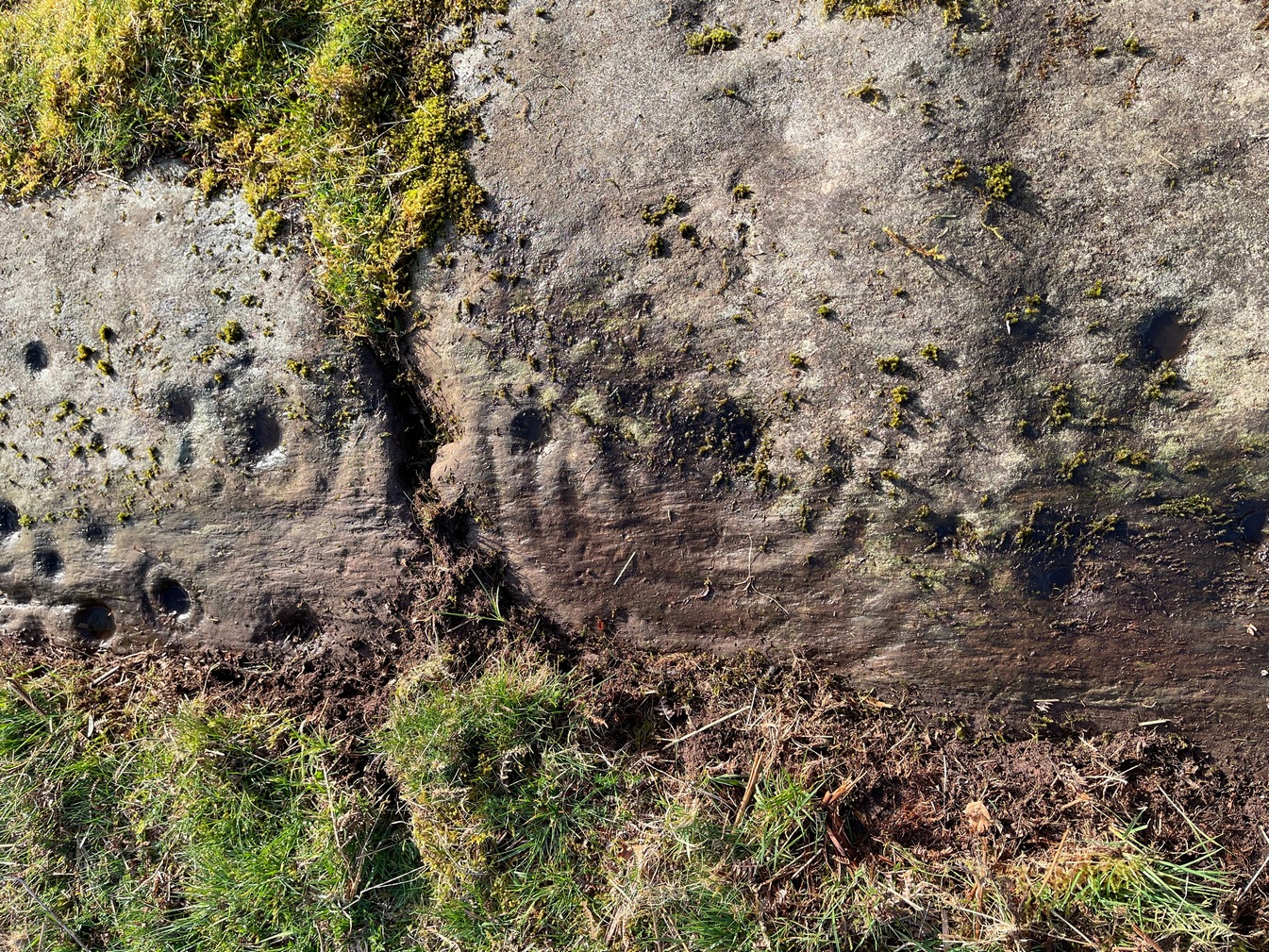
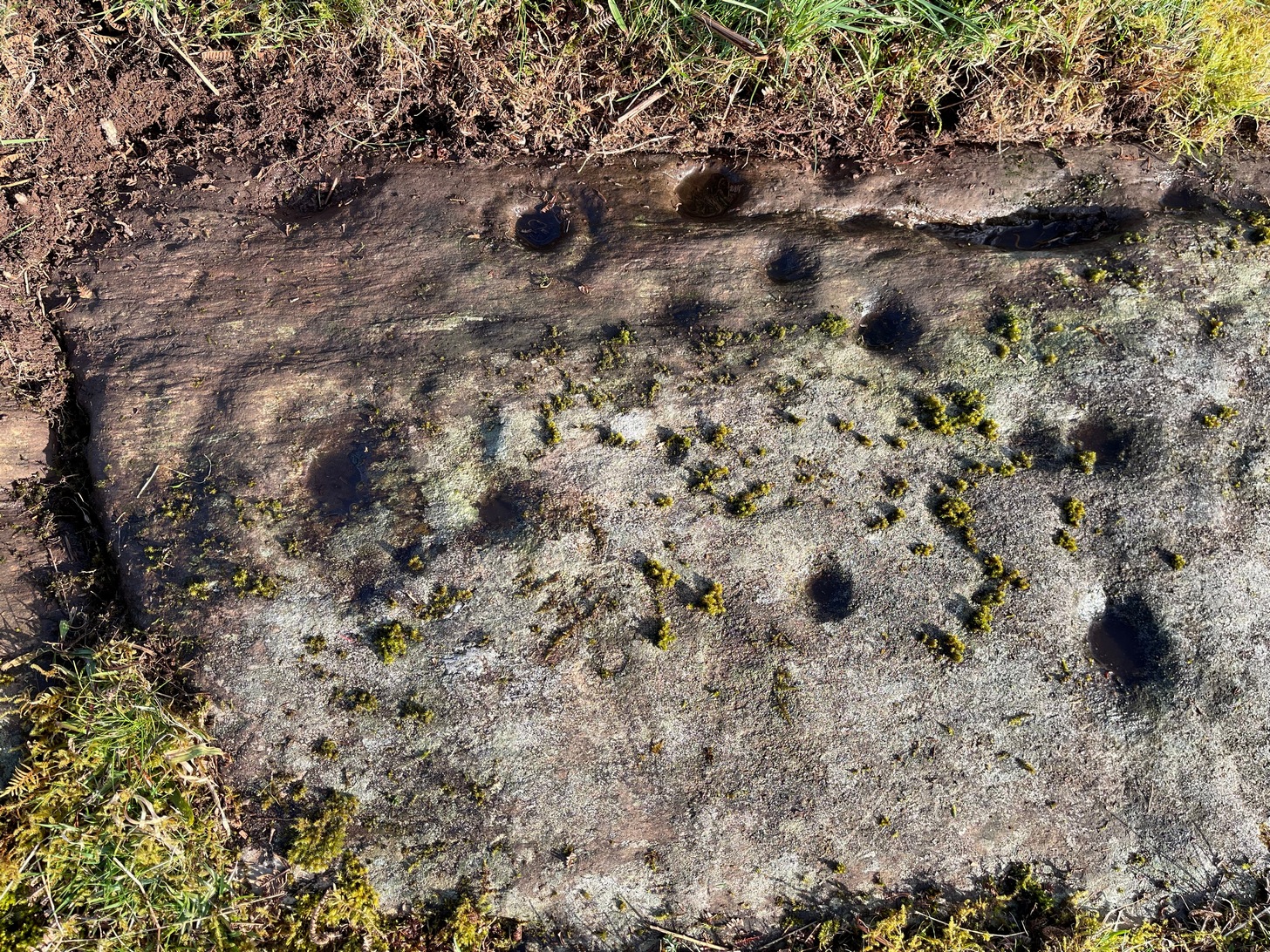
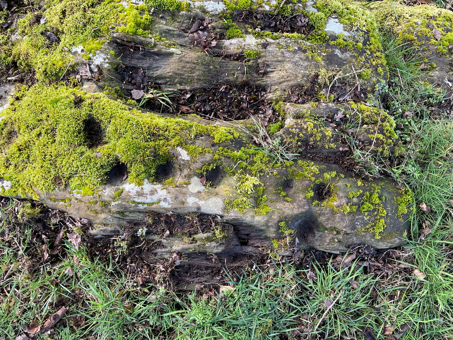
It’s possible that there’s more to this carving than meets the eye. On the west-side of this small rocky rise, along a thin elongated raised section in the stone, a gently meandering line of nine deep cups runs roughly northeast to southwest. You can’t really miss them as they average some 2 inches across and 1 inch deep, strongly suggesting that they were cut and reworked over and over for a long period of time.
Line of cups, from aboveRough NE-SW alignment
It was first described in distinct brevity by Lorna Main (1988) who told that, “over a length of 60cm on a north-east facing outcrop are 9 cup marks.” And, whilst all of the cups are clearly visible, one of them at the edge of the stone has been cut or worked into a natural curved hollow. You’ll see what I mean when you visit the site (it’s pretty clear in the photos).
Beneath the roots and soil there may well be other cup-markings that are still hiding away on this rocky dome. I have no doubt that other unrecorded carvings exist in this area, but due to the excessive forestry plantations all around here, they will be covered over or have been destroyed.
References:
Main, L., “Blarnaboard (Drymen parish), Cup Marked Rock,” in Discovery & Excavation Scotland, 1988.
Cross / Sacred Tree: OS Grid Reference – NN 581 012
Also Known as:
Law Tree
Archaeology & History
As a folklorist and antiquarian, I find this long lost site more than intriguing. Most ancient crosses are stone; but in early centuries many were made from wood which, obviously, have decayed down the years. But this cross, located on the northeast edge of the Lake of Menteith, was actually a tree: a hawthorn no less. This choice would have been made based on it being one of the few trees that are deemed sacred in both christian and indigenous lore. It was described—albeit briefly—in A.F. Hutchison’s (1899) excellent history book of the area:
“The cross of the burgh is said to have been the trunk of an old hawthorn tree, which stood by the lake side, opposite the manse of Port, and was known as ” the law tree.” Around this tree an annual fair was held in the month of September, and called after St. Michael.”
We’re obviously seeing here the traditional animistic veneration of trees by local people, with the incoming christian symbol being grafted onto it. Hawthorns were one of the potent protections against witchcraft and so the handshake between christian and pre-christian systems obviously worked here. Faerie-lore was also rampant at many places for many miles around this site.
References:
Hutchison, Andrew F., The Lake of Menteith – Its Islands and Vicinity, Eneas Mackay: Stirling 1899.
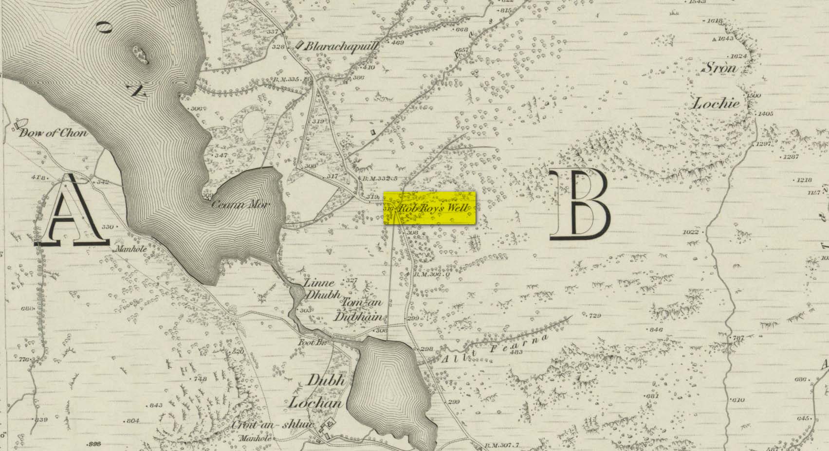
This long-forgotten site was found just by the old roadside several miles northwest of Aberfoyle, up the B829 Loch Chon road. Shown on the first Ordnance Survey map of the area in 1866, subsequent visits showed no remains of it and we must assume it had fallen back to Earth. When we visited the place recently, although there were no remains of any water trough, the spot where the well was shown on the map was very boggy with a small trickle of water running out of the slope. There is the possibility that, if the soaked soil just above the trickling water was excavated a few feet into the ground, that the original spring might be retrievable.
Obviously, its name tells of the tradition that this was a place where Rob Roy was known to drink. A number of places in this area bear his name. Surely this is a site that is worthy of bringing back to life, so to speak, and place it on the Scottish heritage map, where it belongs?
Acknowledgements: Huge thanks for use of the 1st edition OS-map in this site profile, Reproduced with the kind permission of the National Library of Scotland.