Take the same directions as if you’re going to the nearby Moirlanich 2 Carving (about 550 yards down Glen Lochay, on the north side of Killin). In the same field, about 150 yards northwest of Moirlanich 2, you’ll see another large rock close to the wall. That’s the spot!
Archaeology & History
Cup-marks highlighted
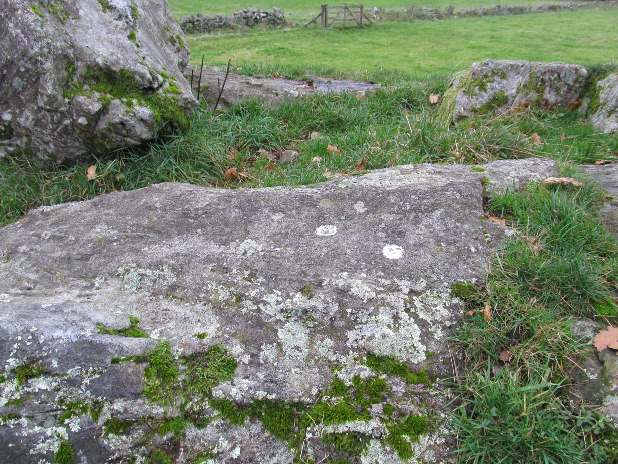
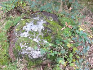
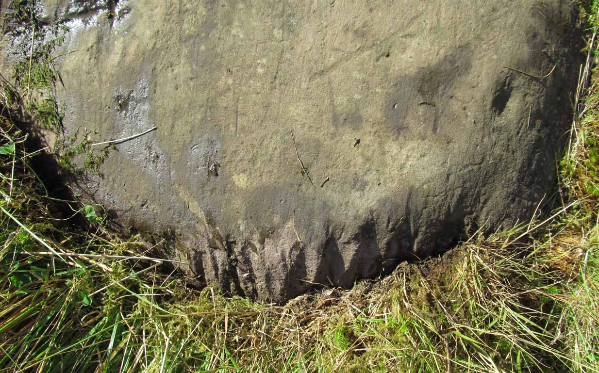
Looking down upon the River Lochay, with views east and west along the glen, here we find a carved rock that’s probably of interest only to the petroglyphic purists amongst you. Two simple cup-markings, about 5 inches apart, can be seen etched into the slightly sloping southern-face of this small rocky outcrop. The sacred mountain of the Creag na Cailleach rises to the immediate north.
From Killin, take the A827 road out of the north side of the village, turning left down Glen Lochay just before the Bridge of Lochay Hotel. 500 yards along the single-track road you’ll reach the electricity station. Just past this, in the field on your right, a large rock stands out just a few yards away. Go through the gate and walk to the spot!
Archaeology & History
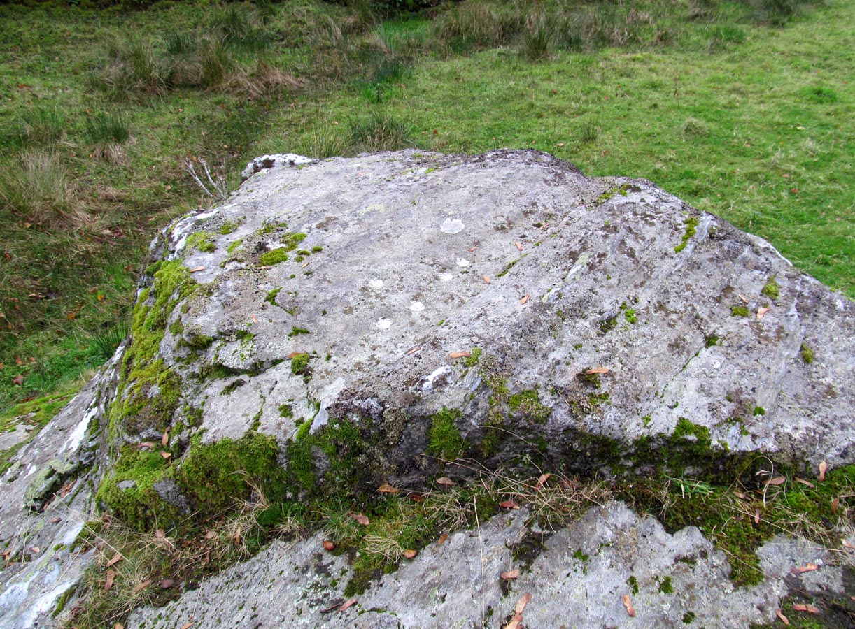
Highlighted cup-marks
This is a simple cup-marked stone, perhaps used in ages gone by as a look-out spot by villagers. Only for the petroglyphic purists amongst you, this carving consists of just five cup-marks on the topmost section of the flat stone, with four of them roughly in a line and a solo one (the most pronounced of the them all) a few inches south of the row. The cup-marked Moirlanich 1 stone can be seen in the same field, 150 yards (137m) to the northwest.
Cup-and-rings on gatepost (photo credit, Dave Whittaker)
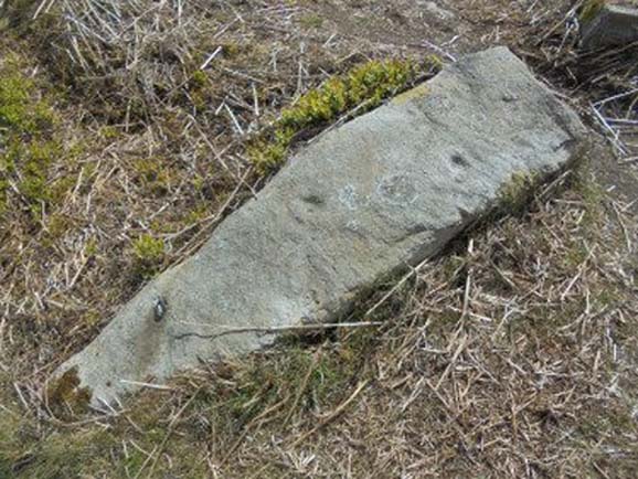
From Ilkley, follow the same directions as if you’re going up to the superb Swastika Stone. Keep walking on the footpath, west, for 65 yards (59m), then walk into the heather on your left. Barely 5 yards in, you’ll see this fallen standing stone or gatepost.
Archaeology & History
First described in one of Stuart Feather’s (1964) old rambles, I first saw this stone in my late-teens and was as puzzled by it then as I am today. Upon an obviously worked stone that may once have stood upright (or was intended to do), two faint and incomplete cup-and-rings were carved – but when exactly? If this stone was cut from a larger rock into its present shape, were the petroglyphs already on it, or were they done when the ‘gatepost’ was created?
It was first described in one of Stuart Feather’s (1964) rambles up here and later included in Hedges’ (1986) survey, where he told it to be a, “recumbent gatepost with one cup with almost complete ring and one cup with vestigial ring.” Boughey & Vickerman’s (2003) survey added little more. And when a group calling itself Carved Stones Investigation got itself about £250,000 to “investigate” the Ilkley petroglyphs, I was hoping that they could have at least turned this stone over to see if other carvings were on the stone – but they just revisited all those found by others, made a new list, and took the money to be honest (no website and no book – as they should’ve done). Thankfully, local folk are having a look at this and others and doing the work they should have. Check it out when you’re next up at the Swastika.
References:
Bennett, Paul, Megalithic Ramblings between Ilkley and Baildon, unpublished: Shipley 1982.
Boughey, Keith & Vickerman, E.A., Prehistoric Rock Art of the West Riding, WYAS: Wakefield 2003.
Feather, Stuart, “Mid-Wharfedale Cup-and-Ring Markings: no.26, 27, 28 – Black Pots, High Moor, Silsden, near Keighley,” in Cartwright Hall Archaeology Group Bulletin, 9:10, 1964.
Hedges, John, The Carved Rocks on Rombalds Moor, WYMCC: Wakefield 1986.
Acknowledgements: Huge thanks to Dave Whittaker for the photo. Good luck with the plans fellas.
Cup-Marked Stone (destroyed): OS Grid Reference – NX 0010 5411
Archaeology & History
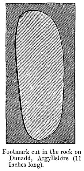
Very little is known about this long-lost carving, whose primary information comes from the folklore records. Apparently it was found on a rock a short distance south of the destroyed St. Patrick’s Well and the two sites seem to have had a traditional relationship with each other. The carving had a foot-shaped motif on the rock, and a number of other cup-markings; but I can find no account as to whether the ‘foot’ carving possessed ‘toes’, as seen on the impressive Cochno Stone, north of Glasgow. It may have been little more that the petroglyphic ‘feet’ seen on the recently discovered and aptly-named Footprint Stone, or those on the newly rediscovered Witches Stone; but we cannot discount it being larger, like the Footprint Stone of Dunadd. If we could locate an early sketch of the stone, all would be revealed! Sadly, as E.M.H. M’Kerlie (1916) told us,
“this rock was blasted at the time when the government essayed to make the harbour one of great importance”,
several years after the nearby holy well had been re-routed. Fucking idiots! Any further info on this site would be most welcome.
Folklore
The local story that was told about St. Patrick creating these carvings seems to have been described first of all by Andrew Agnew (1864), who wrote:
“Once, when about to revisit his native land, he crossed the Channel at a stride, leaving the mark of his foot distinctly impressed on one of the rocks of the harbour; unfortunately, in making a new jetty, this interesting memento was destroyed.”
(The mention of the jetty would seem to imply that the carving was closer to the sea than the grid-reference cited above.) In another tale, St. Patrick rested his hand onto the same rock and the marks of his hand and fingers were left there. This folklore motif is found across the world. It relates to cosmological creation myths of indigenous spirits and deities in the tribes and cultures who narrate it. In this instance, the myth of St Patrick replaced a much earlier mythic tale of another giant or deity, whose name we have lost. Unless, of course, such petroglyphs were still being carved in Galloway by local people in the 4th-5th centuries.
A further tale of St Patrick, at Portpatrick, replaced a quite obvious shamanistic tale. When he journeyed back from Ireland to Galloway, Agnew again told us:
“Having preached to an assembly on the borders of Ayrshire, the barbarous people seized him, and, amidst shouts of savage glee, struck his head from his body in Glenapp. The good man submitted meekly to the operation; but no sooner was it over than he picked up his own head, and, passing through the crowd, walked back to Portpatrick, but finding no boat ready to sail he boldly breasted the waves and swam across to the opposite shore, where he safely arrived (according to the unanimous testimony of Irishmen innumerable), holding his head between his teeth!”
Legends such this are found in shamanistic pantheons worldwide. Shamans primary renown is their ability to travel and recover from the Lands of the Dead, always journeying into impossible and inhospitable arenas, with tales of being dismembered, beheaded, dying, and returning to life to help the tribe with whatever it was that required such a task (usually a healing function). This story of St Patrick – and many other saints – are mere glosses onto the earlier animistic stories, then abridged as being better, more spiritually mature, more egocentric. But their roots are essentially animistic.
Royal Commission Ancient & Historical Monuments of Scotland,Inventory of Monuments and Constructions in Galloway – County of Wigtown, HMSO: Edinburgh 1912.
Walker, J. Russel, “‘Holy Wells’ in Scotland,” in Proceedings of the Society of Antiquaries of Scotland, vol.17 (New Series, volume 5), 1883.
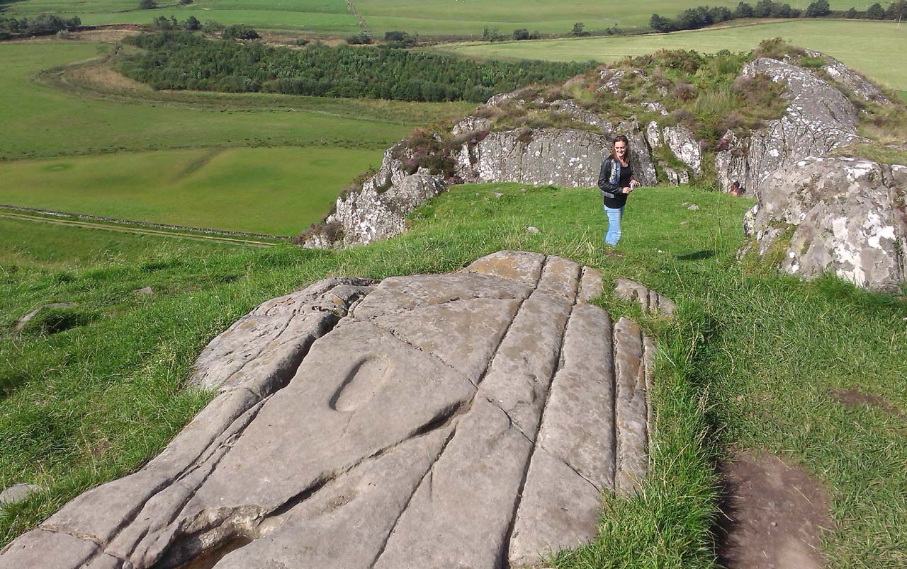
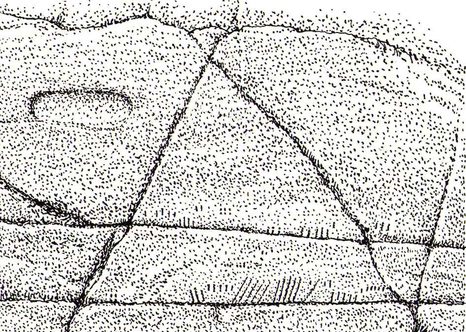
From Lochgilphead, take the A816 road north for several miles (towards the megalithic paradise of Kilmartin), keeping your eyes peeled for the road-signs saying “Dunadd.” Turn left and park-up a few hundred yards down. Go through the gate and walk up Dunadd. Just before the flattened plateau at the top, a length of smooth stone is accompanied to its side by the deep cup-and-ring of the Dunadd Basin. Three or four yards away, you’ll see the long ‘footprint’.
Archaeology & History
Near the top of Dunadd’s Iron Age ‘fortress’ and overlooking the megalithic paradise of the Kilmartin valley, several man-made carvings are in evidence very close to each other, all with seemingly differing mythic content. This one—the footprint—stands out; but it’s not alone! Faint etchings of at least one other ‘foot’ is clearly visible. The first literary account of it was by Ardrishaig historian R.J. Mapleton (1860), who told,
“There is on the top of Dunadd a mark that strikes me as interesting; it is like a large axe-head, or a rough outline of a foot. My impression is that it may have been the spot on which the chief would place his foot when succeeding to the headship of his tribe. The footmark was always considered among the people here as a mould for an axe-head, and I was rather laughed at for suggesting an inaugurating stone.”
Dunadd Footprint (after Royal Commission 1988)F.W.K. Thomas’ 1879 sketch
Be that as it may, a few years later the carving had caught the attention of the Scottish Society of Antiquaries. In his article exploring the potential for ritual inaugurations at Dunadd, Captain F.W.L. Thomas (1879) explored, not only the footprint, but the mythic functions of this symbol, looking at parallels with petroglyphs elsewhere in the world where the ‘foot’ was known to be a ritual inauguration symbol (amongst other things). He gave us the first real detailed account of the carving:
“About 10 or 12 feet below, and to the northward of the highest point, the living rock is smooth, flat and bear of sward, and in it is engraved an impression of a footmark, not of a naked foot, but such as would be made when the foot is clothed by a thick stocking or cuaran… The engravure is for the right foot; and it exactly fitted my right boot. The footmark is sunk half-an-inch deep, with perpendicular sides, the surface is smoothed or polished, and the outline is regular… It has probably been sheltered by the turf until recently. The footmark is 11 inches long, nearly 4½ inches broad where broadest, and 3½ inches across at the heel. When a person stands with his foot in the depression, he looks a little easterly of north.”
A century or so later when the Royal Commission (1988) boys got here, they found not one, but two ‘feet’ carved into the rock! A few feet away, near to the carved boar,
“At the south end of the main rock surface there is the lightly-pecked outline of a shod right foot. 0.24m long and 0.1m in maximum width, with a pronounced taper to the heel. There are further peck marks within the outline, and a sunken footmark was intended but not completed. This print is on almost the same alignment as the more prominent footprint some 2m to the north, which measures 0.27m from NNE to SSW, by 0.1m in maximum width and 25mm in depth. It is somewhat broader at the heel than the incomplete mark, and its sides are straighter.”
Close-up of the carving
They then emphasize how we’re unable to date the footprints, although point out how such carvings are “found in Britain from the Iron Age onwards.” But footprints have be found on other petroglyphs in Scotland (much less in England) and date between the neolithic and Bronze Age periods—but whether Dunadd’s example goes that far back, we cannot say. Extensive excavations occurred at Dunadd between 1980-81 and most of the finds were Iron Age and early medieval in nature (this carving and the cup-and-ring barely got a mention in Lane & Campbell’s [2000] extensive summation). But we may be looking at an evolutionary developmental relationship in symbolism and form, if the traditions of the place have any substance. This is something I’ll return to when writing of the Boar Carving, just a few feet away…
Folklore
The legends behind this seemingly insignificant mark near the top of Dunadd ostensibly echo and relate to the huge cup-and-ring of Dunadd Basin four yards away. I can only repeat what I said in that site profile.
R.J. Mapleton (1860) said that Dunadd was known by local people to be a meeting place of witches and the hill of the fairies, whose amblings in this wondrous landscape are legion. Legends and history intermingle upon and around Dunadd. Separating one from the other can be troublesome as Irish and Scottish Kings, their families and the druids were here. One such character was the ever-present Ossian. Mapleton told:
“From these ancient tales we turn to a much later period of romance, when Finn and his companions had developed into extraordinary and magical proportions; a story is current that when Ossian abode at Dunadd, he was on a day hunting by Lochfyneside; a stag, which his dogs had brought to bay, charged him; Ossian turned and fled. On coming to the hill above Kilmichael village, he leapt clean across the valley to the top of Rudal hill, and a second spring brought him to the top of Dunadd. But on landing on Dunadd he fell on his knee, and stretched out his hands to prevent himself from falling backwards. ‘The mark of a right foot is still pointed out on Rudal hill, and that of the left is quite visible on Dunadd, with impressions of the knee and fingers.’”
As Mr Thomas (1879) clarified:
“The footmark is that of the right foot, and the adjacent rock-basin is the fabulous impression of a knee.”
References:
Bord, Janet, Footprints in Stone, Heart of Albion Press 2004.
Campbell, Marion, Mid-Argyll: An Archaeological Guide, Dolphin Press: Glenrothes 1984.
Campbell, M. & Sanderman, M., “Mid-Argyll: An Archaeological Survey,” in Proceedings of the Society Antiquaries, Scotland, volume 95, 1962.
Craw, J.H. “Excavations at Dunadd and other Sites,” in Proceedings of the Society Antiquaries, Scotland, volume 64, 1930.
Lane, Alan & Campbell, Ewan, Dunadd: An Early Dalriadic Capital, Oxbow: Oxford 2000.
Mapleton, R.J., Handbook for Ardrishaig Crinan Loch Awe and Pass of Brandir, n.p. 1860.
Morris, Ronald W.B., The Prehistoric Rock Art of Argyll, Dolphin Press: Poole 1977.
Royal Commission on the Ancient & Historical Monuments of Scotland, Argyll – Volume 6: Mid-Argyll and Cowal, HMSO: Edinburgh 1988.
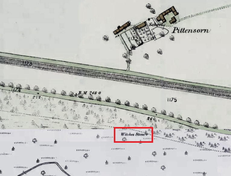
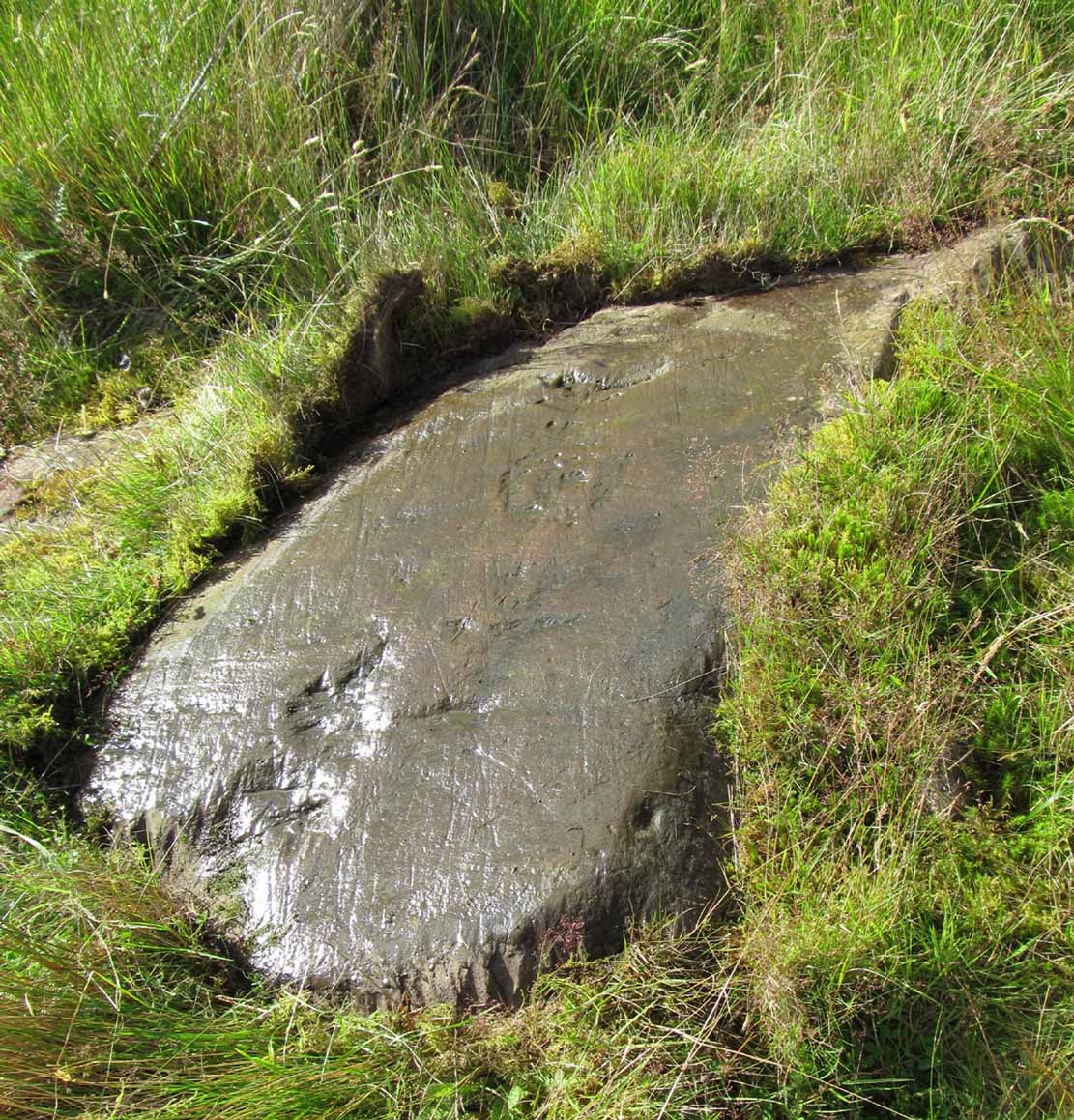
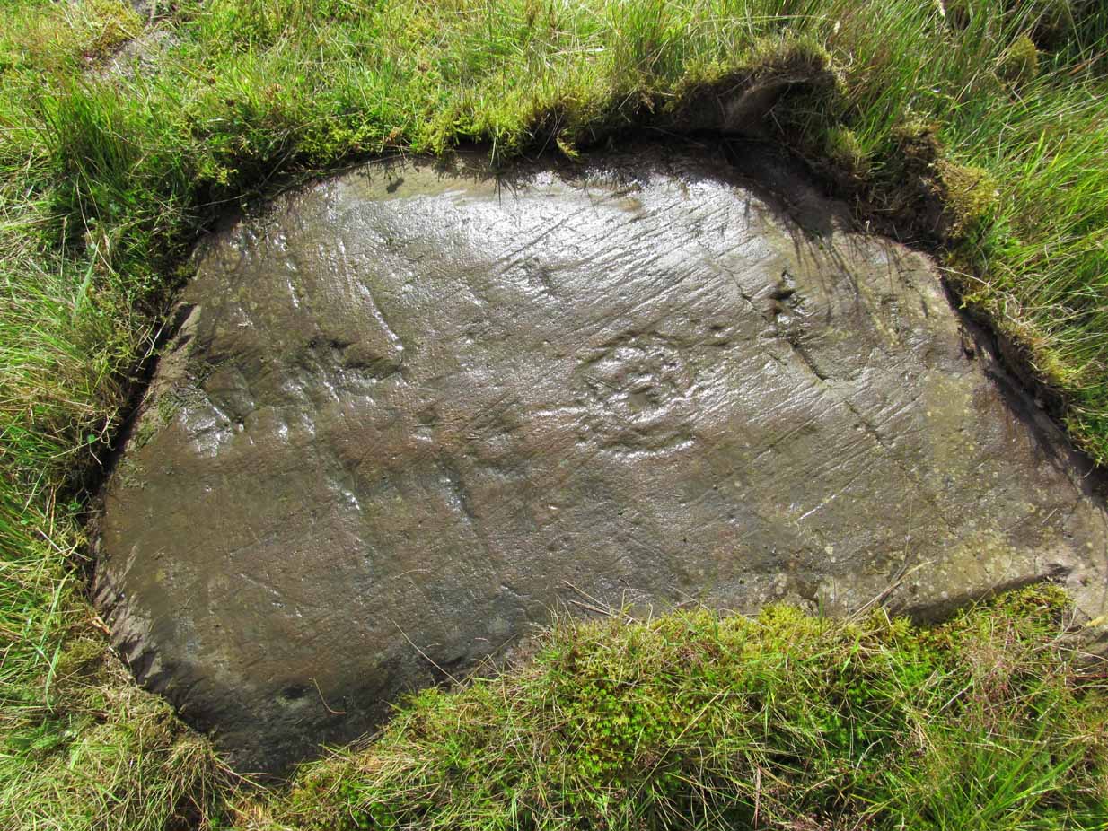
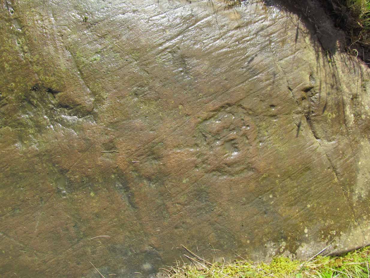
Park up at Murthly village, follow the farm road west, opposite the Kinclaven junction up to the cross roads, and turn right and go past Douglasfield Farm, following the road as it bends to the left; then through the metal gates and walk on until you come to an earth bridge over the ditch to your left. Cross the bridge and the low-lying Witches Stone is about 30 yards on to your left by the drainage ditch.
Archaeology & History
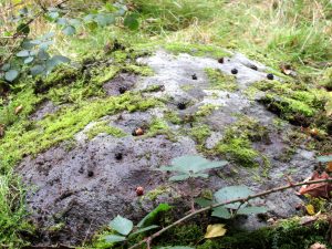
Not recorded on the Canmore online database, the Witches Stone is a low-lying, domed, earthfast rock bearing at least 12 cup marks. One cup mark has been drilled at some time in the past. Did the land owner do this as a preliminary to blowing it up with gunpowder? There is an interesting story relating to the origin of the cup marks, and it seems the name of the rock and its folklore may point to its ritual significance having passed down through oral tradition from the Bronze Age to historical times.
Folklore
The mid-nineteenth century Ordnance Survey Name Book has the following record, attested by Sir W.D. Stewart, Mr. T. Cameron & Mr. J. Cameron:-
Close-up of cupsBlackberries in cupmarks
“A small rock nearly level with the ordinary ground surface, underneath which it is traditionally held that a large sum of money is buried. In order to test the truth of this tradition, it is said that some years ago a man commenced to excavate the soil around the rock in order, if possible, to secure the hidden treasure, while so employed, a small dog suddenly appeared on the top of the rock and desired the man to desist, assuring him at the same time that the reputed treasure was really there, but it was never intended that the eye of mortal should behold it. There are some marks on the rock which the superstitious tell you are the prints of this very sagacious dog’s paws.”
Along the A81 road from Port of Menteith to Aberfoyle, watch out for the small road in the trees running at an angle sharply uphill, nearly opposite Portend, up to Coldon and higher. Keep going, bearing right past Mondowie and stopping at the dirt-track 100 yards or so further up on the left (and ignore the english fuckers up here who might say “you’re not allowed to park here”, as Scottish government regulation allows you to do so unless you block the road). Walk up this dirt-track for ⅔ mile, and just before reaching the planted forestry, turn right along another dirt-track. Less than 200 yards along there’s a large sycamore tree, and about 20 yards below it (south) is the carving you’re looking for.
Archaeology & History
It’s difficult keeping up with the carvings in this region to the north of the Lake of Menteith, as we find new unrecorded ones on every visit, maintaining the tradition of fellow rock art students Maarten van Hoek, Kaledon Naddair, George Currie, Jan Broewer and the rest—and we know that there’s more of them hidden away. This one doesn’t seem to be in the Canmore listings, but I put that down to the fact that they’ve got a grid-reference wrong somewhere, as it’s pretty plain to see. Although, to be honest, in the rather vague descriptions of other adjacent carvings (Over Glenny 5 and 7), this carving is in-between them, so you’d expect it to be listed. Anyway, that aside…
Looking down at the ringsClose-up of faint rings
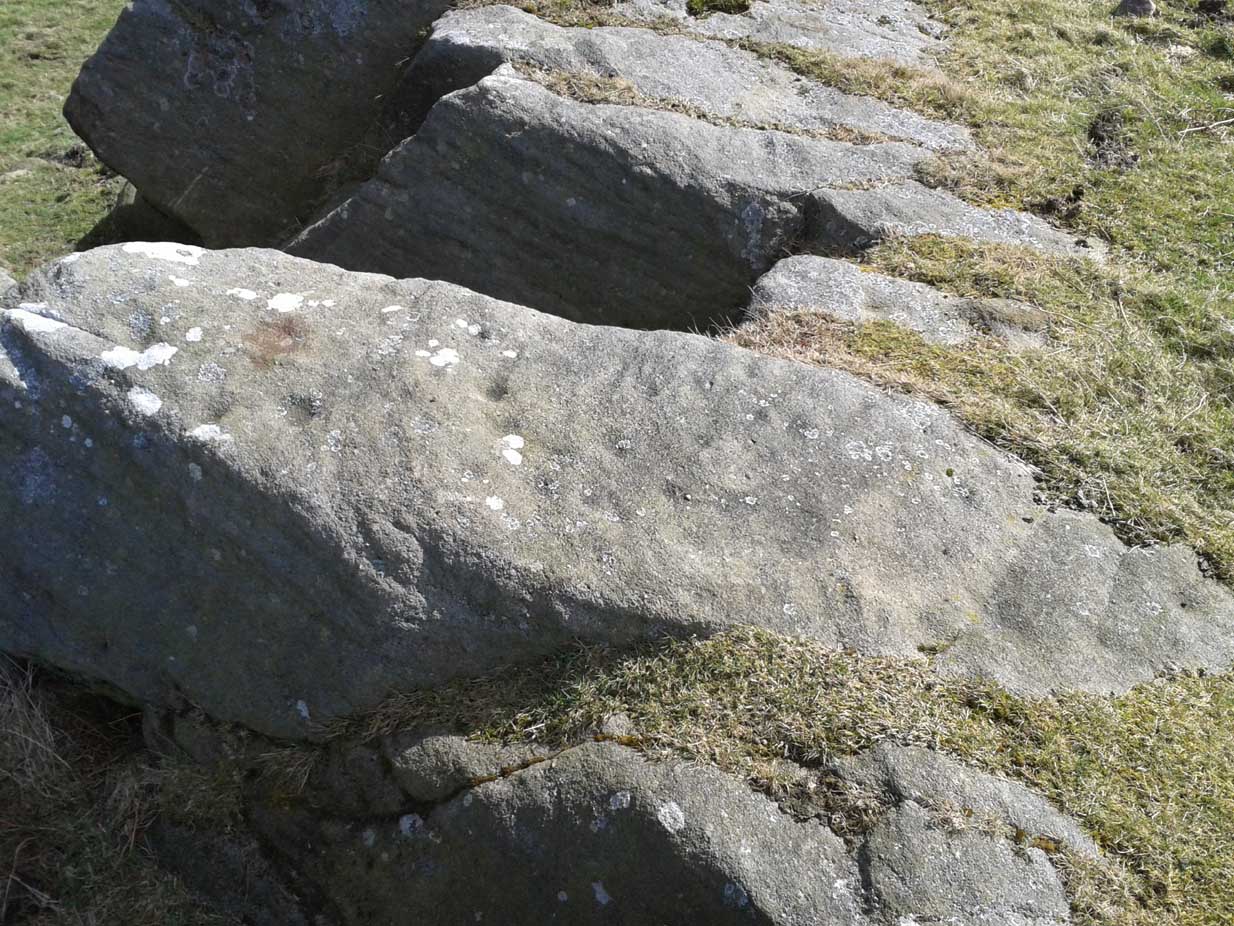
This long flat exposed rock surface has two primary cup-and-rings upon it: one cup with a double-ring, and the other standard cup-and-ring; there are also two single cup-markings on the stone: one near the middle of the rock and the other on its lower-right side. The main element is the double-cup-and-ring, which appears to be incomplete—not only in terms of its design, but also, as you can see in the photos, seems unfinished. From the central double-ring, a faint carved line runs out from the centre and into the other faint, incomplete, single cup-and-ring.
Series of metal-sharpening groovesArty-farty sketch of the design
At the bottom of the stone (as with several others hereby) a curious set of deep scars have been cut into the edge of the rock. They’re unmistakable when you see them. They have probably been created by metal artifacts being sharpened along the bottom of the rock—many many times by the look of it. These deep cuts reminded me of the more famous Polisher Stone, down Avebury-way. They may be explained by the fact that, several centuries ago, a battle occurred here and some of the men gathered in the area before the attack. It would seem as if this and the other cup-and-ring stones were used to sharpen their blades before going into battle. Whether this was done because of some local lore which imbued these stones with some sort of magick, we do not know. Folklore here seems curiously scarce (english incomers destroyed local traditions, as writers were telling us in the 19th century), apart from the well-known one of the area being rife with fairies: Robert Kirk’s famous The Secret Commonwealth of Elves, Fauns and Faeries (1691) was written three miles west of here, at Aberfoyle.
From Otley, take the road north across the River Wharfe up and up, heading towards Askwith Moor. As the moorland opens up ahead of you, at the crossroads turn right along Snowden Carr Road and literally ¾-mile along (1.25km) where a track on your right goes to Carr Farm, on the left-side of the road is a gate. Go through here to the Naked Jogger Stone and walk up the rocky ridge ahead of you, alongside the walling (as if you’re going to the Sunrise Stone), and about 20-30 yards up you’ll reach this carving.
Archaeology & History
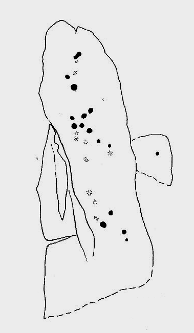
Best visited on a clear day, this is one carving amidst a small cluster of cup-marked petroglyphs found along the small geological ridge between the Sunrise Stone and Naked Jogger carving (none of which are as impressive as those two!). This particular design consists of a number of faint cup-marks— between 17 and 25 of them—reaching along the horizontal surface, with no distinct formal pattern, as usual. The carving continues beneath the encroaching soil.
Looking down at the carvingArchaeo-sketch
It seems to have been described for the first time by Stuart Feather (1973); then subsequently in Boughey & Vickerman’s (2003) survey, in which they attach a single cup-marking on an adjacent rock into the matrix of this design—but the two rock surfaces are distinctly separate. This apart, their description tells, briefly as always: “Large long rock which may be outcrop, with hill falling away steeply below. Seventeen worn cups.”
References:
Boughey, Keith & Vickerman, E.A., Prehistoric Rock Art of the West Riding, WYAS: Leeds 2003.
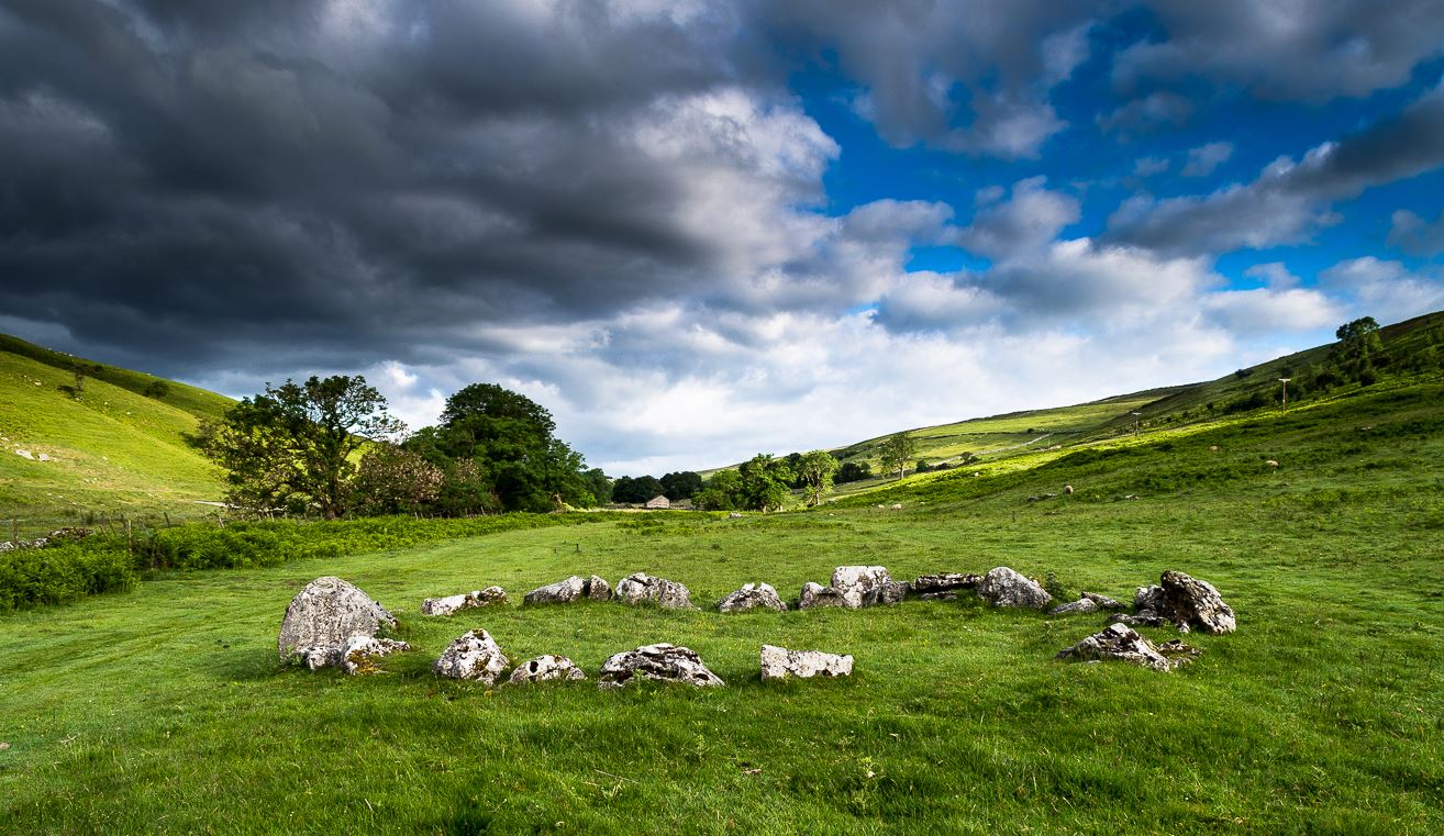
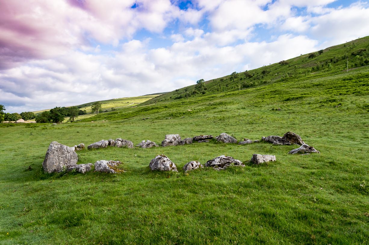
The long country road running between Aysgarth and Kettlewell is the B6160. Whether you’re coming from the north (Aysgarth) or south (Kettlewell), when you reach either Buckden or Cray, take the minor road west to Hubberholme. Just over 1½ miles further on, you reach the tiny hamlet of Yockenthwaite itself. Cross the river bridge, then turn left and walk along the footpath parallel with the river. 600 yards or so along, keep your eyes peeled for the low small ring of stones in front of you.
Archaeology & History
Just above the well-trod path that runs parallel with the usually shallow River Wharfe, this small and silent ring of stones rests in the idyllic host of Langstrothdale, deep in olde Yorkshire. Tis a wonderful spot… Classed as a ‘stone circle’ for many a decade (even by the esteemed Aubrey Burl), this small but ancient ring shouldn’t really be held in the same category as our larger megalithic circles. In truth, it looks more like some of the larger hut circles I’ve seen and uncovered down the decades—and it may well be that. Indeed, even the archaeo’s aren’t in agreement as to what it is, with the general idea being that it is the remains of a ring cairn of some type, despite no human remains being found here.
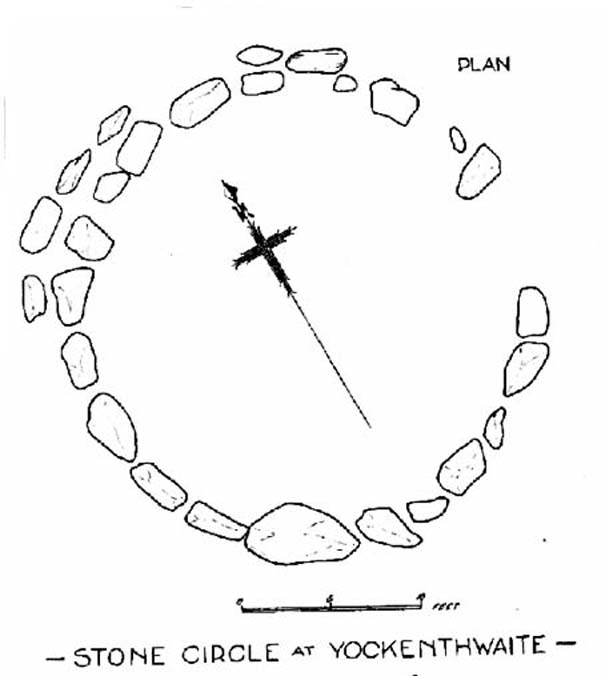
Raistrick’s 1929 planLooking northwest
Yockenthwaite itself was already know by this name in 1241 CE, when the monks of Fountains Abbey were given the land by one of the murderous invading Norman families of the period. This ingredient may be relevant to the history of the circle, for as the great northern antiquarian Harry Speight (1900) pointed out,
“in several places in the dales there are traces of what seems like ancient sheep or cattle enclosures, which are probably vestiges of this grant to the monks of Fountains in 1241.”
And Speight thought the circle had a similar origin to these remains. He continued:
“An enclosure of this kind, composed of a number of big stones on end, lies at the low end of the second pasture on the north side of the river between Yockenthwaite and Deepdale, and has been described as a Druid’s Circle. It is doubtless one of these monastic folds.”
And he may have a point. Although when Arthur Raistrick (1929) ventured here in the early 1920s, he had other ideas, pushing the date of the site way way back into the Bronze Age. “The circle,” Raistrick told,
“is slightly raised above the surrounding ground-level, and the stones, standing edge to edge, can be seen from a considerable distance on either fell side. The circle is 25 feet diameter, very nearly a true circle, there being only about 6 inches variation in diameter. The stones number 20, placed on edge to edge to edge…with only two small gaps, which would accommodate three or perhaps four more stones. These stones were probably removed some years ago to repair the stile in the neighbouring wall. Outside this circle of 20 stones, on the northwest side, there are four others placed concentrically, and very close to the circle, but there is no evidence that the circle was ever double, or that there were ever more than these extra four stones. There is a slight mound at the centre, and probing with a rod proved a small circle of stones, about 9 feet diameter at the centre, indicating probably a burial. Several large boulders lie on the level ground around the circle, but these are all rolled down from the fell-side above, and not placed in any connection with the circle. All the stones of the circle are of limestone…”
It was this designation that led to Burl (1976; 2000) to include it in his corpus of megalithic rings; although John Barnatt (1989) did question the validity of the site as a true ‘stone circle’ in his own gazetteer, saying:
“This unusual site comprises a contiguous ring of orthostats of c. 7.5m diameter, which are graded downslope to the SSW to allow for the gradient; their tops are all roughly horizontal. They range from 0.30 to 1.05m in height, 22-3 stones survive today and 3-4 appear to be missing. To the NNW there is a short outer arc of 4-5 stones placed immediately outside the main ring. 4 loose stones appear to have been added to the ring recently. Raistrick’s plan does not tally with the present remains, despite the sites undisturbed nature. The interior of the site is filled by a low horizontal platform, with virtually no height upslope to the north-east and a height of c. 0.5m to the south-west. The ring of stones stand well proud of this round the full circumference. This site appears to be a variant form of kerb-cairn rather than a true stone circle.”
The structure has been built onto a slight but notable platform, as has also been done with many hut circles—and the Yockenthwaite site may just be one of them. Only an excavation will tell us for sure. It’s isolated from other remains, but on the hills above, both north and south, denuded Iron Age and Bronze Age settlements look down on this solitary ring. Whatever it may be, it’s olde and in a beautiful setting. Well worth checking out if you like yer ancient sites!
References:
Barnatt, John, Stone Circles of Britain (2 volumes), BAR: Oxford 1989.
Burl, Aubrey, A Guide to the Stone Circles of Britain, Ireland and Brittany, New Haven & London 1995.
Burl, Aubrey, The Stone Circles of Britain, Ireland and Brittany, Yale University Press 2000.
Elgee, Frank & Harriet, The Archaeology of Yorkshire, Methuen: London 1933.
Longworth, Ian H., Regional Archaeologies: Yorkshire, Cory, Adams & MacKay: London 1965.
Raistrick, Arthur, ‘The Bronze Age in West Yorkshire,’ in Yorkshire Archaeology Journal, volume 29, 1929.
Standing Stone? (destroyed): OS Grid Reference – SE 2428 2329
Archaeology & History
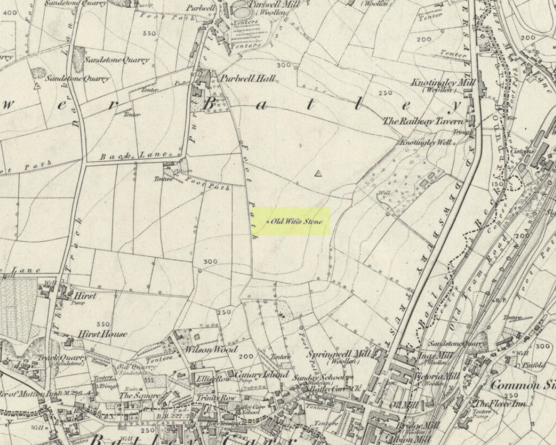
Old Wifes Stone on 1854 map
My first hint at the existence of this once valuable archaeological relic came as a result of me seeking out the history and folklore of some hitherto unknown, forgotten holy wells in the Batley and Dewsbury area. I located the material I was looking for on the old wells, but my fortuitous discovery of this site, the Old Wife’s Stone, blew me away!
It was the place-name of ‘Carlinghow’ about one mile northwest of the grid-reference above that initially caught my attention. From an antiquarian or occultist’s viewpoint, it’s intriguing on two counts: the first is the element ‘how‘ in Carlinghow, which can mean a variety of things, but across the Pennines tends to relate to either an ancient tribal or council meeting place, or a prehistoric burial cairn: an element that wasn’t lost in the giant archaeology survey of West Yorkshire by Faull & Moorhouse (1981). But the first part of this place-name, ‘carling‘, was the exciting element to me; for it means ‘old woman,’ ‘old hag,’ ‘witch’ or cailleach! The cailleach (to those who don’t know) was the prima mater: the Great Mother deity of our pre-christian British ancestors. Meaning that Carlinghow hill was a hugely important sacred site no less—right in the heart of industrial West Yorkshire! What is even more intriguing—or perhaps surprising—is that we have no record of such a powerful mythic creature anywhere in local folklore… Or so it first seemed…
Memory told me that no such prehistoric remains were recorded anywhere in that area—and certainly no prehistoric tombs. I scoured through my library just to triple-check, and found the archaeological records as silent as I first thought. Just to make sure I spent a day at the Central Library, where again I found nothing… So then I explored the region on the modern OS-maps, only to find that much of the area where the Carlinghow place-name existed was, surprisingly, still untouched by housing and similar modern pollutants. This was a great surprise to say the least. And so to check for any potential archaeological sites which might once have been in the Carlinghow area, I turned to the large-scale 1850 OS-maps (6-inch to the mile).
This is when I came across the Old Wife’s Stone, marked in the middle of fields on the outskirts of old Batley. There was no notice of it being a standing stone, or a simple boulder, or archaeological relic—nothing. But its place-name compatriot of ‘Carlinghow’ was the rising hill about a mile to the northwest. In days of olde, if Carlinghow was indeed the ‘burial tomb of the Old Woman’ or ‘meeting place of the cailleach’ (or whatever variants on the theme it may have been), it may have marked the setting sun on the longest day of the year if you had been standing at the Old Wife’s Stone – a midsummer sunset marker no less. (There are other ancient and legendary sites scattering northern England and beyond that are dedicated to the Cailleach, like the Old Woman Stone in Derbyshire, the Old Wife’s Neck in North Yorkshire, the Carlin Stone in Stirlingshire, the Old Woman Stone at Todmorden, Carlin Stone of Loch Elrig and many more.)
As if these curious ingredients weren’t enough to imply something existed in the heathen pantheon of Batley before the Industrialists swept away our indigenous history, we find echoes of the ‘Old Woman’ yet again, immediately east; this time where the animism of water and trees enfolded Her mythos in local rites and traditions, thankfully captured by the pens of several writers, and transmuted into another guise—but undeniably Her! But that, as they say, is for another day and another site profile…
Position of stone in 1894
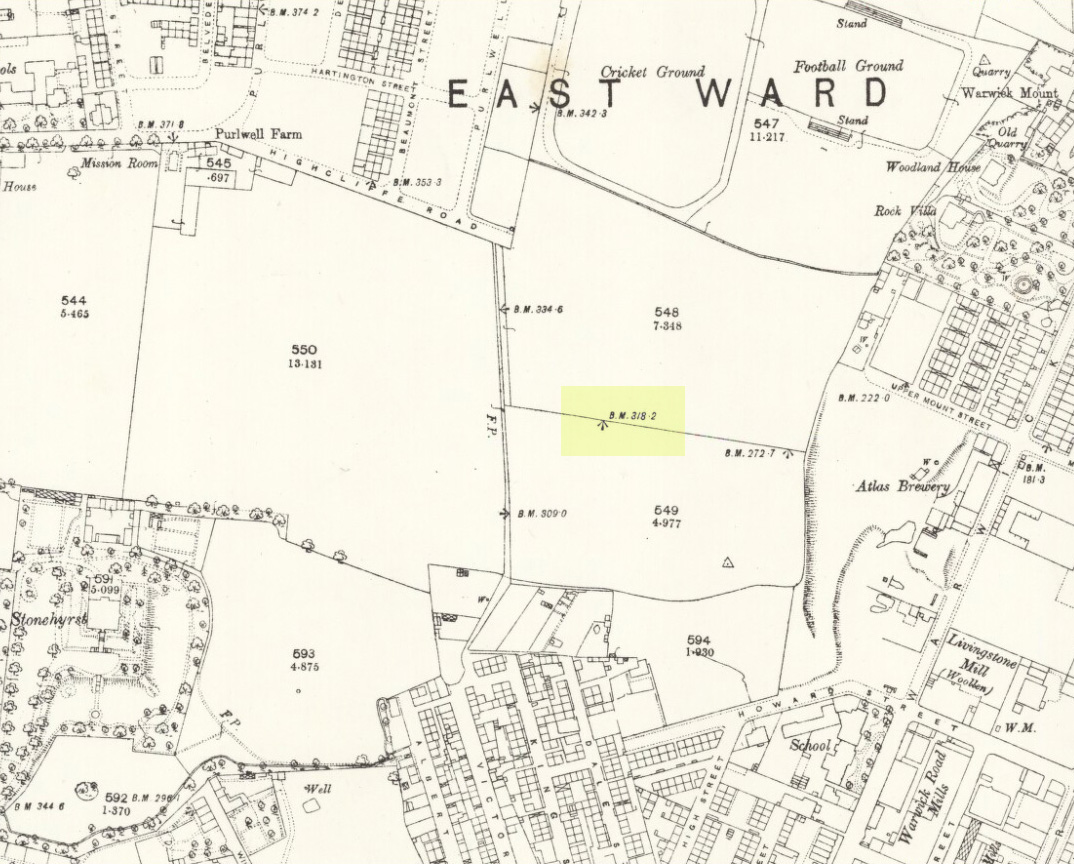
So is our Old Wife’s Stone (or for that matter, Carlinghow’s old tomb) still in evidence? A school has been built where it was highlighted on the 1854 OS-map and, from the accounts of local people, seems to have long since disappeared. The stone looks to have been incorporated into a length of walling, sometime between 1854 and 1888, and a bench-mark of “BM 318.2” carved onto it. But when the Ordnance Survey lads re-surveyed the area in 1905, this had gone. I have been unable to find any more information about this site and hope that, one day, a fellow antiquarian or occult historian might be able to unravel more of its forgotten mythic history.
References:
Faull, M.L. & Moorhouse, S.A. (eds), West Yorkshire: An Archaeological Survey to 1500 AD – volume 1, WYMCC: Wakefield 1981.
Goodall, Armitage, Place-Names of South-west Yorkshire, Cambridge University Press 1914.
Keighley, J.J., ‘The Prehistoric Period’, in Faull & Moorhouse, 1981.
o’ Crualaoich, Gearoid, The Book of the Cailleach, Cork University Press 2004.
Smith, A.H., English Place-Name Elements – volume 2, Cambridge University Press 1956.
Smith, A.H., The Place-Names of the West Riding of Yorkshire – volume 2, Cambridge University Press 1961.
Wright, Joseph, English Dialect Dictionary – volume 1, Henry Frowde: London 1898.
Acknowledgements: Many thanks for the assistance of Simon Roadnight and Julia King in the Batley History Group.