Along Halifax Road (A649), get to the Shears Inn and then take the footpath at the back of the pub that runs down the side of the fields and alongside the allotments. Less than 150 yards down, just through the stile into the edge of the field on your left, you’ll see the side-edge of a large flat stone in the grasses. Check it out!
Archaeology & History
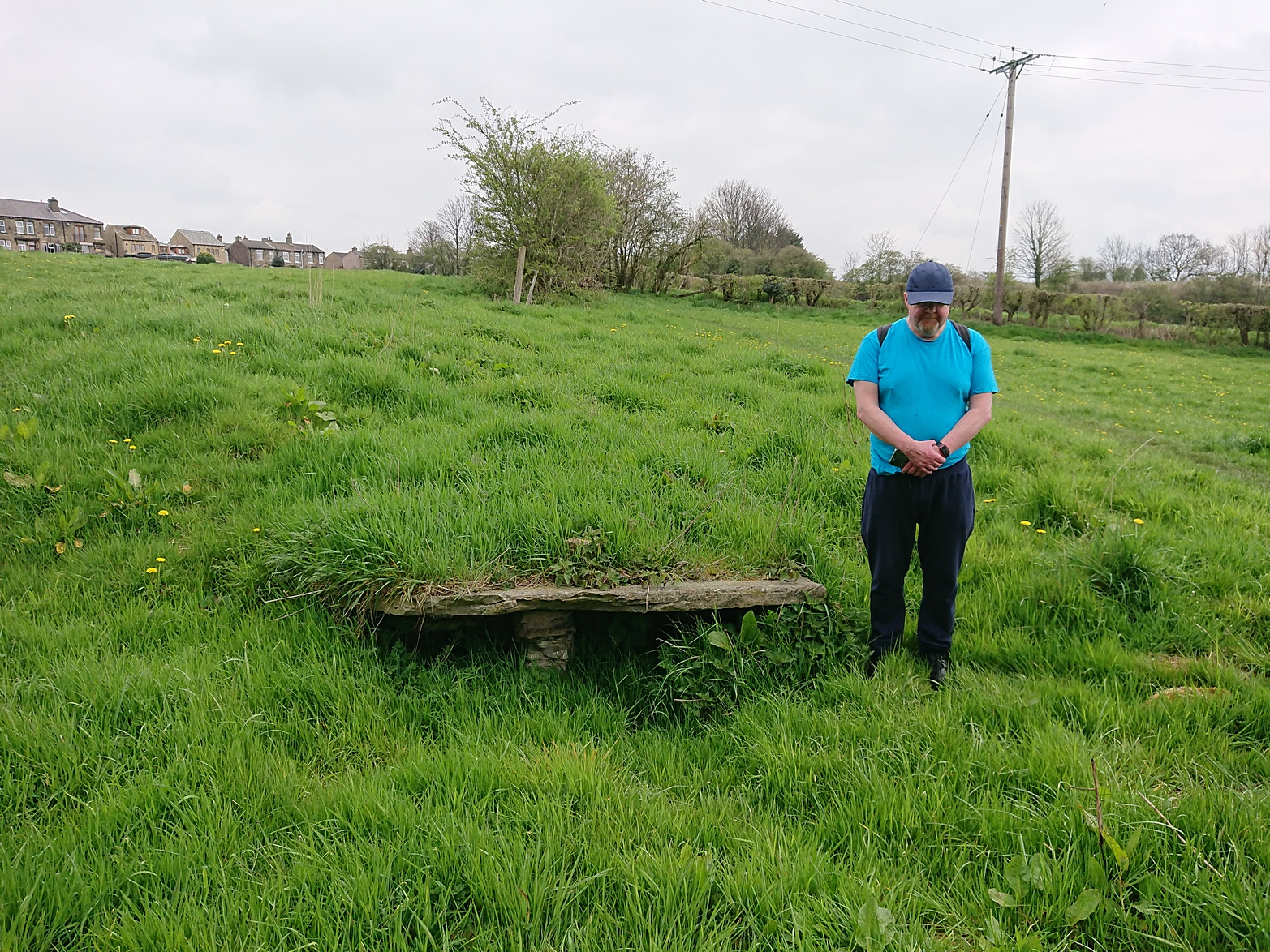
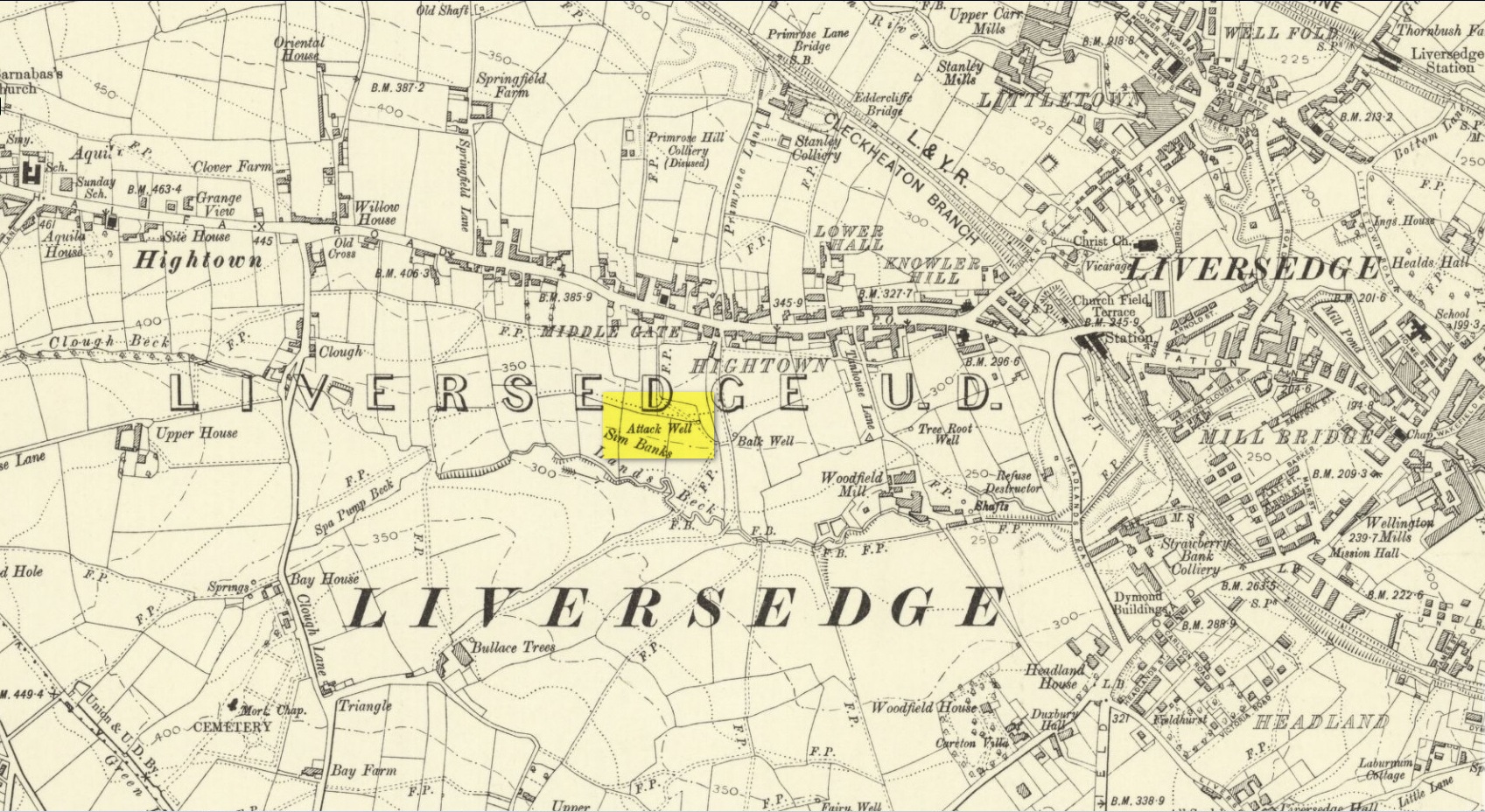
Along with the Attack Well and Tree Root Well, this was one of three springs close to each other that gave local villagers their water supply in bygone times. When we visited here at the height of a long warm spell in the summer of 2023, there was still was a small amount of clear water trickling beneath the long flat slab of stone — although it was somewhat clogged-up with vegetation. It wouldn’t take much work to completely clean this out and use the fresh drinking water once again.
The well gained its name from its position in the land, with balk, being “a portion of a field left unploughed”, or “a strip of ground left untilled” and variants thereof.
References:
Wright, Joseph, The English Dialect Dictionary – volume 1, Henry Frowde: London 1898.
Acknowledgements: Huge thanks to the great Gary Ferner, for use of his photo and the day’s venture!
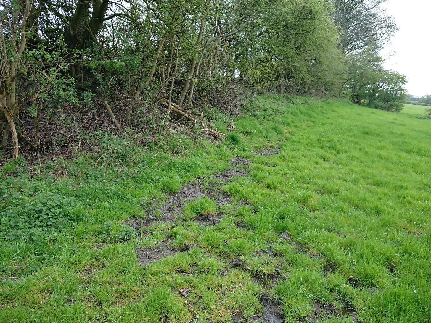
Located down the slope behind Shears Inn on Halifax Road (A649), past the stone-lined Balk Well, then round the other side of the allotments up where the footpath cuts to your right, the waters from this site can barely be found in the now large mass of brambles that make it virtually inaccessible to reach. When Gary Ferner and I visited here, it seemed that a very small pool of water existed in the hollow beneath the prickly vegetative covering—but even I didn’t struggle to get through it all and so we don’t know if the waters are still running as once they were. It was obviously one of the wells that fed local people in earlier times, but I can find no historical references to the site apart from its showing on the 1908 Ordnance Survey map.
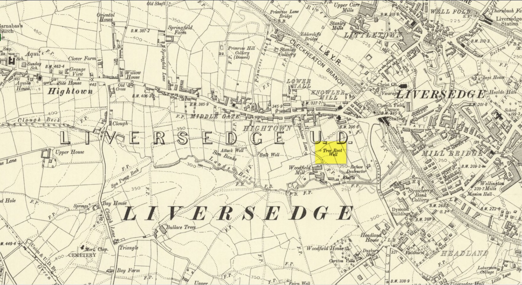
Along with the nearby Attack Well and Balk Well, this was one of three water supplies for the people of Middle Gate between Hightown and Liversdge in the 19th century. Found near the bottom of the old track known as Tanhouse Lane, its waters emerged at the base of some Victorian walling that’s built into the hillside, above which are the decayed remains of what seems to be an old hawthorn tree, whose roots obviously reached down to the stone trough, giving the place its name. Its waters have long since dried up and fallen back to Earth. Although it is shown on the 1908 OS-map of the region, I can find no virtues ascribed to the well nor any local history notes.
Acknowledgements: Huge thanks to the great Gary Ferner, for help in locating the site and the day’s venture!
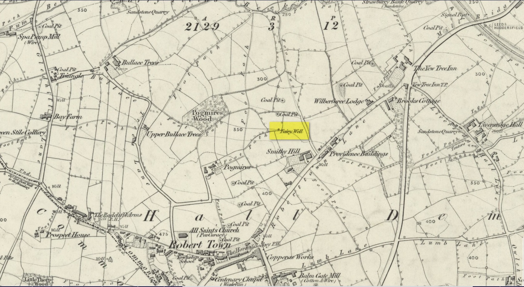
Best approached from Heckmondwike/Liversedge and going up Roberttown Road where, just past the Spen Valley High School parking spot, an almost dead straight footpath takes you down (northwest) into the woods. Walk down here for about 100 yards and then go left over the stile into the small copse of trees. Once you come out the trees at the other side, walk up the slope in the field that you’re now in. As you approach the line of trees at the top, you’ll notice the ground gets very boggy. Look carefully under the trees and you’ll notice an embedded flat stone protruding out and a somewhat trivial trickle of water into the grass at the front. That’s it!
Archaeology & History
Site on the 1854 OS-map
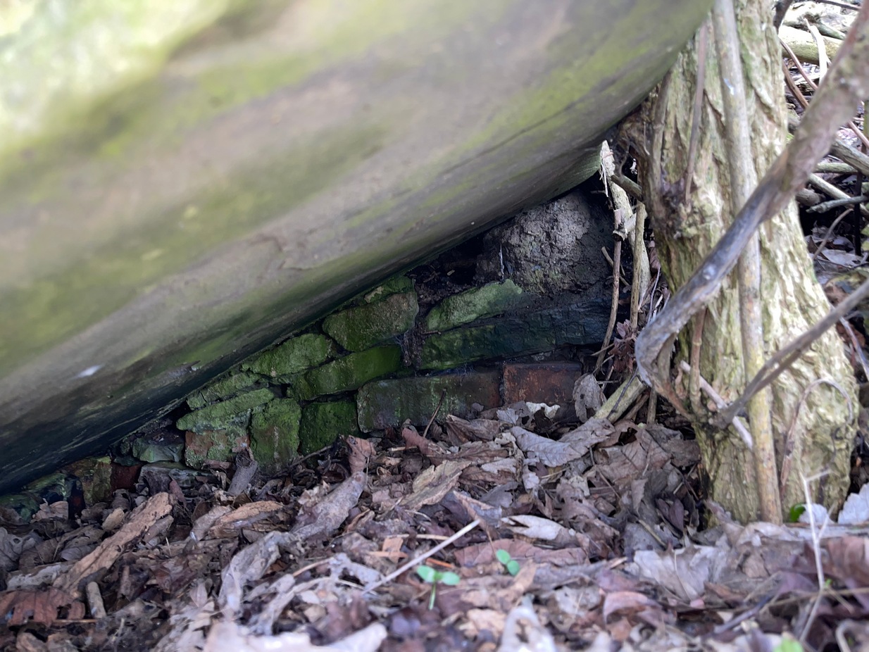
Highlighted on the 1854 Ordnance survey map of the area, this is a somewhat ruinous site which has seen better days. Even after good downpours it’s not very obvious and, in truth, could do with being cleaned-up, cleared out, and brought back into the old life it once had. If you look carefully beneath the roots of the covering tree, you’ll notice a decent-sized flat worked stone sticking out at the bottom of the sycamore and below this, at the back, almost covered in earth, you can make out some brick walling at the rear. It takes some finding! This is evidently the remains of a small protective well-house, now in total ruin.
Old cover of the well
When we visited the place a few weeks ago, there seemed to be no water inside. Instead, the water emerges into a small bog just below the tree-line a few yards away from the covering slab from whence it originally flowed.
Folklore
Obviously the abode of fairy folk in bygone days, all trace of the folklore and habits of them seems to have been lost long ago….
Acknowledgements: Huge thanks to mi old mate Gary Ferner for helping us uncover the source of the waters, which was almost completely covered in soil.
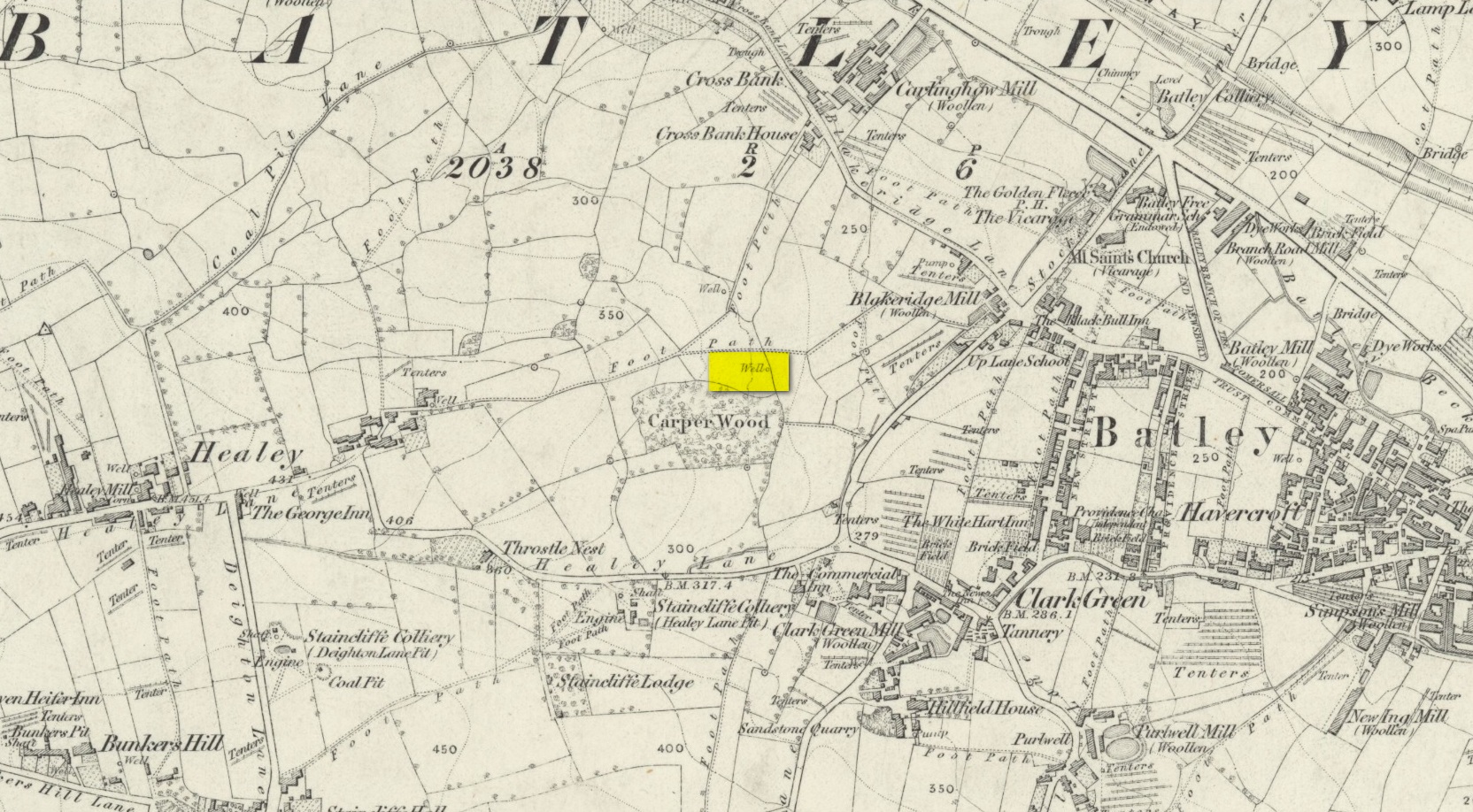
In days of olde, before folk had taps to turn to get water, they’d have to go to the nearby wells and streams. Many of these places were never written about, even to the point where no place-names were recorded, simply because the writers and surveyors either didn’t talk to the right people, or the right people didn’t talk to the surveyors! In many cases, the latter is all too true. Such is the case with this long forgotten healing well, whose memory is only preserved through the pen of a local man who, in the 19th century, was fortunate to have been able to write…
We know that old wells were mainly the province of women in most cultures through history; and Isaac Binns (1882) intimated this in his brief notes about the Wood Well. There’s nowt much to tell to be honest, but its location and lore need to be preserved.
Lamenting the loss of trees, Mr Binns told of the Wood Well’s proximity to Carper Wood: shown on the first OS-maps, but long since destroyed by the ignorance of modernity. In his day, the water from here was fresh “clear water.” This alone was good, but something extra in the water gave it that added healing ingredient. It was used medicinally,
“good yet, the old women say, for sore eyes.”
But not long after he wrote those very words, the Wood Well was destroyed…
References:
Binns, Isaac, From Village to Town: Random Reminiscences of Batley, F.H. Purchas: Batley 1882.
Standing Stone? (destroyed): OS Grid Reference – SE 2428 2329
Archaeology & History
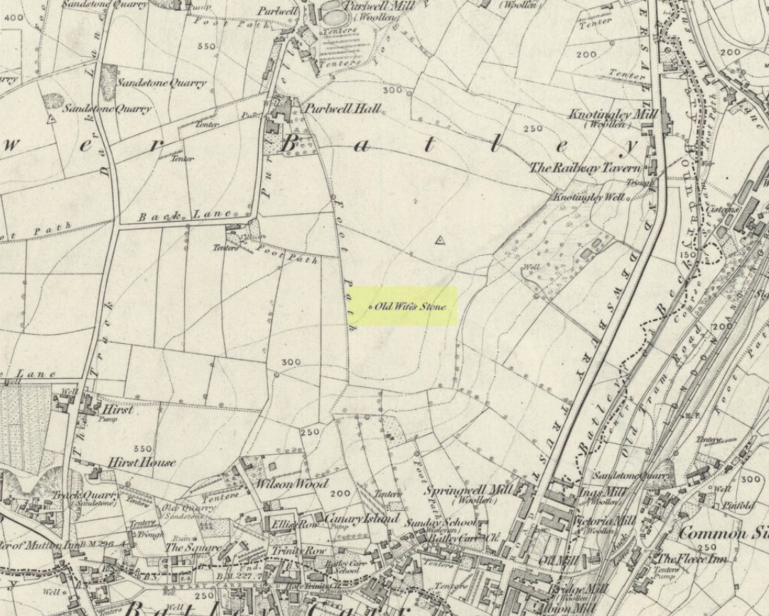
Old Wifes Stone on 1854 map
My first hint at the existence of this once valuable archaeological relic came as a result of me seeking out the history and folklore of some hitherto unknown, forgotten holy wells in the Batley and Dewsbury area. I located the material I was looking for on the old wells, but my fortuitous discovery of this site, the Old Wife’s Stone, blew me away!
It was the place-name of ‘Carlinghow’ about one mile northwest of the grid-reference above that initially caught my attention. From an antiquarian or occultist’s viewpoint, it’s intriguing on two counts: the first is the element ‘how‘ in Carlinghow, which can mean a variety of things, but across the Pennines tends to relate to either an ancient tribal or council meeting place, or a prehistoric burial cairn: an element that wasn’t lost in the giant archaeology survey of West Yorkshire by Faull & Moorhouse (1981). But the first part of this place-name, ‘carling‘, was the exciting element to me; for it means ‘old woman,’ ‘old hag,’ ‘witch’ or cailleach! The cailleach (to those who don’t know) was the prima mater: the Great Mother deity of our pre-christian British ancestors. Meaning that Carlinghow hill was a hugely important sacred site no less—right in the heart of industrial West Yorkshire! What is even more intriguing—or perhaps surprising—is that we have no record of such a powerful mythic creature anywhere in local folklore… Or so it first seemed…
Memory told me that no such prehistoric remains were recorded anywhere in that area—and certainly no prehistoric tombs. I scoured through my library just to triple-check, and found the archaeological records as silent as I first thought. Just to make sure I spent a day at the Central Library, where again I found nothing… So then I explored the region on the modern OS-maps, only to find that much of the area where the Carlinghow place-name existed was, surprisingly, still untouched by housing and similar modern pollutants. This was a great surprise to say the least. And so to check for any potential archaeological sites which might once have been in the Carlinghow area, I turned to the large-scale 1850 OS-maps (6-inch to the mile).
This is when I came across the Old Wife’s Stone, marked in the middle of fields on the outskirts of old Batley. There was no notice of it being a standing stone, or a simple boulder, or archaeological relic—nothing. But its place-name compatriot of ‘Carlinghow’ was the rising hill about a mile to the northwest. In days of olde, if Carlinghow was indeed the ‘burial tomb of the Old Woman’ or ‘meeting place of the cailleach’ (or whatever variants on the theme it may have been), it may have marked the setting sun on the longest day of the year if you had been standing at the Old Wife’s Stone – a midsummer sunset marker no less. (There are other ancient and legendary sites scattering northern England and beyond that are dedicated to the Cailleach, like the Old Woman Stone in Derbyshire, the Old Wife’s Neck in North Yorkshire, the Carlin Stone in Stirlingshire, the Old Woman Stone at Todmorden, Carlin Stone of Loch Elrig and many more.)
As if these curious ingredients weren’t enough to imply something existed in the heathen pantheon of Batley before the Industrialists swept away our indigenous history, we find echoes of the ‘Old Woman’ yet again, immediately east; this time where the animism of water and trees enfolded Her mythos in local rites and traditions, thankfully captured by the pens of several writers, and transmuted into another guise—but undeniably Her! But that, as they say, is for another day and another site profile…
Position of stone in 1894
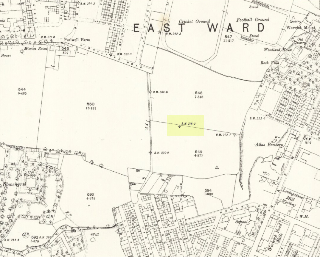
So is our Old Wife’s Stone (or for that matter, Carlinghow’s old tomb) still in evidence? A school has been built where it was highlighted on the 1854 OS-map and, from the accounts of local people, seems to have long since disappeared. The stone looks to have been incorporated into a length of walling, sometime between 1854 and 1888, and a bench-mark of “BM 318.2” carved onto it. But when the Ordnance Survey lads re-surveyed the area in 1905, this had gone. I have been unable to find any more information about this site and hope that, one day, a fellow antiquarian or occult historian might be able to unravel more of its forgotten mythic history.
References:
Faull, M.L. & Moorhouse, S.A. (eds), West Yorkshire: An Archaeological Survey to 1500 AD – volume 1, WYMCC: Wakefield 1981.
Goodall, Armitage, Place-Names of South-west Yorkshire, Cambridge University Press 1914.
Keighley, J.J., ‘The Prehistoric Period’, in Faull & Moorhouse, 1981.
o’ Crualaoich, Gearoid, The Book of the Cailleach, Cork University Press 2004.
Smith, A.H., English Place-Name Elements – volume 2, Cambridge University Press 1956.
Smith, A.H., The Place-Names of the West Riding of Yorkshire – volume 2, Cambridge University Press 1961.
Wright, Joseph, English Dialect Dictionary – volume 1, Henry Frowde: London 1898.
Acknowledgements: Many thanks for the assistance of Simon Roadnight and Julia King in the Batley History Group.