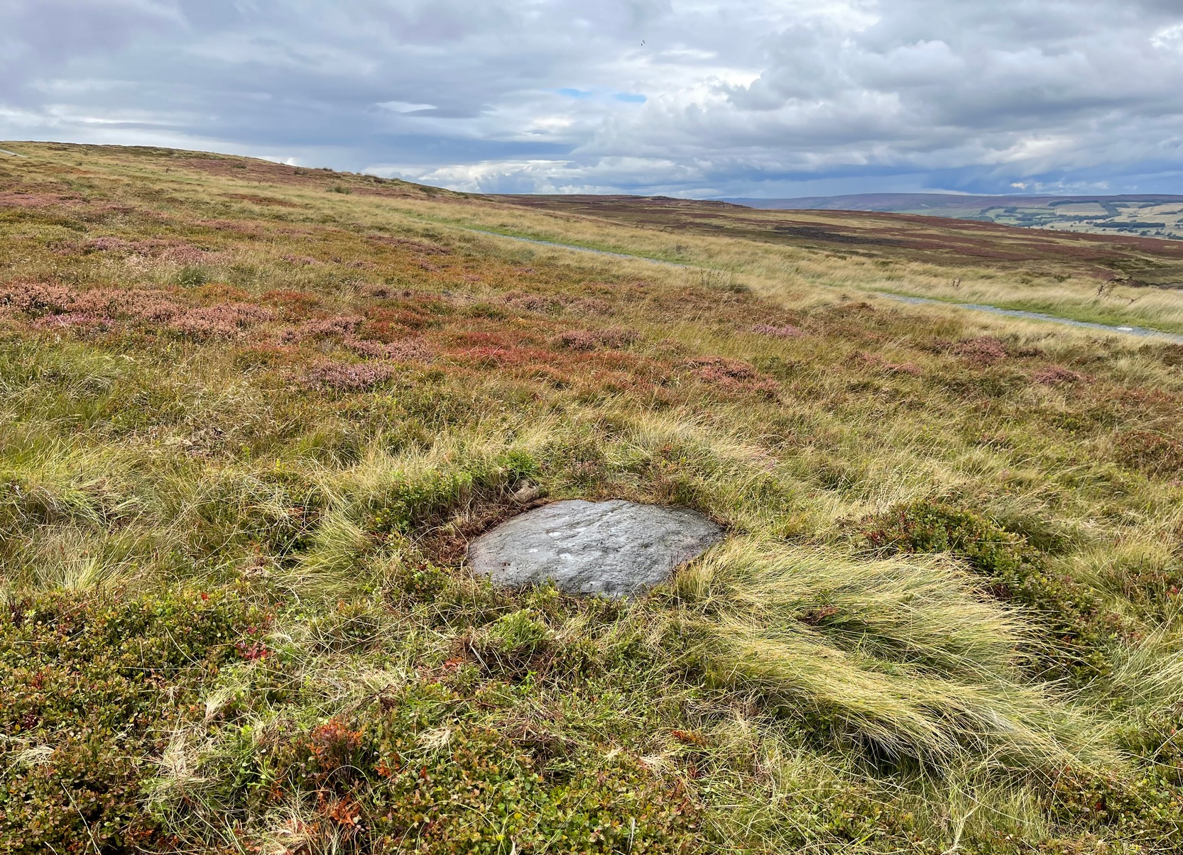
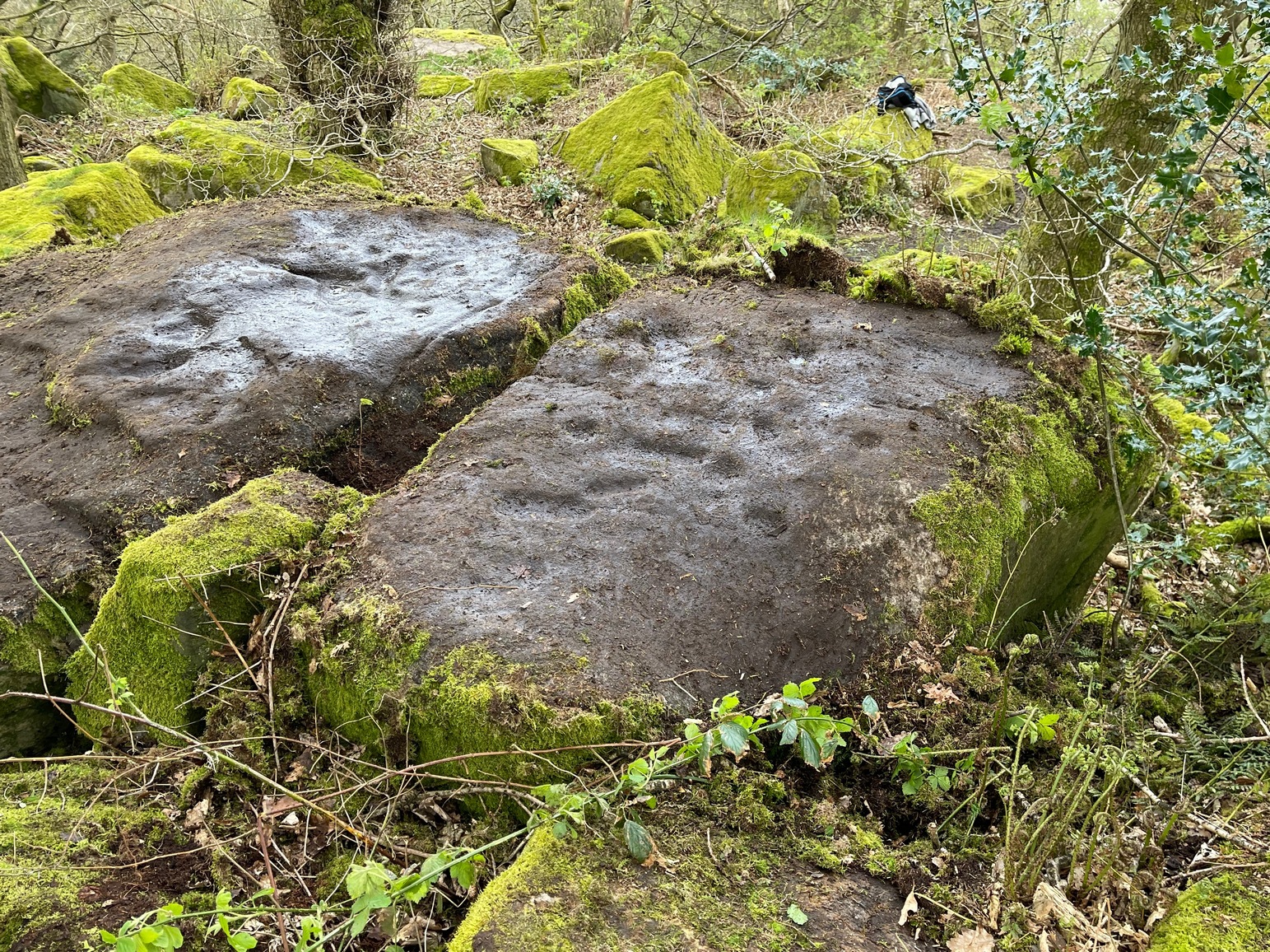
From the Cow & Calf car-park, walk towards and past the gigantic Calf rock, swerving round the fallen mass of rocks and into the trees at the back. Walk uphill to the Hanging Stones cup and ring stones, then keep heading—down the slope then back up the next one—west, for barely 100 yards until you’re on the level ground again, following the footpath alongside the heather. Barely 50 yards along, keep your eyes peeled in the heather for a low flat rock just a few yards in. Forage around and you’ll find it.
Archaeology & History
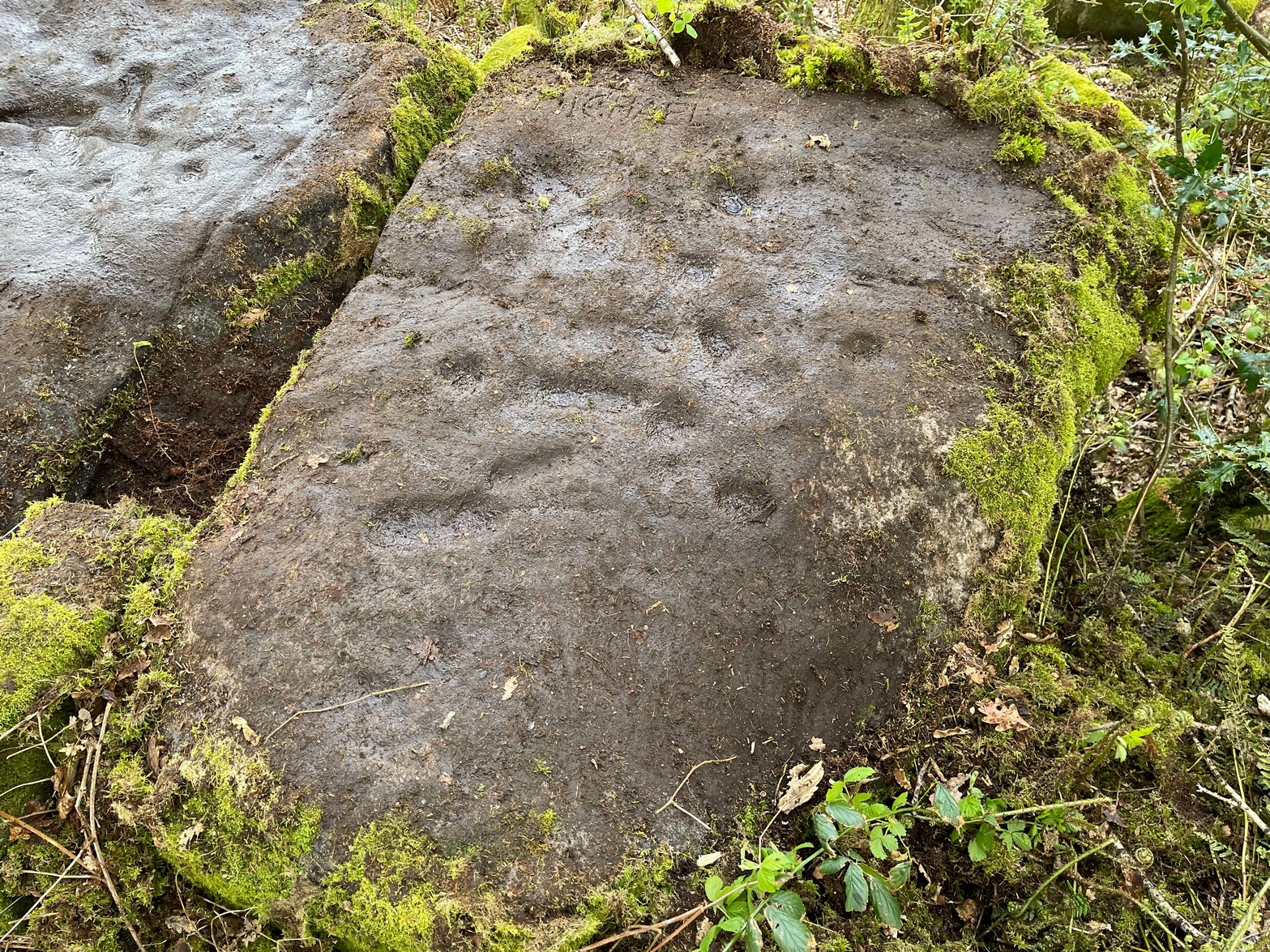
You’ll no doubt be seeing this carving after you’ve visited the impressive Hanging Stones petroglyphs 150 yards to the east. And you’ll probably be disappointed in its lack of visual grandeur when compared to its more ornate eastern neighbour. But the petroglyph fans among you should give it your attention.
Hedges 1986 sketchLooking to the SE
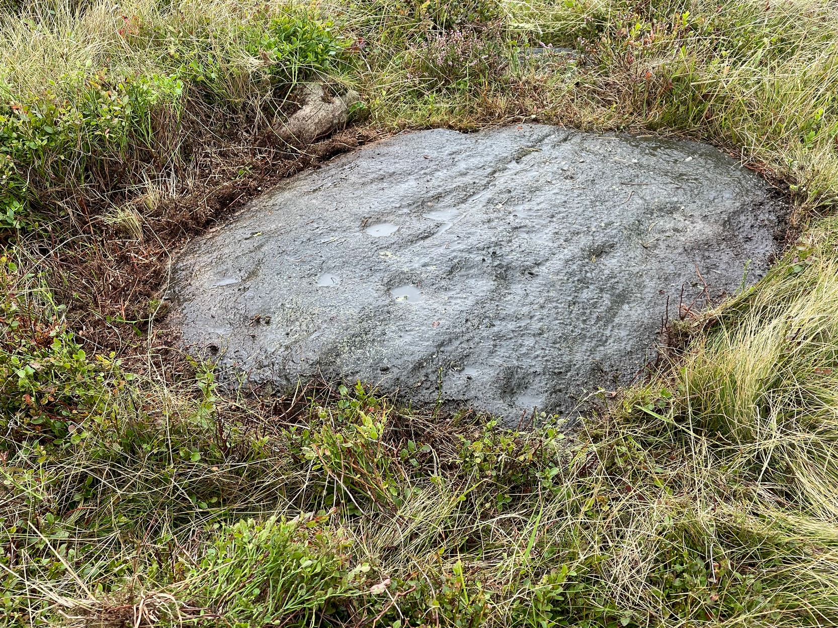
When the dawn or evening daylight cuts across the rock, the design looks much better than at sun high, perhaps telling us that the message of the stone coincided with those periods of the day. The gentle folds of the stone itself morph into the carving: evening and morning light cutting subtle shadowy folds across the rock, giving it an organic texture that our aboriginal ancestors told to be a vital essence of stone itself. The two small clusters of cup-marks upon this stone become greater than their basic design when brushed with the shadows and glows of a sunset. And when our aboriginal peoples painted them in ochre and other colours, an even greater mythos emerged—but sadly it is forgotten here….
When looked at with the simplistic eyes of the archaeo-mind, this and its compatriots are little more than a number of marks on lifeless rocks. This stone for example was described in John Hedges’ (1986) survey as being just “two groups of four and five cups and grooves”—nothing more—with naught but an echo in Boughey & Vickerman’s (2003) later work. The carving has neighbours even more basic in the heather close by…
References:
Boughey, Keith & Vickerman, E.A., Prehistoric Rock Art of the West Riding, WYAS: Wakefield 2003.
Hedges, John (ed.), The Carved Rocks on Rombalds Moor, WYMCC: Wakefield 1986.
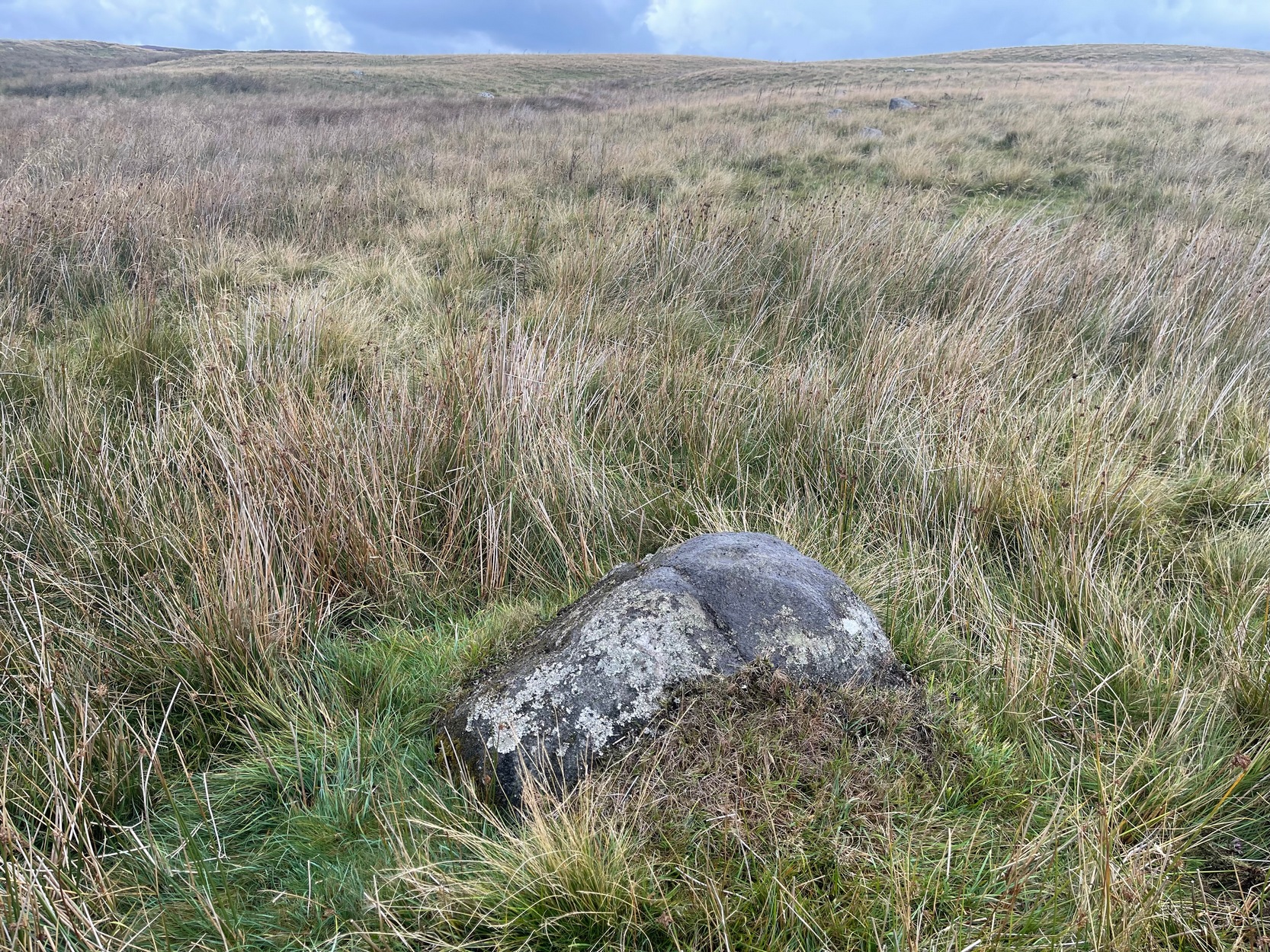
You can walk up from Menston, up Moor Lane north-west towards the moor, then turning left when you hit the moorland road of Hillings Lane. Nearly 350 yards along, turn right up the track known as Occupation lane onto the moor. More than half-a-mile up, past the gate at the Bee Stone, where the track splits, keep to the left and head further uphill, roughly parallel with the fence on your left. Literally ¼-mile (0.4 km) up from the split, you’re looking almost straight down at the reservoir; but to your left, walk towards the fence. Zigzag about! You can also approach it from the Grubstones and Great Skirtful area, by following the Occupation Lane track eastwards down the slope until you’re roughly level with the same reservoir.
Archaeology & History
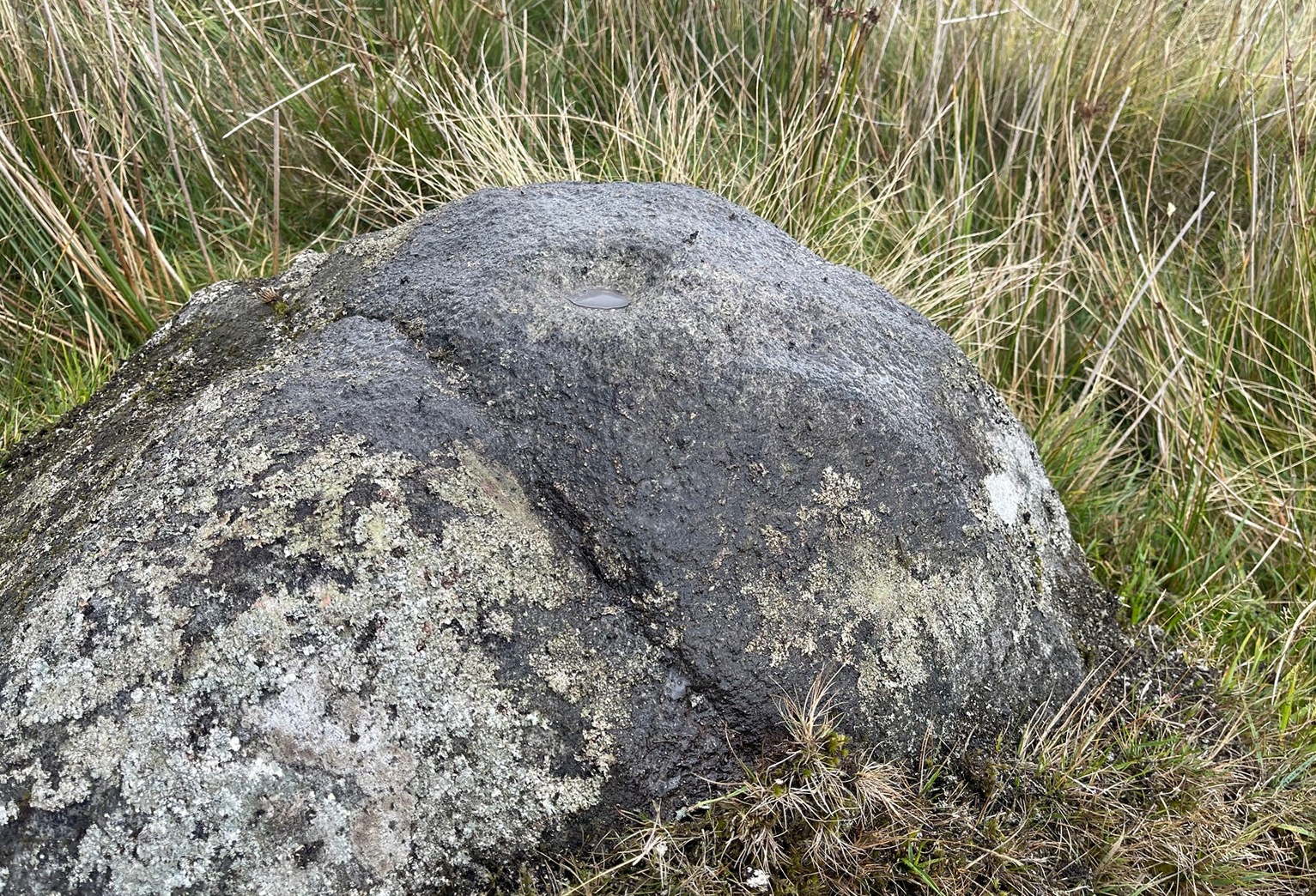
On this somewhat isolated stone on the northern sloping edge of Craven Hall Hill we find a small cluster of shallow cup-marks, first noted in the 1980s and eventually mentioned in a survey by Boughey & Vickerman (2003) where they described it as a,
“Low, medium striated rock lying in slope of hill. SE end carries possibly up to eleven cups, possibly two sets grouped in arcs running into natural striations of rock, one of which may have been artificially enhanced by pecking.”
Shallow cup-marks
The view from here is quite something: gazing east to the heathen hilltop of Otley Chevin (Beltane rites and rock art — albeit not much), north-east to the far uplands of the White Horse of Kilburn, then across the northern panoramas of Askwith and Denton Moors, and beyond. Some archaeologists have started to believe that such vistas may have had relevance with such carvings, sometimes. They’ve caught up at last! 🙂 Anyhow, the carving itself is pretty simplistic and probably only of interest to the real petroglyph nuts amongst you – although it’s mebbe worth checking out if you’re visiting the Great Skirtful giant cairn and its very impressive hengi-form neighbour.
References:
Boughey, Keith & Vickerman, E.A., Prehistoric Rock Art of the West Riding, WYAS: Wakefield 2003.
Boughey, Keith & Vickerman, E.A., Prehistoric Rock Art of the West Riding – Supplement, YAS 2018.
Acknowledgements: With thanks to Tom Cleland for help in relocating the site on a recent visit.
Numerous ways to get here: probably the easiest (direction wise) is if you’re coming from Dick Hudson’s public house on the southern road surrounding Rombalds Moor. From the pub, head left (east) along Otley Road (passing Weecher reservoir) for 1.9 miles (3.1km) until you reach Reva reservoir where a track leads you to the waters. A small parking spot is on the left-side of the road. From here, go through the gate and along the footpath across the field for nearly 300 yards to the next gate. Go through here and immediately follow the walling down to your left for about 135 yards to the edge of the rushes. It’s there!
Archaeology & History
Single cupmark nr the top
On a recent visit to the Fraggle Rock carving, Tom Cleland foraged about at the edge of what was, in centuries gone by, a good flowing stream below the west slope of Reva Hill. An old pathway cut across one section of it near where the walling now runs, covered these days in the mass of Juncus reeds, typical of mashy grounds. And here, just where folk would cross the waters, Tom found a good sized stone with a single deep cup-mark on its crown, calling through a feast of lichens to be seen once more. There may be a second cup-mark by its side, but the light wasn’t good when we were here, so that’ll be worked out some other day. Anyhow, this one’s probably only for the crazy petroglyph hunters out there. It’s the Fraggle Rock and its companios that you’re gonna be looking for, nearby….
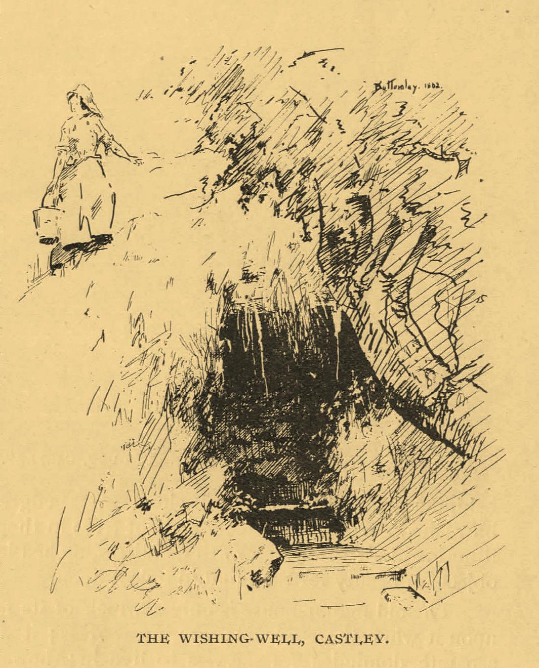
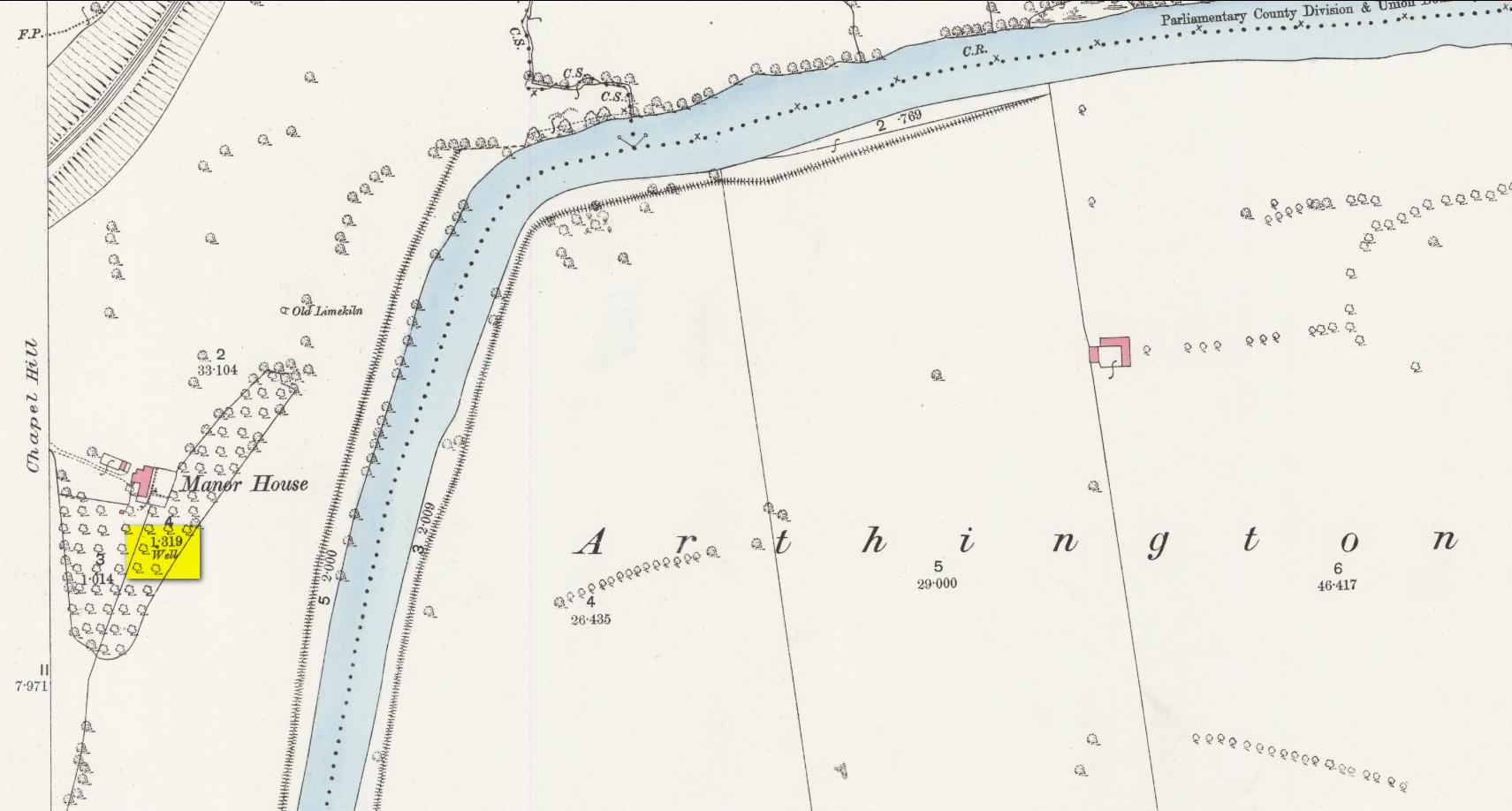
An important water source for local folk in Castley hamlet in previous centuries, this was one of several so-called ‘Wishing Wells’ above the higher banks of the River Wharfe a few miles from each other. It’s a title which, to be honest, was afforded the place when its original local name was removed. It was quite obviously a sacred well in earlier times, as it’s found beneath the slope of Chapel Hill, looking eastwards towards the rising sun, when the waters here (as at countless others) had their greatest remedial or magickal powers. Tradition told there was once a small chapel above the well itself. The spring was highlighted on early Ordnance Survey maps, but all that seems left here today is an occasional boggy mass in the trees at the bottom of the sloping hill.
The old folklorist and antiquarian Edmund Bogg (1904) wrote the following about it:
‘Wishing’ Well on 1888 map
“On the terraced bank near the garden, ’neath an overhanging hawthorn, is a beautiful spring of clear sparkling water, which is locally known as Castley ‘wishing-well.’ More than once we have heard the women-folk declare how, in their maidenhood, they loitered down the bank to the well, usually at eventide, when the birds were warbling their vesper song, and placed their offerings there in silence, yet breathing, as it were, the mute longing of their heart’s desire. It is a natural grotto fit habitation of fairies or the traditional elves. The bank, in which the well is situated, is known as ‘Snake Bank.’”
References:
Edmund Bogg, Higher Wharfeland, James Miles: Leeds 1904.
Acknowledgements:Huge thanks for use of the Ordnance Survey map in this site profile, reproduced with the kind permission of the National Library of Scotland.
Your best starting point is from the Great Skirtful of Stones giant cairn. From here follow the fencing that runs down the slope to your left (south-east) for roughly 160 yards (148m) – past the Great Skirtful Ring – until you reach the gate. Go through it and keep walking down the same fence-line for 300 yards then walk south onto the moorland proper (there are no paths here). You’ll pass over several undulations in the heather (some of these are the edges of ancient trackways) and 55-60 yards south from the fencing you’ll walk over and into this overgrown prehistoric ring. It’s very difficult to see when the vegetation is deep, so persevere!
Archaeology & History
Site shown on 1851 map
This is an interesting site. Marked on the 1851 Ordnance Survey map as a “barrow” (right), it is shown with trackways on either side of it to the north and south, and with an opening or entrance on its northwestern side. Yet since that date, very little archaeological attention has been given to it and the site remains unexcavated, despite its location being repeated on all subsequent maps since then. The designation of the site as a barrow or burial site, without being excavated, was educated guesswork at the time as the place seems to be what we today define as a ring cairn. And whilst this seems likely, there are some oddities here.
Measuring roughly 25 yards (SE – NW) by 21 yards (NE – SW), this overgrown oval ‘ring’ is a similar architectural structure to the more famous Roms Law circle more than half-a-mile northwest of here—but bigger! And, unlilke Roms Law, this overgrown circle seems to have been untouched for many centuries. The oval surrounding ‘ring’ itself is composed of thousands of small packing stones between, seemingly, a number of much larger upright stones, reaching a maximum height of more than three feet high at the northernmost edge. The ‘ring’ ostensibly looks like a wide surrounding wall which measures two yards across all round the structure.
Track running into the ringRaised line into the ring
Internally, there seems little evidence of a burial — although our recent visits here, as the photos indicate, took place when the moorland vegetation was deep and covered almost the entire site. The outline of the site is obviously visible, even in deep heather, but the smaller details remain hidden. But in addition to the main ring, another very distinct ingredient here is the existence of an extended length of man-made parallel walling, probably a trackway, that runs into the circle from the southeast all the way through the circle and out the other side and then continuing northwest heading roughly towards the Great Skirtful giant cairn on the horizon 500 yards to the northwest.
Stone at NE arc of walling
Due to the landscape being so overgrown, it’s difficult to ascertain where this ‘trackway’ begins and ends. Added to this, we find that there are additional ‘trackways’ that run roughly parallel to the one that runs through the circle—and these ‘trackways’ are very old indeed, some of them likely have their origins way back in prehistory. The one that runs through the middle of this ring cairn may be a ceremonial pathway along which, perhaps, our ancestors carried their dead. If we follow it out from here and keep walking along the track 300 yards to the southeast, we eventually run right to the edge of the Craven Hall (3) circle. Parallel to this is another ancient trackway that runs northwest to the edge of the Roms Law circle. It seems very much as if we have ceremonial trackways linking sites to each other: ancestral pathways, so to speak.
Have a gander at this when you’re next in the area. There are many other sites nearby that are off the archaeological radar. In recent years, a number of northern antiquarians wandering over this landscape are finding more and more ancient remains: walling, circles, cairns, trackways. It’s a superb arena—but sadly, most of it is hidden beneath deep moorland vegetation.
References:
Faull, M.L. & Moorhouse, S.A. (eds.), West Yorkshire: An Archaeological Guide to AD 1500– volume 1, WYMCC: Wakefield 1981.
Acknowledgements:Huge thanks for use of the Ordnance Survey map in this site profile, reproduced with the kind permission of the National Library of Scotland.
Cup-Marked Stone (lost): OS Grid Reference – SE 2556 4687
Also Known as:
Carving no.556 (Boughey & Vickerman)
Archaeology & History
We know very little about this carving, which was first highlighted on Eric Cowling’s (1940) map of Wharfedale petroglyphs. Described simply as one of the “cup-marked rocks”, he mentioned it briefly in Rombald’s Way (1946) as being “the most easterly carving” in mid-Wharfedale—which it was at the time (a very recent find by Benn Potts of a cup-marked stone at Weeton has pushed the boundary further eastwards). Oddly for Cowling, he left no further notes nor sketch of the carving and when Stuart Feather (1961) came to write of it, he merely copied Cowling’s earlier words. It’s not been seen since. In Boughey & Vickerman’s (2003) survey, they could find no cup-marked stone in the wood but thought instead that,
“this may be due more to confusion than to loss of the carving. Riffa Wood does contain a carving: of a Native American on a conspicuous rock alongside one of the many woodland paths. Furthermore, one or two local residents recall a German prisoner carving something on a rock in Riffa Wood during the Second World War. Presumably, this is the origin of the Native American carving. Could it be that this man added something of his own to what was already a carved rock, in which case the Native American as he now appears is the site noted by Cowling before the War?”
No cup-marks exist on this Native American carving, and it’s highly unlikely that Cowling would have made such an elementary mistake. The carving no doubt lies covered in woodland vegetation waiting, once more, for the day that someone comes along and exposes its visage to the world again. Let us know if you manage to find it…
References:
Boughey, Keith & Vickerman, E.A., Prehistoric Rock Art of the West Riding, WYAS: Wakefield 2003.
Cowling, E.T., ‘A Classification of West Yorkshire Cup and Ring Stones,’ in Archaeological Journal, volume 97, 1940.
Cowling, E.T., Rombald’s Way: A Prehistory of Mid-Wharfedale, William Walker: Otley 1946.
Feather, Stuart, “Mid-Wharfedale Cup-and-Ring Markings,” in Cartwright Hall Archaeology Group Bulletin, volume 6, no.3, March 1961.
Acknowledgements:Huge thanks for use of the Ordnance Survey map in this site profile, reproduced with the kind permission of the National Library of Scotland.
Naathen… I’d give you the directions of how to find this stone, but I’m not sure of its precise location. Just get to the top of Reva Hill, on its more westerly side, and it’s somewhere on its upper slopes. I was up here again recently and hoped to find it, but the grasses might have grown back over it. If one of you petroglyph fans manages to locate it, please can you send me its exact grid-reference, so I can update the site profile.
Carving when wetFaint Reva Hill carvingCarving when wet
Archaeology & History
This was one in a cluster of carvings that were rediscovered in 2011 and which I’ve not managed to re-locate (bad boy). It’s very plain and simple, as you can see. Indeed, I was lucky to even notice it, as the central photograph above shows how faint and eroded the cup-marks are in normal light. Thankfully with a bit of water, what I initially thought may have been two cup-marks, turned into three or four of them. So the next time you’re having a look at the Fraggle Rock carving and its companions, remember that this little fella is hiding somewhere close by…
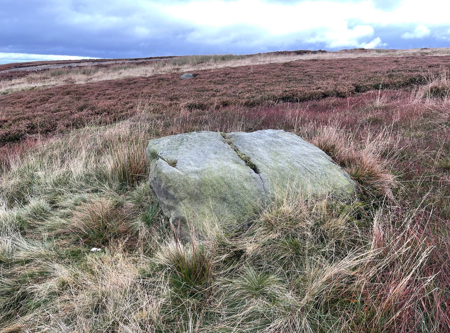
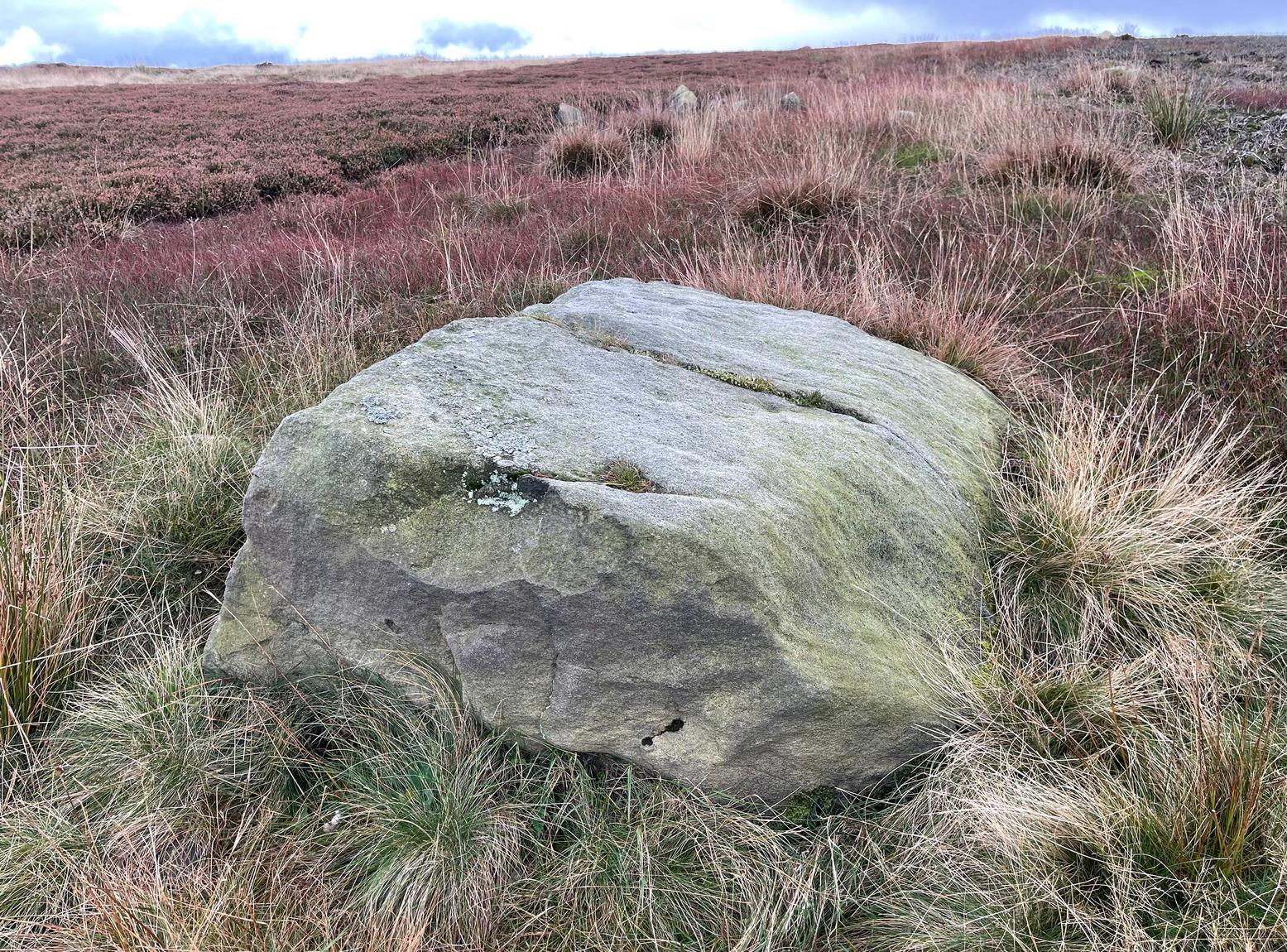
From Cow & Calf Rocks, walk up the steep footpath and turn left (southeast) when it levels out on the edge of the moor. Walk 250 yards along and, where the main path veers down to the road, just keep walking along in the same direction along the footpath that runs gradually uphill until, after 650 yards (595m) you’ll eventually meet up with the footpath that runs along the moorland proper. Where these two paths meet-up, then head upwards (south) into the heather for 55 yards (50m) until you see a good-size sloping block of stone with a crack roughly down the middle. If you hit the Little Haystack Rock (a big conspicuous stone) you’ve gon too far!
Archaeology & History
Shallow cupmarks visible
This is one of the many basic cup-marked stones you’ll find scattered all over these moors possessing (as it does) only two distinct cup-marks on its more northern half, although a possible faint third one needs looking at in better light. When we were kids exploring this and other areas, single and double cup-marked stones like this seemed ten-a-penny and we’d flippantly pass them by after quick perusal, looking for more impressive designs.
The carving here seems to have been missed in the surveys of Hedges (1986) and Boughey & Vickerman (2003), despite the rock standing out quite distinctly. I can only assume that they checked it out when the skies were grey and dull, making the cup-marks difficult to see. A number of other prehistoric remains can be found close to this carving, including cairns and sections of enclosure walling.
Folklore
Tradition tells that the indigenous Britons had a battle with the Romans on the plain where this carving is found.
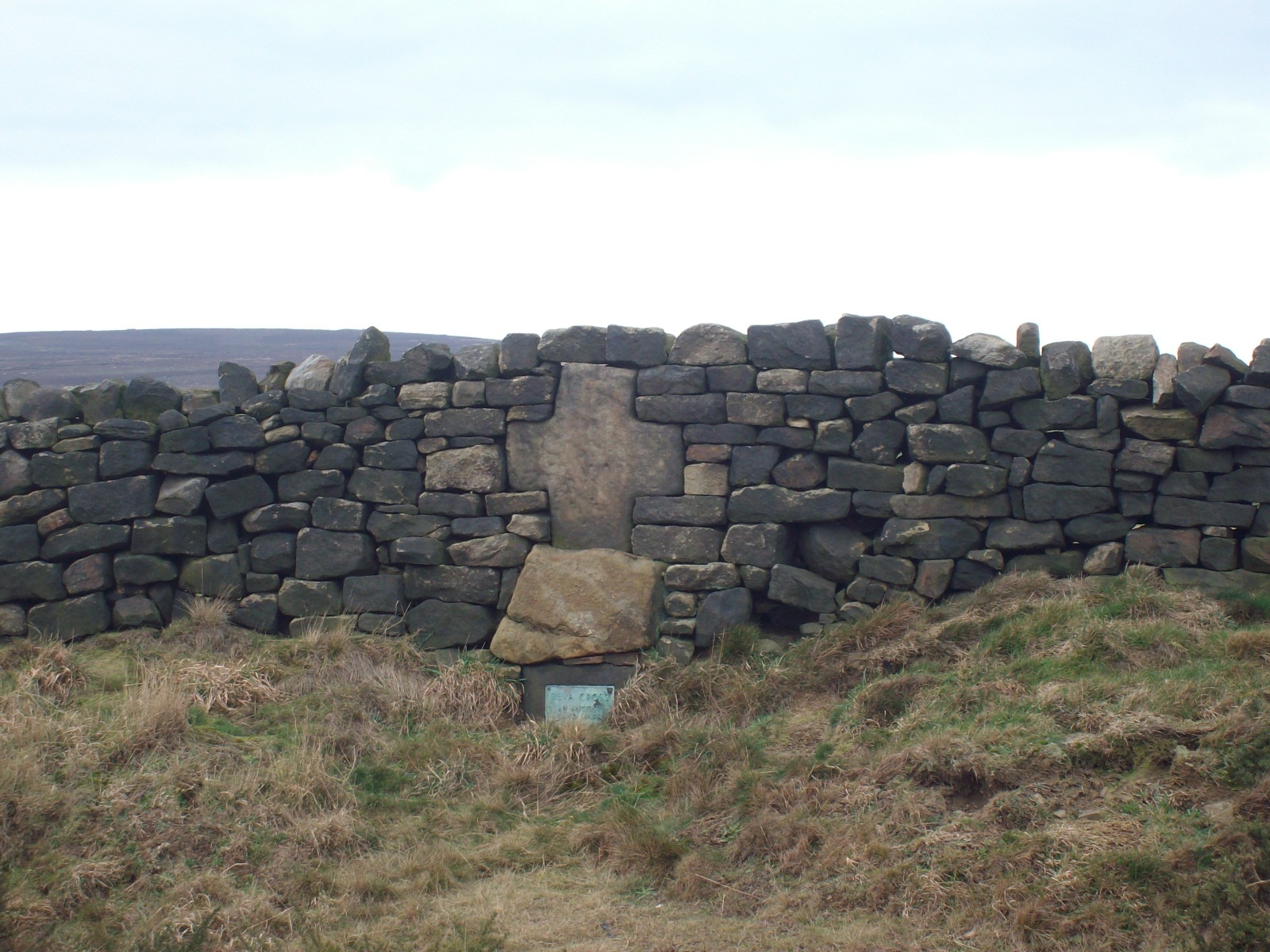
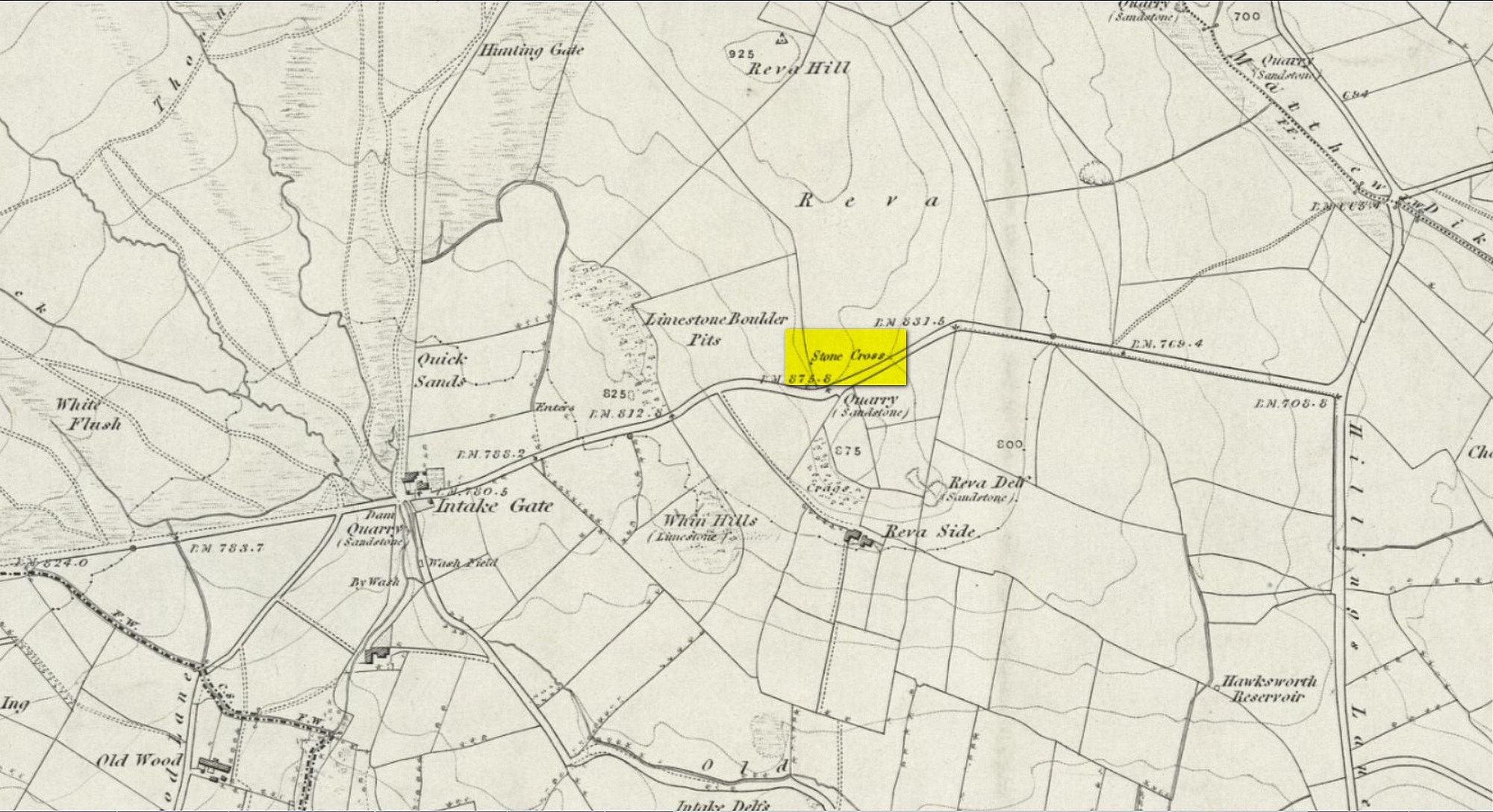
Two main routes to get here: i) from Dick Hudson’s public house, head left (east) along Otley Road (passing Weecher reservoir) for 1.9 miles (3.1km) until you reach Reva reservoir where a track leads you to the waters, and there’s a small parking spot on the left-side of the road. Stop here. (ii) coming from Hawkworth and Guiseley, head west along Hawksworth Lane which runs into Goose Lane and, at the T-junction at the end, turn right and nearly 500 yards along on the left-side of the road is the same small parking spot. From here, walk uphill for nearly 150 yards and then look at the walling to your left.
Archaeology & History
Reva Cross on 1851 map
This relic can be found on the far eastern edges of Hawksworth Moor, near Guiseley, and was said by the historian Eric Cowling to have originally stood upon a large rock nearby. It has an odd history. Initially, the cross was an ancient boundary or mark stone, referred to in a 15th Century document and outlined by William Preston in 1911, that marked the limit of the southern township of Burley township. Local historian C.J.F. Atkinson asserted that this cross in fact came from Otley, although his ideas were considered somewhat “fanciful” by archaeologists and other historians.
Its present position by the roadside is relatively new as it stood, not too long ago, a short distance away in the field to the rear, as highlighted on the early OS-map of this area. E.C. Waight of the archaeology division to Ordnance Survey wrote:
“Situated at SE 1530 4297 on the western side of the gate from the road into the field containing the remains of Reva Cross is a cross base (apparently in situ) serving as a bolster stone to the wall head at the gate opening.”
He described the dimensions of the base and the remainder of the cross, both of which “are contemporary with one and other,” he told. In the 1960s, the local council moved the cross to its present position.
Tradition told that despite its religious symbolism, it was also used as a market cross in bygone times. A certain Mrs Fletcher (1960), writing to the Cartwright Hall Archaeology Group, narrated that,
“Mrs Turner Greenwood….tells me that her mother, who, if living, would be in her nineties, lived at Gaping Goose Farm on the western side of Reva Hill… Mrs Greenwood’s father.. .remembered the cross erected on this hill, and related seeing the roads black with people climbing to it from Otley and Bingley, for the market held there.”
Despite this, Sidney Jackson was somewhat sceptical of it being the site of a market. Weather conditions and the bleakness of the spot would have made this site somewhat intolerable, he thought. However, people in previous centuries were much hardier than modern people and so it’s not as unlikely as you’d initially think.
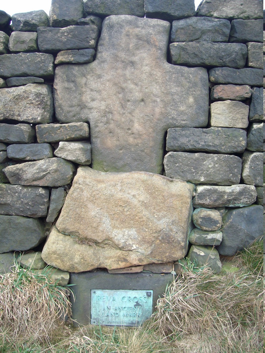
Close-up of cross
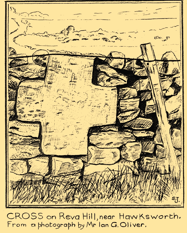
Sid Jackson’s sketch
A much more interesting tradition of the cross was its use in times gone by as a Plague Stone. However, this name only applied to the cross-base at the time as no cross was stood upon it; merely a natural rock laid upon the moorside with a basin cut into it. It gained this name around the time of the great plague of 1660. During the plague, food was left on this table-like rock and money in return was placed in a basin full of vinegar. This tradition may have originated at the large natural rock bowl on one of the earthfast stones near the very top of Reva Hill a short distance to the west (also a number of cup-marked stones are close by and folklore records show that some cup-marks had healing properties). One account tells that it was Sir Walter Hawksworth (of the legendary Grand Lodge of ALL England masonic lodge) who was responsible for the siting of the cross as a Plague Stone.
References:
Cowling, Eric T., Rombald’s Way, William Walker: Otley 1946.
Cowling, Eric T., ‘Letter,’ in Cartwright Hall Archaeology Group Bulletin, 5:5, May 1960.
Fletcher, Elsie, “Letter,” in Cartwright Hall Archaeology Group Bulletin, 5:5, May 1960.
Jackson, Sidney, “Ancient Crosses,” in Cartwright Hall Archaeology Group Bulletin, 1:12, 1955.
Jackson, Sidney, “Cross on Reva Hill,” in Cartwright Hall Archaeology Group Bulletin, 5:1, p.2, 1960.
Jackson, Sidney, “Reva Hill Cross Base Found,” in Cartwright Hall Archaeology Group Bulletin, 9:9, September 1964.
Jackson, Sidney, “Fresh Site for Reva Cross,” in Cartwright Hall Archaeology Group Bulletin, 11:7, July 1966.
Preston, William Easterbrook, “On an Ancient Stone Cross on Riva Hill,” in Bradford Antiquary, New Series 3, 1911.
Acknowledgements:Huge thanks for use of the Ordnance Survey map in this site profile, reproduced with the kind permission of the National Library of Scotland.
Take the Wells Road from Ilkley centre up towards White Wells, bending to the right as you hit the edge of the moor. Keep along the road, past the old college building with its lake and turn right up Westwood Drive. Keep going all the way up (it becomes Panorama Drive) till you hit the small woodland on your right. Where the woodland ends – stop! Walk into the trees about 10-15 yards and you’ll see the large rocks ahead of you. Brush back the vegetation and you’ll find it.
Archaeology & History
This large flat rock surface has a scattering of archetypal deep cup-markings, with other fainter marks scattered over most of its surface. It sits right next to carving no.232, with its own equally large, naturally worn basins.
Faint cup&ring just visible
It was visited in the 1870s (along with the other Panorama Stones) and subsequently illustrated in the personal sketch-pad of Mr Thorton Dale (we’re hoping to have them scanned in due course for open Creative Commons use) who showed the basic cup-marks and shaped “lines” or footsteps that give this petroglyph its name. Little more was said of it until Hedges (1986) described it in his survey, whose notes were subsequently repeated in Boughey & Vickerman’s (2003) work as being a “medium-sized flat-topped, upstanding rectangular rock. Eight cups, six deep ovals, faint circles and lines on SW end.” One of the most notable cup-and-rings can just be made out near the middle of the stone, on the left-side of one the footprints.
The depth of these incisions in this design strongly suggests that the carving was worked and reworked over many centuries, suggesting utilitarian usage of some kind, be it ceremonial or otherwise. It’s also very unusual inasmuch as elongated footstep-like cuttings are scarcities, not just in Yorkshire petroglyphs, but in prehistoric carvings across Britain. Check it out when you’re next walking up to the Swastika Stone.
References:
Bennett, Paul, The Panorama Stones, Ilkley, TNA: Yorkshire 2012.
Boughey, Keith & Vickerman, E.A., Prehistoric Rock Art of the West Riding, WYAS: Wakefield 2003.
Hedges, John (ed.), The Carved Rocks on Rombalds Moor, WYMCC: Wakefield 1986.