King’s Yett, St. Ninians, Stirlingshire

Cairn:  OS Grid Reference – NS 7373 8922

Also Known as:

  1. Canmore ID 45951

Getting Here

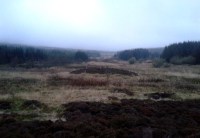
King's Yett cairn, from the track below

King’s Yett cairn, from the track below

Going west out of Stirling or St Ninians, you need to take the minor road/s that cross the M9 and head past the wooded hills, past Graystale and Wallstale.  A mile or so on, keep right when you hit the small road junction past Shielbrae.  A mile past here, where the edges of the road disappears into the moors and the forest grows to your right, park up where the small parking spot takes you down the track into the trees on the right-side.  Walk down here for a coupla hundred yards and keep yer eyes peeled for the rounded fairy-mound on the heaths about 30 yards above you.

Archaeology & History

When we visited this place a few weeks ago, the Dark was almost upon us when we arrived and the clouds were low with a deathly silent mist breathing from the trees and reaching up to meet the low clouds not far above.  It was a curious feeling, borne from the darkening landscape, feeling almost as if the dead were around us—which I suppose they were, in this prehistoric tomb at least.  At the clap of our hands, a great echo rang loudly from the misty silence and the land in which it lived.  Twas almost hypnotic in its lull…..

Looking to the NW

Looking to the NW

King's Yett cairn, looking NE

King’s Yett cairn, looking NE

This site isn’t always gonna have this feel to it of course.  If we’d have visited it on a nice clean blue-sky day, no such feelings would have greeted us—and the tomb would, perhaps, have been little more than an uninteresting-looking mound, overgrown with heather and grasses.  But Nature breathes and casts such entrancements to our central nervous system every now and then—and such states are as worthy of sincere attention as any intellect preys to insist otherwise…. and I should know!

The King’s Yett cairn has yet to be excavated, but it has all the hallmarks of a traditional Bronze Age signature in its structure.  When the Royal Commission  lads came here in 1954, after a report describing the mound, their brief account of it (1963:1) later told, simply:

“A cairn is situated on open moorland, a quarter of a mile W of King’s Yett, at an elevation of 950ft OD.  It consists of a grass-covered, stony mound which measures about 30ft in diameter and stands to a height of 4ft 6in.  A rectangular boulder which lies in the S arc of the base of the cairn, and which appears to be in situ, may have formed part of a peristalith.” (i.e., an encircling ring of stones, PB)

Adjacent circular mound nearby

Adjacent circular mound nearby

This singular fallen stone is now covered in vegetation and there is little evidence of any stone circle around the tomb.  But immediately west, 70 yards WNW on the other side of the forestry track, rises an even larger circular mound, deeply covered in heather and consisting of earth and stones beneath the surface.  It looks for all the world like another giant cairn (up to 6ft high and measuring about 26 yards (23.9m) E-W, by 27.5 yards (25.2m) N-S) upon which new trees have recently been planted.  It might not be, of course—but we’re gonna look at this again when She gives us more daylight and clearer skies…..just in case…

Locally there are various tales of the Sma’ Folk or little people, fallaciously ascribed by romantic intellectuals as ethereal spirits, but which were and are known to have been tribal people in these uplands; and although such stories excel in this area, we have nothing specific relating to the rounded mound of King’s Yett – yet!

References:

  1. Royal Commission on the Ancient & Historical Monuments Scotland, Stirling – volume 1, HMSO: Edinburgh 1963.
  2. Royal Commission on the Ancient & Historical Monuments of Scotland, Archaeological Sites and Monuments of Stirling District, Central Region, Society of Antiquaries of Scotland 1979.

© Paul BennettThe Northern Antiquarian


Chapel Well, Cambusbarron, Stirlingshire

Holy Well:  OS Grid Reference – NS 7781 9251

Also Known as:

  1. Bruce’s Well
  2. Canmore ID 46248
  3. Christ’s Well

Getting Here

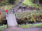
Site of the Chapel Well

Site of the Chapel Well

Along the Main Street in Cambusbarron, walk down Mill Hill for a hundred yards or so, to The Brae.  Just here, a paved footpath goes to the right.  Walk along here for about 120 yards until you reach a small footbridge crossing the stream.  On the other side of this bridge you’ll notice a notice board and a sign.  You’re here!

Archaeology & History

Today, all that remains of this spring of water that was sacred in the animistic pantheon of our ancestors, is a notice board and an epitaph, reading “Site of the Chapelwell (or Christ’s Well)”; but in times past this simple spring of water was a place of considerable activity.  Not only did the local people of Cambusbarron get their water supply from this (and others close to the Main Street), but it was also a place of ritual and reverence.  We know this from early church accounts—most of which were complaints about the traditions performed by local people, in contravention to the christian cult.
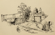
J.S. Fleming's old drawing

J.S. Fleming’s old drawing

The best account of the site is found in J.S. Fleming’s (1898) work, in which we find it also referred to as the ‘Christ’s Well’.  This attribution adds further mystery and controversy regarding another Christ’s Well a few miles away at Blair Drummond, whose position by the academic community is questioned by local historians.  Be that as it may, Mr Fleming’s words on this Chapel Well are worth reading.  He wrote:

“the most famous of all the Stirling Holy Wells, was, early in this century and is still, known by the name of ‘Chapel Well,’ and its water, up till a recent date, was used for domestic purposes by the villagers.  It originally consisted of a square, stone-built, open well, with parapets, but its walls are now built up and roofed, and it has a door, now shut up, however, and the well closed by the sanitary authorities of the district.  The well is situated on the brink of what we assume to be Glenmoray Burn, here crossed by a rustic wooden bridge in a part of the Chapel Croft garden, containing the alleged site of the chapel, from which it is distant a few feet.  The stump of an ancient thorn is shown on the right hand of the sketch.  The overflow of water empties itself into the adjoining burn.  The site of this famous well has been so variously described as to almost challenge its identity, but the authorities examined, all, with one single exception, afternoted, virtually agree in its situation:

“1) Sutherland, about a hundred years ago, writes:  “Not far from St. Thomas’ Well there is another, on the farm of Chapel Croft, called ‘Christ’s Well,’ of great repute, and visited by women, etc.”

“2) Dr. Rogers, later, after referring to the Chapel of Cambusbarron, says ”two of the three wells connected with the establishment still exist near its site by the margin of Glenmoray stream.”

“3) Another writer says: ‘”Christ’s Well,’ now called ‘ Chapel Well,’ is at bottom of a small dell called Glenmoray, immediately adjoining Cambusbarron, and there is a tradition that here the water was got for the religious services at the Battle of Bannockburn, one redeeming quality of the superstition which would consecrate its water.”

“4) A writer, over the initials “S.I.,” in the Stirling Observer of 27th September, 1866, says:  “Within its Chapel King Robert the Bruce partook of the sacrament on the eve of the Sabbath preceding the Battle of Bannockburn, and its sacred font was the resort at Beltane of the superstitious of a former age, as may be seen from extracts from kirk session records.”

“These all agree that ‘Christ’s Well’ was situated not far from St. Thomas’ Well, on Chapel Croft; that it and other two wells existed some few years ago near the site of the Chapel, on the margin of Glenmoray stream, by the name of “Chapel Well”; ” is situated in a small dell called Glenmoray, and is immediately adjoining Cambusbarron; and that it retains, and is presently known by, no other name than the “Chapel Well.”  Further, a small distillery, now removed, situated a few yards from the Chapel on this burn, taking its name from the glen and burn, was called Glenmoray Distillery…”

“However, a writer in the Stirling Observer of 7th September, 1871, in an article on “Touch Glen,” says that not far from the road leading to the three reservoirs on Touch Hills, two of the three Wells connected with the Chapel (which, he states, is 1000 yards distant from Gartur Lodge) still exist, and may be seen near the brink of a little burn which trickles from the miniature glen of Glenmoray, visible on the hillside just below the lowest reservoir. This burn is crossed by a small stone bridge on the main road, and is known as “Johnnie’s Burn.” These Holy Wells, including Chapel Well, would thus, according to this writer, be about a mile, if on “Johnnie’s Burn,” and if near the lower reservoir, on Touch Hill,’ fully a mile and a half from Chapel Croft and the Chapel…

“…The Church dealt severely with the devotees—principally women—who resorted to the virtues of “Christ’s Well,” as is shown by the session records, from which we make a few extracts: —

“July 12, 1610. — The quhilk day compeirit Grissal Glen and Marioun Gillaspie quha for ther superstitione in passing in pilgrimmage to ‘Christe’s Well’ as they confessit the last day ar ordeinit to mak publick repentance the next Sonday in lining claithis.”

” 1 June, 1630. — The quhilk day compeirit Elspet Aiken, spous to Anclro Cuyngham, tinckler; Jonet Harvie, William Huttoune, cutler; Margaret Mitchell, dochter to Alex Mitchell; Jonet Bennet, dochter to James Bennet, cuick; James Ewein, son of John Ewein, wobster, Margt. Wright, James Watsoune, who confessis passing in pilgrimmage to ‘Christe’s Well’ in Mai, and thairfoir they ar ordeaned to mak publik repentance the nixt Sabbat in thair awin habeit, under the paine of disobedience.”

” Lykway I, Mr. Patrik Bell, am ordeaned to desyre the breithren of the Presbyterie to appoint ane actuale minister for to preach upon Sonday nixt for to tak ordour with the said persounes above writen.” (Note — This offence seems a mere ploy of young people observing May morning, as is done at the present day on the first of May, and the responsibility “of asking” an “actual minister’s aid” to take “order” with the accused seems treating the offence too seriously.)

“6 October, 1631. — The quhilk day compeirit Jonet Norbell, in Cambusbarron, for going for water to help her sick son; and Jonet Main, in Cambusbarron, going to ‘Christe’s Well’ for water for help to her bairns; “and for another offence are ordained” to sair the pulpit on Sonday nixt in her ain habit to mak repentance.”

Mr Fleming seemed to think the traditions of Mayday a healthy thing and wrote well of local traditions, speaking of the healing virtues of the dew on May morning, used by people all over the country; also remembering a song that would be sung in honour of “the delightful custom of maying”:

I, been a rambling all this night,
And some time of this day ;
And now returning back again,
I brought you a garland gay.

Why don’t you do as we have done
The very first day of May ?
And from my parents I have come,
And would no longer stay.
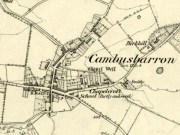
Chapel Well on 1865 map

Chapel Well on 1865 map

Modern plaque at the site

Modern plaque at the site

The fact that Mr Fleming cites the Chapel Well to be known locally as the ‘Christ’s Well’ needs to be remembered when you visit a site of the same name 5 miles northwest of here at Blair Drummond.  It was a place of considerable renown and much used by local people for a variety of indigenous rites and customs for many miles around.  The ancient Scottish practices were still very much alive…

References:

  1. Fleming, J.S., Old Nooks of Stirling, Delineated and Described, Munro & Jamieson: Stirling 1898.
  2. MacKinlay, James M., Folklore of Scottish Lochs and Springs, William Hodge: Glasgow 1893.
  3. Morris, Ruth & Frank, Scottish Healing Wells, Alethea: Sandy 1982.
  4. Roger, Charles, A Week at Bridge of Allan, Adam & Charles Black: Edinburgh 1853.

© Paul BennettThe Northern Antiquarian


Holy Well, Cambusbarron, Stirlingshire

Holy Well (destroyed?): OS Grid Reference – NS 7787 9252?

Archaeology & History

A small but ancient chapel once existed in Cambusbarron, long ago, located about one hundred yards east of the Chapel or Christ’s Well.  William Drysdale (1904) told that, apart from the Chapel Well and nearby St. Thomas’ Well, “several other wells in the locality were believed to possess healing virtues.”  It was J.S. Fleming (1898) who said that, “attached to Cambusbarron Chapel two other holy but nameless wells are stated to have been in existence in 1866, on the brink of Glenmoray Burn, near the chapel itself.”

A writer for the Stirling Observer in 1871 told that one of these holy wells was in fact to “be seen near the brink of a little burn which trickles from the miniature glen of Glenmoray, visible on the hillside, just below the lowest reservoir” above Touch, more than a mile away (heading up towards St Corbet’s Well).  The other was said to be near Johnnie’s Burn, a mile to the west.  In Fleming’s (1898) opinion however, neither of these sites were feasible, as he walked all along the course of both burns and could find no other wells.  Does anyone know any different?

References:

  1. Drysdale, William, Auld Biggins of Stirling, Eneas Mackay: Stirling 1904.
  2. Fleming, J.S., Old Nooks of Stirling, Delineated and Described, Munro & Jamieson: Stirling 1898.

© Paul Bennett, The Northern Antiquarian


Boiling Springs, Cambusbarron, Stirlingshire

Healing Wells (destroyed):  OS Grid Reference – NS 77 91

Archaeology & History

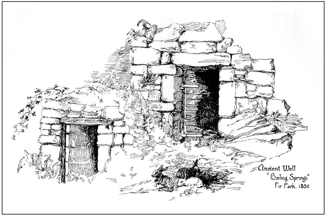
Old drawing of the lost wells

The old line drawing here is all that remains of a pair of healing wells that once bubbled up within their ancient stone well-houses, close to each other, in the middle of the old woods west of Stirling in the massive quarries at Gillies Hill.  It’s possible that the large pools of water that are now in the overgrown quarries are thanks to these ancient wells; although one of them was close to the old building of Fir Park, whose overgrown remains are within the woods at grid-reference NS 7787 9124.  Very little has been written about these wells, but thankfully the local historian Mr Fleming (1898) captured their demise in his lovely antiquarian work, saying:

“The sketch, opposite (taken in 1850) of the picturesque wells, then situated in a marshy dell and surrounded by a dense pine wood near to the ancient ‘Boiling Springs’, now dried up by the sinking of the lime pits, and immediately off the old bridle road from Stirling to Glasgow by Murrayshall, shows very ancient remains of wells connected with the original water supply of Stirling by lead pipes from ‘Lessfeerie Springs’, situated in the Touch Hills.  This supply was begun in 1774, and thus antiquity and interest are given to the sketch.  These wells, with their fringes of mosses and ferns and bramble bushes, are now, with the pine wood, demolished, and the whole face of the district changed by the operations in a quarry recently opened up in Gillies Hill crag, causing the locality to be now unrecognizable.”

References:

  1. Fleming, J.S., Old Nooks of Stirling, Delineated and Described, Munro & Jamieson: Stirling 1898.

© Paul Bennett, The Northern Antiquarian


St. Corbet’s Well, Touch, Stirlingshire

Holy Well:  OS Grid Reference – NS 738 925

Archaeology & History

This little-known holy well on the northeastern edges of the Touch Hills is another part of our ancient heritage that may well have been lost.  All that now remains are the literary remnants telling of this once important site, around which local socio-religious elements occurred from time to time.  When the local historian J.S. Fleming (1898) wrote about the site, it had already disappeared, and was himself fortunate to recover information relating to its former existence. He told:

“My attention has been drawn to an article which appeared in the Stirling Journal of 31st October, 1834, describing what is claimed to be a Holy Well dedicated to Saint Corbet, or probably Saint Cuthbert.  The well was situated in Touch Glen, not far from Gilmour’s Lynn, and was, even at that time, reduced to a spring one foot deep and three or four feet in circumference, surrounded by boggy ground.  The writer states that there were people then alive who had resorted to this Well in their younger days.  Its virtues were restricted to one hour in the year, and that the hour of sunrise on the first Sabbath of May; the supposition being that by drinking of its waters at the Well by the adventurous pilgrims to such a wild and lonely spot at early sunrise, the devotee was assured of the preservation of his life during that year.  We have never come across this Saint’s name, but Saint Cuthbert had an altar in the Rude Kirk (High Church of Stirling) and, as for the Well, from its diminishing condition in 1834, its site no doubt has long been obliterated.”

It is possible that some remnant of the waters here can still be found, or are known about, by dedicated local practitioners—but without their aid, this sacred site may be forever lost…

Folklore

In Thomas Frost’s (1899) essay on the holy wells of Scotland, he echoed what Mr Fleming had told, saying:

“Of St. Corbet’s Well, on the top of the Touch Hills…it was formerly believed that whoever drank its water before sunrise on the first Sunday in May was sure of another year of life, and crowds of persons resorted to the spot at that time, in the hope of thereby prolonging their lives.”

This restorative folklore element, implicit in the nature of water itself, was obviously related to the cycles of renewal in the social activity of our peasant ancestors, as found in every culture all over the world. (Eliade 1959; 1989)

One account relating to the disappearance of St. Corbet’s Well told that it fell back to Earth as the spirit of the site was insulted by profane practices.  Janet & Colin Bord (1985) told that:

“This theme, of real or imagined insult to the well causing it to lose its power, move its location, or cease flowing altogether, is widespread.  St. Corbet’s Well on the Touch Hills (Stirling) was said to preserve for a year anyone who drank from it on the first Sunday in May, before sunrise, and it was visited by great crowds at the height of its popularity.  But the drinking of spirits became more popular than the drinking of well water, so St. Corbet withdrew the valuable qualities of the water, then eventually the water itself stopped flowing.”

References:

  1. Andrews, William (ed.), Bygone Church Life in Scotland, W. Andrews: London 1899.
  2. Bord, Janet & Colin, Sacred Waters, Granada: London 1985.
  3. Eliade, Mircea, The Sacred and the Profane: The Nature of Religion, Harcourt, Brace & World: New York 1959.
  4. Eliade, Mircea, The Myth of the Eternal Return, Arkana: London 1989.
  5. Fleming, J.S., Old Nooks of Stirling, Delineated and Described, Munro & Jamieson: Stirling 1898.
  6. Frost, Thomas, “Saints and Holy Wells,” in Bygone Church Life in Scotland (W. Andrews: Hull 1899).
  7. Morris, Ruth & Frank, Scottish Healing Wells, Alethea: Sandy 1982.
  8. “W.H.”, “St Corbet’s Well,” in The Stirling Antiquary, volume 3, 1904.

AcknowledgementsWith thanks to Ray Spencer for pointing out the Sacred Waters reference. Cheers Ray!

© Paul Bennett, The Northern Antiquarian