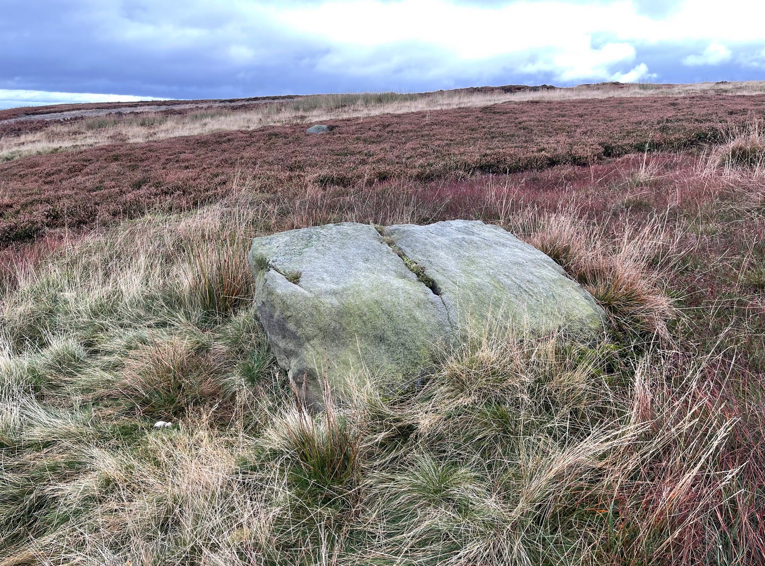
From the Cow & Calf car-park, walk towards and past the gigantic Calf rock, swerving round the fallen mass of rocks and into the trees at the back. Walk uphill to the Hanging Stones cup and ring stones, then keep heading—down the slope then back up the next one—west, for barely 100 yards until you’re on the level ground again, following the footpath alongside the heather. Barely 50 yards along, keep your eyes peeled in the heather for a low flat rock just a few yards in. Forage around and you’ll find it.
Archaeology & History
You’ll no doubt be seeing this carving after you’ve visited the impressive Hanging Stones petroglyphs 150 yards to the east. And you’ll probably be disappointed in its lack of visual grandeur when compared to its more ornate eastern neighbour. But the petroglyph fans among you should give it your attention.
Hedges 1986 sketchLooking to the SE
When the dawn or evening daylight cuts across the rock, the design looks much better than at sun high, perhaps telling us that the message of the stone coincided with those periods of the day. The gentle folds of the stone itself morph into the carving: evening and morning light cutting subtle shadowy folds across the rock, giving it an organic texture that our aboriginal ancestors told to be a vital essence of stone itself. The two small clusters of cup-marks upon this stone become greater than their basic design when brushed with the shadows and glows of a sunset. And when our aboriginal peoples painted them in ochre and other colours, an even greater mythos emerged—but sadly it is forgotten here….
When looked at with the simplistic eyes of the archaeo-mind, this and its compatriots are little more than a number of marks on lifeless rocks. This stone for example was described in John Hedges’ (1986) survey as being just “two groups of four and five cups and grooves”—nothing more—with naught but an echo in Boughey & Vickerman’s (2003) later work. The carving has neighbours even more basic in the heather close by…
References:
Boughey, Keith & Vickerman, E.A., Prehistoric Rock Art of the West Riding, WYAS: Wakefield 2003.
Hedges, John (ed.), The Carved Rocks on Rombalds Moor, WYMCC: Wakefield 1986.
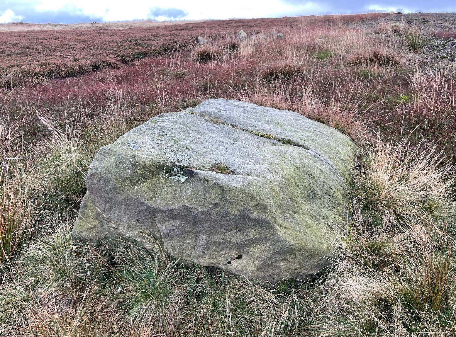
From Cow & Calf Rocks, walk up the steep footpath and turn left (southeast) when it levels out on the edge of the moor. Walk 250 yards along and, where the main path veers down to the road, just keep walking along in the same direction along the footpath that runs gradually uphill until, after 650 yards (595m) you’ll eventually meet up with the footpath that runs along the moorland proper. Where these two paths meet-up, then head upwards (south) into the heather for 55 yards (50m) until you see a good-size sloping block of stone with a crack roughly down the middle. If you hit the Little Haystack Rock (a big conspicuous stone) you’ve gon too far!
Archaeology & History
Shallow cupmarks visible
This is one of the many basic cup-marked stones you’ll find scattered all over these moors possessing (as it does) only two distinct cup-marks on its more northern half, although a possible faint third one needs looking at in better light. When we were kids exploring this and other areas, single and double cup-marked stones like this seemed ten-a-penny and we’d flippantly pass them by after quick perusal, looking for more impressive designs.
The carving here seems to have been missed in the surveys of Hedges (1986) and Boughey & Vickerman (2003), despite the rock standing out quite distinctly. I can only assume that they checked it out when the skies were grey and dull, making the cup-marks difficult to see. A number of other prehistoric remains can be found close to this carving, including cairns and sections of enclosure walling.
Folklore
Tradition tells that the indigenous Britons had a battle with the Romans on the plain where this carving is found.
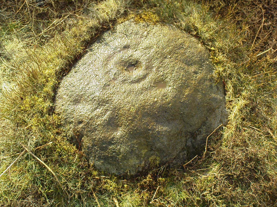
From Ilkley train station, head up Cow Pasture Road and get to the Cow & Calf Hotel (if needs be, ask a local). From its car-park, cross the road and go along the straight-ish footpath onto the moor. Less than 200 yards on, you’ll hit a main track (and a faint cup-marked stone). OK – walk down this track (left) for 30-40 yards, then walk left again into the heather for about 10 yards. You’re looking for a small rounded stone and you’re damn close!
Archaeology & History
…and from another angle
Just over 40 yards east of the very basic Brown Law cup-marked stone, we find this slightly more exotic petroglyph, keeping low in the undergrowth. Difficult to see unless the daylight is just right, preferably as the sun is rising or setting (as with many neolithic carvings), on this small slightly rounded stone we see a central cup-mark surrounded by a double-ring (unfinished, perhaps on its northern edge)—although an outer cup seems to touch the edge of this second ring. As the faint images here show, there are other cups and shallow lines also etched onto the stone, but these are gradually fading as the years go by. It was originally found close to a small cairn that has seemingly been destroyed in recent years.
The carving can be troublesome to find when the heather and bracken gets growing, so it’s best explored in the Winter and early Spring—unless of course you want me to show you it, along with the hundreds of others on these moors! If so, gimme a shout. 😉
References:
Boughey, Keith & Vickerman, E.A., Prehistoric Rock Art of the West Riding, WYAS: Wakefield 2003.
Cowling, E.T., Rombald’s Way: A Prehistory of Mid-Wharfedale, William Walker: Otley 1946.
Hedges, John (ed.), The Carved Rocks on Rombalds Moor, WYMCC: Wakefield 1986.
Cup-and-rings on gatepost (photo credit, Dave Whittaker)
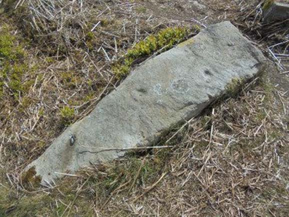
From Ilkley, follow the same directions as if you’re going up to the superb Swastika Stone. Keep walking on the footpath, west, for 65 yards (59m), then walk into the heather on your left. Barely 5 yards in, you’ll see this fallen standing stone or gatepost.
Archaeology & History
First described in one of Stuart Feather’s (1964) old rambles, I first saw this stone in my late-teens and was as puzzled by it then as I am today. Upon an obviously worked stone that may once have stood upright (or was intended to do), two faint and incomplete cup-and-rings were carved – but when exactly? If this stone was cut from a larger rock into its present shape, were the petroglyphs already on it, or were they done when the ‘gatepost’ was created?
It was first described in one of Stuart Feather’s (1964) rambles up here and later included in Hedges’ (1986) survey, where he told it to be a, “recumbent gatepost with one cup with almost complete ring and one cup with vestigial ring.” Boughey & Vickerman’s (2003) survey added little more. And when a group calling itself Carved Stones Investigation got itself about £250,000 to “investigate” the Ilkley petroglyphs, I was hoping that they could have at least turned this stone over to see if other carvings were on the stone – but they just revisited all those found by others, made a new list, and took the money to be honest (no website and no book – as they should’ve done). Thankfully, local folk are having a look at this and others and doing the work they should have. Check it out when you’re next up at the Swastika.
References:
Bennett, Paul, Megalithic Ramblings between Ilkley and Baildon, unpublished: Shipley 1982.
Boughey, Keith & Vickerman, E.A., Prehistoric Rock Art of the West Riding, WYAS: Wakefield 2003.
Feather, Stuart, “Mid-Wharfedale Cup-and-Ring Markings: no.26, 27, 28 – Black Pots, High Moor, Silsden, near Keighley,” in Cartwright Hall Archaeology Group Bulletin, 9:10, 1964.
Hedges, John, The Carved Rocks on Rombalds Moor, WYMCC: Wakefield 1986.
Acknowledgements: Huge thanks to Dave Whittaker for the photo. Good luck with the plans fellas.
Fairy Mine, Bingley Moor (photo by James Elkington)
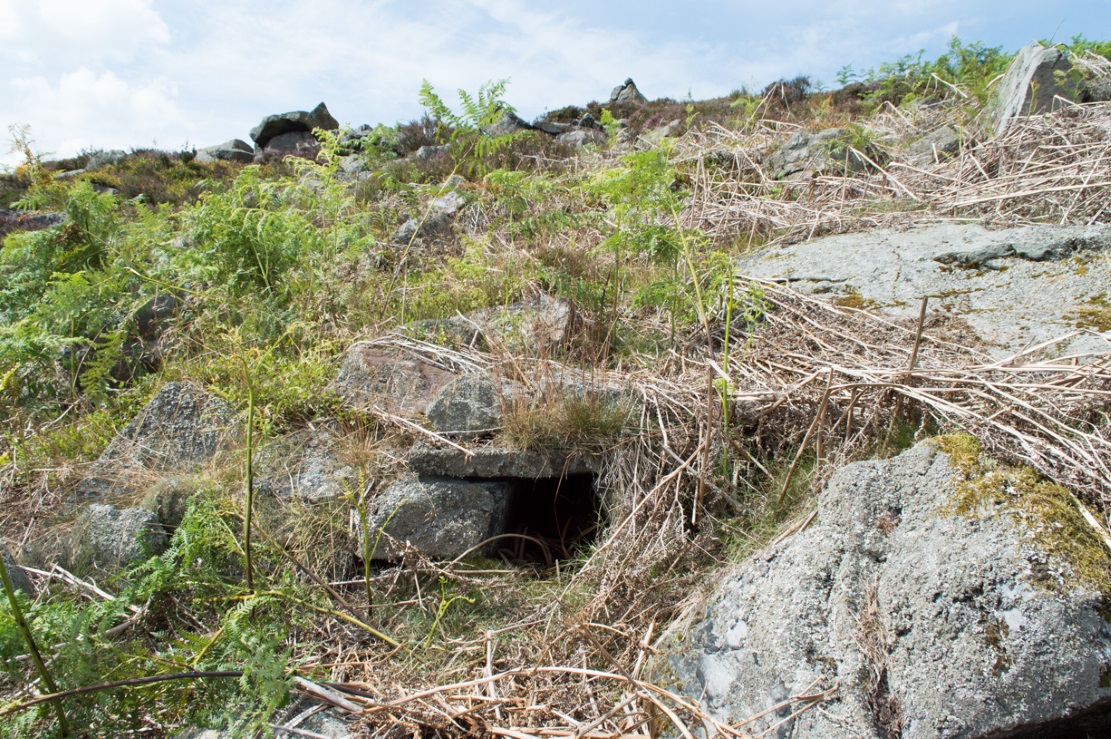
This is a strange one. A really strange one….. The site would not have even been written about had it not been for James Elkington pushing me to make its existence visible to a wide audience. As with many sites that I’ve rediscovered, this is one of many that I never seem to write about, for various reasons…although I did do a short piece on it (Bennett 2001) many years back in a little earth mysteries mag, but kept the location quiet. But now, James has got me to change my mind about it. If anyone can throw any light onto what they think this site might be, feel free to let us know. With the exception of its early history, this is its story…
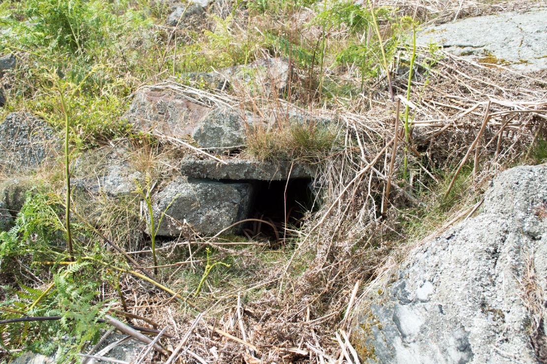
Close-up of the entrance (photo by James Elkington)
One weekend in the early Spring of 1977, Jon Tilleard and I made our weekly wander onto the southern edges of Rombalds Moor, doing little as usual apart from maybe seeking out the curious cup-and-ring stones and other ancient remains, along with walking through the obligatory bogs and wetlands, getting filthy and wet through as healthy kids do at that age. After making our way to Horncliffe Well (generally our first point of call most weeks), we decided to head straight west, off-path as always, and eventually sat ourselves down for something to eat near Wicking Crags on Bingley Moor.
As we packed up again, readying ourselves to walk further onto the moor, John stood upright. In doing so, he dislodged a stone by his feet—right where I was still sitting on the ground!
“Watch out!” he exclaimed loudly—and I quickly rolled forward to get out of the way of the impending stone. Thankfully it wasn’t too big. But then as I turned round to see what had happened, I saw John stood on the small rocky rise he’d been sitting upon—and right beneath his feet, the stone that he’d dislodged had been hiding a very curious secret indeed…
As the photos show, a small opening led into the Earth right underneath where Jon had been sitting. The stone he’d accidentally kicked away had covered and sealed a previously unrecorded entrance. Now, after however many centuries it had been closed and secret, he’d uncovered it again. For us two fourteen-year-old lads gazing into this passageway, our imaginations started running riot!
“What the hell izzit!?”—we must have exclaimed a dozen times or more to each other! To this day, we still don’t know.
I’m not sure how long we stayed here after we’d first found it, but before we left we made sure that the covering stone which had sealed the entrance was propped back upright, securely, so that no one else could find it. The site was quite a way off-path, at the head of a very large boggy area where—to this day—people very rarely walk (in all my years of walking these moors, I’ve yet to see another human walking in this area).
In looking into the tunnel for the very first time, the ground on the outside was of course covered by the usual moorland vegetation; but an inch behind where the stone had sealed this tunnel, the floor was grey dust, all the way in. There were no animal tracks, neither mice nor others, no droppings, no nothing (which we thought was rather unusual). No plants of any form were evident. This ‘door’ had been closed for a very long time it seemed. …Today if you visit the site, ferns and other small plants have encroached several feet into the tunnel.
The entrance itself is about 14 inches across, and from the ground to the top covering stone the entrance is less than 12 inches high, showing quite clearly that no humans can walk in or out of it. Which added to the puzzle: what the hell is it? And why was it sealed with a covering stone? But the more we looked (it became our regular port of call each time we were on the moors) the more obvious it became that a huge amount of work had gone into creating this antiquarian oddity.
As Winter came and cleared all the vegetation surrounding the site, we got an increasingly clear picture of it. But this wasn’t before we tried to get inside! Jon and I failed, but our torches showed that it went in for perhaps 10 feet or so and then appeared to be stop, blocked by another stone. Thankfully I had a younger brother, Phil, who was seven-year old at the time—so we took him up to have a look at the place. We figured that only a small person could get inside the tunnel, but we didn’t tell him this (nor my parents!) until we arrived.
With torch in hand, Phil slithered into the entrance and, eventually, his little feet disappeared into the ground. He didn’t seem too happy about it as I remember—but I was his big brother! (cruel – cruel – cruel!) Shouting back down to us as he slithered further and further in, when he reached the blocking stone in the tunnel he exclaimed—”You can go round it!”
“What!? Really!?”
We were excited.
“Keep going Phil,” we urged. But he wouldn’t.
“I’m scared Paul,” he said. “I won’t be able to get back out”—or something along those lines. And he was probably right.
But he managed to get his young tiny body slightly round the blocking stone that he’d reached and shone the torch-light down the extended tunnel. He told that the it just kept going into the hill still further, keeping the same size and dimensions and straightness for about the same distance again—but then it started to curve very slightly, bending to the left (northwest) until it disappeared underneath the entire hillside, stretching out of sight. It seemed from his description, subsequently, that the tunnel went on for another 50 feet at least.
Once he was safely back out, he reiterated how far in it seemed to go. We walked up the hill under which it had been built and Phil bimbled to roughly where he thought the tunnel was as he saw it with the torchlight. Standing on the hilltop, this was obviously an extraordinary feat as there are thousands of tons of rock and earth covering it! Curiously, years later, a dowser who visited the place walked the same route that Phil had described when he went inside it (we told the dowser nothing of Phil’s venture until afterwards).
Denuded walling leading to entrance (photo by James Elkington)Low walling leading to the ‘Mine’ (photo by James Elkington)
When all the moorland vegetation has died back, you can clearly see how the tunnel has been built upon by a large mass of earth and rocks, some of them loose. All round it is an extended collapse of what seems to be quarried stone tumbling down the hillside. At the top of the hill are the remains of old walling and at least two walled structures—although they appear to be post-medieval in nature, not prehistoric. At the entrance itself is evidence of continued walling of some form. It seems as if a wider man-made chamber of some sort may once have stood here, right in front of the present-day entrance. Even if this proves not to be the case, there is very clear evidence that the tunnel which goes into the hillside was once longer, as low walling continues outside away from the entrance, bending away some 50 yards to the southeast, before ending with no indication of additional structural remains. This walled structure swerving out from the entrance is equally perplexing.
The closest prehistoric feature is an unrecorded cairn and petroglyph a few hundred yards away. As far as I’m concerned, this tiny little entrance into the ground isn’t prehistoric. But I’m nonetheless still very intrigued by it, not least because of a few very strange things that subsequently occurred here after we’d discovered it.
Whoever did this, went to a helluva lot of trouble and immense effort to build it. And for what? …Since being opened nearly 40 years ago, very few people have been to see this curious entrance into the Earth. I’ve kept its location hidden. But amongst the visitors has been an archaeologist, a historian, antiquarian authors, occultists and friends. None have been able to say what this site might be. From souterrains to mine-shafts, probably the best suggestion so far was by Mr Paul Hornby who suggested it might have been some sort of kiln, as there seems evidence of fire against one of the stones. But there are anomalies with the site that don’t quite fit the glove of a normal kiln. The extended collapsed ‘tunnel’ which reaches way out, past the entrance which Jon broke in the 1970s, doesn’t make sense; nor the fact that the tunnel goes way into the natural hillside. Indeed, many things here don’t make sense, simply—I presume—because we haven’t asked the right question yet.
But one thing seems obvious: there may be something at the end of this tunnel, deep inside the hill, which someone many centuries ago, for some odd reason, wanted to keep hidden for a long long time. What’s at the end of this tunnel? And if it’s valuable treasure deep in there—it is NOT going to some museum which then, in later years, will be sold off cheaply to some wealthy dood when the museum runs out of money. It should be kept within the safe holdings of The Northern Antiquarian. If this becomes an issue, whatever lies at the end will simply be re-buried elsewhere.
Fortean History
On that fine Spring morning when we first discovered this “mine shaft for little people” as we called it, before we went on our way, we placed the stone that Jon had dislodged that had covered the entrance back into position so that no one could see the opening leading into the ground and under the hill. It was firm and secure when we left—we made sure of it.
The following Sunday morning we made our way back up past Horncliffe Well again and onto this little mine-shaft to sit and have summat to eat. The rocky arena here made it difficult to locate, even though we knew where it was. But when we eventually did find it again, the covering-stone was missing. In fact it had been rolled a good 5 yards away from the entrance. This was odd, we thought—considering that no one even knew of its existence. We wondered if an animal had taken up residence inside, but there were no tracks or remains consistent with this initial idea. We puzzled about it, ate our food, and said our au revoirs. Before we left, we repositioned the covering stone again to block the entrance. This time we made it a little more secure than previously.
The following Sunday morning we visited the site again—and the covering stone had been removed, again! So we replaced it, securely, and visited the place a week later—and the same thing had happened again. This occurred time after time, month after month, year after year. Every single time we covered the entrance, something came and removed it. Yet no one ever comes on this section of the moorland—and even if they did, the site is very difficult to locate. Until now, the site has never been added to any archaeology or history records anywhere—so no one knew of its existence (in asking two of the moorland rangers who’ve worked here over the decades, neither of them knew what we were talking about).
When Andrew Hammond and I left school at 18 (in 1981), we decided as a ritual to bring our school books onto the moor and burn them as the sun was setting in the northwest. We sat near the little mine-shaft and sang our songs of joys at being out of school at last—and as the darkness began to fall over the moor, we replaced the entrance-stone again. Within 30 minutes Nature had cast pitch black across the moor and we fell asleep.
Awaking at sunrise the following day, we wandered down the slope to the little mine-shaft where we’d repositioned the stone only hours previously. It had been moved again, several yards away from the entrance. No animal could have moved it. Whatever it was, it kept doing it every time we repositioned the covering stone. No animal tracks, droppings, or any evidence whatsoever of Nature’s creatures being responsible for the constant removal of the covering stone has ever been found. The constant removal of the covering stone remains a complete mystery.
When a dowser came and tried tracing the underground route of the tunnel in the early 1990s, his rods took him to the top of the rocky hill above, then led him in a small curve to the northwest for more than 100 yards before stopping.
Note:
In the event that archaeologists ever get round to excavating or assessing this site, I would appreciate being contacted before anything is done and would love to be involved in any work performed at the site. I’ll be a good boy! Other remains nearby (usually covered by heather) need appraising to enable a more complete analysis, otherwise all subsequent reports would lack wider archaeocentric contextualization. Thanks, in advance. 🙂
References:
Bennett, Paul., ‘Into a Mythic Domain – a Passage into the Ilkley Underworld,’ in Northern Earth, 87, Autumn 2001.
Acknowledgements: Huge thanks to James Elkington for use of his photos to illustrate this site profile.
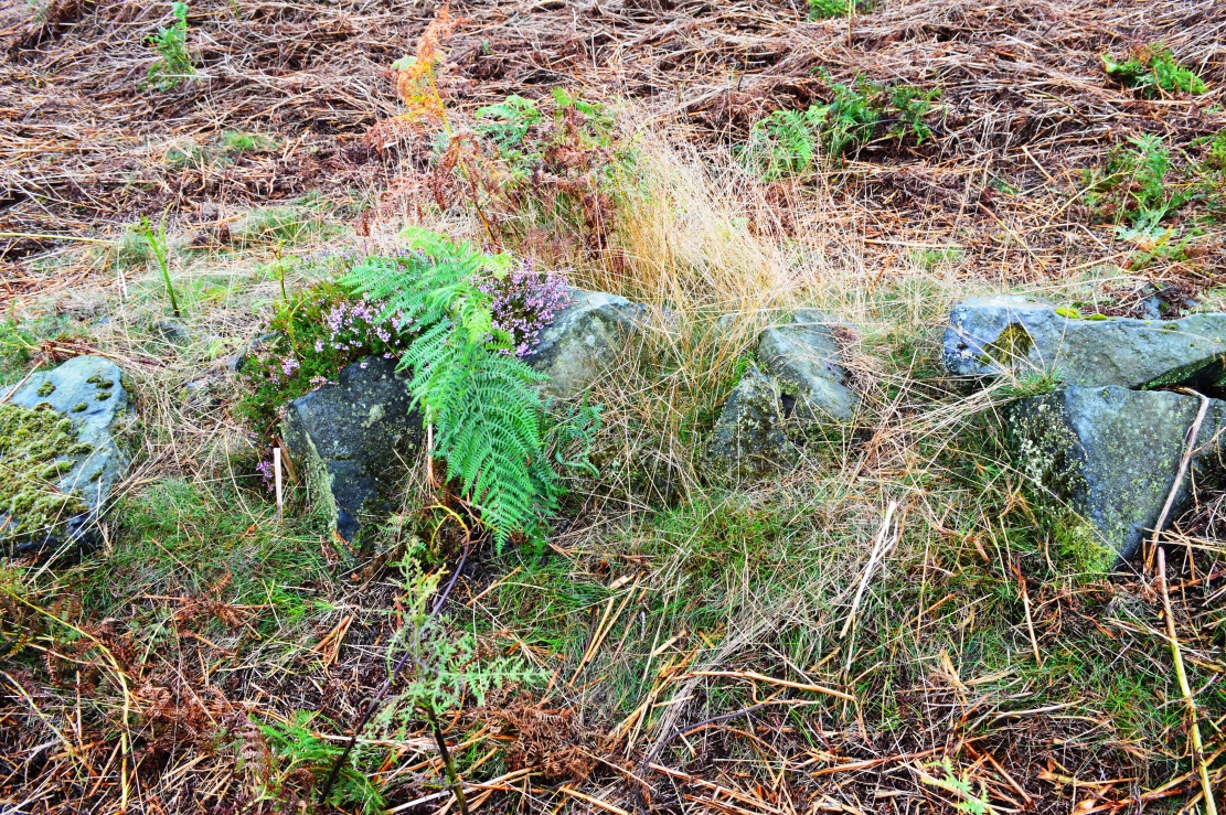
Follow the directions to reach the Little Skirtful of Stones giant prehistoric cairn. Once here, look for the singular rocks out of the many thousands which make up the giant cairn, mainly from the middle to the northern-half of the cairn, and you’ll find them amidst the mass!
Archaeology & History
Cup-marking near the centre of the cairn
Despite the task sounding difficult, it’s not too hard locating the cup-marked rocks within this giant cairn. As I recall there should be five of them, though the Boughey & Vickerman (2003) survey only list four and I only have photos of four of them as well…so I reckon age is probably getting to me at last! There could very well be more of them amidst this massive tomb. But we certainly can’t rely on the Boughey & Vickerman (2003) survey for the carvings at this site as they give the wrong grid references for each of the cup-markings listed, with them all being a kilometre east from the site of the tomb itself! Awesome! God knows what their cartographer was on when he did the profiles for these carvings! (there are plenty of spliff-butts scattered over this moor…..) Not only that, but the position they cite of the relative cup-markings within the cairn are also wrong.
Another portable stoneCup-mark at outer edge
But for those of you who like to know the archaeological data, here’s what was said: Carving 391a is a “small rock towards SW edge of cairn, with single worn cup”; but this stone is actually closer to the northern section of the cairn. Carving 391b was told to be a “small dome-shaped rock at extreme S edge of cairn with single, small clear cup at top of dome.” This again is more on the northern section of the cairn, away from the centre. Carving 391c was described as a “small oval, rounded rock at N edge of cairn, with single, broad, shallow worn cup.” Whilst carving 391d which was told to be a “small rock at SSE edge of cairn, with single small worn cup.” However, we have to take into account that any errors about their position may simply be down to the fact that the small rocks have been moved.
Smoothed cupShowing different rock-type
As you’ll see in the photos here, one of them is actually near the very centre of the cairn, with the cup-marking etched into the edge of the small rock itself. I’m not quite sure if this is the additional fifth carving in the cairn, or whether it’s one of those wrongly ascribed as being in another position. It’s hard to tell, as the local Ilkley Archaeology team don’t publish their findings and information on-line as they should do and unless you’re in their little club they’re hard to get info out of. So this will have to do for the time being I’m afraid. Also note how one of the cup-marked stones is of a rock-type different to the local millstone grit.
Folklore
The creation myth of the Little Skirtful itself tells that the giant Rombald (who gives his name to the moor) was in trouble with his wife and when he stepped over to Almscliffe Crags from here, his giant wife – who is never named – dropped a small bundle of stones she was carrying in her apron. Harry Speight (1900) tells us of a variation of the tale,
“which tradition says was let fall by the aforementioned giant Rumbalds, while hastening to build a bridge over the Wharfe.”
Variations on this story have said it was the devil who made the site, but this is a denigrated christian variant on the earlier, and probably healthier, creation tale. Similar tales are told of the Great Skirtful of Stones, 500 yards south.
The cluster of portable small stones with single cup-marks on them relates to traditions found in other cultures in the world where, usually, women would carry such items in their aprons and deposit them at or on the tomb, in honour of the ancestor or spirit known to be resident at the sacred site. The folklore found at the Little Skirtful (and Great Skirtful too) of Rombald’s wife dropping the rocks here and forming the giant tomb, probably derive from variants of this same honorary practice.
References:
Bennett, Paul, The Old Stones of Elmet, Capall Bann: Chieveley 2001.
Boughey, Keith & Vickerman, E.A., Prehistoric Rock Art of the West Riding, WYAA 2003.
Cowling, Eric T., Rombald’s Way, William Walker: Otley 1946.
Follow the same directions to reach the Little Skirtful of Stones giant cairn. From here, walk 200 yards straight north until you hit the footpath at the top of the Woofa Bank crags. Walk left along the footpath and where it begins to slope downhill, note the large boulder right by the path and another 30 yards further on. Between these large rocks, turn left into the heather some 20 yards. You’re damn close!
Archaeology & History
Close-up of covered tomb
Rediscovered on March 17, 2012, this small untouched prehistoric stone cairn, measuring 3½ yards by 2½ yards across and about 1 yard tall, was found thanks to the moorland heather being burnt, which has stripped the covering vegetation from the monument. It rests just a couple of yards away from a small, almost dried-up stream, seemingly in isolation. There are scattered remains of medieval workings nearby, between here and the Little Skirtful—some of which have intruded upon and destroyed earlier sites—but this particular cairn has a prehistoric pedigree. An excavation here would be worthwhile sometime in the future; but the problem is, there’s so much neolithic and Bronze Age material all over this area, it’s hard to know where to start!
From Ilkley, take the same directions to reach the Haystack Rock; then walk east along the edge of the moor, past the Pancake Stone and keep along the footpath for more than 800 yards till you see the large cairn above-right of the footpath by about 20 yards, a short distance before you’d hit the Rushy Beck. Walk to the cairn, and then past it along the path (west) heading onto the moor for another 30-40 yards, checking the rocks on the ground thereby. You’ll find it!
Archaeology & History
Scruffy sketch I did of the stone, c.1982
Described in John Hedge’s (1986) survey as a “long, low, smooth grit rock, partly covered with heather. Seven clear cups”, we first found this carving when we were out bimbling on one of our hundreds of ventures on these moors as kids—on this occasion, as I recall, seeking out a cup-and-ring stone that Stuart Feather discovered and mentioned in an early Yorkshire Archaeology Journal. Less than a yard away from the one which Mr Feather described (the overgrown cup-and-ring stone no.375) was this curvaceous female rock, with seven simple cup-markings, mostly on its northeastern side.
When the heather is low in this area, you can clearly make out extensive remains of prehistoric walling 11 yards east of the cup-marked stone, running north-south. This eventually meets up with another line of walling that runs east-west and bends back around on the western sides of the carving about 20 yards away, seemingly encircling it. This enclosure will be described in greater detail at a later date.
References:
Hedges, John (ed.), The Carved Rocks on Rombalds Moor, WYMCC: Wakefield 1986.
Boughey, Keith & Vickerman, E.A., Prehistoric Rock Art of the West Riding, WYAS: Wakefield 2003.
Fom Burley train station, take the road uphill onto the moor edge, turning right for a coupla hundred yards where the road runs up the side of the Coldstone Beck. Walk up the stream until you hit the footpath that takes you onto the moor proper, on the righthand (west) side. Once on the level, note scatter rocks on the near horizon above you and the faded track that runs up towards them. Walk up here, keeping your eyes peeled for the small chair-shaped rock immediately left of the pathway. You can’t really miss it.
Archaeology & History
One of an increasing number of carvings that I’m finding have curiously not been included in the general rock art surveys of the region (Boughey & Vickerman, 2003; Hedges 1986). We first found this—Jon Tilleard and I—when we were foraging for such carvings in the 1970s and early ’80s and the scruffy drawing here is taken from one of my early notebooks (1981) that explored the archaeological remains on these moors.
Scruffy drawing of the stone, c.1982Close-up of cup-marks
The name of the stone comes from the slightly chair-like shape of the rock on which the blatantly obvious cup-markings can be seen. There are at least six of them, with a possible seventh near the top of the rock. Some curious eroded markings can still be to the left-side of the main cups, but I’m unsure as to their nature and they may be just geophysical. Above and around this rock are a number of medieval pit workings, quarrying and scatterings of other rocks, none of which have been found to possess cup-and-rings.
References:
Bennett, Paul, Of Cups and Rings and Things, unpublished: Shipley 1981.
From Burley train station walk up the road, turning right as you meet the moorland road. Go on for a couple of hundred yards until you run parallel with the Coldstone Beck stream. Walk up here for about 800 yards until the full moorland begins to open up ahead of you. Walk up the slope on your right (west) about 30 yards above the first of the ruined grouse-butts, towards the scattered mass of rocks before the small crags. The small standing stone on the edge of the ruins will catch your attention!
Archaeology & History
A fascinating small cairn which initially had us puzzling as to its very nature. Was it a cairn? Or was it a section of prehistoric walling? The former would seem to be the more likely, though an excavation here would obviously be helpful.
Standing stone, cairn-spoil & Coldstone valley to rearColdstone Cairn 2, looking west
Scanning the Earth hereby we found no surface remains, merely a section of disturbed ground where the small stones were placed and, obviously, removed in some number not too long ago. Stones from the cairn had obviously been robbed to construct the grouse-butts close by (something the local council officials seem to find acceptable). It would appear to be consistent in structure with many of the other cairns on this moorland, some of which are neolithic, but the majority date from the Bronze Age.* This particular cairn seems to be Bronze Age in nature.
The most defining element in the cairn is the small standing stone, less than two feet tall above ground level, within the southwestern area of the denuded tomb. No carvings could be noted on the stone, nor marks of any significance on the other smaller stones. Another cairn of similar age but in much better condition—the Coldstone Beck Cairn 01—can be seen when the heather’s burnt back, some 20 yards north.
* More than 100 singular small cairns exist around here, most of which have never been archaeologically assessed.