Cup-and-Ring Stone (lost): OS Grid Reference – NT 98491 28424
Archaeology & History
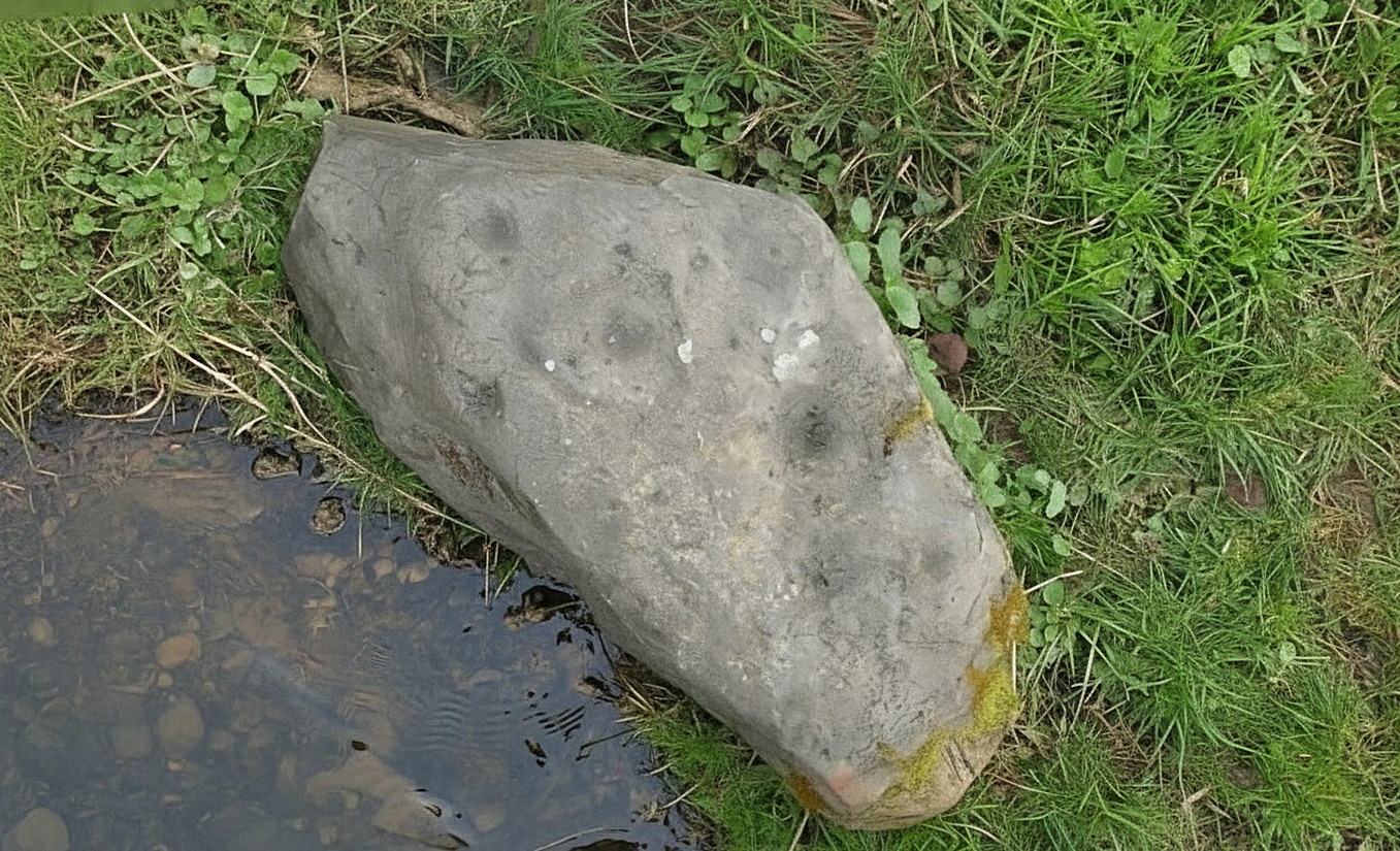
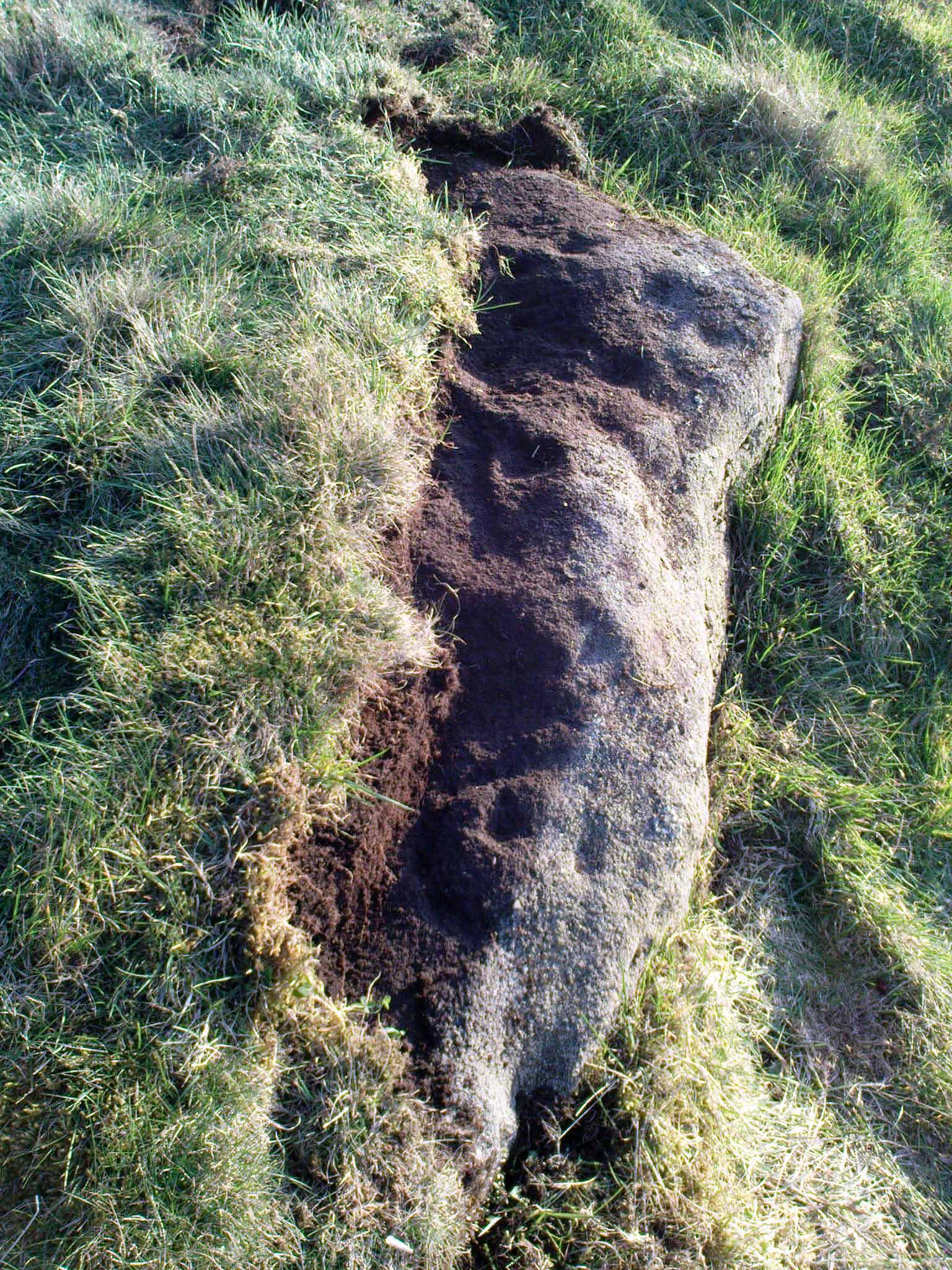
Highburn House C&R, 2015
This carving was rediscovered by rock art explorer Jan Broewer in September, 2007, a few hundred yards out of Wooler on the way to Akeld and Kirknewton, in the field on the right-hand side of the road, on the embankment just a few inches above the waters of the High Burn. On a recent visit here by Tom Cleland and I, despite us rummaging amidst the gorse and other herbage all along the edge of the waters, we were unable to locate the carving and presume that it has either been destroyed or re-housed in someone’s garden, living a more comfortable life. We certainly hope it’s the latter!
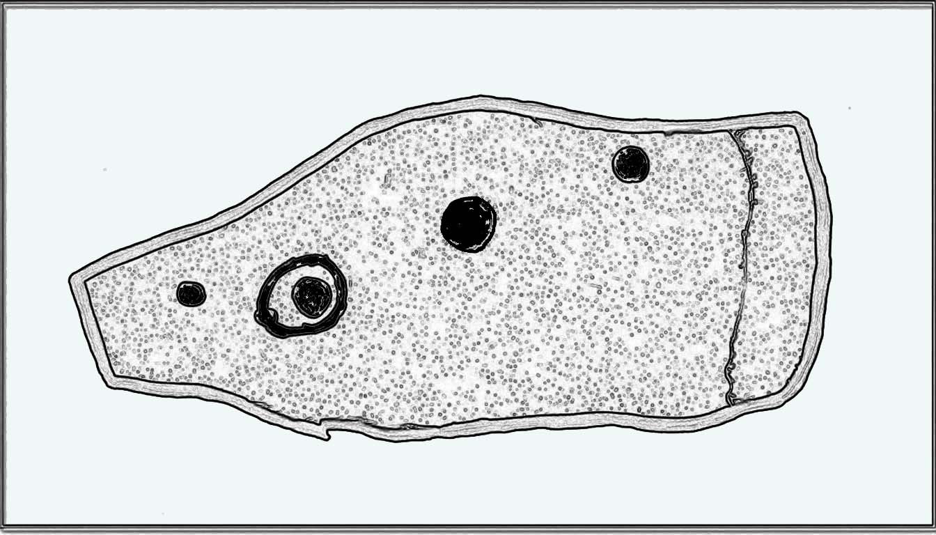
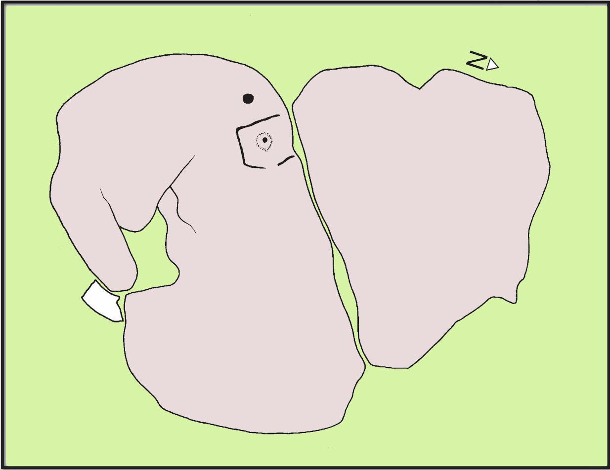
Sketch of the designHome of the lost carving
It’s design is nothing special: merely a singular, albeit scruffy cup-and-ring, with two other distinct pecked cup-marks and, possibly, a third shallow one just to the side of the cup-and-ring (but this is, in my opinion, highly suspect). The stone was obviously not in its original position when Jan first found it, and would seem to have come originally from the slope above the stream where a number of earthfast stones can be found. The numerous scratches across its surface shows that it’s been hit a few times by some (probably) metallic objects, or perhaps horses hooves, thus dislodging it from the slope above and rolling into the spot where Jan found it. Anyhow, we presently don’t know where it is or what’s become of it. Does anyone in Wooler know where it’s living?
Acknowledgements: Huge thanks to Pete Chattaway for use of his photo; and to Tom Cleland for helping the search party!
We took the B6348 road up east, from Wooler, turning left 2 miles up and crossing the small river bridge, going past Weetwood Hall where the road bends to the right and goes uphill for about a mile where, just before West Horton farm, there’s a a dirt-track on your left. 200 hards up, walk past the farm up and along the dead straight track for another 400 yards until you hit the field. Diagonally ahead of you (NW) less than 100 yards away, a small hillock rises in the field where a large metal animal feed-trough sits. Once there, the slope to your right (east) is where the stone lives. If you potter about you’ll find it.
Archaeology & History
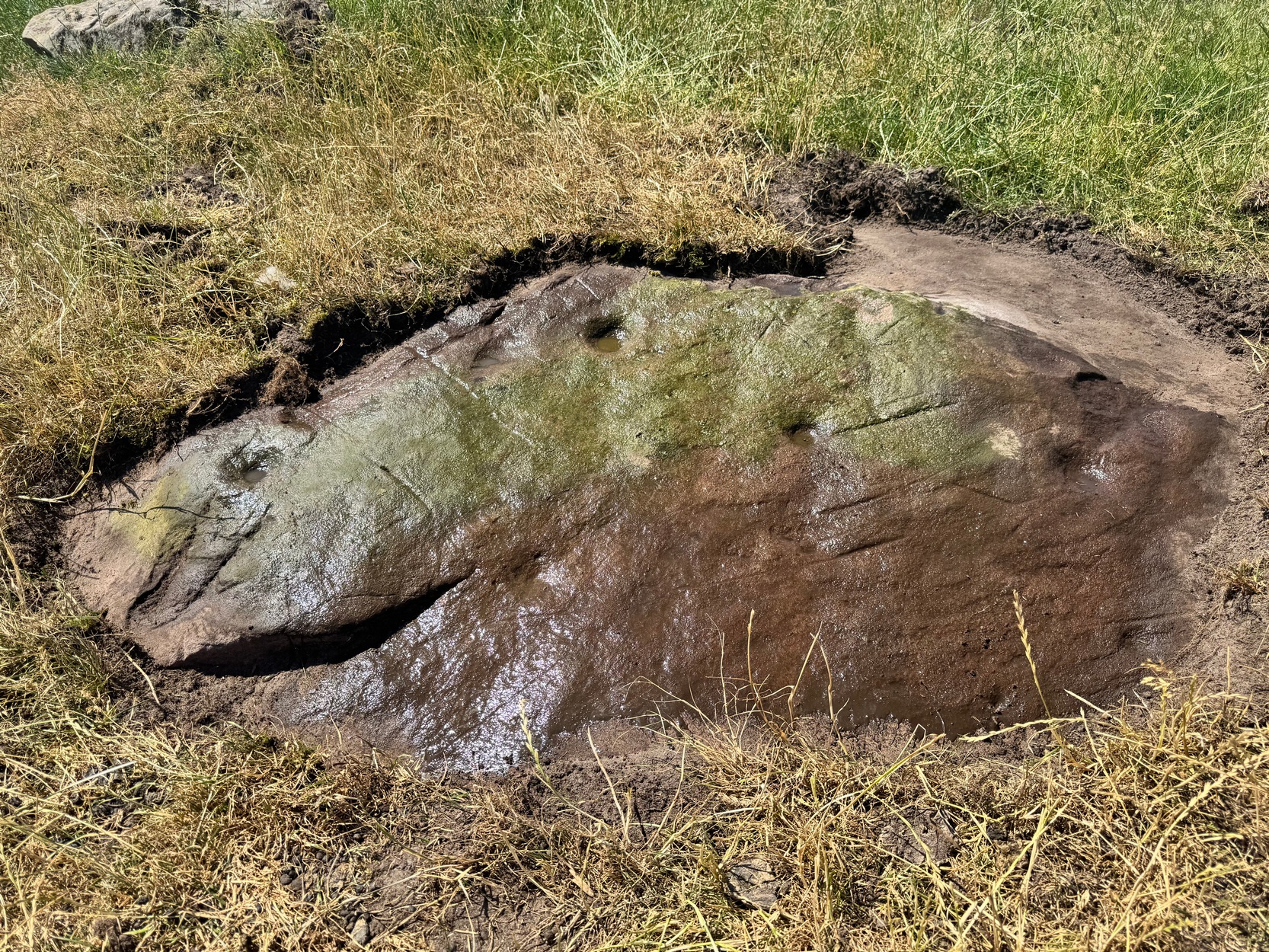
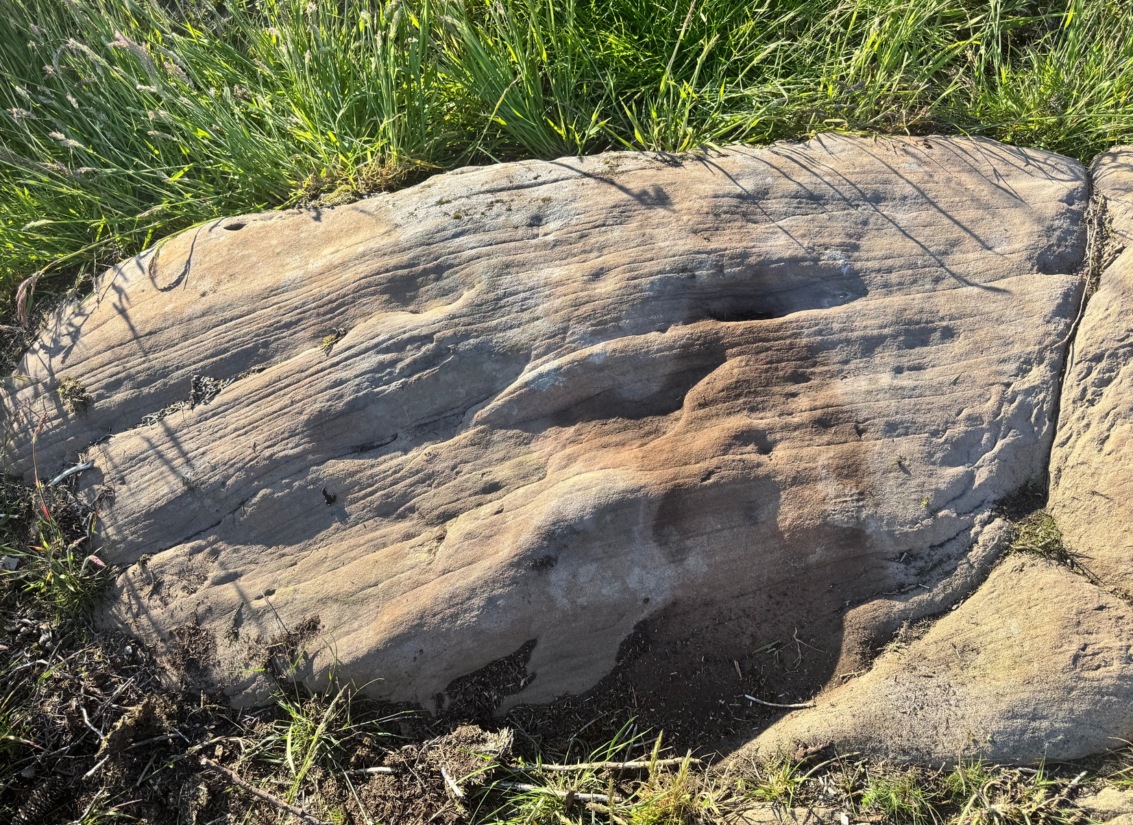
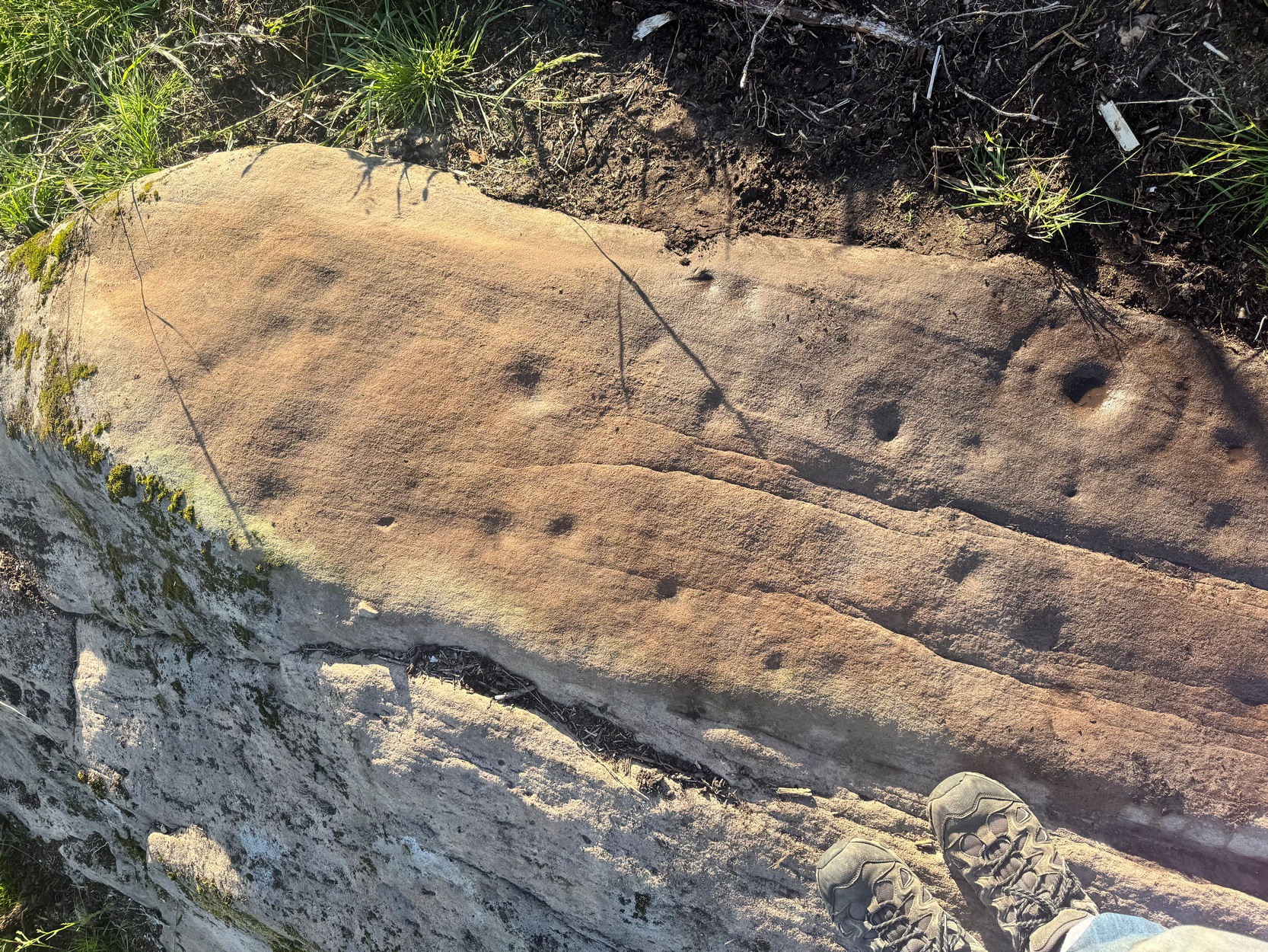
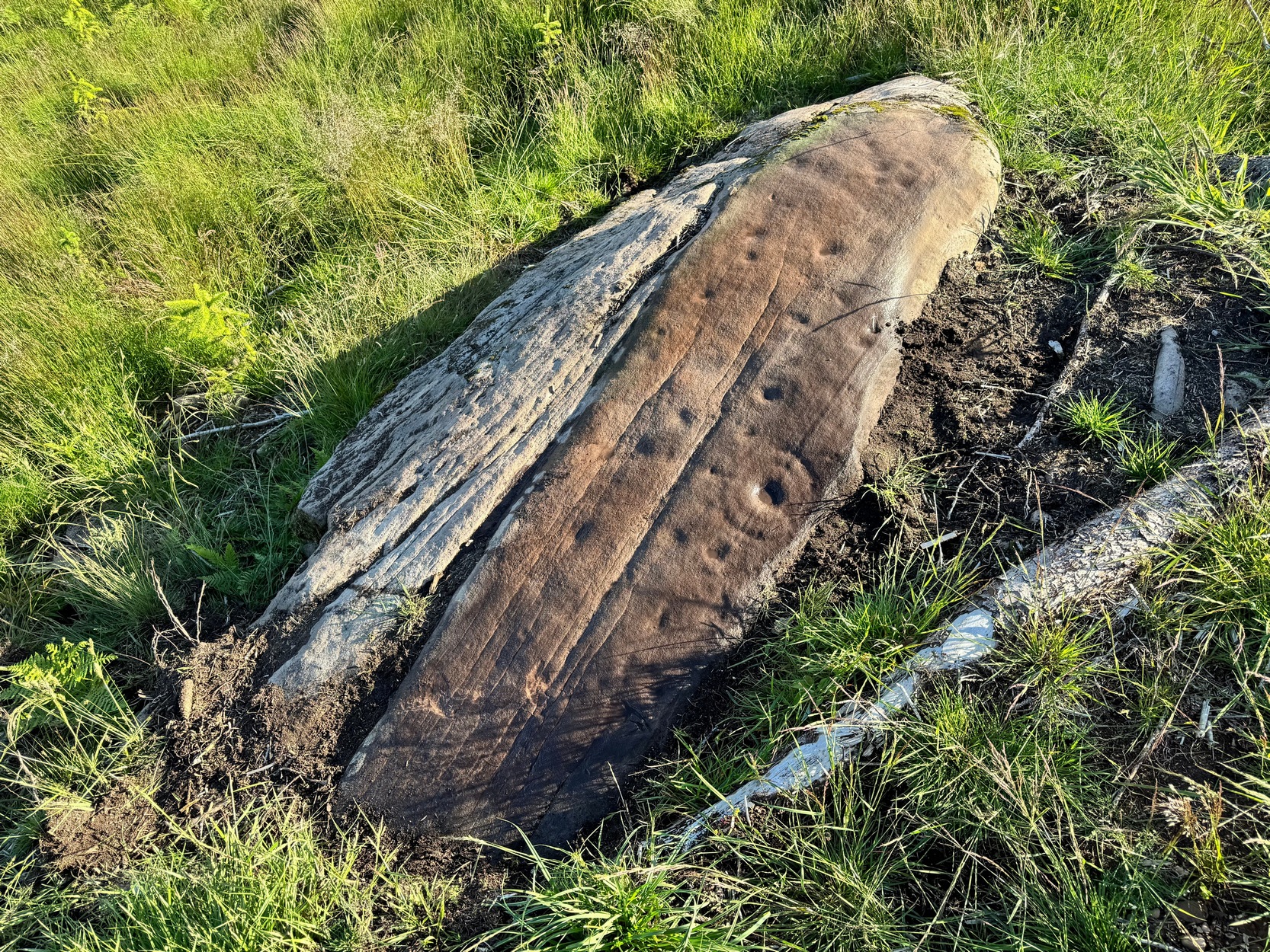
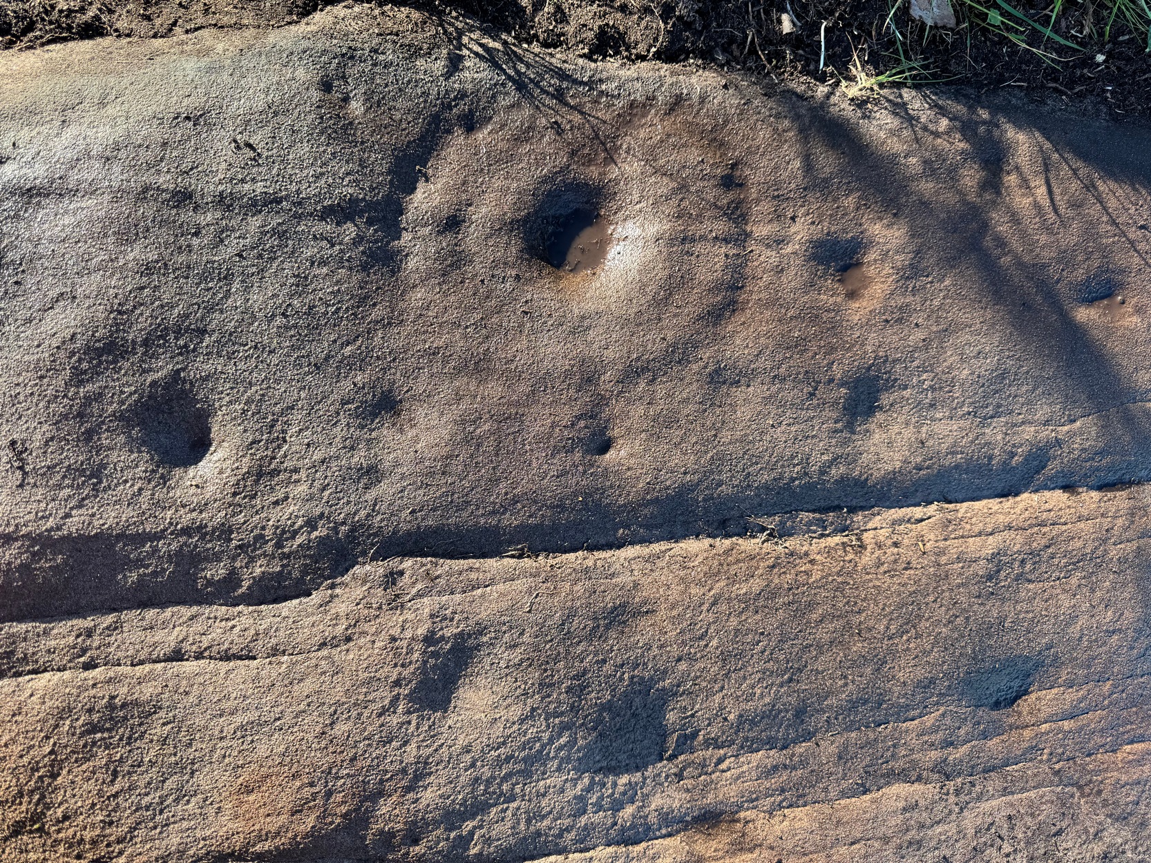
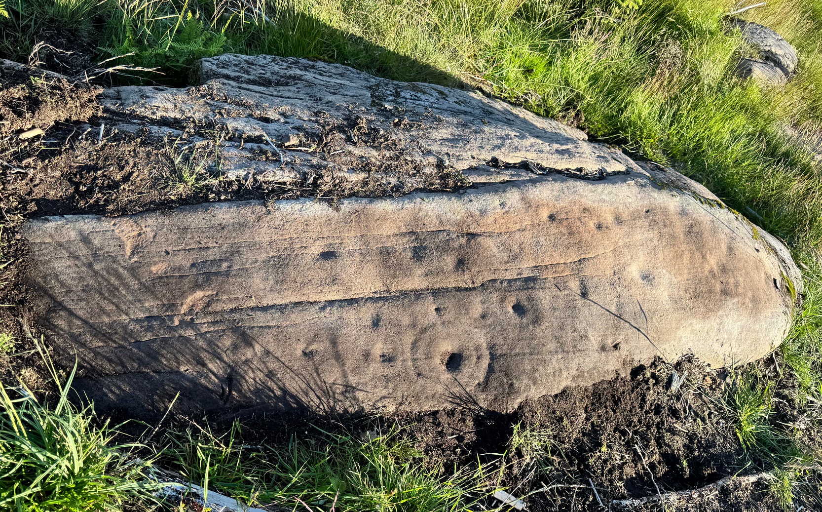
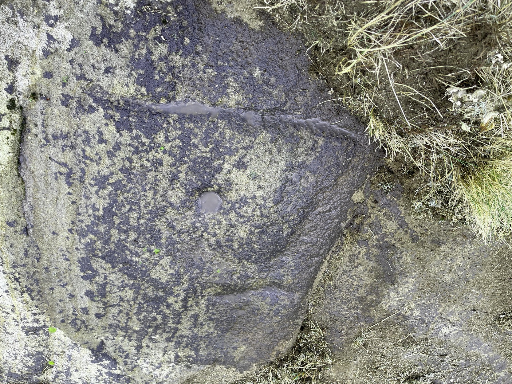
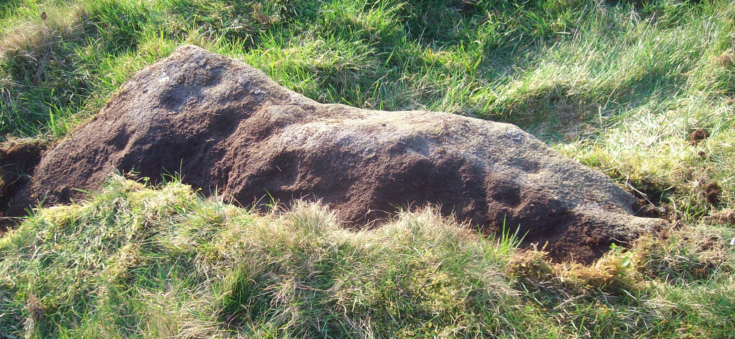
On a visit to the impressive West Horton carvings on one of the searing hot days recently, Tom Cleland and I thought to check on an otherwise unimpressive petroglyph on a rocky rise of land before heading to the beauties 250 yards northwest of here. The covering soil around a scatter of earthfast rocks on this rise in the land had been eroded by cattle and on one of them we noted what seemed to be a distinct cup-marking. And, as happens when you look closer, a more expansive design came into being.
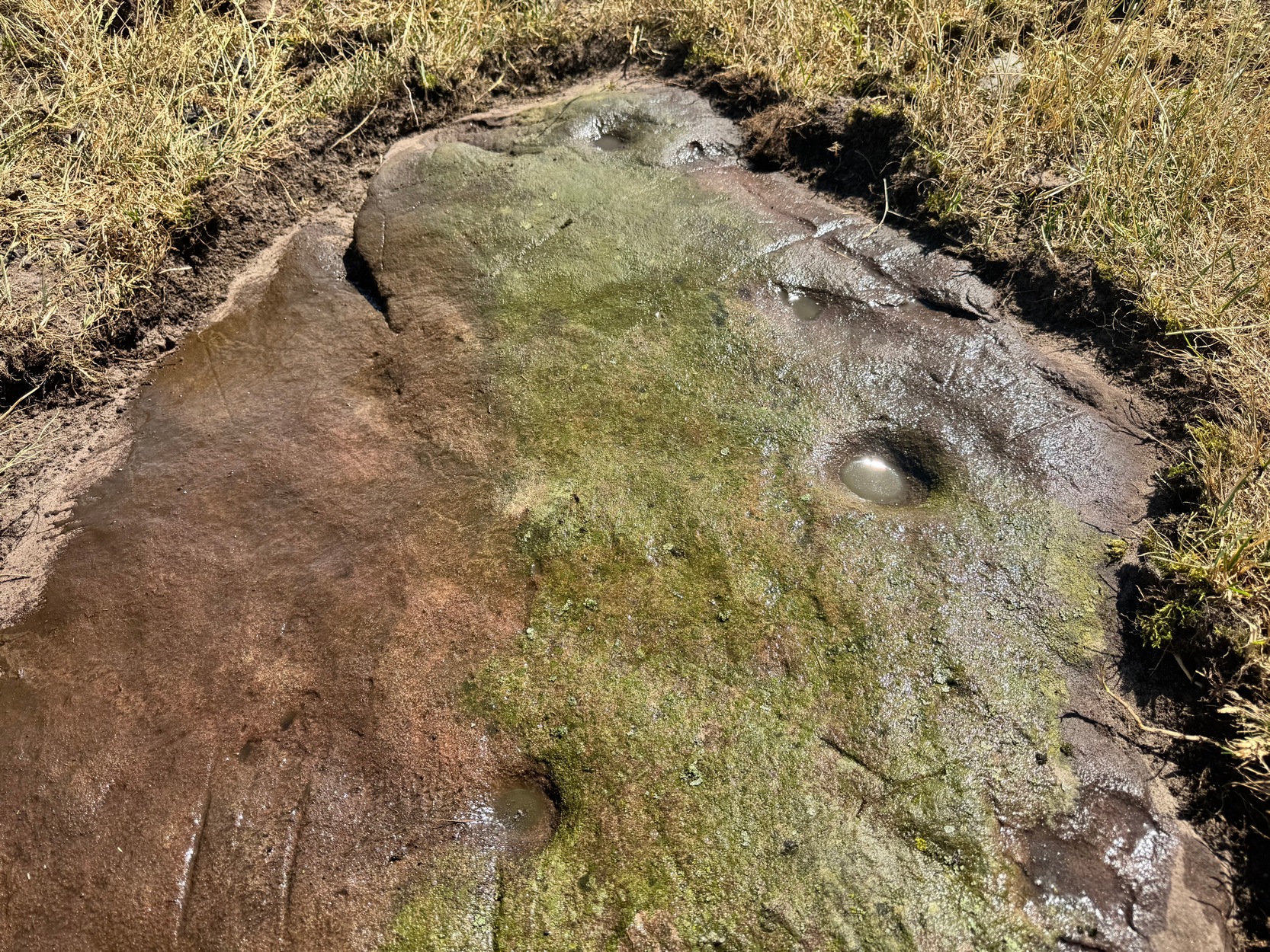
Main design from aboveFaint ring round the cup
On the east-sloping-face of this rock are between six and seven cup-marks, most of them quite distinct. The topmost of the cups has a faint incomplete ring round it which you can just make out in a couple of the photos. It seemed that there was another even fainter ring around one of the other cups, but on the day we visited this the heat was taking its toll of me and I could only stand a short time before we had to move, so we left without getting any good images of the other ring.
More recent cup-marks
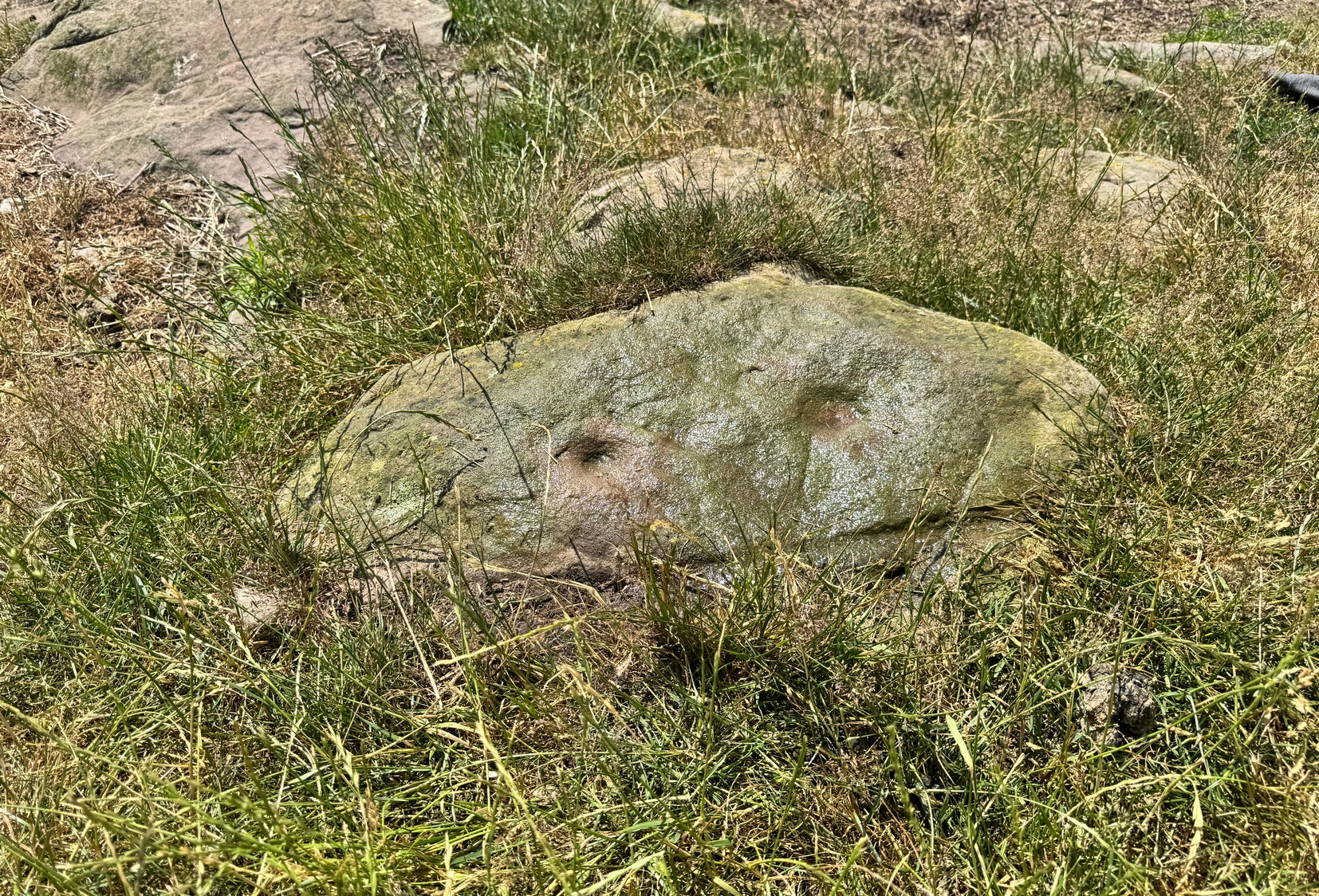
It’s more then likely that other unrecorded carvings are hiding beneath the soil which, no doubt, the cattle will slowly help uncover as the years go by. 🙂 A little further up the slope from here, approaching the West Horton (1b) carving, a small oval-shaped rock has what looks like a single cup-mark on it and another, more recent marking at its side. This impression is likely due to an incision made by the metal legs of one of the animal feeders and is unlikely to be prehistoric.
To find this carving, follow the same directions as if you’re visiting the carving I’ve simply labelled Netherglenny. From here, walk up the slope (north) barely twenty yards and you’ll see the folds of another elongated piece of rock, similar in form to the one you’ve just been to.
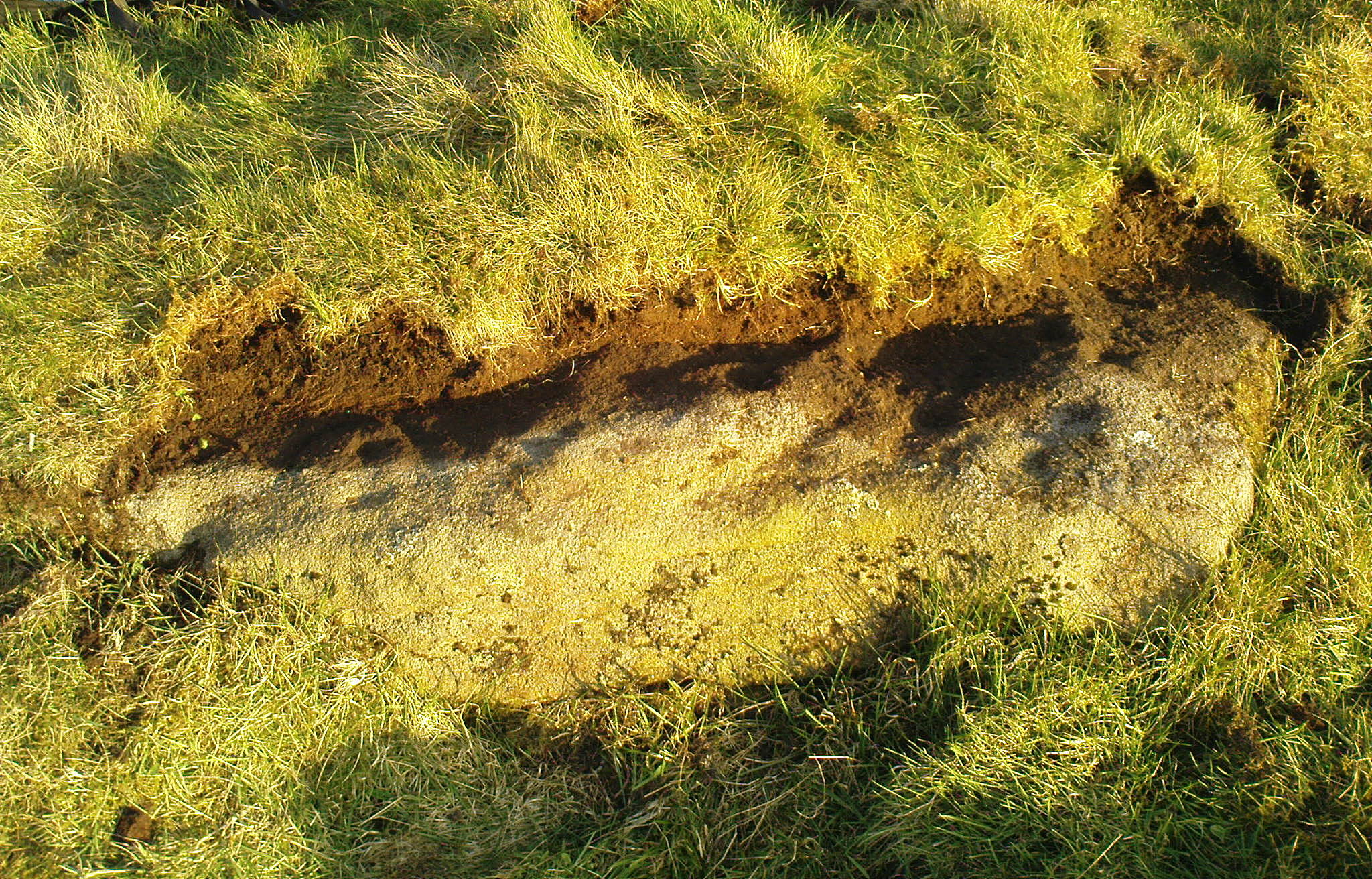
I found this stone when rushing near the end of a red hot day and needed to get back under some shelter, so I didn’t get chance to highlight it as I usually do. Hence, the info and the photos of the carving aren’t impressive. But then, the design on the stone isn’t impressive either. I could discern just two distinct cup-marks: one above the deep elongated slit (vulva-esque) and the other below it. The cup-mark above it comes out clearly in the photos; but the other one is just about hidden in the shadows. There may be a third possible cupmark close to the less visible one. I’ll get some better photos when I’m next up there (he sez, hopefully…)
Shallow cup, top-middle
This carving lies very close indeed to an official site entry known simply as a ‘Nether Glenny’ carving (grid-ref NN 56130 01969), which became lost when forestation took effect here more than 30 years ago. However, the description given to that stone, of “at least six cups on the upper surface of the boulder” isn’t consistent with the marks on this rock. There are several other marks on this stone that may give the impression of them being cup-marks, but they’re entirely natural. Hopefully we can recover the lost ‘official’ stone on our next visit.
(The entry title of this site needs amending, as the entire Menteith rock art complex (more than a hundred carvings in little over a square mile) needs re-assessing and assembled under a singular umbrella. The scattering of place-names, sometimes erroneously, relating to the many so-called ‘Nether Glenny’ carvings [dozens of them], is confusing unless you know the area intimately—and most people don’t! So forgive the title I’ve given this minimalist cup-marked stone. It will be adjusted when we’ve been back and correctly mapped the others in this locale. If anyone wants to help out in this project, please get in touch.)
We took the route up from the hidden Braeval car-park, on the left-side of the road, ⅔-mile (1km) east of the Aberfoyle roundabout (on the edge of town). From here, walk up the dirt-track and bear left 350 yards up where the track splits. Walk up here for 1½ miles, through and beyond the ruined forest until, on the far side of the remaining trees (they may have been cut when you’re reading this) the path eventually brings you out into pasture. At this point, veer immediate right and follow the fence/wall on your right for literally ⅓-mile (0.54 km). This is boggy and uneven all the way as there’s no path here. You’ve gone up and over a ridge and, as you’re coming down the slope, hop back over the wall where there’s a gap and walk about 30-40 yards into the debris. You’re damn close!
Archaeology & History
Rough sketch of design
This is one of several previously unrecorded carvings I came across recently on the northwestern edge of the massive Ballochraggan rock art complex, on the slopes above the Lake of Menteith. I found it during one of the red-hot days we’ve just had —and, sadly, it had me running for home much quicker than usual! The heat beat me on this day (I’ve never been a lover of the sun), so hopefully you’ll forgive me if I missed a bit! 🙂 I was heading for the nearby Solar Stone carving near the bottom of the slope, when this partially-covered rock caught my eye—and I’m glad it did! For scattered along its long slender topmost surface, a number of the usual curious prehistoric symbols had been etched…
Western end of stonePetroglyph when wet!
The first thing I noticed were a scatter of cup-marks at the western end of the stone: four of them in a close-knit cluster (this section reminded me of an old favourite on Shipley Glen), with several others seemingly running in a curved line down the slightly sloping stone with, possibly, one or two others also streaming away below this same cluster. But the main feature, as the photos and sketches illustrate, is the cup with a large double-ring near the middle of the stone, above a long natural crack that almost cuts the stone in half.
On either side of the double-ring are quite separate single cup-and-rings with (roughly) equal layers of erosion—although the central cups were probably re-carved, so to speak, many times over the centuries, as their erosion level is considerably less than that of the rings. This is a feature found at countless carvings across Britain and suggests regular “re-use” or rather re-animating the design on a regular basis. A faint half-ring can be seen round one of the smaller cups near the bottom of the carving. And a peculiar feature near the middle of the design is a simple ‘ring’ that was started but never finished (perhaps?), with no cup-mark in the centre. This is a feature found on quite a few Perthshire carvings, with some of the shallow ‘rings’ being nearly 12-inches across in some instances. Most odd!
Main double cup&ringLooking down at the design
Several of the single cup-marks on here appear to have started life as natural pock-marks in the stone, which would have made carving the design a little easier than just starting from scratch! And, about 10 yards below this carving, a small sloping rock has a distinct eroded ‘bowl’ on it, about six inches across and several inches deep and is perhaps relevant to this carving in a pragmatic sense (mulching colours, herbs, etc). These ‘bowls’—be they natural or enhanced—are much-overlooked features and their existence needs to be taken into consideration when they’re found within a mass of cup-and-ring stones, such as found here, on the outskirts of olde Aberfoyle. Check it out when you’re next up here…. and the cup-marked stone 20 yards further up the slope too. And lots of others!
Acknowledgements: Big thanks to Prof Hornby for getting us up here on a scorching day!
Cup-and-Ring Stone (removed): OS Grid Reference – NZ 1475 6350
Archaeology & History
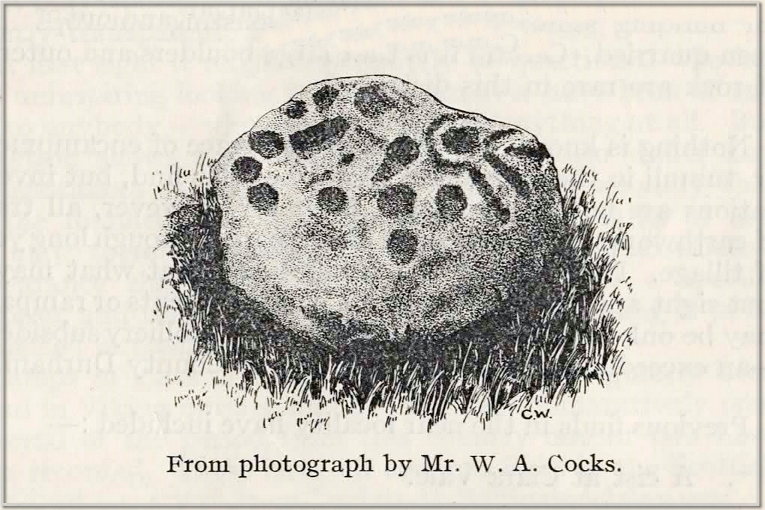
This carving presently lives in what Beckensall & Laurie (1998) described as “the stone store” at the Museum of Antiquities at the University of Newcastle-upon-Tyne, but it was discovered in some walling close to the road on the south-side of Ryton by a Mr William Cocks in 1934. The carved rock is relatively small—measuring “roughly two feet five inches, by one foot ten inches, by one foot three inches in thickness”—and was obviously not in its original position, but would have lived relatively close to the walling into which was placed. Mr Cocks told that,
1934 sketch of the carvingModified Beckensall sketch
“the stone bears one “cup and ring” with four radial ducts, the latter being in an exceedingly fine state of preservation. There are also ten plain cups of circular form; one cup with a deep conical duct; and one large cup which appears to have been formed by uniting two circular cups. All show the “pocking” or tool marks of manufacture, and these are especially noticeable in the radial ducts.”
The cup-marked Ryton (1) stone was found some 250 yards to the west and the Ryton (3) petroglyph was less than half-a-mile north, making it likely that other types of prehistoric remains once existed in this locale.
References:
Beckensall, Stan, Northumberland’s Prehistoric Rock Carvings – A Mystery Explained, Pendulum: Rothbury 1983.
Beckensall, Stan & Laurie, Tim, Prehistoric Rock Art of County Durham, Swaledale and Wensleydale, County Durham Books 1998.
Cocks, W.A., “The Ryton ‘Cup and Ring’ Marked Rock,” in Proceedings Society of Antiquaries Newcastle-upon-Tyne, volume 6, no.8, 1934.
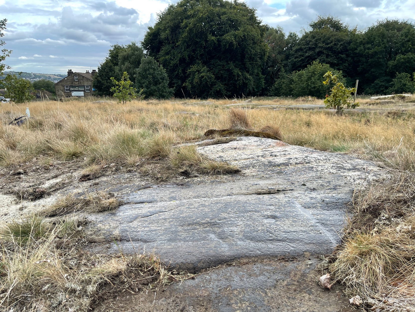
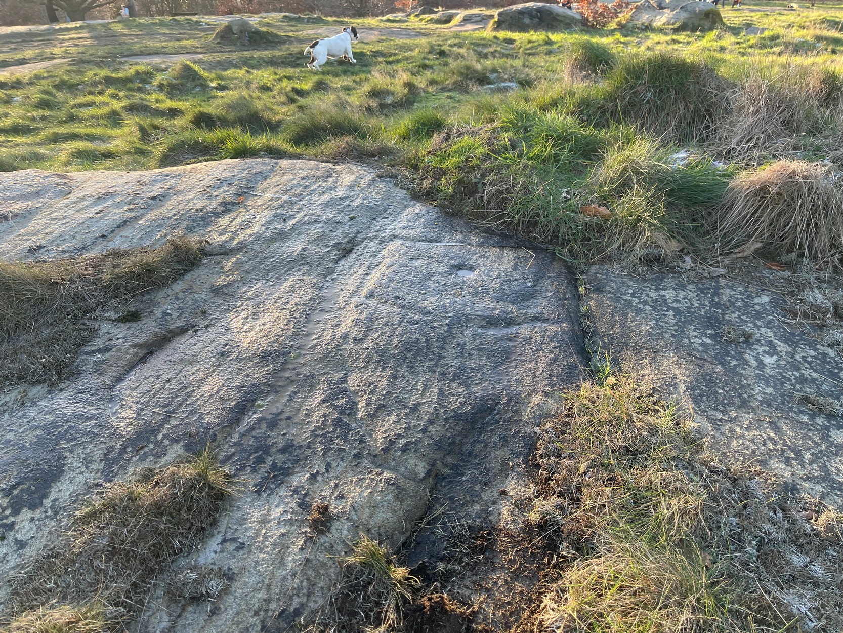
Once you’ve got yourself to the start of Shipley Glen, from the Old Glen House pub, from the car-park outside walk up the road for 60 yards (if you reach the next small car-parking spot, you’ve gone too far) then step off-road into the vegetation on your left and you’ll see the large flat fractured section of earthfast rock. Get low down and seek out the cup-mark first!
Archaeology & History
This is a very faded and quite basic design and unless you get decent low sunlight, it can be very difficult to discern. On my most recent visit here, conditions weren’t too good, as the photos here indicate.
Turner’s 1894 sketchLooking across the faint square
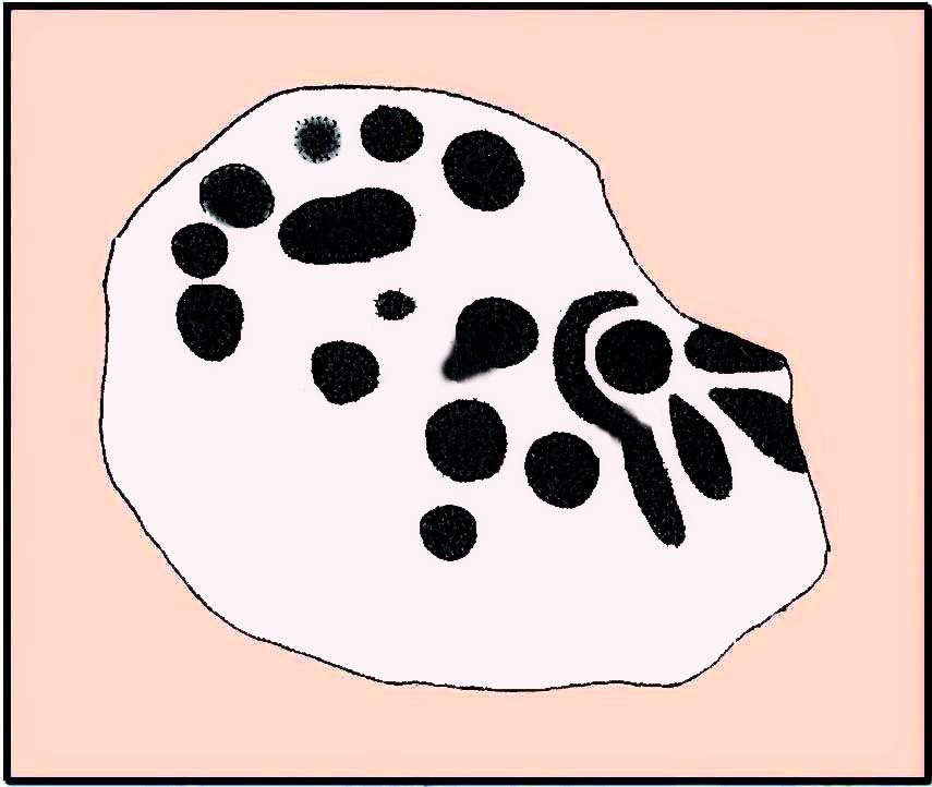
The main feature is a single cup-mark surrounded by a very wide ‘square’ ring (if y’ get mi drift). It’s possible that this carving was first described and illustrated by the great Yorkshire genealogist J. Horsfall Turner (1894) in conjunction with the missing Brackenhall Green carving — although he did tell that they were, since June 1889, “both now destroyed”. But the carving here does bear a distinct similarity to the one he illustrated and so it may have just been covered in turf (or am I grasping at straws here?!). And despite this resemblance, one or two features in his description aren’t found in the carving that we see today. When John Hedges (1986) added the carving to his survey, he described it simply as:
“Striated, pitted bedrock with crack down centre, in grass and amongst other rocks and bedrock. Carving, centre and W end: enclosure type angular grooves and two cups.”
John Hedges 1986 sketchCup & surrounding lines
One of the two cups is presently beneath some shallow vegetation (easily removed if anyone’s passing), but the main feature of the large enclosing square and its central cup is presently exposed and can be seen when your eyes eventually adjust. Interestingly, Hedges shows the existence of a faint ring around the central cup inside of the larger square enclosure. If someone is able to capture a photo of this, please add it on our Facebook page. 🙂
It must also be emphasized that somewhere, not too far from this carving, was once found a very similar design known as the Brackenhall Green carving that possessed the same curious squared-ring feature that we find on this stone.
References:
Boughey, Keith & Vickerman, E.A., Prehistoric Rock Art of the West Riding, WYAS: Wakefield 2003.
Hedges, John (ed.), The Carved Rocks on Rombalds Moor, WYMCC: Wakefield 1986.
Turner, J. Horsfall, ‘Cup Marks, Shipley Glen,’ in Yorkshire County Magazine – volume 4, J.E. Watmough: Idel 1894.
Cup-and-Ring Stone (destroyed): OS Grid Reference – SE 133 389
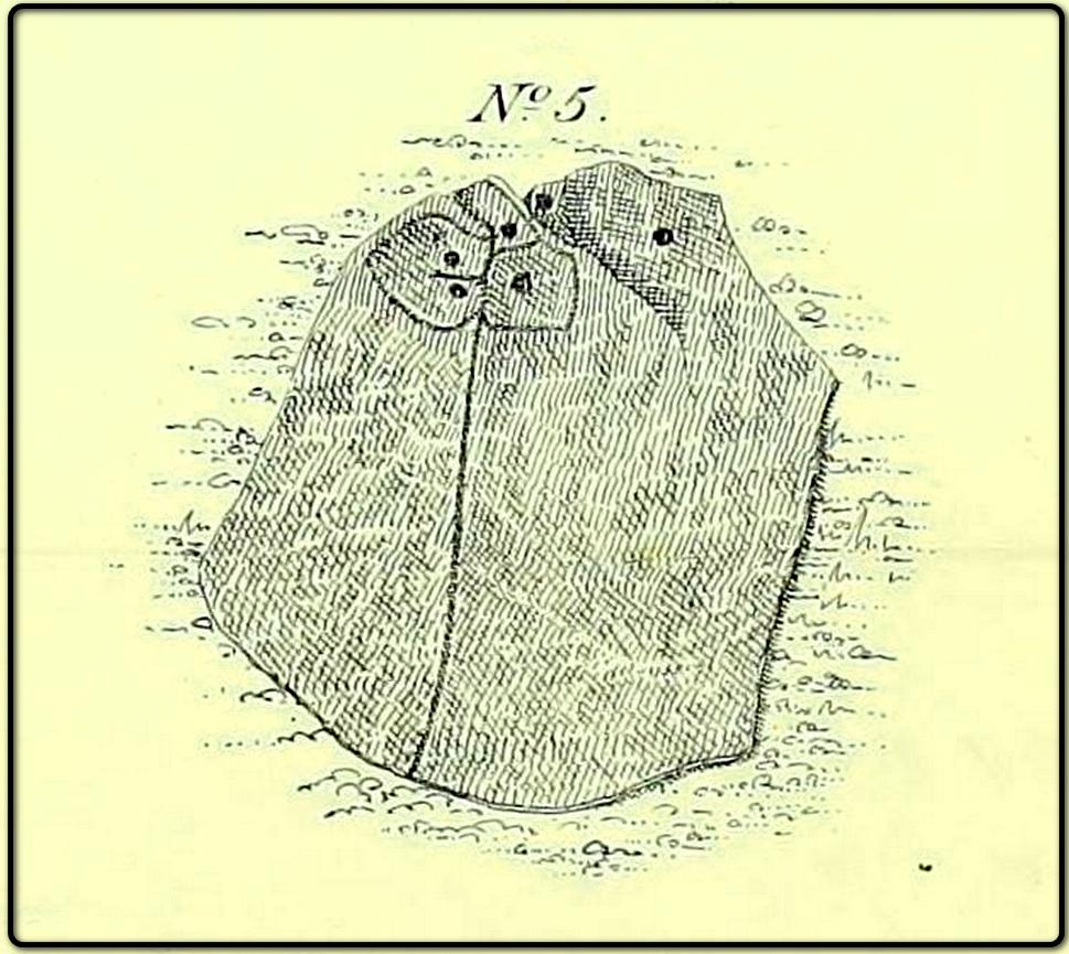
Archaeology & History
The lost carving of Brackenhall, in 1888
I first came across a description of this lovely-looking cup-and-ring carving during some research I was doing in the archives at Bradford Central Library in the 1980s—and decided there and then that I had to find it! It was described and illustrated for the first time by William Glossop (1888) when he made a short survey of some of the prehistoric sites on Baildon Hill and Shipley Glen. He told that it was one amidst “a cluster of rocks on Bracken Hall Green”—but was seemingly destroyed not too long after he wrote about it. There was some discussion in the late-1980s that it may have been a petroglyph that was cataloged by John Hedges as carving ‘BM14’ (at SE 13272 38924), due to it possessing a similar ‘artistic’ element (or motif, as some like to call it) and which is also along the Brackenhall plateau by the roadside about 160 yards below the entrance to the Brackenhall centre—but it turned out not to be the case.
A few years after Mr Glossop uncovered this carving, a short note by J.H. Turner (1894) described two cup-marked stones, “both now destroyed” that could be seen in the same area just as you entered “the plateau where the Easter fair is now held”. And his description closely fitted Glossop’s sketch. Turner wrote:
“The cups were three inches in diameter, and one inch deep, in an oblong 18 by 12 inches, with line 6 feet long towards the east. The second oblong, same size, had also an eastern pointer and one cup in the centre. These have both disappeared since June, 1889; I fear by wanton mischief.”
This would seem to be the same carving illustrated by Glossop, although it’s still difficult to say with any accuracy where it was located. The great historian W.Paley Baildon (1913) thought it may have been the same carving which Harry Speight (aka Johnnie Gray) described at the Glen Gate—and it does sound similar, but until we are able to ascertain (i) where Glen Gate was; and (ii) whether it coincided with the location of “where the Easter fair” was held, we must err on the side of caution. Tis an intriguing mystery… (Note: the grid-reference given for this site profile is an educated guesstimate!)
References:
Baildon, W. Paley, Baildon and the Baildons – volume 1, Adelphi: London 1913.
Glossop, William, ‘Ancient British Remains on Baildon Moor,’ in Bradford Antiquary, no.1, 1888.
Gray, Johnnie, Through Airedale from Goole to Malham, Walker & Laycock: Leeds 1891.
Turner, J. Horsfall, ‘Cup Marks, Shipley Glen,’ in Yorkshire County Magazine – volume 4, J.E. Watmough: Idel 1894.
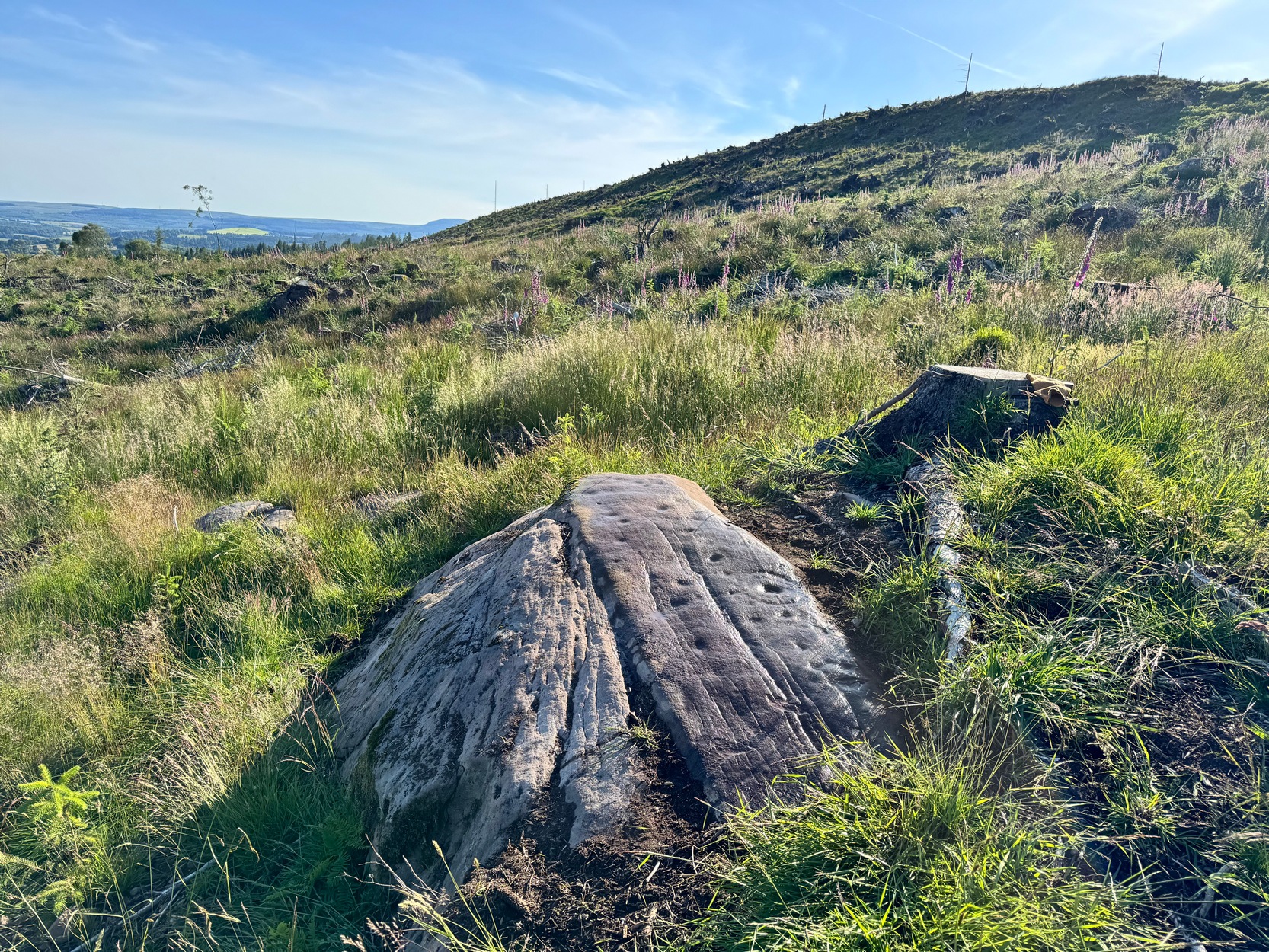
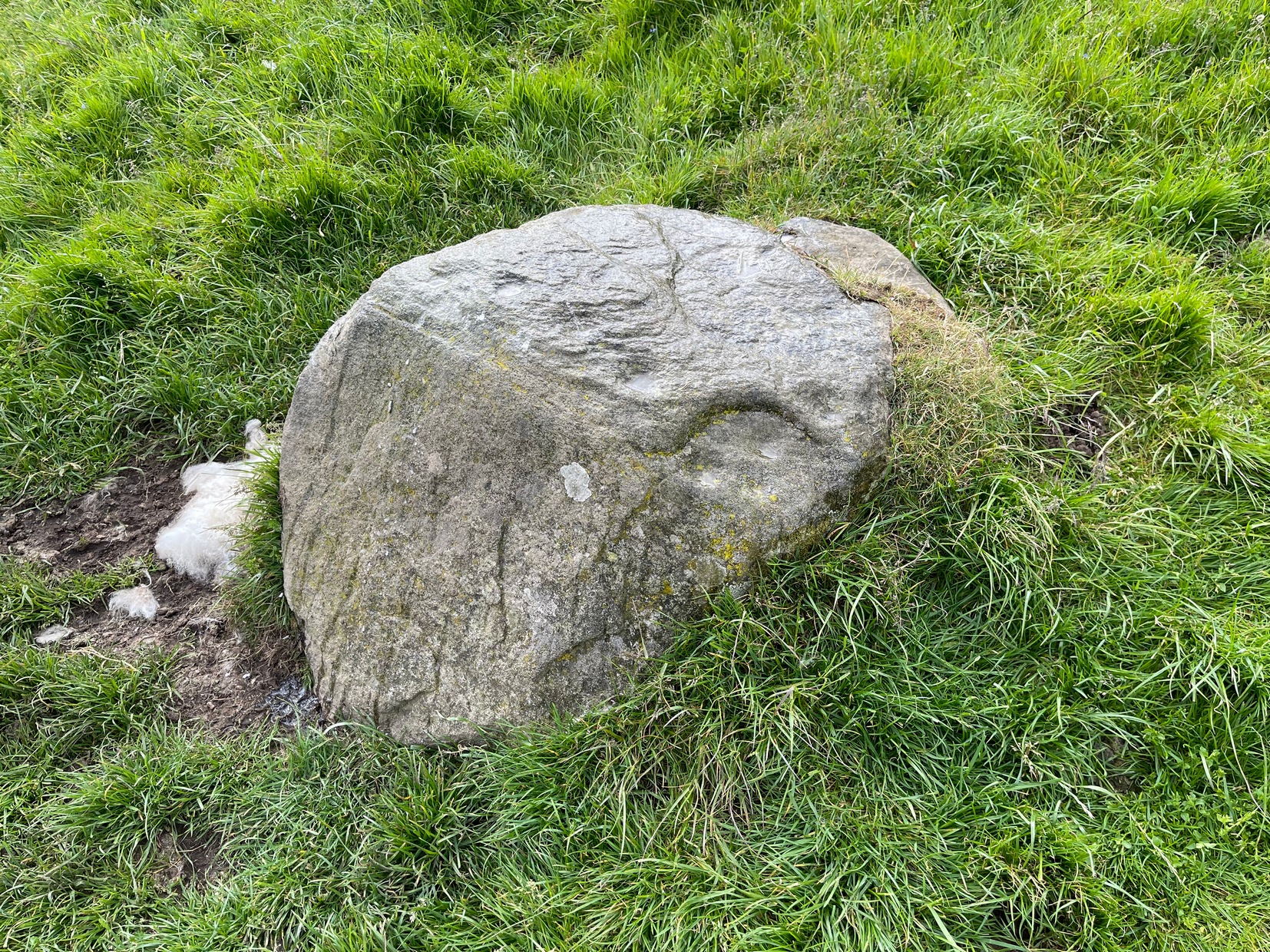
Along the A822 road from the Gilmerton junction on the outskirts of Crieff, heading up towards the Sma’ Glen, after literally 1¾ miles (2.8km) on the right-side of the road you need to follow the route to reach the Connachan rock art cluster by walking up the dirt-track leading up past Connachan Farm. Walk past the carving of Connachan (2) and up the track past Connachan (4), then onto the level ground and walk right to the low-lying ruined Connachan cairn. From here, look up the gentle slope to the fence. A small-ish stone protrudes out 40 yards away. Head straight for it!
Archaeology & History
Close-up of line of cups
You’ll check this out when you’re doing your tour of this petroglyph cluster and sit here to admire the view. It’s the last of the small bunch of carvings, on level ground, close to the denuded cairns. It consists of just eight cup-marks, all of which are carved close to the edge of the stone on its upper sloping surface; although this doesn’t tally with Margaret Stewart’s (1967) description of any of the carvings hereby. There’s nowt much more to be said about it to be honest; apart from saying how it’s highly likely that other carvings remain hidden, undiscovered, not far from this stone along the edge of these hills.
References:
Stewart, Margaret E.C., “Connachan, Crieff – Cup Marks and Hut Circle,” in Discovery & Excavation, Scotland, 1967.
Cup-and-Ring Stone (lost): OS Grid Reference – SE 1347 3882
Also Known as:
Carving no.143 (Boughey & Vickerman)
Archaeology & History
In Johnnie Gray’s (aka Harry Speight) early work on Airedale (1891), he described a number of the prehistoric sites on and around Baildon Moor and Shipley Glen. Almost all of the things he wrote about have been identified, but a cup-and-ring stone at “Glen gate” (as he called it) remains elusive. He wrote:
“After crossing the stream from the Glen gate, and going about thirty paces, we come upon…an incised stone, whereon are a number of circling lines and cup-like cavities — one at each corner, with a long line branching off to the north-east; but this stone unfortunately has got broken, and lying on the main path is much defaced.”
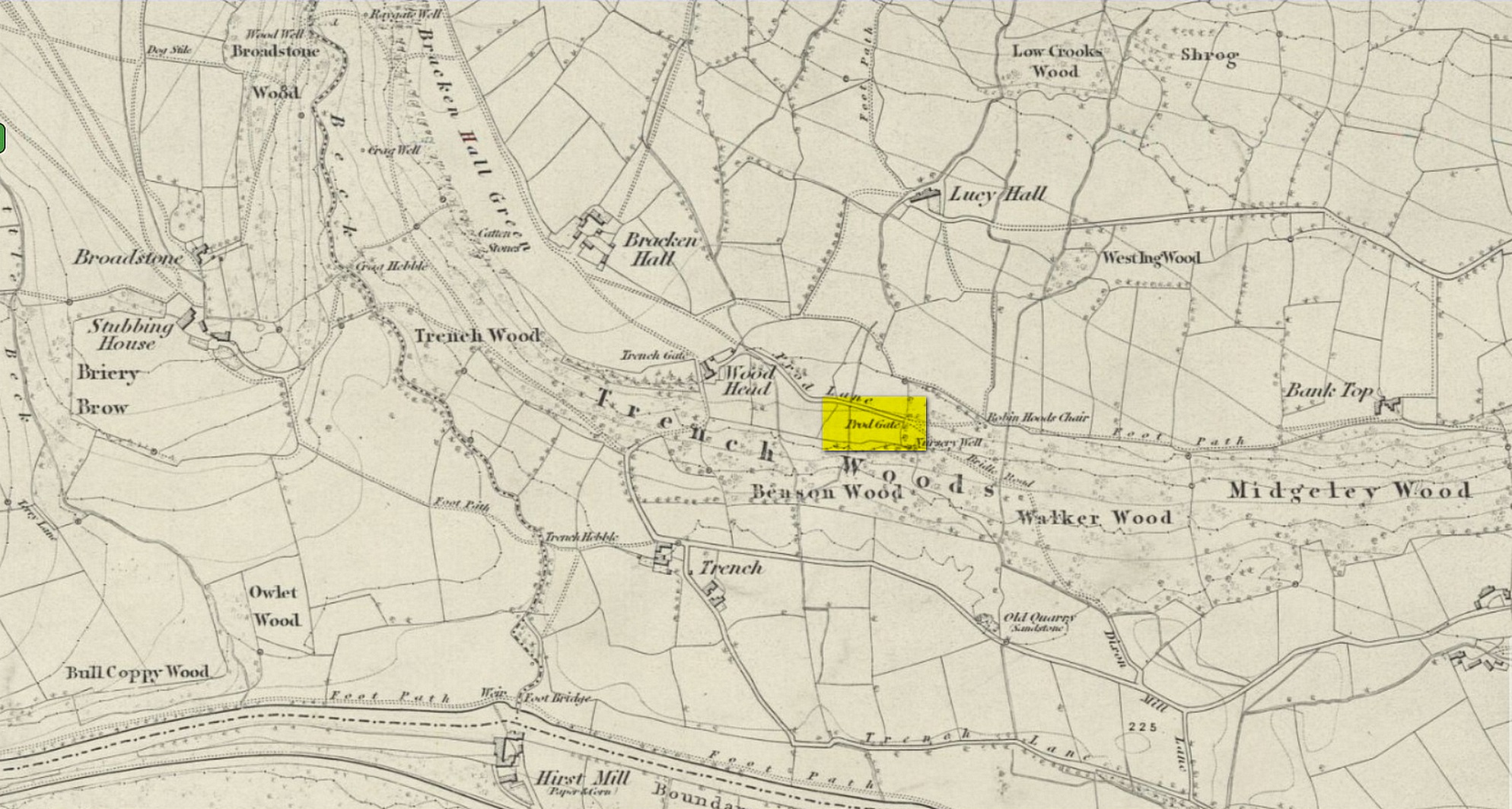
Prod Gate on 1852 map
The exact location of this has proven difficult as the name ‘Glen gate’ was obviously a local one as it wasn’t included on the Ordnance Surveys of the period. There are two named “gates” hereby: one is Prod Gate at the east end of Prod Lane, and the other is Trench Gate a few hundred yards west at the other end of Prod Lane. But the most likely gate of the two would be Prod Gate. When Speight wrote his words, a stream existed that crossed the track about 70 yards west of Prod Gate, whereas no such water-course existed anywhere close to Trench Gate. And so we assume that he was writing about “the stream from the Glen (Prod) Gate.”
Having said all that, there are no known petroglyphs like the one that Speight described anywhere hereby. There are a couple of so-called “carvings” that have been included in so-called official surveys (Boughey & Vickerman 141 and 142; aka ERA- 2445 and ERA-2446) another 150 yards or so on the left-side of the road that could have been regarded as contenders, but these stones have just a mix of modern and natural markings and can be discounted. In all likelihood, this impressive-sounding petroglyph was broken up and destroyed when the proper road was laid in the middle of the 20th century; or perhaps broken up and stuck into one of the garden walls along the roadside. Either way, the carving seems long lost.
References:
Boughey, K.J.S. & Vickerman, E.A., Prehistoric Rock Art of the West Riding, WYAS: Leeds 2003.
Gray, Johnnie, Through Airedale from Goole to Malham, Walker & Laycock: Leeds 1891.
Acknowledgements:Huge thanks for use of the Ordnance Survey map in this site profile, reproduced with the kind permission of the National Library of Scotland.
Along the B6265 old road between Keighley and Bingley, at Riddlesden go up Granby Lane, bending left into Banks Lane. About a mile up you’ll reach the moorland road. Turn left at the junction and nearly half-a-mile along there’s a layby on y’ right. From here walk along the footpath on the edge of the ridge, half-mile along bending slightly above Rough Holden Farm until, a coupla hundred yards on, you hit the dirt-track. There’s a long straight stretch of walling on your left: follow this for a few hundred yards, go through the gate and here walk on the other (left) side of the wall (if you’ve reach a derelict farm, you’ve gone too far). Some 60 yards or so down here, keep your eyes peeled on the long earthfast stone right near the walling. An alternative is to start at the steep hairpin bend up Holden Lane and follow the footpath into the woods. Walk along here (parallel with the stream below) for about 600 yards until you hit the bridge crossing the stream. Don’t cross over: instead double-back up the field on your right, go diagonally across and through the gate into the next field, and walk up along the walling to your right. 160 yards up, go through the gate and walk about 30 yards along the side of the walling again. Tis there!
Archaeology & History
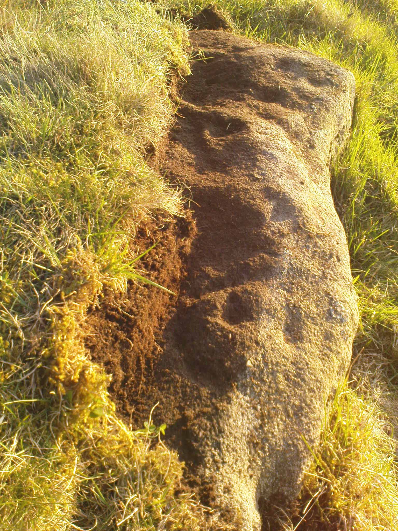
Unveiling the Sunset Stone
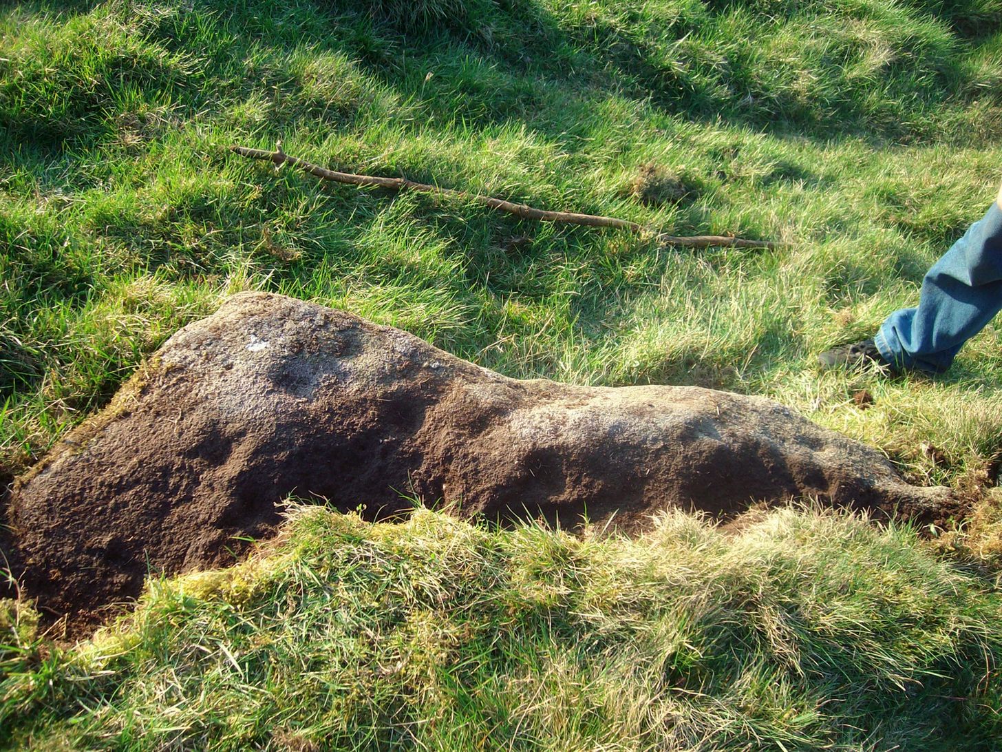
This is a fascinating carved stone on the western edge of Rombald’s Moor that I was fortunate to find in 2008. It’s found in association with two other cup-marked stones, north and south of it. I first noticed it when I was walking along the footpath by the side of the wall and saw that on a small exposed part of the rock a single cup-marking carved close to the vertical edge of the stone—and I’m glad that I stopped to give it more attention. The stone was very deeply embedded and the covering soil so tightly packed that I could only shift a small part of it—but the section that I managed to uncover and, importantly, the time of day when I did this, brought about an intriguing visage with subtle mythic overtones.
Carved arc on edgeEarly photo in low light
The carving was found near the end of the day just as the sun was setting and touching the far horizon. I noticed there was a cup-and-half-ring to the side of where I’d sat for a rest, near the northern edge of the stone, and the clear but soft light of the evening caught this element and almost brought it to life! As I gazed down at the half-ring, the sun highlighted it even more and I saw that some extended carved lines continued and dropped over the near vertical edge of the stone, becoming an unbroken elongated ‘ring’ that stretched twice the length of the half-ring on the flat surface. Not only that, but a faint cup-mark seemed to be inside this extended vertical ring and, as I saw this, a dreaming epiphany hit me that the symbolism behind this was a representation of the setting sun that I was watching at that very moment. It was quite beautiful and the carving seemed to come to life. The thought, nay feeling, that this part of the carving symbolized a setting sun not only slotted easily into a common animistic ingredient, but hit me as common sense too! However, as my ego and rational sense rose back to the fore (I had to get mi shit together and walk a few miles home before night fell), I saw that this impression may be a completely spurious one; but, as the rock-face inclines west, towards the setting sun, the name of Sunset Stone stuck. As I carefully fondled beneath the heavy overgrowth of vegetation covering the stone, I realised that I needed to come here again and uncover more of it, as additional cups and lines seemed to be reaching out from the mass of soil.
Cups near the S edgeClose-up of ring-edge
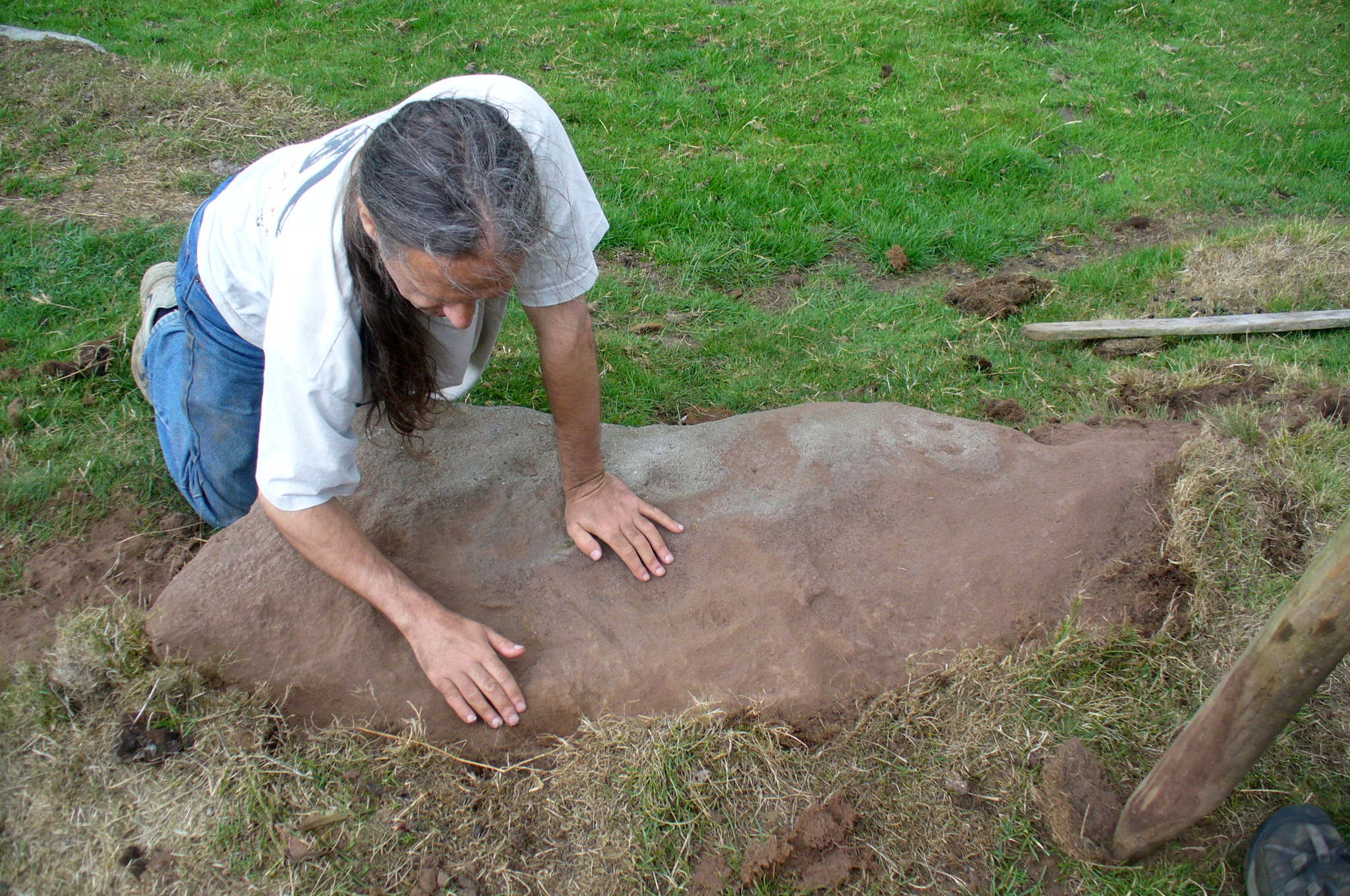
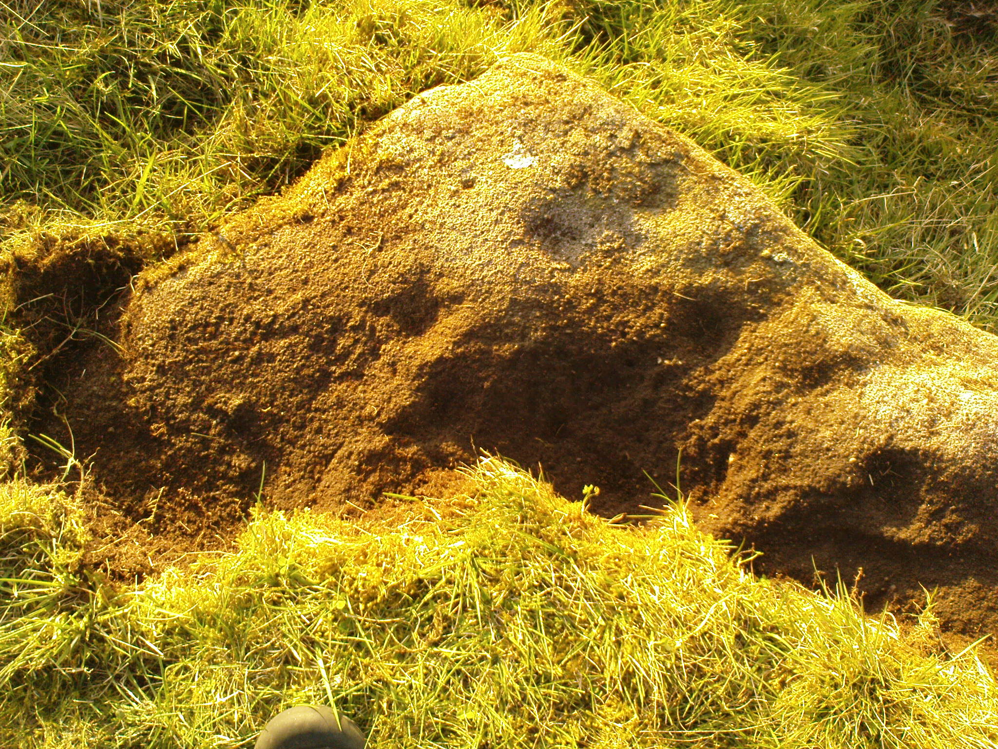
I returned to the stone a few times, but several years passed by before I revisited the site with the intention of uncovering more of the design in the company of Richard Hirst and Paul Hornby on August 4, 2013—and it took considerable effort to roll back the turf that covered the stone. But it was worth it! For it soon became obvious that much of the stone that was covered over had been unexposed for many centuries: as Richard pointed out, the edge of the rock was very smoothed by weathering, whilst the covered section of the stone that we were revealing was still quite rough and misshapen all across the surface, lacking weather and water erosion. Much of this design therefore, highlighted itself to us as it was when the mason first carved the stone. And it turned out to be a pretty curious design!
Faded photo of the carvingFaint proto-ring nr centre
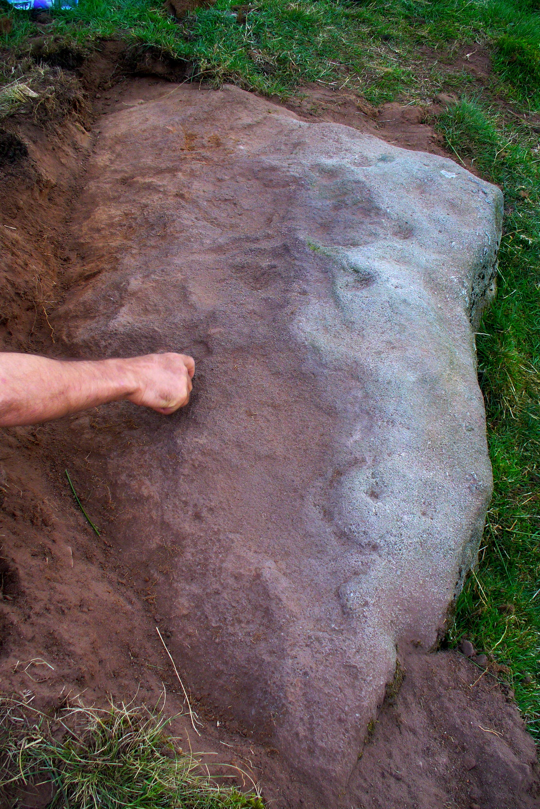
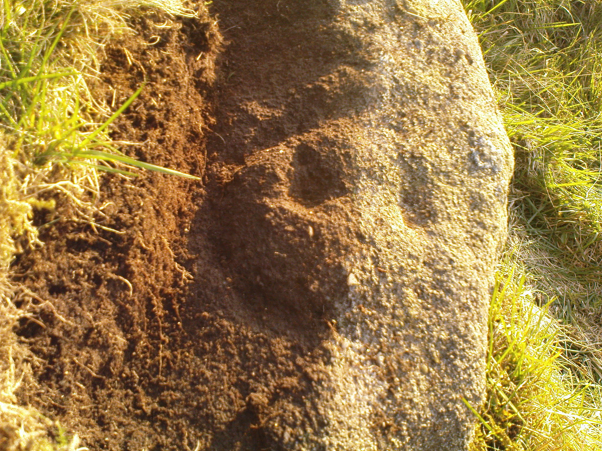
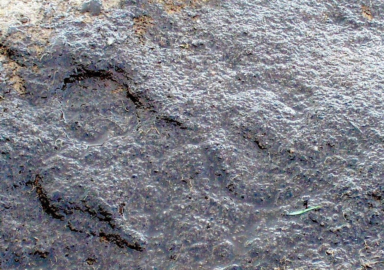
Our first impression was that the design comprised of two cup-and-rings near the middle of the rock, with another cup-and-drooping-ring near the northern edge of the stone, and between ten and twelve typical cup-markings, many on the western exposed side. But curiously near the middle were also a couple of rings whose edges had been defined, but the hollowed-out ‘cup’ in the middle remained uncut or unfinished, being a proto-ring, so to speak. Also, lines leading from these unfinished ‘cups’ were also pecked and laid out, but they were also unfinished. Some sections of the unfinished lines ran onto the western edge of the stone and were very faint, but they were undeniably there. Unfinished cups is an unusual feature for carvings on Rombald’s Moor.
Mr Hirst’s clearanceCups & curves on edge
But the most interesting element in the fainter, seemingly unfinished carved lines, was what may be a small spiral that started above the two faint cup-and-rings. This then continued in a sharp arc which doubled-back on itself. In the other direction, the lines curve round and go down to the vertical face of the rock, before bending back up onto the level surface again, then disappearing. The topmost cup-and-half-ring is also a curious feature. When you visit here you’ll see how this aspect of the design looks for all the world like a simply cup-and-half-ring near the edge of the stone. But, as I’ve already mentioned, closer examination shows that this “half-ring” has a larger oval body beneath it on the vertical face of the stone, very worn due to its exposure to the elements and very much in the shape of a bell—and within this large cup-and-ring ‘bell’ is a much fainter complete cup-and-ring, just below the topmost cup-marking. I know that I’ve already mentioned this, but I’m giving it added emphasis as it’s a unique design element for carvings on these moors.
Early photo of the carvingEdge of the carving
The Sunset Stone really requires more attention, when the daylight conditions are just right, so that all of these intriguing aspects can be highlighted with greater lucidity. There is also the potential that more carved ingredients remains hidden beneath the compacted soil.
What seems to be a more trivial single cup-marked stone can be seen roughly 20 yards to the north.
Acknowledgements: Massive thanks to Richard Hirst of Hebden Bridge, and Prof. Paul Hornby, for their help in bringing this carving to light.