From Bainbridge, take the A684 road east to Aysgarth. Just out of the town, 200 yards over the bridge, take the right turn down Blean Lane. Nearly ½-mile along, take the minor road on your left and go along here for 1½ miles where, a few hundred yards before the solitary farm of Carpley Green (lucky buggers!), you can park up. (keep plenty of room for a tractor to get in the fields) Walk down the track past the farm and 250 yards along, where the first field ends, a gate leads you into the hills on your left. Go through here and then the next gate 120 yards on, then walk straight along th elong geological ridge ahead of you, veering to the top-side until it meets the walling. You’ll see the giant Stoney Raise cairn on the other side.
Archaeology & History
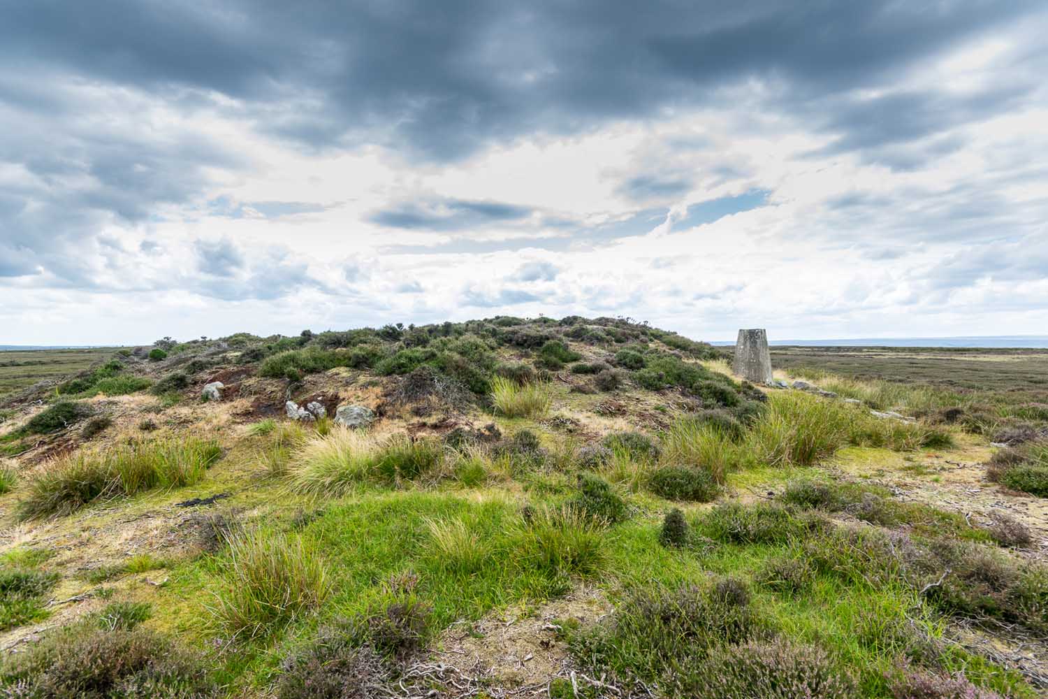
Stony Raise from above
The remains we find here are nigh-on immense! If giant cairns get you going (like the Great Skirtful of Stones or the denuded Devil’s Apronful near Pendle, etc), this one will blow you away! Along its widest axis, to this day it’s nearly 40 yards across and nearly 7 feet high! But in earlier times it was even bigger—much bigger! The first known description of the site was made by one Charles Fothergill, a Yorkshire-born politician and ornithologist, who wrote a diary of his walking excursions to various places in North Yorkshire at the beginning of the 19th century. (Romney 1984) His account of it was a good one for that period and thankfully he recorded information that would otherwise have been forgotten. After his visit here in September 1805, he told about this,
“wonderful tumulus called Stone raise which is a great curiosity: it is formed entirely of large stones piled up without earth or gravel, differing in that respect from any I have seen. Notwithstanding that upwards of a thousand, nay ’tis said several thousand, loads of stones have been led away from it to build walls with, it yet remains a stupendous monument of this species of antiquity: we measured the base of it as well as we could by our strides and made it 369 feet in circumference and of such an height as to be seen for a considerable distance. It has been most completely rifled…and it now presents a number of small craters formed by the investigations of the money searchers. It is situated upon a hill about half a mile south of Addlebrough. In addition to the particulars I formerly mentioned, I may say the men who first opened it about 50 years ago worked incessantly for 33 days. It stands on Thornton moor, and tho’ the Thornton men would not assist in the labour, they intended to share in the profit if there was any; but the adventurers who had all the work resolved they should not and they carried a large sword with them every day to defend the treasure in case they found any; the wise man who read ’till the stones shook and rattled was a schoolmaster at Bainbridge: the teeth they found were deposited in a hollow place in the bottom of the tumuli formed long and narrow like a coffin by a walling of stones. Tho’ the tumulus has apparantly been compleatly rifled, I do not believe the whole base has been sufficiently searched, but if it was to commemorate one great individual, which appears to have been the case, perhaps nothing more may be found.”
Fothergill’s description of “upwards of a thousand” cartloads of stone being removed from Stony Raise has been doubted by some archaeologists, but this claim should not be dismissed so lightly without evidence. There are immense tombs from northern Scotland to the unholy South that have remained untouched by the hand of industrialists that easily enter the category of such giants and this may have had equal stature.
A few years after Fothergill’s visit, Thomas Whitaker (1823) briefly described the site in his magnum opus, but added very little, simply telling that on the hills behind Addlebrough,
“there is still on that elevated spot a cairn, called Stone Raise, about 120 yards in circumference at the base, to which the usual tradition of its containing a treasure of gold having been attached, two persons were several years ago induced to make the experiment; but having penetrated to the centre, found, to their great disappointment, what an antiquary would have prepared them to expect, namely, a kist vaen of flag stones, with the remains of a human skeleton, the teeth of which were still pretty perfect.”
To this day the site remains unexcavated, so we don’t know too much about the place. It’s likely to have been constructed in neolithic times and its ancestral nature quite obviously venerated. It may have been re-used during the Bronze Age, but without excavations we may never know. A decent dig into this site is long overdue!
Folklore
This gigantic tomb is, not surprisingly, said to be haunted. Strange sounds and visions have been encountered here in bygone times. But the most well-known tale is that it was the site of a great treasure—perhaps hinted at by Fothergill. There are variations on the theme, but this is overall story:
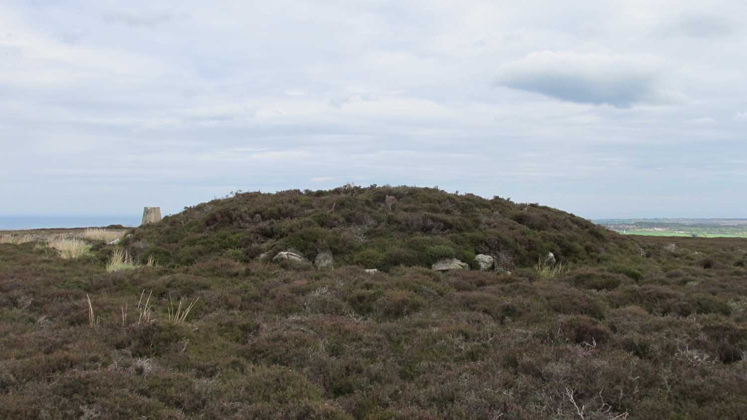
Structured stonework
The tomb was said to be where a local giant had fallen and with him was buried a great chest of gold which he had dropped before he died. Some say that the ‘giant’ was a Brigantian chief – others a great warrior. The great treasure chest beneath the cairn is said to be looked over by a fairy who once lived by the giant’s tomb. It was this tale which gave the site its local name, the ‘Golden Chest on Greenber’. Several attempts have been made to find the treasure, but all have failed.
However, when the roving antiquarian Edmund Bogg came to write of the place in 1908, the giant had by all accounts been found within! He told us that,
The giant’s cist cover?
“this Kist-vaen was opened, many years back, and the skeleton of a chieftain of great stature was unearthed; the treasure chest of that or some other primal savage was not, and has not yet been discovered – for, take heed ye matter-of-fact money hunters, it is said the lucky one must first see the wraith of the ancient warrior to whom it belonged, who will then shew under which part of the immense Raise it is hidden! May this help any reader who is imaginative enough to find it – having seen the wraith he must keep silence – he has then but to stretch out his hand, and draw it forth.”
There are variations on this tale that have subsequently been penned by a number of Yorkshire folklorists, but this is the general lore. There was also a short rhyme told of Stoney Raise, that speaks of its apparent use through history by various races:
Druid, Roman, Scandinavia,
Stone Raise in Addlebro’.
References:
Bogg, Edmund, Wensleydale and the Lower Vale of the Yore, E. Bogg: Leeds 1906.
Bogg, Edmund, Richmondshire, James Miles: Leeds 1908.
Elgee, F. & H.W., The Archaeology of Yorkshire, Methuen: London 1933.
Gutch, Mrs E., Examples of Printed Folklore Concerning the North Riding of Yorkshire, David Nutt: London 1899.
Lofthouse, Jessica, Countrygoer in the Dales, Hale: London 1964.
Parkinson, Thomas, Yorkshire Legends and Traditions – volume 2, Elliot Stock: London 1889.
Pontefract, Ella, Wensleysdale, J.M. Dent: London 1936.
Romney, Paul (ed.), The Diary of Charles Fothergill, 1805, Yorkshire Archaeological Society: Leeds 1984.
Whitaker, Thomas Dunham, An History of Richmondshire – volume 1, Longman Hurst: London 1823.
White, Robert, A Landscape through Time, Great Northern: Ilkley 2002.
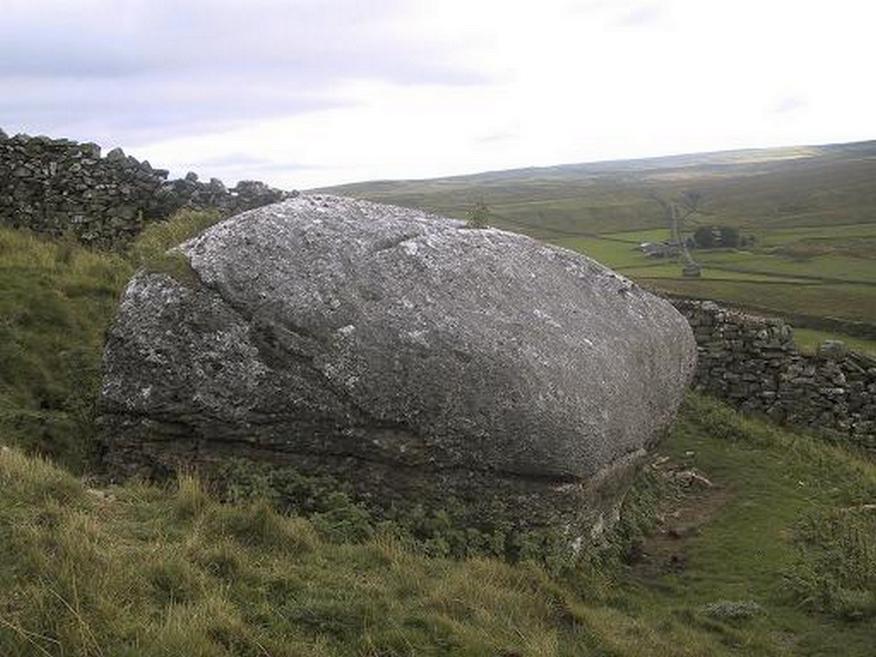
From the small town of Bainbridge, head south down the Carpley Green Road. Less than a mile before the end, look to the west-facing slope of Addlebrough Hill and this huge Devil’s Stone can be seen resting halfway up the slope, just by the wall. Y’ can’t miss it!
Archaeology & History
The Devil’s Stone
Highlighted on the 1856 Ordnance Survey map, one of the legends of this place suggested there might be cup-and-ring markings on the stone, but the curious markings on top of the rock seem to be natural. It’s a superb stone though, dropped here no doubt by some great glacier as it retreated north, in ages truly olde…
There’s a lot of archaeology around here that’s yet to receive the attention of the archaeology textbooks. But if you’ve ventured to see this, have a gander across to the massive prehistoric tomb known as Stony Raise, less than a mile southeast of here.
Folklore
One legend tells that long ago Addlebrough was the home of a great unnamed giant — but a friendly giant by all acounts. However, one day the devil turned up and wanted possession of the giant’s hill and so a fierce row broke out between them. Perched on the top of the crag — which is the rough ridge to the west of here — the giant who lived there hurled huge boulders down at the devil, but they fell short and landed at the side of Lake Semerwater (itself an important spot in local prehistory). In return, Old Nick himself began throwing boulders back — and one of those which the devil threw landed here, halfway up the western flank of Addlebrough Hill (a couple of the large boulders which the giant threw can be seen on the edge of Semerwater and are known as the Carlow and Mermaid stones). Hence it’s name of the Devil’s Stone!
In Edmund Bogg’s Richmondshire (1908), he told how, “the curious markings on (the Devil’s Stone) are accounted due to the pressure of the devil’s fingers” which were caused when he threw this giant stone from somewhere to here.
Site shown on 1856 map
This is a theme we find at countless other stone sites, i.e. the Devil burning holes into rock — and in some cases these devil’s “fingerprints” have turned out to be prehistoric cup-markings. Such tales relate to the pre-christian Creation Myth of a place and would, before the “devil” was supplanted onto a site, have had wider significance in the landscape as a whole, in a manner known only to local people. Devils usually replaced legendary giants, or the hero-figures who created the land in primordial times in the myths of our ancestors. A greater examination of the nearby sites in association with the folklore of the region would no doubt be quite profitable…
References:
Bogg, Edmund, Richmondshire, James Miles: Leeds 1908.
Romney, Paul (ed.), The Diary of Charles Fothergill, 1805, Yorkshire Archaeological Society: Leeds 1984.
Cup-Marked Stone (lost): OS Grid Reference – NN 4808 0140
Archaeology & History
On the south-side of Loch Ard, just a few yards from the entrance to Rob Roy’s Cave (one of several), right by the water’s edge are the natural upstanding pillars known locally as Gog and Magog. In Peter Joynson’s (1996) work on Aberfoyle, this site is listed as one in a number of unrecorded cup-and-ring stones in the area. Discovered by a local lady—”the late Mrs Maitland”—here we have,
“two huge stones about 30ft high known as Gog and Magog situated at the mouth of Blan Ross Bay. They have numerous cup marks, but sadly have disappeared from view as they have been covered by forestry planting.”
This is an increasingly annoying problem that many rock art students are having to contend with! When we visited the site, the tops of these huge stones were, indeed, covered in depths of mosses and pine needles and the carving is hidden from sight. When the trees are felled, let’s hope someone can find it!
Folklore
These natural rocks were said to have been two giants that were turned to stone, the story of which seems to have been forgotten…
References:
Joynson, Peter, Local Past, privately printed: Aberfoyle 1996.
Tumulus (destroyed): OS Grid Reference – NT 9323 2800
Also Known as:
Auld Wife’s Apronful o’ Stanes
Tom Tallon’s Tumulus
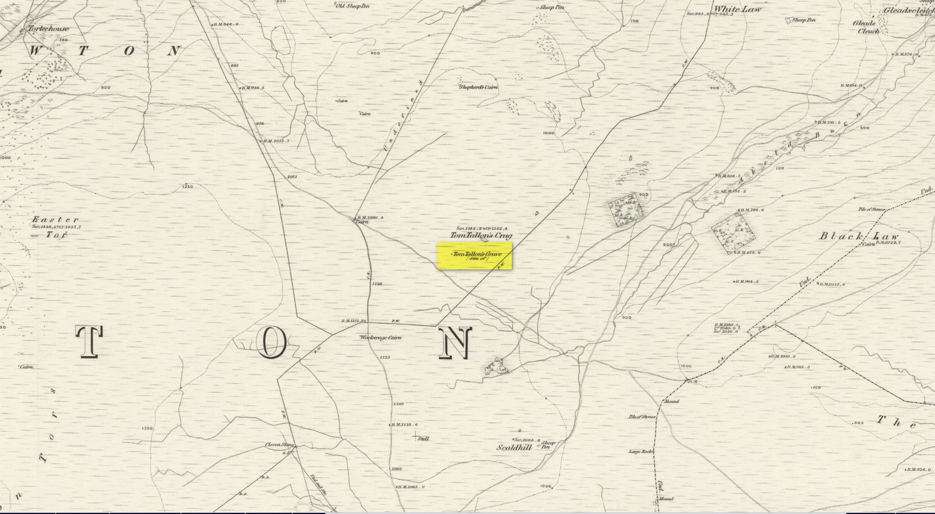
Archaeology & History
Site on the 1866 OS-map
Highlighted on the earliest OS-maps about half a mile to the south of the great prehistoric camp of Yeavering Bell and 100 yards southwest of Tom Tallon’s Crag, there once stood an apparently “massive” Bronze Age tumulus, or cairn, called Tom Tallon. I’d hedge a bet that it was much older, from the neolithic period. It was described by P.A. Graham (1921) as “the largest cairn in the district,” but when it was visited by the antiquarian Henry MacLauchlan in July 1858, he reported that “it was being removed to make a fence”!!! Unbe-fuckin’-lievable… Who were the dickheads that did that?!
Folklore
The Ordnance Survey Name Book of 1860 for Tom Tallon’s Crag told that,
“There is a vague tradition about Tom Tallon having been a Warrior and Slain here – hence the name, but nothing authentic respecting Tom, can now be ascertained.”
The word tom derives from “a rounded hill”, sometimes associated with a tumulus and in Scotland (just over the border) associated “with a dwelling place of the fairies” with tallon suggested by Graham (1921) to derive from “tal, a forehead or promontory, and Llan, an enclosure.”
What is quite obviously an older name, or certainly one that was more recognised by local people, is its title of the Auld Wife’s Apronful of Stones: a title we find associated with a number of the giant cairns in northern England and Scotland. It relates to the creation myth of the site, whereby the countless stones that made up the cairn were dropped or thrown across the landscape by a giantess who inhabited this area.
References:
Hall, James, A Guide to Glendale, M. Brand: Wooler 1887.
MacLauchlan, Henry, “Notes on Camps in the Parishes of Branxton, Carham, Ford, Kirknewton and Wooller, in Northumberland,” in History Berwickshire Naturalists Club, volume 24, 1922.
Legendary Rock (destroyed): OS Grid Reference – NJ 89397 49502
Also Known as:
Crawey Stone
Crawford Putting Stone
Crawstane
Devils Putting Stone
Archaeology & History
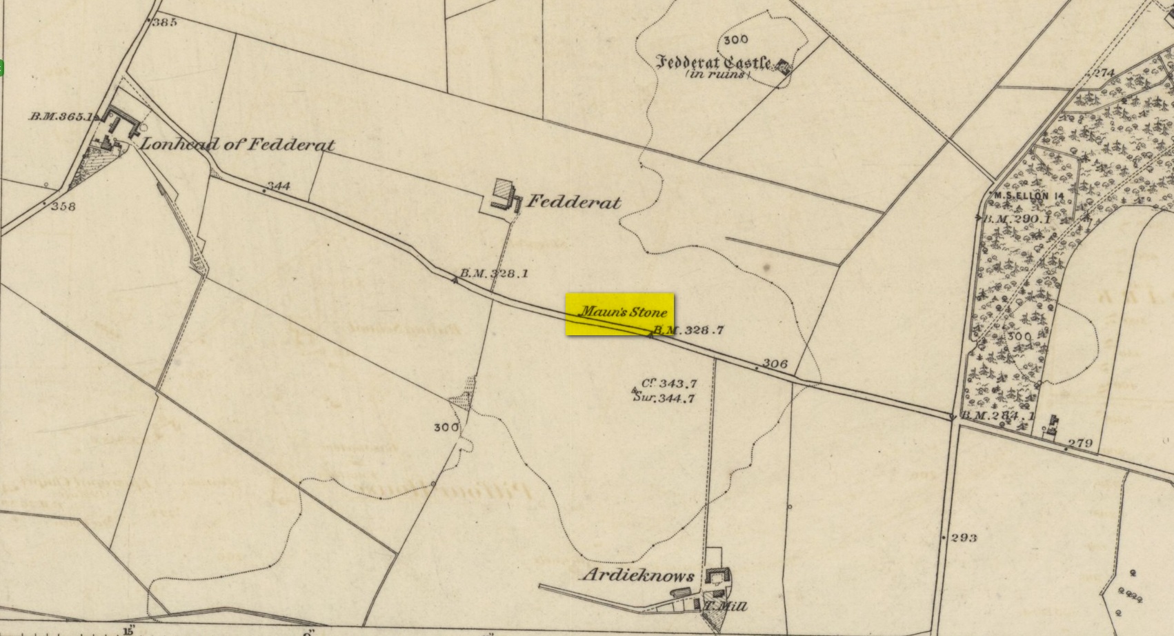
Stone shown on 1874 map
A site whose main claim to fame is its legendary nature. Seemingly buried or destroyed around the end of the 19th century, there have been suspicions that the stone might have had cup-marks on it (see Folklore below), but we’re not sure. Modern lore tells that when roadworks were done here in the 1950, a large stone was uncovered. A local man who was passing by told that he’d seen the Crawey Stone in his youth and that the stone they’d uncovered was one and the same.
Folklore
The story that used to be told amongst local people was thankfully preserved in an article by the pseudonymous “Mormond” (1889) in Scottish Notes & Queries. He told that:
“In the parish of New Deer, and in a field near the Old Castle of Fedderat, there is a large boulder of ten or twelve tons known as the Crawey Stone. I am unable to say if it still occupies its old site, or if it has been broken up for building purposes. The legend connected with this stone used to be well known in the parish, and a version of it appeared in The Aberdeen Magazine some 70 or 80 years ago. This version is substantially the same as the legend known in the district, and relates how a Crawford, the lord of the castle and lands, one day “as he looked o’er his castle wa’ ” — a phrase which often occurs in old ballads — observed a crunkled carl (old woman or witch, PB) inspecting the stone and afterwards successfully lifting up one end clear of the ground. Not to be conquered by such a shabby looking stranger, the laird, who was famed for his athletic powers, went out and challenged the carl; but on attempting to lift the boulder, burst a blood vessel; and the carl, who stood by watching him, suddenly disappeared in a flash of fire taking the remains of the laird along with her. The tradition is that the laird was not mourned for in the district, and the moral drawn was “He couldna hae expected ony ither en’.” When passing the boulder going to school, the legend was often referred to, and some indentations on it pointed out as the marks of the ill man’s fingers made at the time the superhuman feat was accomplished.”
These finger marks have been taken as possible cup-markings. They might have been, but we simply don’t know; they may just have been curious natural markings that gave rise to this animistic creation myth. Another tale told that the markings were due to an old giant in the neighbourhood who used the rock as a putting stone and rolled it to the spot where it used to stand. Giants are always attached to indigenous creation myths, some of which go back thousands of years.
“a large Stone of a roundish shape, built on an old fence, forming a side of the Public road leading from New Deer to Brocklay. Tradition asserts that it has been the putting Stone of a Giant in ancient times. There are Several holes in the Stone said to be the finger marks of the Giant.”
Chambered Cairn (destroyed): OS Grid Reference – H 277 998
Archaeology & History
Included in Eamon Cody’s (2002) magnum opus, this site has long since gone. It was highlighted on the 1845-47 OS-map of the area and the only subsequent information about it was written in the 1903 Ordnance Survey Name Book, where it was described as a “supposed Giant’s Grave” that was marked by a large spread of boulders.
Perhaps the only thing we can ascertain here is from the name Giant’s Grave. Invariably, giants are part and parcel of creation myths in early traditional societies. Such giants, as well as being huge mythical creatures, can also be the progenitor of tribes and communities, i.e., the person who laid the initial foundation of where the tribe came to live, usually an early queen, king or shaman figure. So, in the case of this Giant’s Grave, it was likely to have been known as the burial place of such a figure: mythical in importance as well as size.
References:
Cody, Eamon, Survey of the Megalithic Tombs of Ireland: Volume VI – County Donegal, Duchas: Dublin 2002.
Take the Glenfarg road out of Bridge of Earn, cross the motorway and park at the layby past the bend. Go through the gate opposite and follow the track up to the telecoms mast, you can’t miss it..
Archaeology & History
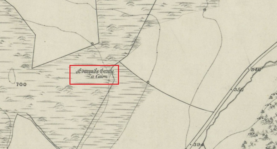
Shown on the 1866 OS Map
Visible from the lowlands below, it is described in the official listing as a cairn of prehistoric date, a funerary monument dating to the late neolithic to early Bronze Age. It is a broadly round stony mound, partially overgrown with turf on the north eastern (mid-summer sunrise) slope of Balmanno Hill, where it has extensive views over the surrounding country. It is 1.8m (6′) high, 17m (56′) across on the N-S axis and 16m (52′ ) on the E-W axis.
The top of the cairn has a depression in it: possibly the result of treasure-seeking long ago, but there is no evidence of any burial cist.
So who was ‘Edmund’? Was this a place of heathen ritual Christianised with the designation of St Edmund during the Anglo-Saxon incursions of the early middle ages, or the name of a local landowner? It is lost to history. The name ‘Balmanno’ can be interpreted as ‘Place of the Big Man’ – so have we an echo of a lost giant legend here in an area of Scotland where such legends abound, and long pre-date the construction of the cairn? Did later people name their local mythic giant ‘Edmund’?
An alternative meaning of ‘Balmanno’ is given by David Dow in the Old Statistical Account – the ‘Town of the Monk’.
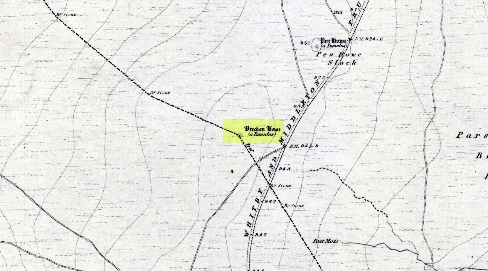
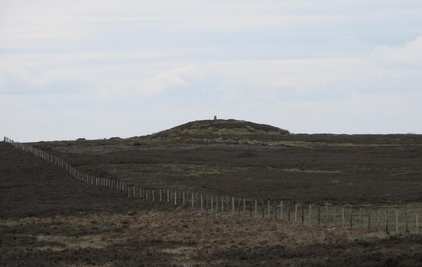
Along the A169 road between Sleights and Pickering, some two miles south of Sleights at the highest point on the moors just above the west side of the road, you’ll see a large mound with what looks like a standing stone on top of it. A minor road turns off the A169 at this point, heading southeast, and the large mound is 150 yards from the roadside. You can’t really miss it!
Archaeology & History
Shown on the first OS map of the area in 1853, this conspicuous prehistoric tomb surmounted by a relatively recent boundary stone, sits at the highest point on the moors in these parts. Despite this (as with others on these moors), very little has been written about the place and it has received only minimal attention in archaeology tomes. Even the renowned pen of Frank Elgee (1912; 1930) gave it only passing mention. Perhaps it aint a bad thing to be honest.
Breckon Howe, from the south
As well as being conspicuous, it’s large. Rising some six feet above the natural ground level, it measures 26 yards across its east-west axis, and 29 yards north-south, with a rough circumference of 88 yards. The boundary stone that surmounts its crown sits in a hollow that looks like it was opened up a century or two ago by antiquarians (much like ourselves). But its position of the tomb in the landscape that is most striking. The view from here is considerable, having a clear 360º view for many miles around. Other prehistoric tombs can be seen from here, but more importantly this tomb can be seen on the skyline from many others. This was probably a deliberate feature intended by its builders–and it’s not uncommon, as many of our upland regions are crowned with ancient tombs like Breckon Howe. In all likelihood this would have been the resting place of some important ancestral figure: a tribal elder or a shaman, whose spirit after death could view and travel across the landscape they inhabited in life.
Although the tomb presently sits amidst an endless sea of heather (Calluna vulgaris) typical of moorland across our northern lands, the name of the site ‘breckon’, according to George Young (1817) derives from the dialect word meaning ferns or bracken. This is echoed in Francis Kildale’s (1855) local dialect study and subsequently in Joseph Wright’s (1898) unequalled magnum opus.
Folklore
In the early 19th century, one George Calvert who lived in the area, collected as much folklore as he could, as it was dying off with the coming of the Church. One such piece told that there was once a hob who lived by this old tomb. A hob is generally known as a supernatural creature, but in this area it can also be a medicine man. Some hobs were good, others were malicious. We know not what type of hob lived lived here, but Calvert simply told us there used to be “T’ Hob of Brackken Howe”. Nowt more! It would be good to find the story behind this old character, if it hasn’t been lost entirely…
References:
Elgee, Frank, Early Man in Northeast Yorkshire, Frank Bellows: Gloucester 1930.
Elgee, Frank, The Moorlands of North-Eastern Yorkshire, A. Brown: London 1912.
Kildale, Francis, A Glossary of Yorkshire Words and Phrases Collected in Whitby and the Nieghbourhood, J.R. Smith: London 1855.
Home, Gordon, The Evolution of an English Town, J.M. Dent: London 1905.
Wright, Joseph, English Dialect Dictionary – volume 1, .Henry Frowde: London 1898.
Young, George, A History of Whitby and Streoneshalh Abbey – volume 2, Clarke & Medd: Whitby 1817.
Acknowledgements: A huge thanks to Lindsay Mitchell for getting us up to see this great tomb and its companion.
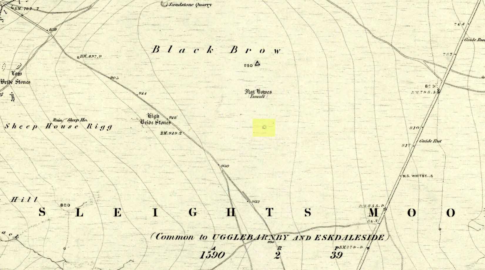
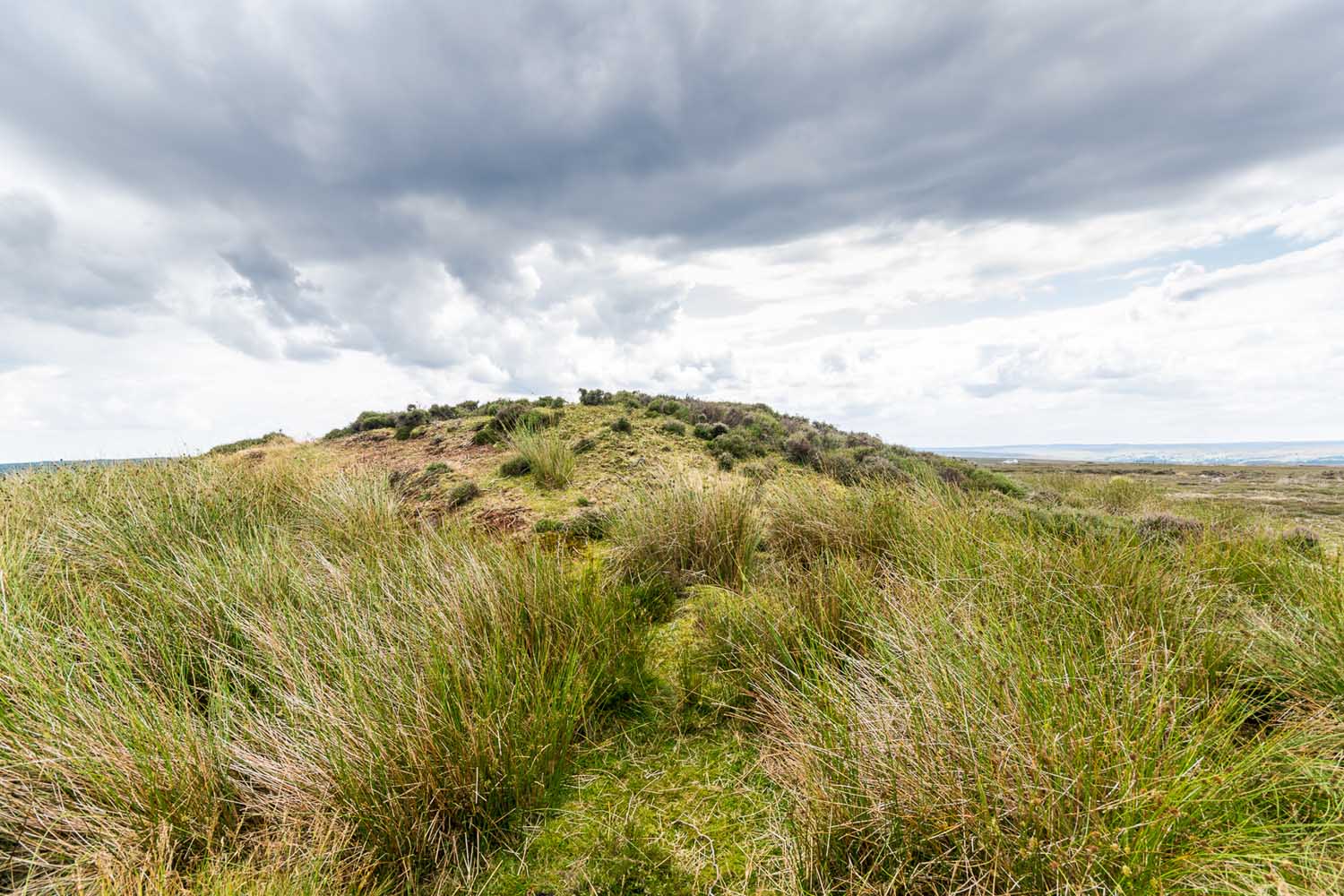
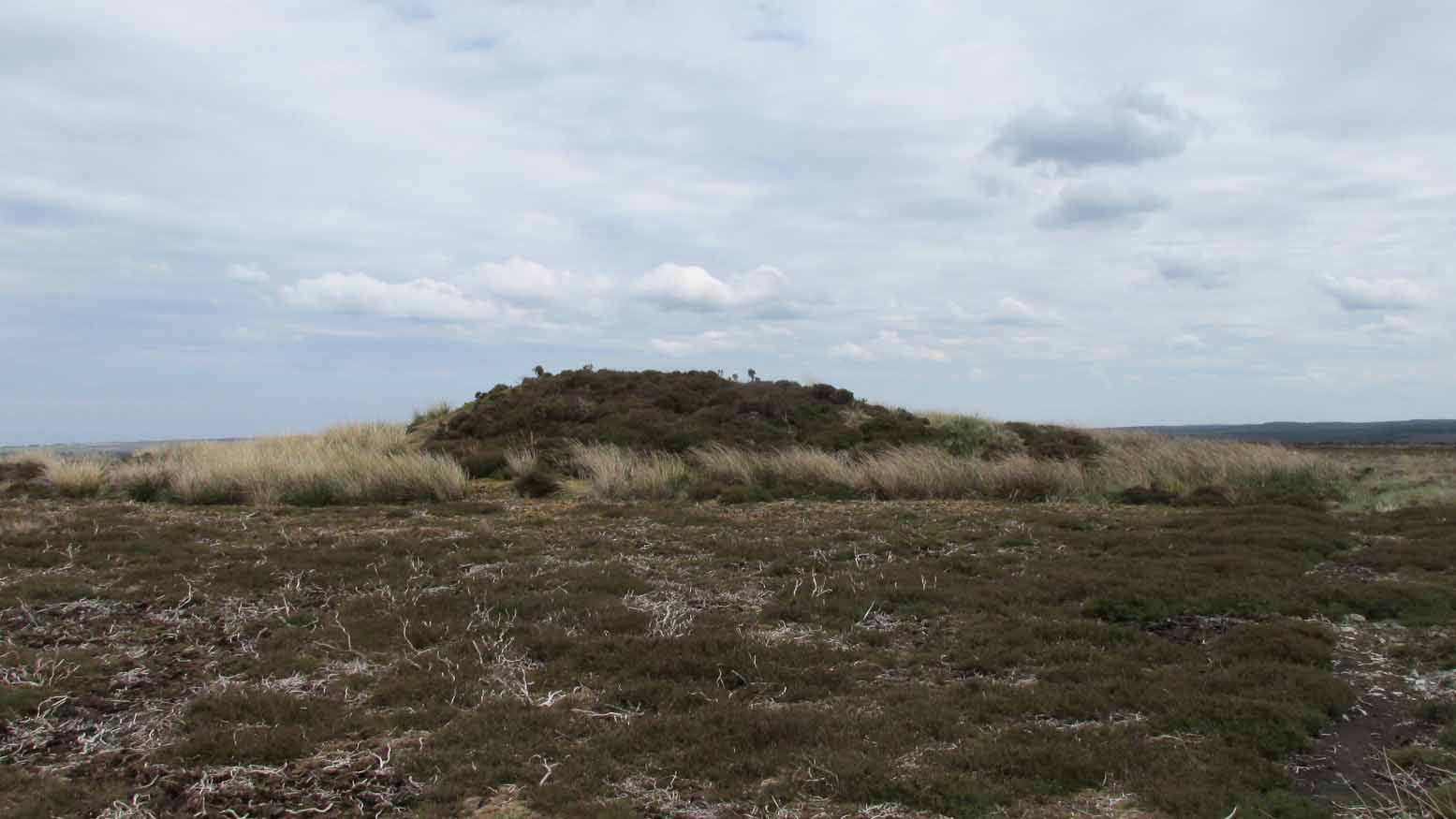
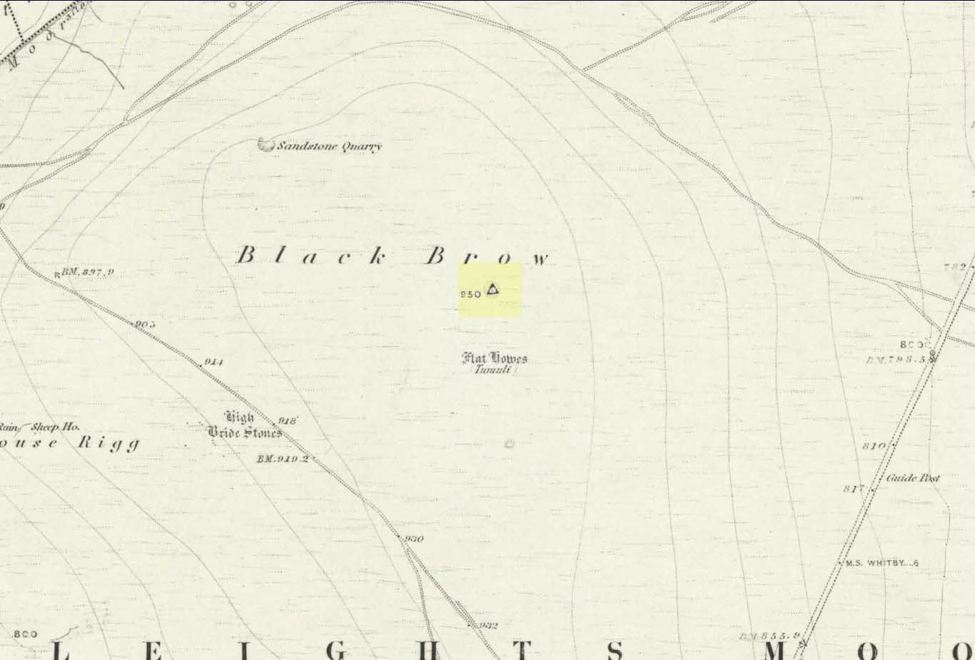
Along the A169 road that runs may miles from Whitby to Pickering, as you go through the small town of Sleights, the road gets steep for a mile or so, until you reach the moorland tops, where the road runs dead straight. After 1.2 miles (1.93km) along the straight road, a small minor road is to your right. Go along here for literally half-a-mile (0.8km) where you’ll see a small dirt-track on your right, with a locked gate. There’s room to park here. Walk straight onto the moor towards the large rounded mound about 200 yards northeast. That’s it!
Archaeology & History
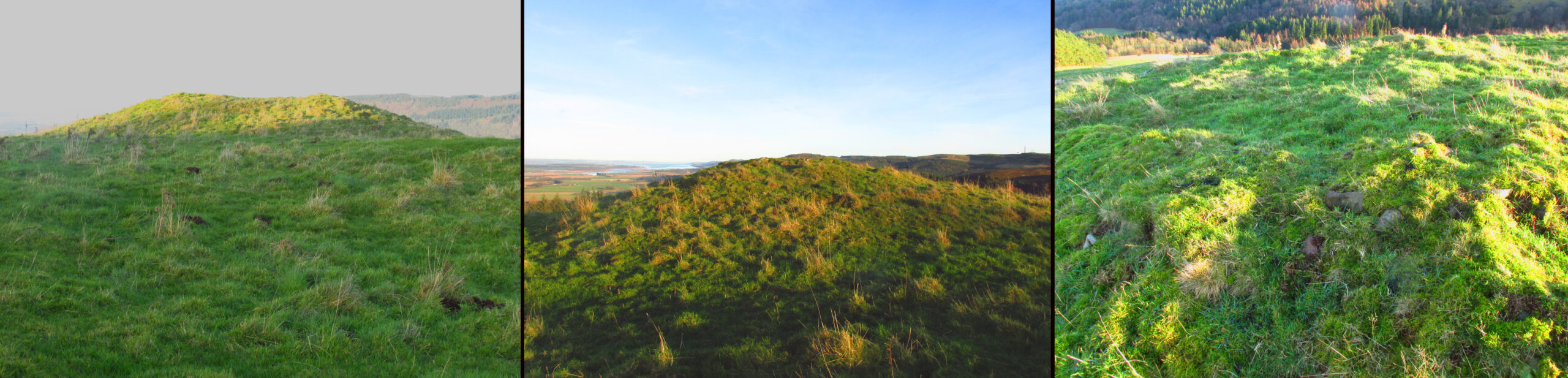
Highlighted as a blip on the 1853 OS-map (see above) 250 yards south of Flat Howe (1), this is the slightly smaller of the two prehistoric cairns on this flat piece of moorland (which covered in scattered woodland at the time of its construction). It has been severely robbed of stones by some land-owning fuckwits in the 19th century, who saw fit to build a shooting hut into the tomb itself! Knob-heads! As a result, much of the content of the cairn has been severely depleted, with only its western side having any real height to it.
Flat Howe 2 looking south (photo, James Elkington)Flat Howe 2, looking east
Just like Flat Howe 1, it seems that it’s never been excavated, so we can only guess about how old it is; though it is very probably Bronze Age. The cairn is roughly 25 yards across and oval in form, but was probably more circular before those morons built their hunting lodge into it. Its western side stands some 4-5 feet tall, which was probably the uniform height all round it before it was vandalized. A few yards to the south is what may be a cup-marking on one of the flat earthfast rocks, although I’m slightly sceptical of it.
The position of the site in the landscape is a fine one: living on a large flat open expanse of land, which was probably cleared of some trees when it was first built, allowing for a very wide view in all directions, just like its companion 250 yards to the north. Well worth checking out.
Folklore
It’s worth repeating the myth we have of a place on Sleights Moor that I’ve also cited in the Flat Howe 1 site profile. Although we have nothing specific relating to this tomb, an olde creation myth tells us that the local giants, Wade and his wife Bel, left their young son (whose name seems to have been forgotten) somewhere on Sleights Moor (which aint a big place). The story was first written down by George Young (1817) in his magnum opus on Whitby and the tale was subsequently re-told by many others – Mrs Gutch (1901) for one:
“Young Wade, even when an infant, could throw a rock several tons weight to a vast distance; for one day when his mother was milking her cow near Swarthoue, the child, whom she had left on Sleights moor, became impatient for the breast, and seizing a stone of vast size, heaved it across the valley in wrath, and hit his mother with such violence, that though she was not materially hurt, her body made an impression on the stone which remained indelible, till the stone itself was broken up, a few years ago, to mend the highways!”
This rock was Bel’s Rock, whose exact location seems to have been lost.
References:
Elgee, Frank, Early Man in Northeast Yorkshire, Frank Bellows: Gloucester 1930.
Elgee, Frank, The Moorlands of North-Eastern Yorkshire, A. Brown: London 1912.
Grinsell, Leslie V., The Ancient Burial Mounds of England, Methuen: London 1936.
Gutch, Mrs, County Folk Lore – volume 2: Examples of Printed Folk-lore Concerning the North Riding of Yorkshire, York and the Ainsty, David Nutt: London 1901.
Jeffrey, P. Shaw, Whitby Lore and Legend, Home: Whitby 1923.
Roberts, Anthony, Sowers of Thunder, Rider: London 1978.
Smith, A.H., The Place-Names of the North Riding of Yorkshire, Cambridge University Press 1928.
Young, George, A History of Whitby and Streoneshalh Abbey – volume 2, Clarke & Medd: Whitby 1817.
Acknowledgements: A huge thanks to Lindsay Mitchell for getting us up to see this great tomb and its companion; and to James Elkington for use of the photograph.
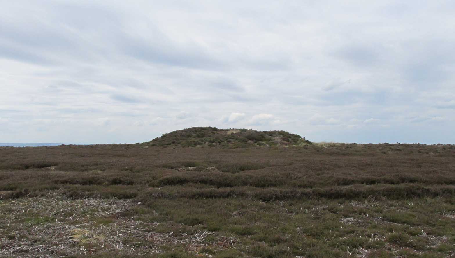
Along the A169 road that runs may miles from Whitby to Pickering, as you go through the small town of Sleights, the road gets steep for a mile or so, until you reach the moorland tops, where the road runs dead straight. After 1.2 miles (1.93km) along the straight road, a small minor road is to your right. Go along here for literally half-a-mile (0.8km) where you’ll see a small dirt-track on your right, with a locked gate. There’s place to park here. You’ll see the large rounded mound of Flat Howe-2 about 200 yards NE. Head there, then another 250 yards north. You’ve arrived!
Archaeology & History
Of the two ‘Flat Howe’ burial mounds on Sleights Moor, this is the northern one of the two, being 250 yards (230m) away from its southern companion (at NZ 85510 04614). It’s quite a big fella too – and so you’d expect there to be quite a bit of information about it. But there isn’t! No recorded excavation has taken place here, despite the top of the monument being cut into. But this might have occurred when the Ordnance Survey lads built one of their triangulation pillars into the side of it. Thankfully it’s not done too much damage.
I was quite surprised to find that even Frank Elgee (1912; 1930) had little to say about either of the two Flat Howes, simply mentioning them in passing in relation to the numerous other prehistoric tombs on these moors. Despite this, the archaeologist L.V. Grinsell (1936) thought this site to be one of “the finest peristalith barrows I have ever seen.” And this one in particular is still very impressive.
Flat Howe from the southFlat Howe (by James Elkington)
First shown on the 1853 OS-map, this large heather-covered mound of earth and stone is some six feet high and measures roughly 22 yards (20m) east-west by 19 yards (17.5m) north-south. The tomb was originally constructed within a circle of reasonably large boulders, some of which were upright. These can still be seen, mainly along the western and southern sides of the monument, although many have been dislodged over time and fallen at various angles, as you can see in the photo. Whether or not these stones were erected first and then the mound built inside the ring, we do not know. It’s the highest point in the landscape on Sleights Moor, with damn good views in all directions: an element that is common to many large prehistoric tombs, for obvious reasons. Other tombs of similar size and probably similar periods in prehistory can be seen close by and on the skyline. Whether this was a deliberate visual ingredient by our tribal ancestors is difficult to say, as the moors here were covered in scattered woodlands in prehistoric times. Only detailed archaeo-botanical surveys would be able to tell us one way or the other.
Folklore
Flat Howe, with large stones defining its edge
Although we have nothing specific relating to this tomb, an olde creation myth told us that the local giants, Wade and his wife Bel, left their young son (whose name seems to have been forgotten) somewhere on Sleights Moor (which aint a big place). It is worth narrating simply because it may have related to this tomb or its companion close by. Giant legends have long been associated with the creation of many prehistoric tombs in this country and abroad. The story was first written down by George Young (1817) in his magnum opus on Whitby and the tale was subsequently re-told by many others – Mrs Gutch (1901) for one:
“Young Wade, even when an infant, could throw a rock several tons weight to a vast distance; for one day when his mother was milking her cow near Swarthoue, the child, whom she had left on Sleights moor, became impatient for the breast, and seizing a stone of vast size, heaved it across the valley in wrath, and hit his mother with such violence, that though she was not materially hurt, her body made an impression on the stone which remained indelible, till the stone itself was broken up, a few years ago, to mend the highways!”
This rock was Bel’s Rock, whose exact location seems to have been lost.
References:
Elgee, Frank, Early Man in Northeast Yorkshire, Frank Bellows: Gloucester 1930.
Elgee, Frank, The Moorlands of North-Eastern Yorkshire, A. Brown: London 1912.
Grinsell, Leslie V., The Ancient Burial Mounds of England, Methuen: London 1936.
Gutch, Mrs, County Folk Lore – volume 2: Examples of Printed Folk-lore Concerning the North Riding of Yorkshire, York and the Ainsty, David Nutt: London 1901.
Jeffrey, P. Shaw, Whitby Lore and Legend, Home: Whitby 1923.
Roberts, Anthony, Sowers of Thunder, Rider: London 1978.
Smith, A.H., The Place-Names of the North Riding of Yorkshire, Cambridge University Press 1928.
Young, George, A History of Whitby and Streoneshalh Abbey – volume 2, Clarke & Medd: Whitby 1817.
Acknowledgements: A huge thanks to Lindsay Mitchell for getting us up to see this great tomb and its companion; and to James Elkington for use of the photograph.


“wonderful tumulus called Stone raise which is a great curiosity: it is formed entirely of large stones piled up without earth or gravel, differing in that respect from any I have seen. Notwithstanding that upwards of a thousand, nay ’tis said several thousand, loads of stones have been led away from it to build walls with, it yet remains a stupendous monument of this species of antiquity: we measured the base of it as well as we could by our strides and made it 369 feet in circumference and of such an height as to be seen for a considerable distance. It has been most completely rifled…and it now presents a number of small craters formed by the investigations of the money searchers. It is situated upon a hill about half a mile south of Addlebrough. In addition to the particulars I formerly mentioned, I may say the men who first opened it about 50 years ago worked incessantly for 33 days. It stands on Thornton moor, and tho’ the Thornton men would not assist in the labour, they intended to share in the profit if there was any; but the adventurers who had all the work resolved they should not and they carried a large sword with them every day to defend the treasure in case they found any; the wise man who read ’till the stones shook and rattled was a schoolmaster at Bainbridge: the teeth they found were deposited in a hollow place in the bottom of the tumuli formed long and narrow like a coffin by a walling of stones. Tho’ the tumulus has apparantly been compleatly rifled, I do not believe the whole base has been sufficiently searched, but if it was to commemorate one great individual, which appears to have been the case, perhaps nothing more may be found.”


“there is still on that elevated spot a cairn, called Stone Raise, about 120 yards in circumference at the base, to which the usual tradition of its containing a treasure of gold having been attached, two persons were several years ago induced to make the experiment; but having penetrated to the centre, found, to their great disappointment, what an antiquary would have prepared them to expect, namely, a kist vaen of flag stones, with the remains of a human skeleton, the teeth of which were still pretty perfect.”