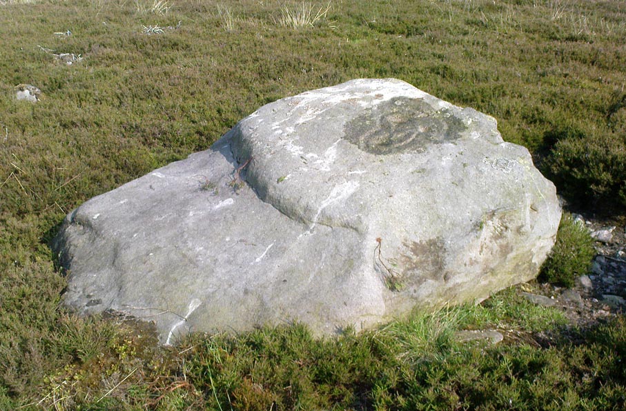
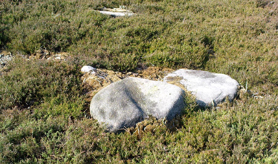
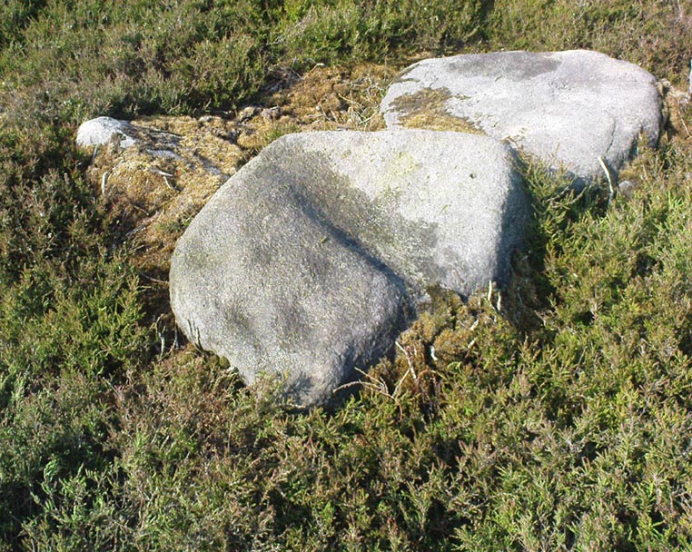
Holy Well, Sulgrave, Northamptonshire

Holy Well (destroyed?):  OS Grid Reference – SP 5549 4574

Also Known as:

  1. Stock Well

Archaeology & History

This seemingly lost holy well was first mentioned by John Morton (1712), who told us that it was the source of the River Tove.  About eighty years later, John Bridges (1791) wrote that,

“In this town was formerly a grange to the monastery of St Andrews in Northampton; and a spring which riseth near the place where this house stood, still retains the name of Halywell Spring.”

Little else was written of the site until H.C. Smith’s (1933) in-depth overview of the famous Washington family (some dood called George apparently) of Sulgrave, where he echoed John Morton’s words that the River Tove “rises from the spring of Holy Well, near the site of the old Grange of St. Andrew’s Priory.”  He told that it was located up Stockwell Lane where an old water-mill was located and “the water for the mill is provided by a large mill-pool fed by a spring known in former times as Holy Well Spring.”  Local historian Beeby Thompson (1914) identified the Stock Well as being the later alternative name for our holy one.

References:

  1. Bridges, John, The History and Antiquities of Northamptonshire, D. Price: Oxford 1791.
  2. Hart, Jeremy, English Holy Wells – volume 2, HOAP: Wymeswold 2008.
  3. Morton, John, The Natural History of Northamptonshire, R. Knaplock: London 1712.
  4. Smith, H. Clifford, Sulgrave Manor and the Washingtons, MacMillan: New York 1933.
  5. Thompson, Beeby, “Peculiarities of Waters and Well,” in Journal Northamptonshire Natural History Society, volume 17, 1914.

© Paul BennettThe Northern Antiquarian

Longbarrow Field, Timble, North Yorkshire

Cairn (lost):  OS Grid Reference — SE 18 53

Archaeology & History

Described in the Field Lore of Timble village by William Grainge (1895) are the names and short histories of some of the local place-names—with this in particular standing out like a veritable sore thumb!  Quite plainly, as Grainge told us,

“The name ‘Longbarrows’ is indicative of some burial mounds of a very early day.  None exist at present.  The land is under the plough, and is about the best in the township.”

But I cannot locate the position of this long-lost site and it’s not shown on any of the early OS-maps hereby.  Grainge said that the land on which it once stood was owned by a local farmer called Charles Dickinson, who leased it out to others.  He wrote:

“Dickinson had in Longbarrows 3 roods* and 23 perches*, and William Jackson’s share in Longbarrows was 1 acre, 3 roods and 21 perches.  Besides these, John Ward of Nether Timble had 1 rood and 17 perches int he same field, a long narrow slip without fence, between Dickinson’s and Jackson’s lots.”

Does anyone know where this was?  One of my suspects is the gathering place of the Fewston witches, a half-mile south of the village; but no remains of anything can be found there today and I may just be barking up the wrong tree.

The area south and west of here is rich in little-known prehistoric heritage, from the cairn-fields of Askwith Moor, the cairn circle at Snowden Crags, the settlements of Snowden Carr and the extensive petroglyphs all over the place!  Giants cairns of the early Bronze Age and neolithic period were also once more numerous upon the moors to the west and south, so the former existence of a long barrow in Timble wouldn’t necessarily be too unusual.  But where was it?!

References:

  1. Grainge, William, The History and Topography of the Townships of Little Timble, Great Timble and the Hamlet of Snowden, William Walker: Otley 1895.

*  A rood is an English unit of area, equal to a quarter of an acre or 10,890 square feet; a perch was a more variable unit of measure, being lengths of 1612, 18, 21, 24 and 25 square feet.

© Paul BennettThe Northern Antiquarian 


Snowden Carr carving (610), Askwith, North Yorkshire

Cup-Marked Stone:  OS Grid Reference – SE 18105 51210

Getting Here

Snowden Carr carving 610

From Otley, take the road north across the River Wharfe up and up, heading towards Askwith Moor.  As the moorland opens up ahead of you, at the crossroads turn right along Snowden Carr Road and literally ¾-mile along (1.25km) where a track on your right goes to Carr Farm, on the left-side of the road is a gate.  Go through here to the Naked Jogger Stone and walk up the rocky ridge ahead of you, alongside the walling (as if you’re going to the Sunrise Stone), and about 20-30 yards up you’ll reach this carving.

Archaeology & History

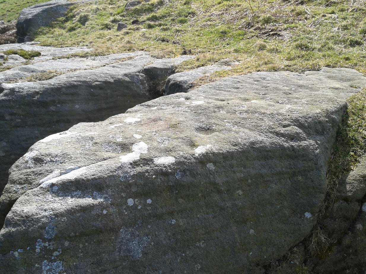
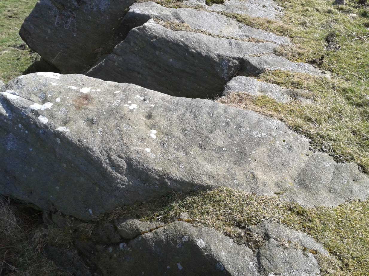
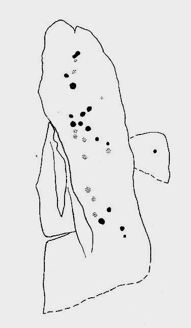
Best visited on a clear day, this is one carving amidst a small cluster of cup-marked petroglyphs found along the small geological ridge between the Sunrise Stone and Naked Jogger carving (none of which are as impressive as those two!).  This particular design consists of a number of faint cup-marks— between 17 and 25 of them—reaching along the horizontal surface, with no distinct formal pattern, as usual.  The carving continues beneath the encroaching soil.

Looking down at the carving
Archaeo-sketch

It seems to have been described for the first time by Stuart Feather (1973); then subsequently in Boughey & Vickerman’s (2003) survey, in which they attach a single cup-marking on an adjacent rock into the matrix of this design—but the two rock surfaces are distinctly separate.  This apart, their description tells, briefly as always: “Large long rock which may be outcrop, with hill falling away steeply below. Seventeen worn cups.”

References:

  1. Boughey, Keith & Vickerman, E.A., Prehistoric Rock Art of the West Riding, WYAS: Leeds 2003.
  2. Feather, Stuart, “Askwith, W.Yorkshire,” in ‘Yorkshire Archaeological Register’, Yorkshire Archaeology Journal, volume 45, 1973.

© Paul BennettThe Northern Antiquarian 


Lower Lanshaw Stone (02), Askwith Moor, North Yorkshire

Cup-and-Ring Stone:  OS Grid Reference – SE 16059 50875

Getting Here

Lanshaw cup-and-ring nearby
Lanshaw cup-and-ring stone

Start at the Askwith Moor parking spot on Askwith Moor Road, then walk down the road (south) 300 yards till you reach the gate and track on the other side of the road, heading southeast.  Following the track onto the moor and take the footpath on your right after 75 yards. Follow this along until you hit the gate & fence.  Climb over this, then follow the same fence along (left) and down, and keep following the fence and walling all the way on until you reach the very bottom southwestern edge of Askwith Moor itself.  Now, walk up the slope to your right and, near the top of this rise 250 yards away, past Lower Lanshaw 01 carving, in some ancient walling, you’ll find it!

Archaeology & History

A very faded cup-and-ring carving can be found about 30 yards northeast of the Lower Lanshaw cup-marked stone, just as the hill slopes down to the overgrown stream.  It rests on the lower edges of the prehistoric (probably Bronze Age) enclosure in which other archaeological remains can be found.  Although the photo here highlights what seems to be 3 cups on the south-face of the rock, only one of them seems authentic.  A pecked “line” also seemed evident, but the light conditions were poor when we were here.  It does seem that there’s a faded ring around one of the cups, as you can see in the photo.

© Paul Bennett, The Northern Antiquarian 

Snowden Carr Carving (603), Askwith Moor, North Yorkshire

Cup-Marked Stone:  OS Grid Reference – SE 17993 51112

Getting Here

Snowden Carr carving 603

From Askwith village go up the Moor Lane and at the crossroads go straight across (Snowden Moor is across left).  Go down and along Snowden Carr Road until the road levels out and, watch carefully, about 500 yards on from the crossroads on your left you’ll see a small crag of rocks in the fields above.  Stop and go through the gate walking up the field and as you near the top you’ll see a gate across to your left that leads onto the moor.  Go through this and on the path which veers up to the right up to the Tree of Life Stone.  About 20 yards along, keep your eyes peeled just off-path, to the left, where a small rounded stone hides at the edge.

Archaeology & History

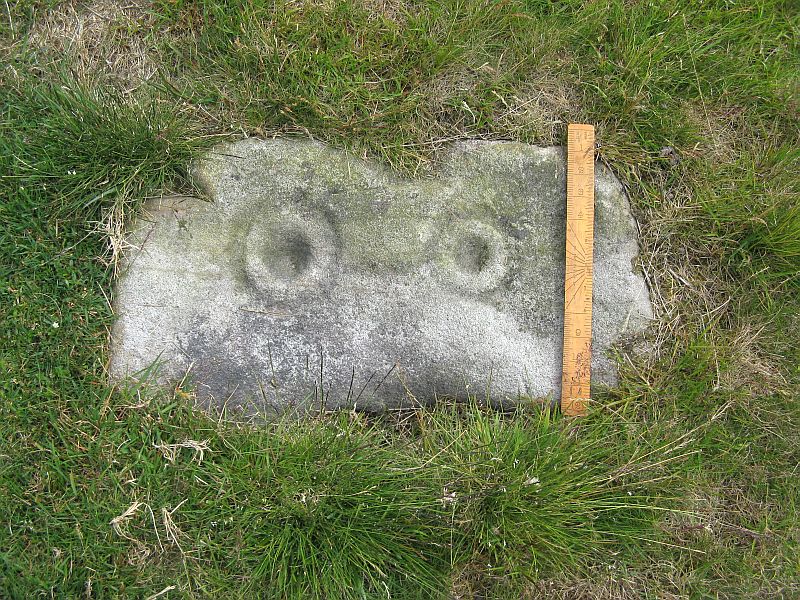
This was one of a number of cup-markings that Graeme Chappell and I came across in the early 1990s, though it didn’t receive any literary attention until included in Boughey & Vickerman’s (2003) survey.  It’s only a small fella, consisting of just six or seven cups on its upper rounded surface — though what may be a carved line runs round the southern side of the stone.  It seems to have been associated with a small cairn close by (a common feature on these moors) and adjacent prehistoric settlement walling.  In Boughey & Vickerman’s text, they gave the following notes:

“Small rock with rounded surface at ground level, near scattered cairn. Seven or eight cups, possible grooves at edge.”

Drawing of the stone (Boughey & Vickerman)

[You’ll notice in the photo above that the local phantom painter had been here again, artistically highlighting the cup-marks.  The photos we took were done earlier this year, when the paint (or whatever it is) was first noted.  It had not been painted-in the previous autumn.  But most notably is the fact that this carved stone has never previously appeared on the internet (until today) and the only other reference to it is in the standard Boughey & Vickerman text.  This would indicate that whoever it is that’s painting the carvings up and down mid-Wharfedale possesses a copy of that text, aswell as being relatively new to the subject of rock art.]

References:

  1. Boughey, Keith & Vickerman, E.A., Prehistoric Rock Art of the West Riding, WYAS 2003.

© Paul Bennett, The Northern Antiquarian

Weston Moor (543), North Yorkshire

Cup-and-Ring Stone:  OS Grid Reference – SE 18521 49406

Getting Here

Weston Moor cup-and-rings (after ‘QDanT’)

Get yourself to the impressive multi-ringed Greystone Allotment carving, then walk to the copse of trees close by and bear left, following the edge of the fence along and following it when it turns down at right-angles, until you hit the bottom corner of the trees, where a path cuts in front of you.  From the bottom corner of the trees walk 25-30 yards diagonally away from the trees.  It’s under your nose somewhere damn close!

Archaeology & History

This is another archetypal cup-and-ring stone, similar in size and design to the recently discovered Slade (02) carving on Blubberhouses Moor, just over 4 miles (6.5 km) northwest (followers of Alexander Thom’s megalithic inch theory might be interested in assessing the measure of these two).   It is one of number clustered in and around this small grass ‘moorland’ region, where a number of carvings perished in the 19th century.  Thankfully this one survived.  Boughey & Vickerman’s (2003) brief notes on the stone tell:

“Small, rough grit rough of regular oblong shape set very low in turf.  Two cups, each with a ring, and connected by a groove.”

On a recent visit to see this carving, Danny Tiernan, Paul Hornby, James Elkington and I were unable to locate it.  The carving may well have been destroyed, or moved.  If anyone is aware of what has happened to this petroglyph, please let us know.  We will be contacting the local authorities to see if any explanation is forthcoming from them.

References:

  1. Boughey, Keith & Vickerman, E.A., Prehistoric Rock Art of the West Riding, West Yorkshire Archaeology Service 2003.

Links:

  1. Weston Moor Rock Art – more notes & images


© Paul Bennett, The Northern Antiquarian
Snowden Carr (597), Askwith Moor, North Yorkshire

Cup-Marked Stone:  OS Grid Reference – SE 17965 51158

Getting Here

Find your way to the excellent Tree of Life cup-and-ring stone, then walk about 10-15 yards west.  It’s under your nose!

Archaeology & History

Single cup-marked stone

Another stone for the rock art purists amongst us: a singular cup-marking near the edge of the rock.  Although the photo here seems to show three cup-markings close to each other, only one of the three is in fact real.  The other two are simple geological creations.  But this fact seemed to go over the heads of some English Heritage archaeologists who reported to Boughey & Vickerman (2003) that this was a stone “with three cup markings” on it.  I’m not sure who trains EH rock-art enthusiasts, but they seem to have a tendency to mistake natural features with artificial cup-markings and their evaluations should be treated with considerable caution (you’ve gotta wonder who the students are that are teaching them).

The rock itself is found in close association with other prehistoric remains and may have been a part of enclosure walling.  Very close by are numerous well-preserved settlement remains, cairns and other cup-and-ring stones.

References:

  1. Boughey, Keith & Vickerman, E.A., Prehistoric Rock Art of the West Riding, WYAS: Wakefield 2003.

© Paul Bennett, The Northern Antiquarian

Death’s Head Carving (577), Askwith Moor, North Yorkshire

Cup-and-Ring Stone:  OS Grid Reference – SE 17795 51235

Also Known as:

  1. Carving no.577


Getting Here

Follow the directions to find the Tree of Life Stone, then follow the main footpath uphill from it.  Once on the level, look out for a couple of large rocks abaat 100 yards to your left.  Check ’em out, cos it’s on one of ’em!

Archaeology & History

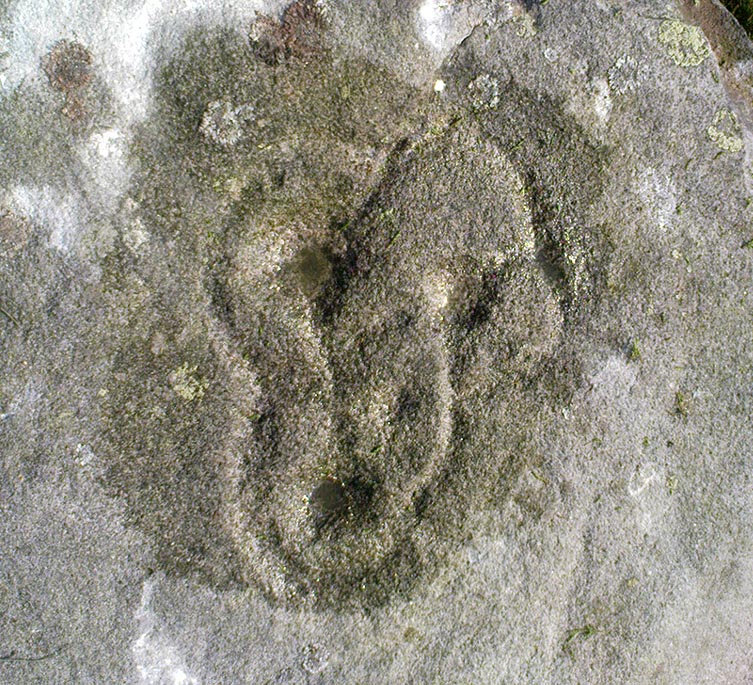
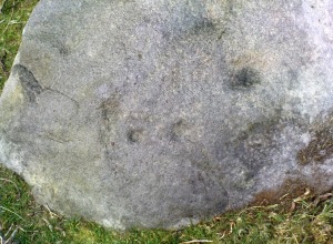
This is another decent carving living on these prolific moors.  Found near the end of a lengthy line of prehistoric walling that runs east-west over this part of the moor, the general Rorsharch-response to this carving is of some sorta skull or screaming face.  My impression of it the other day was, “it looks like a pig!”

Although mentioned by numerous writers, the first description of it was in Eric Cowling’s (1937) essay on the cup-and-ring stones north of Otley, saying:

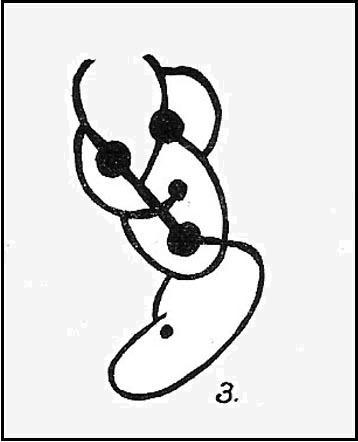
“On an isolated table stone, situated at the upper end of the shallow valley which drains Snowden Carr, the writer found a marking having a strangely skull-like appearance, but which is really a group of three large cups which are linked by inter-turning curved grooves.”

Close-up of main design
The Death’s Head Rock

He then strives to make links between this carving and the design on the Swastika Stone above Ilkley — which in some way is a little similar, i.e., as a three-armed triskele swastika; but the notion is perhaps as accurate as saying it represents a cloud, or a tree, or bird-flight, or any number of other natural phenomena.  Beckensall’s (1999) brief note of the stone — despite getting his grid-ref off by a few hundred yards — described it as “four cups linked and enclosed by grooves, unconvincingly suggesting a skull to some people.”  With Boughey & Vickerman (2003) saying:

“Fairly large, upstanding rock with surface sloping down to N. Figure of four cups linked by and enclosed by grooves: entire pattern resembles a skull, hence the name ‘Death’s Head Rock.'”

References:

  1. Beckensall, Stan, British Prehistoric Rock Art, Tempus: Stroud 1999.
  2. Boughey, Keith & Vickerman, E.A., Prehistoric Rock Art of the West Riding, WYAS 2003.
  3. Cowling, Eric T., “Cup and Ring Markings to the North of Otley,” in Yorkshire Archaeological Journal, part 131, 33:3, 1937.
  4. Cowling, Eric T., Rombald’s Way: A Prehistory of Mid-Wharfedale, William Walker: Otley 1946.

© Paul Bennett, The Northern Antiquarian

Step Stone, Snowden Crags, Askwith, North Yorkshire

Cup-Marked Stone:  OS Grid Reference – SE 17841 51306

Getting Here

Get to the Fence Stone carving and walk up to the top of the hill about 50-60 yards away.  Once on the long flat rock, walk less than 20 yards WNW until you see the stone in the picture.

Archaeology & History

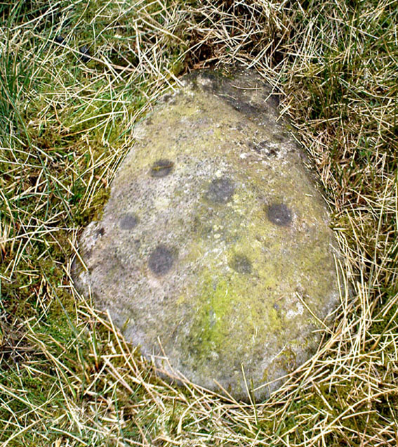
So named due to it being shaped like a little singular step on a stone, this cup-marked carving was first found in the middle of May, 2010, around the same time Michala Potts located the Snowden Crags cairn circle.

Step Stone, Snowden Crags
Close-up of the cups

First described and illustrated on the Avebury Forum on June 3, 2010, this cup-marked rock is found in association with a number of (as yet) unexcavated prehistoric remains, close to some Iron- or Bronze Age walling and a distinct hut circle, close to one of the D-shaped enclosures 20 yards away.*  When I first found it there seemed to be just two simple cups on it, but upon viewing it several times over the last few weeks in differing lighting conditions, it seems there may be as many as 4 cups on the southwestern face of the rock.  In one of the images here, you get the impression that there could actually be five cups — but I’m gonna play safe and just say there are three such cups here.

* At least 3 large, prehistoric, D-shaped enclosures have been isolated on these moorlands, with diameters ranging between 15 and 80 yards.  None of these have yet to receive serious archaeological attention!

© Paul Bennett, The Northern Antiquarian


Riverbank Cup-Marking, Askwith, North Yorkshire

Cup-Marked Stone:  OS Grid Reference – SE 1659 4744

Getting Here

Just over the county boundary on the north side of the Wharfe’s riverbank, the easiest way to find this is from the village of Burley-in-Wharfedale, walking out as if heading towards Ilkley (west) and, just 100 yards or so before reaching the A65(T) road, walk down the footpath that takes you down to the River Wharfe.  Go over the large stepping-stones and, once on the other side, walk down the edge of the riverbank for 10 yards, up the first ridge and there, just below the grass where the edge of the land is coming away, you’ll find this small cup-marking.

Archaeology & History

First discovered t’other day, on Friday, 28 May, 2010, when we were starting on another wander onto the hills.  We’d only just crossed the large stepping-stones over the River Wharfe just outside Burley and heading up to Askwith, when Michala Potts stopped, peered and said summat along the lines of, “Errr….look at this!”

Riverbank Cup-Marking
Close-up of cup-mark

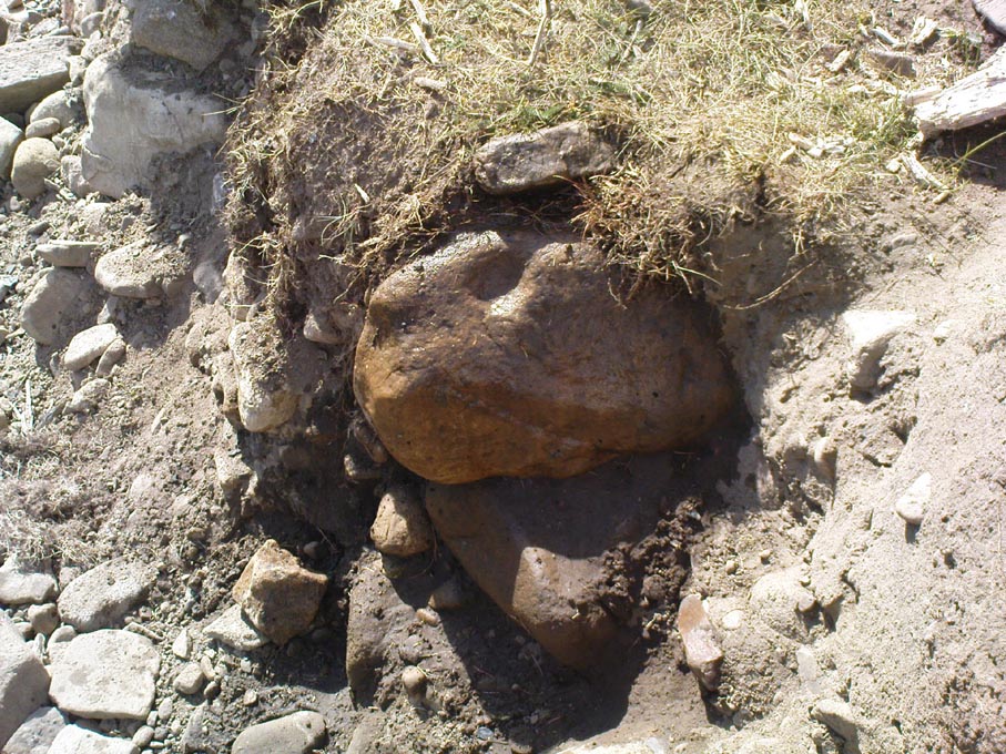
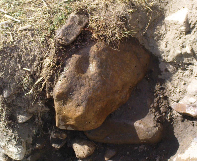
My initial thought was it was gonna be some naturally eroded water-worn stone — but it didn’t seem that way.  Peering out from the edge of the ground n the company of many other small stones and gravel, which was slowly coming away just yards above the edge of the river, a rounded cup-marked stone with just a single cup-mark stood out like a sore thumb!  It was covered in dusty earth and looked a quite decent example; but once we’d cleared the dried earth away and wet the stone, the cup-marking was truly enhanced.  To those of you who have a thing about cup-markings and associations with rivers and streams, this one can be added to your statistics! (20 yards away the Askwith East Beck meets with the river)

Obviously added as part of the river embankment, the stone would obviously have been taken from a nearby source, but we’re unlikely to ever find out where.  It looks typical of cup-marked stones that were added to cairns, but no such site (that we know of) occurred close by.  We were gonna peel some of the embankment back and see if there was anything else here, but time and another ancient site that we’d arranged to see was calling us away, so we just got a few pictures and kept on our way…

© Paul Bennett, The Northern Antiquarian