Cup-and-Ring Stone (removed): OS Grid Reference – NZ 1475 6350
Archaeology & History
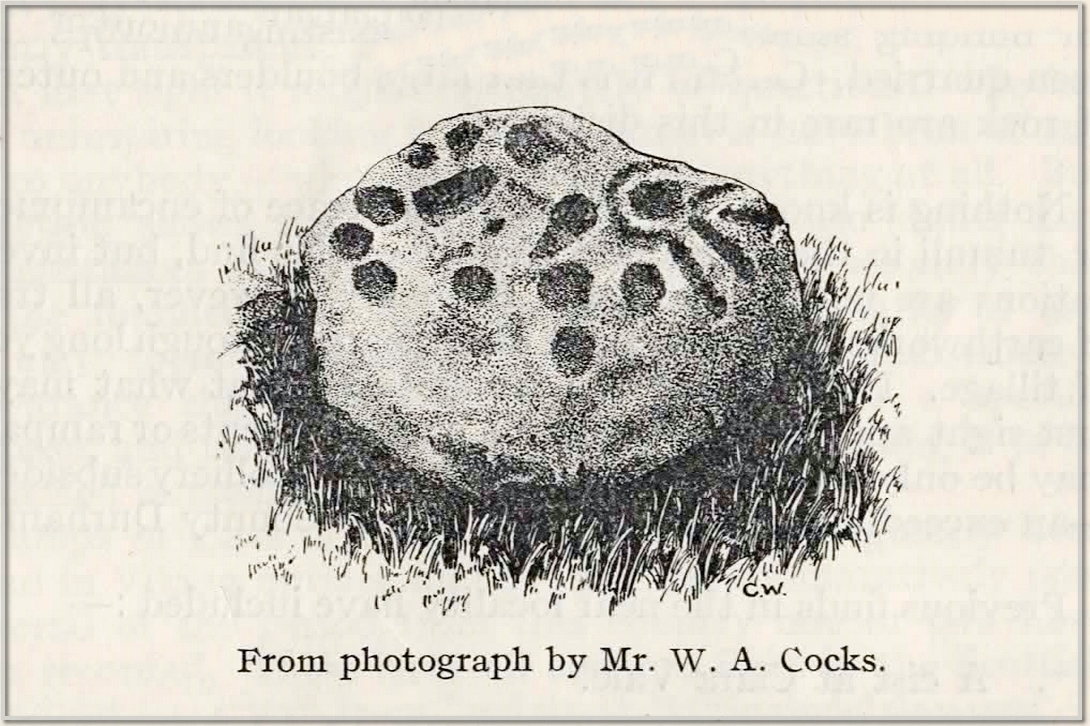
This carving presently lives in what Beckensall & Laurie (1998) described as “the stone store” at the Museum of Antiquities at the University of Newcastle-upon-Tyne, but it was discovered in some walling close to the road on the south-side of Ryton by a Mr William Cocks in 1934. The carved rock is relatively small—measuring “roughly two feet five inches, by one foot ten inches, by one foot three inches in thickness”—and was obviously not in its original position, but would have lived relatively close to the walling into which was placed. Mr Cocks told that,
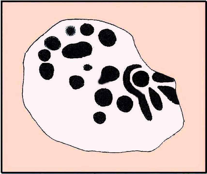
1934 sketch of the carvingModified Beckensall sketch
“the stone bears one “cup and ring” with four radial ducts, the latter being in an exceedingly fine state of preservation. There are also ten plain cups of circular form; one cup with a deep conical duct; and one large cup which appears to have been formed by uniting two circular cups. All show the “pocking” or tool marks of manufacture, and these are especially noticeable in the radial ducts.”
The cup-marked Ryton (1) stone was found some 250 yards to the west and the Ryton (3) petroglyph was less than half-a-mile north, making it likely that other types of prehistoric remains once existed in this locale.
References:
Beckensall, Stan, Northumberland’s Prehistoric Rock Carvings – A Mystery Explained, Pendulum: Rothbury 1983.
Beckensall, Stan & Laurie, Tim, Prehistoric Rock Art of County Durham, Swaledale and Wensleydale, County Durham Books 1998.
Cocks, W.A., “The Ryton ‘Cup and Ring’ Marked Rock,” in Proceedings Society of Antiquaries Newcastle-upon-Tyne, volume 6, no.8, 1934.
First described in the Object Name Book* of 1867 as being “the remains of a cairn in which D MacMillan of Glenbarr says a cist was found”, this prehistoric tomb was subsequently going to be destroyed in the 1950s by the farmer when local researchers Mr & Mrs J.G. Scott (1958) took to checking the place out before its demise. And it was a damn good job they did! The cairn still remains to this day—albeit in a very dilapidated state. The assistant editor of The Prehistoric Society journal, Ian Longworth (1959), wrote an account of the findings, telling:
“A small mound, apparently the remains of a cairn, was excavated on the farm of Glencreggan by Mr and Mrs J.G. Scott. The mound was roughly oval in shape, about 20 feet by 14 feet in size, and about 2 feet in height, with its longer axis lying almost E-W. A large stone slab, about 8 by 3 feet in size, lay against its N corner.
“The cairn was found to consist of a small and fairly compact core of stones intermixed with sand and clay, surrounded by a rather ill-defined outer ring of boulders, the intervening space being largely filled with earth. Remains of a cremated burial were found beneath the centre core, but there was no trace of a cist, and the bones seemed to be scattered, giving the impression that the cairn might mark the spot where the cremation took place. Apart from a flint flake, the only finds were two small boulders, each bearing a single cup-mark, which were incorporated in the material of the centre core.”
Of the two cup-marked stones found beneath the cairn, they’re presently living in some box somewhere in the Kelvingrove Museum, Glasgow, who are very approachable when it comes to viewing them if you make an appointment. I have to say though, one of them may be natural, as it has the distinct look of being the creation of molluscs, who live in profuse numbers just off the coast hereby. Nonetheless, they were left in the tomb as offerings to the ancestral spirits here.
References:
Bede, Cuthbert, Glencreggan – 2 volumes, Longman Green: London 1861.
Longworth, Ian, “Notes on Excavations in the British Isles, 1958,” in Proceedings of the Prehistoric Society, volume 25, 1959.
Royal Commission Ancient & Historical Monuments of Scotland, Argyll – volume 1: Kintyre, HMSO: Edinburgh 1971.
* The Object Name Book website recently got “upgraded”, to make it better, smilier, user-friendly, and the usual buzzwords we all hear when things are just gonna get worse. The website is now a real pain-in-the-arse to use since those halfwit management-types upgraded the site, making it much more hard work to find anything. Fucking idiots! Who pays these morons?!
Stone Circle (destroyed): OS Grid Reference – NN 857 489
Archaeology & History
In an early essay on the rock art around Aberfeldy, Hugh MacMillan (1884) remarked on what he thought was a tumulus on the southern slope above the town and where a large old petroglyph once lived. Subsequently (MacMillan 1901), in his beautiful artistic foray through upper Tayside, he revised his earlier remarks telling that:
“On the side of a high, tree-covered hillock, rising up abruptly behind the central part of Aberfeldy, called the Tullich, there was once a Druidical circle, one of the huge stones of which, called the Clachmore, forms part of a garden wall on the old military road passing along its base.”
The circle was mentioned in Mackay’s (1954) excellent work, albeit in the past tense, and he could add no more to it other than his memory of the whereabouts of the Clach Mhor (as it was more accurately known), on which were numerous cup-markings. (Note: the grid-reference to this site is an approximation)
Folklore
In bygone times the people of Aberfeldy observed the celebration of Samhain, the old pre-christian New Year’s Day—a.k.a. Hallowe’en—on November 11th. Interestingly for us, “bonfires were numerous and there was always a great blaze on the Tullich,” said Dr John Kennedy. (1901) Considering the small area of The Tullich, it would be unusual if such festivities did not have some relationship with the stone circle. Samhain relates primarily to the passing over of the dead in the cycle of the year: the spirits of the ancestors moving through the worlds. If this circle had such a relationship with the bonfires, it may have been a ring cairn and not a free-standing stone circle.
References:
Kennedy, John, Old Highland Days, Religious Tract Society 1901.
Mackay, N.D., Aberfeldy Past and Present, Town Council: Aberfeldy 1954.
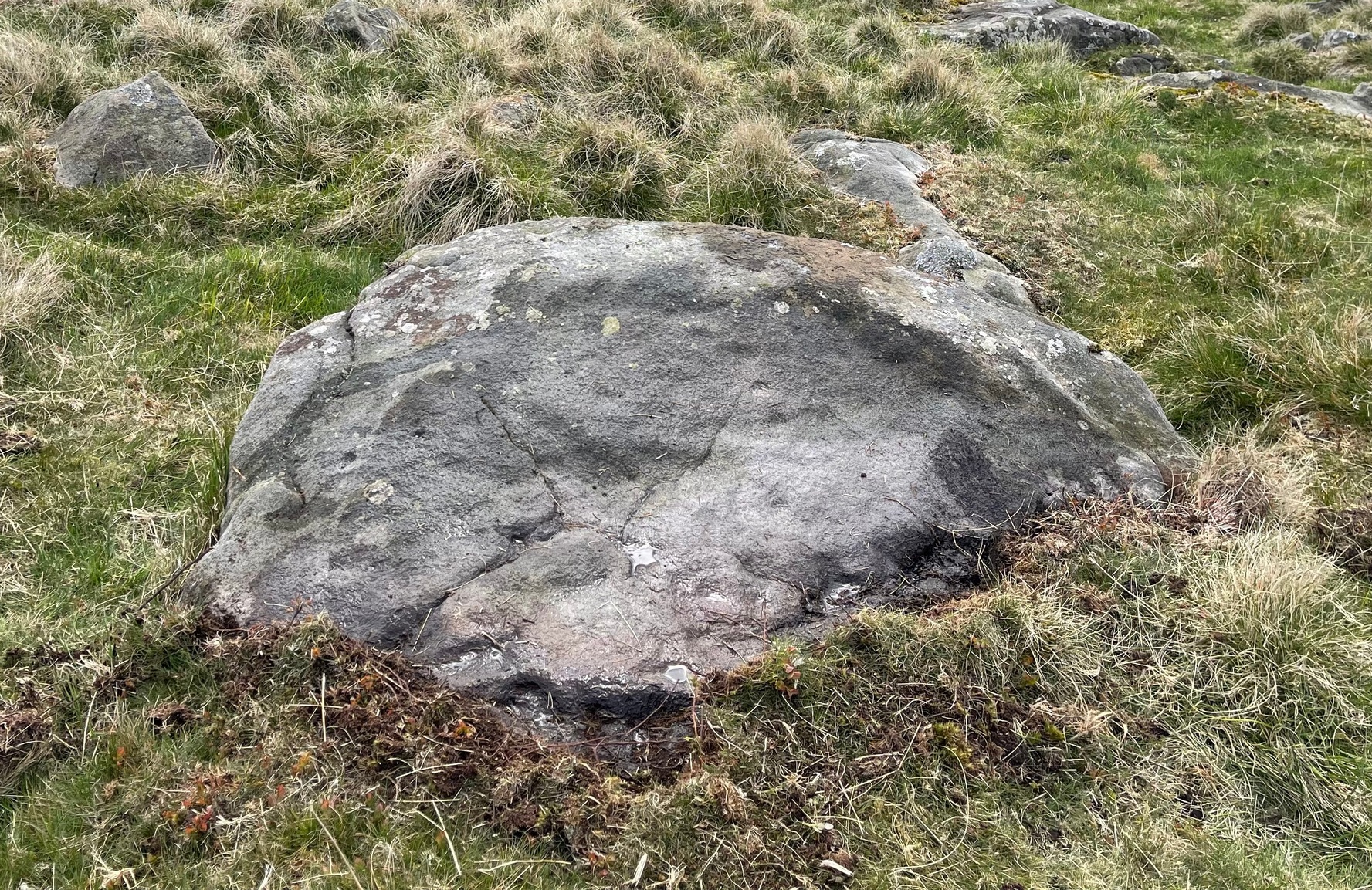
Along the A822 road from the Gilmerton junction on the outskirts of Crieff, heading up towards the Sma’ Glen, after literally 1¾ miles (2.8km) on the right-side of the road you need to follow the route to reach the Connachan rock art cluster by walking up the dirt-track leading up past Connachan Farm. Walk past the carving of Connachan (2) and up the track past Connachan (4), then onto the level ground and walk right to the low-lying ruined Connachan cairn. From here, look up the gentle slope to the fence. A small-ish stone protrudes out 40 yards away. Head straight for it!
Archaeology & History
Close-up of line of cups
You’ll check this out when you’re doing your tour of this petroglyph cluster and sit here to admire the view. It’s the last of the small bunch of carvings, on level ground, close to the denuded cairns. It consists of just eight cup-marks, all of which are carved close to the edge of the stone on its upper sloping surface; although this doesn’t tally with Margaret Stewart’s (1967) description of any of the carvings hereby. There’s nowt much more to be said about it to be honest; apart from saying how it’s highly likely that other carvings remain hidden, undiscovered, not far from this stone along the edge of these hills.
References:
Stewart, Margaret E.C., “Connachan, Crieff – Cup Marks and Hut Circle,” in Discovery & Excavation, Scotland, 1967.
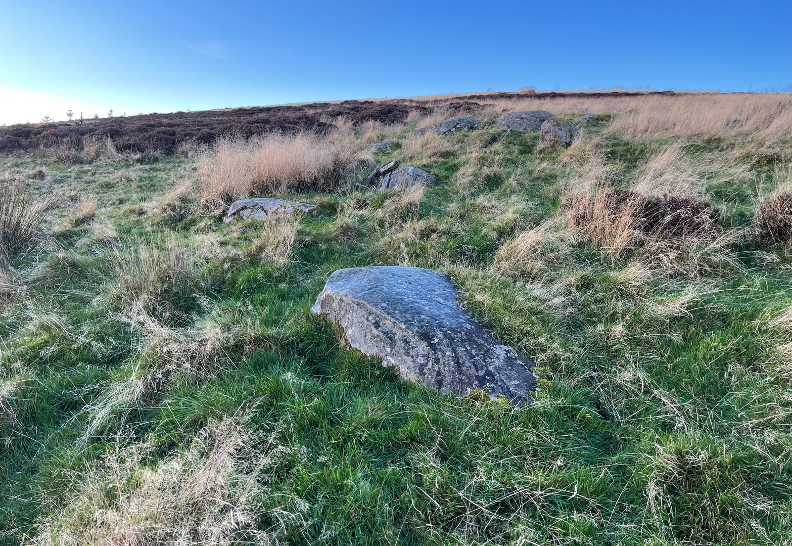
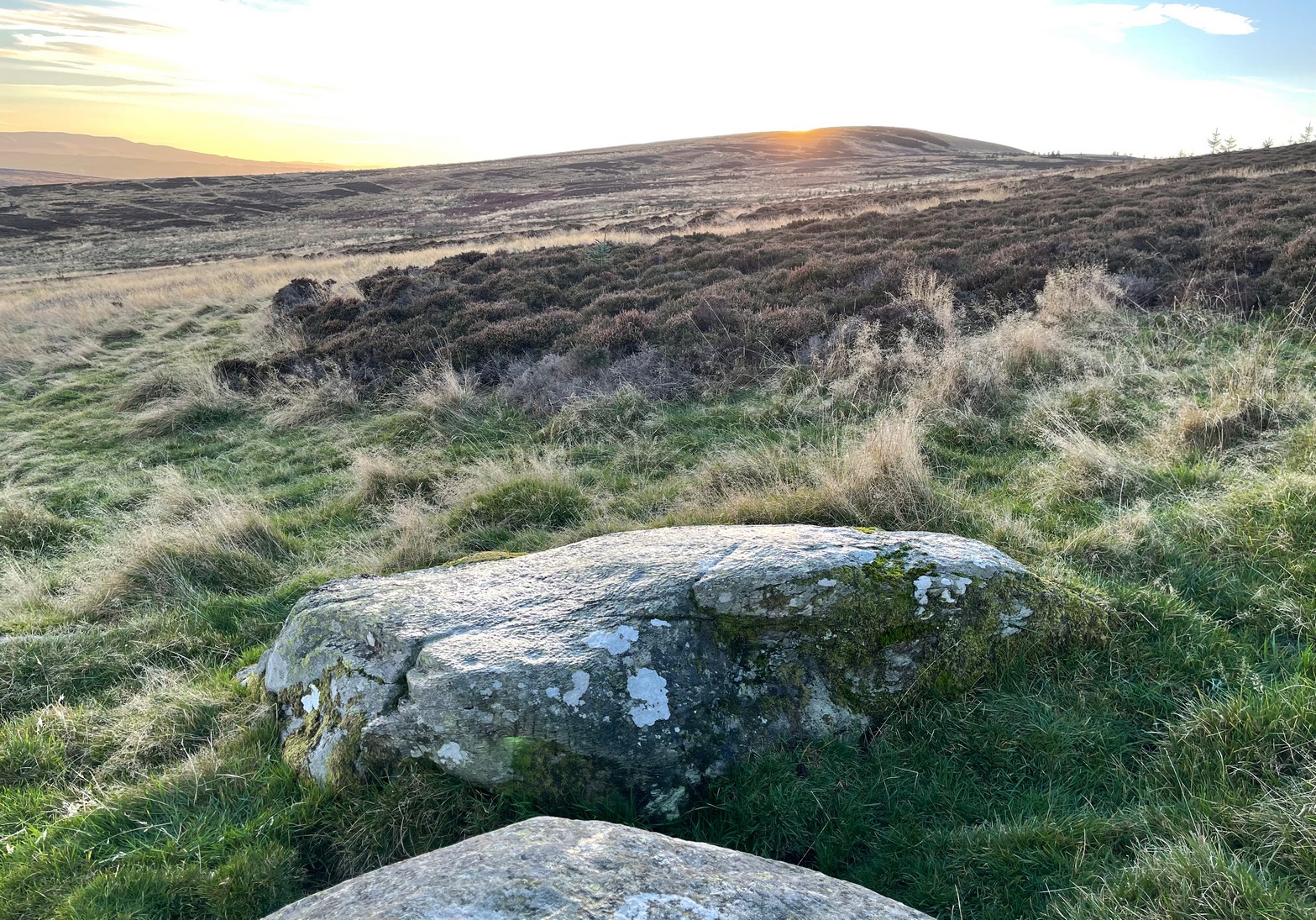
In High Bradley village, you need to go up Mill Lane for 140 yards and then bear left up High Bradley Lane for just over a half-mile, past the last row of houses on your left where it becomes a dirt-track and park-up a short distance up here. 400 yards up, in the field past the new house on your left, walk up the hill over the field, past the wall at the top and head for the large protruding boulder a few hundred yards further up on the near skyline. Once here, walk to the right of it and there’s a scatter of rocks and stones. Look around!
Archaeology & History
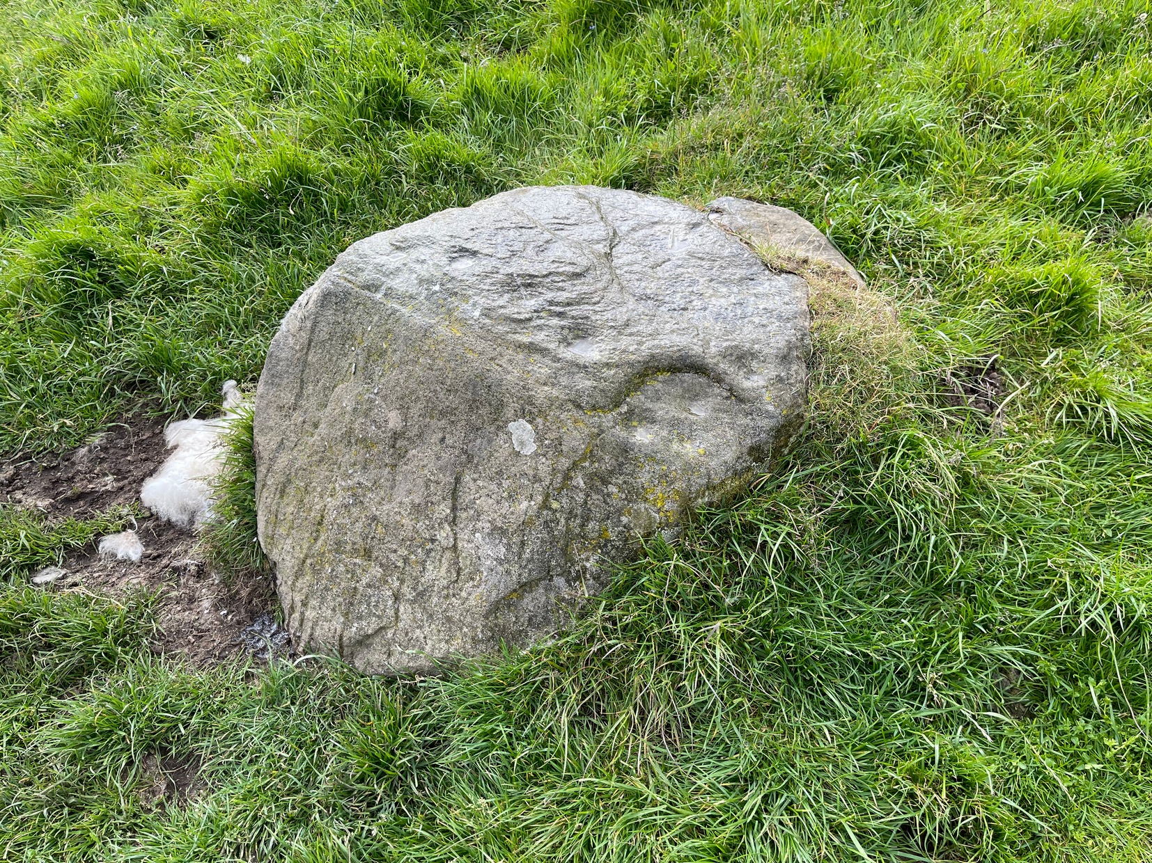
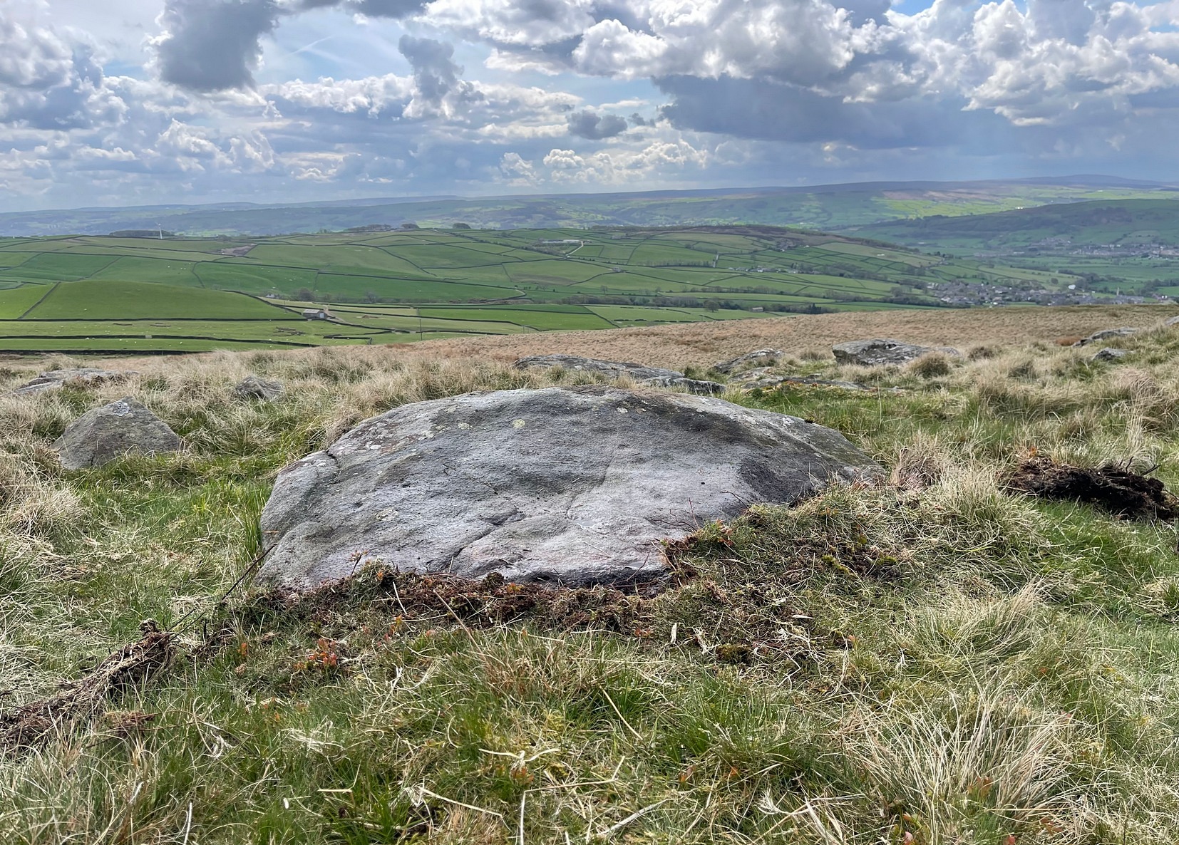
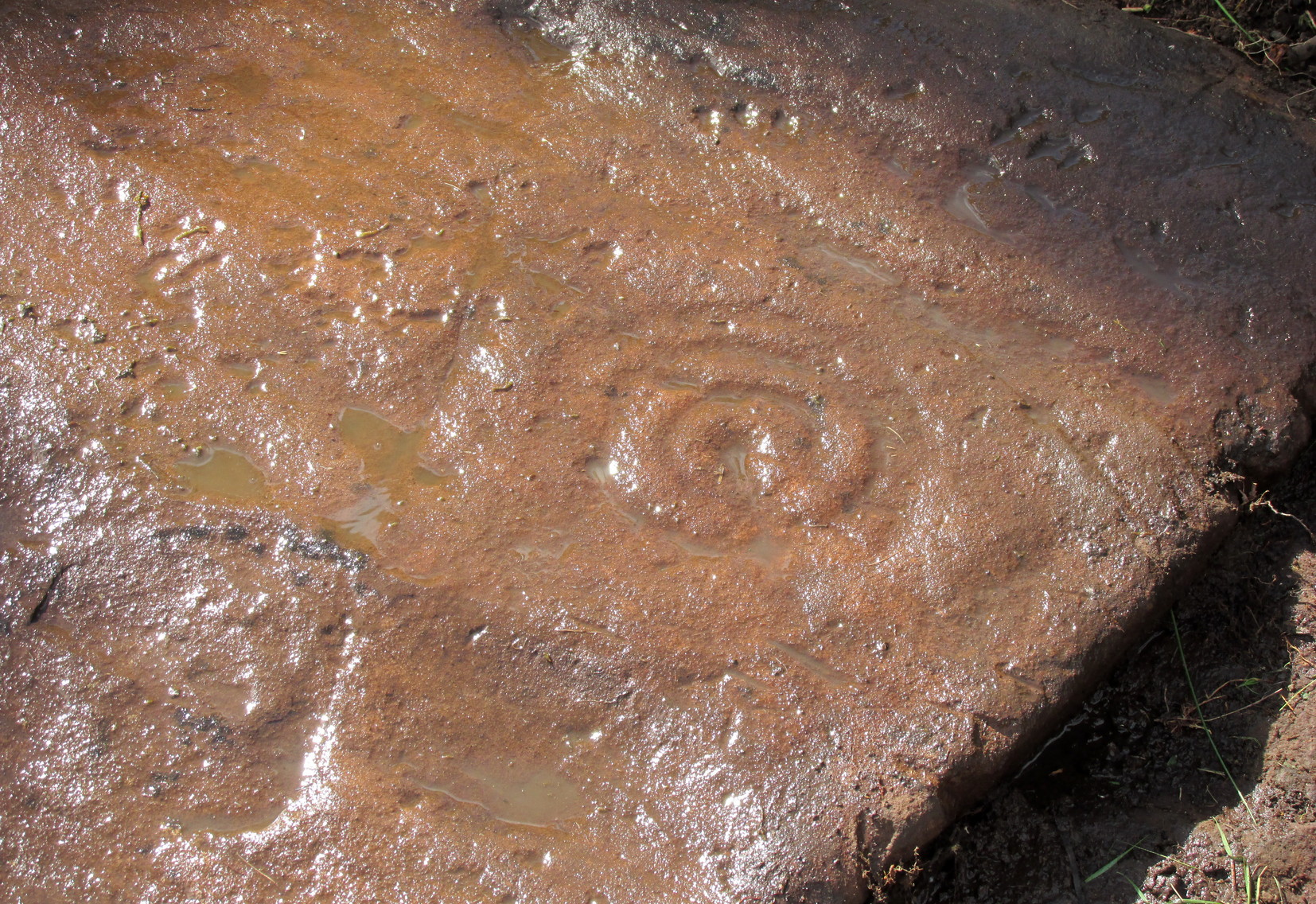
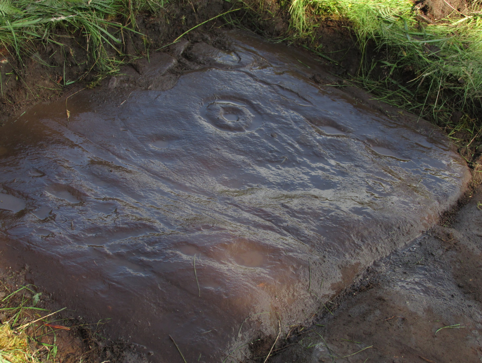
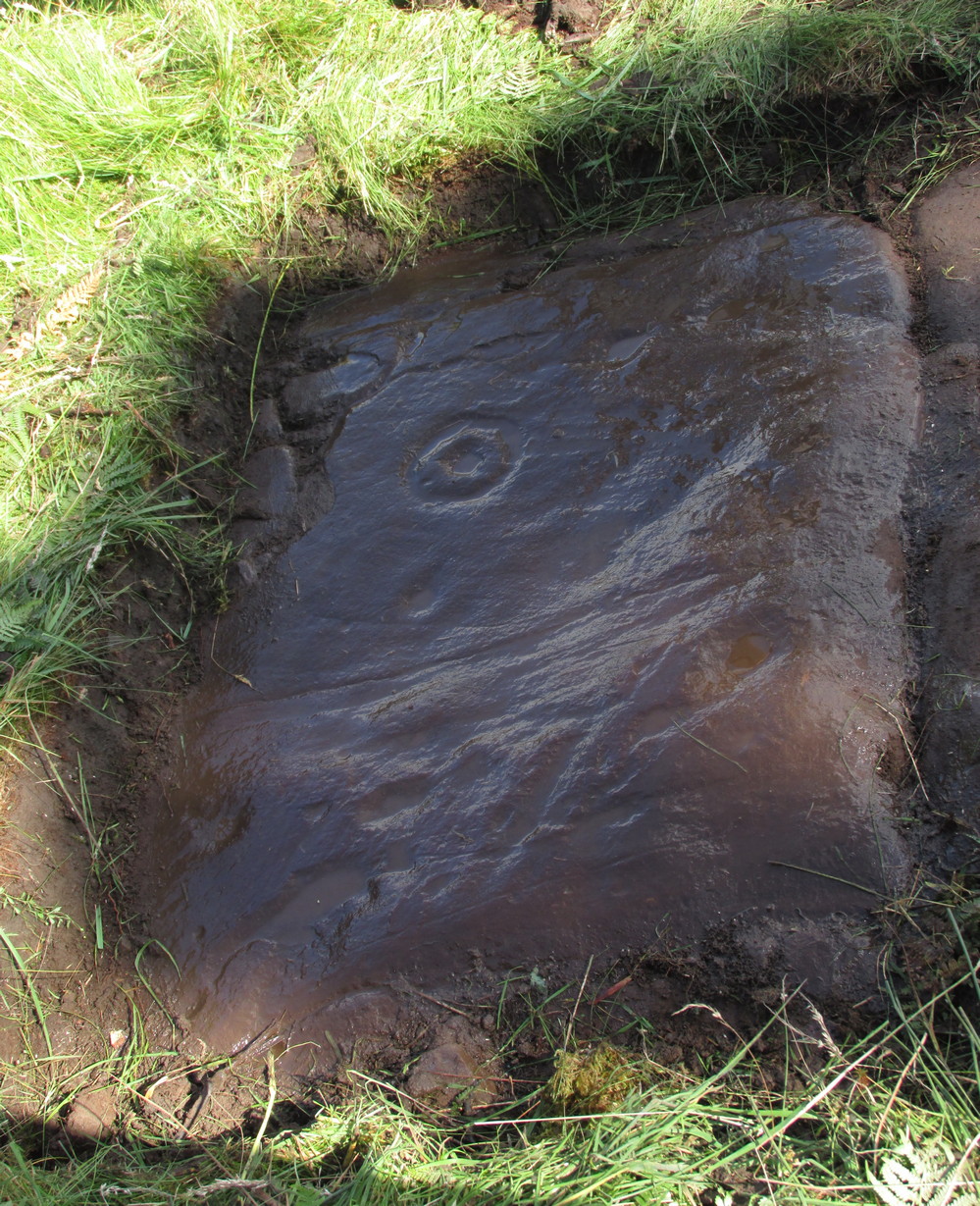
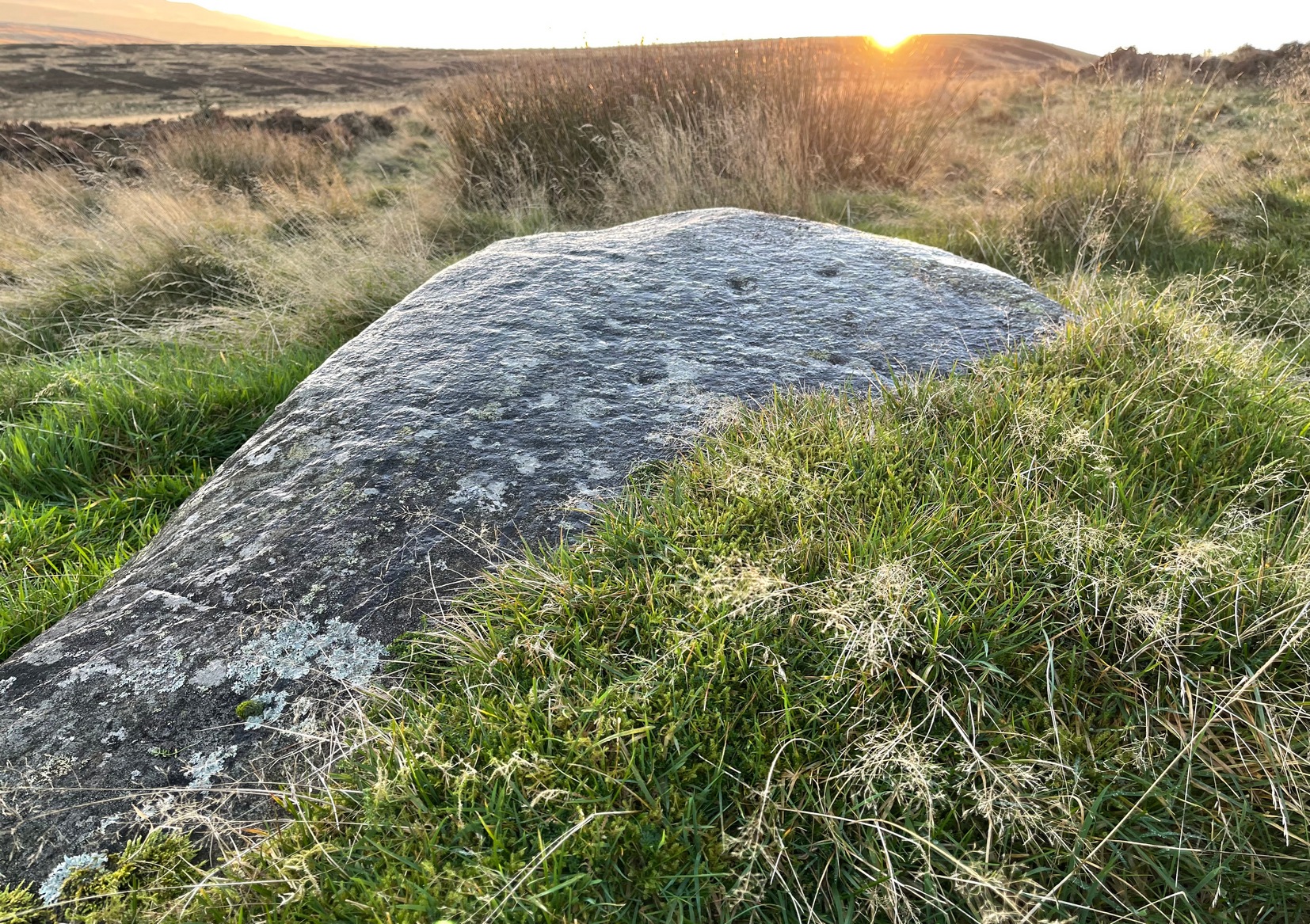
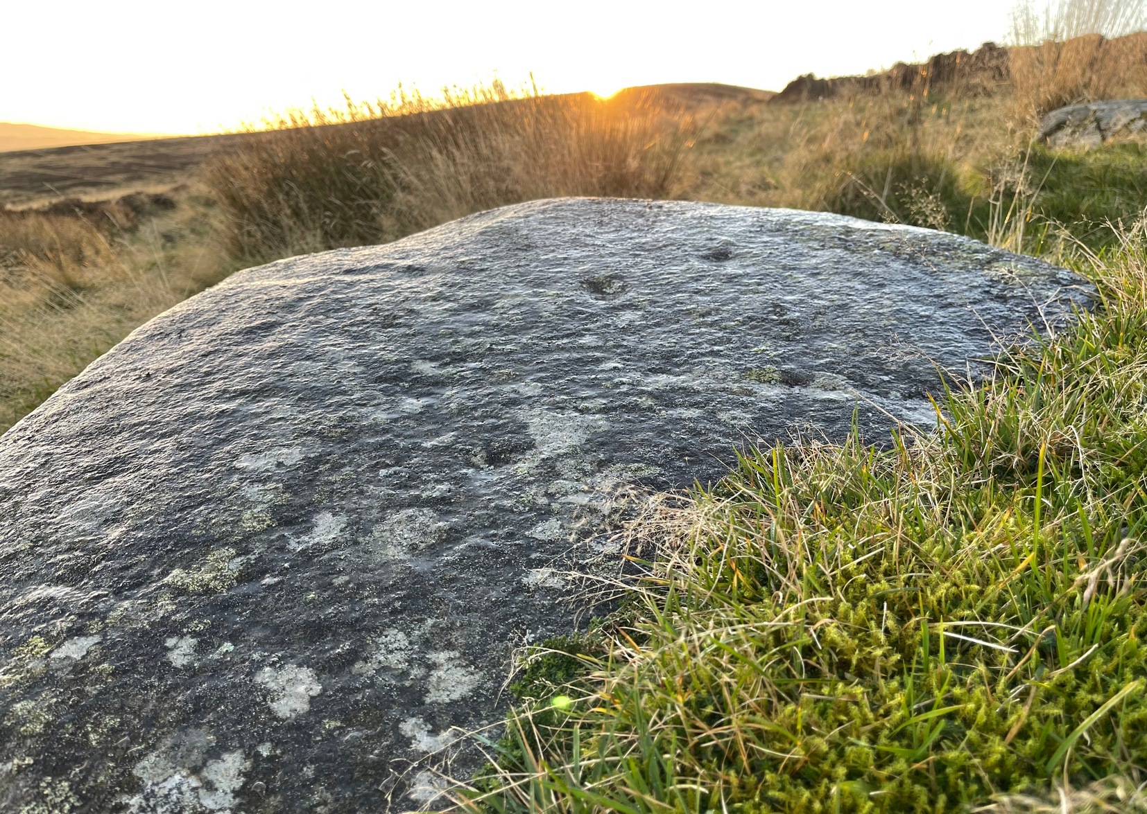
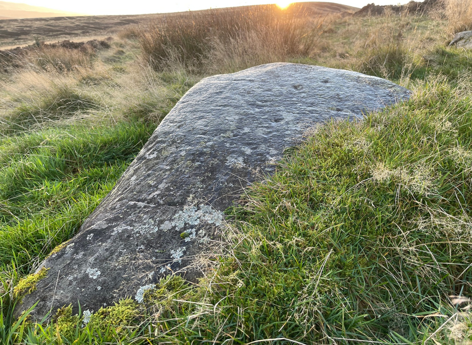
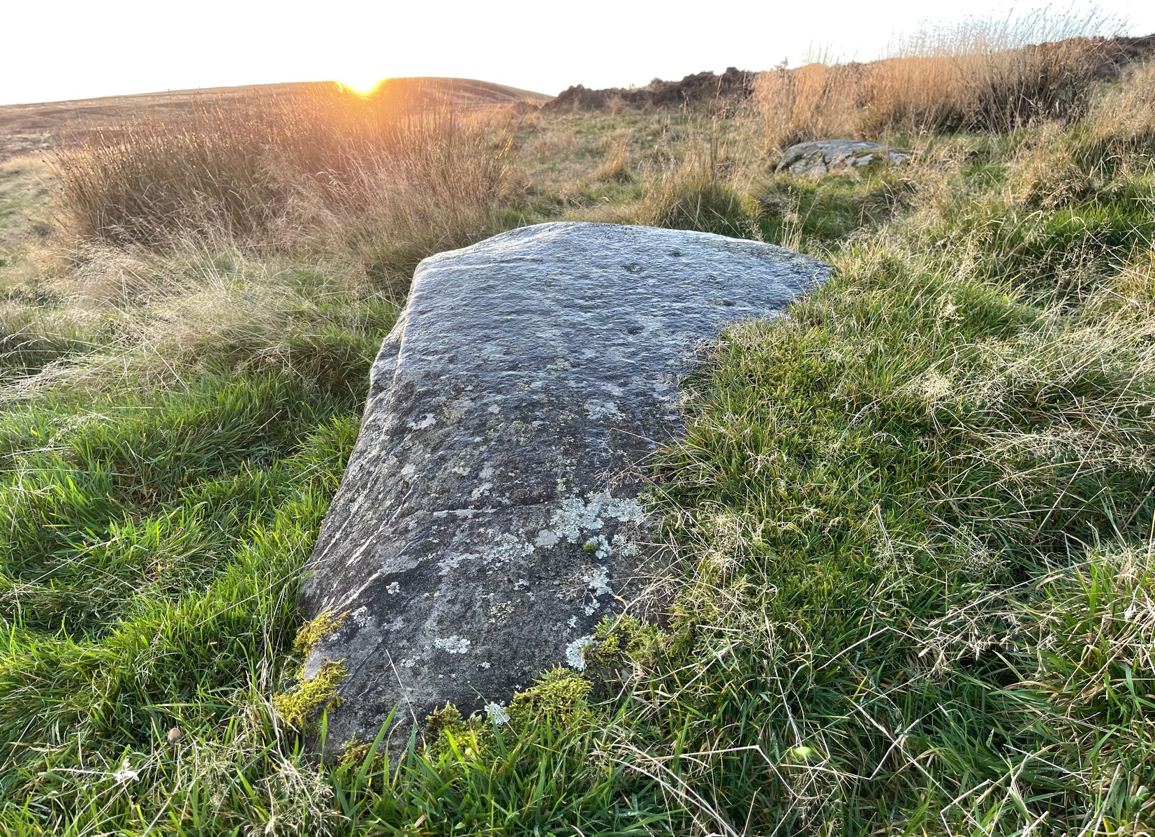
In an area that was extensively cut up by the Industrialists in the 18th and 19th century, Thomas Cleland came across this scarce example of a cup-marked, possibly cup-and-ring marked stone in March 2025 high up on Millstone Hill, where extensive views reach out to the south, east and west, gazing with particular attention to the mightily impressive King and Queen’s cairns, more than 1½ (2.6km) south of here—and which would have stood out much more back then than they do today.
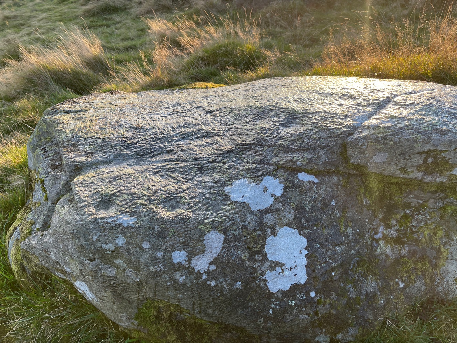
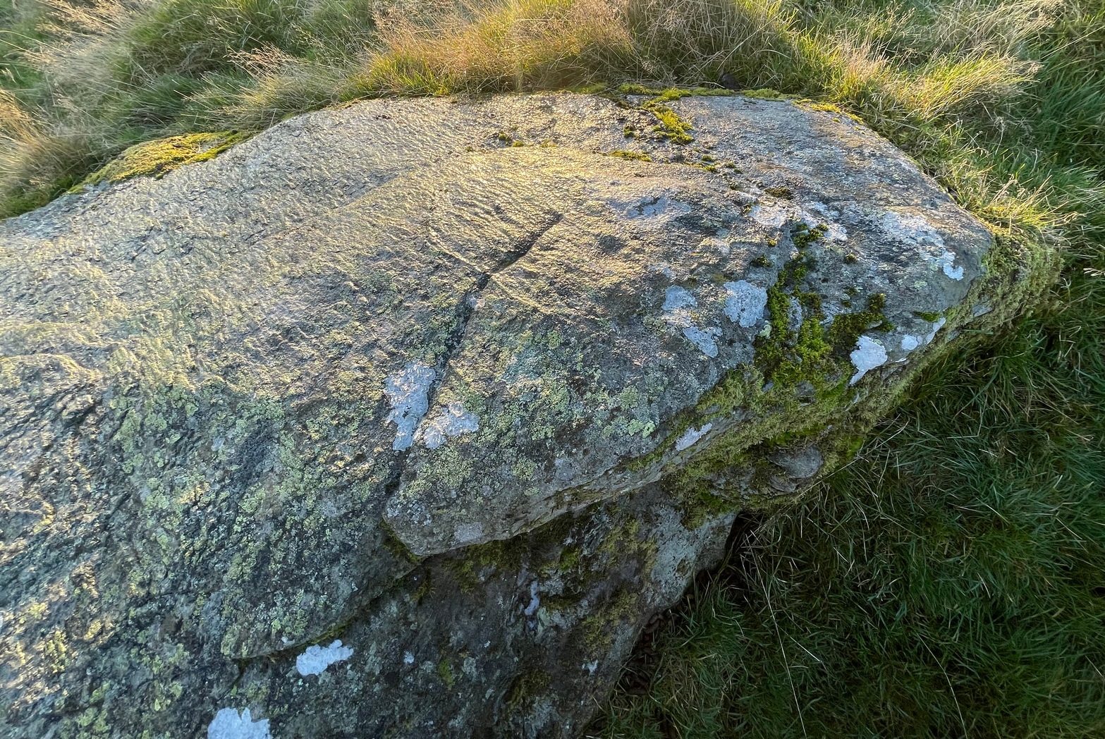
Close-up of faint arc
An arc of cups is faintly visible on the more western-side of the stone—five, perhaps six of them. Several others are in a typically chaotic scatter across the rock, with one or two looking as if they may have been affected by the heavy industrial actions that occurred up here. When Tom first found the carving, he could see a faint ring around one of the cups near the middle of the stone, but on our visit here the sun was near its apogee and due to the slope of the rock to the north where the cups are carved, this was nigh on impossible to make out. Near the bottom edge however (as shown in the photos), a cup-and-incomplete ring seems evident; although we didn’t notice this on our visit here and it may just be a fortuitous play of the light (but I hope I’m wrong!). This is a design that mainly comes to life, so to speak, is more easily visible, when the sun is either rising or setting. (typical of many petroglyphs on flat rocks)
Acknowledgements:Huge thanks to Thomas Cleland for use of his photos in this site profile.
Cup-Marked Stone (lost): OS Grid Reference – SE 2556 4687
Also Known as:
Carving no.556 (Boughey & Vickerman)
Archaeology & History
We know very little about this carving, which was first highlighted on Eric Cowling’s (1940) map of Wharfedale petroglyphs. Described simply as one of the “cup-marked rocks”, he mentioned it briefly in Rombald’s Way (1946) as being “the most easterly carving” in mid-Wharfedale—which it was at the time (a very recent find by Benn Potts of a cup-marked stone at Weeton has pushed the boundary further eastwards). Oddly for Cowling, he left no further notes nor sketch of the carving and when Stuart Feather (1961) came to write of it, he merely copied Cowling’s earlier words. It’s not been seen since. In Boughey & Vickerman’s (2003) survey, they could find no cup-marked stone in the wood but thought instead that,
“this may be due more to confusion than to loss of the carving. Riffa Wood does contain a carving: of a Native American on a conspicuous rock alongside one of the many woodland paths. Furthermore, one or two local residents recall a German prisoner carving something on a rock in Riffa Wood during the Second World War. Presumably, this is the origin of the Native American carving. Could it be that this man added something of his own to what was already a carved rock, in which case the Native American as he now appears is the site noted by Cowling before the War?”
No cup-marks exist on this Native American carving, and it’s highly unlikely that Cowling would have made such an elementary mistake. The carving no doubt lies covered in woodland vegetation waiting, once more, for the day that someone comes along and exposes its visage to the world again. Let us know if you manage to find it…
References:
Boughey, Keith & Vickerman, E.A., Prehistoric Rock Art of the West Riding, WYAS: Wakefield 2003.
Cowling, E.T., ‘A Classification of West Yorkshire Cup and Ring Stones,’ in Archaeological Journal, volume 97, 1940.
Cowling, E.T., Rombald’s Way: A Prehistory of Mid-Wharfedale, William Walker: Otley 1946.
Feather, Stuart, “Mid-Wharfedale Cup-and-Ring Markings,” in Cartwright Hall Archaeology Group Bulletin, volume 6, no.3, March 1961.
Acknowledgements:Huge thanks for use of the Ordnance Survey map in this site profile, reproduced with the kind permission of the National Library of Scotland.
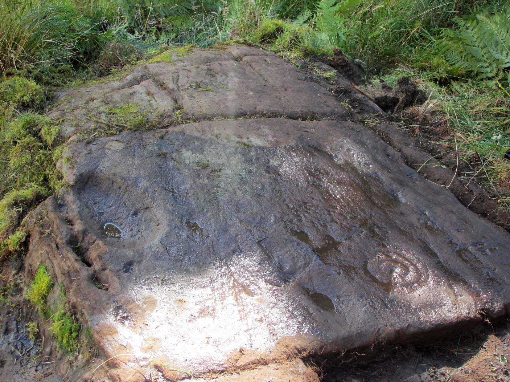
Along the A81 road from Port of Menteith to Aberfoyle, watch out for the small road in the trees running at an angle sharply uphill, nearly opposite Portend, up to Coldon and higher. Keep going, bearing right past Mondowie and stopping at the dirt-track 100 yards or so further up on the left (ignore the english fuckers up here who tell you it’s a pwivate road and they don’t want you parking there—unless you’re blocking the road obviously!). Walk up up here for ⅔-mile, as if you’re visiting the Over Glenny (5) carving, but as you get close to the defining sycamore tree, walk past it for about 60 yards towards the ruinous buildings. You’re looking for a reasonably large earthfast rock with a notable bowl about 12-inch across at the edge of the stone. That’s your defining feature.
Archaeology & History
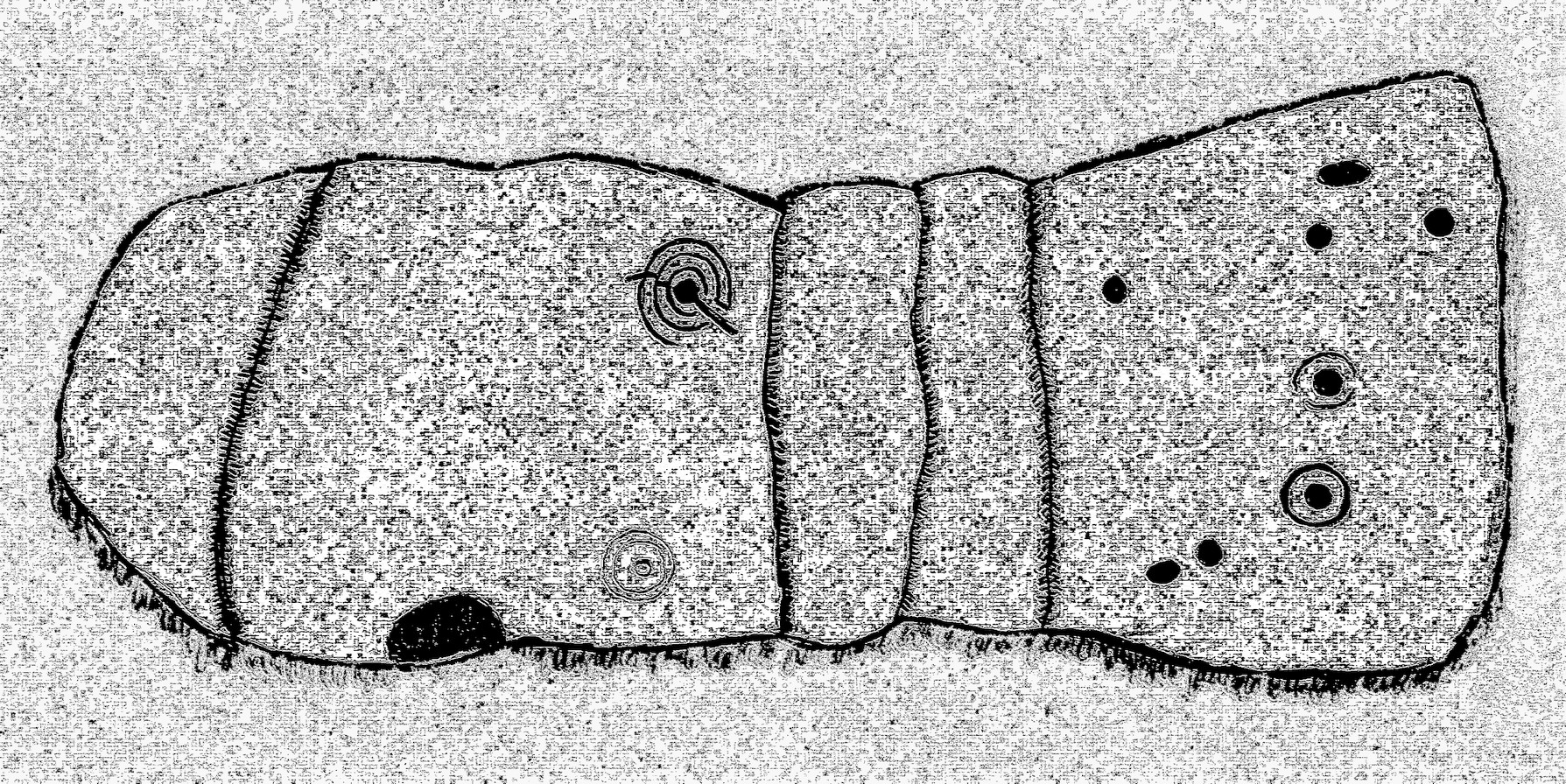
Arty sketch of the design
This is another decent design in the mass of petroglyphs on this plain overlooking the Lake of Menteith. On our first visit here ten yeas ago, only one half of the rock was visible—and half of that was covered with grasses! But with patience, we slowly rolled back the turf and slowly uncovered more and more, eventually seeing the main elements you can see in these photos and the arty sketch I’ve made here. (the Over Glenny [14] carving a few yards further east may be just be a continuation of this design)
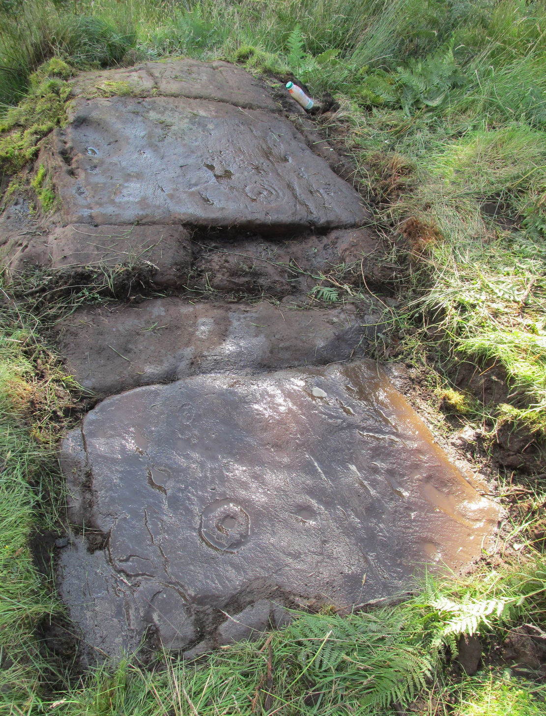
Full length of the stoneThe triple cup-and-ring
When the carving was first noticed by George Currie (2010), he only noticed “a cup mark surrounded by two penannulars, an arc and a single radial”—ostensibly meaning, a cup-and-triple ring, with the outer ring incomplete, and a line running out from the central cup. But there’s more, obviously. On our second visit, a very faint but distinct cup-and-double-ring was noticed in low light on the same section of the rock where the triple-ringed element is carved. We weren’t able to get a photo that showed it, as the light wasn’t doing as we needed, but I’ve highlighted it on the sketch, where it’s to the right of the large ‘bowl’ at the very edge of the rock. This ‘bowl’ probably had utilitarian functions, whether it was for just crushing herbs or grains, or to make organic paints: and this function most likely had some relationship with the petroglyph—but we know not what! It’s possible that the people who lived in the adjacent ruin, several centuries ago, may also have made use of this.
East-end of the designEast-end angular pose
When we exposed the other half of the carving, a very well-cut and well-preserved cup-and-ring sat beside another much more eroded partner, which was almost impossible to see from some angles. You can just make it out in the photos here. You’ll also notice a scatter of several other cup-marks and elongated ‘cups’ on the same section of rock. It was difficult to work out whether some of these marks in the stone were Nature’s handiwork, or the result of human hands. Some were obviously man-made, but we need to look at it again when the daylight conditions are good, so that we can make a more accurate assessment.
Currie, George, “Port of Menteith: Upper Glenny (UG 1), Cup-and-Ring Marked Rocks”, in Discovery & Excavation, Scotland, New Series – volume 11, 2010.
Acknowledgements:Huge thanks to the crew: Paul Hornby, Lisa Samson & Fraser Harrick in making this carving come to life, and for use of a photo or two.
If you can make your way to the Stroness (2) carving, then walk down the slope for less than 50 yards past quite a few other earthfast stones, you’ll eventually run into the stone shown here in the photos. You’ll find it easily enough.
Archaeology & History
This carving was found when I was heading down the hillside to meet up with my antiquarian colleague 500 yards lower down. The sun was just setting, so visibility wasn’t good, but as I rushed from stone to stone feeling each one in the hope of finding a carving, this one gave my fingers that distinct feedback of a cup-marking; then another; and what seemed like another. I had a small amount of water left in a bottle and quickly sprayed it over the surface of the stone and saw that there were indeed a number of cups on it. Two or three certainly – but possibly as many as five. I laid on the wet ground and looked across its even surface from several angles and caught what seemed to be a very faint semi-circle around one of the cups. But I wasn’t sure it was real. However, on a number of quick photos I took, several of them do appear to show such an arc around one of the cups. But I’m very cautious about it. Only when we (or you) go back up and have a look at it in good light will we be able to affirm or discount it.
One additional feature that needs mentioning is a small low arc of walling just above this stone. It’s man-made, it’s very old, but I couldn’t work out what it might be: hut circle, cairn (there’s one further up the hill), enclosure walling. I’m not sure, but it needs to be looked at when we have a full day.
The minor road that runs roughly north-south between the hamlets of Fowlis Wester and Buchanty is probably your best bet. Nearly 2 miles north of the village up the tiny winding lane, where the moorland at the roadside finishes and the fields begin – is where to take the track, left, up onto the hillside. But after just 75 yards, go left over the rickety-gate and follow the walling until your reach the burn. Follow this up all the way to its source (it’s boggy as hell) and, once you’re there, walk due north for 250 yards until you reach a cluster of rocks. Look around!
Archaeology & History
It’s a long way to come to see such a simplistic design —but for the real petroglyph researchers among you, it’s worth it the trek. It’s had scant attention. George Currie (2004) seems to have been the only person to mention this stone, giving the standard bland description typifying archaeology. He wrote:
“SE-facing slope, 1.2m long pointed rock aligned E-W; three shallow cups, 30-40 x 6-10mm.”
Inspiring stuff, ey?! Anyhow… As usual, there’s more to it than that. If we assume that the carving described above is the same one I visited yesterday (Mr Currie’s grid-ref is slightly different), even despite the poor daylight, it was obvious there was more than three cup-marks on this.
Lower cups & upper cups
Cups on top
When I got to this stone, the evening sun was literally touching the horizon and so the light cutting across half the rock highlighted very little indeed. I was rushing, trying to fondle and see as much as I could before the darkening sky clouded everything, and as I almost frenetically sprayed showers of water across its surface, the two or three cups that I could see near the crown of the stone suddenly doubled in number. Two cups along one edge became three; whilst the sloping surface above these that had one cup suddenly seemed to have a companion. On the highest part of this gently sloping stone, the form of one of the two distinct cup-marks that first caught my eye seemed to slowly morph into one of the carved “footprint” designs, akin to those clustered on the Ardoch (2) carving 1½ miles south-west of here. However, this element needs looking at again, as it may have been a curious playful trick between stone and light showing me something that wasn’t there! Things like that happen with stones.
Altogether there are at least six cup-marks on here, but perhaps as many as eight. Obviously, if we (or you) visit the site when the light is much better, an even larger design might emerge from this old rock.
I spent perhaps just five minutes here, before heading back down to meet my companion 500 yards below in the midst of the boggy moorland. Usually a carving gets my fondles for a an hour or two, but conditions weren’t good for us to form a healthy relationship. And so, as I headed downhill, another unrecorded cup-marked stone appeared beneath my rushing feet (Stroness [3] carving)— and I spoke with that for only a couple of minutes. We need to come back up here and zigzag to find other companions that lay sleeping, forgotten for countless centuries…
References:
Currie, George, ‘Buchanty Hill (Fowlis Wester parish): Cup-marked Rocks’, in Discovery & Excavation Scotland, volume 5, 2004.
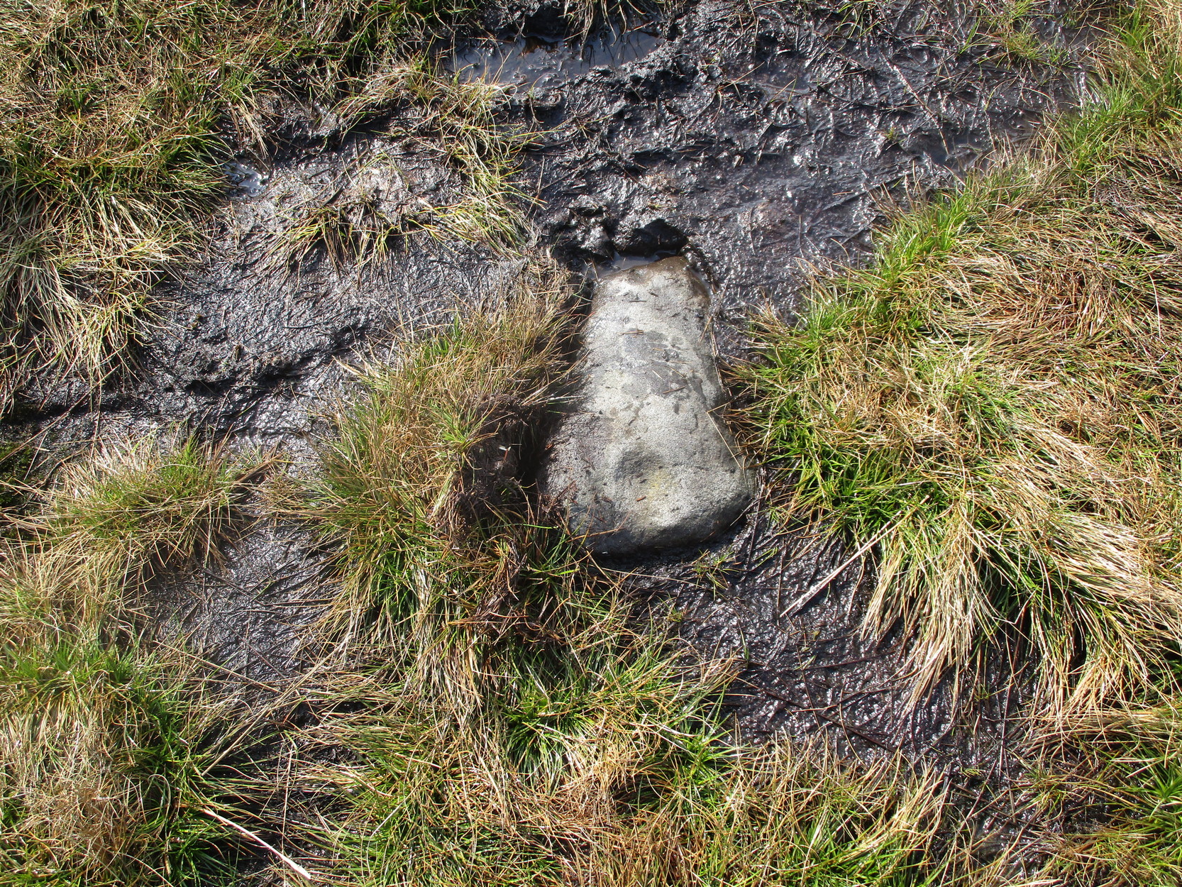
During a walk I did with a small group of people in the Spring of 2024, after a series of heavy rainfalls we ended up having to veer on and off the footpath to ensure we didn’t get swallowed in one of the bogs! In doing so, one of the group, Sarah Walker, noticed a small, almost portable-sized stone sticking up out of the edge of a peat-bog with a very distinct single cup-marking on it. (it may have been on its way as an offering stone to the Little Skirtful cairn) Sarah twizzzled it round a few times in the mud so we could get some good photos of it before we went on our way to the circle at Horncliffe. We didn’t get an exact position for the stone, but it can be found somewhere roughly over halfway between Roms Law and Horncliffe, not far off the path. Good luck!
Acknowledgements: Big thanks to Sarah Walker for stumbling across and uncovering this cup-marking, deep in the moorland mud.