Cup-and-Ring Stone (removed): OS Grid Reference – NZ 1475 6350
Archaeology & History
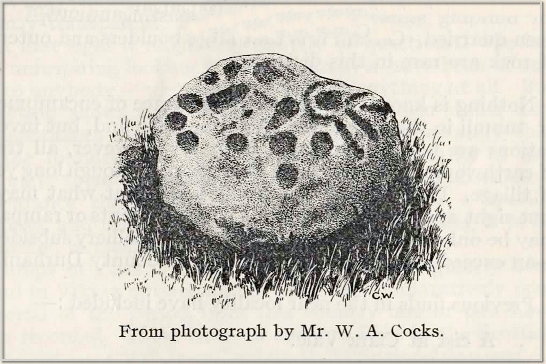
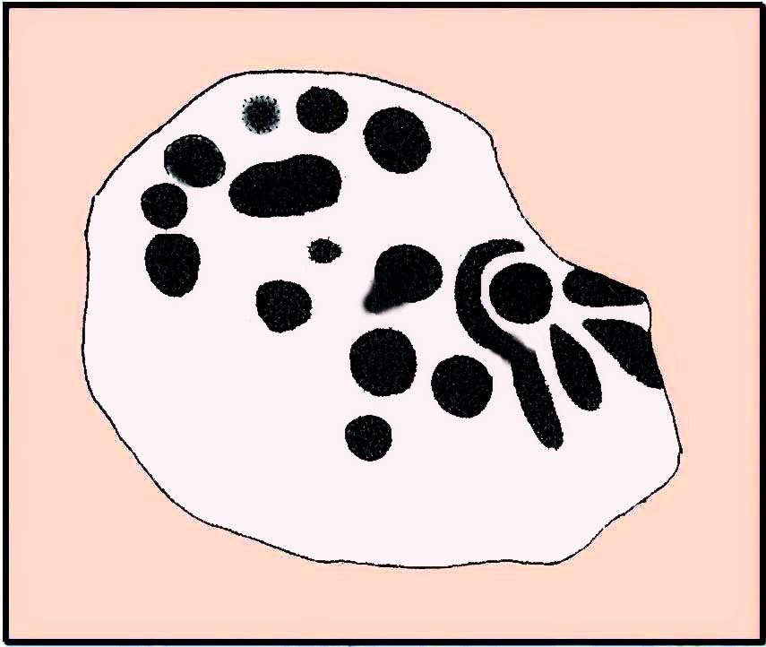
This carving presently lives in what Beckensall & Laurie (1998) described as “the stone store” at the Museum of Antiquities at the University of Newcastle-upon-Tyne, but it was discovered in some walling close to the road on the south-side of Ryton by a Mr William Cocks in 1934. The carved rock is relatively small—measuring “roughly two feet five inches, by one foot ten inches, by one foot three inches in thickness”—and was obviously not in its original position, but would have lived relatively close to the walling into which was placed. Mr Cocks told that,
1934 sketch of the carvingModified Beckensall sketch
“the stone bears one “cup and ring” with four radial ducts, the latter being in an exceedingly fine state of preservation. There are also ten plain cups of circular form; one cup with a deep conical duct; and one large cup which appears to have been formed by uniting two circular cups. All show the “pocking” or tool marks of manufacture, and these are especially noticeable in the radial ducts.”
The cup-marked Ryton (1) stone was found some 250 yards to the west and the Ryton (3) petroglyph was less than half-a-mile north, making it likely that other types of prehistoric remains once existed in this locale.
References:
Beckensall, Stan, Northumberland’s Prehistoric Rock Carvings – A Mystery Explained, Pendulum: Rothbury 1983.
Beckensall, Stan & Laurie, Tim, Prehistoric Rock Art of County Durham, Swaledale and Wensleydale, County Durham Books 1998.
Cocks, W.A., “The Ryton ‘Cup and Ring’ Marked Rock,” in Proceedings Society of Antiquaries Newcastle-upon-Tyne, volume 6, no.8, 1934.
From the Cow & Calf car-park, walk towards and past the gigantic Calf rock, swerving round the fallen mass of rocks and into the trees at the back. Walk uphill to the Hanging Stones cup and ring stones, then keep heading—down the slope then back up the next one—west, for barely 100 yards until you’re on the level ground again, following the footpath alongside the heather. Barely 50 yards along, keep your eyes peeled in the heather for a low flat rock just a few yards in. Forage around and you’ll find it.
Archaeology & History
You’ll no doubt be seeing this carving after you’ve visited the impressive Hanging Stones petroglyphs 150 yards to the east. And you’ll probably be disappointed in its lack of visual grandeur when compared to its more ornate eastern neighbour. But the petroglyph fans among you should give it your attention.
Hedges 1986 sketchLooking to the SE
When the dawn or evening daylight cuts across the rock, the design looks much better than at sun high, perhaps telling us that the message of the stone coincided with those periods of the day. The gentle folds of the stone itself morph into the carving: evening and morning light cutting subtle shadowy folds across the rock, giving it an organic texture that our aboriginal ancestors told to be a vital essence of stone itself. The two small clusters of cup-marks upon this stone become greater than their basic design when brushed with the shadows and glows of a sunset. And when our aboriginal peoples painted them in ochre and other colours, an even greater mythos emerged—but sadly it is forgotten here….
When looked at with the simplistic eyes of the archaeo-mind, this and its compatriots are little more than a number of marks on lifeless rocks. This stone for example was described in John Hedges’ (1986) survey as being just “two groups of four and five cups and grooves”—nothing more—with naught but an echo in Boughey & Vickerman’s (2003) later work. The carving has neighbours even more basic in the heather close by…
References:
Boughey, Keith & Vickerman, E.A., Prehistoric Rock Art of the West Riding, WYAS: Wakefield 2003.
Hedges, John (ed.), The Carved Rocks on Rombalds Moor, WYMCC: Wakefield 1986.
Cup-and-Ring Stone (removed): OS Grid Reference – NX 550 520
Archaeology & History
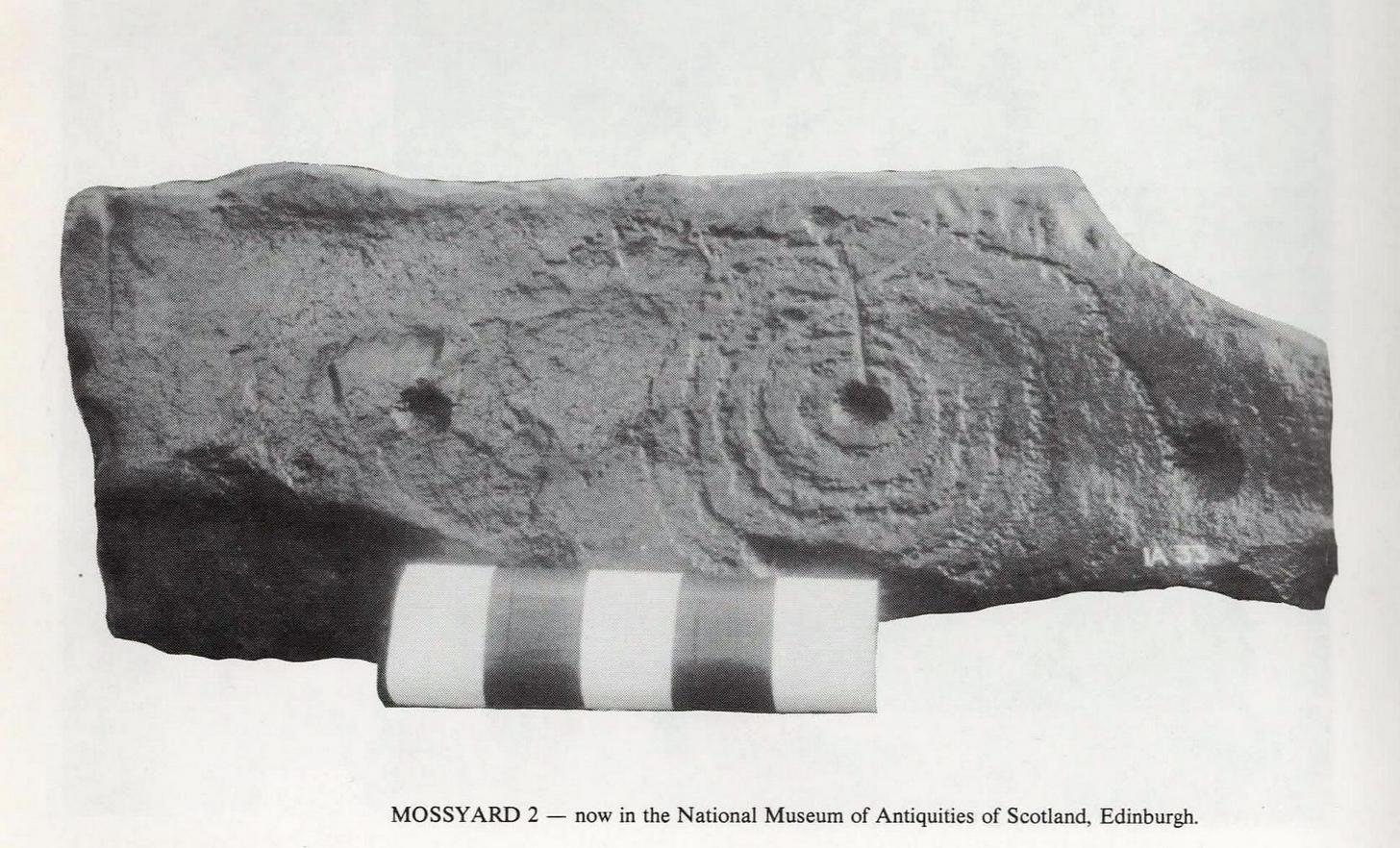
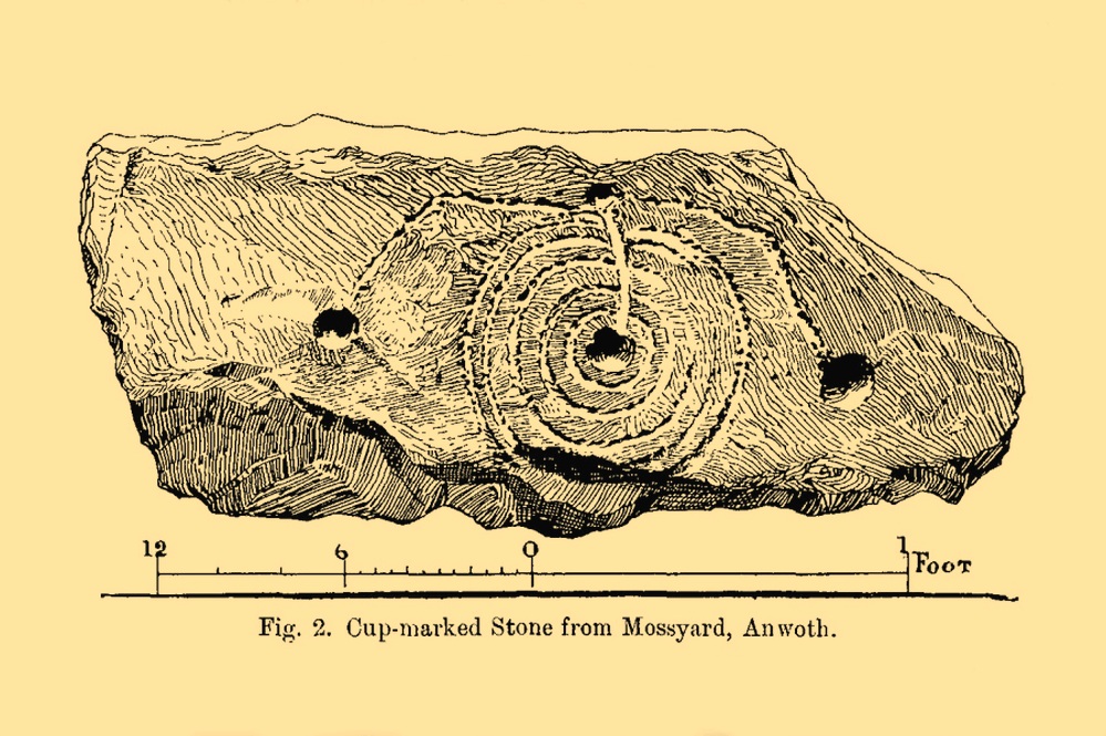
This impressive-looking carving was brought to the attention of the Scottish Society of Antiquaries by Sir Herbert H. Maxwell (1900), who thereafter moved it to the National Museum where, I presume, it still lives, in a box somewhere, sleeping gently. Maxwell’s brief resumé of the stone was as follows:
“Cup and Ring-marked Slab…found in a dyke on the farm of Mossyard, Anwoth, Kirkcudbrightshire. This cup-and ring-sculpturing is peculiar in having five rings round the central cup crossed by a gutter which ends in another cup from which gutters also proceed to right and left, each terminating in a cup.”
In Ron Morris’s (1979) survey he erroneously told how the carving had been found in a wall instead of the dyke from whence it came; but, that triviality aside, he described it as,
Morris’ 1979 photoMaxwell’s 1900 drawing
“A cup-and-five-rings, the rings slightly flattened where a radial groove from the cup passes through them. 23cm (9½in) diameter, grooves connecting this with 3 other cups. Carving depths up to ½cm (¼in). The rings are rather lightly pecked though quite wide and well preserved. All gapped, except the inner ring.”
If anyone is able to get any good photos of the carving, out from its museum hideaway, it would be good to see how it’s coping therein….
References:
Maxwell, Herbert R., “Donations to the Museum and Library,” in Proceedings Society Antiquaries, Scotland, volume 35, 1901.
Morris, Ronald W.B., The Prehistoric Rock Art of Galloway and the Isle of Man, Blandford: Poole 1979.
Cup-Marked Stone (removed): OS Grid Reference – SE 1579 3995
Archaeology & History
Jenny Lane carving
A small, seemingly broken cup-marked stone that may have once been part of a prehistoric tomb, found itself being included in an old wall at some time in the not-too-distant past: in the south-facing wall of the cricket ground at the top end of town. No one seemed to know it was there until it was noticed in the 1950s by a local man who brought it to the attention of Sidney Jackson (1958), editor of the local Bradford archaeology mag at the time. Jackson visited the site and thankfully did a sketch of what it looked like, before it was removed at a later date. He wrote:
“The small rectangular stone bearing four cup-shaped hollows…is another of Mr George Pritchard’s finds. It forms part of the high wall which bounds the Baildon Cricket Club’s ground in Jenny Lane… Its appearance suggests that it is part of a Bronze age cup-marked rock which was split to make building stones.”
Following its removal more than twenty years ago, it ended up in the hands of a dude from Cononley called Gerald Wright. I’m not sure whether it still lives over there or has subsequently found a new abode. Does anyone know what’s become of it…?
Folklore
Although there’s nothing specific to this carving, the place where it was found, on Jenny Lane, was where a phantom black dog used to be seen in bygone years. It was renowned as the harbinger od death.
References:
Jackson, Sidney, “Cup-Marked Stone in Jenny Lane, Baildon,” in Cartwright Hall Archaeology Group Bulletin, volume 3, part 10, 1958.
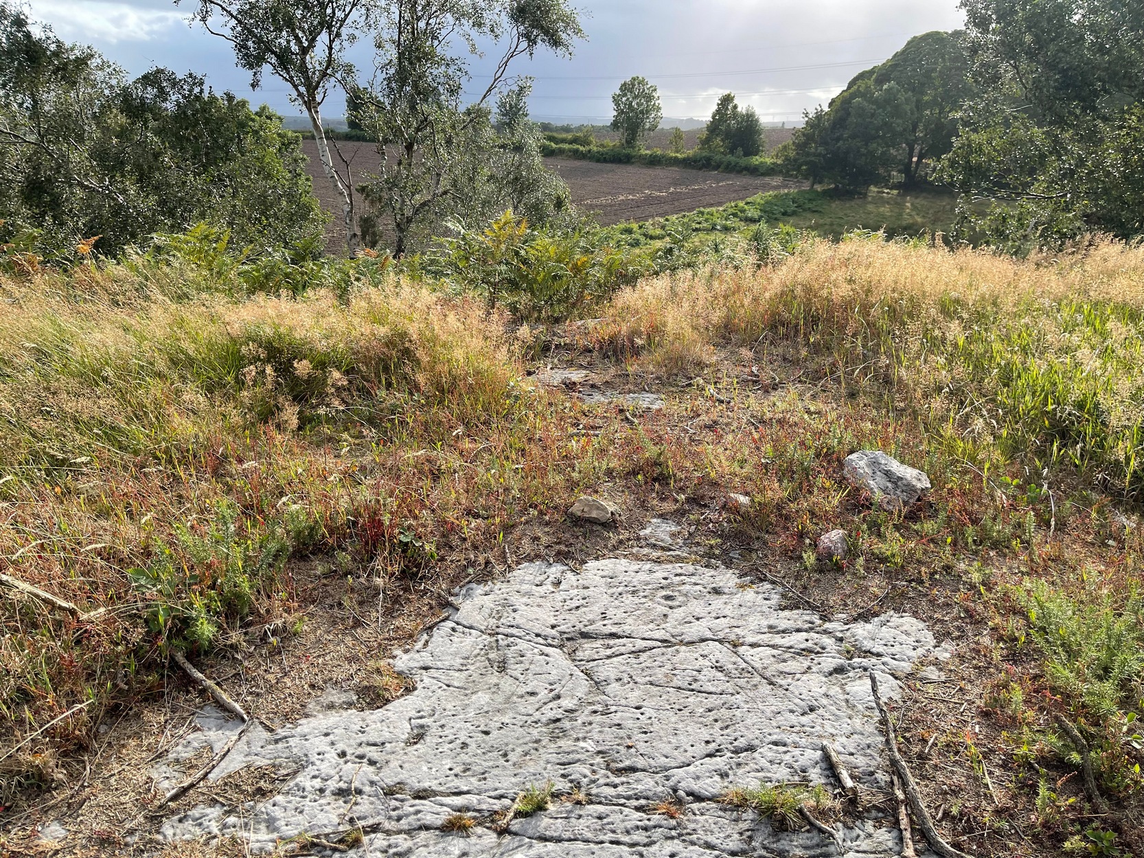
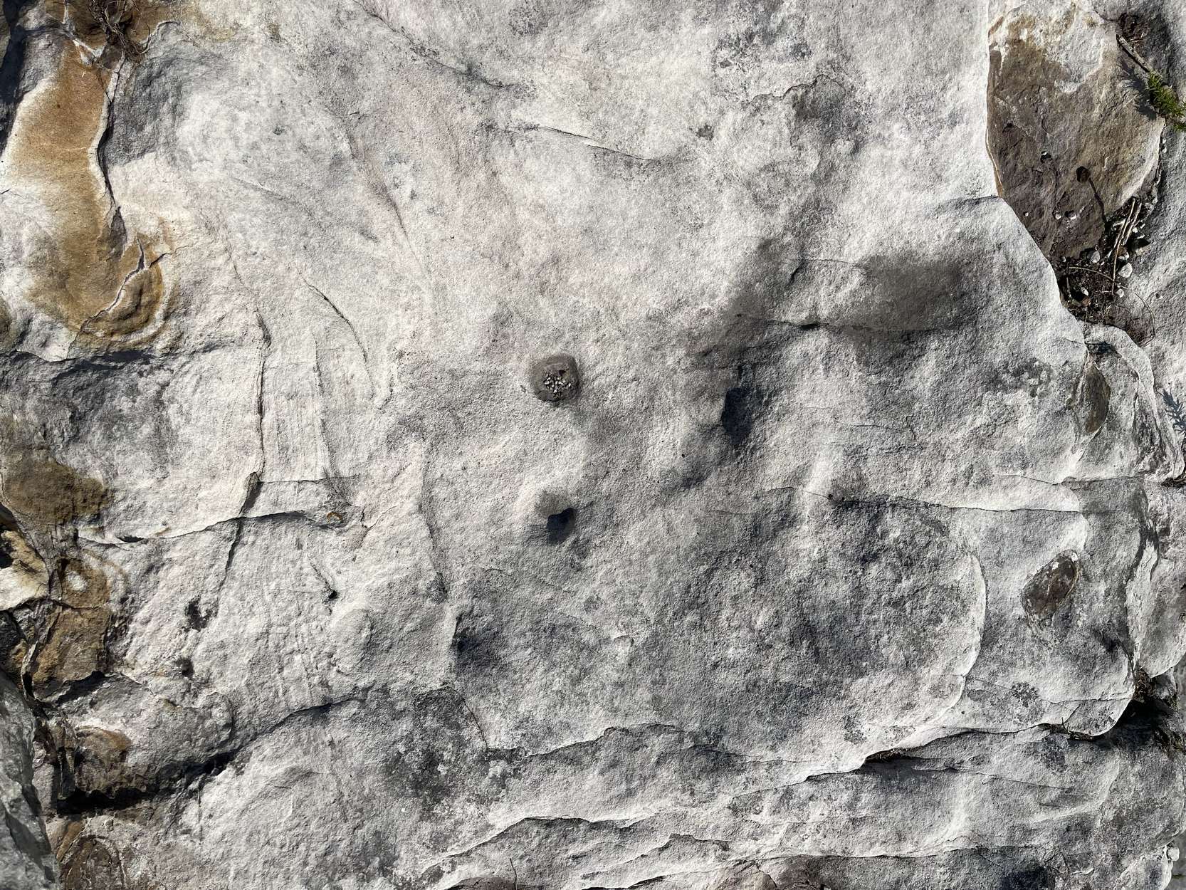
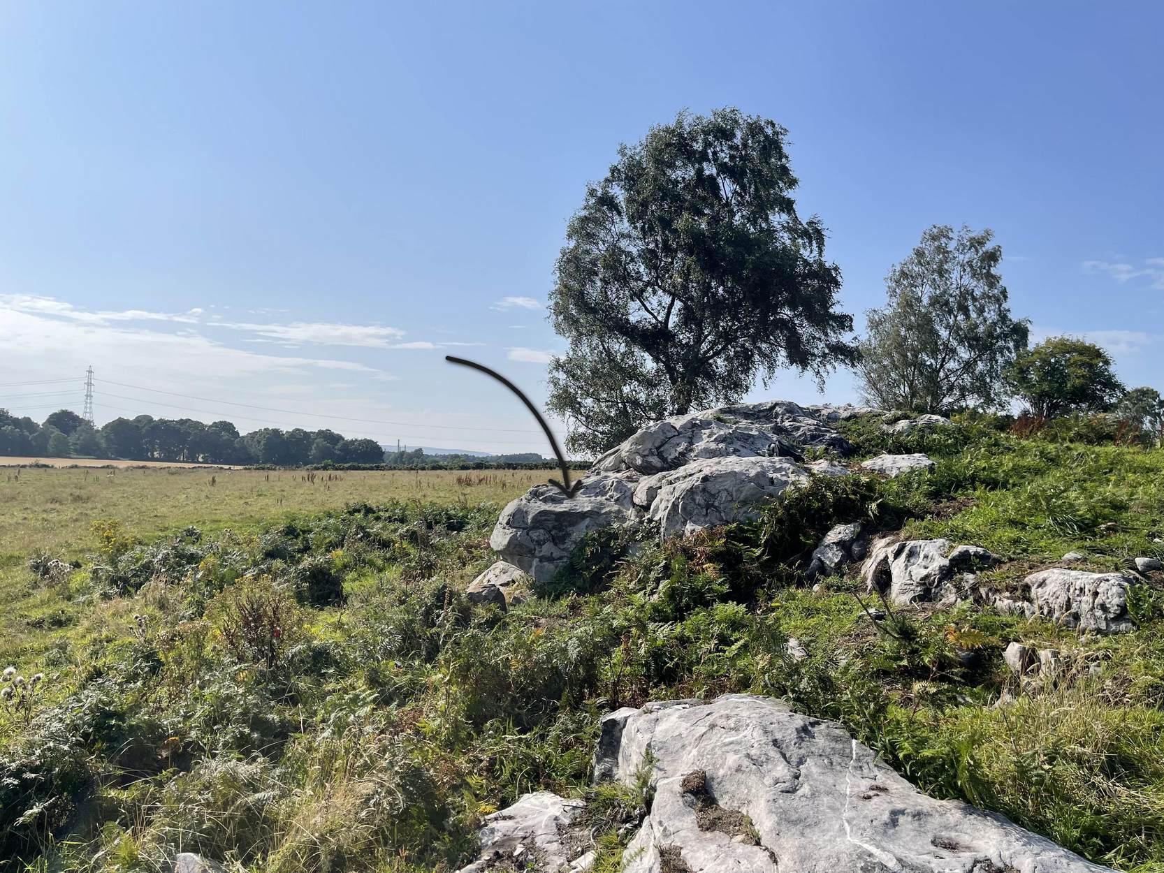
A real pain-in-the-arse to find this one, and even describing how to get there is troublesome—but I’ll try my best! I think the best starting point would be from the track that runs through Rivock plantation. Follow directions to reach the Ripple Stone carving, then walk 35-40 yards east to the ornate multiple-ringed stones of Rivock (067) and company. Now comes the tricky bit. From here walk, zigzag fashion (it’s the only way y’ can do it!) up the slope ever-so-slightly east of due south until you reach the top of the slope, where the land levels out. If you walked in a dead straight line from the triple-ringed Rivock (66) carving, it is almost bang on 100 yards. Anyhow, now you’re on top of the slope, zigzag about and look for the large flat oval-shaped stone. Take your time—you’re gonna need it!
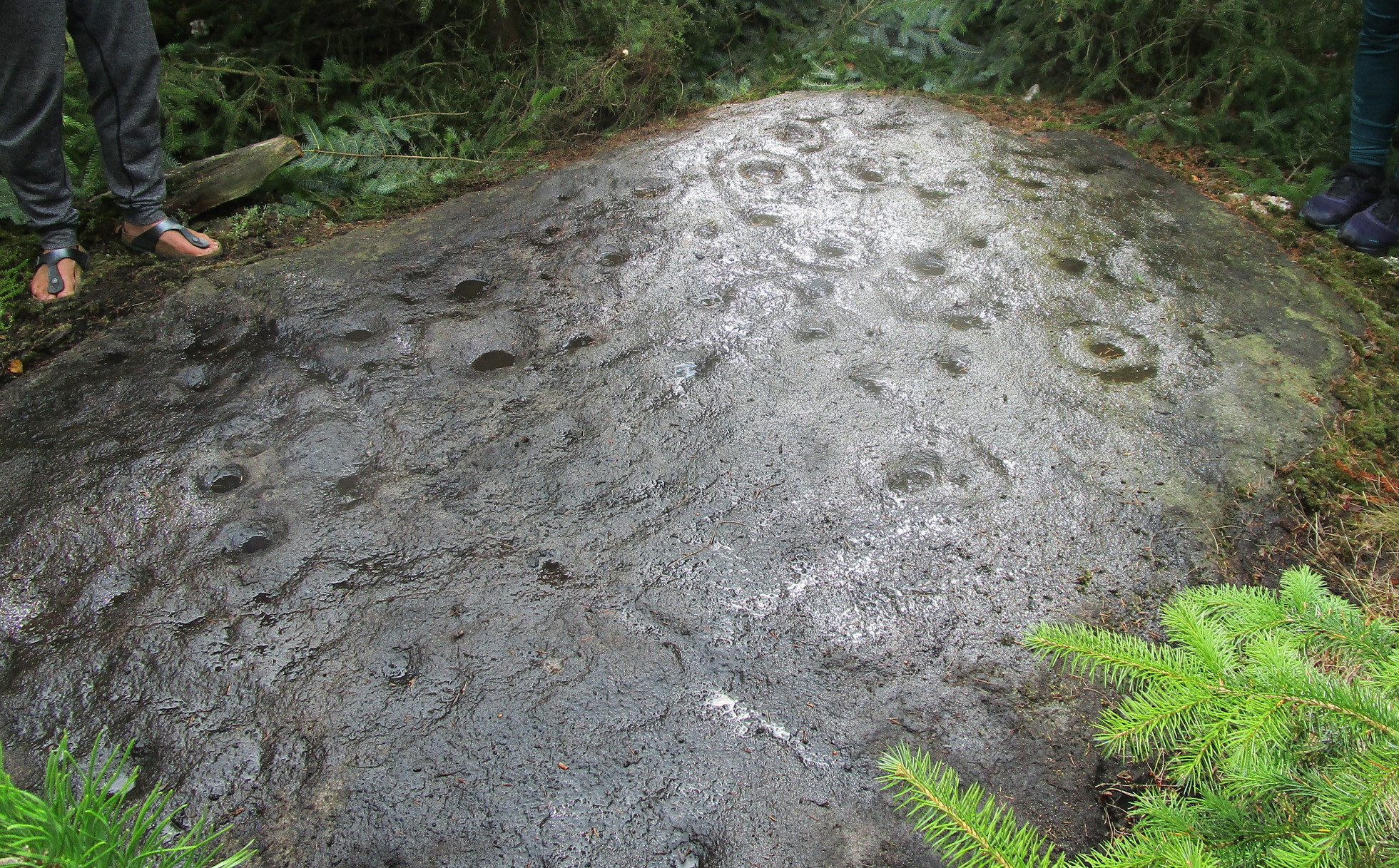
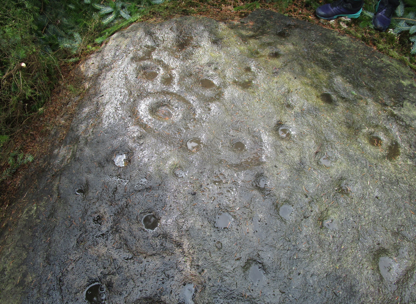
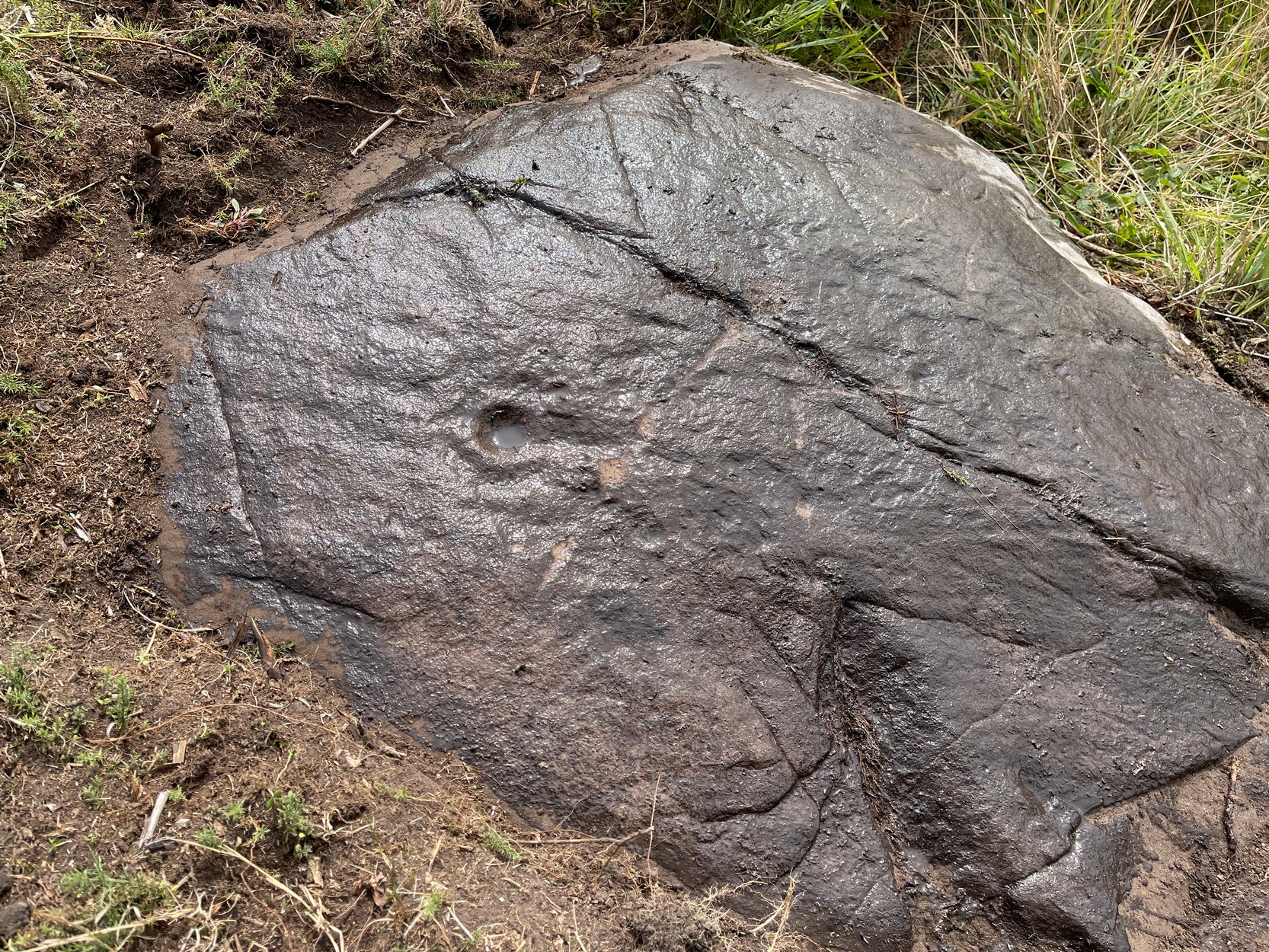
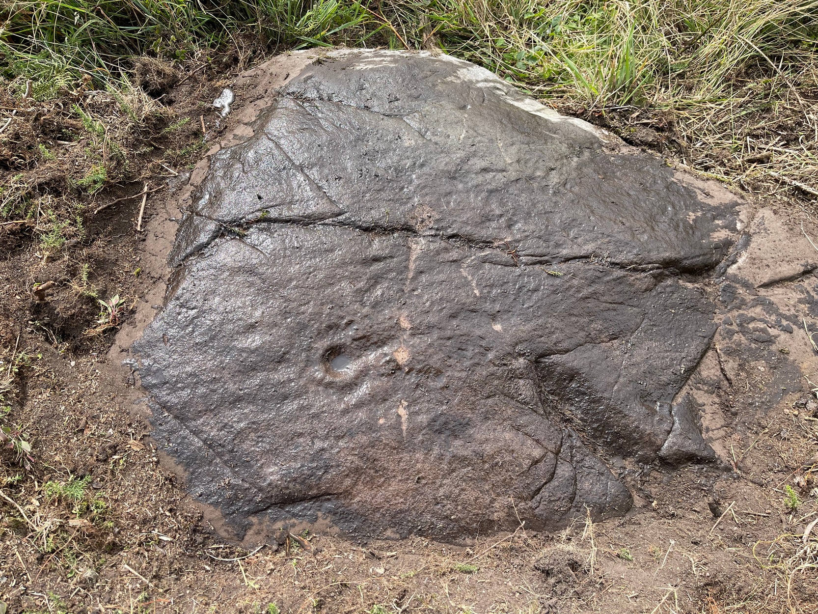
Archaeology & History
Section of carving
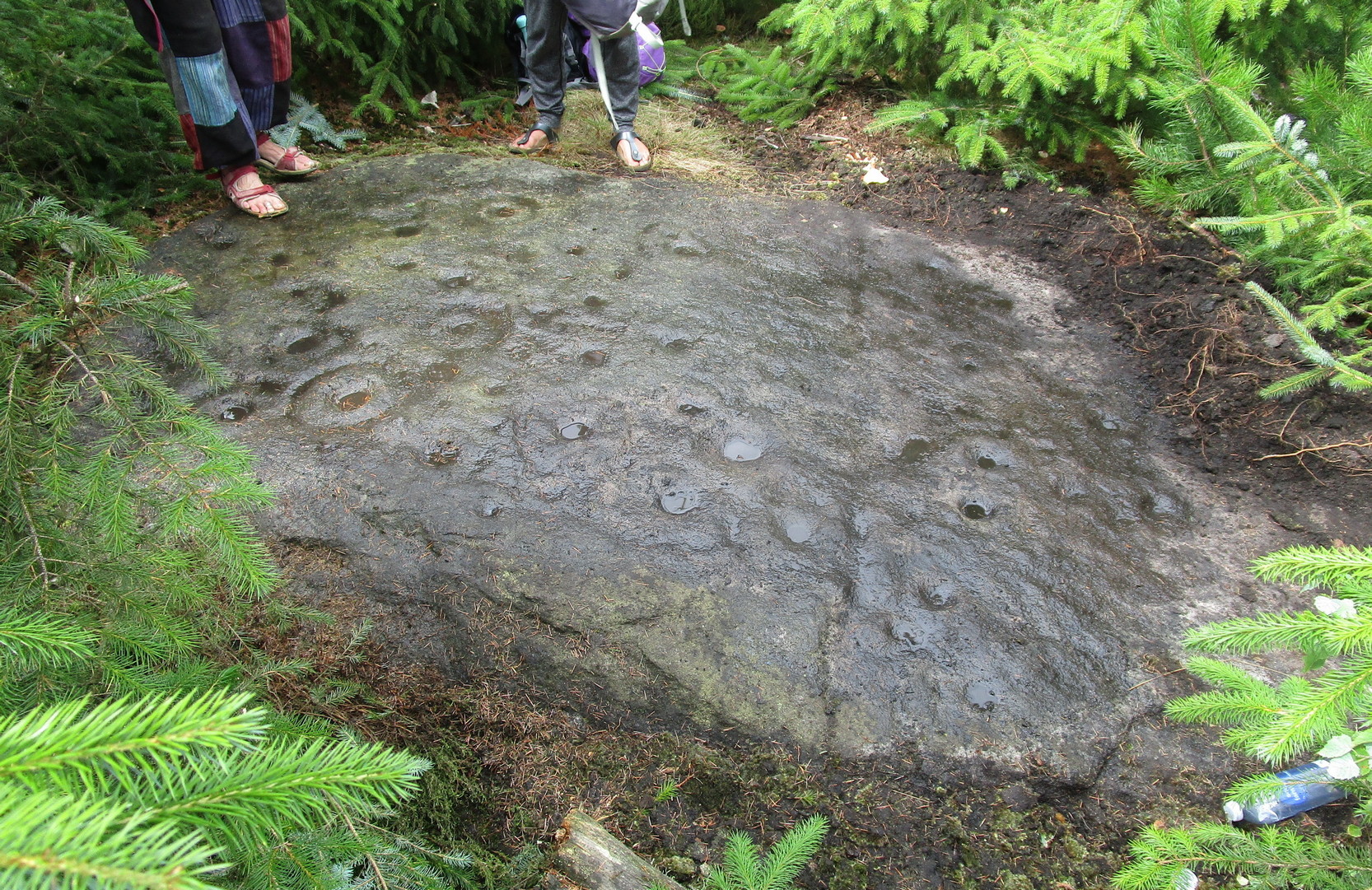
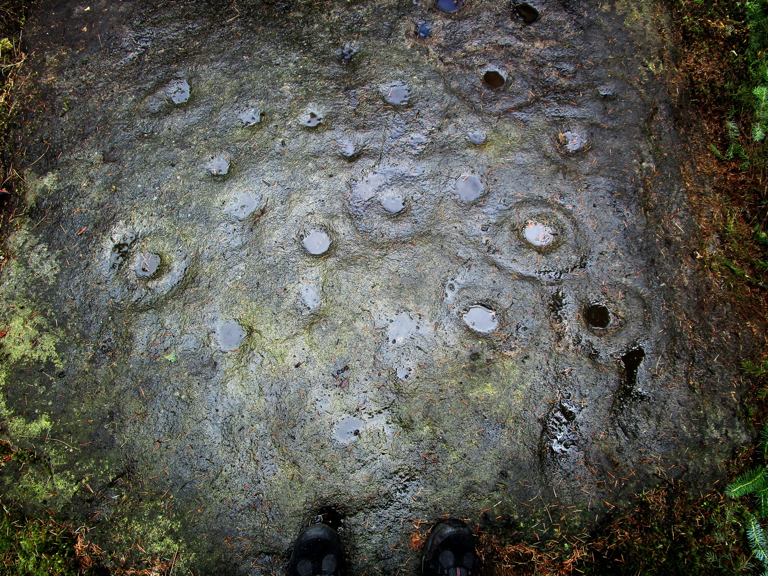
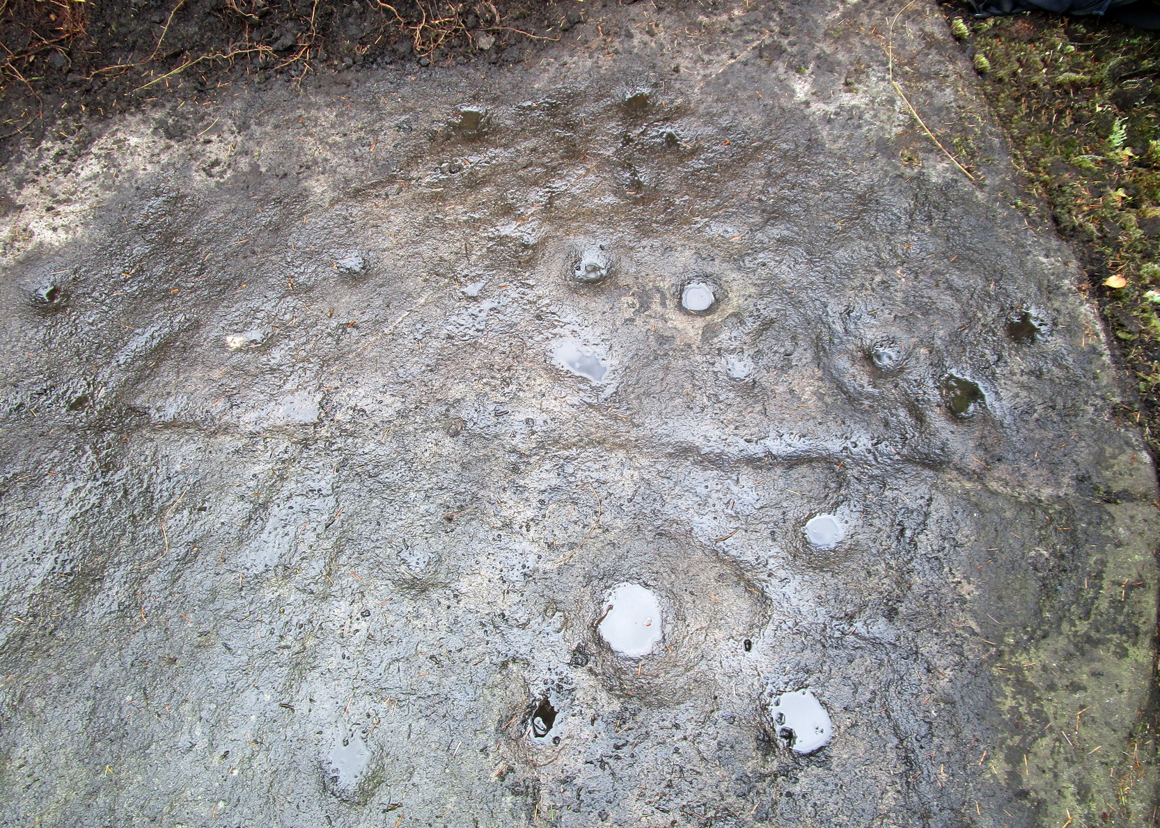
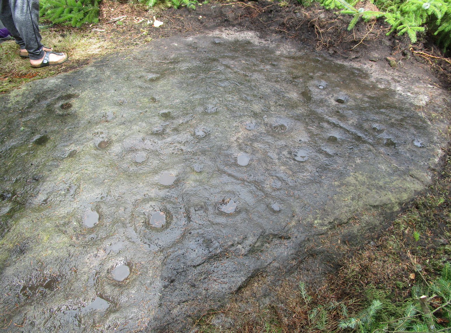
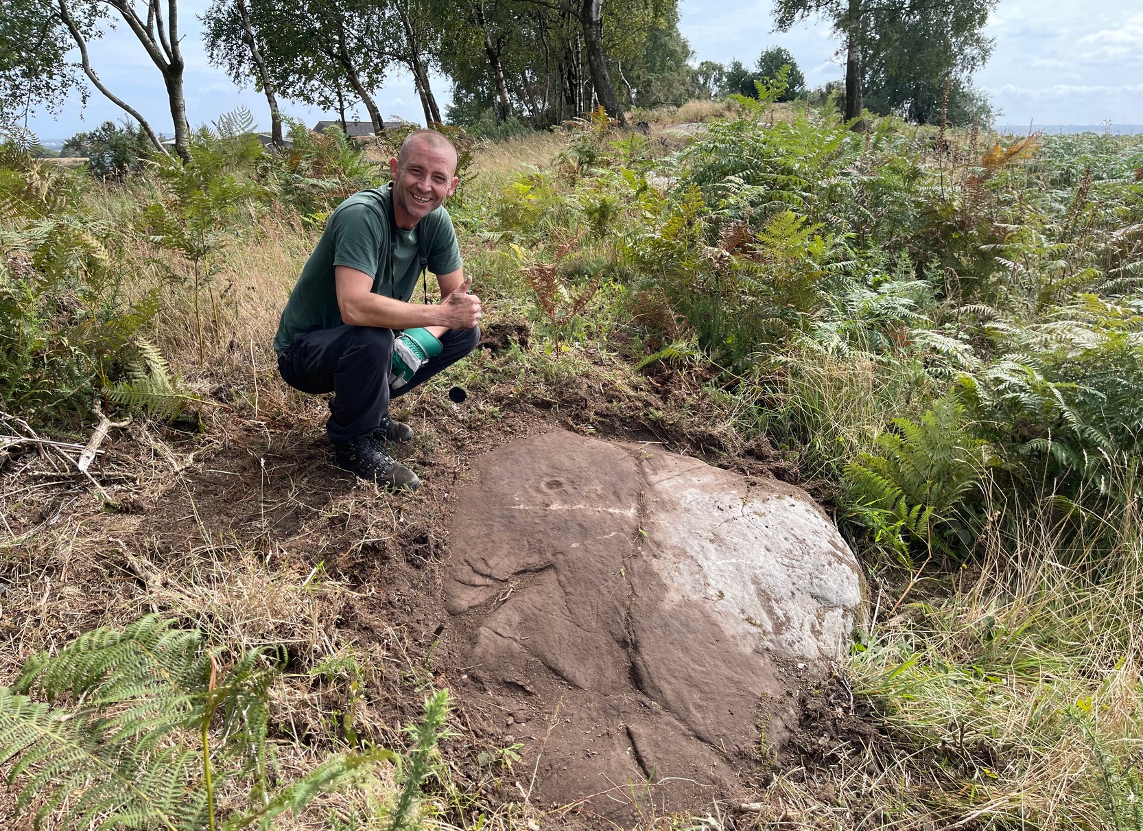
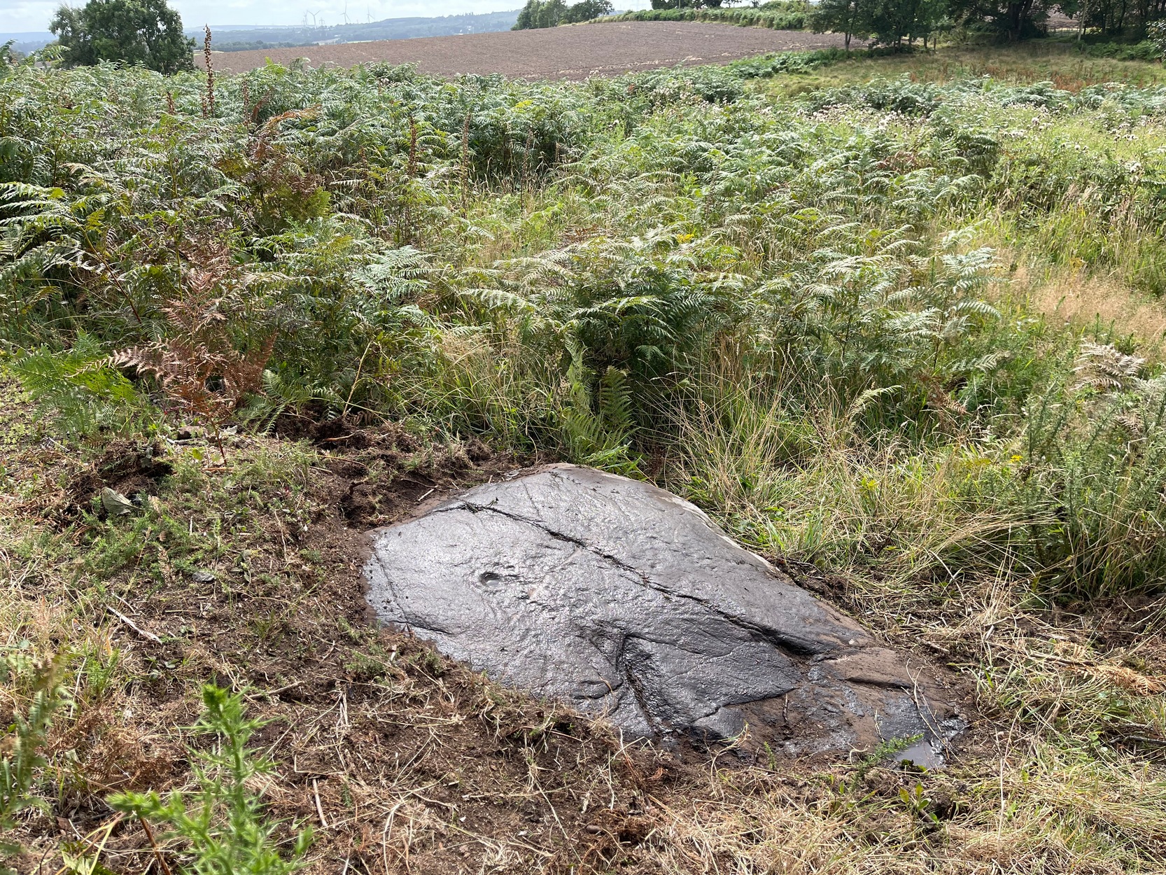
Laid amongst the dense mass of cheap crappy pine trees that plagues some of our upland countryside depriving the land of necessary nutrients for animals, flowers and other trees, this impressive multiple cup-and-ringed marked rock lies sleeping. It was rediscovered in 2017 by local hunter Chris Slinger during one of his many ventures through the undergrowth. I’m informed that one of his compatriots reckons that he already knew about it some forty years prior to Chris claiming it—but as yet we have no way of knowing that for sure, so the name of the carving goes to Mr Slinger. And it’s a beauty—one helluva beauty!
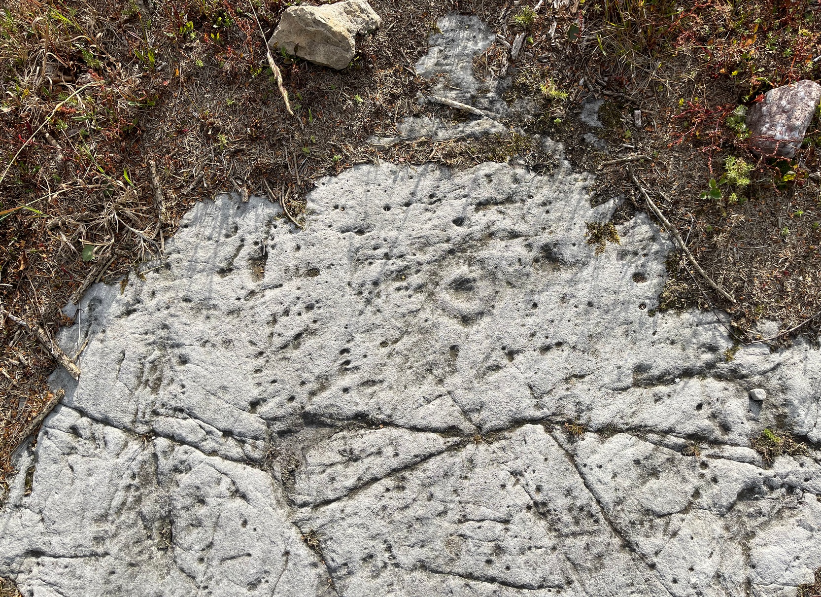
Main line & ring clusterScattered mass of rings
This large, flat, ovoid-shaped stone, roughly 10 feet by 7 feet across, is virtually covered from head to foot in large and not-so-large cup-and-rings at varying levels of erosion. The carving appears to have been partitioned, so to speak, into two sections that are clearly defined by a carved line that runs the breadth of the stone. On the top, larger section above this main line are about 30 cup-marks, with perhaps a dozen of them having rings around them—some complete, some incomplete—scattered about in the usual non-linear manner. One or two of the cup-and-rings may have double-rings, but due to dark conditions in here none of us could be sure. On one visit, a local lady (Liz of Fell Edge if I remember rightly) noticed that the largest cluster of cup-and-rings near one quarter of the stone seemed to be arranged in a similar form to the Swastika Stone, 1.9 miles northeast of here!
Main line, cups & ringsCluster of cup & rings
On the lower smaller section of the carving, beneath the main line if you like, there’s not quite as much going on. At least twelve cup-marks are apparent here, at least five of which have rings around them. The main little bunch of these are pushed right up against the long carved line, seemingly communicating with other rings on the top-side of it. In some photos it looks as if, in this section of the stone, carved lines link the cup-and-rings on each side of the main dividing line (if y’ get mi drift). There’s a lot going on here. It’s a pretty complex carving as you can see: one of the best in the Rivock cluster and one that I’d like to spend more time with, if only to get a complete picture of what the carving looks like in full as we’ve not yet got to the outer edges of the stone itself, meaning that there may be more of it beneath the vegetation.
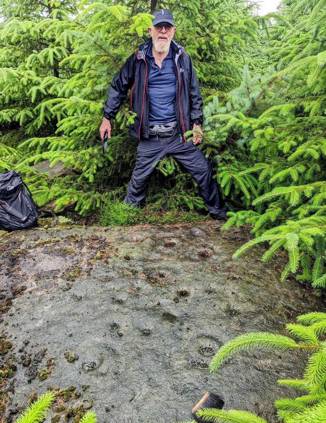
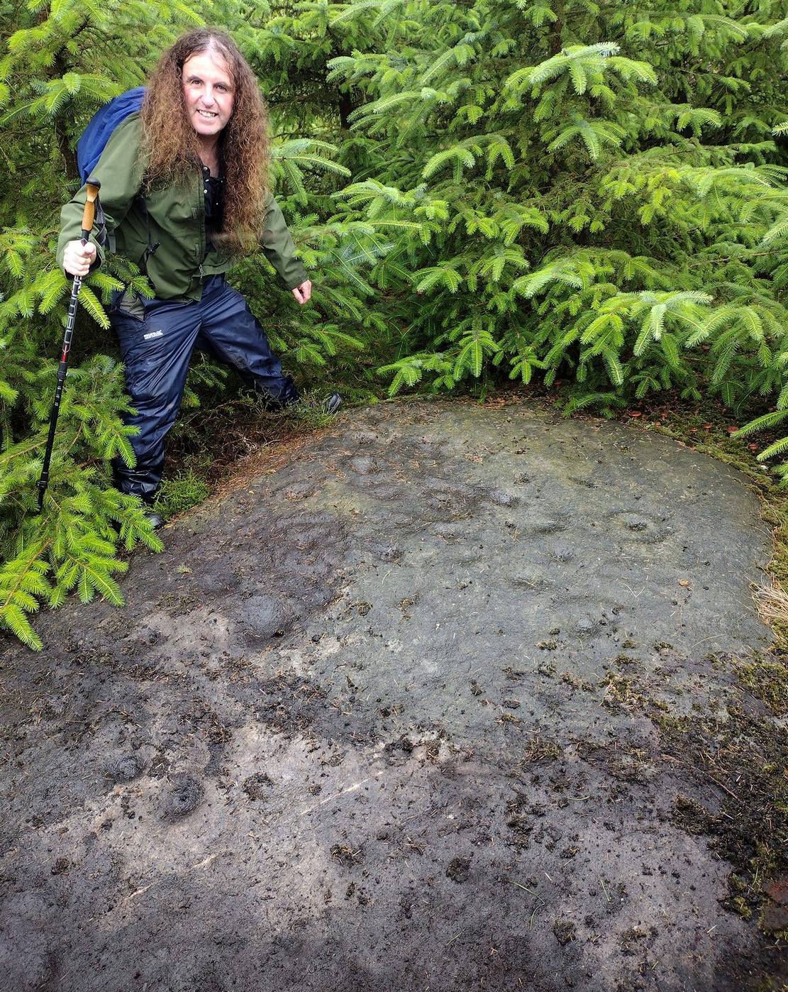
Stone-fondler KootStone-fondler Sean
I was hoping to get some much better photos of this site and clear back more of the covering foliage, but as the carving is now all but covered in dense forestry, we may have seen the last of it for a few decades. Even worse, there’s the great possibility that the carving will be destroyed when the forestry lads come to cut down the trees—through no fault of their own—as they’ll have no idea that it’s directly beneath their machinery. It would be good if some local volunteers could perhaps completely clear and protect this stone to avert such a likely disaster a few decades from now. A small metal fence with a little notice-board would do the trick!
Acknowledgements: Firstly, to Chris Slinger for rediscovering the carving; then to the modern stone-fondlers Rod ‘Koot’ Chambers and Sean Dillon for beginning the cleaning process, and for their photographs in this site profile; and then to Sarah Walker, Sarah Jackson and Marianna, for helping to bring the entire stone into view.
If you start from the Castleton (2) carving, in the first small birch copse closest to the road, walk to its southeast side where there’s a small break before the next small birch copse begins which runs along the raised rocky crag to the southeast. Walk along the back lower east-side of these birches for about 100 yards until you reach a break in the copse (the next lot of trees are another 30-40 yards further on) and from here walk up the slope onto the first flat piece of rock on the crag itself. Zigzag hereabouts until you’re about two or three yards from the edge.
Archaeology & History
Single cup-and-ring
Once this rock surface is covered again by Nature’s carpet, you’ll struggle to find it. Unlike many of its more ornate neighbours, this seems to be a lonely solitary cup-and-ring design, cut near the edge of a large level piece of otherwise blank rock. Numerous geological nicks and scratches scatter the same surface, but the carved element is easy enough to see, as the photos here show. It was rediscovered in the 1980s by Morris & van Hoek (1986) who described it simply as “a single cup and one ring, 8cm in diameter on horizontal rock.” There may well be additional elements to this design beneath the soil.
References:
Morris, Ronald W.B. & van Hoek, Maarten, “Stirling District: Castleton 4d; Castleton 5e,” in Discovery & Excavation, Scotland, 1986.
Acknowledgments: Massive thanks to Thomas Cleland for helping to make this site visible again.
Start from the Castleton (2) carving, in the first small birch copse closest to the road and walk to its southeast side where there’s a small break in the trees before the next small birch copse begins, which runs along the raised rocky crag to the southeast. Walk to the front or western side of the trees there and along the very edge of the low crag. About thirty yards along, right on the edge of where the rocks begin, look for the smooth sloping earthfast boulder (about 20 yards before the mighty nine-ringer of Castleton 7). Rummage around and you’ll find it.
Archaeology & History
Castleton (7e) carving
This newly recorded petroglyph was rediscovered by Thomas Cleland on August 6, 2025. Initially it was thought to consist of just a single cup-and-ring with an opening from which a carved line ran outwards; but, once wet, there seemed to be the beginning of an outer second-ring on its left-side. You can see it clearly in the photos. And, the more we looked, the more it seemed there were one or two other very faded elements.
Above the main cup-and-ring is a faint, shallow cup-marking and surrounding this appears to be an incomplete dumb-bell-shaped ‘ring’ that you can only just make out in the photos. It’s very faded and would seem to pre-date the primary design by some considerable time (unless, of course, it was merely ‘outlined’, so to speak and never completed).
Cup & ring & faint ‘bell’Cup & ring & faint ‘bell’
Both Tom and I are convinced that there’s more to this carving than is presently visible. The rock is covered in deeply compacted soil and it would require a lot of work to uncover the rest of it. A job for the future maybe…..
Note to self: This carving and all the others in the Castleton complex need to be fully re-catalogued as their indexing is haphazard through various academic tomes and websites.
Acknowledgements: Massive thanks to Thomas Cleland for locating this carving, for the first time in millenia. 🙂
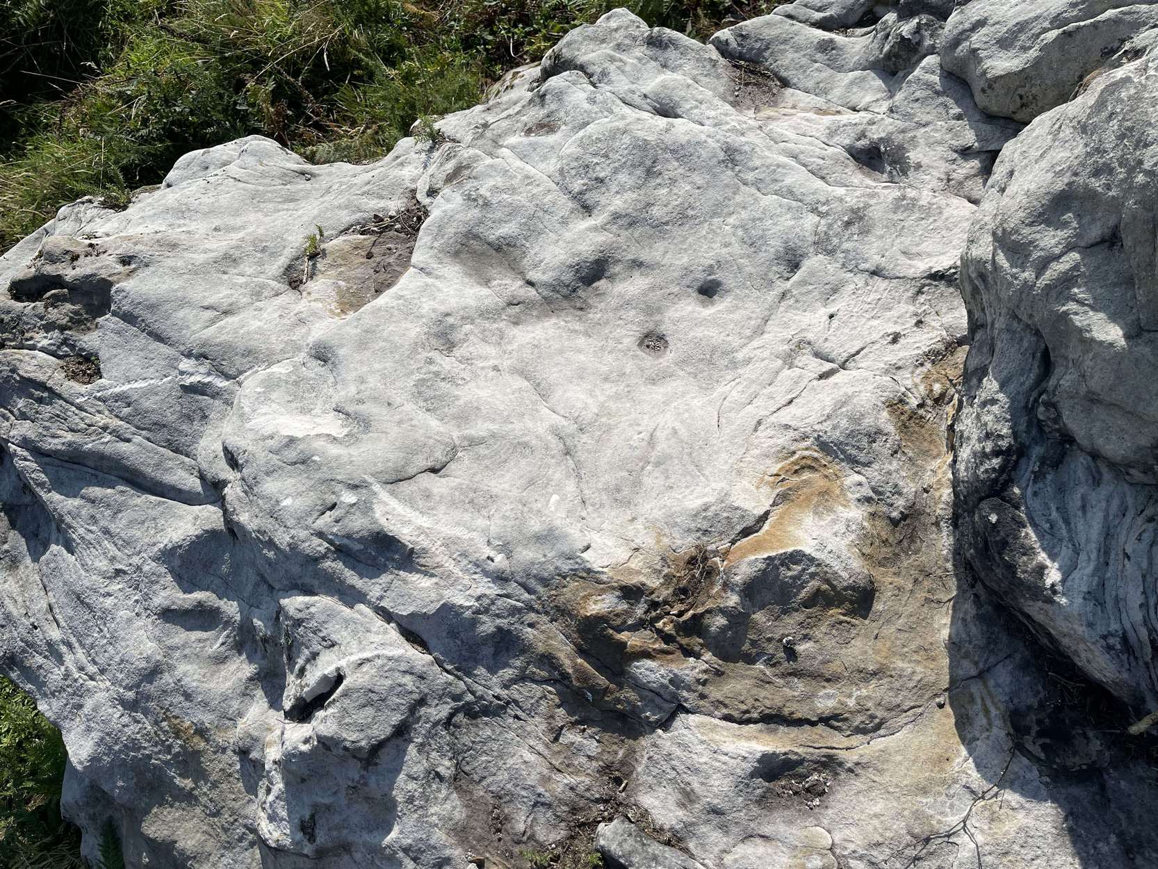
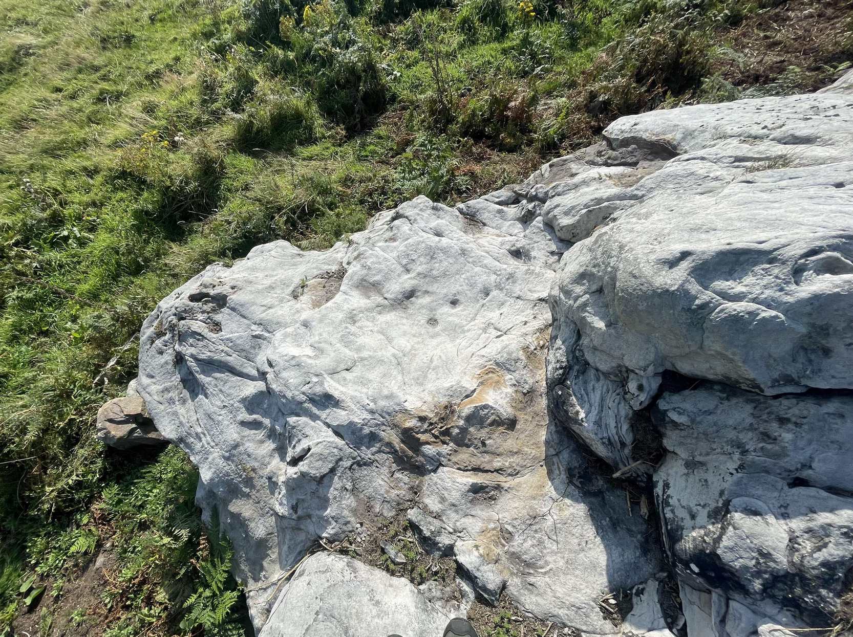
Follow the directions as if you’re visiting the impressive multi-ringed design of the Castleton (10) carving. Once there, walk south-east along the geological ridge for 45 yards where the small cliff drops down to the field. Just where this drop occurs, on a lower horizontal level of the rock face (only a small section) you’ll notice two distinct “cups”. You can’t really miss it!
Archaeology & History
This very basic cup-marked stone was, until recently, covered in dense gorse, making access to the site almost impossible. But following a fire that happened here not too long ago, the smoldering remains needed to be cleared and, once the job was done, we were able to see the two distinct ‘cups’ that were first described in Maarten van Hoek’s (1996) survey. But the cups that he described are, most likely, little more than Nature’s handiwork. I’m somewhat skeptical of them as being the real deal. In the same survey, he added another site, which are just natural bowls in the rock just over 100 yards southwest of here as being cup-marks — which they’re not!
References:
van Hoek, M.A.M.,”Prehistoric Rock Art around Castleton Farm, Airth,” in Forth Naturalist & Historian, volume 19, 1996.
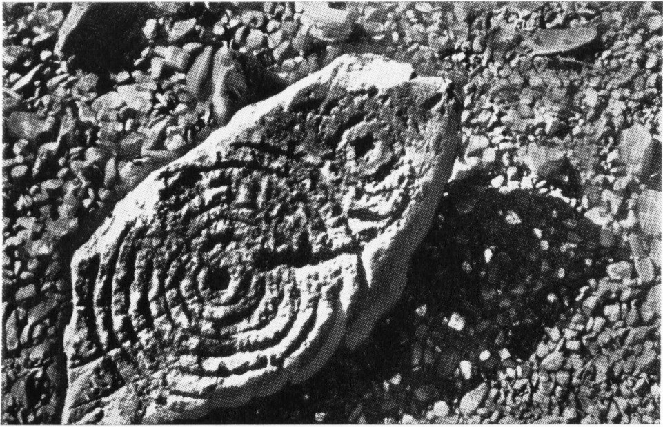
Cup-and-Ring Stone (removed): OS Grid Reference – NX 546 530
Archaeology & History
A.E. Truckell’s 1961 photo (TGDNHAS, 1961)
A small multiple-ringed archetypal design consisting of a central cup-mark with seven consecutive rings emerging from it, with a second outlying, incomplete cup-and-double-ring that nearly touches the outer edge of the seven-rings, was found by a Mr Sproat “in the bed of a shallow stream on Laggan farm” in 1960. The design, as the old photo (right) shows, is very well preserved, suggesting that it cannot have been in the stream for too long, as the erosion on the carving isn’t in anyway excessive. In all likelihood it originally came from a nearby prehistoric tomb: of which, there are several upstream from the farm.
Described by A.E. Truckell (1961) as “a particularly fine example”, the carving is on a particularly small and thin piece of stone, measuring 18 inch by 8 inch amd just 2 inches thick, with one edge of it snapped-off. It’s obviously no longer in situ and, I presume, is still resting somewhere in the Kirkcudbright museum.
References:
Morris, Ronald W.B., The Prehistoric Rock Art of Galloway and the Isle of Man, Blandford: Poole 1979.
Morris, Ronald W.B., “The Cup-and-Ring Marks and Similar Sculptures of South-West Scotland,” in Transactions of the Ancient Monuments Society, volume 14, 1967.
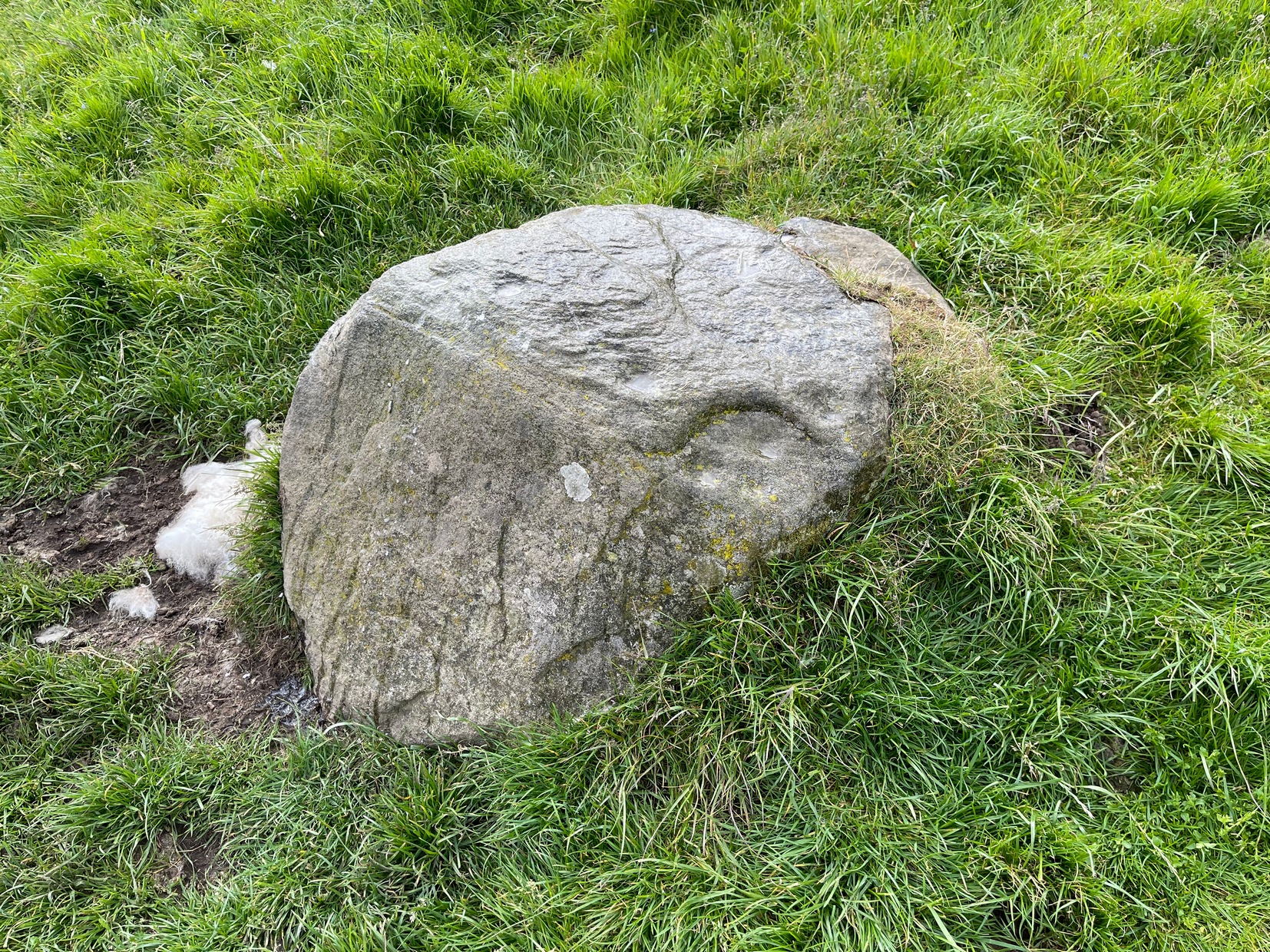
Along the A822 road from the Gilmerton junction on the outskirts of Crieff, heading up towards the Sma’ Glen, after literally 1¾ miles (2.8km) on the right-side of the road you need to follow the route to reach the Connachan rock art cluster by walking up the dirt-track leading up past Connachan Farm. Walk past the carving of Connachan (2) and up the track past Connachan (4), then onto the level ground and walk right to the low-lying ruined Connachan cairn. From here, look up the gentle slope to the fence. A small-ish stone protrudes out 40 yards away. Head straight for it!
Archaeology & History
Close-up of line of cups
You’ll check this out when you’re doing your tour of this petroglyph cluster and sit here to admire the view. It’s the last of the small bunch of carvings, on level ground, close to the denuded cairns. It consists of just eight cup-marks, all of which are carved close to the edge of the stone on its upper sloping surface; although this doesn’t tally with Margaret Stewart’s (1967) description of any of the carvings hereby. There’s nowt much more to be said about it to be honest; apart from saying how it’s highly likely that other carvings remain hidden, undiscovered, not far from this stone along the edge of these hills.
References:
Stewart, Margaret E.C., “Connachan, Crieff – Cup Marks and Hut Circle,” in Discovery & Excavation, Scotland, 1967.