Along Halifax Road (A649), get to the Shears Inn and then take the footpath at the back of the pub that runs down the side of the fields and alongside the allotments. Less than 150 yards down, just through the stile into the edge of the field on your left, you’ll see the side-edge of a large flat stone in the grasses. Check it out!
Archaeology & History
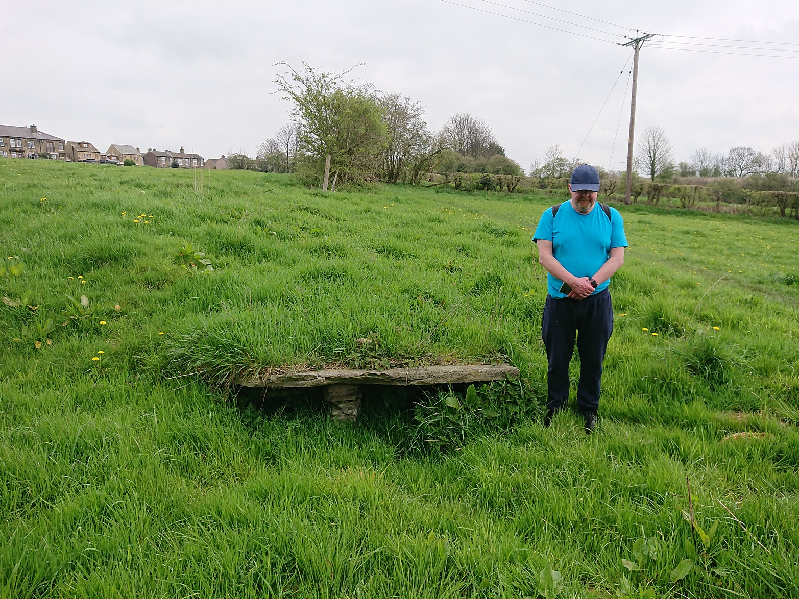
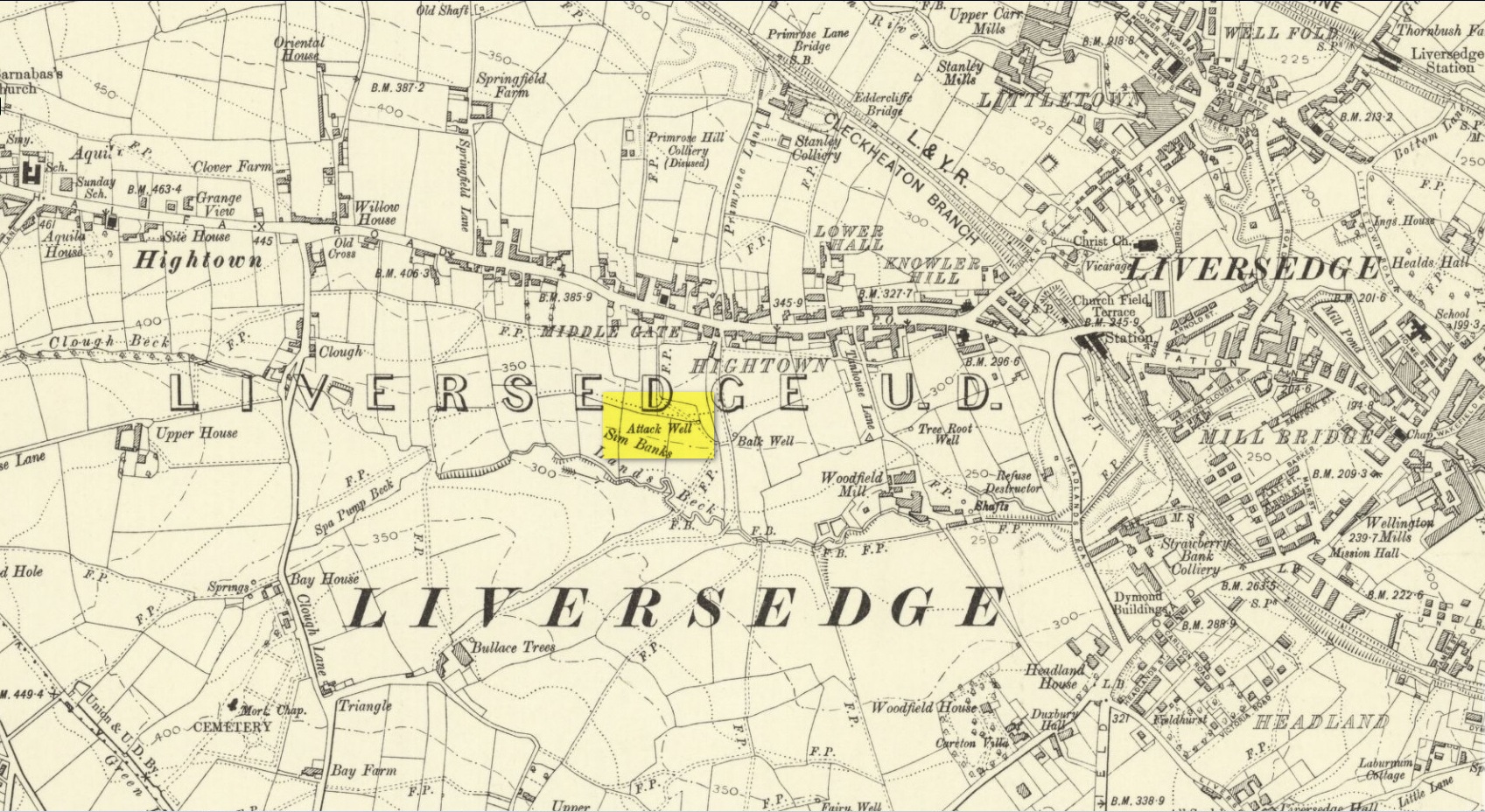
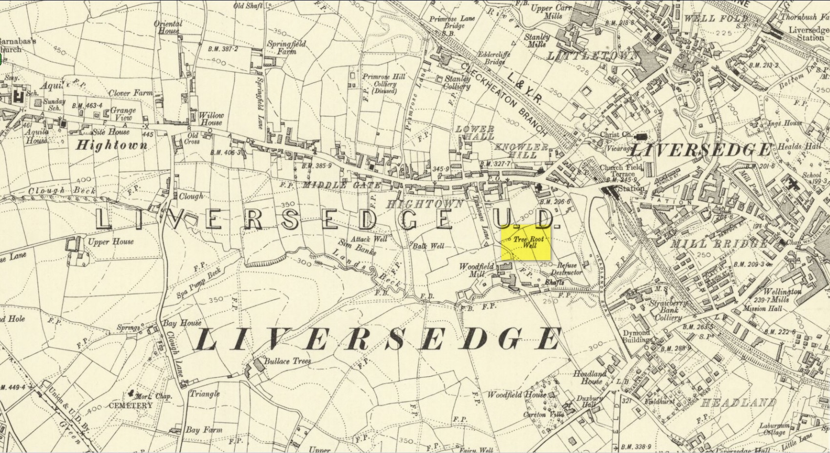
Along with the Attack Well and Tree Root Well, this was one of three springs close to each other that gave local villagers their water supply in bygone times. When we visited here at the height of a long warm spell in the summer of 2023, there was still was a small amount of clear water trickling beneath the long flat slab of stone — although it was somewhat clogged-up with vegetation. It wouldn’t take much work to completely clean this out and use the fresh drinking water once again.
The well gained its name from its position in the land, with balk, being “a portion of a field left unploughed”, or “a strip of ground left untilled” and variants thereof.
References:
Wright, Joseph, The English Dialect Dictionary – volume 1, Henry Frowde: London 1898.
Acknowledgements: Huge thanks to the great Gary Ferner, for use of his photo and the day’s venture!
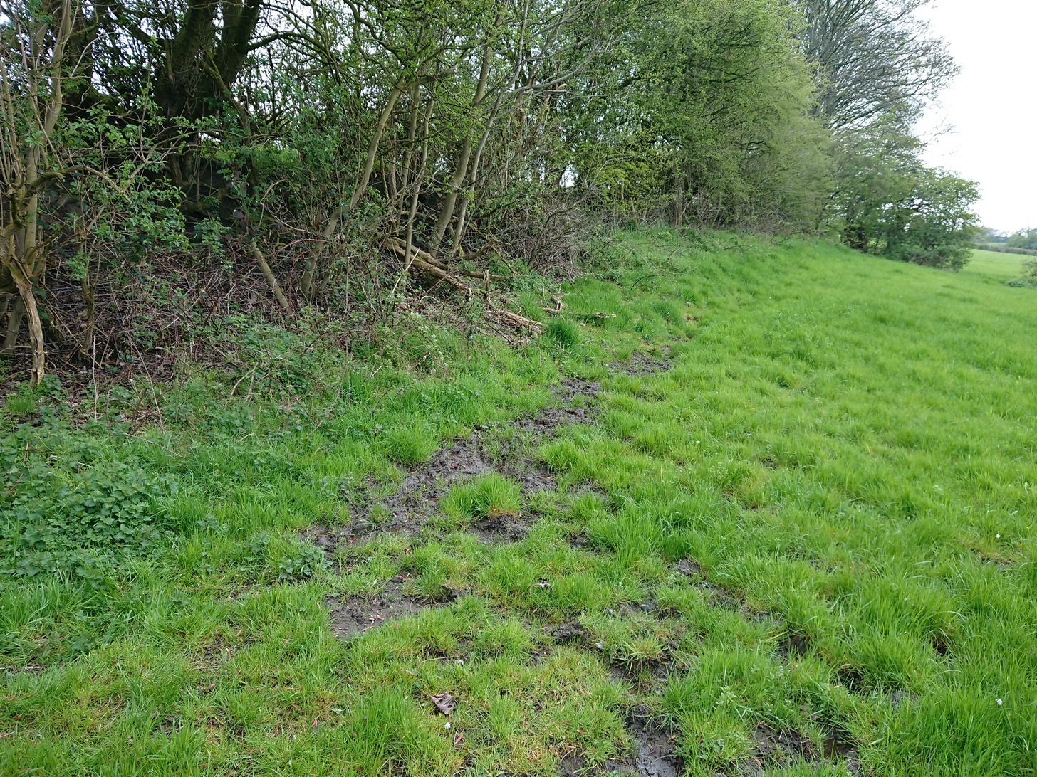
Located down the slope behind Shears Inn on Halifax Road (A649), past the stone-lined Balk Well, then round the other side of the allotments up where the footpath cuts to your right, the waters from this site can barely be found in the now large mass of brambles that make it virtually inaccessible to reach. When Gary Ferner and I visited here, it seemed that a very small pool of water existed in the hollow beneath the prickly vegetative covering—but even I didn’t struggle to get through it all and so we don’t know if the waters are still running as once they were. It was obviously one of the wells that fed local people in earlier times, but I can find no historical references to the site apart from its showing on the 1908 Ordnance Survey map.
Along with the nearby Attack Well and Balk Well, this was one of three water supplies for the people of Middle Gate between Hightown and Liversdge in the 19th century. Found near the bottom of the old track known as Tanhouse Lane, its waters emerged at the base of some Victorian walling that’s built into the hillside, above which are the decayed remains of what seems to be an old hawthorn tree, whose roots obviously reached down to the stone trough, giving the place its name. Its waters have long since dried up and fallen back to Earth. Although it is shown on the 1908 OS-map of the region, I can find no virtues ascribed to the well nor any local history notes.
Acknowledgements: Huge thanks to the great Gary Ferner, for help in locating the site and the day’s venture!
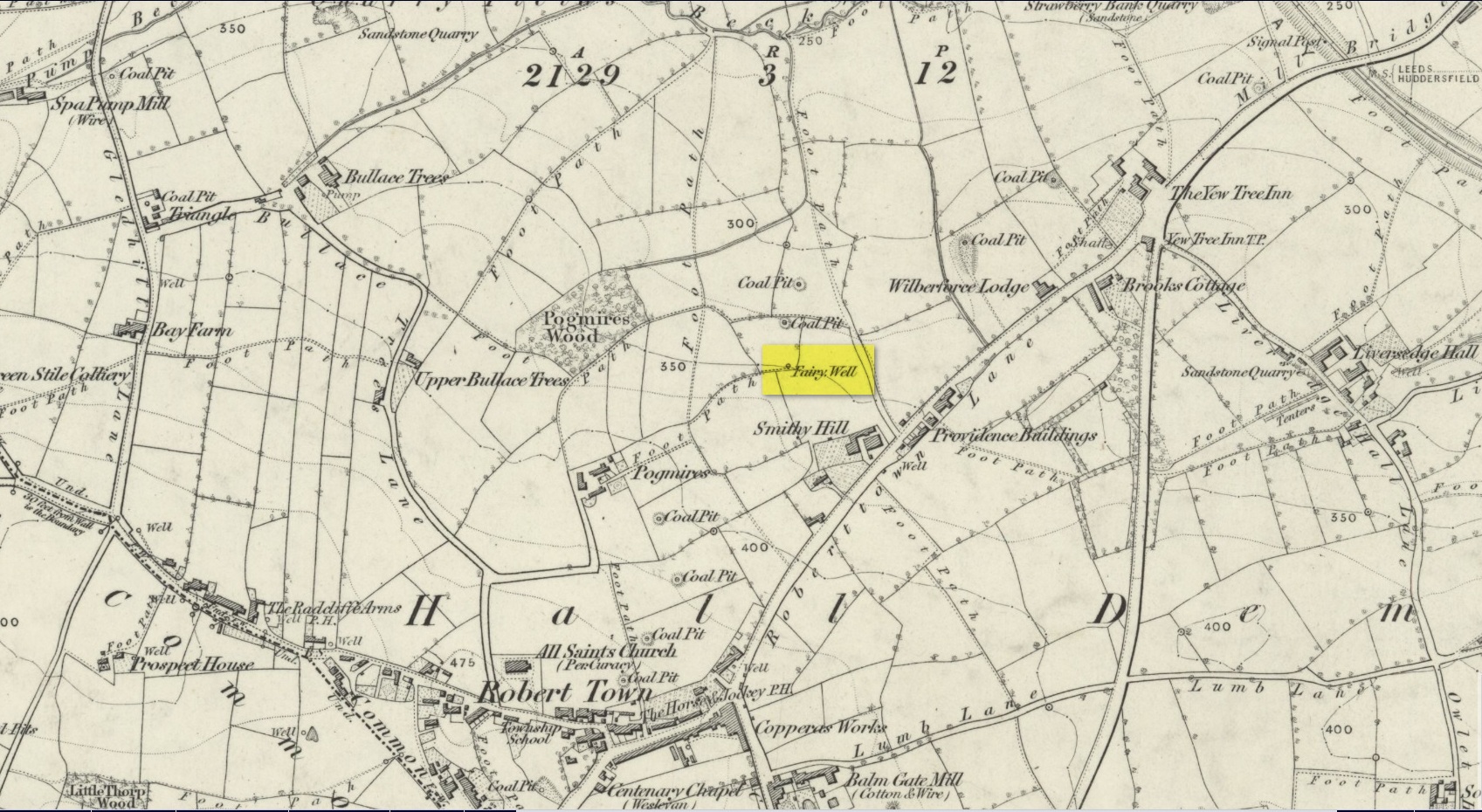
In times gone by there was a singular St.Giles’ Well in the old village of Lightcliffe, but the only reference we have of it is from one of James Parker’s works (1904) where, in his description of St. Giles’ House, he tells, “It derives its name from an ancient well, called ‘St. Giles’ Well,’ which once existed near to the house, and was dedicated to St. Giles”: an 8th century Greek prince who left everything to become a hermit. He lived on wild herbs and developed the ability to cure rheumatism (perhaps a curative aspect of the well), cripples and help beggars. He is the patron saint of woodlands and his symbol is the arrow gained after he healed a wounded doe shot by one (the mass of Robin Hood folklore in this area may have something to do with this symbolism). His date is September 1.
A.H. Smith (1963) cites the “local tradition that it is named from a well dedicated to St. Giles,” but thinks this attribution to be an unlikely one. As can be seen on the accompanying map, a great number of wells are in this area, none of them named, with one just below the said Giles House.
References:
Parker, James, Illustrated History from Hipperholme to Tong, Percy Lund: Bradford 1904.
Smith, A.H., The Place-Names of the West Riding of Yorkshire – volume 3, Cambridge University Press 1961.
Acknowledgements:Huge thanks for use of the Ordnance Survey map in this site profile, reproduced with the kind permission of the National Library of Scotland.
Best approached from Heckmondwike/Liversedge and going up Roberttown Road where, just past the Spen Valley High School parking spot, an almost dead straight footpath takes you down (northwest) into the woods. Walk down here for about 100 yards and then go left over the stile into the small copse of trees. Once you come out the trees at the other side, walk up the slope in the field that you’re now in. As you approach the line of trees at the top, you’ll notice the ground gets very boggy. Look carefully under the trees and you’ll notice an embedded flat stone protruding out and a somewhat trivial trickle of water into the grass at the front. That’s it!
Archaeology & History
Site on the 1854 OS-map
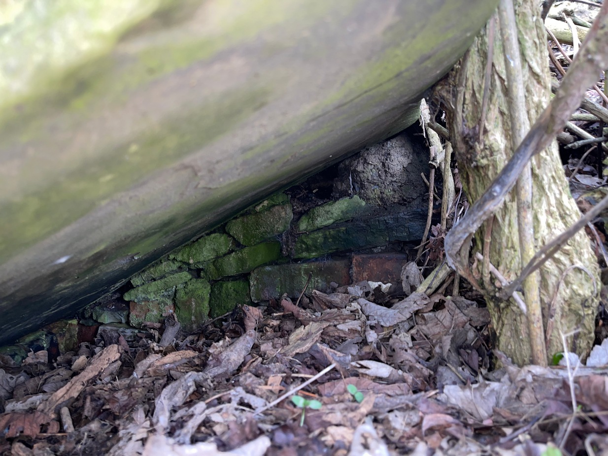
Highlighted on the 1854 Ordnance survey map of the area, this is a somewhat ruinous site which has seen better days. Even after good downpours it’s not very obvious and, in truth, could do with being cleaned-up, cleared out, and brought back into the old life it once had. If you look carefully beneath the roots of the covering tree, you’ll notice a decent-sized flat worked stone sticking out at the bottom of the sycamore and below this, at the back, almost covered in earth, you can make out some brick walling at the rear. It takes some finding! This is evidently the remains of a small protective well-house, now in total ruin.
Old cover of the well
When we visited the place a few weeks ago, there seemed to be no water inside. Instead, the water emerges into a small bog just below the tree-line a few yards away from the covering slab from whence it originally flowed.
Folklore
Obviously the abode of fairy folk in bygone days, all trace of the folklore and habits of them seems to have been lost long ago….
Acknowledgements: Huge thanks to mi old mate Gary Ferner for helping us uncover the source of the waters, which was almost completely covered in soil.
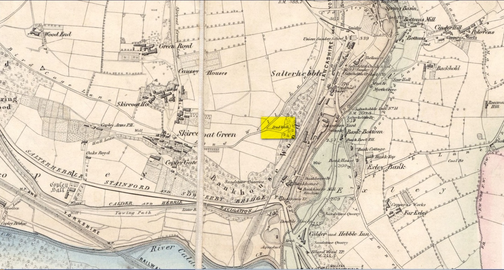
This curiously-named old water source may have an equally curious history behind it – albeit forgotten. Shown on the 1854 OS-map of the area and giving its s name to Dudwell Lane, we can see how an old path led from the road to the well and nowhere else.
It’s the word “dud” that holds our attention here; for if we hasten to the immensely erudite Joseph Wright (1900) in his gigantic survey of northern dialect, we find that the word relates to “a rag, piece of cloth; pl. clothes, esp. shabby, ragged, or dirty clothing.” This is echoed in another Yorkshire dialect work by Morris (1892) who told that the word meant “clothes (or) rags.” Several other Victorian writers tell us variations on this meaning (one adds old shoes to the list!), but in all instances it relates to dud being a rag, whereas the plural duds are rags or scruffy clothes. Naathen (to use another old dialect word), those of us who know a thing or two abaat olde wells are very very familiar with their association to old rags that were hanged on the surrounding trees as offerings to the spirits of the water—the genius loci—to aid in the hope or desire of something, or merely as respect to the waters for their beneficient properties. (this sometimes occurred ritually at set times in the calendar)
Dud Well on 1854 OS-map
The Dud Well was obviously of considerable local repute, for just a couple of years after it was shown on the earliest OS-map, a local bailiff called Samuel Rhodes built The Dudwell house close to the waters, which he named “in honour of the magnificent and never-failing spring of pure, bright, sparkling water in the wells close by.”
There is a possible alternative meaning to the word dud, which is that some dood called ‘Duda’ left his name here! This seems much more speculative and unlikely than the use of a local dialect term. Hopefully a local historian amongst you might perhaps be able to find out more.
References:
Morris, M.C.F., Yorkshire Folk-Talk, Henry Frowde: London 1892.
Wright, Joseph, English Dialect Dictionary – volume 2, Henry Frowde: London 1900.
There are various ways to find this. When we came here, we started from the Barton and Crosland Moor side, parking up on Ivy Street and walking to the fields at the end of the road. From here, walk along the track to your left and just over 100 yards on there’s a small footpath on your right that veers down the slope. Walk on here for another 100 yards, keeping your eyes peeled for another path on your right that almost doubles-back on you, heading into the trees. Another fifty yards along and you’ll see some tell-tale stonework!
Archaeology & History
An earlier, adjacent water trough?
Highlighted on the 1854 OS-map, the site has seen better days. Although the waters today emerge from a blasted rock face and collect into a relatively modern round stone trough, there is a larger square stone structure just a few yards away that seems to have been where water was previously collected. According to local antiquarian Andy H, this was known to be a local Wishing Well in bygone times, but apart from this there are no literary accounts about the place. The area was decimated by 19th century Industrialists who, as is well known, destroyed much of our indigenous histories and sites—and the Huddersfield district was particularly hard hit by them.
On a recent visit to the site—in superb pouring rain!—the waters were choked with modern trash and bottles, making it unsafe to drink. This is surely a good case for restoration, then stuck on some local tourist route to ensure better, more appreciative attention.
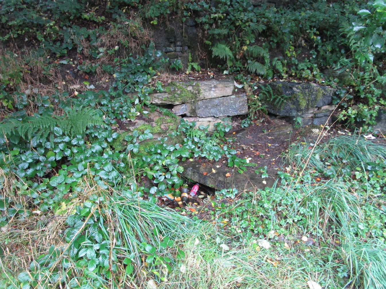
In days of olde, before folk had taps to turn to get water, they’d have to go to the nearby wells and streams. Many of these places were never written about, even to the point where no place-names were recorded, simply because the writers and surveyors either didn’t talk to the right people, or the right people didn’t talk to the surveyors! In many cases, the latter is all too true. Such is the case with this long forgotten healing well, whose memory is only preserved through the pen of a local man who, in the 19th century, was fortunate to have been able to write…
We know that old wells were mainly the province of women in most cultures through history; and Isaac Binns (1882) intimated this in his brief notes about the Wood Well. There’s nowt much to tell to be honest, but its location and lore need to be preserved.
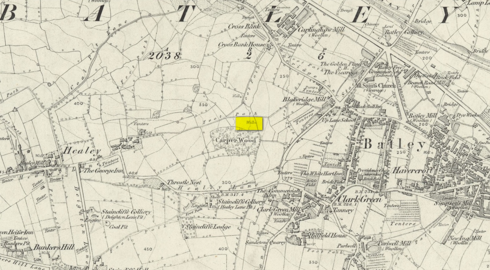
Lamenting the loss of trees, Mr Binns told of the Wood Well’s proximity to Carper Wood: shown on the first OS-maps, but long since destroyed by the ignorance of modernity. In his day, the water from here was fresh “clear water.” This alone was good, but something extra in the water gave it that added healing ingredient. It was used medicinally,
“good yet, the old women say, for sore eyes.”
But not long after he wrote those very words, the Wood Well was destroyed…
References:
Binns, Isaac, From Village to Town: Random Reminiscences of Batley, F.H. Purchas: Batley 1882.
Holy Well (destroyed): OS Grid-Reference – SE 100 254
Archaeology & History
This sacred site seems to have been destroyed sometime at the end of the 19th century. It was located on the great slopes heading up to Beacon Hill. In 1787, a property survey showed six houses here called Holy Well Cottages and on the 1852 OS-map a “Well” is highlighted at the bend in the pathway of the Old Bank as you’re going uphill, which is the place in question. On my last visit here about thirty years ago, its position was preserved under a large manhole.
References:
Heginbottom, J.A., “Early Christian Sites in Calderdale”, in Proceedings Halifax Antiquarian Society 1988.
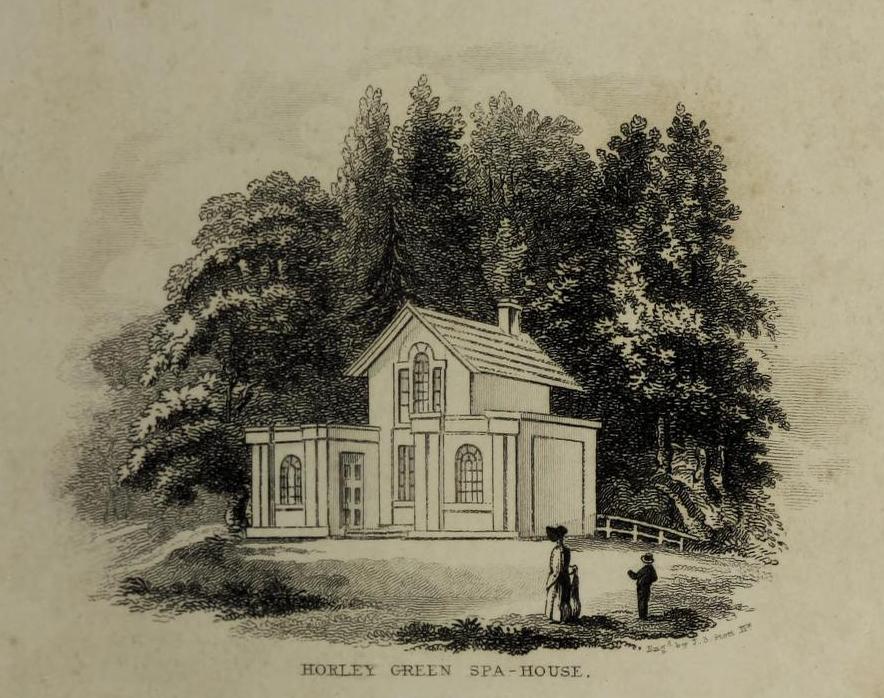
The historian William Addison (1951), in his history on the subject, told how “the spas began as holy wells”; and although no direct accounts are left of early dedications here, the remnants of Mayday traditions tell us there were more archaic goings-on before the waters were taken by the aristocrats. Once it had been designated as a spa, the waters were covered and a typical Spa House constructed over them. From hereon, for more than a century, the waters were accessible only to those with money who wished their ailments to be treated.
Between the end of the 18th to the end of the 19th century, the Horley Green Spa was a very prominent ingredient in the history of Calderdale. A chalybeate or iron-bearing spring, its waters were directed into a large underground cistern covered by metal. Thomas Garnett (1790) was the first to write about it, telling us:
“The Horley Green water is quite pellucid—sparkles when poured out of one glass into another—and has a sharp, aluminous, styptic taste, not unlike ink. The taste is not unpleasant when the water is taken from the springhead and drank immediately.”
He went on to espouse the waters to be good in healing bone and rheumatic diseases, giving many first-hand accounts from people in Yorkshire and beyond who used the waters here with apparent success, including one case of curing diabetes! Its reputation was later reinforced in a book by William Alexander (1840), who told us how,
“I unhesitatingly affirm that the Horley Green Spa possesses a very strong claim to be regarded as a powerful tonic and chalybeate.”
By the time those words were written, it had already gained a considerable reputation and many were those who’d received treatment.
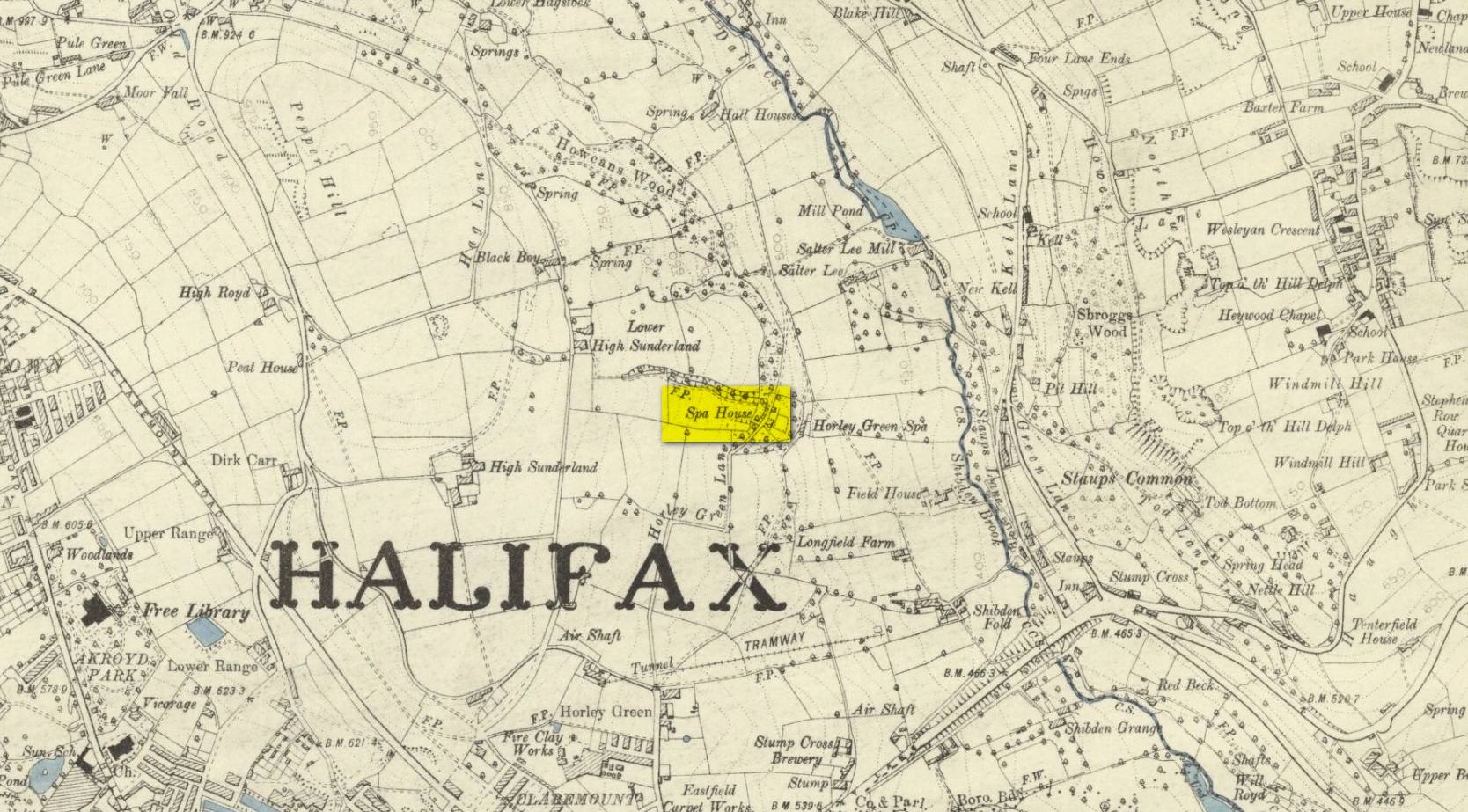
Spa House on 1894 map
A years after Alexander, the roving doctor A.B. Granville (1841) visited Horley Green—who described it as “a renowned steel-water Spa”. But at the same time he reported how its popularity had started to decline. But, via one Mr West, he did leave us with a greater chemical analysis of the Horley Green waters in an attempt, once more, to certify and prove its curative properties. Their results found the waters to possess, in varying quantities, lime, magnesia, silica, iron oxide, sulphur and silica—all of which further attributed the science of its medicinal actions. A number of case histories of the people cured here can be found in the works of Granville, Garnett and Alexander.
The well-house that stood here eventually fell into disuse. When it was eventually restored as someone’s home in the the late 20th century, the disused spring was found beneath the foundations, filled with stones.
Folklore
Horley Green’s spa well came about as a result of local people visiting the site around Beltane, probably for centuries before the aristocrats and early pharmacists took their hand to the place. But once the spa became renowned, people could only gather here “on the first Sundays in the month of May,” with Sunday being that legendary ‘day of the lord’ crap, to which the people would abide to save them from prosecution. It is obvious though that it had been used as a place of magick thanks to the snippets of lore which have found their way into local history books. We read how, at 6am, people gathered here, to such an extent that the roads were completely crowded. Those who arrived first were given bags of nuts: an archaic traditional motif found at many pre-christian wells in Britain. Occultists and ritual magickians amongst you will note the time when folk frequented the well, at 6am: the time when many nature-spirits are invoked for full effects. We find this time echoed in the ritual gatherings at Lady or St. Anne’s Well in Morley, just a few miles to the east.
References:
Addison, William, English Spas, Batsford: London 1951.
Alderson, Frederick, The Inland Resorts and Spas of Britain, David & Charles: Newton Abbot 1973.
Alexander, William, “On the Mineral Springs of the Parish of Halifax,” in Proceedings Geological & Polytechnic Society, West Riding, Yorkshire, volume 1, Edward Baines: Leeds 1849.
Crabtree, John, Concise History of the Parish and Vicarage of Halifax, Hartley & Walker: Halifax 1836.
Granville, A.B., Spas of England, Henry Colburn: London 1841.
Hembry, Phyllis, The English Spa 1560-1815, Athlone Press: London 1990.
Short, Thomas, The Natural, Experimental and Medicinal History of the Mineral Waters of Derbyshire, Lincolnshire and Yorkshire, privately printed: London 1724.
Short, Thomas, A General Treatise on Various Cold Mineral Waters in England, privately printed: London 1765.