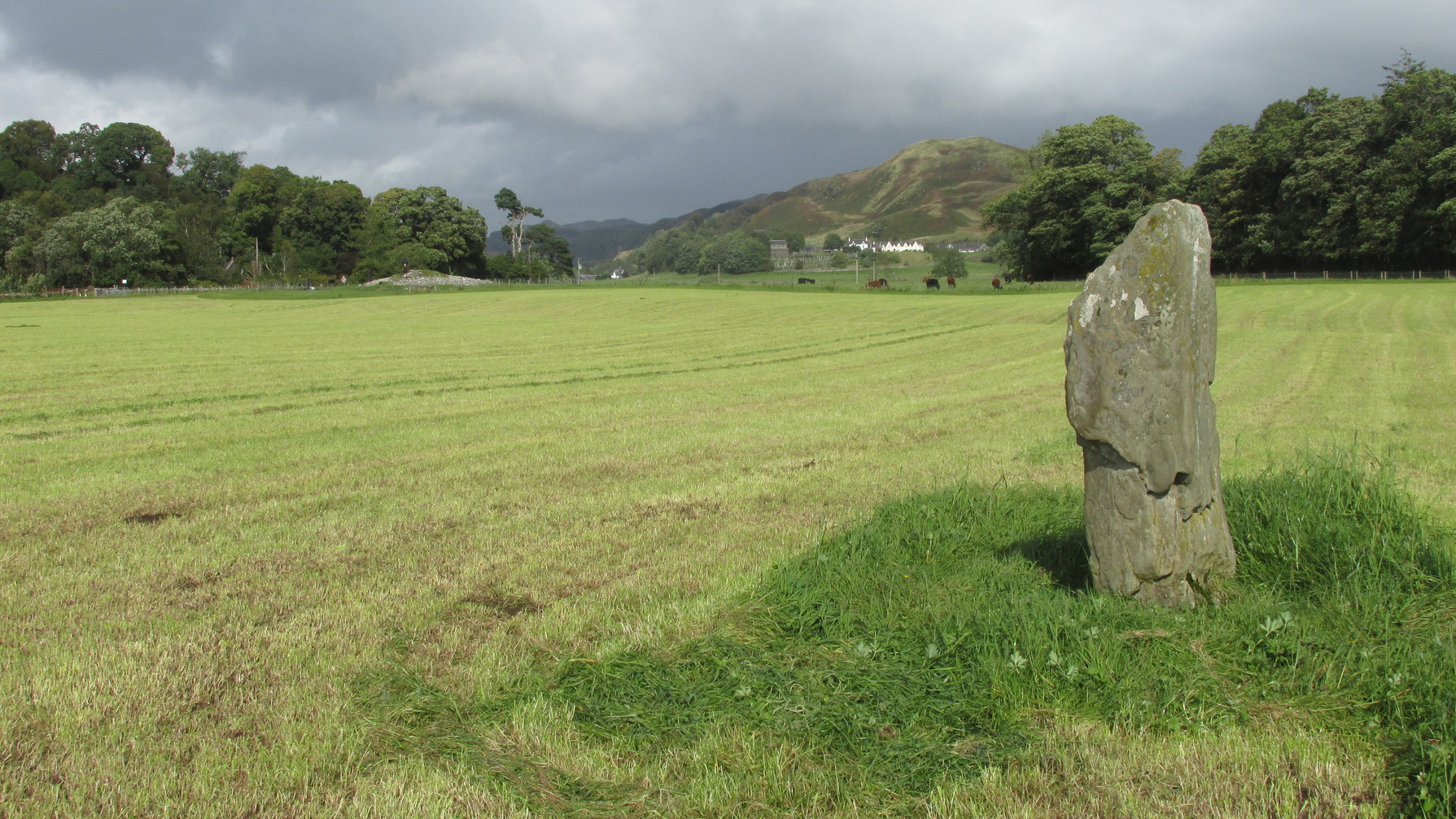
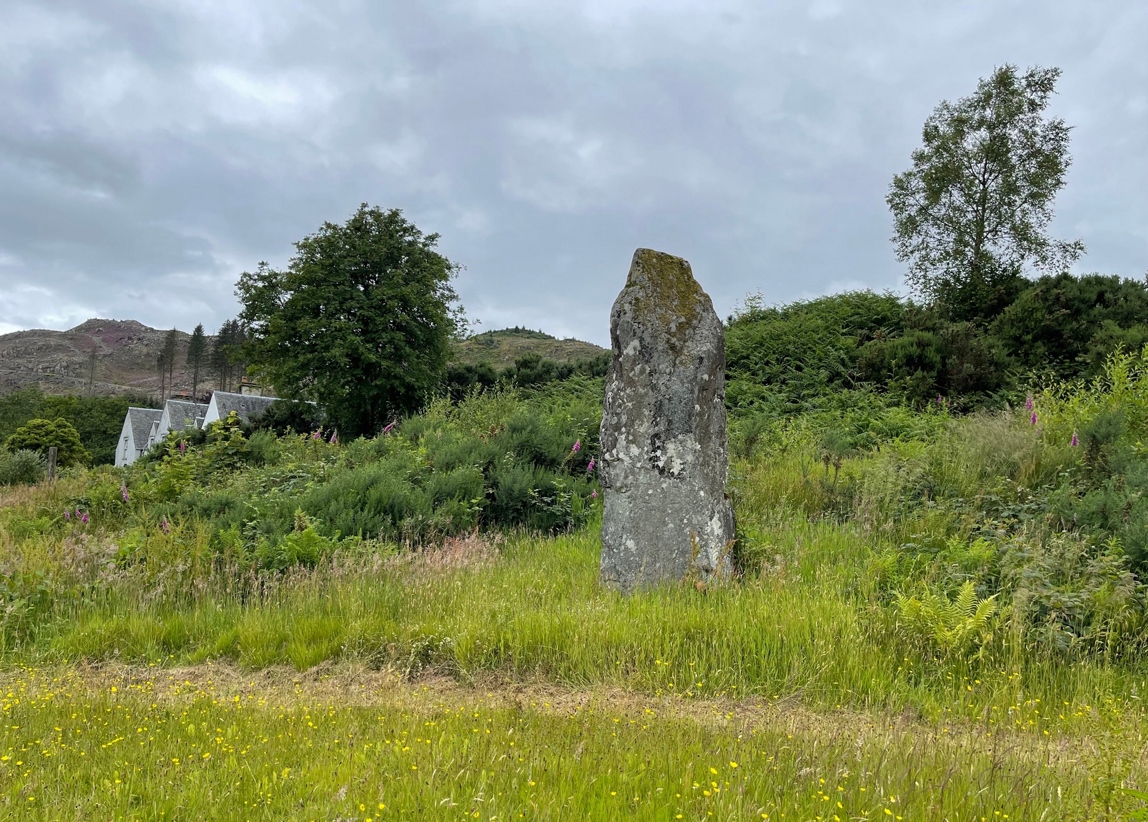
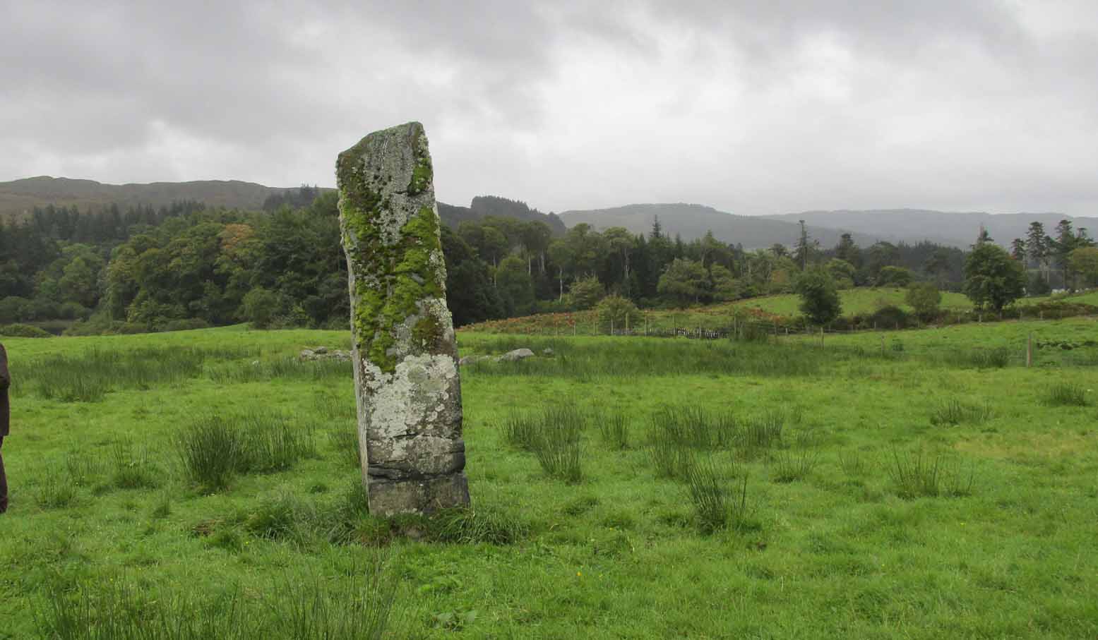
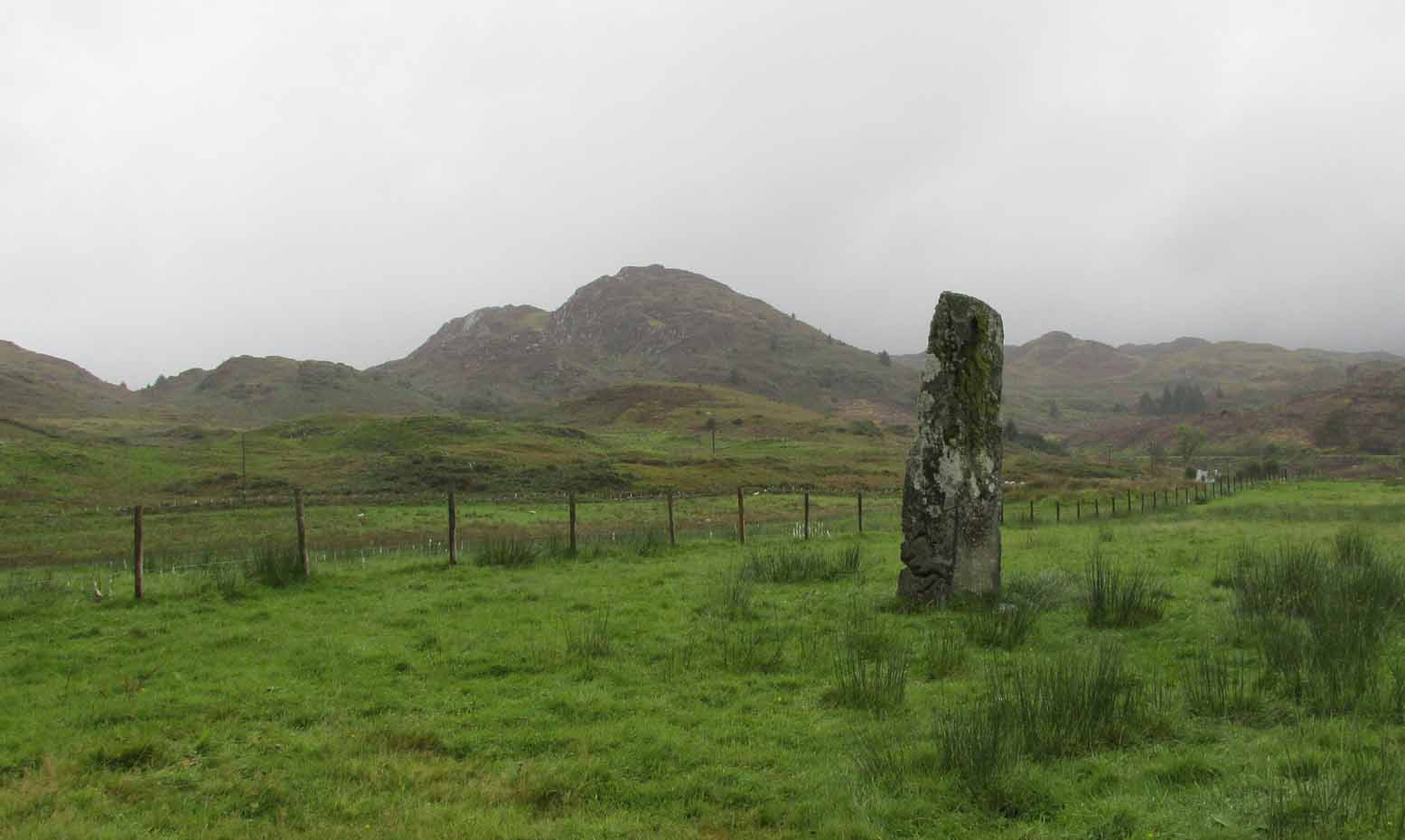
Along the A816 road, just less than a mile south of Kilmartin, take the right-turn on the B8025 Tayvallich road. Barely 50 yards along here, park up on the left-side of the road. Cross the road and walk along the well-marked footpath to the mighty megalithic Kilmartin ‘X’. The path continues to Temple Wood but you’ll see, in the field to your right, this single standing stone. (you’ll see the mighty Netherlargie South cairn in the field beyond)
Archaeology & History
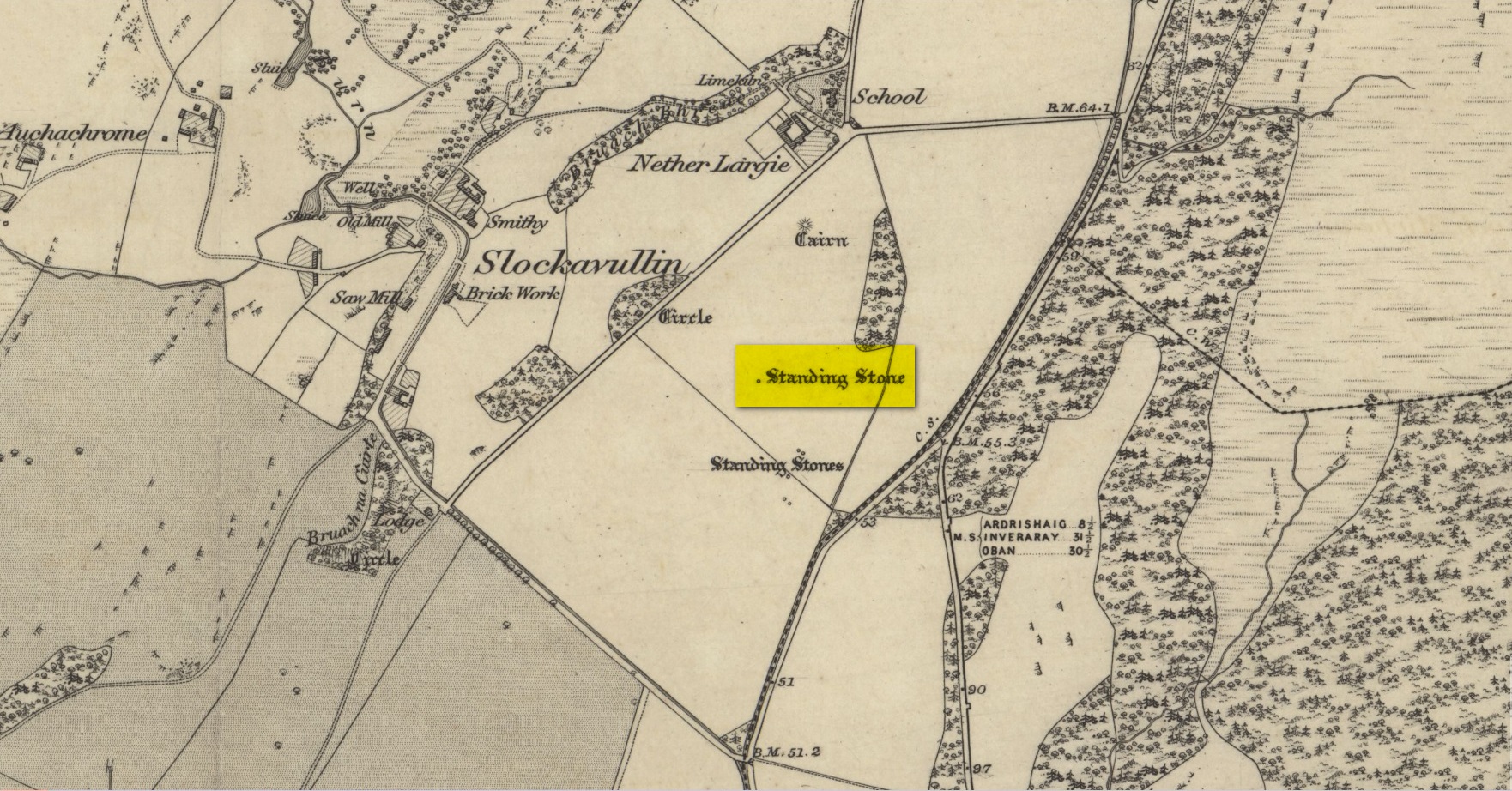
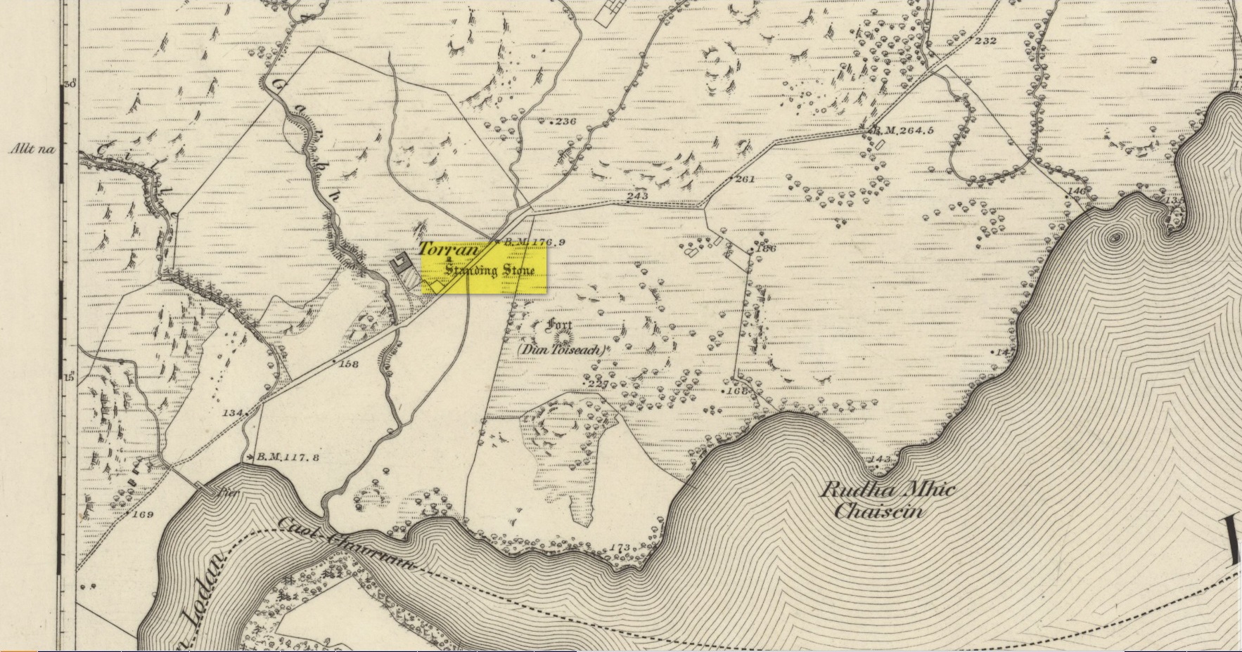
Stone on the 1874 OS-map
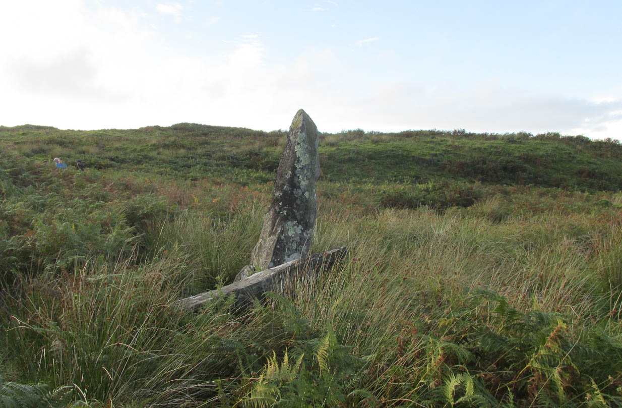
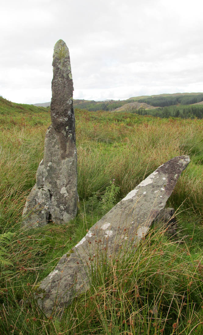
First illustrated on the 1874 Ordnance Survey map, this solitary stone (though it may once have had companions) stands some 200 yards south-east of the Temple Wood circle and 355 feet north-west of the northernmost stone in the Kilmartin ‘X’ megalithic complex. When Alexander Thom surveyed this area, despite finding astronomical alignments at many of the standing stones nearby, he could find no heavenly association at this solitary monolith. Its function remains hidden for the time being, although everyone assumes it had some relationship with the giant tombs close by. It makes sense.
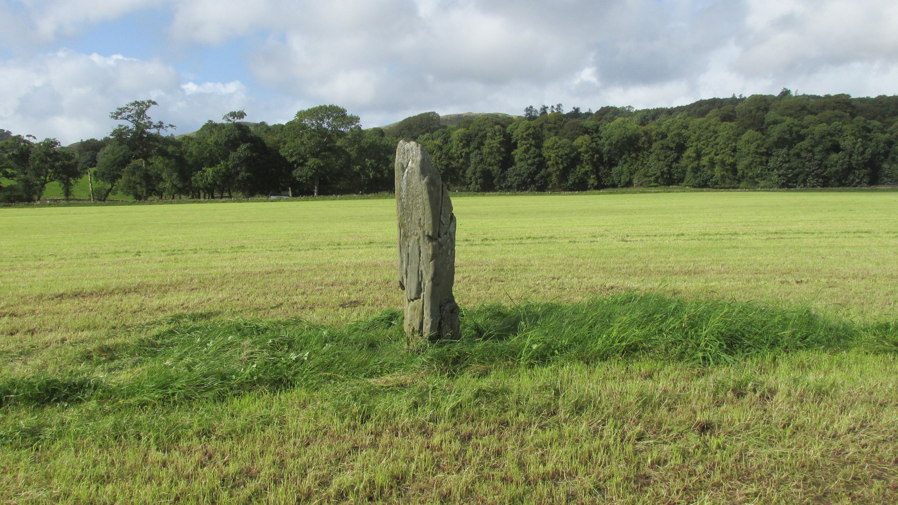
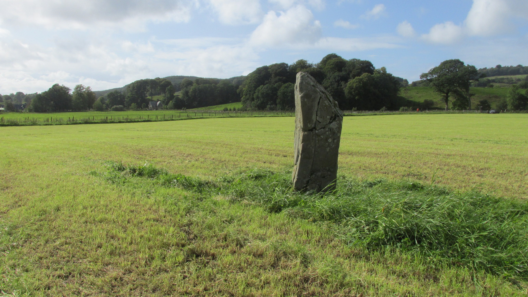
Looking W to Temple WoodLooking to the southwest
Despite being referenced in a number of prehistoric surveys, archaeological circles say very little about it. When the Royal Commission lads (1988) visited here they told how it was, at the time, leaning to the south-east. It fell over a few years afterwards but has thankfully been resurrected. When the archaeologists fondled around the base of where it had stood, apart from a few packing stones at one side of the monolith, nothing was found.
Pearson, Jane, Kilmartin – The Stones of History, Famedram: Alexandria 1975.
Ritchie, Graham, The Archaeology of Argyll, Edinburgh University Press 1997.
Royal Commission on the Ancient & Historical Monuments of Scotland, Argyll – Volume 6: Mid-Argyll and Cowal, HMSO: Edinburgh 1988.
Ruggles, Clive, “The Stone Alignments of Argyll and Mull,” in Records in Stone (ed. C.L.N. Ruggles), Cambridge University Press 1988.
Thom, Alexander, Megalithic Lunar Observatories, Oxford University Press 1971.
Acknowledgements:Huge thanks for use of the Ordnance Survey map in this site profile, reproduced with the kind permission of the National Library of Scotland.
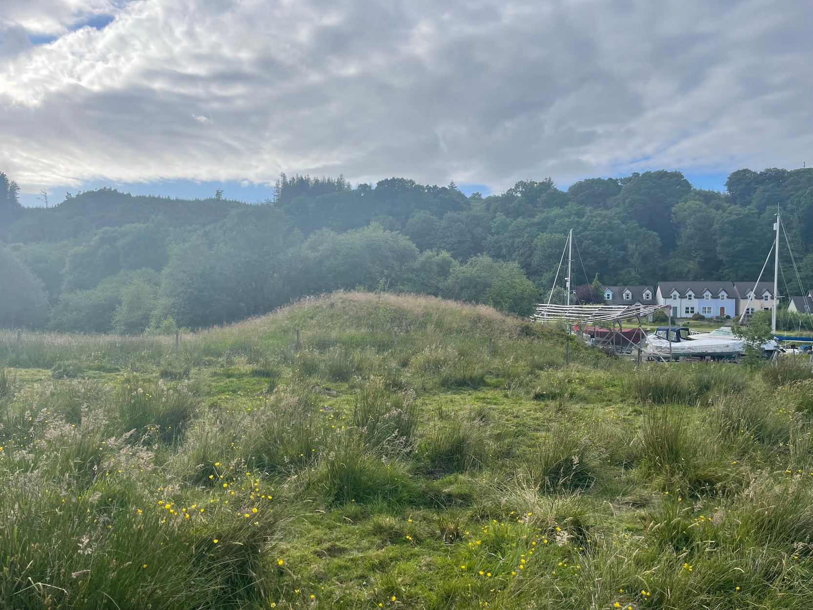
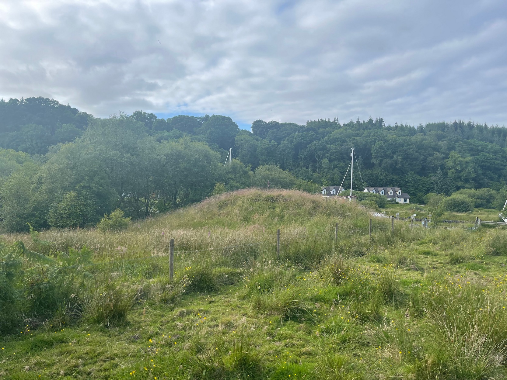
Take the A816 out of Lochgilphead and head north as if you’re going to Kilmartin. Nearly 2 miles along, take the left turn along the B841 Crinan road. A few hundred yards along, go over the canal bridge and about 70 yards along there’s a left turn onto the track into the Knapdale Forest. Go along here (there’s a parking spot) for 200 yards until your reach the grasslands on your left. If you walk into this bit of scrubland, you’ll see the rounded fairy-mound over the fence in the adjacent field, almost overlooking the canal. Y’ can’t really miss it.
Archaeology & History
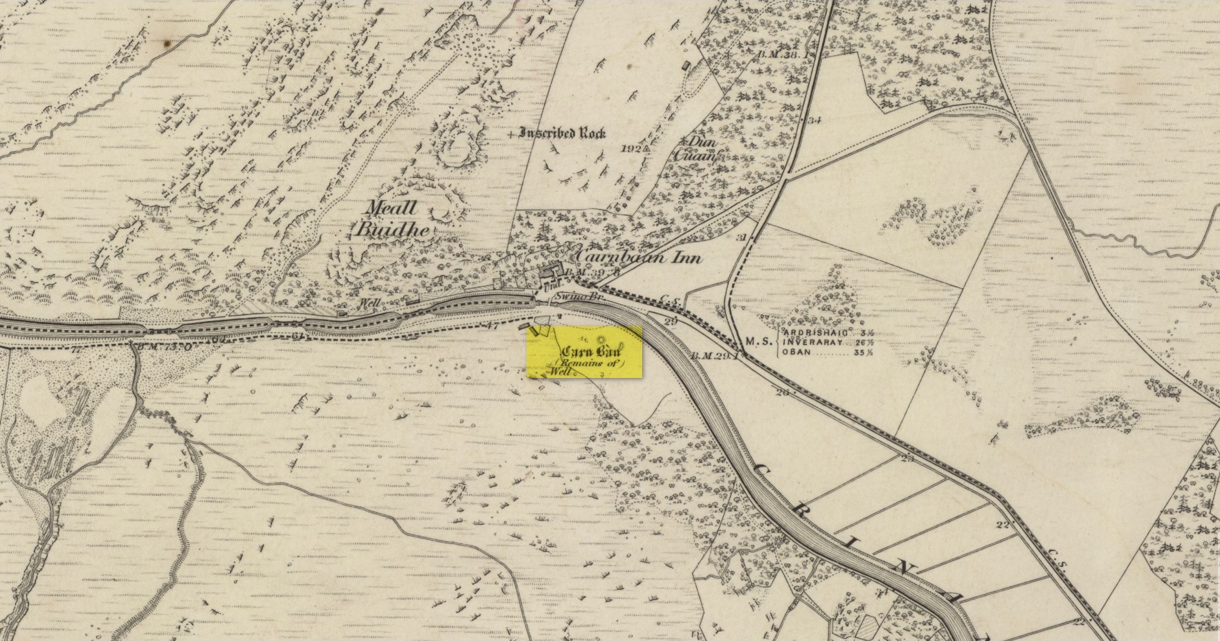
Carn ban, or the White Cairn, from which the hamlet of Cairnbaan gets its name, is a good-sized round cairn, now much overgrown in vegetation, though is still accessible and easy to see. Just above the water-line of the Crinan Canal, the mound is about ten yards across and more than six feet high and is in a good state of preservation. Originally, according to J.H. Craw (1930), the tomb was 12 feet high and 40 feet across!
Carn Ban on 1873 mapCarn Ban, looking NE
In the 1850s, the site was examined by a Dr Hunter of Lochgilphead, and Mr Richardson Smith of Achnaba, and a cist that had been built straight on top of the bare rock was uncovered near the centre of the cairn, nearly four feet long and aligned northeast to southwest. Inside it a thin slab of stone—“2 feet long, 17 inches broad, and 2½ inches thick”—had been slid up against the western end of the chamber and on it was a curious petroglyph design comprising “several incised diamond-shaped figures, one within the other”—five altogether, and the commencement of a sixth—similar to ones found at Newgrange in Ireland. This carving was removed and given to the Scottish National Museum where it still resides. Inside the cist, Hunter and Smith found a deposit of some “yellow sand with some black charcoal and several burnt bones lying upon its bottom”, and a subsequent search unearthed some flint fragments.
The Carn Ban is a good site—but if you’re wanting something bigger, something more impressive, I suggest heading just a few miles north…
References:
Beckensall, Stan, The Prehistoric Rock Art of Kilmartin, Kilmartin Trust: Kilmartin 2005.
Simpson, James, Archaic Sculpturings of Cups, Circles, etc., Upon Stones and Rocks in Scotland, England and other Countries, Edmonston & Douglas: Edinburgh 1867.
Acknowledgements:Huge thanks for use of the Ordnance Survey map in this site profile, reproduced with the kind permission of the National Library of Scotland.
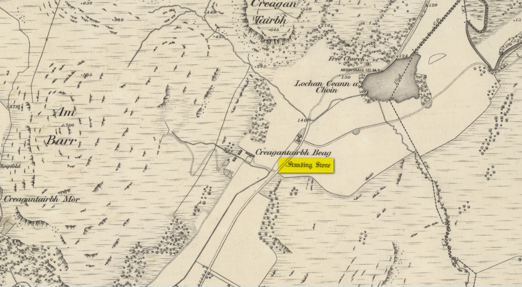
On the A816 road, a mile-and-a-bit north of Kilmartin, take the small road (east) to Ford—passing the Creagantairbh stone on your right, then a bit further on the Auchinellan stone on your left. Go through Ford village, making sure to stick to the road that goes along the north side of Loch Awe — as if you’re heading to Dalavich. Just fractionally over a mile out of Ford village, just where the road begins to swerve into a large bend, there’s a small left-turn that takes you to some houses. Just 60-70 yards along this little road, take the trivial little path on your right that takes you straight to a piece of manicured scrubland. If you walk into it, and bear left, you’ll see what you’re looking for. It’s unmissable!
Archaeology & History
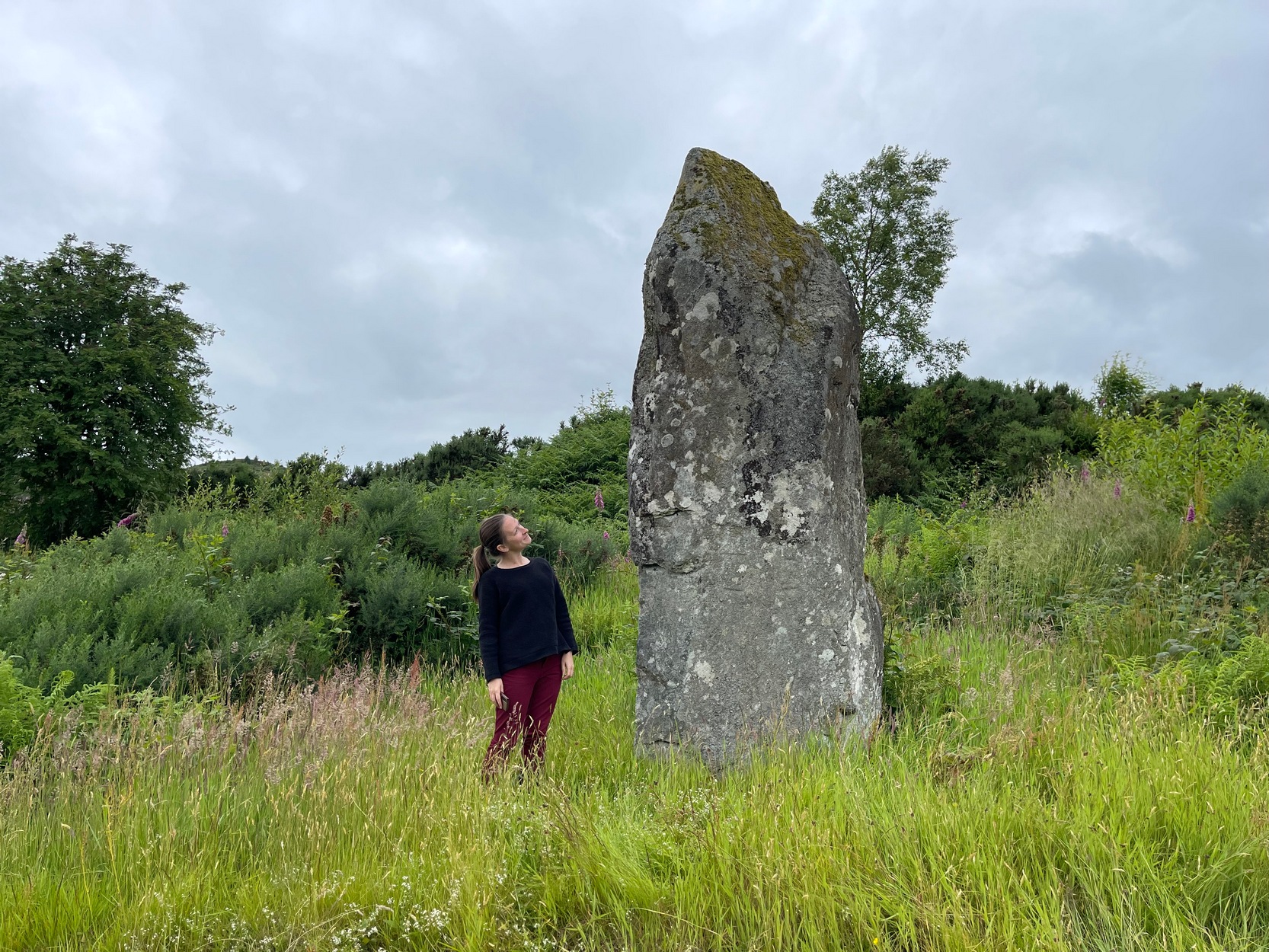
When I first visited here in the 1990s, a farm building stood by this huge standing stone and there were no other houses nearby. How things change—but thankfully our old sentinel stone is still living here.
Site shown on 1875 mapRomilly Allen’s 1880 sketch
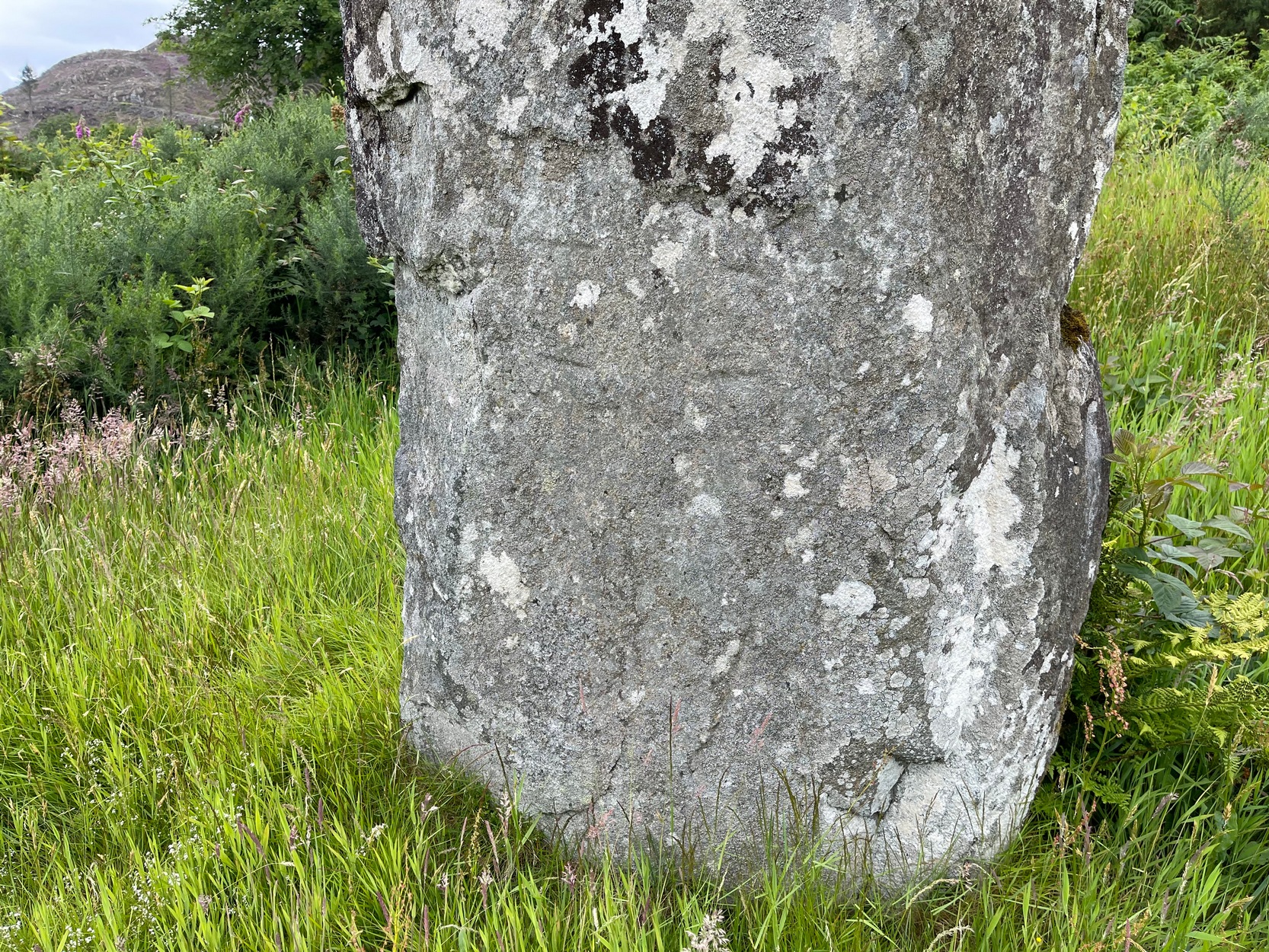
It was highlighted by the Ordnance Survey lads on their early map of the area, and visited a few years later by the great petroglyphic pioneer J. Romilly Allen. (1880) Standing eleven feet tall and more than four feet across at the base, Allen noticed that, about four feet above ground-level, someone had carved an old cross onto the northeast face of the stone (you can just make it out in the attached photos). It had obviously been carved many centuries ago, by a wandering christian no doubt—although it was incomplete and never finished. Perhaps the person who carved it was chased away by local folk, who would have obviously and rightly seen such an act as outright vandalism. The cross was deemed by Ian Fisher (2001) and the Royal Commission (1992) to be medieval in nature. Apparently there’s another, much fainter cross that was first mentioned by Marion Campbell etched on the other side of the stone, but in all the times I came here I was never able to make it out.
Old faint cross carvingSmall person, big stone!
But even further back in time someone had carved a cup-marking on the stone—and the cross was etched onto the same spot, enclosing the cup-mark. When I lived nearby, I made a sketch (long since lost) of what seemed to be two other faint cup-marks at one end of the extended arms of the cross, but on our recent visit here these were very hard to make out. When Ron Morris (1981) mentioned the stone in his survey, he mentioned its proximity to other cup-and-ring carvings immediately to the southeast and a hillock thereby, wondering whether there was “an astronomical complex” going on here. I doubt it—but I like the idea!
But it’s the size of the stone that’s most impressive here and keeps up with the tradition of similar megaliths in and around the Kilmartin area. Check the place out when you’re hunting the other stones nearby. You won’t be disappointed!
Folklore
Local tradition ascribed this great stone as marking the grave of an ancient warrior. The full folk tale seems to have been lost.
Fisher, Ian, Early Medieval Sculpture in the West Highlands and Islands, RCAHMS: Edinburgh 2001.
Morris, Ronald W.B., The Prehistoric Rock Art of Southern Scotland, BAR: Oxford 1981.
Royal Commission on the Ancient & Historical Monuments of Scotland, Argyll – Volume 6: Mid-Argyll and Cowal, HMSO: Edinburgh 1988.
Royal Commission on the Ancient & Historical Monuments of Scotland, Argyll – Volume 7: Mid-Argyll and Cowal: Medieval and Later Monuments, HMSO: Edinburgh 1992.
Ruggles, Clive, Megalithic Astronomy, BAR: Oxford 1984.
Swarbrick, Olaf, A Gazetteer of Prehistoric Standing Stones in Great Britain, BAR: Oxford 2012.
Acknowledgements:Huge thanks for use of the Ordnance Survey map in this site profile, reproduced with the kind permission of the National Library of Scotland.
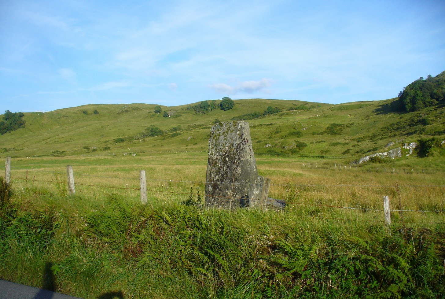
From Kilmartin go north on the A816 Oban road, and after 1½ miles watch out for the small B840 road on your right, to Ford and Loch Awe. Less than a mile along the winding road, just after the track to the farmhouse on your left, keep your eyes peeled for the standing stone on your right, whose top is peeking over the old walling. If you’re not careful you’ll miss it!
Archaeology & History
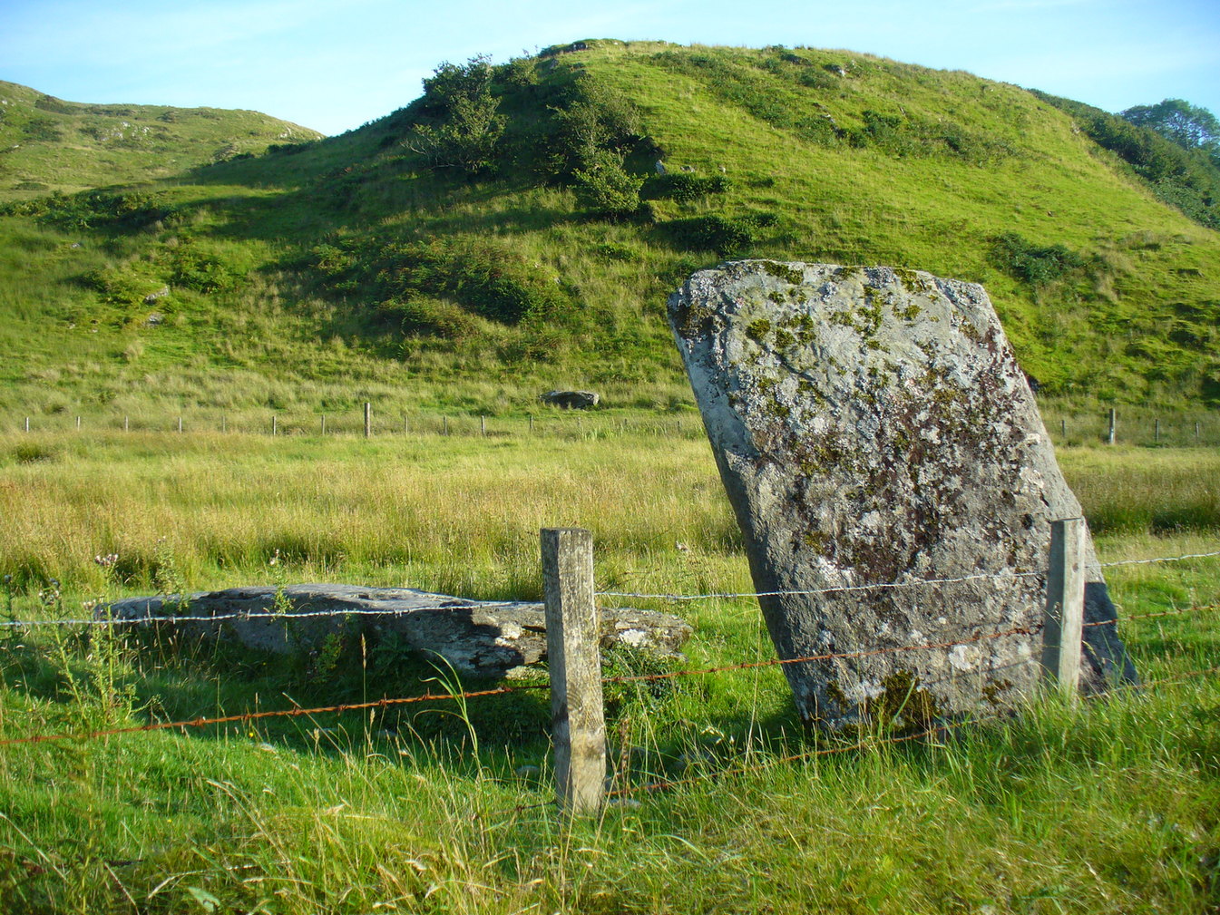
From the roadside this looks like just a reasonably small standing stone, but closer inspection shows it’s been snapped halfway up—apparently in a great storm in December 1879. If you look over the wall, just a couple of yards behind the upright you’ll see the larger section of stone that was attached to the 6-foot upright before its calamitous fall. Originally it was said to have been 16 feet tall!
Broken bit laid flatFrom the roadside
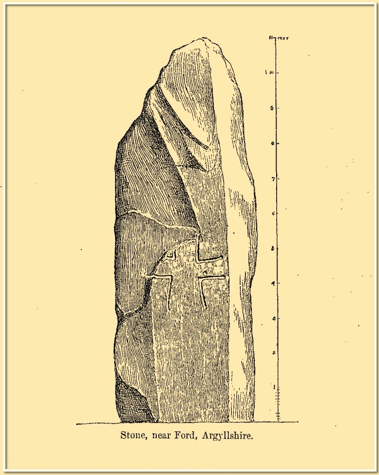
The first description of the stone is thought to be by the great J. Romilly Allen (1880) in his brief visit to Ford, saying simply that the stone “is close to the road on the east side, 1 mile from Ford. It is 14 feet high and 3 feet by 4 feet at the base. The material is slate. It inclines considerably from the perpendicular”—meaning, that he saw it before the stone had been broken. Lucky bugger!
More than twenty years later David Christison (1904) visited the site and wrote his of his finds in an essay for the Society of Antiquaries, although in truth he said little more than anyone before and after has been able to say:
“A mile and a quarter south-south-west of Ford Church, 130 yards east by south of Creagantairbh Beag farmhouse, close to the west side of the highway, stands the base of an obelisk, at the foot of which the shaft lies prostrate. The base is 5 feet 6 inches high,’and has an oblique ledge, half way up on to which the shaft would accurately fit. If restored, the height of the stone would be 16 feet 2 inches above ground, and it must have had a very handsome appearance, tapering in width as it gradually does from 2 feet 6 inches to 2 feet. It is 18 inches thick at the base and 10 inches to 12 inches at the top.”
Christison’s 1904 sketch
The name Creagantairbh derives from the Crag of the Bull, which is the sharp hill immediately in front of you to the north; and its geological consort, the Creag a’ Chapuill (or Crag of the Horse) rises to its immediate northwest. A few hundred yards further along the road towards Ford is the large Auchinellan standing stone.
Folklore
When I lived in Ford many years ago, the olde folk told me how, in bygone centuries, bulls were sacrificed on the Creagantairbh above.
Unless you’re venturing down the tiny Loch Awe roads, the easiest way here is to turn right off the A816 Lochgilphead-Oban road, 1½ miles north of Kilmartin. Go along this winding minor road for literally 2½ miles where, after coming out the tree-lined road, just past the small Loch Ederline, the fields re-appear on both sides of the road. Just here, where the trees end, just a few hundred yards before the hamlet of Ford, in one of the field on the left, you’ll see a tall upright stone. That’s it!
Archaeology & History
I was very fortunate, many years ago, to live in the old farmhouse of Auchinellan in the trees by this ancient stone. It became a companion of mine many-a-time, as I sat with it in rain and mist and darkness sometimes, beneath the bright Moon. It always had a good feeling about it. And so when a small bunch of us visited here again recently, it was almost as if I’d never been away. Tis a magickal part of our landscape.
The old stone looking NThe old stone looking NW
Standing ten-foot-tall on a grassy plain with craggy hills all round, this old fella once had a companion close by its side—a stone one! Accounts of it are curious to say the least, with one telling us that it was only “a few inches high” – which is just daft. The now-lost stone was in fact about six-feet tall and the story of its disappearance was that it was moved into the grounds of Auchinellan House where I used to live, somewhere in the garden. I could never find it, and local folk told me that the old fella who lived in the mansion would have known about it, but died shortly before I moved in. Clive Ruggles (1984) told that it could be found at grid-reference NM 8653 0268, but that would be smack bang on the manor house.
As far as I can tell, the first written testimony of this stone was by the Ordnance Survey lads after they’d visited here in 1871 and, several years later, highlighted it on their maps. (above) On this is clearly shown, just yards apart, the two standing stones. Much later, when the Royal Commission (1988) doods did their survey, they described the stone in their usual brief way:
“Situated on the top of a slight rise in a pasture field 270m SW of the Ford Hotel, there is a standing stone which measures 0.7m by 0.55m at the base and rises with straight sides to a flat top at a height of 3m…”
The site was included in Thom’s (1990) major survey on prehistoric stone rows where, again, only a brief description is given, saying:
“On a terrace near Loch Ederline is a standing stone which leans to the E. It is 9ft 6 (2.9m) high.”
It’s a beautiful place in a beautiful setting and is one of countless prehistoric monuments in this part of Scotland. Well worth having a look at.
Folklore
The Gaelic names for this site—Achnacarra and Achadh nan Carradh—means “the field of the burial stone”, which relates to the folklore of the stones reputedly marking the place of an ancient grave.
Campbell, Marion & Sandeman, M., “Mid Argyll: An Archaeological Survey,” in Proceedings Society of Antiquaries Scotland, volume 95, 1964.
Royal Commission on the Ancient & Historical Monuments of Scotland, Argyll – Volume 6: Mid-Argyll and Cowal, HMSO: Edinburgh 1988.
Ruggles, Clive L.N., Megalithic Astronomy, BAR: Oxford 1984.
Thom, Alexander, Thom, A.S. & Burl, Aubrey, Stone Rows and Standing Stones – volume 1, BAR: Oxford 1990.
Acknowledgements: Big thanks to Neens Harris, Paul Hornby & Frank Mercer. And the stunning resource of Scotland’s 1st edition OS-maps is Reproduced with the kind permission of the National Library of Scotland.
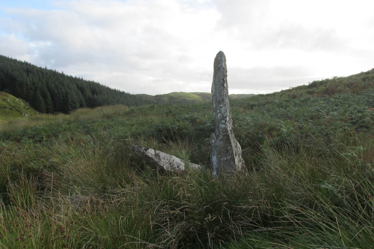
Roughly halfway between the staggering standing stone at Kintraw and the farmhouse of Salachary a coupla miles east along the A816 road to Kilmartin, a small overgrown car park nearly hides on the south-side of the road, just below the forestry. 50 yards west of this, a small track winds uphill. 650 yards (0.6km) up here, once it levels out, a hairpin in the track veers NW; ignore it, instead walking into the marshy grass in front of you (south) for 50-60 yards up and round the small rocky crag. Once you get round the edge of this, immediately east, you’ll see one of the tall monoliths 50 yards ahead of you.
Archaeology & History
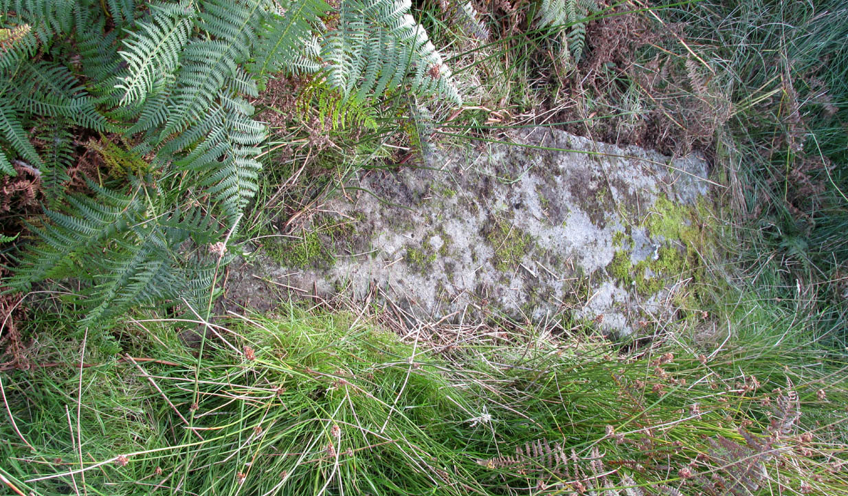
Rediscovered in recent times by Marion Campbell (1962), this damaged row of three tall standing stones is cited in Swarbrick’s (2012) poorly-arranged survey as being “difficult to find in broken ground”; although patience brings the stones clearly into sight for any explorer. They’re big too! Sadly only one of them still remains fully upright—but that one’s nearly 9 feet tall!
In Miss Campbell’s initial description of the site, following their rediscovery, she told how,
“A chance sighting led to the discovery of a group of three monoliths, one erect, one sloping and one prostrate, on the West side of a wide glen leading S from the upper part of the Bealach Mor; the site commands a fine view into the northern hills. The spot is about 550ft above sea level and this is therefore the highest group of standing stones so far recorded in the area.
“The erect stone is 8ft 4in x 2ft x 1 ft, lozenge-shaped in section, with a pointed top. The leaning stone, also lozenge-shaped, is 10ft x 1ft 8in x 1ft, and pointed. The fallen stone is over 11ft x 2ft wide, too deeply buried in turf for the thickness to he measured. The stones appear to have stood in line, the nearest points of the first and third stones 9ft apart and the line joining them running north and south. Along a ridge running S behind the stones are a number of small ruins, oval and rectangular, in old cultivations. No surviving placename has been recovered for the site so far.”
Section of the fallen stoneLooking west
Indeed, no subsequent investigation has led to either an early name nor any traditions about the site, and the stones cannot be found on any early maps of the area. A pity, as they’re quite impressive stones and would have had some old stories known of them in ages gone by.
Twenty years after Miss Campbell’s discovery, in May 1982, the stones were visited and surveyed by the Royal Commission lads. Their description very much tallied with Miss Campbell’s, but it’s worth citing anyway. They told us that:
“On a terrace on the W side of an unnamed valley to the S of Bealach Mor and about 850m SW of Salachary, there is a setting of three large standing stones which is aligned from N to S. Only the N stone is still upright; it measures 0.7m by 0.72m at the base and rises with straight sides to a pointed top at a height of 2.75m. The central stone is of similar proportions, but it now leans to the NE at an angle of about 15° to the horizontal. The S stone, which measures 3.4m by 0.65m has fallen with its top to the SE.”
Royal Commission planAlexander Thom’s plan
Around the same time, Clive Ruggles (1984) assessed the Salachary stones for any potential astronomical alignments and found—as Alexander Thom & Aubrey Burl did in their own survey (1990)—that as they pointed virtually north-south they stood beyond any solar or lunar functions. Thom found the stones align almost perfectly north-south, with a notch in the southern horizon at 178°, and on the northern horizon the hilltop of Meall Reamhar at 2° west of north. This northern line may relate to the airt of death, although no other immediate archaeological remains have been found to fortify this idea (however, other unrecorded standing stones are close by and their relationship with Salachary has yet to be adequately assessed).
Aubrey Burl’s first description of this stone row told us:
“There are three stones in a N-S row situated on a terrace on the W side of a glen. The N stone, with a pointed top, stands 8ft 4 (2.5m) high. The central stone leans dramatically at 20°. It is 10ft (3m) in length. The S stone is prostrate and half-buried. It is 11ft (3.4m) long. The row is about 13ft (4m) long. From the site there is a fine view of the northern hills.”
Looking north
In truth, the main north-south axis relates to the more open geological avenue of the landscape. Both the east and west are all but blocked by crags and hills, and the stones seem to have been positioned to echo the hollowed section of the landscape. The land runs in curious geological folds and has a distinct genius loci which I enjoyed in differing (usually wet) conditions when I used to live nearby. The site is well worth a walkabout if you’re in the area – and there are more unrecorded stones still hiding in Nature’s rocky folds nearby.
References:
Burl, Aubrey, From Carnac to Callanish, Yale University Press 1993.
Campbell, M. & Sandeman, M., “Mid Argyll: An Archaeological Survey,” in Proceedings Society Antiquaries Scotland, volume 95, 1964.
Campbell, Marian, ‘Salachary, Kintraw’, in Discovery & Excavation Scotland, 1962.
Ferguson, Lesley, “A Catalogue of the Alexander Thom Archive Held in the National Monuments Record of Scotland,” in Records in Stone (ed. C. Ruggles), Cambridge University Press 1988.
Royal Commission on the Ancient & Historical Monuments of Scotland, Argyll – volume 6: Mid-Argyll and Cowal, HMSO: Edinburgh 1988.
Ruggles, Clive L.N., Megalithic Astronomy, BAR: Oxford 1984.
Ruggles, Clive L.N., “The Stone Alignments of Argyll,” in Records in Stone (ed. C. Ruggles), Cambridge University Press 1988.
Swarbrick, Olaf, A Gazetteer of Prehistoric Standing Stones in Great Britain, BAR: Oxford 2012.
Thom, A., Thom, A.S. & Burl, Aubrey, Stone Rows and Standing Stones – volume 1, BAR: Oxford 1990.
Weston, Garth, Monuments and Mountains, Ashridge: Bakewell 2007.
Acknowledgements: This site profile could not have been written without the help and of Nina Harris, Paul Hornby, Frank Mercer and Belinda Sales.
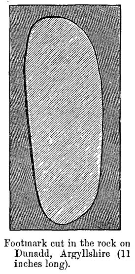
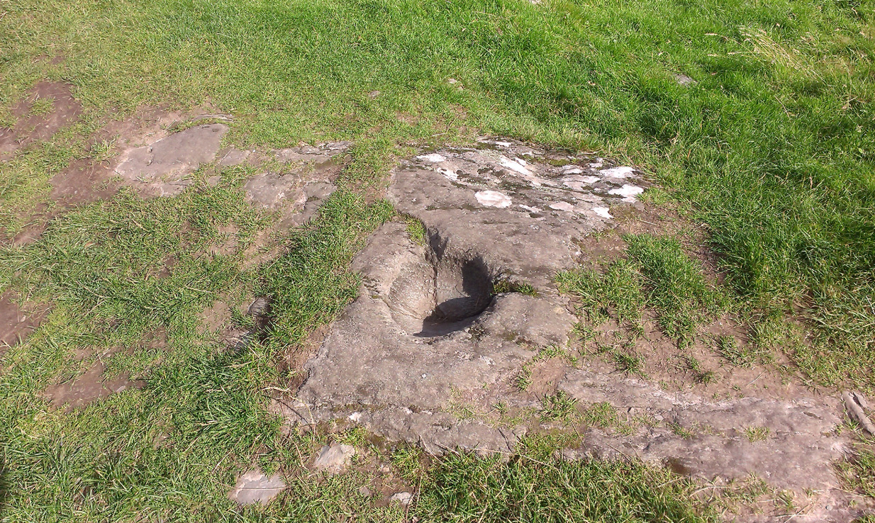
From Lochgilphead, take the A816 road north for several miles (towards the megalithic paradise of Kilmartin), keeping your eyes peeled for the road-signs saying “Dunadd.” Turn left and park-up a few hundred yards down. Go through the gate and walk up Dunadd. Just before the flattened plateau at the top, a length of smooth stone is accompanied to its side by the deep cup-and-ring of the Dunadd Basin. Three or four yards away, you’ll see the long ‘footprint’.
Archaeology & History
Near the top of Dunadd’s Iron Age ‘fortress’ and overlooking the megalithic paradise of the Kilmartin valley, several man-made carvings are in evidence very close to each other, all with seemingly differing mythic content. This one—the footprint—stands out; but it’s not alone! Faint etchings of at least one other ‘foot’ is clearly visible. The first literary account of it was by Ardrishaig historian R.J. Mapleton (1860), who told,
“There is on the top of Dunadd a mark that strikes me as interesting; it is like a large axe-head, or a rough outline of a foot. My impression is that it may have been the spot on which the chief would place his foot when succeeding to the headship of his tribe. The footmark was always considered among the people here as a mould for an axe-head, and I was rather laughed at for suggesting an inaugurating stone.”
Dunadd Footprint (after Royal Commission 1988)F.W.K. Thomas’ 1879 sketch
Be that as it may, a few years later the carving had caught the attention of the Scottish Society of Antiquaries. In his article exploring the potential for ritual inaugurations at Dunadd, Captain F.W.L. Thomas (1879) explored, not only the footprint, but the mythic functions of this symbol, looking at parallels with petroglyphs elsewhere in the world where the ‘foot’ was known to be a ritual inauguration symbol (amongst other things). He gave us the first real detailed account of the carving:
“About 10 or 12 feet below, and to the northward of the highest point, the living rock is smooth, flat and bear of sward, and in it is engraved an impression of a footmark, not of a naked foot, but such as would be made when the foot is clothed by a thick stocking or cuaran… The engravure is for the right foot; and it exactly fitted my right boot. The footmark is sunk half-an-inch deep, with perpendicular sides, the surface is smoothed or polished, and the outline is regular… It has probably been sheltered by the turf until recently. The footmark is 11 inches long, nearly 4½ inches broad where broadest, and 3½ inches across at the heel. When a person stands with his foot in the depression, he looks a little easterly of north.”
A century or so later when the Royal Commission (1988) boys got here, they found not one, but two ‘feet’ carved into the rock! A few feet away, near to the carved boar,
“At the south end of the main rock surface there is the lightly-pecked outline of a shod right foot. 0.24m long and 0.1m in maximum width, with a pronounced taper to the heel. There are further peck marks within the outline, and a sunken footmark was intended but not completed. This print is on almost the same alignment as the more prominent footprint some 2m to the north, which measures 0.27m from NNE to SSW, by 0.1m in maximum width and 25mm in depth. It is somewhat broader at the heel than the incomplete mark, and its sides are straighter.”
Close-up of the carving
They then emphasize how we’re unable to date the footprints, although point out how such carvings are “found in Britain from the Iron Age onwards.” But footprints have be found on other petroglyphs in Scotland (much less in England) and date between the neolithic and Bronze Age periods—but whether Dunadd’s example goes that far back, we cannot say. Extensive excavations occurred at Dunadd between 1980-81 and most of the finds were Iron Age and early medieval in nature (this carving and the cup-and-ring barely got a mention in Lane & Campbell’s [2000] extensive summation). But we may be looking at an evolutionary developmental relationship in symbolism and form, if the traditions of the place have any substance. This is something I’ll return to when writing of the Boar Carving, just a few feet away…
Folklore
The legends behind this seemingly insignificant mark near the top of Dunadd ostensibly echo and relate to the huge cup-and-ring of Dunadd Basin four yards away. I can only repeat what I said in that site profile.
R.J. Mapleton (1860) said that Dunadd was known by local people to be a meeting place of witches and the hill of the fairies, whose amblings in this wondrous landscape are legion. Legends and history intermingle upon and around Dunadd. Separating one from the other can be troublesome as Irish and Scottish Kings, their families and the druids were here. One such character was the ever-present Ossian. Mapleton told:
“From these ancient tales we turn to a much later period of romance, when Finn and his companions had developed into extraordinary and magical proportions; a story is current that when Ossian abode at Dunadd, he was on a day hunting by Lochfyneside; a stag, which his dogs had brought to bay, charged him; Ossian turned and fled. On coming to the hill above Kilmichael village, he leapt clean across the valley to the top of Rudal hill, and a second spring brought him to the top of Dunadd. But on landing on Dunadd he fell on his knee, and stretched out his hands to prevent himself from falling backwards. ‘The mark of a right foot is still pointed out on Rudal hill, and that of the left is quite visible on Dunadd, with impressions of the knee and fingers.’”
As Mr Thomas (1879) clarified:
“The footmark is that of the right foot, and the adjacent rock-basin is the fabulous impression of a knee.”
References:
Bord, Janet, Footprints in Stone, Heart of Albion Press 2004.
Campbell, Marion, Mid-Argyll: An Archaeological Guide, Dolphin Press: Glenrothes 1984.
Campbell, M. & Sanderman, M., “Mid-Argyll: An Archaeological Survey,” in Proceedings of the Society Antiquaries, Scotland, volume 95, 1962.
Craw, J.H. “Excavations at Dunadd and other Sites,” in Proceedings of the Society Antiquaries, Scotland, volume 64, 1930.
Lane, Alan & Campbell, Ewan, Dunadd: An Early Dalriadic Capital, Oxbow: Oxford 2000.
Mapleton, R.J., Handbook for Ardrishaig Crinan Loch Awe and Pass of Brandir, n.p. 1860.
Morris, Ronald W.B., The Prehistoric Rock Art of Argyll, Dolphin Press: Poole 1977.
Royal Commission on the Ancient & Historical Monuments of Scotland, Argyll – Volume 6: Mid-Argyll and Cowal, HMSO: Edinburgh 1988.
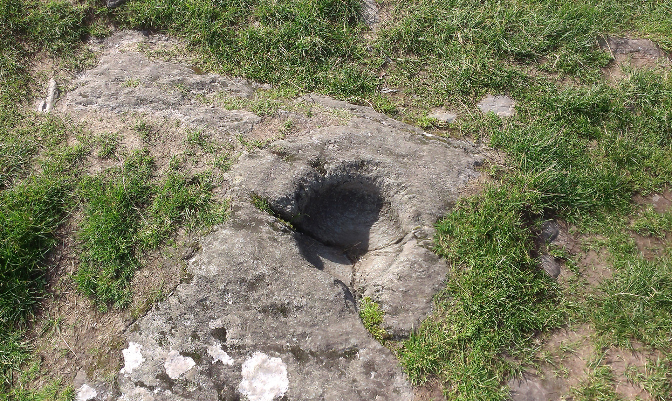
From Lochgilphead, take the A816 road north for several miles (towards the megalithic paradise of Kilmartin), keeping your eyes peeled for the road-signs saying “Dunadd.” Turn left and park-up a few hundred yards down. Go through the gate and walk up Dunadd. Just before the flattened plateau at the top you’ll come across a length of smooth stone, adjacent to the Dunnad Footprint Stone, with a deep large circular ‘bowl’ cut deep into the rock. That’s the spot!
Archaeology & History
Basin with encircling faint ring
This large ‘bowl’ or basin just below the top of Dunadd—next to the other carvings of footprint, Ogham and boar—is speculated by many to have been a part of the kingship rituals that were alleged to have occurred up here, going way back. But please remember that ‘kingship’ as it was in ages past has nothing to do with the touristy nonsense that prevails in the UK today. Kingship in its early forms relates to rituals for the benefit of the tribe/society, in many cases resulting in sacrifices. (see Frazer 1972; Hocart 1927; Quigley 2005, etc) This is quite probably what occurred at Dunadd. But whether this curious deep bowl with its semi-circular carved ring had anything to do with the kingship rites, we simply don’t know.
An early description of the Dunadd Basin is in Mr Thomas’ (1879) essay on the hill itself. It was a brief note:
“About four yards southwards from the (Dunadd) footmark is a smooth-polished and circular rock basin cut in the living rock; it is 11 inches in diameter and 8 inches deep.”
There is no mention of the incomplete ring which, though faded, can be seen to surround two-thirds of the hollow. And as Dunadd was used by people until medieval times (Lane & Campbell 2000) it not only begs the question: when was it carved; but also: was the myth behind this petroglyph still alive? We’ll probably never know.
The Royal Commission lads (1988) said the following:
“The rock-cut basin measures 0.25m in diameter by 0.14m in depth, and is bisected by a crack. It is surrounded by a shallow pecked ring about 40mm in width, but parts of this have been worn away, especially to the S where the path from (the) enclosure passes the basin.”
Folklore
…and from another angle
The basin here was said by the incoming priest R.J. Mapleton (1860) to be entirely natural in origin; though he also noted how Dunadd was known by local people to be the meeting place of witches and the hill of the fairies, whose amblings in this wondrous landscape are legion. Legends and history intermingle upon and around Dunadd. Separating one from the others can be troublesome as Irish and Scottish Kings, their families and the druids were here. One such character was the ever-present Ossian. Mapleton told:
“From these ancient tales we turn to a much later period of romance, when Finn and his companions had developed into extraordinary and magical proportions; a story is current that when Ossian abode at Dunadd, he was on a day hunting by Lochfyneside; a stag, which his dogs had brought to bay, charged him; Ossian turned and fled. On coming to the hill above Kilmichael village, he leapt clean across the valley to the top of Rudal hill, and a second spring brought him to the top of Dunadd. But on landing on Dunadd he fell on his knee, and stretched out his hands to prevent himself from falling backwards. ‘The mark of a right foot is still pointed out on Rudal hill, and that of the left is quite visible on Dunadd, with impressions of the knee and fingers.'”
As Mr Thomas clarifies: “The footmark is that of the right foot, and the adjacent rock-basin is the fabulous impression of a knee.”
References:
Bord, Janet, Footprints in Stone, Heart of Albion Press 2004.
Campbell, Marion, Mid-Argyll: An Archaeological Guide, Dolphin Press: Glenrothes 1984.
Campbell, M. & Sanderman, M., “Mid-Argyll: An Archaeological Survey,” in Proceedings of the Society Antiquaries, Scotland, volume 95, 1962.
Craw, J.H. “Excavations at Dunadd and other Sites,” in Proceedings of the Society Antiquaries, Scotland, volume 64, 1930.
Lane, Alan & Campbell, Ewan, Dunadd: An Early Dalriadic Capital, Oxbow: Oxford 2000.
Mapleton, R.J., Handbook for Ardrishaig Crinan Loch Awe and Pass of Brandir, n.p. 1860.
Morris, Ronald W.B., The Prehistoric Rock Art of Argyll, Dolphin Press: Poole 1977.
Royal Commission on the Ancient & Historical Monuments of Scotland, Argyll – Volume 6: Mid-Argyll and Cowal, HMSO: Edinburgh 1988.
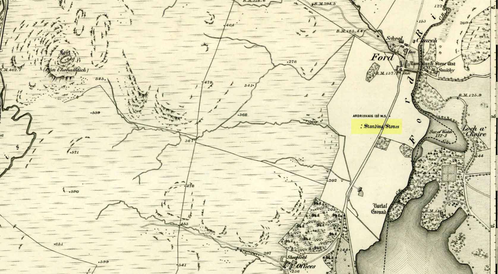
From Lochgilphead, take the A816 road north for several miles (towards the megalithic paradise of Kilmartin), keeping your eyes peeled for the road-signs saying “Dunadd.” Turn left and park-up. Instead of walking up the craggy fortress, follow the road-track to the house and, alongside the River Add, you’ll see the standing stone in the well-mown garden on your right.
Archaeology & History
As a monolith within the Kilmartin Valley complex, this is a slight, almost gentle standing stone, missed by most when they visit the other larger sites in Argyll’s Valley of the Kings. Set upright close to the gentle winding River Add and only a few yards from the ancient ford that bridged the waters beneath the shadow of Dunadd’s regal fortress, the late great Alexander Thom (1971) wrote about it in his exploration of lunar alignments found at other nearby standing stones. This one however, was 3° out to have any astronomical validity.
Described only in passing by a number of writers, the greatest literary attention it has previously been afforded was by the Royal Commission lads (1988), whose notes on it were short:
“An irregularly-shaped block of stone, 1.35m high and 1.35m in girth at the base, is situated 25m S of Dunadd farmhouse, it is aligned NNW and SSE, and the top the SSE edge appear to have been broken off.”
…My first visit here was when I lived north of Kilmartin and each time I found the same ‘gentle’ feeling, in all different weathers: a most unusual phenomenon, as there tends to be changes in psychological states between rain, sunshine, frosts, dark night and mists. But there was a consistency of subtlety; a regularity in genius loci—probably due to its proximity to the River Add, the lowland tranquility below the crags. It’s a wonderful little place. Well worth visiting if you go to Dunadd.
References:
Campbell, Marion, Mid-Argyll: An Archaeological Guide, Dolphin Press: Glenrothes 1984.
Lane, Alan & Campbell, Ewan, Dunadd: An Early Dalriadic Capital, Oxbow: Oxford 2000.
Royal Commission on the Ancient & Historical Monuments of Scotland, Argyll – Volume 6: Mid-Argyll and Cowal, HMSO: Edinburgh 1988.
Ruggles, Clive L.N., “A critical examination of the megalithic lunar observatories,” in Ruggles & Whittle, Astronomy and Society in Britain, BAR: Oxford 1981.
Ruggles, Clive L.N., Megalithic Astronomy, BAR: Oxford 1984.
Many ways to get here, but you’ve gotta amble off-path through the woods to eventually find it — but it’s not difficult. From Kilmartin village head to Slockavullin and walk up the winding track which takes you towards the Ballygowan cup-and-ring stones, but follow it into the woods instead. The OS-map’s gonna be your best guide here. I first visited this spot from the south and ambled about, aimlessly at times for several hours, after I’d first been to the great ruined mansion of Poltalloch. Well worth checking out if you enjoy finding allsorts!
Archaeology & History
The old tomb is actually a few hundred yards beneath the small rocky summit of Barr a’ Chuirn, with the overgrowth of the woods imposing itself upon it. The Scottish Royal Commission report (1988) told that there was a large seat built here in the 19th century called the Lady’s Seat, and actually set up on the cairn itself so giving groovy views all round to those who came here. The Seat was made from large slabs of stone, which may originally have come from the old tomb. An excavation here in the mid-19th century,
“found the remains of two cists and some burnt bones, with a ‘skeleton of later date, between the two cists, but probably put there by the men who destroyed the cairn.’ In 1929 Craw re-examined the site and found that the central cist had chambered and grooved slabs. This cist is aligned ENE and WSW, and the E end-slab is now missing; the cist measured about 1m by 0.5m and about 0.3m in depth internally. The northern side-slab is grooved at the west end.”
References:
Royal Commission on the Ancient & Historical Monuments of Scotland, Argyll: volume 6 – Mid-Argyll and Cowal, HMSO: Edinburgh 1988.