Lochan Hakel (02), Tongue, Sutherland

Cup-and-Ring Stone:  OS Grid Reference – NC 56995 52656

Also Known as:

  1. Canmore ID 5375
  2. Lochan Hacoin
  3. Ribigill carving

Getting Here

Carving on the 1878 map

Whether you take the A836 or A838 into Tongue (through truly beautiful wilderness), make sure you go into the village itself—and then keep going, south, along the tiny country road.  Nearly 2½ miles along, note the small loch of Lochan na Cuilce on your right.  A few hundred yards past this, on the other side of the road (barely visible at first) is Lochan Hakel.  Walk around to the south-side of the loch until you find the Lochan Hakel 1 carving.  Then look up at the rock right above you.  That’s the one!

Archaeology & History

In James Simpson’s (1867) primary work on British petroglyphs, he mentions this site as being in the lands of “Ribigill, near Tongue”, although it is a little further to the south.  A certain “Mr Mitchell” had come across it in one of his many rambles in the hills.  Simpson told that he had:

“discovered cups and circles upon a large stone, about nine feet square, apparently lying in its original position, close to the edge of a loch, which contains the remains of an old castle… The surface of the stone shows eighteen or twenty round cup excavations, about an inch deep.  There is a ring of ‘hollow around each cup.'”

Although there aren’t rings around every cup, a great number of clear and impressive rings exist around many of them and are, thankfully, still reasonably visible amidst the mass of lichens.

Around the same time as Mr Simpson’s description, James Horsburgh (1868) wrote about the carving, telling us:

The rock and its island
Some of the cup-and-rings

“On the edge of the precipitous bank of the loch, and exactly opposite the island, there is a large boulder with a flat top, and on this there are a number of cups and rings… This stone is not generally known. Old Ross, the gamekeeper at Tongue, first told me of it, and he and I scraped off the moss and exposed the whole. He thought it was for playing some game. On the left of the stone, on a bit separated by a crack, there is a sort of a figure which appears to have been formed by cutting away the stone around it and leaving it in relief, and also some artificial cutting on the right, a sort of circular groove.”

A better description of the carving came near the beginning of the 20th century, when the Scottish Royal Commission (1911) lads included the site in their inventory.  They told:

From the rock, looking N
The carving from above

“At the S end of Lochan Hacoin, to the SE of the islet on the top of the bank, is a large earth-fast boulder, on the flat upper surface of which are a number of cup and ring marks placed irregularly over it.  The total number of undoubted markings is thirty-four, of which those surrounded by a ring number eleven.  No cup with a double ring round it is observable.  The best defined cup-mark measures 3″ across by 1¼” deep, and the enclosing ring is 7″ in diameter.  Eight of the markings are well defined; the others less noticeable.  At the S end there is a boss or projection, roughly rectangular, measuring 12″ x 6″.  A sketch of this stone, made about the year 1866 by Mr James Horsburgh, is preserved in the library of the Society of Antiquaries of Scotland.”

Does anyone know if this drawing still exists?

Folklore

In Horsburgh’s essay on the prehistoric remains of the area, he said how local people told that the cup-and-rings “were made by the high heels of a fairy who lived in the castle” on the island of Grianan about 40-50 yards away.

References:

  1. Close-Brooks, Joanna, Exploring Scotland’s Heritage: The Highlands, HMSO: Edinburgh 1995.
  2. Horsburgh, James, “Notes of Cromlechs, Duns, Hut-circles, Chambered Cairns and other Remains, in the County of Sutherland,” in Proceedings Society of Antiquaries Scotland, volume 7, 1868.
  3. o’ Reilly, Kevin, What to See Around the Kyle of Tongue, privately printed 1980.
  4. Royal Commission on Ancient & Historical Monuments & Constructions of Scotland, Inventory of Monuments and Constructions in the County of Sutherland., HMSO: Edinburgh 1911.
  5. Simpson, J.Y., “On Ancient Sculpturings of Cups and Concentric Rings,” in Proceedings of the Society of Antiquaries, Scotland, volume 6, 1866.
  6. Simpson, James, Archaic Sculpturings of Cups, Circles, etc., Upon Stones and Rocks in Scotland, England and other Countries, Edmonston & Douglas: Edinburgh 1867.

Acknowledgments:  Huge thanks to Sarah MacLean for guiding me to this carving, and also for the kind use of her photos in this site profile.  Cheers Sarah!  And to Donna Murray again, for putting up with me whilst in the area!  Also – Huge thanks for use of the 1st edition OS-map in this site profile, Reproduced with the kind permission of the National Library of Scotland

© Paul BennettThe Northern Antiquarian

Pitcur Souterrain (3) – Carving 2, Kettins, Perthshire

Cup-and-Ring Stone:  OS Grid Reference – NO 25290 37378 

Getting Here

MacRitchie’s 1900 groundplan

Follow the same directions as if you’re visiting the Pitcur (3) souterrain.  Once here, you’re standing at the southernmost uncovered section of the monument, where one uncovered passageway bends round and meets up with another open section (“m” on MacRitchie’s plan, right).  From here, just to your right, a single large roofing stone joins one side of the open passageway with the other, enabling you to walk across it—and the stone you’d walk across has these very faint carvings on it.

Archaeology & History

Shortly before darkfall a few weeks ago, Nina Harris, Frank Mercer, Paul Hornby and I were just about ready to pack-up and leave the brilliant Pitcur souterrain with its underground chambers and various petroglyphs when, as I walked along one of the open passages beneath one of the monument’s many large capstones, my fingers gently stroked the rock above me, almost unconsciously.

First photo of the carving (by Paul Hornby)

“Was that a faint cup-mark?” I asked myself, fondling gently the smooth stone once more.

Standing eight-feet above me in the long grasses, Mr Hornby was gazing around in his usual way.

“Paul – can you see from up there if this is a cup-marking I’m feeling here?”

Walking onto the edge of the rock itself, he proclaimed, “it looks like it!”

It was indeed!  And during the remaining 30 minutes of daylight we found that the single cup-mark had a number of companions on the same stone.  With multiple rings!  Twas another good day out.

Carving when wet (photo, Frank Mercer)

Looking straight down

Previously unrecorded, this large rounded stone just about covers the space across from one side of the souterrain passage to the other, measuring roughly 6 feet by 4 feet, with its longer axis positioned roughly east-west.  It was on the westernmost edge of the stone where I located the first single cup-mark, close to the edge, but there are perhaps 12  others: three of which, as the photos show, are in a straight line from near the west-side of the stone to the upper-middle.  On its far eastern edge, another cup-mark is clearly evident; whilst on its southernmost edge is another.  It’s the middle and eastern section of the rock that grabs most of the attention.  Here we found the very faint rings becoming clearer and clearer as the dust of ages was carefully swept away, eventually giving us vision of carvings that were, in all likelihood, first pecked into the rock in the neolithic period, 4-6000 years ago.

Close-up of the 2 triple-rings

Cup-and-rings at an angle

As we can see, two faint triple-rings exist, each with lines running in/out of them.  The eastern concentric system is just about complete and has a small cup-mark on the NW edge of the outer ring.  A line that runs out from the central cup meets another carved line which, from some angles, appears to look almost like a bowl beneath the triple rings—but this is unclear.  The other triple cup-and-ring, slightly closer to the middle of the stone, has an incomplete outer ring, with evidence of another line running outwards from its central cup. There seems to be a slightly-pecked outline of a single cup-and-ring on the north side of the stone, but this is also unclear.

In truth we need to revisit the site soon, when the lighting gives us a clear idea of what we actually found, because our visit here was cut short by encroaching night and a grey cloudy evening—which are not the best conditions for isolating new petroglyphs!

At least six other petroglyphs exist within the Pitcur Souterrain (3), with the one closest to this (Pitcur 3:3) also used as a roofing stone, covering the deep trench from one side to the other.  However, it would appear the petroglyphs on that stone were on its underside, as the erosion on it is negligible, away from the elements—unlike this one! Another capstone that was also turned over (Pitcur 3:4) was found to possess more cup-and-rings, again on the underside of the stone.

This carving was probably executed 2-3000 years before the souterrain came into existence, and as a result of this we’re unsure as to the original location of the stone—but it was probably close by.  It might have originally been a carved standing stone, re-used here; or been part of a lost prehistoric tomb; or even a loose earthfast rock (though this is the least likely of the three).  Why it was used, and whether it retained any sense of the original meaning when it was re-positioned into the present construction, is a relevant question.  In all likelihood some of the original mythic element—or a morphed development of its original animistic narrative–was probably a functional ingredient of importance to the souterrain builders, 2-3000 years after the carving had been made.

A superb site!

References:

  1. Wainwright, F T., The Souterrains of Southern Pictland, RKP: London 1963.

Acknowledgements:  This site profile would not have been made possible were it not for the huge help of Nina Harris, Frank Mercer & Paul Hornby.  Huge thanks to you all, both for the excursion and use of your photos in this site profile. 🙂

© Paul BennettThe Northern Antiquarian


Airthrey Mineral Wells, Bridge of Allan, Stirlingshire

Healing Wells:  OS Grid Reference – NS 79504 97686

Also Known as:

  1. Airthrey Spa
  2. Airthrey Springs
  3. Bridge of Allan Spa
  4. Canmore ID 317260

Getting Here

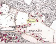
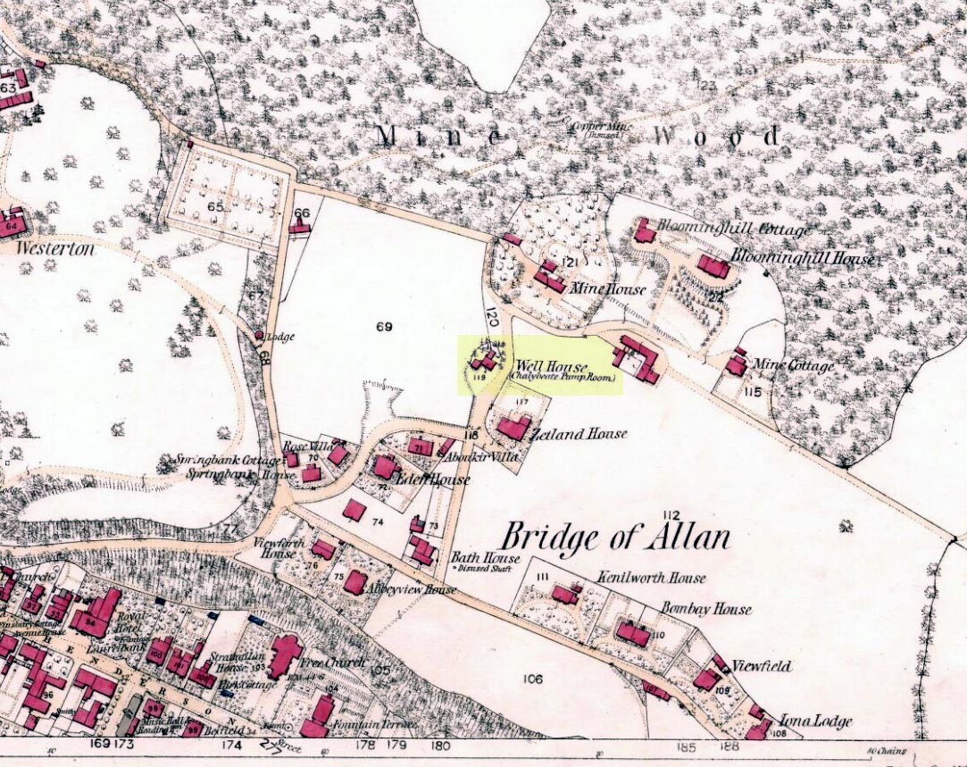
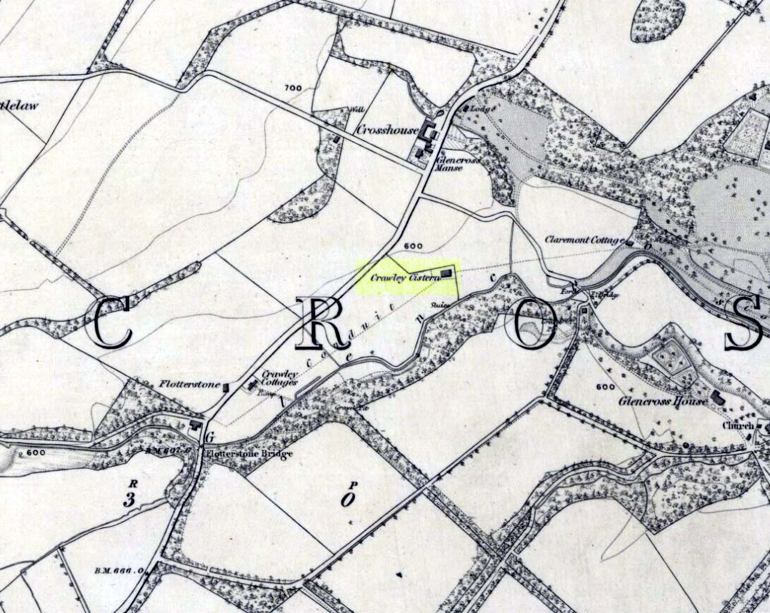
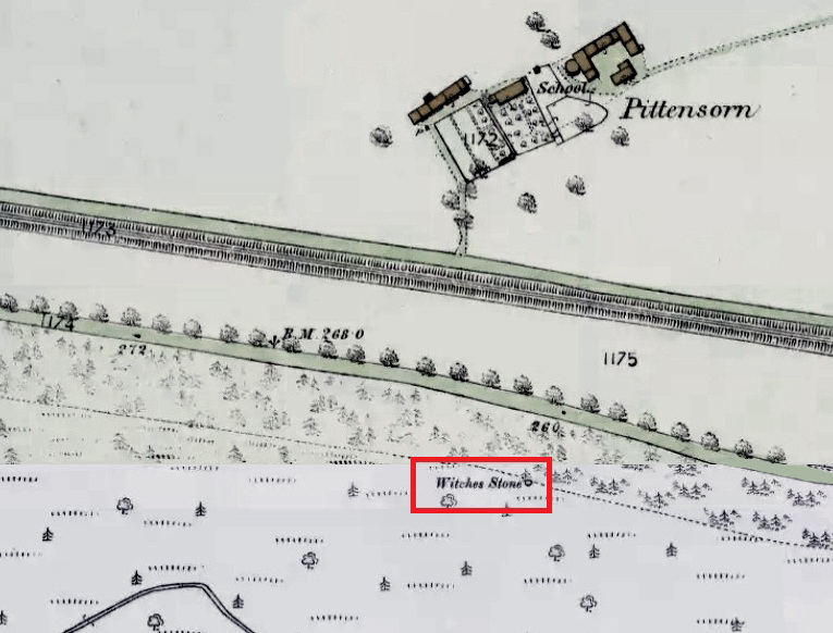
Site shown on 1865 OS map

The old well-house is accessed easily.  From the main road of Henderson Street (or A9), that runs through the town, as you approach the main shopping area, go up Alexander Drive, then immediately turn right up Well Road. 100 yards up, take your first right again along Kenilworth Road and then first right up Mine Road.  100 yards or so along here, as you reach the tennis courts on your right, a small crumbly-tumbly building is to your left, just by the car-park to the hotel, with some old trees hiding its presence.  You can’t get into it and the waters therein sound to have fallen silent.

Archaeology & History

In 1761, the great writer Daniel Defoe in his Tour across Britain, found himself visiting a healing spring under the western reaches of the Ochils:

“Airthrey Well, two miles north of Stirling, flows from a mountain, where is a copper mine, with some mixture of gold; the water is very cold, and being tinctured with the minerals it flows through, is of use against outward distempers.”

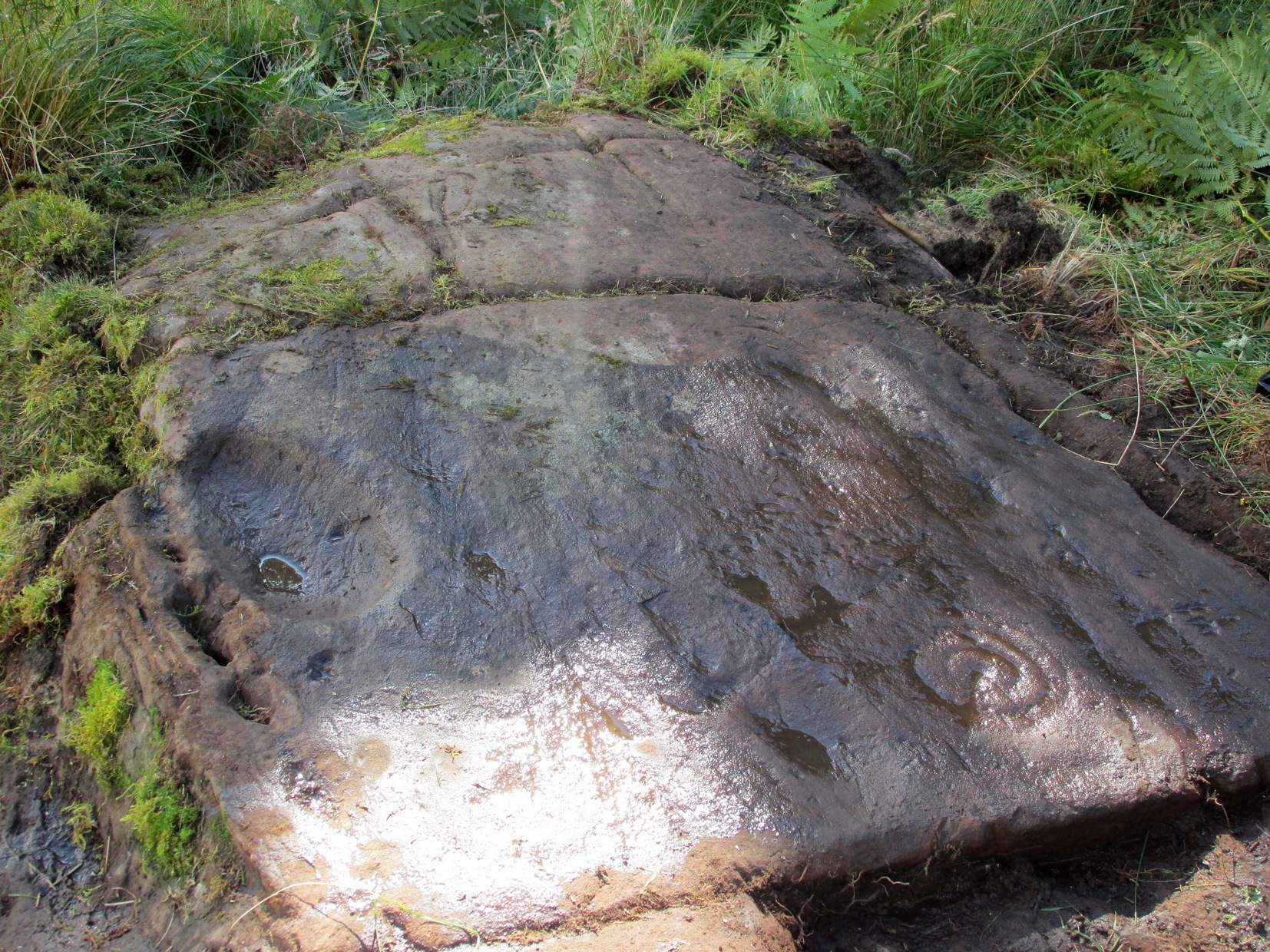
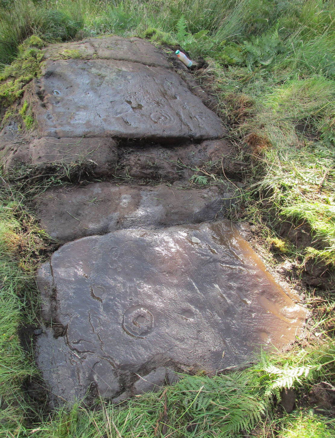
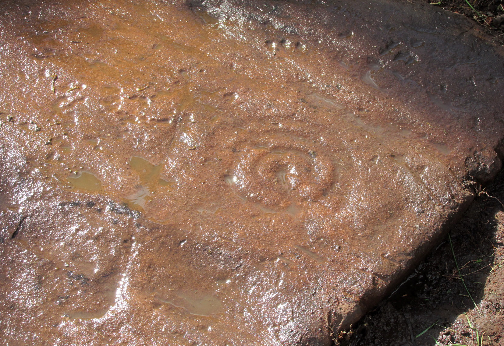
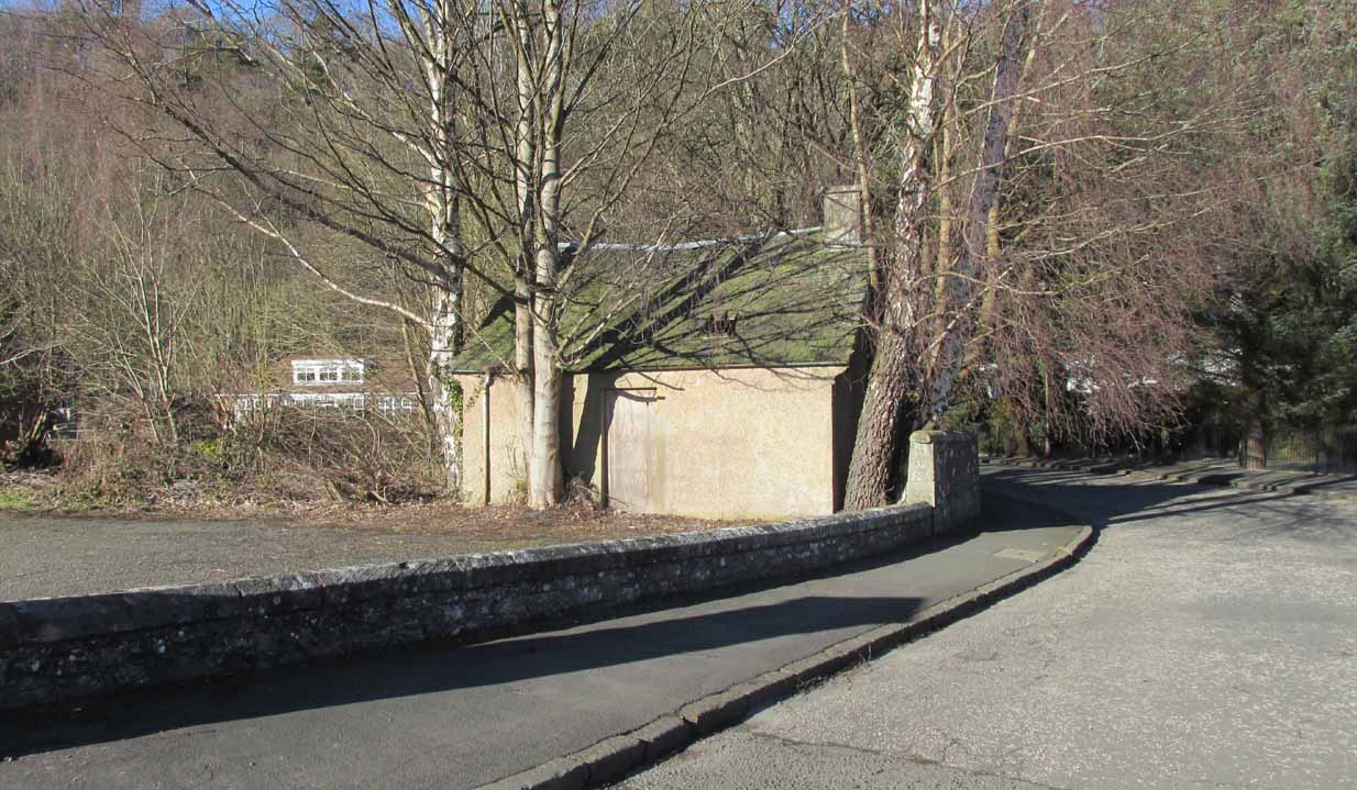
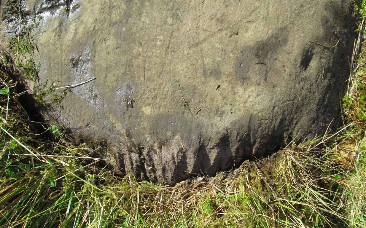
Airthrey Wellhouse in ruins

Perhaps the earliest literary description of this site, the Bridge of Allan that we see today was little more than a stretch of old abodes, reaching into woodland above the crystal clear river and burns, chiming with countless fauna and that rich chorus of colours that pre-date the Industrialist’s ‘progress’.  The old hamlet was said by Robert Chambers (1827) to be “a confusion of straw-roofed cottages and rich massy trees; possessed of a bridge and a mill, together with kail-yards, bee-skeps, colleys, callants, and old inns.” But all of this was about to change.

In the old woods on the northwest slopes above the hamlet was indeed an old copper mine as Defoe described, and housed therein were a number of mineral springs–six of them according to the early reports of Forrest (1831) and Thomson. (1827)  They were obviously “known to the country people,” said Thomson, and had been “used by them as an occasional remedy for more than forty years”; although in Forrest’s very detailed account of these wells, he told how

“one of the old miners, an intelligent man and an enthusiastic admirer of the medicinal virtues of these waters, informs me, that they have been known for at least one hundred years.”

This comment was echoed a few years later when Charles Roger (1853) wrote his extensive book on the village.

It was in the 1790s when the mineral waters were channeled out of the mines for the first time, and Mr Forrest told that they were collected lower down the slope,

“in a wooden trough, for the use of the miners, and of the country people, some of whom used it as an aperient, whilst others, deeming the water impregnated with common salt merely, employed it for culinary purposes. …It was…much used as a medicine by the country people of the neighbourhood who attended regularly every Sunday morning to partake of it.”

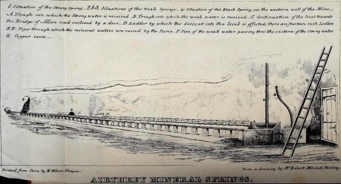
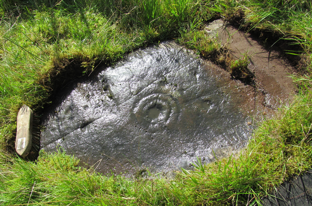
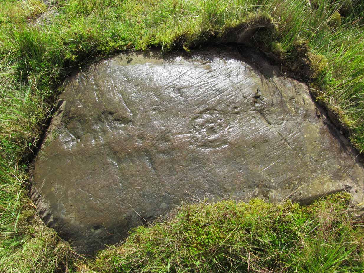
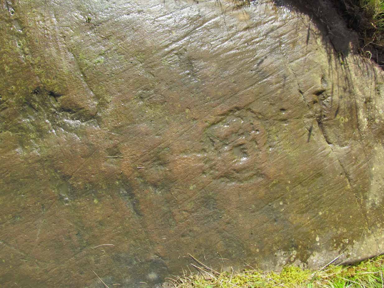
Airthrey waters channeled along the long trough (Robert Mitchell 1831)

The fact that Sunday mornings was when people came here tell us that the Church had something to do with the timing; strongly implying that the wells possessed earlier indigenous traditions—probably similar to those practiced at the Christ’s Well, the Chapel Well and countless others across the country.  But written records on this are silent.

The main history of the Airthrey Springs is of them becoming famous Spa Wells and, much like Harrogate in Yorkshire, were responsible for the very growth of Bridge of Allan itself.  Oddly enough, this came about a few years after the copper mines were closed in 1807.  This wouldn’t have stopped some of the local people still getting into them and drinking the waters when needed—but the written records simply tell that, for a few years at least, their reputation faded.  Around the same time in the village of Dunblane, just a few miles to the north, another Spa Well had been discovered and it was attracting quite a lot of those rich wealthy types—bringing fame and money to the area.  As a result of this, the medicinal virtues of the Airthrey Springs were revived thanks to the attention of the local lord, a Mr Robert Abercromby, who thought that Bridge of Allan could gain a reputation of his own.  And so in the winter of 1821-22, Abercromby procured the research chemist Thomas Thompson to analyse the medicinal waters at Airthrey and have them compared with the ones at Dunblane.  He was in luck! Not only were they medicinal, they were incredibly medicinal!

Dr Thomson then wrote a series of articles in various academic journals in the early 19th century—each espousing, not just the health-giving property of the Airthrey waters, but lengthy chemical analyses outlining the active constituents.  To his considerable surprise he found that the Airthrey waters were as good as any of the great spa towns in England at Harrogate, Buxton, Bath and Leamington.  Their virtues were so good that Mr Forrest (1831) doubted any of the Spa Wells in England were as beneficial as the waters here!  R.M. Fergusson (1905) echoed this sentiment in his massive work on the adjacent parish of Logie, calling the Airthrey springs “the Queen of Scottish Spas”!—and these accolades prevailed long after Dr Thomson’s analyses.  He wrote:

“At Airthrey there are six springs containing, all of them, the same saline constituents, but differing a good deal in their relative strengths. I analyzed two of these during the winter of 1821-22, and the other four during the autumn of 1827.”

He found that, in varying degrees, the main constituents were salt, muriate of lime, sulphate of lime and muriate of magnesia. At that time, in medical circles, these ingredients were beauties!  As Mr Logie (1905) said:

“This mineral water has been for long distinguished as a specific for derangements of the stomach and liver, and skin and chest diseases, rheumatism, gout, sciatica, and nerve affections…”

Thomson’s initial findings were much to the liking of Mr Abercromby; for hereafter, he realised, all and sundry who could read and travel to the country spas in England and beyond, would visit Bridge of Allan and bring with it great trade.  So Abercromby quickly,

“caused the water of the two Springs analysed by Dr. Thomson, one of which was characterised by its strength, the other by its comparative weakness, to be carefully collected and conveyed apart in earthen pipes, to two stone troughs placed in a convenient situation, from which it was raised by two well-constructed forcing pumps. Over these pumps a commodious house was erected.

In 1822, several thousand copies of Dr. Thomson’s analyses were circulated; and the water acquired immediate celebrity.  Invalids from all parts of the country, but especially from Glasgow and its vicinity, resorted to Airthrey. Every house, in fact, in its neighbourhood, however mean and incommodious, was occupied by strangers; and so great was the popularity of the new springs that even in 1823 they threatened to supersede all the other same springs of Scotland.”

The success of these medicinal waters created the town itself and, unlike many other spa wells, this one continued to be used until the end of the 1950s.  Its demise came when, in one financial year, only two people came to “take the cure,” as it was called.

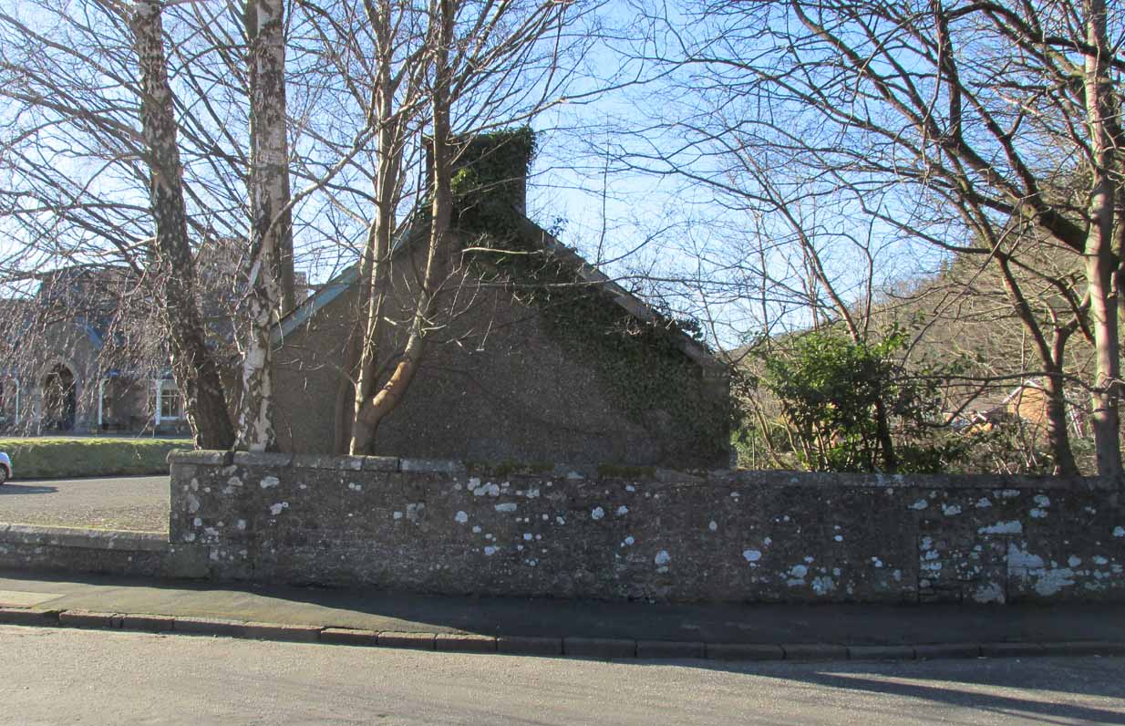
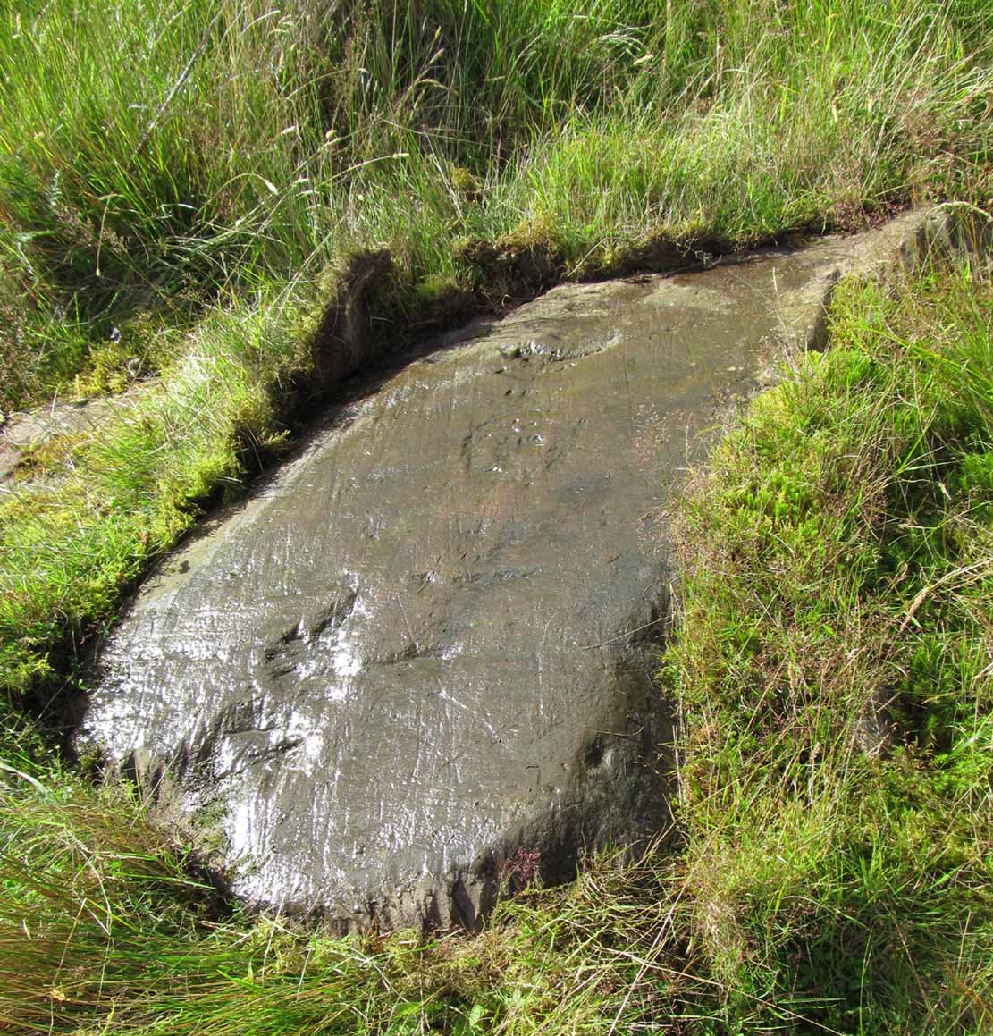
Side wall of ruined wellhouse

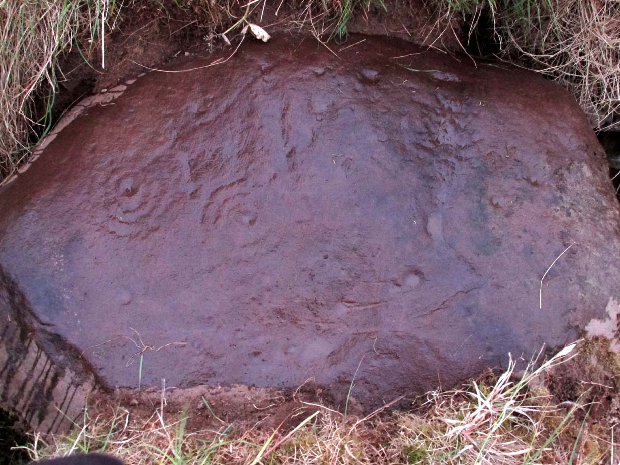
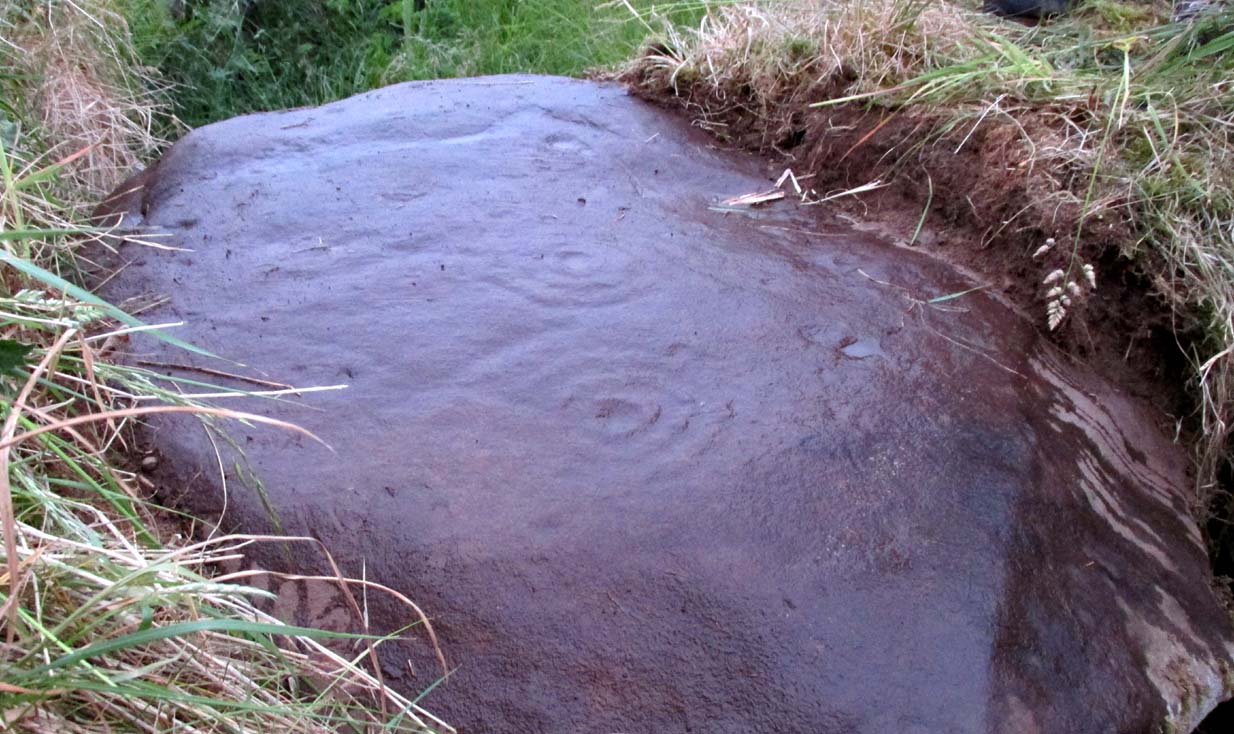
If you visit the well-house nowadays, it’s in rather poor condition and will be of little interest unless you’re a devout architectural fanatic.  It’s thought to be the earliest surviving building associated with this spa town, said by Mr Roger (1853) to have been built in 1821.  Shown on the first OS-map of the area, adjacent buildings were constructed to accommodate the overflow of people who came here.  And in the woodlands above, if you look around halfway up the slopes, an old trough has water running into it just by the side of a path.  This, say some local folk, is the trickling remains of the medicinal waters, still used occasionally by some people…

References:

  1. Durie, Alastair J., “Bridge of Allan: Queen of the Scottish Spas,” in Forth Naturalist & Historian, volume 16, 1993.
  2. Erskine, John, Guide to Bridge of Allan, Observer Press: Stirling: 1901.
  3. Fergusson, R. Menzies, Logie: A Parish History – 2 volumes, Alexander Gardner: Paisley 1905.
  4. Forrest, W.H., Report, Chemical and Medical, of the Airthrey Mineral Springs, John Hewit: Stirling 1831.
  5. Morris, Ruth & Frank, Scottish Healing Wells, Alethea: Sandy 1982.
  6. Roger, Charles, A Week at Bridge of Allan, Adam & Charles Black: Edinburgh 1853.
  7. Stewart, Peter G., Essay on the Dunblane Mineral Springs, Hewit: Dunblane 1839.
  8. Thomson, Thomas, “On the Mineral Waters of Scotland,” in Glasgow Medical Journal, volume 1, 1827.
  9. Turner, E.S., Taking the Cure, Michael Joseph: London 1967.

© Paul BennettThe Northern Antiquarian


Crawley Spring, Glencorse, Midlothian

Healing Well (covered):  OS Grid-Reference – NT 23894 63346

Archaeology & History

Site of Crawley Spring on 1854 map

Site of Crawley Spring on the 1854 map

Once found flowing freely beneath the shadow of the prehistoric hillfort of Castlelaw, this all-but-forgotten site was thankfully recorded in Hope & Telford’s (1813) survey of Edinburgh’s natural water supply.  Mr Telford said how “This noble spring rises from the bottom of a bank, at the foot of the Castlelaw Hill, at the edge of a small, low, almost marshy meadow close by the Glencorse Burn, a little way below the bridge.”  Twelve years after writing this, the well had been blocked and a cistern built over it.

It was proclaimed by local people to be medicinal (though to what ailments, I cannot find), but there was an effective confirmation of some medicinal qualities in the waters following an analysis in 1810 when very tiny mineral elements were found.  Mr Telford (1813) explained:

“The water is perfectly transparent and colourless, free from every smell and taste and is of excellent quality.  It has, as is the case with almost all spring water, some matters dissolved in it, though in smaller quantities than common… This foreign matter consist of carbonate of lime, muriate of soda, and sulphate of lime, with an excessively minute portion of magnesium salt. The proportions of these ingredients, in each pound, are nearly:

Carbonate of Lime – 0.43 of a grain
Muriate of Soda – 0.10 of a grain
Sulphate of Lime – 0.90 of a grain
Sulphate of Magnesia – 0.05 of a grain

The carbonate of lime is dissolved by means of carbonic acid, which is not in greater quantity than is barely sufficient for the purpose.  All of these ingredients are in themselves innocent to the human body; and in the quantity in which they are present in the water, do not affect its goodness.  The water is perfectly soft and fit for washing, infusing tea and other domestic purposes.  The water, therefore, is exceptional in every respect.”

When it came to the Crawley Spring waters being used to feed the habits of Edinburgh city, there was considerable opposition by the land-owner and local people who were, correctly, concerned that that ecosystem here would be adversely affected if the waters were to disappear.  And so it was that Earth’s blood was taken from the land and the people and the animals, to benefit and feed the religion of Industrialism and ‘progress’ once more…

References:

  1. Bennett, Paul, Ancient and Holy Wells of Edinburgh, TNA: Alva 2017.
  2. Hope, Thomas C. & Telford, Thomas, Reports on the Means of Improving the Supply of Water for the City of Edinburgh, A. Constable: Edinburgh

© Paul BennettThe Northern Antiquarian


St. Anne’s Well, Strathaven, Lanarkshire

Holy Well:  OS Grid Reference – NS 7039 4438

Archaeology & History

St Anne's Well on 1865 map

St Anne’s Well on 1865 map

Long since lost it would seem, in a search for this legendary site over the weekend with Gordon, Aisha and Lara, I’m still not certain of the actual status of the site.  Although we found a very fresh water supply still running not far from where the old OS-map showed the original holy well to be, it may be a completely different water source.

There are hardly any references to the spring and those that exist are scant.  In the early 1860s, St. Ane’s Well was mentioned briefly in the Object Name Book of the area:

“This is a good spring well in the southern part of the town of Strathaven.  It is commonly called Tun’s (Tan’s?) Well, but this is an abbreviation of the name.”

Lara plays at a nearby well

Lara plays at a nearby well

Looking down on the waters

Looking down on the waters

More recently, thanks to a communication from the local historian Robert Currie, more information has come to light about the well.  It was described in the local history work by Mary Gebbie (1880).  Mr Currie told me:

“In her Sketches of Avondale and Strathaven…we read: “In a lane off Tod’s Hill was the famous Tann’s Well – obviously a corruption of the celebrated water saint, St. Anne. This spring has within a few years completely dried up. Access was easily had from the castle to it, over the draw-bridge, which is said to have rested on the ledge of the ground and rock on which the fifth house is built south of the bridge. Before this aperture was built up, the inhabitants around took advantage of the pathway for drawing water from the Pomillion, at a place called the Fairy Pool. A little above this comes the Dove Castle; and a half a mile further out is the Gallow Hill.”

He continued:

“That said, the current siting of St. Anne’s Well is located on Lesmahagow Road with (the) site being almost opposite the Council houses bordering on Station Road (there is currently a mini-roundabout near the locus). In recent years the site has become obscured but in my own living memory there was once a plaque authenticating the site and with a garden seat thereby.”

In searching through their own library, Mr Currie and his wife came across more about the site in William Downie’s (1979) book on Strathaven, in which he wrote:

“A small lane off Todshill went down to a cluster of houses called St. Anne’s Well nestling on the sloping ground beside the mill dam. In 1911 these houses were acquired and demolished by the Town Improvement Committee. A row of houses backing backing on to Powmillon Burn were also demolished at the same time and a retaining wall with railings erected, so opening up a very fine view of the castle and burn etc.”

The dedication here to the mythic figure of St. Anne (mother of the Virgin Mary and grandmother of Jesus) is isolated and mysterious.  No church is dedicated to her in the area, nor other relative christian remains.  Her appearance in Strathaven is something of an oddity.  There was a Duchess ‘Ann’ Hamilton of Strathaven Castle who lived 200 yards away at Strathaven Castle on the other side of the river that might have given her name to the well, but this is very unlikely.  More probable is that St. Anne was used as the mythic figure who covered an earlier dedication to the prima mater, or Cailleach—although there are no remains that relate to Her either.  However, the existence of St Mary’s church and an associated well to the north, along with a burn dedicated to a “maiden” in the same parish to the northwest add to the cailleach’s potential…..but all tales of Her have seemingly been forgotten.

…So it seems that the spring of water that Lara, Aisha, Gordon and I came across was obviously not the same place, but exists just below the roadside where the disused railway line is.  It’s close to St Anne’s Well – but is not the same water source.

References:

  1. Downie, Fleming, A History of Avondale and Strathaven, Eric Moore: Glasgow 1979.
  2. Gebbie, Mary, Sketches of the Town of Strathavon and Parish of Avondale: Historical & Traditional, John Menzies: Edinburgh 1880.

Links:

  1. Strathaven Past & Present

Acknowledgements:  Considerable thanks must be given to Robert Currie, BA Hons, who sent us additional information enabling a more informative and accurate site profile for this holy well.  Thanks Bob! Also huge thanks again to Aisha Domleo, Lara Domleo, Unabel Gordon and their frobbling Leonidus!

© Paul BennettThe Northern Antiquarian


Weeping Stone, Fladaigh Chuain, Skye

Legendary Rock: OS Grid Reference – NG 3638 8091

Getting Here

Unless you’ve got your own boat, forget it!  This one’s miles out on the isolated uninhabited island of Fladda-chuain about 5 miles off the northwest tip from Duntulm, Trotternish.  I wouldn’t mind a coupla weeks alone on the isle though – if anyone can get me there!

Archaeology & History

This little rocky island was allegedly another one of the many visiting places that St. Columba frequented in his copious ventures, trying to sell his new religion to local people wherever he went.  Here he came to the legendary clach known as the Weeping Stone: a place of reverence to the druids and indigenous people.  But St Columba came here to christianize the rituals that were had at the site; and, eventually, he was allowed to build a  small stone chapel close by.

Folklore

In Otta Swire’s (1961) excellent work on the folklore and history of the Isle of Skye, she wrote:

“In Duntulm Bay lies Tulm Island and beyond it, in clear weather, Fladdachuan, Fladda of the Ocean, can be seen. In olden times this was a sacred spot, held by many to be Tir-nan-Og, the Isle of Perpetual Youth, which lay in the west; here it is always summer and the sun never sets. The puffins recognized its sacred nature and never began any venture until they had circled the island three times sunwise; this they did also on arriving in Skye and before leaving it. It was held by some to be the reason why in Skye people used to turn three times sunwise before starting a new enterprise. The Druids held it in veneration and St. Columba caused a chapel to be built there. On its altar lay a black stone which some say was the original altar stone of the Druids and which was known as the Weeping Stone because it was always wet. Until fairly recently fishermen used to land on the island and pour three handfuls of seawater on the stone to procure favourable winds or to stop bad floods. The Weeping Stone no longer exists, or at least is no longer to be found where the altar once stood.”

I can’t find anything more about this place.  Does anyone know owt more about it?

References:

  1. Swire, Otta F., Skye: The Island and its Legends, Blackie & Son: Glasgow 1961.

© Paul BennettThe Northern Antiquarian


Witches Stone, Pittensorn, Murthly, Perthshire

Cup Marked Stone: OS Grid Reference — NO 0851 3881  

Getting Here

Witches Stone on 1867 map

Park up at Murthly village, follow the farm road west, opposite the Kinclaven junction up to the cross roads, and turn right and go past Douglasfield Farm, following the road as it bends to the left; then through the metal gates and walk on until you come to an earth bridge over the ditch to your left. Cross the bridge and the low-lying Witches Stone is about 30 yards on to your left by the drainage ditch.

Archaeology & History

The stone with cupmarks highlighted in blackberries

Not recorded on the Canmore online database, the Witches Stone is a low-lying, domed, earthfast rock bearing at least 12 cup marks. One cup mark has been drilled at some time in the past. Did the land owner do this as a preliminary to blowing it up with gunpowder? There is an interesting story relating to the origin of the cup marks, and it seems the name of the rock and its folklore may point to its ritual significance having passed down through oral tradition from the Bronze Age to historical times.

Close-up of cups

Folklore

The mid-nineteenth century Ordnance Survey Name Book has the following record, attested by Sir W.D. Stewart, Mr. T. Cameron & Mr. J. Cameron:-

“A small rock nearly level with the ordinary ground surface, underneath which it is traditionally held that a large sum of money is buried. In order to test the truth of this tradition, it is said that some years ago a man commenced to excavate the soil around the rock in order, if possible, to secure the hidden treasure, while so employed, a small dog suddenly appeared on the top of the rock and desired the man to desist, assuring him at the same time that the reputed treasure was really there, but it was never intended that the eye of mortal should behold it. There are some marks on the rock which the superstitious tell you are the prints of this very sagacious dog’s paws.”

References:

  1. Ordnance Survey Name Book: Perthshire – volume 50, page 63, 1859-62.

© Paul Hornby 2017, The Northern Antiquarian


Over Glenny (04), Port of Menteith, Stirlingshire

Cup-and-Ring Stone: OS Grid Reference — NN 56991 02834

Also Known as:

  1. Canmore ID 352014

Getting Here

Over Glenny (4) C&R

Along the A81 road from Port of Menteith to Aberfoyle, watch out for the small road in the trees running at an angle sharply uphill, nearly opposite Portend, up to Coldon and higher. Keep going, bearing right past Mondowie and stopping at the dirt-track 100 yards or so further up on the left. Walk up this dirt-track for ⅔ mile, and just before reaching the planted forestry, turn right along another dirt-track. Less than 200 yards along there’s a large sycamore tree, and about 20 yards below it (south) are several open flat rock surfaces.  This is the most westerly of them.

Archaeology & History

…and again

On this small smooth rock surface we find an almost archetypal cup-and-ring stone, whose design consists of a double cup-and-ring and a faint cup-and-ring. The double-ring has several seemingly natural small fissures in the rock running at various angles into the central cup from the outside; and there are two faint ones running from the double-rings outwards to the cup-mark in the single-ring, framing the central cupmark in the middle. It may have been that these scratches on the rock gave rise to the position of the cupmark in this petroglyph.  It’s difficult to see whether or not the single cup-and-ring was ever completed.

Canmore’s description of this petroglyph tells simply: “The larger of the two is 180mm in diameter and has two rings around a cup that is 70mm in diameter and 15mm deep. The smaller has one ring around a cup.”

References:

  1. Brouwer, Jan & van Veen, Gus, Rock Art in the Menteith Hills, BRAC 2009.
  2. Sorowka, P., Davenport, C., & Fairclough, J., “Stirling, Over Glenny,” in Discovery & Excavation, Scotland, vol. 15, 2014.

Acknowledgements:  Massive thanks to Paul Hornby, Lisa Samson & Fraser Harrick for all their help on the day of this visit.

© Paul BennettThe Northern Antiquarian


Over Glenny (05), Port of Menteith, Stirlingshire

Cup-and-Ring Stone:  OS Grid — NN 56993 02835

Getting Here

‘Over Glenny 5’ Carving

Along the A81 road from Port of Menteith to Aberfoyle, watch out for the small road in the trees running at an angle sharply uphill, nearly opposite Portend, up to Coldon and higher. Keep going, bearing right past Mondowie and stopping at the dirt-track 100 yards or so further up on the left.  Walk up this dirt-track for ⅔ mile, and just before reaching the planted forestry, turn right along another dirt-track.  Less than 200 yards along there’s a large sycamore tree, and about 20 yards below it (south) is the carving you’re looking for.

Archaeology & History

It’s difficult keeping up with the carvings in this region to the north of the Lake of Menteith, as we find new unrecorded ones on every visit, maintaining the tradition of fellow rock art students Maarten van Hoek, Kaledon Naddair, George Currie, Jan Broewer and the rest—and we know that there’s more of them hidden away.  This one doesn’t seem to be in the Canmore listings, but I put that down to the fact that they’ve got a grid-references wrong somewhere, as it’s pretty plain to see.  Although, to be honest, in the rather vague descriptions of the adjacent carvings (Over Glenny 4 and 6), this carving is in-between them, so you’d expect it to be listed.  Anyway, that aside…

Looking down at the rings
Close-up of faint rings

This long flat exposed rock surface has two primary cup-and-rings upon it: one cup with a double-ring, and the other standard cup-and-ring; there are also two single cup-markings on the stone: one near the middle of the rock and the other on its lower-right side.  The main element is the double-cup-and-ring, which appears to be incomplete—not only in terms of its design, but also, as you can see in the photos, seems unfinished. From the central double-ring, a faint carved line runs out from the centre and into the other faint, incomplete, single cup-and-ring.

Series of metal-sharpening grooves
Arty-farty sketch of the design

At the bottom of the stone (as with several others hereby) a curious set of deep scars have been cut into the edge of the rock.  They’re unmistakable when you see them.  They have probably been created by metal artifacts being sharpened along the bottom of the rock—many many times by the look of it.  These deep cuts reminded me of the more famous Polisher Stone, down Avebury-way.  They may be explained by the fact that, several centuries ago, a battle occurred here and some of the men gathered in the area before the attack.  It would seem as if this and the other cup-and-ring stones were used to sharpen their blades before going into battle.  Whether this was done because of some local lore which imbued these stones with some sort of magick, we do not know.  Folklore here seems curiously scarce (english incomers destroyed local traditions, as writers were telling us in the 19th century), apart from the well-known one of the area being rife with fairies: Robert Kirk’s famous The Secret Commonwealth of Elves, Fauns and Faeries (1691) was written three miles west of here, at Aberfoyle.

References:

  1. Brouwer, Jan & van Veen, Gus, Rock Art in the Menteith Hills, BRAC 2009.

Acknowledgements:  Massive thanks to the rest of the crew: Paul Hornby, Lisa Samson & Fraser Harrick.

© Paul BennettThe Northern Antiquarian


Holy Well, Cambusbarron, Stirlingshire

Holy Well (destroyed?): OS Grid Reference – NS 7787 9252?

Archaeology & History

A small but ancient chapel once existed in Cambusbarron, long ago, located about one hundred yards east of the Chapel or Christ’s Well.  William Drysdale (1904) told that, apart from the Chapel Well and nearby St. Thomas’ Well, “several other wells in the locality were believed to possess healing virtues.”  It was J.S. Fleming (1898) who said that, “attached to Cambusbarron Chapel two other holy but nameless wells are stated to have been in existence in 1866, on the brink of Glenmoray Burn, near the chapel itself.”

A writer for the Stirling Observer in 1871 told that one of these holy wells was in fact to “be seen near the brink of a little burn which trickles from the miniature glen of Glenmoray, visible on the hillside, just below the lowest reservoir” above Touch, more than a mile away (heading up towards St Corbet’s Well).  The other was said to be near Johnnie’s Burn, a mile to the west.  In Fleming’s (1898) opinion however, neither of these sites were feasible, as he walked all along the course of both burns and could find no other wells.  Does anyone know any different?

References:

  1. Drysdale, William, Auld Biggins of Stirling, Eneas Mackay: Stirling 1904.
  2. Fleming, J.S., Old Nooks of Stirling, Delineated and Described, Munro & Jamieson: Stirling 1898.

© Paul Bennett, The Northern Antiquarian