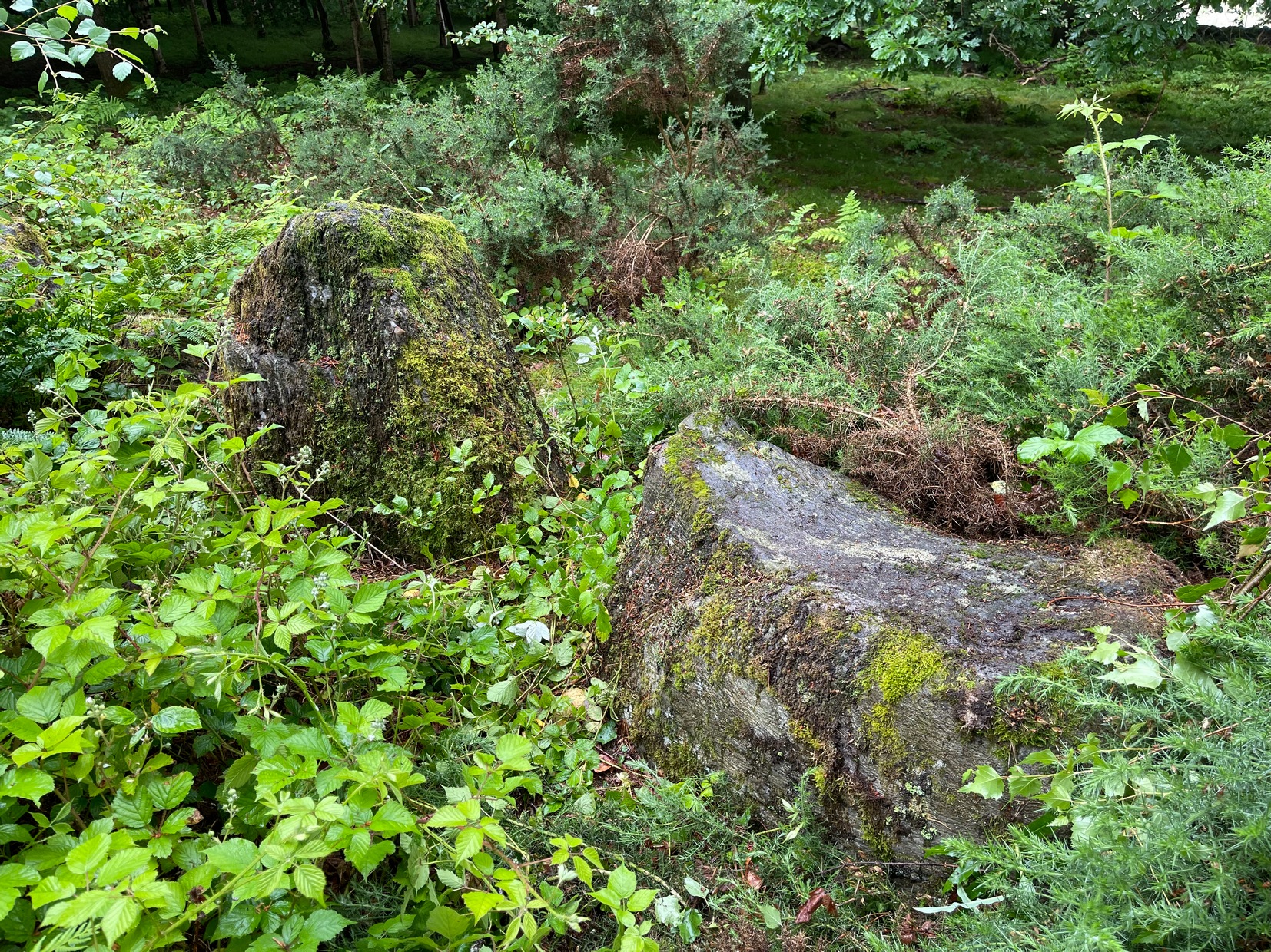
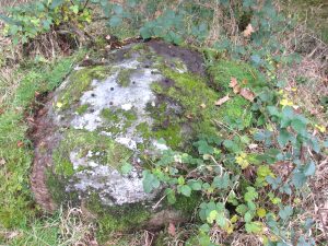
Take the directions to reach the Ninewells ring cairn on the hills east of Dunkeld. Once here, if you can work your way through the dense mass of prickly vegetation in and around the circle, on its western side you’ll find three elongated monoliths (if you stood them upright they’d be taller than all the rest) laid next to each other. On the smallest of these three, next to an upright, almost pyramidal stone, you’ll find what you’re looking for. Persevere! (someone needs to clean up this impressive site and keep it in good condition)
Archaeology & History
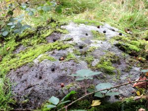
Cluster of 4 or 5 cups
This minor-looking petroglyph can be found on the upper surface of the westernmost stone in the cairn circle. It’s nowt much to look at and will only be of interest to the hardcore rock art freaks among you. Carved onto the flattened edge of the stone are at least four shallow cup markings, close to each other. When we visited here, the light wasn’t good, but it seemed that a fifth cupmark was sat amidst the small cluster. You can make them all out (just!) in the photo. Another visit on a better day would tell us one way or the other…
References:
Royal Commission on the Ancient & Historical Monuments of Scotland, South-East Perth: An Archaeological Landscape, HMSO: Edinburgh 1994.
Acknowledgements:Huge thanks for use of the Ordnance Survey map in this site profile, reproduced with the kind permission of the National Library of Scotland.
Park up at Murthly village, follow the farm road west, opposite the Kinclaven junction up to the cross roads, and turn right and go past Douglasfield Farm, following the road as it bends to the left; then through the metal gates and walk on until you come to an earth bridge over the ditch to your left. Cross the bridge and the low-lying Witches Stone is about 30 yards on to your left by the drainage ditch.
Archaeology & History
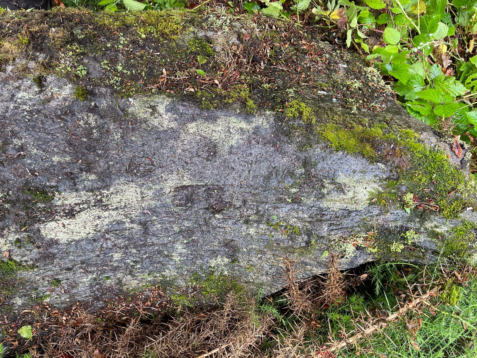
Not recorded on the Canmore online database, the Witches Stone is a low-lying, domed, earthfast rock bearing at least 12 cup marks. One cup mark has been drilled at some time in the past. Did the land owner do this as a preliminary to blowing it up with gunpowder? There is an interesting story relating to the origin of the cup marks, and it seems the name of the rock and its folklore may point to its ritual significance having passed down through oral tradition from the Bronze Age to historical times.
Folklore
The mid-nineteenth century Ordnance Survey Name Book has the following record, attested by Sir W.D. Stewart, Mr. T. Cameron & Mr. J. Cameron:-
Close-up of cupsBlackberries in cupmarks
“A small rock nearly level with the ordinary ground surface, underneath which it is traditionally held that a large sum of money is buried. In order to test the truth of this tradition, it is said that some years ago a man commenced to excavate the soil around the rock in order, if possible, to secure the hidden treasure, while so employed, a small dog suddenly appeared on the top of the rock and desired the man to desist, assuring him at the same time that the reputed treasure was really there, but it was never intended that the eye of mortal should behold it. There are some marks on the rock which the superstitious tell you are the prints of this very sagacious dog’s paws.”
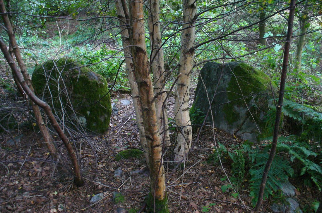
From Dunkeld, head out for a mile or so on the long and winding A923 road, taking your first road right along the Craigie and Caputh road, south of the Loch of Lowes. Go along here for about 2 miles, watching out for the little road to Black Hill on your left, where you can park up (if you hit a road junction, you’ve gone too far). Across the road, note the copse of trees. Go in there along the walling for about 50-70 yards, past the curious gathering of rounded stones, then walk into the trees where the giant fir trees stand. You’re damn close!
Archaeology & History
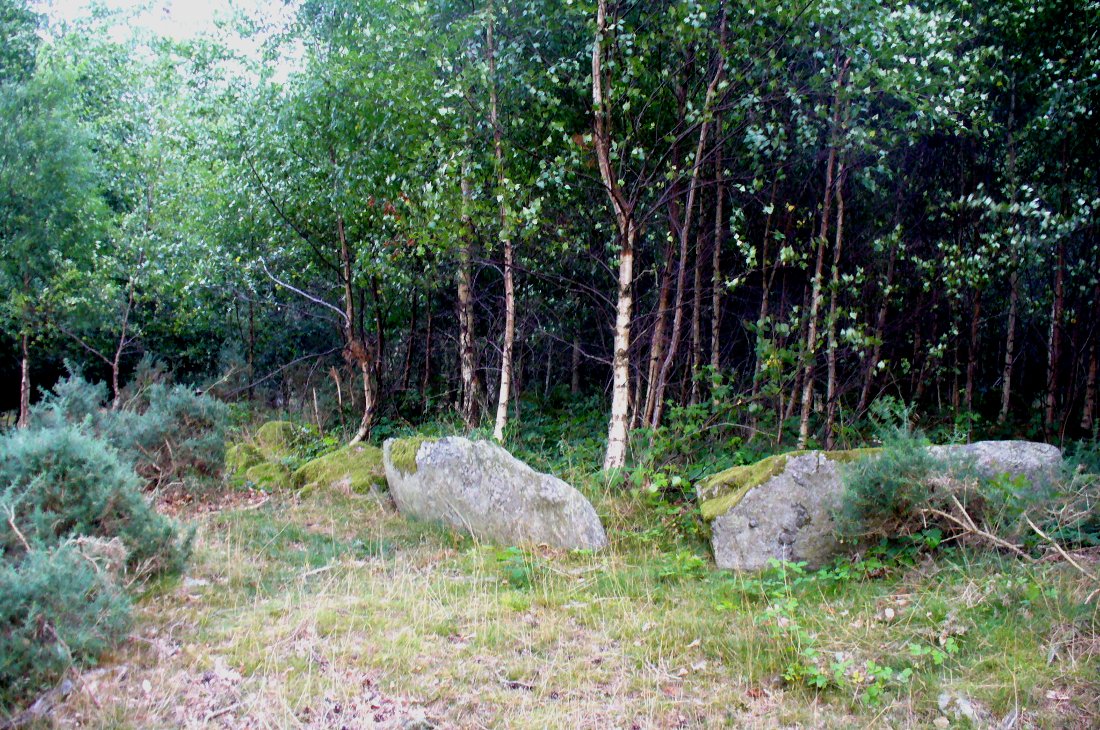
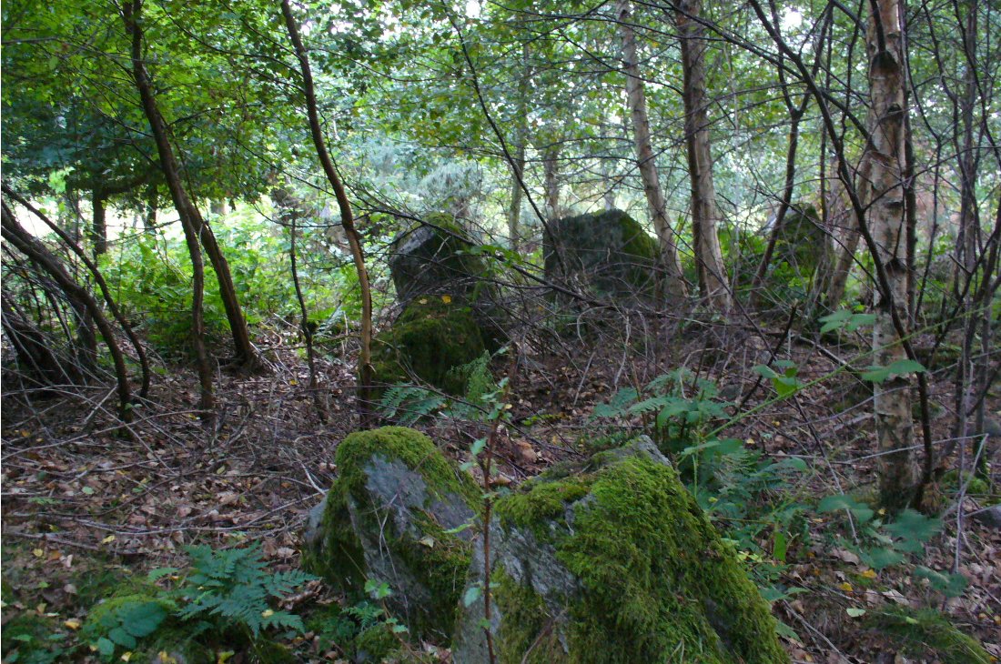
This is an excellent site, hiding away in a scattered copse of woodland, with young trees inside and very old ones in close proximity to its outer edge. We visited the place for the first time in the middle of summer, not knowing anything about it, and found Nature had covered much of the place in Her usual clothes of fern, bramble, gorse and other vegetation. Yet despite this, the site was superb! In a very good state of preservation this ring of small stones is more than 30 feet across, though the stones making up the ring are only small. Within the ring itself you’ll find many young birch trees growing over a mass of small rounded rocks, typical of cairn material such as found at other prehistoric sites of this nature up and down our northern counties, from the overgrown Roms Law, to Temple Wood and many others. No evidence of internal burial or cist of any form was noted on our visit, nor mentioned in the Canmore survey.
Section of the Ninewells ringPlan of the Ninewells ring (after RCAHMS)
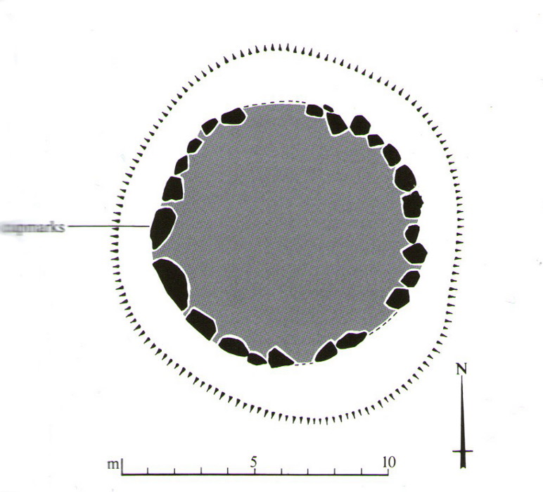
Although rightly classed as a cairn circle or ring-cairn, I’ve seen sites like this labelled as ‘stone circles’ in the past — and it’s easy to see why once you’re inside this! If the internal scatter of cairn-material had been cleared in earlier centuries—as with many others—this site would be classed as a typical stone circle. Curiously it hasn’t fared too well in archaeological surveys, but thankfully the Scottish Royal Commission (1994) lads included the site in theirs, telling us,
“This cairn measures 10m in diameter and 0.75m in height and has a near-complete kerb of large contiguous boulders and slabs set on edge. The kerb is graded so that the largest, though not the tallest stones are situated in the southwestern quadrant, and one of the stones on the west bears four cupmarks. Today the cairn material is roughly level with the top of the kerbstones, but there is no evidence to suggest that it has been heavily robbed and it was probably never much higher. Concentric with the kerb there is an external platform about 0.2m high. This type of feature is more usually associated with Clava ring-cairns and passage graves around Inverness, which are believed to be of late Neolithic date; but, despite the disturbance of the centre of the Ninewells cairn, there is no evidence of stones defining an internal court.”
Two of the largest stones
Some broken quartz stones were also found inside this ring. The cup-marked stone on the west side of the circle has an entry of its own. Whether or not the ‘opening’ or lack of stones in the north of the ring was intentional can only be known with certainty if an excavation happens here; suffice to say that North is the airt or direction most commonly representative of the Land of the Dead in many early northern cultures, which may explain this. A truly fascinating site…
The name ‘Ninewells’ derives from a cluster of healing springs of water that once flowed nearby. Several legendary waters with this name can be found in this part of southern Perthshire.
References:
Royal Commission on the Ancient & Historical Monuments of Scotland, South-East Perth: An Archaeological Landscape, HMSO: Edinburgh 1994.