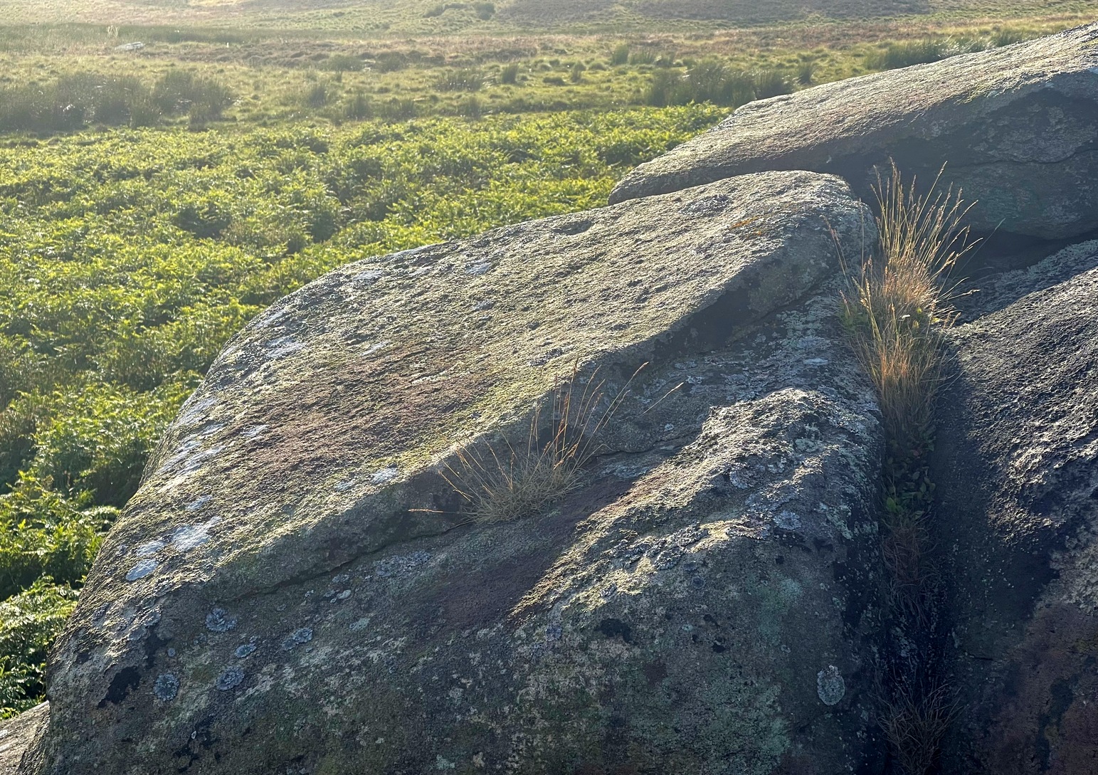
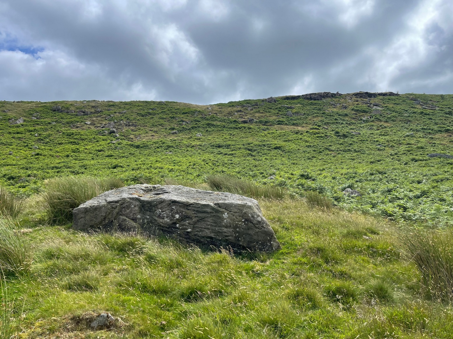
From the Cow & Calf car-park, walk towards and past the gigantic Calf rock, swerving round the fallen mass of rocks and into the trees at the back. Walk uphill to the Hanging Stones cup and ring stones, then keep heading—down the slope then back up the next one—west, for barely 100 yards until you’re on the level ground again, following the footpath alongside the heather. Barely 50 yards along, keep your eyes peeled in the heather for a low flat rock just a few yards in. Forage around and you’ll find it.
Archaeology & History
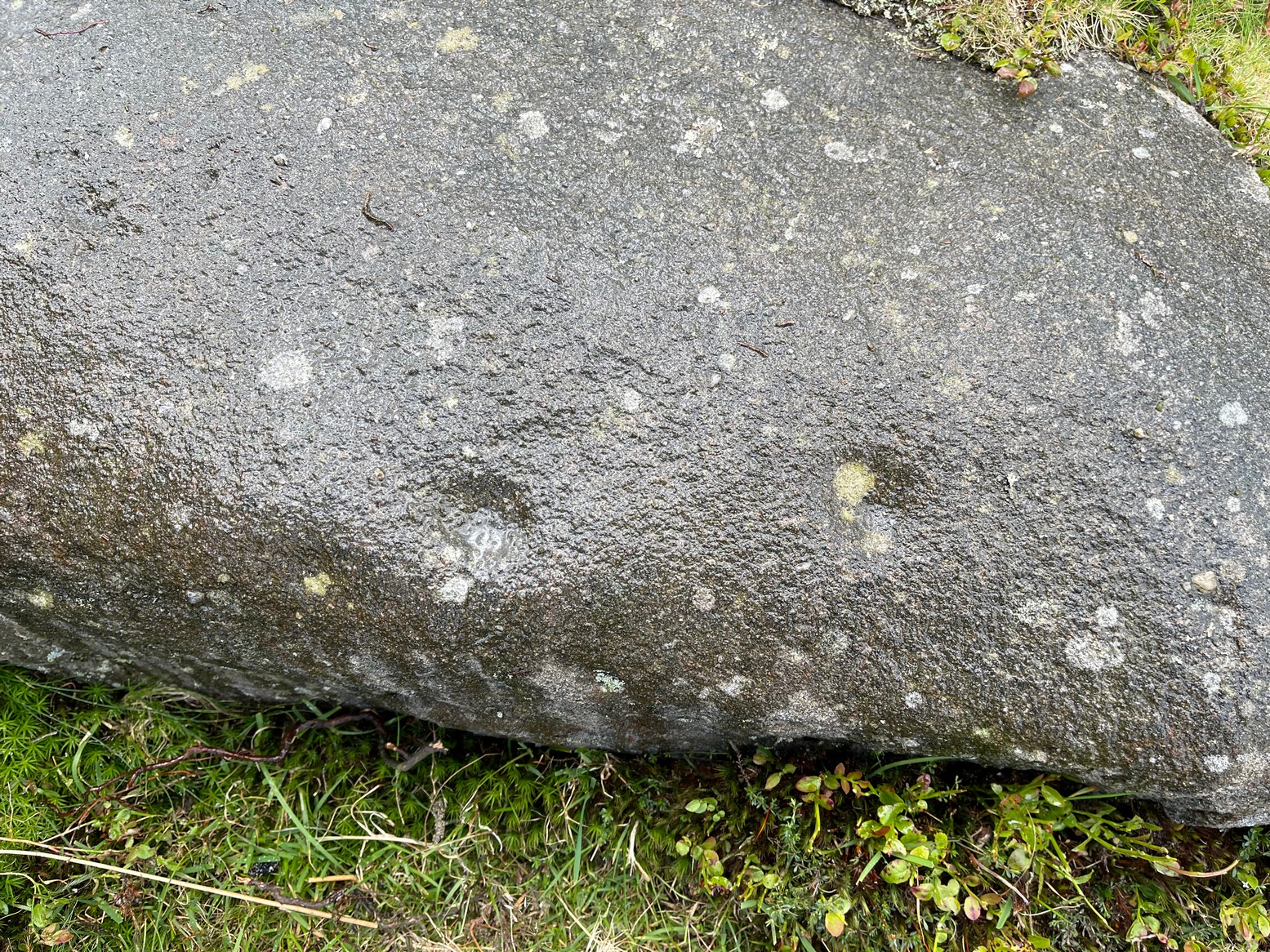
You’ll no doubt be seeing this carving after you’ve visited the impressive Hanging Stones petroglyphs 150 yards to the east. And you’ll probably be disappointed in its lack of visual grandeur when compared to its more ornate eastern neighbour. But the petroglyph fans among you should give it your attention.
Hedges 1986 sketchLooking to the SE
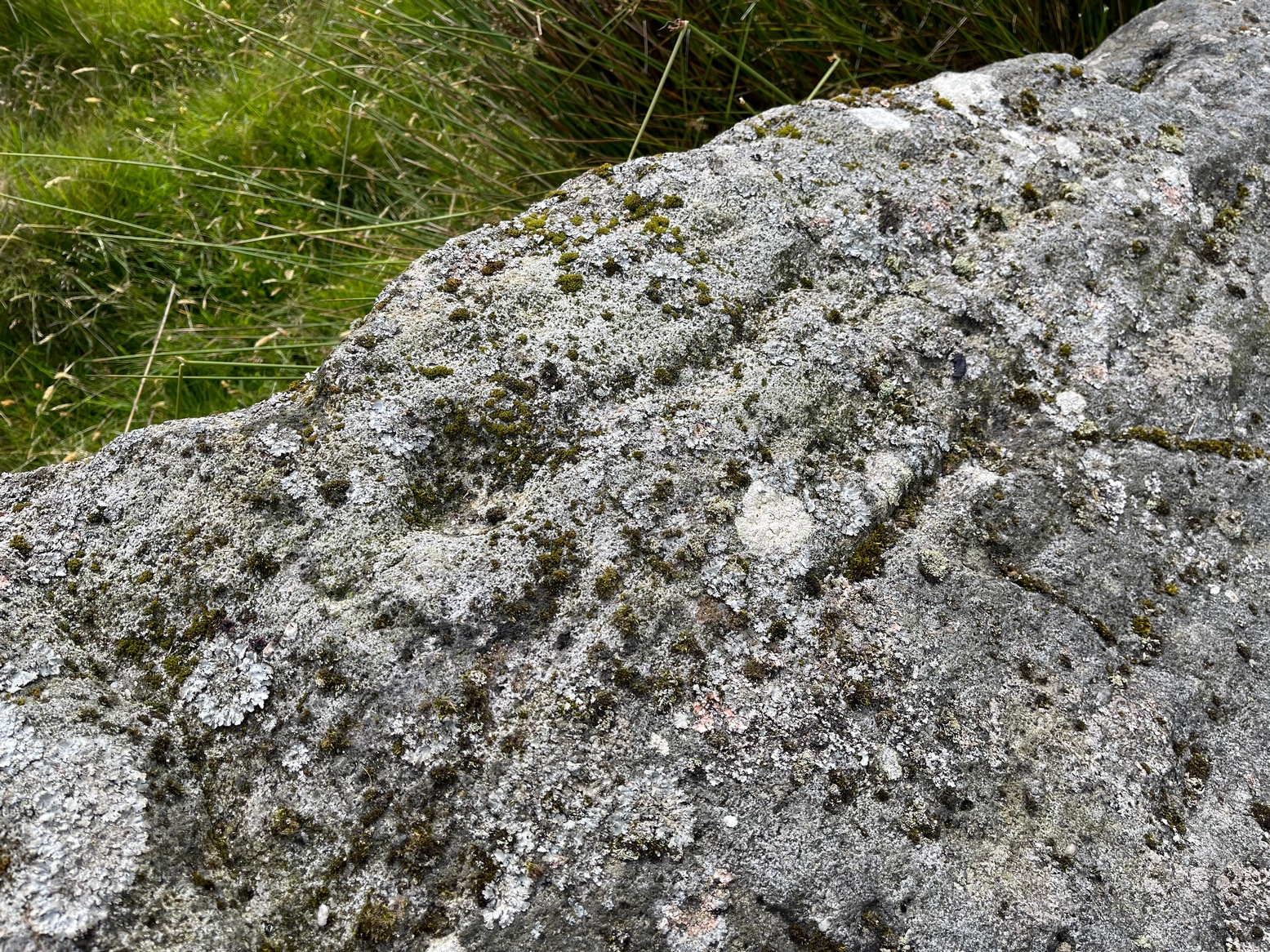
When the dawn or evening daylight cuts across the rock, the design looks much better than at sun high, perhaps telling us that the message of the stone coincided with those periods of the day. The gentle folds of the stone itself morph into the carving: evening and morning light cutting subtle shadowy folds across the rock, giving it an organic texture that our aboriginal ancestors told to be a vital essence of stone itself. The two small clusters of cup-marks upon this stone become greater than their basic design when brushed with the shadows and glows of a sunset. And when our aboriginal peoples painted them in ochre and other colours, an even greater mythos emerged—but sadly it is forgotten here….
When looked at with the simplistic eyes of the archaeo-mind, this and its compatriots are little more than a number of marks on lifeless rocks. This stone for example was described in John Hedges’ (1986) survey as being just “two groups of four and five cups and grooves”—nothing more—with naught but an echo in Boughey & Vickerman’s (2003) later work. The carving has neighbours even more basic in the heather close by…
References:
Boughey, Keith & Vickerman, E.A., Prehistoric Rock Art of the West Riding, WYAS: Wakefield 2003.
Hedges, John (ed.), The Carved Rocks on Rombalds Moor, WYMCC: Wakefield 1986.
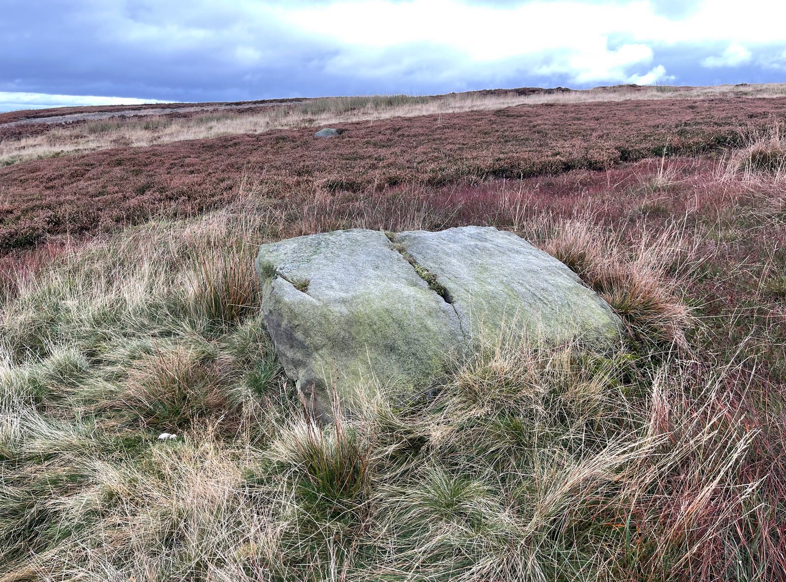
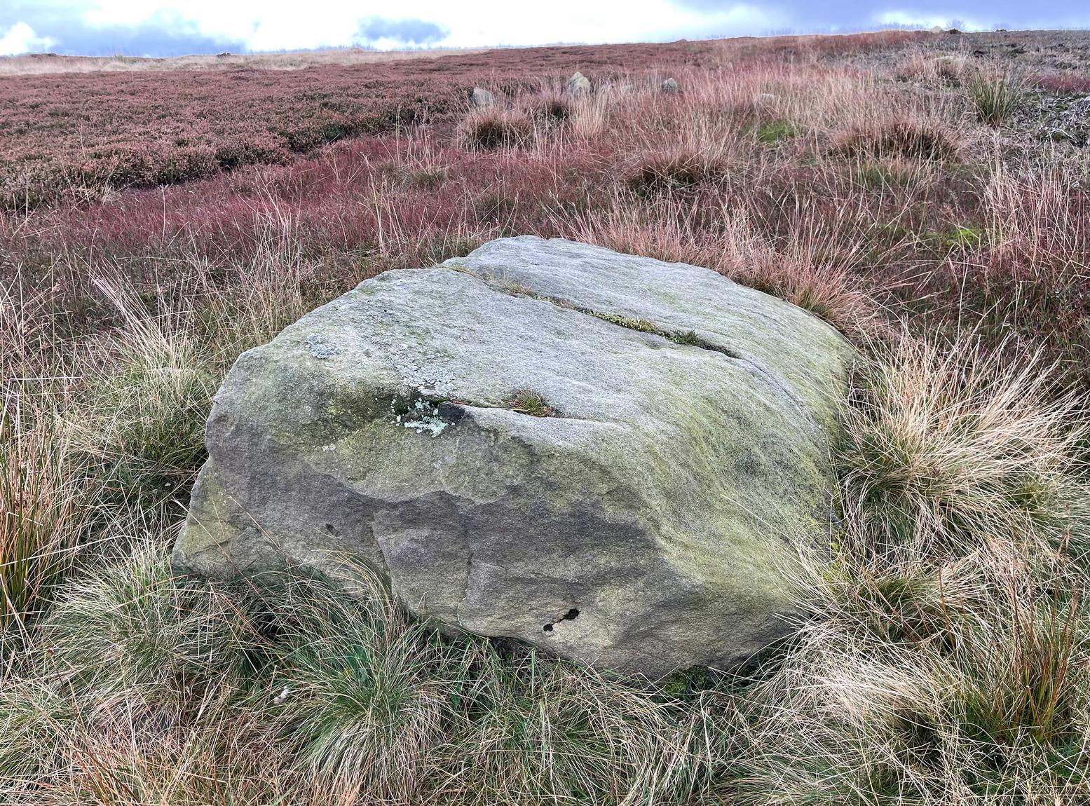
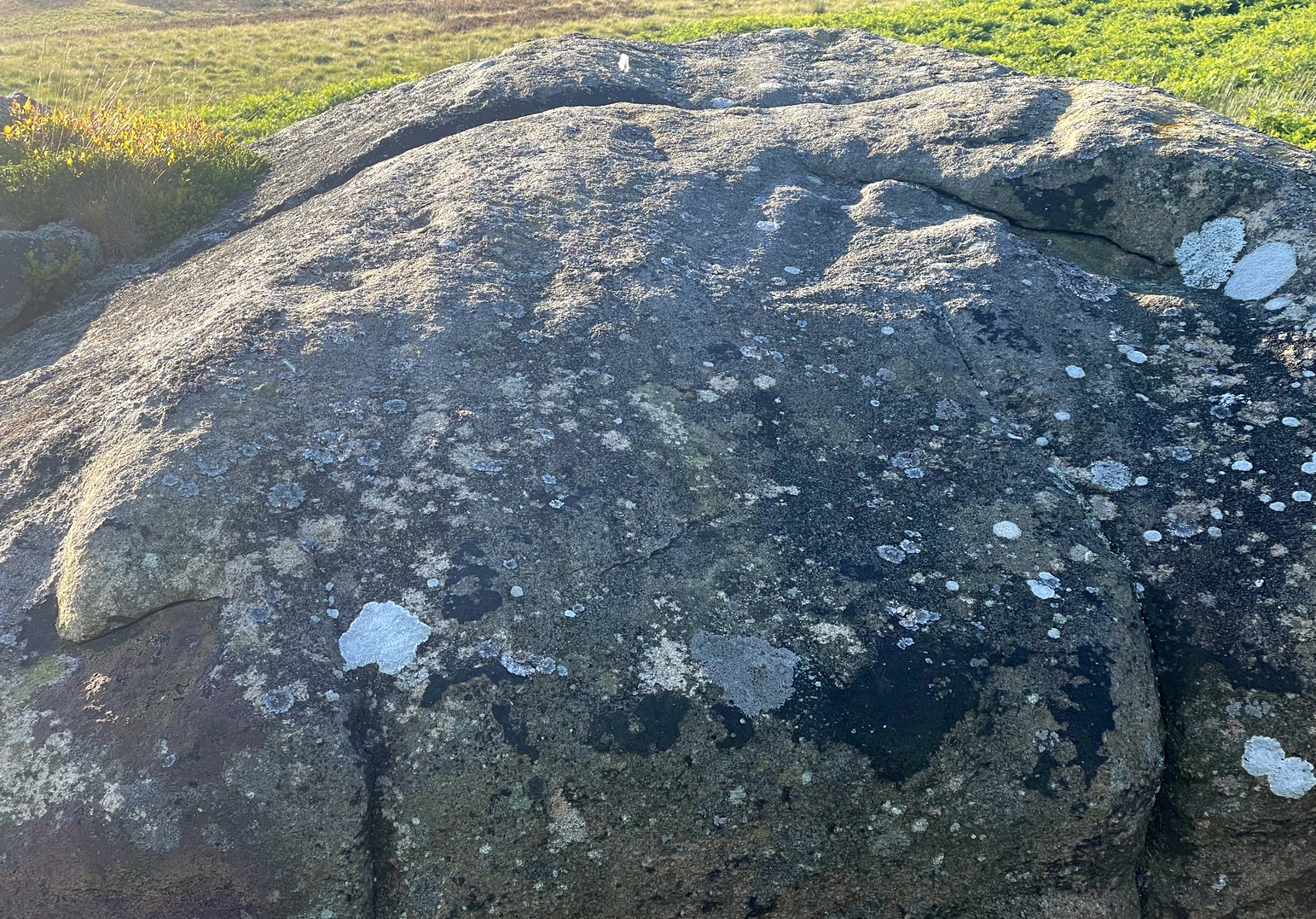
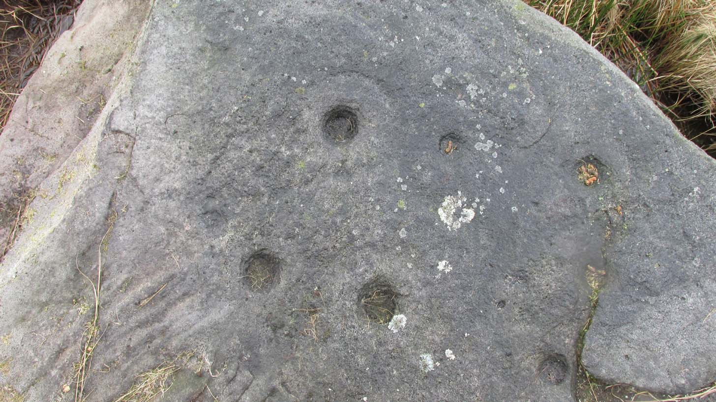
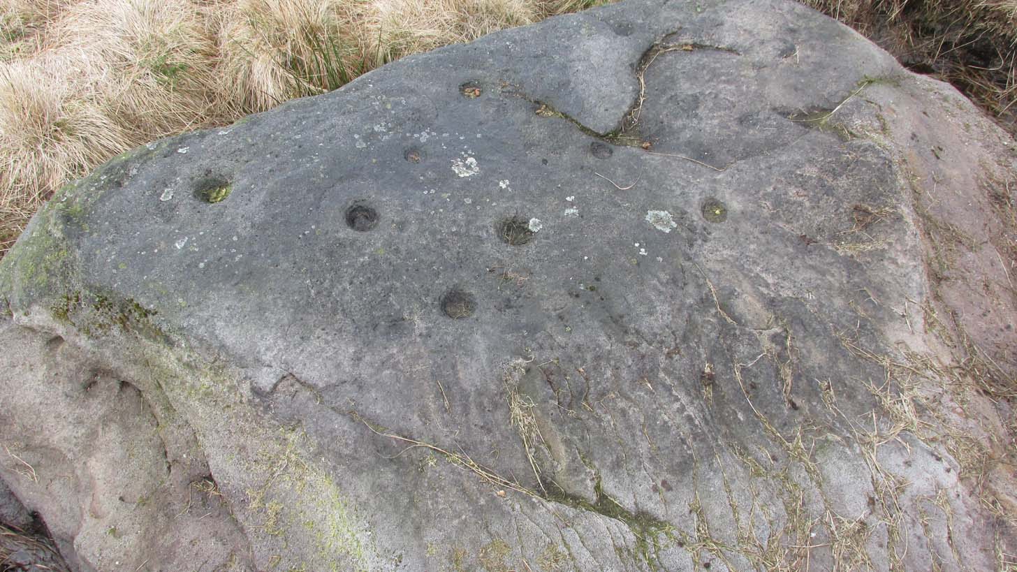
From Cow & Calf Rocks, walk up the steep footpath and turn left (southeast) when it levels out on the edge of the moor. Walk 250 yards along and, where the main path veers down to the road, just keep walking along in the same direction along the footpath that runs gradually uphill until, after 650 yards (595m) you’ll eventually meet up with the footpath that runs along the moorland proper. Where these two paths meet-up, then head upwards (south) into the heather for 55 yards (50m) until you see a good-size sloping block of stone with a crack roughly down the middle. If you hit the Little Haystack Rock (a big conspicuous stone) you’ve gon too far!
Archaeology & History
Shallow cupmarks visible
This is one of the many basic cup-marked stones you’ll find scattered all over these moors possessing (as it does) only two distinct cup-marks on its more northern half, although a possible faint third one needs looking at in better light. When we were kids exploring this and other areas, single and double cup-marked stones like this seemed ten-a-penny and we’d flippantly pass them by after quick perusal, looking for more impressive designs.
The carving here seems to have been missed in the surveys of Hedges (1986) and Boughey & Vickerman (2003), despite the rock standing out quite distinctly. I can only assume that they checked it out when the skies were grey and dull, making the cup-marks difficult to see. A number of other prehistoric remains can be found close to this carving, including cairns and sections of enclosure walling.
Folklore
Tradition tells that the indigenous Britons had a battle with the Romans on the plain where this carving is found.
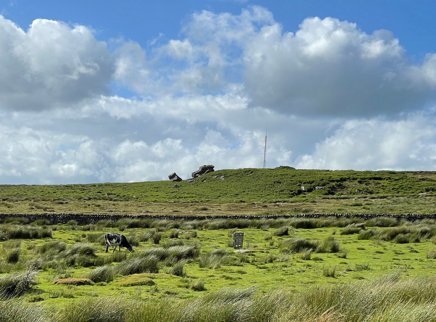
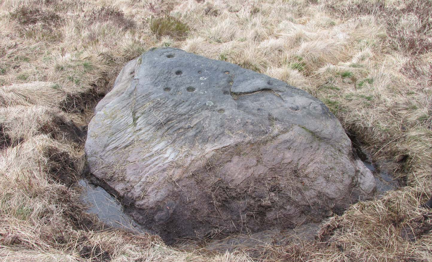
The easiest way to get reach here is via the Doubler Stones, which is usually approached either from the long and winding country lanes Silsden-side (you can’t drive all the way and there are hardly any parking spots en route), or from a long walk over the moors. Taking the latter route, probably the easiest is by starting at Whetstone Gate right on the moortop, on the Ilkley-Keighley road. From here, walk west along the footpath by the wallside for more than ½-mile until you reach the West Buckstones. From here, take the footpath NW (not SW) alongside the walling for literally one mile, where a notable angular skewing of three walls appears: keep to the left and walk alongside that wall for another ⅓-mile (0.5km) then climb over the wall and head straight for the small TV mast. The Giant’s Chair’s just below it.
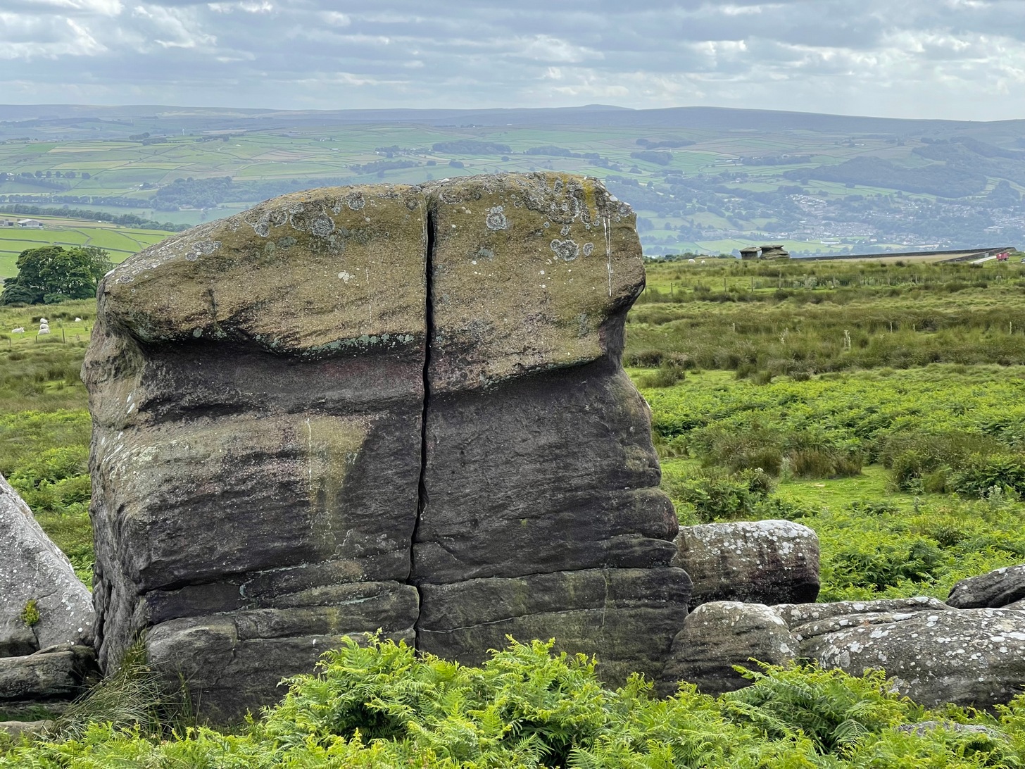
Some time in the mid- to late-1970s, on one of our early ventures to see the legendary Doubler Stones, this great rock outcrop of the Giant’s Chair also, understandably, drew our attention. And, as young fertile teenage lads, we all but flew up onto the top of this great rocky rise with relative ease. Now, nearly fifty years later, I’m unable to climb onto its top without ropes. (sigh….) It’s not easy. Anyhow, when we were on top of this rock as kids, a number of notable cup-markings stood out to us—in no distinct order, as I recall. But on the day of our clambering visit, She was grey and overcast; as She was on the two or three other visits we made to the stone, sitting on its top, fondling the cup-marks and eating our sarnies. All that I ever noticed were the cup-markings.
A few years after my early visits here, John Hedges (1986) wrote about this “very large high rock.” He mentioneed the cup-markings, obviously, but he also mentioned some things that we’d missed, saying that here are,
“Six large shallow worn cups, one with (a) partial ring and another with possible ring. One cup on SW end.”
Single cup-mark (?)One of the cup-and-rings (?), top-left
Sadly, I’ve never seen these rings and, these days, my ageing bones might not allow me back onto its surface to see them. (the expression, “sad bastard” comes to mind!) On a recent visit here with Sarah Walker of Silsden, neither of us could get our useless arses on top! (the photos taken here were done with me stood on top of an adjacent rock, hands held high, trying to get at least some elements of the carving—with a minor bit of success, I think) I take comfort in the fact that when Boughey & Vickerman (2003) subsequently added this carving in their enlarged inventory, that they never got to see them either, as they gave it the completely wrong grid-reference! And so, due to the ineptitude of us old folk, I await some younger and more competent explorers who can climb up on top and send us some good photos of the design, when weather and lighting conditions allow for good imagery. Are there any takers…?
References:
Boughey, Keith & Vickerman, E.A., Prehistoric Rock Art of the West Riding, WYAS: Wakefield 2003.
Deacon, Vivien, The Rock Art Landscapes of Rombalds Moor, West Yorkshire, ArchaeoPress: Oxford 2020.
Hedges, John (ed.), The Carved Rocks on Rombalds Moor, WYMCC: Wakefield 1986.
Acknowledgements: Big thanks to Sarah Walker for helping, albeit unsuccessfully, to scale this old rock to see the cup-and-rings on my last visit here. At least we tried…
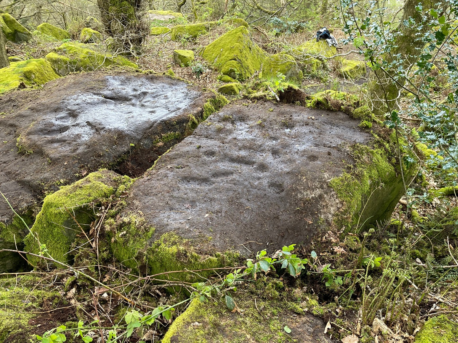
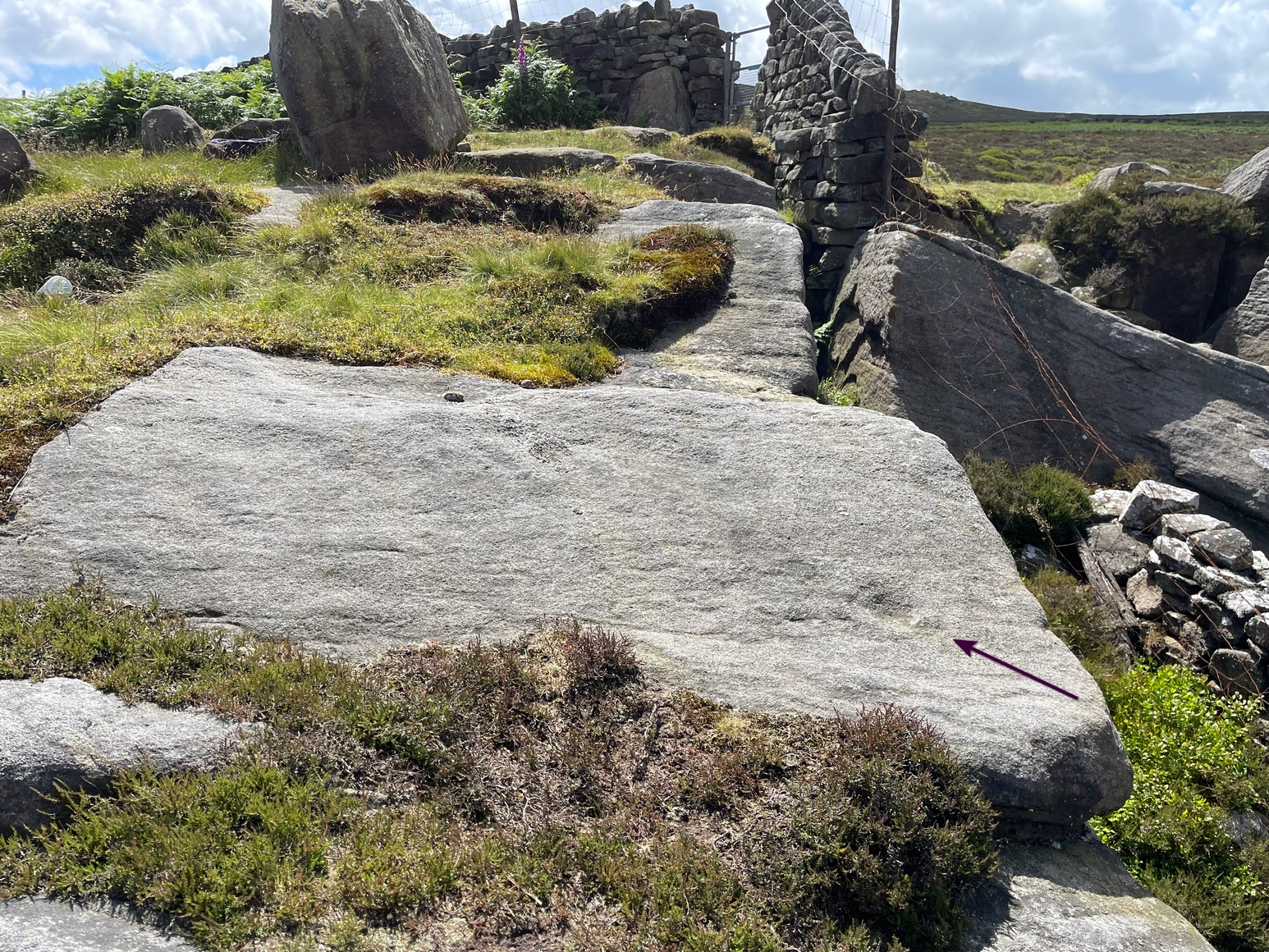
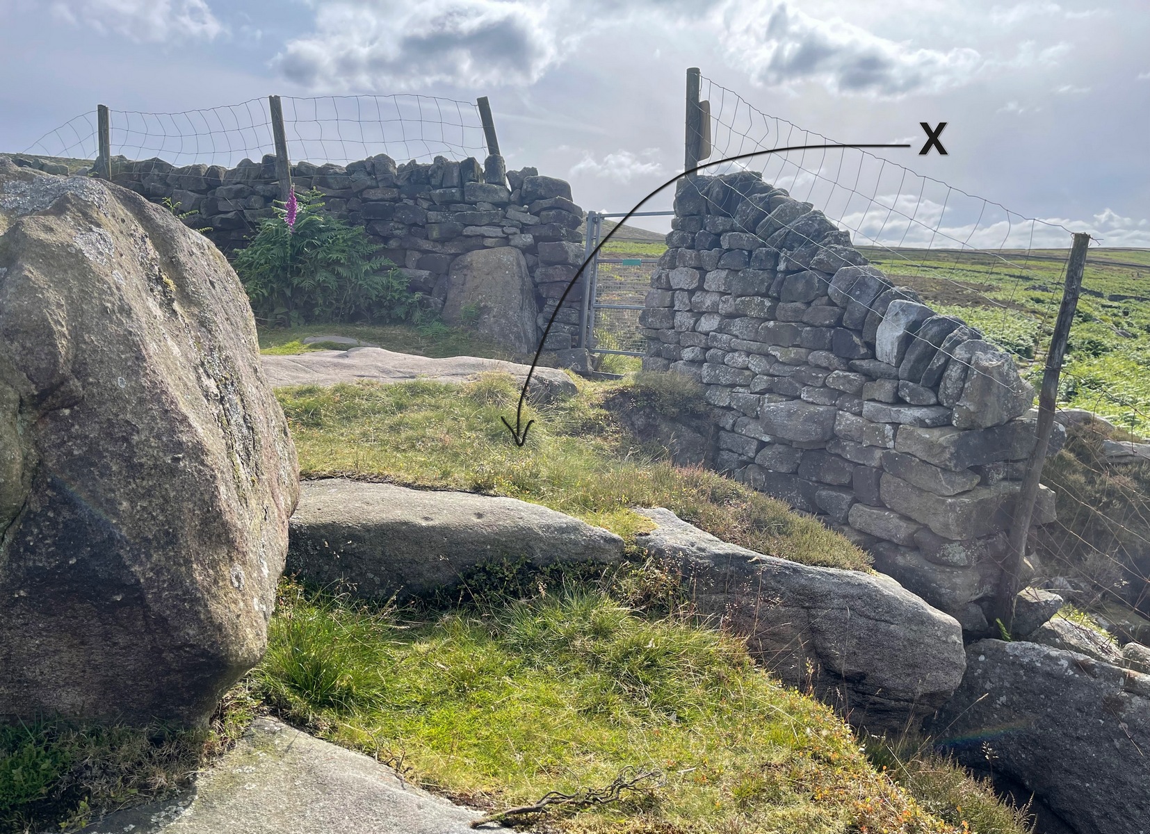
Take the Wells Road from Ilkley centre up towards White Wells, bending to the right as you hit the edge of the moor. Keep along the road, past the old college building with its lake and turn right up Westwood Drive. Keep going all the way up (it becomes Panorama Drive) till you hit the small woodland on your right. Where the woodland ends – stop! Walk into the trees about 10-15 yards and you’ll see the large rocks ahead of you. Brush back the vegetation and you’ll find it.
Archaeology & History
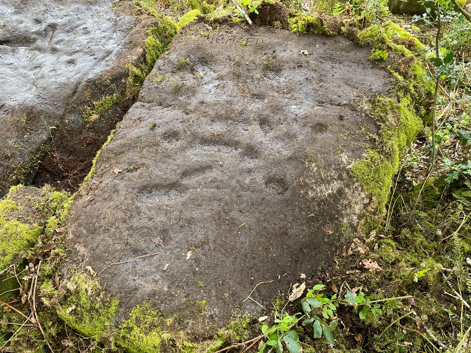
This large flat rock surface has a scattering of archetypal deep cup-markings, with other fainter marks scattered over most of its surface. It sits right next to carving no.232, with its own equally large, naturally worn basins.
Faint cup&ring just visible
It was visited in the 1870s (along with the other Panorama Stones) and subsequently illustrated in the personal sketch-pad of Mr Thorton Dale (we’re hoping to have them scanned in due course for open Creative Commons use) who showed the basic cup-marks and shaped “lines” or footsteps that give this petroglyph its name. Little more was said of it until Hedges (1986) described it in his survey, whose notes were subsequently repeated in Boughey & Vickerman’s (2003) work as being a “medium-sized flat-topped, upstanding rectangular rock. Eight cups, six deep ovals, faint circles and lines on SW end.” One of the most notable cup-and-rings can just be made out near the middle of the stone, on the left-side of one the footprints.
The depth of these incisions in this design strongly suggests that the carving was worked and reworked over many centuries, suggesting utilitarian usage of some kind, be it ceremonial or otherwise. It’s also very unusual inasmuch as elongated footstep-like cuttings are scarcities, not just in Yorkshire petroglyphs, but in prehistoric carvings across Britain. Check it out when you’re next walking up to the Swastika Stone.
References:
Bennett, Paul, The Panorama Stones, Ilkley, TNA: Yorkshire 2012.
Boughey, Keith & Vickerman, E.A., Prehistoric Rock Art of the West Riding, WYAS: Wakefield 2003.
Hedges, John (ed.), The Carved Rocks on Rombalds Moor, WYMCC: Wakefield 1986.
For those who like a walk: take the route to reach the Swastika Stone and keep walking west along the Millenium Way footpath, past the Piper’s Stone carving and over the next two walls. Then, stagger down the steep hill and head for the large upright near-cuboid block of stone and, once here, walk 30 yards to your east! Alternatively, from the Silsden-side, go along Brown Bank Lane up and past Brown Bank caravan park, and at the second crossroads turn right and travel for exactly 1¼ miles (2km) along Straight Lane (from hereon there’s nowhere to park!) which runs naturally into Moorside Lane, and notice the raised gate entrance into the field on your right. Walk to the top of this field, go through the next gate and, less than 100 yards uphill (south) you’ll find the stone in question.
Archaeology & History
Cup, incomplete ring & line
Rediscovered by Paul Bowers in 2011, this is another one of those petroglyphs that’s difficult to make out unless the light is falling just right across the surface of the stone. Two distinct cup-marks can be seen near the more southern-edge of the stone, one of which has a near-complete, albeit unfinished ring around it, and from this a seemingly carved line runs roughly parallel with the edge of the stone, down towards another equally distinct cup close to the southwestern edge of the rock. Most of the stone is nicely covered in a decent lichen cover, so the design’s a bit difficult to see when the light’s not right. But, if you’ve made it this far, the petroglyph 30 yards to the west will make up for any disappointment you may have!
References:
Boughey, Keith & Vickerman, E.A., Prehistoric Rock Art of the West Riding Supplement, 2018.
Get up to the Swastika Stone, then head west along the footpath towards the Piper Stone. Shortly before there, you’ll see the small cup-marked Piper’s Crag (3) carving, just by the walling. From this carving, just step a few yards down the slope and on the smooth sloping rock face is this faded carving. You’ll see it.
Archaeology & History
A larger than normal single cup-mark near the bottom slope of this rock has an incomplete ring around its east and southern edges, possibly with another broken element of it on its northern edge. It’s difficult to work out whether or not this is one of Nature’s curious markings and so needs looking at in different lights to work it out, one way or the other. It’s included in Boughey & Vickerman’s (2018) updated rock art survey, but there are a number quite natural cup-marks in that tome, so we need to exercise a little bit of caution here. However, it does seem to have a greater degree of authenticity than some of the other dubious single cup-marked stones in their book. Check it out on your way to the Piper’s Stone.
References:
Boughey, Keith & Vickerman, E.A., Prehistoric Rock Art of the West Riding Supplement, 2018.
Heading up from Ilkley, follow the directions to reach the Swastika Stone, then keep walking (west) along the footpath to the small clump of trees, and keep walking past them too and keep going along the same path as if you’re heading toward the Piper’s Stone. About 200 yards before reaching it, just where the gate and boundary stone is in the old walling, there’s a small line of crags to the right of your feet and there, at the edge of the path, is the stone in question. You’ll see it (unless it’s a cloudy gray day, in which case you might struggle).
Archaeology & History
The two cup-marks
This is one of a number of cup-marked stones that you’ll find scattering this part of the moor, almost all of which are Nature’s handiwork (a few of these natural carvings have somehow found their way into Keith Boughey’s [2018] updated West Riding rock art book). I’m not 110% certain that this doesn’t have Nature’s name on it either, but it’s got a greater degree of probability to it than some of the others. It’s a simple little thing, as y’ can see, consisting of just the two cup-marks, smaller than usual, living next to each other. If it’s the real deal, we can surmise that it may have been carved by a young person back-in-the-days. In the walling just above this stone you can see the medieval boundary stone, which might—just might—have a prehistoric pedigree to it….
References:
Boughey, Keith & Vickerman, E.A., Prehistoric Rock Art of the West Riding Supplement, 2018.
Cup-and-Ring Stone (lost): OS Grid Reference – SE 0965 4797
Archaeology & History
In Ronald Morris’ (1989) gazetteer of British petroglyphs, he included this curious entry but gave no real details regarding its appearance or history. Listed by the Royal Commission lads, it would seem to have been located immediately south of the dismantled railway where it used to cross the Addingham-Ilkley road, but no one seems to have seen it either before or since Morris’ description. Any help regarding its whereabouts would be appreciated.
References:
Boughey, Keith & Vickerman, E.A., Prehistoric Rock Art of the West Riding, WYAS: Wakefield 2003.
Morris, Ronald W.B., “The Prehistoric Rock Art of Great Britain: A Survey of All Sites Bearing Motifs more Complex than Simple Cup-marks,” in Proceedings of the Prehistoric Society, volume 55, 1989.
From Ilkley town centre take the road up to White Wells (ask any local if y’ can’t find it), but instead of heading up the track to the wells, keep on the road and, after just over 200 yards, turn left up the Keighley Road. Half-a-mile up there’s a dirt-track on your right which leads to Silver Well Farm. Walk along here for about 150 yards, keeping your eyes peeled for a large rock in the heather about 50 yards up onto the moor. You’ll find it.
Archaeology & History
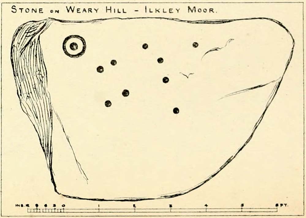
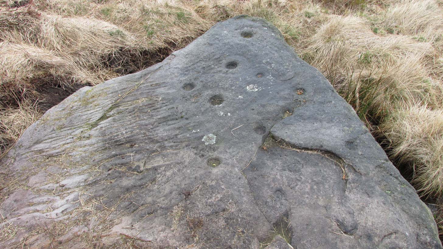
Located just 100 yards west of the old Roman road that effectively runs north-south through the middle of Rombalds Moor and which, when this carving was executed, was a prehistoric trackway, this is an impressive carving, all but unknown by many. On my last visit to this stone—maybe 10 years ago or more—it was a cloudy day. I know this from the fact that the design on the stone was difficult to see in its entirety. But not anymore! When the northern antiquarian Dave Whittaker came a-wandering this way a few years back, the stone so overgrown in vegetation that the design was very difficult to appreciate and, like any healthy curious antiquarian, he wanted to know what the full carving would look like. He enquired whether or not it was OK to uncover the stone from beneath its mass of heather to see the full image and, as far as we were concerned the idea was a good one. And so, following in the footsteps of Beckensall, Currie, Chappell, me and a few others, he got stuck in!
Cup-and-rings from above (photo by Dave Whittaker)Looking across the stone (photo by Dave Whittaker)
As you can see in Dave’s fine photos, the petroglyph is indeed a fine one. It comprises mainly of four cup-and-rings, two of which are incomplete The rings, as you can see, are very faint, whilst the cups, both in the rings and those outside of them, are notably deep; perhaps indicating that they were carved into many times over a long period.
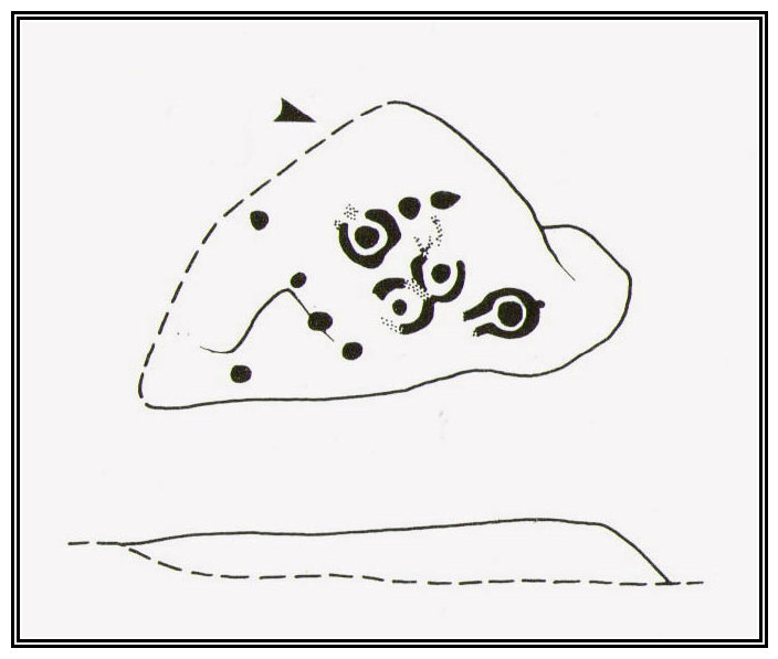
One of the great petroglyphic pioneers, J.Romilly Allen (1882) seems to have been the earliest to record this carving. Allen’s early sketch (below) was obviously drawn on a shady day, as it misses several of of the rings that are clear to see when the the daylight is just right. It’s an easy mistake to make. He wrote:
J.R. Allen’s 1882 sketchHedge’s 1986 sketch
“One mile south-west of Ilkley is a road leading over the top of the Moor…very appropriately as Weary Hill. To the west of the road, and between it and the boundary-wall of Silver Well Farm, is a small boulder of gritstone with cup-markings on it. It lies at a level of 900 ft. above the sea, and it measures 8ft by 5ft. On its upper surface, which is nearly level, are carved ten cups, varying in diameter from 2 to 3 ins., one of them being surrounded by a single ring.”
The pseudonymous “A. Reader” (1891) also included the stone in his international overview of prehistoric carvings, but merely copied the notes of his predecessors. Nearly a hundred years later when archaeologist John Hedges (1986) did his survey of these moors, he described this carving simply as:
“Medium seized rock…in grass, heather and crowberry with c.ten cups, four with rings, two with grooves from rings, three depressions and series of probably natural lines running down to bottom edge.”
And as with the pseudonymous A. Reader (1891), Boughey & Vickerman’s (2003) also just copied Hedges’ earlier description.
Seeking numeracy in Alan Davis 1988 sketchAnd from another angle (photo by Dave Whittaker)
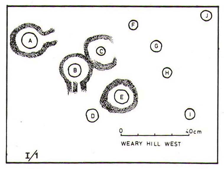
The greatest analysis of this carving to date is by physicist and mathematician Alan Davis. He set out in 1983 to explore the possibility of there being a universal measurement used in neolithic times that was coded into our cup-and-rings—a theory first espoused by the great archaeo-astronomer Alexander Thom. (1968) He selected carvings from Rombalds Moor and Northumberland, including this one at Weary Hill (calling it the I/1 carving) to see if a ‘megalithic inch’ (MI) that was propounded by Thom had any foundation in fact. As a mathematician he was ideally qualified to examine this proposition. His 1983 paper found there to be “substantial support” for this prehistoric megalithic inch. However, in a subsequent 30-page analysis of the same carvings Davis (1988) found that some criteria in his initial investigation needed re-examining. In his updated report he told that “many of these deficiencies have now been remedied.”
His initial 1983 report concluded the Weary Hill carving possessed a deliberate mathematical code in accordance with Thom’s MI. However in the subsequent 1988 report, Davis found that the measurements were based on 5MI and 3 MI, but only in the cup-and-rings and not the single cups. Despite this, there remained an overall scepticism in terms of any deliberate universal use of the MI. My own take on this is a simple one: there was no deliberate use of any MI at carvings. Where we do find precise MIs, this is due simply to the average size of human hands, meaning that some obvious figurative correspondences will occur upon investigation. The more you think about it, the more obvious it becomes.
Anyhow, all this intriguing geometry aside: to those of you who take the time to check this out, have a bimble in the heather barely 100 yards west and you’ll find a few other carvings sleeping quietly, whose site profiles I’ve yet to do…
References:
Allen, J. Romilly, “Notice of Sculptured Rocks near Ilkley,” in Journal of the British Archaeological Association, volume 38, 1882.
Anonymous, Walks Around Cup and Ring Stones, ITIC: Bradford n.d. (1995)
Boughey, K.J.S. & Vickerman, E.A., Prehistoric Rock Art of the West Riding, WYAS: Leeds 2003.
Collyer, Robert & Turner, J. Horsfall, Ilkley, Ancient and Modern, William Walker: Otley 1885.
Davis, Alan, ‘The Metrology of Cup and Ring Carvings near Ilkley in Yorkshire,’ in Science and Archaeology, 25, 1983.
Davies, Alan, ‘The Metrology of Cup and Ring Carvings,’ in Ruggles, C., Records in Stone, Cambridge 1988.
Hedges, John (ed.), The Carved Rocks of Rombald’s Moor, WYMCC: Wakefield 1986.
Reader, A., Archaic Rock Inscriptions, privately printed: London 1891.
Thom, Alexander, “The Metrology and Geometry of Cup and Ring Marks,” in Systematics, volume 6, 1968.
Turner, J. Horsfall, Historical Notices of Shipley, Saltaire, Idle, Windhill, Wrose, Baildon, Hawksworth, Eccleshill, Calverley, Rawdon and Horsforth, Shipley Express: Idle 1901.
Cist (destroyed): OS Grid Reference – SE 1192 4759
Archaeology & History
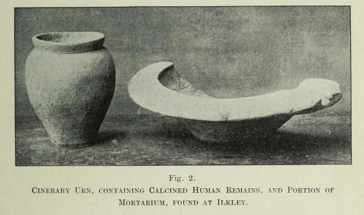
Urn found below Cowpasture Rd in 1874
In a lecture given by Frank Hall at the Ilkley Library in February, 1910, he described a number of prehistoric remains found in the area—including the remnants of a “cinerary urn, containing calcined human remains” and more, as illustrated in the old photo here. He contextualized the findings as being typical of the remains found “under a large heap of earth and stones which we now call a ‘barrow’, ‘cairn’ or ‘tumulus'” and believed that one must have existed here in bygone times. The urn, he told us,
“was found within a few yards of these premises, for it was dug up when the excavations were being carried out for the erection of Messrs Robinson and Sons’ buildings on the opposite side of Cowpasture Road, in March 1874.”
Although we list this site as a cist, we don’t know for sure; but due to the lack of descriptive and historical data about a mound of any form in this area, it is most likely to have been a cist burial and not a tumulus or barrow which Mr Hall inferred. Its location near the valley bottom is unusual when we consider the huge number of cairns on the moors above here; but a cist was found in a similar low-lying geographical position on the south side of the moors near Bingley, 5.8 miles due south, when construction of local sewage works were being done.
References:
Hall, Frank, The Contents of Ilkley Museum, William Walker: Otley 1910.