Flat Howe (1), Sleights Moor, Sleights, North Yorkshire

Tumulus:  OS Grid Reference – NZ 85483 04866

Also Known as:

  1. Flat Howe (north)

Getting Here

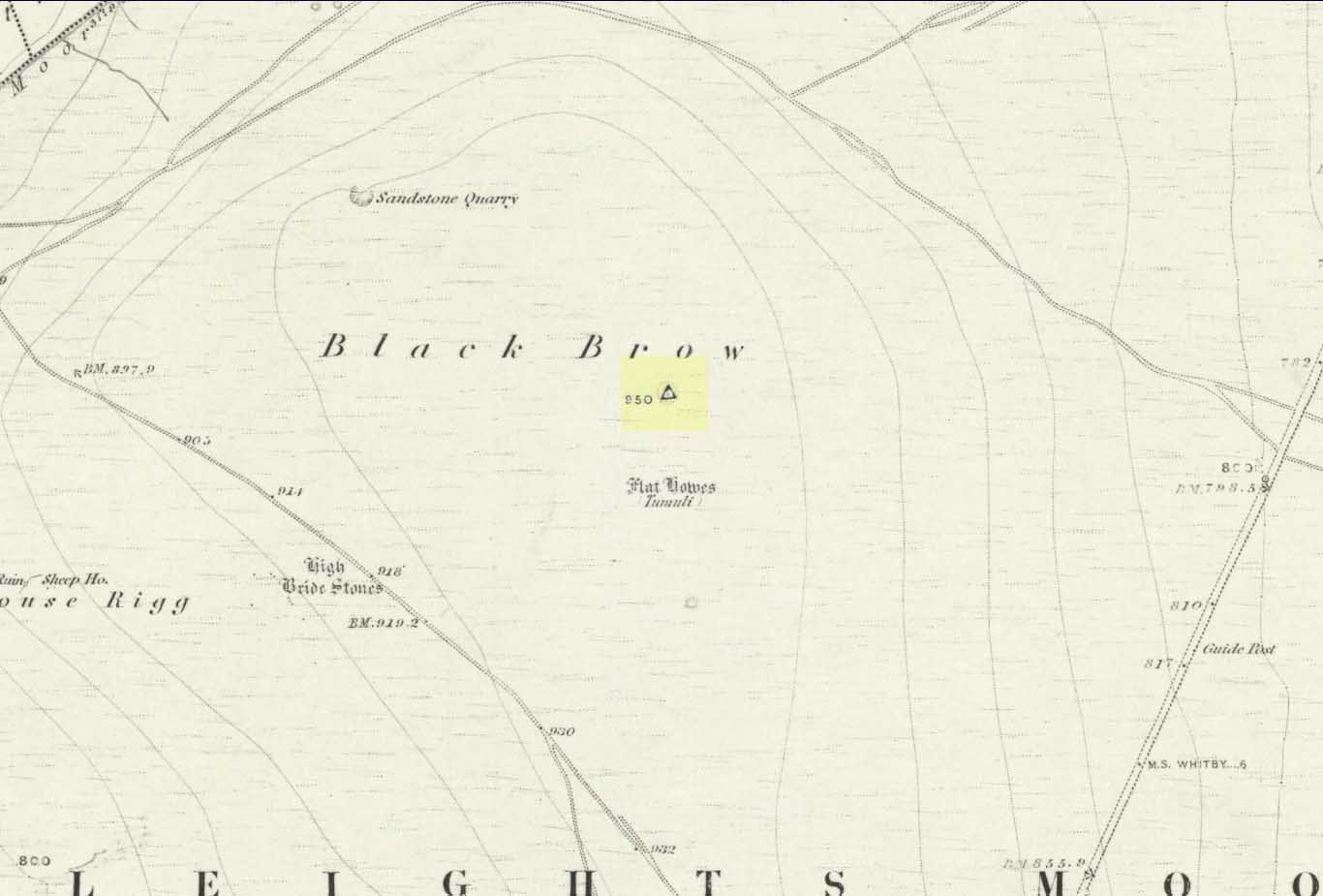
Flat Howe-1 on 1853 map

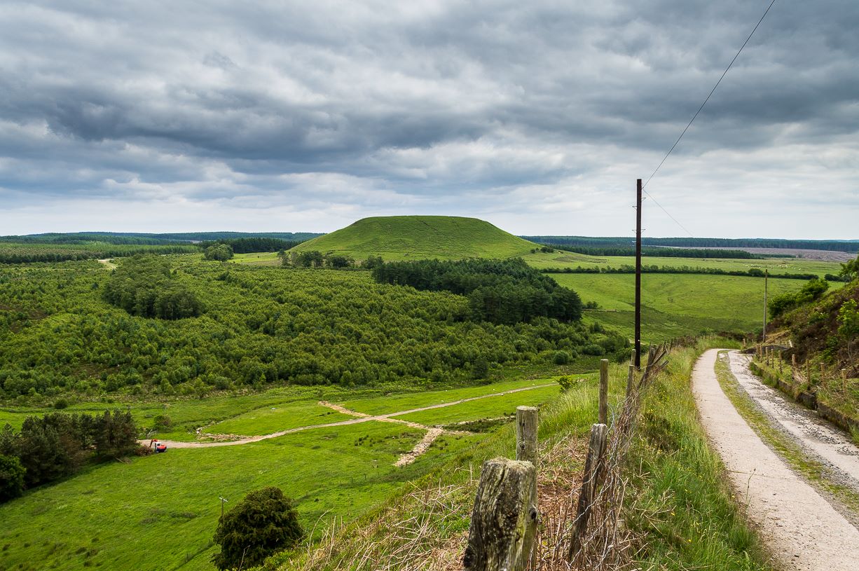
Along the A169 road that runs may miles from Whitby to Pickering, as you go through the small town of Sleights, the road gets steep for a mile or so, until you reach the moorland tops, where the road runs dead straight.  After 1.2 miles (1.93km) along the straight road, a small minor road is to your right.  Go along here for literally half-a-mile (0.8km) where you’ll see a small dirt-track on your right, with a locked gate.  There’s place to park here.  You’ll see the large rounded mound of Flat Howe-2 about 200 yards NE.  Head there, then another 250 yards north.  You’ve arrived!

Archaeology & History

Of the two ‘Flat Howe’ burial mounds on Sleights Moor, this is the northern one of the two, being 250 yards (230m) away from its southern companion (at NZ 85510 04614).  It’s quite a big fella too – and so you’d expect there to be quite a bit of information about it.  But there isn’t!  No recorded excavation has taken place here, despite the top of the monument being cut into.  But this might have occurred when the Ordnance Survey lads built one of their triangulation pillars into the side of it.  Thankfully it’s not done too much damage.

I was quite surprised to find that even Frank Elgee (1912; 1930) had little to say about either of the two Flat Howes, simply mentioning them in passing in relation to the numerous other prehistoric tombs on these moors.  Despite this, the archaeologist L.V. Grinsell (1936) thought this site to be one of “the finest peristalith barrows I have ever seen.”  And this one in particular is still very impressive.
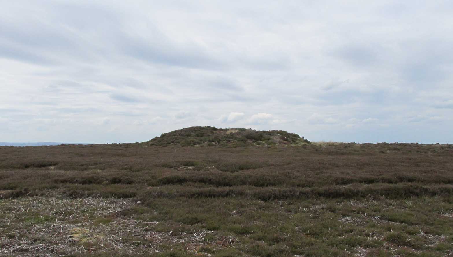
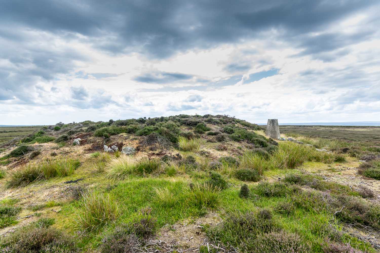
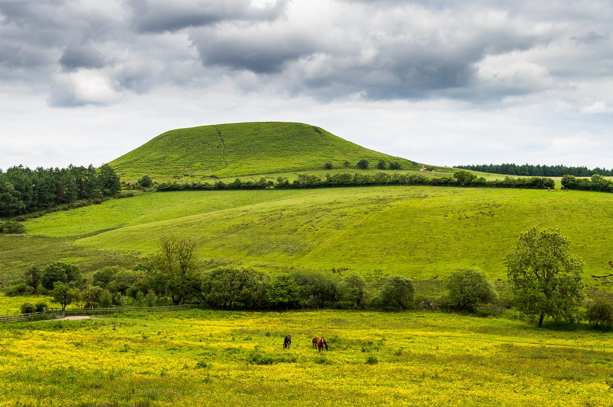
Flat Howe from the south
Flat Howe (by James Elkington)

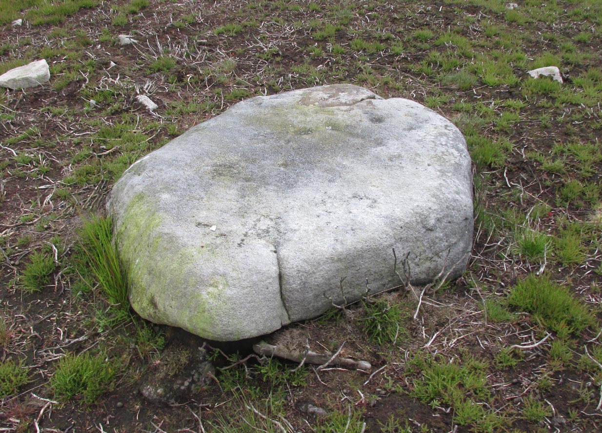
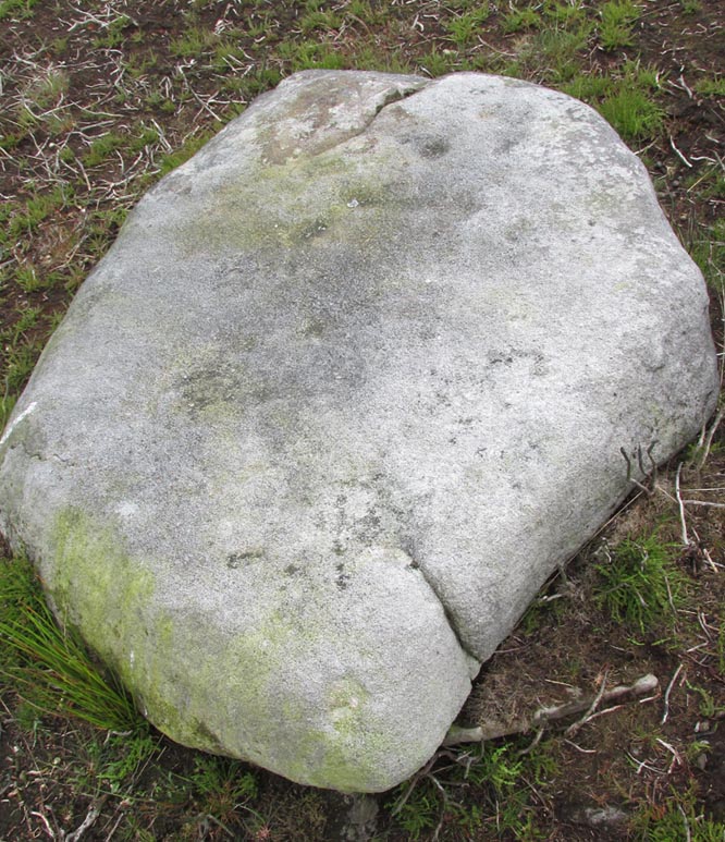
First shown on the 1853 OS-map, this large heather-covered mound of earth and stone is some six feet high and measures roughly 22 yards (20m) east-west by 19 yards (17.5m) north-south.  The tomb was originally constructed within a circle of reasonably large boulders, some of which were upright.  These can still be seen, mainly along the western and southern sides of the monument, although many have been dislodged over time and fallen at various angles, as you can see in the photo.  Whether or not these stones were erected first and then the mound built inside the ring, we do not know.  It’s the highest point in the landscape on Sleights Moor, with damn good views in all directions: an element that is common to many large prehistoric tombs, for obvious reasons.  Other tombs of similar size and probably similar periods in prehistory can be seen close by and on the skyline.  Whether this was a deliberate visual ingredient by our tribal ancestors is difficult to say, as the moors here were covered in scattered woodlands in prehistoric times.  Only detailed archaeo-botanical surveys would be able to tell us one way or the other.

Folklore
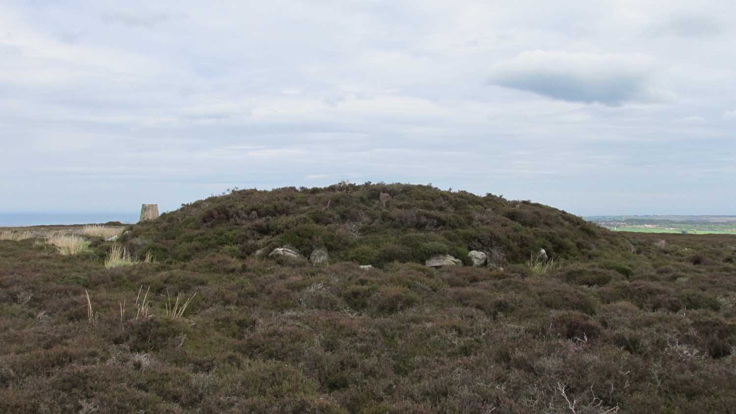
Flat Howe, with large stones defining its edge

Although we have nothing specific relating to this tomb, an olde creation myth told us that the local giants, Wade and his wife Bel, left their young son (whose name seems to have been forgotten) somewhere on Sleights Moor (which aint a big place).  It is worth narrating simply because it may have related to this tomb or its companion close by.  Giant legends have long been associated with the creation of many prehistoric tombs in this country and abroad.  The story was first written down by George Young (1817) in his magnum opus on Whitby and the tale was subsequently re-told by many others – Mrs Gutch (1901) for one:

“Young Wade, even when an infant, could throw a rock several tons weight to a vast distance; for one day when his mother was milking her cow near Swarthoue, the child, whom she had left on Sleights moor, became impatient for the breast, and seizing a stone of vast size, heaved it across the valley in wrath, and hit his mother with such violence, that though she was not materially hurt, her body made an impression on the stone which remained indelible, till the stone itself was broken up, a few years ago, to mend the highways!”

This rock was Bel’s Rock, whose exact location seems to have been lost.

References:

  1. Elgee, Frank, Early Man in Northeast Yorkshire, Frank Bellows: Gloucester 1930.
  2. Elgee, Frank, The Moorlands of North-Eastern Yorkshire, A. Brown: London 1912.
  3. Grinsell, Leslie V., The Ancient Burial Mounds of England, Methuen: London 1936.
  4. Gutch, Mrs, County Folk Lore – volume 2: Examples of Printed Folk-lore Concerning the North Riding of Yorkshire, York and the Ainsty, David Nutt: London 1901.
  5. Jeffrey, P. Shaw, Whitby Lore and Legend, Home: Whitby 1923.
  6. Roberts, Anthony, Sowers of Thunder, Rider: London 1978.
  7. Smith, A.H., The Place-Names of the North Riding of Yorkshire, Cambridge University Press 1928.
  8. Young, George, A History of Whitby and Streoneshalh Abbey – volume 2, Clarke & Medd: Whitby 1817.

AcknowledgementsA huge thanks to Lindsay Mitchell for getting us up to see this great tomb and its companion; and to James Elkington for use of the photograph.

LinksThe Megalithic Portal on Flat Howe

© Paul BennettThe Northern Antiquarian


Nor Hill, Skipton Moor, North Yorkshire

Cup-Marked Stone:  OS Grid Reference – SE 02181 51125

Getting Here

Along the A65 near Draughton, go (south) uphill at Height Lane until it levels out.  ¾-mile (1.2km) up, a modernized stone milepost is where the road crosses the ancient Roman Road. From here, walk west for just over a mile (1.8km), past the trees on your right, until you approach another small copse further along on your right.  In the field just before the copse, walk uphill until you reach the highest of the two rises and walk about. You’re damn close!

Archaeology & History

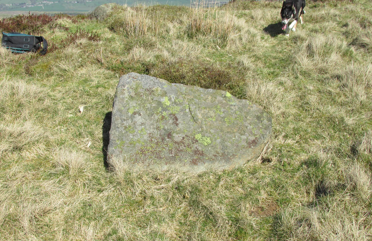
Nor Hill cupmarked stone
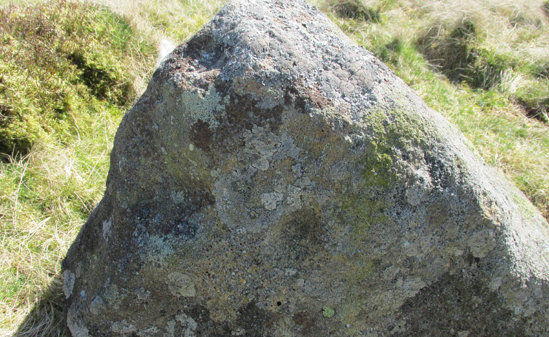
Cupmarks, top & side

This small cup-marked rock was rediscovered by Chris Swales in April 2018.  It’s probably only for the purist petroglyph fanatics amongst you, consisting of just a single cup-mark on its vertical west-face, and another near its top western edge.  Official records show no other carvings in the immediate vicinity, but local antiquarians may find it profitable in surveying the area for other potential remains.

© Paul BennettThe Northern Antiquarian


Rough Haw Carvings, Flasby, North Yorkshire

Cup-Marked Stone: OS Grid Reference – SD 96396 55834

Rough Haw cupmarks

Getting Here

The quickest way to get here is to follow the directions to the Sharp Haw Trig Stone. From the Trig Stone keep heading down the footpath until you see the gate at the bottom. Go through the gate and Rough Haw is straight in front of you.  Head towards Rough Haw and you will see a track going straight up the middle. Go right up that track and over the top till your on the summit, keep walking forward about 50-60 yards and you will see it.

Archaeology & History

Second lot of cups

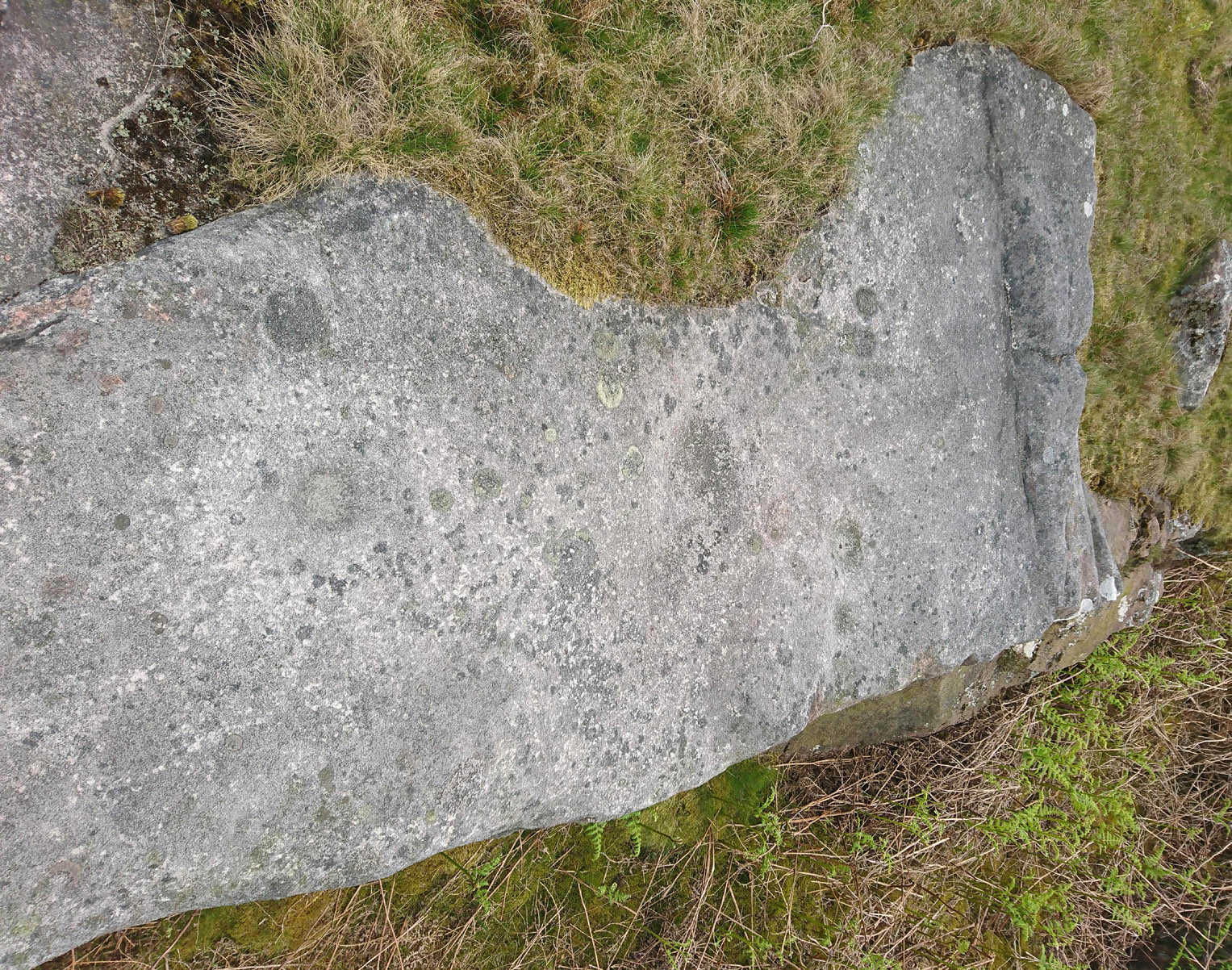
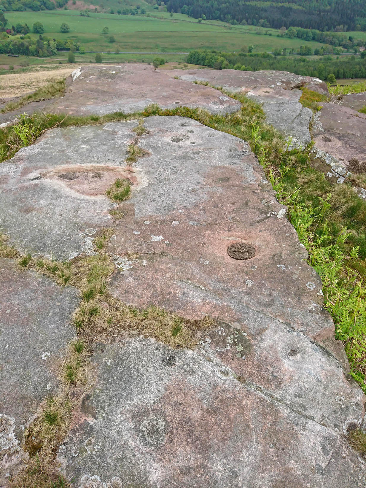
Some petroglyphs have been found near the top of the prehistoric Iron Age settlement called Rough Haw, a few miles north of Skipton. Not previously recorded, this long flat stone and its companion are littered in cup markings (perhaps a couple of dozen).  There could be more cups and other markings than we saw today, but by the time we reached here the sun had disappeared, so poor daylight made it difficult to see if there were any more.  Another venture up onto this hillfort might be worthwhile to see if anymore can be found.

© Chris Swales, The Northern Antiquarian

Blakey Topping, Allerston, North Yorkshire

Stone Circle:  OS Grid Reference – SE 8719 9338

Getting Here

Old stones of Blakey Topping (James Elkington)

From Pickering, take the A169 towards Whitby. When you get to the Car Park at the ‘Hole-of-Horcum’ – (you can’t miss it), park the car and walk North along the side of the road towards Whitby. After 60 yds, take the track East. Follow this for approximately a mile until the track splits. Take the concrete track left towards the farm-house of ‘Newgate Foot’. Go through the yard past the house on the right, and you will come to a stream and a gate. Enter the field on the right and up the track. The stones are in front of you.

Archaeology & History

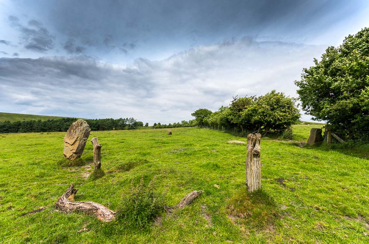
The great rounded hill of Blakey Topping—recorded as early as 1233 CE and meaning the ‘black mound’ or ‘black meeting-place’— has the ruins of a stone circle living several hundred yards to its south, little-known to many.  The early writer George Young (1817) seemed to come close here, mentioning the ‘druidic’ standing stones of Blakey Moor and district, but gave no specific indication of the ruinous ring we’re visiting here.  Instead, the first real description was penned by Robert Knox (1855) who, at the time of writing, was under the academic spell of druidism: prevalent as it was amongst most universities and places of learning back then.  Also, beset by the equally sad plague of Biblical comparitivism—beloved even to this day by halfwits—Knox’s formula about this ancient ring was founded on the druidical reverence of Blakey Topping as a site beneath which our Bronze age tribal ancestors erected their stones with the rounded hill immediately to the north, as signified by its early name, black. (In early place-names, ‘black’ and its variants—dubh, dove, etc—relates to the cardinal direction of ‘north’ and actually means ‘shining’; and white or ban is ‘south’, when both elements are located in relative proximity.)  Knox told us:

“At the southwest side of this arch-Druid’s tomb-like hill (Blakey Topping) a far more conspicuous cluster of larger Druid stones occurs; here three pillars form a triangle…and a smaller one…stands one hundred and fifty paces east of these nearer to the farmhouse there.  These single stones, possibly, once formed part of a circle… The diameter of a circle formed on this triangle of stones would be about fifty-five feet; but as these pillars form a nearly equilateral triangle, the number of stones in that circle cannot now be correctly ascertained, if, indeed, they ever formed part of a circle…

“These three sandstone pillars, untouched by tools…are much weather-worn; and hence it may be inferred that they are very ancient.  I shall only add that the tallest pillar here is nine feet high, from two-and-a-half to three feet wide, and rom fifteen to twenty inches thick, and is the tallest ancient pillar next to the celebrated one in Rudston churchyard, now standing in the eastern part of Yorkshire.  When I last visited the Blakey Topping Druid-stones in 1836, I learned that the farmer, on whose ground they stand, “had talked about breaking the three large ones to pieces,” and perhaps nothing but the trouble of doing so has hitherto preserved them, and many others.  I told him what had been their use, and begged he would preserve them.”

Stone re-used as gatepost (James Elkington)

And thankfully they remain there to this day!  Around the same time of Mr Knox’s visit, the Ordnance Survey lads came here too and, in 1854, highlighted the remaining ‘Druidical Stones’ on the first map of the area.  But references to the stones from here onwards are sparse and add nothing pertinent to its archaeomythic status.  It was a Mr & Mrs Elgee (1930) who were the next to tell us about the site in their exposition on Yorkshire archaeology.  They wrote:

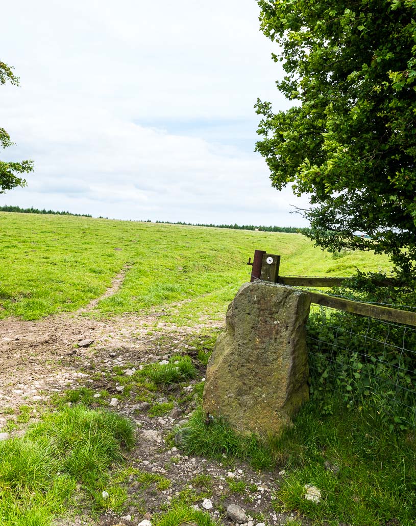
“Three large standing stones about 6 feet high on the south-west side of Blakey Topping…are the remains of a circle about 18 yards in diameter.  Two or three hollows in the ground indicate the position of other stones, some of which are serving as gateposts nearby. Others have been broken up to help build a wall.  These stones are associated with a large settlement sites similar to (one) on Danby Rigg not very far from the imposing Bridestones and approached by an ancient trackway known as the Old Wife’s Trod.”

The general interpretation by the great megalithic archaeologists Aubrey Burl, John Barnatt and their fellow associates, is that these stones are the remains of a stone circle – which seems apt.  But of even greater importance seems to be the great hill of Blakey Topping itself, to which this olde ring no doubt related to.  Many other prehsitoric sites once scattered this area, but sadly most of them have been destroyed.

References:

  1. Barnatt, John, Stone Circles of Britain (2 volumes), BAR: Oxford 1989.
  2. Burl, Aubrey, A Guide to the Stone Circles of Britain, Ireland and Brittany, New Haven & London 1995.
  3. Burl, Aubrey, The Stone Circles of Britain, Ireland and Brittany, Yale University Press 2000.
  4. Elgee, F., Early Man in Northeast Yorkshire, Frank Bellows: Gloucester 1930.
  5. Elgee, F. & H.W., The Archaeology of Yorkshire, Methuen: London 1933.
  6. Gutch, Mrs E., Examples of Printed Folklore Concerning the North Riding of Yorkshire, David Nutt: London 1899.
  7. Knox, Robert, Descriptions Geological, Topographical and Antiquarian in Eastern Yorkshire, London 1855.
  8. Phillips, Guy Ragland, Brigantia, RKP: London 1976.
  9. Smith, A.H., The Place-Names of the North Riding of Yorkshire, Cambridge University Press 1928.
  10. Spratt, D.A., Prehistoric and Roman Archaeology of North-East Yorkshire, BAR: Oxford 1982.
  11. White, Stanhope, Standing Stones and Earthworks on the North Yorkshire Moors, privately printed: Scarborough 1987.
  12. Young, George, A History of Whitby and Streoneshalh Abbey – 2 volumes, Clark & Medd: Whitby 1817.

Links:

  1. Mountains, Myths and Moorlands

Acknowledgements:  Big thanks to the photographer James Elkington, for use of his photos in this profile. Cheers mate.  Also, accreditation of early OS-map usage, reproduced with the permission of the National Library of Scotland.

© Paul Bennett & James ElkingtonThe Northern Antiquarian

Blakey Topping, Allerston, North Yorkshire

Sacred Hill:  OS Grid Reference – SE 8731 9377

Getting Here

Blakey Topping (James Elkington)

From Pickering, take the A169 towards Whitby. When you get to the Car Park at the ‘Hole-of-Horcum’ – (you can’t miss it), park the car and walk North along the side of the road towards Whitby. After 60 yds, take the track East. Follow this for approximately a mile until the track splits. Take the concrete track left towards the farmhouse of ‘Newgate Foot’. Go through the yard past the house on the right, and you will come to a stream and a gate and there, ahead of you, rises Blakey Topping…

Archaeology & History

The giant hill of Blakey Topping was recorded as early as 1233 CE and in a simplistic style just means the ‘black mound’; but this derivation has additional ingredients, implying it as a ‘black meeting-place’ or moot.  Black in the etymological sense also implies ‘shining’ and it may also relate to the northern airt of black (meaning death, darkness, north, etc), when you’re stood at the ruined stone circle 400 yards to the south. But I’m speculating here…

Several 19th century antiquarians suggested there may have once been a cairn on top of the hill, but others who’ve explored this idea seem to have put it to bed.

Folklore

This great hill is well recognised amongst local people and, to this day, its animistic creation myths and other folklore elements are still spoken.  When the photographer James Elkington recently visited the nearby standing stones, he bumped into the old farmer who told him how his father had seen the faerie-folk on the hill many years back.  And its modern reputation as a gorgeous site adds to such lore, which dates way back.

In Frank & Harriett Elgee’s (1933) archaeology work, they narrated the old creation myth that local people used to tell of this great hill,

“A witch story related by a native 25 years ago attempts to explain two conspicuous natural features two miles apart on Pickering Moor; Blakey Topping, an isolated hill, and the Hole of Horcum, a deep basin-shaped valley. The local witch had sold her soul to the devil on the usual terms, but when he claimed it, she refused to give it up, and flew over the moors, with the devil in hot pursuit. Overtake her he could not, so he grabbed up a handful of earth and flung it at her. he missed his aim and she escaped.  The Hole of Horcum remains to prove where he tore up the earth and Blakey Topping where it fell to the ground.

“From our point of view the significance of this story lies in the fact that between the Hole and the Topping there is a Bronze Age settlement site at Blakey Farm, with its stone circle. The rough trackway leading from the Hole to the circle is known as the Old Wife’s Way, presumably also marking the witch’s flight. This, together with other Old Wife’s Ways, preserves as it were Bronze Age church tracks”.

Looking up from the SW (James Elkington)

A relative variation on this tells that the Hole of Horcum was made by the local giant, Wade. He was having a row with his wife, Bell, and got so angry that he scooped out a lump of earth and threw it at her.  The huge geological feature known as the Hole of Horcum is the dip left where he scooped out the earth, and Blakey topping, the clod itself, resting in situ where it landed.  A christian appropriation of the story replaces Wade and his wife with their ‘devil’: a puerile element unworthy of serious consideration.

In more recent times, the old geomancer Guy Ragland Phillips (1976; 1985) found that a number of alignments, or leys (known as a ‘node’), centred on Blakey Topping: twelve in all, reaching out and crossing numerous holy wells, prehistoric tumuli, standing stones, etc.  The precision of the alignments is questionable, yet the matter of the hill being a centre-point, or omphalos, would seem moreso than not.

References:

  1. Elgee, F. & H.W., The Archaeology of Yorkshire, Methuen: London 1933.
  2. Phillips, Guy Ragland, Brigantia, RKP: London 1976.
  3. Phillips, Guy Ragland, The Unpolluted God, Northern Lights: Pocklington 1987.
  4. Smith, A.H., The Place-Names of the North Riding of Yorkshire, Cambridge University Press 1928.

Links:

  1. Mountains, Myths and Moorlands

Acknowledgements:  Big thanks to the photographer, James Elkington, for use of his photos in this profile. Cheers mate.

© Paul Bennett & James ElkingtonThe Northern Antiquarian

Stone Hill Head, Allerston Moor, North Yorkshire

Standing Stone (missing):  OS Grid Reference – SE 881 947

Archaeology & History

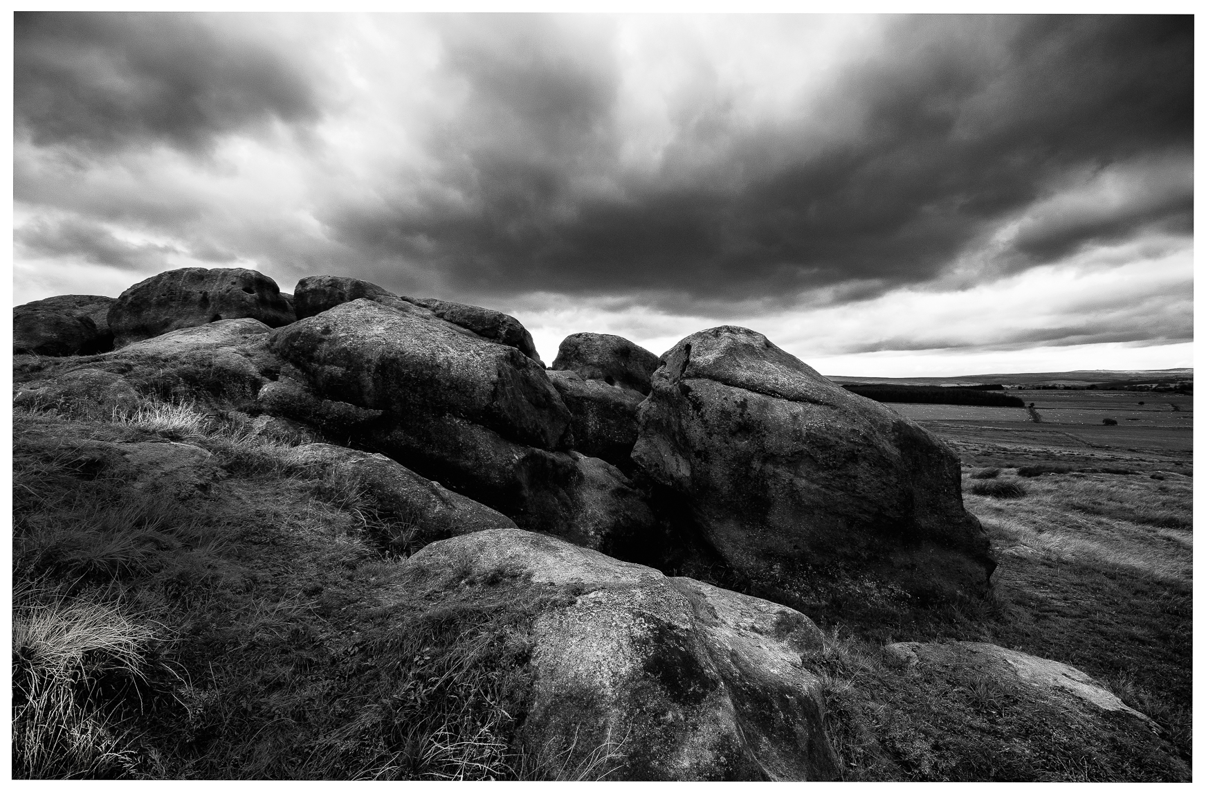
A number of standing stones were reported by regional historian Robert Knox (1855) in his antiquarian work of this area, but forestry and vandalism has seen the demise of some.  This one, however, may possibly still be found, laid down somewhere on the tops, along the ridge aptly-named as Stone Hill Head.  Where precisely it might be, we know not—but one of you Yorkshire antiquarian ramblers might be able to find and resurrect it by following old Mr Knox’s notes.  Writing extensively of the ancient remains around nearby Blakey Topping this is what he told us of the Stone Hill Head monolith:

“The pillar…standing erect, is five and a half feet high, three broad, and from ten inches to two feet thick.  This is much corroded either by natural decomposition, or designedly made so by manual labour; some of the holes in it being circular, as if intended to fit the heads of human beings into them, at the time of their immolation, while laid prostrate on the ground… This stone stands northeast from Blakey Topping, distant about six furlongs, and is the furthest pillar in this collection from that hill.”

If the real explorers amongst you manage to rediscover the stone, please let us know.

References:

  1. Knox, Robert, Descriptions Geological, Topographical and Antiquarian in Eastern Yorkshire, London 1855.

© Paul BennettThe Northern Antiquarian 

Gawk Hall Stone, Middleton Moor, North Yorkshire

Cup-Marked Stone:  OS Grid Reference – SE 13004 53097

Getting Here

Gawk Hall Stone

Probably the easiest route to find this is via the Roman Road from Blubberhouses. Go up Cooper Lane a few hundred yards, turning right (west) on the footpath past the Manor House and onto the moor. Walk along the footpath until you hit the dead straight Roman Road and walk 1⅓ miles (past the cup-marked Eagle Stone) until you meet another footpath on your right veering over the haunted Sug Marsh away from the straight road. This takes you to Gawk Hill Gate ½-mile away. Go over the wall here and walk for 350 yards where several stones are just yards to the left of the path. You’re there!

Archaeology & History

…and again!

Depending on the age of the old path by which this carving lies, it may have represented a marker of the ancient route.  It lives in relative isolation from other petroglyphs a mile or so further down the moorland slopes and is probably one only for the purists amongst you.  A smoothed (female) medium-sized rock, about 2 yards by 1 yard across, possesses at least two simple cup-marks on its upper western surface. A third cup seems evident between the main two cups, with a carved line running some 10 inches towards the eastern side of the stone.  What may be several other cup-marks can be seen on the stone, but the day was overcast when we came here and so we’re unsure as to whether they’re natural or man-made.

Acknowledgements:  Many thanks to James Elkington and his little compatriot Mackenzie, who accompanied us to this and other sites nearby.

© Paul BennettThe Northern Antiquarian

Clowder (1), Arncliffe, North Yorkshire

Enclosures:  OS Grid Reference – SD 9165 6968

Also Known as:

  1. Clouder

Getting Here

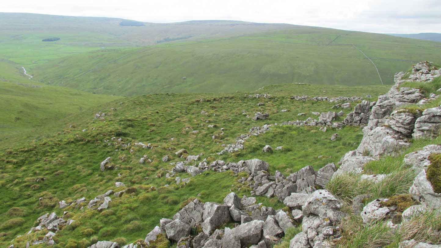
Looking down on Clowder-1

To the right of The Falcon Inn across from Arncliffe village green is a trackway called the Monk’s Way.  Walk up here for about 450 yards until there’s a stile on your right which is the start of the diagonal footpath SW up the hillside.  Once you hit the limestone ridge several hundred yards up, keep on the path that curves round the edge of the hill for 1.3 miles (2.1km), going over 5 walls until, at the 6th one, you should look uphill, east, at the small cliff-face 100 yards above you.  That’s where you need to be!

Archaeology & History

This is one of several clusters of large prehistoric enclosures and settlements in the expanse of land known as Clowder, on the hills 1.65 miles (2.63km) southwest of Arncliffe.  It’s in a very good state preservation and, surprisingly, almost nothing has been written about it.

Covered hut circle on NW edge
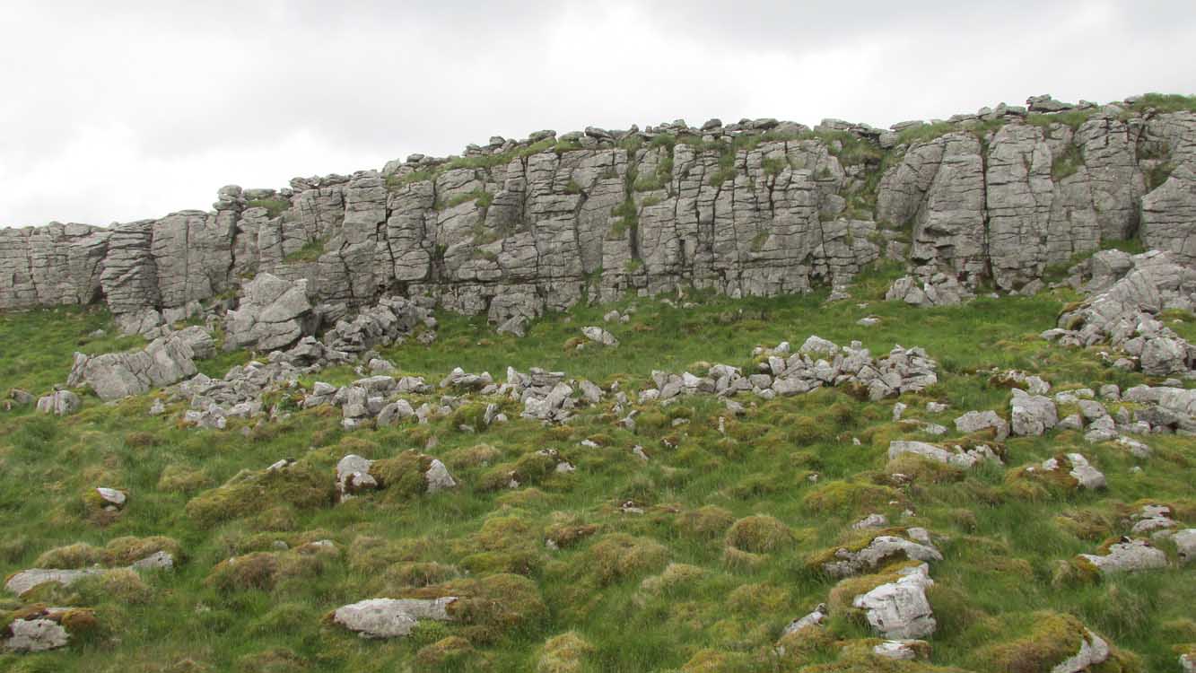
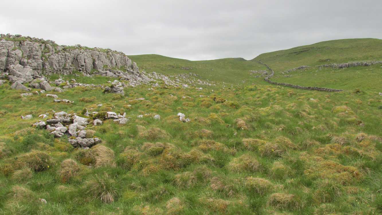
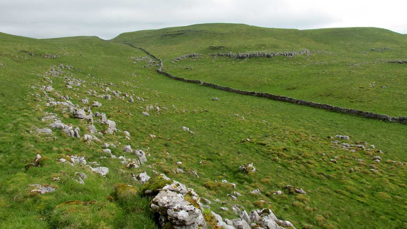
Cliffs & walls of Clowder-1

A multi-period site whose construction probably began  sometime in the Iron Age (although the old Yorkshire Dales archaeologist, Arthur Raistrick, thought the settlements up originated in the Bronze Age), we can say with some certainty that parts of this complex were definitely being used until medieval times due to the lack of growth on some of the walling.

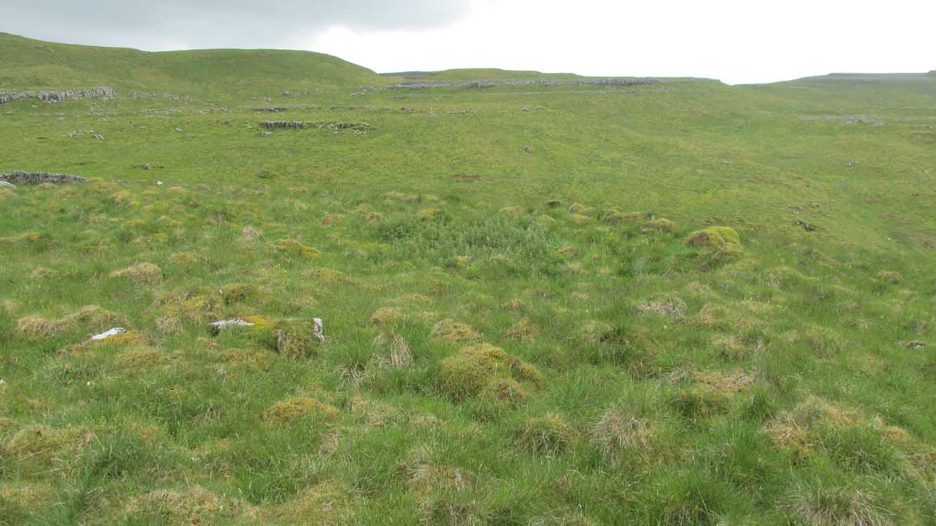
The entire complex comprises of a series of interlinked walled enclosures running roughly north-south for a distance of more than 200 yards.  Along the 200 yards are at least eight conjoined walled sections of varying shapes and sizes.  Some of the walling, particularly along its western edges, measuring up to 10 feet across (some of this will be due to collapse) is very overgrown indeed and is probably the oldest aspect of the enclosure.  The inner walled sections, much of it leading up to the small cliff face, are rough rectangular structures, each of them averaging 30 yards from their western edge to the eastern cliff and rock faces.

Most recent walled section

Within the largest and best preserved section at the northern end, a smaller and more recent walled rectangular enclosure would seem to have been used for either cattle or storage of some form, as it’s on too much of a slope to have been viable as a living quarter.  Also on the very northern edge is a well-preserved but much overgrown hut circle, between 8-9 yards across.

Faint walling looking south

The entirity of Clowder-1 is difficult to assess without an archaeological dig.  Despite this, as half of the walled enclosures (in the northern half) are on slopes leading up to the cliffs they would seem unsuitable for people to live in.  It is more probable that these sections were used for livestock and other storage.  At the more southern end however, the land begins to level out and this would be feasible as good living quarters.  There was also once a good source of water immediately beneath the entire complex, but with deforestation the waters eventually fell back to Earth.Back to its southern end and down towards the modern-day walling, some 70 yards on we find more ancient structures of the same architectural form that we’ve just walked along.  This lower section has just one notable singular oval-shaped hut circle, 20 yards east-west by 29 yards north-south.  Other probable man-made structures seem to be just below this; and this part of the settlement then continues on the other side of the walling, into the large Dew Bottoms (5) settlement complex.

Folklore

Weather lore of the ‘Clauder’ hill tells that it “draws the skies down” – i.e., as Halliwell Sutcliffe (1929) put it:

“A deluge may be in process on each side of the Clouder when lower down the sun is hot on tired pastures.”

We encountered just such a truth when James ElkingtonChris Swales and I visited the sites up here just a week or so ago…

References:

  1. Dixon, John & Phillip, Journeys through Brigantia – volume 2, Aussteiger: Barnoldswick 1990.
  2. Sutcliffe, Halliwell, The Striding Dales, Frederick Warne: London 1929.

Acknowledgements:  Huge thanks to James Elkington and Chris Swales, without whose guidance this site profile would never have been written.

© Paul BennettThe Northern Antiquarian
Little Almscliffe, Stainburn, North Yorkshire

Cup-and-Ring Stone:  OS Grid Reference – SE 23242 52260

Also Known as:

  1. Little Almes Cliffe
  2. Little Almias Cliff Crag

Archaeology & History

Little Almscliffe Crag (photo by James Elkington)

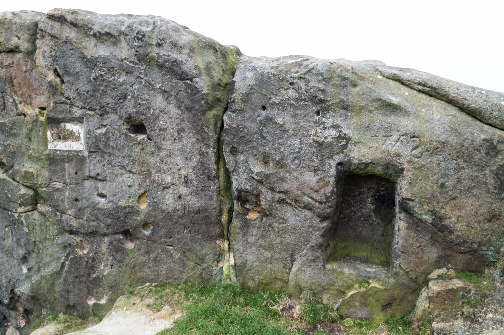
The crags of Little Almscliffe are today peppered with many modern carvings, such as are found on many of our northern rock outcrops.  Yet upon its vertical eastern face is a much more ancient petroglyph – and one that seems to have been rediscovered in the middle of the 20th century.  When the great northern antiquarian William Grainge (1871) visited and wrote of this place, he told us that, “the top of the main rock bears…rock basins and channels, which point it out as having been a cairn or fire-station in the Druidic days; there are also two pyramidal rocks with indented and fluted summits on the western side of the large rock” – but he said nothing of any prehistoric carvings. Curiously , neither the great historian Harry Speight or Edmund Bogg saw anything here either.

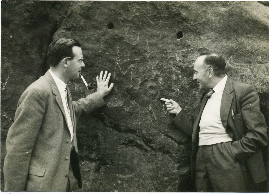
Stuart Feather & Joe Davies here, c.1955
Cup&Ring, left of ‘door’ (photo by James Elkington)

This singular cup-and-ring design seems to have been reported first in E.S. Wood’s (1952) lengthy essay on the prehistory of Nidderdale. It was visited subsequently by the lads from Bradford’s Cartwight Hall Archaeology Group a few years later; and in the old photo here (right) you can see our northern petroglyph explorer Stuart Feather (with the pipe) and Joe Davis looking at the design.  In more recent times, Boughey & Vickerman (2003) added it in their survey of, telling briefly as usual:

“On sheltered E face of main crag above a cut-out hollow like a doorway is a cup with a ring; the top surface of the rock is very weathered and may have had carvings, including a cupless ring.”

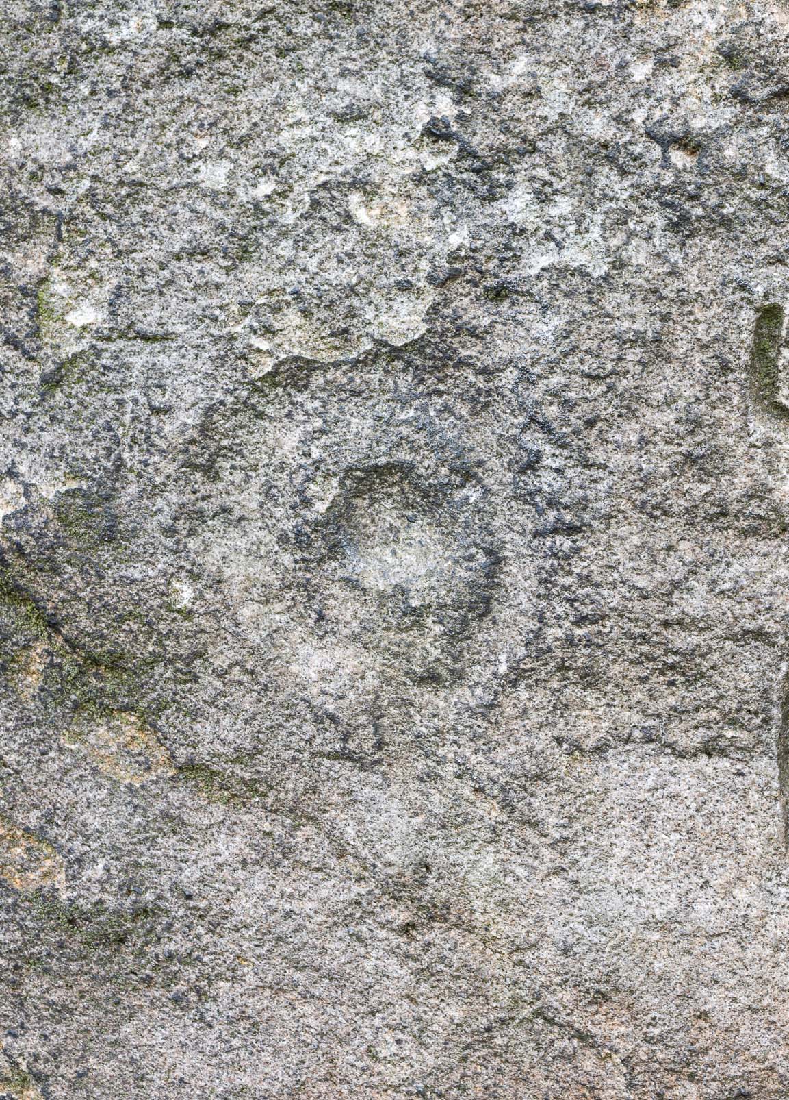
Close up of design

Indeed… although the carving is to the left-side of the large hollow and not above it.  Scattered across the topmost sections of the Little Almscliffe themselves are a number of weather-worn cups and bowls, some of which may have authentic Bronze age pedigree, but the erosion has taken its toll on them and it’s difficult to say with any certainty these days.  But it’s important to remember that even Nature’s ‘bowls’ on rocks was deemed to have importance in traditional cultures: the most common motif being that rain-water gathered in them possessed curative properties.

References:

  1. Bennett, Paul, The Old Stones of Elmet, Capall Bann: Milverton 2001.
  2. Bogg, Edmund, From Eden Vale to the Plains of York, James Miles: Leeds 1895.
  3. Bogg, Edmund, Higher Wharfeland, James Miles: Leeds 1904
  4. Cowling, E.T., Rombald’s Way, William Walker: Otley 1946.
  5. Grainge, William, History & Topography of Harrogate and the Forest of Knaresborough, J.R. Smith: London 1871.
  6. Parkinson, Thomas, Lays and Leaves of the Forest, Kent & Co.: London 1882.

Acknowledgements:  Huge thanks to James Elkington for use of his fine photos on this site.

© Paul BennettThe Northern Antiquarian

Longbarrow Field, Timble, North Yorkshire

Cairn (lost):  OS Grid Reference — SE 18 53

Archaeology & History

Described in the Field Lore of Timble village by William Grainge (1895) are the names and short histories of some of the local place-names—with this in particular standing out like a veritable sore thumb!  Quite plainly, as Grainge told us,

“The name ‘Longbarrows’ is indicative of some burial mounds of a very early day.  None exist at present.  The land is under the plough, and is about the best in the township.”

But I cannot locate the position of this long-lost site and it’s not shown on any of the early OS-maps hereby.  Grainge said that the land on which it once stood was owned by a local farmer called Charles Dickinson, who leased it out to others.  He wrote:

“Dickinson had in Longbarrows 3 roods* and 23 perches*, and William Jackson’s share in Longbarrows was 1 acre, 3 roods and 21 perches.  Besides these, John Ward of Nether Timble had 1 rood and 17 perches int he same field, a long narrow slip without fence, between Dickinson’s and Jackson’s lots.”

Does anyone know where this was?  One of my suspects is the gathering place of the Fewston witches, a half-mile south of the village; but no remains of anything can be found there today and I may just be barking up the wrong tree.

The area south and west of here is rich in little-known prehistoric heritage, from the cairn-fields of Askwith Moor, the cairn circle at Snowden Crags, the settlements of Snowden Carr and the extensive petroglyphs all over the place!  Giants cairns of the early Bronze Age and neolithic period were also once more numerous upon the moors to the west and south, so the former existence of a long barrow in Timble wouldn’t necessarily be too unusual.  But where was it?!

References:

  1. Grainge, William, The History and Topography of the Townships of Little Timble, Great Timble and the Hamlet of Snowden, William Walker: Otley 1895.

*  A rood is an English unit of area, equal to a quarter of an acre or 10,890 square feet; a perch was a more variable unit of measure, being lengths of 1612, 18, 21, 24 and 25 square feet.

© Paul BennettThe Northern Antiquarian