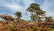
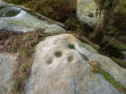
Raven Stones (east), Thruscross, North Yorkshire

Cup-Marked Stone:  OS Grid Reference – SE 12000 57932

Getting Here

Ravenstones (east)

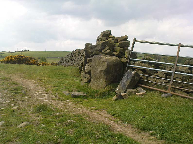
Take the A59 road from Harrogate and Skipton and at the very top of the moors near the Gill Head Enclosures, take the small Kex Ghyll road up past the disused quarry works north for a mile or so. At the junction go left for about 1½ miles where, on your left, is Burnt House farm.  A hundred yards past here is a small spot to park on the right-hand side of the road, opposite the gate to Rocking Hall House (make sure you leave enough room for tractors to pass you!).  Across the road is the track to Rocking Hall and, 2 miles along the track, look out for the copse of trees ½-mile NE.  Head towards it and, as you get close to the wall, walk slowly downhill towards the stream where a single block of stone lives.  You’ll find it!

Archaeology & History

Design from above

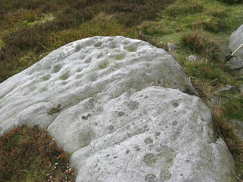
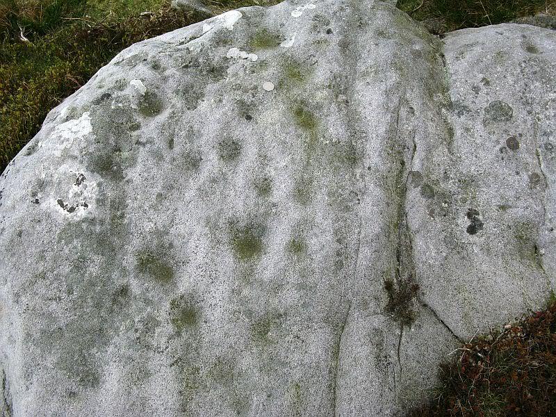
Rediscovered on Rocking Moor by Rod Chambers on August 15, 2023, this reasonably large sloping block of stone has between 21 and 24 cups cut quite deeply and scattered erratically into it, very similar to one some 200 yards to the northwest (Raven Stones carving 559).  It seems pretty obvious that some of these cups were Nature’s handiwork, but have been modified by human hands.   There’s nothing complex about it, but there may be a semi-circular arc around one of the cups, centre-left of the natural crack that cuts across the top of the stone, but this is very faint and could be just a trick of the eyes.  Going there at sunrise and wetting the stone might tell us for sure.

Acknowledgements:  Big thanks to Rod Chambers for use of his photo in this site profile.

© Paul BennettThe Northern Antiquarian

Raven Stones (562), Thruscross, North Yorkshire

Cup-Marked Stone: OS Grid Reference – SE 1194 5810

Getting Here

The Raven stone setting

Take the A59 road from Harrogate and Skipton and at the very top of the moors keep your eyes peeled for the small Kex Ghyll Road on your left(it’s easy to miss, so be diligent!).  It goes past some disused disused quarry and after a mile or so where you hit a junction, turn left, past the Outdoor Centre of West End and straight along Whit Moor Road.  About a mile past the Outdoor Centre go left down to Brays Croft Farm and over the ford, then keeping to the footpath up to the right (west) and note the clump of trees on the moors above you to the west.  That’s where you need to be.

Archaeology & History

Several of the cupmarks

Several natural basins that might have been worked in prehistoric times are accompanied by several distinct cup-marks near the middle-edge of the stone, in a rough triangular formation, with two others slightly more eroded a little further down the same side.  Boughey and Vickerman (2003) noted several other cupmarks on the rock, some distinct, some not so.

Adjacent to this carved stone is another naturally worn stone of some size, with incredibly curvaceous ripples over the top of the rock which, in all probability, possessed some animistic property to the people who carved this and other nearby carvings. Check the place out.  It’s a gorgeous setting!

References:

  1. Armstrong, Edward A., The Folklore of Birds, Collins: London 1958.
  2. Boughey, Keith & Vickerman, E.A., Prehistoric Rock Art of the West Riding, WYAS: Wakefield 2003.

© Paul BennettThe Northern Antiquarian 

Little Almscliffe, Stainburn, North Yorkshire

Cup-and-Ring Stone:  OS Grid Reference – SE 23242 52260

Also Known as:

  1. Little Almes Cliffe
  2. Little Almias Cliff Crag

Archaeology & History

Little Almscliffe Crag (photo by James Elkington)

The crags of Little Almscliffe are today peppered with many modern carvings, such as are found on many of our northern rock outcrops.  Yet upon its vertical eastern face is a much more ancient petroglyph – and one that seems to have been rediscovered in the middle of the 20th century.  When the great northern antiquarian William Grainge (1871) visited and wrote of this place, he told us that, “the top of the main rock bears…rock basins and channels, which point it out as having been a cairn or fire-station in the Druidic days; there are also two pyramidal rocks with indented and fluted summits on the western side of the large rock” – but he said nothing of any prehistoric carvings. Curiously , neither the great historian Harry Speight or Edmund Bogg saw anything here either.

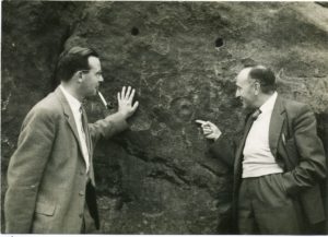
Stuart Feather & Joe Davies here, c.1955
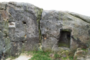
Cup&Ring, left of ‘door’ (photo by James Elkington)

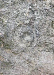
This singular cup-and-ring design seems to have been reported first in E.S. Wood’s (1952) lengthy essay on the prehistory of Nidderdale. It was visited subsequently by the lads from Bradford’s Cartwight Hall Archaeology Group a few years later; and in the old photo here (right) you can see our northern petroglyph explorer Stuart Feather (with the pipe) and Joe Davis looking at the design.  In more recent times, Boughey & Vickerman (2003) added it in their survey of, telling briefly as usual:

“On sheltered E face of main crag above a cut-out hollow like a doorway is a cup with a ring; the top surface of the rock is very weathered and may have had carvings, including a cupless ring.”

Close up of design

Indeed… although the carving is to the left-side of the large hollow and not above it.  Scattered across the topmost sections of the Little Almscliffe themselves are a number of weather-worn cups and bowls, some of which may have authentic Bronze age pedigree, but the erosion has taken its toll on them and it’s difficult to say with any certainty these days.  But it’s important to remember that even Nature’s ‘bowls’ on rocks was deemed to have importance in traditional cultures: the most common motif being that rain-water gathered in them possessed curative properties.

References:

  1. Bennett, Paul, The Old Stones of Elmet, Capall Bann: Milverton 2001.
  2. Bogg, Edmund, From Eden Vale to the Plains of York, James Miles: Leeds 1895.
  3. Bogg, Edmund, Higher Wharfeland, James Miles: Leeds 1904
  4. Cowling, E.T., Rombald’s Way, William Walker: Otley 1946.
  5. Grainge, William, History & Topography of Harrogate and the Forest of Knaresborough, J.R. Smith: London 1871.
  6. Parkinson, Thomas, Lays and Leaves of the Forest, Kent & Co.: London 1882.

Acknowledgements:  Huge thanks to James Elkington for use of his fine photos on this site.

© Paul BennettThe Northern Antiquarian

Sunrise Stone (605), Snowden Crags, Askwith, North Yorkshire

Cup-and-Ring Stone:  OS Grid Reference – SE 18066 51251

Also Known as:

  1. Carving 605
  2. Northern Earth Mysteries Stone

Getting Here

Sunrise Stone, Snowden Carr

Sunrise Stone, Snowden Carr

Take the same directions as if you’re going to visit the Naked Jogger Carving (stone 612), not far from the well-known Tree of Life Stone.  From the Naked Jogger carving, walk up the small outcrop of rocks that bends above you.  Barely 100 yards up when you reach the top, you’ll notice a single large sloping stone barely 50 yards ahead of you in the same field.  That’s the spot!

Archaeology & History

This is a little-known beauty of a carving just off the edge of the quiet moors that are littered with prehistoric remains.  It was only rediscovered a few years ago — by myself if you believe the writings of rock art student Keith Boughey (2010) in his essay (scattered with mistakes) on the validity of so-called “amateurs” exploring petroglyphs.  But I’d never even visited this carving until two years ago!  The stone was in fact found during a field-walk by early members of the Northern Earth Mysteries group in August 1989 (Wilson 1990) and subsequently described and illustrated for the first time by Phil Reeder (1990).
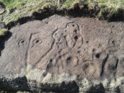
Close-up of main cluster

Close-up of main cluster

As can be seen in the photos accompanying this site profile, the rock on which the carving has been done has, at some point in the past, been cut into and its edges have been hacked away and destroyed, literally cutting into the overall design.  We have no idea what the original size of the stone was, obviously, but this petroglyph was once larger than the design that we see at present.  Such is the price of ‘progress’, as some folk call it.

Anyway – a few months after the carving was rediscovered, Phil Reeder (1990) wrote:

“After a visit to the Tree of Life stone…a cursory inspection by the NEM Group was made on nearby rock outcrops, part of which showed evidence of recent exposure due to soil erosion.

“One stone in particular stood out as five shallow cups and associated rings could be discerned.  When cleaned, it became apparent that further carvings extended beneath a thin eroding soil layer.  When this layer was cleared, a complex set of carvings were revealed.

“Only preliminary work at the site has been carried out to date, but it appears that the carvings comprise of at least 28 cups, 13 of which have associated rings; several of the cups are linked by gutters forming an intricate design, one gutter part enclosing 11 cups.  The carvings on the lower edge of the stone have weathered badly and are difficult to interpret.”

Reeder’s so-called “amateur” description is a good one. Certainly more accurate than the subsequent one by Boughey & Vickerman (2003):

“Large rock of coarse grit whose surface slopes with the hill. About forty cups, some large, many with single rings, and many curving grooves, the whole forming a remarkable, complex design.”

Phil Reeder's 1990 drawing

Phil Reeder’s 1990 drawing

Boughey & Vickerman's sketch

Boughey & Vickerman’s sketch

We can see in the respective drawings by both Reeder (left) and Boughey & Vickerman (right) that some elements which should have been included in the ‘official’ drawing were missed, yet had been accurately included in the earlier ‘preliminary’ drawing, as Mr Reeder put it.  I hope that readers will forgive me pointing out these seemingly minor elements; but I do it to illustrate the ineffectiveness of more recent rock art students who are gaining the title of ‘experts’ in this field.  It’s important to recognise that, in this field of study, “experts” are few and far between indeed… I’ve certainly yet to meet any!

Northern end of carving
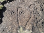
Northern end of carving

Southern side of carving

Southern side of carving

The carving is mentioned briefly in Beckensall’s (1999) introductory study, with little comment.  But of note here is not only the curious linear feature running between two cup-and-rings, but the position of the stone in the landscape.  For if you sit either upon or next to this carving, you are looking east straight across the gorgeous Fewston valley directly at the prominent wooded hill of Sword Point.  As it slopes down into the present-day greenery of fields and scattered woods, the Wharfe Valley spreads out to the distant east and, as the sun rises and scatters its rays onto the wet morning stone here, the design on the rock awakens with much greater visual lucidity than that which our daytime eyes bestow to us.  In all likelihood, sunrise was an important element in whatever mythic function underscored this curious carving, with its human-like figure rising on its southern side, emerging from the edge of the rock, personifying perhaps the rising solar disc and the living landscape as the daylight breath awoke Earth’s creatures; or maybe it signifies a symbolic group of people gathered together watching the sunrise…

Of course, I’m dreaming…

References:

  1. Barnett, T. & Sharpe, K. (eds.), Carving a Future for British Rock Art, Oxbow: Oxford 2010.
  2. Beckensall, Stan, British Prehistoric Rock Art, Tempus: Stroud 1999.
  3. Boughey, Keith, “The Role of the Amateur in the Study of UK Prehistoric Cup-and-Ring Art,” in Barnett & Sharpe, Oxford 2010.
  4. Boughey, Keith & Vickerman, E.A., Prehistoric Rock Art of the West Riding, WYAS: Leeds 2003.
  5. Chappell, Graeme, “North Yorkshire Rock Art – New Discoveries,” in Northern Earth, no.62, 1995.
  6. Michell, John, The Earth Spirit, Thames & Hudson: London 1975.
  7. Reeder, Phil, “Snowden Carr Rock Carvings,” in Northern Earth Mysteries, no.40, 1990.
  8. Wilson, Rob, “Pateley Bridge Gathering,” in Northern Earth Mysteries, 40, 1990.

© Paul Bennett, The Northern Antiquarian
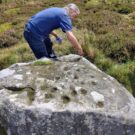

James Stone, Blubberhouses Moor, North Yorkshire

Standing Stone: OS Grid reference – SE 15196 54722

Getting Here

James Stone, looking SW

From Blubberhouses church by the crossroads, walk up the slope (south) as if you’re going to Askwith, for 100 yards or so, taking the track and footpath past the Manor House and onto the moor.  Once you hit the moorland proper, take the footpath that bears left going down into heather and keep going till you hit the dead straight Roman Road path running west onto Blubberhouses Moor. Carry along the Roman Road for about 200 yards as though you are going towards the Eagle Stone, and looking right (if you squint) you can just make out a small pimple on the top of the moors about a quarter of a mile away. That is where you are heading (be warned – it is boggy getting there).

Archaeology and History

James Stone, looking NE

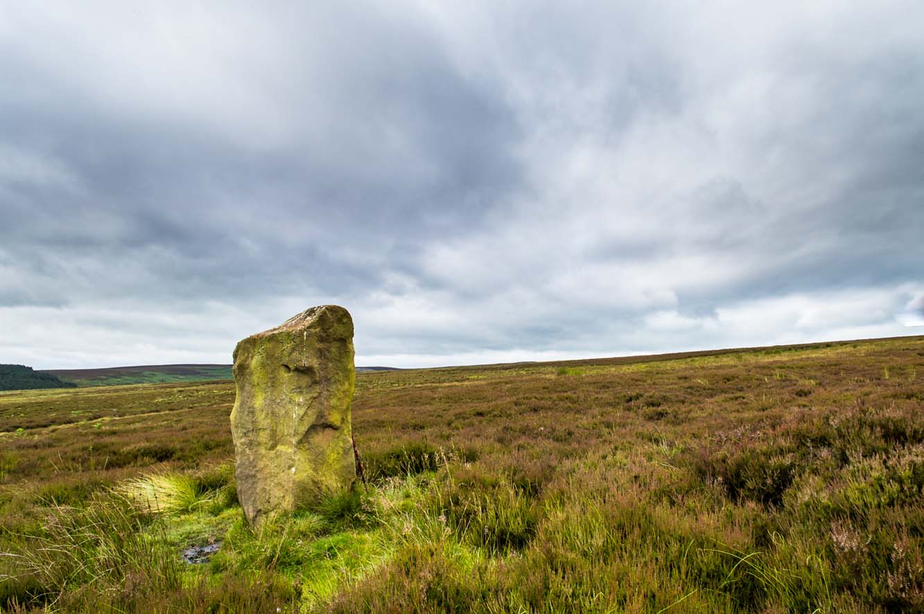
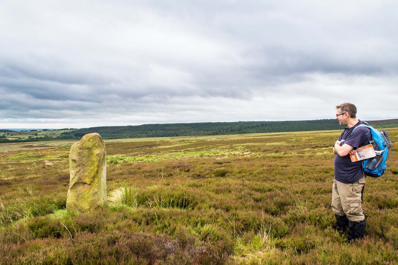
Discovered (or rather ‘noticed’) by James Turner and James Elkington in July 2016 (hence the name James Stone), this standing stone is of an indeterminable age – although it does look ancient.  Standing more than 5 feet tall, and in the middle of nowhere, it is fairly difficult to get to unless you want to get wet feet.  It is situated very close to a small and unexcavated prehistoric settlement and we could find no physical evidence of any tracks nearby (although Google Earth does show what looks like one or two very short, faint tracks near the stone, which is the old ‘Benty Gate’ track).

It could be a boundary stone, although doubtful – it has a feel to it that says it is prehistoric, although this is just guesswork on our part.  I can find no reference to it in Cowlings Rombalds Way (1946) and there seems nothing about it in either of William Grainge’s (1871; 1895) detailed history works of the region.

Mr Turner gazing at the stone

At first we thought it unlikely to be a new find, however the stone is difficult to see from the Roman Road (I had been up here dozens of times before I noticed it) and seeing that people rarely go up here anyway, and it is relatively difficult terrain getting to it, it is not surprising that no one has bothered visiting it. It would take someone who is quite keen on megaliths to want to examine it and it is well off any tracks.

Having said that, it is a nice find and it could be linked in some way with the small unexcavated settlement nearby, or possibly the large Green Plain settlement nearly a mile away.  Well worth a visit…bring your wellies!

References:

  1. Cowling, Eric T., Rombald’s Way, William Walker: Otley 1946.
  2. Grainge, William, The History and Topography of Harrogate and the Forest of Knaresborough, John Russell Smith: London 1871.
  3. Grainge, William, The History and Topography of the Townships of Little Timble, Great Timble and the Hamlet of Snowden, William Walker: Otley 1895.

© James Elkington, The Northern Antiquarian


Raven Stones (559), Thruscross, North Yorkshire

Cup-Marked Stone:  OS Grid Reference – SE 11835 58006

Getting Here

Heavily cup-marked Raven Stone (after QDanT)

Take the A59 road from Harrogate and Skipton and at the very top of the moors near the Gill Head Enclosures, take the small Kex Ghyll road up past the disused quarry works north for a mile or so. At the junction go left, past the Outdoor Centre, thru West End up Whit Moor Road, then go left down to Brays Cross Farm and over the ford. Note the clump of trees on the moors to the west and take the path there. Once here, a large outcrop of rocks will be seen about 150 yards on the moor to the west. That’s the spot! Otherwise, follow the directions of the legendary wandering Teddy!

Archaeology & History

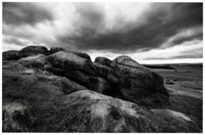
This dramatic looking outcrop of rocks rising out of the ground a half-mile due west of Bray farmhouse has long been known as the rocks of the ravens: oracular birds of ill-omen in all peasant traditions, yet carrier birds of shamans in their Underworld ventures, from accounts in Russia and Scandinavia, through the Scottish highlands and into Yorkshire’s northern hills, as folklore records show.  Whether such mythical figures used the Raven Stones here for such magick, we have no firm accounts; but the existence of the many cup-markings on this particular rock (and others in the outcrop) show that animistic traditions of some form or another occurred here in prehistoric times at the very least.

Looking across the stone
Looking down on the cups (after QDanT)

Records of this place as an archaeological spot are scant indeed.  It is passed with barely a mention by those Victorian antiquarian giants, Bogg, Grainge and Speight.  The rock art students Boughey & Vickerman (2003) give the wrong grid reference here, but added the site to their inventory, saying only that it is “long, low, exposed bedrock. 22-25 cups; some very weathered and smooth.”  A series of channels runs down the slope of the stone, but there are probably natural.  However, a cup-and-line does occur on the eastern side of the carving.

References:

  1. Armstrong, Edward A., The Folklore of Birds, Collins: London 1958.
  2. Boughey, Keith & Vickerman, E.A., Prehistoric Rock Art of the West Riding, WYAS: Wakefield 2003.

Links:  

  1. Teddy Tour Teas

Acknowledgements:  Huge thanks for QDanT & Teddy for the fine photos of the Raven Stone carving!

© Paul Bennett, The Northern Antiquarian 
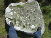

Busky Dike Druidical Altar, Fewston, North Yorkshire

Legendary Rocks (destroyed):  OS Grid Reference – SE 187 545

Archaeology & History

The original position and nature of this site was difficult to ascertain and left us wondering whether the place was once a monolith, stone circle or legendary rock outcrop, as seemed that there were no remains left of the place.  Aswell as that, the only reference we had that describing this place is from William Grainge’s History of Knaresborough (1871), where he wrote:

“At Busky Dike, a place between Cragg Hall and Fewston, according to the report of tradition, there once existed a Druidical altar; and that same venerable authority declares that the same place is the haunt of a Bharguest; and many of the country people yet tremble as they pass that place in the dark, for fear they should meet that strange and terrible beast.”

The latter remark would indicate that something decidely pre-christian was once of renown here.  But it seems that an old rock outcrop was the place in question here, found in the now wooded area on the south side of the Busky Dike Road, just northwest a half-mile outside of Fewston itself.  It would be good to hear more about this place…if anyone knows owt…

References:

  1. Grainge, William, The History of Harrogate and the Forest of Knaresborough, 1871.
  2. Grainge, William, The History and Topography of Little Timble, Great Timble and the Hamlet of Snowden, William Walker: Otley 1895.

© Paul BennettThe Northern Antiquarian
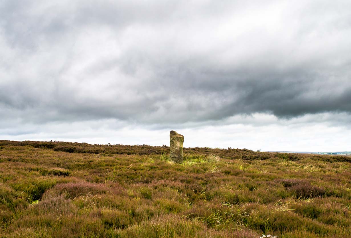

Bride Stone, Farnley Moor, North Yorkshire

Standing Stone:  OS Grid Reference – SE 1991 4932

Getting Here

From Otley go north straight over the river and upwards into the countryside for nearly two miles (past the TV mast on the right).  As you reach near the top of the hill, there’s a turn to your right.  Go on here for a hundred yards or so, then walk along the footpath to your right.  After a few hundred yards, keep your eyes out for the stone just through the gate, in the walling on your left.

Archaeology & History

Although we see named on the 1853 Ordnance Survey map the respective place-names of Bride Cross House and Bride Cross Allotment, the first literary reference to any site here as a standing stone appears to be Eric Cowling (1946) who, when commenting on the pagan tradition and folklore of ancient sites, told that

“The name of Bride Cross Farm, Dob Park, is very significant, for at the meeting place of several tracks to the south-east is a squat standing stone built into a wall and marked as a boundary stone, which was probably Brides Cross.”

Bride Stone, Farnley Moor
Boundary markers on top

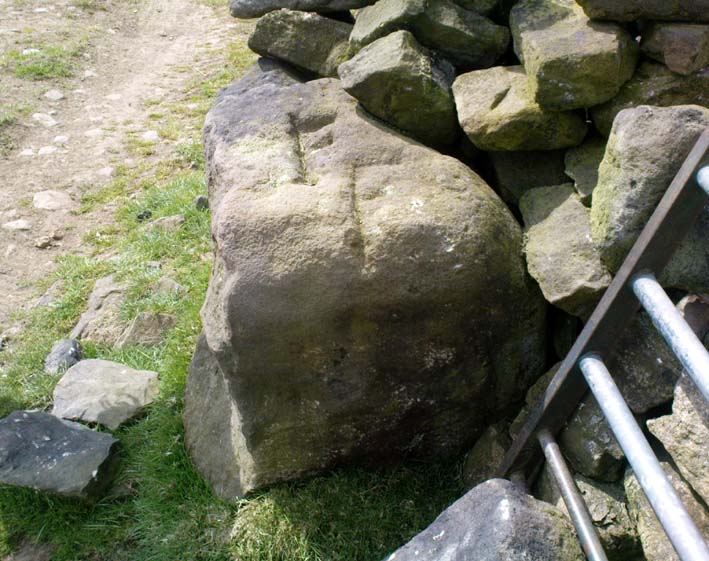
Although I’d read about this place as a kid, it was Graeme Chappell who first brought me here some twenty years back, in one of our many exploratory forays into the prehistory of this area.  It’s a nice fat squat standing stone, similar in stature to the more famous Bull Stone near Otley Chevin, a few miles to the south — though our Bride Stone here is about half as high.  Only about three-feet tall, it stands by the gate at the wall-side about 200 yards down the footpath from the Dob Park Lodge road and does seems to have been used as a boundary marker, as the letters “F.F.” are carved deeply on top of the upright (possibly denoting the Fawkes family of Farnley).

Cowling’s assertion that this old stone accounts for the ‘Bride Cross’ place-name is probably right, as the site is roughly midway between the respective place-names of the House and Allotment.  There is an old field-name of Crosse Close in the vicinity, from 1692, but I haven’t located it.  If such a cross ever existed nearby (most likely, it’s gotta be said), it’s obviously the relic which left the place-names — though the standing stone was certainly here first!  As yet, we’ve found no references to this place before 1853…which can’t be right…

Folklore

Seems to be a petrification legend in here somewhere. Although the short tale doesn’t say as much, it is supposed to have got its name through “the murder of a bride, rejected by a suitor, on her return from a wedding.”  Indeed, I’d go so far as to say ‘fertility’ as well!

Eric Cowling (1946) really stuck his neck out and reckoned sacrifices occurred here in the not too distant past. This may relate to the nearby Haddock Stones, a few hundred yards south, thought to derive its name from a cairn and ‘altar stones.’

References:

  1. Bennett, Paul, The Old Stones of Elmet, Capall Bann: Milverton 2001.
  2. Cowling, E.T., Rombald’s Way, William Walker: Otley 1946.
  3. Phillips, Guy Ragland, Brigantia — A Mysteriography, RKP: London 1976.
  4. Smith, A.H., The Place-Names of the West Riding of Yorkshire – volume 5, Cambridge University Press 1961.

© Paul Bennett, The Northern Antiquarian