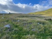
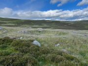
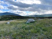
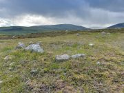
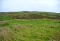
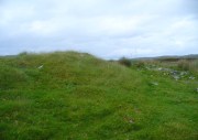
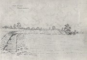
Southdown Cottage, Cotmandene, Dorking, Surrey

Tumulus (destroyed):  OS Grid Reference – TQ 1686 4958

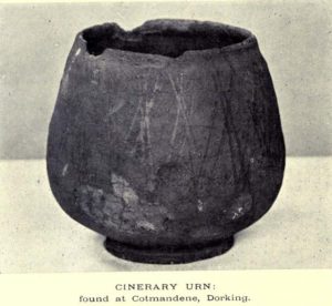
The Cotmandene urn

Archaeology & History

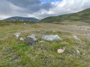
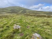
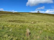
Highlighted on the 1914 OS-map (as ‘Site of’), nothing now remains of the prehistoric structure that either covered or surrounded the ancient burial urn, found fortuitously by a Mr Turner in the garden of Southdown Cottage at the beginning of the 20th century.  Believed to be either Iron Age or Romano-British in origin, the find was noted by Mr Malden (1913) in his brief in the Surrey ArchaeologicalCollections, who wrote:   

“Early in 1913 it came to my knowledge that some years ago some discoveries had been made in the garden of a house on Cotmandene, Dorking.  Mr Turner…was digging for sand in his garden when he found a small cinerary urn (see illustration), with ashes in it.  The height is only 5 inches, the diameter across the top about 4 inches, but at the widest part 5⅜.  The urn is so small that it probably contained the ashes of a child: it is wheel-made, but badly; the diameter is not precisely the same across the top from every direction: Mr Reginald Smith attributes it to the first century BC.  Some fragments of other urns were found.  Mr Turner has kindly presented the whole specimen to the Society’s Museum.  At a lower depth in the same garden were numerous flints, some implements, many flakes, and traces of a hearth with several burnt stones. These clearly belonged to an earlier date, considerably, than the interments, but as the finds were made about 1906-7, and not investigated till this year, it is impossible to be precise about the depth at which they occurred.”

References:

  1. Malden, H.E., “A Cinerary Urn and other Matters found at Dorking and Betchforth,” in Surrey Archaeological Collections, volume 26, 1913.

© Paul BennettThe Northern Antiquarian


Uphall Camp, Ilford, Essex

Hillfort (destroyed):  OS Grid Reference –TQ 4383 8510

Archaeology & History

Uphall Camp, 1893

This prehistoric site was a giant – a huge colossus of an ‘enclosure’, a ‘settlement’, a ‘camp’—call-it-what-you-will.  More than a mile in circumference and with an internal area of 48 acres (big enough to hold 37 football fields!), archaeologist Pamela Greenwood (1989) told us, not only that it was “the largest recorded hillfort in Essex”, but that it compared in size with the immensity of Maiden Castle in Dorset!  Yet despite it being cited by the Oxford Archaeology report of Jonathan Millward (2016) as “the most significant archaeological site within the Borough” from the Iron Age period, it has fallen prey to the thoughtless actions of the self-righteous Industrialists who, as usual, have completely destroyed it.  It was already in a “bad” state when the Royal Commission lads visited here around 1916, saying how it was “in some danger of destruction.” Thankfully, in earlier centuries, we did have more civilized and educated people who seemed proud to describe what there was of their local history.

Early literary accounts seem sparse; although in Mr Wright’s (1831) huge commentary to Philip Morant’s (1768) Antiquities of Essex, he thought that the adjoining parish of Barking—whose ancient boundary line is marked here by the southern embankments of the enclosure—derived from the Saxon words burgh-ing, which he transcribed as ‘the fortress in the meadow’.  The same derivation was propounded in Richard Gough’s 1789 edition of Camden’s Britannia, from the “Fortification in the meadows.”  It seems a more reasonable derivation than that ascribed in the Oxford Names Companion (2002) as the “(settlement of) the family or followers of a man called *Berica” (the asterisk here denotes the fact that no personal name of this form has ever been found and is pure guesswork).  But according to the English Place-Name Society text on Essex by Paul Reaney (1935), the early spellings of Barking implies a derivation from ‘birch trees.’  Anyway….
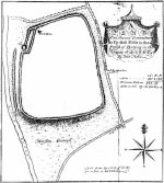
Uphall Camp c.1735

A fine plan of the site was drawn by John Noble some time around 1735 although, curiously, he seems to have written no notes about the place.  The first real citation of Uphall Camp as an antiquity seems to have been by Morant himself (1768).  In a work bedevilled by genealogical and ecclesiological tedium, he occasionally breaks from that boredom to tell of the landscape and the people living here, mentioning our more ancient monuments—but only in passing, as illustrated here:

“Near the road leading from Ilford to Berking, on the north west side of the brook which runs across it, are the Remains of an ancient Entrenchment: one side of which is parallel with the lane that goes to a farm called Uphall; a second side is parallel with the Rodon, and lies near it; the third side looks towards the Thames; the side which runs parallel with the road itself has been almost destroyed by cultivation, though evident traces of it are still discernible.”

Just over thirty years later we were thankfully given a more expansive literary portrayal by Daniel Lysons. (1796)  Lysons was drawing some of his material from a manuscript on the history of Barking by a Mr Smart Lethieullier, written about 1750 (this manuscript was unfortunately destroyed by fire, and no copies of it ever made).  He told us:

“In the fields adjoining to a farm called Uphall, about a quarter of a mile to the north of Barking-town, is a very remarkable ancient entrenchment: its form is not regular, but tending to a square; the circumference is 1792 yards, (i.e., one mile and 32 yards,) inclosing an area of forty-eight acres, one rood, and thirty-four perches.  On the north, east, and south sides it is single trenched: on the north and east sides the ground is dry and level (being arable land), and the trench from frequent ploughing almost filled up: on the south side is a deep morass: on the west side, which runs parallel with the river Roding, and at a short distance from it, is a double trench and bank: at the north west corner was an outlet to a very fine spring of water, which was guarded by an inner work, and a high keep or mound of earth.  Mr. Lethieullier thinks that this entrenchment was too large for a camp: his opinion therefore is, that it was the site of a Roman town.  He confesses that no traces of buildings have been found on that spot, which he accounts for on the supposition that the materials were used for building Barking Abbey, and for repairing it after it was burnt by the Danes.  As a confirmation of this opinion, he relates, that upon viewing the ruins of the Abbey-church in 1750, he found the foundations of one of the great pillars composed in part of Roman bricks. A coin of Magnentius was found also among the ruins.”

But this is a spurious allusion; albeit an understandable one when one recognizes that the paradigm amongst many writers at the time was to say that anything large and impressive was either a construction of the Romans or the Danes, as the early British—it was deemed—were incapable of building such huge monuments.  How wrong they were!

In Mrs Ogborne’s (1814) description of Uphall Camp, she thought that its form and character betrayed anything Roman and—although she wasn’t specific—seemed to prefer the idea that our earliest Britons had built this place.  And she was right!  She wrote:

“There is, about a quarter of a mile from Barking, adjoining Uphal farm, on the road to Ilford, an antient entrenchment, a mile and 32 yards in circumference, with the corners rounded off; the west side, parallel with the river Rodon, has a double trench and bank, and a high keep, or mound of earth, about 94 yards round the base, about nine in height, on the side of the river, and seven on the opposite side: there was an outlet to a spring of water at the north-west corner; the south side has a morass; the north and east sides are single trenched, which is almost lost by cultivation, and in some places barely discernible.”

Uphall Camp on 1873 map

Uphall Camp on 1897 map

When the Ordnance Survey lads gave the site their attention in the 1870s, they showed its real size for the first time—cartographically at least!  As the two old maps either side here show, it was a big one!  Although some sections of the edges of the ‘camp’ were diminishing at the time, much of it was still in evidence.  And when the local writer Edward Tuck (1899) wrote about it, he told us,

“On the north and east sides the ground is dry and level (being arable land) and the trench from frequent ploughings is almost filled up. On the south side is a deep morass; on the west side which runs parallel with the river Roding, and at a short distance from it is a double trench and bank; at the north-west corner is an outlet to a very fine spring of water, which is guarded by an inner work and a high keep or mound of earth designated “Lavender Mound.”  Mrs. Ogborne in her History of Essex gives a charming drawing of this mound as it was in 1814, and says that the mound was then about 94 yards round the base, and about nine yards in height, with trees growing upon it, and its surface covered with soft verdure.”
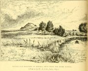
Uphall earthworks in 1893

Several other writers mentioned the remaining embankments of Uphall Camp, which was beginning to fade fast as the city-builders spread themselves further afield.  A chemical factory did most of the damage (as they still do, in more ways than one!).  When the Royal Commission (1921) lads came here they curiously deemed it as an “unclassified” structure; but in those days unless things were Roman in this neck of the woods, it could unduly puzzle them!  Their account of it told that,

“the remaining earthworks consist of a short length of rampart with an irregularly shaped mound at the north end, which is known locally as Lavender Mount, and another short length north of the farmhouse; there are also traces of the east side of the camp running parallel with Barking Lane.  An early plan shows part of the north and east sides of the earthwork and suggests that it was roughly rectangular in outline.  In 1750 the north, east and south sides are said to have had a single trench, and the west side a double trench and bank.

“The mound is 21 ft. high and 85 ft. in diameter at the base. The date of the earthwork is doubtful, but it does not appear to be pre-Roman.”

1908 photo of Lavender Mount

1814 sketch of Lavender Mount

The ‘Lavender Mount’ aspect in this monument, seemed a peculiar oddity.  Even modern archaeologists aren’t sure of what it might have been, erring on the side of caution with interpretations saying it was a keep of some sort, or a small beacon hill.  It might have been of course; but if it was a beacon hill, there would very likely be some written account of it – but none exist as far as I’m aware.  Initial impressions when just looking at the images is that it was a tumulus, but the position of the mound on top of the raised earthen embankments tells us that it was constructed after the Iron Age ramparts.  Writers of the Victoria County History (1903) said the same, suggesting a Saxon or more likely Danish origin.  The area around Lavender Hill was eventually explored by archaeologists in 1960, and several times thereafter – and what they uncovered showed us a continuity of usage that spanned several thousand years!

The 1960 excavation took place where, adjacent to the embankment, “the bank and ditch contained middle-Iron Age pottery”, along with traces of the large wooden fencing-posts (palisade) that initially surrounded and protected the enclosure. In Pamela Greenwood’s (1989) archaeological report, she told us that in further digs in 1983-4 there were discoveries of neolithic and Bronze Age flint remains.  The finds included,

“a leaf-shaped arrowhead and a discoidal scraper… fragments of an Ardleigh type urn, probably from a middle Bronze Age burial disturbed by later activity.  An L-shaped ditch, possibly part of an enclosure or field boundary, was found during the watching-brief. It contained flint-gritted pottery, perhaps attributable to the Bronze Age.”

But the majority of the finds at Uphall came from the mid-Iron Age period.  Greenwood continued:

“The settlement, judging from the relatively small area of the fortification actually excavated, was laid out in a regular way.  As might be expected, the round-houses appear to be aligned, indicating some sort of street-pattern.  ‘Four-poster’ structures have been located in particular areas, again pointing to some sort of designation of special zones of activity. Large quantities of charred grain from the post-pits and surroundings would confirm that these structures are granaries….

“The middle Iron Age structures are of several types: round-houses or round-buildings, pennanular enclosures, (wooden) ‘four-posters’; rectangular structures, ditches, post-holes and innumerable and ill-assorted small pits, small gullies and holes dug into the gravel.  Many of the last three types are undatable and could belong to the Iron Age, Roman, medieval or later activity on the site.”

I could just copy and paste the rest of Greenwood’s report here, but it’s quite extensive and interested readers should refer to her own account in the London Archaeologist .  It’s a pity that it’s been destroyed.

References:

  1. Crouch, Walter, “Ancient Entrenchments at Uphall, near Barking, Essex,” in Essex Naturalist, volume 7, 1887.
  2. Crouch, Walter, “Uphall Camp,” in Transactions of the Essex Archaeological Society, volume 9 (New Series), 1906.
  3. Doubleday, H.A. & Page, William (eds.), Victoria History of the County of Essex – volume 1, Archibald Constable: Westminster 1903.
  4. Greenwood, Pamela, “Uphall Camp,” in Essex Archaeology & History News, 1987.
  5. Greenwood, Pamela, “Uphall Camp, Ilford, Essex,” in London Archaeologist, volume 6, 1989.
  6. Hogg, A.H.A., British Hill-Forts: An Index, BAR: Oxford 1979.
  7. Kemble, James, Prehistoric and Roman Essex, History Press: Stroud 2009.
  8. Lysons, Daniel, The Environs of London – volume 4, T. Cadell: London 1796.
  9. Millward, Jonathan, London Borough of Redbridge: Archaeological Priority Areas Appraisal, Oxford Archaeology 2016.
  10. Morant, Philip, The History and Antiquities of Essex – volume 1, T.Osborne: London 1768.
  11. Norris, F.J., “Uphall Camp”, in Gentleman’s Magazine, 1888.
  12. Ogborne, Elizabeth, The History of Essex, Longmans: London 1814.
  13. Royal Commission Ancient & Historical Monuments, England, An Inventory of the Historical Monuments in Essex – volume 2, HMSO: London 1921.
  14. Tuck, Edward, A Sketch of Ancient Barking, Its Abbey, and Ilford, Wilson & Whitworth: Barking 1899.
  15. Wilkinson, P.M., “Uphall Camp,” in Essex Archaeology & History, volume 10, 1979.
  16. Wright, Thomas & Bartlett, W., The History and Topography of the County of Essex – volume 2, G. Virtue: London 1831.

© Paul BennettThe Northern Antiquarian


Clowder (1), Arncliffe, North Yorkshire

Enclosures:  OS Grid Reference – SD 9165 6968

Also Known as:

  1. Clouder

Getting Here

Looking down on Clowder-1

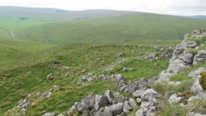
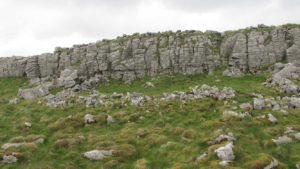
To the right of The Falcon Inn across from Arncliffe village green is a trackway called the Monk’s Way.  Walk up here for about 450 yards until there’s a stile on your right which is the start of the diagonal footpath SW up the hillside.  Once you hit the limestone ridge several hundred yards up, keep on the path that curves round the edge of the hill for 1.3 miles (2.1km), going over 5 walls until, at the 6th one, you should look uphill, east, at the small cliff-face 100 yards above you.  That’s where you need to be!

Archaeology & History

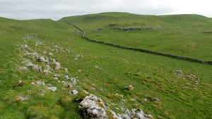
This is one of several clusters of large prehistoric enclosures and settlements in the expanse of land known as Clowder, on the hills 1.65 miles (2.63km) southwest of Arncliffe.  It’s in a very good state preservation and, surprisingly, almost nothing has been written about it.

Covered hut circle on NW edge
Cliffs & walls of Clowder-1

A multi-period site whose construction probably began  sometime in the Iron Age (although the old Yorkshire Dales archaeologist, Arthur Raistrick, thought the settlements up originated in the Bronze Age), we can say with some certainty that parts of this complex were definitely being used until medieval times due to the lack of growth on some of the walling.

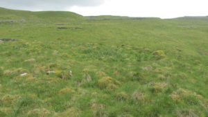
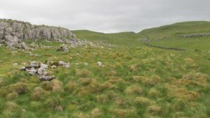
The entire complex comprises of a series of interlinked walled enclosures running roughly north-south for a distance of more than 200 yards.  Along the 200 yards are at least eight conjoined walled sections of varying shapes and sizes.  Some of the walling, particularly along its western edges, measuring up to 10 feet across (some of this will be due to collapse) is very overgrown indeed and is probably the oldest aspect of the enclosure.  The inner walled sections, much of it leading up to the small cliff face, are rough rectangular structures, each of them averaging 30 yards from their western edge to the eastern cliff and rock faces.

Most recent walled section

Within the largest and best preserved section at the northern end, a smaller and more recent walled rectangular enclosure would seem to have been used for either cattle or storage of some form, as it’s on too much of a slope to have been viable as a living quarter.  Also on the very northern edge is a well-preserved but much overgrown hut circle, between 8-9 yards across.

Faint walling looking south

The entirity of Clowder-1 is difficult to assess without an archaeological dig.  Despite this, as half of the walled enclosures (in the northern half) are on slopes leading up to the cliffs they would seem unsuitable for people to live in.  It is more probable that these sections were used for livestock and other storage.  At the more southern end however, the land begins to level out and this would be feasible as good living quarters.  There was also once a good source of water immediately beneath the entire complex, but with deforestation the waters eventually fell back to Earth.Back to its southern end and down towards the modern-day walling, some 70 yards on we find more ancient structures of the same architectural form that we’ve just walked along.  This lower section has just one notable singular oval-shaped hut circle, 20 yards east-west by 29 yards north-south.  Other probable man-made structures seem to be just below this; and this part of the settlement then continues on the other side of the walling, into the large Dew Bottoms (5) settlement complex.

Folklore

Weather lore of the ‘Clauder’ hill tells that it “draws the skies down” – i.e., as Halliwell Sutcliffe (1929) put it:

“A deluge may be in process on each side of the Clouder when lower down the sun is hot on tired pastures.”

We encountered just such a truth when James ElkingtonChris Swales and I visited the sites up here just a week or so ago…

References:

  1. Dixon, John & Phillip, Journeys through Brigantia – volume 2, Aussteiger: Barnoldswick 1990.
  2. Sutcliffe, Halliwell, The Striding Dales, Frederick Warne: London 1929.

Acknowledgements:  Huge thanks to James Elkington and Chris Swales, without whose guidance this site profile would never have been written.

© Paul BennettThe Northern Antiquarian

Briscoe Rigg, Rigton, North Yorkshire

Settlement (destroyed):  OS Grid Reference — SE 2581 5100

Archaeology & History

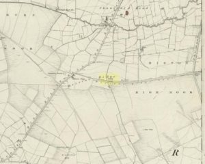
Briscoe Rigg on 1851 map

Highlighted on the 1851 OS-map of the area as a ‘Camp’, all trace of this ancient settlement would seem to have been destroyed.  It was already on its way out when the Ordnance Survey lads looked at it for a second time in 1888, finding barely a trace of it.  Thankfully though, when the clearer eyes of that great northern antiquarian Eric Cowling visited the site in the early 1930s, traces of it could still be made out.  Both he and fellow antiquarian, Mr B.J.W. Kent of Beckwithshaw, did their own investigations; and it is their notes we are most grateful for in describing this forlorn antiquity.  Mr Cowling (1946) wrote:

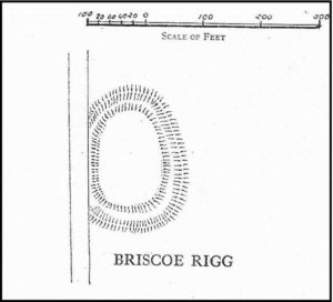
“On the highest point of the enclosed land on the east side of the Briscoe Rigg (to) Rigton road is a small entrenched site.  The enclosed area measures 130 yards from north to south and 70 yards from east to west.  The camp is six-sided, but this appears to be due to bad workmanship and layout rather than intention.  One gains the impression that the original plan was oblong and that the longer sides were bent to conform to the shorter ones.  It is slightly hollow and the whole area is almost levelled by heavy ploughing; the outer bank barely being one foot above the surroundings.  The ditch and outer bank now cover a spread of 60 feet.

“Recent hurried investigations by Mr Kent showed interesting details.  The area seems to have been occupied by hut-sites previous to the hurried digging of a trench some 16ft wide and 6ft deep, going down into the bed-rock nearly 6 feet.  Son after, the ditch was half-filled by boulders and earth amongst which was a fragment of pottery, black in colour and indefinite in type, but probably Roman.  When the ditch was half-full it was used for some time for cooking…”

Cowling’s 1946 site-plan

Cowling also told us there was “a tradition that tools, which by description appear to be socketed celts, were found here when the site was brought under cultivation”, in about 1840.  Mr Kent also discovered various flints hereby, many Mesolithic scrapers and “a fine Bronze Age barbed and tanged point and also a transverse cutting arrow point of the early four-sided types.”

Although these finds from much earlier periods show that people have been living and hunting in the area for an exceptionally long period, the settlement or camp at Briscoe Rigg was probably built in the early Iron Age period and continued to be used into Romano-British times (somewhere between between 500 BCE and 500 CE).

References:

  1. Cowling, E.T., Rombald’s Way, William Walker: Otley 1946.

© Paul BennettThe Northern Antiquarian


Horn Bank, Rigton, North Yorkshire

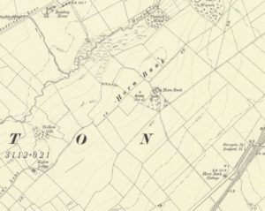
Horn Bank on 1910 map

Settlement (destroyed):  OS Grid Reference – SE 2905 5035

Archaeology & History

Upon the top of the old ridge where ran the ancient trackway between Rigton and Pannal, could once be found a multi-period settlement, long since gone – as happens all too often in this neck o’ the woods.  And unfortunately there doesn’t appear to be any sketch plans of the site.  It was first described by Edward Hargrove (1789) in his historical old rambles around Harrogate and district.  When the scribe reached Horn Bank, he told that here,

“was lately discovered the remains of several entrenchments forming three distinct enclosures, two of a square and one of a circular form.  Not far from these entrenchments, which were probably of Danish origin, was found, in May 1787, the umbo of a shield, with several other fragments of gilt brass…”

In William Grainge’s (1871) magnum opus he told that,

“At Horn Bank, on the crest of the hill east of Rigton, near a farm-house, are the remains of three camps—two of a square, and one of a circular form; they are probably of British and Roman origin. The location is a lofty and commanding one; but the ploughshare has so often passed over them that they are nearly obliterated.”

Just below the settlements Grainge also said how, “a fine spring of water was formed into a bath here many years ago, but the whole is now in a state of ruin.”  This would have likely been the main water supply for the people living here.  Harry Speight (1903) implied the same thing when he investigated the site, saying:

“At a place called Horn Bank, near Rigton, on the west side of the parish, on the crest of the hill on the north side of the Horn Bank farmhouse, there were formerly to be seen very distinct indications of three camps, each encompassed with fosse and rampart. Hargrove supposed them to be Danish, but as two of them were of a square or rectangular form, and the other circular, they were in all probability relics of the Romano-British contest, at first occupied by the native tribes and subsequently as a temporary camp and look-out post by their conquerors. The site commands a wide and uninterrupted view in every direction, while close at hand is a copious spring of good water. This spot many years ago was converted into a bathing-place, but is now broken down and abandoned… The site has long been ploughed, and little or no trace of these earthworks is now discernible.”

The only thing Eric Cowling (1946) could find when he came to the place were faint scars of walling whose shadows were highlighted by the sun when the conditions were just right.  He thought the settlements were Iron Age in nature, but would have continued to be used in subsequent centuries by local people.  It seems a sensible suggestion…

References:

  1. Cowling, E.T., Rombald’s Way, William Walker: Otley 1946.

  2. Grainge, William, History & Topography of Harrogate and the Forest of Knaresborough, J.R. Smith: London 1871.

  3. Hargrove, E., The History of the Castle, Town and Forest of Knaresborough with Harrogate, W. Blanchard: York 1789.

  4. Speight, Harry, Kirkby Overblow and District, Elliot Stock: London 1903.

© Paul BennettThe Northern Antiquarian


Achamore Hut Circles, Bettyhill, Farr, Sutherland

Hut Circles:  OS Grid Reference – NC 74219 58055

Also Known as:

  1. Canmore ID 6262

Getting Here

Achamore's NE 'hut' circle, looking E

Achamore’s NE ‘hut’ circle, looking E

Along the A836 road a mile east of Bettyhill, a track goes south onto the moors just before Loch Salachaidh. Walk along here for several miles, past the windmills and past the Achadh Thaibstil Cairn, until you reach the remote green fields that are the remains of the clearance village of Achamore.  As you walk into the green grasses, a ruined building is to your left.  In front of you, a large raised round structure almost entirely covered in grass.  You’re here!

Archaeology & History

This is a curious structure – and were it not for being labelled as a ‘hut circle’ by the lads at Ordnance Survey, on first impression I’d be more tempted to classify it as either a collapsed broch, or a large cairn circle.  This is entirely due to the size of the thing, as it’s big for a hut circle!

NW arc of the circle

NW arc of the circle

Eastermost embankment

Eastermost embankment

Circular in form, the sides of the structure on its eastern face are nearly three feet high, piled at an angle of nearly 45 degrees, and several feet across before you reach the internal section of the said ‘hut circle.’  As you walk around it, the height of the piled stones diminishes to between 1-2 feet, but the diameter of the walling all round is consistently wide – increasing the thought of it being a collapsed or robbed-out broch.  The diameter of the structure is some 20 yards across, with an approximate circumference of 64 yards.

'Hut circle' atop of nearby hill

‘Hut circle’ atop of nearby hill

Another “hut circle” is immediately visible some 80 yards to the south, on top of the nearby grassy hilltop.  The majority of this is also covered in meadow grasses, with edges and upper surfaces all but hidden.  On its southeastern edge is what looks like a structural stone ‘entrance’ some two yards across and three yards long.

Other smaller hut circles in the area indicate that this region – like others nearby – was a place of consistent human habitation from prehistoric (probably Neolithic) times, unbroken all the way through until the 18th century.

© Paul BennettThe Northern Antiquarian 

Castle Craig, Tillicoultry, Clackmannanshire

‘Fort’ (destroyed):  OS Grid Reference – NS 9116 9769

Also Known as:

  1. Canmore ID 48294

Archaeology & History

This ancient fort could once be seen in the ancient woodlands on the western side of the Mill Glen, above the village, going into the Ochils—but it was completely destroyed, as usual, by the Industrialists when they quarried the entire structure out of existence.  It was a big thing too, by all accounts.  When Stewart Cruden (1964) saw it, shortly before its final demise, it was still impressive to look at.  He told that the fort consisted of a deep rock-cut ditch with a stone wall on the inside and the remains of a stony rampart on the outside.  Although damaged it still measured 300 feet across.  Its interior contained an almost precise circular enclosure, more than eighty feet across inside the remains of a large stone wall some twelve feet thick.

Nearly a hundred years earlier, Miss Christian MacLagan (1875) told it to be much bigger!  Not only did she report how locals remembered a stone roof on top, but it possessed three concentric circular walls, thirty-five apart, with the central area eighty feet in diameter—much as Cruden later reported.  However, even in MacLagan’s day, she told how many of the stones from the fort were being used to construct sheepfolds.  This destruction was being lamented by the local historian William Gibson (1883), who wrote:

“On the west side of the burn, and overtopping the village, stands the beautiful Castle Craig, wooded to the top, and on which stood, in ancient times, a round Pictish fortress, the traces of which can still be distinctly seen. This craig is, I think, one of the most picturesque objects on the Alva estate, and it is a very great pity that it should be so disfigured by the extensive quarrying operations that are being at present carried on at it.”

On the top of the quarry edges can still be found old walled remains crumbling at the edge of the huge cliffs, but these are unlikely to have been attached to the ancient fortress, and may just be the fragmentary memories of the sheepfolds built from the old fort.

Folklore

Tradition told that this was one of the old forts of the Picts who lived in the Ochils.  If it was a fort, then the Pictish tradition is probably true.  Old lore also told that some of the stones from the fort were used in the construction of Stirling Castle, 7.8 miles (12.6km) to the west.

References:

  1. Corbett, L., et al., The Ochil Hills, Forth Naturalist & Historian 1994.
  2. Cruden, Stewart H., “Castle Craig, Tillicoultry,” in Discovery & Excavation Scotland, 1964.
  3. Feacham, Richard, Guide to Prehistoric Scotland, Batsford: London 1977.
  4. Gibson, William, Reminiscences of Dollar, Tillicoultry and other Districts Adjoining the Ochils, Andrew Elliot 1883.
  5. Maclagan, Christian, The Hill Forts, Stone Circles and other Structural Remains of Ancient Scotland, Edinburgh 1875.
  6. Royal Commission on the Ancient & Historical Monuments, Scotland, Inventory of Monuments and Constructions in the Counties of Fife, Kinross and Clackmannan, HMSO: Edinburgh 1933.
  7. Royal Commission on the Ancient & Historical Monuments, Scotland, The Archaeological Sites and Monuments of Clackmannan District and Falkirk District, Society of Antiquaries of Scotland 1978.
  8. Watson, Angus, The Ochils: Placenames, History, Tradition, PKDC: Perth 1995.

© Paul BennettThe Northern Antiquarian


Manor Farm, Bolnhurst, Bedfordshire

Hillfort:  OS Grid Reference – TL 0849 5985

Also Known as:

  1. The Camp

Archaeology & History

Wadmore's 1920 groundplan

Wadmore’s 1920 groundplan

This much disturbed Iron Age ‘hillfort’ is effectively a large enclosure of Iron Age origin, much ruined by farming and subsequent landscape alterations through the centuries, with much of it re-fashioned as a medieval moat more than a thousand years after first being built.  Even when the site was visited and described in Mr Wadmore’s (1920) fascinating work he told of the variants in its apparent construction phases:

“This large earthwork is situated on flat level ground, a few yards off the Bedford-Kimbolton Road, at the VIIth milestone out of Bedford.  In shape it is very irregular and presents little to aid one in arriving at an estimate of its original form, except the construction of its defensive lines, which are of two totally different characters and suggest that a comparatively modern manor has been added to an older work.

“The portion which I take to be the older, lies to the south, and is contained on this and the western side, as far as and including the great sweep bending east, by a strong vallum with a parapet and external fosse.

“The modern portion appears to me to commence between the east and west faces where the lines run north, and are purely the remains of a fosse without any indication of a parapet.  The extension of these lines, so far as can be traced, would tend to prove that the work occupied both sides of the road; but such a fact should not prejudice one’s view concerning the work as a whole….”

Section of the earthworks drawn by Wadmore

Section of the earthworks drawn by Wadmore

Adding with a good sense of humility that, “I am quite willing to admit that I may be mistaken, as the matter is entirely speculative.”  But modern archaeological analysis tends to prove that much of Wadmore’s words were correct and the remaining northern section of these earthworks is where the medieval moated section was built.  Roman remains and other period artifacts have also been unearthed in and around the site.

A few hundred yards southwest of the hillfort we find a place called Greenbury Farm.  This place was known in the 14th century as ‘Grymesbury’, which has been taken by some students as relating to the Norse deity, Grim.  However, Mawer & Stenton (1926) point out that in this instance,

“The Grym family had a holding in Bolnhurst in 1302 and bury is here used in the manorial sense. Hence ‘Grym’s Manor.’”

References:

  1. Mawer, A. & Stenton, F.M., The Place-Names of Bedfordshire and Huntingdonshire, Cambridge University Press 1926.
  2. Wadmore, Beauchamp, The Earthworks of Bedfordshire, Bedfordshire Standard: Bedford 1920.

© Paul BennettThe Northern Antiquarian 2016


Castlehill Wood, St Ninians, Stirling, Stirlingshire

Dun:  OS Grid Reference – NS 75074 90902

Also Known as: 

  1. Canmore ID 46233
  2. Castlehill Wood

Getting Here

In ghostly mist and bracken

Take the Gateside Road from St Ninians or Polmaise Road out of Torbrex across the M9, heading out west onto the southern moors of Touch Hills, passing the Wallstale dun in the trees and then the Castlehill dun just off the road.  Keep going uphill for just over half-a-mile, keeping your eyes peeled on the right for where the MOD lads play some of their war-games.  Walk along the track here, following the line of the woods, until it gets to the spot where it doubles back on itself.  Just here, about 30 yards in front of you, a rounded walled knoll gives the game away!

Archaeology & History

Artists impression of the reconstructed site (PSAS 1959)

An impressive-looking site, not too far off the moorland road, it is one of more than half a dozen hillforts and duns found to the west of Stirling, all of them relatively close to each other—showing that a lot of human activity was going on here in the Iron Age and, probably, much earlier.  Looking like a cross between a broch and a traditional hillfort, the site is best visited in the Winter and Spring months before the bracken starts to encroach and cover it.

Officially rediscovered in 1952 and excavated three years later, it was thought to have been built in the 1st century AD and used for a few hundred years thereafter.  As you walk up to the eastern edge of the monument, a large entrance, 4½ wide, allows you into the large open space within.  From here, and walking around both the inner and outer walls, you get an idea of the huge amount of work it must have taken to build this structure.  The walls alone which constitute the main of Castlewood Dun are, on average, 16 feet thick!  The Royal Commission report for the area (summarizing the archaeological work of F.W. Feacham in the ’50s) gives the basic architectural features of the place:

“The dun is oval in plan…and measures 75ft from NE to SW, transversely within a drystone wall 16ft thick.  The faces of the wall are composed of large, angular blocks, and the core of boulders, small rubble and earth.  The entrance in the E arc, is provided with door-checks.  Within these, the passage measures 4ft 6in in width, and outside them 3ft 9in.  A few paving-stones were laid to level the rough rock surface of the passage-floor.  Traces of what might have been the bottom step of a stair, rising up the inner face of the wall, were found at a point 8ft N of the entrance.  The dun had no mural stair or galleries, but two sets of mural chambers were located, one in the W and the other in the S acr of the wall.  The former consisted of an entrance-passage, 6ft in length, which varied in width from 2ft at the outer to 3ft at the inner end, where it opened into a circular chamber 4ft in diameter.  From either side of the passage a narrow duct or flue, about 19ft in length and 1ft 6in in width, led off obliquely through the core of the wall to debouch into the interior of the dun.  The construction in the S arc consisted of a similar passage, one flue and a smaller chamber.  Ash and a clinker of very light weight were found in the form of deposits in both passages and all the flues. …The excavator suggested they might have been corn-drying installations.”

Groundplan of site (PSAS 1959)
Entrance details (PSAS 1959)

Apart from a small piece of Roman glass, quern fragments, anvils stones and a pot lid, the excavators found very little inside the dun—not even any hearths.  The walling on the southwest and western edges was built onto a small cliff, making access slightly difficult from that side.

From the site itself, views are excellent, particularly in an arc through the north, east and southeast, with the western skylines being only a short distance away.  This enabled relatively easy tribal communication with people at the other brochs, duns and forts in the area, across an otherwise large but difficult landscape in prehistoric times.  A few hundred yards to the northeast, on the other side of the recently planted tree-farm (forestry plantation), a large D-shaped structure—possibly Iron Age, possibly medieval— is accompanied by lines of ancient walling running down the slopes.

References:

  1. Feachem, R W., “Castlehill Wood Dun, Stirlingshire“, in Proceedings Society Antiquaries, Scotland, volume 90, 1959.
  2. Feachem, R W., “Castlehill Wood, Polmaise”, in Discovery & Excavation Scotland, 1955.
  3. MacKie, E W. “English Migrants and Scottish Brochs’, in Glasgow Archaeological Journal, volume 2, 1971.
  4. Royal Commission on the Ancient & Historical Monuments Scotland, Stirling – volume 1, HMSO: Edinburgh 1963.
  5. Royal Commission Ancient & Historical Monuments, Scotland, Archaeological Sites and Monuments of Stirling District, Central Region, Edinburgh 1979.

© Paul Bennett, The Northern Antiquarian 


Newton Bridge Enclosure, Fowlis Wester, Perthshire

Enclosure:  OS Grid Reference – NN 8884 3155

Getting Here

Enclosure’s western wall

Venture along the A822 Crieff to Dunkeld road, turning down into the gorgeous Sma’ Glen.  Nearly 1 mile past Ossian’s Stone, just past where the road crosses the River Almond, walk along the track on your right where the big boulder sits.  Past the boulder, walk up the grassy slope to the left.  A standing stone will catch your attention, which sits in the walling.  Y’ can’t really miss it!

Archaeology & History

Rediscovered by Paul Hornby in 2015 at the end of a day’s excursion to the neolithic sites a few miles west of here, I can find no references at all to the denuded remains of what seems to be a typical prehistoric enclosure.

Looking down the west wall
The southwestern walls

Constructed around a natural rise in the land 60-70 yards above the River Almond, the enclosure has that ‘Iron Age’ look about it (it may be earlier).  Shaped like a giant ‘D’ (and clearly visible on GoogleEarth), the extensive walling that makes up the site—about a yard wide all the way round—is far from small, measuring some 60 yards (54.8m) at its greater longer axis roughly north-south, by 54 yards (49.5m) east to west, with a circumference of about 170 yards (155.5m).  The much-denuded walling that defines the perimeter is comprised of a number of large stones with thousands of smaller packing stones that are mainly overgrown.  A large ‘standing stone’ about 3 feet tall is the most notable feature nearly halfway along the western wall.

Small standing stone in wall

In all probability this enclosure would have been in use since its construction in the Iron Age period all the way through to the coming of Fuadach nan Gàidheal (the Highland Clearances) in the 19th century, as the people here were pragmatists who made best use of what was around them.  It is likely to have ended its days as an area where cattle was contained.

Acknowledgements:  Huge thanks to Paul Hornby for his assistance with site inspection, and additional use of his photos.

© Paul Bennett, The Northern Antiquarian