This is an outstanding site visible for miles around in just about every direction – so getting here is easy! If you’re coming from Harrogate, south down the A658, turn right and go thru North Rigton. Ask a local. If you’re coming north up the A658 from the Leeds or Bradford area, do exactly the same! (either way, you’ll see the crags rising up from some distance away) As you walk to the main crags, instead of going to the huge central mass, you need to follow the line of walling down (south) to the extended cluster of much lower sloping rocks. Look around and you’ll find it!
Archaeology & History
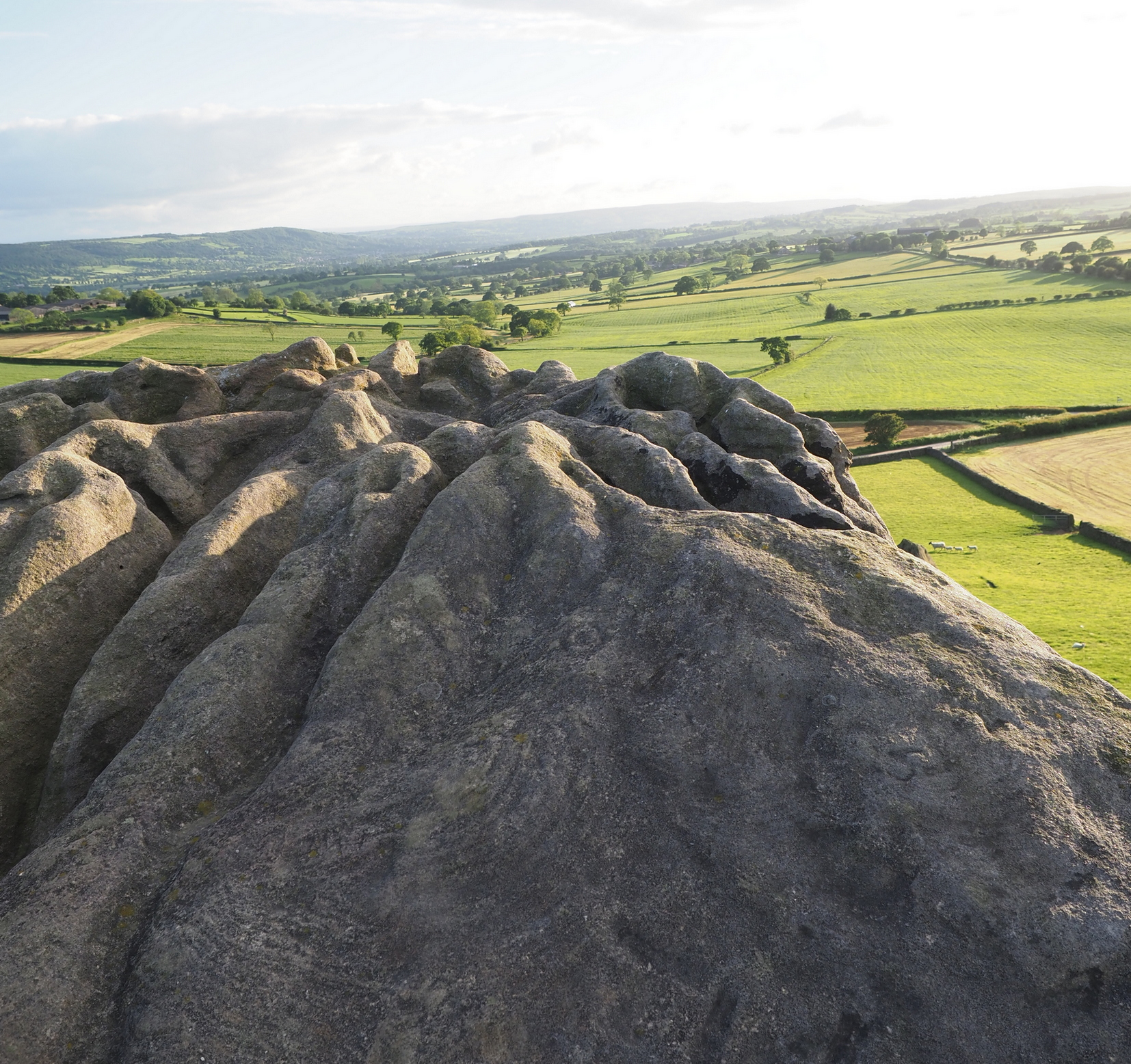
On the evening of May 27, 2024, I received a phone call from a Mr James Elkington of Otley. He was up Almscliffe Crags and the wind was howling away in the background, taking his words away half the time, breaking the sentences into piecemeal fragments. But through it all came a simple clarity: as the sun was setting and the low light cut across the rocky surface, a previously unrecorded cup-and-ring design emerged from the stone and was brought to the attention of he and his compatriot Mackenzie Erichs. All previous explorations for rock art here over the last 150 years had proved fruitless—until now!
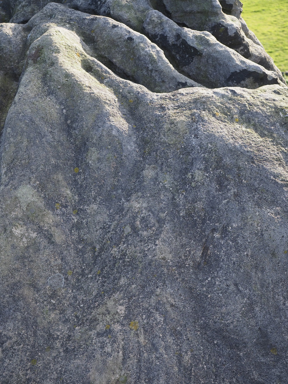
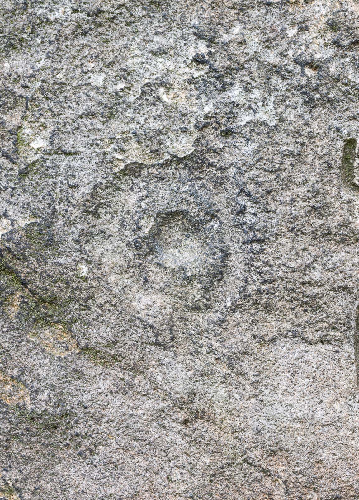
Looking northwestCentral cup-&-ring
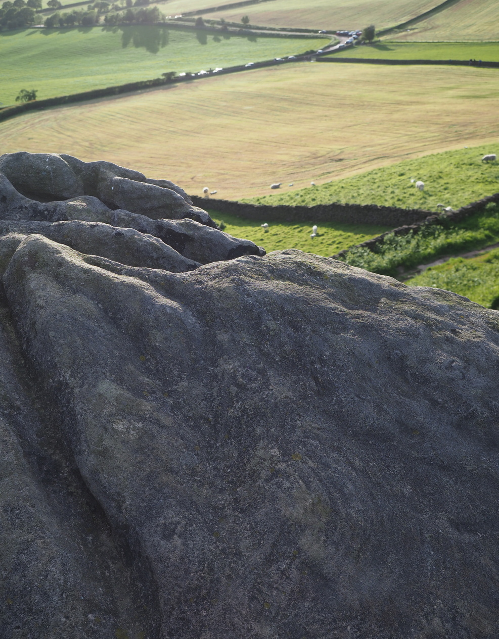
On the east-facing slope of the stone, just below the curvaceous wind-and-rain hewn shapes at the very top of the boulder, is a singular archetypal cup-and-ring. It’s faint, as the photos show, but it’s definitely there. What might be another cup-and-ring is visible slightly higher up the sloping face, but the site needs looking at again when lighting conditions are just right! (you can just about make it out in one of the photos) But, at long last, this giant legend-infested mass of Almscliffe has its prehistoric animistic fingerprint, bearing fruit and giving watch to the countless heathen activities going back centuries. Rombald’s wife Herself might have been the mythic artist of this very carving! (if you want to read about the many legends attached to the major Almscliffe rock outcrop, check out the main entry for Almscliffe Crags)
Coming from Harrogate, take the B6162 and B6161 road to Beckwithshaw, through the village and, 4-500 yards on, turn right onto Norwood Lane. 2 miles along, keep your eyes peeled on your left for a gravelled parking spot and you’ll see the large rock outcrop 200 yards south of the road. …Otherwise, from Otley: go over the river bridge and turn right up Farnley Lane and follow the B6451 for a few miles, thru Farnley village up the Washburn valley, past Norwood and at Bland Hill, turn right along Broad Dubb Road for 1¾ miles where you’ll reach that same gravelled parking spot.
Archaeology & History
Very much the ‘little brother’ of Great Almscliffe, 3 miles (4.83km) to the southeast, this site would be more of interest to the travelling geologist, perhaps, than to antiquarians. But that depends what tickles y’ fancy I s’ppose.
In 1702 when the northern antiquarian Ralph Thoresby mentioned this and its big brother to the southeast, he described the “two famous crags of Almes Cliff—in some old writings called Aylmoys ut dicitur—but have seen nothing memorial of it, saving its remarkable lofty situation.” He missed the cup-and-ring carving on the east-side of the crags, obviously, which indicates that it had some form of animistic sanctity in ancient times.
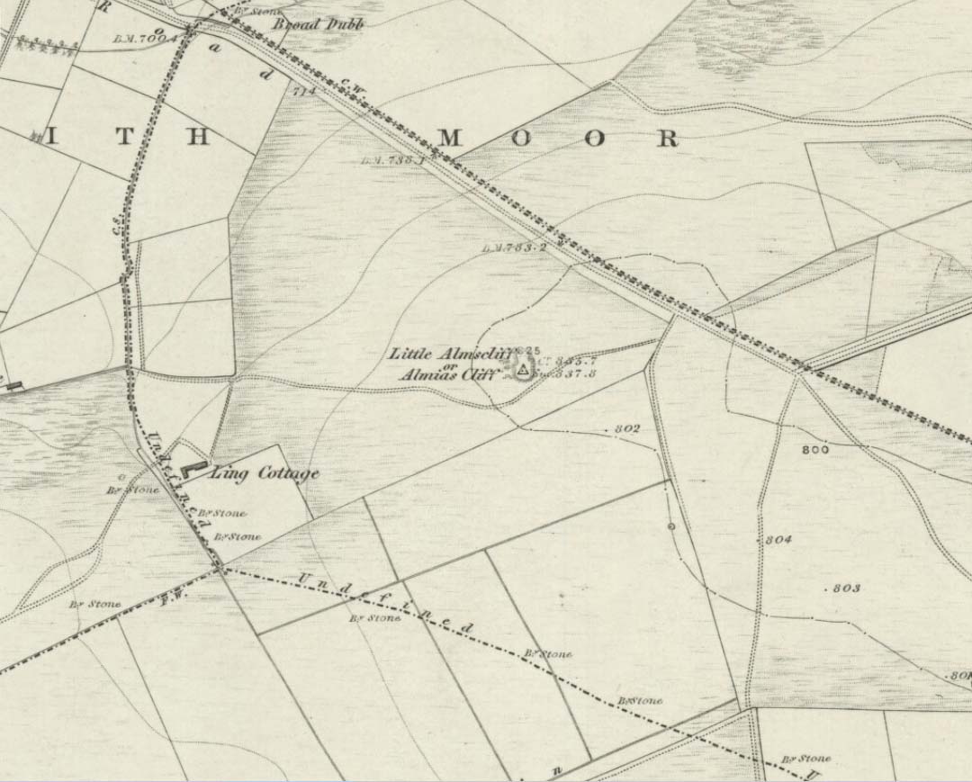
The location on 1851 mapLittle Almscliffe c.1900
Little Almscliffe was one of many impressive places located within the ancient Forest of Knaresborough; and although it wasn’t on the original boundary line, a perambulation (i.e., annual ritual walking to the old stones, trees and wells defining the region) of the area written in 1770, in what Mr Grainge called “the Copyhold Forest”, was undertaken by the Enclosure Commissioners. It differed from the more ancient perambulation rite, in that the newer one included a mention of,
“five bounder stones also marked F to an earth-fast stone, lying northeast of Little Almes Cliffe, marked also with an F; (and) from thence by other four bounder stones marked F to Sandwith Wath…”
The letter ‘F’ here signifying the word ‘forest’, as in the Forest of Knareborough.
William Grainge (1871) also believed these crags to have been a place of druidic worship. He wasn’t the only one. Many other writers of the time thought the same thing; and although we have no concrete evidence to prove this, it is highly likely that these rocks would have served some ritual purpose in pre-christian days. Certainly in more recent times (during the 1980s and ’90s) we know that ritual magickians used this site for their workings. On a more mundane level, the crags were previously used as a site for for beacon fires. One was erected here in 1803 when the first Bonaparte threatened to invade England; but I can find no written accounts of earlier beacons here.
References:
Bennett, Paul, The Old Stones of Elmet, Capall Bann: Milverton 2001.
Bogg, Edmund, From Eden Vale to the Plains of York, James Miles: Leeds 1895.
Bogg, Edmund, Higher Wharfeland, James Miles: Leeds 1904
Cowling, E.T., Rombald’s Way, William Walker: Otley 1946.
Grainge, William, History & Topography of Harrogate and the Forest of Knaresborough, J.R. Smith: London 1871.
Parkinson, Thomas, Lays and Leaves of the Forest, Kent & Co.: London 1882.
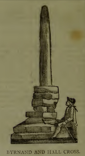
This long lost Cross could once be seen close to the Tudor era Byrnand Hall, which stood on the north side of the High Street. The Hall was demolished around 1780, and replaced by the present building, which is now a political club. The Cross was taken down around the same time, so we’re very fortunate to have a contemporary sketch.
Harry Speight (1906), the Great Yorkshire antiquarian, described the Cross when he was writing of the ‘big houses’ of Knaresborough, saying:
“Another notable old mansion was Byrnand Hall, which stood at the top of the High Street facing Gracious Street, and was rebuilt about a century ago. It was the property and seat for many generations of one of the leading families of Knaresborough, named Byrnand, one of its members being recorder of York in 1573. Opposite the house stood a very ancient stone cross, consisting of a plain upright column, without date or inscription, supported by several rudely-formed stones placed on three tiers or steps. It appears that one Richard Byrnand paid a fine and was permitted to enclose a cross standing on a piece of waste land then lately belonging to Robert Nessfield. The cross may be conjectured to have been either a memorial or boundary-stone. In those days ” it was not enough,” says the old antiquary, Hearne, ” to have the figure of the cross both on and in churches, chapels, and oratories, but it was put also in church-yards, and in every house, nay, many towns and villages were built in shape of it, and it was very common to fix it in the very streets and highways.
“This ancient relic, the site of which is now marked by a brass cross sunk in the causeway, was in after times called the Byrnand Hall Cross, from its proximity to the house of the same name. It stands on the road equidistant between York and Leeds, being eighteen miles from either place.”
At the end of the eighteenth century, E. Hargrove wrote:
“The (Byrnand) family mansion was situated at the end of the High-street, leading towards York. Near it formerly stood an ancient Cross, which being placed on the outside of the Rampart, and opposite to the entrance into the borough, seems to have been similar in situation, and probably may have been used for the same purpose, as that mentioned by Mr. Pennant, in his History of London, which stood without the city, opposite to Chester Inn; and here, according to the simplicity of the age, in the year 1294, and at other times, the magistrates sat to administer justice. Byrnand-Hall hath been lately rebuilt, by Mr. William Manby, who took down the remains of the old Cross, and left a cruciform stone in the pavement, which will mark the place to future times.”
Abbot J.I. Cummins, writing in the 1920s about the Catholic history of Knaresborough, told:
“Of the Byrnand Cross beyond the old town ditch the site is now marked in York Place by a brass cross let into the pavement for Christians to trample on.”
The Cross occupied an important position in the Knaresborough of old, at one of the highest points of the town by the junction of the modern High Street and Gracious Street, this latter being the road down the hill to the riverside and the troglodytic shrines of St Robert of Knaresborough and Our Lady.
Assuming the eighteenth century drawing is an accurate representation of the Cross, it does give the impression of considerable antiquity, and looks to have been 15-16 feet (4.75m.) high. From its appearance it looks like either a prehistoric monolith or an Anglo-Saxon ‘stapol‘ or column, and if it was the latter, it may have been erected to replace an earlier heathen wooden column or sacred tree following the replacement of the old beliefs by Christianity. If so, there may be no reason to deny Hargrove’s speculation that Byrnand Hall Cross once had a similar juridical function to the Chester Inn Cross in London.
References:
Bintley, Michael D.J., Trees in the Religions of Early Medieval England, Woodbridge, Suffolk, Boydell Press 2015.
Cummins, J.I., “Knaresborough,” in The Ampleforth Journal, Vol XXIV, No II, Spring 1929.
Hargrove, E., The History of the Castle, Town and Forest of Knaresborough, 5th Edition, Knaresborough 1790.
Speight, H., Nidderdale, from Nun Monkton to Whernside, London, Elliot Stock, 1906.
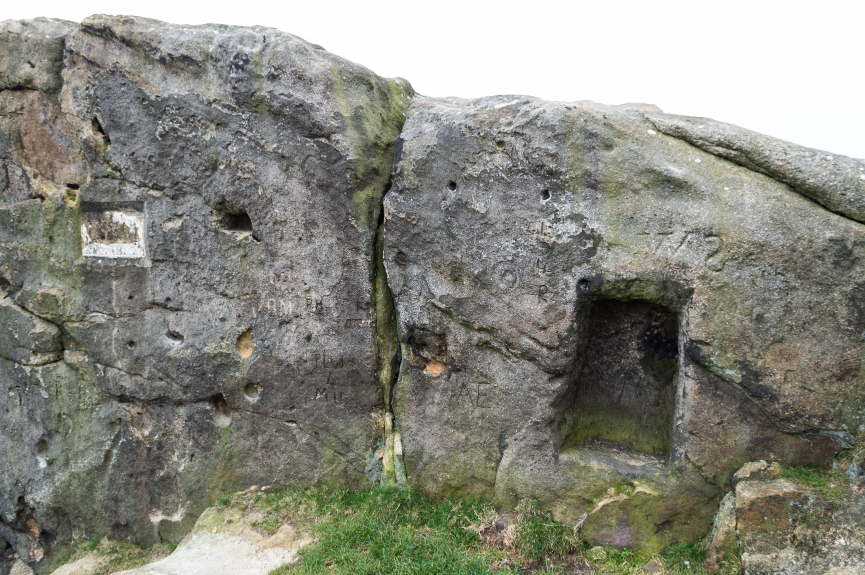
The crags of Little Almscliffe are today peppered with many modern carvings, such as are found on many of our northern rock outcrops. Yet upon its vertical eastern face is a much more ancient petroglyph – and one that seems to have been rediscovered in the middle of the 20th century. When the great northern antiquarian William Grainge (1871) visited and wrote of this place, he told us that, “the top of the main rock bears…rock basins and channels, which point it out as having been a cairn or fire-station in the Druidic days; there are also two pyramidal rocks with indented and fluted summits on the western side of the large rock” – but he said nothing of any prehistoric carvings. Curiously , neither the great historian Harry Speight or Edmund Bogg saw anything here either.
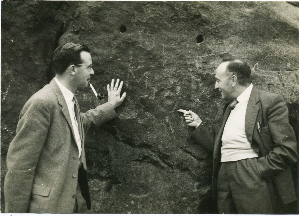
Stuart Feather & Joe Davies here, c.1955Cup&Ring, left of ‘door’ (photo by James Elkington)
This singular cup-and-ring design seems to have been reported first in E.S. Wood’s (1952) lengthy essay on the prehistory of Nidderdale. It was visited subsequently by the lads from Bradford’s Cartwight Hall Archaeology Group a few years later; and in the old photo here (right) you can see our northern petroglyph explorer Stuart Feather (with the pipe) and Joe Davis looking at the design. In more recent times, Boughey & Vickerman (2003) added it in their survey of, telling briefly as usual:
“On sheltered E face of main crag above a cut-out hollow like a doorway is a cup with a ring; the top surface of the rock is very weathered and may have had carvings, including a cupless ring.”
Close up of design
Indeed… although the carving is to the left-side of the large hollow and not above it. Scattered across the topmost sections of the Little Almscliffe themselves are a number of weather-worn cups and bowls, some of which may have authentic Bronze age pedigree, but the erosion has taken its toll on them and it’s difficult to say with any certainty these days. But it’s important to remember that even Nature’s ‘bowls’ on rocks was deemed to have importance in traditional cultures: the most common motif being that rain-water gathered in them possessed curative properties.
References:
Bennett, Paul, The Old Stones of Elmet, Capall Bann: Milverton 2001.
Bogg, Edmund, From Eden Vale to the Plains of York, James Miles: Leeds 1895.
Bogg, Edmund, Higher Wharfeland, James Miles: Leeds 1904
Cowling, E.T., Rombald’s Way, William Walker: Otley 1946.
Grainge, William, History & Topography of Harrogate and the Forest of Knaresborough, J.R. Smith: London 1871.
Parkinson, Thomas, Lays and Leaves of the Forest, Kent & Co.: London 1882.
Acknowledgements: Huge thanks to James Elkington for use of his fine photos on this site.
Settlement (destroyed): OS Grid Reference — SE 2581 5100
Archaeology & History
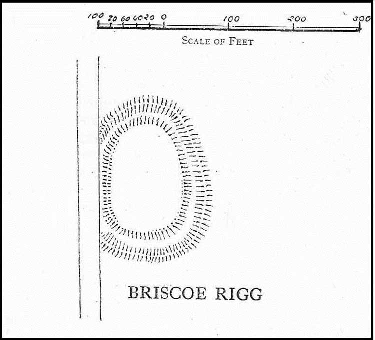
Briscoe Rigg on 1851 map
Highlighted on the 1851 OS-map of the area as a ‘Camp’, all trace of this ancient settlement would seem to have been destroyed. It was already on its way out when the Ordnance Survey lads looked at it for a second time in 1888, finding barely a trace of it. Thankfully though, when the clearer eyes of that great northern antiquarian Eric Cowling visited the site in the early 1930s, traces of it could still be made out. Both he and fellow antiquarian, Mr B.J.W. Kent of Beckwithshaw, did their own investigations; and it is their notes we are most grateful for in describing this forlorn antiquity. Mr Cowling (1946) wrote:
“On the highest point of the enclosed land on the east side of the Briscoe Rigg (to) Rigton road is a small entrenched site. The enclosed area measures 130 yards from north to south and 70 yards from east to west. The camp is six-sided, but this appears to be due to bad workmanship and layout rather than intention. One gains the impression that the original plan was oblong and that the longer sides were bent to conform to the shorter ones. It is slightly hollow and the whole area is almost levelled by heavy ploughing; the outer bank barely being one foot above the surroundings. The ditch and outer bank now cover a spread of 60 feet.
“Recent hurried investigations by Mr Kent showed interesting details. The area seems to have been occupied by hut-sites previous to the hurried digging of a trench some 16ft wide and 6ft deep, going down into the bed-rock nearly 6 feet. Son after, the ditch was half-filled by boulders and earth amongst which was a fragment of pottery, black in colour and indefinite in type, but probably Roman. When the ditch was half-full it was used for some time for cooking…”
Cowling’s 1946 site-plan
Cowling also told us there was “a tradition that tools, which by description appear to be socketed celts, were found here when the site was brought under cultivation”, in about 1840. Mr Kent also discovered various flints hereby, many Mesolithic scrapers and “a fine Bronze Age barbed and tanged point and also a transverse cutting arrow point of the early four-sided types.”
Although these finds from much earlier periods show that people have been living and hunting in the area for an exceptionally long period, the settlement or camp at Briscoe Rigg was probably built in the early Iron Age period and continued to be used into Romano-British times (somewhere between between 500 BCE and 500 CE).
References:
Cowling, E.T., Rombald’s Way, William Walker: Otley 1946.
Settlement (destroyed): OS Grid Reference – SE 2905 5035
Archaeology & History
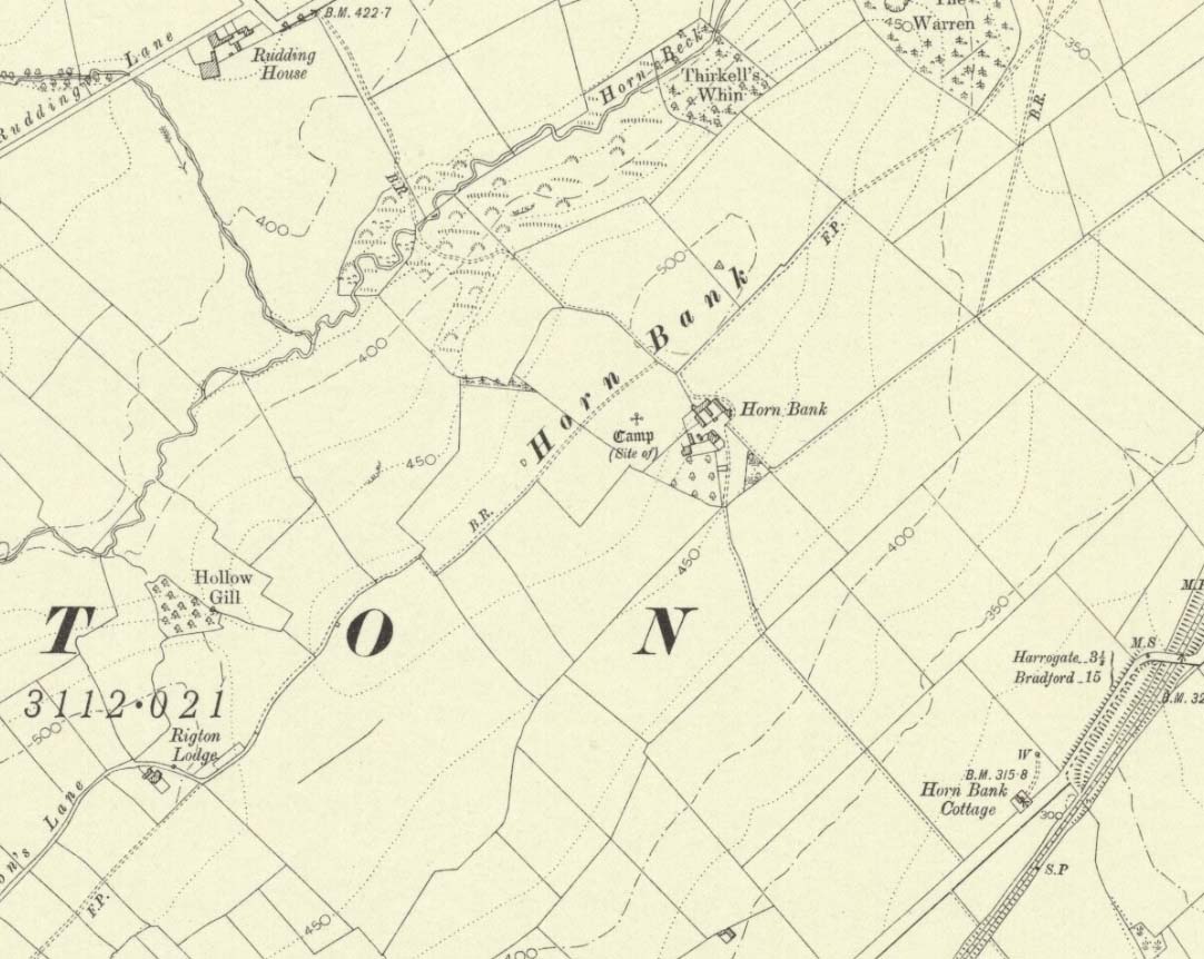
Upon the top of the old ridge where ran the ancient trackway between Rigton and Pannal, could once be found a multi-period settlement, long since gone – as happens all too often in this neck o’ the woods. And unfortunately there doesn’t appear to be any sketch plans of the site. It was first described by Edward Hargrove (1789) in his historical old rambles around Harrogate and district. When the scribe reached Horn Bank, he told that here,
“was lately discovered the remains of several entrenchments forming three distinct enclosures, two of a square and one of a circular form. Not far from these entrenchments, which were probably of Danish origin, was found, in May 1787, the umbo of a shield, with several other fragments of gilt brass…”
In William Grainge’s (1871) magnum opus he told that,
“At Horn Bank, on the crest of the hill east of Rigton, near a farm-house, are the remains of three camps—two of a square, and one of a circular form; they are probably of British and Roman origin. The location is a lofty and commanding one; but the ploughshare has so often passed over them that they are nearly obliterated.”
Just below the settlements Grainge also said how, “a fine spring of water was formed into a bath here many years ago, but the whole is now in a state of ruin.” This would have likely been the main water supply for the people living here. Harry Speight (1903) implied the same thing when he investigated the site, saying:
“At a place called Horn Bank, near Rigton, on the west side of the parish, on the crest of the hill on the north side of the Horn Bank farmhouse, there were formerly to be seen very distinct indications of three camps, each encompassed with fosse and rampart. Hargrove supposed them to be Danish, but as two of them were of a square or rectangular form, and the other circular, they were in all probability relics of the Romano-British contest, at first occupied by the native tribes and subsequently as a temporary camp and look-out post by their conquerors. The site commands a wide and uninterrupted view in every direction, while close at hand is a copious spring of good water. This spot many years ago was converted into a bathing-place, but is now broken down and abandoned… The site has long been ploughed, and little or no trace of these earthworks is now discernible.”
The only thing Eric Cowling (1946) could find when he came to the place were faint scars of walling whose shadows were highlighted by the sun when the conditions were just right. He thought the settlements were Iron Age in nature, but would have continued to be used in subsequent centuries by local people. It seems a sensible suggestion…
References:
Cowling, E.T., Rombald’s Way, William Walker: Otley 1946.
Grainge, William, History & Topography of Harrogate and the Forest of Knaresborough, J.R. Smith: London 1871.
Hargrove, E., The History of the Castle, Town and Forest of Knaresborough with Harrogate, W. Blanchard: York 1789.
Speight, Harry, Kirkby Overblow and District, Elliot Stock: London 1903.
Take the same directions as if you’re going to visit the Naked Jogger Carving (stone 612), not far from the well-known Tree of Life Stone. From the Naked Jogger carving, walk up the small outcrop of rocks that bends above you. Barely 100 yards up when you reach the top, you’ll notice a single large sloping stone barely 50 yards ahead of you in the same field. That’s the spot!
Archaeology & History
This is a little-known beauty of a carving just off the edge of the quiet moors that are littered with prehistoric remains. It was only rediscovered a few years ago — by myself if you believe the writings of rock art student Keith Boughey (2010) in his essay on the validity of so-called “amateurs”who research and discover petroglyphs (Boughey’s essay is scattered with mistakes). But I’d never even visited this carving until two years ago! The stone was in fact found during a field-walk by early members of the Northern Earth Mysteries group in August 1989 (Wilson 1990) and subsequently described and illustrated for the first time by Phil Reeder (1990).
Close-up of main cluster
As can be seen in the photos accompanying this site profile, the rock on which the carving has been done has, at some point in the past, been cut into and its edges have been hacked away and destroyed, literally cutting into the overall design. We have no idea what the original size of the stone was, obviously, but this petroglyph was once larger than the design that we see at present. Such is the price of ‘progress’, as some folk call it.
Anyway – a few months after the carving was rediscovered, Phil Reeder (1990) wrote:
“After a visit to the Tree of Life stone…a cursory inspection by the NEM Group was made on nearby rock outcrops, part of which showed evidence of recent exposure due to soil erosion.
“One stone in particular stood out as five shallow cups and associated rings could be discerned. When cleaned, it became apparent that further carvings extended beneath a thin eroding soil layer. When this layer was cleared, a complex set of carvings were revealed.
“Only preliminary work at the site has been carried out to date, but it appears that the carvings comprise of at least 28 cups, 13 of which have associated rings; several of the cups are linked by gutters forming an intricate design, one gutter part enclosing 11 cups. The carvings on the lower edge of the stone have weathered badly and are difficult to interpret.”
Reeder’s so-called “amateur” description is a good one. Certainly more accurate than the subsequent one by Boughey (“I’m a professional”) & Vickerman (2003):
“Large rock of coarse grit whose surface slopes with the hill. About forty cups, some large, many with single rings, and many curving grooves, the whole forming a remarkable, complex design.”
Phil Reeder’s 1990 drawing
Boughey & Vickerman’s sketch
We can see in the respective drawings by both Reeder (left) and Boughey & Vickerman (right) that some elements which should have been included in the ‘official’ drawing were missed, yet had been accurately included in the earlier ‘preliminary’ drawing, as Mr Reeder put it. I hope that readers will forgive me pointing out these seemingly minor elements; but I do it to illustrate the ineffectiveness of more recent rock art students who are gaining the title of ‘experts’ in this field. It’s important to recognise that, in this field of study, “experts” are few and far between indeed… I’ve certainly yet to meet any!
Northern end of carving
Southern side of carving
The carving is mentioned briefly in Beckensall’s (1999) introductory study, with little comment. But of note here is not only the curious linear feature running between two cup-and-rings, but the position of the stone in the landscape. For if you sit either upon or next to this carving, you are looking east straight across the gorgeous Fewston valley directly at the prominent wooded hill of Sword Point. As it slopes down into the present-day greenery of fields and scattered woods, the Wharfe Valley spreads out to the distant east and, as the sun rises and scatters its rays onto the wet morning stone here, the design on the rock awakens with much greater visual lucidity than that which our daytime eyes bestow to us. In all likelihood, sunrise was an important element in whatever mythic function underscored this curious carving, with its human-like figure rising on its southern side, emerging from the edge of the rock, personifying perhaps the rising solar disc and the living landscape as the daylight breath awoke Earth’s creatures; or maybe it signifies a symbolic group of people gathered together watching the sunrise…
Of course, I’m dreaming… (how very amateur of me! 🙂 )
References:
Barnett, T. & Sharpe, K. (eds.), Carving a Future for British Rock Art, Oxbow: Oxford 2010.
Beckensall, Stan, British Prehistoric Rock Art, Tempus: Stroud 1999.
Boughey, Keith, “The Role of the Amateur in the Study of UK Prehistoric Cup-and-Ring Art,” in Barnett & Sharpe, Oxford 2010.
Boughey, Keith & Vickerman, E.A., Prehistoric Rock Art of the West Riding, WYAS: Leeds 2003.
Chappell, Graeme, “North Yorkshire Rock Art – New Discoveries,” in Northern Earth, no.62, 1995.
Michell, John, The Earth Spirit, Thames & Hudson: London 1975.
Reeder, Phil, “Snowden Carr Rock Carvings,” in Northern Earth Mysteries, no.40, 1990.
Standing Stone (lost): OS Grid Reference – SE 2522 5010
Archaeology & History
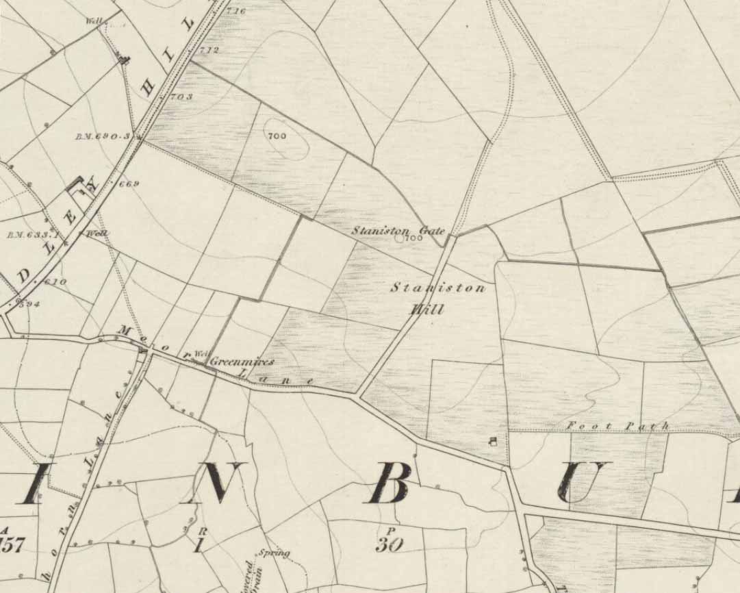
Staniston Hill on 1851 map
This long-lost standing stone gave its name to the small hill between the geological giants of Little Almscliffe and Almscliffe Crags, ‘Staniston Hill.’ Described as early as the 13th century in the Cartulary of Fountains Abbey as ‘Standandestan’, its precise whereabouts is unknown—but it’s damn close to the grid-reference cited here. As the early OS-map shows, a small rounded hill occurs a short distance northwest of the small copse of trees now growing. The monolith may have been felled by some grumpy christian, or it could be standing in some nearby walling. Local antiquarians, dowsers or archaeologists may or may not find a search for it worthwhile…
Its position between the two Almscliffe Crags makes it very close to marking the midway point of a natural solstice marker: the Winter sunrise from Little Almscliffe and summer sunset from the greater Almscliffe.
References:
Bennett, Paul, The Old Stones of Elmet, Capall Bann: Milverton 2001.
Smith, A.H., The Place-Names of the West Riding of Yorkshire – volume 5, Cambridge University Press 1961.
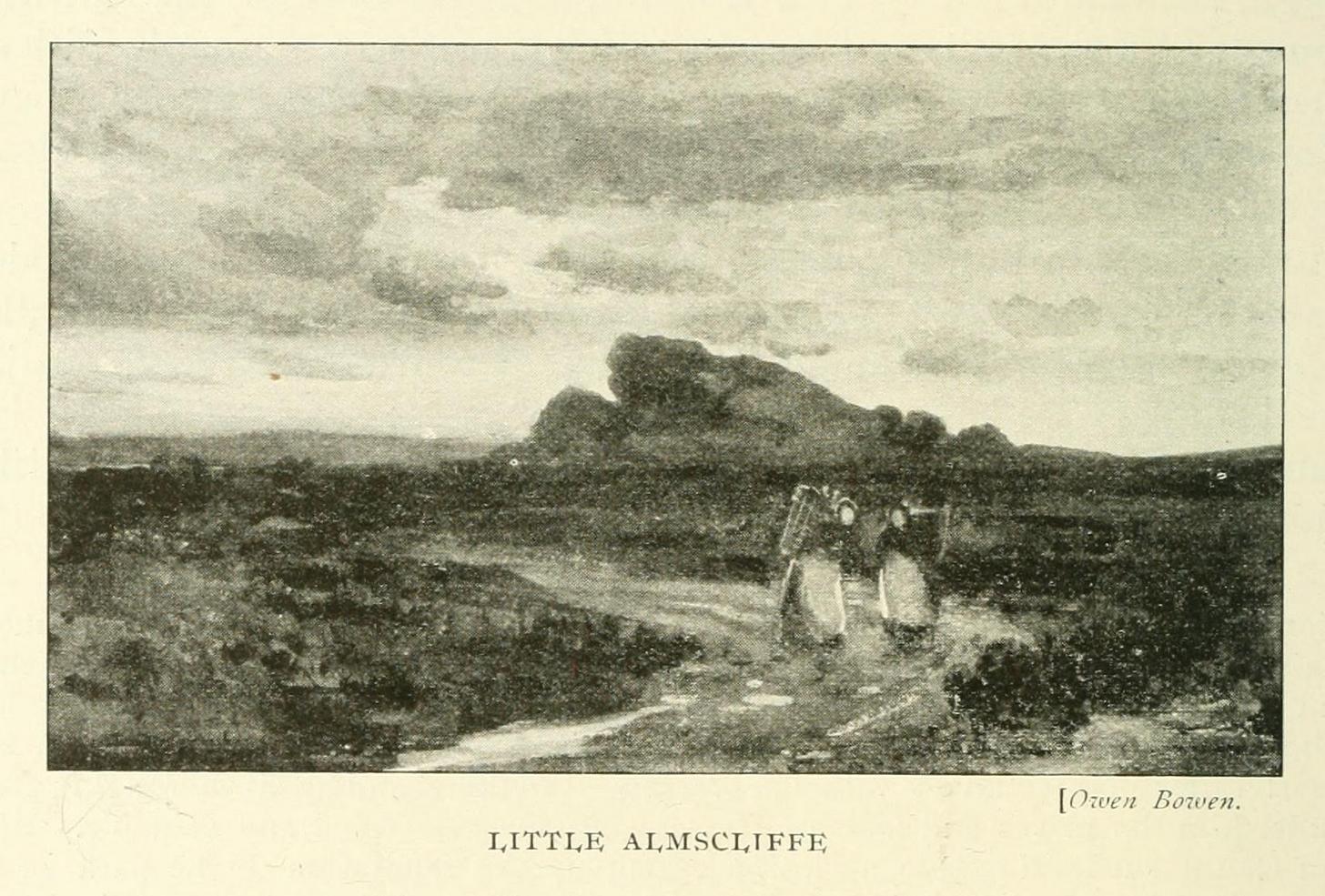
This is an outstanding site visible for miles around in just about every direction – so getting here is easy! If you’re coming from Harrogate, south down the A658, turn right and go thru North Rigton. Ask a local. If you’re coming north up the A658 from the Leeds or Bradford area, do exactly the same! (either way, you’ll see the crags rising up from some distance away)
Archaeology & History
Almscliffe Crags – looking east
This giant outcrop of rock rises out from the meadowlands here like a miniature volcano, visible for many miles all round. The history and legends surrounding the aged edifice are prodigious and the view from its tops on a fine day is one to be remembered. It is likely, although there is little corroborative historical evidence, that is was an “omphalos”, or navel centre of the universe for the local people many centuries ago. A great cutting runs through its centre and “runs from nearly north to south, and forms the boundary between the townships of Rigton and Stainburn, so that a portion of the rock is in each township.” On the respective sides of this division are carved the letters “T.F.” and “E.L.”, being the initials of the families who owned the land here in olden days, Thomas Fawkes [of the legendary Guy Fawkes’ family] and Edwin Lascelles, of the ancient Harewood family.
Although Almscliffe Crags have been described in a great many local history books, it almost beggars belief to find it omitted from all the ancient mystery or “sacred sites” books ever written. Curious… Such lesser sites as Alderley Edge, the Cow and Calf rocks, Kilburn’s White Horse, Twelve Apostles stone circle, and many more, whilst having their respective virtues, don’t touch this place for ritual or sacred intent.
First described in the early 13th century records of Fountains Abbey, A.H. Smith (1961) thought the name of Almscliffe itself originally came from a hypothetical lady’s name, which seems an all-too-easy proclamation to make, instead of the humble option of “I don’t know”! But Smith wasn’t the only one to throw some curious ideas up about the etymology of Almscliffe. Said by some local etymologists to derive from the Celtic Al-, a rock or cliff, and mias, an altar, there are other attempts to bring its rocky form into a consensus meaning. The anglo-saxon Ael or El, being fire, and messe, or mass; and the Scandinavian Ormcliff, being the “cliff of the serpent”. In Jones’ History of Harewood (1859), he tells
“it to have derived its name from the distribution of almes, at certain times, agreeably to the tenor of legacies left to the chapel which stood there in the sixteenth century, and was at that time dedicated to the Virgin Mary.”
It’s difficult to say which one tells its true title. Many a druidic tale has also been carved into its form. Such is the nature of this site that Grainge (1871) wrote how,
“it would not be difficult to show, with the exception of the artificial temple or circle of stones, this place possesses all the accessories of that ancient worship as…typical of the worship of the sun.”
Simpson’s 1879 drawing of the Almscliffe ‘cromlech’
A remark that was even echoed by one of Yorkshire’s finest and most sober historians, Harry Speight. (1903) Grainge also pointed out that in his day there were three standing stones by the great Crags, one fallen, but “two of these rocks yet stand upright.” A few years later we find that the ranting christian writer, Henry T. Simpson (1879), described similar megalithic remains here, though his description was of a “cromlech.” (illustrated here) I can find no trace, nor further references to these relics; but think it reasonable to suggest that, perhaps, Simpson’s cromlech and Grainge’s standing stones may have been one and the same monument.
In the field 100 yards immediately north of the Crags (the one with the two rocks in it) there used to be seen the remains of some primitive early walling, suggestive of a small, early settlement site. Very little can be seen of these remains today and, as far as I’m aware, no archaeological survey was ever done of them. In all honesty, it’s highly probable that a number of other important prehistoric sites were once in evidence at varying distances around Almscliffe Crags…
Folklore
The creation myth of Almscliffe tells that, long long ago, the great giant Rombald — whose main place of residence tended to be Ilkley Moor — was having a fight with the devil upon his homeland heath. As is common in the myths of giants, the ‘devil’ picked up a great boulder and threw it at Rombald, but it missed and fell just short of the village of North Rigton, creating Almscliffe Crags. A variation of this tale tells that it was Rombald and his wife having the argument and she threw the stones to create the place. Several sites have been named as the place where the mythological argument occurred: the Cow and Calf rocks, the Great Skirtful and Little Skirtful of Stones all cited in the folktales of our Yorkshire peasants. Another variation of the tale tells that the devil was simply carrying some stones (as devils and giants are renowned to do in the folk-tales of the world) and he accidentally dropped them where the Crags now stand. Such rock-throwing tales are, once more, symptomatic of cailleach tales more commonly found in Ireland and Scotland.
There are a great many cup-markings on the top surface of these Crags, most of which seem natural, but it is not unreasonable to think that, perhaps, some may have been carved by human hands? (not sure misself) Eric Cowling (1946) sincerely believed the antiquity of some carvings here. One of them particularly, three feet across and eighteen inches deep, though seemingly natural, has for several centuries been known as the “Wart Well.” Its name is attributed to folklore that is more commonly found in Ireland and the Scottish highlands; that is, should you have a wart, prick it with a pin until a drop or two of blood drips into the water that gathers in the stone bowl, then dip your hand in afterwards. The wart is sure to vanish. Another method to achieve the same end is to merely wash the skin affliction in the water, and it will soon fade. (Interestingly, an old psychotherapist friend, afflicted with the damned things, did just this and they promptly vanished.)
A more minor creation myth tells that the stone bowls we see on top of the Crags here – including the Wart Well – was actually made when the giant Rombald stepped from his home onto the Crags and left his footprint embedded in the rock face. He was said to have made it in just one step, from the Giant Skirtful of Stones prehistoric cairn [where one legend reputes him buried].
Faerie folk were also long held to live here. On the northwest side of the Crags is the entrance to a small cave that was always known as the Faerie’s Parlour, as it was said to be an entrance to their supernatural world. In times past, many people have scrambled down into the cave, but never reached their Otherworldly paradise. William Grainge (1871) wrote how the little people “were all powerful on this hill and exchanged their imps for children of the farmers round about.” This is typical of old changeling lore! In outlying villages surrounding the Crags there is a particular excess of faerie and old heathen lore.
One very curious-sounding tale tells how a goose was sent down the hole and, after some considerable time, re-emerged 3½ miles away out from a well near Harewood Bridge. The goose is one of the many symbols of the sun and one of its primary symbolic attributes is that of winter. Interestingly perhaps, as the rock art writer Graeme Chappell has pointed out, the underground journey of the goose from Almscliffe to Harewood Bridge coincides closely with the rising of sun on morning of the winter solstice. This tale may simply be a folk remnant — and an archaic one at that — of just that event: ritualising winter solstice from these Crags. In Norse lore, shamans tell of geese carrying the great god Wotan across the skies at the coming of the Yule period.
Another ritual date that was celebrated here was Beltane, or May 1. Not only do we find many of the outlying villages possessed their own maypoles, but in 1879 Mr Simpson of Adel reported seeing Beltane fires atop of these rocks. Other meetings were made here as the Crags are spliced in half by the local boundary line, and perambulation records show that people came here during the ‘beating of the bounds’, as they used to be called. This boundary perambulation moot ingredient is what strongly implies the site to have had ritual importance. And the fact that a mass of folktales emerge from here adds to this. Then of course we have the physical situation of the Crags at the heart of the mid-Wharfedale landscape. All these ingredients combined, strongly suggest the site would have been, not just the ritual meeting place of tribal elders in pre-christian times, but an omphalos: it rises majestically from the land and all monuments gaze towards its giant form. Important giant prehistoric monuments from the hills miles away tell of myths that come and go from this proud mass of stone. Although we have other omphali just over the extended horizons from Almscliffe, this is where the World began in the creation myths of ancient times in mid-Wharfedale, at the heart of the ancient kingdom of Elmet.
But there is still more lore to be told of these rocks…
The centre piece of the Crags is known as the Altar Rocks. Upon its western side is carved the “figure of a large tree, which we take to be the monogram of the Celtic Jupiter,” says Grainge. This assumption is derived from an eighteenth century writer who, said Speight (1903), told that “Almnus and Alumnus are titles of Jupiter, to whom this high altar was dedicated.”
The highest part of the Crags, to the west, is known as Lover’s Leap where, in 1766, a daughter of a respectable Rigton farmer of the name Royston, having been disappointed in love, decided to kill herself. She jumped, so legend reputes, from a point some sixty feet above ground, but a strong wind blowing at the time caught hold of her dress and carried her through the air until she landed safely in an adjoining field with naught but a sprained thumb! The said lady realised the stupidity of her ways and was said to have lived out a long and fine life.
In recent years earthlights (UFOs) have been seen floating above and around the great outcrop. It is likely that these were the same things which, in days of olde, the people would call the faerie. I highly recommend visiting the place!
References:
Bennett, Paul, The Old Stones of Elmet, Capall Bann: Milverton 2001.
Bogg, Edmund, From Eden Vale to the Plains of York, James Miles: Leeds 1895.
Bogg, Edmund, Higher Wharfeland, James Miles: Leeds 1904
Cowling, E.T., Rombald’s Way, William Walker: Otley 1946.
Eliade, Mircea, Patterns in Comparative Religion, Sheed & Ward: London 1958.
Grainge, William, History & Topography of Harrogate and the Forest of Knaresborough, J.R. Smith: London 1871.
Jones, John, The History and Antiquities of Harewood, Simpkin Marshall: London 1859.
Simpson, William, Archaeologia Adelensis, W.H. Allen: London 1879.
Smith, A.H., The Place-Names of the West Riding of Yorkshire – volume 5, Cambridge University Press 1961.
Speight, Harry, Kirkby Overblow and District, Elliott Stock: London 1904.
Legendary Rocks (destroyed): OS Grid Reference – SE 187 545
Archaeology & History
The original position and nature of this site was difficult to ascertain and left us wondering whether the place was once a monolith, stone circle or legendary rock outcrop, as seemed that there were no remains left of the place. Aswell as that, the only reference we had that describing this place is from William Grainge’s History of Knaresborough (1871), where he wrote:
“At Busky Dike, a place between Cragg Hall and Fewston, according to the report of tradition, there once existed a Druidical altar; and that same venerable authority declares that the same place is the haunt of a Bharguest; and many of the country people yet tremble as they pass that place in the dark, for fear they should meet that strange and terrible beast.”
The latter remark would indicate that something decidely pre-christian was once of renown here. But it seems that an old rock outcrop was the place in question here, found in the now wooded area on the south side of the Busky Dike Road, just northwest a half-mile outside of Fewston itself. It would be good to hear more about this place…if anyone knows owt…
References:
Grainge, William, The History of Harrogate and the Forest of Knaresborough, 1871.
Grainge, William, The History and Topography of Little Timble, Great Timble and the Hamlet of Snowden, William Walker: Otley 1895.


")
")