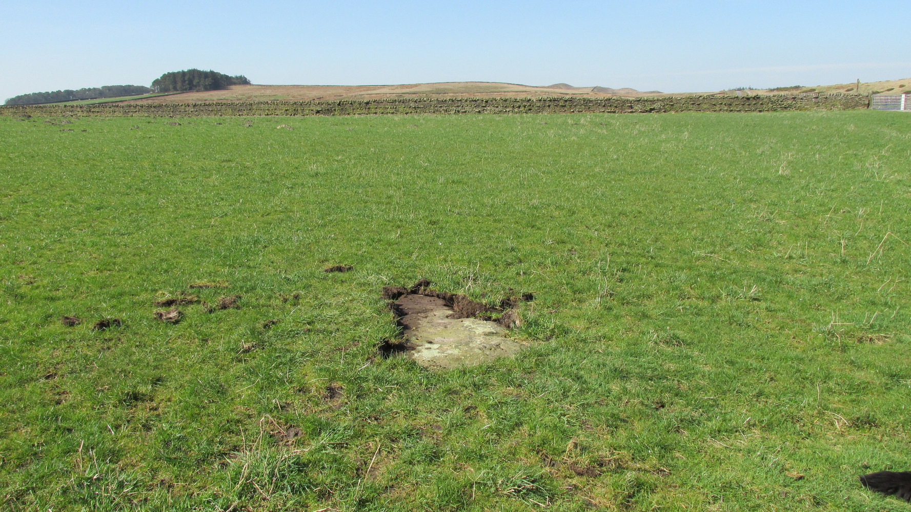
Probably the easiest way here is to take the well-trodden Dales High Way track westwards, under the bypass from Addingham, and along the old Roman Road. After 1.7 miles (2.7km) you’ll reach the Heights Lane country road. Stop here! Walk back on yourself along the track for maybe 50 yards and look in the field to your right (south) between 10-20 yards in the short grass and there, somewhere under your feet next to a modern stone, you’ll see peeking up at you (probably somewhat covered on the whole by the soil) a long flat stone. That’s what you’re looking for.
Archaeology & History
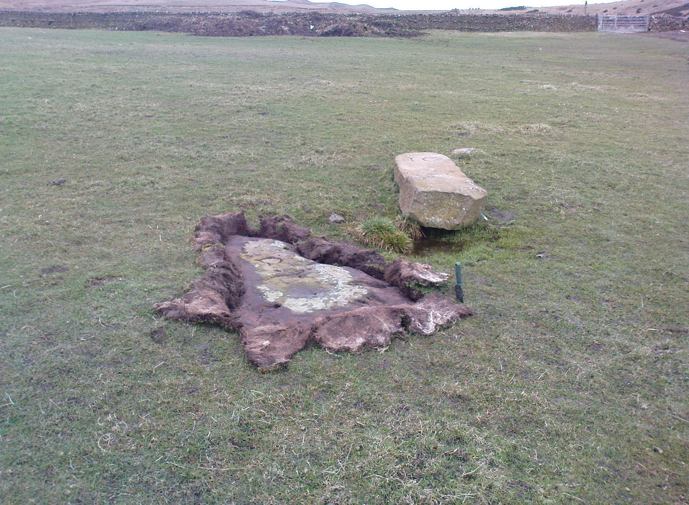
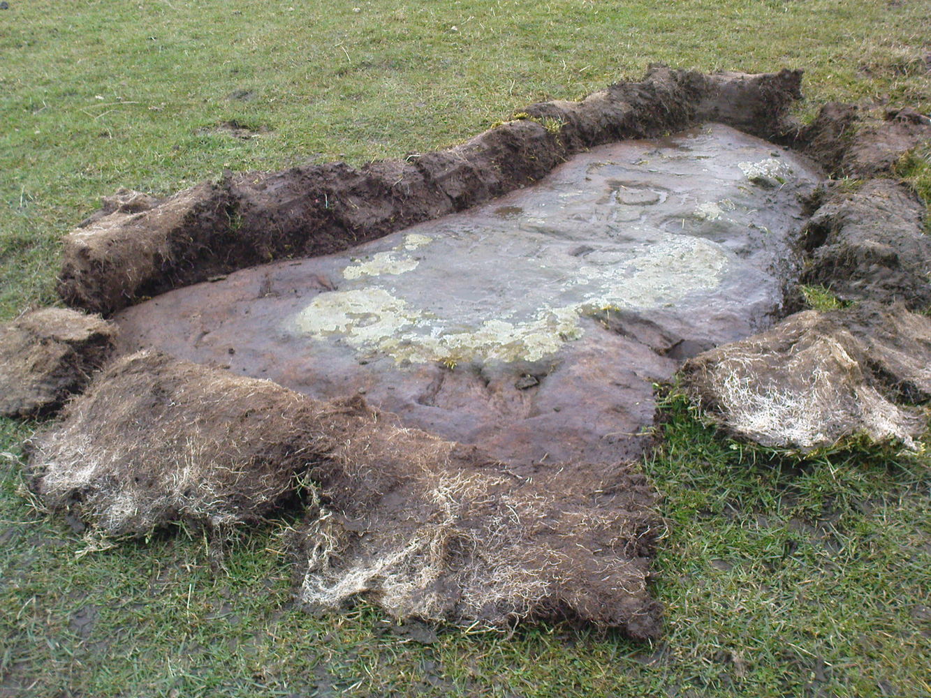
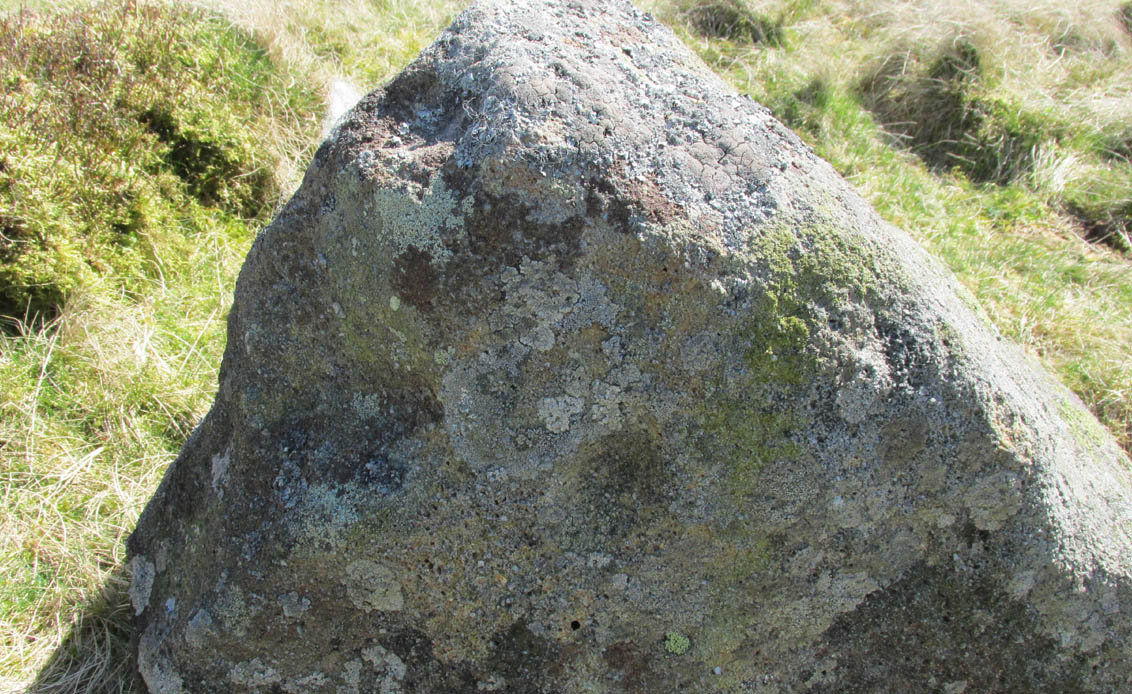
This old stone had been sought after by various groups and people for many years and I was fortunate to relocate it about thirty years ago, laid down and all-but-hidden beneath the grasses. The stone appears to have been buried nearly 100 years earlier, because when Harry Speight (1900) wrote about it in 1900 he described it as still upright. In more recent years, it seems that the farmer has put a replacement stone next to its position with the letters “JC” cut into it. You can see it in the above photo.
Thief Thorne uncoveredThief Thorne, looking W
First mentioned in the 16th century and included in boundary perambulation records of 1709, and again in 1781, someone during that period turned it into a milestone, etching the words “To Skipton 3 m. To Addingham 2 m.” It stood by the old Roman road, but its considerable erosion and shape is decidedly prehistoric. Nearly 6 feet long, it is now laid in the earth and almost completely covered over. A sure case for resurrection.
References:
Bennett, Paul, The Old Stones of Elmet, Capall Bann: Milverton 2001.
Speight, Harry, Upper Wharfedale, Elliott Stock: London 1900.
Along the A65 near Draughton, go (south) uphill at Height Lane until it levels out. ¾-mile (1.2km) up, a modernized stone milepost is where the road crosses the ancient Roman Road. From here, walk west for just over a mile (1.8km), past the trees on your right, until you approach another small copse further along on your right. In the field just before the copse, walk uphill until you reach the highest of the two rises and walk about. You’re damn close!
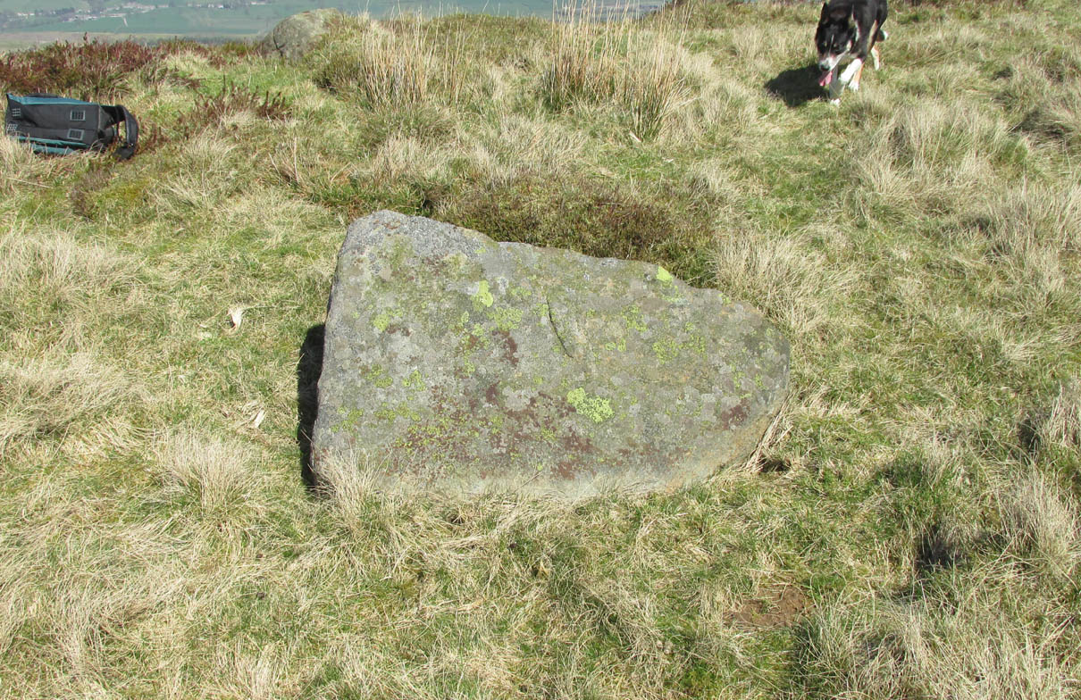
Archaeology & History
Nor Hill cupmarked stoneCupmarks, top & side
This small cup-marked rock was rediscovered by Chris Swales in April 2018. It’s probably only for the purist petroglyph fanatics amongst you, consisting of just a single cup-mark on its vertical west-face, and another near its top western edge. Official records show no other carvings in the immediate vicinity, but local antiquarians may find it profitable in surveying the area for other potential remains.
Take the A6034 road between Addingham and Silsden and, at the very top of the hill between the two towns, at Cringles, take the small road of Cringles Lane north towards Draughton. Less than a mile on, veer to left and go along Bank Lane until you reach the track and footpath on your right that takes you to Moorock Hall. On the other side of the Hall, take the track on your left, along the wallside; and where the track turns left again, look into the field on the other side of the wall. You can see some of the ditch and embankment running across the field.
Archaeology & History
Found within the southwestern segment of the gigantic Counter Hill enclosure, near Woofa Bank, Eric Cowling (1946) described “an almost obliterated fortification” which has certainly seen better days — though you can make out the ditched earthwork pretty easily at ground level. When T.D. Whitaker visited this place sometime before 1812, he described it as a camp that “was found to contain numbers of rude (?!?) fireplaces constructed of stone and filled with ashes.” He also thought the enclosure was Roman in nature.
Western line of embankment
It’s a large site. Running around the outer edge of the embankment, this enclosure measures roughly 378 yards (345m) in circumference. It has diameters measuring, roughly east-west, 132 yards (121m); and north-south is 95 yards (87m). The ditch that defines the edges of the enclosure averages 6-7 yards across and is give or take a yard deep throughout — but this is not an accurate reflection of the real depth, as centuries of earth have collected and filled the ditch. An excavation is necessary to reveal the true depth of this. There also seems to have been additional features constructed inside the enclosure, but without an excavation we’ll never know what they are. Examples of cup-marked stones can be found nearby.
The Marchup Hill enclosure was described by the early antiquarian James Wardell (1869), who visited this and the other earthworks around Counter Hill. He told that this was,
“of oblong form, but broadest at the west end, and rather larger than the other. When the area of this camp was broken up, there were found some numbers of rude fireplaces constructed of stone and filled with ashes, and also a large perforated bead of jet.”
E.T. Cowling’s plan
Modern opinion places the construction of this enclosure within the Iron Age to Romano-British period, between 1000 BC to 300 AD. E.T. Cowling (1946) thought the Iron Age to be most likely, but it may indeed be earlier. His description of the site was as follows:
“At the foot of the southern slope of Counter Hill and close to the head waters of Marchup Beck is an almost obliterated fortification. These remains are roughly rectangular, but one side is bent to meet the other; the enclosure has rounded corners and has a ditch with the upcast at each side. The inner area is naturally above the level of the surrounding ground. In spite of heavy ploughing, the ditch on the western side still has a span of fifteen feet and a depth of five feet between the tops of the banks. Whitaker states that the camp “was found to contain numbers of rude fireplaces constructed of stone and filled with ashes.” These hearths appear to be the remains of cooking-holes such as are often found on Iron Age sites… Cup and ring markings are close at hand, but no flints have been found or trace of Mid-Bronze Age habitation. The enclosure is badly planned, the upcast on the western side would aid an attack rather than the defence.”
…to be continued…
References:
Cowling, Eric T., Rombald’s Way, William Walker: Otley 1946.
Wardell, James, Historical Notes of Ilkley, Rombald’s Moor, Baildon Common, and other Matters of the British and Roman Periods, Joseph Dodgson: Leeds 1869. (2nd edition 1881).
Whitaker, Thomas Dunham, The History and Antiquities of the Deanery of Craven in the County of York, (3rd edition) Joseph Dodgson: Leeds 1878.
From Silsden go up the long hill (A6034) towards Addingham until the hill levels out, then turn left on Cringles Lane (keep your eyes peeled!) for about 500 yards until you reach the Millenium Way footpath, or rather, green lane track, to your right. Walk along this usually boggy old road for another 400 yards until you’re level with the small copse of trees below the field (about 100 yards away). The slightly raised ditched mound on the left side of the track ahead of you is what you’re after!
Archaeology & History
Unless this old tomb was pointed out, you probably wouldn’t give the place a second glance. It’s a seemingly isolated singular round tomb, subsided on top and surrounded by a small ditch, running into the edge of the walling. Gorse bushes and a few rocks are around the edges of the site. Harry Speight (1900) described this old tomb as a
“lonely isolated mound, to be seen in Parson Lane about a hundred yards west of the Celtic boundary, Black Beck, where some old dying chief has called his friends around him bidding them, “heap the stones of his renown that they may speak to other years.” It is a tumulus 80 feet in circumference and does not seem to have been disturbed.”
In Faull and Moorhouse’s (1981) magnum opus they describe the site as “the denuded remains of a ditched round barrow,” but say little else. It may have had some relationship with the settlement remains in and around the huge Counter Hill complex, immediately north.
References:
Cowling, E.T., Rombald’s Way: A Prehistory of Mid-Wharfedale, William Walker: Otley 1946.
Faull, M.L. & Moorhouse, S.A. (eds.), West Yorkshire: An Archaeological Guide to AD 1500 (4 volumes), WYMCC: Wakefield 1981.
Speight, Harry, Upper Wharfedale, Elliott Stock: London 1900.
From Silsden go up the long hill (A6034) towards Addingham until the hill levels out, then turn left on Cringles Lane (keep your eyes peeled!) for a half-mile where you need to veer right along Banks Lane and go 100 yards past Moorcock Farm Hall where the footpath takes you into the fields on your right. Walk down the line of the wallings, thru the gate, and keep following down until you reach a cluster of large rocks. Stop here and look over the wall where you’ll see one of the boulders poking its head out on the other side. That’s it!
Archaeology & History
First discovered by Eric Cowling in the late 1930s during one of his explorations of the immense Counter Hill earthworks (thought to be Iron Age), whose remains can still be seen encircling the peaked hill close by. The stone is found in the edge of the walling halfway down the field towards the Marchup enclosure and is just inside the outer edge of the Counter Hill ditched enclosure surrounding the hill above you. (on the other side of the wall from the carving, you can make out the remains of the faint line of the ditch running pretty straight up towards the next wall)
Cluster of cups by wallingCounter Hill carving from above
At the top eastern edge of the stone is a clear cluster of 3 cup-markings, just as the rock meets the walling. A much more faint group is visible to the left. Cowling (1946) suggesting that the three-cup-cluster “shows the final form of the fylfot symbol,” i.e., the three-armed swastika. Boughey & Vickerman (2003) meanwhile suggest that one of the two clusters are “doubtful (possibly recent?).”
When we came to this site yesterday, the day was overcast and cloudy. But it seemed there may be more to this carving than has previously been recorded. What may be a faint ring seemed possible near the middle of the stone, with a natural crack running through it (you can just about make it out in the photo on the right). There also seemed to be other faint lines on the rock, but until we’ve been here again with better lighting conditions, the two groups of 3-cups is the symbolic state of play for this stone!
References:
Boughey, Keith & Vickerman, E.A., Prehistoric Rock Art of the West Riding, WYAS: Wakefield 2003.
Cowling, E.T., Rombald’s Way: A Prehistory of Mid-Wharfedale, William Walker: Otley 1946.
Hedges, John (ed.), The Carved Rocks on Rombalds Moor, WYMCC: Wakefield 1986.


")


