Probably the easiest route to find this is via the Roman Road from Blubberhouses. Go up Cooper Lane a few hundred yards, turning right (west) on the footpath past the Manor House and onto the moor. Walk along the footpath until you hit the dead straight Roman Road and walk 1⅓ miles (past the cup-marked Eagle Stone) until you meet another footpath on your right veering over the haunted Sug Marsh away from the straight road. This takes you to Gawk Hill Gate ½-mile away. Go over the wall here and walk for 350 yards where several stones are just yards to the left of the path. You’re there!
Archaeology & History
…and again!
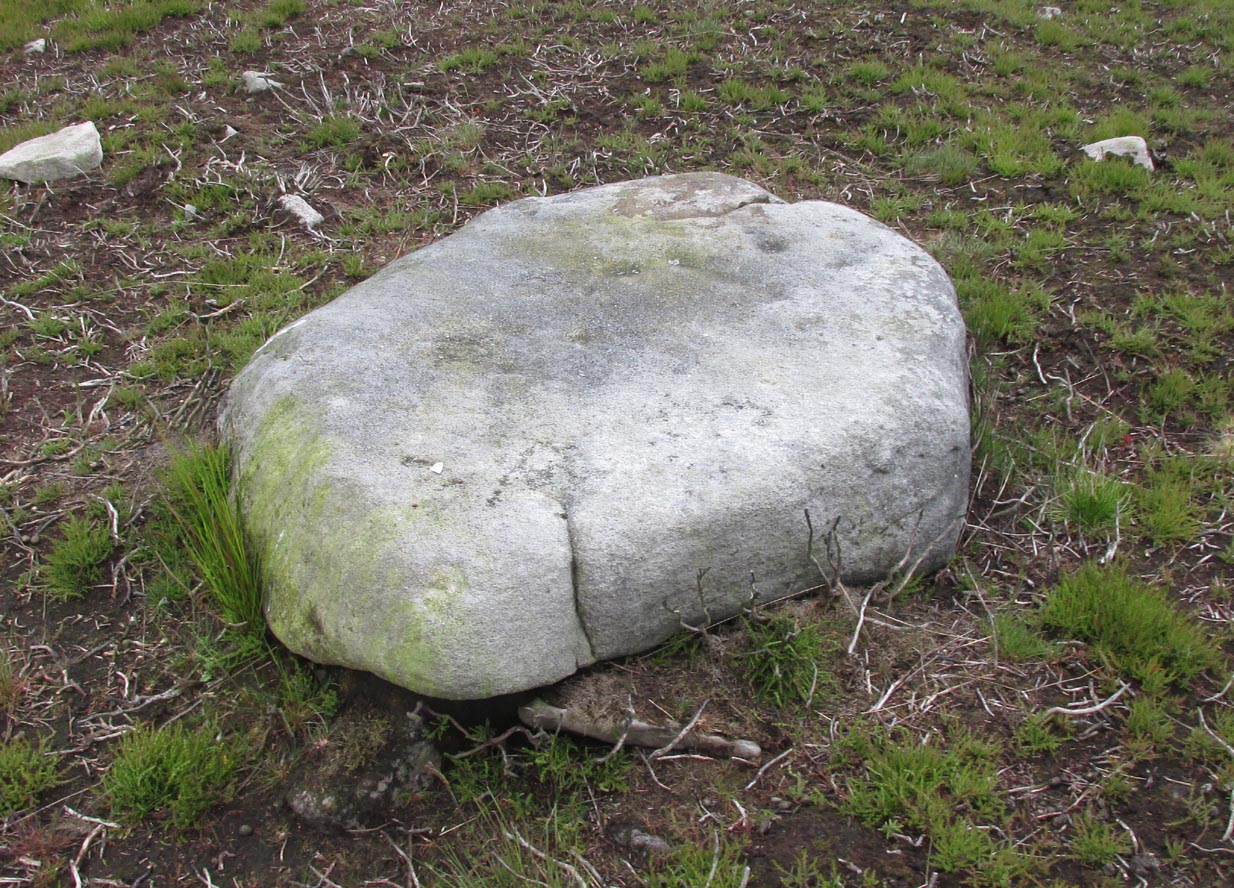
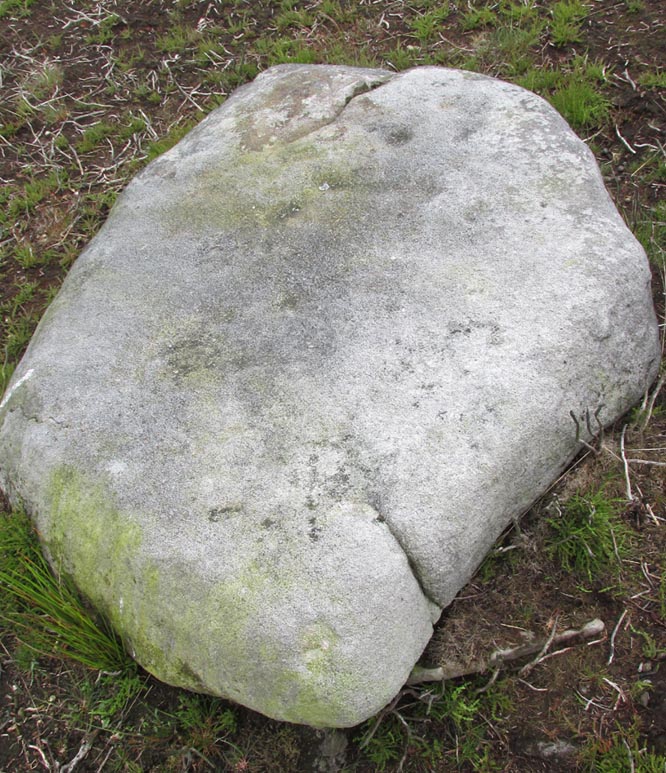
Depending on the age of the old path by which this carving lies, it may have represented a marker of the ancient route. It lives in relative isolation from other petroglyphs a mile or so further down the moorland slopes and is probably one only for the purists amongst you. A smoothed (female) medium-sized rock, about 2 yards by 1 yard across, possesses at least two simple cup-marks on its upper western surface. A third cup seems evident between the main two cups, with a carved line running some 10 inches towards the eastern side of the stone. What may be several other cup-marks can be seen on the stone, but the day was overcast when we came here and so we’re unsure as to whether they’re natural or man-made.
Acknowledgements: Many thanks to James Elkington and his little compatriot Mackenzie, who accompanied us to this and other sites nearby.
From Ilkley town centre, taken the road north across the River Wharfe, turning left and up the country lane towards Nesfield. As you’re driving with the farmed fields on either side, you’ll go round a couple of swerves in the lane and reach the open moorland on your right, just past the small copse of trees on the same side. There’s a small place to pullover on the right 100 yards on and walk up the footpath running northeast onto the moor. Go past the disused quarry and up further till you reach the rounded hill where the tumulus stands.
Archaeology & History
On the moors north of Ilkley – as shown on OS-maps since the 1850s – on the southeastern edge of Middleton Moor, is this singular tumulus, a short distance west of some old quarrying at the curiously-named Lurgy Delf. The small hill is easy to find and appears at the western edge of a whole host of neolithic and Bronze Age remains. It is included as a boundary marker between Middleton and Langbar, as marked by an old stone on its southern side. Eric Cowling (1946) described this as “a spread of stones on Round Hill” in the same context as other burial mounds and cairns in the region, also naming it as the Black Hill tumulus. Many flints had been found all round here and it stands at the western edge of a great number of cup-and-ring stones, stretching eastwards across the moors for several miles. To my knowledge, no excavation has taken place here.
References:
Cowling, Eric T., Rombald’s Way, William Walker: Otley 1946.
Follow the same directions as to reach the so-called Smiley Stone carving and look just 10 yards SE.
Archaeology & History
About 10 yards away from the Smiley Stone is another of Middleton Moor’s ‘dubious carvings’ to me. I remember seeing the drawing of this years back, perhaps a decade after Stuart Feather first described it (1966) and remember thinking it looked a bloody good carving. But when I saw it for the first time in February 2005 with Richard Stroud, not only could I hardly see what was supposed to be there, but once I’d seen the alleged design, some doubt came over me regarding its archaic nature. That doubt still remains.
Faint cups & linesDesign on carving 447
There certainly seems to be a few faded cup-marks on the stone — which looks to be broken from a larger, circular worked stone of a much more modern age (an old mill stone perhaps?) — but the lines which both Feather and the grand pair of Boughey & Vickerman (2003) copy into their survey, are all too vague and certainly not ancient in my book. Perhaps some local folk were still etching cup-marks and lines onto stones into the medieval period and later, like the ones found on the Churn Milk Joan monolith near Hebden Bridge…
References:
Boughey, Keith & Vickerman, E.A., Prehistoric Rock Art of the West Riding, WYAS: Leeds 2003.
Feather, Stuart, “Mid-Wharfedale Cup-and-Ring Markings, no.47: Middleton Moor, Ilkley,” in Cartwright Hall Archaeology Gorup Bulletin, 11:9, 1966.
Go over Ilkley Bridge and take your first left, on & over the roundabout, then follow the road as it bends uphill. Keep going until you reach the fields and moors either side of you, up Hardings Lane, stopping at the bend in the land where it meets a couple of dirt-tracks. Go up the track onto the moor and follow this right into the moorland (avoiding the path to your right after a few hundred yards) where it follows the edge of the walling again. After a few hundred yards there’s a gate on your right. Go thru this and, after 40-50 yards, walk up into the heather. You’re damn close!
Carving no.484
Archaeology & History
This is another cup-marked stone that’ll only be of interest to the petroglyphic purists amongst you, as it’s another one of those incredibly interesting single cup-marked rocks — this time with an additional single line running from it! WOWWWW….! The photo here just about does it justice, as in some light conditions you wouldn’t even notice it. There’s also the possibility that this ‘carving’ was actually Nature’s handiwork.
It was first described by our old mate Stuart Feather in 1965, and was then included in Boughey & Vickerman’s (2003) survey as stone 484, describing it as, “medium-sized, approximately square rock of fairly smooth grit. One cup with groove leading from it.”
References:
Boughey, Keith & Vickerman, E.A., Prehistoric Rock Art of the West Riding, WYAS: Wakefield 2003.
Feather, Stuart, “Mid-Wharfedale Cup-and-Ring Markings: Nos. 36, 37 and 38, Middleton Moor, Ilkley,” in Cartwright Hall Archaeology Group Bulletin, volume 10, 1965.
ACKNOWLEDGEMENTS: to Richard Stroud for use of his photo
From the back of Moor End Farm on the south-side of Langbar village, follow the Long Ridge footpath up onto the moor. Walk along the path until its starts dipping down again, onto the moor proper and where another footpath crosses and goes down into the small valley of the Dryas Dike stream: follow it down, crossing the stream and up the small slope till you’re on the next level of ground. Stop here and walk right, off-path and up the gentle slope towards a small fenced-off piece of moor. About 30 yards before the fence, check out the rocks under your noses. You’re damn close!
Archaeology & History
If you’re gonna come up this region, this is the carving you’ll most wanna check out. It’s the most ornamented of all the cup-and-ring stones at the top of Delves Beck. Comprising at least five full cup-and-rings and a number of single cups, carved on a roughly square flat rock, it was first found by Stuart Feather in the mid-1960s. It sits amidst a cluster of many other carvings on the same ridge. This (for me at least) is something of a curiosity, inasmuch as we have a seeming lack of other prehistoric remains in attendance.
Carving 448 with paint damage…and again, with paint damage
On the other side of the Wharfe valley above Ilkley, aswell as where we find cup-and-ring clusters on the Aire valley side at Baildon and East Morton, a preponderance of burials tend to cluster around clusters of rock art; but this doesn’t, initially, seem evident here. A possible cairn is located on the northern side of this small ridge, and there is distinct evidence of another cairn down the slope on the other side of the Dryas Dike stream (by stone 440) just 100 yards away, but that’s it. A more thorough examination of this region is required to see if other burial remains were in evidence hereby in the past. I have photos of seemingly cairn-scatter material, and ancient walling in is clear evidence on the northern side of Dryas, but much more work needs doing. Obviously much of this would require full surface excavation, which means we’re gonna need quite a bit of work and effort to see if the rock-art/burial patterns found elsewhere are echoed here. It’s likely, it’s gotta be said.
…On a slightly more disturbing note: when me and Dave were up here last week, this carving and several others with more ornate designs on this ridge (carvings 446, 453 and others) had been painted over in some black substance. You can see this clearly in the photos we took, above. Whoever did it appears (word gets to me that a arty-dood called Paul did it) has done so to highlight the carvings so they stand out very clearly. If you wanna highlight carvings for better images or photos, there are much better ways of bringing out the designs than the methods you employed there: chalk for one!
References:
Boughey, Keith & Vickerman, E.A., Prehistoric Rock Art of the West Riding, WYAS 2003.
Feather, Stuart W., “Mid-Wharfedale Cup-and-Ring Markings: Nos 43 & 44, Middleton Moor,” in Cartwright Hall Archaeology Group Bulletin, 11:4, 1966.
Follow the same directions to find the Middleton Moor carvings of 441, 445, or others close by. If you can get to carving 445, then you’re about 20 yards northeast away from this one! A bittova upright stone, with another undecorated smooth flat rock about one-foot away.
Archaeology & History
Amidst the clump of other carvings on top of the ridge at the head of Delves Beck on the southern side of Dryas Dike, is this small standing-stone-like rock, which has a distinct single cup-marking right on the topmost part of the stone. In certain lighting conditions it seems that there may have been a partial surrounding-ring on its top, or perhaps a smaller faded cup by its side. It’s hard to tell — so let’s play safe and just stick with it being a single-cup stone for the time being!
References:
Boughey, Keith & Vickerman, E.A., Prehistoric Rock Art of the West Riding, WYAS 2003.
Another off-the-beaten track site! Follow the directions to reach the Middleton Moor 001 carving, then walk due east for about 500 yards until you reach the distinct footpath that’s the Roman Road. Once here, zigzag along its edge on the western side, up and down hereabouts. Keep looking around till you see the stone shown in Richard’s photo here!
Archaeology & History
First found in April 2005, this medium-sized flattish stone is just 10 yards west of the prehistoric trackway which cuts across the moors — later used as a Roman road — on Middle Gill Bents. A somewhat simplistic design, it was found by Richard Stroud when we were exploring some of the many other carvings up here, and looking for previously unrecorded ones hiding in the heather. Carved onto this stone are eight, perhaps nine cup-markings, with grooved lines connecting at least two of them. That’s it!
From Ilkley go up to Middleton and from there go up Harding Lane and, where the road bends left a track goes straight north onto the moors. Go up this until you’re onto the moor proper. Keep going until you’re following the line of walling, where a small stream is trickling right by your right-hand side. Follow this to its source a coupla hundred yards up. Stop!
Archaeology & History
Middleton Moor CR483: single cup-and-line
First mentioned by Stuart Feather in 1965, this simple cup-marking has a long line squirming away to the edge of the rock on which it’s carved. The cup-marking is some 3 inches across and about ½-inch deep, with the long line about 24 inches long. There’s really nowt much to look at here unless you’re a real cup-and-ring freak — though note that the carving occurs on a broken piece of stone just where a spring of water emerges from the ground. Some archaeo’s have a notion that sometimes our cup-and-ring stones have some sorta relationship with water — though they’re not into sticking their necks out and saying anymore than that! And of course, some carvings obviously relate to water. This one here is a strong contender, with the long wiggly line perhaps representative of the stream running from its source, which itself is the cup-mark.
However, we might just aswell surmise that the carving here was executed by some bored teenager, just testing out his first antler pick, or flintstone, telling his mates, “I woz ‘ere!”
References:
Boughey, Keith & Vickerman, E.A., Prehistoric Rock Art of the West Riding, WYAS 2003.
ather, Stuart, ‘Cup and Ring Boulders,’ in the Cartwright Hall Archaeology group Bulletin, 10:7, July 1965.
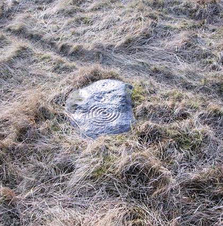
Best approached from the south, up Hardings Lane, then where its bends and the track of Parks Lane goes onto the moor, follow it. Onto the moor, keep on the track as it follows the walling until you reach the gate on your right. From here you’re close: head into the grasses and heather (left) not far off the western edge of the footpath at the eastern end of Dryas Dike. Look around!
Archaeology & History
This lovely looking carving “quite near to the footpath and enclosed fields above March Ghyll reservoir,” was first described by Stuart Feather. (1965) It can be found on a small flat stone and is easily obscured if the grasses are long – but it’s worth searching for. It’s an archetypal cup-and-ring stone, consisting of a cup-and-five rings, a cup-and-ring, and a cup-and-three rings — though they are rather faint and can be missed in bad light. As with other carvings, it’s best to splash water over it (as me & Richard did in the photo above) so you can see it a bit clearer. Feather (1965) told us:
“The symbols are very fine, consisting of three cup-and-rings. One of them, a quadruple, concentrically-circled cup with part of a fifth, unfinished ring. The cup is very shallow, 1 inch across, and the circles…½ inch wide and shallow, with an overall diameter of 8 inch for the four circles; 9 inch with the other unfinished section. The single cup-and-ring has a cup ¾-inch in diameter, ½-inch deep and a 4-inch diameter ring somewhat broader than the other rings on the rock and abutting on the north side against a slightly raised part of the rock surface.”
The triple-ringed cup is of similar dimensions to the larger example, with the cup being 1½ inch across and deep, with the circles being 7 to 7½-inch across.
About a half-mile northeast of here is the old Langbar Stone where I got the distinct impression that the same person was responsible for both of these carvings. God knows why!
References:
Boughey, Keith & Vickerman, E.A., Prehistoric Rock Art of the West Riding, WYAS 2003.
Feather, Stuart, ‘Mid-Wharfedale Cup-and-Ring Markings: No.32-3, Middleton Moor,’ in the Cartwright Hall Archaeology group Bulletin, February 1965.
Near the western end of the Middle Ridge, south of Dryas Dike, it’s probably best reached following the same directions to find carving no.435, walking past it but then following the footpath down onto the moor 100 yards further down the slope. Walk along here for about 200 yards till you get to the boundary stone. You’re close!
Archaeology & History
Sketch of carving 446Smiley Stone carving
First described by Stuart Feather and described by him in 1966, this small rounded stone comprises of nine or ten cup-markings with a long, enclosing line that circuitously goes around four or five of them. It’s a curious-looking design which, from one angle, gives the impression of a smiley face — hence the name (this is Boughey & Vickerman’s name for it — not mine!).
References:
Boughey, Keith & Vickerman, E.A., Prehistoric Rock Art of the West Riding, WYAS 2003.
Feather, Stuart, ‘Mid-Wharfedale Cup-and-Ring Markings – no.43 and 44: Middleton Moor, Ilkley,’ in Cartwright Hall Archaeology Group Bulletin, 11:4, 1966.