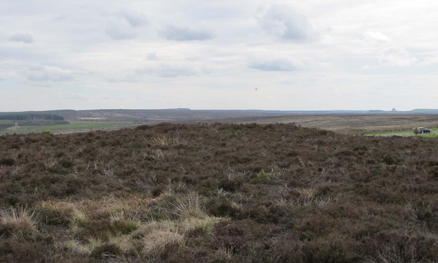
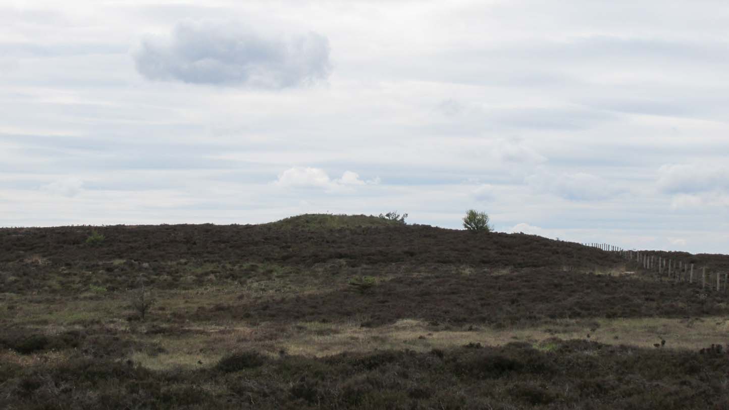
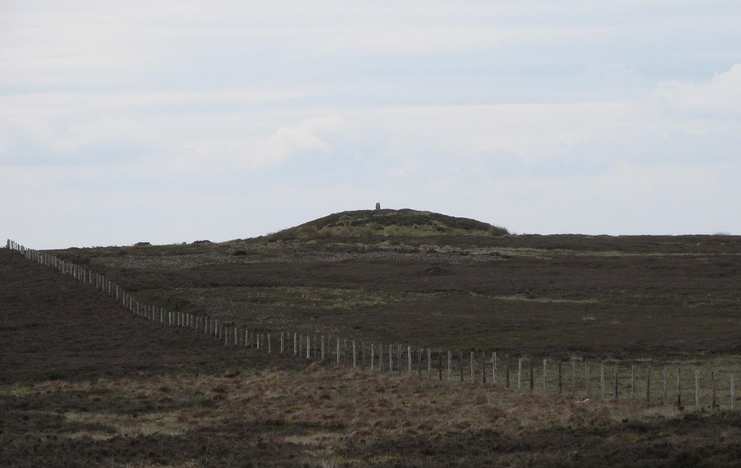
Prehistoric companion to the more pronounced Pen Howe (1) Bronze Age cairn just 20 yards to the west, this overgrown tumulus is hardly noticeable when the heather’s deep and is probably only of interest to dedicated antiquarians and geomancers. Its position in the landscape, whilst not as prominent as its companion and the nearby Breckon Howe, would still have been important to its builders and the relative proximity of the two tombs may imply a continuity of tribal companionship in the Land of the Dead. But hey! – that’s just a silly idea of mine! 🙂
Rising barely three feet above ground level, this is slightly smaller than Pen Howe (1), being just 13 yards across; and there is no indication that it has ever been dug into.
References:
Elgee, Frank, Early Man in Northeast Yorkshire, Frank Bellows: Gloucester 1930.
Acknowledgements: Big huge thanks to my Lindsay Mitchell for getting us up to see this old tomb (which is nearly as old as Linzi 🙂).
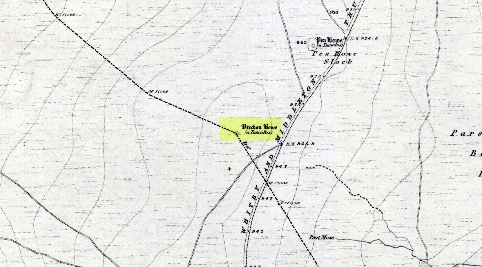
Along the A169 road between Sleights and Pickering, some two miles south of Sleights turn right as if you’re going to the tombs of Flat Howe and the Bride Stones, but just park up 80 yards along by the cattle grid. From here, a fence runs southeast and the mound is on the near skyline, just over 100 yards away. Just walk through the heather to reach it.
Archaeology & History
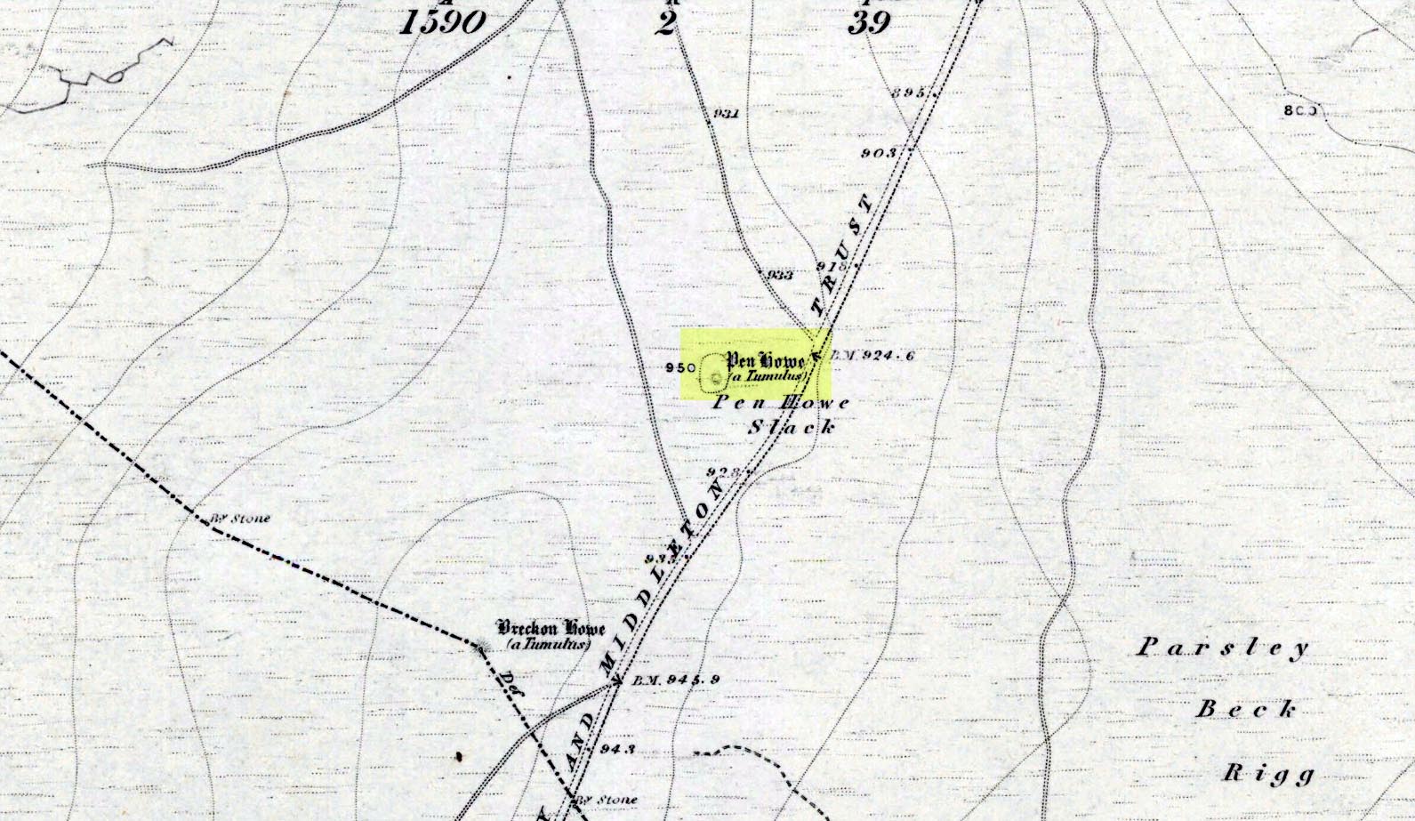
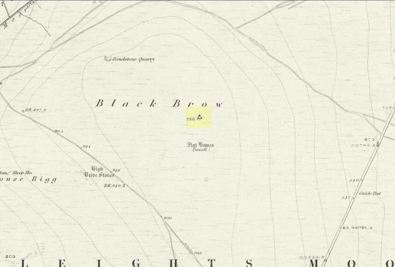
Shown on the first OS map of the area in 1853, this somewhat overgrown prehistoric tomb is one of two in close attendance to each other (see Pen Howe 2); and is some 435 yards (398m) away from the more prominent Breckon Howe tomb to the southwest. Like others on Sleights Moor, no real archaeological attention has been paid here, with Frank Elgee (1930) only giving it the slightest mention in passing.
Pen Howe on 1853 mapPen Howe, looking SE
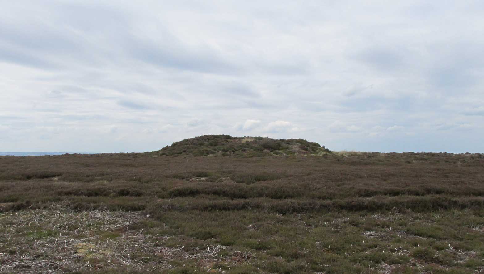
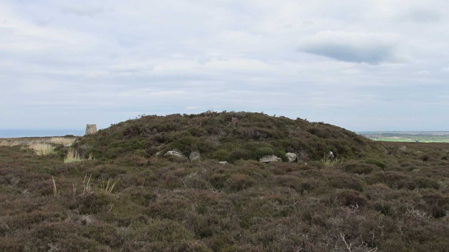
Smaller than its nearby companions of Flat and Breckon Howe, the overgrown cairn raises about four feet above ground level and about 20 yards across. Probably Bronze Age in origin, it has a slightly concave top that gives the impression that someone at sometime in the not-too-distant past has had a bittova dig here to see if there’s owt inside. But we have no record of such a thing.
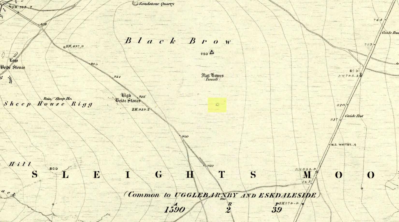
surmounted by a relatively recent boundary stone, sits at the highest point on the moors in these parts. Despite this (as with others on these moors), very little has been written about the place and it has received only minimal attention in archaeology tomes. Even the renowned pen of Frank Elgee (1912; 1930) gave it only passing mention. Perhaps it aint a bad thing to be honest.
References:
Elgee, Frank, Early Man in Northeast Yorkshire, Frank Bellows: Gloucester 1930.
Acknowledgements: Big huge thanks to my Lindsay Mitchell for getting us up to see this old tomb and its companion. (which is nearly as old as Linzi 🙂 )
Along the A169 road between Sleights and Pickering, some two miles south of Sleights at the highest point on the moors just above the west side of the road, you’ll see a large mound with what looks like a standing stone on top of it. A minor road turns off the A169 at this point, heading southeast, and the large mound is 150 yards from the roadside. You can’t really miss it!
Archaeology & History
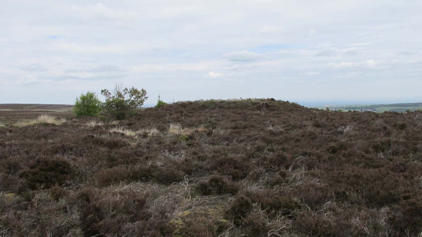
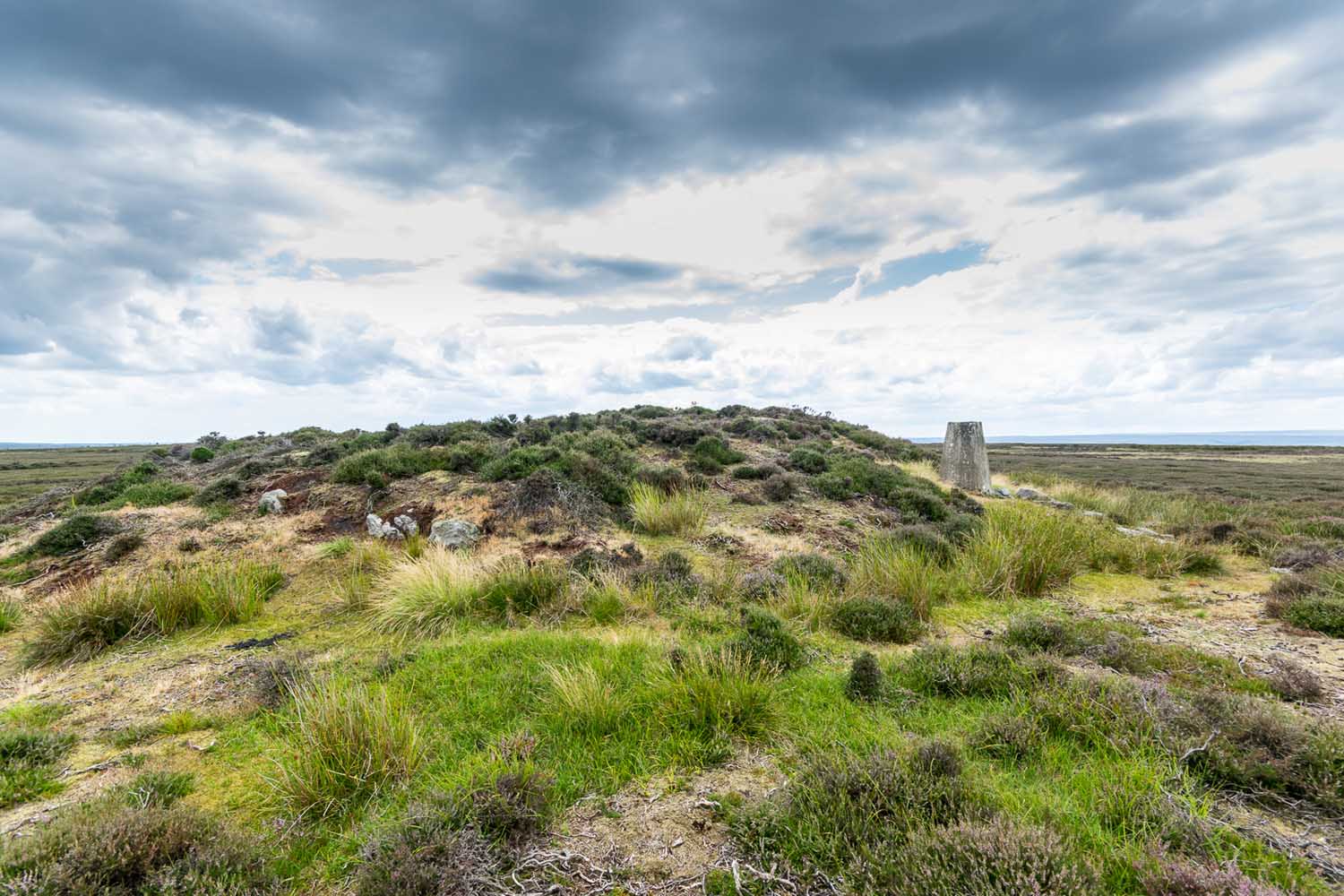
Shown on the first OS map of the area in 1853, this conspicuous prehistoric tomb surmounted by a relatively recent boundary stone, sits at the highest point on the moors in these parts. Despite this (as with others on these moors), very little has been written about the place and it has received only minimal attention in archaeology tomes. Even the renowned pen of Frank Elgee (1912; 1930) gave it only passing mention. Perhaps it aint a bad thing to be honest.
Breckon Howe, from the south
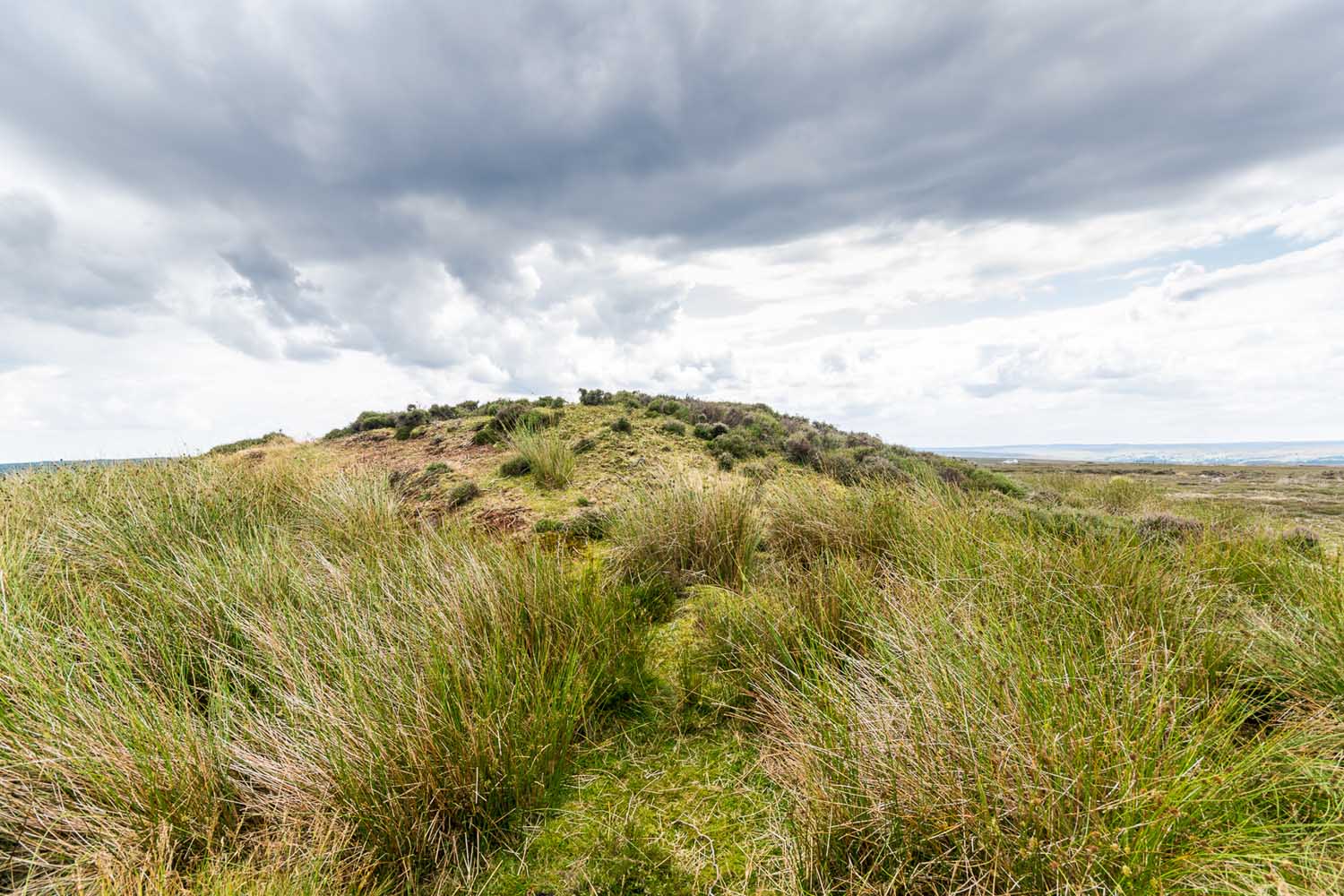
As well as being conspicuous, it’s large. Rising some six feet above the natural ground level, it measures 26 yards across its east-west axis, and 29 yards north-south, with a rough circumference of 88 yards. The boundary stone that surmounts its crown sits in a hollow that looks like it was opened up a century or two ago by antiquarians (much like ourselves). But its position of the tomb in the landscape that is most striking. The view from here is considerable, having a clear 360º view for many miles around. Other prehistoric tombs can be seen from here, but more importantly this tomb can be seen on the skyline from many others. This was probably a deliberate feature intended by its builders–and it’s not uncommon, as many of our upland regions are crowned with ancient tombs like Breckon Howe. In all likelihood this would have been the resting place of some important ancestral figure: a tribal elder or a shaman, whose spirit after death could view and travel across the landscape they inhabited in life.
Although the tomb presently sits amidst an endless sea of heather (Calluna vulgaris) typical of moorland across our northern lands, the name of the site ‘breckon’, according to George Young (1817) derives from the dialect word meaning ferns or bracken. This is echoed in Francis Kildale’s (1855) local dialect study and subsequently in Joseph Wright’s (1898) unequalled magnum opus.
Folklore
In the early 19th century, one George Calvert who lived in the area, collected as much folklore as he could, as it was dying off with the coming of the Church. One such piece told that there was once a hob who lived by this old tomb. A hob is generally known as a supernatural creature, but in this area it can also be a medicine man. Some hobs were good, others were malicious. We know not what type of hob lived lived here, but Calvert simply told us there used to be “T’ Hob of Brackken Howe”. Nowt more! It would be good to find the story behind this old character, if it hasn’t been lost entirely…
References:
Elgee, Frank, Early Man in Northeast Yorkshire, Frank Bellows: Gloucester 1930.
Elgee, Frank, The Moorlands of North-Eastern Yorkshire, A. Brown: London 1912.
Kildale, Francis, A Glossary of Yorkshire Words and Phrases Collected in Whitby and the Nieghbourhood, J.R. Smith: London 1855.
Home, Gordon, The Evolution of an English Town, J.M. Dent: London 1905.
Wright, Joseph, English Dialect Dictionary – volume 1, .Henry Frowde: London 1898.
Young, George, A History of Whitby and Streoneshalh Abbey – volume 2, Clarke & Medd: Whitby 1817.
Acknowledgements: A huge thanks to Lindsay Mitchell for getting us up to see this great tomb and its companion.
Along the A169 road that runs may miles from Whitby to Pickering, as you go through the small town of Sleights, the road gets steep for a mile or so, until you reach the moorland tops, where the road runs dead straight. After 1.2 miles (1.93km) along the straight road, a small minor road is to your right. Go along here for literally half-a-mile (0.8km) where you’ll see a small dirt-track on your right, with a locked gate. There’s room to park here. Walk straight onto the moor towards the large rounded mound about 200 yards northeast. That’s it!
Archaeology & History
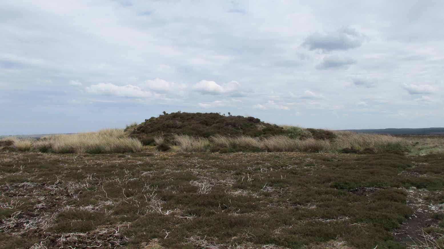
Highlighted as a blip on the 1853 OS-map (see above) 250 yards south of Flat Howe (1), this is the slightly smaller of the two prehistoric cairns on this flat piece of moorland (which covered in scattered woodland at the time of its construction). It has been severely robbed of stones by some land-owning fuckwits in the 19th century, who saw fit to build a shooting hut into the tomb itself! Knob-heads! As a result, much of the content of the cairn has been severely depleted, with only its western side having any real height to it.
Flat Howe 2 looking south (photo, James Elkington)Flat Howe 2, looking east
Just like Flat Howe 1, it seems that it’s never been excavated, so we can only guess about how old it is; though it is very probably Bronze Age. The cairn is roughly 25 yards across and oval in form, but was probably more circular before those morons built their hunting lodge into it. Its western side stands some 4-5 feet tall, which was probably the uniform height all round it before it was vandalized. A few yards to the south is what may be a cup-marking on one of the flat earthfast rocks, although I’m slightly sceptical of it.
The position of the site in the landscape is a fine one: living on a large flat open expanse of land, which was probably cleared of some trees when it was first built, allowing for a very wide view in all directions, just like its companion 250 yards to the north. Well worth checking out.
Folklore
It’s worth repeating the myth we have of a place on Sleights Moor that I’ve also cited in the Flat Howe 1 site profile. Although we have nothing specific relating to this tomb, an olde creation myth tells us that the local giants, Wade and his wife Bel, left their young son (whose name seems to have been forgotten) somewhere on Sleights Moor (which aint a big place). The story was first written down by George Young (1817) in his magnum opus on Whitby and the tale was subsequently re-told by many others – Mrs Gutch (1901) for one:
“Young Wade, even when an infant, could throw a rock several tons weight to a vast distance; for one day when his mother was milking her cow near Swarthoue, the child, whom she had left on Sleights moor, became impatient for the breast, and seizing a stone of vast size, heaved it across the valley in wrath, and hit his mother with such violence, that though she was not materially hurt, her body made an impression on the stone which remained indelible, till the stone itself was broken up, a few years ago, to mend the highways!”
This rock was Bel’s Rock, whose exact location seems to have been lost.
References:
Elgee, Frank, Early Man in Northeast Yorkshire, Frank Bellows: Gloucester 1930.
Elgee, Frank, The Moorlands of North-Eastern Yorkshire, A. Brown: London 1912.
Grinsell, Leslie V., The Ancient Burial Mounds of England, Methuen: London 1936.
Gutch, Mrs, County Folk Lore – volume 2: Examples of Printed Folk-lore Concerning the North Riding of Yorkshire, York and the Ainsty, David Nutt: London 1901.
Jeffrey, P. Shaw, Whitby Lore and Legend, Home: Whitby 1923.
Roberts, Anthony, Sowers of Thunder, Rider: London 1978.
Smith, A.H., The Place-Names of the North Riding of Yorkshire, Cambridge University Press 1928.
Young, George, A History of Whitby and Streoneshalh Abbey – volume 2, Clarke & Medd: Whitby 1817.
Acknowledgements: A huge thanks to Lindsay Mitchell for getting us up to see this great tomb and its companion; and to James Elkington for use of the photograph.
Along the A169 road that runs may miles from Whitby to Pickering, as you go through the small town of Sleights, the road gets steep for a mile or so, until you reach the moorland tops, where the road runs dead straight. After 1.2 miles (1.93km) along the straight road, a small minor road is to your right. Go along here for literally half-a-mile (0.8km) where you’ll see a small dirt-track on your right, with a locked gate. There’s place to park here. You’ll see the large rounded mound of Flat Howe-2 about 200 yards NE. Head there, then another 250 yards north. You’ve arrived!
Archaeology & History
Of the two ‘Flat Howe’ burial mounds on Sleights Moor, this is the northern one of the two, being 250 yards (230m) away from its southern companion (at NZ 85510 04614). It’s quite a big fella too – and so you’d expect there to be quite a bit of information about it. But there isn’t! No recorded excavation has taken place here, despite the top of the monument being cut into. But this might have occurred when the Ordnance Survey lads built one of their triangulation pillars into the side of it. Thankfully it’s not done too much damage.
I was quite surprised to find that even Frank Elgee (1912; 1930) had little to say about either of the two Flat Howes, simply mentioning them in passing in relation to the numerous other prehistoric tombs on these moors. Despite this, the archaeologist L.V. Grinsell (1936) thought this site to be one of “the finest peristalith barrows I have ever seen.” And this one in particular is still very impressive.
Flat Howe from the southFlat Howe (by James Elkington)
First shown on the 1853 OS-map, this large heather-covered mound of earth and stone is some six feet high and measures roughly 22 yards (20m) east-west by 19 yards (17.5m) north-south. The tomb was originally constructed within a circle of reasonably large boulders, some of which were upright. These can still be seen, mainly along the western and southern sides of the monument, although many have been dislodged over time and fallen at various angles, as you can see in the photo. Whether or not these stones were erected first and then the mound built inside the ring, we do not know. It’s the highest point in the landscape on Sleights Moor, with damn good views in all directions: an element that is common to many large prehistoric tombs, for obvious reasons. Other tombs of similar size and probably similar periods in prehistory can be seen close by and on the skyline. Whether this was a deliberate visual ingredient by our tribal ancestors is difficult to say, as the moors here were covered in scattered woodlands in prehistoric times. Only detailed archaeo-botanical surveys would be able to tell us one way or the other.
Folklore
Flat Howe, with large stones defining its edge
Although we have nothing specific relating to this tomb, an olde creation myth told us that the local giants, Wade and his wife Bel, left their young son (whose name seems to have been forgotten) somewhere on Sleights Moor (which aint a big place). It is worth narrating simply because it may have related to this tomb or its companion close by. Giant legends have long been associated with the creation of many prehistoric tombs in this country and abroad. The story was first written down by George Young (1817) in his magnum opus on Whitby and the tale was subsequently re-told by many others – Mrs Gutch (1901) for one:
“Young Wade, even when an infant, could throw a rock several tons weight to a vast distance; for one day when his mother was milking her cow near Swarthoue, the child, whom she had left on Sleights moor, became impatient for the breast, and seizing a stone of vast size, heaved it across the valley in wrath, and hit his mother with such violence, that though she was not materially hurt, her body made an impression on the stone which remained indelible, till the stone itself was broken up, a few years ago, to mend the highways!”
This rock was Bel’s Rock, whose exact location seems to have been lost.
References:
Elgee, Frank, Early Man in Northeast Yorkshire, Frank Bellows: Gloucester 1930.
Elgee, Frank, The Moorlands of North-Eastern Yorkshire, A. Brown: London 1912.
Grinsell, Leslie V., The Ancient Burial Mounds of England, Methuen: London 1936.
Gutch, Mrs, County Folk Lore – volume 2: Examples of Printed Folk-lore Concerning the North Riding of Yorkshire, York and the Ainsty, David Nutt: London 1901.
Jeffrey, P. Shaw, Whitby Lore and Legend, Home: Whitby 1923.
Roberts, Anthony, Sowers of Thunder, Rider: London 1978.
Smith, A.H., The Place-Names of the North Riding of Yorkshire, Cambridge University Press 1928.
Young, George, A History of Whitby and Streoneshalh Abbey – volume 2, Clarke & Medd: Whitby 1817.
Acknowledgements: A huge thanks to Lindsay Mitchell for getting us up to see this great tomb and its companion; and to James Elkington for use of the photograph.