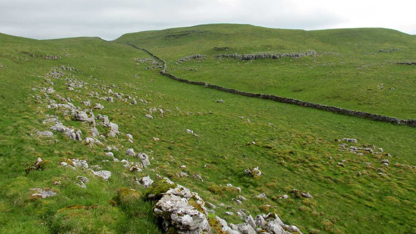
From Arncliffe village, walk past the front of the Falcon Inn village pub and along the track called the Monk’s Road. After a short distance it becomes a dirt-track where the old house lives. Less than 200 yards past the old house, a footpath takes you over the wall, then you walk 200+ yards southwest and through another wall, then up the curvaceous footpath diagonally WSW up the steep hill until you go over another wall where the land levels out. Follow the footpath along the edge of the steep drop for just over a mile where you’ll cross the fifth wall (the Clowder (1) enclosure is up above you by the rock outcrop to the left) and 100 yards along, just north of the footpath, you’ll see a large hollow defined by rocks and low walling. You’ve arrived!
Archaeology & History
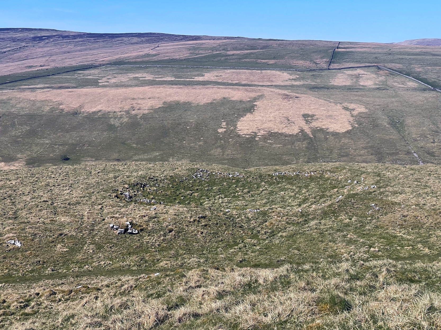
The south & eastern walls
Amidst the scattered remains of the extensive Dewbottoms settlement complex, this large hollowed walled enclosure is pretty clear to see. Measuring 40 yards north-south across its longest axis and 31 yards east-west, the structure is like an erratic rectangle in shape, with entrances in the middle of its northern wall and, perhaps, another along the southern side too. It’s quite deep too, being several feet lower than the land around it, keeping it protected from any strong winds above: an ingredient that would obviously have been taken into consideration when it was being built. The walling that defines the structure is a contrived mix of Nature’s own semi-circle of earthfast limestone rock, with intermittent gaps filled-in with thousands of small stones placed there by humans, 2-3000 years ago. It’s quite impressive when you see it in the flesh.
Northern wall & dipped entranceThe west & northern walls
The site appears to have an Iron Age to Romano-British pedigree – although I’m hedging a bet that the place was probably still in use during medieval times. The enclosure has the appearance of some sort of prehistoric village hall. There are no hut circles or any other walled structures inside the overall enclosure, meaning it may have been used, perhaps, for tribal village gatherings; or it might just have been a large enclosure for cattle. Only an excavation would tell us one way or the other.
Anyhow, if you’re coming up to see the Dewbottoms complex from Arncliffe, this is the first main thing that you’ll come across. From here, to your immediate south and west, there’s a mass of prehistory beneath your feet. Make a long day out of it as you’re gonna be somewhat overwhelmed by the magnitude of it all.
References:
Charlesworth, D., ‘Iron Age Settlements and Field Systems,’ in Proceedings of the Archaeological Journal, 125, 1968.
Dixon, John & Phillip, Journeys through Brigantia – volume 2, Aussteiger: Barnoldswick 1990.
Raistrick, Arthur & Holmes, Paul F., Archaeology of Malham Moor, Headley Brothers: London 1961.
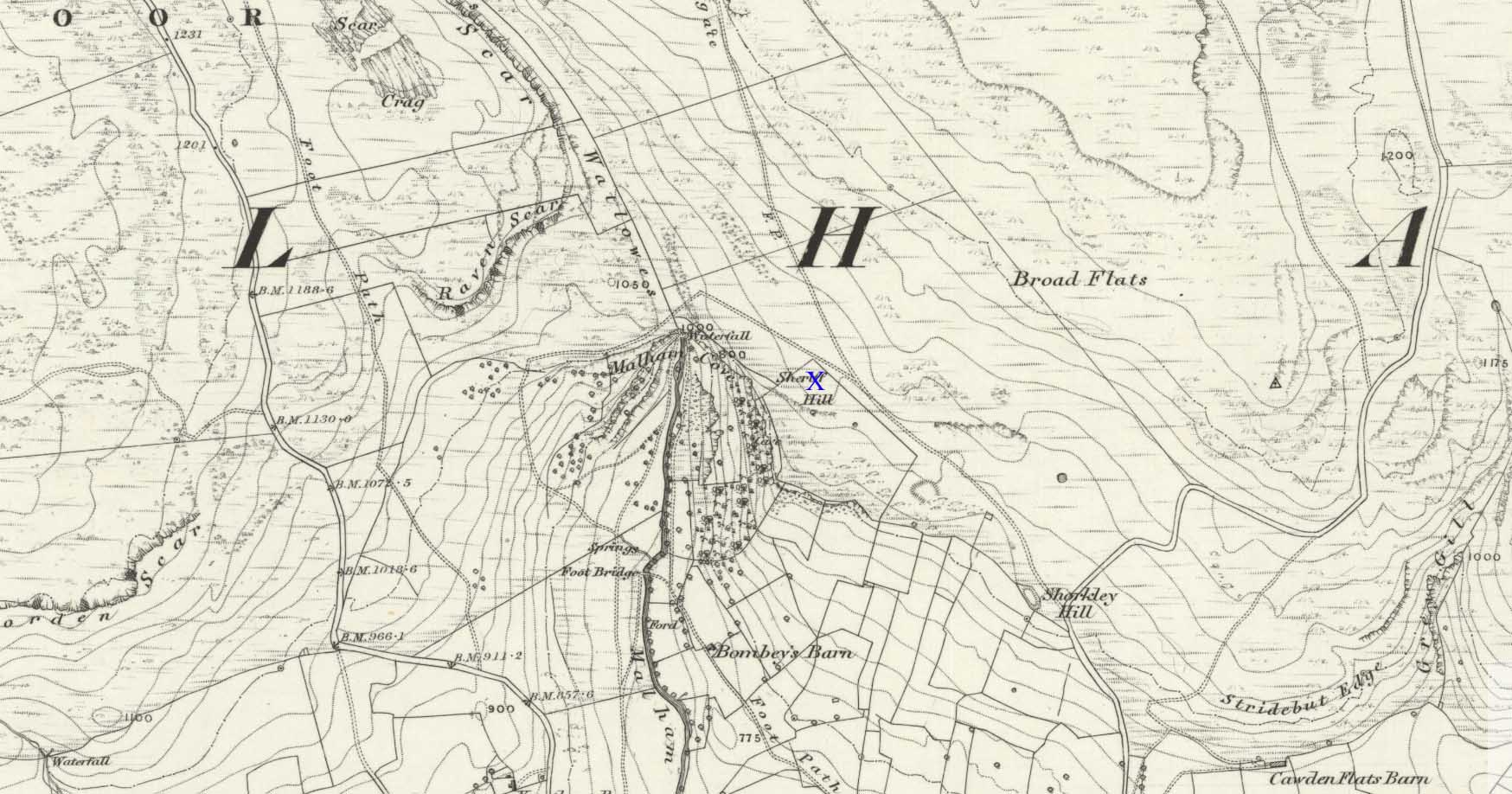
There’s nowhere to park any vehicles anywhere near this place if you wanna reach this site. And so, from Malham village, take steep eastern road up Malham Rakes (ask a local if needs be) for exaclt half-a-mile (0.81 km) where, at a bittova sharp turn in the road, there’s a footpath on your left. Walk along here for about 350 yards until you hit a straight line of walling on your left. Follow this along, about 30 yards before it turns at a right-angle. On the other side of the wall from here, a barely discernible denuded heap is in the overgrown field. That’s it!
Archaeology & History
To be found above the grand rise of Malham Cove—on its eastern side—the earliest mention I’ve found of this once-large prehistoric burial cairn was in the Cravendale travelogue of William Howson (1850). His description was only a brief one, telling us how,
“The workmen engaged on the fences have lately opened a large barrow, which is known by the local as the Friars’ Heap, near the eastern arm of the Cove, and a quantity of human bones were found.”
In Howson’s opinion he thought “the spot is much more likely to be connected with the marauding Scots than the peaceful monks”; but he was wrong on both counts. When the site was later visited and described by the great northern antiquarian, Harry Speight – aka, Johnnie Gray (1891) – he told us that the place “was much more likely to have been a British or Danish burial mound.”
Originally standing to a height of more than six-feet, the tomb has subsequently been reduced to half that height. The most lengthy descriptions of it were written by the regional antiquarian Arthur Raistrick. In his topographical literary meanderings across the Malham landscape, he gives a fine overview of its features and locale:
“Across the clints the old valley which leads to the edge of the Cove is seen, and looking upstream a grand impression of the Dry Valley, properly called Watlowes, is obtained. Across the foot of the valley a stile crosses rhe wall, and a footpath goes up the hill near to the boundary wall of the Cove; this is Sheriff Hill. At the prominent corner of the wall where the path resumes a level course, it joins the path from Malham Lings called Trougate. Between here and the road there are abundant traces of the Celtic fields, nestling under the small limestone crags that offer shelter from the northeast, evidently as unwelcome a quarter for the wind when these were occupied as today. Where the wall turns at right-angles again towards the Cove, there is a very prominent circular mound nearly a hundred feet in diameter. This is a burial mound of late Iron Age. It was dug into about the year 1845 and in addition to many human bones , fragments of an iron spearhead were found. It is to be regretted that no careful account of this excavation was preserved, as there seems no doubt that this was a multiple burial of some importance. Like other burial mounds in this district, the site was well chosen with a most extensive view which includes many notable hill summits…”
This latter remark could well have come from the pen of the old ley-hunter, Alfred Watkins (1925), who noted time and again how landscape features would seemingly connect one site with another, and another. (the modern idea of leys as ‘energy-lines’ is an American invention and wholly without merit)
A few years after Raistrick gave us his initial description, the cairn was excavated. In his short work on the archaeology of Malham Moor (1961), he wrote:
“A burial mound (that was) three-quarters removed at the time of the enclosures (about 1845) when the mound was dug as a quarry for walling stones. The remaining fragment was trenched right through and was found to be built entirely of stone with a kerb of large flaggy stone laid on the slope at the foot of the mound. Many fragments of decorated pottery were founmd under the turf cover and were associated with what appeared to be discarded gravel from the original quarrying, so may have come from the centre. At the inner edge of the kerb and under a carefully placed cover-stone, a smal oval vessel was got. This is of thick bluey-grey paste, red outside and very flaky so that part of the surface is lost on the two-thirds of the vessel which remains. Prof Stuart Piggott has reported on the pottery. Of this vessel he says — “an oval cup of the so-called ‘Incense Cup’ class: one sherd is of the wall and base of one end, the other a piece spalled off from the inside of the base. I only know of one paralle to this remarkable pot, another oval incense-cup from Far Fields, Lockton, N.R. Yorks, in the York Museum. A very odd little oval ‘cup’ of sandstone from Defford, Bredon, Worcs, in the Hastings Muesum at Worcerster is a stray find and might be of any age, and anyway only provides a vague parallel.”
Another “vessel is represented by sherd of what appears to be a small cinerary urn of collared or overhanging-rim type with the yellow-brown surface characteristic of so many pots of this class. The decoration appears to be in alternating panels of vertical and horizontal lines of uncertain width, the whole forming the so-called ‘hurdle’ pattern. The ornament is made of double lines of twisted cord, one with a right-hand and the other with a left-and twist: such ornament is widely distributed on such vessels…
“A third “vessel is represented by a few sherds with purple-red exterior, decorated with impressed cord, whipped cord and grooving. It is diffcitul to say what sort of pot is represented, but I suspect something within the food vessel class… The whole assemblage could well be contemporary and would fall withini the Middle Bronze Age of conventional nomenclature, somwhat in the middle of the second millenium BC…”
The most striking feature of this site is its position in the landscape, typical of large cairns in the Pennines and much further afield. The view to the south is extensive and would have had some bearing on its construction, as such heights allow for the spirits of the dead to move across the landscape. The huge cliffs of Malham Cove below may also have been an important factor. In the days when this tomb was built, a great waterfall existed at the Cove that has subsequently fallen back to Earth. In many traditional cultures, water is an extremely important element. Its relationship to life is obvious; but also in the Lands of the Dead water feeds the spirit on its journeys. These animistic and geomantic features are essential in looking at the nature of the placement of sites—and this at Sheriff Hill would have been no exception.
Enjoy your sojourns and meditations here…
References:
Gray, Johnnie, Airedale, from Goole to Malham, 1891.
Howson, William, An Illustrated Guide to the Curiosities of Craven, Whittaker: London 1850.
Raistrick, Arthur, Malham and Malham Moor, Dalesman: Clapham 1947.
Raistrick, Arthur & Holmes, Paul F., Archaeology of Malham Moor, Headley Bros: London 1961.
To the right of The Falcon Inn across from Arncliffe village green is a trackway called the Monk’s Way. Walk up here for about 450 yards until there’s a stile on your right which is the start of the diagonal footpath SW up the hillside. Once you hit the limestone ridge several hundred yards up, keep on the path that curves round the edge of the hill for 1.3 miles (2.1km), going over 5 walls until, at the 6th one, you should look uphill, east, at the small cliff-face 100 yards above you. That’s where you need to be!
Archaeology & History
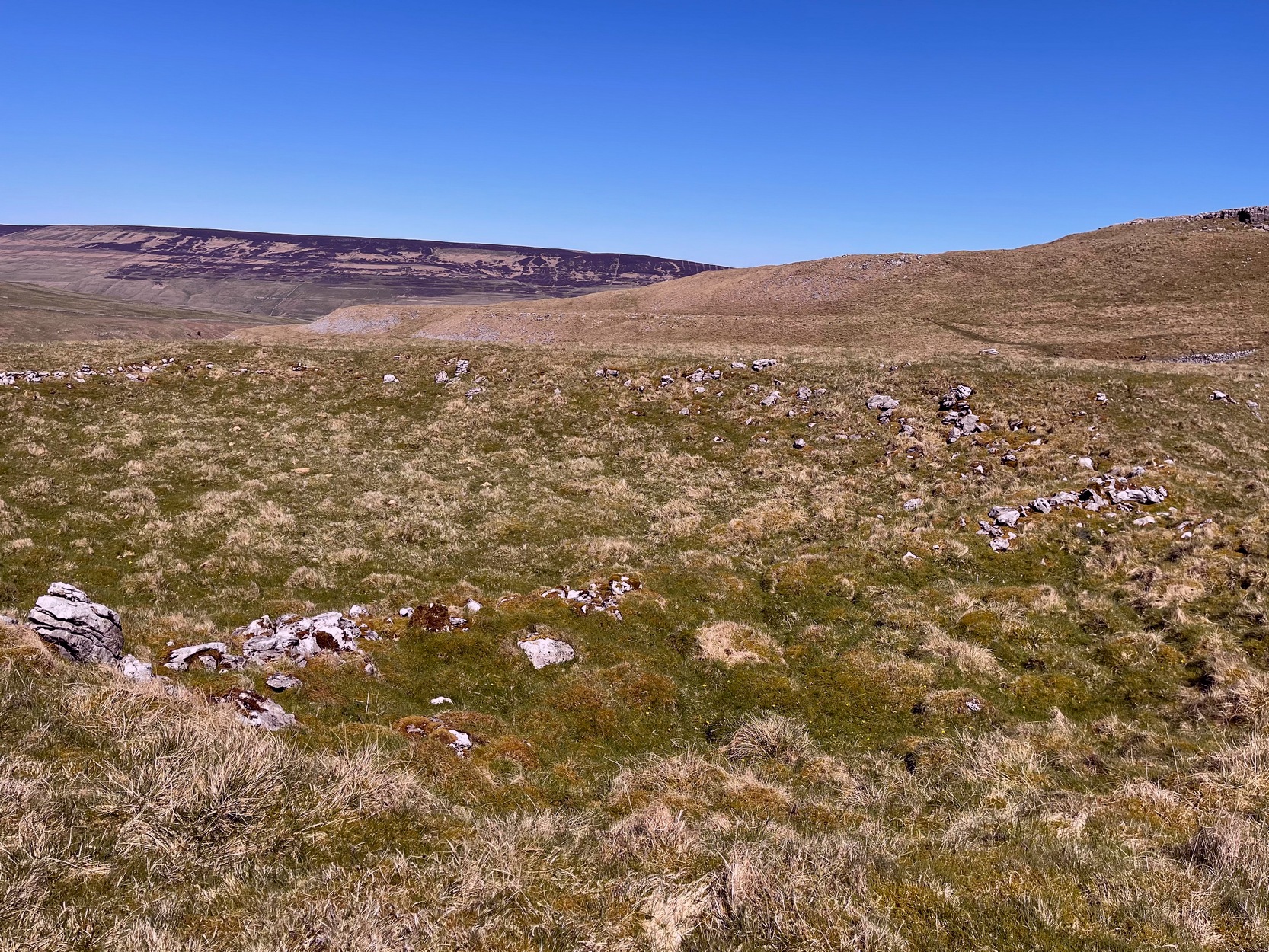
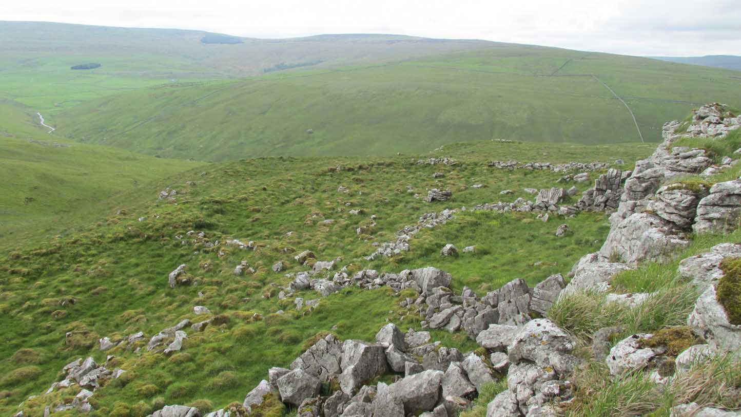
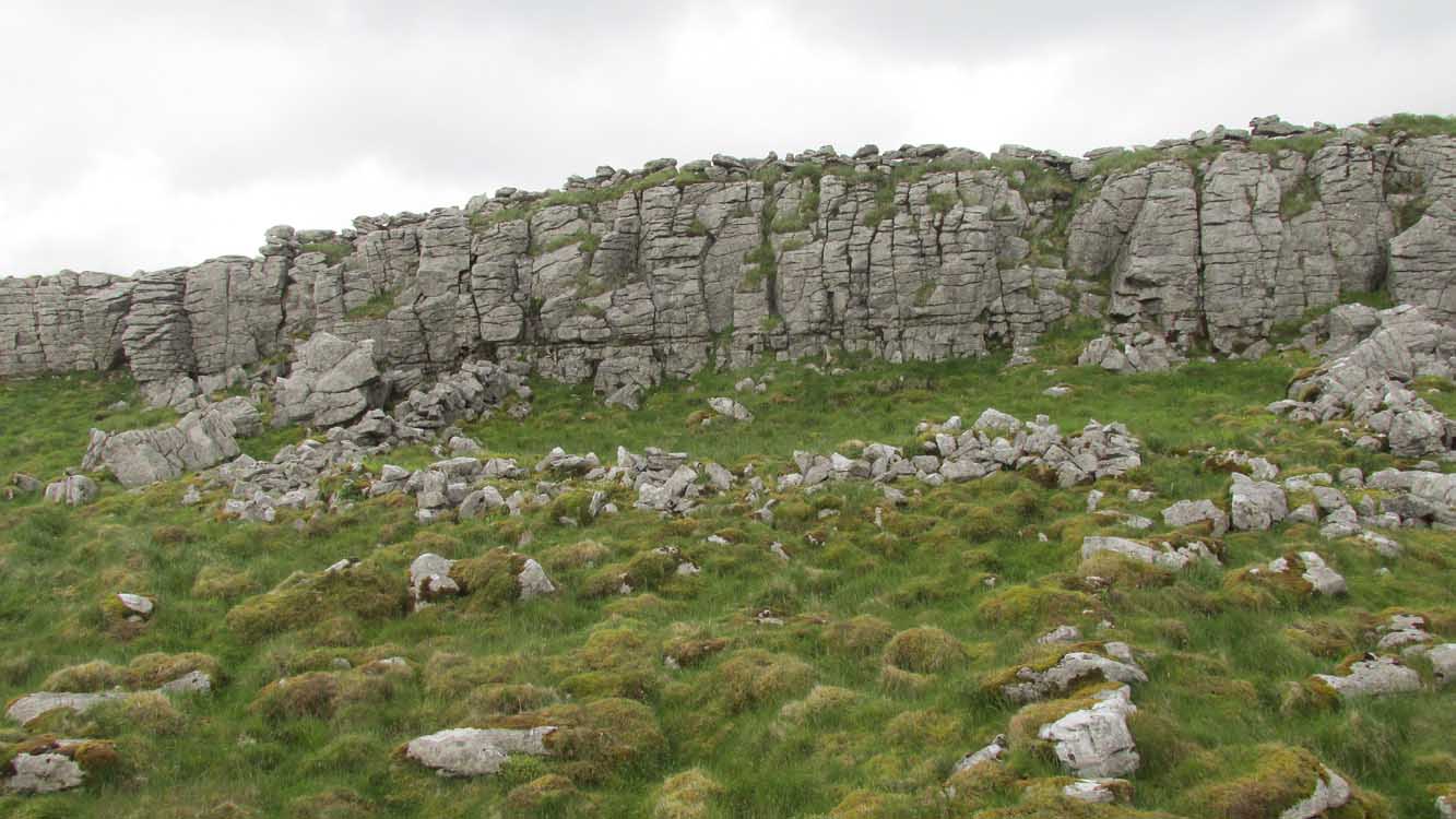
This is one of several clusters of large prehistoric enclosures and settlements in the expanse of land known as Clowder, on the hills 1.65 miles (2.63km) southwest of Arncliffe. It’s in a very good state preservation and, surprisingly, almost nothing has been written about it.
Covered hut circle on NW edgeCliffs & walls of Clowder-1
A multi-period site whose construction probably began sometime in the Iron Age (although the old Yorkshire Dales archaeologist, Arthur Raistrick, thought the settlements up originated in the Bronze Age), we can say with some certainty that parts of this complex were definitely being used until medieval times due to the lack of growth on some of the walling.
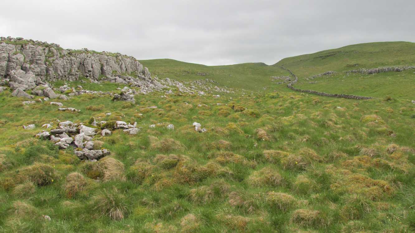
The entire complex comprises of a series of interlinked walled enclosures running roughly north-south for a distance of more than 200 yards. Along the 200 yards are at least eight conjoined walled sections of varying shapes and sizes. Some of the walling, particularly along its western edges, measuring up to 10 feet across (some of this will be due to collapse) is very overgrown indeed and is probably the oldest aspect of the enclosure. The inner walled sections, much of it leading up to the small cliff face, are rough rectangular structures, each of them averaging 30 yards from their western edge to the eastern cliff and rock faces.
Most recent walled section
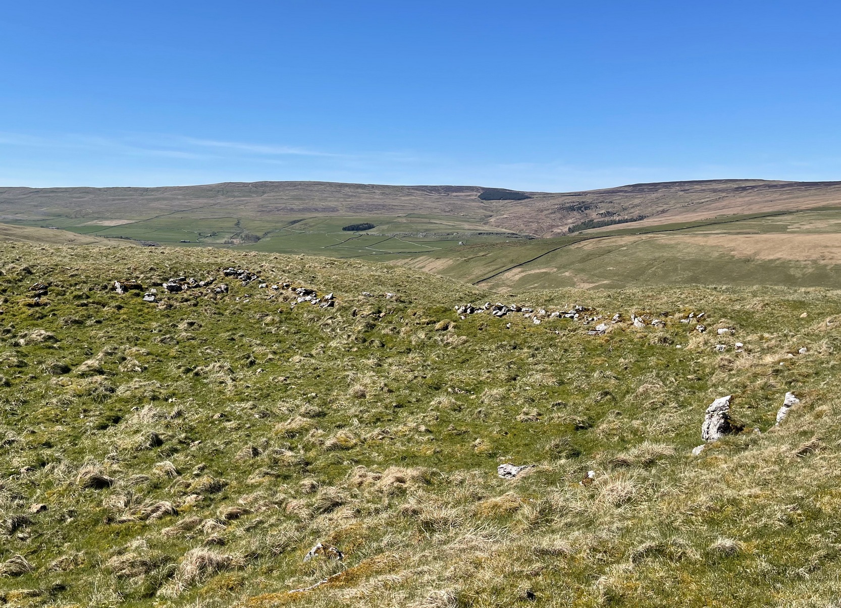
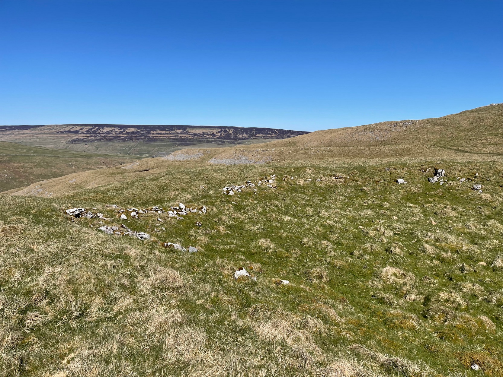
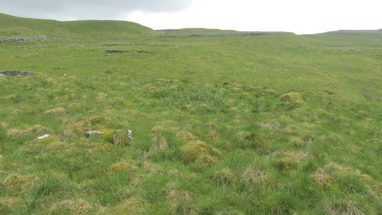
Within the largest and best preserved section at the northern end, a smaller and more recent walled rectangular enclosure would seem to have been used for either cattle or storage of some form, as it’s on too much of a slope to have been viable as a living quarter. Also on the very northern edge is a well-preserved but much overgrown hut circle, between 8-9 yards across.
Faint walling looking south
The entirity of Clowder-1 is difficult to assess without an archaeological dig. Despite this, as half of the walled enclosures (in the northern half) are on slopes leading up to the cliffs they would seem unsuitable for people to live in. It is more probable that these sections were used for livestock and other storage. At the more southern end however, the land begins to level out and this would be feasible as good living quarters. There was also once a good source of water immediately beneath the entire complex, but with deforestation the waters eventually fell back to Earth.Back to its southern end and down towards the modern-day walling, some 70 yards on we find more ancient structures of the same architectural form that we’ve just walked along. This lower section has just one notable singular oval-shaped hut circle, 20 yards east-west by 29 yards north-south. Other probable man-made structures seem to be just below this; and this part of the settlement then continues on the other side of the walling, into the large Dew Bottoms (5) settlement complex.
Folklore
Weather lore of the ‘Clauder’ hill tells that it “draws the skies down” – i.e., as Halliwell Sutcliffe (1929) put it:
“A deluge may be in process on each side of the Clouder when lower down the sun is hot on tired pastures.”
We encountered just such a truth when James Elkington, Chris Swales and I visited the sites up here just a week or so ago…
References:
Dixon, John & Phillip, Journeys through Brigantia – volume 2, Aussteiger: Barnoldswick 1990.
Sutcliffe, Halliwell, The Striding Dales, Frederick Warne: London 1929.
Acknowledgements: Huge thanks to James Elkington and Chris Swales, without whose guidance this site profile would never have been written.
From Threshfield, go up Skirethorns Lane for about 1/2 mile, where the lane takes a sharp right. Continue uphill for nearly 2 miles to a metal gate. Go through the gate into the fields on your left where you’ll see this pair of curious standing stones ahead of you (if you keep walking uphill in the same direction, you’ll reach the impressive Hammond Close enclosure above you).
Archaeology & History
There seem to be no references in either archaeology or geology texts about this site which, when you approach it and consider the prevalence of other prehistoric sites all round you, strongly suggests that they are either archetypal standing stones, or the remains of a collapsed cairn, with the surrounding mound removed. This is certainly the case at the Druid’s Altar or Bordley Circle visible a few hundred yards west of here, on the same grassland plain.
The stones alone, looking north
As you can see in the photos, the stones here are 4 feet tall and stand in isolation from the excess of neighbouring settlements and enclosures. A scatter of small stones—perhaps packing stones, perhaps the remains of cairn-spoil—is evident at the foot of the stones. It was initially thought that the uprights here could have been the remains of enclosure or settlement walling, as we find an excess of such remains on the hills here, but this isn’t the case. Other unrecorded prehistoric remains scatter this part of the countryside.
From Malham village, take the winding uphill road up Malham Rakes (not the Malham Cove road). If you aint sure, ask a local. Get to the top of the long winding road and, a mile on, you meet with another single-track road on the top level known as Street Gate. Stop here, then head across the grasslands on the left-side of the road, southwest. There are a couple of footpaths running over the land here: I wouldn’t say it makes much difference which one you take as they take you in the right direction. You’ll eventually meet the old craggy hilltop with the drystone walling down t’other side of it. You’re here!
Archaeology & History
The history of this region seems to have been covered to a great deal by the likes of Arthur Raistrick and his mates, though I can’t find a specific entry in mi library about the remains we’re looking at here. Surrounding the edges of the small hill, as can be seen in the aerial photo here, walling has clearly been built up around it, with considerable remains still visible at ground level, as indicated in the photos aswell.
Eastern edges of enclosureEastern walls, looking north
A settlement or large stone-walled enclosure, lying primarily on the north side of the drystone wall, measures approximately 82 yards north-to-south, and roughly 78 yards (72m) east-to-west, with a rough circumference around the outer edges of its rough elliptical outlines of more than 270 yards (250m). Along the walled edges can clearly be seen several ‘hut circle’ remains: one in particular at the northeastern side and, more prominently, at the southeastern side, are in reasonably good states of preservation. The northeasterly hut circle measures approximately six yards across. The stone walls of this circle are more than a yard wide. The ‘hut circle’ on the southeastern corner are more prominent and is in a better state of preservation, but much of the structure has of course been ruined to build the adjacent, more modern, drystone walls. This circular structure is larger than its counterpart on the northeast, measuring some 13 yards across.
The southern edge of the main settlement walling has been built up against and onto a large length of bedrock running roughly east-to-west. This inclusion of local geological features within man-made settlements and houses is a feature found all over Malham Moor and adjacent areas, for many miles around here. (see the Hammond Close settlement, for example) The southernmost section of the Torlery Edge settlement is in a reasonable state of preservation, as is the length of walling along its eastern edge. Along the northern section of the settlement it seems that an internal enclosure feature has been built (“perhaps for cattle?” would be the archaeologists usual query); whilst the western edges are the least visible part of this monument.
Hut circle on southern edgesHut circle, looking north
If we now jump over the drystone wall running along the southern edges (and visible in the aerial photo above), we can see a series of six, perhaps seven, hut circles, all adjoining each other and running along the line of the wall. Some of these are in a very good state of preservation and an excavation of these sites might prove fruitful. (unless it’s already been done – does anyone know?) Two of these hut circles have entrances clearly visible. They are all roughly the same size and structure, with average diameters (from outer wall to outer wall) of 7 yards. They consist of a rough ring of small upright stones, packed with smaller rocks and (in bygone times) peat and wood. Sheltered from the north winds by the ridge above it and the extensive ancient enclosure walling (not the drystone, which in itself is very old), this row of prehistoric buildings were probably for members of the same tribal group.
Without excavation it’s difficult to date these hut circles, but they would probably have been used between the Bronze Age and Romano-British period. There is every likelihood they were also used up to the medieval period, as this land was acquired (i.e. stolen) from local people by the Church and their law-bringers. We know that much of the landscape hereabouts was possessed by Fountains Abbey in the 12th century, who made extensive use of the area for their cattle; and we find considerable evidence scattering these hills of medieval archaeological remains.
Although the site is catalogued as a separate site from, say, the settlement remains and enclosures we find at Combe Hill, Prior Rakes, New Close, and other field areas close by, this individual archaeological site must be assessed as part of a greater collective series of settlement remains hereby. Instead of looking at this as an individual settlement, its relationship with the others in the vicinity needs re-evaluating and contextualizing and set within a wider and more realistic vision. Whilst appreciating that detailed modern excavations have yet to be done in this region on a scale that is required (as with many of our northern archaeological landscapes), it is probable that this singular settlement was part and parcel of what was once a prehistoric city.
If you visit this particular site, spend a few days looking round at the many other settlements and prehistoric religious sites in the area. And don’t forget to look and enquire as to why the Romans came and built a huge monument near the centre-edges of this domain of our prehistoric ancestors. Tis a fascinating arena indeed…
References:
Dixon, John & Phillip, Journeys through Brigantia – volume 2: Walks in Ribblesdale, Malhamdale and Central Wharfedale, Aussteiger: Barnoldswick 1990.
Raistrick, Arthur & Holmes, Paul F., Archaeology of Malham Moor, Headley Bros: London 1961.
From Malham village go over the lovely old bridge and follow the road up and round, keeping to the left (not up the Gordale Lane) where the junction appears a few hundred yards along. Follow this steep and winding road all the way to the top for a couple of miles until you hit a junction seemingly in the middle of nowhere. Park up somewhere to the left and notice the hillock which you’ve just passed on your right (east) with a bittova flat top to it. Cross the stile and go up to it!
Archaeology & History
Although somewhat overgrown thanks to the persistence of Nature, this good-sized burial mound on top of this, one of many small hills in and around the moors hereby, is a fine specimen to behold and a fine place to sit and drink in the view. Although not quite having the grandeur of the Great Close Hill tomb a mile to the north, the countryside hereby is still impressive and was of obvious importance in the mythic landscape of our Bronze Age ancestors. If you think otherwise, there’s obviously summat wrong with you.
Approaching the tumulusSeaty Hill tumulus
Although we can only see the remains of one singular round tomb today, at least two other tumuli were once in evidence in this large open field but they were dug out many years back. There were probably even more of them, but any trace has long since gone. Thankfully this one was given the attention of decent archaeologists some fifty years back, when Arthur Raistrick (1962) and his mates got stuck into the place. His initial account of the place told us how it was,
“…surrounded by a shallow ditch and bank enclosing a low mound 66 feet diameter, rising about 4 feet above the ditch bottoms. In the original surface of the hill top there had been dug two holes, circular and partly impinging on one another, both 3ft 6in deep. In the northwesterly one of these a skeleton had been carefully placed in a sitting position, with knees drawn well up, and was facing the second hole which is to the southeast. This hole was almost filled by a carefully built cairn of limestone boulders, but nothing was found either in or beneath it. No artifact of any kind was found with the skeleton. Both holes had been filled in with fine sandy and gravelly loam to the natural ground level and then covered with a low mound, 15 feet in diameter and 1 foot high, of coarser gravel and small boulders. The second mound, 66 feet diameter, of limestone rubble and boulder clay and 3 feet high above ground level, was put over this and provided with a kerb of large limestone boulders buried in the toe of the mound. A shallow ditch was then dug and its spoil thrown outwards to form a shallow bank.
“In the surface of the large mound there were not less than 13 secondary burials of early Iron Age, each in a small saucer-shaped depression filled in with gravelly loam. These burials are extremely fragmentary and are more like token burials than complete ones. In three of them, beads were found, one of jet, one of blue glass and one of carved limonite. In a burial nearly over the central older burial, a skeleton was arranged with a bone (musical) pipe between the knees, where also there were several small bones of hand and wrist and part of an iron knife. The (musical) pipe was made from the tibia of a sheep, perforated with three finger holes, with a well-shaped speaking lip and mouthpiece. The pipe was playable… A full account of this unique instrument has been published elsewhere… In two of the burials there were recognizable fragments of iron knives, and in two others pieces of iron of unrecognized use, all in positions which could have been under the knee of a more primitive skeleton. By analogy and style the primary burial has been assigned to the Early Bronze Age, and the Iron Age burials to the period first century BC to the first century AD.”
It would be intriguing to ascertain how many people from this period were playing flute-like instruments such as the one found here, and whether (as with other musical instruments in all other tribal cultures on Earth) magickal virtues were assigned to it, or the music it liberated. Certainly in a great number of places around this very area where this instrument was found, many natural sites still abound with the hugely underrated virtue of silence; and upon the still air amidst which music would be cast, the echoes or else faint sense of such sound would evoke a marvel — curious or dreamt — to those upon who it fell. If you think otherwise, there’s definitely summat wrong with y’!
References:
Raistrick, Arthur & Holmes, Paul F., Archaeology of Malham Moor, Headley Bros: London 1961.
Follow the same directions to reach the Bordley ‘circle’ (it’s actually a much denuded burial site). Look up the hill (south) at the limestone escarpments above you, walk past the Hammond Close Stones and head up the slopes in front of you. If you get to the top of the hill without noticing the extensive prehistoric walled structures you’ve passed, then start to slowly amble here and around the tops and the slopes you’ve just walked up. They’re everywhere!
Archaeology & History
The grid reference here has to be considered as a general one. The site we’re looking at, upon the tops of this wonderful limestone-enriched hill, is quite extensive and covers much more than the simple eight-figure grid ref I’m using to direct you here. On the way up the slope from the Bordley ‘circle’ site, you’ll notice how the natural lines of limestone have been used to define lines of walling. The remains of many smaller stones have been laid into the natural rock outcrops, and others set into the earth and sectioned off smaller enclosures within the greater whole. It was obviously a huge and time-consuming exercise to create these large rocky sections, some of which appear to have actually been cut into the rock. The aerial image here shows clearly the lines as they were laid out, intruding the extensive natural bedrock covering the landscape, not just here but much further afield. Indeed, the large set of enclosures here at Hammond Field typifies dozens and dozens of other such sites in the hills north and west of here.
Enclosure walling running E-WTopmost line of walling
The trouble with this and other sites in the Upper Wharfedale region is dating them. Although we typically ascribe an Iron Age date to many of these settlements, we know that many of them were added to and maintained by peasants and farmers well into medieval times. And why not!? They’re excellent, solid and need little maintainance! The sections we’re looking at here in this particular site may have had their origins in the Bronze Age. It seems a reasonable assumption considering the existence of the Bordley circle site and several other denuded burials along the same ridge at the bottom of the slope. But the majority of the ‘enclosed’ sections running up and around this hill seem to have Iron Age and Romano-British stamps on them. It’s likely that some of the ‘enclosed’ sections would have been constructed to keep cattle in, aswell as being living quarters for people. At least one well-defined hut circle can be seen along the north-facing edge of the hill and, perhaps, even the fallen remains of a once upright standing stone.
The topmost part of the Hammond Close hill is all but surrounded by Nature’s limestone, with a large oval grassy region in the middle of it all; but on the eastern side of the hill, the natural limestone walls are lacking and so were supplemented by the work of people who built an additional protective line of walling, running north for some 45 yards from the small craggy ridge at the top, along the level, until it meets up with more natural limestone. The man-made walling is built into this aswell. Halfway along this length of north-south walling is another section, running to the east for nearly 40 yards before bending slightly for another 25 yards into yet more natural outcrop.
Partition walls on north slopeStretches of walling: from ancient to modern
I could spend the next few paragraphs describing all the walled sections visible on this hill and down its edges, but don’t wanna bore you with the small detail of it all! Aswell as that, if you climb over the eastern walls and walk a short distance across the rocky hill, you’ll start seeing other prehistoric settlement remains beneath your feet. And on the hill across directly to your north, we find more extensive remains at the very large Lantern Holes settlement, dating again from the Iron Age, if not earlier.
The ancient remains are all over the place round here! So those of you who love good outdoor wanderings, prehistoric archaeological sites and excellent views, give this place your attention! It’s well worth it!
References:
Dixon, John & Phillip, Journeys through Brigantia – volume 2: Walks in Ribblesdale, Malhamdale and Central Wharfedale, Aussteiger: Barnoldswick 1990.
From Threshfield, go up Skirethorns Lane for about 1/2 mile, where the lane takes a sharp right. Continue uphill for nearly 2 miles to a metal gate. Go through the gate, where you’ll see a pair of curious standing stones ahead of you, but instead walk about 250 yards along the line of the old field wall running to the west. You’ll see on the modern OS-map that a ‘cairn’ is shown: this is where you’re heading!
Archaeology & History
First highlighted on the 1852 OS-map of Bordley and district, this is a lovely site in a beautiful setting, surrounded by a veritable mass of other prehistoric remains at all quarters, including the large settlement of Hammond Close immediately south, the little-known settlement at Kealcup to the west, the Lantern Holes settlement up the hill immediately north, some standing stones due east, and much more. Although it was described in Aubrey Burl’s Four Posters (1988) as just such a type of megalithic relic (a “four-poster stone circle”), an earlier description of the site from the mighty pen of Harry Speight (1892) told of a much more complete ring of stones, with trilithon to boot. He wrote:
“This prehistoric relic consists of a round stone and earthen mound, about 150 feet in circumference and 3 feet high, and was formerly surrounded by a circle of upright stones, only three of which are now left standing. On one side was a large flat stone resting upon two others, and known as the Druid’s Altar. On the adjoining land an ancient iron spear-head was found some years ago, and fragments of rudely-fashioned pottery have also from time to time turned up in the same neighbourhood.”
Edmund Bogg’s (1904) description following his own visit a few years later described this “remains of Druidical sacrifice” as consisting of,
“a mound some four feet high, and fifty yards round the outer rim. In the centre are two upright stones about four feet in length; and others nearly buried in the mound. Numerous stones from this circle have been used in building the adjoining walls.”
Bordley Circle, looking SEBordley Hill, looking south to Pendle Hill
A decade later another writer (Lewis 1914) merely copied what Speight and Bogg had recited previously. And whatever the modern books might tell of its status, I think we can safely assert that this was originally a much more substantial monument than the humble four-poster stone circle that meets our eye nowadays. Our megalithic magus, Aubrey Burl (1988), wrote the following on Bordley’s druidical stones:
“On a circular mound 41ft (12.5m) across and 3ft (1m) high, three stones of local limestone form the corners of a rectangle 11ft 6in (3.5m) square, from which the SW stone is missing. At its corner is ‘a stump, possibly the base of a prostrate stone,’ 5ft 10in (1.8m) long, now lying near the centre. The tallest stone, 3ft 7in (1.1m) high is at the south-east. The sides of the square are close to the cardinal points. Between the SW and SE stones is a scatter of round cairnstones… Characteristically, the 4-Poster stands at the edge of a terrace from which the lands falls steeply to the west.”
Plan of the Druid’s Altar (after Burl, 1988)
The Druid’s Altar seems to have originally been a large prehistoric tomb, perhaps even a chambered cairn. Its situation in the landscape where it holds a circle of many outlying hills to attention, almost in the centre of them all, was evidently of some importance. The only geographical ‘opening’ from here is to the south, where a long open valley widens to capture the grandeur of Pendle Hill, many miles away. This would not have been insignificant.
We must also draw attention to what may be a secondary tumulus of similar size and form to the mound that the Druid’s Altar sits upon only some 25 yards to the west of the “circle”. The shape and form of this second mound is similar to that of our Druid’s Circle — though to date, it seems that no archaeologist has paid attention to this secondary feature. It measures some 21 yards (east-west) x 19 yards (north-south) in diameter and has the appearance of a tumulus or buried cairn. The mound may be of a purely geological nature, but this cannot safely be asserted until the attention of the spade has been brought here.
Druid’s Altar, Bordley (drawing by Neil Wingate, 1976)
Folklore
Although we have nothing directly associated with the circle, the surrounding hills here have long been known as the abode of faerie-folk. Threshfield — in whose parish this circle lies — is renowned for it. There have been accounts of curious light phenomena here too. Modern alignment lore tells the site to be related to the peaked tomb above Seaty Hill, equinox west of here.
References:
Bogg, Edmund, Higher Wharfeland, James Miles: Otley 1904.
Burl, Aubrey, Four Posters: Bronze Age Stone Circles of Western Europe, BAR 195: Oxford 1988.
Feather, S.W. & Manby, T.G., ‘Prehistoric Chambered Tombs of the Pennines,’ in Yorkshire Archaeological Journal, Vol 42, 1970.
Lewis, A.L., ‘Standing Stones and Stone Circles in Yorkshire,’ in Man, no.83, 1914.
Raistrick, Arthur, ‘The Bronze Age in West Yorkshire,’ in Yorkshire Archaeological Journal, Vol 29, 1929.
Speight, Harry, The Craven and Northwest Yorkshire Highlands, Elliott Stock: London 1892.
Wingate, Neil, Grassington and Wharfedale, Grassington 1977.
From Grassington go north up the B6160, turning left to Arncliffe, and parking up by the pub. Take the footpath past it and onto the rocky ridge to your SW for a mile-and-half. Dew Bottoms settlement is on the wide ridge between the two decent streams dropping back into the valley road below. Look round!
Archaeology & History
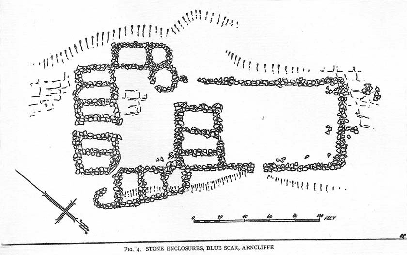
The remains of this prehistoric settlement first seem to have been described by Arthur Raistrick and Paul Holmes. (1961) They told that:
“the principal field is approximately 120 feet square, enclosed by a massive boulder and gravel bank, probably the foundation of a substantial stockade. The field is now mostly bare limestone pavement. Four smaller fields adjoin it on the north and west. Circular huts with drystone walls still about 3 freet 6 inches high before excavation, covered by collapsed material suggesting an original height of 5 feet, are placed, two of them in the course of the field wall and two in the junction of three field walls. The huts are about 10 feet internal diameter, the walls about 3 feet thick. A very fine quartzite hone was the only find in the huts. There are two rectangular stone-built enclosures, 20ft by 10ft, and 15ft by 8ft, and several small rectangular enclosures, probably buildings, with walls of boulders and turf, using one wall of a field as a common back wall. The whole site suggests a compact family farm.”
A few years later the site was visited and later described by Miss D. Charlesworth at the annual meeting of the Archaeological Society in July 1968, and is one of several found on the hills 2-3 miles southwest of Arncliffe village. Miss Charlesworth told:
“This site also faces north and covers an area of about 330 by 280ft, much of it now bare limestone. There are eight rectangular buildings and four circular huts associated with a large enclosure about 120ft square, with five smaller enclosures adjoining it.”
References:
Charlesworth, D., ‘Iron Age Settlements and Field Systems,’ in Proceedings of the Archaeological Journal, 125, 1968.
Raistrick, Arthur & Holmes, Paul F., Archaeology of Malham Moor, Headley Brothers: London 1961.
Pretty easy really. From Arncliffe village, walk up the Monk’s Road footpath, heading for the rocky mass immediately south. Once you get onto the moor edge, veer straight up to your right and keep walking till you hit the rocks. Look around!
Archaeology & History
Drawing of main part of the settlement (Raistrick 1929)
Described by Miss D. Charlesworth at one of the annual meetings of the Archaeological Society in July 1968, this ‘settlement’ is found immediately south of Arncliffe village, literally 1000 feet up on the hillside and has a field system attached to it. When Charlesworth described this place, it had not been excavated, though her description of the place very much echoed those of Raistrick & Chapman (1929) nearly forty years earlier. She wrote:
“It faces north and east over the Skirfare valley, sheltered by the bulk of Parson’s Pulpit. The most interesting feature is the rectangular enclosure west of the sunken road. The walls are built of limestone some 5ft wide at the base and standing 2-3ft (tall). The huts are grouped round a courtyard at the south-eastern end and have a large stockyard attached to them. Of the 14 huts, only two are circular (those in the northwest corner), and one on the east side is approximately a circle. The remainder are rectangular, approximately 30 by 12ft.”
Although the sites is generally ascribed as Iron Age to Romano-British in date, it seems evident that these buildings were used in much later centuries — perhaps until late medieval periods. Other remains of similar size and stature can be found scattered on the hills near here (I’ll add them on TNA at sometime in the future).
References:
Charlesworth, D., ‘Iron Age Settlements and Field Systems,’ in Proceedings of the Archaeological Journal, 125: 1968.
Raistrick, Arthur & Chapman, S.E., ‘The Lynchet Groups of Upper Wharfedale, Yorkshire,’ in Antiquity, volume 3, 1929.