Settlement: OS Grid Reference – SE 1785 5128
Travel along the Askwith Moor Road between Blubberhouses and Askwith (near Otley) and park-up at the large gritted parking post on the moor edge. Walk straight onto Snowden Moor (east) and walk a few hundred yards north until you reach the brow of the small rounded hill, scattered with small stones and outcrop rock. The settlement is all around you!
Archaeology & History
As we already know from earlier posts on TNA, this moorland region is rich in prehistoric remains, and the settlement that I’m about to briefly describe here is another excellent site – when you can see it!
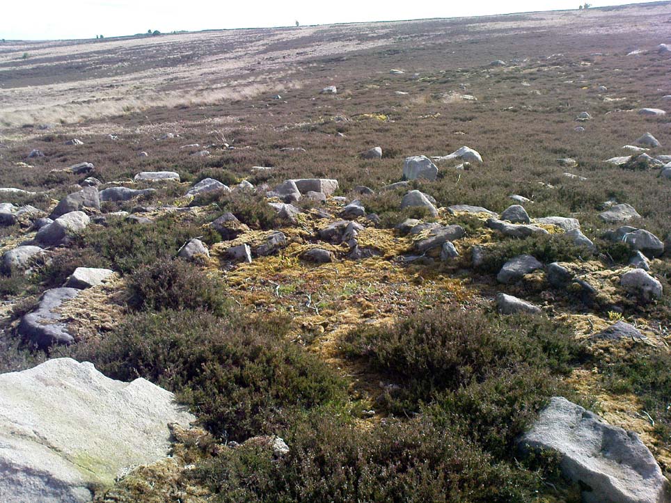
My first exploration here was in the company of Graeme Chappell more than 20 years ago, where we tried locating remains that had been described by Eric Cowling (1946) during a foray taking photographs of the cup-and-ring stones nearby. But due to an overgrowth of moorland vegetation at the time, the remains which Cowling described proved hard to find. Years later when Richard Stroud and I visited the place in May 2005, all the heather had been burnt back and much of what looked like the remains of an entire prehistoric village was in plain view for us to see. I was well impressed! This occurred again last year, enabling the bunch of us who came here a few times to see even more of the place. But — just like the newly discovered prehistoric settlement on Blubberhouse Moor a couple of miles north — once the heather grows back again you wouldn’t really think anything of worth was hidden here. In archaeological terms however — despite the lack of references and research by those who are paid to be archaeologists — we have one helluva little-known prehistoric settlement, complete with walling, hut circles, village hall (!), tombs, cup-and-ring carving and more, much of it probably dating from the Bronze Age, but some of the sites here indicate it was also much in use during the Iron Age period aswell.
Probably the best place to start exploring here is on the large flat rock on the rounded knoll at the edge of the moor (SE 1785 5129) with a simple cup-mark saying ‘hello’ on its surface, looking east down into the Fewston Valley and across lower Wharfedale, then veering up towards the hills above Nidderdale. The great prehistoric temple of Brimham Rocks is clearly visible from this spot aswell. Upon this rocky hillock we have a veritable scattering of several large, earthfast boulders and smaller rocks, from where much of the settlement expands, mainly to the west through to the south, across the open moors in front of you. On a clear day this is truly beautiful and quiet spot.
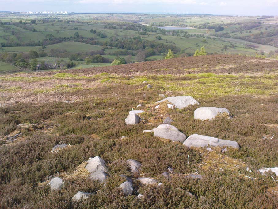
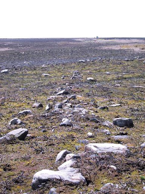
Just a couple of yards from the edge of the rocky knoll is a very good example of what would at first sight appear to a prehistoric hut circle. Its position at the top of this rocky knoll however, implies an additional function other than a purely domestic one. Also from here is a prominent long straight stretch of walling running roughly southwest for about 90 yards onto the moor, and also to the northeast, downhill off the moorland for some 30 yards before disappearing into undergrowth (we didn’t actually explore this lower section of walling running downhill, so there’s probably more to be found there). This long section of walling, mainly comprising small stones and rubble, with a number of larger uprights defining much of its length, is just one of several stretches of walls that are clearly visible hereby. There are also a number of other hut circles to be found scattered around this particular walled sections near the top of the rocky rise. When Eric Cowling (1946) came here he counted 10 of them here; but subsequent explorations have found at least 13 of them hereby.
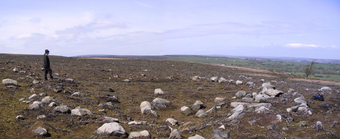
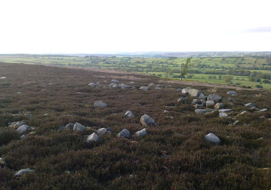
One of the most notable remains here is the large D-shaped enclosure about 25 yards west of the rocky knoll. This very impressive archaeological site was curiously not included in the Nidderdale Archaeological survey report of sites in this region. Either they hadn’t done their homework correctly when they came here, or the heather must have been really deep; cos as you can see in the photo here, it’s a decent size! I tend to see this large stone enclosure as a sort of tribal gathering building of sorts — a bit like a ‘village hall’ so to speak. If you get here and see it all in context, it makes a lotta sense (not that it’s right of course, merely an opinion). With the exclusion of the Cowling D-shaped enclosure more than 80 yards east of here, this is the largest monument on this section of the moor, measuring some 45ft along the NW to SE axis and 20ft across the NE to SW axis. The walling in parts is quite thick aswell and the stones making up the main north, east and southern edges are anything between 12 inches to 34 inches tall. Along its northeast edge is a curious stone, with what initially looked to be a most distinct cup-and-ring carving on the outer walling, but once we’d looked and looked again, saw it seemed to be one of the oddest light-created ‘carvings’ we’d ever seen! (i.e., it’s natural)
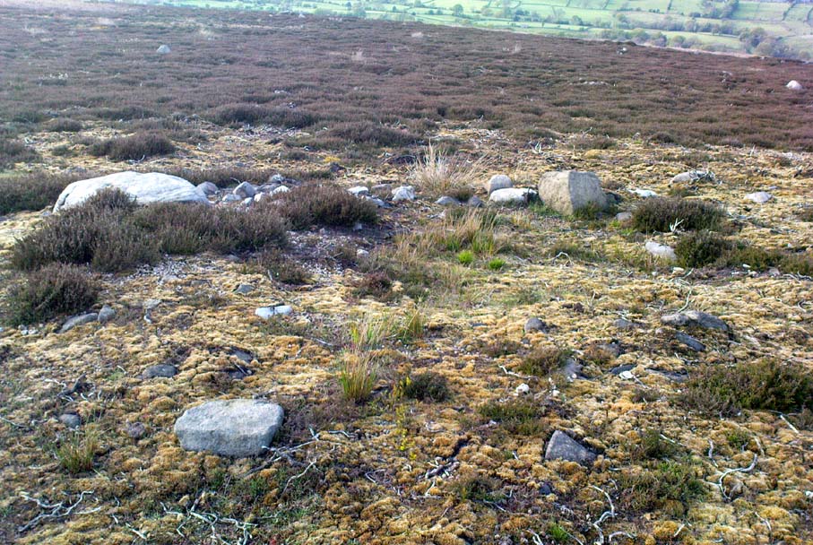
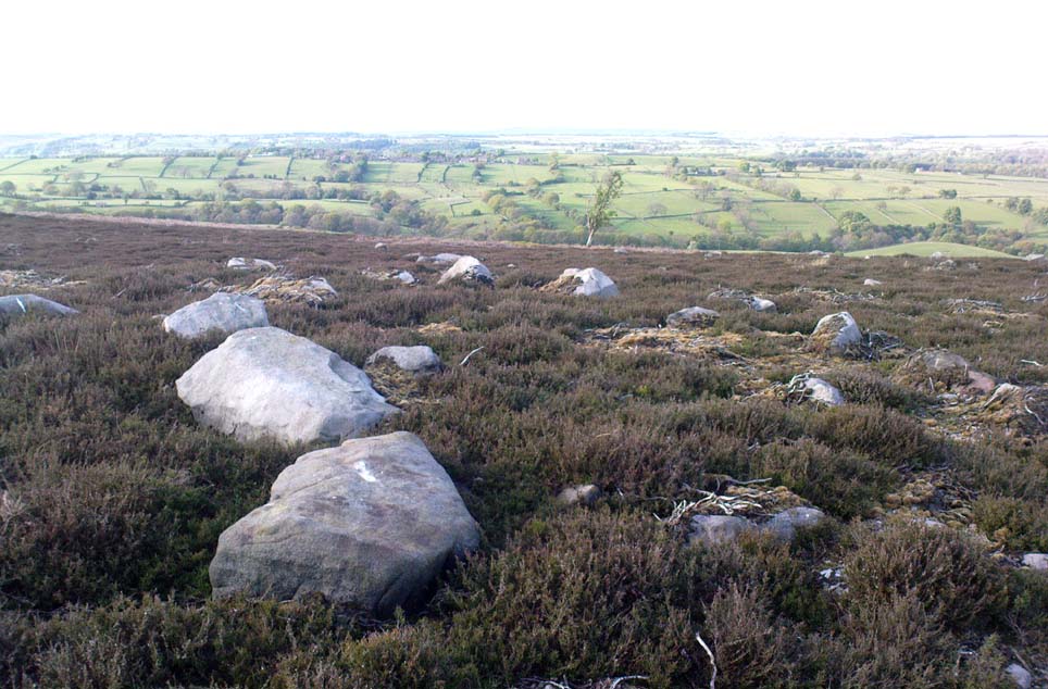
A few yards from here, heading to the little peak close by, more walls emerge. On the small rise in the land about 30 yards west you’ll see an arc of stones running around the contour line of another hillock on the moor. It’s difficult to say with any certainty, but a lot of this arc of stone is certainly man-made and at least Iron Age in date, perhaps earlier; but the line of stones itself may actually run all round the very edges of the hill on whose sides this section rests (see photo). You get a distinct impression here that this small hill was actually sectioned off all the way round, so to speak, for some reason or other. The remains of at least two small cairns can be found on the top of this small enclosed rise, close to one of which Boughey & Vickerman (2003) have designated there to be a cup-marked stone. From this elongated hillock we look immediately northwest onto the flat moorland plain of the Snowden Moor necropolis …amidst which the hardworking Keighley volunteer Michala Potts recently found the Snowden Crags cairn circle.
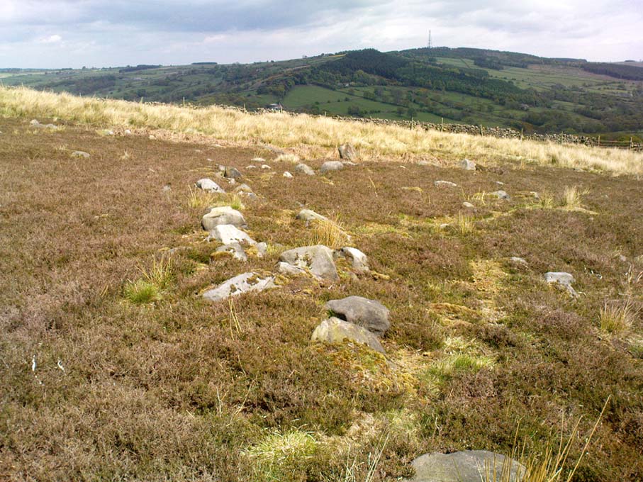
Further down the moorland slope—a couple of hundred yards below Cowling’s D enclosure—are yet more remains, many of which lie outside the geographical boundaries of the “official” Scheduled Monument Record for this settlement (known as SMR 28065). We’ve located several other cairns in relatively good states of preservation; more extensive lines of another walled enclosure (again in a large D-shape), as well as several cup-marked stones.
The Site and Monuments account of this place tells us simply:
“The monument includes a cairnfield and associated concentration of prehistoric features. Included in the area are a large sub-rectangular enclosure, two smaller enclosures, at least 17 cairns of various sizes, several lengths of boulder walling, a hollow way, and at least 17 carved rocks. There is also a bare patch of ground on which lumps of lead slag survive. This was produced by medieval or earlier lead smelting.
“This concentration of prehistoric features is situated towards the north east edge of Snowden Carr, and measures c.426m x c.155m. The cairns occur throughout the area and range in size from an elongated cairn 17m x 7m down to cairns c.4m in diameter. The cairns are best preserved in the north western part of the area. The large sub-rectangular enclosure has an earth and stone bank c.3m wide and c.0.6m high. The bank is double on the east side of the enclosure. The two smaller enclosures have rubble banks 1m-2m wide and up to c.0.6m high. They are more irregular in shape than the large enclosure. The boulder walling consists of a number of approximately linear rubble banks 1m-2m wide. It is concentrated in the area immediately north west of the large enclosure, and in the area to its south. The boulder walls are interpreted as part of a field system contemporary with the large enclosure. The hollow way is located within the southern group of boulder walls and may be contemporary with them. “
There is still a considerable amount of work that needs doing in and around this settlement complex and it seems any work here is gonna be done by the like of us amateur doods. Archaeological officials don’t seem interested here. I was informed by Neil Redfern of the archaeology department of English Heritage for North Yorkshire that they are unable to support any funding that might help towards any decent analysis of this important archaeological arena, nor do they consider the important cairn circle discovered a few months ago on the northern end of this settlement worthy of financial help either, which is of course very disappointing,* but typifies their lack of enthusiasm unless money comes their way. And so this site profile entry will be added to gradually as our amateur team visit and uncover further aspects of this neglected prehistoric arena – such as the finding of another previously unrecorded ancient circle of stones not too far away!
References:
- Boughey, Keith & Vickerman, E.A., Prehistoric Rock Art of the West Riding, WYAS: Wakefield 2003.
- Cowling, Eric T., Rombald’s Way: A Prehistory of mid-Wharfedale, William Walker: Otley 1946.
Acknowledgements: Many thanks for use of their photos to Graeme Chappell and Michala Potts.
* No doubt a church window somewhere will eat up a few thousand quid and weeks of their time to fit the little piece — along with all those prawn sandwich meetings that cost so much to endure. Much more important!
© Paul Bennett, The Northern Antiquarian
I suggest that you set up camp on the moors now, – the months of Nov, Dec & Jan provide ideal conditions for outdoor survey work. Your group will thrive in the outdoors. Fritzjof Nansen did his finest work in the winter months, so take on his example and lead your flock to a life of health and fitness that such a venture will undoubtably provide.
The all day ‘breakfast on a bapp’ and betting establishments may suffer losses with their absence – but the greater good will be served.
Give them plenty of stick and a very small measure of carrot is my advice
Let ‘VENTURE FORTH’ be your clarion call!