Stone Rings, Pannal, North Yorkshire

Stone Circle (destroyed):  OS Grid Reference – SE 308 527

Archaeology & History 

‘Stone Rings’ place-names on the 1910 OS-map

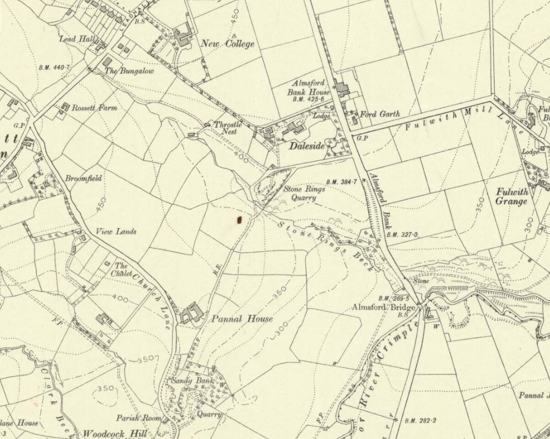
The plurality of the place-name implies that there was more than one circle, but we don’t that know for sure either!  But if there was more than one, it is more likely they were cairn circles than traditional free-standing stones circles.  But once again, we simply don’t know….No remains exist of the “stone rings”—or rings of stone—that once stood here in bygone centuries.  The only remains left are in the place-names of the stream and roads hereby, highlighted on several of the early OS-maps: Stone Rings Lane, Stone Rings Beck and the Stone Rings Quarry—the latter of which is probably the reason why there is nothing to be seen here anymore. But we don’t know for sure.

The grid-reference given here is an approximation.

References:

  1. Smith, A.H., The Place-Names of the West Riding of Yorkshire – volume 5, Cambridge University Press 1961.

© Paul BennettThe Northern Antiquarian


Briscoe Rigg, Rigton, North Yorkshire

Settlement (destroyed):  OS Grid Reference — SE 2581 5100

Archaeology & History

Briscoe Rigg on 1851 map

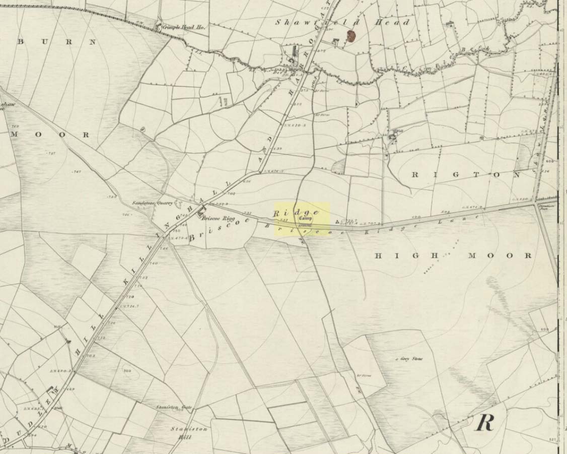
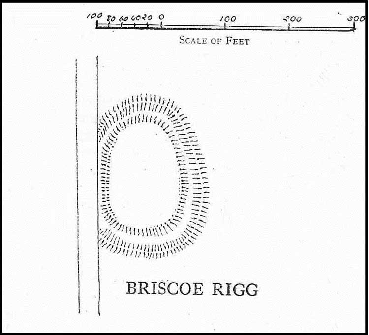
Highlighted on the 1851 OS-map of the area as a ‘Camp’, all trace of this ancient settlement would seem to have been destroyed.  It was already on its way out when the Ordnance Survey lads looked at it for a second time in 1888, finding barely a trace of it.  Thankfully though, when the clearer eyes of that great northern antiquarian Eric Cowling visited the site in the early 1930s, traces of it could still be made out.  Both he and fellow antiquarian, Mr B.J.W. Kent of Beckwithshaw, did their own investigations; and it is their notes we are most grateful for in describing this forlorn antiquity.  Mr Cowling (1946) wrote:

“On the highest point of the enclosed land on the east side of the Briscoe Rigg (to) Rigton road is a small entrenched site.  The enclosed area measures 130 yards from north to south and 70 yards from east to west.  The camp is six-sided, but this appears to be due to bad workmanship and layout rather than intention.  One gains the impression that the original plan was oblong and that the longer sides were bent to conform to the shorter ones.  It is slightly hollow and the whole area is almost levelled by heavy ploughing; the outer bank barely being one foot above the surroundings.  The ditch and outer bank now cover a spread of 60 feet.

“Recent hurried investigations by Mr Kent showed interesting details.  The area seems to have been occupied by hut-sites previous to the hurried digging of a trench some 16ft wide and 6ft deep, going down into the bed-rock nearly 6 feet.  Son after, the ditch was half-filled by boulders and earth amongst which was a fragment of pottery, black in colour and indefinite in type, but probably Roman.  When the ditch was half-full it was used for some time for cooking…”

Cowling’s 1946 site-plan

Cowling also told us there was “a tradition that tools, which by description appear to be socketed celts, were found here when the site was brought under cultivation”, in about 1840.  Mr Kent also discovered various flints hereby, many Mesolithic scrapers and “a fine Bronze Age barbed and tanged point and also a transverse cutting arrow point of the early four-sided types.”

Although these finds from much earlier periods show that people have been living and hunting in the area for an exceptionally long period, the settlement or camp at Briscoe Rigg was probably built in the early Iron Age period and continued to be used into Romano-British times (somewhere between between 500 BCE and 500 CE).

References:

  1. Cowling, E.T., Rombald’s Way, William Walker: Otley 1946.

© Paul BennettThe Northern Antiquarian


Horn Bank, Rigton, North Yorkshire

Horn Bank on 1910 map

Settlement (destroyed):  OS Grid Reference – SE 2905 5035

Archaeology & History

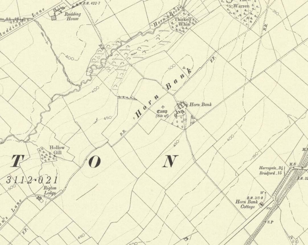
Upon the top of the old ridge where ran the ancient trackway between Rigton and Pannal, could once be found a multi-period settlement, long since gone – as happens all too often in this neck o’ the woods.  And unfortunately there doesn’t appear to be any sketch plans of the site.  It was first described by Edward Hargrove (1789) in his historical old rambles around Harrogate and district.  When the scribe reached Horn Bank, he told that here,

“was lately discovered the remains of several entrenchments forming three distinct enclosures, two of a square and one of a circular form.  Not far from these entrenchments, which were probably of Danish origin, was found, in May 1787, the umbo of a shield, with several other fragments of gilt brass…”

In William Grainge’s (1871) magnum opus he told that,

“At Horn Bank, on the crest of the hill east of Rigton, near a farm-house, are the remains of three camps—two of a square, and one of a circular form; they are probably of British and Roman origin. The location is a lofty and commanding one; but the ploughshare has so often passed over them that they are nearly obliterated.”

Just below the settlements Grainge also said how, “a fine spring of water was formed into a bath here many years ago, but the whole is now in a state of ruin.”  This would have likely been the main water supply for the people living here.  Harry Speight (1903) implied the same thing when he investigated the site, saying:

“At a place called Horn Bank, near Rigton, on the west side of the parish, on the crest of the hill on the north side of the Horn Bank farmhouse, there were formerly to be seen very distinct indications of three camps, each encompassed with fosse and rampart. Hargrove supposed them to be Danish, but as two of them were of a square or rectangular form, and the other circular, they were in all probability relics of the Romano-British contest, at first occupied by the native tribes and subsequently as a temporary camp and look-out post by their conquerors. The site commands a wide and uninterrupted view in every direction, while close at hand is a copious spring of good water. This spot many years ago was converted into a bathing-place, but is now broken down and abandoned… The site has long been ploughed, and little or no trace of these earthworks is now discernible.”

The only thing Eric Cowling (1946) could find when he came to the place were faint scars of walling whose shadows were highlighted by the sun when the conditions were just right.  He thought the settlements were Iron Age in nature, but would have continued to be used in subsequent centuries by local people.  It seems a sensible suggestion…

References:

  1. Cowling, E.T., Rombald’s Way, William Walker: Otley 1946.

  2. Grainge, William, History & Topography of Harrogate and the Forest of Knaresborough, J.R. Smith: London 1871.

  3. Hargrove, E., The History of the Castle, Town and Forest of Knaresborough with Harrogate, W. Blanchard: York 1789.

  4. Speight, Harry, Kirkby Overblow and District, Elliot Stock: London 1903.

© Paul BennettThe Northern Antiquarian


Cunnel Fold Well, Marsett, Bainbridge, North Yorkshire

Healing Well:  OS Grid Reference – SD 88727 85543

Archaeology & History

Cunnel Fold Well on 1856 map

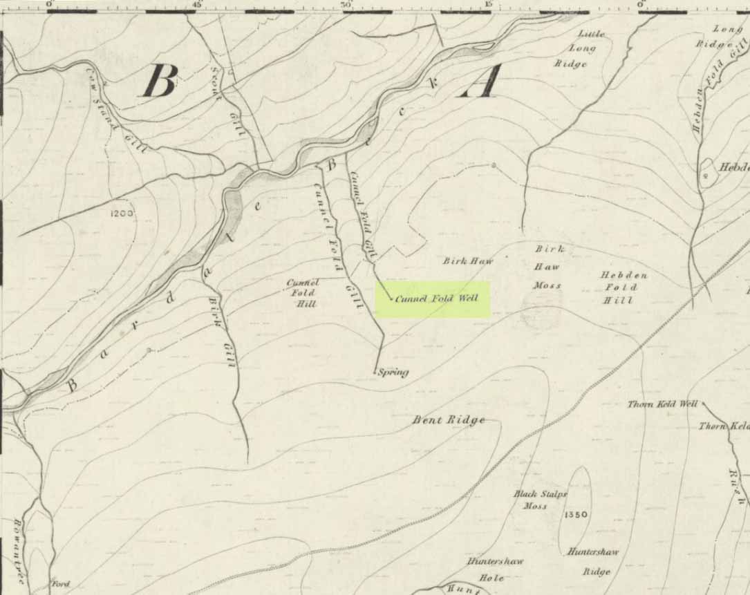
Found high on the moors several miles south of Hawes, this is a small almost insignificant water source that I sat with, drinking in both the landscape and the waters many moons ago in a daydreaming amble.  It’s history is only remembered in the name it was given, no doubt by some local to the Ordnance Survey lads in their own, albeit more focussed assessment on these hills.  Its name puzzled me for a long while and I wondered if some untold story lay behind it.  Sadly that doesn’t appear to be the case.  Although there are doubtless many tales that could be told of the people who, through the centuries, have sat and drank the waters here, we know none.

Its name very probably derives from the misapprehended dialect word ‘cannel’ which, as Mr Wright (1898) explains, is simply “a ditch…gutter, watercourse,” which seems appropriate here.  Of the place-names shown on the 1856 OS-map, it seems the most likely solution to the word.

As for a place to sit and have a drink, it’s very refreshing after the rains have fallen.  All too often nowadays, as with many of the old hilltop watercourses, their life-blood is falling back to Earth…

References:

  1. Wright, Thomas (ed.), English Dialect Dictionary – volume 1, Henry Frowde: London 1898.

© Paul BennettThe Northern Antiquarian


Brandy Well, Carlton, North Yorkshire

Holy Well (lost):  OS Grid Reference – NZ 52 03?

Archaeology & History

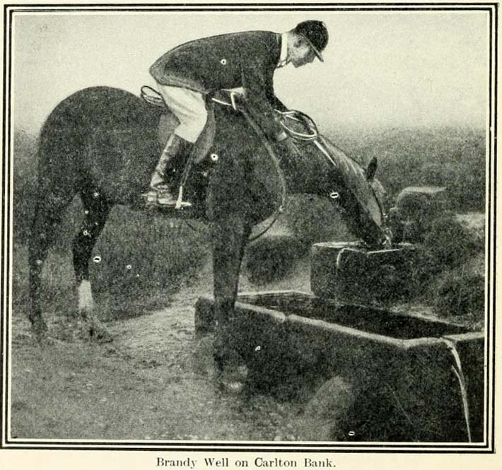
Brandy Well c.1910

Not marked on any map of the area (that I can find), this little-known possible holy well is described just once in one of Mr Blakeborough’s (1912) numerous regional history tomes.  Although he doesn’t explore the origin of the well’s name (which we find repeated at other water sources in northern Britain), the Scottish writers, Ruth & Frank Morris (1982) tell how examples of wells with this name in Scotland owe their names to the curious early christian figure of St. Brendan, whose annual saint’s day is May 16.  Whether this applies here I cannot tell.

We need some help locating the place, as it seems to have fallen off the radar.  The best I can do is give Mr Blakeborough description, who wrote of this Brandy Well:

“Speaking of superstitions reminds me of a tradition that the water in Brandy Well, half way up Carlton Bank, has most wonderful curative properties, and that a wish made here when drinking, is pretty certain to be fulfilled.  The well is by the road side and the water is no doubt just about as pure as it could possibly be, coming as it does, after much filtering through peat, straight from the hills.  There may be something more than mere superstition in the health giving properties of this water, especially in conjunction with the climb up the hill amid pine trees and the inhaling of the invigorating air.”

Its exact location is difficult to pin down.  There is no sign of any Well along the roadside between Carlton village and where the road eventually levels out on the northwest side of the hill.  It certainly isn’t the Mere Beck Spring on the south-side of the hill (is that still there and what is its history?); but there is however a ‘Spring’ shown on the early OS-maps on the east-side of the hill, along an old track at roughly NZ 52233 02357. Could this be it?  Or has the old Brandy Well been destroyed?  In an area littered with prehistoric and mythic sites, it would be good to relocate this one.

References:

  1. Blakeborough, J. Fairfax, Life in a Yorkshire Village, Yorkshire Publishing: Stockton-on-Tees 1912.
  2. Morris, Ruth & Frank, Scottish Healing Wells, Alethea: Sandy 1982.

© Paul BennettThe Northern Antiquarian


Old Lane Carving, Cowling, North Yorkshire

Cup-and-Ring Stone:  OS Grid Reference – SD 97300 42625

Getting Here

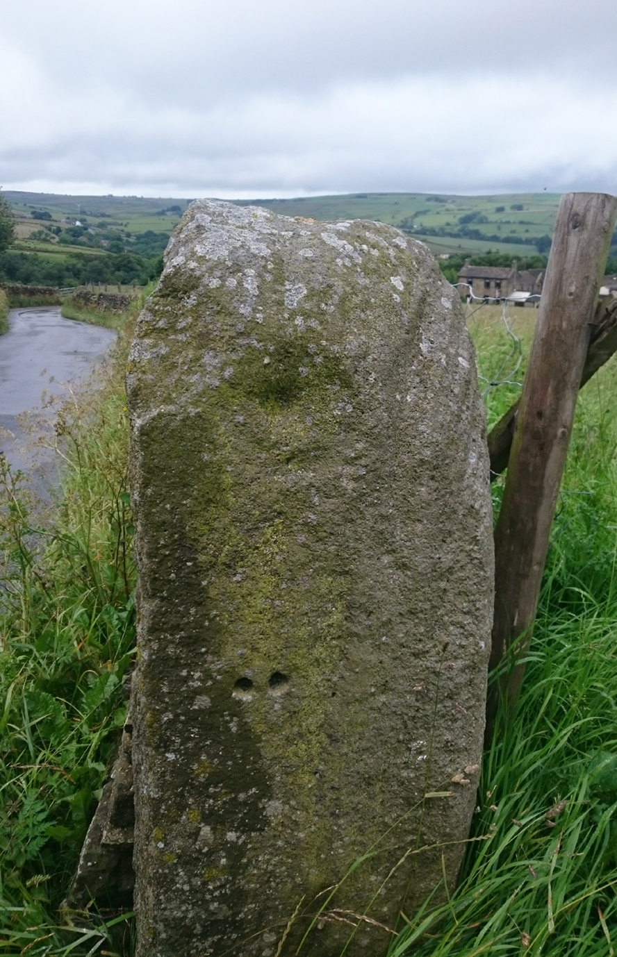
Old Lane Cup-and-Ring, Cowling

Old Lane Cup-and-Ring

This Stone is situated on Old Lane, Cowling, North Yorkshire. To get here coming from Crosshills, you come straight through the village and past the shops.  About 250 yards after the shops you will come to a sharp left hand bend, and once you have gone round this corner you will see a sign pointing to Oakworth (Old Lane).  You need to turn left here (up by the cemetery) and continue for about half a mile up that lane until you come to a sharp left-hand bend. Once you have gone round that left-hand bend you will see a driveway on the right, the stone is situated opposite, in the gateway.  Hope you can find it and enjoy it like I do every time I pass it.

Archaeology & History

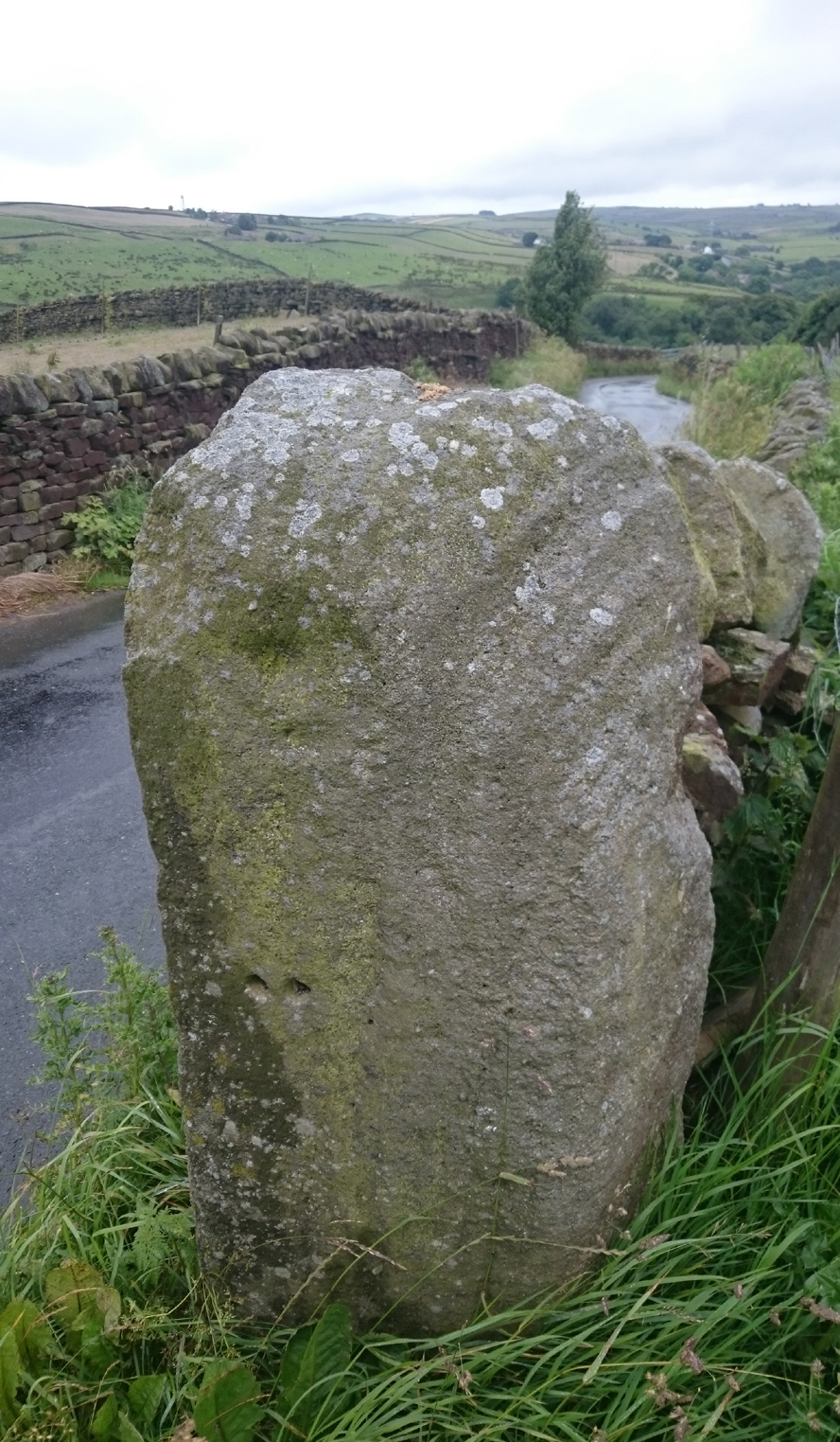
...and from another angle

…and from another angle

I’ve driven past this stone many times, almost every day and never previously noticed any markings.  Then, one particular day, the weather was a bit miserable but the lighting was just right to illuminate this little gem.  Was this lump of rock a standing stone, or have modern day folk took advantage and moved it here to be used as a gatepost? I don’t think we ever will know.

(Editor’s Note – When Chris first informed us of this carving, I wondered whether or not it had anything to do with a cup-and-ring found on a gatepost in the 1950s or ’60s by Stuart Feather or Sidney Jackson, but this was not the case.  This petroglyph therefore, is yet another one that our users have discovered and it has to be classified as a new find. Keep up the good work sir!  PB)

© Chris Swales, The Northern Antiquarian


Robin Hood & Little John Stones, Whitby, North Yorkshire

Standing Stones (destroyed?):  OS Grid Reference – NZ 9171 0952

Also Known as:

  1. Robin Hood’s Pillars

Archaeology & History

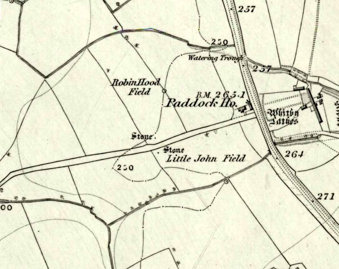
The 2 stones on 1853 map

The 2 stones on 1853 map

References to these old standing stones are scarce—at least in archaeology books anyway.  Even the usually diligent masters of Burl (1993) and Thom (1990) missed them!  But thankfully our folklorists and antiquarians with their keen interest in popular culture have written about these long lost monoliths, which could once be seen in fields just a mile or so south of Whitby town.

The earliest known account of the site is as the “Robyn-Hood-stone” in records dating from 1540 CE cited in the Cartularium Abbathiae de Whiteby (1881).  It was later described in land registers in 1713 and the fields in which they stood were—and still are—respectively known as Robin Hood’s Close and Little John’s Close.

These Whitby monoliths—like their namesakes in Northamptonshire— weren’t too big.  In Mr Young’s (1817) early description, when the stones were still visible, he told how Robin Hood’s stone was “a stone pillar about a foot square and four feet high”, and Little John’s Stone was “a similar pillar about two-and-a-half feet high.”  Mr J.C. Atkinson, the editor of the Cartularium (1881), also told that the two stones were “still in situ in the earlier part of the present century,” continuing:

“Both stones have now been removed, and are, I was informed, set up again near the enclosing fence of the field in which they stood. Almost beyond question , like the other monoliths of the district, they marked the site of ancient British interments.”

So—do the remains of these old stones still exist somewhere close by as J.C. Atkinson said, either in the walling, as a gatepost, or just pushed over and now covered in grass (like the long lost Thief Thorne standing stone near Addingham)?  Are any northern antiquarians living close by who might enable their rediscovery?

Folklore

A number of writers exploring the mythic histories of Robin Hood have included this site in their surveys, usually repeating the earlier creation myths about them that could be heard in popular culture.  The Whitby historian George Young (1817) told the tale:

“According to tradition, Robin Hood and his trusty mate, Little John, went to dine with one of the Abbots of Whitby, and, being desired by the Abbot to try how far each of them could shoot and arrow, they both shot from the top of the Abbey, and their arrows fell on the west side of Whitby Laithes, beside the lane leading from thence to Stainsacre; that of Robin Hood falling on the north side of the lane and that of Little John about a hundred feet further, on the south side of the lane.”

Whitby folklorist P.S. Jeffrey (1923) took this myth literally, saying how the distance of the arrows fired by the respective folk heroes was “scarcely credible, as the distance in each case is about a mile-and-a-half.”  However, the earlier historian Lionel Charlton (1779) thought the incredible feat quite credible!

The distance between the Abbey and the stones is 1.36 miles (2.2km); but it may be that the direction related in the tale was more important than the distance, as the alignment between the two sites runs northwest to southeast—or southeast to northwest, whichever you prefer!—and may relate to an early astro-archaeological alignment.  Might…..

References:

  1. Anonymous, “Robin Hood in Yorkshire“, in Yorkshire Folk-Lore Journal – volume 1, T.Harrison: Bingley 1888.
  2. Anonymous, “Whitby Arms,” in Yorkshire Folk-Lore Journal – volume 1, T.Harrison: Bingley 1888.
  3. Benedicti, Ordinis S., Cartularium Abbathiae de Whiteby – volume 2, Andrews: Durham 1881.
  4. Burl, Aubrey, From Carnac to Callanish, Yale University Press 1993.
  5. Charlton, Lionel, The History of Whitby and Whitby Abbey, T. Cadell: York 1779.
  6. Doel, Fran & Goeff, Robin Hood: Outlaw or Greenwood Myth, Tempus: Stroud 2000.
  7. Green, Barbara, The Outlaw Robin Hood – His Yorkshire Legend, KCS: Huddersfield 1992.
  8. Gutch, Mrs, County Folk-lore – volume 2: North Riding of Yorkshire, York and the Ainsty, David Nutt: London 1901.
  9. Jeffrey, P. Shaw, Whitby Lore and Legend, Whitby 1923.
  10. Mitchell, W.R., Exploring the Robin Hood Country, Dalesman: Clapham 1978.
  11. Parkinson, Thomas, Yorkshire Legends and Traditions – volume 2, Elliot Stock: London 1889.
  12. Thom, A., Thom, A.S. & Burl, Aubrey, Stone Rows and Standing Stones – 2 volumes, BAR: Oxford 1990.
  13. Young, George, The History of Whitby and Streoneshalh Abbey – volume 2, Clark & Medd: Whitby 1817.

© Paul Bennett, The Northern Antiquarian


Sunrise Stone (605), Snowden Crags, Askwith, North Yorkshire

Cup-and-Ring Stone:  OS Grid Reference – SE 18066 51251

Also Known as:

  1. Carving 605
  2. Northern Earth Mysteries Stone

Getting Here

Sunrise Stone, Snowden Carr

Sunrise Stone, Snowden Carr

Take the same directions as if you’re going to visit the Naked Jogger Carving (stone 612), not far from the well-known Tree of Life Stone.  From the Naked Jogger carving, walk up the small outcrop of rocks that bends above you.  Barely 100 yards up when you reach the top, you’ll notice a single large sloping stone barely 50 yards ahead of you in the same field.  That’s the spot!

Archaeology & History

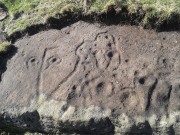
This is a little-known beauty of a carving just off the edge of the quiet moors that are littered with prehistoric remains.  It was only rediscovered a few years ago — by myself if you believe the writings of rock art student Keith Boughey (2010) in his essay on the validity of so-called “amateurs”who research and discover petroglyphs (Boughey’s essay is scattered with mistakes).  But I’d never even visited this carving until two years ago!  The stone was in fact found during a field-walk by early members of the Northern Earth Mysteries group in August 1989 (Wilson 1990) and subsequently described and illustrated for the first time by Phil Reeder (1990).
Close-up of main cluster

Close-up of main cluster

As can be seen in the photos accompanying this site profile, the rock on which the carving has been done has, at some point in the past, been cut into and its edges have been hacked away and destroyed, literally cutting into the overall design.  We have no idea what the original size of the stone was, obviously, but this petroglyph was once larger than the design that we see at present.  Such is the price of ‘progress’, as some folk call it.

Anyway – a few months after the carving was rediscovered, Phil Reeder (1990) wrote:

“After a visit to the Tree of Life stone…a cursory inspection by the NEM Group was made on nearby rock outcrops, part of which showed evidence of recent exposure due to soil erosion.

“One stone in particular stood out as five shallow cups and associated rings could be discerned.  When cleaned, it became apparent that further carvings extended beneath a thin eroding soil layer.  When this layer was cleared, a complex set of carvings were revealed.

“Only preliminary work at the site has been carried out to date, but it appears that the carvings comprise of at least 28 cups, 13 of which have associated rings; several of the cups are linked by gutters forming an intricate design, one gutter part enclosing 11 cups.  The carvings on the lower edge of the stone have weathered badly and are difficult to interpret.”

Reeder’s so-called “amateur” description is a good one. Certainly more accurate than the subsequent one by Boughey (“I’m a professional”) & Vickerman (2003):

“Large rock of coarse grit whose surface slopes with the hill. About forty cups, some large, many with single rings, and many curving grooves, the whole forming a remarkable, complex design.”

Phil Reeder's 1990 drawing

Phil Reeder’s 1990 drawing

Boughey & Vickerman's sketch

Boughey & Vickerman’s sketch

We can see in the respective drawings by both Reeder (left) and Boughey & Vickerman (right) that some elements which should have been included in the ‘official’ drawing were missed, yet had been accurately included in the earlier ‘preliminary’ drawing, as Mr Reeder put it.  I hope that readers will forgive me pointing out these seemingly minor elements; but I do it to illustrate the ineffectiveness of more recent rock art students who are gaining the title of ‘experts’ in this field.  It’s important to recognise that, in this field of study, “experts” are few and far between indeed… I’ve certainly yet to meet any!

Northern end of carving
Northern end of carving

Southern side of carving

Southern side of carving

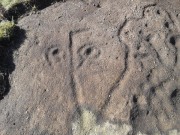
The carving is mentioned briefly in Beckensall’s (1999) introductory study, with little comment.  But of note here is not only the curious linear feature running between two cup-and-rings, but the position of the stone in the landscape.  For if you sit either upon or next to this carving, you are looking east straight across the gorgeous Fewston valley directly at the prominent wooded hill of Sword Point.  As it slopes down into the present-day greenery of fields and scattered woods, the Wharfe Valley spreads out to the distant east and, as the sun rises and scatters its rays onto the wet morning stone here, the design on the rock awakens with much greater visual lucidity than that which our daytime eyes bestow to us.  In all likelihood, sunrise was an important element in whatever mythic function underscored this curious carving, with its human-like figure rising on its southern side, emerging from the edge of the rock, personifying perhaps the rising solar disc and the living landscape as the daylight breath awoke Earth’s creatures; or maybe it signifies a symbolic group of people gathered together watching the sunrise…

Of course, I’m dreaming… (how very amateur of me! 🙂 )

References:

  1. Barnett, T. & Sharpe, K. (eds.), Carving a Future for British Rock Art, Oxbow: Oxford 2010.
  2. Beckensall, Stan, British Prehistoric Rock Art, Tempus: Stroud 1999.
  3. Boughey, Keith, “The Role of the Amateur in the Study of UK Prehistoric Cup-and-Ring Art,” in Barnett & Sharpe, Oxford 2010.
  4. Boughey, Keith & Vickerman, E.A., Prehistoric Rock Art of the West Riding, WYAS: Leeds 2003.
  5. Chappell, Graeme, “North Yorkshire Rock Art – New Discoveries,” in Northern Earth, no.62, 1995.
  6. Michell, John, The Earth Spirit, Thames & Hudson: London 1975.
  7. Reeder, Phil, “Snowden Carr Rock Carvings,” in Northern Earth Mysteries, no.40, 1990.
  8. Wilson, Rob, “Pateley Bridge Gathering,” in Northern Earth Mysteries, 40, 1990.

© Paul Bennett, The Northern Antiquarian

Skyreholme Carving (406), Appletreewick, North Yorkshire

Cup-marked Stone:  OS Grid Reference – SE 0740 6254

Getting Here

Skyreholme 406

Skyreholme 406 carving

Along the B6265 Pateley Bridge-Grassington road, roughly halfway between Stump Cross Caverns and the turn to Skyeholme and Applecross (New Lane) is a dirt-track on your right-hand side called Black Hill Road. Walk down here for a few hundred yards till y’ reach the gate on the right. A track goes downhill to the psilocybin-rich pastures of Nussey Green. Several hundred yards down, to the right-hand side of the track, we find this and its several companions. Look around!

Archaeology & History

Skyreholme-406 carving

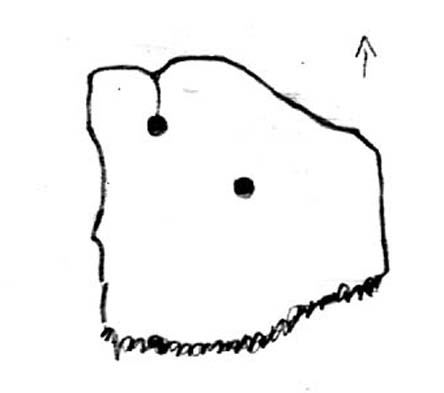
Sketch showing cups

Just a few yards away from the Skyrehome Carving-404, this very basic petroglyph was rediscovered by Stuart Feather (1969) during one his many forays in this area.  Although the stone has what initially seems to be a number cup-marks on it, it seems only two of them are man-made. The rock art students Boughey & Vickerman (2003) think there may be up to four of them.

References:

  1. Boughey, Keith & Vickerman, E.A., Prehistoric Rock Art of the West Riding, WYAS 2003.
  2. Feather, Stuart, “Appletreewick, W.R.: Black Hill,” in Yorkshire Archaeological Journal, volume 42, part 167, 1969.

© Paul BennettThe Northern Antiquarian
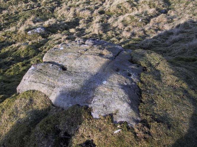

Skyreholme Carving (405), Appletreewick, North Yorkshire

Cup-Marked Stone:  OS Grid Reference – SE 07395 62382

Getting Here

Skyreholme 405 Carving

Skyreholme 405 Carving

Going down (south) off the B6265 Black Hill Road towards Skyreholme, turn right and go all round the hill ahead of you, but instead of looking to the right (where other carvings, described elsewhere, are found), turn left where the collapsed entrance to a mine-shaft is visible about 50 yards up the hill on the left. Walk up here, keeping to the right side of the collapsed mine, till you reach this rock.

Archaeology & History

Only for the purist petroglyph fanatics amongst you, the rock art students Boughey & Vickerman (2003) allege there to be four cup-markings here—and debatable ones at that—but we could really only make out the topmost cup, shown in the picture and an elongated one (which they think may have been two cups merged into one).  A faint “X” is also carved on the stone, possibly from the mining days.

References:

  1. Boughey, Keith & Vickerman, E.A., Prehistoric Rock Art of the West Riding, WYAS: Wakefield 2003.

© Paul BennettThe Northern Antiquarian